Dirt Roads and Hiking
Hey Guys! This is the last of three posts about our two weeks in the Moab, UT area. We really did cram quite a lot into those two weeks!! I feel like we went non-stop and we still didn’t even scratch the surface of what’s in the Moab area. I think it’s safe to say that we will definitely be revisiting Moab in the future.
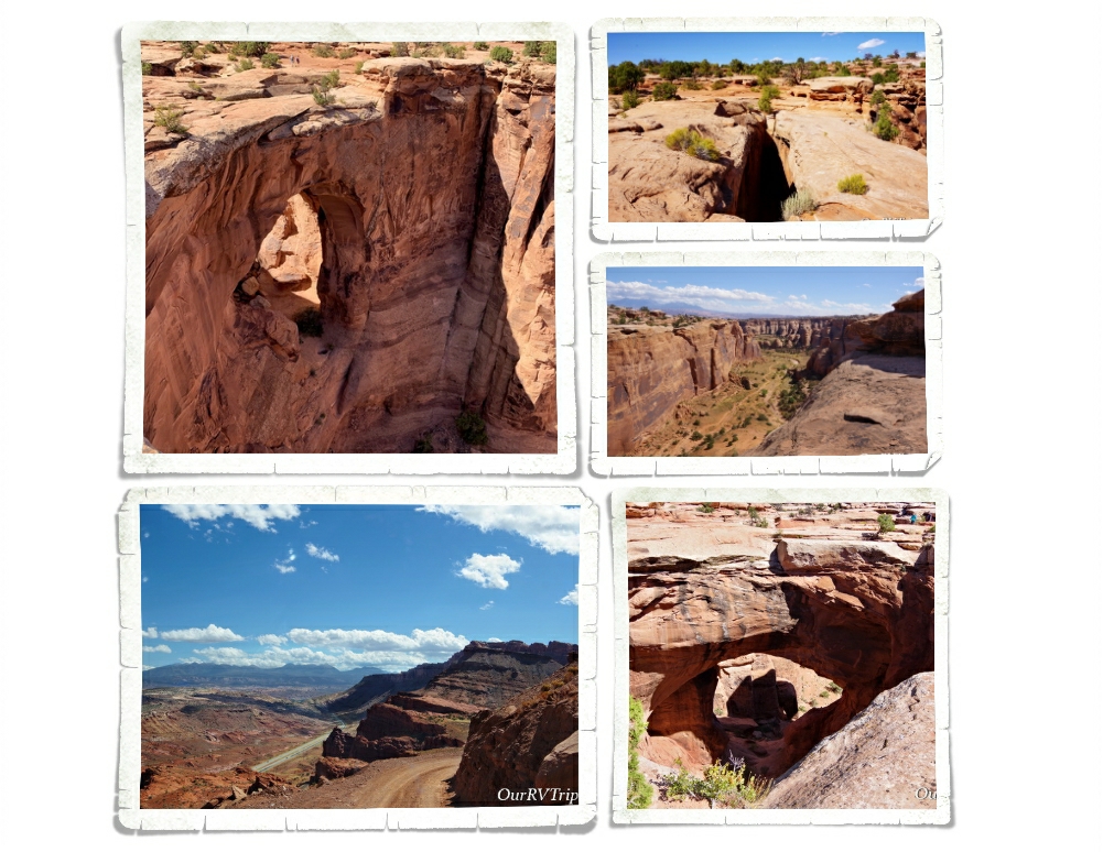
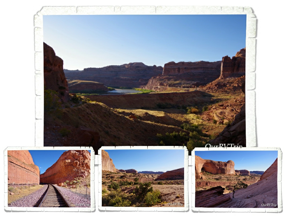
One of our favorite things about this Nomad life of ours is the people we get to meet. Our neighbors in Moab were super nice! They were in the middle of an epic road trip from Massachusetts all the way to Arizona and back. When they left, they gave us a few guide books for the Moab area and they left notes as to what they did! Like I said..super nice! We ended up doing the Gemini Bridges trail/hike because they’d recommended it and Guys, it was awesome! To get to the Gemini Bridges we drove up a dirt 4×4 road. Yup, we found another dirt road to drive on. The road up to the plateau that the bridges are found on was steep and narrow with a pretty big drop on one side, but once we got up onto the plateau, the road was better. There are a few places to park and a marked trail out to the bridges. Gemini Bridges are two natural bridges that lay side by side. There’s about a six foot gap between them and apparently some people try to jump the gap…and a few have missed. The sheer height of the cliffs near the bridges could set someone’s vertigo off. It was so steep! When we got there a group was leaving. We had the place to ourselves for about ten minutes.
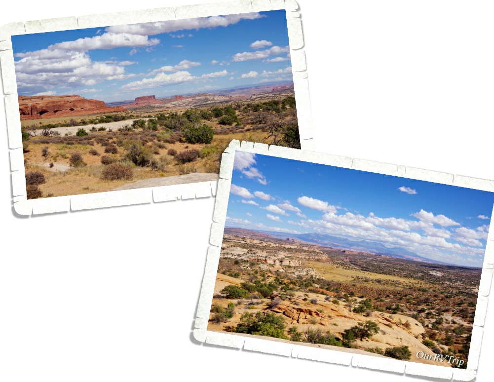
When we left Gemini Bridges we went a different way and ended up on a paved highway just outside of Canyonlands National Park. On the way home we found a scenic pull off with a short hike. Not a bad view. We were amazed at how far we could see. The day we went was crazy windy! We were very careful not to get too close to any of the edges because we were concerned we’d get blown off by a gust of wind. It was that windy.
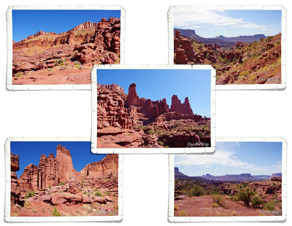
A couple of years ago, I found a picture of Fisher Towers somewhere on social media and I immediately wanted to go see them in person. I tagged them on my Google Map and waited patiently for the time we would be in the Moab area.
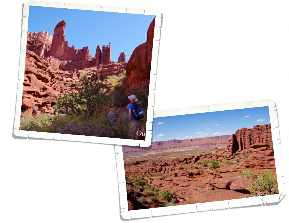
I loved this hike! It was just the right combination of effort and views to make it interesting and enjoyable. I can’t really imagine doing this hike in the summer though. There wasn’t much shade to be found on the trail and there was a fair amount of effort in going up and down to navigate this trail. The whole area is made of pinnacles, spires, and fins that you wind your way around.
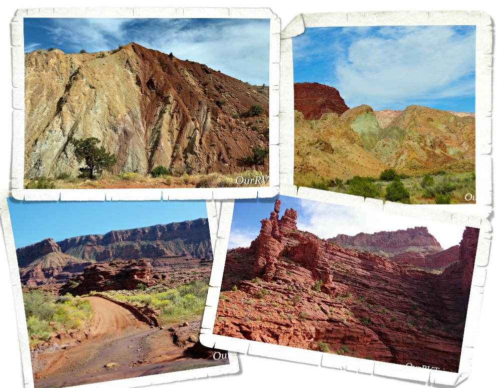
After we finished playing over at the Fisher Towers, we headed down the road to Onion Creek for a dirt road adventure. Onion Creek got it’s name from the slightly stinky smell of the creek. You splash through this creek several times as you make your way through some really cool rock formations. We were surprised by all the different rock colors! The top right picture in the above gallery reminded us so much of Artist Pallet in Death Valley. We didn’t drive the entire road, but what we saw was really cool!
Corona Arch trail is one of our favorites in the Moab area! This trail is only three miles long , but it leads to one of the biggest arches in the Moab area. We went on a late afternoon, mid-week and we pretty much had the place to ourselves. We passed a few people on the trail and there was one other person at the arch with us, but there wasn’t a crowd of people like you’ll find over in Arches National Park.
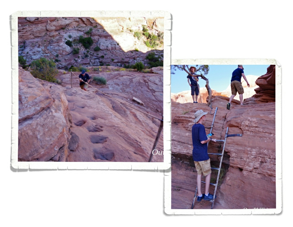
The trail to Corona Arch has you climbing up a ladder and using some steps that have been cut into the side of the rock (called Moki steps) along with some cables. It wasn’t too technical, but just hard enough to be fun. It’s a great hike for someone who’s trying to get outside of their comfort zone just a little and get off the flat path.
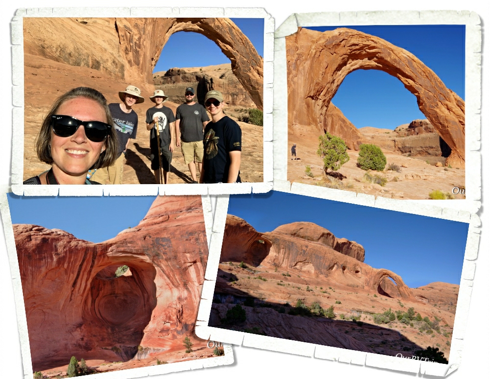
Your effort is rewarded with not one but two arches. Bowtie Arch is…I think…a pothole arch and it’s smaller, but still very cool. The star of the hike is Corona Arch. We actually all voted Corona Arch our favorite arch in the area. And yes, that’s including all of the arches we saw at Arches National Park! Corona Arch has an opening of 140 feet across by 105 feet tall and is made of Navajo sandstone like most of the arches in the area. Rumor has it…that airplanes used to fly through the opening of Corona Arch. Since it’s not in a National Park…it’s not quite as protected. I think it’s now a BLM NP Unite and protected land though so hopefully, it’ll receive some more protection.
That’s it, Guys! That is pretty much everything we did in the Moab area. We checked off everything we had on our list, but ended up adding several new things to see next time!
See y’all down the road!
#NationalParkTour