Capitol Reef National Park
Hey Guys!! We are now on our second stop in Utah as we make our way across southern Utah to visit the Big Five along with as many National Monuments and State Parks as we can fit in. We thought that there would be less to do in the Torrey, UT area…but, well…we were wrong. We were just as busy!! Guys, we might need a vacation from our National Park Tour.
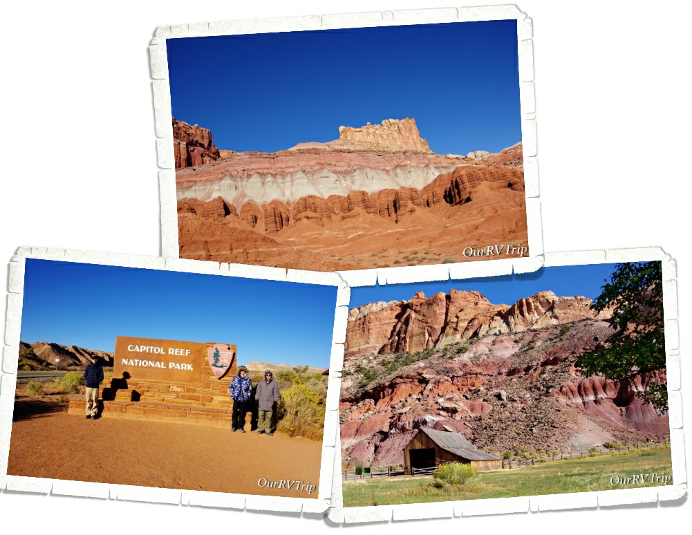
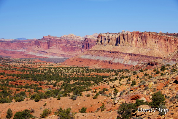
When we first got to Capitol Reef NP, I wasn’t sure how I felt about it. The thing that stuck out the most to me was the main highway that went right through a portion of the park. Now, we’ve been in other parks with highways and paved roads…most have them…but for some reason, this particular setup just didn’t do it for me.
Until I spent some time in the park.
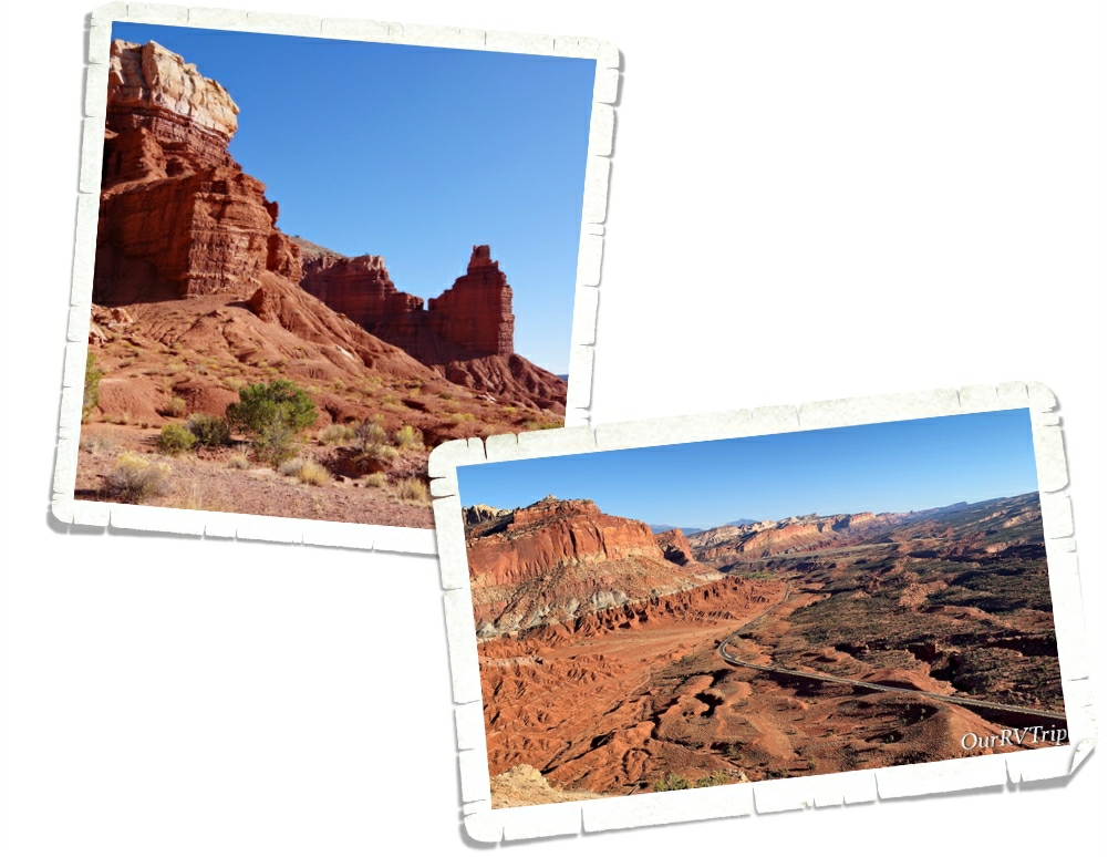
The huge domes, towering cliffs, arches, bridges, and amazing stone rock formations transport you to another world. And Guys, the way the light plays on the rocks and makes them change colors throughout the day… I totally fell in love with this park.
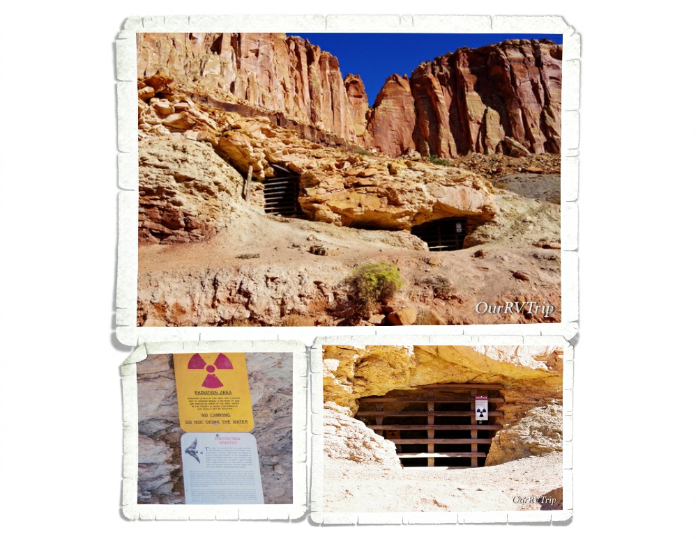
Never, in my wildest dreams, did I imagine I would see a caution radiation sign in a National Park. And…the radiation area is a protected bat habitat?? Um…what?
The yellow tint in the sandstone rock is actually trace amounts of uranium. In the early 1900s uranium was a hot commodity due to the idea that it had health benefits. People would wear rocks laced with uranium around their necks or crush it up and drink it in water. Then in the 1950s the government was on a search for uranium to help protect the country. Ultimately, the amount of uranium found in the Captiol Reef NP area was so scant that the area was abandoned for uranium production. The mines are still there though and apparently, bats like to roost in them…so if you see little glowy lights flying around at night…it’s probably just the bats.
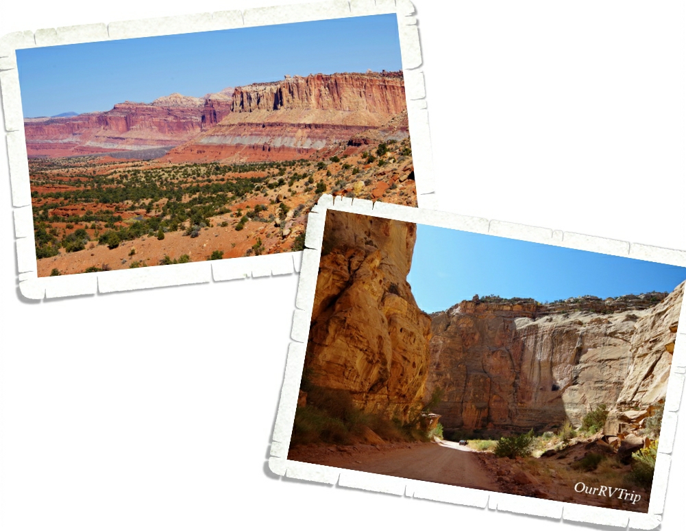
The first thing we did was the eight mile Scenic Drive that takes you back into a small portion of the park. It’s a great introduction to the park and what this park is protecting. The Scenic Drive is a small portion of an original route once used by the Ancient people we now refer to as the Fremont. When settlers came to the area in the 1880s the route was turned into a wagon road.
The backbone of Capitol Reef National Park is a 100 mile long waterpocket fold. A what? A waterpocket fold is basically a huge wrinkle in the earth’s crust formed by a monocline. Early settlers described it as an “impassable reef” of rock. Until 1962, when Highway 24 was completed, the only way through this section of the Waterpocket Fold was the original road that was prone to flash floods. We actually witnessed a flash flood while were on part of the original road. We found high-ish ground with our 4Runner and waited it out. Some people had to abandon their vehicles in the flow of water and just hope it didn’t rise too much more. The flash flood came on quick and left just as quickly leaving a muddy wet mess behind. no one was hurt and all humans/vehicles were able to get out mostly unscathed.
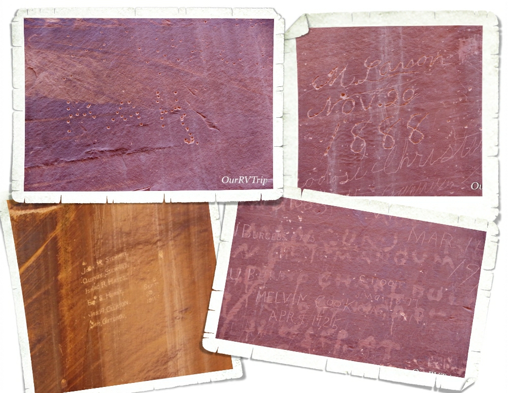
They call it The Pioneer Register, but really it’s just old graffiti. And, you’re not supposed to add to it. Ha! The Pioneer Register is located along a stretch of the original road through the Waterpocket Fold. For some reason, early travelers started leaving their mark on the steep sandstone walls. We saw everything from fancy script to names being shot into the wall with a gun.
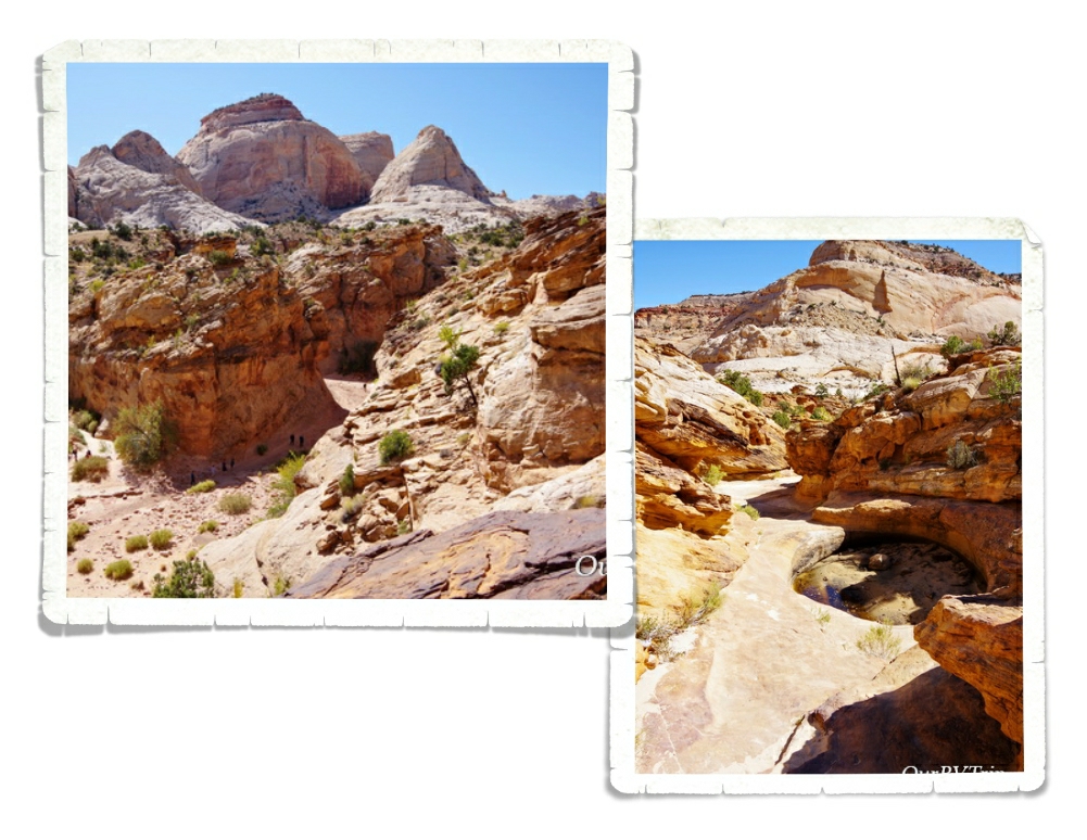
On the same hike as the Pioneer Register, you’ll find The Tanks. You can climb up the cliff and see some depressions in the rock that collect water when it rains. When we went, the “tanks” were pretty dry, but the view from the top of the cliff was pretty cool! And the boys (all four) had a great time being mountain goats as they criss-crossed around the cliff trails.
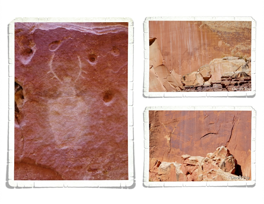
There are also several places where you can find even older graffiti left by the Fremont people who were some of the very first people to settle in the area (from 600-1300 CE). They didn’t have a form of writing other than the petroglyphs found along the canyon walls so we don’t know much about them. We know they did a bit of farming and that they used the atlatl to hunt with. We think they had camps along the Fremont River.
One of the hikes we did while in Capitol Reef NP was the Chimney Rock Loop. The trailhead is right off that highway I told you runs through the park and every time we passed it, the parking lot was full so we knew it must be a good one. This trail has an elevation gain of 590 ft, all at the beginning of the hike during the first half mile or so. After that, it was cake. And the views…
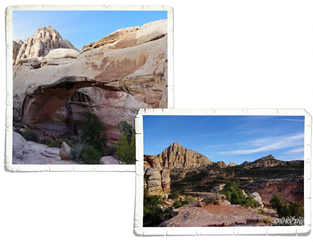
The Hickman Bridge trial was another one that had some amazing views. This was a relatively short trail to a 133 foot natural bridge. Hickman Bridge is one of the pictures you’ll find on a lot of the Capitol Reef NP souvenirs like stickers, postcards, and pins. We did each of these hikes late in the afternoon and the crowds were minimal.
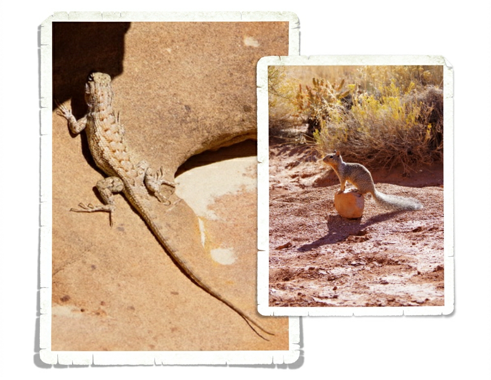
We never saw any glowing bats… but we did see tons of these little squirrels and lizards while we were there. The squirrels were pretty used to seeing people and I think they’ve been fed a few times. Please keep wildlife wild. Even the squirrels. You really are doing them a disservice by making them dependent on humans and handouts. And honestly, human food isn’t good for them.
There are a couple of longer scenic drives you can do that wind their way in and out of the Capitol Reef National Park boundaries. We did the entire Cathedral Loop drive and Guys, it was totally awesome! We spent an entire Saturday doing this drive. We stopped by the visitor center and picked up the Cathedral Loop driving guide. It totally made the drive. Seriously. It had info on all the stops and the little side roads that we would have driven right by had we not known what was down them. That little guide was totally worth the $3 we paid for it and more.
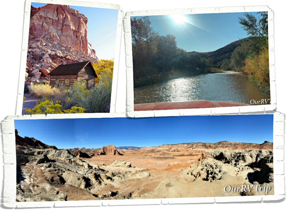
The Cathedral Loop starts out at the visitor center then takes you down the main highway. There are a few stops along the highway that talk about the early Mormon settlers that came to the area back in the late 1800s. It’s not long before the scenic loop has you turning off of the nicely paved highway onto a dirt road where you have to ford the Fremont river! This was our first river fording and it was both exciting and terrifying all at once.
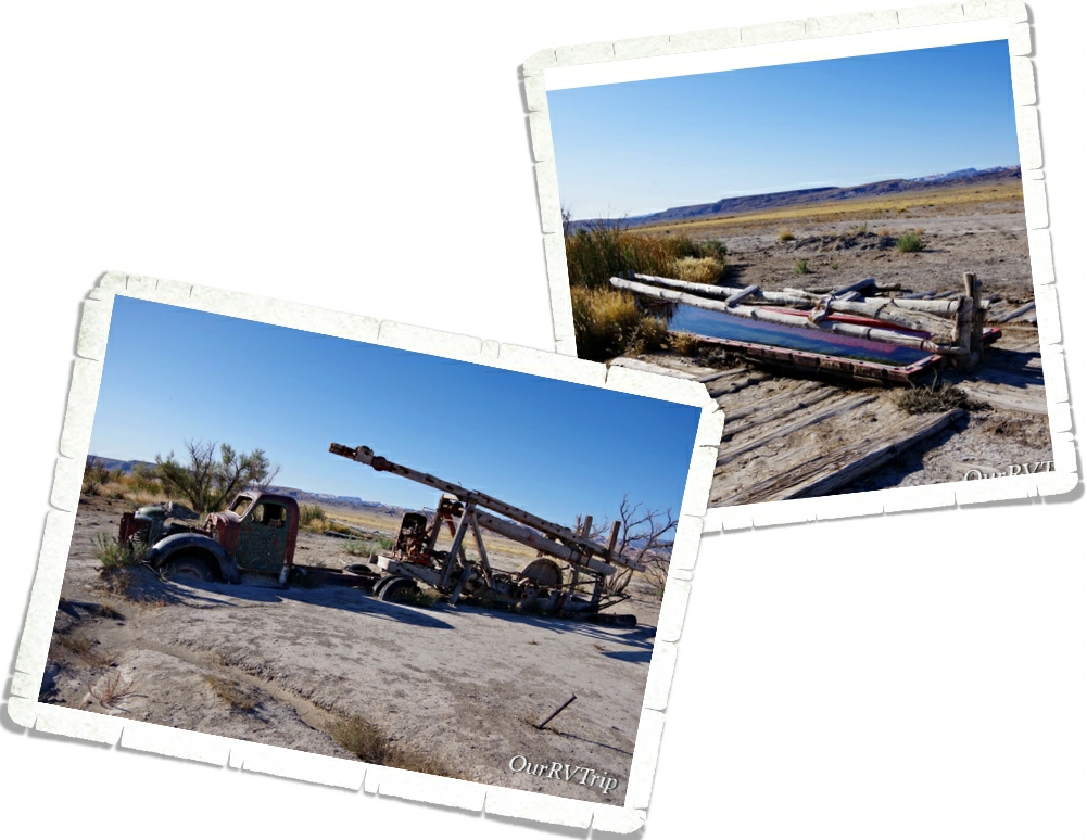
Once upon a time… this land was used for ranching and the ranchers brought out a drilling truck to find water for all of their cattle. I’m not sure why the ranchers left the drilling truck, but it looks neat. The well is still active so there’s an artificial oasis way out in the middle of the desert. We got out and looked around on the way through. The truck really does look cool the way it’s partially buried.
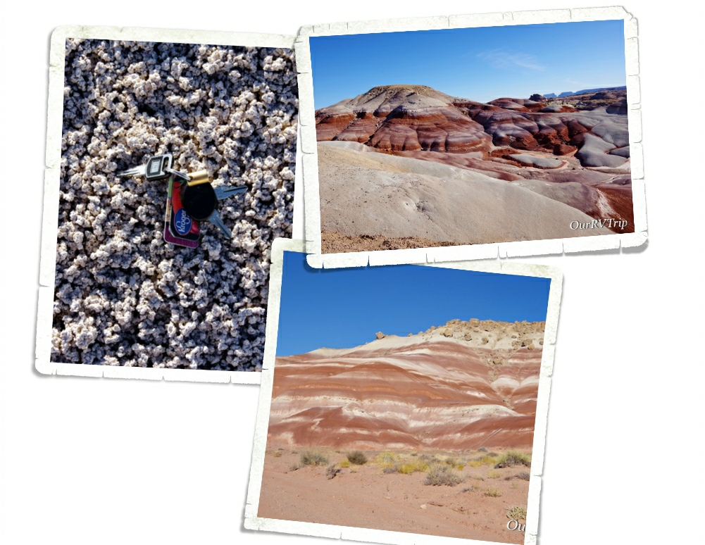
These bentonite hills are sooo my color. Bentonite is actually a clay that is full of volcanic ash. When it gets wet, it’s super slick and sticky. How can it be slick and sticky at the same time? Magic. That’s the only explanation I have. See that left picture? It kind of looks like popcorn, right? Bentonite clay gets a popcorn like surface from repeated cycles of absorbing rain then drying again. We thought these bentonite hills were super neat!
One of our favorite things about the Cathedral Loop is that it has small hikes spaced throughout. It was nice to get out of the car and stretch our legs…and to stop bumping down the dirt road every so often.
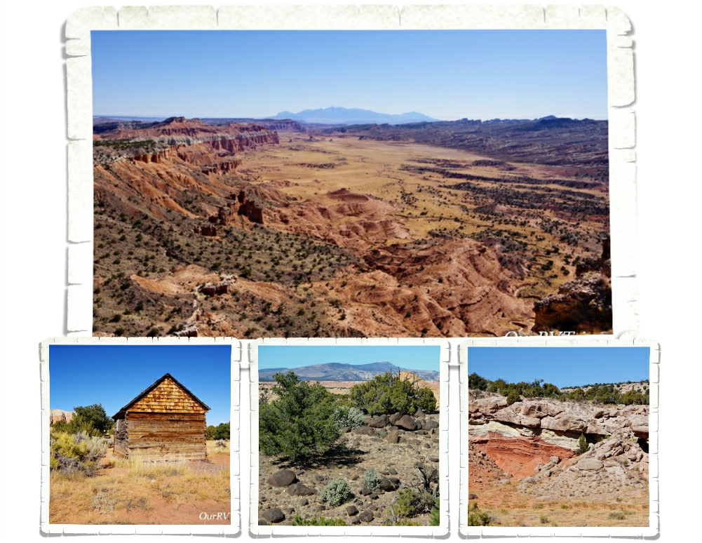
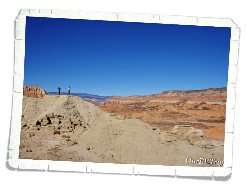
We learned sooo much on this drive. The booklet we picked up at the visitor center is jam packed with geology facts, history, and even a bit of ecology. I’m not going to go through each stop and lesson we learned. Y’all can go do the loop yourself for that! Ha! But, I will share some of our favorite pictures and some little tidbits too. Like…in the top picture in the gallery above…the valley extends twenty miles! This view was unreal. We felt like we were looking at a movie set. The picture doesn’t do it justice at all.
Welcome to Cathedral Valley. In 1945, the first superintendent of Capitol Reef, Charles Kelly, and Frank Beckwith, a newspaper owner, gave this valley the name of Cathedral Valley because the rock formations reminded them of Gothic architecture.
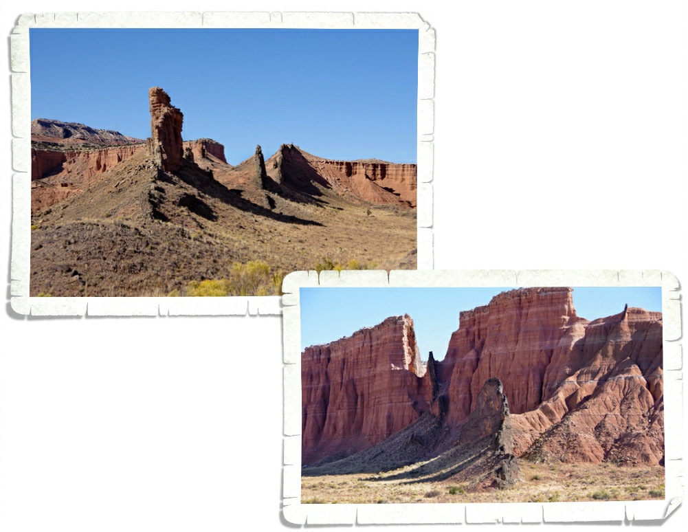
Alex is taking an earth science class this year. He was pretty stoked to get the chance to see volcanic sills and dikes in person! What am I talking about? Well, a long long time ago…around three to six million years ago…molten magma pushed its way up through cracks in the earth’s surface. The magma cooled and solidified and turned into vertical walls (dikes) and horizontal layers (sills). You can see some awesome vertical walls (dikes) in the two pics above.
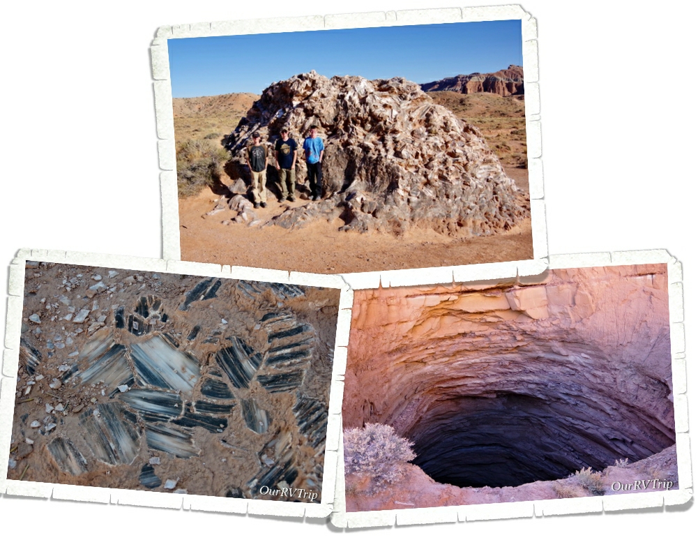
On the right you’ll see a two hundred foot gypsum sinkhole. It was impressive! Now, on the top, you will see the boys standing in front of Glass Mountain…which isn’t made of glass at all. It’s actually made of selenite crystals also known as moonstone which is a crystalline form of gypsum. They think that the sinkhole used to look like Glass Mountain. It’s weird to think that one day, Glass Mountain could be gone and replaced with a huge sinkhole.
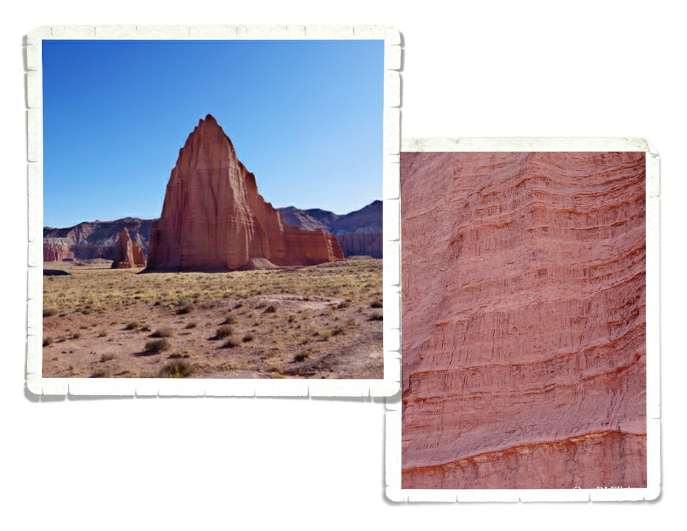
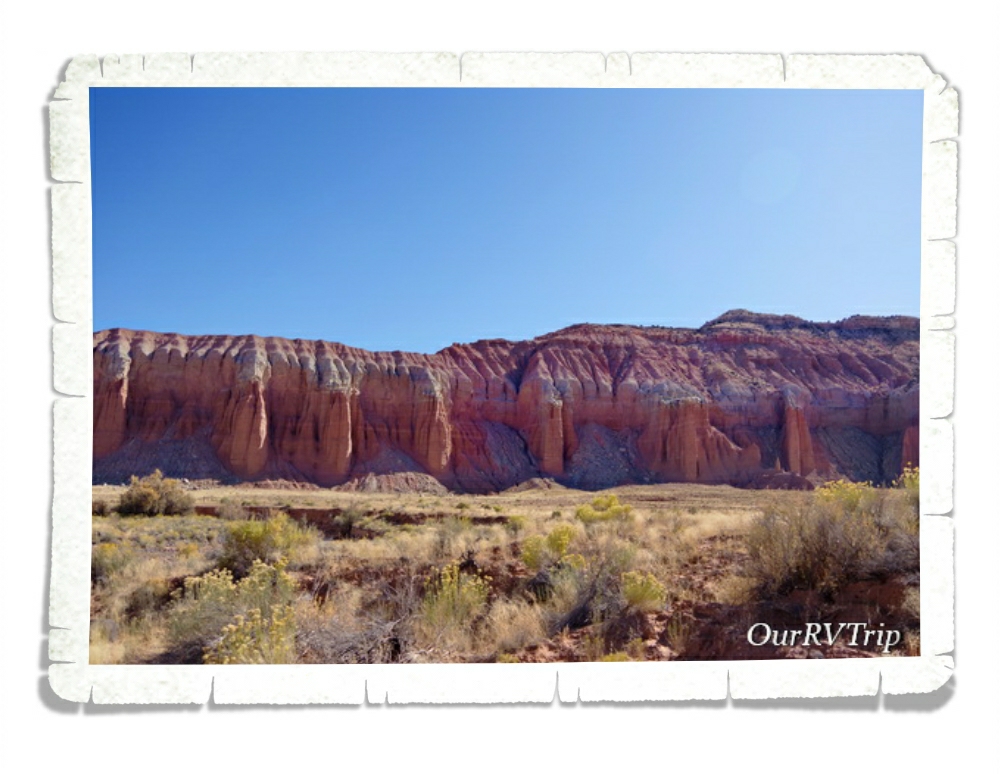
Guys, you really need to get out there and see these places. At this stop along the loop, we got to see the Temples of the Sun and Moon up close. Made of soft Entrada Sandstone…these giant monoliths are literally melting every time it rains. In the picture on the right…you can see the texture of these monoliths. It looks like flowing mud…because when it’s wet, it basically is. Many of the cool rock formations within this amazing National Park are melting away…they’re eroding at relatively rapid rates.
“Wilderness is not a luxury but a necessity of the human spirit, and as vital to our lives as water and good bread…” ~Edward Abbey
Go out and explore the wilderness while it’s still around to explore.
See y’all down the road!
#NationalParkTour