Category: Dirt Road

Waiting For Spring

Waiting For Spring

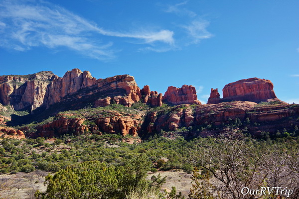
Hey Guys!! Our original plan was to hop our way up Arizona, hitting a few of our favorite state parks. Unfortunately, I waited a week or two too long to try to reserve them and we couldn’t get in without site hopping each day…and that’s such a pain. So, we headed up to one of our all time favorite areas of Arizona…Sedona…to park our home-on-wheels for two whole months as we waited for Spring.

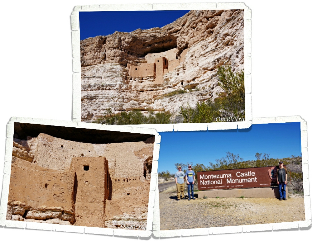
We’ve been to Montezuma Castle National Monument before, but it’s been a few years so we decided to visit it again since we were right down the road from it. And as one of our Nation’s first National Parks…it’s worth revisiting.

President Theodore Roosevelt signed the Antiquities Act in Dec of 1906 and declared four sites of historical and cultural significance our first four National Monuments. Montezuma Castle was one of those first four.

The dwellings that Montezuma Castle National Monument protects and preserves aren’t really a castle. They’re more like…a prehistoric apartment building, built by the Sinagua people sometime between 1100 and 1425 AD.

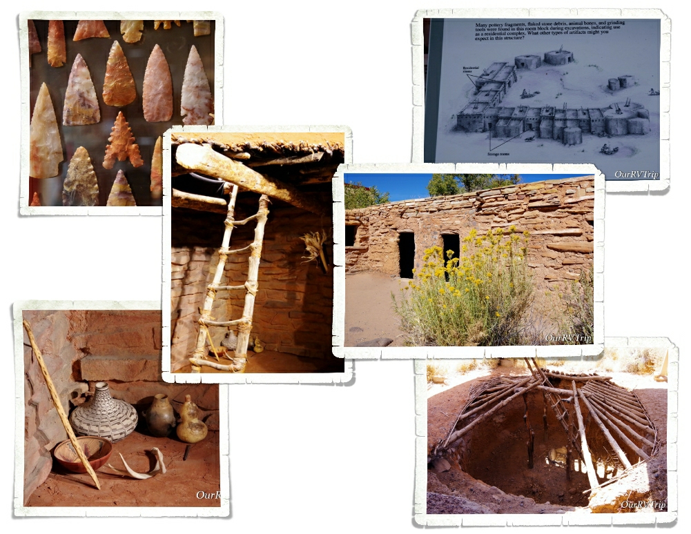
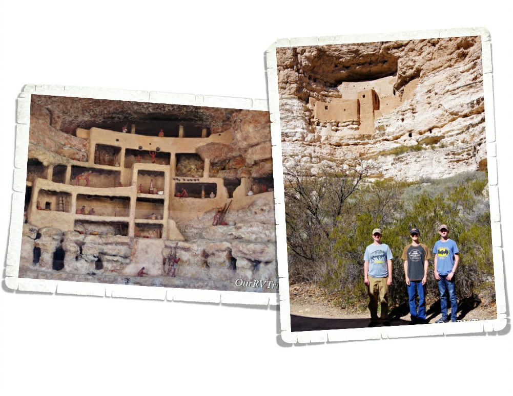
Montezuma Castle sits in a recess in a limestone wall about 90 feet above the ground. When the Monument first opened, you could actually climb up a series of ladders into the Castle. Due to the damage visitors were causing, access to the Castle was discontinued. Now, you’ll have to check out the diorama they have set up to see what the inside of the Castle looks like.

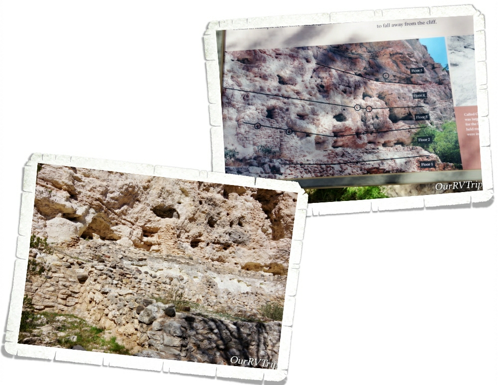
Sometimes when you’re looking at ancient dwellings, it’s hard to see what it once was. I love that they put this sign (pic on the above right) up to make it easier to see what used to be there. The Sinagua people lived and farmed here over 600 years ago.

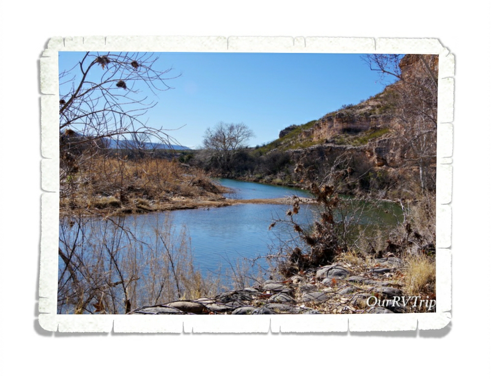
The Sinagua people built their homes near Beaver Creek which floods every year during monsoon season. They built their homes higher to not only protect themselves from other tribes, but also to protect their homes form the yearly flooding. The Castle housed around 40 or so people and consisted of 20 rooms. There’s another section of the wall that the Castle is built on that has evidence of an even larger dwelling.

We had so much fun revisiting this National Monument and seeing all of the improvements the park has made!

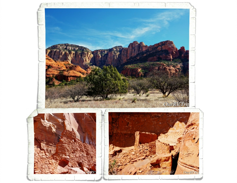
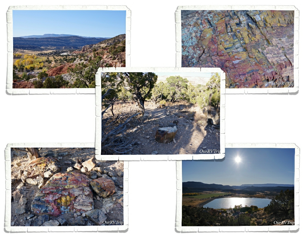
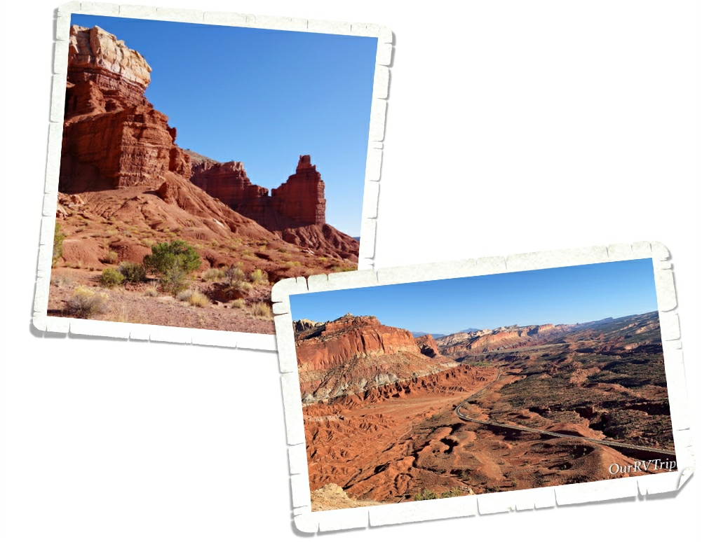
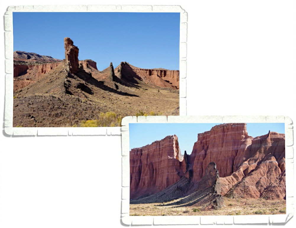
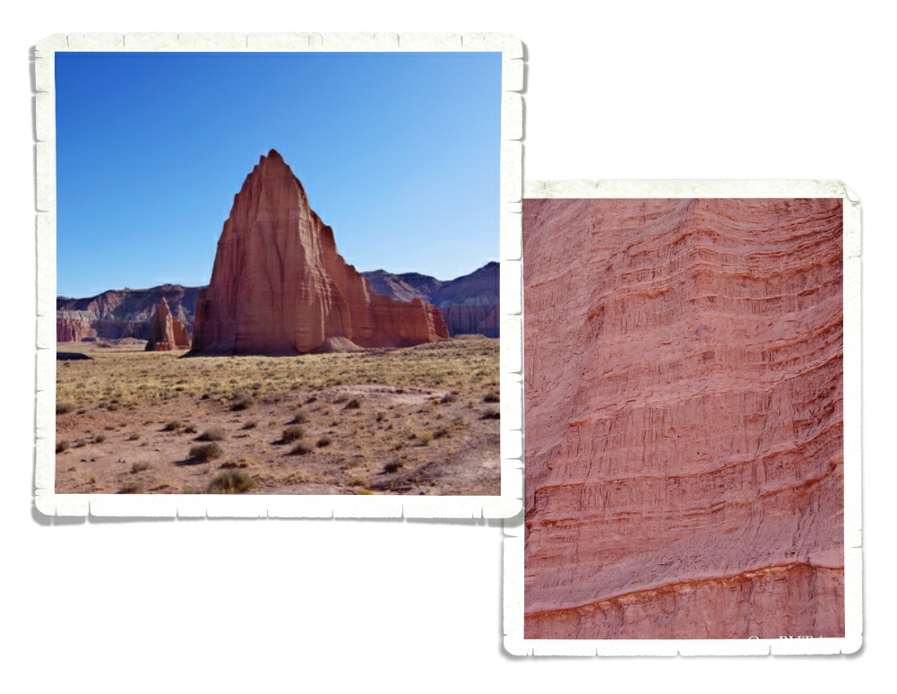
I stumbled on the Palatki Red Cliffs Heritage Site as I was looking for a specific trailhead in Sedona. When I did some research on it, I found that it’s run by the US Forest Service. Sedona is known for it’s gorgeous red rocks, and the area Palatki is in, is no different. We took just as many pictures of the surrounding area as we did of the ancient dwellings and rock art!

There are two ancient Sinagua dwellings at Palatki. The West Alcove has deteriorated to the point that it’s no longer safe to let people explore it. You do get up close to East Alcove, but you don’t get to go into it. East Alcove is a nine room dwelling that is tucked up under an alcove and faces south. If you think about where they built their homes…it’s really pretty smart. The overhang of the alcove provided protection from the rain (even during very hard rain) and having them face South would provide more sun exposure during the coldest part of the year.

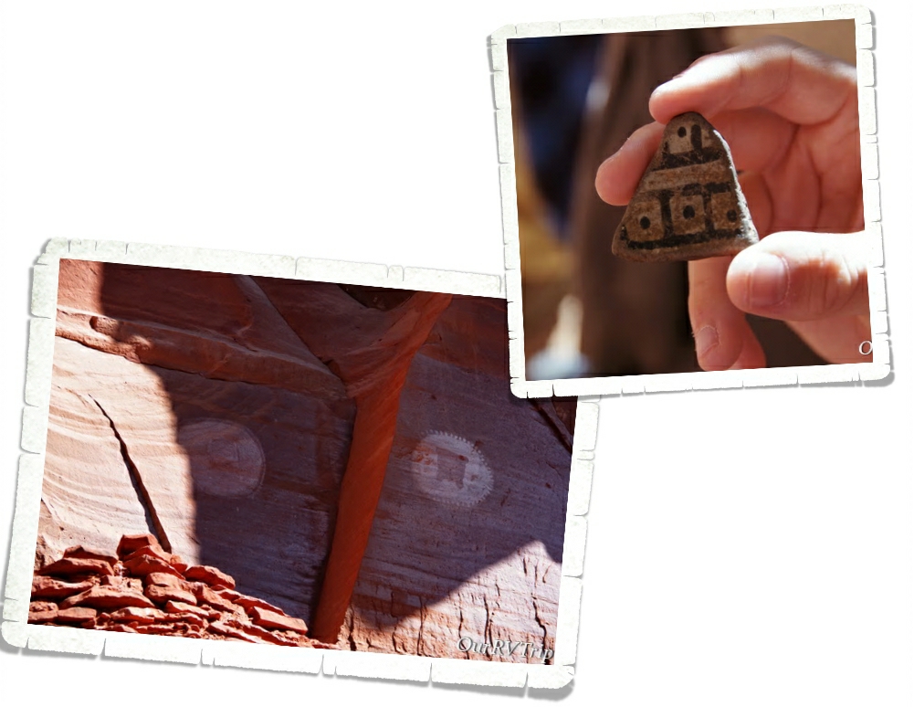
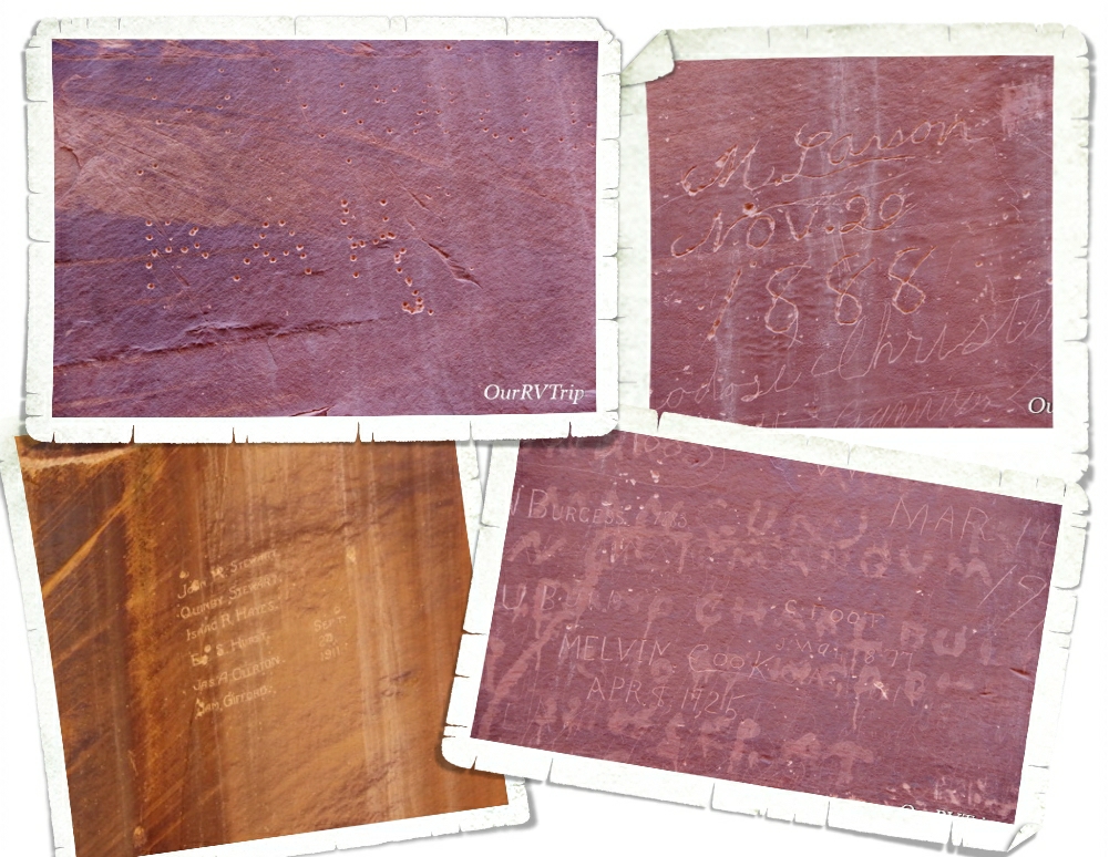
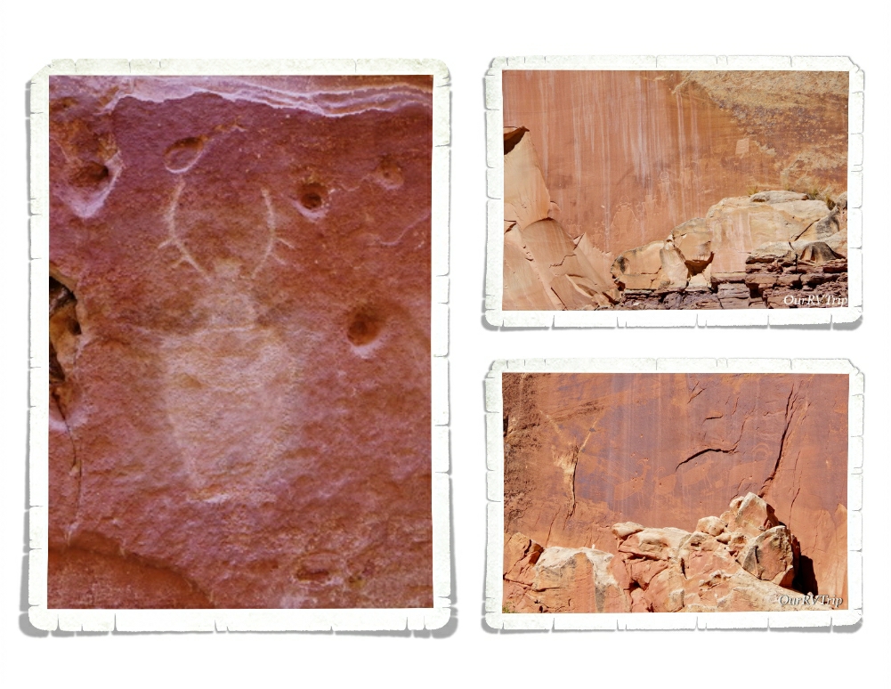
One of the coolest things about visiting Palatki is that we got to hold some of the pottery that was found there. Another cool thing…and the first time we’d seen anything like it…are the two family shields or clan signs. They’re not sure if the two round shield like pictographs indicate a family or if they’re a clan sign. They do know that it tells who the dwellings belonged to. Scientist believe that two extended families called the two alcove dwellings home.

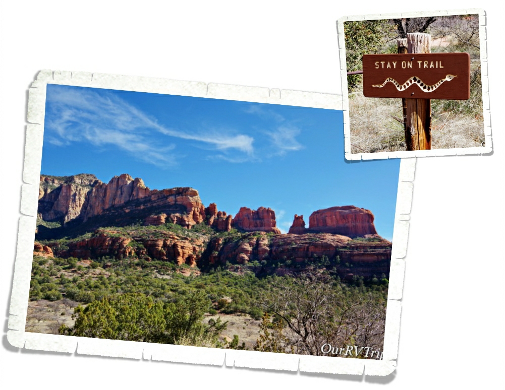
Snakes really aren’t my thing. Every time I see one of these warning signs, I get super paranoid about nope-ropes. I’m already hyper-aware of all of the places you usually find a danger-noodle… I spent most of the time at Palatki worrying about snakes. When we were there, it was almost Spring which is when most of the baby danger-noodles are born. Did you know that mother snakes are more aggressive and will chase you without being provoked? Totally not a fan of nope-ropes.

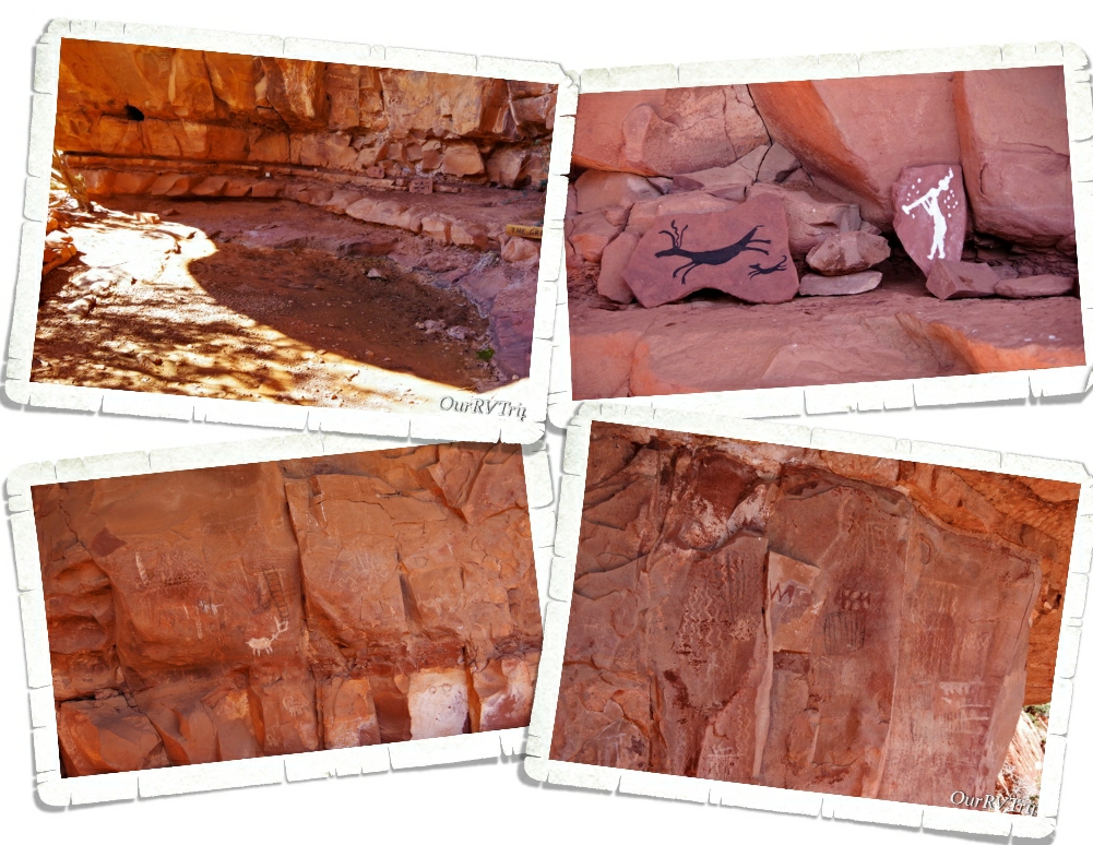
The other thing you’ll find at Palatki is The Grotto. Depending on when you go, you might see some water in the pool here, but what’s really neat about The Grotto is all of the rock art. There are pictographs from the Paleo Period (11,000 – 9,000 BC) and the Archaic Period (9,000 BC to AD 600). The walls are covered with pictographs! One of the Rangers took some of the materials that they believe was originally used to make the colors for the pictographs and made some new ones so we can see how bright the rock art was when it was new. You can see the new rock art in the top right picture of the above gallery.

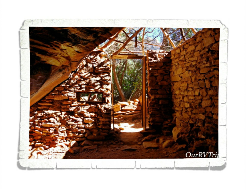
The first homesteader in the area was Charles D. Willard. He took materials from the various ancient dwellings to build his own home. Charles arrived in 1923 and you can still see the one room structure he stayed in over by The Grotto, where he stayed until his house was completed in 1925. On the same field that the Sinagua people who used to live, Charles planted 500 fruit trees. He sold the property in 1938 and the Forest Service obtained the land in 1975 through a land exchange.

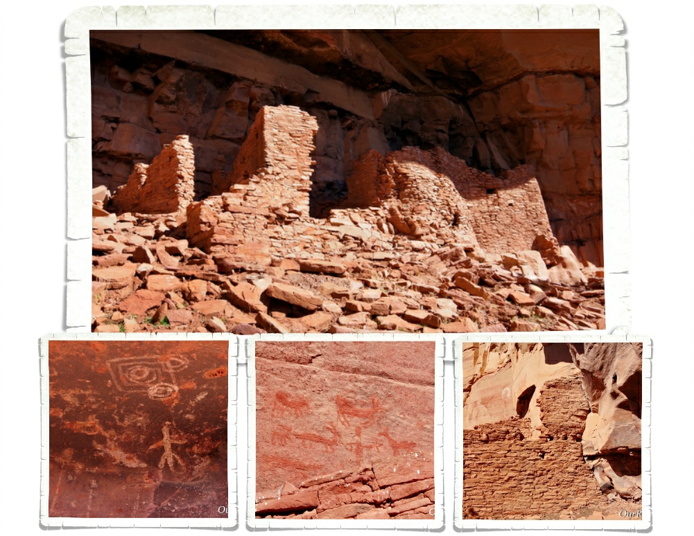
Palatki’s sister site is Honanki Cliffs Dwelling Heritage Site. We found out about it while we were at Palatki and headed over there right after we left Palatki. Honanki is one of the largest cliff dwellings and has the largest most diverse collection of pictographs in Verde Valley. The cliff dwellings found at Honanki were originally two stories tall and were made up of about 40 rooms on the ground floor. Sometime around 1300AD the residents of Honanki started to move on. The Sinagua left Verde Valley in the early 1400s. The Hopi and Zuni can both trace part of their heritage back to the Sinagua.

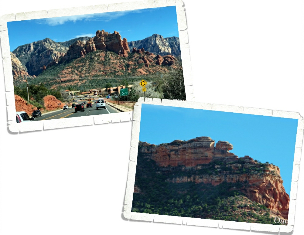
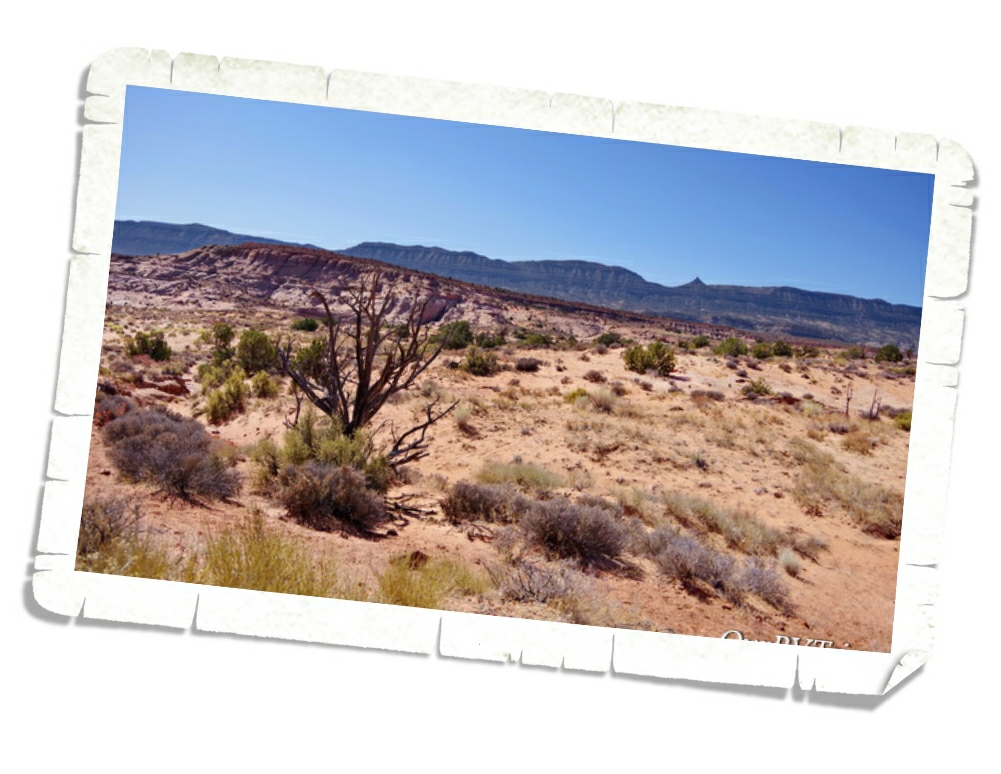
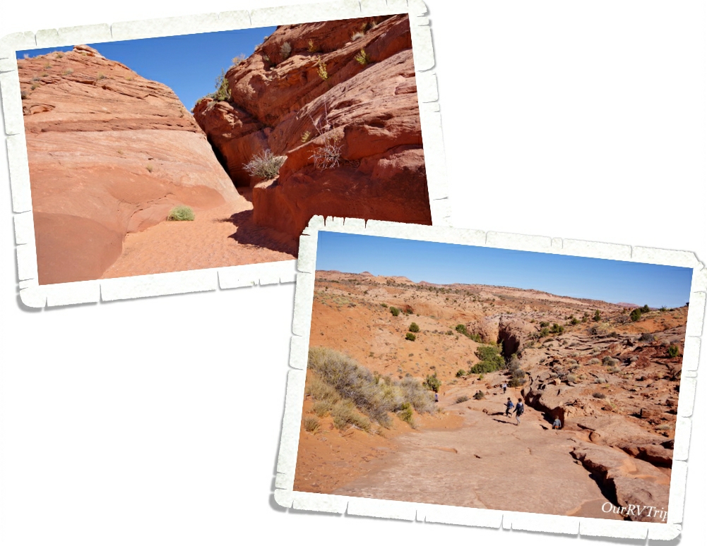
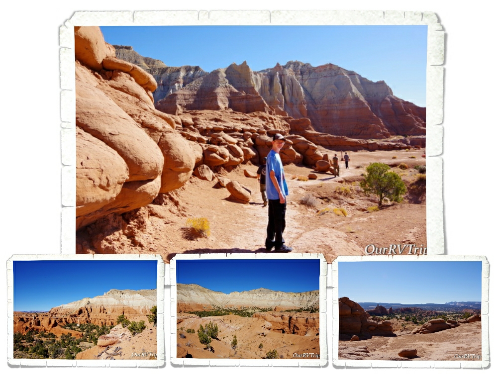
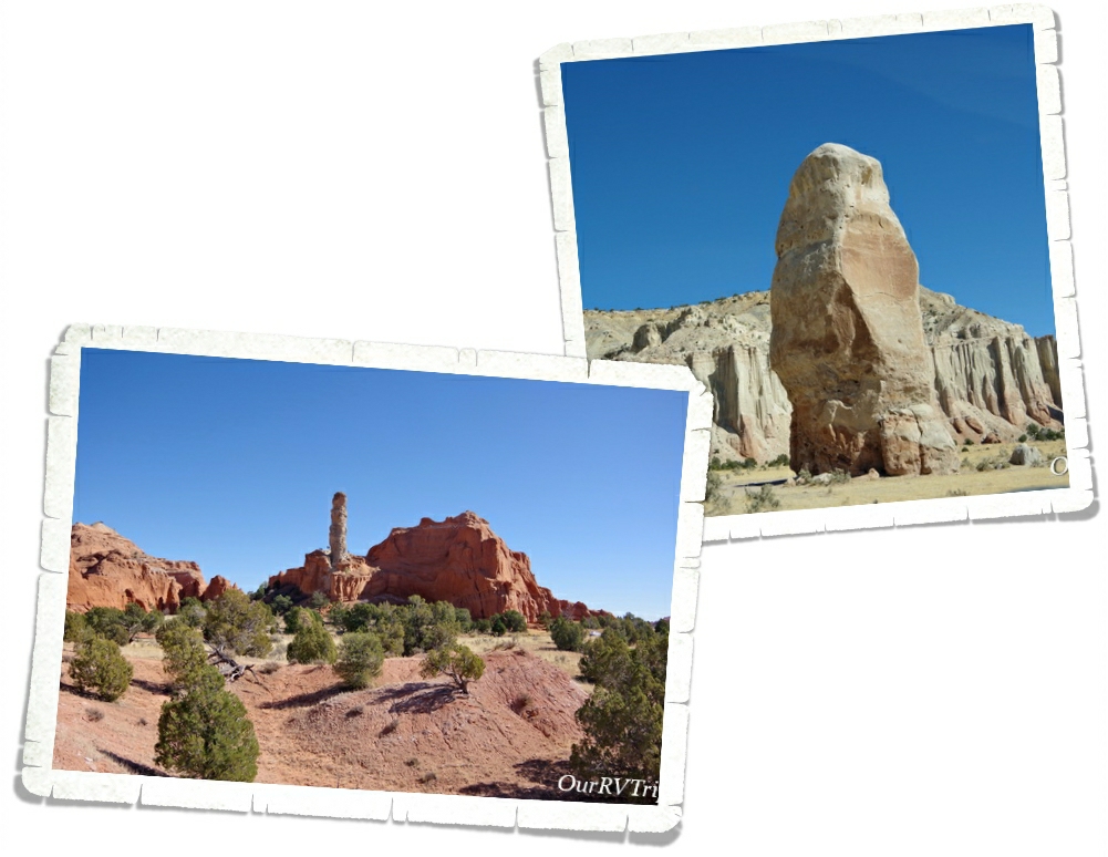
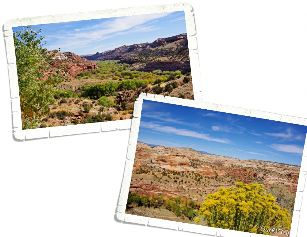
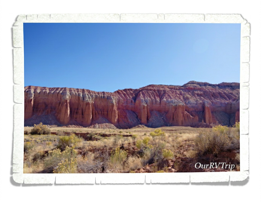
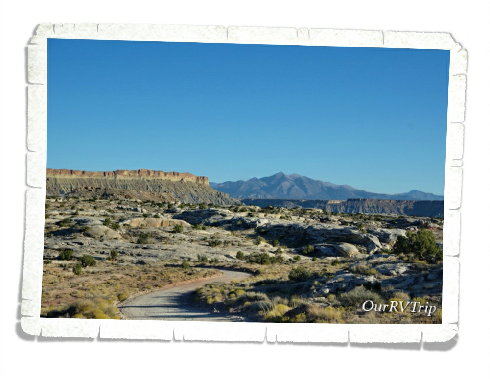
Sedona, Arizona is one of our favorite places to spend time. There are so many trails to hike in the Sedona area. I think you could do a different hike every week for a year and never have to do the same hike!

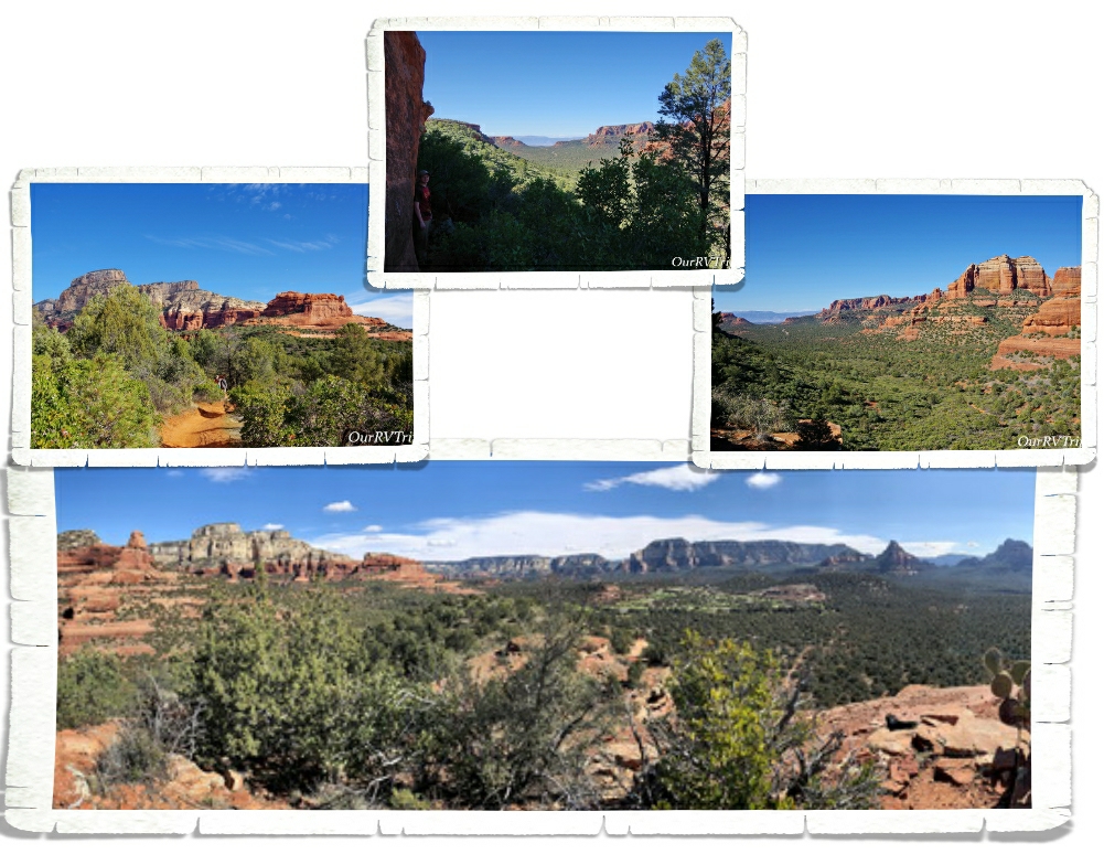
We had plans to do so many hikes in the two months we were going to be in the Sedona area. Due to the weather and other circumstances…we only got one of those hikes in. But, Guys…it was an awesome hike!

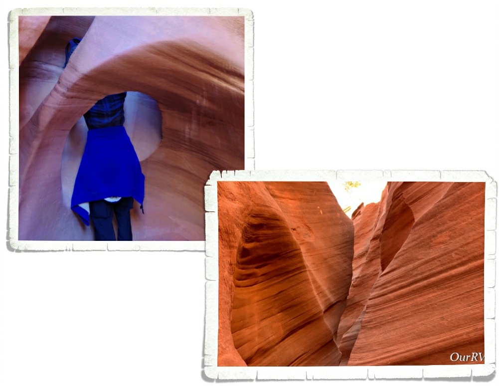
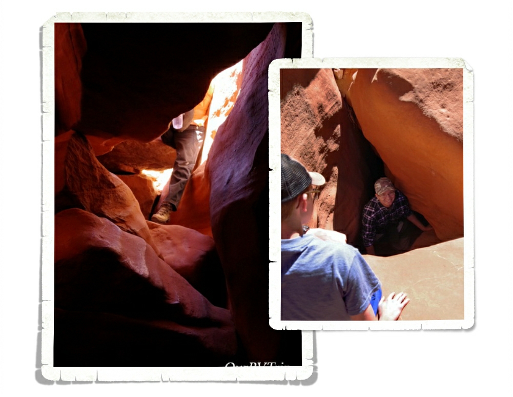
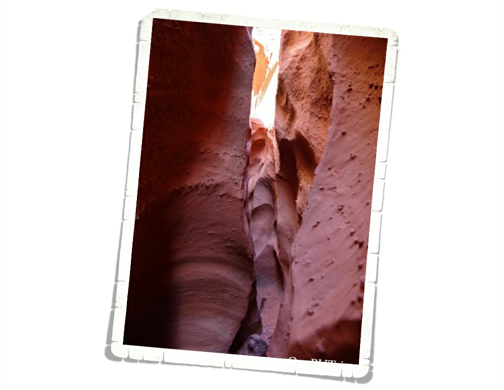
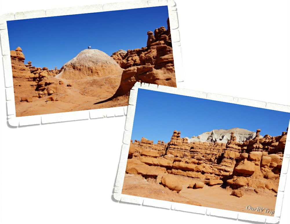
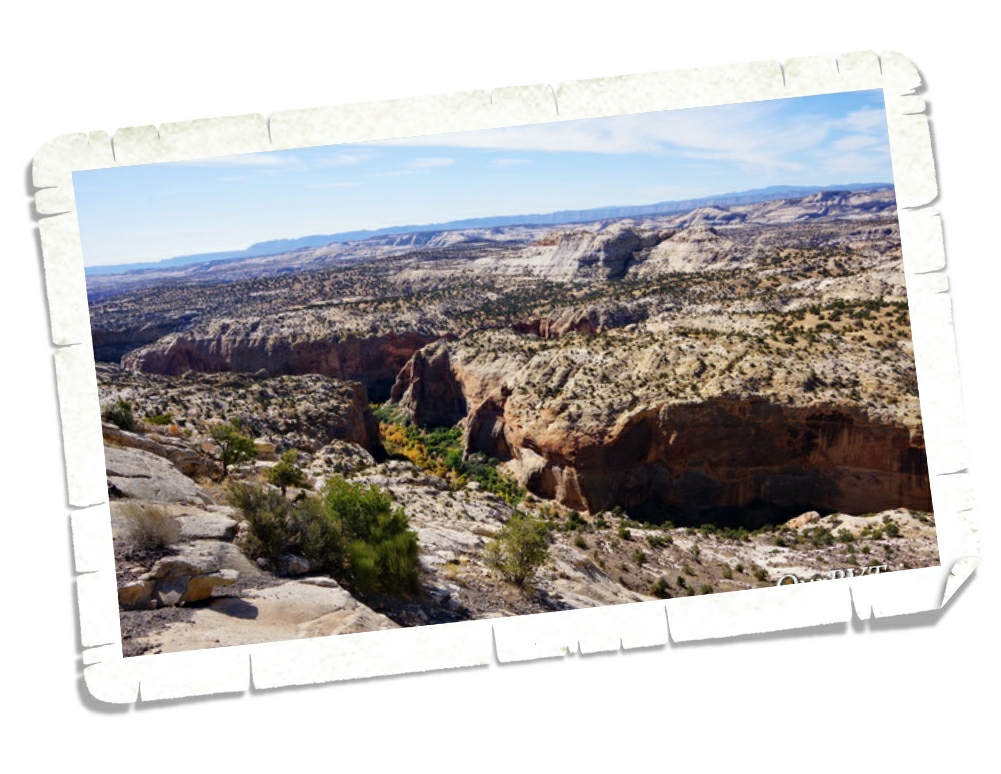
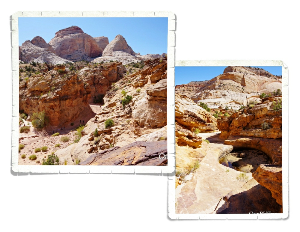
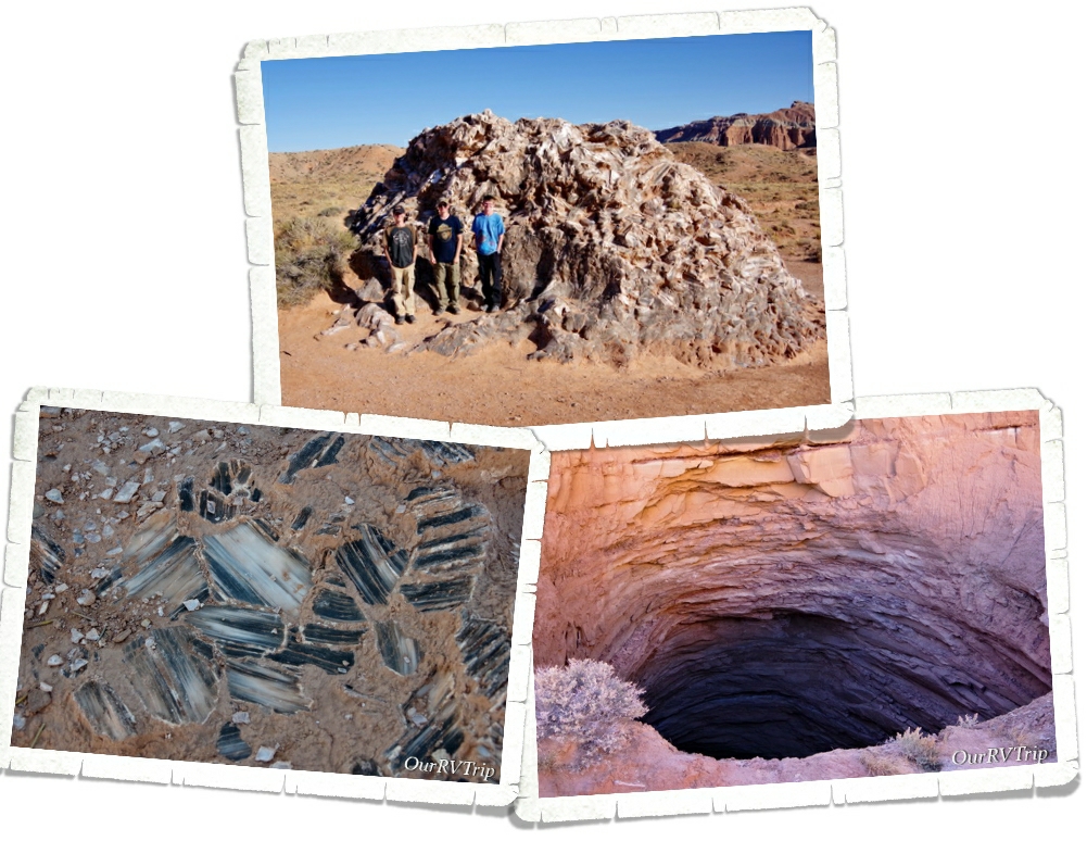
I found this place called the Birthing Cave on Instagram and really wanted to see it for myself. I did some research and found the trailhead in Sedona. I’d read that it was tricky to find. Quite a few people walk right by it because the trail isn’t marked that great. And…we did the same thing. We walked right by the side trail that takes you up to the Birthing Cave.

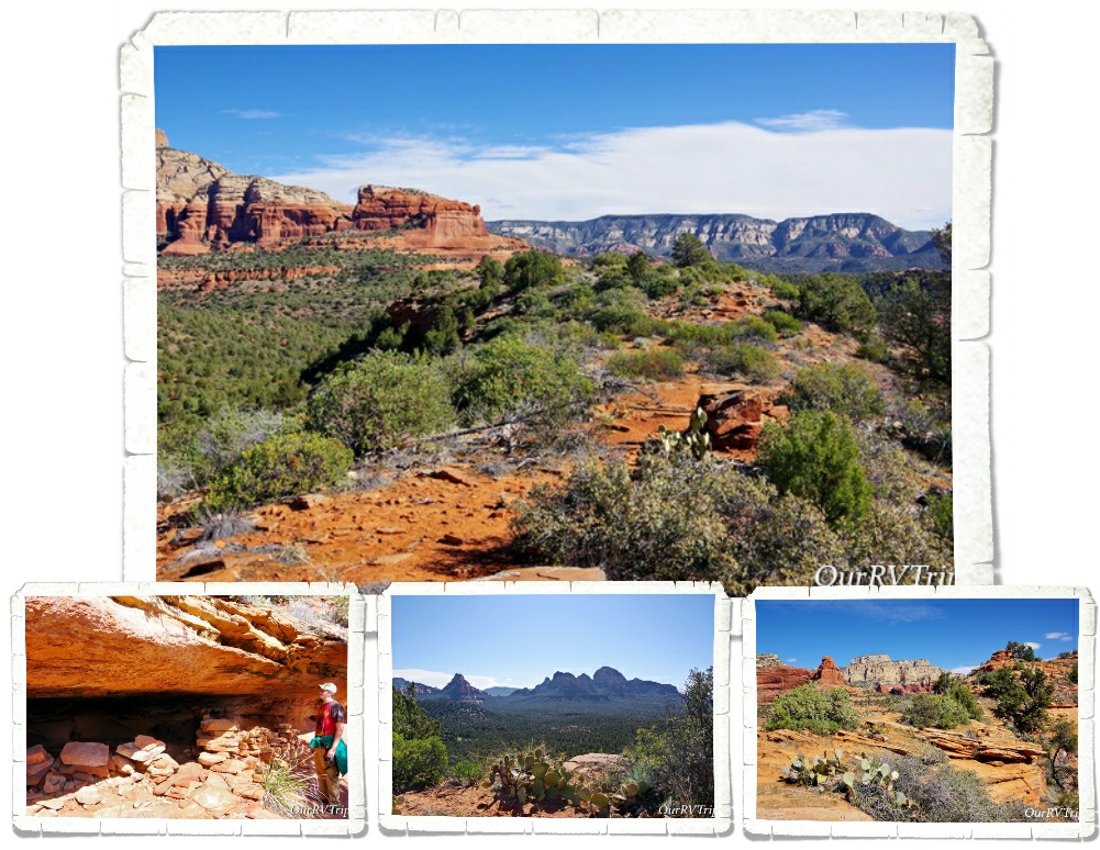
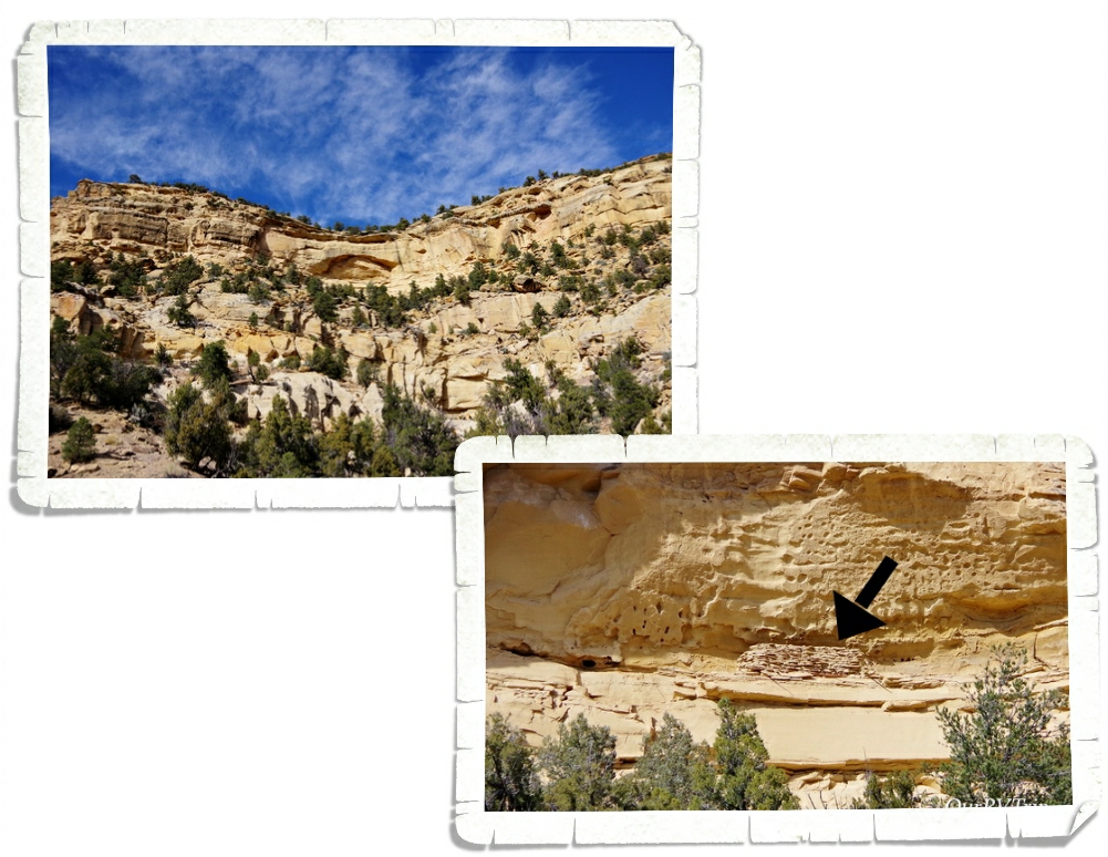
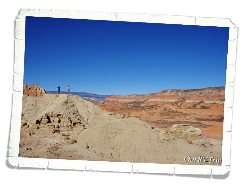
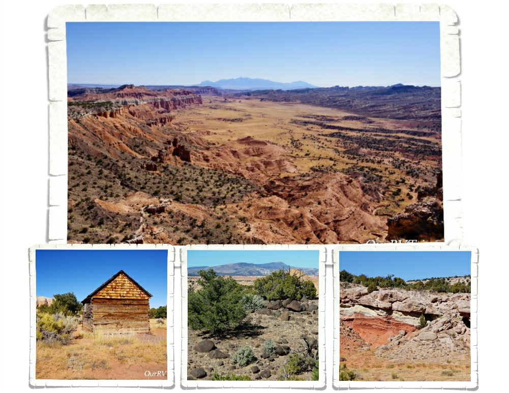
We found a different trail that turned off in the right direction at around the same distance as the trail was supposed to be… We ended up scrambling up the side of the mesa that the Birthing Cave is in. So…we were on top of it. The views were so good though, that we didn’t care. If we didn’t make it to the cave we were totally ok with it. We were having so much fun we felt like the day was a win no matter what.

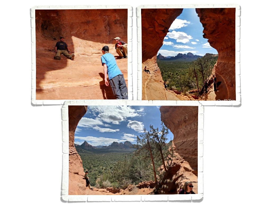
We ended up meeting another hiker on top who told us how to get down to the Birthing Cave. Guys, it’s not really a cave. It’s more like an alcove that you can shimmy up the walls of. We got some neat pictures, but if I’m being honest…we had a better time and saw better views from being up on top of the mesa.

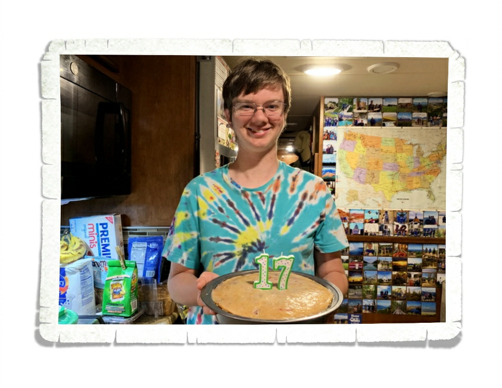
Alex celebrated his 17th birthday! Excuse the mess…we were in the middle of the Covid19 stock up thing. His birthday was a little different this year, but I think he had a good day!

Should we talk foodies? Now, keep in mind we were there for two months…so this was all spread out over the five or six weeks we were there before the Corona Virus thing really hit hard. After that, we continued to support the small local places by getting orders to go.

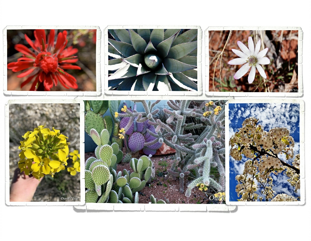
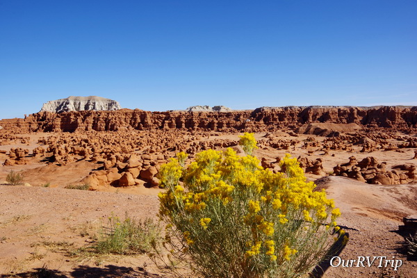
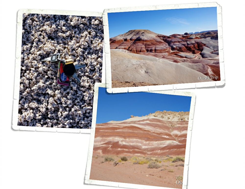
I also found some pretties! It was getting to be that time of the year again! There are so many colors in the desert. Those pops of color are just amazing!!

Around our sixth week in the Sedona area, the Corona Virus hit hard. Our life changed along with everyone else’s in the world. We stopped exploring so we could comply with the “social distancing” that was being requested by our government. The stores were running out of groceries and necessities. And every day we heard about more RV parks closing down. It was pretty stressful. We had to make a decision…do we keep with our reserved schedule or do we try to find a spot to hunker down and stay put until this all clears up?

We decided to keep with our schedule. As I’m writing this, we are planning our first move since the Covid 19 virus thing started. Our next spot is still in Arizona. We’ve been checking with the next place to make sure they’re still open and they have no plans to shut down…so, we’ll head that way. If you know me, you know I’m a planner. We do have a couple of backup plans. So, I guess we’ll see how it goes! If you follow us on Instagram you’ll get more timely updates…our blog posts are usually a month or more behind where we are for safety reasons.

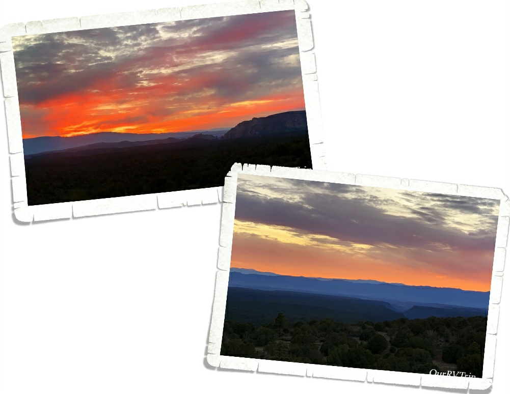
Well Guys, that’s all for now! Even with the “social distancing” we had a great visit to the Sedona area!!

See y’all down the road!

#NationalParkTour

Ghost Towns and Smoking Mountains

Ghost Towns and Smoking Mountains

Hey Guys!! We have so much to get through in this post…so lets just dive right in!

The first place we went when we got to Page is the Carl Hayden Visitor Center. This is the visitor center for Glenn Canyon National Recreation Area and where you can find all the most up-to-date information on the hiking trails and dirt roads in the area. While we were there, the boys did the Junior Ranger program and we walked across the bridge to check out the view of the Glenn Canyon Dam.

The Glen Canyon Bridge is 700 feet above the Colorado River which makes it the second highest steel arch bridge in the world! From the walkways along the bridge, you get a pretty stellar view of the river below. We walked to the center on one side then crossed the road to see the other side.

One of our favorite adventures at Glenn Canyon NRA was driving out to Alstrom Point to get a view of Lake Powell. To get there, we found ourselves on a dirt road out in the middle of nowhere. The road started off pretty good…really we commented about how smooth it was. But I think that after a certain mileage, they decided to just let the “road” return to nature. There were a couple of times that we weren’t sure we were even on the path anymore. And then we reached the slick rock section where you have to try and follow the little cairn stacks. We got lost on this section and had to turn around and take a better look at where we thought they wanted us to go. Needless to say, it was quite the adventure! And we loved it! We made it to Alstrom Point right before sunset and had the entire place to ourselves!! The water was so still and had some amazing reflections of the redish/orange rocks. This…this is what we look for when we set out on an adventure. No crowds. Nothing but nature.

We also drove out to the Lake Powell Campground and Marina for some more views. We were there right around sunset and there weren’t too many other people there. I think the bitterly cold wind kept everyone else inside. We woke up the next day (the day we left) to find that it had snowed. There was a very light dusting of snow around Page. I wasn’t able to snag any pictures of the lake with snow…but it was pretty!

Horseshoe Bend. I’ve wanted to see Horseshoe Bend in person for years. We’d driven by the parking lot several times during our stay in Page and every single time the parking lot was jam-packed with cars and huge tour buses. And every time I thought…well, maybe next time it won’t be so crowded. But, it always was. I was running out of time to see it during our stay so we bit the bullet and went during the time of day that was supposed to offer the best lighting for it. And…it was pandemonium. Just soooo many people everywhere. Standing in line to wait for my turn at the railing I kept looking around at everyone getting those Instagram shots. What’s funny is when you see those shots on social media, it looks like that person is all alone out in the wilderness with some meditative look…but in reality…they’re surrounded by chaos. People climbing every rock trying to get that just right angle…taking seventy or more selfies…the whole thing left a bad taste in my mouth.

I took a few pictures of the bend itself, snapped some of the insane amount of people and then we left. It is pretty. And from the picture above you can’t tell that the family right next to me was doing an entire photo secession and kept sticking their arms in my shot. Or that the couple on the other side of me kept pushing at me trying to get into the perfect spot. But, I got to see it and the picture doesn’t look half bad…all things considering.

We found ourselves back in Grand Staircase-Escalante National Monument again! We can’t seem to stay out of this park. This time we entered from it’s southern border and headed for the ghost town of Paria. There’s not really anything left of the Paria town sight or the movie set. We really loved the colors in the rocks though!

Between a fire or two and the seasonal flooding, the only structure we saw was this vault toilet put in place by the park. And Guys, one of us (Charles) got stuck in it. I’m not even kidding. Charles got stuck in the bathroom while we were out in the middle of nowhere. The door closed and didn’t want to open back up. It took a combined effort to get him out. I can’t imagine having that happen when you’re all alone out there…with no cell service. But look at those stripes and colors on the rocks!!

We did find a little pioneer cemetery. None of the markers had names on them. Instead, there was a little plaque toward the front that had the names of everyone buried there.

We made it all the way to the river where the original town sight is rumored to have been. Again, we never saw any traces of what was once there, but we enjoyed the drive and the scenery. We used our imaginations a bit and tried to decide what buildings would have been where and talked about good and bad places to build a town.

The whole adventure to Paria took us a couple of hours and we only saw a few other people. But boy-howdy…Guys, just look at that view. It really was like that the entire drive. One amazing thing to see after another. So, even though we didn’t get to explore a ghost town, we spent some time outside soaking up some vitamin D in a gorgeous setting. I call that a win.

The last thing we did in the Page area was head back into one of our favorite National Parks, Grand Staircase-Escalante, for one more adventure. Smoky Mountain Scenic Backway will take you all the way up to the All American Scenic Byway 12, but we didn’t go the entire 78 miles.

We kind of felt like we were driving around on another planet as we drove through stark canyons and some desert slick rock. The colors of the rocks kept changing…different sections had different colors. There was very little plant life. The first picture above…with the grey rocks…that area is called The Moon and parts of the movie Planet of the Apes was filmed there. It really felt otherworldly and remote.

Sometimes, if you’re lucky (or just plan better than we did), you’ll see smoke wafting up from one of the vents of the 100 year old coal seam fire still burning deep in Smoky Mountain. Which, is where the mountain got it’s name. In the upper right picture, you can see some of the coal seams that run through the mountain and in the left picture you can see what one of the vents looks like. To see the smoke, you have to be near a vent when it’s below freezing. So…we didn’t see any smoke.

We made it to the Kelly Grade Overlook and that’s as far as we went. We’ve driven a lot of dirt roads…but the road to get up to this overlook at 6,500 feet was so narrow with blind turns…I really don’t know what we would have done if we’d met someone going the other way on this road. We sat and ogled the view while we ate lunch. Not a bad view…you know, if you like that sort of epic landscape.

I know that people call these landscapes “badlands” because they’re not really good for anything…but I find them so beautiful and interesting. I’m so thankful that our government saw the need to set aside places like this for us to explore.

We found this pizza place…Strombolli’s Italian Restaurant… Guys, it was so good! We got the sampler appetizer platter and it was so big that we didn’t have that much room for pizza. Oh! And the mozzarella sticks were so huge and obviously house made. They were amazing! The pizza was delicious. The crust had that chew that we look for with a savory sauce (not sweet). When we’re back in Page this Spring…we’re totally going back here.

Ok, Guys!! That’s it for Page!! We didn’t do some of the activities that we’d initially planned on, but we knew we’d be back in the area soon.

See y’all down the road!

#NationalParkTour

Slot Canyons, Petrified Wood, and Sand Pipes… Oh My!

Slot Canyons, Petrified Wood, and Sand Pipes… Oh My!

Hey Guys! While we were in the Panguitch area the weather was so cold, but we didn’t let that stop us from exploring! We crammed in a National Park, two National Monuments, and two State Parks all in the two weeks we were there! This is the second post of our time in Panguitch, UT…let’s get started!

It’s not considered one of Utah’s Big 5…but it really should be on your list of must see National Park Units to visit while you’re in Utah. Grand Staircase-Escalante National Monument is so big (somewhere around 1.9 million acres) with so many diverse things to do and see…it’s easily one of our favorite NPS units. This National Monument is BLM managed so I think it tends to fly under the radar of most National Park enthusiasts.

We got a taste of what a slot canyon is back at Little Wild Horse Canyon a couple of weeks before we got to Panguitch and we all loved it! The Peek-a-boo/Spooky slot canyon loop has been on my list for a while and I was really excited to finally get the chance to explore them. These are family friendly slot canyons…meaning, you don’t need technical gear or experience to explore them. They are still slot canyons though…so there’s some scrambling, climbing, and squeezing involved. To get into Peek-a-boo, you must first climb up a twelve foot entry wall. There are a few hand and foot holds that help a bit, but it’s still difficult. I wouldn’t have made it up on my own…Jerl had to help pull me up part of the way. But we all made it up!

Peek-a-boo was so fun! You had to climb through holes, squeeze between walls, and work your way around some easy and fun obstacles. It was like a playground. Grand Staircase-Escalante is divided up into three distinct sections. In the Canyons of Escalante section, you’ll find the most extensive network of slot canyons in Utah.

Once you make it through Peek-a-boo you climb up and out of it and follow the trail over to Spooky to continue the loop. Or you can retrace your steps and go back through Peek-a-boo to get out the way you came. Grand Staircase-Escalante is a unique park. It’s considered the flagship unit of the newly established National Landscape Conservation System. This new conservation initiative’s goal is to basically preserve the wildness of the land. You won’t find defined trails like you will in other NPS units. While there are trails, there is minimal change to the land. So, you’ll need a map and you’ll have to watch for the cairns that have been built on some of the trials. The trial system isn’t as defined as what you might be used to.

Once you reach Spooky, you have to make your way down a fifteen foot drop. Like I said…it’s still a slot canyon and you’ll still have to do some climbing and scrambling. This drop was the hardest part of the whole loop for us. You’re coming out of the bright sun down into a dark canyon so it was hard to judge where you were and how far of a drop it was. Jerl went first here and helped the rest of us down. He also might have cracked a rib or two here…

Once we all made it down the drop, we caught up to a big group that was in front of us and so we had to wait while we were in some of the tightest sections of Spooky…which are ten inches wide. Ten inches. If you’re claustrophobic at all, I would suggest skipping Spooky. If I started to feel a little closed in, I would just look up at the blue sky. It helped quite a lot knowing if I absolutely had to, I could climb up the canyon walls to get out. They were narrow enough and they weren’t so tall that I couldn’t have made it. There were places that Jerl had to exhale in order to squeeze through. Always research the hike you’re going on and know what you’re getting yourself into.

I have to give a shout out to Tanya from Florida. When I saw that first climb up into Peek-a-boo…I thought briefly about copping out. It was intimidating…especially with an audience. But, she totally called me out…and said we can’t wimp out now after coming all this way. And she was totally right! The group of people we found ourselves exploring these slot canyons with really made the hike so much fun. We all helped each other and encouraged one another to make it through. So, thank you Tanya from Florida for pushing me to not wimp out!

The Dry Fork Narrows where Peek-a-boo and Spooky Gulches are found is the perfect way to experience Grand Staircase-Escalante National Monument the way it was meant to be…wild and free. Go be adventurous. Step outside your comfort zone and find out who you really are. But, always know your limits and be prepared when you’re out in the wilderness. If you’re going to explore a slot canyon…or really any canyon…be weather aware. There was a sign at the beginning of this hike that said the two most common causes of death are dehydration and drowning. Don’t go if it looks like it might rain anywhere in the area and always take plenty of water.

The last thing we did in Grand Staircase-Escalante National Monument was go see Grosvenor Arch. Like everything else we’d done in this National Monument, the drive to get there was on a dirt road. Ten bumpy and washboard miles down the road, you reach the little pulloff for Grosvenor Arch. You can see it from the parking lot, but if you want a closer look at the arch you can take the little “paved” trail out to it. We didn’t walk out there. I feel like the best view of an arch is from a distance. This arch is actually two arches that tower about 150 feet above the ground.

We had so much fun learning about and exploring Grand Staircase-Escalante National Monument!

Kodachrome Basin State Park is known for it’s sand pipes and it’s red rock sandstone chimneys. Kodachrome was named by a National Geographic Society Expedition back in the late 1940s. They named it in honor of Kodak film for it’s color.

We did the Angel’s Palace Trail to catch some views of the sand pipes, hoodoos, and chimneys that the park is so known for. There are over sixty sand pipes that range in height from 6 to 170 feet throughout the park. This is a pretty easy, well marked trail that offers some fantastic views of the park and the surrounding area.

Kodachrome Basin is located on the Colorado Plateau. Most of the layers exposed in the park are made of the Carmel Formation (the white rocks) and the Entrada Formation (the red rocks). While scientist know what the sand pipes are made of…they’re not really sure how they were made. There are a few different theories out there, but no one has been able to prove exactly how these unique rock formations were formed.

While we were exploring Kodachrome Basin State Park and Grosvenor Arch which are on the same road, we kept running into this group of cowboys (and girls) doing a roundup. They were moving their herd from the summer grazing field to the winter one. It was really neat to watch. We first encountered them on the way into Kodachrome, then caught up with them on the dirt road out to Grosvenor Arch…then met up with them one more time on our way back out. The cows didn’t think much of our car and they weren’t too inclined to walk around us. lol! A few of them bumped our car as if to say…”Hey, we’re walking here”… I think a couple of them were trying to hitch a ride on our bumper as we slowly moved through the herd. We stopped and asked the owners if we could drive through them…we were prepared to follow along behind them, but the owner assured us it was fine to drive next to them.

One day while we were driving around the area, we encountered three of these gorgeous Golden Eagles. Three! I, of course, didn’t have my good camera on me…and like the doofus I am, I just sat there too dumbstruck to even think of whipping out my phone to catch a video. We watched three giant golden eagles fight over something that one of them had just found in a field. It was…unforgettable.

We stopped by Escalante Petrified Forest State Park late one afternoon on our way back to our home-on-wheels after a long day of exploring. We always take the chance to see petrified wood. On top of a mesa that used to be the bottom of an ancient flood plain, you can walk a trail and see several specimens of petrified wood. The trees this wood came from were standing close to 100 feet tall around 130 million years ago. One of my favorite things about petrified wood is the variety of colors! The minerals in the soil determine what colors you get. For example, iron oxide will produce an orange, red or yellow coloring while manganese oxide tends to create blue, black or purple coloring. Yes… we’re nerds…we know things like that. Ha!

We had the honor of being featured in the November/December 2019 issue of Escapees Magazine. The whole process was a really fun learning experience. The author, Rene, is also an Escapees member and writes articles for the magazine on a regular basis. If you don’t know about Escapees, go check them out here. If you are living the Nomad life you definitely need to be an Escapee member. They make life so much easier and give Nomadic families, like ours, a community of likeminded individuals we can count on. We’ve made friends, learned from other members experiences and have found places to stay with Escapees help over the last almost five years.

That’s all for this post, Guys! I can’t believe our Utah explorations are almost over. It’s gone by so fast!

See y’all down the road!

#NationalParkTour

Goblins and Canyons and Foodies

Goblins and Canyons and Foodies

Hey Guys! This is the last post for our time in the Torrey, UT area. We crammed so much into the two weeks we were in the area.

Goblin Valley State Park is the home of hoodoos and goblins. One of the coolest things about Goblin Valley is that there isn’t a set trail. You get to wander around three square miles filled with thousands of varying sizes and shapes of hoodoos that the park affectionately calls…goblins.

Before the park was known as Goblin Valley, it was called Mushroom Valley. We spent a couple of hours roaming around the goblin city and exploring the valley. It’s weird to think that millions of years ago this dry desert was once a tidal flat area next to a huge ancient inland sea.

While we were at Goblin Valley State Park we went to Little Wild Horse Canyon where we got our very first taste of a slot canyon. We got there late in the day so we couldn’t do the whole hike. We went in a mile or so then turned around. We did go far enough in that we did some rock scrambling and get a feel for what a slot canyon is. The sun was setting so the lighting wasn’t there for the glowing slot canyon pics you normally see.

Our first slot canyon was a success…it gave us the bug for more and now I’m trying to find family friendly (non-technical) slot canyons near our next stops.

Torrey, UT is a small town, but we did find some tasty foodies there. At one of the nearby diners, we found a pie sampler that consisted of oatmeal pie, pinto bean pie, pickle pie, and buttermilk pie. Each piece was just big enough that we could each have a bite. Well, I’m going to let you guess at the two flavors that none of us liked. At least we tried it. The last night we were in town we tried a burger place called Capitol Burger. Guys, this was the best place in town and it was just a little food truck!

With all of the rock formations around, we started seeing animals and patterns in the rock. Can you see them? We found a turtle, heart, baby dragon, and a turtle.

We had such a good time exploring this part of Utah! I didn’t realize just how much we’d seen until I started setting aside pictures for the posts for this area.

See y’all down the road!

#NationalParkTour

The All-American Scenic Byway

The All-American Scenic Byway

Hey Guys!! While we were staying in the Torrey, UT area we stayed right at the beginning of Highway 12…also known as The All-American Road Scenic Byway. With a name like that, we couldn’t help but explore at least some of it! The entire scenic byway is 124 miles with sooo many stops, hikes, and scenic backway roads that lead off to even more adventures.

All along highway 12 are scenic pulloffs to some absolutely stunning panoramic vistas.

You’ll also find three State Parks spaced out along highway 12. We stopped at one of them during our day of exploring. Anasazi State Park Museum sits at the site of an Ancestral Puebloan community that was used between 1050 to 1200 AD. Most of the site has been left unexcavated, but they have uncovered ninety-seven rooms along with several pit structures. There is a small replica (that you can explore) of what some of the structures would have looked like when the Ancestral Puebloan people were there. We spent a couple of hours checking this small State Park out.

One of the best…maybe the best… section of The All-American Road Scenic Byway is what they refer to as The Hogsback. This is the part of the highway that follows the thin razorback ridge of a mesa with steep drop offs on each side of the highway. Luckily, they put in a nice wide pulloff right at the top where you can get out of your vehicle and ogle the breathtaking views. I think I must have taken twenty pictures of just this pulloff alone.

When I did my research on places to stop and things to see on highway 12, one place kept coming up. Kiva Koffeehouse. Everyone said to stop for a snack and soak in the view…Guys, they weren’t lying. The view here was spectacular and the food was super fresh and tasty! We sat outside while we ate and the picture on the left was our lunch view. Then we drove around the corner and ran into the view in the right picture. And for probably the 100th time that day we all stood there saying wow!

Ancestral Puebloans used this area long before highway 12 was built. If you look closely, you can see the upper valley granaries still stored. A granary is where food was stored to keep it safe. They would wall up the area to keep animals and other people from getting to their storage. If you don’t know where to look, I’ve zoomed in and put an arrow pointing to the granary. It really blends in with the cliff side.

We made it all the way to Powell Point before we turned around. At Powell Point you can see the very topmost layer of the Colorado Plateau’s Grand Staircase. You can also see this same layer at Bryce Canyon NP.

On a different day we went back to highway 12 to tackle the scenic backway known as Hells Backbone. This is a thirty-eight mile dirt road built by the CCC to connect two mountain towns. So many of the reviews I read about this road kept saying how dangerous it is and under the wrong circumstances, I can see how it would be dangerous. You’d definitely want dry weather and no snow or ice on the road, but Hells Backbone is a great short scenic drive. Just watch out for the cows along the road (upper right picture).

We still had some light left, so we headed over to the Burr Trail Scenic Backway. Yup…another scenic trail! Ha! Burr Trail started out as a cattle trail to get cattle from their summer grazing pastures to their winter ones. We drove to the end of the paved part and found the view above. Not a bad view of the Circle Cliffs with the Henry Mountains in the background.

On the way back out of the Burr Trail, we stopped at a pulloff that led to a deep cleft in the side of the canyon wall. When we walked up to the cleft, there was a family there with two girls who were singing songs from The Sound of Music and Guys…the acoustics in this cleft were amazing! The girls sounded wonderful. While we were chatting with the family, a small owl flew out of a nearby tree, floated right over our heads, and landed in a little alcove in the canyon wall. It took us all by surprise! It was a really cool experience.

Hells Backbone Road and Anasazi State Park Museum are actually part of a bigger National Monument. Grand Staircase-Escalante National Monument is divided into three different units and spans across close to one million acres. Besides the fact that this is one huge National Monument, the area within it is the last place in the US to have been mapped. We explored some of this park from Torrey and some from our next stop, Panguitch…so stay tuned for more on this amazing National Monument!

I have one more post for our time in Torrey! We’re going to need a vacation once we finish with Utah so we can get some rest… There’s so much to see and do here.

See y’all down the road!

#NationalParkTour

Capitol Reef National Park

Capitol Reef National Park

Hey Guys!! We are now on our second stop in Utah as we make our way across southern Utah to visit the Big Five along with as many National Monuments and State Parks as we can fit in. We thought that there would be less to do in the Torrey, UT area…but, well…we were wrong. We were just as busy!! Guys, we might need a vacation from our National Park Tour.

When we first got to Capitol Reef NP, I wasn’t sure how I felt about it. The thing that stuck out the most to me was the main highway that went right through a portion of the park. Now, we’ve been in other parks with highways and paved roads…most have them…but for some reason, this particular setup just didn’t do it for me.

Until I spent some time in the park.

The huge domes, towering cliffs, arches, bridges, and amazing stone rock formations transport you to another world. And Guys, the way the light plays on the rocks and makes them change colors throughout the day… I totally fell in love with this park.

Never, in my wildest dreams, did I imagine I would see a caution radiation sign in a National Park. And…the radiation area is a protected bat habitat?? Um…what?

The yellow tint in the sandstone rock is actually trace amounts of uranium. In the early 1900s uranium was a hot commodity due to the idea that it had health benefits. People would wear rocks laced with uranium around their necks or crush it up and drink it in water. Then in the 1950s the government was on a search for uranium to help protect the country. Ultimately, the amount of uranium found in the Captiol Reef NP area was so scant that the area was abandoned for uranium production. The mines are still there though and apparently, bats like to roost in them…so if you see little glowy lights flying around at night…it’s probably just the bats.

The first thing we did was the eight mile Scenic Drive that takes you back into a small portion of the park. It’s a great introduction to the park and what this park is protecting. The Scenic Drive is a small portion of an original route once used by the Ancient people we now refer to as the Fremont. When settlers came to the area in the 1880s the route was turned into a wagon road.

The backbone of Capitol Reef National Park is a 100 mile long waterpocket fold. A what? A waterpocket fold is basically a huge wrinkle in the earth’s crust formed by a monocline. Early settlers described it as an “impassable reef” of rock. Until 1962, when Highway 24 was completed, the only way through this section of the Waterpocket Fold was the original road that was prone to flash floods. We actually witnessed a flash flood while were on part of the original road. We found high-ish ground with our 4Runner and waited it out. Some people had to abandon their vehicles in the flow of water and just hope it didn’t rise too much more. The flash flood came on quick and left just as quickly leaving a muddy wet mess behind. no one was hurt and all humans/vehicles were able to get out mostly unscathed.

They call it The Pioneer Register, but really it’s just old graffiti. And, you’re not supposed to add to it. Ha! The Pioneer Register is located along a stretch of the original road through the Waterpocket Fold. For some reason, early travelers started leaving their mark on the steep sandstone walls. We saw everything from fancy script to names being shot into the wall with a gun.

On the same hike as the Pioneer Register, you’ll find The Tanks. You can climb up the cliff and see some depressions in the rock that collect water when it rains. When we went, the “tanks” were pretty dry, but the view from the top of the cliff was pretty cool! And the boys (all four) had a great time being mountain goats as they criss-crossed around the cliff trails.

There are also several places where you can find even older graffiti left by the Fremont people who were some of the very first people to settle in the area (from 600-1300 CE). They didn’t have a form of writing other than the petroglyphs found along the canyon walls so we don’t know much about them. We know they did a bit of farming and that they used the atlatl to hunt with. We think they had camps along the Fremont River.

One of the hikes we did while in Capitol Reef NP was the Chimney Rock Loop. The trailhead is right off that highway I told you runs through the park and every time we passed it, the parking lot was full so we knew it must be a good one. This trail has an elevation gain of 590 ft, all at the beginning of the hike during the first half mile or so. After that, it was cake. And the views…

The Hickman Bridge trial was another one that had some amazing views. This was a relatively short trail to a 133 foot natural bridge. Hickman Bridge is one of the pictures you’ll find on a lot of the Capitol Reef NP souvenirs like stickers, postcards, and pins. We did each of these hikes late in the afternoon and the crowds were minimal.

We never saw any glowing bats… but we did see tons of these little squirrels and lizards while we were there. The squirrels were pretty used to seeing people and I think they’ve been fed a few times. Please keep wildlife wild. Even the squirrels. You really are doing them a disservice by making them dependent on humans and handouts. And honestly, human food isn’t good for them.

There are a couple of longer scenic drives you can do that wind their way in and out of the Capitol Reef National Park boundaries. We did the entire Cathedral Loop drive and Guys, it was totally awesome! We spent an entire Saturday doing this drive. We stopped by the visitor center and picked up the Cathedral Loop driving guide. It totally made the drive. Seriously. It had info on all the stops and the little side roads that we would have driven right by had we not known what was down them. That little guide was totally worth the $3 we paid for it and more.

The Cathedral Loop starts out at the visitor center then takes you down the main highway. There are a few stops along the highway that talk about the early Mormon settlers that came to the area back in the late 1800s. It’s not long before the scenic loop has you turning off of the nicely paved highway onto a dirt road where you have to ford the Fremont river! This was our first river fording and it was both exciting and terrifying all at once.

Once upon a time… this land was used for ranching and the ranchers brought out a drilling truck to find water for all of their cattle. I’m not sure why the ranchers left the drilling truck, but it looks neat. The well is still active so there’s an artificial oasis way out in the middle of the desert. We got out and looked around on the way through. The truck really does look cool the way it’s partially buried.

These bentonite hills are sooo my color. Bentonite is actually a clay that is full of volcanic ash. When it gets wet, it’s super slick and sticky. How can it be slick and sticky at the same time? Magic. That’s the only explanation I have. See that left picture? It kind of looks like popcorn, right? Bentonite clay gets a popcorn like surface from repeated cycles of absorbing rain then drying again. We thought these bentonite hills were super neat!

One of our favorite things about the Cathedral Loop is that it has small hikes spaced throughout. It was nice to get out of the car and stretch our legs…and to stop bumping down the dirt road every so often.

We learned sooo much on this drive. The booklet we picked up at the visitor center is jam packed with geology facts, history, and even a bit of ecology. I’m not going to go through each stop and lesson we learned. Y’all can go do the loop yourself for that! Ha! But, I will share some of our favorite pictures and some little tidbits too. Like…in the top picture in the gallery above…the valley extends twenty miles! This view was unreal. We felt like we were looking at a movie set. The picture doesn’t do it justice at all.

Welcome to Cathedral Valley. In 1945, the first superintendent of Capitol Reef, Charles Kelly, and Frank Beckwith, a newspaper owner, gave this valley the name of Cathedral Valley because the rock formations reminded them of Gothic architecture.

Alex is taking an earth science class this year. He was pretty stoked to get the chance to see volcanic sills and dikes in person! What am I talking about? Well, a long long time ago…around three to six million years ago…molten magma pushed its way up through cracks in the earth’s surface. The magma cooled and solidified and turned into vertical walls (dikes) and horizontal layers (sills). You can see some awesome vertical walls (dikes) in the two pics above.

On the right you’ll see a two hundred foot gypsum sinkhole. It was impressive! Now, on the top, you will see the boys standing in front of Glass Mountain…which isn’t made of glass at all. It’s actually made of selenite crystals also known as moonstone which is a crystalline form of gypsum. They think that the sinkhole used to look like Glass Mountain. It’s weird to think that one day, Glass Mountain could be gone and replaced with a huge sinkhole.

Guys, you really need to get out there and see these places. At this stop along the loop, we got to see the Temples of the Sun and Moon up close. Made of soft Entrada Sandstone…these giant monoliths are literally melting every time it rains. In the picture on the right…you can see the texture of these monoliths. It looks like flowing mud…because when it’s wet, it basically is. Many of the cool rock formations within this amazing National Park are melting away…they’re eroding at relatively rapid rates.

“Wilderness is not a luxury but a necessity of the human spirit, and as vital to our lives as water and good bread…” ~Edward Abbey

Go out and explore the wilderness while it’s still around to explore.

See y’all down the road!

#NationalParkTour