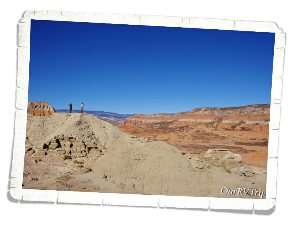
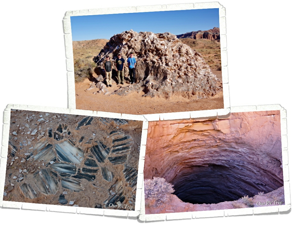
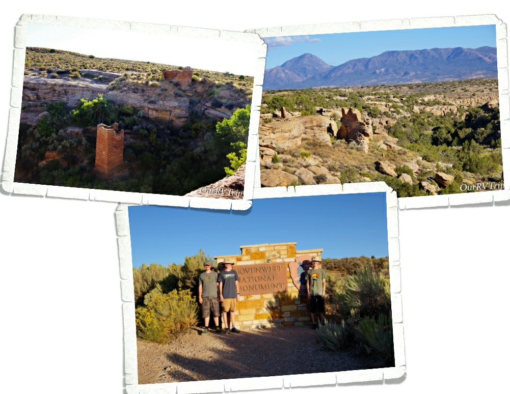
Category: National Park

The Hoodoos

The Hoodoos

Hey Guys!! Man, did Utah get cold!! We drove out of Moab and into what felt like Fall weather while we were in Torrey. We ended up having to use our propane furnace several nights. When we drove to our next stop in Panguitch…well…I’m pretty sure we drove right into Winter! Brrr it was cold the entire two weeks we were in Panguitch!

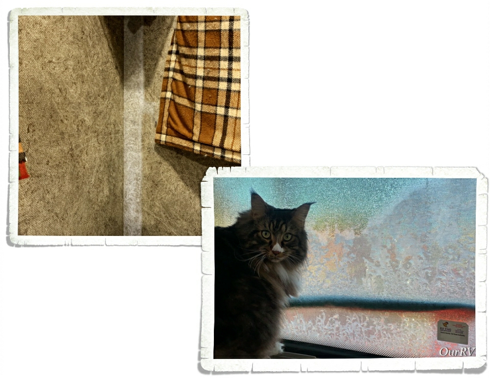
There are certain things you don’t think about when you live in a sticks-n-bricks home. Like…can we find someplace to fill the propane tank in our home…will we have ice crystals on the inside of our walls in the morning…and did we remember to turn off the water so the hose doesn’t freeze and crack overnight? These are real concerns when you live in a home-on-wheels and you’re experiencing below freezing weather. There are measures you have to take to insure you don’t have frozen poo in your tank or hose because…frozen poo is never a good thing. Ever. And it also has a tendency to cause some major issues when you’re trying to dump your tanks. Again…that’s not something you want to have to deal with. Ever.

Panguitch is a bit bigger than Torrey. There was an actual (albeit small) grocery store. But, hey…beggars can’t be choosers and we were just thrilled to have a grocery store close! Did you know, that Panguitch is a Paiute word that means “big fish”? Panguitch was originally settled in 1864 with the name of Fairview, but the name was changed in the late 1800s.

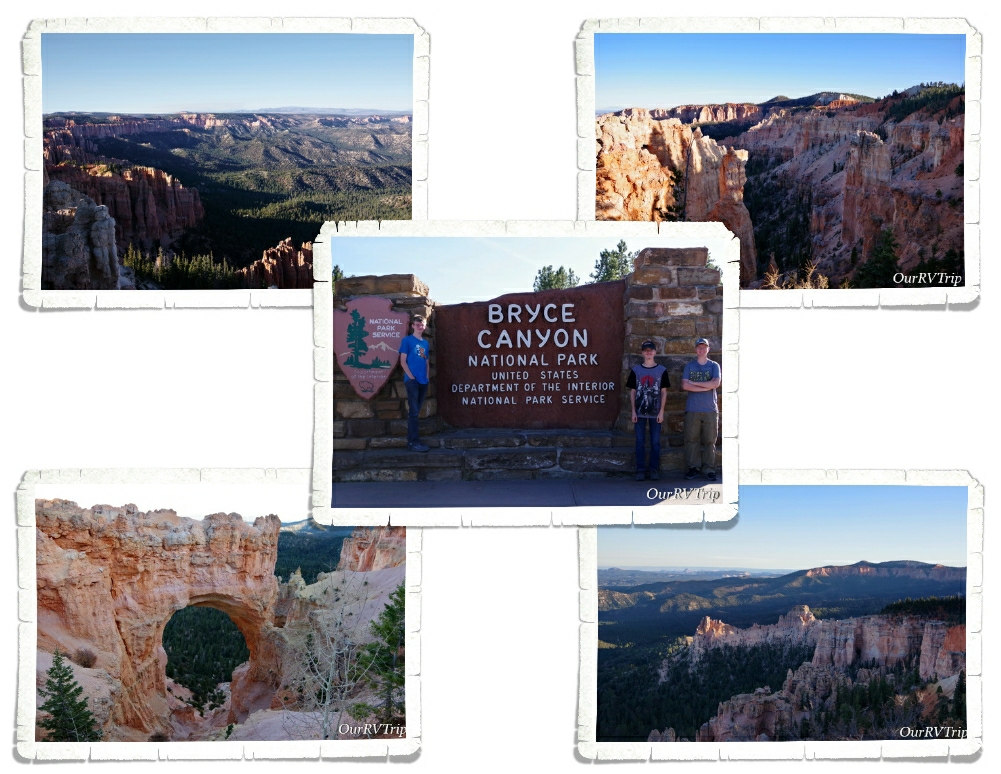
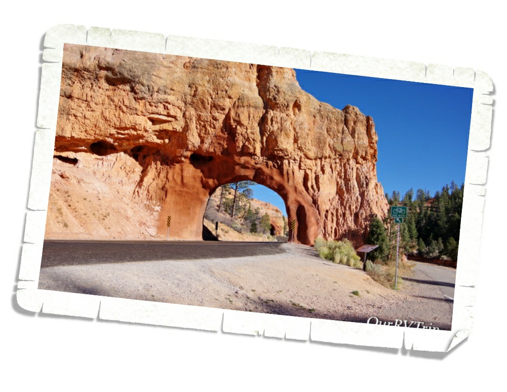
The main reason we were in the area was to continue our Utah Big Five National Park tour with Bryce Canyon National Park. I’d heard so many wonderful things about this park that I had pretty high expectations for our visit. The pictures I kept seeing on social media had me itching to get there and grab some shots of my own.

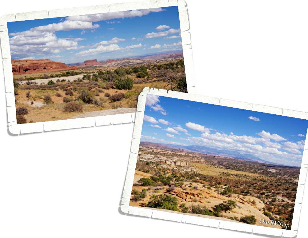
Our first trip into Bryce Canyon NP was later in the afternoon. We hit the visitor center so the boys could start the Junior Ranger books and then we headed out to do the eighteen mile scenic drive. I have to admit to y’all…our first impression of Bryce wasn’t good. In fact, after the first few viewpoints, we all kind of thought it was going to be another Grand Canyon for us. If you missed that post you can find it here. We weren’t really feeling it. The boys stopped getting out of the car to look at the view because “it all looks the same”. We were totally bummed. So far, Utah had not disappointed…was this park going to be a dud for us?

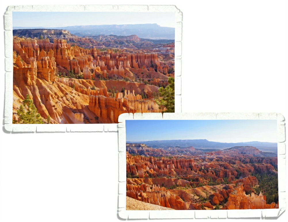
We didn’t get to go back to Bryce Canyon NP for several days…real life tends to happen even when you’re a Nomad. The next weekend we headed in to do the Navajo Loop/Queens Garden combined loop trail. We got there super early (about 8am) and headed straight to the trail. And Guys, oh…my…goodness…what a difference the right lighting makes. Look at those hoodoos! This was the fiery color I was wanting. I do know a bit about lighting…I do take my fair share of photos…but it really was interesting to see just how big of a difference the right lighting makes.

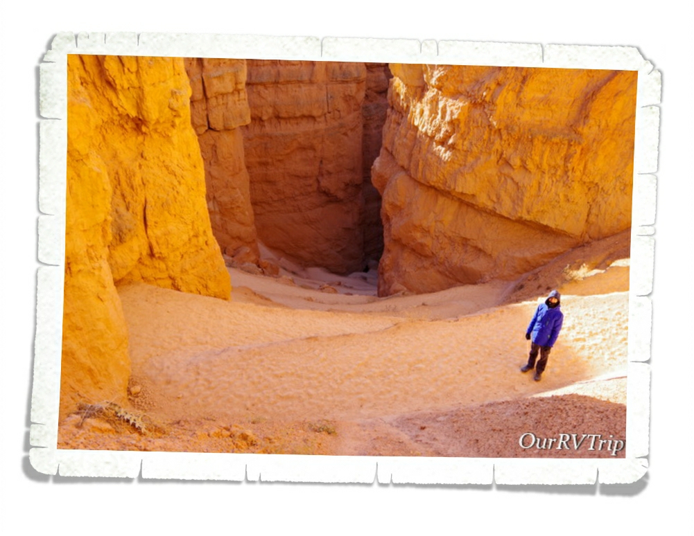
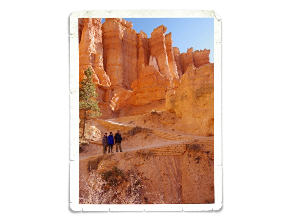
There are a few different ways you can do the Navajo Loop/Queens Garden trail. We opted to start at the Wall Street side of the Navajo Loop. It’s a pretty steep decent down into the canyon and we were kind of digging the feeling of heading down into the depths of it. When we started out that morning the temperature was close to 30° and there was a bitingly cold breeze. We bundled up and hoped that the cold would keep some hikers home.

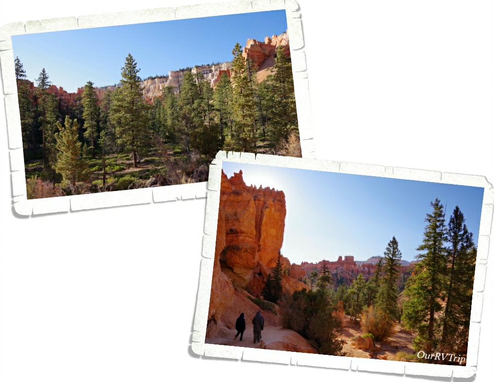
We loved how once we got down into the canyon we found an entire forest. You can, of course, see the trees from the canyon rim, but you don’t realize how big they are or how many of them are hiding down there.

Did you know that Bryce Canyon isn’t really a canyon at all? It’s actually a series of amphitheaters that over many thousands of years of erosion have been carved out of the pink Claron limestone that makes up the Paunsaugunt Plateau.

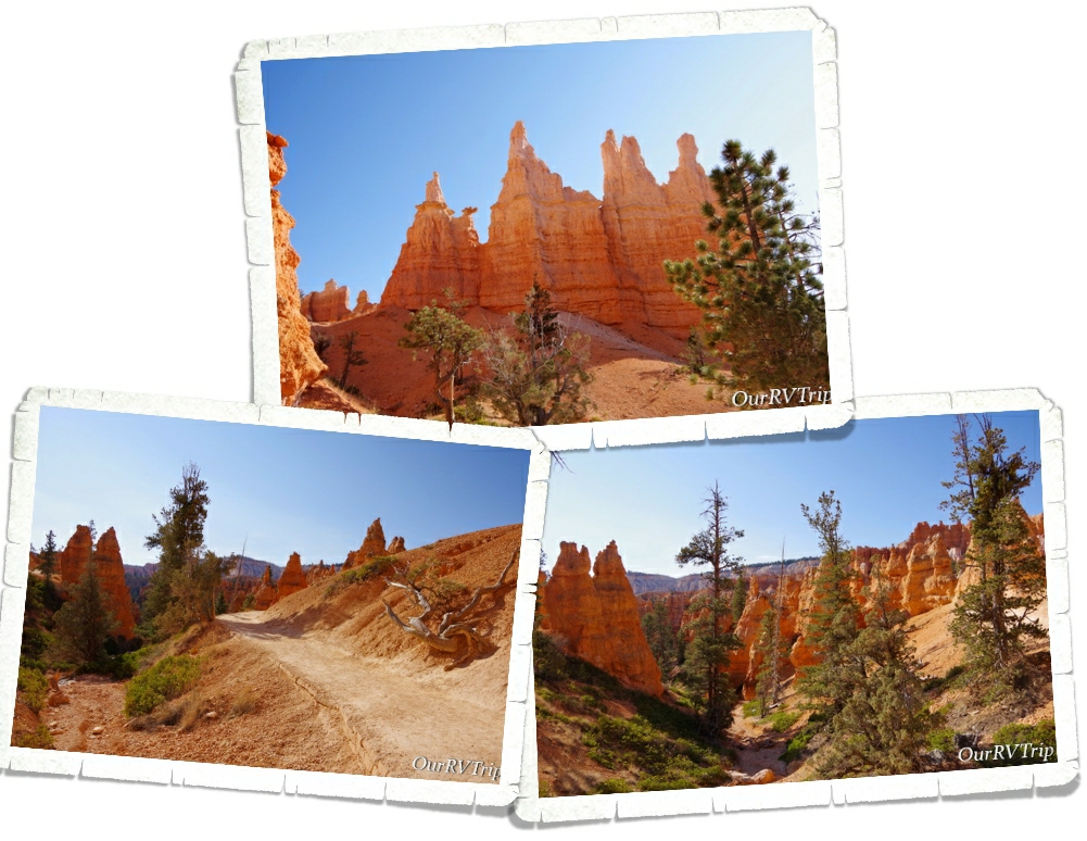
The Paiutes believe that the rock pinnacles and hoodoos are actually people turned to stone by angry gods. They believe that their people were placed here to take care of the earth. Some of the rock formations do have people like shapes to them. In fact, the Queens Garden was given that name because someone thought that one of the formations looked like a statue of Queen Victoria. I don’t really see it… but, to each his own.

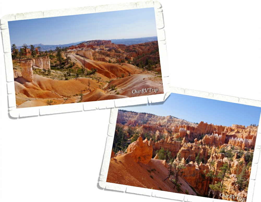
Our hike ended at Sunrise Point right as the park started getting busy. I have to admit…this hike totally changed our opinions of Bryce Canyon National Park. We’d resigned ourselves to not liking this National Park, but getting down into the canyon and walking amongst the hoodoos, spires, pinnacles, and monuments was amazing.

The canyon looks completely different when you’re down in it. It really is amazing how changing your perspective/view can change your whole outlook about a place. Bryce Canyon went from being near the bottom of our list to somewhere near the top.

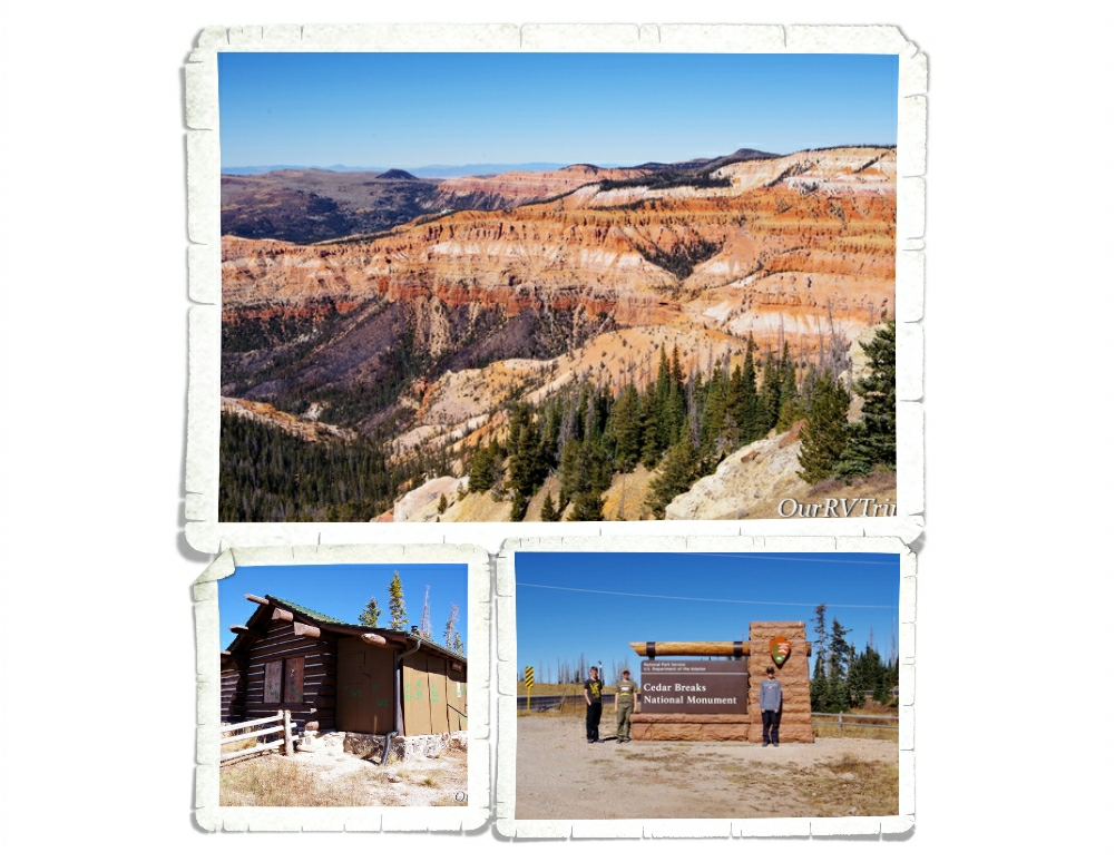
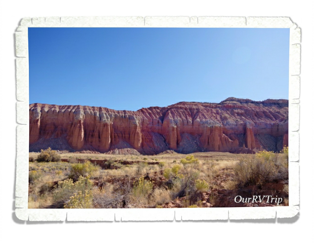
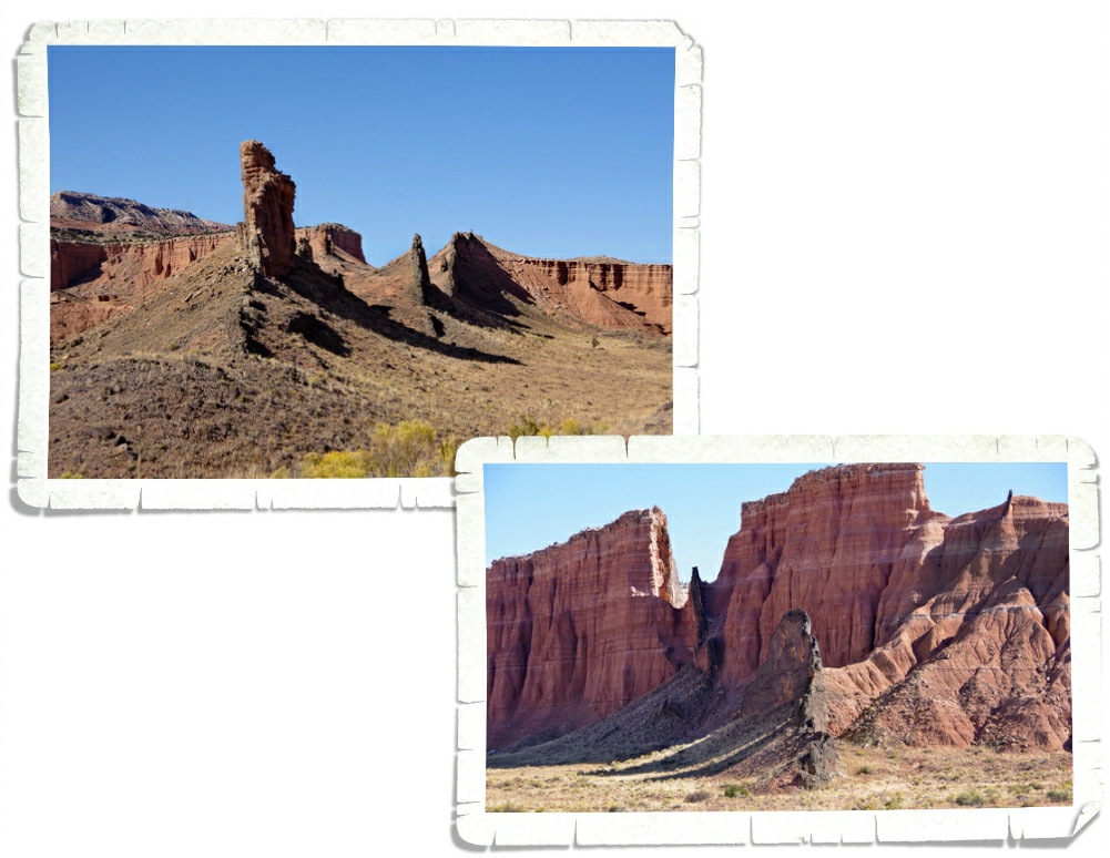
We were close to Cedar Breaks National Monument so we took a day to go explore it. Unfortunately, when we got there…the facilities were closed. We were able to drive the six mile scenic road and stop at a few different viewpoints though. Also known as “Circle of Painted Cliffs”, Cedar Breaks has some beautiful views.

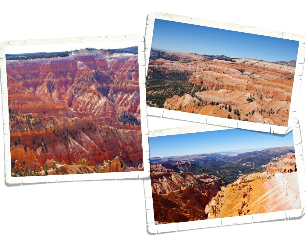
Cedar Breaks National Monument is like a mini Bryce Canyon. It is, in fact, an amphitheater just like Bryce Canyon. Cedar Breaks is around three miles wide and close to two-thousand feet deep and just like in Bryce, you’ll see a combination of fins, spires and columns jutting out of the canyon wall.

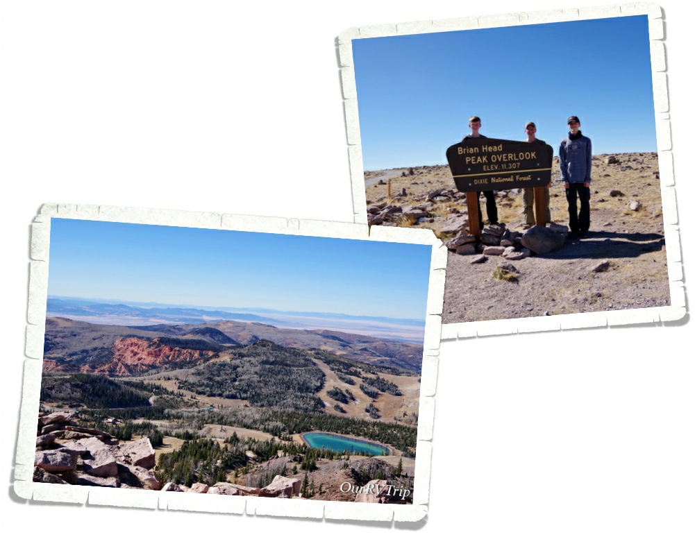
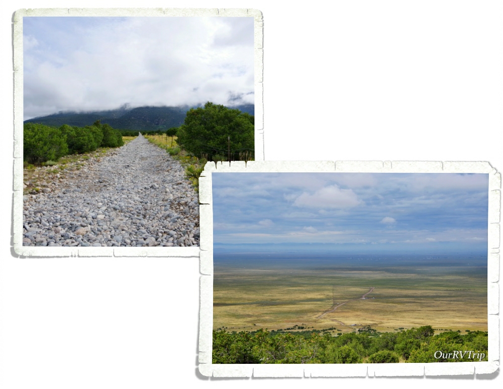
While we were exploring the Cedar Breaks National Monument area, we stumbled on Brian Head. At 11,312 feet, Brian Head Peak is the highest peak in southwest Utah and the 360° views from the top are breathtaking! On a clear day, you can see all the way to Arizona and Nevada. It was just a quick drive up a dirt road that didn’t need four-wheel drive and we had the entire place to ourselves.

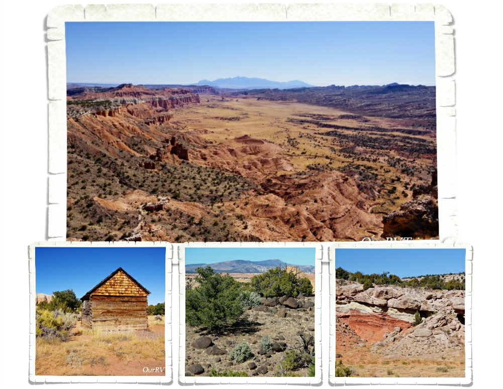
We spent over four weeks exploring in and around Dixie National Forest. At nearly two million acres, Dixie NF has something to offer everyone from mountain forests and alpine lakes to canyon gorges. Dixie NF is Utah’s largest national forest. We’ve been to quite a few national forests during our travels, and Dixie is one of the most diverse we’ve seen.

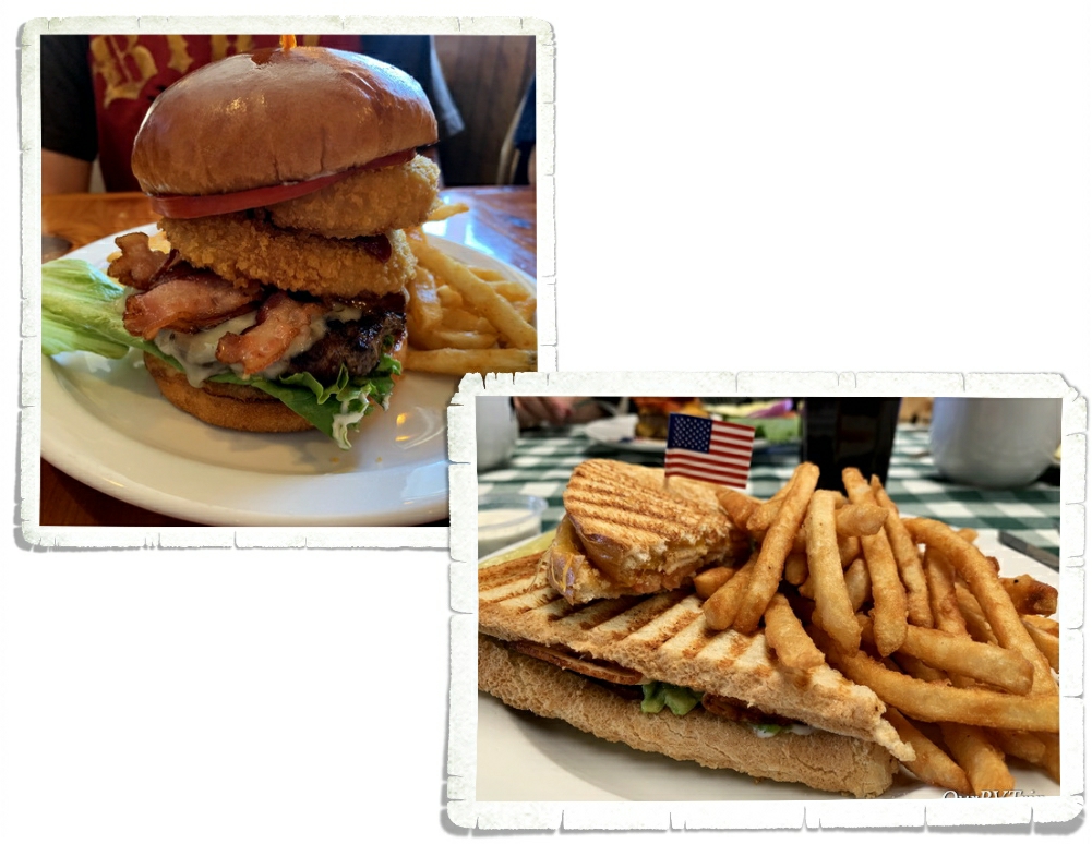
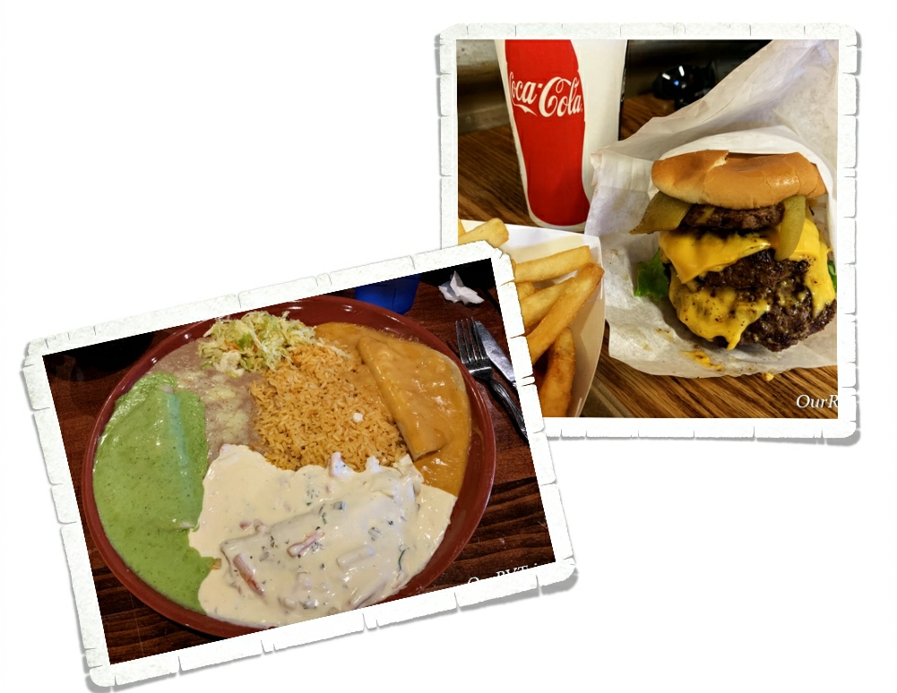
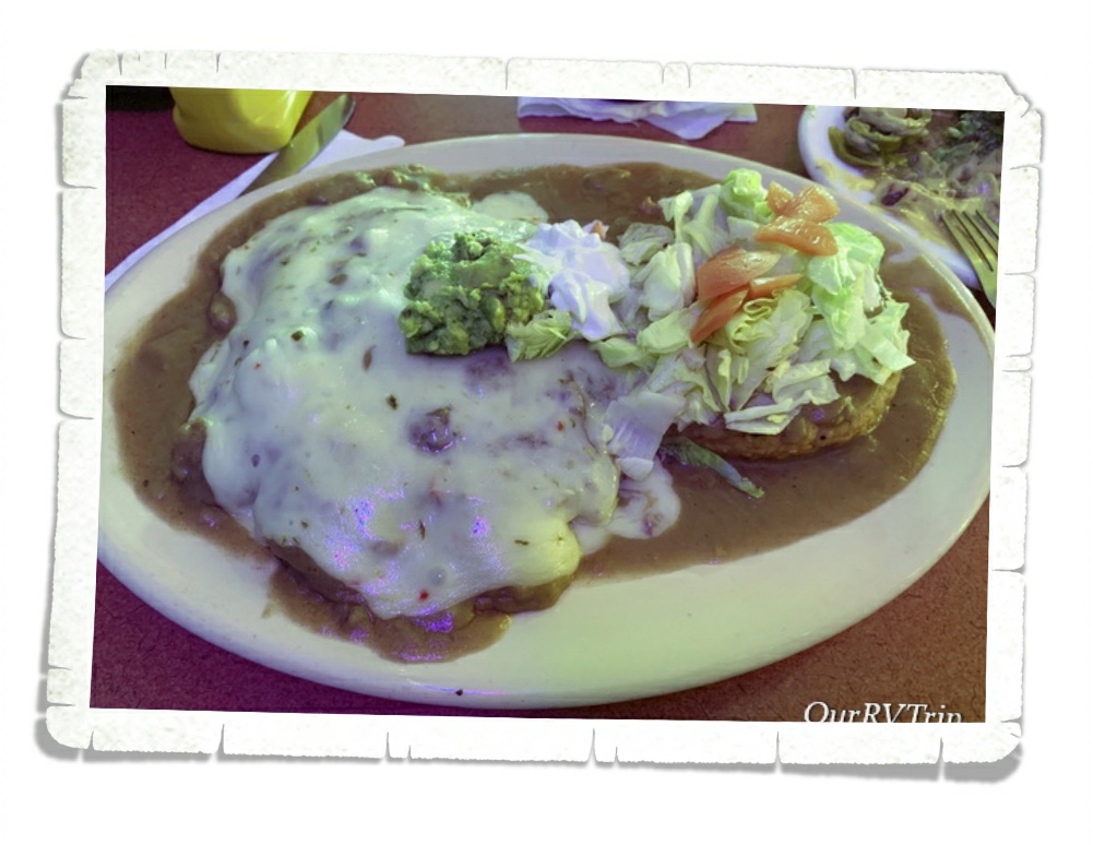
We did find some time for foodies. Ha! Y’all know how we are about the foodies. So far, while in Utah…we hadn’t really been impressed with most of what we’d found. We did find a couple of hidden gems here and there. Panguitch had a couple more hidden gems for us. Local, little mom and pop places that were still open while quite a few places were closing for the season.

Well, Guys…I’m going to pause on our Panguitch explorations for now. I’ll share more with you in our next post!

See y’all down the road!

#NationalParkTour

Capitol Reef National Park

Capitol Reef National Park

Hey Guys!! We are now on our second stop in Utah as we make our way across southern Utah to visit the Big Five along with as many National Monuments and State Parks as we can fit in. We thought that there would be less to do in the Torrey, UT area…but, well…we were wrong. We were just as busy!! Guys, we might need a vacation from our National Park Tour.

When we first got to Capitol Reef NP, I wasn’t sure how I felt about it. The thing that stuck out the most to me was the main highway that went right through a portion of the park. Now, we’ve been in other parks with highways and paved roads…most have them…but for some reason, this particular setup just didn’t do it for me.

Until I spent some time in the park.

The huge domes, towering cliffs, arches, bridges, and amazing stone rock formations transport you to another world. And Guys, the way the light plays on the rocks and makes them change colors throughout the day… I totally fell in love with this park.

Never, in my wildest dreams, did I imagine I would see a caution radiation sign in a National Park. And…the radiation area is a protected bat habitat?? Um…what?

The yellow tint in the sandstone rock is actually trace amounts of uranium. In the early 1900s uranium was a hot commodity due to the idea that it had health benefits. People would wear rocks laced with uranium around their necks or crush it up and drink it in water. Then in the 1950s the government was on a search for uranium to help protect the country. Ultimately, the amount of uranium found in the Captiol Reef NP area was so scant that the area was abandoned for uranium production. The mines are still there though and apparently, bats like to roost in them…so if you see little glowy lights flying around at night…it’s probably just the bats.

The first thing we did was the eight mile Scenic Drive that takes you back into a small portion of the park. It’s a great introduction to the park and what this park is protecting. The Scenic Drive is a small portion of an original route once used by the Ancient people we now refer to as the Fremont. When settlers came to the area in the 1880s the route was turned into a wagon road.

The backbone of Capitol Reef National Park is a 100 mile long waterpocket fold. A what? A waterpocket fold is basically a huge wrinkle in the earth’s crust formed by a monocline. Early settlers described it as an “impassable reef” of rock. Until 1962, when Highway 24 was completed, the only way through this section of the Waterpocket Fold was the original road that was prone to flash floods. We actually witnessed a flash flood while were on part of the original road. We found high-ish ground with our 4Runner and waited it out. Some people had to abandon their vehicles in the flow of water and just hope it didn’t rise too much more. The flash flood came on quick and left just as quickly leaving a muddy wet mess behind. no one was hurt and all humans/vehicles were able to get out mostly unscathed.

They call it The Pioneer Register, but really it’s just old graffiti. And, you’re not supposed to add to it. Ha! The Pioneer Register is located along a stretch of the original road through the Waterpocket Fold. For some reason, early travelers started leaving their mark on the steep sandstone walls. We saw everything from fancy script to names being shot into the wall with a gun.

On the same hike as the Pioneer Register, you’ll find The Tanks. You can climb up the cliff and see some depressions in the rock that collect water when it rains. When we went, the “tanks” were pretty dry, but the view from the top of the cliff was pretty cool! And the boys (all four) had a great time being mountain goats as they criss-crossed around the cliff trails.

There are also several places where you can find even older graffiti left by the Fremont people who were some of the very first people to settle in the area (from 600-1300 CE). They didn’t have a form of writing other than the petroglyphs found along the canyon walls so we don’t know much about them. We know they did a bit of farming and that they used the atlatl to hunt with. We think they had camps along the Fremont River.

One of the hikes we did while in Capitol Reef NP was the Chimney Rock Loop. The trailhead is right off that highway I told you runs through the park and every time we passed it, the parking lot was full so we knew it must be a good one. This trail has an elevation gain of 590 ft, all at the beginning of the hike during the first half mile or so. After that, it was cake. And the views…

The Hickman Bridge trial was another one that had some amazing views. This was a relatively short trail to a 133 foot natural bridge. Hickman Bridge is one of the pictures you’ll find on a lot of the Capitol Reef NP souvenirs like stickers, postcards, and pins. We did each of these hikes late in the afternoon and the crowds were minimal.

We never saw any glowing bats… but we did see tons of these little squirrels and lizards while we were there. The squirrels were pretty used to seeing people and I think they’ve been fed a few times. Please keep wildlife wild. Even the squirrels. You really are doing them a disservice by making them dependent on humans and handouts. And honestly, human food isn’t good for them.

There are a couple of longer scenic drives you can do that wind their way in and out of the Capitol Reef National Park boundaries. We did the entire Cathedral Loop drive and Guys, it was totally awesome! We spent an entire Saturday doing this drive. We stopped by the visitor center and picked up the Cathedral Loop driving guide. It totally made the drive. Seriously. It had info on all the stops and the little side roads that we would have driven right by had we not known what was down them. That little guide was totally worth the $3 we paid for it and more.

The Cathedral Loop starts out at the visitor center then takes you down the main highway. There are a few stops along the highway that talk about the early Mormon settlers that came to the area back in the late 1800s. It’s not long before the scenic loop has you turning off of the nicely paved highway onto a dirt road where you have to ford the Fremont river! This was our first river fording and it was both exciting and terrifying all at once.

Once upon a time… this land was used for ranching and the ranchers brought out a drilling truck to find water for all of their cattle. I’m not sure why the ranchers left the drilling truck, but it looks neat. The well is still active so there’s an artificial oasis way out in the middle of the desert. We got out and looked around on the way through. The truck really does look cool the way it’s partially buried.

These bentonite hills are sooo my color. Bentonite is actually a clay that is full of volcanic ash. When it gets wet, it’s super slick and sticky. How can it be slick and sticky at the same time? Magic. That’s the only explanation I have. See that left picture? It kind of looks like popcorn, right? Bentonite clay gets a popcorn like surface from repeated cycles of absorbing rain then drying again. We thought these bentonite hills were super neat!

One of our favorite things about the Cathedral Loop is that it has small hikes spaced throughout. It was nice to get out of the car and stretch our legs…and to stop bumping down the dirt road every so often.

We learned sooo much on this drive. The booklet we picked up at the visitor center is jam packed with geology facts, history, and even a bit of ecology. I’m not going to go through each stop and lesson we learned. Y’all can go do the loop yourself for that! Ha! But, I will share some of our favorite pictures and some little tidbits too. Like…in the top picture in the gallery above…the valley extends twenty miles! This view was unreal. We felt like we were looking at a movie set. The picture doesn’t do it justice at all.

Welcome to Cathedral Valley. In 1945, the first superintendent of Capitol Reef, Charles Kelly, and Frank Beckwith, a newspaper owner, gave this valley the name of Cathedral Valley because the rock formations reminded them of Gothic architecture.

Alex is taking an earth science class this year. He was pretty stoked to get the chance to see volcanic sills and dikes in person! What am I talking about? Well, a long long time ago…around three to six million years ago…molten magma pushed its way up through cracks in the earth’s surface. The magma cooled and solidified and turned into vertical walls (dikes) and horizontal layers (sills). You can see some awesome vertical walls (dikes) in the two pics above.

On the right you’ll see a two hundred foot gypsum sinkhole. It was impressive! Now, on the top, you will see the boys standing in front of Glass Mountain…which isn’t made of glass at all. It’s actually made of selenite crystals also known as moonstone which is a crystalline form of gypsum. They think that the sinkhole used to look like Glass Mountain. It’s weird to think that one day, Glass Mountain could be gone and replaced with a huge sinkhole.

Guys, you really need to get out there and see these places. At this stop along the loop, we got to see the Temples of the Sun and Moon up close. Made of soft Entrada Sandstone…these giant monoliths are literally melting every time it rains. In the picture on the right…you can see the texture of these monoliths. It looks like flowing mud…because when it’s wet, it basically is. Many of the cool rock formations within this amazing National Park are melting away…they’re eroding at relatively rapid rates.

“Wilderness is not a luxury but a necessity of the human spirit, and as vital to our lives as water and good bread…” ~Edward Abbey

Go out and explore the wilderness while it’s still around to explore.

See y’all down the road!

#NationalParkTour

Dirt Roads and Hiking

Dirt Roads and Hiking

Hey Guys! This is the last of three posts about our two weeks in the Moab, UT area. We really did cram quite a lot into those two weeks!! I feel like we went non-stop and we still didn’t even scratch the surface of what’s in the Moab area. I think it’s safe to say that we will definitely be revisiting Moab in the future.

One of our favorite things about this Nomad life of ours is the people we get to meet. Our neighbors in Moab were super nice! They were in the middle of an epic road trip from Massachusetts all the way to Arizona and back. When they left, they gave us a few guide books for the Moab area and they left notes as to what they did! Like I said..super nice! We ended up doing the Gemini Bridges trail/hike because they’d recommended it and Guys, it was awesome! To get to the Gemini Bridges we drove up a dirt 4×4 road. Yup, we found another dirt road to drive on. The road up to the plateau that the bridges are found on was steep and narrow with a pretty big drop on one side, but once we got up onto the plateau, the road was better. There are a few places to park and a marked trail out to the bridges. Gemini Bridges are two natural bridges that lay side by side. There’s about a six foot gap between them and apparently some people try to jump the gap…and a few have missed. The sheer height of the cliffs near the bridges could set someone’s vertigo off. It was so steep! When we got there a group was leaving. We had the place to ourselves for about ten minutes.

When we left Gemini Bridges we went a different way and ended up on a paved highway just outside of Canyonlands National Park. On the way home we found a scenic pull off with a short hike. Not a bad view. We were amazed at how far we could see. The day we went was crazy windy! We were very careful not to get too close to any of the edges because we were concerned we’d get blown off by a gust of wind. It was that windy.

A couple of years ago, I found a picture of Fisher Towers somewhere on social media and I immediately wanted to go see them in person. I tagged them on my Google Map and waited patiently for the time we would be in the Moab area.

I loved this hike! It was just the right combination of effort and views to make it interesting and enjoyable. I can’t really imagine doing this hike in the summer though. There wasn’t much shade to be found on the trail and there was a fair amount of effort in going up and down to navigate this trail. The whole area is made of pinnacles, spires, and fins that you wind your way around.

After we finished playing over at the Fisher Towers, we headed down the road to Onion Creek for a dirt road adventure. Onion Creek got it’s name from the slightly stinky smell of the creek. You splash through this creek several times as you make your way through some really cool rock formations. We were surprised by all the different rock colors! The top right picture in the above gallery reminded us so much of Artist Pallet in Death Valley. We didn’t drive the entire road, but what we saw was really cool!

Corona Arch trail is one of our favorites in the Moab area! This trail is only three miles long , but it leads to one of the biggest arches in the Moab area. We went on a late afternoon, mid-week and we pretty much had the place to ourselves. We passed a few people on the trail and there was one other person at the arch with us, but there wasn’t a crowd of people like you’ll find over in Arches National Park.

The trail to Corona Arch has you climbing up a ladder and using some steps that have been cut into the side of the rock (called Moki steps) along with some cables. It wasn’t too technical, but just hard enough to be fun. It’s a great hike for someone who’s trying to get outside of their comfort zone just a little and get off the flat path.

Your effort is rewarded with not one but two arches. Bowtie Arch is…I think…a pothole arch and it’s smaller, but still very cool. The star of the hike is Corona Arch. We actually all voted Corona Arch our favorite arch in the area. And yes, that’s including all of the arches we saw at Arches National Park! Corona Arch has an opening of 140 feet across by 105 feet tall and is made of Navajo sandstone like most of the arches in the area. Rumor has it…that airplanes used to fly through the opening of Corona Arch. Since it’s not in a National Park…it’s not quite as protected. I think it’s now a BLM NP Unite and protected land though so hopefully, it’ll receive some more protection.

That’s it, Guys! That is pretty much everything we did in the Moab area. We checked off everything we had on our list, but ended up adding several new things to see next time!

See y’all down the road!

#NationalParkTour

A Day of Monuments

A Day of Monuments

Hey Guys! Since we’re on a National Park Tour we decided to cram three National Monuments into one very long day. Three. I’m not sure that was one of our better ideas…but we did it and we all survived…barely. Ha!

Our first stop was in the Shash Jaa Unit of Bears Ears National Monument. Bears Ears is made up of two different units and is bursting with ancestral dwellings, rock art, and amazing rock formations. The whole National Monument is contained within about 228,000 acres. The Shash Jaa Unit has some incredible cliff dwellings tucked into the sides of cliffs and in caves.

Bears Ears NM is so big…and we were trying to squish three different National Monuments into one day…so we had to pick and choose what we made time for during this visit. My main interest was a place I’d found out about several years ago…House on Fire. The trick is to get there during the right time of day so that the sun bounces off the canyon floor and hits the cliff dwelling giving it a fiery glow. We got there too early and joined the small group who were also there to see the phenomenon of House on Fire. While we waited I took pictures from several angles at several different times. I took some with my good camera…I took some with my phone camera…I took some up-close…far away… You get the point. I was covering all of my bases trying to capture the amazing effect I’d seen on the interwebs. I got it! I had several different pictures that I deemed worthy. And, honestly, my phone camera picked up the effect just as good as my expensive camera.

Bears Ears National Monument is a newer National Park. There’s not an official visitor center yet. It seemed to us that the area BLM Rangers and National Park Service Rangers were all kind of sharing the stewardship of this particular park. We hope to one day go back and explore more of this amazing park. BTW…Bears Ears NM is named for the two towering buttes that stand out against the surrounding landscape. You can see them in the picture on the right.

Natural Bridges National Monument was our second stop of the day. This might be a good time to tell you the difference between an arch and a natural bridge. An arch has to have an opening of three feet and is the remnants of geological stone formations such as fins, ridges, or rock cliffs. A natural bridge is formed when running water cuts through a canyon wall. Natural bridges are actually more rare than arches. Another noteworthy difference is that bridges tend to be lower in canyons while arches are usually higher up and easier to spot. Both are formed from different types of erosional forces.

Natural Bridges National Monument is the home to three of the world’s largest natural bridges and all of them are within the same canyon. Sipapu Bridge is actually taller than the National Capitol Building. There are short but steep hikes down to each of the three bridges. You can see them from some well placed viewpoints as well. We’d already done some hiking this day and the boys were starting to make noise about lunch, so we opted to gaze at the natural bridges from afar instead of hiking down to each of them.

Our last stop of the day was Hovenweep National Monument. This National Monument tells the story (or at least what we know of the story) of a group now known as the Ancestral Puebloan people. There have been people living in and around Little Ruin Canyon for thousands of years. They started out as hunter/gatherers and somewhere around AD 900, settlements began appearing along the cliff walls and around the top of the canyon. In the 1200s, the Ancestral Puebloans started adding pit houses, kivas, and pueblos to the community that was now around 2,500 members strong.

Most of the ruins you can see standing today were built in the mid to late 1200s. This little community was just one in a whole system of settlements. Each community was a days walk to the next community. There’s a bit of a puzzle as to why so many stone towers were built in this particular location and why they were placed in sometimes precarious positions along the canyon rim or within the canyon. No one knows why the Ancestral Puebloan people seemed to suddenly disappear or why they left or even where they went.

We’ve always enjoyed learning about our country’s history. Some of our favorite National Park Units tell the story of the first people to call our country home. We had several great conversations as we walked through these ancient dwellings. Where did they go…why did they leave…why did they build the towers? Sometimes we leave a National Park with more questions than when we got there and that’s ok. One of the reasons we go to National Parks is to learn and sometimes you have to learn what questions to ask before you can find the answer.

Well, Guys…I think I’m going to hit the pause button again on the Moab area adventures. I’ve got more to share with you so stay tuned!

See y’all down the road!

#NationalParkTour

Arches and Canyons

Arches and Canyons

Hey Guys!! We made it to Utah!! We loved Colorado quite a bit and we’re totally going to miss it, but we were ready to adventure into a different state…at least for a little while.

Y’all know we’re on a National Park Tour so it shouldn’t be a surprise that our first stop in Moab was Arches National Park. We stayed pretty close to Arches, so we were in and out of the park on a fairly consistent basis during our two weeks in the area. We would head there in the late afternoons to get some hiking in and it worked out pretty well because most other explorers were headed out about that same time which meant…fewer people in the park.

Arches National Park is home to over two thousand natural arches made out of sandstone. There are several arches you can see right from the paved road that winds its way through the park. But, if you want to really experience an arch…you’ll need to get out of your car and get some sand under your feet. To photograph an arch, you’ll want a little distance so you can get the whole arch in the shot, but to get a good feel for how big some of these arches are, you’ll need to get up close to one. This can be easier said than done on most days in the park. Arches NP is super crowded with tons of other people trying to get “the view” of that same arch you’re trying so hard to get “that shot” of. It can be frustrating. We try to avoid going into a busy NP during the weekend or over a holiday. We had better luck with crowds by going during odd times…usually later in the afternoon/evening throughout the week when most people were leaving.

Arches are the main attraction at this National Park, but they aren’t the only attraction. There are also towering sandstone spires, pinnacles, fins, and balanced rocks. Some formations look like elephants! To get to Sandstone Arch, you have to hike between two sandstone fins! It was a really short and neat hike.

It takes a lot to make an arch. You have to have the right kind of rock and it has to be exposed to just the right combination of environmental factors…and time…lots and lots of time. In order to be considered an “official arch”… there has to be at least three feet of space within the opening of the arch. Becoming an arch is no easy task.

If you’ve ever seen a postcard or a sticker or sign for Arches National Park, chances are…you’ve seen Delicate Arch. Delicate Arch is the poster arch for all arches at Arches National Park. It’s the arch that all of the other arches want to be. It’s a stand-alone, complete arch with an awesome view. There are two ways to see Delicate Arch. You can go to one of two viewpoints or you can go to the trail-head and hike the mile and half up, up and up to get to the actual arch. We did both. We stopped by the viewpoints first, but when we saw how far away we still were…we went back on a different day to hike up to Delicate Arch. I’m so glad we hiked it…the view from the top is spectacular and while there was quite a lot of up to this hike, it wasn’t too horrible.

Our favorite hikes at Arches National Park was the Devils Garden. There are several different trails and arches you can get to within the Devils Garden. We did the four mile Double O Arch Trail and it was awesome! When you first start this trail the crowd can be a bit thick, but once you get to the good stuff…the part where you climb up the back of one of the fins…the crowd starts to thin. And then when you walk across the back of a different fin…Guys…the views. I caught the boys with their mouths hanging open and their cameras out trying to capture the amazingness of this hike. I know, I know, some of you don’t think amazingness is a real word…and if it’s not…well, it should be. It. Should. Be.

We timed our Double O Arch hike just right. We got there ogled all of the views, shimmied down the back of the fin and made it to the trail-head right as the light show started during that evening’s sunset. We stopped the car several times so we could all sit and watch the sunset. Mother Nature was not playing around that night…no…she was showing us some of her best stuff. She always wins. Always.

We only spent a day at Canyonlands National Park. We were a little farther away from it and there was so much to see and do in the area that we didn’t want to take the time to drive all the way back. We only had time to visit one of the three sections of Canyonlands NP. We spent time in the Island in the Sky section. We’ve already discussed the need to go back and see more of this park. It is, after all, the biggest national park in Utah and that is saying something.

We did the scenic drive, stopped at all the stops, and got in a couple of short hikes, but we were really wanting to drive down into the canyon and then find our way over to Potash road where we could drive back to Moab…on a dirt road…following the Colorado River for most of it. Y’all know how we are about dirt roads. Ha! Canyonlands National Park has a canyon within a canyon within a canyon. I’m not even joking. There are three layers of canyons at work in the picture above!

We seem to always find ourselves on a dirt road. What is it about dirt roads that we love so much? Well, they usually take us to some pretty dang awesome places and…not many people are equipped to drive them so the crowds tend to thin out a bit. We drove down out of Canyonlands on Shafer Trail then made our way over to Potash Road and back to Moab. Potash Road is one of our absolute favorite dirt roads in the Moab area. The views along this drive are breathtaking as it follows the Colorado River for several miles.

Well, Guys…I think I’m going to pause here for now and pick up with some more of our Moab adventures next time!! We crammed so much into these two weeks…So, stay tuned!!

See y’all down the road!

#NationalParkTour

Monuments, Dinosaurs, and Mesas…

Monuments, Dinosaurs, and Mesas…

Hey Guys!! We spent two weeks in the Grand Junction area of Colorado and we enjoyed it way more than we thought we would. Sometimes we’re not sure what the area we’re heading to is like. We try to make sure there’s an actual grocery store somewhere close, but you never really know until you’re pulling into the park. We’ve had some places look great on paper and then when we pull in…the entire area was a big nope for us. I’ll be honest, I kind of expected it to be that way for Grand Junction. So, when we got to Grand Junction and saw it, we were pleasantly surprised. It’s that perfect mix of small town vibe with all of the stores we like and with more than 1.5 million acres of public lands in the area…we had more than enough places to explore to keep us occupied.

A whopping seventy-five percent of Mesa County is made up of public lands. Guys, that’s insane! To give you a size comparison…Mesa County is larger than the states of Delaware and Rhode Island combined. You’ll find areas for National Park Service, Bureau of Land Management, National Forests, State Parks and even a few City Parks. I’m thinking we could easily spend an entire season exploring everything that the Grand Junction area has to offer.

The main reason we were staying in Grand Junction was to visit Colorado National Monument. We headed in to explore the plateau and canyon that make up the Colorado Monument on a few different afternoons. You can pretty much see all of the highlights if you do the 23 mile Rim Rock Drive, stopping at all of the well thought out scenic view points. Some will have short hikes to get to the view…most will not. We thought the Rim Drive was fantastic, but we like to get into the park and hike. We feel like you get a better feel for the landscape and the story the park is trying to tell/preserve.

Ten minutes down the road was the little Dinosaur Journey Museum. It was inexpensive to get in (even with five people) and it was stuffed with information on the dinosaurs that used to roam the Mesa County area. I’ve had songs from the animated show Land Before Time stuck in my head ever since. The animatronic dinosaurs seemed to all be characters from the show. Ha! We learned a lot in the museum even with me trying to get the boys to sing along to the songs of their early childhood.

The day after we visited the Dinosaur Journey Museum, we drove part of the Dinosaur Diamond Scenic Byway up to the Dinosaur National Monument. There are actually two parts to this National Monument. There’s the Colorado side, which has all of the grand vistas and geology information. This is the side we started on. We did a couple of hikes here, but since we were trying to get the entire park into just one day…we were kind of hoofing it. The views were absolutely amazing on this side of the National Park. We could have easily spent the entire day hiking and ogling the views here.

The Utah side of Dinosaur National Monument is all bout the dinosaurs and the petroglyphs. The first thing you’ll want to do is take the tram to the Quarry Exhibit Hall where you’ll come face to face with a huge wall of dinosaur bones. And Guys, these are the real deal…these aren’t the casts that you’ll so often see in museums. It’s hard to capture how big this bone wall is…it holds over 1,500 fossils that have been embedded within the rock. The scientist working the quarry that this rock wall is part of found over 500 different kinds of dinosaur remains along with some other animals who were alive during the Morrison time period. For the most part, you’re not allowed to touch the wall or the bones, but there are a few bones that the National Monument has set up so you can actually touch 149 million year old dinosaur bones. When we were done soaking up all of the dinosaur awesomeness…we headed back out to the park to find some petroglyphs and check out a cabin leftover from an early settler to the area. We saw quite a few lizards during our visit and if the petroglyphs are any indication…the lizards have been around for quite a while. There was a section of petroglyphs that had tons of giant lizards. I’m glad the lizards we saw were the little bitty variety and not the six foot beasts on the canyon walls.

The cabin used to belong to Josie Bassett Morris back in the early 1900s. She moved to Cub Creek when she was forty to establish a homestead. Most of the time she was there alone, but her family and friends from a nearby town visited as often as they could to check up on her. One day when she was out checking the cattle she fell off of her horse and ended up breaking her hip. Josie drug herself the entire way back to her cabin to heal. She lived at her homestead in Cub Creek for fifty years before passing away in the cabin. The cabin is still there. Open for anyone to walk through. You can see the remnants of the wall paper she had up…the nails are still there where she hung pictures of her family. The fire place has a couple of logs in it. If you close your eyes you can imagine the braided rugs on the floor and the handmade quilts on the bed. I enjoyed looking though the rooms and thinking about Josie’s life there. She was definitely a strong and independent woman.

We took an entire day to do the Grand Mesa National Scenic Byway where we explored the world’s largest flat-top mountain. So, what the heck is a Mesa? I know you’re wondering. A mesa is a wide mountain with steep sides and a flat top. Mesa is the Spanish word for table. Grand Mesa’s flattop is due to the cap of volcanic basalt it acquired around nine million years ago when lava pushed up through cracks in the earth covering a valley floor with basalt lava. Eventually, the soft rock around the hardened basalt lava eroded away and Grand Mesa was born. Around 14,000 years ago ice caps went through the area rearranging the tabletop and forming more than three hundred lakes and reservoirs.

Can we take a minute to appreciate all of the pretties I found in the Grand Junction area?! I mean…Guys…I think I took just as many pictures of flowers as I did all of the other awesomeness in the area!! And…I found one of my absolute favorites…fireweed!

We had two pretty good weeks in Grand Junction! We didn’t even scratch the surface of what there is to do. I think we’ll for sure have to go back and spend more time in Mesa County, Colorado.

This was our last stop in Colorado before heading on to Utah.

See Y’all down the road!!

#NationalParkTour

Alpine Lakes and Mountain Passes

Alpine Lakes and Mountain Passes

Hey Guys! Welcome to part two of our time in the Montrose, CO area! We did sooo much in the two weeks we had in the area that I felt like it made the post too long. So, I split the post up. And…I’m not going to lie…I’ve left the best for last.

The last National Park Unit we did in the area was Curecanti National Recreation Area. Curecanti NRA is made up of three reservoirs along the Gunnison River. Blue Mesa, Morrow Point, and Crystal Reservoir are all popular for boating and fishing, but there are some hiking opportunities as well. We did a short hike along Crystal Reservoir where the trail literally sparkled! I’m not sure what kind of rock it was, but there were tons of this flakey, sparkly rock all over the trail. Engine 278 had a new display after seven years of restoration. This engine used to pull trains up and down the Black Canyon for the Denver and the Rio Grande railroads.

Y’all know we love our National Parks. I mean, we’re on a National Park Tour! But, my favorite memories from our time in the Montrose area were the old mining roads we drove up to see the wild areas and the mountains. The Million Dollar Highway was built in the late 1880s. Technically, it’s only twenty five miles long, but this road is packed with some seriously winding mountain roads that are littered with the skeletons of Colorado’s mining days. We found this little alpine lake down one of the old mining roads that snaked off the highway and Guys…I think we found the best place in Colorado. This little alpine lake was amazingly gorgeous. We had the whole place to ourselves…

except for the chipmunks, marmots, and picas that call the area home. They were all too busy preparing for winter to bother with us though.

The main reason (besides the views) we headed down the Million Dollar Highway was to get to the Alpine Loop, a seventy five mile loop that follows routes first traveled by Native Americans. Later, these routes became roads as Colorado moved into it’s mining boom.

Last winter Colorado had a record number of avalanches. We saw the destruction they left behind and even drove through the remnants of one.

Y’all know we love driving down those dirt roads…but we’re not into technical 4×4 trails. The section of the Alpine Loop we drove is about as technical as we like it…in fact, it was pushing the limit of what we’re comfortable with. We started in Silverton and made our way up to Engineer Pass. On the last curve to the pass, Jerl got out of the car just to make sure we could actually make the turn. The road was…tight…and the drop off on one side was…steep. We were so relieved to reach the pass! And y’all, when we got to the pass, there was a mini-van!!! We were like…what-the-what?!?! Who in their right mind would drive a mini-van on those roads? Turns out it was a rental. They headed down the pass before us and we never saw them on the way back down. We still wonder how they did. Can we take a minute to admire that view though?

We didn’t do the whole loop. We made it to Engineer Pass (12,800 feet) then headed toward our home-on-wheels by taking a different route. We stayed on the dirt roads and ended up going over two more passes. California Pass (12,960 feet) and Hurricane Pass (12,730 feet). The views were stunning but we were all ready for that paved road by the time we found it again.

Horsefly Brewing Company in Montrose, CO was one of our go to spots while we were in the area. They had the best nachos I’ve ever found at a restaurant. Seriously. They also had awesome burgers! If y’all ever find yourself in Montrose, head over to Horsefly Brewing for a meal. You won’t be disappointed.

That winds up our time in Montrose. We had an excellent adventure and will most definitely be back.

See y’all down the road!

#NationalParkTour

Canyons and Cliff Dwellings in Colorado

Canyons and Cliff Dwellings in Colorado

Hey Guys! After two weeks fighting yellow jackets in Colorado Springs we were ready to move on. While we loved Cheyenne Mountain State Park…we got really tired of fighting for our food and running from the yellow jackets. It took us two days to drive to Montrose. The plan was to hit a state park during our overnight to get in a hike to a waterfall, but we got there later than we’d anticipated so we missed the hike. We weren’t too upset…it would have been another hour drive and we were all pretty done driving/riding for the day.

Our spot in Montrose was fantastic! We had shade pretty much throughout the entire day…which was welcomed with the 90° plus temps we were getting. I’ve started making notes on each of our spots. We stay at so many places they can get jumbled up in our memories. Did that place have good cell service? What were the sites like? Did we have a spot we wanted to get next time?

The main reason we stayed in Montrose was to visit Black Canyon of the Gunnison National Park. It’s called the Black Canyon because the walls are usually in shadows (there are parts of the canyon walls that only get about thirty minutes of sunlight a day) making the canyon look black. This canyon started forming millions of years ago as the Gunnison River cut it’s way through rock eventually making one of the steepest cliffs in North America. Even with the dizzying height of the canyon, you can still hear the Gunnison River at the bottom as it continues to carve away the Black Canyon. At somewhere around 2,000 feet high and only about 1,000 feet wide the Black Canyon may not be the deepest or biggest canyon in the US, but it definitely has a beauty all it’s own. Plus, it’s one of the least visited NPS units which means fewer people. We had most viewpoints to ourselves. We did a few hikes, made our way down the dirt road to see the Gunnison River at the bottom of the canyon and went to an astronomy program one evening. The park never felt crowded.

We hadn’t planned on going to Mesa Verde National Park from Montrose, but we realized if we waited until we were closer later on in our loop, all of the tours would be closed. We’ve always enjoyed the National Park Units that protect and tell the history of the Ancestral Pueblo people so we had high hopes for this park. Mesa Verde National Park protects around 5,000 different archaeological sites which include almost 600 cliff dwellings. The Ancestral Pueblo people made this area their home for 700 years. We saw so many cliff dwellings all along the walls of the cliffs that make up this park. Now, the most important thing you need to know about visiting Mesa Verde NP is that you have to take a Ranger guided tour to actually get down into one of the dwellings. We did the Cliff Palace tour and we definitely weren’t the only ones there. The tour was packed. Our Ranger talked so much that we didn’t get to do much looking. When we tried to lag behind to snag some pictures or look he would hurry us along. The tour was pretty disappointing. The NPS needs to either give more time between tours or make the tour groups smaller.

One of the cooler things we learned was that the Ancestral Pueblo people would use corn-on-the-cobs to chink in the spaces in the walls. We saw a 700 year old corn cob. We think we know quite a bit about the Anasazi people. We know they use to farm on the tops of the mesa’s that their cliff homes were built on. We know they made baskets and later on pottery. We know they lived in communities. We know they hunted. We even know how they collected water. What we don’t know is why they suddenly abandoned the Mesa Verde region.

Going on a tour of one of the cliff dwellings is a workout. You go down stairs, up ladders, and on some tours you crawl through tunnels. The Ancestral Pueblo people didn’t have the luxury of stairs and ladders. They used hand and foot holds to make their way down or up the cliff faces. We were told by a visiting archaeologist that each trail had a story that went with it so they could remember what hand or foot hold to use next. It was also a type of security…if you didn’t know the story, you’d have a harder time finding your way. I’m not sure how they could know that…but, I’m not an archaeologist.

Let’s talk foodies. We found a few places we liked. One was a Mexican place called Mi Mexico. Guys, we were really surprised by this place. We went into it not expecting anything spectacular, but we liked it so much we ate there three times in the two weeks we were in the area. Another of our favorites was a little place called Crash Burger where we got some very tasty burgers and fries.

There were flowers everywhere! They were so gorgeous!! I might have taken a few dozen pictures of various flowers/weeds that I found. Y’all know how I like my pretties.

Well, Guys, I’m going to save the rest of our Montrose area meanderings for the next post. Stay tuned for an epic mountain drive, ghost towns, and another National Park Service unit!

See y’all down the road!

#NationalParkTour

Sand For Days

Sand For Days

Guys!! We’re officially back on the road and it feels good to get some miles under our tires! Now that we’re done with our State Tour where we visited all of the states we could drive to, we have officially started our National Park Tour.

It took us two long days to get to Alamosa, CO and when we did…there wasn’t too much there. It was sandy and hot…but the views of the mountains from our “yard” were welcome.

I’ve always been curious about Great Sand Dunes National Park. It sounds odd to say that the highest sand dunes in North America are in Colorado…but, they are. Driving to the park, all you see is the Sangre de Cristo Mountains. You’d never know you were driving toward sand dunes until you turn a corner and then there they are stretching out under the mountains. Looking deceptively small.

The highest dune is close to 750 feet tall and called Star Dune. To get to the dunes you have to cross the Medano Creek first. The creek wasn’t very deep when we went, but it can have waves up to a foot deep depending on the time of year. We rented some sand sleds from a nearby store and the boys had a good time sledding down the dunes a few times. The sand at Sand Dunes is very different than the sand at White Sand National Monument. The sand at Dunes sticks to everything…including the boards whereas the sand at White Sands seems to slide right off of everything.

It’s hard walking in sand. You take a step forward and slide back almost as far as you stepped. It makes walking up sand dunes more taxing than you’d think. Add that to the fact that we’d just spent nine months at near sea level…and well, we definitely got a workout. I made it up to this point and decided my view was pretty darn good. Jerl, Charles, and Alex decided to try and go farther up.

Nicholas and I walked at a more leisurely pace until we got to a very steep section. We decided we’d just sit in the sand and have a snack…and people watch. The view from our snack spot was pretty amazing. It wasn’t the worst place to have a snack.

I sent my camera with Jerl up to the top. He got some great shots! When you visit the dunes, you’re really only seeing a small portion of the thirty square miles of sand dunes. In fact, the park itself encompasses woodlands, grasslands, 13,000 foot mountains, and alpine tundras.

It’s hard to convey the size of the dunes. Here’s a picture that will help give you and idea of the scale. Those little dots are people on the dunes. We’d been warned to get there early in the morning not only because the dunes get busy but because the sand gets hot fast. Sand temps can reach 150° when the air temp is only 80° to 90°.

On the way to Great Sand Dunes NP we kept passing this little gravel road that went up the side of a mountain…so…we had to see where it went. It was one of the bumpiest roads we’ve been on in our car! We never made it to the lake that was said to be at the end of the road, but we made it a good distance up the mountain before we turned around. The view was hazy, but decent.

It wouldn’t be a proper post without some foodies. Guys, this burger…yes, there’s a burger under there somewhere…is firmly on our list of top five burgers. When I got this burger, I didn’t know it was an open-faced burger. Ha! I thought they’d given me the wrong thing, but it looked so good I was going to ask if I could just have it instead of what I’d ordered. It’s a smothered green chili burger with pepper jack cheese. We liked it so much we ate there twice in one week instead of trying someplace new.

Our first week back to being nomads went by quickly. We fell back into the usual rhythm of our traveling lives pretty easily.

See y’all down the road!

#NationalParkTour

Leaving Florida

Leaving Florida

Hey Guys! After almost four months of hiding from winter in Florida, we’re down to our last two weeks in the Sunshine State. We spent two weeks in Jacksonville, FL. I’m not going to lie…we weren’t super impressed with the area we stayed in. The RV park had recently been purchased and was converting from a mobile home community to an RV park…so…it was kind of a dump. There were still mobile homes that looked like they should have been demolished twenty years ago, the roads around the park were filled with some of the biggest potholes we’ve seen, and the neighborhood was sketchy at best. But, we stayed anyway. We could tell the new owners were making strides to clean the park up and make it something less…scary. We saw them working hard every day we were there. And, we will probably give them another chance the next time we’re in the area.

We have quite a few adventures on our list for the Jacksonville area. We made it to several places, but couldn’t get to all of them.

Y’all know we love old Forts. We stopped by Fort Caroline National Memorial. Fort Caroline preserves the story of a sixteenth century French colonial settlement. The actual location of Fort Caroline has never been determined. The NPS has made a near full scale replica near the location they believe the original fort was. Honestly, there’s not much there. We did enjoy learning about the old French fort, but kind of expected more from a NPS unit.

Kingsley Plantation is part of the Timucuan Ecological and Historic Perserve. When Zephaniah Kingsley first settled on Fort George Island, the plantation was only accessible by boat. The once one-thousand acre plantation had a cash crop of Sea Island cotton. This NPS unit shares the story of Zephaniah Kingsley, his wife Anna, and their children. Anna was once a slave of his. She and Zephaniah ended up having three children together and in 1811 he freed Anna and their three children. They all moved to the Kingsley Plantation together and Anna managed not only that plantation but several others they owned in the area. When Anna was freed in 1811 she acquired more land and slaves.

Today at the Kingsley Plantation you can walk around the now sixty acre NPS unit and learn about the stories of the people who used to live and work at the plantation. There are several buildings still standing and you can explore most of them.

Our favorite Jacksonville adventure was Fort Clinch State Park. The very first fortifications to sit on this site were started in 1736 and like most forts of that time, there were several different stages of fortifications before the construction of Fort Clinch was started in 1847. At the start of the Civil War the fort was only about 2/3 complete and didn’t have a single canon mounted yet. There was minimal work on the fort during the Civil War so it still wasn’t finished by the end of the war. Because of this, in 1869 the fort was abandoned and left empty. The US Army maintained the fort until the Spanish-American War when Fort Clinch was used as not only barracks for the soldiers, but also as an ammunition depot as well. Less than a year later the hostilities were over and the fort was abandoned once again. By 1926 the location was no longer thought to be of strategic value and the US Army sold the fort and its land to private buyers. In 1935 Fort Clinch became one of Florida’s first State Parks. At this point the CCC stepped in and started renovations. CCC Company 1420 built the campground, roads, and museum as well as the restoration of the fort itself. We’re fans of the CCC. We’ve come across their work all across our country and the stories they tell are always some of the most fascinating. It’s amazing that the work they did back then is still being utilized even today. Personally, I think our country could benefit from another program like the CCC.

Guys, this fort was so awesome. There were sooo many tunnels, and buildings, and walkways to explore! We had the best time learning the story of Fort Clinch!

We found another beach…well, there were tons of beaches, but we were specifically looking for a shelling beach. I can’t remember the name of the beach we ended up at, but there were quite a few shells. We didn’t find a huge variety…we might have been there too late for that…but we found enough to fill up a big ziplock! We now have quite the collection of Florida shells. If I have time, I’ll put together a post on how we clean and preserve our shells.

I know this is going to come as a shock, but we found some foodies. Just a few. Ha! The best/worst one was Toby’s BBQ. It was the best because the food was stellar…it was the worst because it was literally right across the street from where we were staying. So…we ate there a few times. Oh! And Toby’s gives you a free dessert with every meal. I mean…it was free…we had to eat it, right?

Alfred B. Maclay Gardens State Park isn’t in Jacksonville…it’s in Tallahassee. We stopped for a visit while we were on the way to Alabama, but I thought I’d stick it in with this post. Guys, this place… So. Many. Pretties! And, the best part about this SP…there are pretties that bloom all year! This SP was once the winter home of Alfred Maclay and his wife who were, like us, hiding from the winter in Florida. The Maclay’s bought the property in 1923 and set out to create the beautiful gardens you can walk through today. The SP is used as a setting for weddings and events throughout the year, but the most popular season is around February/March when the camellias are in full bloom. In fact, the day we went, there were two weddings taking place later that day.

And that, Guys, is the end of our Florida winter! It’ll be two years before we head toward the east coast again. I’m not sure when we’ll winter in Florida again…it’s difficult to find places…but, really, it’s hard to find places that will take us in Arizona (which is another great place to hide from the cold) for the winter too…so, we’ll see!

See y’all down the road!

#hidingfromthecold