Hey Guys!! Our last stop in New Mexico this time was Las Cruces. We spent two weeks in the area, but didn’t really do a whole lot of adventuring.
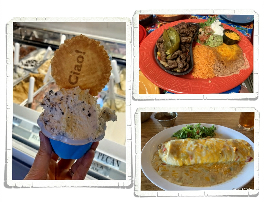
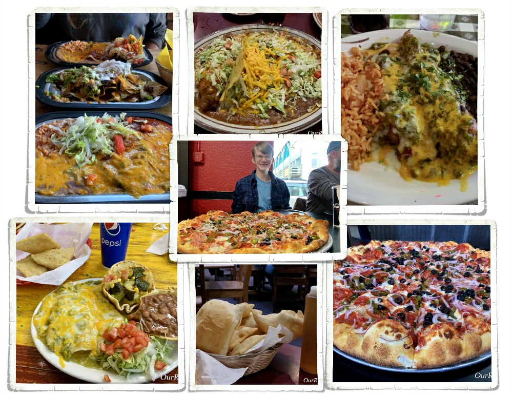
The first thing we did when we got to Las Cruces was head to Hatch, NM for some spicy melt-your-face-off food. Our go to spot in Hatch is a joint called Sparkeys. Even the ice cream at Sparkeys is spicy!!
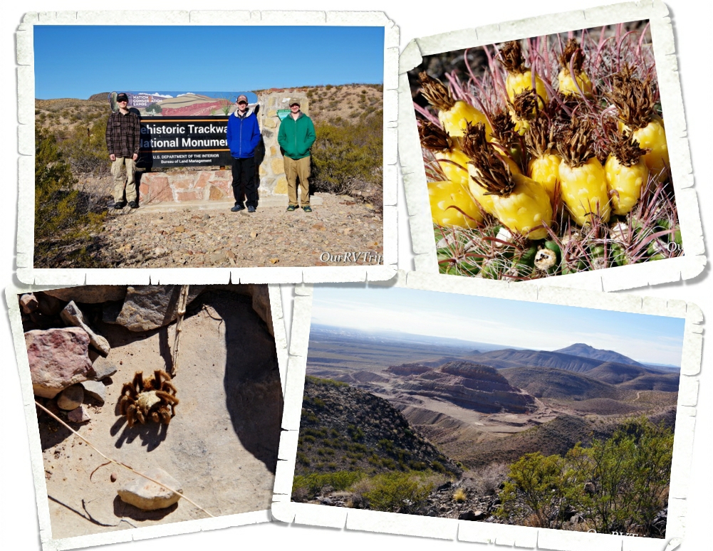
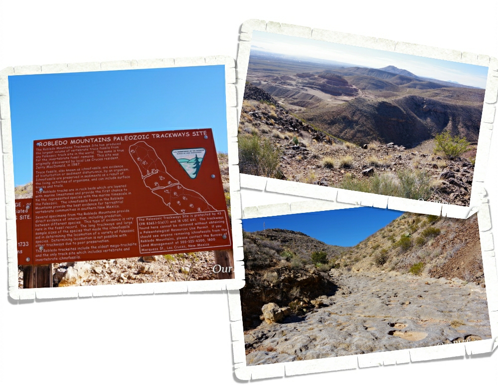
Prehistoric Trackway National Monument is a BLM run National Park that was established to protect a large collection of Paleozoic era fossilized footprints along what’s called a megatrackway.
The monument consists of over 5,000 acres and has been called by some scientists as possibly the most “scientifically significant Permian track sites in the world…and Guys…we couldn’t find a single track. We tried so hard. We looked around the trail for a couple of hours but didn’t see single track. We found a couple of shell fossils, but no tracks.
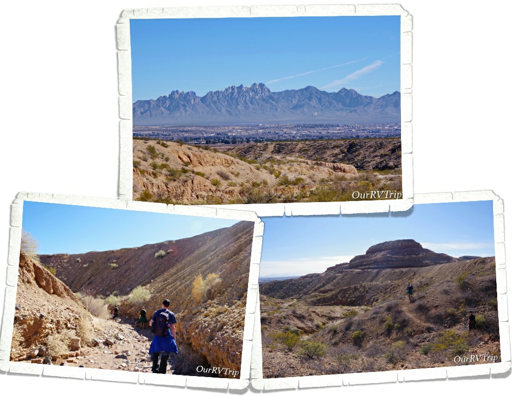
There are a few different hiking paths. There’s supposed to be a way to link a couple of them and make a loop. We tried to do that and we somehow got lost and ended up in a section that was supposed to be closed. It was great to get outside on a beautiful day with some great views though! We’ll call it a win even though we didn’t find what we were looking for.
We hit up some of our go to foodie spots while we were there and found a few new spots that were fantastic! If you’re in Las Cruces, go check out Chala’s Woodfire Grill and High Desert Brewing Co!! This was our last chance to get some authentic New Mexican food so we ate as much of it as we could.
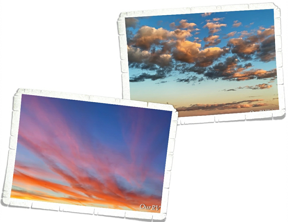
So, as you can see, we didn’t really do a lot during the two weeks we were in Las Cruces. We ate a lot more than we probably should have, soaked up the beautiful sunsets, and made some plans for our 2020 adventures.
Hey Guys!! We made it down to Alamogordo, NM where we spent a week cramming in as many adventures (and foodies) as we possibly could! It helped that Jerl had a few days off to celebrate the New Year.
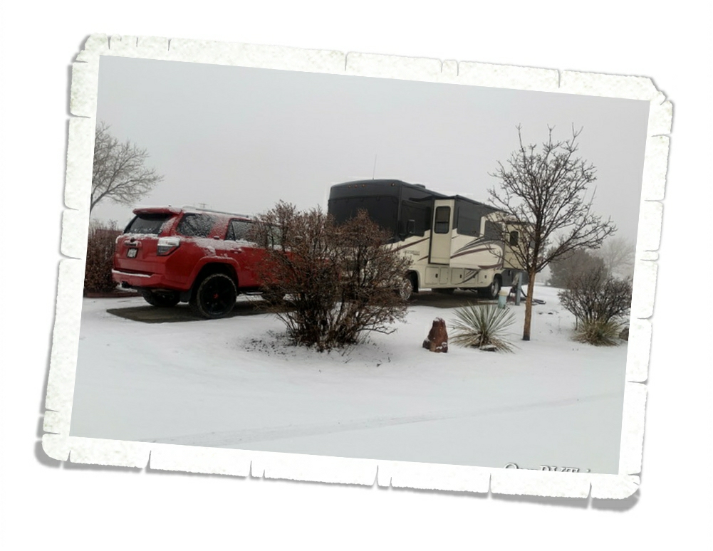
As per our usual timing while in New Mexico…we raced a snow storm to get to Alamogordo. I think we saw all four seasons of weather on our way between Santa Fe and Alamogordo. It was quite the drive.
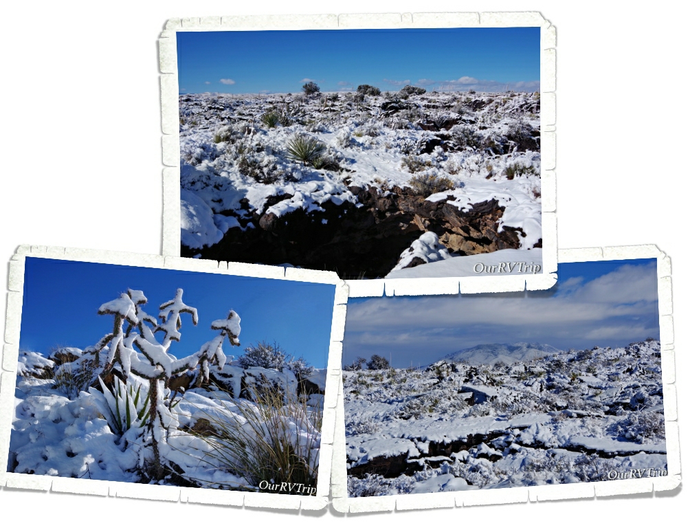
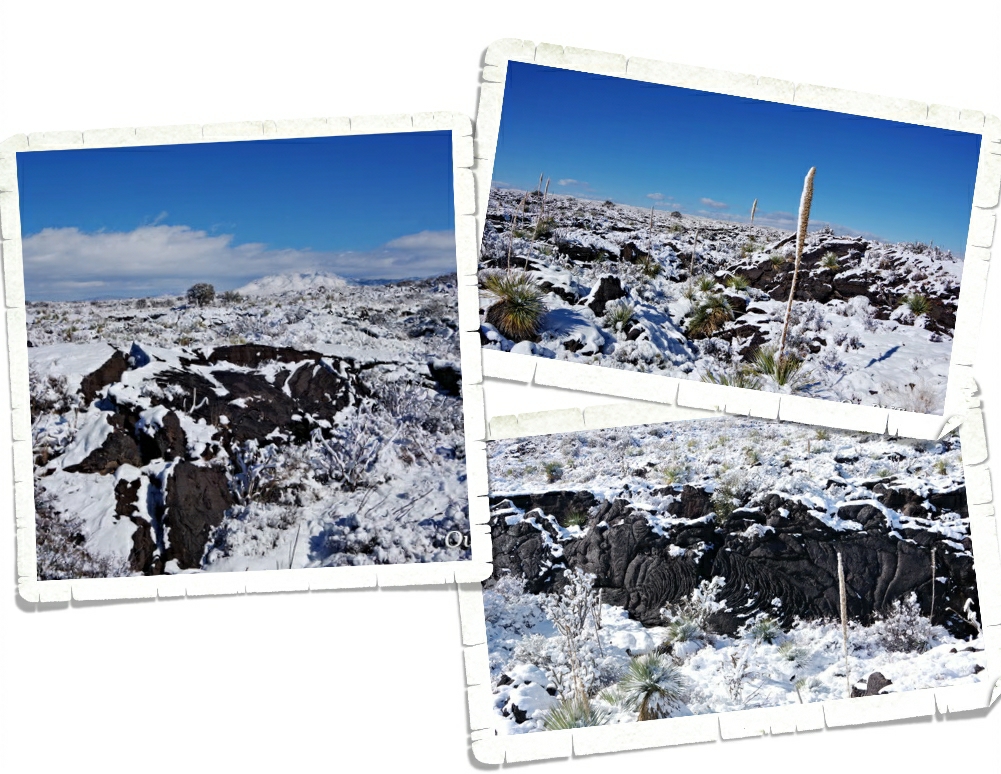
We found the Valley of Fires Recreation Area during our second visit to the Alamogordo area, but didn’t make it there to explore. I guess going to see a lava field in the snow wasn’t the best idea. But, we weren’t the only people there! Ha! I guess sometimes, you have to just work with the weather you’re given. If you look closely, you’ll see the black of the lava peeking out from under the white snow. Valley of Fires Rec Area is a BLM run National Park. There’s a visitor center, and small gift shop on site.
You can see the Carrizozo Lava Flow on Google Maps if you look. It formed when lava was pushed up through vents in the earth’s surface sometime around 4,000 years ago which makes it one of the youngest lava flows in the U.S. When it’s not covered in snow, you can see cracks, collapsed lava tubes, fissures and collapsed lava bubbles. In some places, the lava is more than 160 feet deep.
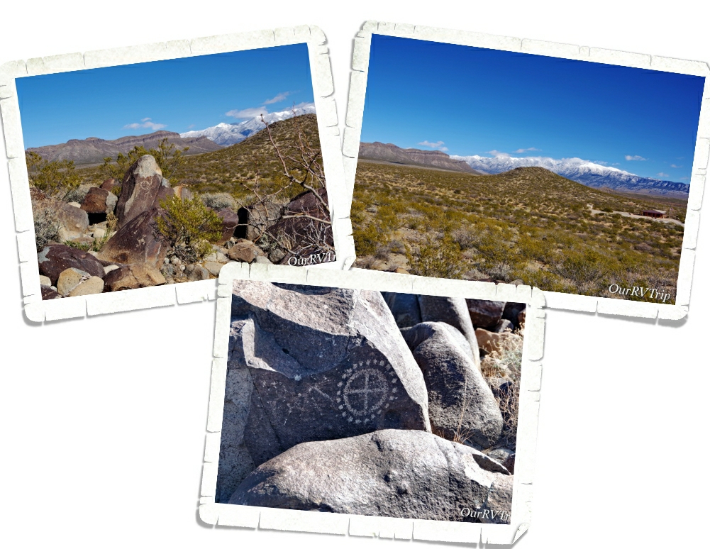
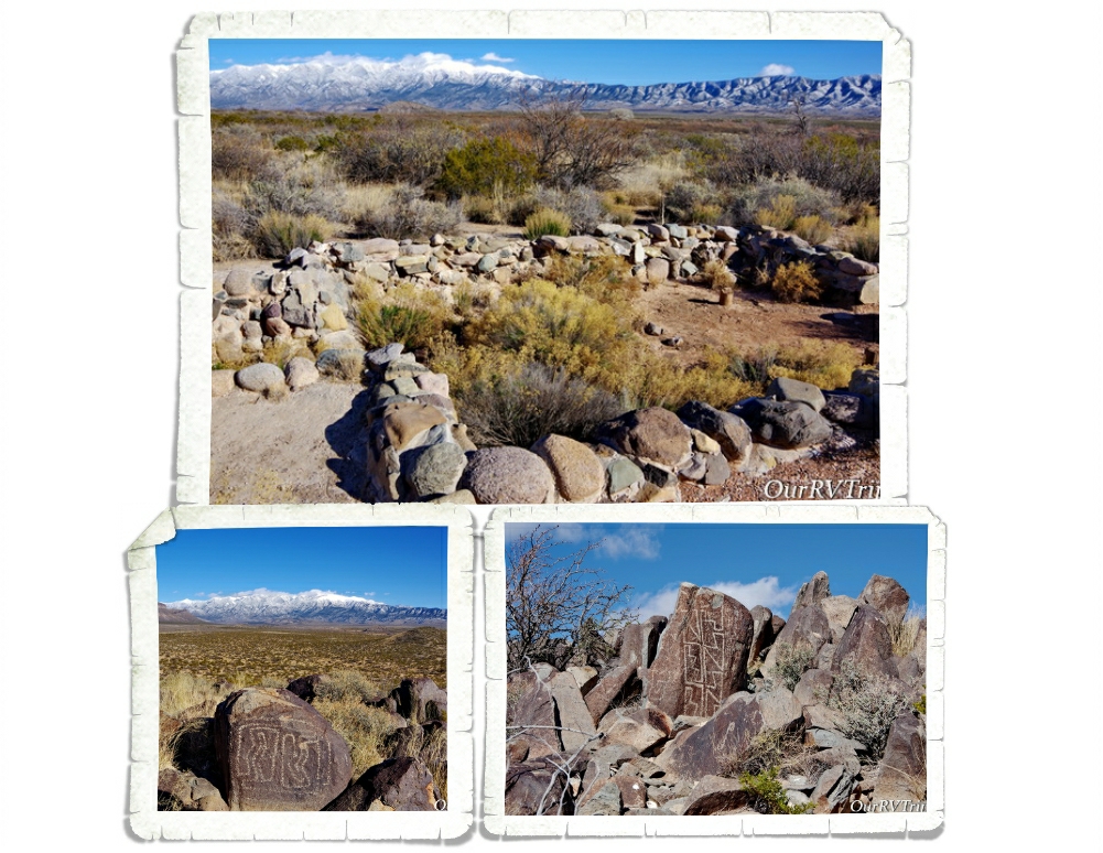
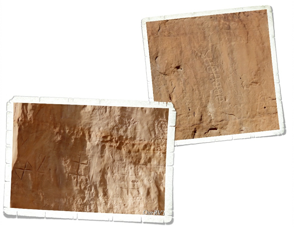
Right down the road from the Valley of Fires Rec Area is the Three Rivers Petroglyph Site which is also a BLM run National Park. There’s a visitor center and small campground at this site. I’ll be honest, I spent as much time ogling the snow covered mountain as I did checking out the petroglyphs here.
The petroglyphs found at Three Rivers were made by a group of prehistoric Native Americans referred to as Jornada Mogollon. There are more than 21,000 petroglyphs at this one site. The sheer number of petroglyphs in such a big concentration makes Three Rivers one of the largest rock art sites in the Southwest.
Even though we know when these petroglyphs were made and have a good idea of who made them…we still don’t know what they really mean. We can guess, but we’ll never truly know.
There are also the remains of a Mongollon village that was occupied for around 400 years. The village was only partially excavated, but you can see part of three different structures.
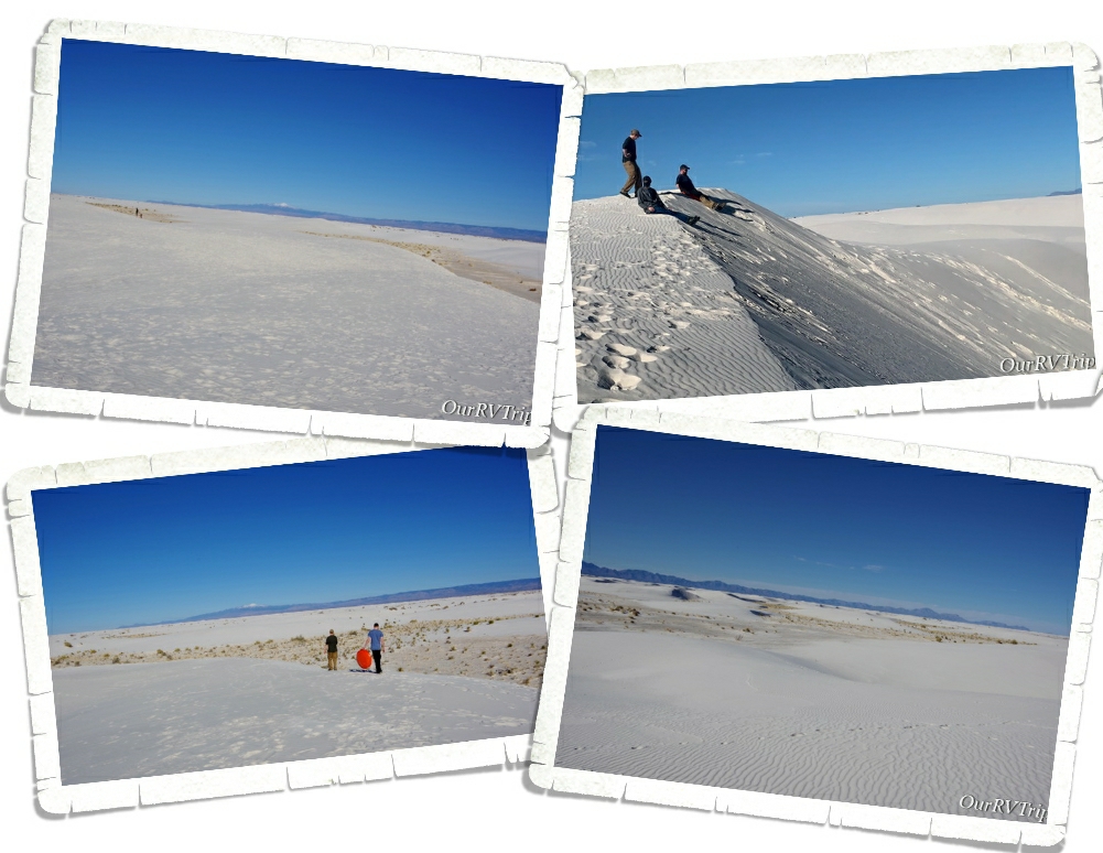
Our favorite thing to do in Alamogordo is go visit White Sands which was recently changed from a National Monument to a National Park. When we were there in December 2019 the park was still working on getting everything switched over to National Park status stuff. We’ve been to White Sands many times, but it never gets old. We’ve spent two New Year’s Days at White Sands…so those gypsum sand dunes will always hold a special place in our hearts.
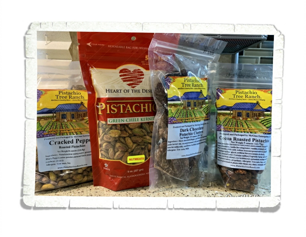
Anytime we’re in Alamogordo, we have to stock up on some of our favorite foodies. Pistachios are pretty high on our list of must haves and the ones from both Heart of the Desert and Pistachio Tree Ranch are awesome! We also fill our freezer with as many chopped green chilies as we can fit in it. The grocery stores there keep a supply of freshly roasted and peeled green chilies and jalapenos right in the produce section. It’s the best!! We stock up and then freeze them so we can use them throughout the year. I’m greedy with them though…I try to stretch out the good stuff so we don’t run out too quickly.
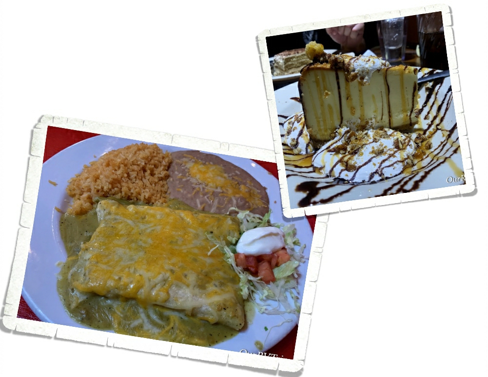
Confession: We were only in Alamogordo for a week…and we ate out every single day we were there. Every. Single. Day. And we’re not even sorry.
Every time we go back to Alamogordo it feels a little like going home to us. No, we’re not thinking about settling down there…but, we could definitely spend a season or two there. Not summer though…we’ve heard it gets way too hot.
Hey Guys!! We always seem to end up in Santa Fe around Christmas. This year (2019) makes our third Christmas in Santa Fe since we started this grand adventure of ours. There’s something so magical about seeing Santa Fe in the snow. I think, for me, it’s the luminaries lit up and the adobe style buildings with their chili pepper garlands all covered in snow. I fell in love with it during our first visit to Santa Fe back in 2015 and it kind of feels like revisiting an old friend now.
We’ve had snow in Santa Fe every single time we’ve been there and this time didn’t let us down! In fact, I scheduled Santa Fe for Christmas because I wanted to have a white Christmas.
So, in between all of our adventuring, we did our Christmas traditions. We have tamales for our Christmas dinner and Guys, it’s almost impossible to find decent tamales outside of New Mexico.
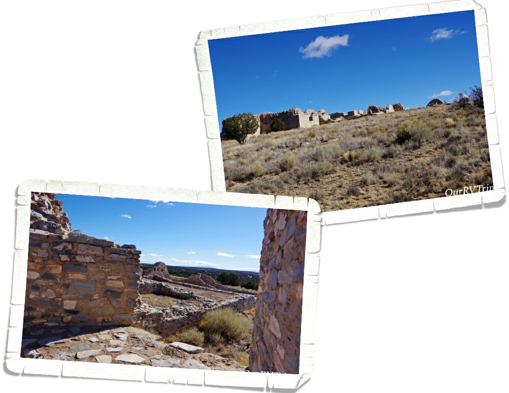
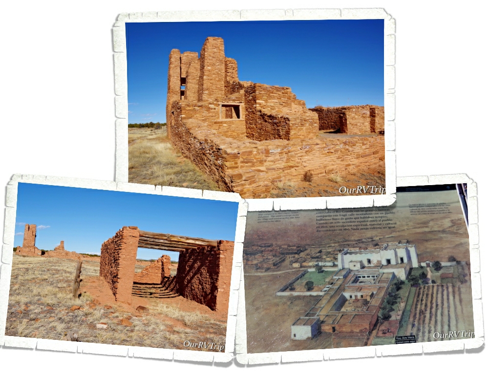
We spent an entire day exploring the Salinas Pueblo Missions National Monument. This National Monument is split into three separate mission sites. It’s quite a drive to get in between them, so if you’re going…go early and plan on an entire day. You do drive through small communities so you could grab lunch somewhere if you didn’t want to pack a picnic.
We started our explorations of the Salinas Pueblo Missions at the Gran Quivira Mission which is the largest of the three missions. Gran Quivira was an important trading community because of it’s location between the Pueblo Tribes and the Plains Tribes who were more nomadic.
When the Spanish explorers arrived in this area in 1583, they reported that there were eleven pueblos with close to 40,000 people. Gran Quivira started as a group of pit houses around 1,200 years ago but grew into a thriving community with over twenty masonry buildings. They had water catchment systems in place for the dry times because there wasn’t a water source close by.
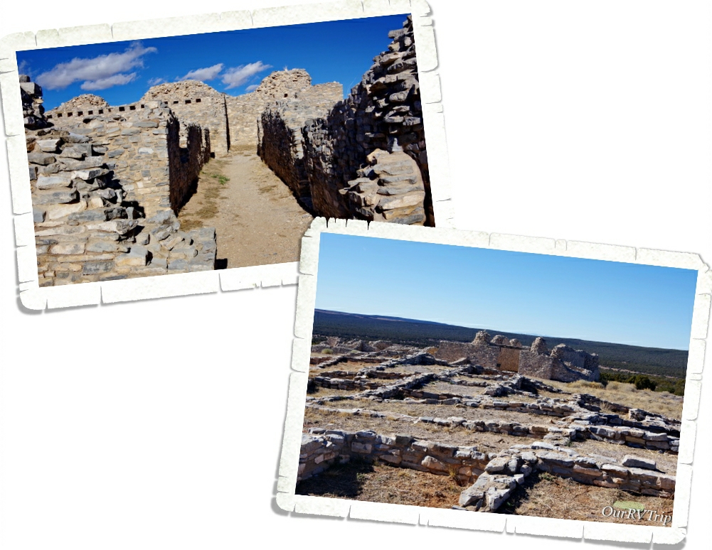
The Friars and the Franciscan missionaries showed up in 1627 and started preaching with translators. They allowed some religious freedoms at first, but by the 1660s changes started to appear in church policies that forced the Natives to hide their sacred ceremonies and beliefs. In 1630 the first priest moved into the pueblo and had the Natives start building a church and by 1659 had plans for a bigger church. Everyone helped…even the women and children.
At some point in the 1660s there was a drought in the area and the already dry pueblo suffered. In 1670 the people of Gran Quivira left and went to Abó and those that were left behind died from either smallpox or a different disease brought over with the Spanish soon after.
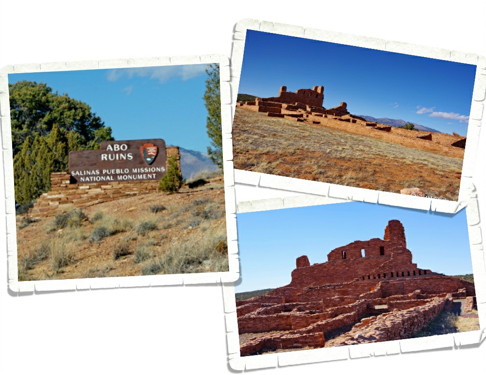
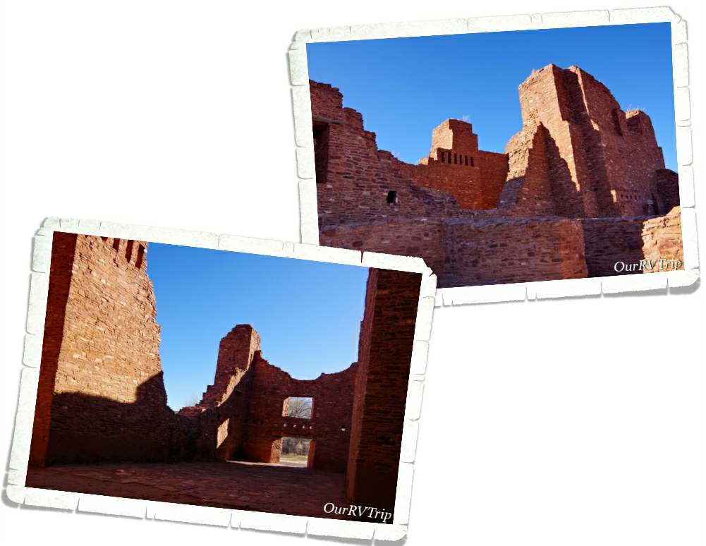
Mission San Gregorio de Abó was home to the Pueblo Indians for over five hundred years. In 1622 the Franciscan priests came to this area to “civilize” the Tribes who called this region home. For close to one thousand years, people have been drawn to this area.
Abó had two priests who lived there. That was unusual for that time and made Abó one of the largest missionaries in all of New Mexico. While the priests and the friars worked to Christianize the Native population, they had them building not one church but two.
When the Spanish found Abó, they estimated the population close to 800 Indians. By 1670, drought, Apache uprisings, and disease caused the abandonment of Abó. In the span of just fifty years, this flourishing community was left empty.
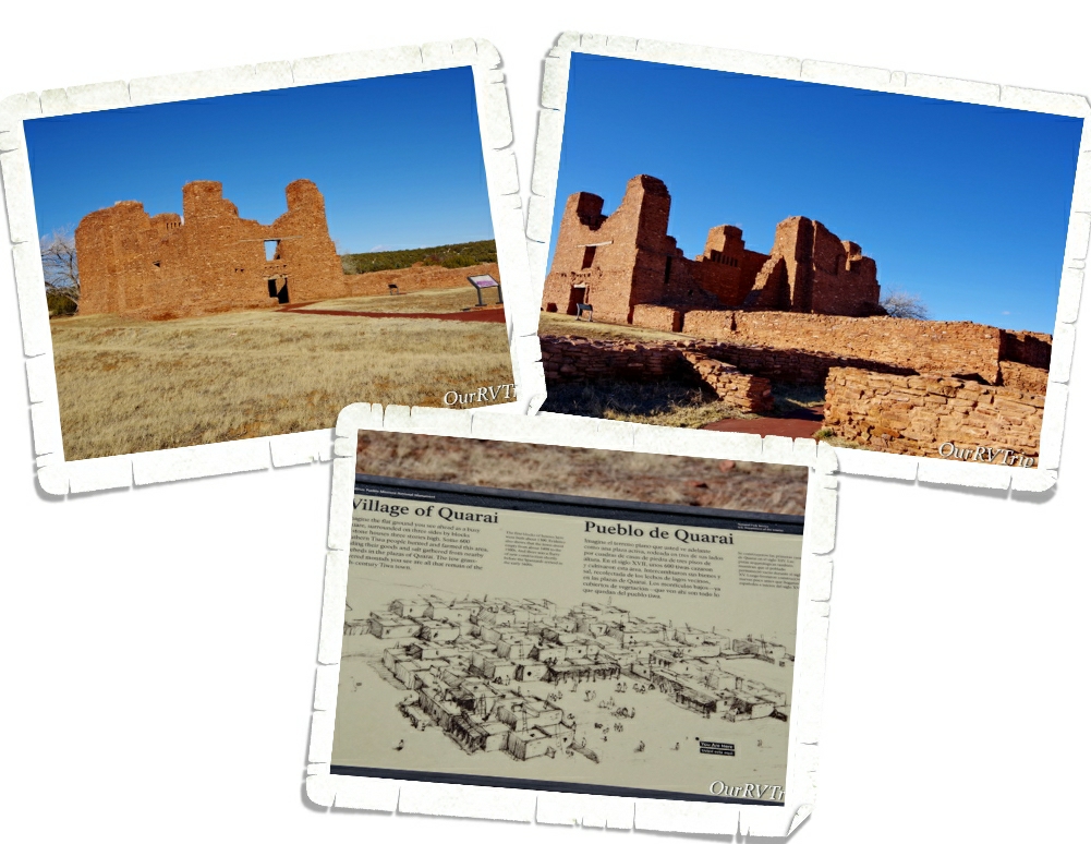
The Villages of Quarai are largely unexcavated. The church is really the only thing left standing. They took several ground surveys and based on what they found…they believe this community was around 400 to 600 people.
I didn’t see a ton of info about life here at Quarai. There’s still quite a bit they don’t really know. So, I don’t have a ton of info to pass on to you about this site. We do know that in 1598 when the first priest showed up, Quarai was a thriving community.
I can also tell you that by the late 1670s, the residents of Quarai were all suffering from the same drought, famine, and disease we’ve read about at so many other ancient dwellings and missions of this time. Quarai also had trouble with nearby warring tribes.
It always makes us sad when we learn how thriving and full of life these communities were when they were living and worshiping their way and then to ‘see’ how fast they declined once interference was inserted into their lives. I don’t feel like their lives were made better and I often wonder, while walking amongst the ancient dwellings, what their lives would have been like if they’d been left alone.
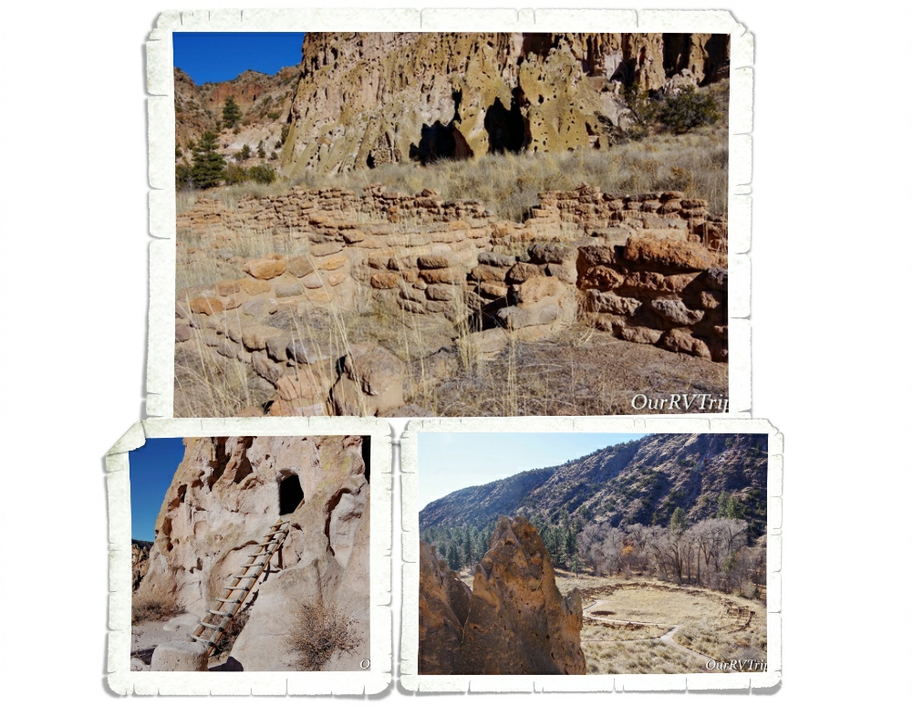
Bandelier National Monument is one of the parks we’ve been to numerous times now…and every time we visit we find out some new information or see something with a new perspective. Since we were in the Santa Fe area, we spent some time in one of our favorite parks.
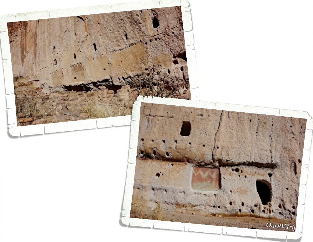
Bandelier National Monument protects close to thirty thousand acres and eleven thousand years of human history. Found on the slopes of the Jemez volcanic field in what’s known as Frijoles Canyon, the Ancestral Pueboloans built their homes out of the volcanic tuff that was left over after the Valles Caldera volcano blew her top over a million years ago. Today, you can see what’s left of several ancient communities.
You can see where the walls of this ancient dwelling used to be. the holes in the rock are where support beams used to be. There is even a small space where you can see how the interior of these homes used to be decorated. We like to walk amongst these sites and imagine what life would have been like for the former occupants.
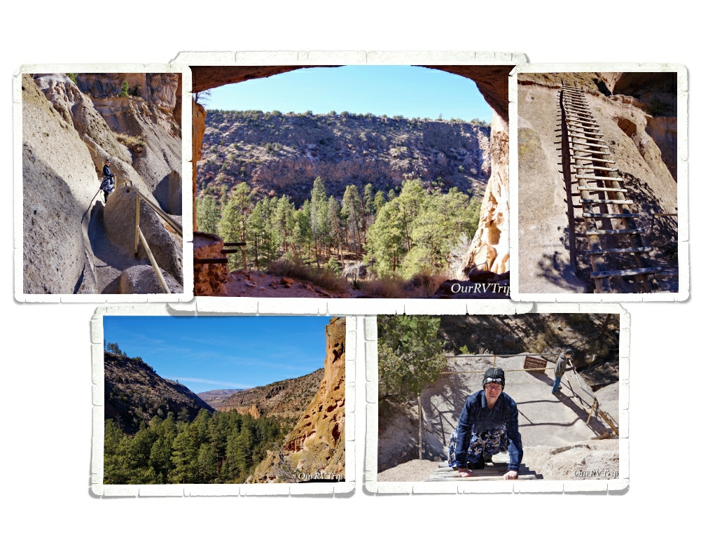
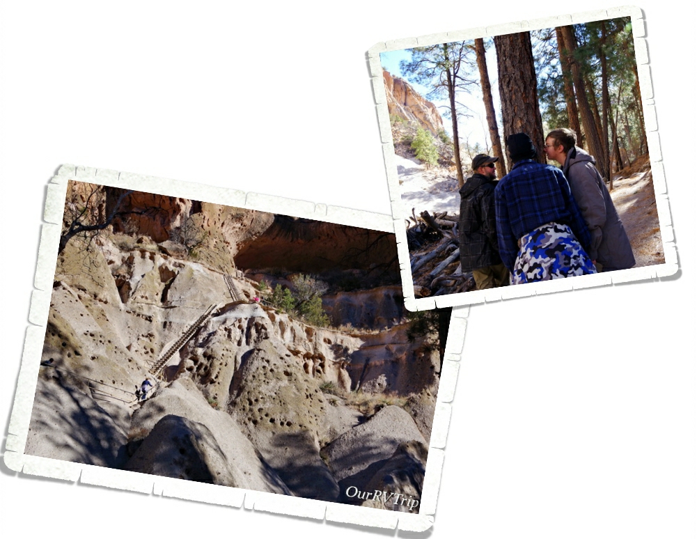
Our favorite trail takes you up to Alcove House. This is a fun trail where you get to climb up four wooden ladders and some stone stairs to get to an ancient dwelling 140 feet above the canyon floor. They believe about twenty or so people used to live there. There’s a reconstructed kiva at Alcove House, but we’ve never seen it open to the public. The views of the canyon from the top are pretty amazing!
Bandelier not only has some amazing views, fun trails, and ancient dwellings (that you get to explore from the inside) it also has some of our favorite trees…ponderosa trees smell so good! What can I say…we’re a tree hugging/smelling family of nomads.
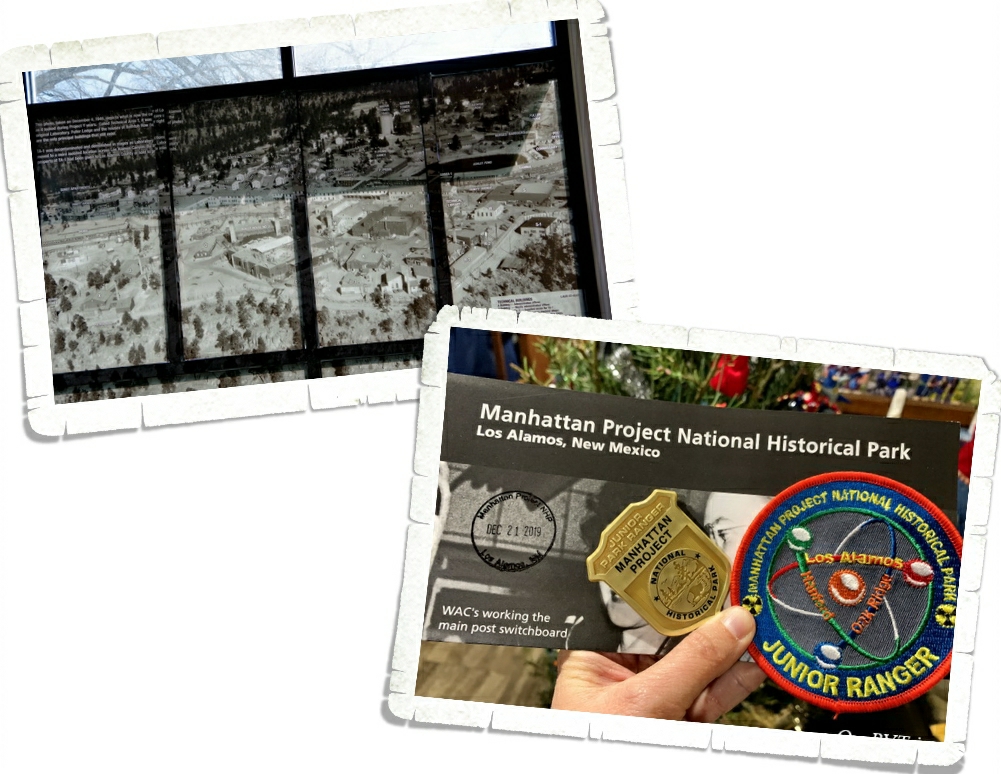
Back in 2015 during our first visit to the Santa Fe area, we found the little town of Los Alamos and the Bradbury Science Museum. While we were soaking in all of the science goodness, we found out that the National Park Service was actually in the process of making a visitor center for the Manhattan Project National Historic Park in Los Alamos. Our little science hearts were so excited! We’ve tried a few times to make it to the visitor center and every time we were thwarted. But this time…we made it! And…it was open!!! I don’t know if you know this about us, but we’re nerds. Science is totally our jam. Back in 2015 I had the boys read a book called The Secret Project Notebook by Carolyn Reeder. It was a great way to start our Los Alamos explorations and get them interested in the history of the project Los Alamos is known for…the atomic bomb.
If you have the chance to visit Los Alamos, you really should. It’s a great little town with some top notch science nerdery.
Did someone say foodies? We might be slightly obsessed with New Mexican food. Maybe. We ate so much of it while we were there that we started to smell like a Mexican restaurant when we would sweat. Ha! It was fantastic!! We have our favorite spots…but we also found a few new favorites that we will definitely revisit next time!
That’s it for our Santa Fe adventures for this time!
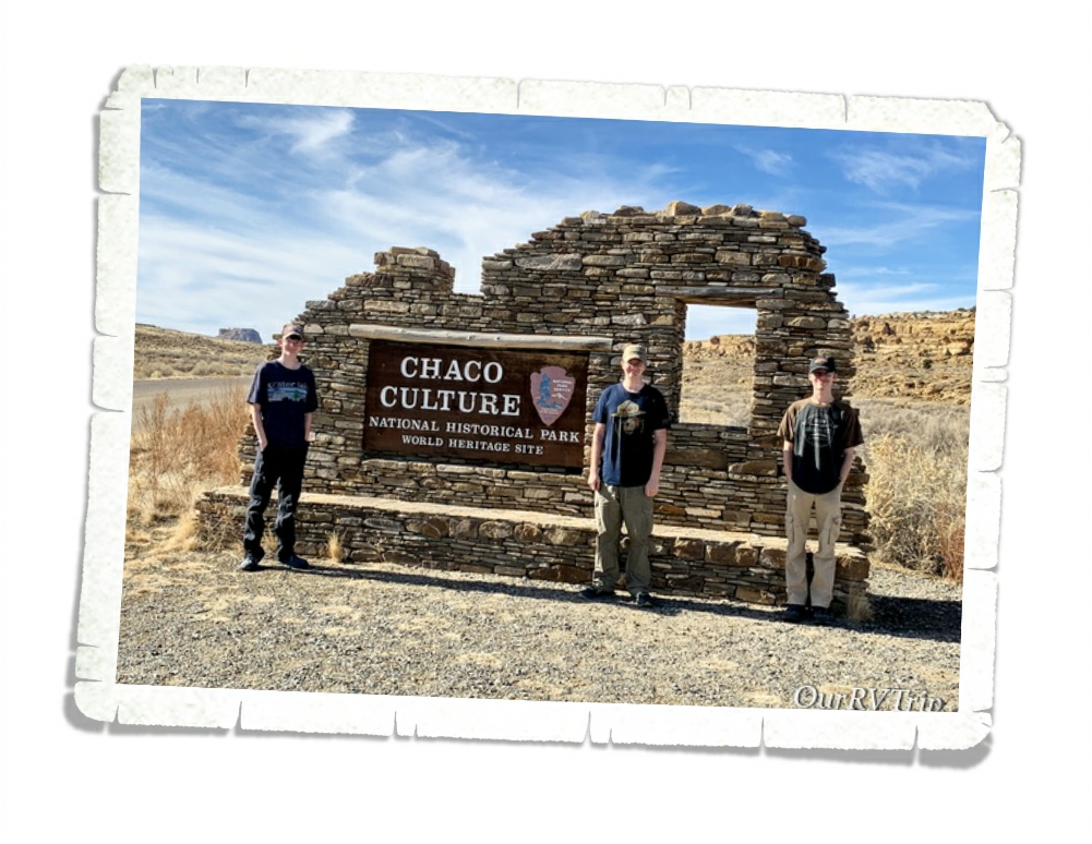
Hey Guys! We’re back in Farmington for one more post. This time we’re taking you to Chaco Culture National Historical Park. We found out about Chaco years ago. While we were visiting a different ancient dwelling, a Ranger saw how much we enjoyed the park and she dug out a map and started telling us about some of her favorite National Parks/Monuments. I think she was thrilled to have a family who was excited about learning to talk to and we were thrilled to have some insider knowledge about what parks we should put on our list.
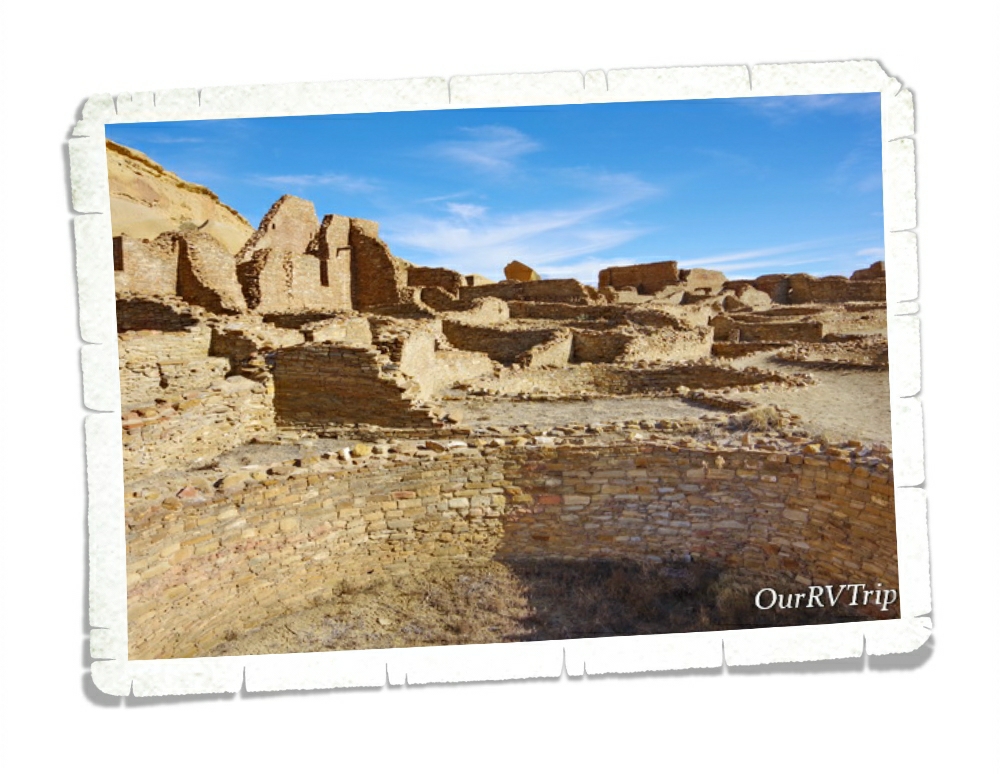
Chaco Canyon is the largest excavated, best preserved ancient dwelling site in North America. This National Park sits in the middle of nowhere so don’t count on cell service…or really any kind of service. Make sure you’re geared up with plenty of snacks…possibly some lunch…water, and gas for your car. You’ll want to get there early because there’s so much to see…plan on spending an entire day here.
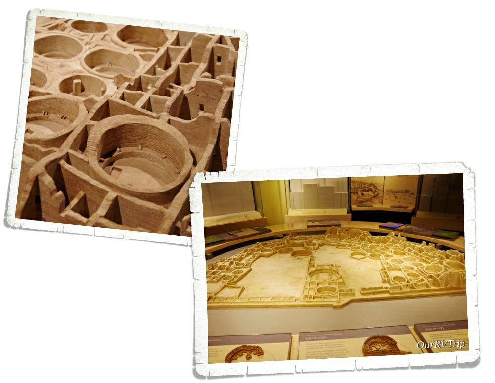
In the visitor center there’s a great little museum that has a cool little diorama that will give you a view of what Pueblo Bonito looks like from afar. It really gives you a better perspective of just how big a Chacoan Great House was.
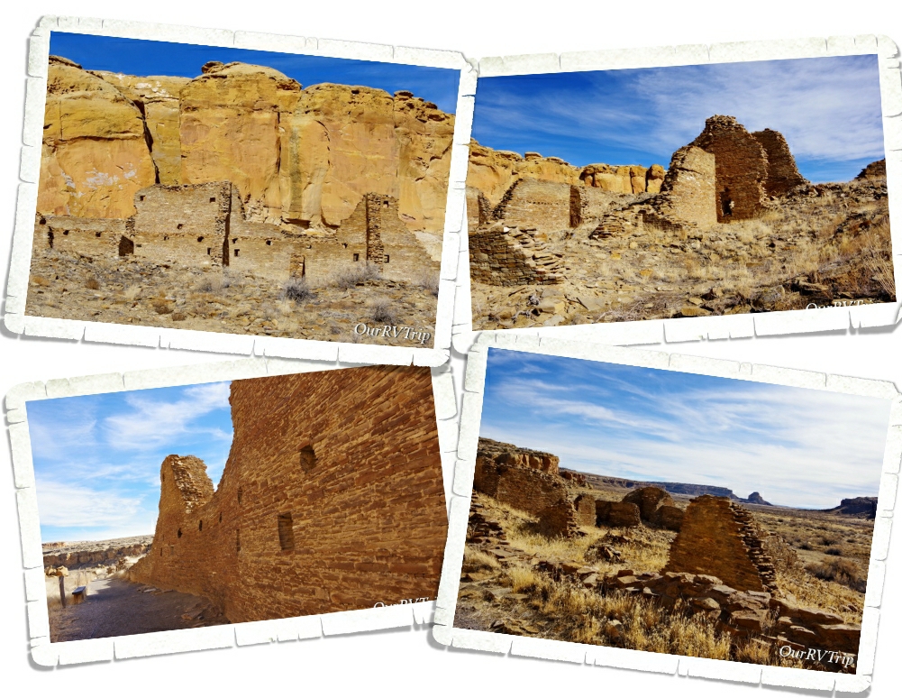
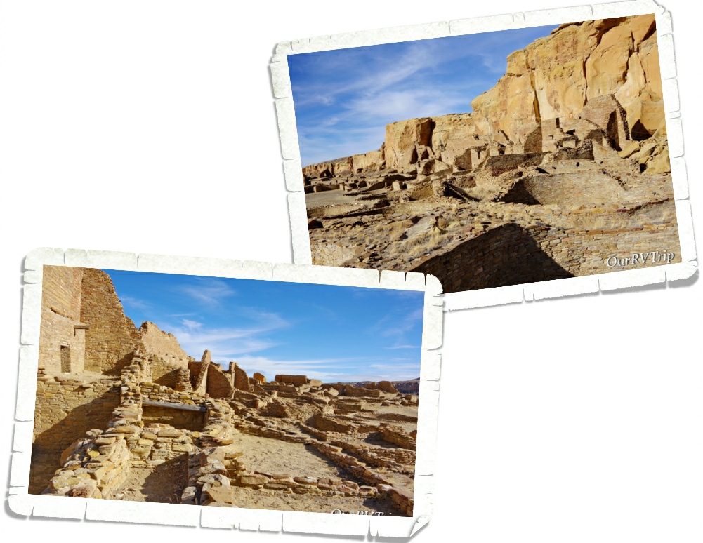
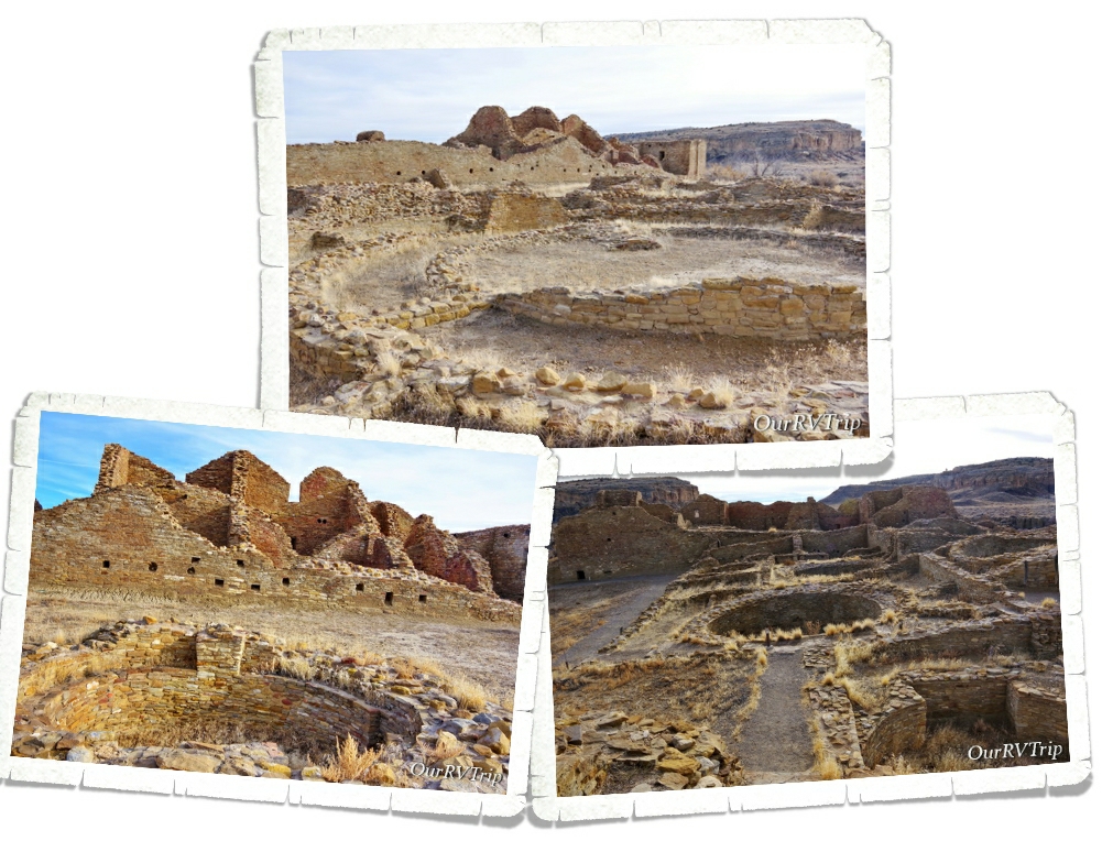
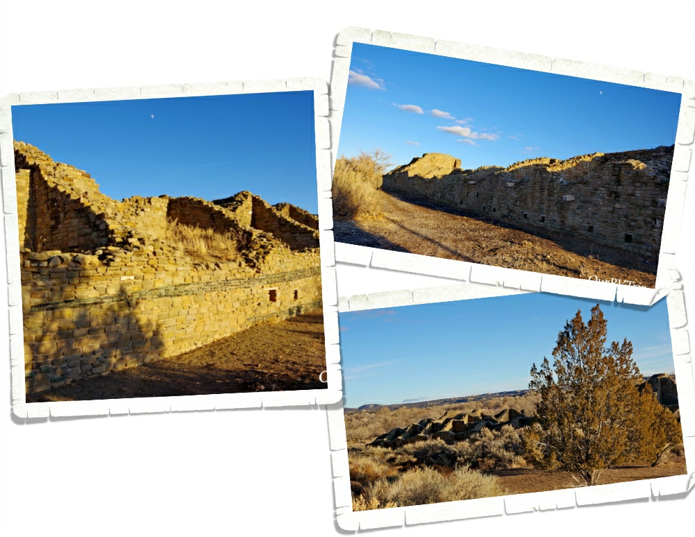
Chaco Canyon is home to several great houses and hundreds of smaller sites spread out over the entirety of the canyon. Above you can see a few pictures of Hungo Pavi, an unexcavated Choacoan great house they believe had about one hundred and fifty rooms.
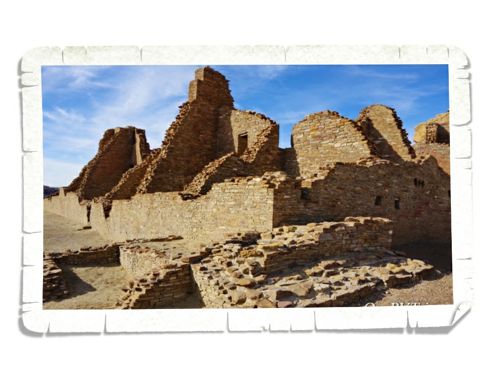
We spent the most time exploring Pueblo Bonito. This Chacoan great house was constructed in stages between 850 CE to 1250. At that time, Chaco was basically the center of the ancestral Puebloan people’s world. It was built at the geographical center of more than two hundred communities located outside of the canyon.
Chacoan builders often times oriented great houses with solar, lunar, and cardinal directions. The doors and windows pointed to specific directions. The inhabitants of the pueblos would use these guides as a type of calendar to know when to plant crops and hold specific ceremonies.
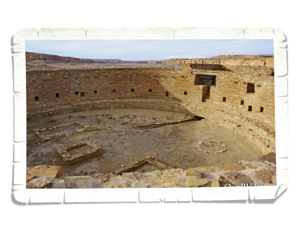
For three hundred years, generations of people worked on building Pueblo Bonito. Looking at the size and number of rooms, you’d think that the population of this pueblo was in the hundreds, but archaeologist think the permanent population was really only around 100 people. It’s thought that the residents Chaco Canyon numbered up to 6,000 people and the great houses were more of a center of trade, politics, and community business.
When the archaeologist started excavating, they found a sealed room containing 50,000 pieces of turquoise. That would have been amazing to see! Just to give you some perspective on that turquoise find…that’s more turquoise than what’s been found at all of the other archaeological sites in the American Southwest. In another room they found 4,000 pieces of jet and fourteen macaw skeletons. The fact that archaeologists found rooms full of items that would have been traded, leads them to believe that most of the rooms in Pueblo Bonito were used for storage.
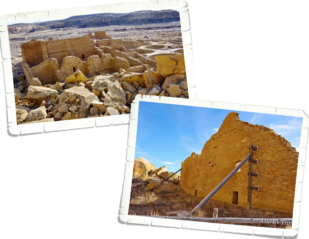
In 1941, a huge rockfall destroyed around thirty rooms and damaged a portion of a main wall. Today, there’s only so much the NPS can legally do to help maintain and preserve sites like this. At one time, they could actually replace load bearing timbers and were able to put up these support beams. Now…it’s tricky. Rangers have to walk a fine line between to preserve as much as possible within the law.
There are quite a few petroglyphs in several places with the canyon. There’s an entire wall of them. We’ve seen petroglyphs at several different ancient dwellings and it’s always interesting to try and guess what they are or mean.
Archeologist have found proof of over 10,000 years of human occupation within Chaco Canyon. Pueblo del Arroyo was built between the years of 1065 CE and 1150. The most interesting thing we found about Pueblo del Arroyo was the triple wall kiva. A tri-wall kiva is rare in the Chaco region…in fact, only about a dozen or so have been found. Another big difference with this pueblo is that it faces east instead of south the way the other great houses are.
Casa Rinconada great kiva was constructed on the top of a hill surrounded by smaller villages. This great kiva is the largest found in Chaco Canyon and one of the biggest ever found within the Chacoan world. The layout seems to be very much like the reconstructed great kiva we saw at Aztec National Memorial. If you missed that post you can find it here.
We had the best day exploring and learning while at Chaco Culture National Historical Site. We were bummed when we ran out of light and the park closed before we could see everything. We’ve decided we need to find a place to stay that’s closer so we can go back at least a few times.
If you’re anywhere near Chaco Canyon…go visit. It’s one of the best, perhaps the best, ancient dwelling sites we’ve ever been to.
Hey Guys!! We’re back in New Mexico!! This is one of our absolute favorite states to visit…and not just because the foodies here are sooo insanely good…we also really love the history and culture of New Mexico.
Each state has a feel. I know, I know…I’m getting all woo woo on you, but stay with me here… Every place has a feel to it. Usually, you associate certain feelings or emotions with a place based on your experiences there. But, sometimes you can visit a new place and you just click with it. It resonates with you in a way you might not understand, but you like. New Mexico is like that for us. We’ve liked it from the get-go…it resonates with us. So, we always look forward to spending time in New Mexico.
We spent two weeks in Farmington, NM so we could visit a couple of National Monuments and explore some close-ish by places we wanted to see that aren’t National Parks, but interesting.
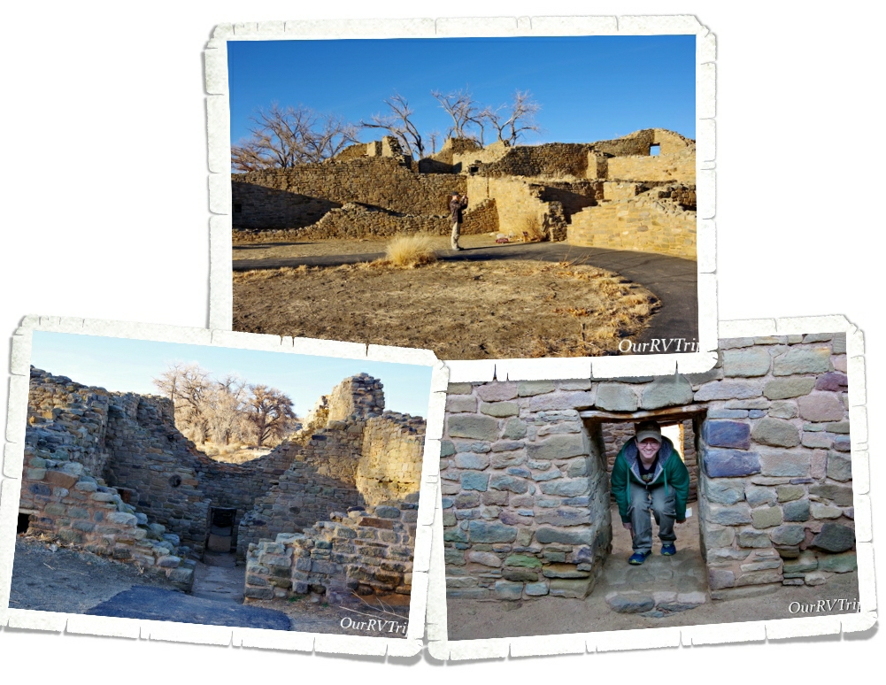
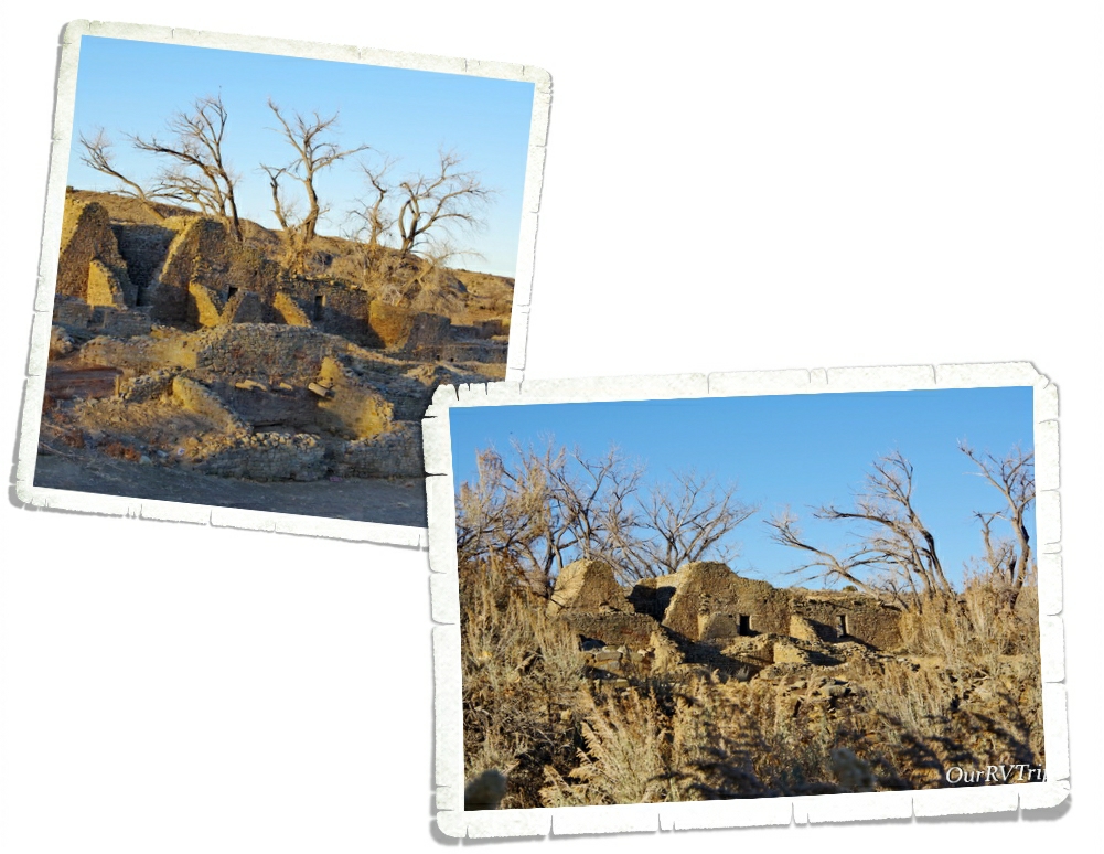
One of our first stops was Aztec National Monument. No, the Aztecs never lived there. This location got it’s name from early Spanish explorers who often used the name “Aztec” pretty much anytime they found ancient sites. The people who lived and built the ancient community of Aztec National Monument are known as ancestral Puebloan people. The descendants of the ancestral Puebloan people who are still in the area don’t like to call the ancient dwellings ruins. They’re not ruins to them. They believe the spirits of their ancestors still live in those ancient dwellings.
The ancient building you find at Aztec NM is called a great house and is considered to be part of the Chaco Phenomenon. This period of time saw members of the Chaco community move to the banks of the Animas River and start building the Aztec Community around 1100 CE. These Great Houses were used as community centers where business, politics, trade, and ceremonies would have taken place.
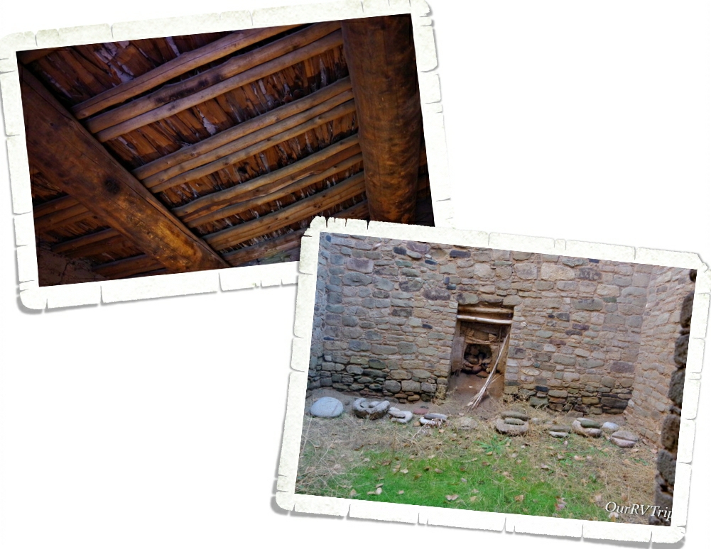
There are places within the ancient dwelling where you can see the original ceilings. Still holding up after 900 years of use. The wooden beams are made of trees like ponderosa pine, Douglas fir, spruce, or aspen. Most of these trees are all found in higher elevations and would have required at least a twenty mile walk to get them to this site. Because of how well preserved these ceilings are…the scientist have been able to do a test called dendrochronology where they take tiny little core samples of the trees to find out the age of them by counting the tree rings. This process tells the scientist when each room of the community was built and allows them to more precisely date the ancient dwelling.
Ancestral Peublo people were living in and building the Aztec NM site from the late 100s to sometime during late 1200s. The community was so large its thought to have rivaled the size of the community found in Chaco Cannyon.
The ancestral Puebloan people incorporated solar and lunar alignments into most of their structures and used these markers as a way to determine when to plant crops, when to do certain ceremonies, and to keep a balance within the community. The inhabitants of Aztec NM often included green stones within certain walls. You can see this in the above left picture. No one really knows why they did this. Did it have meaning or was it purely decorative? There are some archeologists who believe, based on shared ideas by some Pueblos and Navajos, that the stripes could have been associated with water and believed to protect the community.
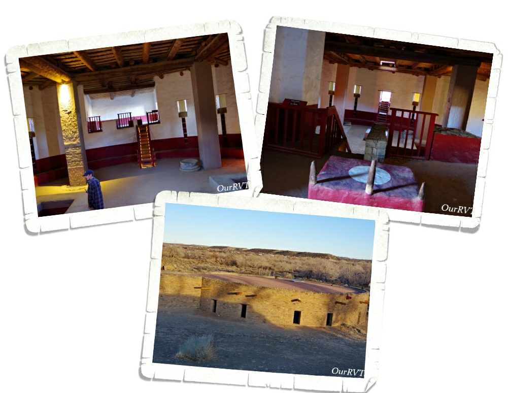
The Great Kiva was considered to be the heart and soul of the community. It is believed that great kivas would have been used as public buildings for the surrounding communities. A sanctuary. Possibly a place where different clans had meetings or held ceremonies. The great kiva at Aztec NM was excavated in 1921 by Earl Morris and then reconstructed in 1934 so that we could get an idea of what these amazing buildings would have looked like when they were being used. We’ve been to several ancient dwellings and have seen what’s left of kivas of all sizes. We’ve read what they were used for. We tried to picture in our minds what they would have looked like. We’ve listened to Rangers talk about what’s known and guessed about them…but being able to actually walk into one of the great kivas and explore it…even though it is a reconstructed one…was amazing.
The dwellings at Aztec NM consisted of several different sites. The great house we’ve been talking about was a three-story building with over 500 rooms. It held quite a few smaller kivas and also had a great kiva as it’s community center. Sometime during the late 1200s people started moving away from this area. No one really knows why. There is speculation it was a long period of drought and perhaps some social factors that caused the move, but there’s no hard evidence. We know that from this area they traveled west, south and east to what are now Hopi and Zuni communities.
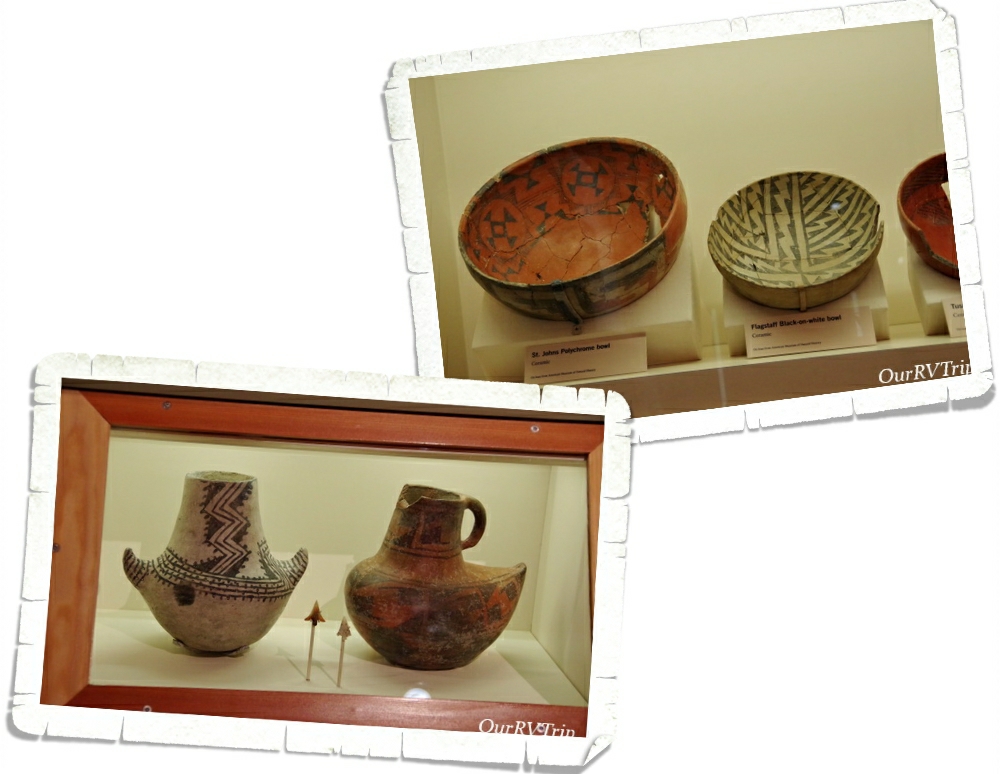
When the people left, they left pieces of their lives behind. I always enjoy seeing the pottery they made. It amazes the how detailed they are.
The ancestral Puebolan people might have moved on, but the descendants of those people still come to Aztec NM to remember. They still feel a connection to their ancestors as they walk the ancient dwellings. They believe their ancestor’s spirits are still there and that the ancient dwelling is still inhabited. So, when you go visit these places please respect them and those that are believed to still be living there.
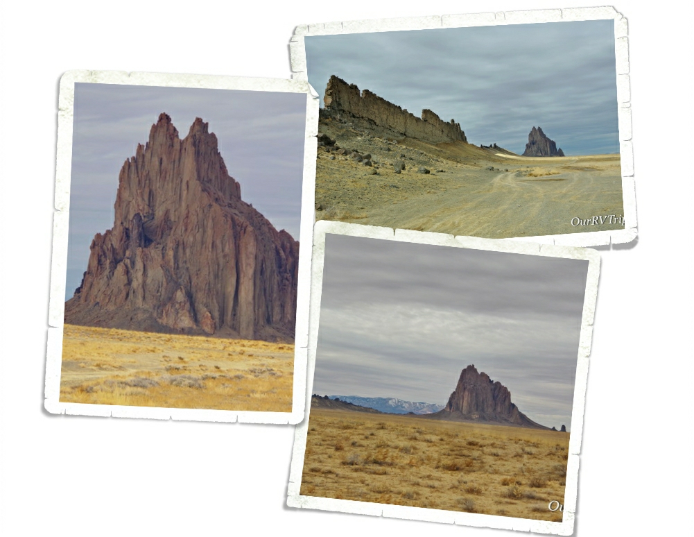
Shiprock is known by the Navajo as Tsé Bit’ a’í which means rock with wings. It stands at somewhere around 1500 feet high, making it’s peak close to 7,000 feet above sea level. Located on Navajo Nation land, Shiprock is very important to Navajo beliefs and culture. They ask that you don’t climb it or hike to it or it’s surrounding rocks. They also ask that you no longer drive down the dirt road leading to it. It is a sacred site and should be treated with reverence. Shiprock was created over a millennia ago and is at the center of three volcanic pressure points.
When we went to Shiprock, there was a group of people holding a public event along the dirt road leading up to the rock. We asked them for permission to drive a little on the road up to the rock and they told us we could. We didn’t go far and we didn’t climb on anything. In fact, we just took some pictures, marveled at the whole structure and left.
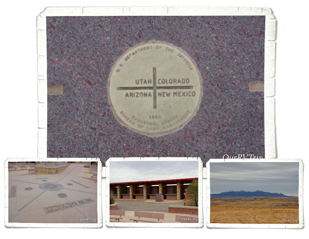
We also made it out to Four Corners where we stood in four states at once. The Four Corners complex is also on Navajo Nation land and there is a small fee to get to it. We went during the winter so there weren’t a whole lot of people. There are vendor stalls set up all around the complex so locals can sell their art. We chatted with a couple of them, bought a few things, and headed down the road. I’ve said it before…and I’ll say it again here…talk to the locals. They have some really great stories about their culture and beliefs…that they might be willing to share with you. We talked for quite a while to a woman selling sand art. She told us how she and her family go up into the surrounding mountains to find the different rocks to make the various colors needed for her art. Each color is made using a specific rock or mineral. Each has meaning. We find it all fascinating and really enjoy chatting with the local artists.
I’ll end this post with some foodies…because…well, yum! We found a pizza place called Pizza 9 and fell in love with it. We ate there several times in the two weeks we were in Farmington. Some of us have even declared it to be our favorite pizza place of all time while others still insist Back Road Pizza in Santa Fe is top of the list. We also ate a a couple of Mexican places…one was Fiesta Mexicana and I can’t remember where the other one was. Both were good! Not great…but good!
Well, that’s pretty much everything we did in the Farmington area. I’ll finish up with one more National Monument in the next post!
Hey Guys!! We have so much to get through in this post…so lets just dive right in!
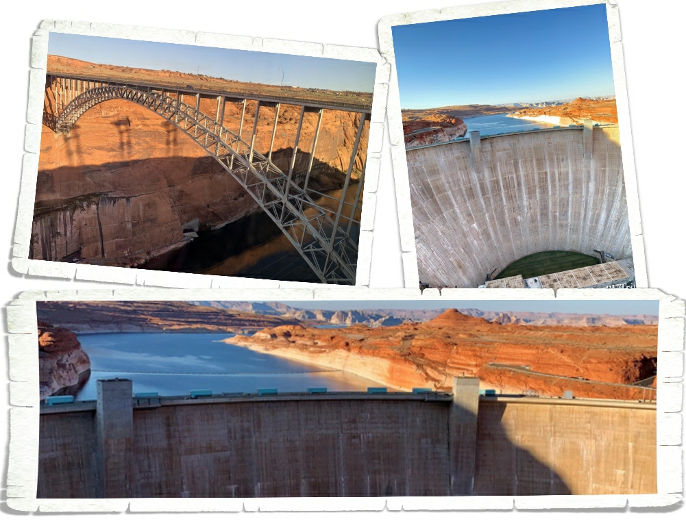
The first place we went when we got to Page is the Carl Hayden Visitor Center. This is the visitor center for Glenn Canyon National Recreation Area and where you can find all the most up-to-date information on the hiking trails and dirt roads in the area. While we were there, the boys did the Junior Ranger program and we walked across the bridge to check out the view of the Glenn Canyon Dam.
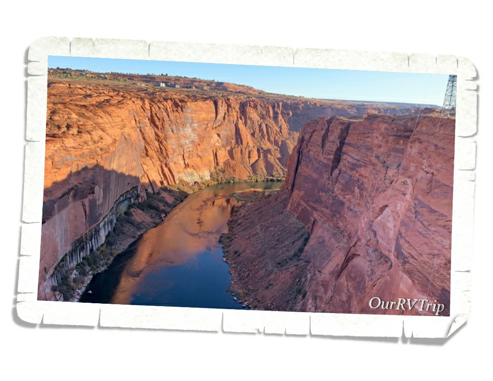
The Glen Canyon Bridge is 700 feet above the Colorado River which makes it the second highest steel arch bridge in the world! From the walkways along the bridge, you get a pretty stellar view of the river below. We walked to the center on one side then crossed the road to see the other side.
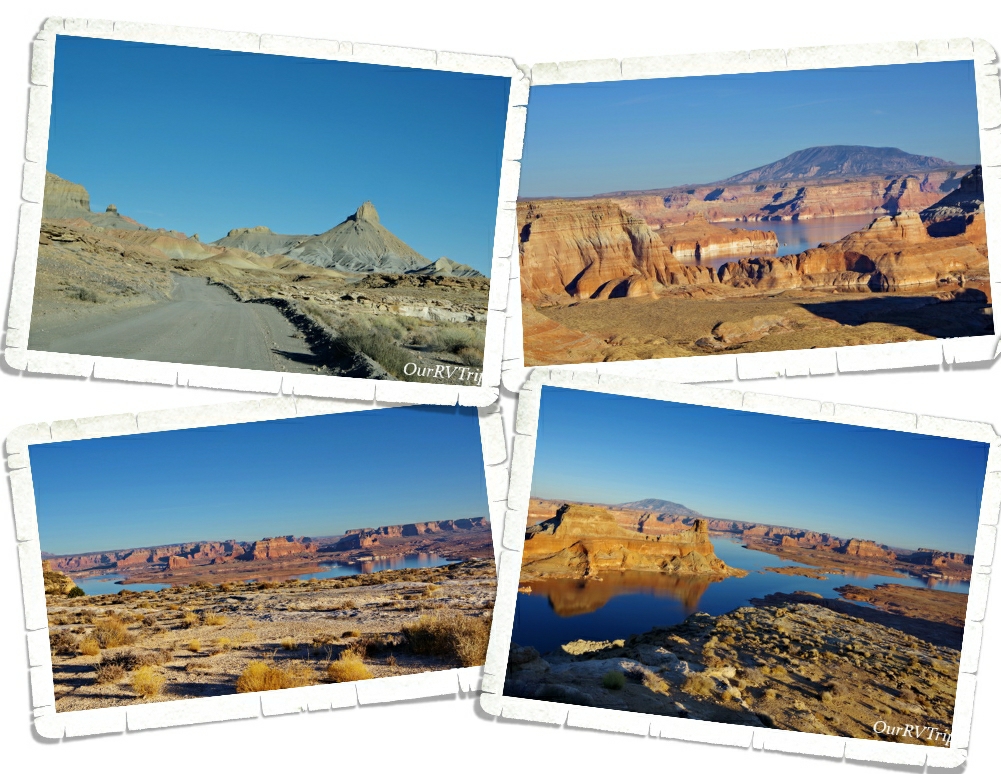
One of our favorite adventures at Glenn Canyon NRA was driving out to Alstrom Point to get a view of Lake Powell. To get there, we found ourselves on a dirt road out in the middle of nowhere. The road started off pretty good…really we commented about how smooth it was. But I think that after a certain mileage, they decided to just let the “road” return to nature. There were a couple of times that we weren’t sure we were even on the path anymore. And then we reached the slick rock section where you have to try and follow the little cairn stacks. We got lost on this section and had to turn around and take a better look at where we thought they wanted us to go. Needless to say, it was quite the adventure! And we loved it! We made it to Alstrom Point right before sunset and had the entire place to ourselves!! The water was so still and had some amazing reflections of the redish/orange rocks. This…this is what we look for when we set out on an adventure. No crowds. Nothing but nature.
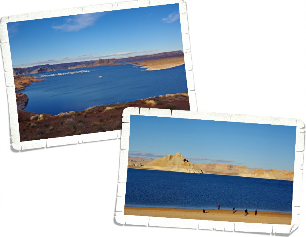
We also drove out to the Lake Powell Campground and Marina for some more views. We were there right around sunset and there weren’t too many other people there. I think the bitterly cold wind kept everyone else inside. We woke up the next day (the day we left) to find that it had snowed. There was a very light dusting of snow around Page. I wasn’t able to snag any pictures of the lake with snow…but it was pretty!
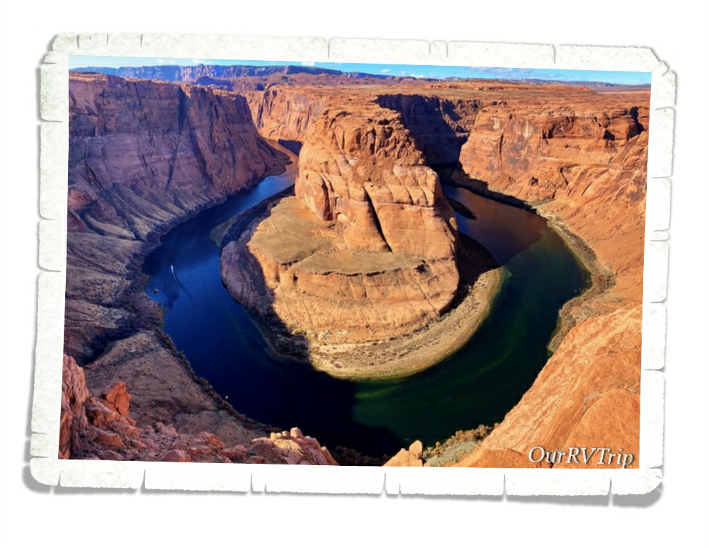
Horseshoe Bend. I’ve wanted to see Horseshoe Bend in person for years. We’d driven by the parking lot several times during our stay in Page and every single time the parking lot was jam-packed with cars and huge tour buses. And every time I thought…well, maybe next time it won’t be so crowded. But, it always was. I was running out of time to see it during our stay so we bit the bullet and went during the time of day that was supposed to offer the best lighting for it. And…it was pandemonium. Just soooo many people everywhere. Standing in line to wait for my turn at the railing I kept looking around at everyone getting those Instagram shots. What’s funny is when you see those shots on social media, it looks like that person is all alone out in the wilderness with some meditative look…but in reality…they’re surrounded by chaos. People climbing every rock trying to get that just right angle…taking seventy or more selfies…the whole thing left a bad taste in my mouth.
I took a few pictures of the bend itself, snapped some of the insane amount of people and then we left. It is pretty. And from the picture above you can’t tell that the family right next to me was doing an entire photo secession and kept sticking their arms in my shot. Or that the couple on the other side of me kept pushing at me trying to get into the perfect spot. But, I got to see it and the picture doesn’t look half bad…all things considering.
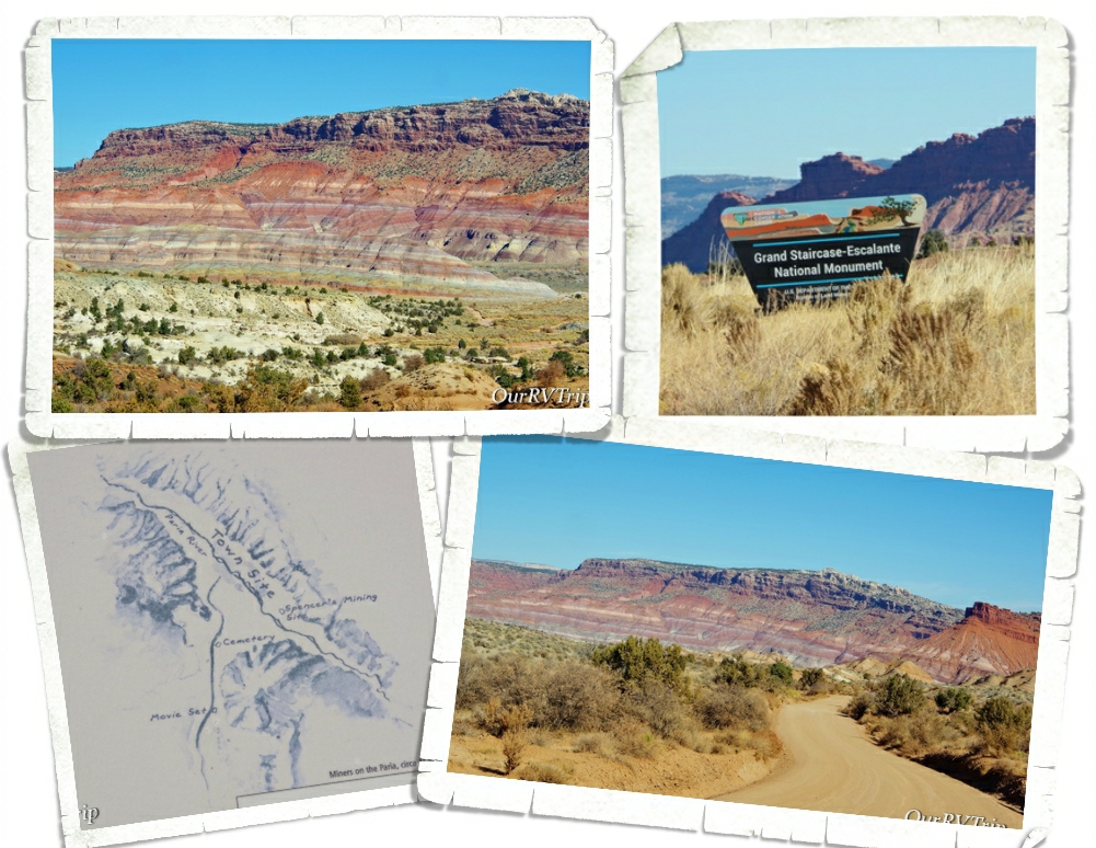
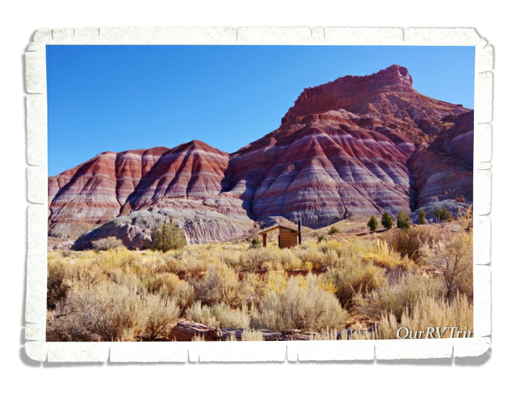
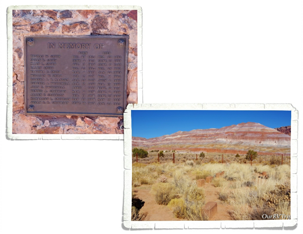
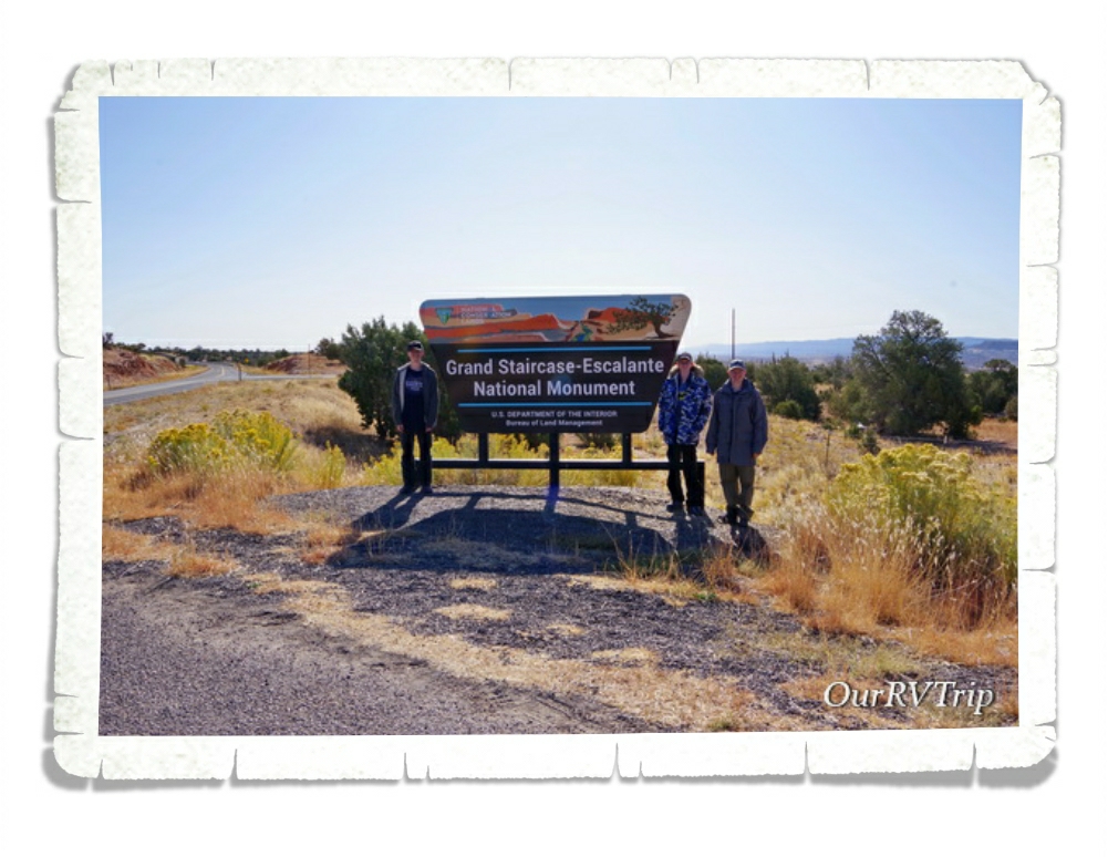
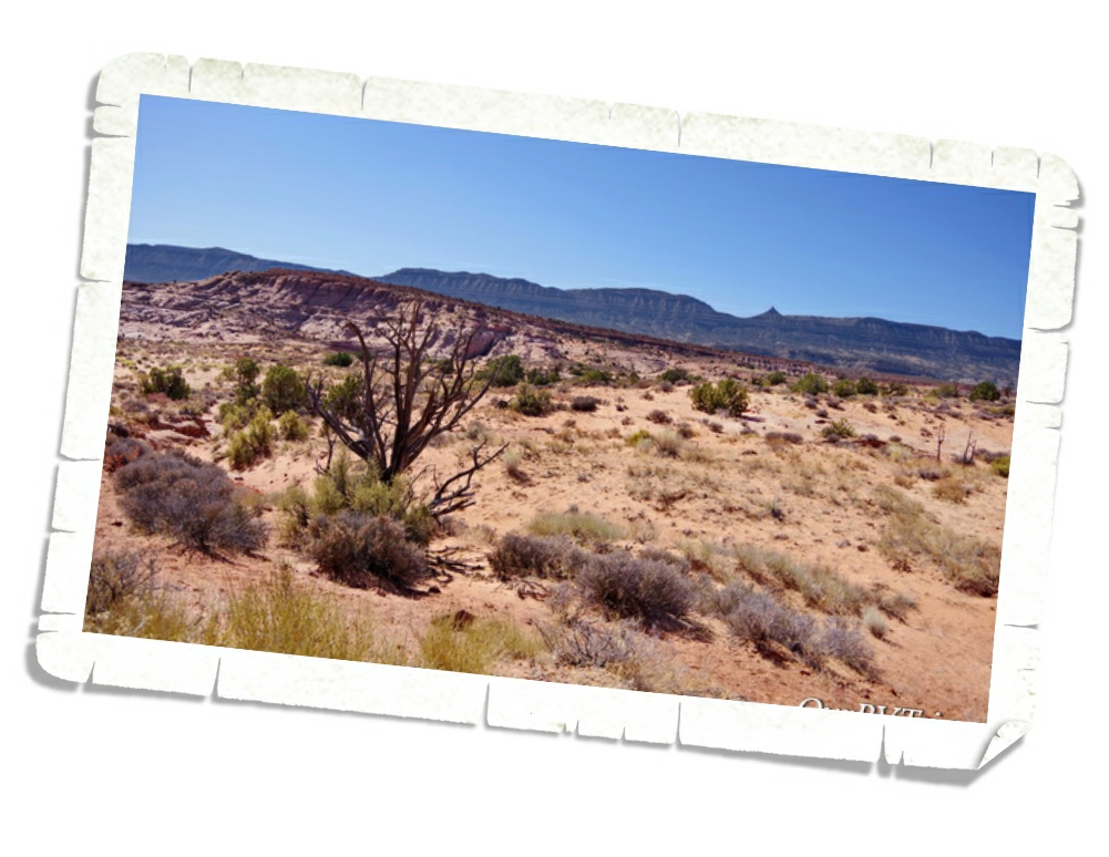
We found ourselves back in Grand Staircase-Escalante National Monument again! We can’t seem to stay out of this park. This time we entered from it’s southern border and headed for the ghost town of Paria. There’s not really anything left of the Paria town sight or the movie set. We really loved the colors in the rocks though!
Between a fire or two and the seasonal flooding, the only structure we saw was this vault toilet put in place by the park. And Guys, one of us (Charles) got stuck in it. I’m not even kidding. Charles got stuck in the bathroom while we were out in the middle of nowhere. The door closed and didn’t want to open back up. It took a combined effort to get him out. I can’t imagine having that happen when you’re all alone out there…with no cell service. But look at those stripes and colors on the rocks!!
We did find a little pioneer cemetery. None of the markers had names on them. Instead, there was a little plaque toward the front that had the names of everyone buried there.
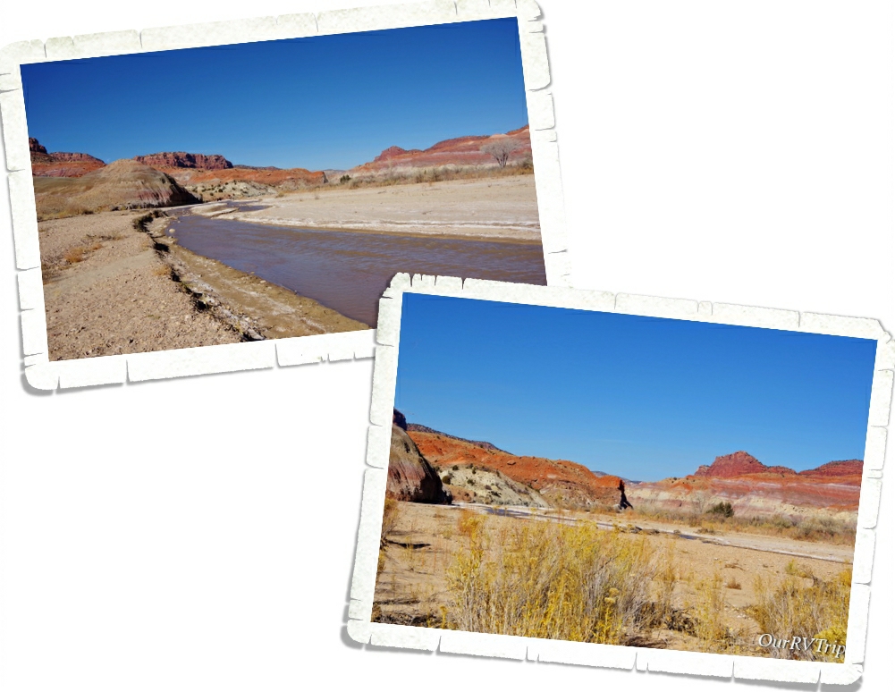
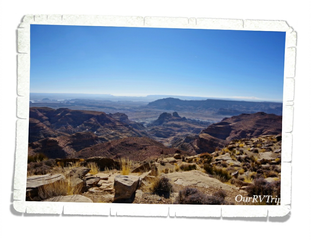
We made it all the way to the river where the original town sight is rumored to have been. Again, we never saw any traces of what was once there, but we enjoyed the drive and the scenery. We used our imaginations a bit and tried to decide what buildings would have been where and talked about good and bad places to build a town.
The whole adventure to Paria took us a couple of hours and we only saw a few other people. But boy-howdy…Guys, just look at that view. It really was like that the entire drive. One amazing thing to see after another. So, even though we didn’t get to explore a ghost town, we spent some time outside soaking up some vitamin D in a gorgeous setting. I call that a win.
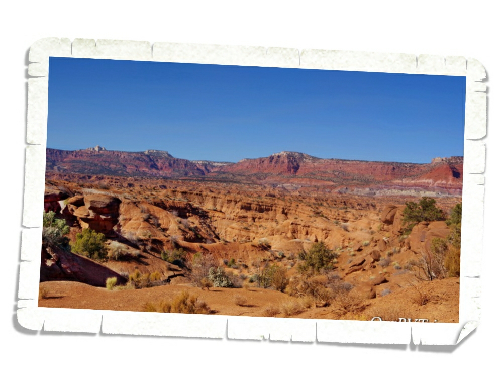
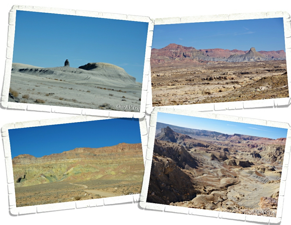
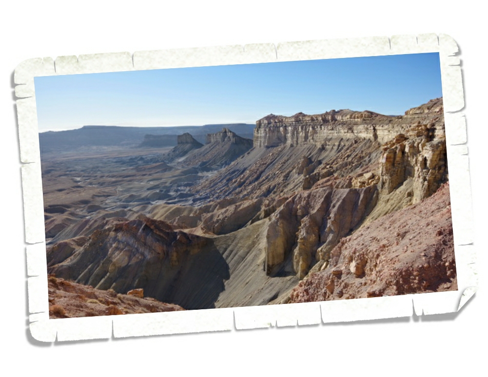
The last thing we did in the Page area was head back into one of our favorite National Parks, Grand Staircase-Escalante, for one more adventure. Smoky Mountain Scenic Backway will take you all the way up to the All American Scenic Byway 12, but we didn’t go the entire 78 miles.
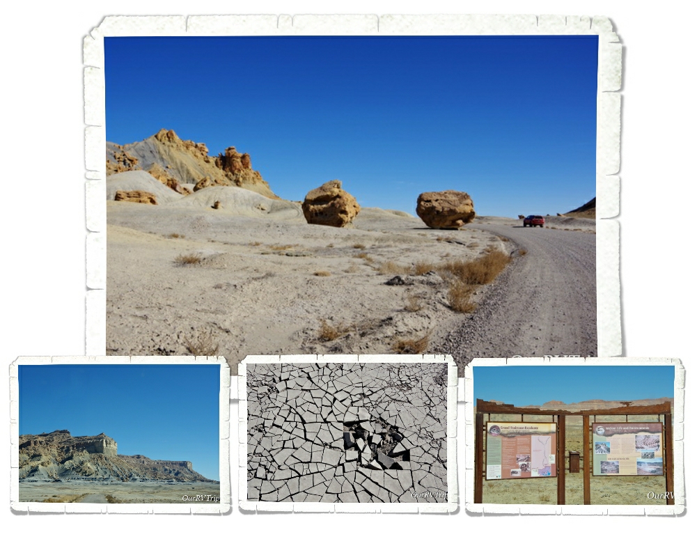
We kind of felt like we were driving around on another planet as we drove through stark canyons and some desert slick rock. The colors of the rocks kept changing…different sections had different colors. There was very little plant life. The first picture above…with the grey rocks…that area is called The Moon and parts of the movie Planet of the Apes was filmed there. It really felt otherworldly and remote.
Sometimes, if you’re lucky (or just plan better than we did), you’ll see smoke wafting up from one of the vents of the 100 year old coal seam fire still burning deep in Smoky Mountain. Which, is where the mountain got it’s name. In the upper right picture, you can see some of the coal seams that run through the mountain and in the left picture you can see what one of the vents looks like. To see the smoke, you have to be near a vent when it’s below freezing. So…we didn’t see any smoke.
We made it to the Kelly Grade Overlook and that’s as far as we went. We’ve driven a lot of dirt roads…but the road to get up to this overlook at 6,500 feet was so narrow with blind turns…I really don’t know what we would have done if we’d met someone going the other way on this road. We sat and ogled the view while we ate lunch. Not a bad view…you know, if you like that sort of epic landscape.
I know that people call these landscapes “badlands” because they’re not really good for anything…but I find them so beautiful and interesting. I’m so thankful that our government saw the need to set aside places like this for us to explore.
We found this pizza place…Strombolli’s Italian Restaurant… Guys, it was so good! We got the sampler appetizer platter and it was so big that we didn’t have that much room for pizza. Oh! And the mozzarella sticks were so huge and obviously house made. They were amazing! The pizza was delicious. The crust had that chew that we look for with a savory sauce (not sweet). When we’re back in Page this Spring…we’re totally going back here.
Ok, Guys!! That’s it for Page!! We didn’t do some of the activities that we’d initially planned on, but we knew we’d be back in the area soon.
Hey Guys!! We’re in Arizona!! Utah was so much better than I thought it would be. I mean, I knew it was going to be amazing…I’d seen all of the pictures of the various National Park Units throughout the state, but Guys, the whole two months we spent exploring Utah were way better than we’d expected.
Utah was harder than we expected too. The remoteness of it…the lack of good groceries stores…not even a Walmart in most areas that we stayed. It was really great to pull into Page and see some major chain stores! Ha!! It’s all about the little things…like being able to find the right brand of cat litter or the right dish soap.
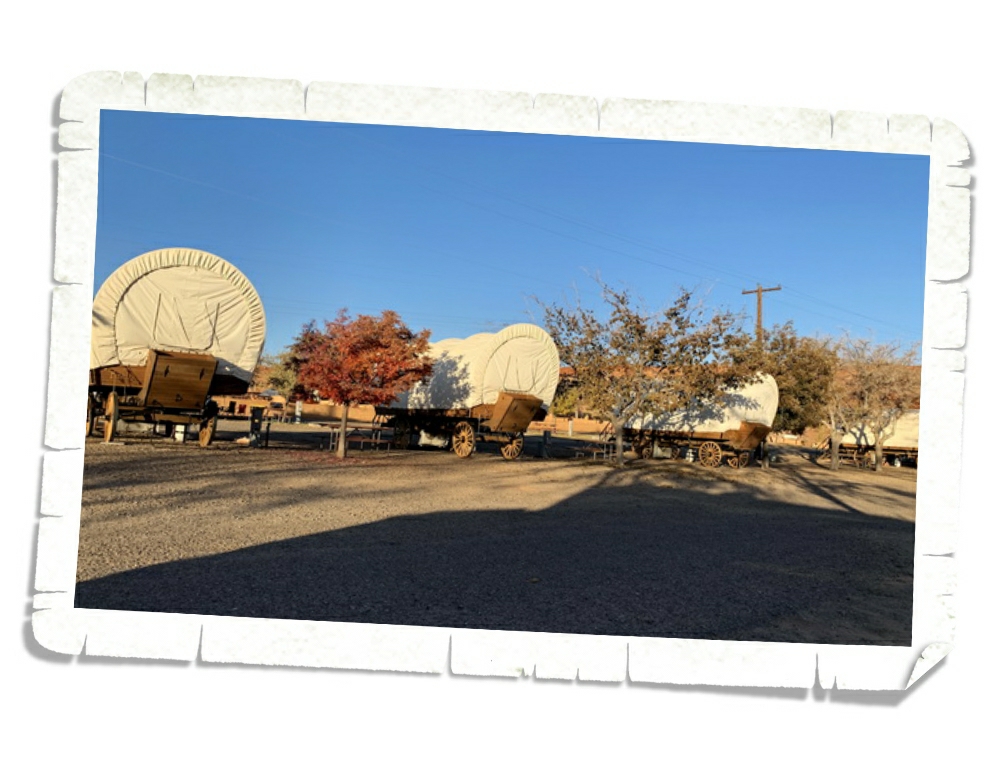
The RV park we stayed at had these really cool covered wagons that you can book and stay in! So neat! I kept seeing people walk up to the wagons and try to get into them. I guess out of curiosity, but sheesh…can you imagine staying in one and having a constant stream of people trying your door handle? We’ll actually be back in this park on our way North after the winter passes and I think I’m going to ask someone in the office if I can see the inside of one! I’m super curious.
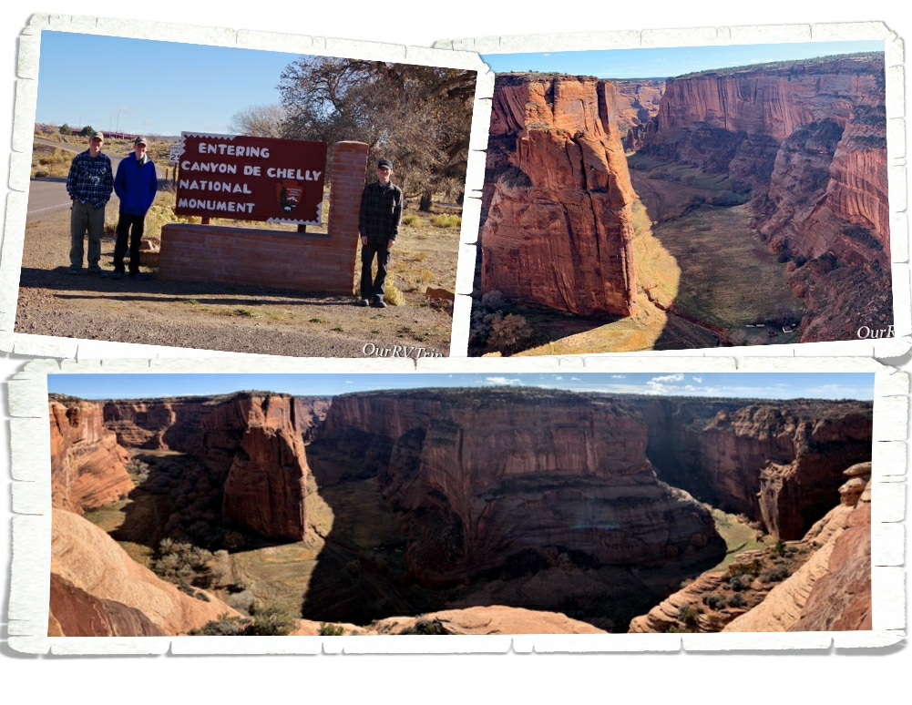
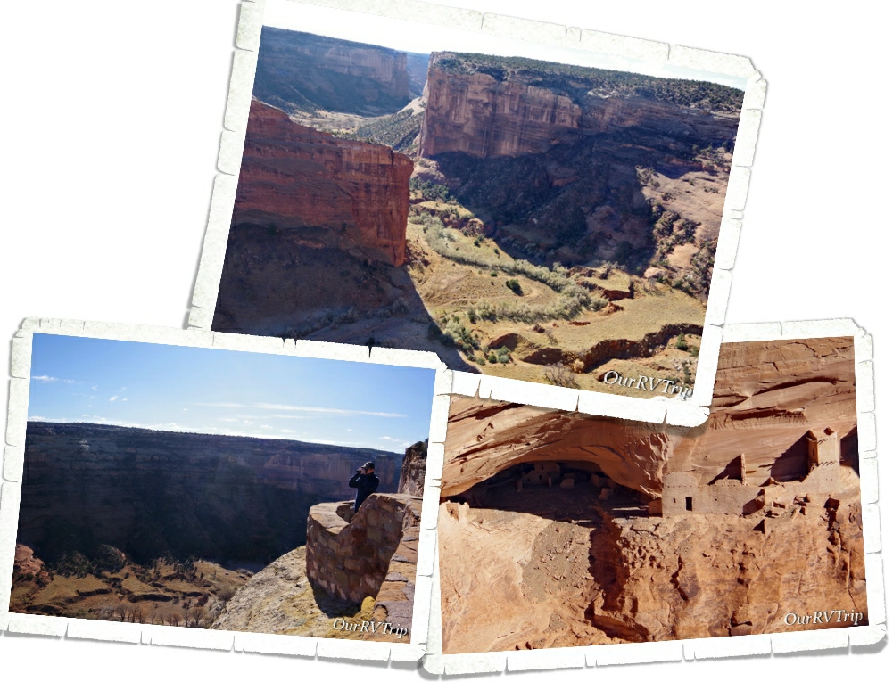
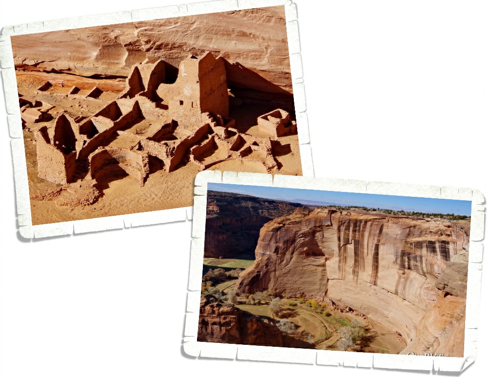
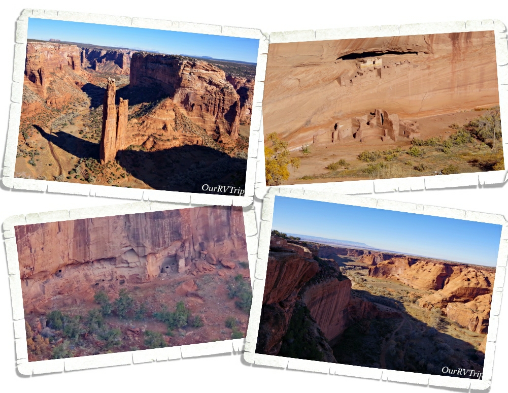
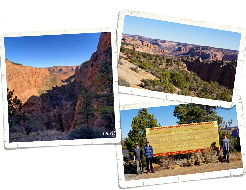
We stayed in the Page area so we could explore a few different National Park Units. Canyon de Chelly National Monument was quite the drive from Page, but we were the closest we would be and we all really wanted to see this park. We found out about this park back in 2015 while we were exploring Wupatki National Monument. The Ranger there told us about Canyon de Chelly and we immediately stuck it on our need-to-see list.
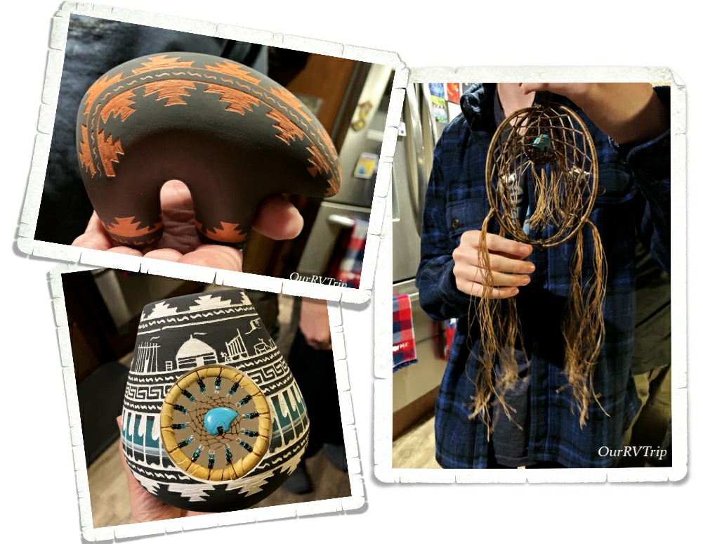
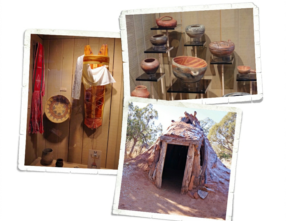
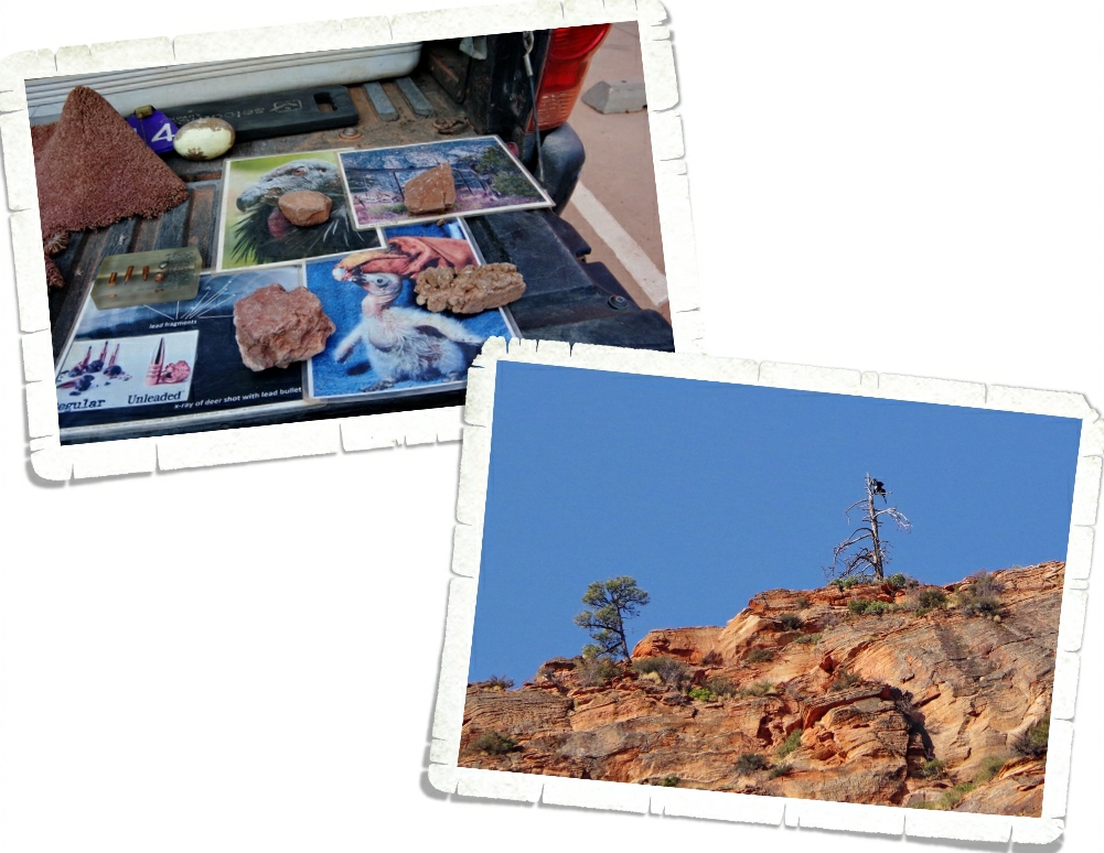
Canyon de Chelly National Monument is actually still home to several Navajo families. They live down in the canyon during the summer months then move up to the rim community during the winter months. I worried it would be super awkward driving around their community to the various viewpoints, but it wasn’t. Not really. Everyone we met was welcoming and had stories of their life in the canyon to tell along with some beautiful handmade jewelry or pottery to sell. If you make it to Canyon de Chelly…and I highly recommend it…make sure to take cash because you’ll want to take home some of their wonderful wares. We ended up with several things. We bought some jewelry as well as the items pictured. Everything was fairly priced. Everything was expertly made. And everything came with the opportunity to get to know one of the residents.
One thing I didn’t know before we visited Canyon de Chelly is that the National Monument is actually split up into two different canyons. Canyon del Muerto (North Rim) and Canyon de Chelly (South Rim). You drive down one then turn around and drive the other. I honestly didn’t think this park would take long. We had no plans of taking a tour down in the canyon…so I figured a couple of hours and that would be it. I didn’t plan on two different canyons with a very low speed limit! But, its all a residential area, so the speed limit makes total sense.
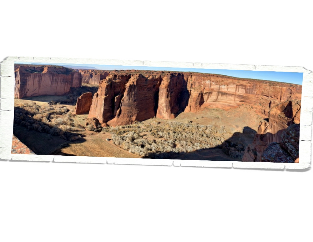
North Rim Drive is 34 miles round trip and has several stops along Canyon del Muerto. The maze of canyons known as Canyon de Chelly has been occupied for close to 5,000 years and has encompassed many different cultures. The current residents, the Navajos, have made this canyon their home since the 1700s.
The canyon walls go from around thirty feet at the canyon entrance to a soaring 1,000 feet in some places. At each viewpoint along the rim drive you can see evidence of both past and present residents. Right by the ancient dwelling (the Navajo don’t like to call them ruins because they don’t see them as ruins), you’ll find a freshly plowed field waiting for the seasonal planting.
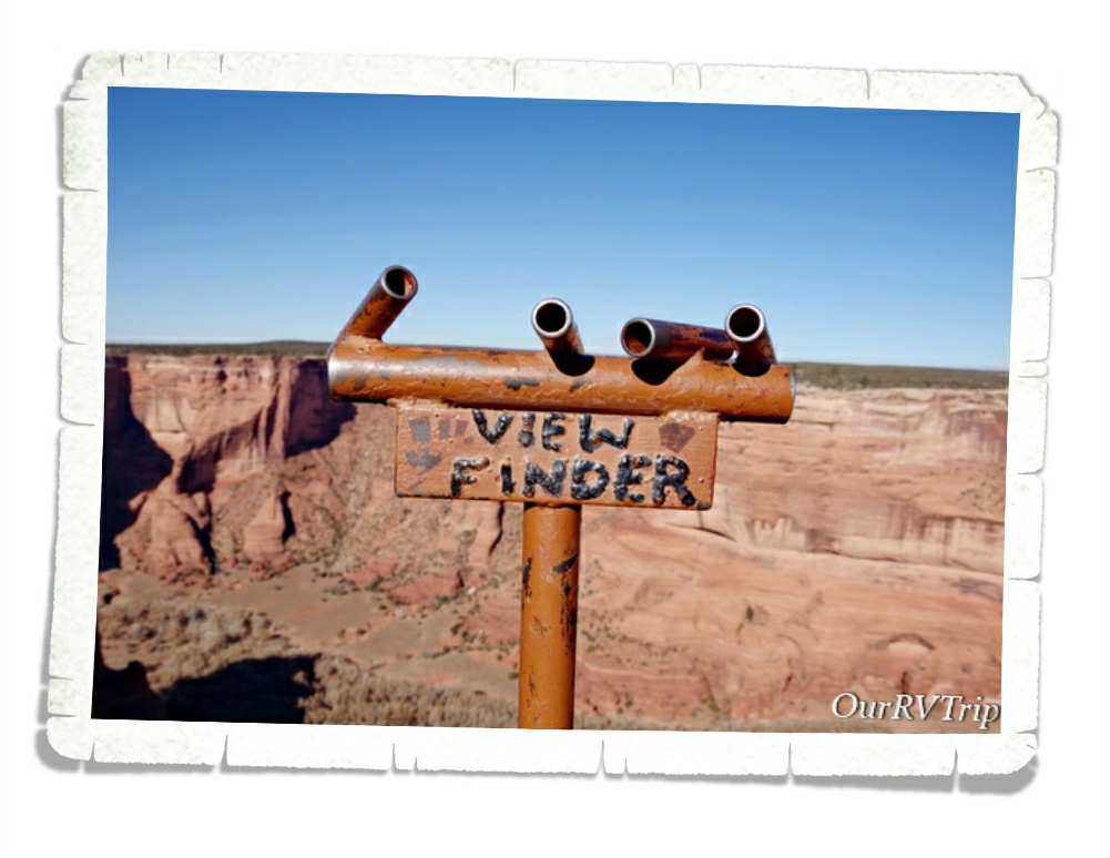
When you visit Canyon de Chelly National Monument, make sure you bring some binoculars…you’ll need them. We appreciated these view finders we found at almost every spot. When you’re trying to find something all the way across the canyon…it can be hard to pinpoint exactly where you’re supposed to be looking. The view finders they have up are super helpful. We would locate the ancient dwelling with the view finder then use our binoculars to get a better look at it.
Established in 1931, Canyon de Chelly National Monument preserves and protects nearly 5,000 years of human history within the 84,000 acres that make up the park. When you visit any National Park you should be respectful of what the park is trying to preserve, but I feel like at parks like Canyon de Chelly, you should be extra careful…extra respectful. You’re essentially visiting someone’s home and when you’re a guest in someone’s home you try to learn, respect and observe their customs and beliefs.
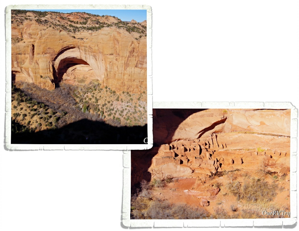
We also made a trip to Navajo National Monument. This NPS unit protects three ancient Ancestral Puebloan dwellings built into the cliff walls of the Tsegi Canyon System. Tsegi is pronounced SAY-ih and means a spiritual and physical home.
Navajo National Monument is a smaller park with only around 360 acres. There’s a great little museum and gift shop at the visitor center. We learned so much about the Navajo culture from this park and Canyon de Chelly. The structure in the picture above is an old style hogan. A hogan is the traditional home of the Navajo people. The word hogan comes from the Navajo word hooghan (ho-won). Everything about the construction and the elements of the hogan have meaning and purpose. Everything. Even the direction you walk when you enter a hogan. The hogan is round because the Navajo (they call themselves Diné) have always believed that the world is round and that everything in our world is connected within a circle.
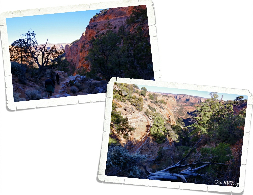
Navajo National Monument protects three puebloan dwellings. You can only see one of them from the trails. The Sandal Trail is only about a mile long (round trip) and it takes you down to an overlook for the Betatakin dwelling. You can also take a guided tour to see this dwelling. We would have loved to do that, but we were there in the wrong season. The Betatakin dwelling was used for about fifty years before it was abandoned. They think there were close to 100 people living here while it was occupied. The cliff dwellings are so often built in an alcove because that is a source of water. The alcoves are made from water seeping through the sandstone and they would collect the water to use while they lived there.
The Keet Seel dwelling can be seen through a guided 17 mile round-trip tour. That’s a long hike, but it’s to see one of the best preserved dwellings in the Southwest. Keet Seel is the biggest of the three dwellings protected in Navajo National Monument and was occupied much longer than Betatakin. The Inscription House is currently closed to the public because it’s unstable and not safe for people to explore.
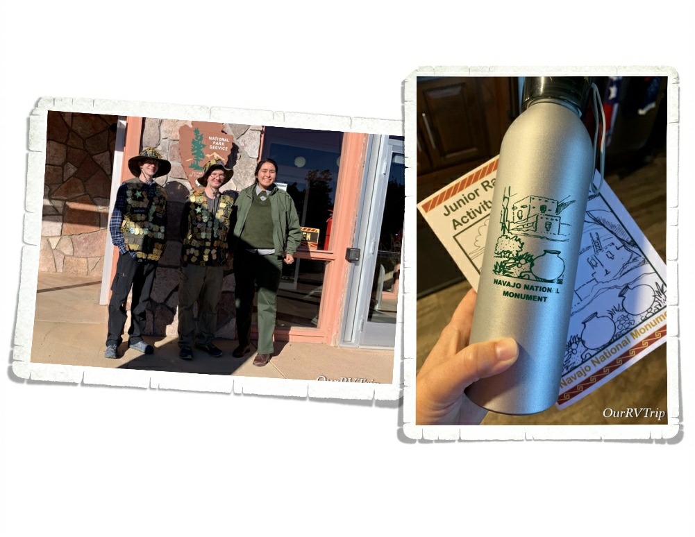
The boys got some pretty cool swag at Navajo National Monument for completing the Junior Ranger program! We really enjoyed chatting with the Rangers there! The Ranger in the photo wanted to get her picture taken with the boys because she hadn’t seen that many Junior Ranger Badges before. It’s always fun to watch the Rangers check out all the different badges Alex and Nicholas have earned.
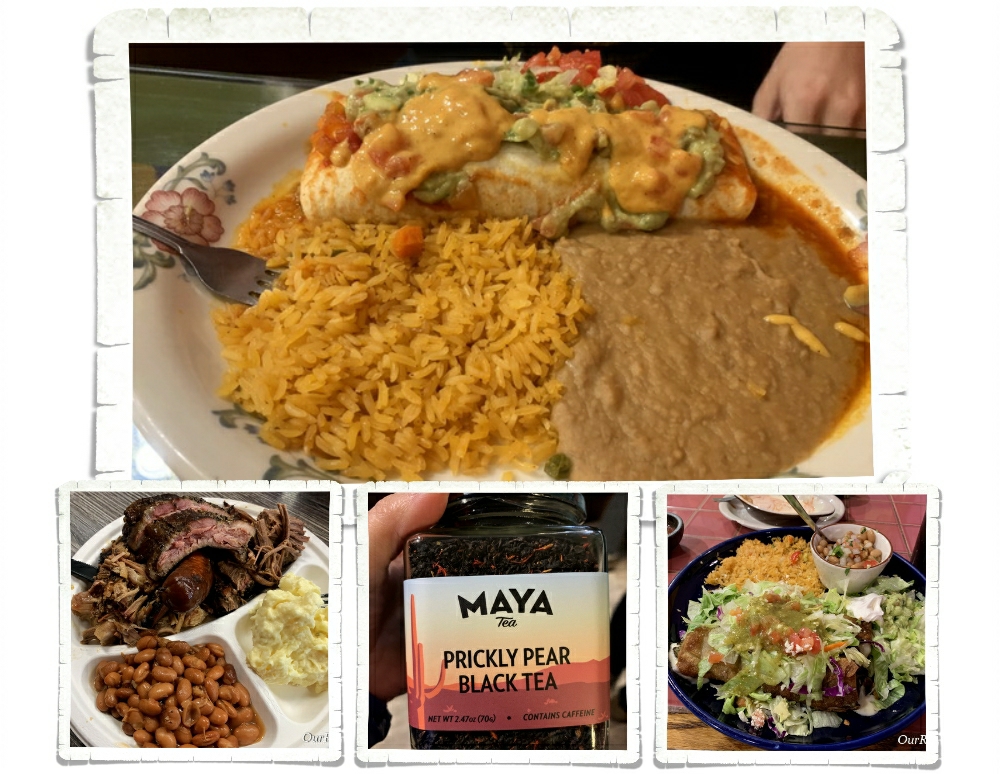
Let’s talk foodies! We were pleasantly surprised with the foodies in Page! Not only did we find some really good Texas BBQ…I found my absolute favorite chili rellenos! We also found prickly pear tea. We’re huge fans of anything prickly pear so we were pretty stoked to find a tea made of it!
We had a busy two weeks in the Page area. I’m going to pause here on our Page area adventures. I’ve got more adventures, more National Park Units, and more foodies to tell you about next time!
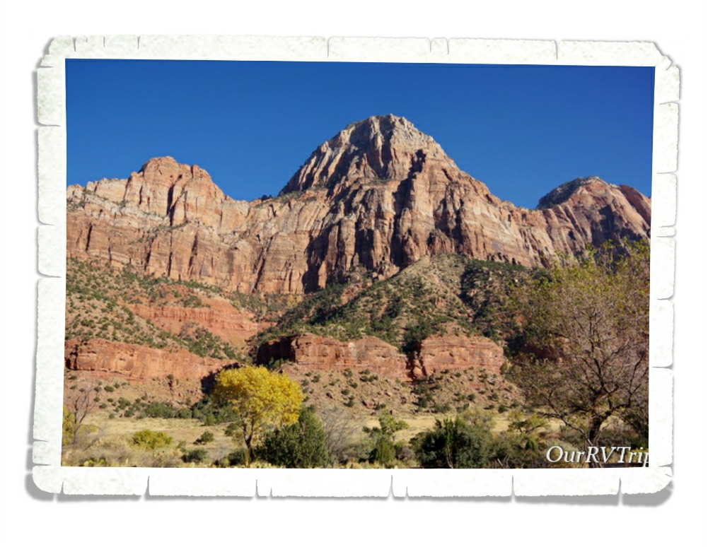
Hey Guys!! We’ve made it to the last post of the Southern Utah section of our National Park Tour and our focus is on Zion National Park!
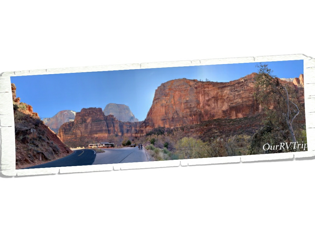
This canyon was called Mukuntuweap by the areas first inhabitants and changed to Zion when it became a National Park in 1919. It’s not the biggest National Park in the country, but it’s definitely one of the most popular. Zion National Park has six sections. Yup, you read that right. Six. We didn’t make it to all six sections, but we made it to four and saw the beginning of a different section (the narrows), but didn’t actually explore it.
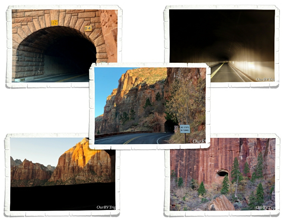
Let’s start with the Zion-Mt Carmel Tunnel. Oh, the things I’ve heard about this tunnel. When I first decided to do a tour through Utah’s Big Five, I knew we would end with Zion which meant we would either have to go through this tunnel or find a way around it. The tunnel itself is just over a mile long and is 13’2″ tall in the center. So, if you’re in a vehicle over 11’4″…well, you’ll need to drive down the middle of this two way tunnel to make it through. Which, means you have to pay $15 and have an escort. I didn’t want to even think about that tunnel and our home-on-wheels so we went around. We did go back and drive through the tunnel in our 4Runner and decided we’d made the right decision.
The tunnel itself it pretty cool! Construction started on it in 1927 and completed in 1930 with a cost of $503,000…to put that into perspective…that would be around eight million dollars today (2019).
In the tunnel, there are big windows (galleries) that allow some natural light in. I got a picture out one of the windows…it was tricky since you can’t slow down or stop within the tunnel. Originally, the windows were used to get rid of the rock the tunnel was made of. The rock from the tunnel construction was dumped out of the windows into the canyon below.
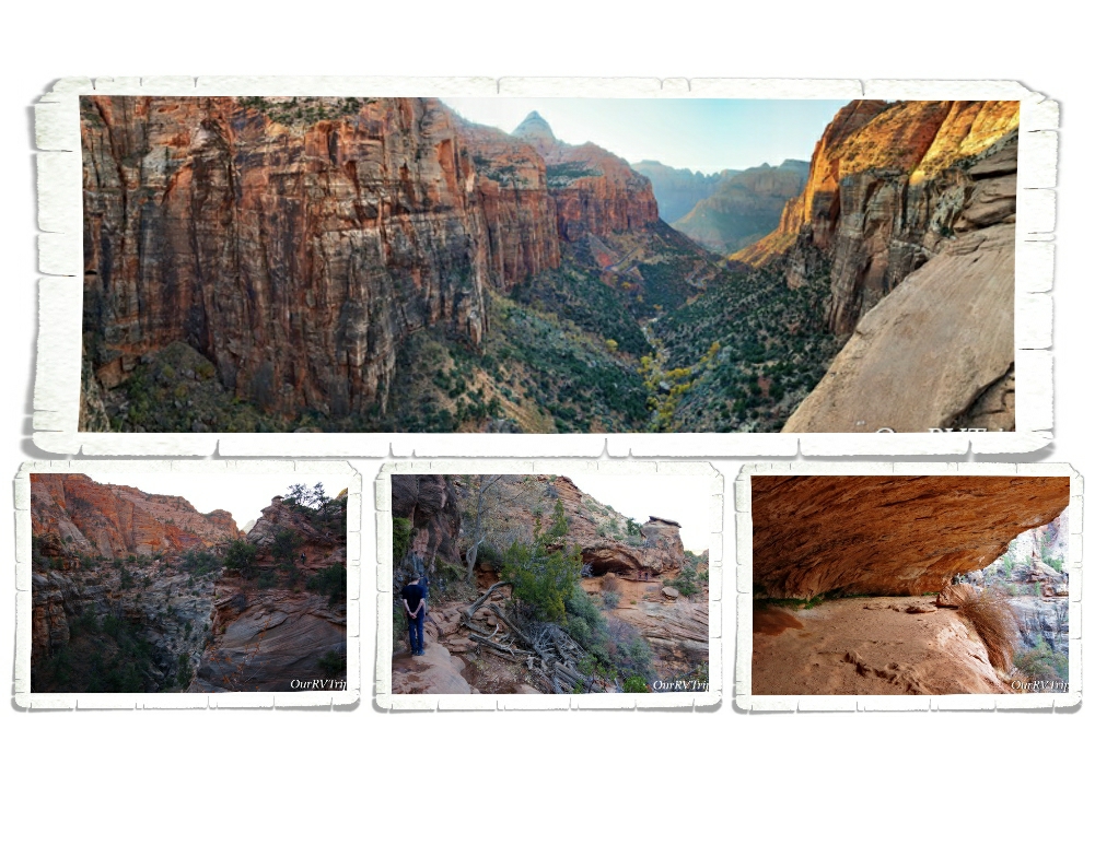
The first section of Zion that we explored was the Upper East Canyon. We went through the tunnel so we could do the Canyon Overlook Trail. We picked the wrong time of the day to do this trail. Pretty much all of it was in the shadows which made getting a good picture of anything difficult. The hike was really cool though! We hiked up onto the side of a canyon, through a little cave, across a weeping wall, and out to the overlook. If you do this hike, make sure you’re wearing shoes with good grip. There’s a lot of walking on slick rock that is sometimes wet. We saw a few people doing this hike with the wrong shoes and they struggled quite a bit.
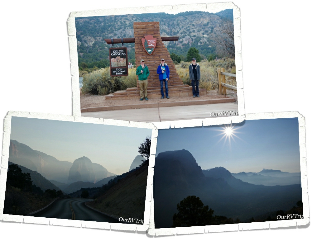
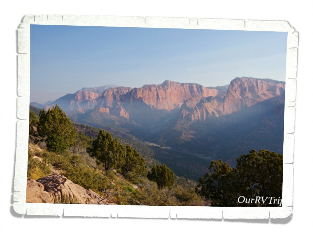
The second section we explored was Kolob Canyons. This section is about a thirty minute drive from the main canyon and has it’s own visitor center and ranger station. Because this section is so far away from the more popular Main Canyon, it sees fewer visitors. If you’re wanting to get away from the massive crowds…this is the place to go. You’re still going to see some people, but not nearly as many.
The day we went to Kolob Canyons it was super smoky as smoke from a controlled burn being held north of the park blew in. We wanted to make it back on a different day to see the canyon smoke free, but it just didn’t happen. Because of the smoke, we didn’t do much hiking. We did one small hike up to the Kolob Canyons Viewpoint. You can see from the pictures that it was really smoky so we didn’t dawdle too much here.
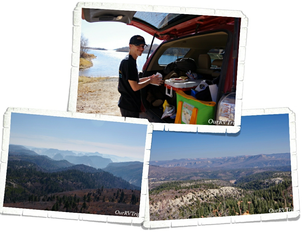
Kolob Terrace was the third section of the park we explored. We hit this section the same day we hit Kolob Canyon and you can see the smoke was still hanging around. This section of Zion is known mostly for the “Subway” hike. We didn’t do this hike…I’m not a fan of cold and the thought of traipsing through 32° water for hours on end…well…I’m going to pass on that every time.
You can also find the highest point in Zion in this section. Lava Point. You can see the view from there in the pic above. You can also see a huge lava flow from there (not pictured). We meandered our way around Kolob Terrace and then drove up to Kolob Reservoir to have lunch. It was nice and quiet with just a few other people milling around.
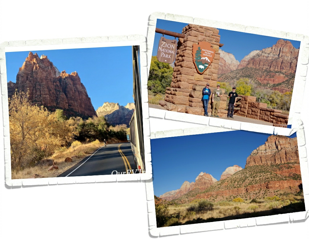
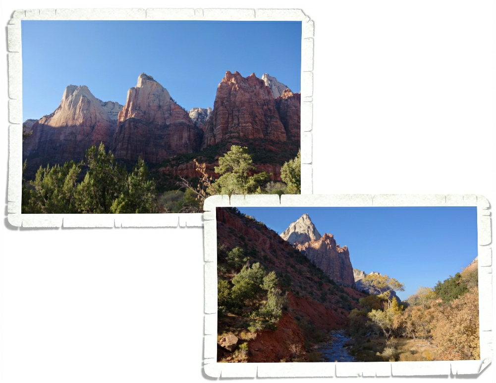
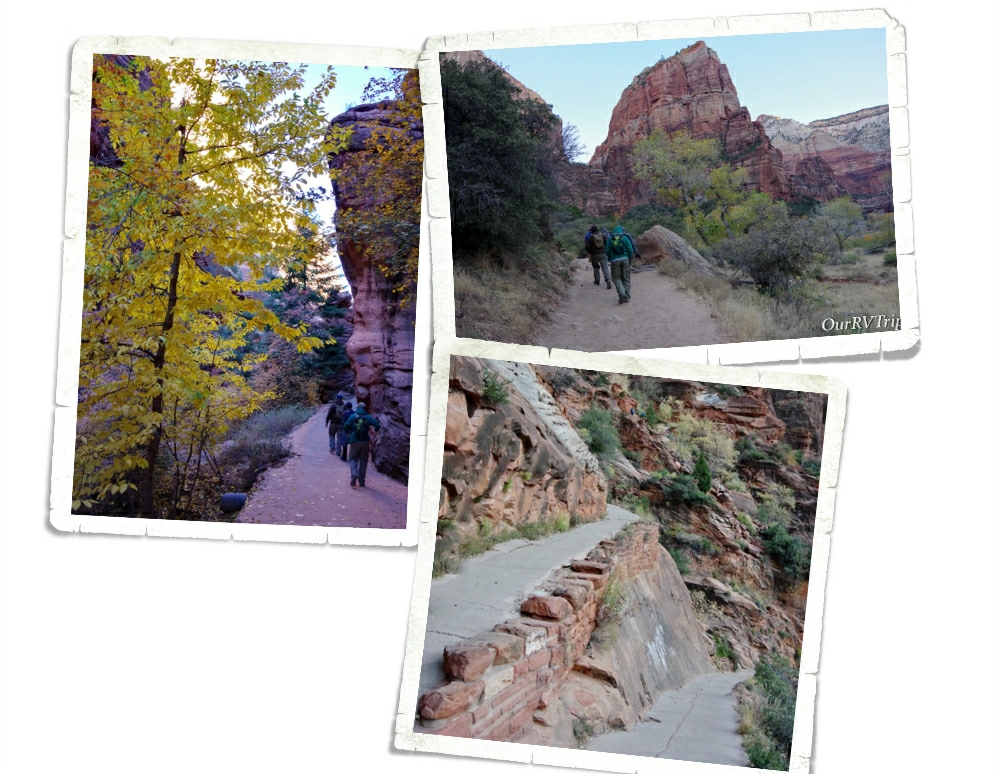
The last section of Zion National Park we explored was the Maine Canyon. This section of the park is the most visited section where you’ll find hikes like Angles Landing, The Narrows, and the Emerald Pools. Our first expedition into this section was to work on the Junior Ranger Book and to familiarize ourselves with the park and shuttle stops. We got there late in the afternoon and the park was starting to clear out for the day. The Junior Ranger book had us stopping at each of the shuttle stops looking for specific things.
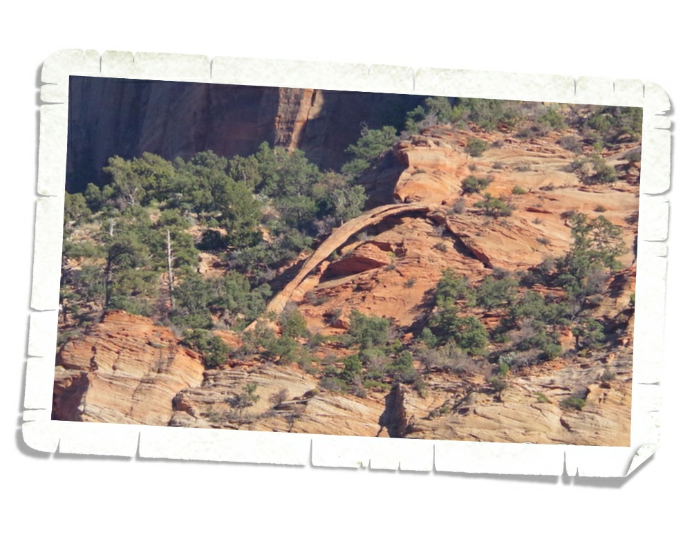
Did you know that there’s an arch in Zion? Actually, there are several. Crawford Arch is the easiest to see even if it is barely visible, but you can see it if you know where to look on Bridge Mountain.
It took us a few minutes to spot it, but we eventually found it! For a long time, people thought it was a natural bridge…which is why the mountain is called Bridge Mountain.
When we first found out we would have to ride the shuttle anytime we wanted to explore the main canyon, we weren’t thrilled. Our first two experiences with mandatory shuttles weren’t the best. Tons of people…all of them pushing to get on and off the shuttles…most of them in a bad mood…we avoid those types of crowds as much as possible. In order to try and cut down on the crowds, we went in and out of the park during odd times. Very early or later in the after noon seemed to be the best times for avoiding the biggest crowds.
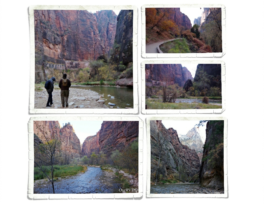
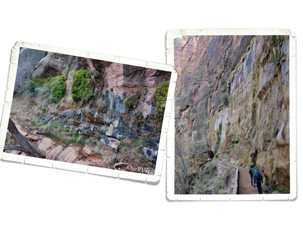
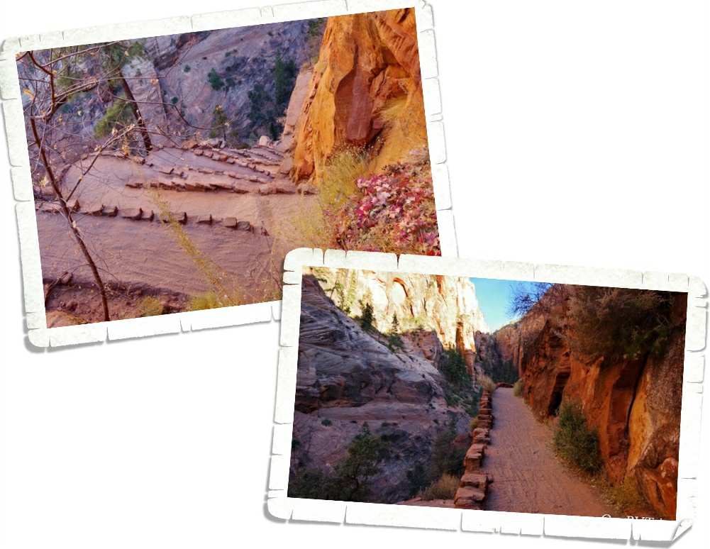
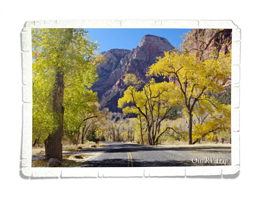
One of the hikes we did in Zion was the Riverside Walk Trail. This is the trail to get to The Narrows. It takes you along the Virgin River for a mile or so then the trail ends and The Narrows begins. This is a great hike for those of us who are curious about The Narrows, but don’t want to hike in freezing water. You can rent gear that’s supposed to help with the cold, but I talked to a few people as they were finishing this trail…and you still get wet…and it’s still cold. When we were there the water was right at freezing. We decided to save all of the water trails for when the water and the air (it was a balmy 40° while we were there) are both warmer.
The Riverside Walk was a great walk in the park. Really, that’s what it was. The trail is paved and takes you beside the river the whole way. One of the coolest things you’ll get to see on this trail is a weeping wall. Zion is all about the weeping walls. I don’t have a good picture of a weeping wall…it’s hard to capture the right angle/shot of it to really convey what and how big it is. I’m not an expert photographer…I just point and shoot with a semi-fancy camera. So, what the heck is a weeping wall? Well, a weeping wall is when the water that is seeping down from the top of a sandstone (or really any) rock can’t get through the stone going down anymore so it goes sideways…and forms a weeping wall…or sometimes it’ll form a spring. Usually on weeping walls you’ll find hanging gardens that are just…magical. Seriously…it’s amazing stuff.
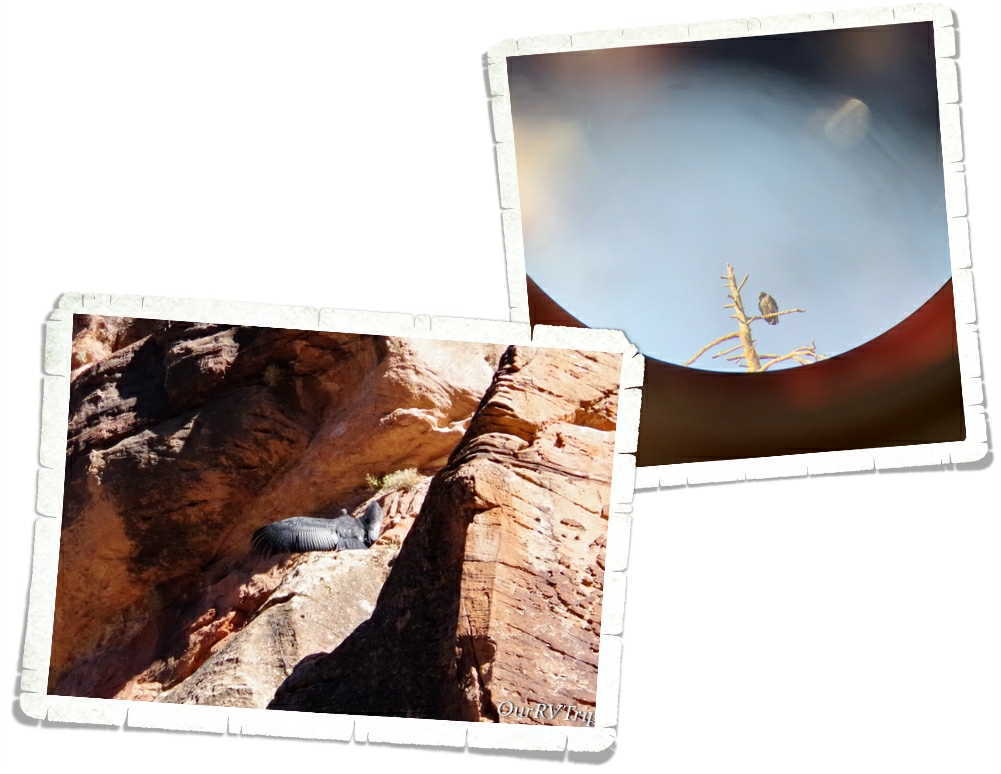
One of the neater things you can do at Zion right now (or at least when we went) is see a juvenile California Condor. Chick #1000 and its parents were sticking around shuttle stop number eight. We stopped by a couple of times and were rewarded with a few views. The Ranger that was posted there told us that if one of the adult California Condors were to fly down and land next to us, they would stand at 4′ tall. Guys…I’m 5′. Those area some seriously big birds! In the right picture you can see one of the parents sitting near the top of the tree.
In the right picture you can see the adult condor a little better. I tried to take a picture through the scope the Ranger had set up. In the left picture, you can see the juvenile chick #1000 sunning it’s wings. It was fun to see these big birds. While we were there one day, one of the other visitors was telling us how he had been on the team who caught the original California Condor transplants. He got a little emotional talking to us about it all. It was a treat to see it all through his experiences with the birds.
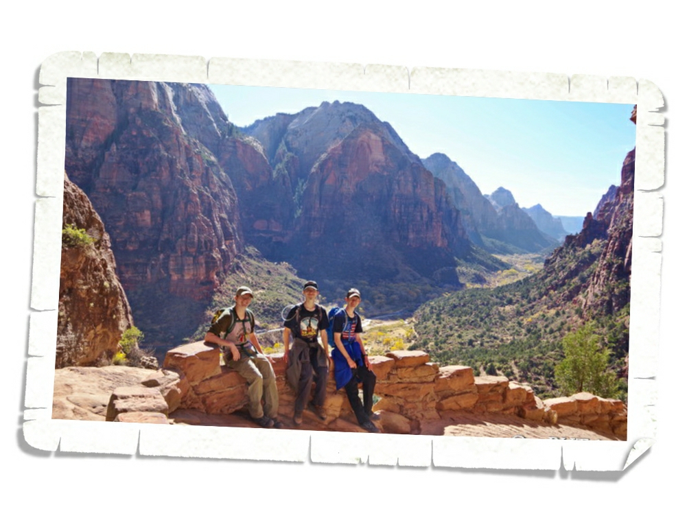
For those of you who know me…you know that I’m not a morning person. Not even a little. And if you’re wondering…this (the picture above) is what the butt-crack-of-dawn looks like. We got up way too early on our last day in Zion to do the Angels Landing Trail. We wanted to be on the first shuttle out that day so we could beat some of the crowd.
We made the very first shuttle out that day. It wasn’t packed, but it was pretty full. Most of us were going to one of two hikes…Angles Landing or The Narrows. You could tell which hike a person was going on based on whether they were wearing water proof gear or not.
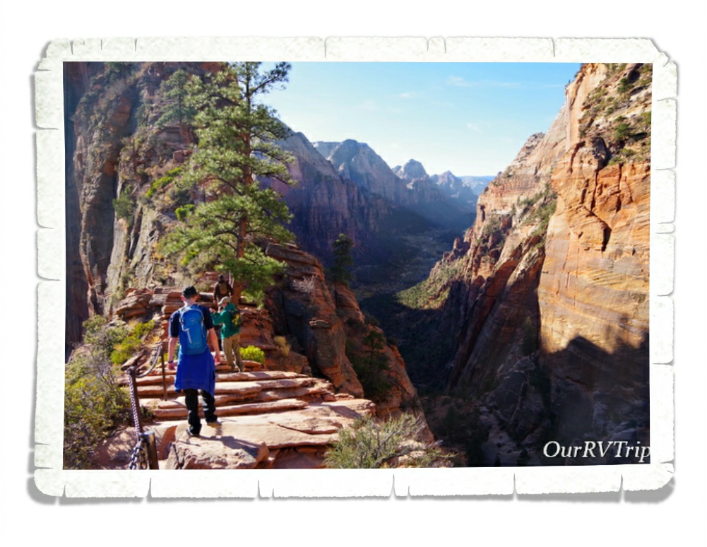
I’m a slow hiker. I’m slow going up due to lack of being able to breath (I’m out of shape…and love my foodies) and I’m slow going down (I have a thing about slipping on a trail). And…I’m always stopping to take pictures…of everything. So I knew it would take me longer to get up this trial. Some of these switchback are close to a 15% grade…which doesn’t sound like a lot, but when you’ve been walking at a constant up for close to two hours…15% feels more like 75%.
We got through one set of switchbacks and thought we were almost there when we found the second set of switchbacks. I think this second set is called Walter’s Wiggles. They were even steeper than the first set. Everyone on our shuttle had passed us by this point and the people on the next shuttle were starting catch up and pass us…but really, the trail was pretty empty. It was still super early. The lighting was starting to get to that amazing golden hour lighting that makes everything pretty.
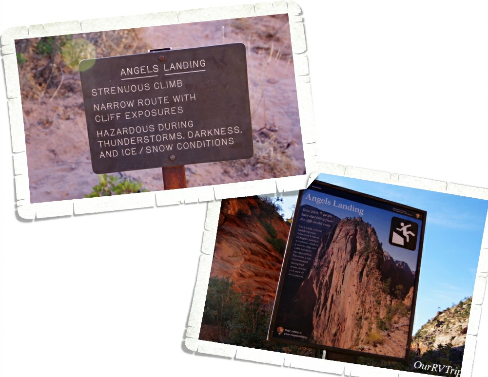
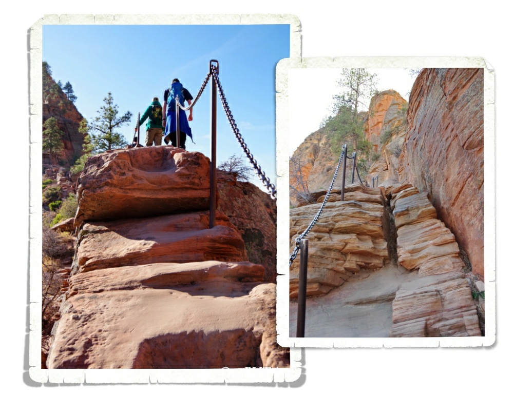
So…I had mixed feelings about taking the boys on this hike. Angels Landing is a dangerous hike once you reach the chains section of the trail. Until then…it’s just switchbacks and anyone can do it. But the chains section…it’s serious. People fall of this section every single year. We had several talks with our boys about this section and we were confident that they wouldn’t mess around or get distracted. One mess up…one wrong step…it wouldn’t be good. I honestly think this hike should go to a permit based system that has an age requirement of 14. As Zion gets more and more popular the crowds on Angles Landing get worse and worse.
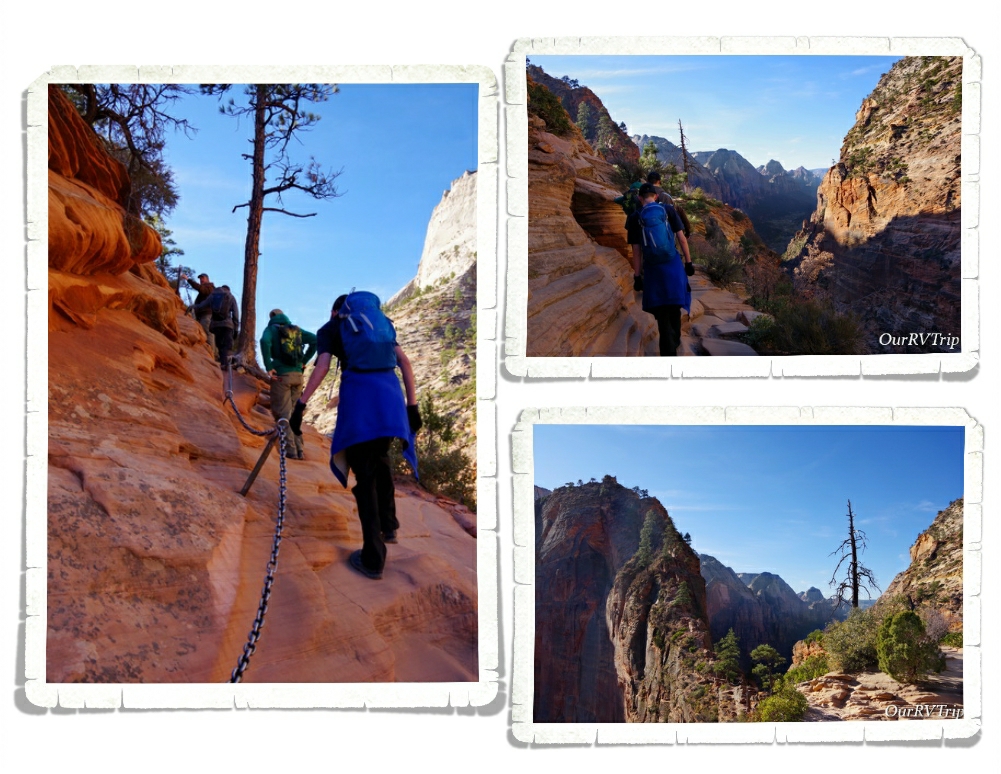
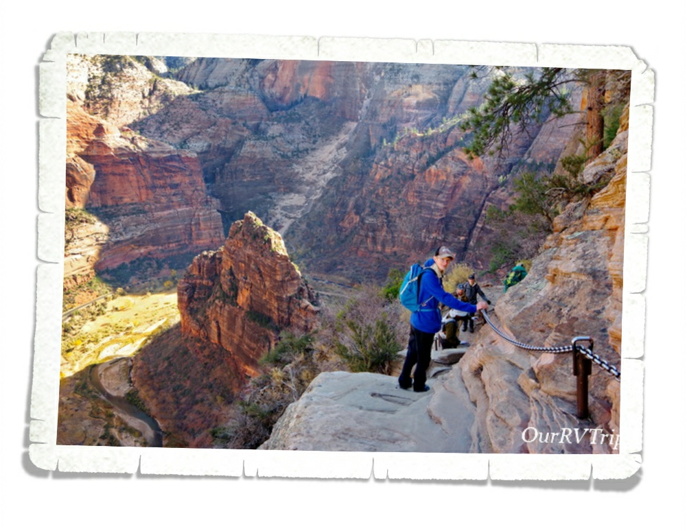
We decided that at any time one of us felt like we couldn’t go on with this hike that we would all stop and turn around. Zion has bolted chains into the rock pretty much the whole way up to the summit of Angles Landing, but when the trail is crowded and you have to go around other people on the trail…then there are times when you might have to let go of the chain. That’s another reason we started so early. I didn’t want to deal with crowds on the chain section. In fact, we wouldn’t have done the chains section if it’d been really crowded.
We only had a few people coming down as we were making our way up and each time it was at a place that was a little wider so hanging onto the chains wasn’t imperative. I didn’t take as many pictures or videos on this hike as I would have liked to…I took them when I felt like it was safe, but didn’t want to mess with my camera or my phone very much.
It’s only two and a half miles to the top of Angels Landing. There’s an elevation gain of close to 1500 feet. There were several places on the trail where I’d pause to try and breath and I’d look to the side and would have my breath taken away by the view. I can’t tell you how many times I said wow during this hike. The picture above is one of my favorite pictures I took during the Angels Landing hike. It was taken at one of the wider spots on the chain section and it was during one of those “wow” moments.
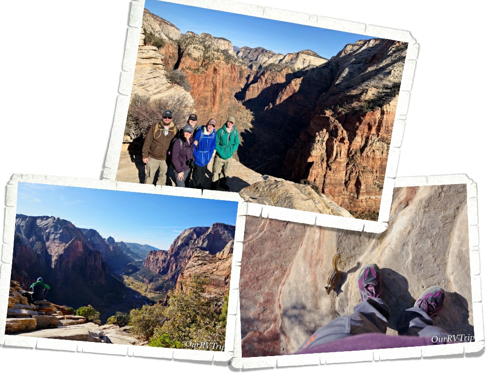
When we made it to the top we had some amazing views! And there were only about twelve other people up there so it wasn’t crowded at all. We took our time ogling the views and taking pictures then sat down and had a snack before heading back down the trail. There were these cute little squirrels running around the summit. They weren’t shy at all! They would run up onto people to see if they could get a bite of whatever the human was eating. We could have stayed up there for hours but we wanted to get back down the chain section before it got crowded.
Thankfully, we didn’t start seeing a lot of people on the trail until we were close to the end of the chain section. We saw more people as we were going down than we saw when we were going up…but it still wasn’t bad at all.
When we got to the area of the trail called Scotty’s Landing, the crowd was pretty bad. There were probably close to a hundred or so people milling about trying to catch their breath before heading up to the chain section. We passed tons of people going up as we made our way down the switchbacks and we all agreed we’d made the right choice when we woke up sooo early to do this hike before it got crowded.
Even though Angels Landing was only a five mile hike, it was one of the hardest hikes we’ve done. And not just because of the physical aspect of it…this hike takes a lot of mental fortitude during the chains section. You have to pay attention…and me being the mama bear that I am…I was constantly watching and worrying about my kiddos…and my partner-in-crime who has trouble with heights. I wouldn’t even consider taking my kids on this hike before the age of 14. They all did awesome. None of us wavered in our desire to make it to the summit. We’ve talked fondly of this hike quite often since the day we did it (as I’m writing this post, it’s been close to two weeks since we did the hike) so it shouldn’t be a surprise when I tell you that this hike is on our top five favorite hikes. It’s firmly in the number two slot, coming in right after…The Harding Ice Field Trail.
Here’s a fun little tidbit for you…The reason it’s called Angles Landing is because back in 1916 a group of people traveling through the area commented that it was so high only an angle could land on it. The trail to the summit of Angles Landing was made in 1926. It’s become so popular that during busy times at the park, you might have a three hour wait to get to the chain section of the trail.
That’s all I have for you on Zion National Park. We totally fell for this park… so much that we’re trying to decide if we’re going to change our plans for Spring of 2020 so we can spend a little more time there as we head north from Arizona.
That’s it Guys! That concludes the Utah section of our National Park Tour! We spent an amazing two months in Utah exploring and found some of our favorite parks/hikes. Utah…we will be back!
Hey Guys!! We’ve made it to the last stop on our Utah Big Five section of our National Park Tour. We stayed in a city called Hurricane for two weeks and after four weeks of tiny towns with tiny grocery stores and very few foodie options…we were loving this area of Utah!
The main reason we were in Hurricane was to explore Zion National Park. I’ll tell you all about our Zion shenanigans in the next post. Zion is getting a post all to itself. Yup, it was that epic.
So, what else did we do while in the area? Honestly…not a whole lot. We’d pretty much been going non-stop for three months straight and we were so worn out. We’d had plans to explore Zion, Pipe Spring, and then a few state parks in the area, but that didn’t happen. We needed some down time. Living in a small space does have its good points…we’re a close family…but it also has its drawbacks. We’re always within a few feet of one another. Personal space isn’t really a thing when you live in an RV and usually, that’s cool. Like I said, we’re a close family, but when you have five people who have zero personal space and they’re all tired and worn out…our home-on-wheels can feel a little more cramped than usual. We decided to, of course, explore Zion and Pipe Spring National Monument (since we are on a National Park Tour), but we skipped everything else…this time. We spent a lot of time just hanging out…trying the foodie spots…and resting.
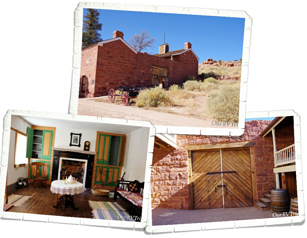
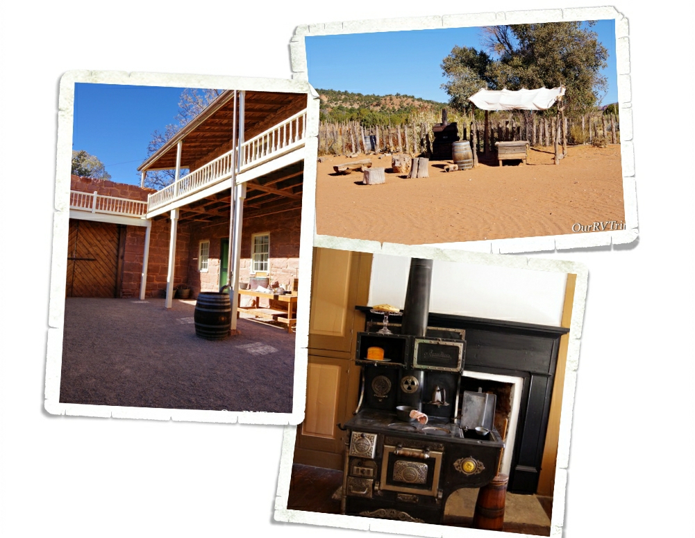
Sometime in the early 1920s, Steven Mather (the first director of the National Park Service) was on his way from Zion National Park to the North Rim of the Grand Canyon when he stopped at Pipe Spring to rest. He became fascinated with the place and saw an opportunity to make a little money by having a place to stop on the way from one big National Park(Zion) to the other (Grand Canyon). So, he bought it with his own money and by 1923, Pipe Spring National Monument was born.
Back before it was known as Pipe Spring, this land was home to the Paiutes. They lived off of and cared for the land in and around the spring. In the mid 1800s, the Church of Jesus Christ of Latter-day Saints claimed 160 acres of the land to use as a ranch for cattle. The first thing they did was build a fort over a small section of the spring so they would always have access to fresh water. Relations between the Paiutes and the LDS members escalated horribly when the Paiutes started hunting the cattle since the LDS members were hunting the deer in the area. The Paiutes weren’t being malicious…they didn’t see a difference in hunting one thing over another. The cattle, after all, were on the land they’d called home for 1000s of years. One thing led to another, and the ranch was abandoned for a time.
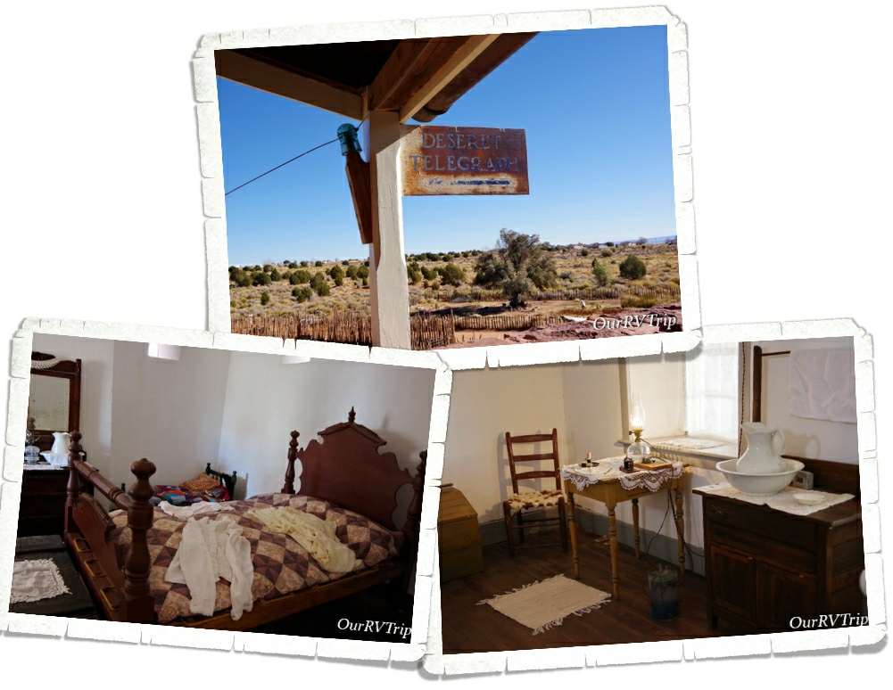
Not wanting to give up the land and all of the profit it was bringing in for the church, the LDS members went back to Pipe Spring and built a stronghold. This strong hold became known as Winsor Castle. Winsor Castle and the ranch was out in the middle of nowhere and needed a fast way to communicate with people. By 1871, 995 miles of telegraph wire had been installed and Pipe Springs was connected to the Deseret Telegraph system. Eliza Stewart was the first telegraph operator at Pipe Spring.
The ranch prospered from 1871 to 1879 making bimonthly delivers of butter, cheese, and cattle to St. George, Utah while the LDS Temple was being built. When the Temple was built, the Church no longer needed the ranch and in 1895 the ranch was sold to Maggie Heaton. Maggie welcomed any and all to her home. She’d have fresh water, pies, cakes, and fresh bread. And the rest…is history.
I’ll be honest here…this is the first National Park Unit that I’m not really sure why it’s a National Park Unit. Every National Park Unit tells a story…it preserves an important building/town/canyon/section of our Country that needs protecting or needs to be remembered. The story we were told at Pipe Spring National Monument, while interesting…wasn’t really any different than 1000s of other stories/places of that time. In fact, the story told at Pipe Spring National Monument was mainly about LDS Members and early days of their church and if I’m being completely honest with y’all…it wasn’t a kind story about them or their early life practices. Perhaps this was a learning story…if we forget our country’s history/mistakes, then we’re more likely to repeat them. I’ve watered down the history of Pipe Spring National Monument here…my intention is to keep it real, but not offend anyone. I feel like this park would be better suited as perhaps a State Park or a privately owned museum.
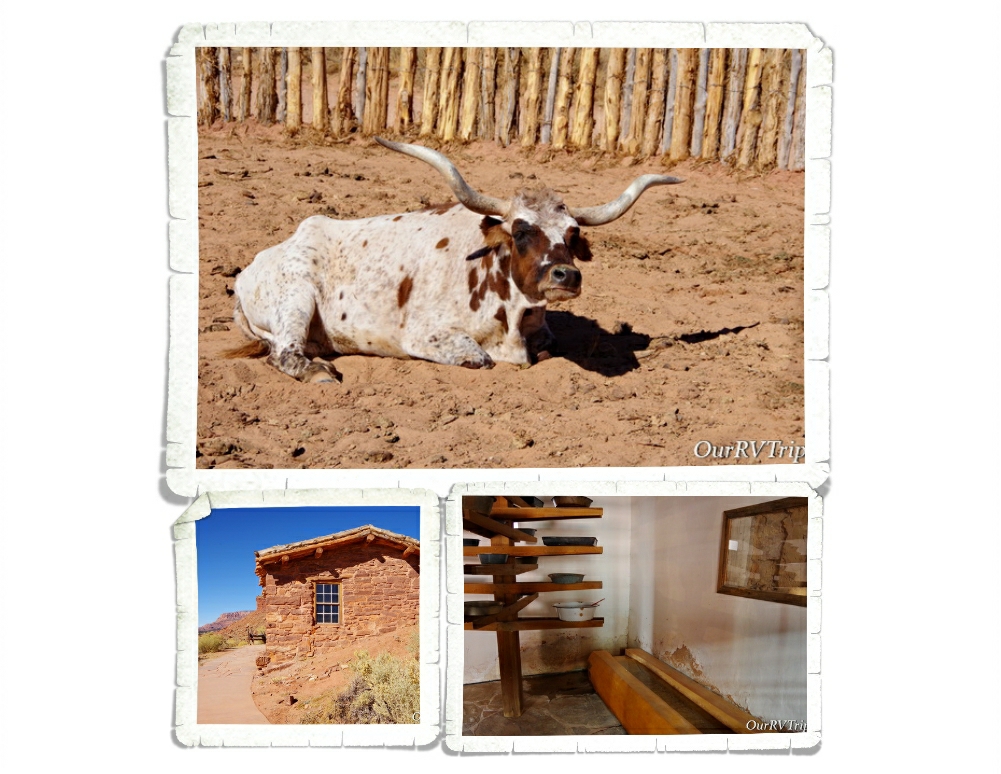
Oh, and one more thing…Pipe Spring National Monument is actually in Arizona…not Utah…so the Texas Longhorn in the photo was in Arizona. 😉 We did see some in Utah on the way into Zion though. A whole herd of them! They were very cool!
Let’s talk foodies! Now, keep in mind…we’d been out in the middle of little towns that didn’t have many options for foodies…and keep in mind we were recuperating. Yeah, recuperating… we’ll go with that. **wink, wink**
We kind of went crazy with the options for foodies. And, Guys…we’re not even sorry about it. Not. Even. A little bit.
One of my all time favorite things to do is peruse the ice cream sections in the different areas/regions. I’m always on the look out for a different brand or flavor. We started seeing the Red Button Brand as soon as we crossed into Utah and well…we had to try a few flavors. Our favorite (and one that’s not pictured) was the Root Beer Float flavor. It was really good!
Every time we’d head into Zion, we would pass this place called Fort Zion. This place was a souvenir store/restaurant/petting zoo. It was a really neat place and the petting zoo price was super reasonable. My favorite thing here was the cute little old western town they’d made!
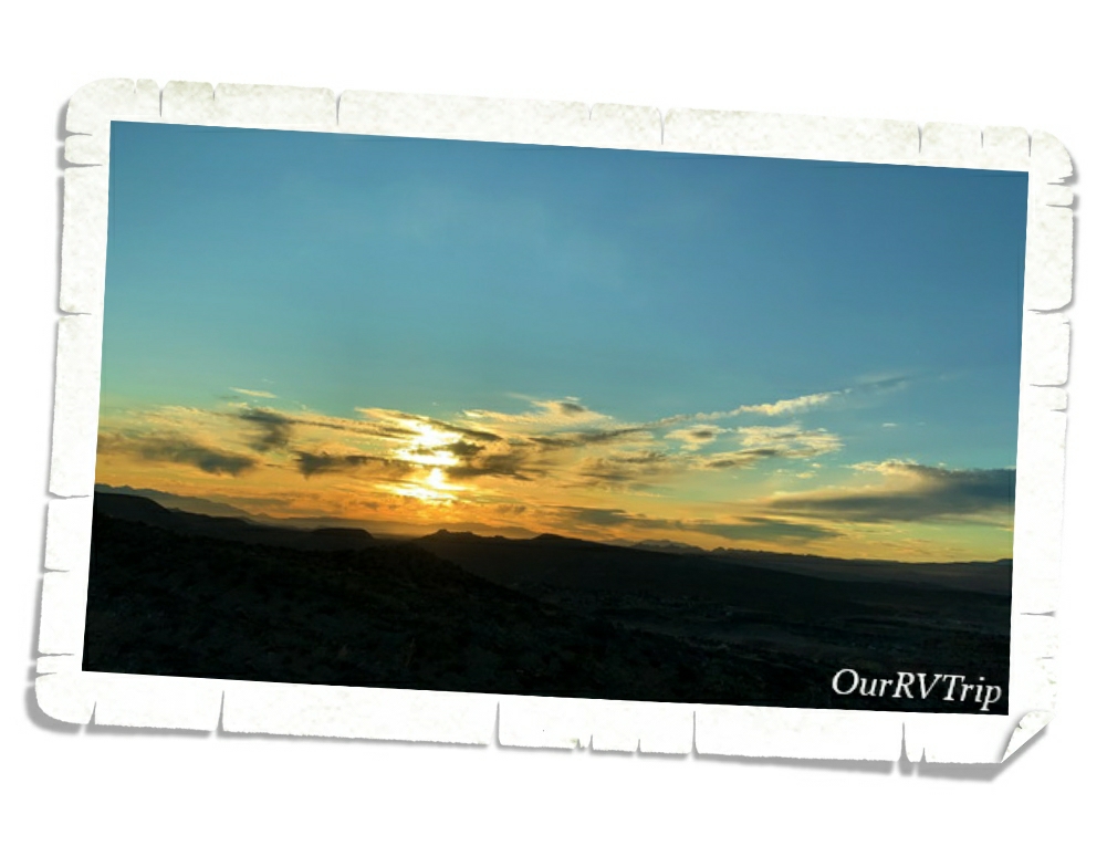
I didn’t get any pictures of pretty flowers so I’ll leave you with this sunset picture. In the next post I’ll tell y’all all about our Zion explorations…so stay tuned!
See y’all down the road!
#NationalParkTour
Slot Canyons, Petrified Wood, and Sand Pipes… Oh My!
Hey Guys! While we were in the Panguitch area the weather was so cold, but we didn’t let that stop us from exploring! We crammed in a National Park, two National Monuments, and two State Parks all in the two weeks we were there! This is the second post of our time in Panguitch, UT…let’s get started!
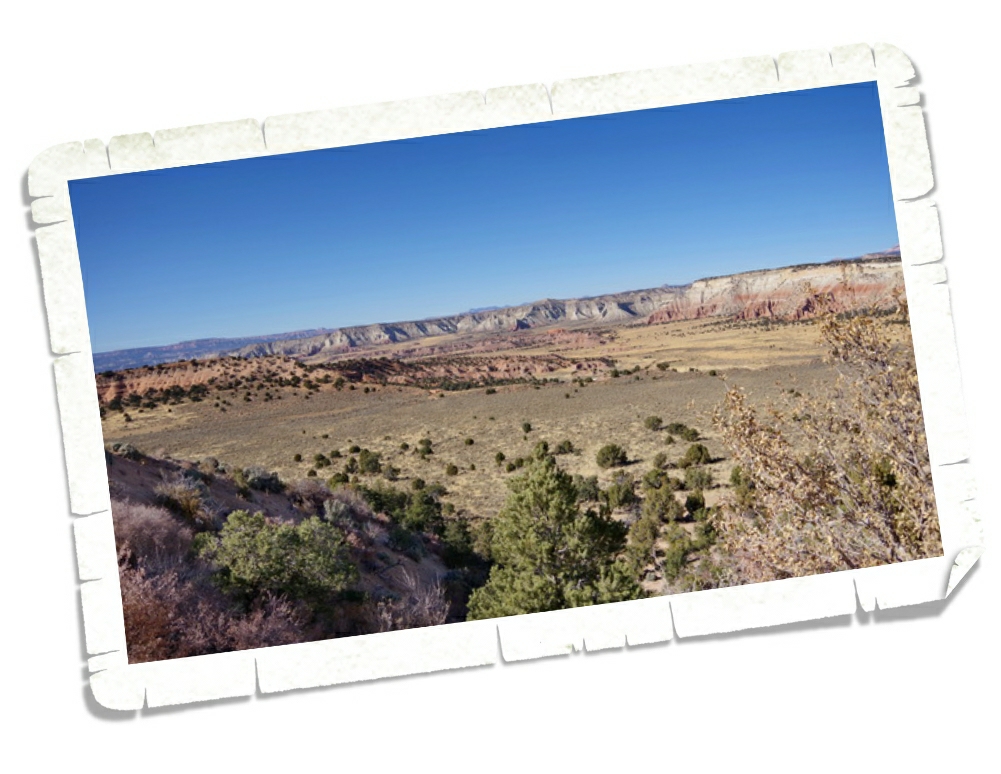
It’s not considered one of Utah’s Big 5…but it really should be on your list of must see National Park Units to visit while you’re in Utah. Grand Staircase-Escalante National Monument is so big (somewhere around 1.9 million acres) with so many diverse things to do and see…it’s easily one of our favorite NPS units. This National Monument is BLM managed so I think it tends to fly under the radar of most National Park enthusiasts.
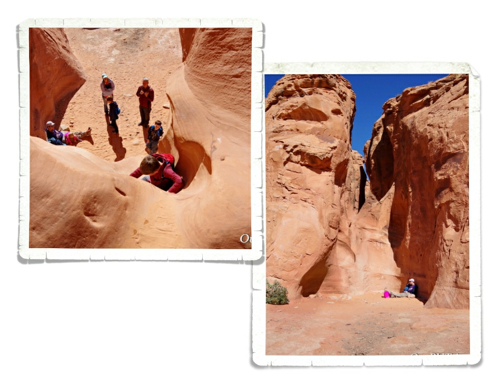
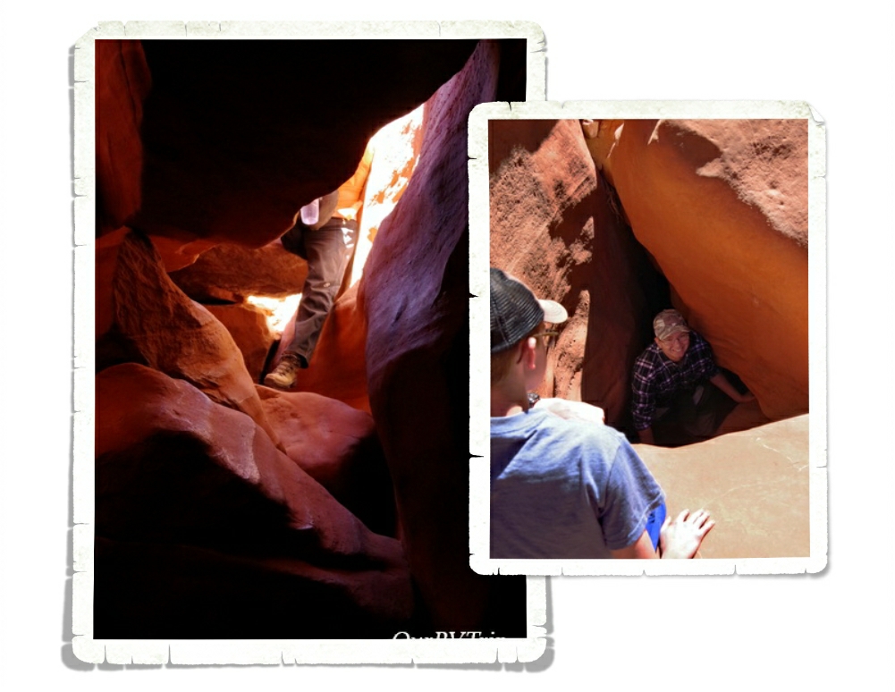
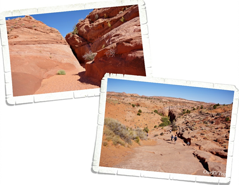
We got a taste of what a slot canyon is back at Little Wild Horse Canyon a couple of weeks before we got to Panguitch and we all loved it! The Peek-a-boo/Spooky slot canyon loop has been on my list for a while and I was really excited to finally get the chance to explore them. These are family friendly slot canyons…meaning, you don’t need technical gear or experience to explore them. They are still slot canyons though…so there’s some scrambling, climbing, and squeezing involved. To get into Peek-a-boo, you must first climb up a twelve foot entry wall. There are a few hand and foot holds that help a bit, but it’s still difficult. I wouldn’t have made it up on my own…Jerl had to help pull me up part of the way. But we all made it up!
Peek-a-boo was so fun! You had to climb through holes, squeeze between walls, and work your way around some easy and fun obstacles. It was like a playground. Grand Staircase-Escalante is divided up into three distinct sections. In the Canyons of Escalante section, you’ll find the most extensive network of slot canyons in Utah.
Once you make it through Peek-a-boo you climb up and out of it and follow the trail over to Spooky to continue the loop. Or you can retrace your steps and go back through Peek-a-boo to get out the way you came. Grand Staircase-Escalante is a unique park. It’s considered the flagship unit of the newly established National Landscape Conservation System. This new conservation initiative’s goal is to basically preserve the wildness of the land. You won’t find defined trails like you will in other NPS units. While there are trails, there is minimal change to the land. So, you’ll need a map and you’ll have to watch for the cairns that have been built on some of the trials. The trial system isn’t as defined as what you might be used to.
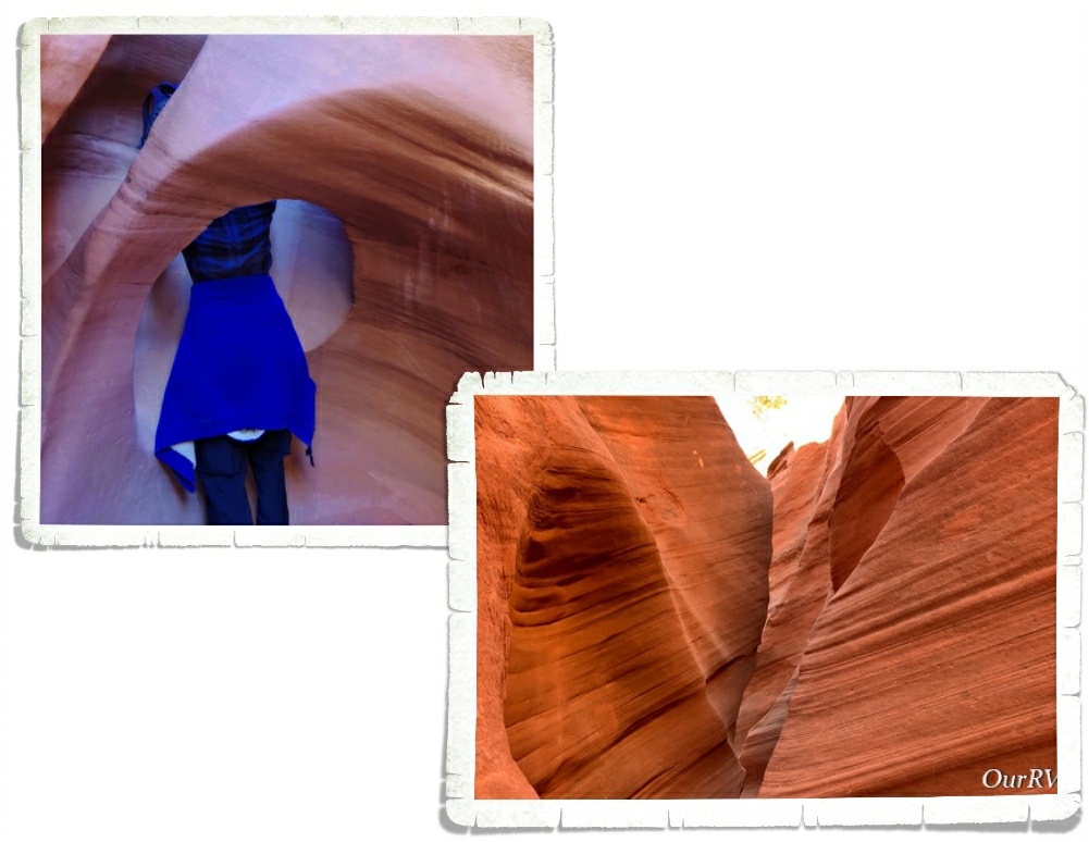
Once you reach Spooky, you have to make your way down a fifteen foot drop. Like I said…it’s still a slot canyon and you’ll still have to do some climbing and scrambling. This drop was the hardest part of the whole loop for us. You’re coming out of the bright sun down into a dark canyon so it was hard to judge where you were and how far of a drop it was. Jerl went first here and helped the rest of us down. He also might have cracked a rib or two here…
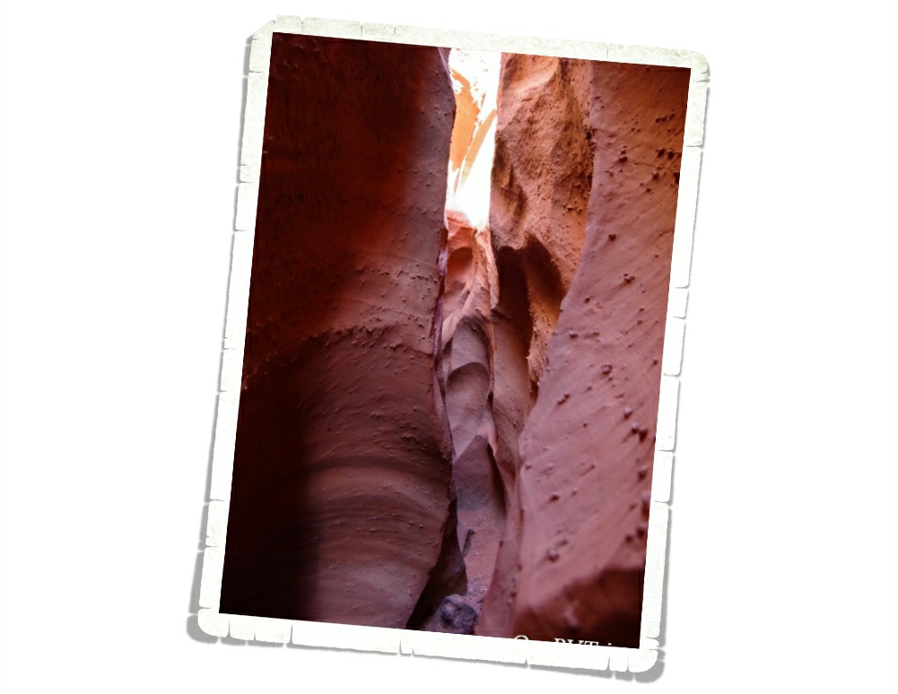
Once we all made it down the drop, we caught up to a big group that was in front of us and so we had to wait while we were in some of the tightest sections of Spooky…which are ten inches wide. Ten inches. If you’re claustrophobic at all, I would suggest skipping Spooky. If I started to feel a little closed in, I would just look up at the blue sky. It helped quite a lot knowing if I absolutely had to, I could climb up the canyon walls to get out. They were narrow enough and they weren’t so tall that I couldn’t have made it. There were places that Jerl had to exhale in order to squeeze through. Always research the hike you’re going on and know what you’re getting yourself into.
I have to give a shout out to Tanya from Florida. When I saw that first climb up into Peek-a-boo…I thought briefly about copping out. It was intimidating…especially with an audience. But, she totally called me out…and said we can’t wimp out now after coming all this way. And she was totally right! The group of people we found ourselves exploring these slot canyons with really made the hike so much fun. We all helped each other and encouraged one another to make it through. So, thank you Tanya from Florida for pushing me to not wimp out!
The Dry Fork Narrows where Peek-a-boo and Spooky Gulches are found is the perfect way to experience Grand Staircase-Escalante National Monument the way it was meant to be…wild and free. Go be adventurous. Step outside your comfort zone and find out who you really are. But, always know your limits and be prepared when you’re out in the wilderness. If you’re going to explore a slot canyon…or really any canyon…be weather aware. There was a sign at the beginning of this hike that said the two most common causes of death are dehydration and drowning. Don’t go if it looks like it might rain anywhere in the area and always take plenty of water.
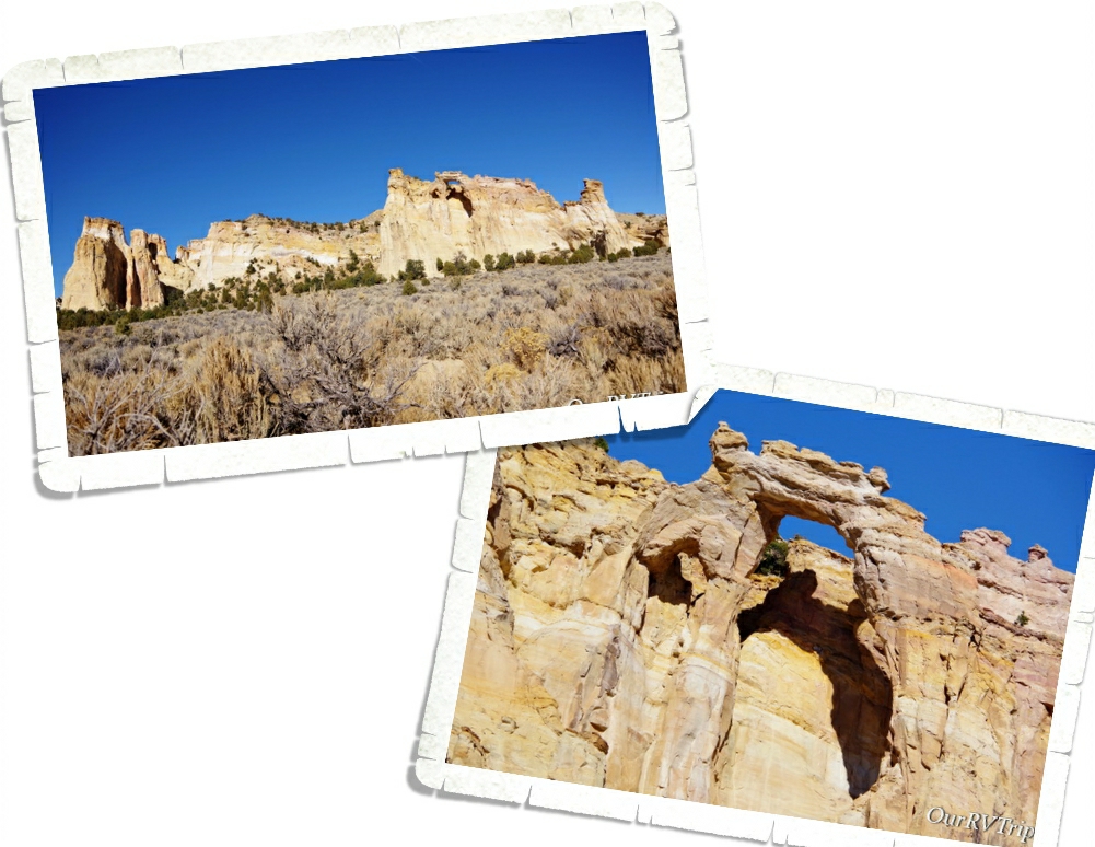
The last thing we did in Grand Staircase-Escalante National Monument was go see Grosvenor Arch. Like everything else we’d done in this National Monument, the drive to get there was on a dirt road. Ten bumpy and washboard miles down the road, you reach the little pulloff for Grosvenor Arch. You can see it from the parking lot, but if you want a closer look at the arch you can take the little “paved” trail out to it. We didn’t walk out there. I feel like the best view of an arch is from a distance. This arch is actually two arches that tower about 150 feet above the ground.
We had so much fun learning about and exploring Grand Staircase-Escalante National Monument!
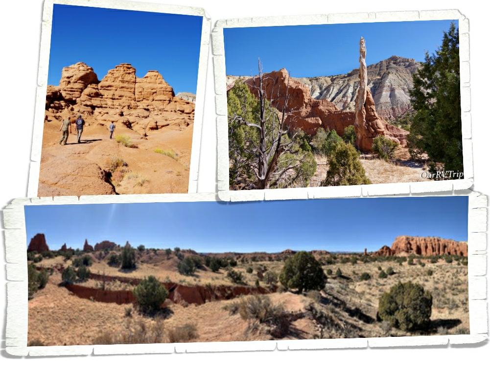
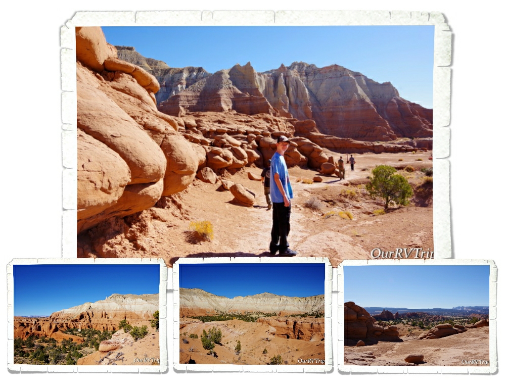
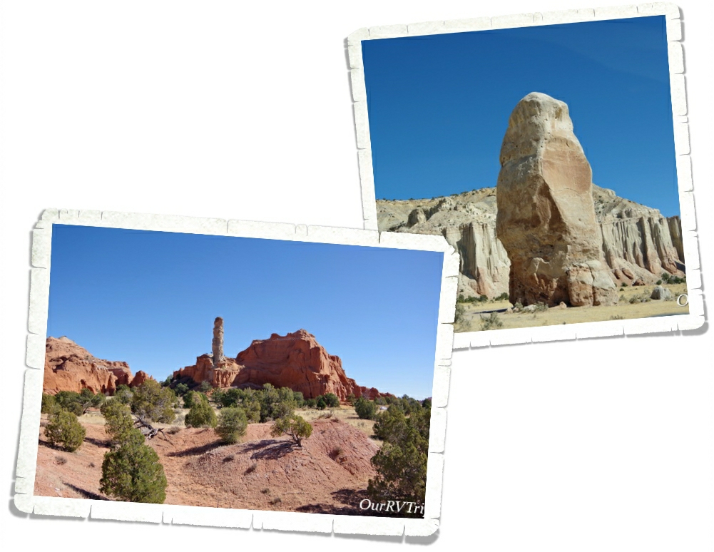
Kodachrome Basin State Park is known for it’s sand pipes and it’s red rock sandstone chimneys. Kodachrome was named by a National Geographic Society Expedition back in the late 1940s. They named it in honor of Kodak film for it’s color.
We did the Angel’s Palace Trail to catch some views of the sand pipes, hoodoos, and chimneys that the park is so known for. There are over sixty sand pipes that range in height from 6 to 170 feet throughout the park. This is a pretty easy, well marked trail that offers some fantastic views of the park and the surrounding area.
Kodachrome Basin is located on the Colorado Plateau. Most of the layers exposed in the park are made of the Carmel Formation (the white rocks) and the Entrada Formation (the red rocks). While scientist know what the sand pipes are made of…they’re not really sure how they were made. There are a few different theories out there, but no one has been able to prove exactly how these unique rock formations were formed.
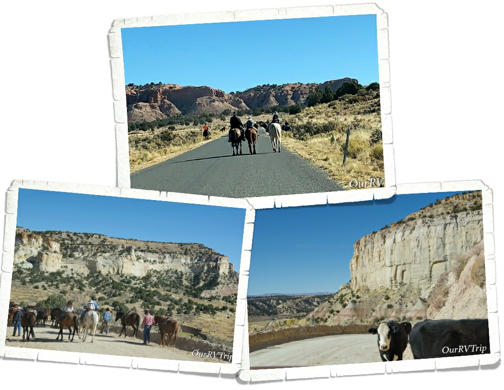
While we were exploring Kodachrome Basin State Park and Grosvenor Arch which are on the same road, we kept running into this group of cowboys (and girls) doing a roundup. They were moving their herd from the summer grazing field to the winter one. It was really neat to watch. We first encountered them on the way into Kodachrome, then caught up with them on the dirt road out to Grosvenor Arch…then met up with them one more time on our way back out. The cows didn’t think much of our car and they weren’t too inclined to walk around us. lol! A few of them bumped our car as if to say…”Hey, we’re walking here”… I think a couple of them were trying to hitch a ride on our bumper as we slowly moved through the herd. We stopped and asked the owners if we could drive through them…we were prepared to follow along behind them, but the owner assured us it was fine to drive next to them.
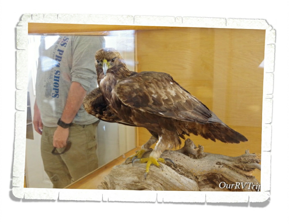
One day while we were driving around the area, we encountered three of these gorgeous Golden Eagles. Three! I, of course, didn’t have my good camera on me…and like the doofus I am, I just sat there too dumbstruck to even think of whipping out my phone to catch a video. We watched three giant golden eagles fight over something that one of them had just found in a field. It was…unforgettable.
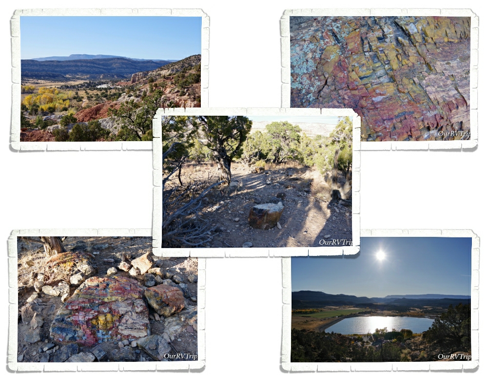
We stopped by Escalante Petrified Forest State Park late one afternoon on our way back to our home-on-wheels after a long day of exploring. We always take the chance to see petrified wood. On top of a mesa that used to be the bottom of an ancient flood plain, you can walk a trail and see several specimens of petrified wood. The trees this wood came from were standing close to 100 feet tall around 130 million years ago. One of my favorite things about petrified wood is the variety of colors! The minerals in the soil determine what colors you get. For example, iron oxide will produce an orange, red or yellow coloring while manganese oxide tends to create blue, black or purple coloring. Yes… we’re nerds…we know things like that. Ha!
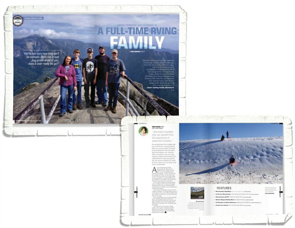
We had the honor of being featured in the November/December 2019 issue of Escapees Magazine. The whole process was a really fun learning experience. The author, Rene, is also an Escapees member and writes articles for the magazine on a regular basis. If you don’t know about Escapees, go check them out here. If you are living the Nomad life you definitely need to be an Escapee member. They make life so much easier and give Nomadic families, like ours, a community of likeminded individuals we can count on. We’ve made friends, learned from other members experiences and have found places to stay with Escapees help over the last almost five years.
That’s all for this post, Guys! I can’t believe our Utah explorations are almost over. It’s gone by so fast!