Hey Guys! Well, in true 2020 style…something went wrong.
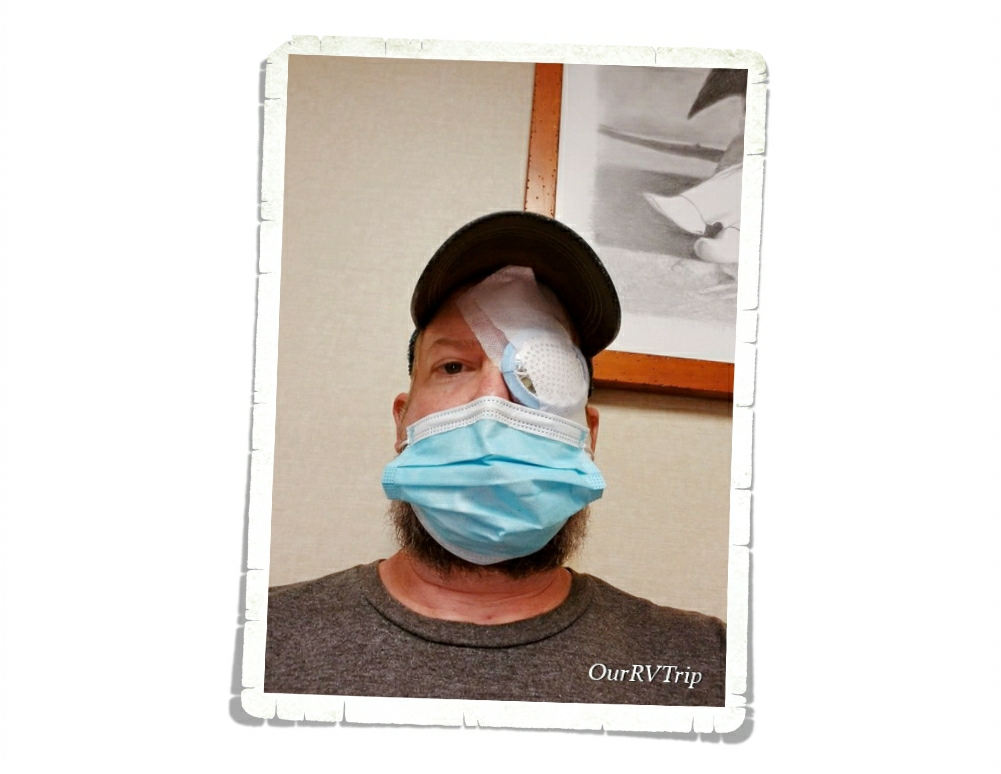
We had three weeks left of the 2020 travel loop and Jerl’s right retina started to detach.
We were in the middle of exploring Yellowstone National Park when he started to notice some light tracers…which are the first signs that something isn’t right. Fortunately (I guess) this wasn’t his first experience with a detaching retina, so we knew what to expect and what needed to happen.
We ended up cutting our Yellowstone adventures short by a couple of days and start the long 1300 mile journey back to Missouri. Which…wasn’t our first experience with that either. During the last week of 2017 we were in Phoenix, AZ and had to make a similar trek. You can read about that adventure here if you missed it.
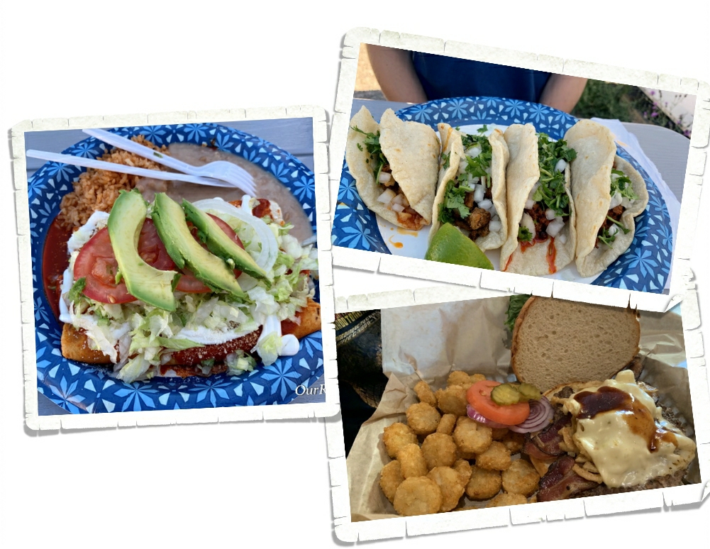
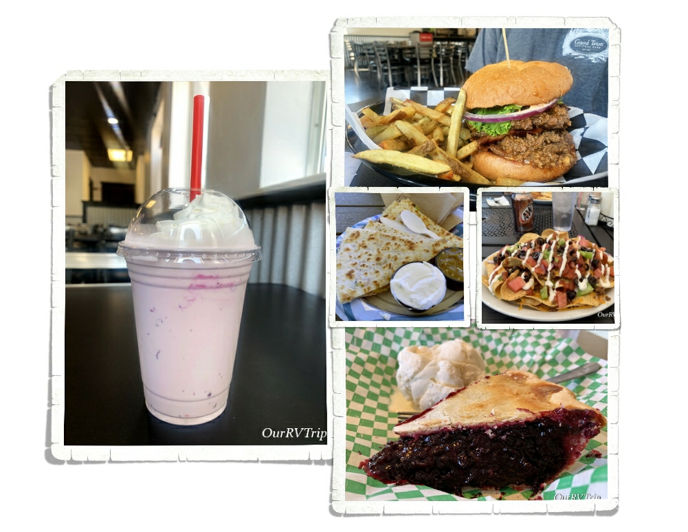
Before I get into the drive back to Missouri…let’s talk foodies from the West Yellowstone area. We found a couple of tasty spots! One was a food truck called Taqueria Malverde…it was really good Mexican food. Big portions, great food and nice people. The other place we found was The Buffalo Bar. We had some great burgers! We highly recommend both of these places if you’re ever in the West Yellowstone area.
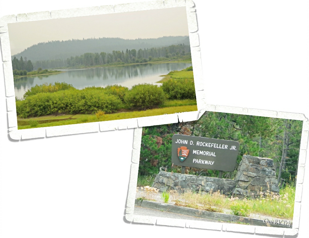
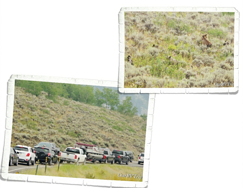
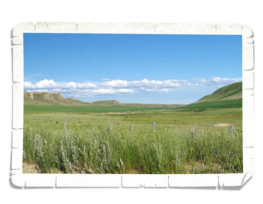
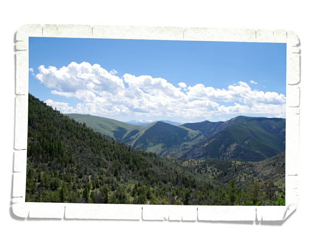
There are a few different ways we could have left West Yellowstone and made our way back to Missouri. We decided to head south in Yellowstone National Park to the John D Rockerfeller Jr Memorial Parkway. The day we left was really smoky from all of the wildfires raging in the west.
This route let us drive through Grand Teton National Park one more time…and Guys, we saw eight grizzly bears! Eight!! The first three were hanging out on the road. We think they were juvenile males…possibly siblings. They were so goofy and unimpressed with all of the cars.
Right around the corner we ran into Mama Bear 399 with her four murder minions. Y’all know I wanted to see these bears sooo bad that while we were in Grand Teton earlier in the year, we’d gotten up at 4am to try and get a glimpse of these famous danger floofs. We never saw them during that trip, but Guys!!! We finally saw them! It kind of took some of the sting out of our situation.
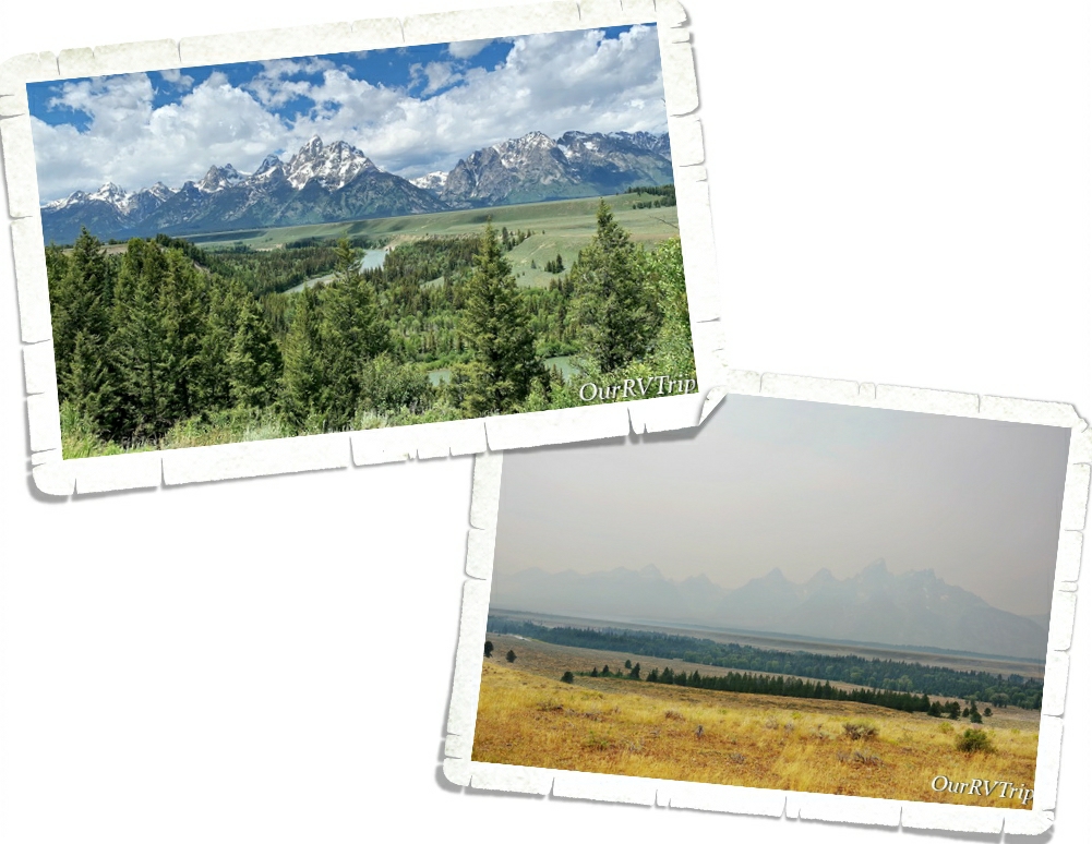
To give you an idea of how smoky it was…the picture on the left is what the Tetons looked like when we were there back in early July of this year. I took the picture on the right as we were driving through Grand Teton NP in September this year.
Between the smoke from all of the California and Montana fires and then the smoke blowing up from the many Colorado fires, we saw really smoky skies for the first two days we were driving.
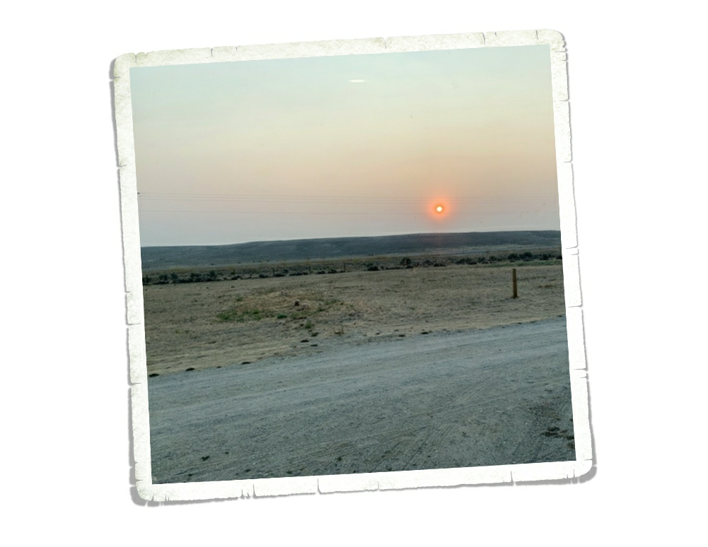
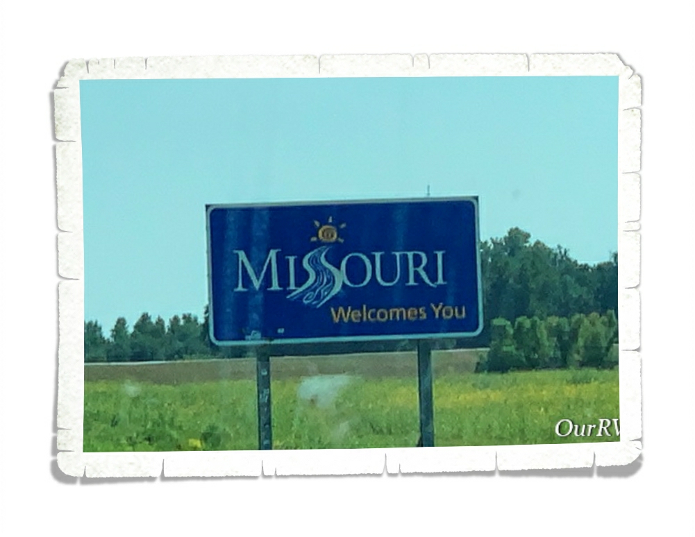
We made it to Missouri late that third day. While it was good to see family, it was still disappointing to miss several National Park Units and anxiety about upcoming eye surgeries was starting to set in.
We got back to Missouri on a Sunday and Jerl had eye surgery that Thursday. Everything went well. He had to lay face down for three weeks while his eye was trying to heal. It wasn’t his first eye surgery experience…and this one seemed to go smoother for him with less pain.
But now what?
We had to cancel the rest of our travel loop for 2020 and figure out what we wanted to do for the winter. With the whole virus thing still an issue plus all of the civil unrest/violence plaguing the country and the upcoming elections…we decided it might be a good idea to stick close to family this winter. Which means…we’re mooch-docking in my (Jennie’s) parent’s driveway until we head out again. We’re not sure when that will be. Like the rest of the world, we’re waiting to see how the whole virus thing plays out and how this coming election ends. By the time this post goes live, we will hopefully know who the next President will be and will have a better idea of what the heck we’re going to do with our 2021. Do we travel more? Do we buy a house and settle down?
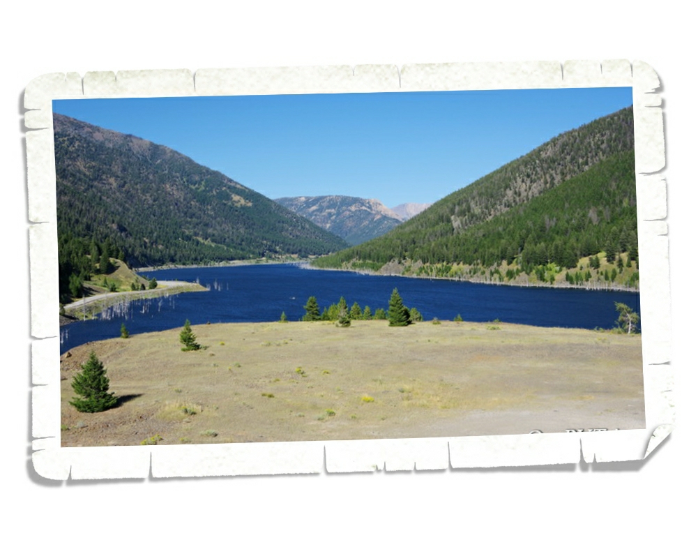
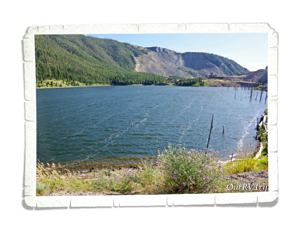
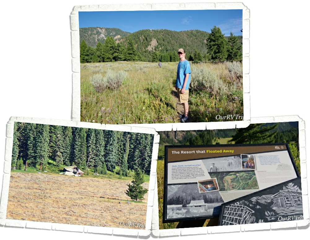
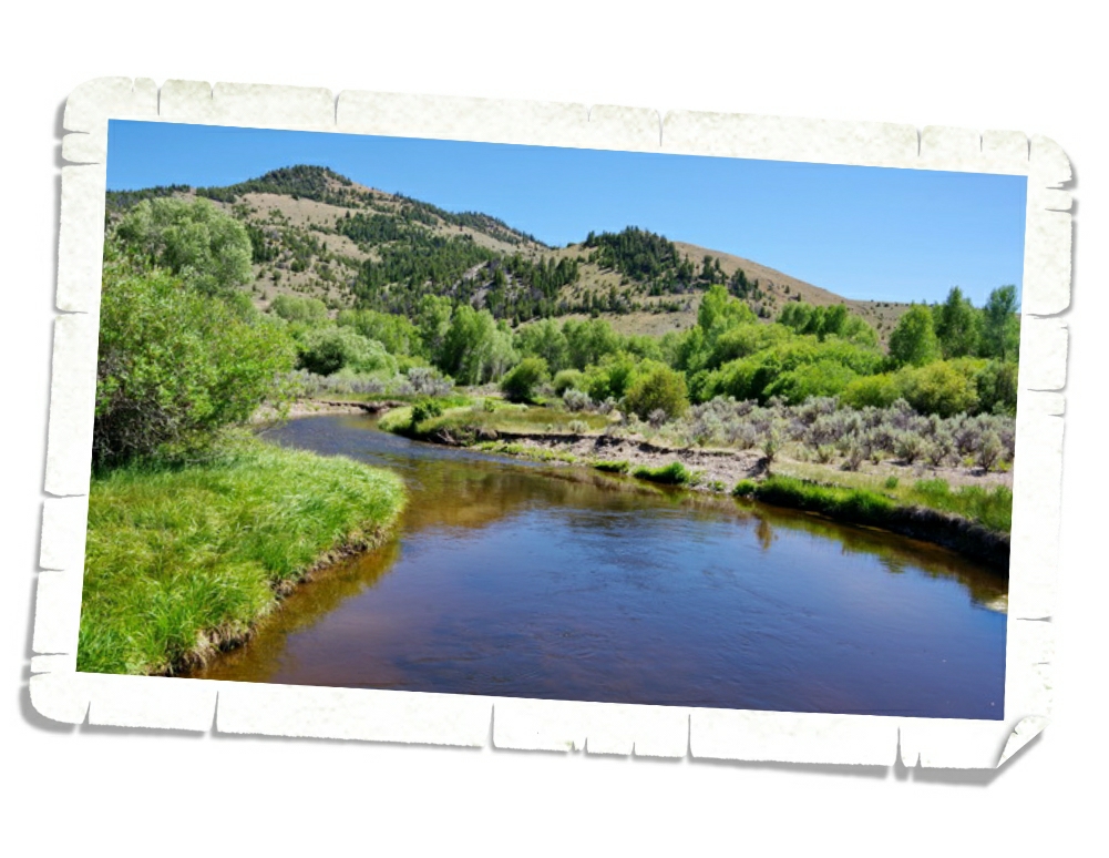
Hey Guys! While we were in the West Yellowstone area, we took an afternoon to explore Earthquake Lake Geological Area. A Ranger in one of the National Parks we were visiting told us about this place earlier this year (2020) and it sounded right up our alley. Earthquake Lake is located in Custer Gallatin National Forest and is maintained by the National Forestry. There is a Junior Ranger program, a wonderful museum, and several stops along the lake that have info-signs about that night.
We started our exploration of Earthquake Lake at the visitor center where we learned the whole story of what happened here. You can see the view of Earthquake Lake from the visitor center in the picture above.
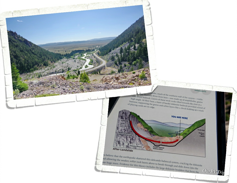
On August 17, 1959 most of the campgrounds around Madison Canyon were packed. The Rock Creek, Cabin Creek, and Beaver Creek Campgrounds were all popular camping destinations because they were right next to the Madison River that meandered it’s way through the canyon. It’s estimated there were around 250 people in the canyon that night…all of them had just gone to bed or were getting ready to.
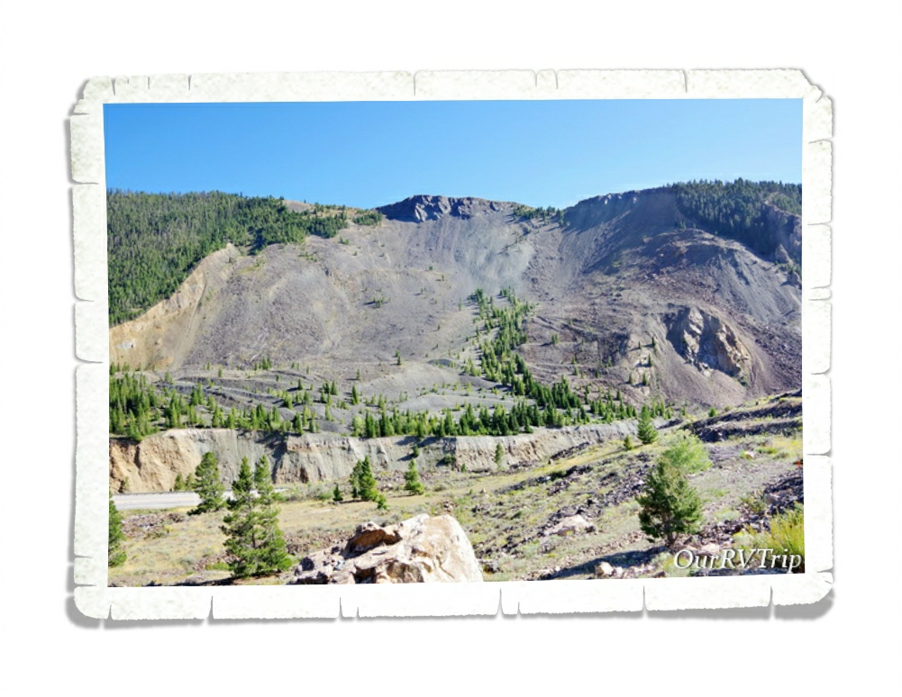
Just before midnight, one of the most powerful earthquakes ever recorded in the Rocky Mountains, measuring 7.5 on the Richter scale, struck in the nearby Hebgen Lake. The earthquake triggered an enormous landslide that crashed down and sent 80 million tons of rock sliding down the mountain, through the canyon and back up the other side all in a matter of 20 seconds.
This earthquake was felt in eight states and Canada. Visitors in Yellowstone said that Old Faithful “wouldn’t shut off”. According to the NPS, this earthquake altered the average interval between Old Faithful eruptions by ten or so minutes.
In 20 seconds, a massive wall of splintered trees, busted up rocks, mud and huge boulders slid from the south side of the canyon…swept through the peaceful campgrounds, and continued up the other side of the canyon wall and plugged up the river. Families were separated as they fled for their lives, people were trapped within the wreckage and debris and Hebgen Lake started to slosh so badly that a wall of water swept through the area.
This boulder is one of the many that crashed through the canyon that night. Geologist who have worked to piece together the story of that night believe that boulders like this basically…surfed on the landslide that was acting more like water than land to come to rest on the other side of the canyon. They think that because of the undisturbed moss on the boulder. In just twenty seconds this six million ton boulder traveled about half a mile.
It was a long night for the campers. They went through not one, but three major events. First was the earthquake, then the massive landslide…and then they had to find their way to high ground as the flooding began. On top of all of that…a storm started rolling through the area.
By 1AM groups of survivors started making their way to what is now called Refuge Point where a couple of nurses who happened to be camping started taking care of the injured.
Three sections of the highway had been lost to the devastation so no one could drive out of the area. Those that didn’t make it to Refuge Point spent the long night huddled on the rocks…waiting for help…hoping to make it to the morning.
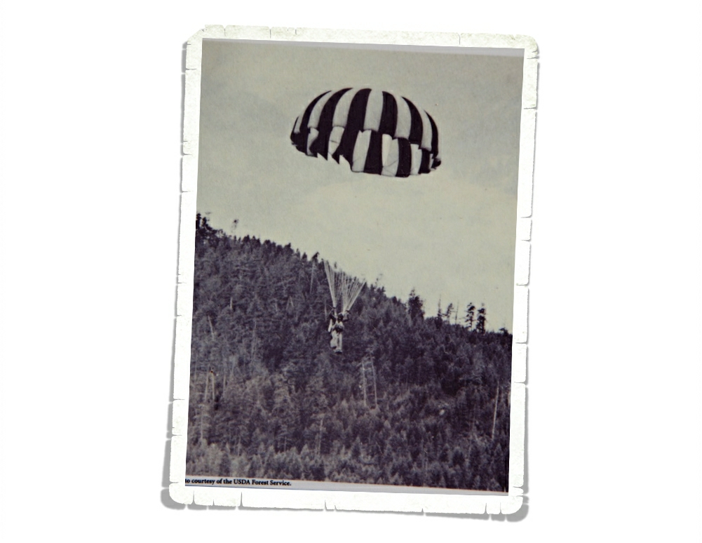
Rescuers raced in to help, but it wasn’t until the morning that they realized the scope of what had happened. Around noon the next day Forest Service Smokejumpers started arriving with rescue gear while helicopters started evacuating people. When it was all said and done…19 people had been buried in the landslide (their bodies were never found)…a total of 28 people lost their lives that night.
Today you can visit Refuge Point and hike down to see the remnants of a few cabins that’s now called Ghost Village.
Some Parks change you…the story of Earthquake Lake will stay with us forever.
We highly recommend visiting Earthquake Lake and learning about the night that changed so much for so many.
In the next post I’ll give you an update on our drive back to Missouri and what our winter plans might look like.
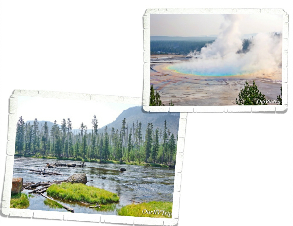
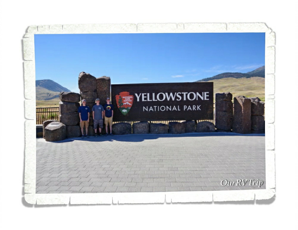
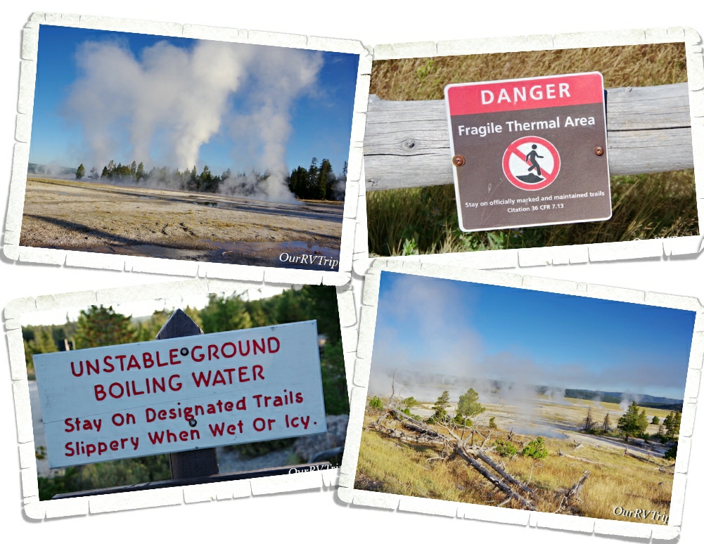
Hey Guys! We spent almost two weeks in West Yellowstone, MT so we could explore Yellowstone National Park. This is a park that everyone seems to compare all other parks to. We were both excited and a little… weary about exploring this park. We don’t have the best track record when it comes to enjoying the super popular parks. We’re not fans of overly crowded areas plus sometimes we’ve heard the hype and built it up so much in our minds that the park doesn’t have a chance to live up to our high expectations.
Yellowstone National Park is not only our Nation’s very first National Park it’s also the world’s very first National Park. When people find out we’re on a National Park Tour there are two parks they always ask about…Yellowstone and Glacier. And they were usually shocked when we told them that we hadn’t been to either park yet but had plans to…eventually.
At the heart of Yellowstone National Park sits the remnants of a supervolcano. This supervolcano last erupted somewhere around 631,000 years ago and now is the power behind all of Yellowstone’s hydrothermal features. You see signs everywhere warning about the fragile crust and the heat of the water. Another words…stick to the trails! Even with all of the signs, we saw people getting off the trails. This not only puts them in danger of falling through the thin crust and getting burned by the boiling water that’s sitting just under the surface of the crust…but it also damages fragile ecosystems that will take years to recover.
We liked to get into the park early in the morning. Not only were we avoiding the major crowds by getting out early, it was also easier to see where all the geysers were. It looked so otherworldly looking out over the land and seeing so many steam columns coming up from the various hydrothermal geysers, hot springs, steam vents and mud pots.
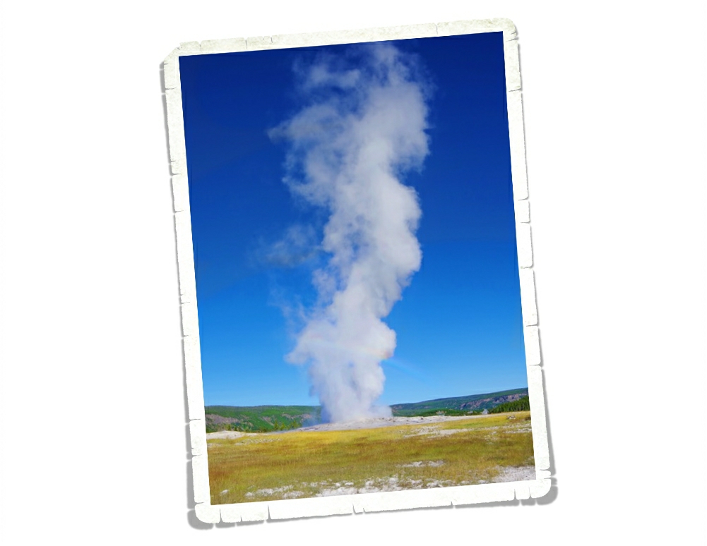
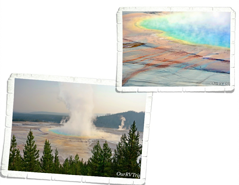
When you ask most people what first comes to mind when they think of Yellowstone National Park, more often than not they’re going to say Old Faithful. We spent almost an hour waiting for the famous geyser to do it’s thing. The park has tons of benches around the viewing area so people can sit and wait. It was…ok. I mean, I’m glad we saw it…but once was enough.
Old Faithful was first documented in 1870 and is one of Yellowstone’s more predictable geysers erupting about every 90 minutes. So, what’s a geyser? Basically, a geyser is a hot spring that has a narrow space somewhere in its “plumbing” system where steam and water will escape as pressure builds up. When pressure reaches a critical temp and the water bubbles harder…the geyser expels water and steam until the pressure in the plumbing has dropped again.
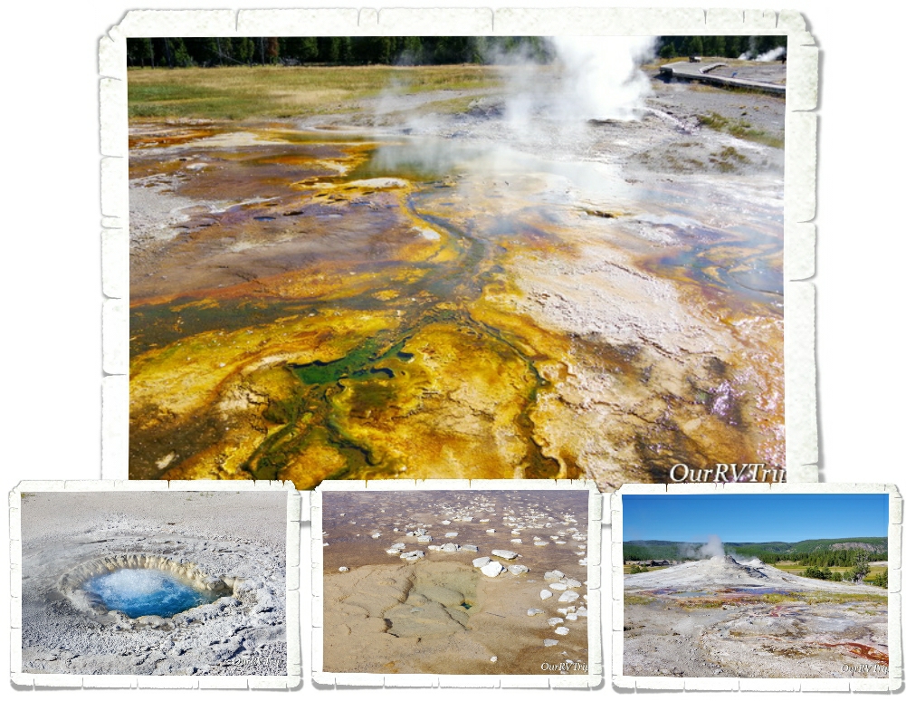
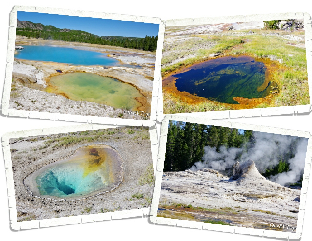
Old Faithful might be the most well known geyser in the Upper Geyser Basin, but it’s definitely not the only one. There are 150 different geysers, hot springs and steam vents found along a boardwalk trail. Honestly, I enjoyed the boardwalk trail more than Old Faithful. But that’s just me.
Even with the whole covid virus thing happening there were still tons of people at Yellowstone during our visit.
So many people. Everywhere.
We were told by one of the volunteers that the NPS had, for some reason, cut the Ranger numbers down to a quarter of what they usually were. I believe it. We hardly ever saw a Ranger out. We did see tons of people treating the park like their own personal playground. We saw someone moving a fence so they could park there. It was crazy.
Yellowstone is home to close to 10,000 hydrothermal features… that’s over half of the total hydrothermal features found worldwide. All of those hydrothermal features are evidence that the Yellowstone volcano is still very much alive and active.
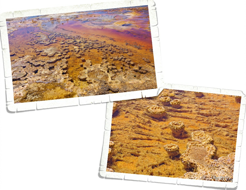
They’re called thermophilic communities. Bacterial microbes from thick structures and mats…communities made of a descendant of an ancient bacterium called Thermocrinis. The colors and shapes of the communities depend on the types of microbes, pH, and temperature of the water. Mats can be as thin as a single piece of paper or as thick as a 600 page book. Cyanobacteria form columns or pedestals. These communities are made up of layers and can be a mix of thermophilic microbes.
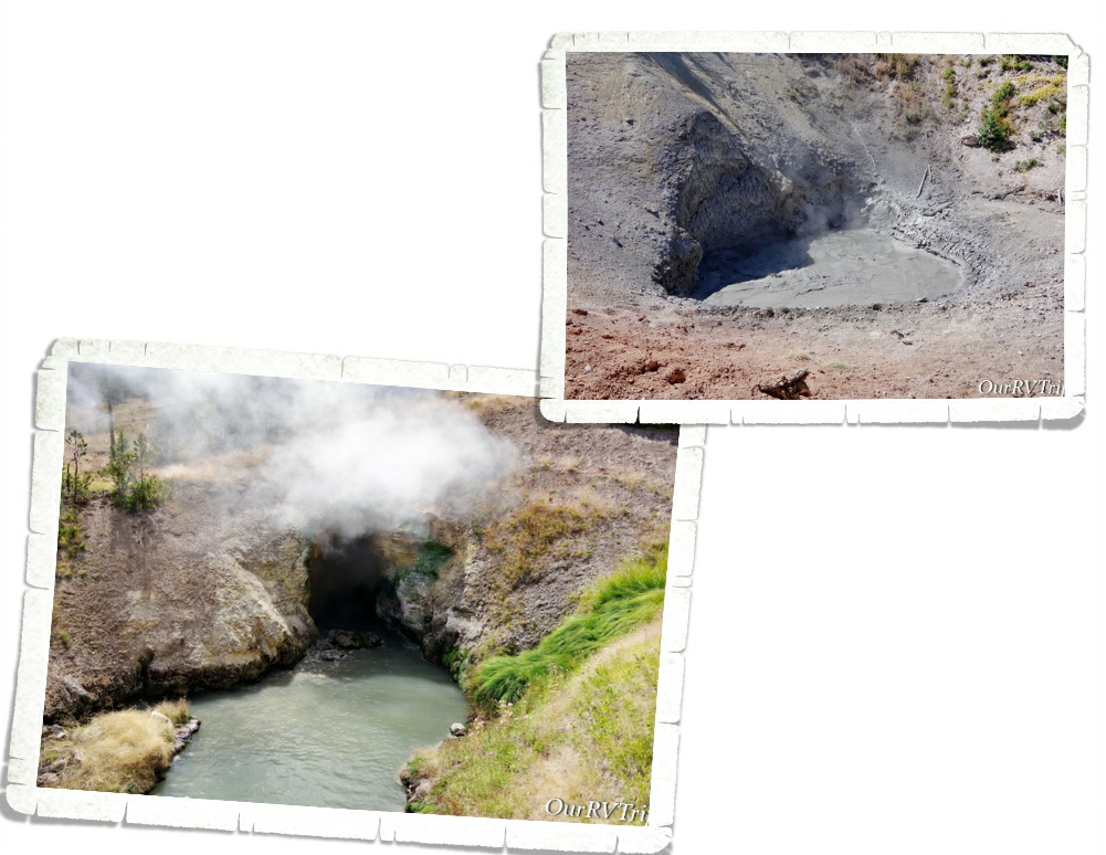
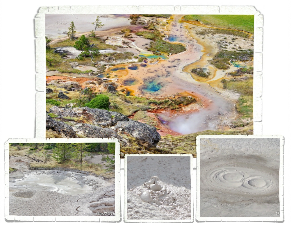
Another hydrothermal feature you can find in Yellowstone National Park is called a mudpot.
A what?
A mudpot is exactly what it sounds like. A bubbling stinky mud pool. A mudpot forms when a hot spring is very acidic and has a limited water supply which causes the rock around it to dissolve into a thick slurry type substance. While I don’t love the smell…I do love the different colors and formations you can find in the area.
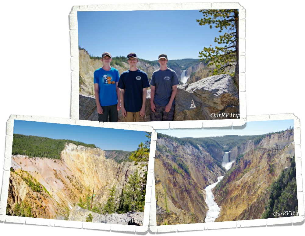
The Grand Canyon section of Yellowstone has several overlooks where you can get a good look at the Upper and Lower falls of the Yellowstone River. I wasn’t expecting canyons like this in Yellowstone. The canyon is just over 20 miles long and has some really pretty colors along the walls of the canyon.
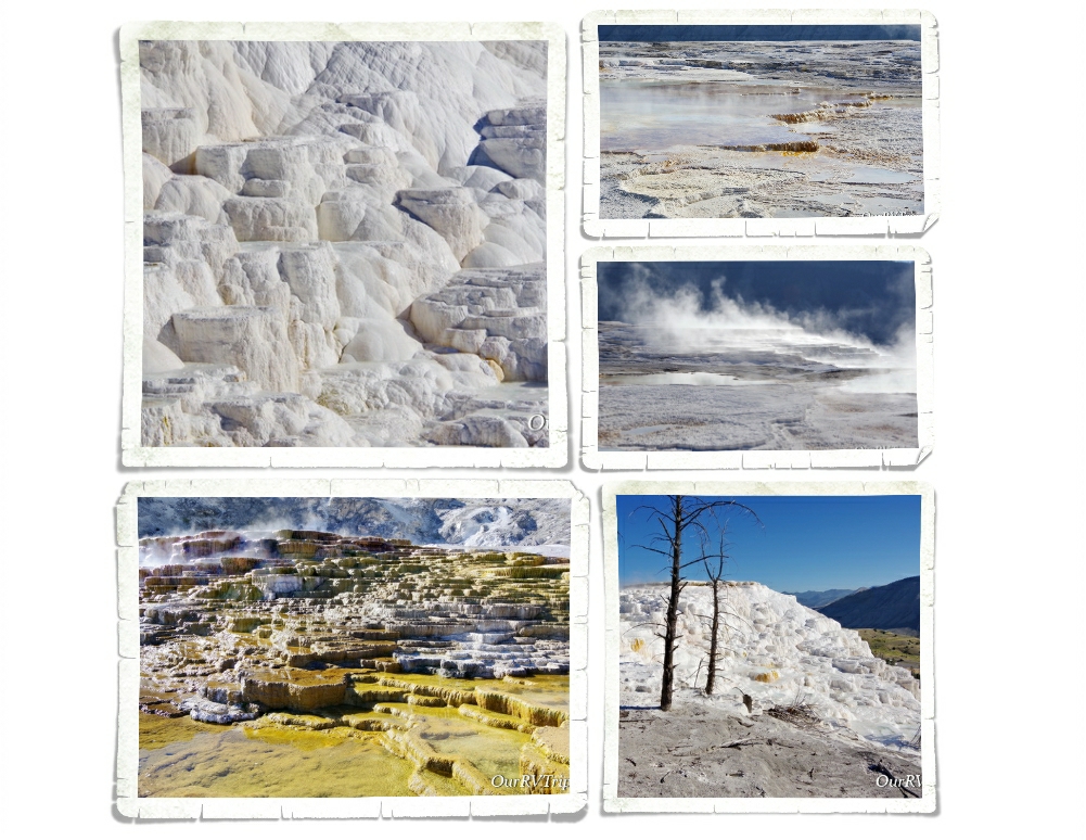
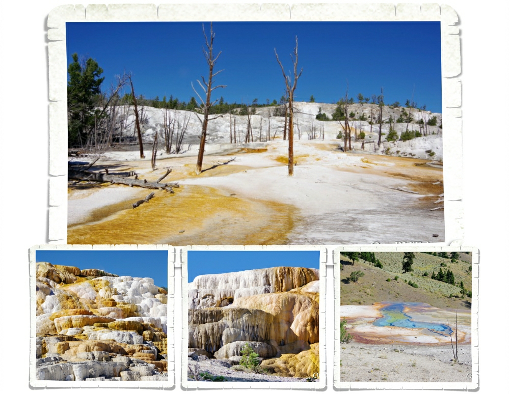
Mammoth Hot Spring Terraces are constantly changing shapes and colors as hot springs go dormant and then suddenly come back to life. Hot water combined with dissolved limestone bubbles up to the surface and over time builds steps and terraces that can be different colors based on the temperature of the water.
We spent a couple of hours exploring the different terraces of Mammoth Hot Springs. We got there early one morning and beat the crowd. I’d read that it’s a popular spot and to get a parking spot you need to get there before 10am. We were finishing up as the crowds started to descend and people were circling the parking lots trying to find a spot.
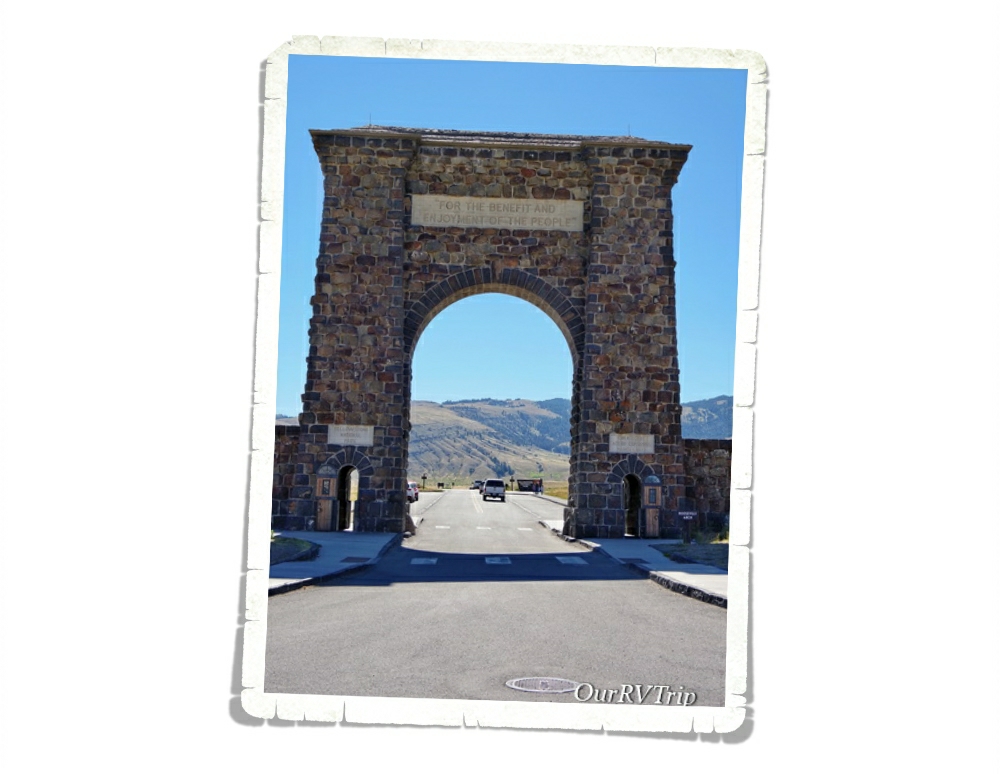
“For the benefit and enjoyment of the people.” President Roosevelt was visiting Yellowstone National Park in 1903 during construction of the north entrance arch and was asked to lay the cornerstone. The arch was then called the Roosevelt Arch. We drove all the way up to the north entrance just to see the Roosevelt Arch. I saw a picture of this arch in a textbook in elementary school and decided I would one day go see it. Seeing the arch in person after having it on my “bucket list” for so many years was amazing. The northern entrance was the first and main entrance into the park.
Yellowstone NP protects over 2.2 million acres of land. To give you some size perspective…that is larger than Delaware and Rhode Island combined. There are five entrances that will get you into the park and get you to the Grand Loop Road which is the way to get around the park. The loop road looks more like a figure eight and is about 142 miles long. We did it in two very full days. On day one we did the bottom half and then the next day we did the top half.
The main loop road might only be142 miles long but there are 300 miles of paved roads in the park that will take you off the beaten path.
If Old Faithful is the first thing people think of when you mention Yellowstone, Grand Prismatic is the second. This is what I really wanted to see. We tried to see it three times while we were in the park, but never made it there before the crush of people. Our last day in the park we went super early to beat the crowds…but…it was smoky from nearby wildfires and it was cold, so steam blocked most of the view. I really wanted to see those bright vibrant colors…but I have to admit, I’m not mad at the softer pastel morning lighting that we got.
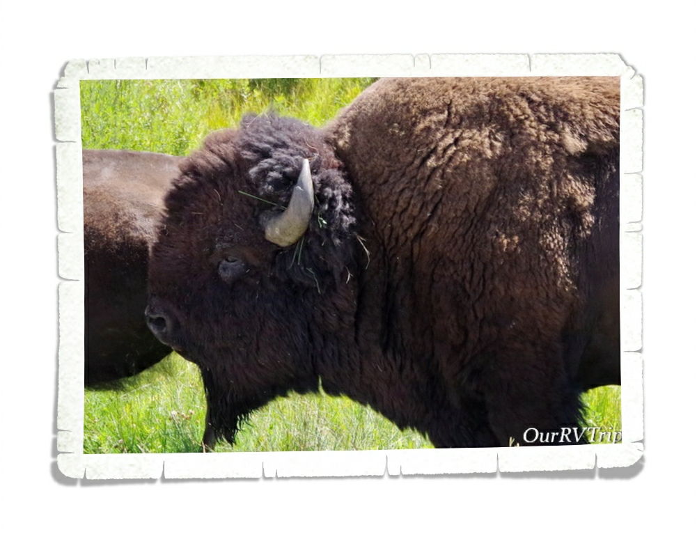
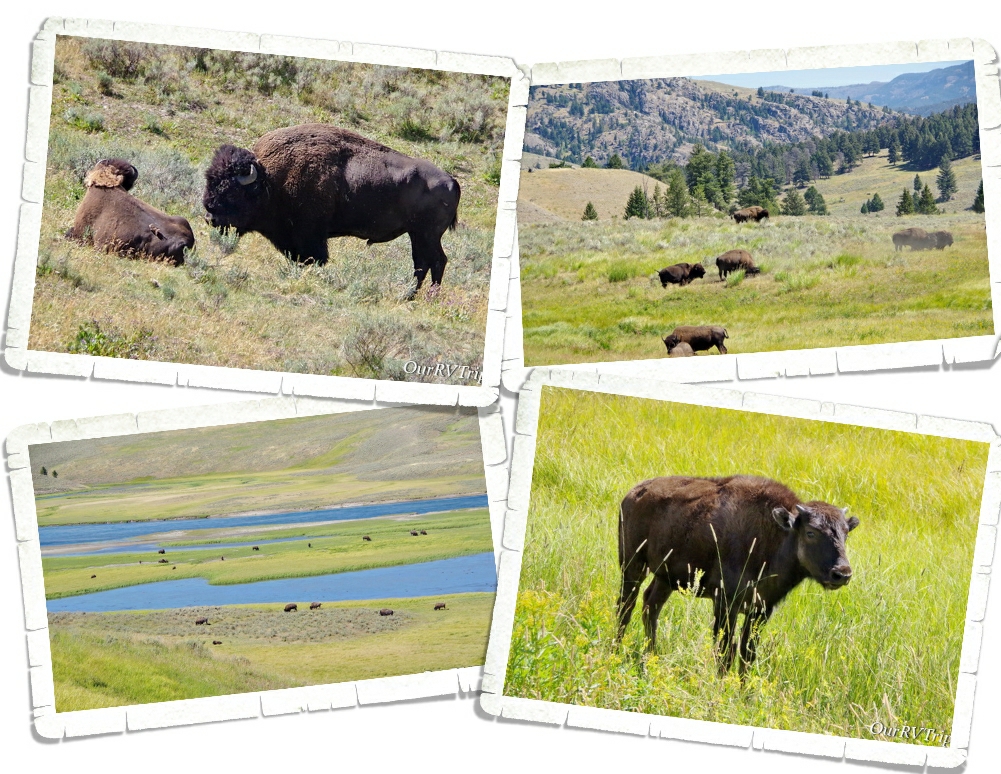
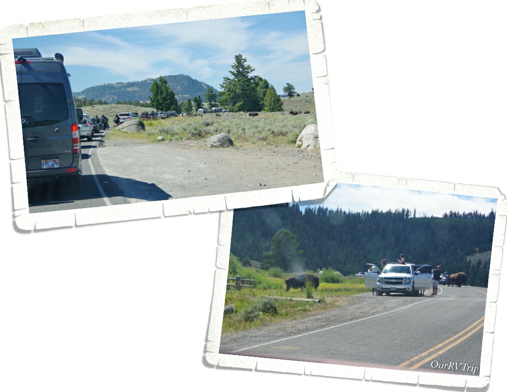
We drove to both Lamar and Hayden Valleys to see the bison herds. Yellowstone NP is the only place in the United States where bison have continuously lived since prehistoric times. The herds here are the largest found on public lands. We saw so many bison and they pretty much go wherever they want to go…whenever they want to. We got to Yellowstone right as bison rut was starting. The bison bulls were pretty aggressive with each other and anyone else they felt might get in their way or challenge them. Including cars on the road. One bison charged a car and busted a tire. I guess he was tired of the paparazzi taking pictures. ;-p
Bison and elk roadblocks were a frequent thing. We also saw tourons trying to get killed by two ton bison bulls as they were taking pictures of it. I can’t believe we didn’t see anyone get hurt. It was close a few times though.
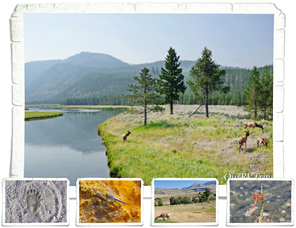
We saw tons of bison, loads of elk…pronghorn antelope, dragonflies galore…but no wolves or bears. We did see a bear print on a hike…but no actual bears.
We enjoyed our time in Yellowstone National Park. I’m not sure it made our top ten list. I mean…Yellowstone is definitely the most colorful and smelliest NP we’ve been to…but Guys, you can only look at so many geysers and hot springs before they kind of all start looking the same. I hate to say that…but I like to keep it real with y’all. While we totally appreciate the history of Yellowstone National Park and love the history/story this park is preserving…we probably won’t go back any time soon.
Our Yellowstone visit was cut short by two days when Jerl’s retina detached in his right eye. If you’ve been with us for a while, you’ll know that he’s had two other detachments (both in his left eye) so… we knew what to expect and headed back to Missouri three weeks before schedule. I’ll tell you more about that in the next post.
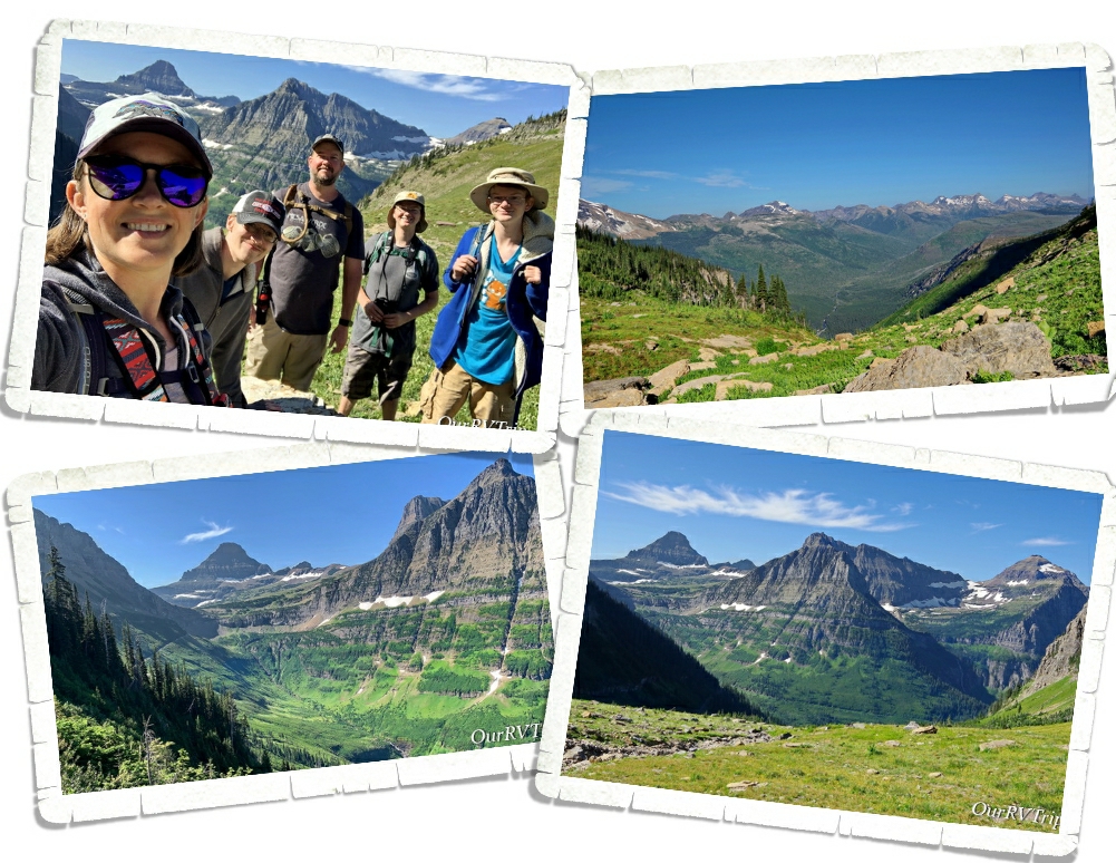
Hey Guys!! We spent two weeks in West Glacier so we could explore Glacier National Park!
Confession: We didn’t want to like Glacier National Park.
It’s true. For years, we’ve heard so many people say how awesome Glacier NP is. We heard the same things about a couple of other parks that are wildly popular and…well…we’re not too fond of those particular parks. So, when we headed to Glacier, we’d already made up our minds (but tried to stay hopeful) that Glacier was going to be another dud for us. I should tell you here…the entire east side of the park (according to most, the east side is the best side) was closed so that also factored into our feelings that this park was going to be a miss for us.
And honestly, after the first day…we thought maybe we’d been right…that Glacier was a dud for us. Our first day was filled with super grumpy Rangers, so many people we felt like canned sardines, and some pretty spectacular views.
We also saw an alarming number of tourons (tourist+moron) trying to get selfies with wildlife. Guys, don’t be a touron. Just don’t. It’s not cool…wild animals don’t like it…and Ranger’s will have to step in and try to save your life while putting their lives in danger. Please remember to stay 100 yards from bears and wolves and 25 yards from all other wild animals.
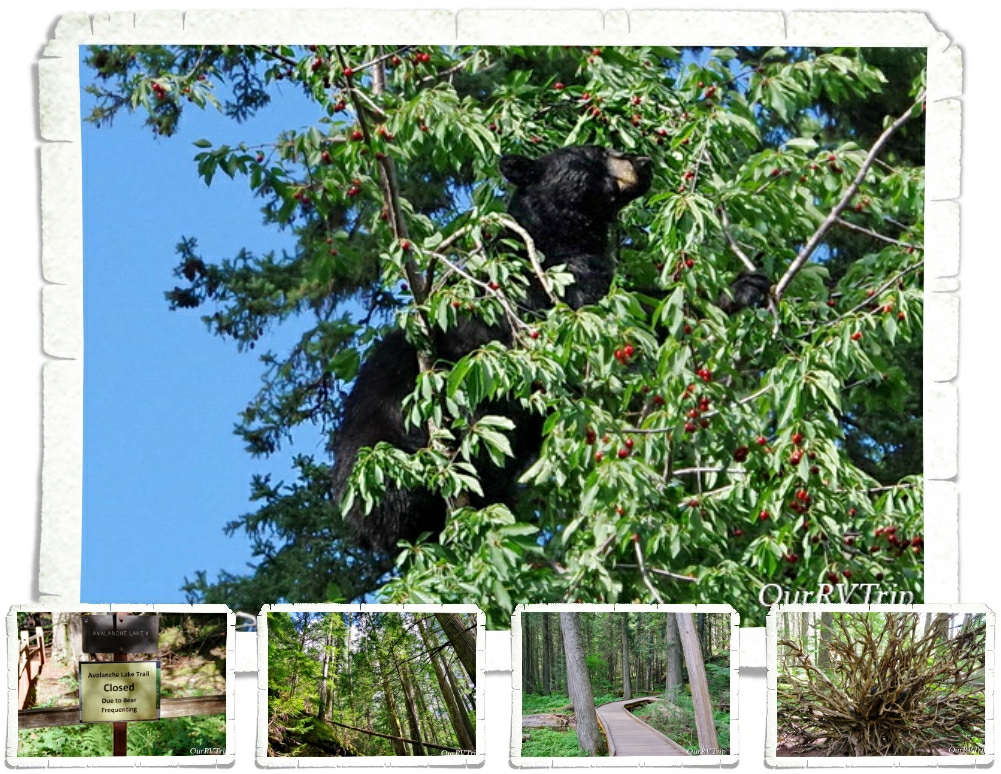
The next time we went into the park we decided to head out to Kintla Lake to hopefully get away from the crush of people. We had a relaxing day at the lake with about twenty other people. We just about had the place to ourselves. The boys spent about an hour or so floating around in the glacier fed lake before we headed to Bowman Lake to check it out. Bowman was super crowded so we walked to the edge, got a look, then left. On the way out to the main road we got our first glimpse of a black bear in Glacier NP. It was off the side of the road, up the hill, gorging on berries. He knew we were there (there was a group of us), but couldn’t have cared less. He was more interested in the fresh berry bushes.
The next day, we drove Going To The Sun Road and stopped at all of the stops we could find a parking space. It was ridiculously busy but, we found a spot at a few key pull-offs.
When Glacier National Park was established in 1910 there were over 100 glaciers within the park boundaries. Today, there are 25 active glaciers. So, what makes a glacier a glacier? A glacier forms when an area of snow doesn’t melt over the summer then accumulates layers of snow over the years. Eventually, the bottom layers will compress under the weight of snow and turn to ice. The weight of the snow mass along with some of the yearly melt will cause the bottom layers of ice to become flexible and slick and the snow mass will start to move downhill…becoming a glacier. A glacier has to have enough mass to “flow” downhill under gravity due to it’s own weight.
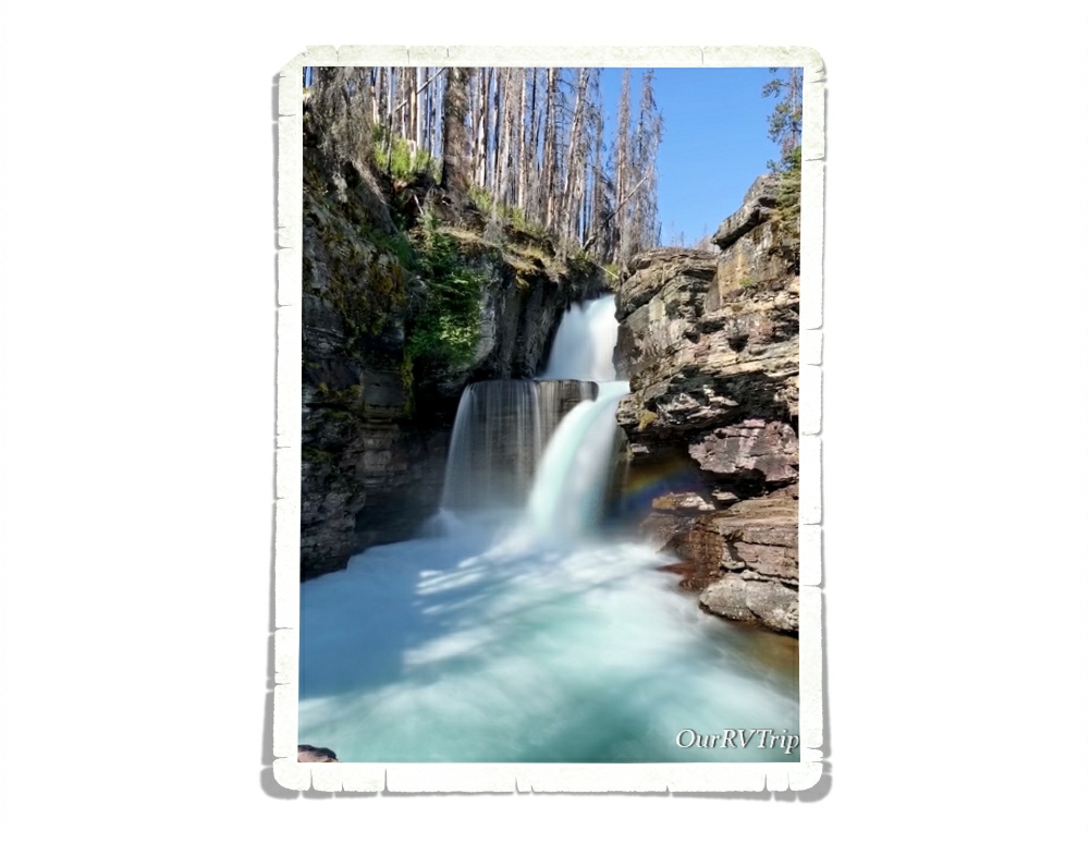
Most of the trail-heads we wanted to stop at were full by 9am so we found ourselves pulling into any pull-off that had an available spot. That’s how we ended up at the St. Mary Falls trail. We hadn’t planned on doing this hike, but we were there and y’all know I love a good waterfall. We were checking out the trail-head sign when we met a couple of ladies just finishing up so we talked to them about the trail and if it was worth the mileage with the 90°+ temps. You can see in the picture above that there had been a fire and all of the trees for most of the trail were burned which means…no shade. The ladies who were finishing up insured us that it was worth it so…we headed down our first trail in Glacier NP.
We made it to St. Mary Falls (in the pic above) without any trouble and decided to head on to Virginia Falls. We saw so many small waterfalls along the trail! It was kind of amazing… Now, having said that, y’all know I like to keep it real for you…a couple of us really struggled on the way back to the car. It was right in the heat of the day, it was 93°, there was zero shade or cloud cover and there was a pretty good incline we had to make it up to get back to the car. We had taken our water and we were all wearing hats, but the heat just zapped us. If we were to do this hike again, we would be on the trail by 7am if not earlier to escape the heat of the day. It was a great trail, and I would highly recommend it…just be prepared for the heat and the lack of shade. But Guys, look at the color of that water!! We decided after this hike that maybe…just maybe…Glacier NP was going to be ok.
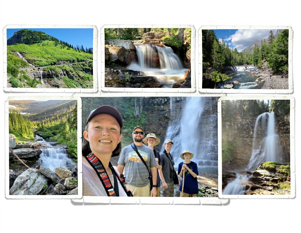
Speaking of waterfalls… Oh. My. Goodness!! There were so many waterfalls!!
So. Many!
Glacier National Park has a whopping 200 waterfalls scattered throughout the park. You’ll see everything from a trickle making its way down the side of a cliff to a full out gushing beauty. I think I might have taken more pictures of waterfalls than anything else in this park.
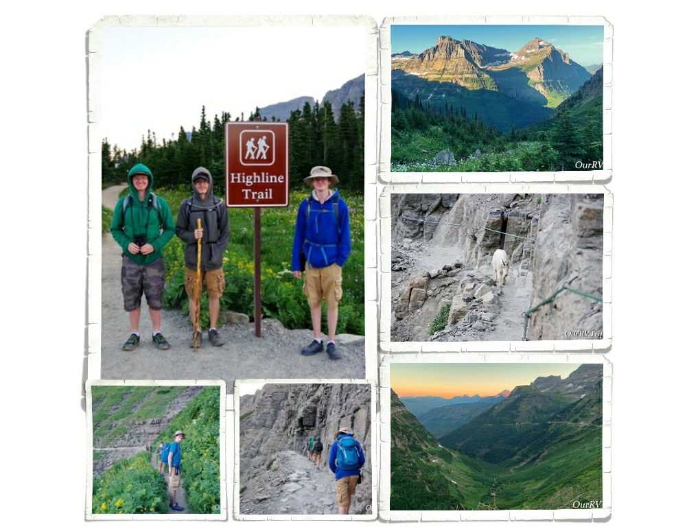
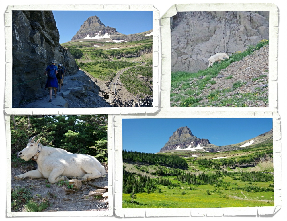
The big trail I wanted to get in while we were there was the Highline Trail. The Highline Trail is said to be the one trail in Glacier that you have to do. You start at the Logan Pass Visitor Center. We learned from our friends at the St. Mary Falls trailhead that if we wanted to get a parking spot at Logan Pass, we would need to be there by 7am at the latest. So, we got there at 6am and scored a spot. I wanted to start this trial early because the temps were still brutal and the only shade on this trail is provided by the shadow of the mountain. Starting mid-day, there’s zero shade and I’d made that mistake once…I wasn’t going to do that again.
The Highline Trail begins on the Continental Divide where you follow it for a while. This section of the trail is known as the “Garden Wall” and is roughly 100 feet or more above the Going to the Sun Road which means you get some amazing views right from the beginning of the trail. We started our trek as the sky was starting to lighten up with temps in the high 30s. We froze, but none of us complained. We prefer to hike in the cold rather in the sweltering heat.
About a quarter mile or so from the trail-head you get to the part of the trail that gives anyone with a height issue some problems. In some places along this portion of the trail, the trail is only about four to six feet wide with steep drop-offs on one side. The park has installed a cable for people to use. I noticed a couple of us holding pretty tightly to that cable…this part of the trail seemed pretty tame to me after hiking Angel’s Landing in Zion last year. Until, we met up with a mountain goat. He was coming at us down the narrow trail, but seemed totally unfazed by our presence. He politely got off the trail when he got to us and perched precariously on some rocks along the steep drop-off while we scurried by him.
Remember all of those waterfalls I told you about? Well, you get to hike through the tops of several of them while on the Highline Trail. Between the morning dew and the slick wet rocks and the mud…well, I had a few little moments of panic while going through the waterfalls. None of them were deep. We were all wearing regular hiking shoes and none of us got wet feet or anything, but every time we would walk through one of the waterfalls, I would look down, down, down, and down to how far we would slide if we happened to slip right then. There wasn’t a ledge to catch yourself. This aspect of the trail is the only part that would give me pause about doing it again. But let’s be honest, I’d still do it again…some moments of panic are worth it.
I’ll also confess to you that I did slip and fall on some mud. It wasn’t on a waterfall crossing (thank goodness) but it was in front of several people and on some slippery rocks. It happened so fast I didn’t even know it was happening until I was on the ground with a sharp rock trying to wedge itself somewhere I’d prefer it not be. I had a humongo bruise that lasted three weeks and I messed up my forearm from landing on it (that only lasted a couple of days). Honestly, I think my ego was hurt worse than my body, but it did make me slow down when walking over those slick rock areas and hesitate even more before walking over a waterfall crossing.
We had planned on only going about two or three miles into the hike then turning around. The entire hike is anywhere between 13 and 30 miles depending on how far you go and any trails you take off on that meet up with the Highline Trail. When we got to the two mile point none of us were ready to turn back. When we made it to three miles we could see the switch backs up to the pass and decided to push on to get to the view so, we ended up hiking up to the Haystack Pass. Haystack Pass sits at an elevation of 7,024 feet and has plenty of great rocks to sit on and have a snack.
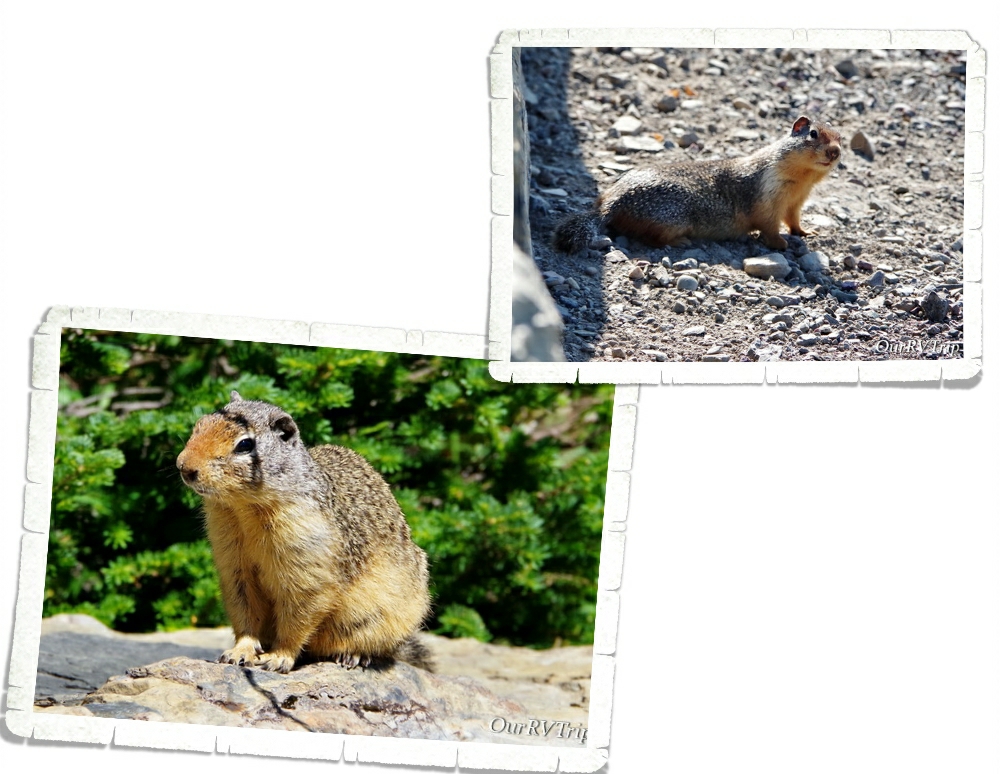
While three of us decided to hangout at Haystack Pass and watch all of the Colombian Ground Squirrels scurry around (there were so many), two of us headed on down the trail for another half mile or so just to see what they could see. Alex took this picture when he and Jerl explored a bit farther down the trail. We spent about an hour hanging out at the pass before making our way back to Logan Pass.
On our trek back to the trail-head, the crowds started to show up and we had to stop several times to let people pass on the narrow trail. We ended up seeing four different mountain goats and met back up with our mountain goat friend from the morning. He had taken up a spot right by the trail and was posing for all of the paparazzi snapping photos of him.
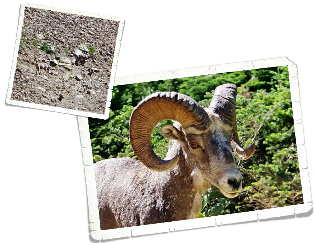
We also spotted some longhorn sheep. We saw a group of them way up on the hillside chilling out, avoiding the people…but one was romping around right by the trail and seemed a little panicky. He busted out of the trees onto the trail right as I was walking up and we sized each other up for a minute before I started yelling for Jerl and the sheep took off. Ha! I’m not sure which of us (me or the sheep) was more startled to see the other.
We had a great morning on the Highline Trail! We’ve decided it’s on our list of top five hikes and we all agree we would do it again. Between the views and the wildlife, I can see why this trail is so popular.
A couple of the trails we wanted to do were closed due to bear activity. We heard a couple of stories about bears and mauling and stealing backpacks… If you visit Glacier NP make sure you are prepared for bears. Educate yourselves and be bear aware.
OK…let’s talk pretties. I know y’all are here for the pictures of flowers and Glacier National Park did not disappoint. Most of these pictures are from the Highline Trail. I was in flower heaven the entire hike!
And…the foodies! We had our first huckleberry pie and it was pretty darn good! You can find huckleberry flavored everything in the Glacier area and yes, we totally had to try as much as we could. Our faves were the pie, ice cream, and preserves. We also found a great burger place called Mudman and a really tasty Mexican food truck called The Wandering Gringo that we ate at twice!
I guess Glacier National Park is called “Crown of the Continent” for a reason. We had our doubts, but in the end…the park won us over and easily earned a spot on our top ten list. We will definitely go back to explore the east side.
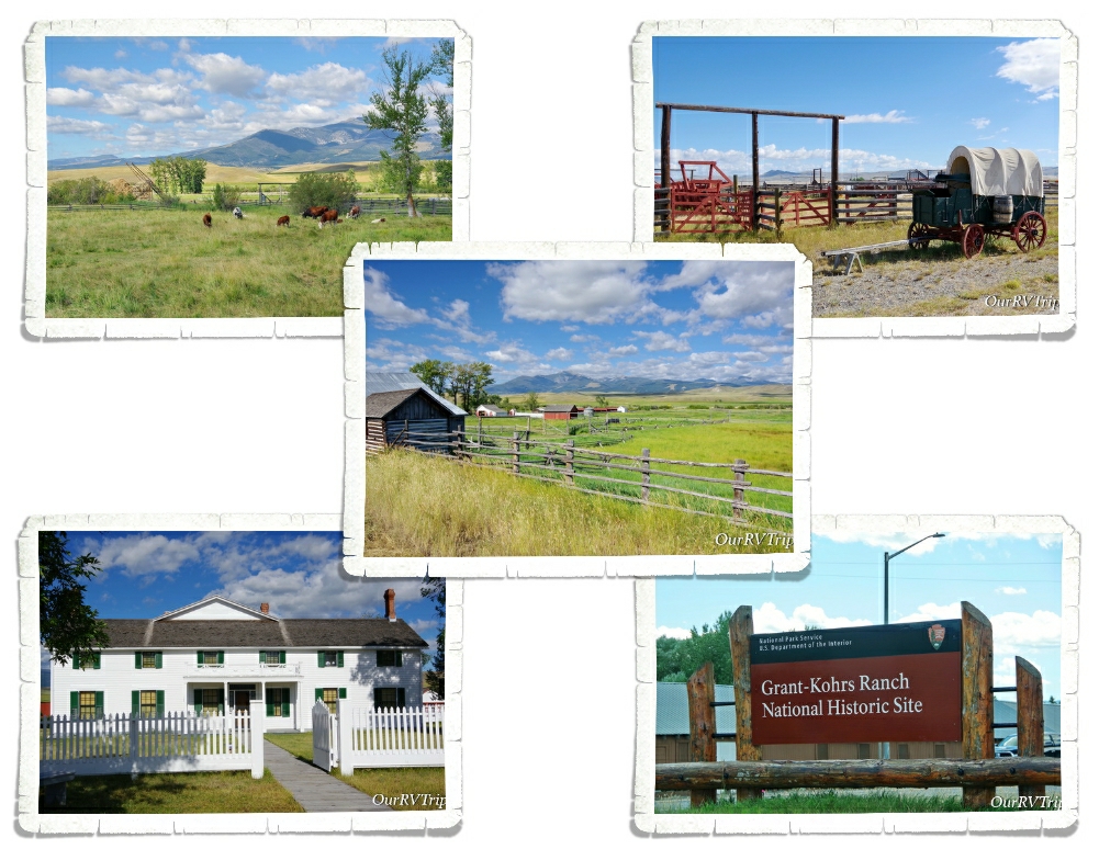
Bonus Park! We had two days to kill in between our Glacier reservations and our Yellowstone reservations so we stayed in Deer Lodge, MT for two nights just to see the Grant-Kohrs Ranch National Historic Site.
Grant-Kohrs Ranch was once the headquarters of a 10 million acre cattle empire. Today, this National Historic Site preserves the history and memory of two of the biggest symbols of the American West…the cowboy with his vast herds of cattle out on the open range. Grant-Kohrs Ranch was founded in 1862 by John Grant, a Canadian fur trader, and then expanded by a cattle baron named Conrad Kohrs. Dwindling bison herds and the growth of eastern cities led to a demand for beef.
Returning Civil War soldiers came back to Texas to find millions of unbranded cattle roaming around. There was too many cows in Texas which made the price of cattle go down to $2 a piece but the quickly growing cities in the north would buy a cow for $30. Nelson Story and his group of twenty-five cowboys made the first cattle drive from the open lands in Texas up to the rich grazing ranges of Montana in 1866.
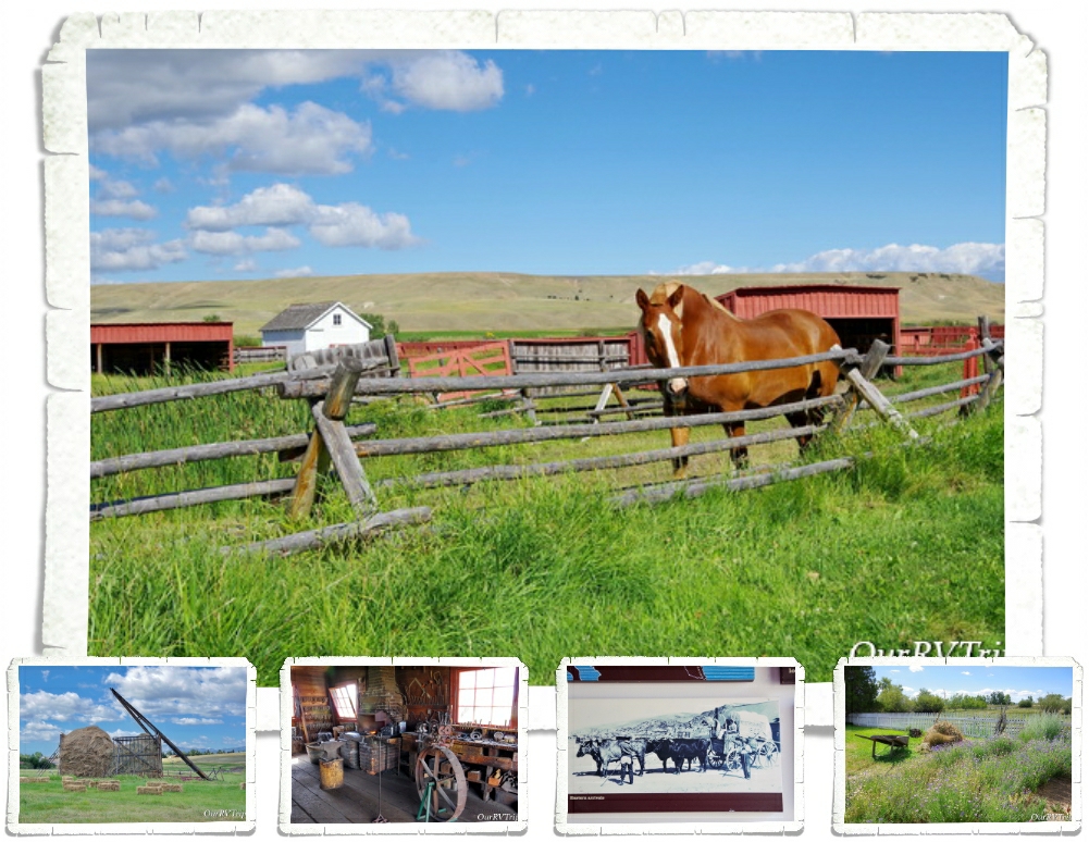
By 1885, cattle was the most lucrative industry on the High Plains but, it only lasted for three decades. Between a couple of extremely harsh winters and the Homesteaders Act that split up the open range into 160 acre barb-wired plots, the big cattle barons had to find a different way. Grant-Kohrs Ranch NHS helps preserve and tell the story of the Open Range Era. Today, it’s still a working ranch and you can see some cows, horses, chickens, and learn about a chapter of America’s history.
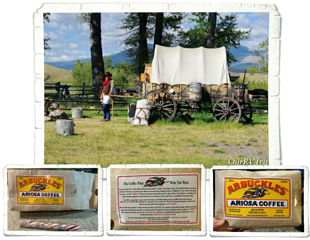
We learned a lot about cowboys and their life on the range. Most cowboys were teenagers who were willing to work long hard days and nights for very little pay. Chuck-wagons like the one above was home for cowboys out on the range. One of these wagons could carry enough food and supplies for ten to fifteen cowboys to live on the range for one month. The chuck wagon was where the cowboys would gather for food, sleep, and companionship.
One of the most memorable things we were able to do while exploring Grant-Kohrs Ranch was try Cowboy Coffee. The volunteer at the Chuck Wagon made up a pot of it the same way the cooks would have made it out on the range. The cooks would get the coffee in the same packages you can see above. Since the coffee came in whole beans, the cook would always ask for a volunteer to grind it all and he never had to ask twice. The cowboy who volunteered to grind up the coffee beans got to keep the sweet surprise hidden in the coffee package…a stick of peppermint. They sell packages of the coffee in the visitor center at the park. It’s from the same company that sold it to the Chuck Wagon cooks way back then for life on the range.
“Cowboys are smaller and less muscular than wielders of ax or pick, but they are as hardy and self-reliant as any man who ever breathed — with bronze, set faces, and keen eyes that look all the world straight in the face without flinching as they flash out from under their broad-brimmed hats. Peril and hardship and years of long toil, broken by weeks of dissipation, draw haggard lines across their eager faces, but never dim their reckless eyes, nor break their bearing of defiant self-confidence…” ~Theordore Roosevelt, 1888
Hey Guys! We spent one week in the Dillon, MT area as we were making our way up to Glacier National Park. This stop was basically just a big hopping point between Ketchum and West Glacier, but I chose it specifically so we could visit Big Hole National Battlefield and Bannack State Park. I figured…we might as well make the best of the week, right? Let’s stop someplace where we can continue our National Park Tour.
Every single National Park Unit tells a story. Battlefield stories are usually hard to hear, but I feel like they need to be remembered. History should never be forgotten…our history reminds us of how far we’ve come and how far we could fall if we make the same mistakes. Learning our history…all of our history…not just the history that’s pretty or makes us feel good… helps keep us from making those same mistakes again. We’ve learned. We’ve grown. Let’s not forget it.
Every story has two point of views. We’ve found that the National Park System is excellent at portraying both sides of the story equally and without prejudices. Our school system could learn a thing or two from the National Park System about teaching the true history of our country.
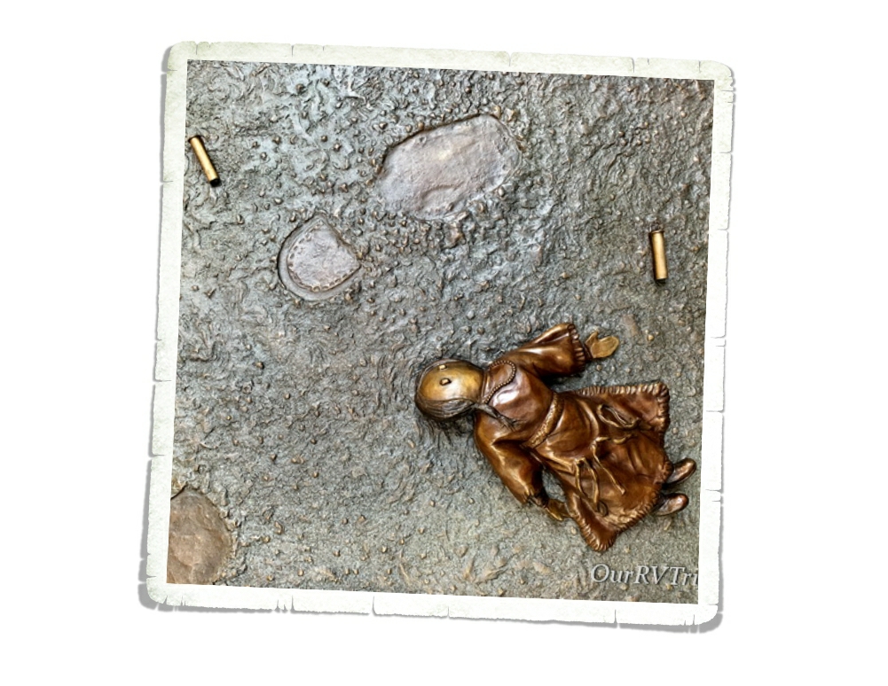
Like so many battlefields, Big Hole National Battlefield is considered a sacred place…a place where blood was spilled and life was extinguished. This National Park Unit tells of the battle between the Nez Perce (nimí•pu) and US Army troops. But really, it’s the story of the Nez Perce’s struggle to survive. The Nez Perce can trace their heritage and their life on the land back 9,000 years. They were one of the biggest tribes in the US with around thirteen million acres of land spanning across what is now Idaho, Montana, Oregon, Washington and up into Canada. As the US struggled to find it’s footing as a new nation, the Nez Perce lost most of their land and conflicts began to occur.
In 1855 the US government proposed a treaty. The Nez Perce would give up over half of their traditional lands to the growing US nation but they would still keep the right to hunt, fish, and gather on those lands. Everything seemed to work for five years, but then gold was found which led to an influx of over 15,000 miners and settlers and once again conflicts started to occur.
In 1863 the US government met with all of the leaders of the different Nez Perce bands to try and come to an agreement that would cut the Nez Perce lands by another ninety percent and the Nez Perce would go live on specified land reservations. During the meetings the leaders of five bands were so disgusted by what they were hearing, they got up and left the meetings. The meetings didn’t stop though. They continued with the leaders who stayed and in the end the leaders who stayed agreed to the treaty because it didn’t affect their bands as much. Those leaders signed the treaty for all Nez Perce…even the bands who had left the meetings. The bands who left refused to acknowledge the new treaty and would become known as the non-treaty Nez Perce.
The US government gave the non-treaty Nez Perce thirty days to move onto the reservation or they would be put there by force. The Nez Perce had lived on this land for thousands of years and didn’t see what gave the US government the authority to tell them where they should and shouldn’t live. In the end, the non-treaty Nez Perce gave in and started the long process of gathering all of their things and livestock to make the journey to the reservations. Before they could reach their destination though, conflict and fighting broke out as they were going through land that had once been theirs, but had since been claimed by settlers. This started the the long chain of events that would be known as the Nez Perce War.
On August 7, 1877 around 800 non-treaty Nez Perce made their way to a place they knew well from past buffalo hunts. They called it The Place of the Buffalo Calf (Iskumtselalik Pah). They knew there would be fresh water, a big field for their horses to graze and the nearby forest would provide trees for the tipi poles. They had been relentlessly pursued… fighting and fleeing for several long weeks and they were all weary and worn. The leaders of the five non-treaty Nez Perce bands believed that by moving across the Idaho border into Montana that they would leave the war behind.
The next day, August 8, they spent the day setting up camp. Eighty-nine tipis were set up throughout the field. They spent the day hunting and gathering food and water, looking after their tired horse herds (close to 2,000 horses), and planning the next step.
In the early morning on August 9, a Nez Perce elder went down to the river to check on some horses. What he didn’t know, was that during the night the US Army, led by Colonel Gibbon, had caught up with them and was positioned for an ambush at the river front. What happened next was pure chaos. One of the military volunteers got itchy and shot the elder. The Nez Perce woke to gunshots and screams. At one point soldiers started setting fires to tipis with women and children hiding in them.
I should point out that this particular unit of the US Army had just come from Little Bighorn where they saw what was left of Custer and his unit (not much). They were worked up and scared for their lives. Most of this unit was new to fighting. I don’t think you can ever really justify the brutality of what they did though.
When it was over, 90 Nez Perce and 30 military/civilian volunteers had been killed. The US Army had expected the Nez Perce to be surprised and to quickly surrender, but that’s not what happened. The Nez Perce fought back to protect their families and pushed the military back across the river and up the bank. The military retreated and dug shallow rifle pits to hole up in. Several Nez Perce volunteered as sharp shooters to hold the US military troop pinned down so their families could quickly do what they could for their dead and then flee.
After the sharp shooters left, the unwounded soldiers did their best to help the injured. There wasn’t a doctor and they really weren’t sure if the Nez Perce would come back or not. With no medical supplies, equipment, clothing, or food Colonel Gibbon decided to camp where they were until reinforcements could arrive.
This was just one battle in the Nez Perce War. From Big Hole, the Nez Perce eventually made their way up to the Canadian border where some of them crossed over and continued to fight and some chose to stay and surrender. It had be a long hard journey stretching over 126 days and close to 1200 miles that spanned over 4 different states. Today, the Nez Perce visit the Big Hole Battlefield to honor the memories of those who were killed on August 9 and 10 of 1877.
We only spent a few hours at Big Hole Battlefield, but what we learned will stay with us for the rest of our lives. We remember and we honor all those who fell.
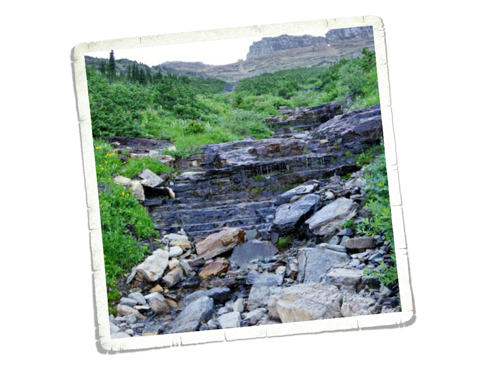
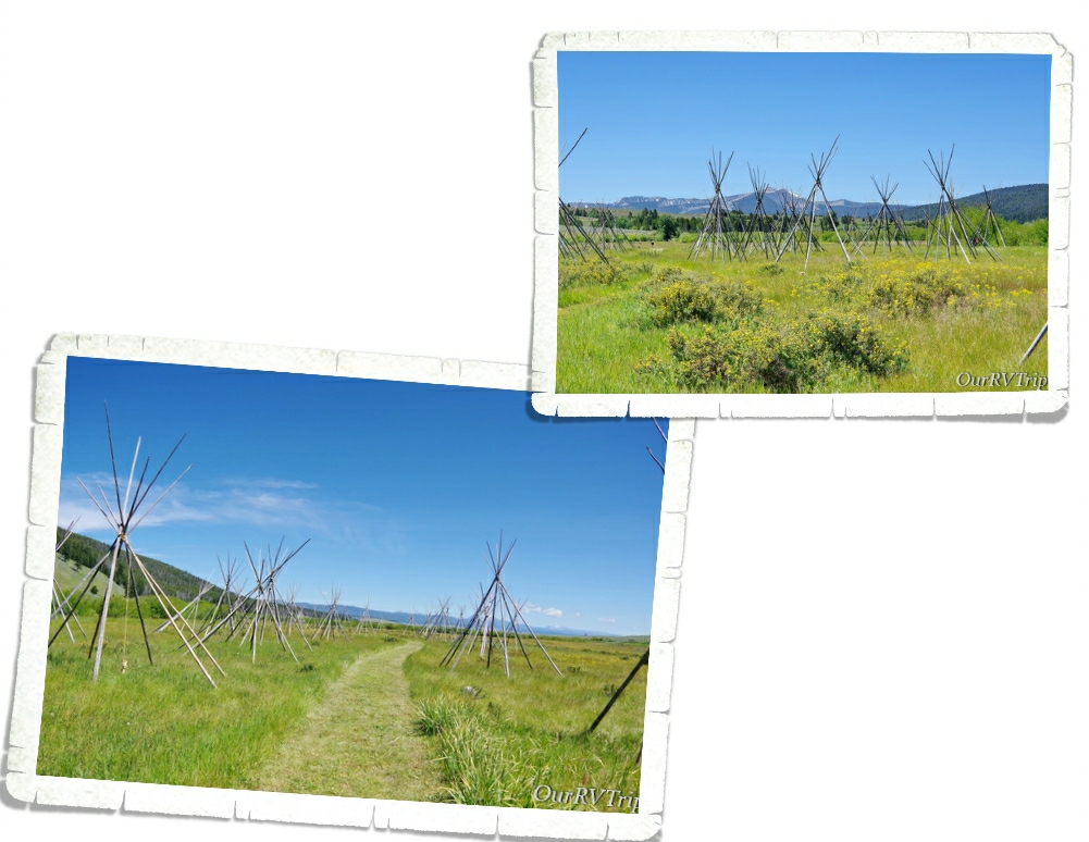
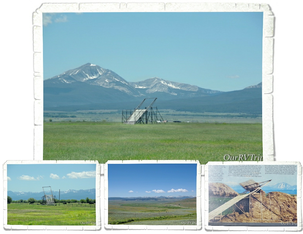
On the way to Big Horn Battlefield, we kept seeing these unusual structures out in the fields. Being the inquisitive nerds we are…when we got to the National Park unit, we asked a Ranger if she knew what they were. Luckily, she knew exactly what we were trying to describe. Which…look at that structure, how would you describe it?
They’re called beaverslides. Yup, you read that right. A beaverslide is a hay stacker. Invented by two ranchers in the Big Hole Valley in 1910, the ranchers of this valley used them to stack hay up to 35 feet high and contain close to 20 tons of hay so they could feed their cattle from it all winter. There was a time when the Big Hole Valley was known as the Valley of 10,000 Hay Stacks. Most ranchers in the valley have switched to more modern methods, but there are still a few who are using the beaverslides.
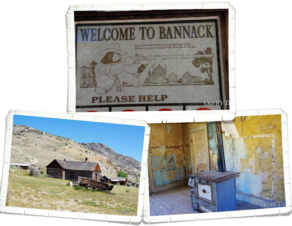
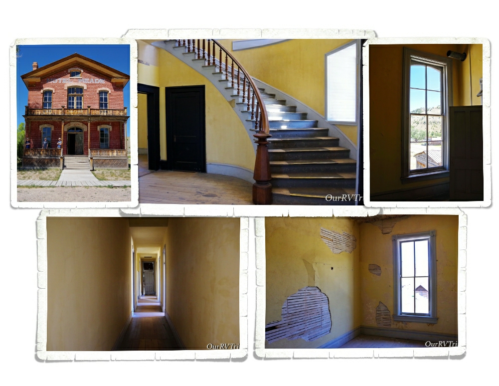
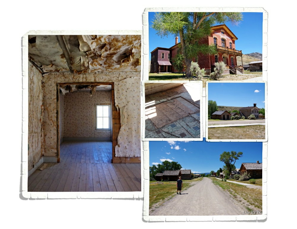
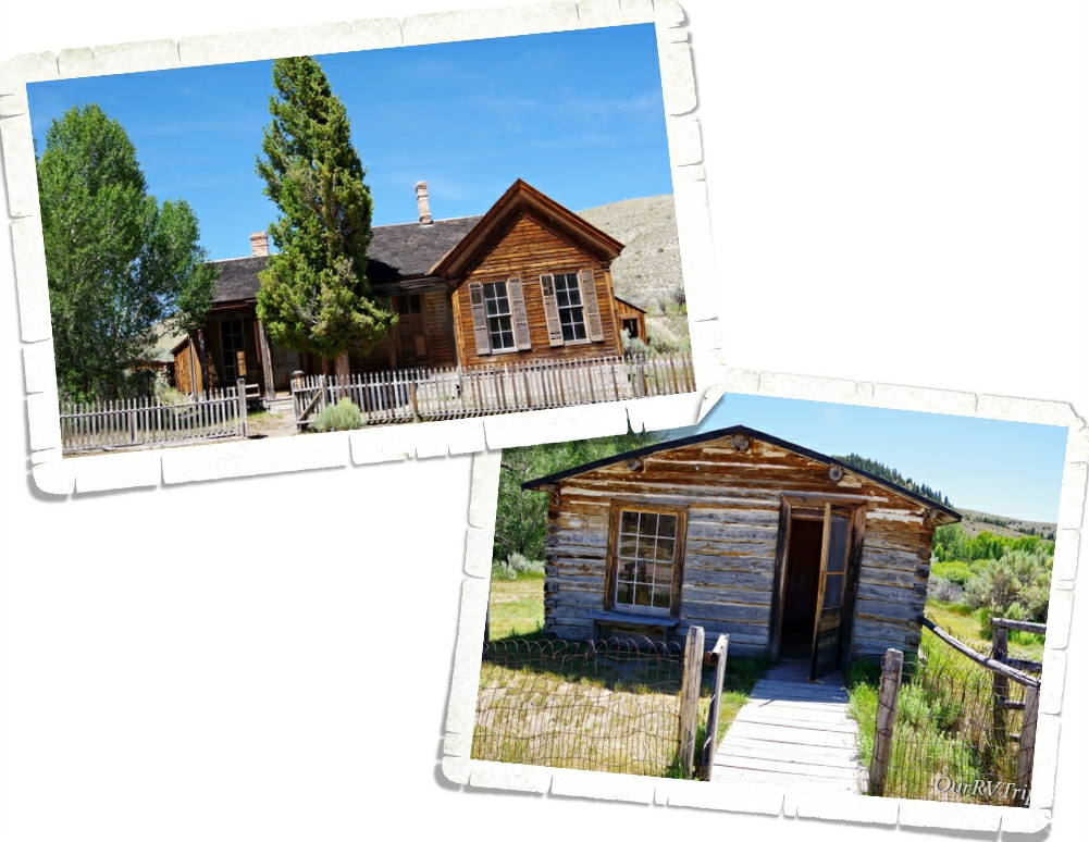
The other place we wanted to explore while in the Dillon area was Bannack State Park. Bannack is said to be one of the best preserved ghost towns in the US. We’ve been to our fair share of ghost towns and I have to agree. Bannack is the best we’ve seen.
One of the best things about this ghost town is that you actually get to go into the buildings. And I don’t mean go in and look through some plexiglass at a few decorated rooms…nope…you can actually go in and explore. The Hotel Meade was one of our favorite buildings to go through. We were able to go through the rooms downstairs and then venture upstairs to see most of the actual rooms that guests stayed in. They’ve been left alone, but preserved…if that makes sense. Montana Fish and Wildlife oversees Bannack and has done an excellent job of keeping the buildings authentic but as safe as possible. Quite a few buildings had a sign at the entrance that warned people to enter at their own risk. They are old buildings…
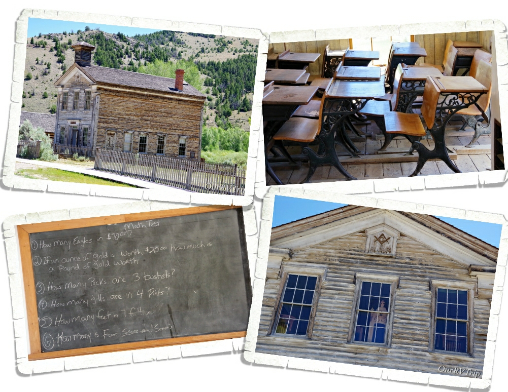
This building, built in 1874, served as both a school and the Masonic Lodge. The first floor was used as a public school for grades K-8th while the second floor was used as Masonic Lodge Number 16. We were able to go into the first floor school, but the second floor was closed off the day we went.
Like so many towns of that time, Bannack (named for the Bannock Indians who frequented the area) started as a mining camp when gold was found in July of 1862 at the nearby Grasshopper creek. The camp grew from around 400 people that fall to over 3,000 people the next spring. During the winter of 1862, Governor Sidney Edgerton named Bannack the first capital of the Territory of Montana. The Post Office was established in November of 1863.
And, like most mining towns of that time…Bannack wasn’t a safe place…especially after dark. We found a hidey hole in the floor of every building we went into. And…there was a rumor that Sheriff Henry Plummer and his posse were actually a gang of thieves and murderers called “The Innocents”.
Most people came to Bannack to find their fortunes in gold mining. Some, came to start businesses like butcher shops, saloons, craftsmen, and ranching. Any supplies had to be brought into Bannack from a great distance and at a pretty big expense. While the town of Bannack wasn’t exactly hard up for money…the residents found that most of their earnings were going to the high cost of goods and services. $500,000 in gold was mined in the area by the end of 1862.
When World War II started, all non-essential mining was prohibited. Bannack’s existence was dependent on the mining of gold. Mining did start back up as soon as the war was over, but the price of gold was so low that the mining town couldn’t survive. People went elsewhere to find jobs and by the late forties, most of the population had moved on. The Post Office closed in 1938, the school closed sometime in the early 1950s and just like that the mining town of Bannack became a ghost town. The gold rush is over, but the spirit of the old west can still be found at Bannack State Park.
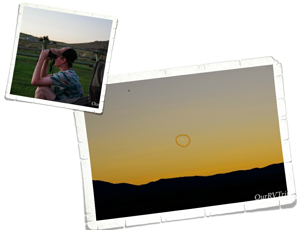
We spent a few nights trying to see the Neowise Comet that was visible at the time. We were so far north and the comet was so bright that we didn’t have to wait too long each evening to try and spot it. We think we saw it one night. I circled it in the right picture…It’s not the best shot, but it’s all I got.
Our week flew by. We didn’t really do much of anything else since we’re still trying to avoid going out too much. We mainly just go get groceries and stay home…when we’re not out adventuring in the wild places.
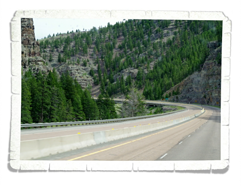
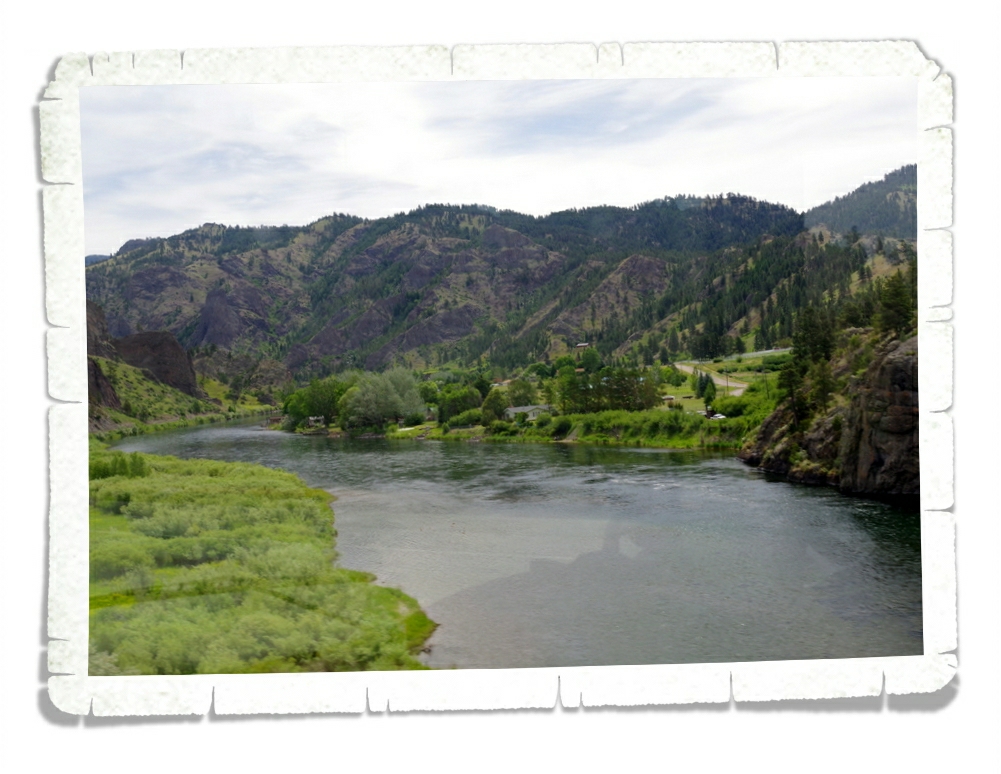
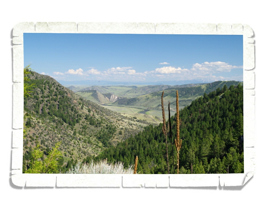
Today we drove from Three Forks, MT to Shelby, MT to stay overnight on our way to Alaska! The drive between Helena and Great Falls was absolutely gorgeous!
This road was cut right through the mountain range and it was really cool! In the picture above you can see a bridge we went over and how the road seems to go right through the mountains.
We crossed over the Missouri River several times. There were quite a few people out on the river enjoying the beautiful weather. This area is breathtakingly gorgeous!
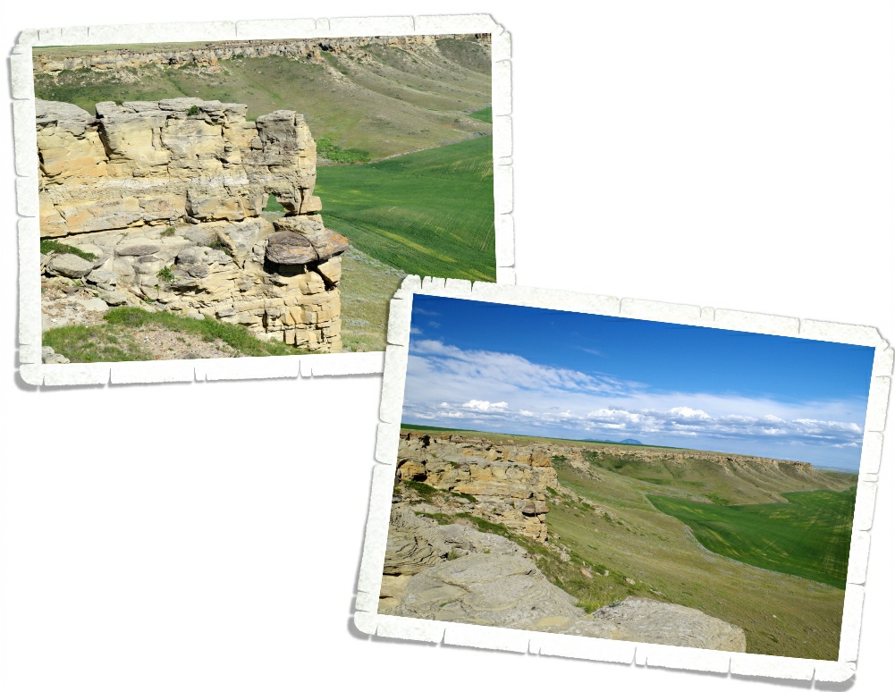
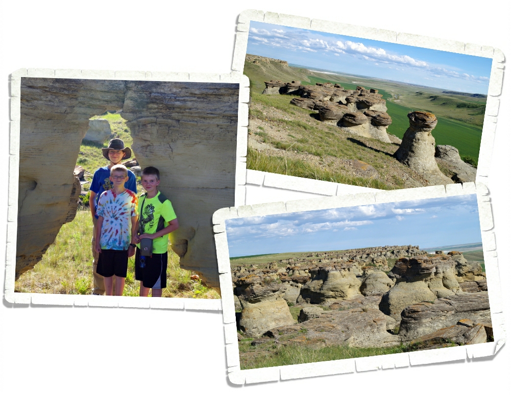
I can’t remember where I found this place. It was during one of my many research stints…and really it was just a mere mention and a photo. It took us a couple of hours on the computer using Google Maps to actually find it and then figure out how to get there. So, today we got to Shelby early enough to make the 45 min drive out to the middle of nowhere to see if what we worked so hard to find was actually worth it. We drove for awhile on a dirt road that turned so narrow it looked more like someone’s driveway which made us a little nervous thinking maybe we were trespassing, but we kept going…turned a corner…and found this… And the Oooos and ahhhhs started. We had the whole place to ourselves, but there were signs of some heavy partying. Glass shards and tin cans were everywhere. It’s such a shame people go to these places and feel like they have to trash them.
The rock formations in the picture above are called hoodoos. These are some of the smaller ones. They were really fantastic! We could have spent several hours picking our way through them! In the left photo above you can see the boys in a small arch we found.
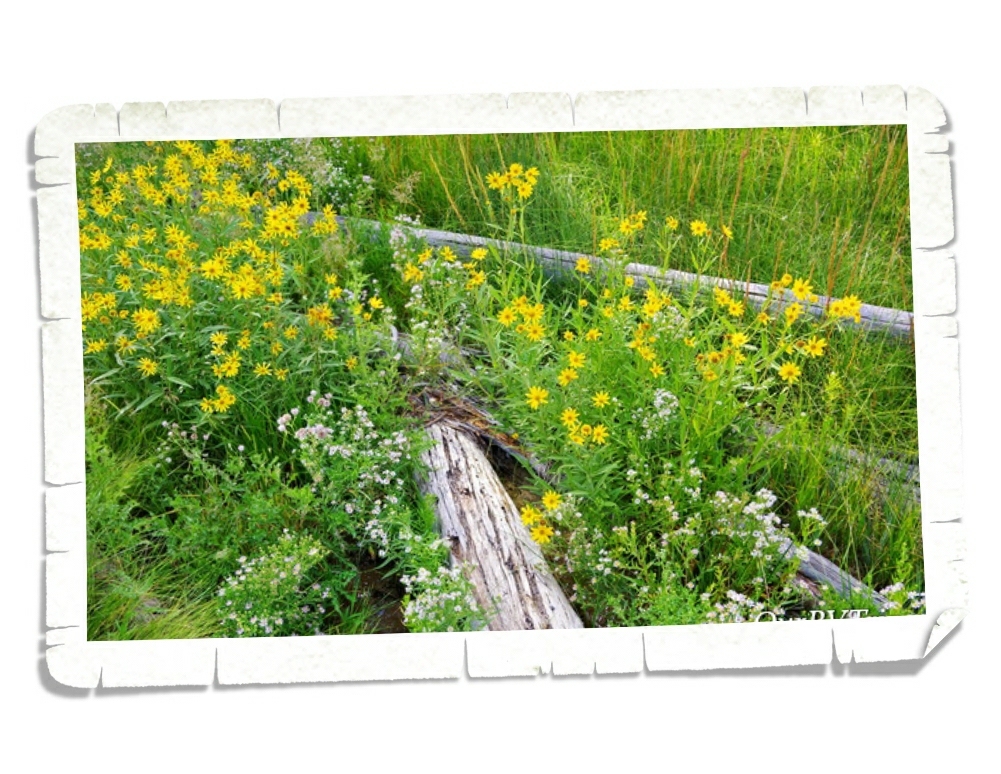
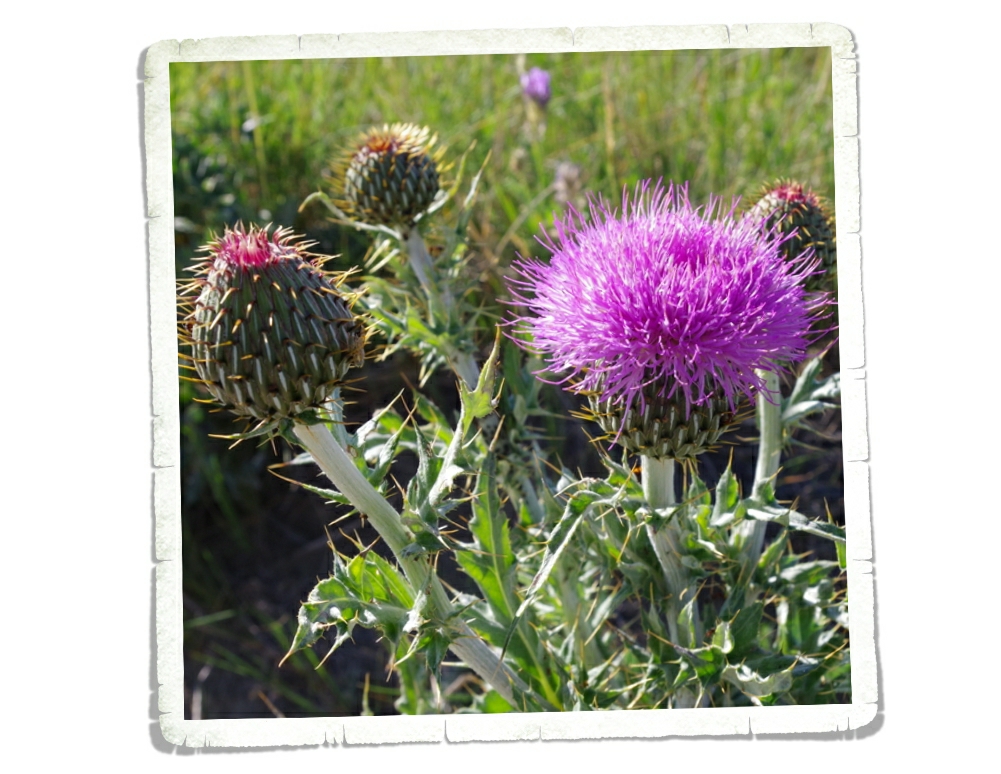
Yes, yes…I know…it’s a weed, but it’s so gosh darn pretty!! I couldn’t resist.
And this is Huckleberry Valley. I didn’t see any huckleberries…I don’t know why it’s called that…but it is beautiful!
We had a great time exploring on our last afternoon in the Lower 48 for a while. Tomorrow we head into Canada and to start our journey all the way up to Alaska!
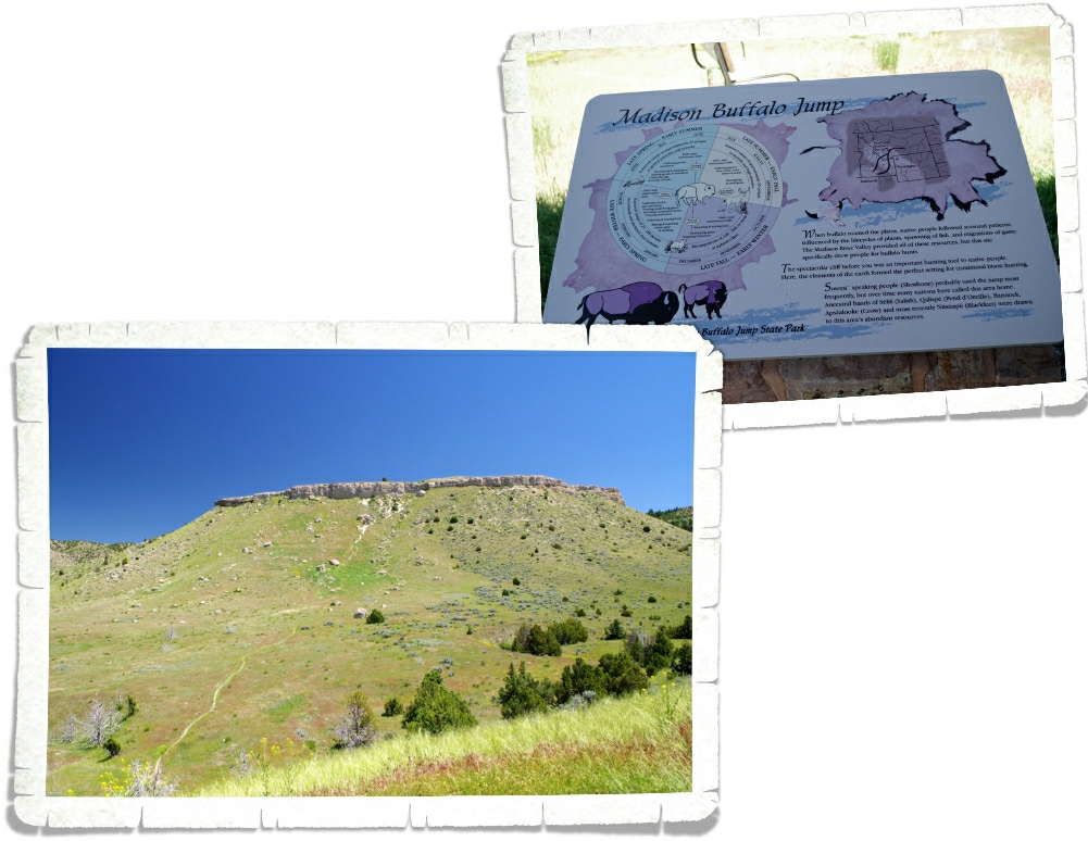
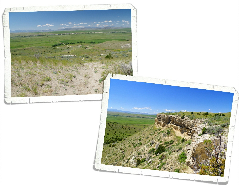
Madison Buffalo Jump was used by numerous Native American tribes for about 2000 years. Young men called ‘runners’ were trained in speed and endurance. The ‘runners’ would wear buffalo, antelope, or wolf skins and cause entire herds of buffalo to stampede off the cliff. By using logs, the tribes would funnel the buffalo to certain points on the cliff where other members of the tribe would be waiting to start the long process of utilizing all parts of the fallen animals. It’s pretty amazing to think they did all of this without the aid of horses or guns.
We walked the quarter mile to the interpretive center where they had great signs explaining the whole process. In the picture above you can see the cliff where the buffalo would fall. There are still tons of bones at the base of the cliff where the women of the tribe would prepare the buffalo to be used as food, clothing, shelter and tools. They used everything they could.
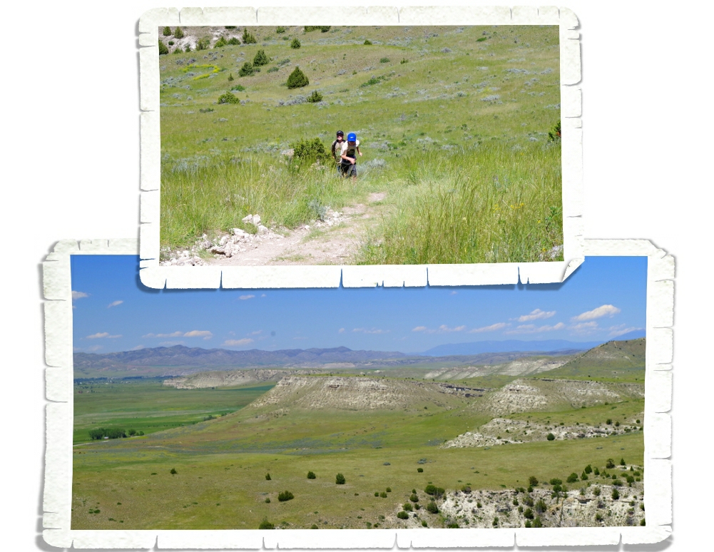
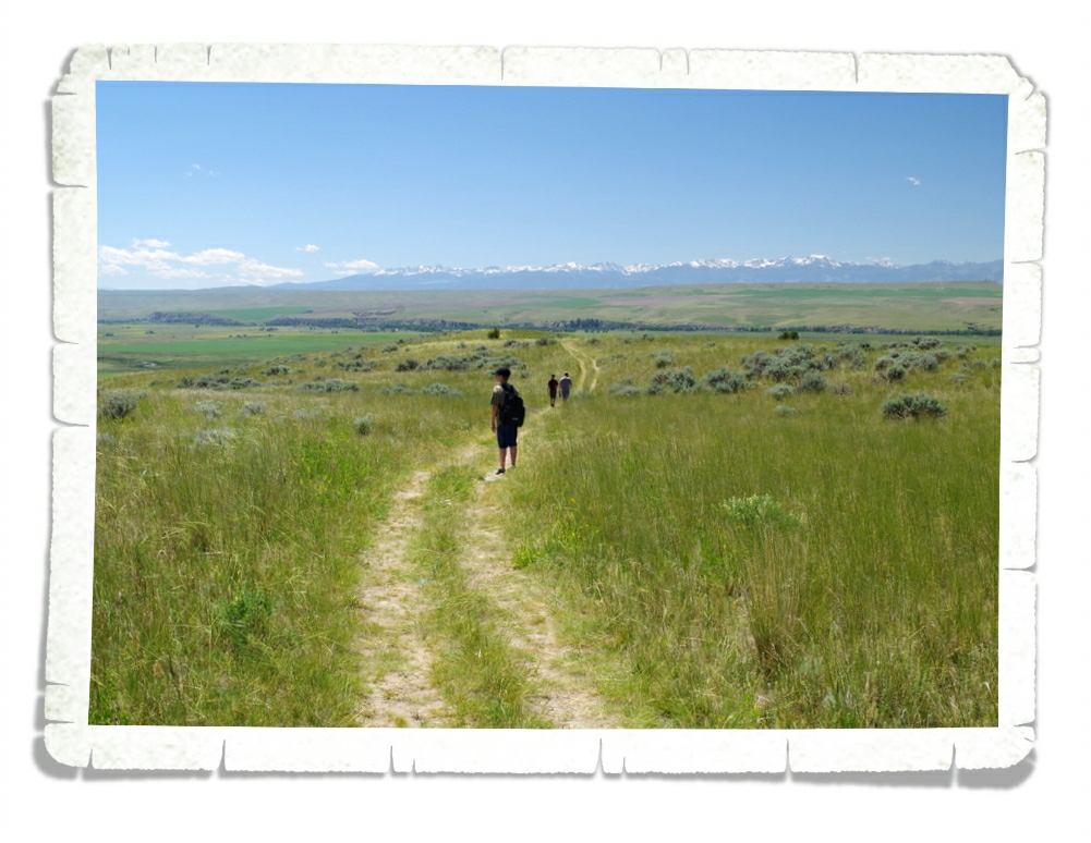
There’s a mile hike that takes you to the top…so of course we did it! The path started off just fine until we got to the part where it took us right up the side of the cliff. That’s when we started huffing and puffing and I started slowing down to take pictures of all the pretty flowers…and to catch my breath…but really I was distracted by the flowers. No one complained when we stopped every few feet for me to snap another few pictures! The view from the top was amazing! We stood there catching our breath and appreciating the view…and the fact that the hard part was over. It’s always hard while we’re in the middle of it, but we’re always so glad we did it. Especially, this particular hike. The lease for the land that this state park sits on is up soon and there’s talk of not renewing it.
Once we got to the top of the cliff it was another quarter mile or so to the front of the cliff. The path was flat and no one complained…I’m not sure if that’s because we were all enjoying the views or because we were all still out of breath.
See that dot toward the center of the left photo above? That teeny tiny dot is the interpretive center we started at! We found a side path while we were on top that led over to a different view of the cliff. Going down was so much easier!! Gravity really can be nice sometimes. You can see that for most of the hike we were surrounded by pretty tall grass.
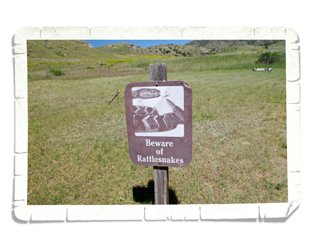
We didn’t run into any of these guys…but I was constantly looking for one. We’ve been in rattlesnake country for a month now and haven’t seen or heard one. I’m not complaining.
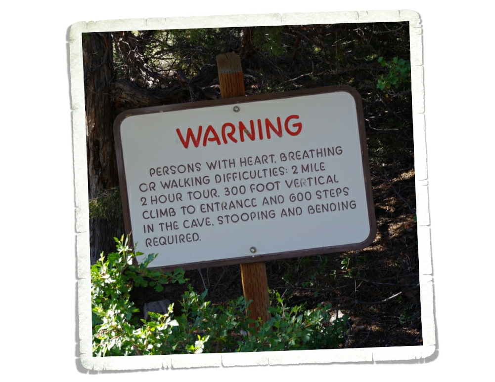
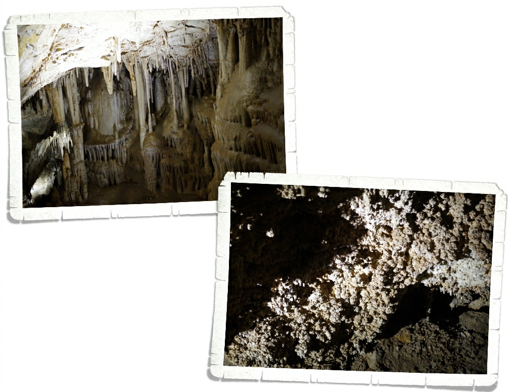
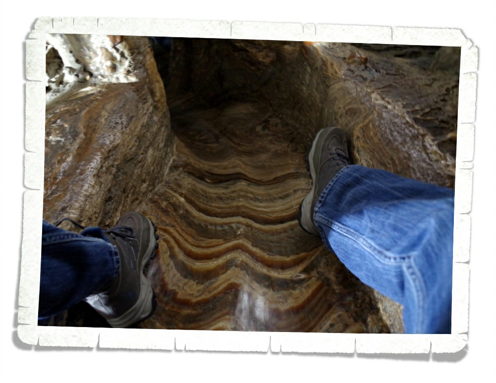
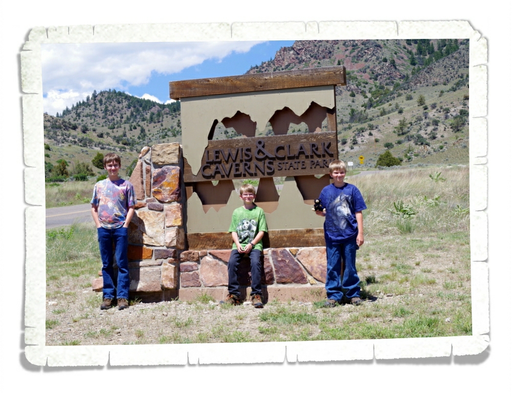
This is the sign that greets you at the beginning of the hike to the entrance of the Lewis & Clark Caverns cave and let me tell you…it’s a doozy of a hike! You gain 300 vertical feet in less than a mile. Now, that might not sound like a big deal and to someone used to an altitude of close to 5,000 ft, it’s probably not a big deal at all, but we’re used to something a little closer to sea level. We huffed and we puffed our way up to the entrance and I think by half way there we all thought we were gonna die right there on the trail! It was a beautiful sunny Montana afternoon and I thought seriously about just laying down right there on the trail and telling the boys I’d meet them back at the visitor center…until I remembered we happened to be in rattlesnake country. So, I forged ahead and we finally dragged ourselves to the entrance of the cave. Believe it or not we weren’t even the last ones in our group to arrive so we got to appreciate the view and catch our breath once we got to the top.
And oh, what a view it was!
Once our entire group got there (we had to wait for a couple that decided to go at the last minute and who showed off by running up the entire path while the rest of us were still trying to recover) we started on our cave tour. It felt amazingly good in that dark cave! It was around 80ish degrees outside and a steady 50ish inside the cave! The cave entrance sits at about 1,400 ft above the Jefferson River. I don’t know why it’s called the Lewis & Clark cave, they didn’t even know it was there when they passed by this area back in 1805. Two guys from a nearby town found it. Tom Williams and Burt Pannel found it in 1882 and in 1911 it became Montana’s first state park.
We walked in and walked down a couple hundred stairs and then we started to see some of the formations the cave is known for. The stuff you can see in the right photo above is called cave popcorn. I don’t know… I think I would’ve called it cave cauliflower or something. It doesn’t look much like popcorn to me. I’ll apologize now for the shoddy camera work. I am by no means a professional and this cave was really dark and we weren’t allowed to use a flash, so I was working with the tiny bit of light that was available.
Do you see the rock formations running down the side of the wall in the picture above? That stuff is called bacon.
Yup, bacon.
You’ve got to wonder how they come up with the names they do. What about this looks like bacon?
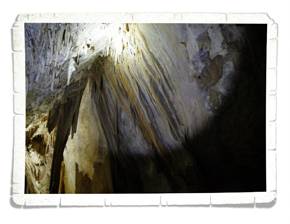
We didn’t actually get to go into the room in the picture above, but I snuck a picture of it anyway. I love the formations in it! The tour guide said the name of this room is the Princess Room. There’s a separate tour you can take (at night) that allows you access to other parts of the cave and this room is part of that tour.
When that sign at the beginning of the trail warned of having to bend and stoop to get through the cave it forgot to mention you also have to slide down a rock slide too. Look at all of those lovely layers in that rock! We were smart here and went last on the slide so everyone else cleaned and dried it off for us! The boys…who am I kidding…we all had fun sliding down the rock slide in the cave!
And just like with all cave tours…the guides take great pleasure out of scaring the buh-jeez-us out of all of us by turning off the lights to show us just how dark it really is in the cave. All I could think of after this part was how glad I am we all have phones with flashlights on them now!
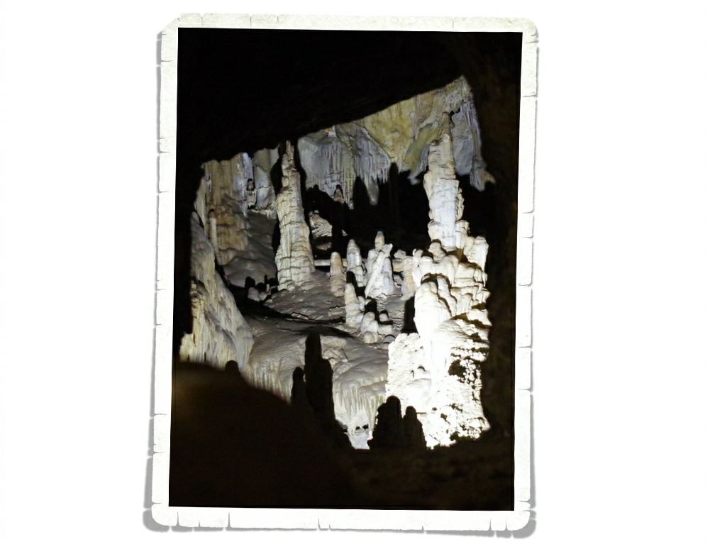
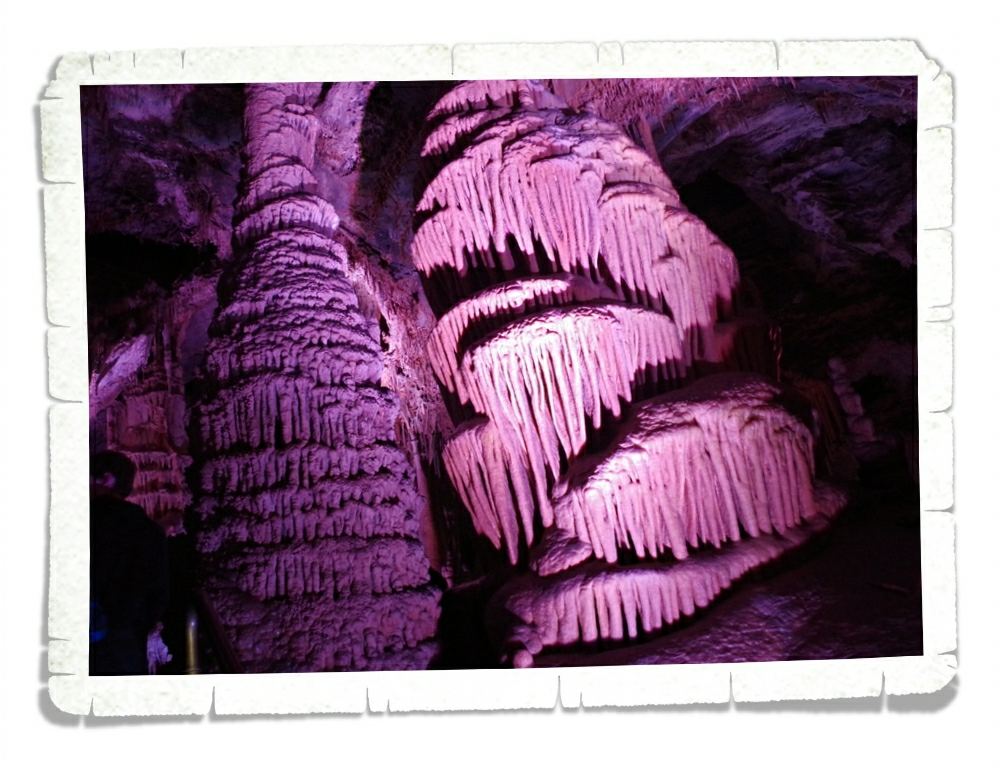
This room was called The Garden Of The Gods Room. Everything in this room was pink! The lights were still white. I looked. Not only was this room colorful it was also the room with the biggest formations in the cave. It was impressive!
When our tour was over, we were spit out of the mountain a half mile from the visitor center, we were all glad we huffed and puffed up that trail. The guided tour covers 2 miles, is 2 hours long and you travel 600 or so stairs in the cave. It was all worth it. The formations were amazing, the tour guide was entertaining, and the time spent learning something new with our boys was definitely an afternoon well spent!
If we ever get to go back for a second visit, we’ll try to go earlier in the day and do one of the several hikes that are available outside of the cave. The whole area is beautiful with postcard worthy views!
One of the things I was looking forward to doing in Montana was visiting Virginia/Nevada City. Online it looks so…western! In the pamphlets it all looked like such a unique experience! Well, I was less than impressed with Virginia City or Nevada City. There were a few highlights of the day and I’m glad we went just so we can say we went, but I don’t imagine we’ll ever want to go back.
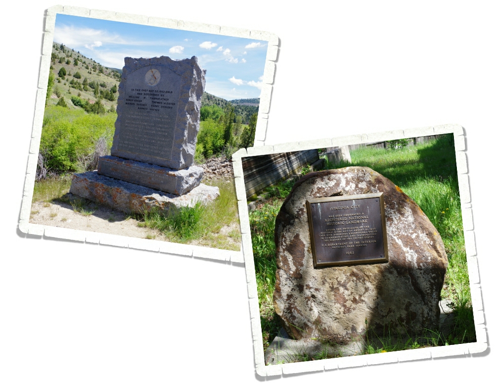
Virginia City was founded by William Fairweather back in 1862 when he and a group of his buddies found gold in Alder Gulch. Within a few months of the first person finding gold, over 10,000 gold miners flooded into the 14 mile stretch of land seeking their own claims. The town drew prospectors, but also drew merchants and outlaws. Every social and economic class was represented in Virginia City. While it all sounds exciting, human comforts were few and far between.
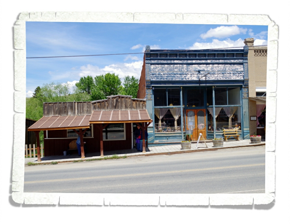
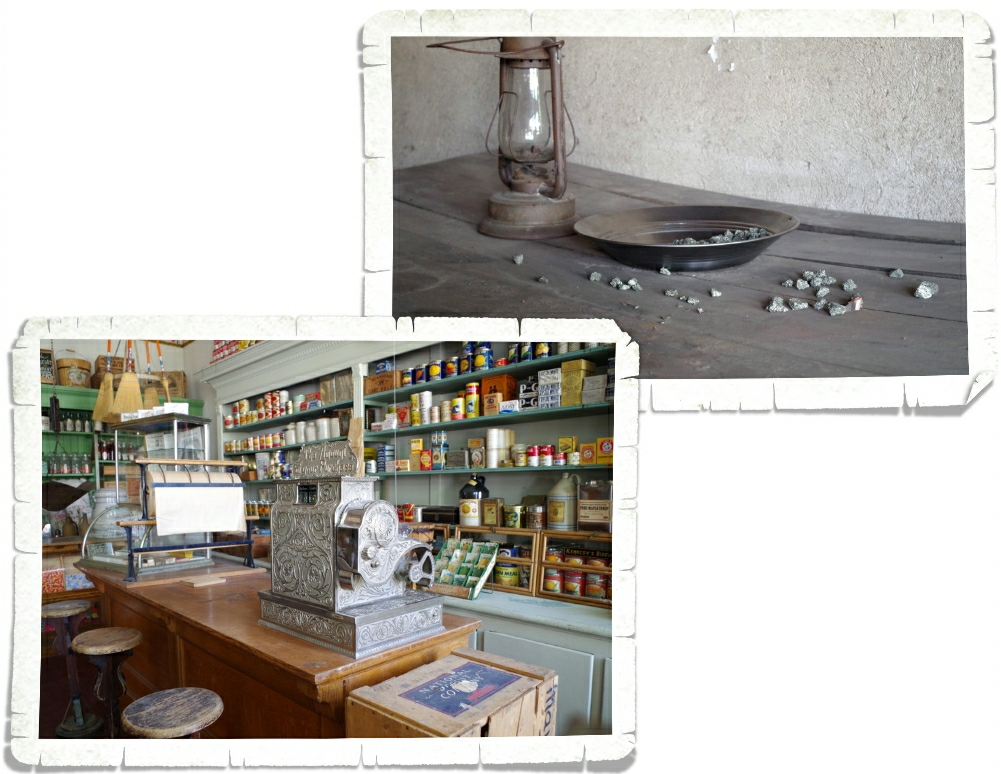
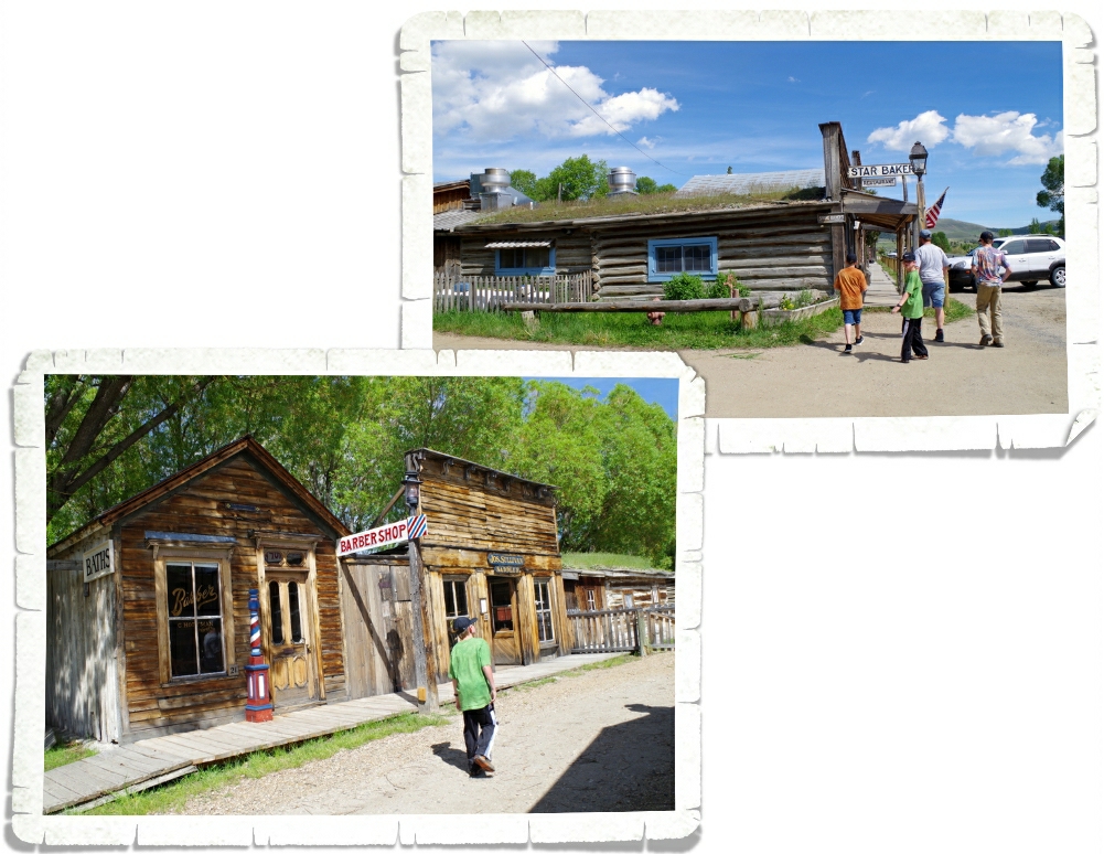
Here’s a picture of some original buildings along the main stretch in Virginia City. Most of them are kind of like a museum where you can walk into the doorway and stand to look at the display. The old buildings line a board sidewalk that is mostly original to the town. I’ll admit…it was kind of neat to imagine the cowboys and miners and their families all walking the board sidewalks, living their lives on this huge adventure they’d decided to go on.
Some of the displays, like the ones above, are nice and organized while quite a few of them were more like items shoved into an old building and forgotten. I was disappointed with the shops that were actually open for business. The merchant shops were just as rundown as the original buildings and the items they were trying to sell weren’t much better. Definitely a tourist trap type of thing.
Today, Virginia City is a National Historic Landmark. The buildings that have been preserved in large part due to Mr. Charles Bovey. I’m not going to go into the full details of it…he was an heir to the General Mills Corporation and had a love for history… I do appreciate that people with the means make an effort to preserve our history.
We drove around and found the exact location Mr. Fairweather found the first gold in the area. There was actually someone panning for gold in the creek!
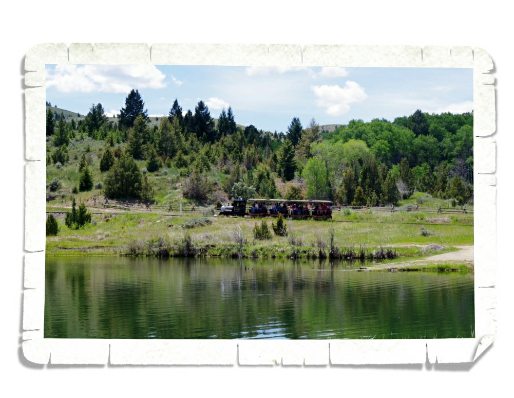
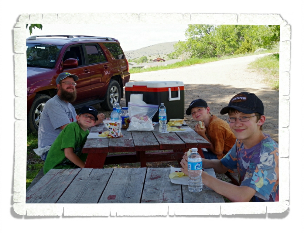
There’s a little train that runs between Virginia City and Nevada City. It’s a 25 minute ride where they point out some rocks and tell you a few interesting facts. We rode it both ways and then drove our car to the little pond you see in the picture above to have a picnic lunch. I’m too cheap to pay $20 for a bison burger.
We somehow lucked out and actually found a shady spot with enough room for all five of us to sit and have lunch! The weather was fantastic!! After lunch we headed toward Nevada City.
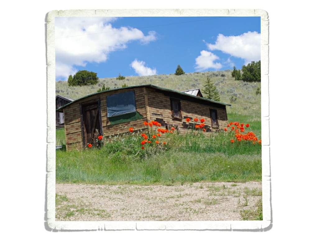
I spotted these orange flowers while we were on the train. I love them! They’re so bright and vibrant!! Maybe one day when we have a yard I can plant some poppies in it!
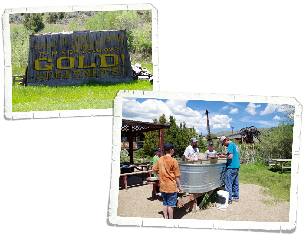
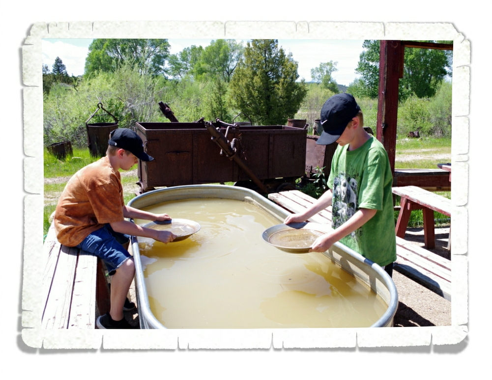
We also stopped to pan for some gold! I mean, we were there to learn about the gold rush so we had to give it a try! They gave us a lesson first, then turned us loose to find our own treasure. I’m not the most patient person…panning for gold takes a lot of patience and hard work.
I rushed through mine (I found some very pretty and very small garnets and amethysts) and then took some pictures. We didn’t find gold, but we will always remember trying and we all walked away with a little vial of amethyst and garnet chips!
While Virginia City is an authentic town with the original restored buildings, Nevada City is a fictional historic town or a “living museum” where on weekends costumed interpreters bring the city to life. There’s a fee to get in and it’s not too bad. We got the Family Package that included the train, panning for gold, and entrance to Nevada City.
The buildings along the highway in Nevada are original, but the “living museum” is what you have to pay to see. The Star Bakery is one of the original buildings. The buildings in the museum part of Nevada City were all brought in from other parts of Montana and restored.
Some are less restored than others, but give the museum a feeling of authenticity.
We didn’t stay long in Nevada City. We got there kind of late in the day and were the only ones walking around and to be honest…it kind of creeped me out to see the interpreters walking around in costume. I kept thinking about those movies where the unsuspecting tourist goes to a town and gets trapped there. I’m a dork.
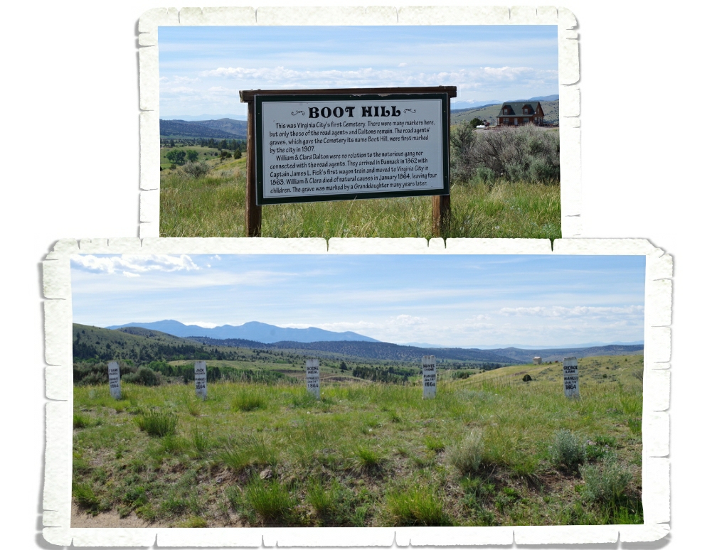
We ended our tour of the area with a trip up to Boot Hill Cemetery.
You can see the graves of five men who were hanged in Virginia City at Boot Hill Cemetery. You can also see the post where they were hanged in the Hangman’s Building.
All in all, it wasn’t a horrible day. The drive to get there was beautiful and the picnic lunch along with the panning for gold are all great memories!
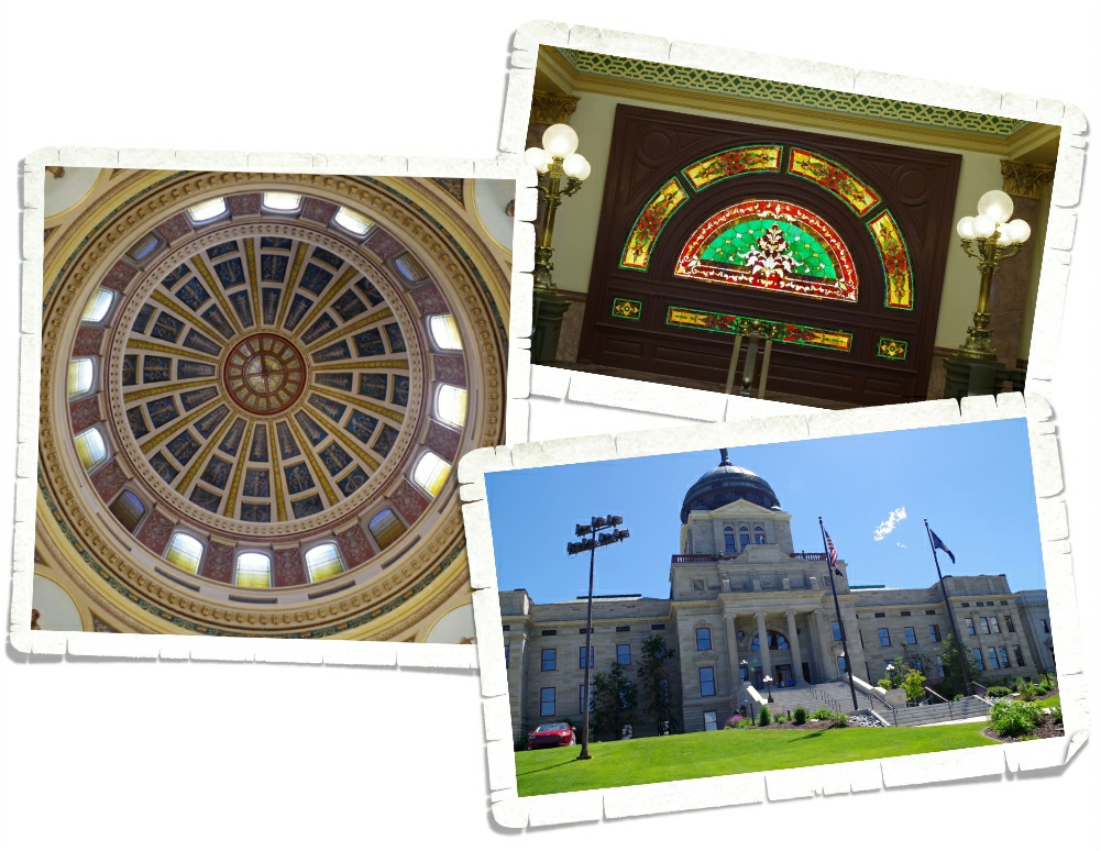
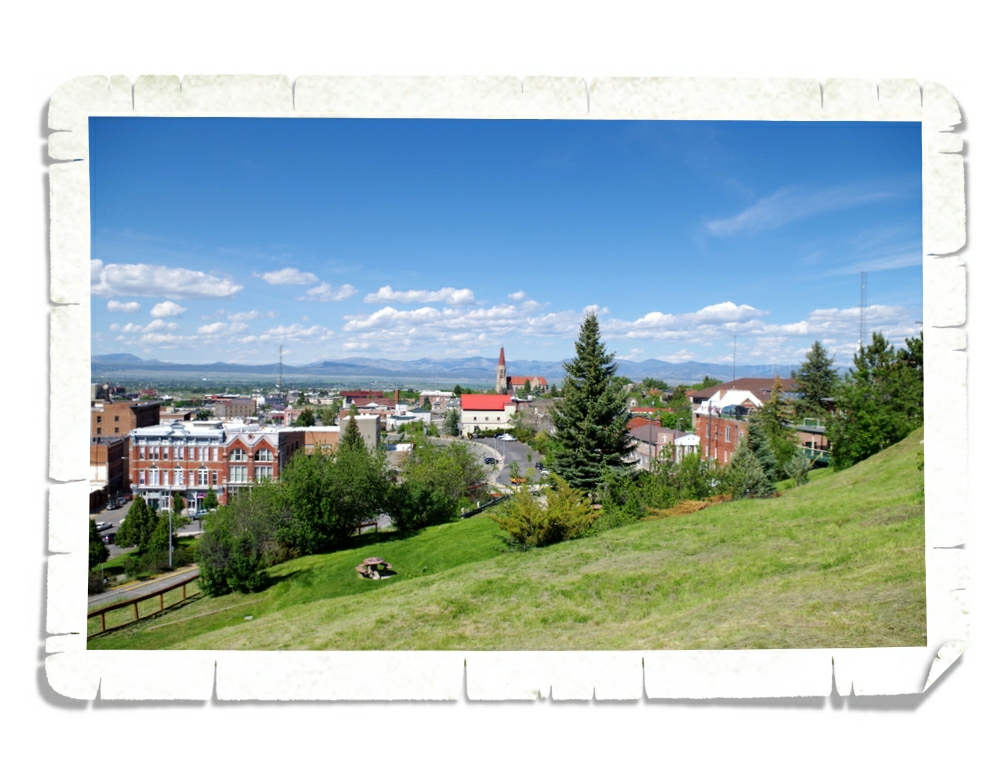
Our first impressions of Helena is that it’s kind of small and the city is laid out weird.
We went to the Capitol Building…it was a lovely dome building! You can see a picture of the inside of the dome in the left photo above. There were several stained glass windows, which were very pretty! A dome and stained-glass…It’s such a great combination! It seems to be a very popular theme with the State Capitol Buildings.
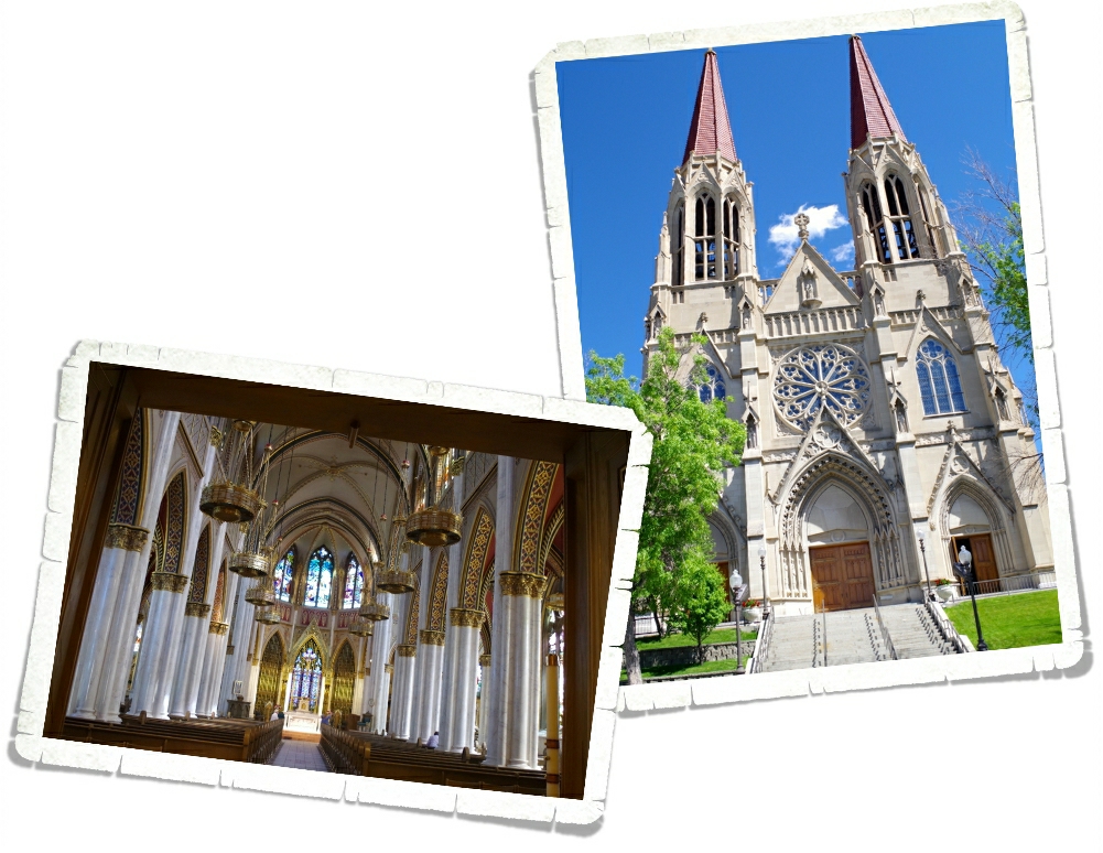
After we got our State Capitol Building stamp, we headed over to the Cathedral of Saint Helena. It was worth the trip to Helena just to see this cathedral! It was absolutely stunning inside!
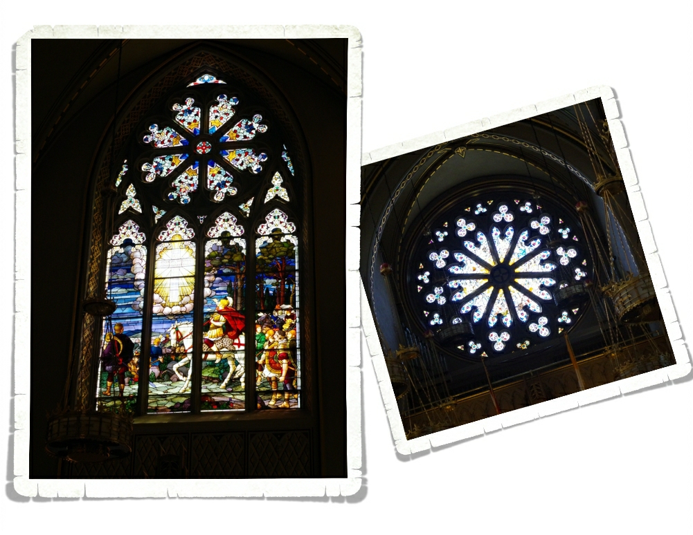
And the stained glass…it was amazing! We walked up and down each side looking at each window. I could have stayed a couple of hours just looking around, but there were people trying to pray so we made a quick tour and headed out.
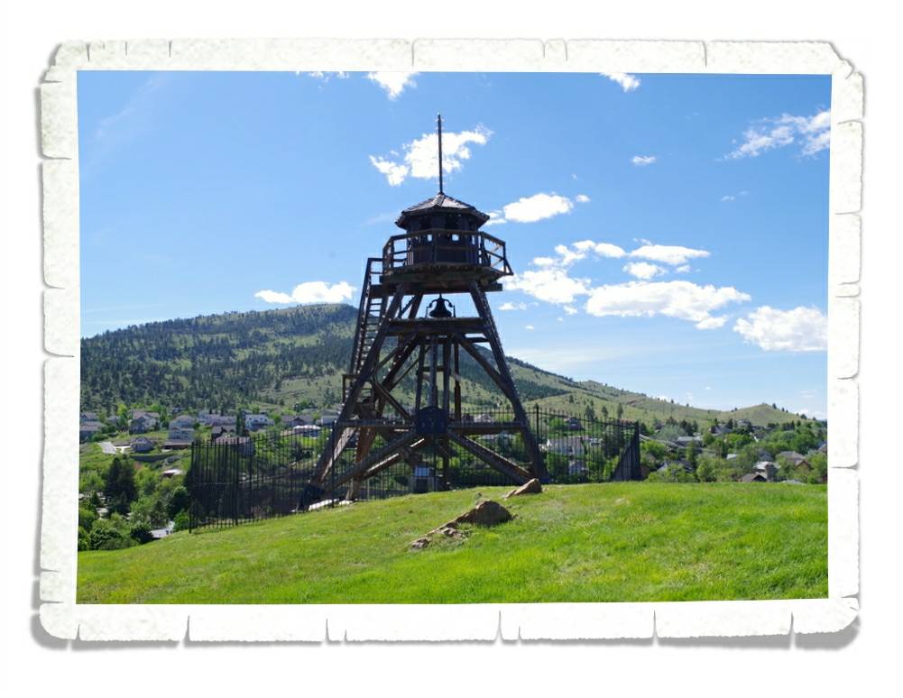
While we were trying to decide on what to eat we found this fire tower and after several passes around the block figured out how to get to it! We couldn’t go up in it, but it was neat to look around it and the view of the city wasn’t anything to complain about.
Helena was a neat place to spend an afternoon. We moseyed through some of the shops and down a very cool (I’m bummed I didn’t get a picture of it) brick street!