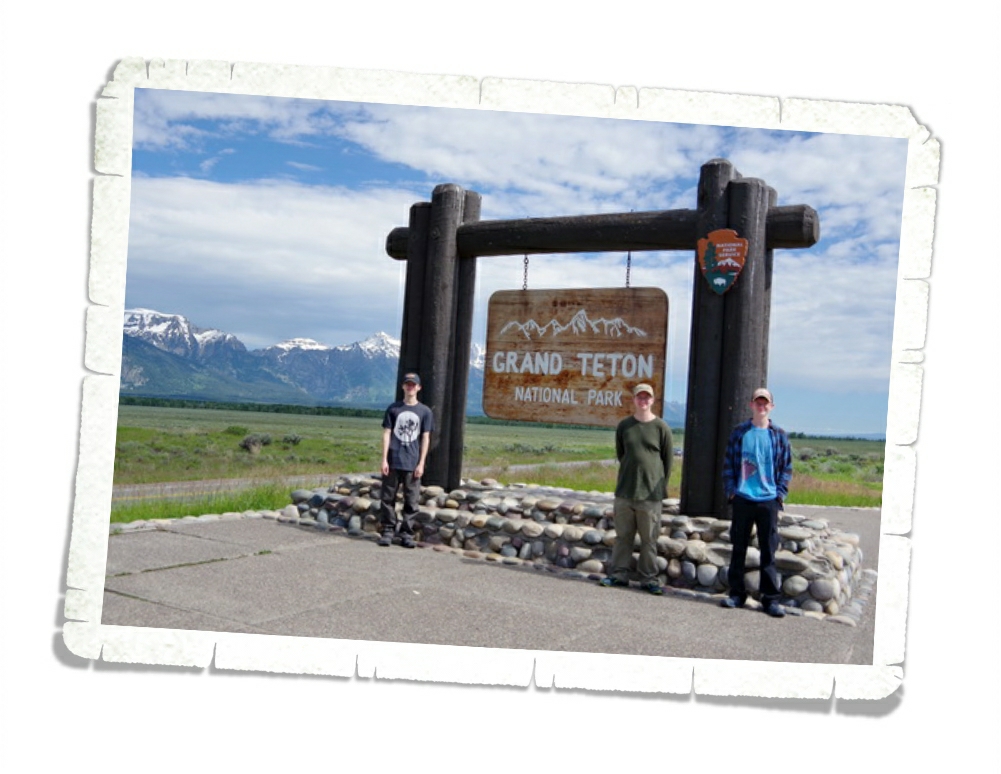
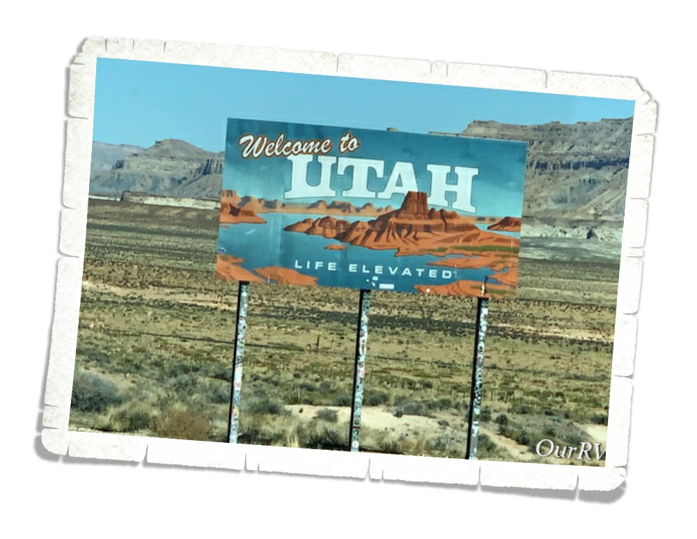
Glacier National Park And A Ranch
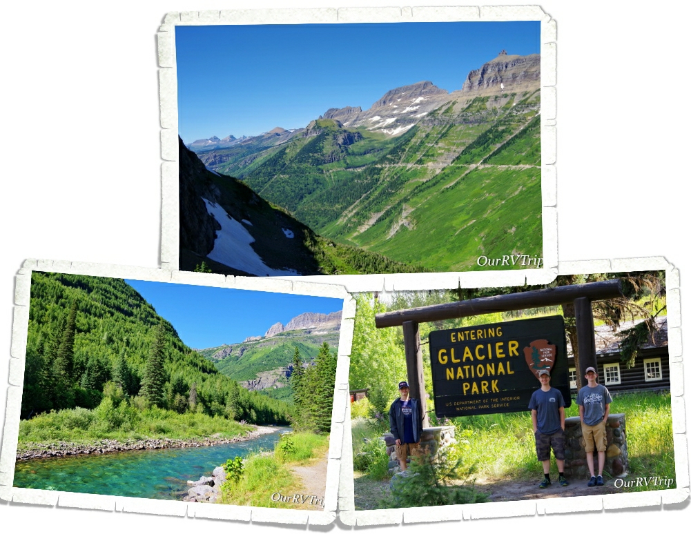
Hey Guys!! We spent two weeks in West Glacier so we could explore Glacier National Park!
Confession: We didn’t want to like Glacier National Park.
It’s true. For years, we’ve heard so many people say how awesome Glacier NP is. We heard the same things about a couple of other parks that are wildly popular and…well…we’re not too fond of those particular parks. So, when we headed to Glacier, we’d already made up our minds (but tried to stay hopeful) that Glacier was going to be another dud for us. I should tell you here…the entire east side of the park (according to most, the east side is the best side) was closed so that also factored into our feelings that this park was going to be a miss for us.
And honestly, after the first day…we thought maybe we’d been right…that Glacier was a dud for us. Our first day was filled with super grumpy Rangers, so many people we felt like canned sardines, and some pretty spectacular views.
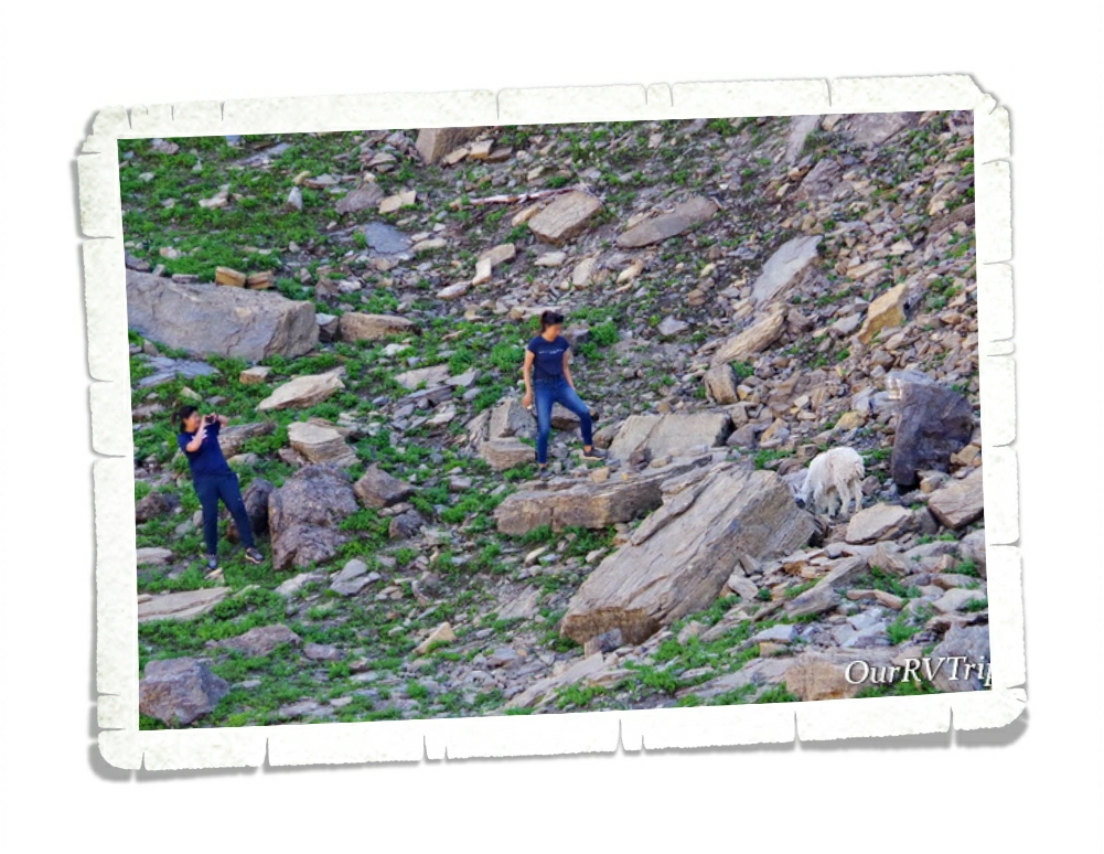
We also saw an alarming number of tourons (tourist+moron) trying to get selfies with wildlife. Guys, don’t be a touron. Just don’t. It’s not cool…wild animals don’t like it…and Ranger’s will have to step in and try to save your life while putting their lives in danger. Please remember to stay 100 yards from bears and wolves and 25 yards from all other wild animals.
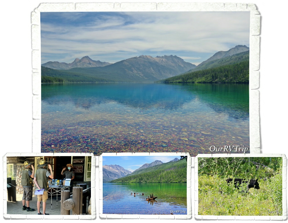
The next time we went into the park we decided to head out to Kintla Lake to hopefully get away from the crush of people. We had a relaxing day at the lake with about twenty other people. We just about had the place to ourselves. The boys spent about an hour or so floating around in the glacier fed lake before we headed to Bowman Lake to check it out. Bowman was super crowded so we walked to the edge, got a look, then left. On the way out to the main road we got our first glimpse of a black bear in Glacier NP. It was off the side of the road, up the hill, gorging on berries. He knew we were there (there was a group of us), but couldn’t have cared less. He was more interested in the fresh berry bushes.

The next day, we drove Going To The Sun Road and stopped at all of the stops we could find a parking space. It was ridiculously busy but, we found a spot at a few key pull-offs.
When Glacier National Park was established in 1910 there were over 100 glaciers within the park boundaries. Today, there are 25 active glaciers. So, what makes a glacier a glacier? A glacier forms when an area of snow doesn’t melt over the summer then accumulates layers of snow over the years. Eventually, the bottom layers will compress under the weight of snow and turn to ice. The weight of the snow mass along with some of the yearly melt will cause the bottom layers of ice to become flexible and slick and the snow mass will start to move downhill…becoming a glacier. A glacier has to have enough mass to “flow” downhill under gravity due to it’s own weight.

Most of the trail-heads we wanted to stop at were full by 9am so we found ourselves pulling into any pull-off that had an available spot. That’s how we ended up at the St. Mary Falls trail. We hadn’t planned on doing this hike, but we were there and y’all know I love a good waterfall. We were checking out the trail-head sign when we met a couple of ladies just finishing up so we talked to them about the trail and if it was worth the mileage with the 90°+ temps. You can see in the picture above that there had been a fire and all of the trees for most of the trail were burned which means…no shade. The ladies who were finishing up insured us that it was worth it so…we headed down our first trail in Glacier NP.
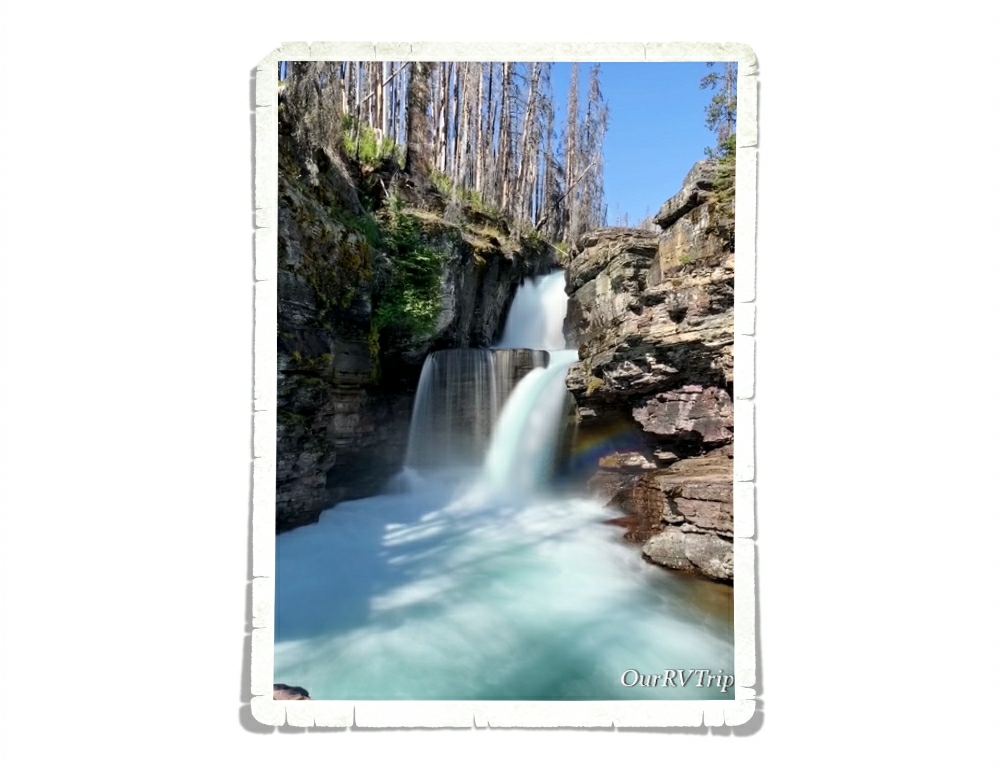
We made it to St. Mary Falls (in the pic above) without any trouble and decided to head on to Virginia Falls. We saw so many small waterfalls along the trail! It was kind of amazing… Now, having said that, y’all know I like to keep it real for you…a couple of us really struggled on the way back to the car. It was right in the heat of the day, it was 93°, there was zero shade or cloud cover and there was a pretty good incline we had to make it up to get back to the car. We had taken our water and we were all wearing hats, but the heat just zapped us. If we were to do this hike again, we would be on the trail by 7am if not earlier to escape the heat of the day. It was a great trail, and I would highly recommend it…just be prepared for the heat and the lack of shade. But Guys, look at the color of that water!! We decided after this hike that maybe…just maybe…Glacier NP was going to be ok.
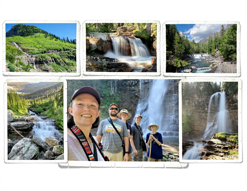
Speaking of waterfalls… Oh. My. Goodness!! There were so many waterfalls!!
So. Many!
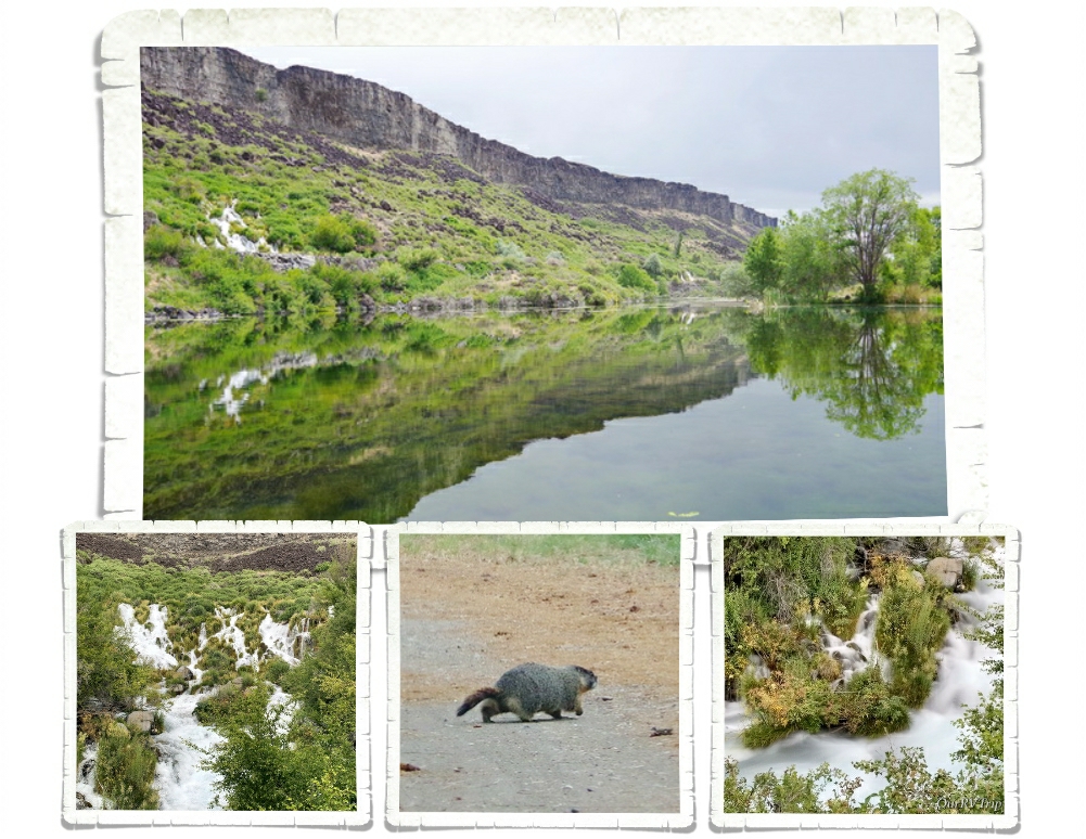
Glacier National Park has a whopping 200 waterfalls scattered throughout the park. You’ll see everything from a trickle making its way down the side of a cliff to a full out gushing beauty. I think I might have taken more pictures of waterfalls than anything else in this park.
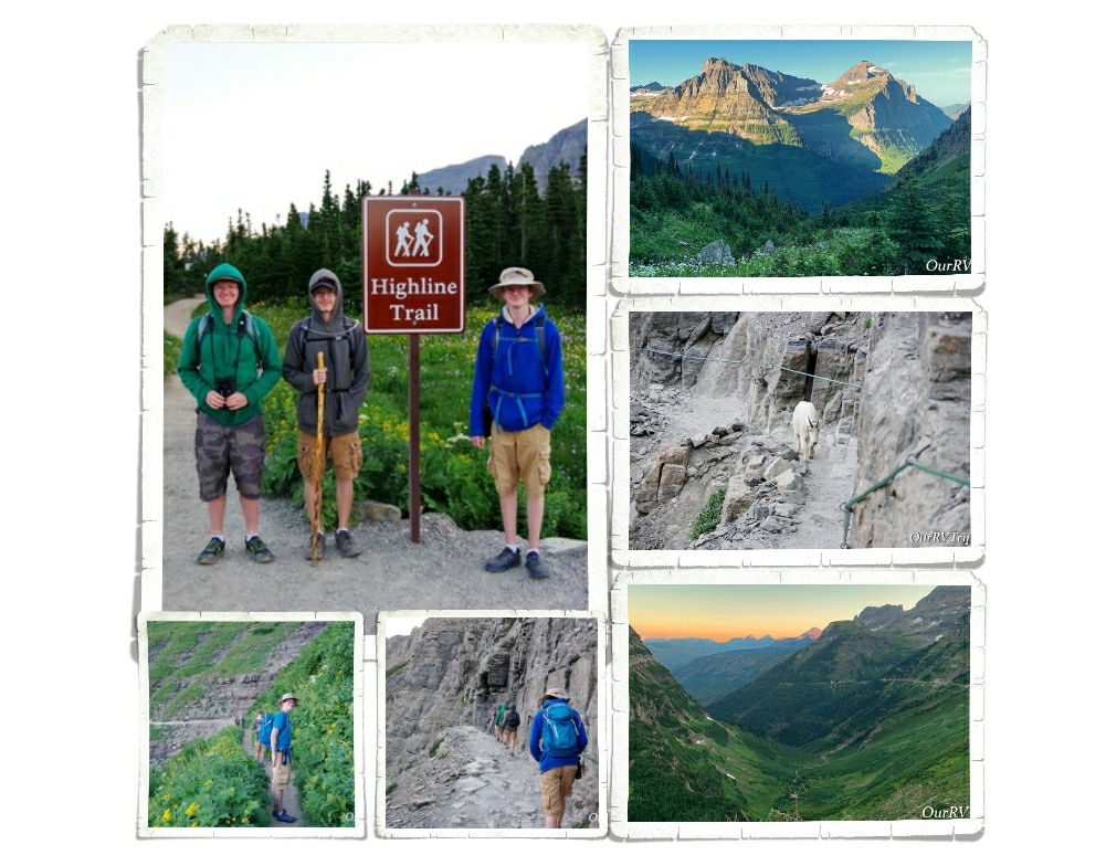
The big trail I wanted to get in while we were there was the Highline Trail. The Highline Trail is said to be the one trail in Glacier that you have to do. You start at the Logan Pass Visitor Center. We learned from our friends at the St. Mary Falls trailhead that if we wanted to get a parking spot at Logan Pass, we would need to be there by 7am at the latest. So, we got there at 6am and scored a spot. I wanted to start this trial early because the temps were still brutal and the only shade on this trail is provided by the shadow of the mountain. Starting mid-day, there’s zero shade and I’d made that mistake once…I wasn’t going to do that again.
The Highline Trail begins on the Continental Divide where you follow it for a while. This section of the trail is known as the “Garden Wall” and is roughly 100 feet or more above the Going to the Sun Road which means you get some amazing views right from the beginning of the trail. We started our trek as the sky was starting to lighten up with temps in the high 30s. We froze, but none of us complained. We prefer to hike in the cold rather in the sweltering heat.
About a quarter mile or so from the trail-head you get to the part of the trail that gives anyone with a height issue some problems. In some places along this portion of the trail, the trail is only about four to six feet wide with steep drop-offs on one side. The park has installed a cable for people to use. I noticed a couple of us holding pretty tightly to that cable…this part of the trail seemed pretty tame to me after hiking Angel’s Landing in Zion last year. Until, we met up with a mountain goat. He was coming at us down the narrow trail, but seemed totally unfazed by our presence. He politely got off the trail when he got to us and perched precariously on some rocks along the steep drop-off while we scurried by him.
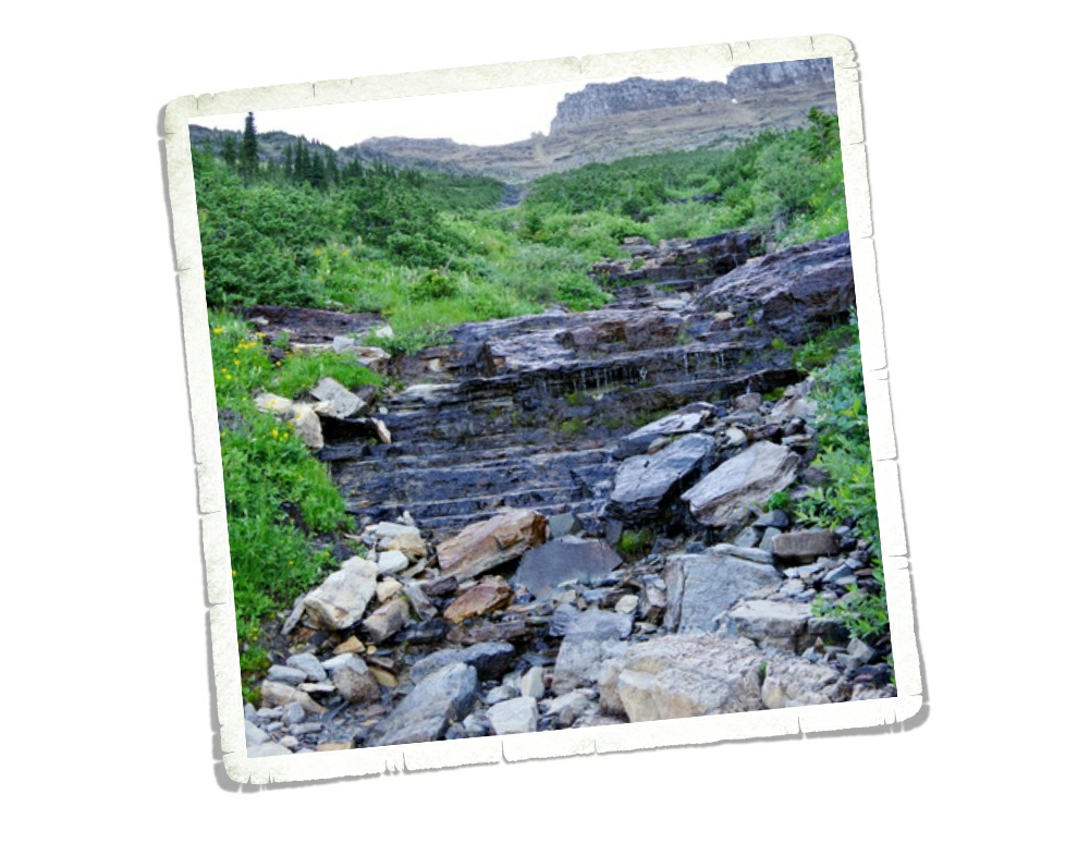
Remember all of those waterfalls I told you about? Well, you get to hike through the tops of several of them while on the Highline Trail. Between the morning dew and the slick wet rocks and the mud…well, I had a few little moments of panic while going through the waterfalls. None of them were deep. We were all wearing regular hiking shoes and none of us got wet feet or anything, but every time we would walk through one of the waterfalls, I would look down, down, down, and down to how far we would slide if we happened to slip right then. There wasn’t a ledge to catch yourself. This aspect of the trail is the only part that would give me pause about doing it again. But let’s be honest, I’d still do it again…some moments of panic are worth it.
I’ll also confess to you that I did slip and fall on some mud. It wasn’t on a waterfall crossing (thank goodness) but it was in front of several people and on some slippery rocks. It happened so fast I didn’t even know it was happening until I was on the ground with a sharp rock trying to wedge itself somewhere I’d prefer it not be. I had a humongo bruise that lasted three weeks and I messed up my forearm from landing on it (that only lasted a couple of days). Honestly, I think my ego was hurt worse than my body, but it did make me slow down when walking over those slick rock areas and hesitate even more before walking over a waterfall crossing.
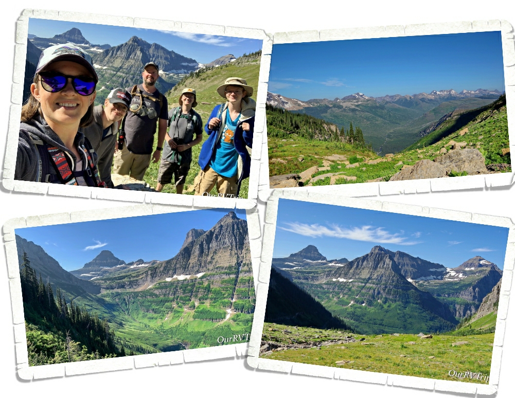
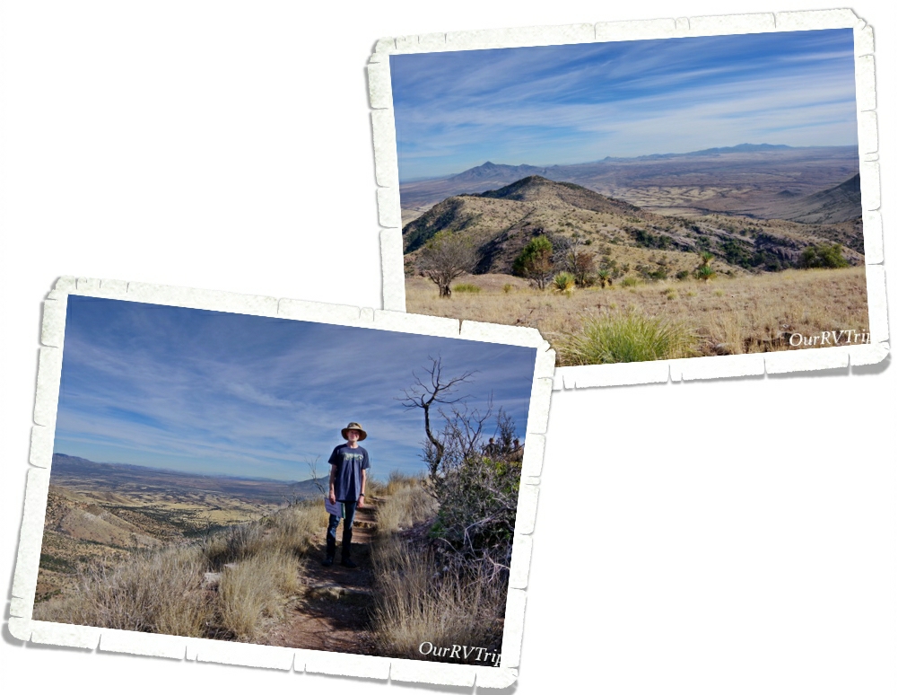
We had planned on only going about two or three miles into the hike then turning around. The entire hike is anywhere between 13 and 30 miles depending on how far you go and any trails you take off on that meet up with the Highline Trail. When we got to the two mile point none of us were ready to turn back. When we made it to three miles we could see the switch backs up to the pass and decided to push on to get to the view so, we ended up hiking up to the Haystack Pass. Haystack Pass sits at an elevation of 7,024 feet and has plenty of great rocks to sit on and have a snack.

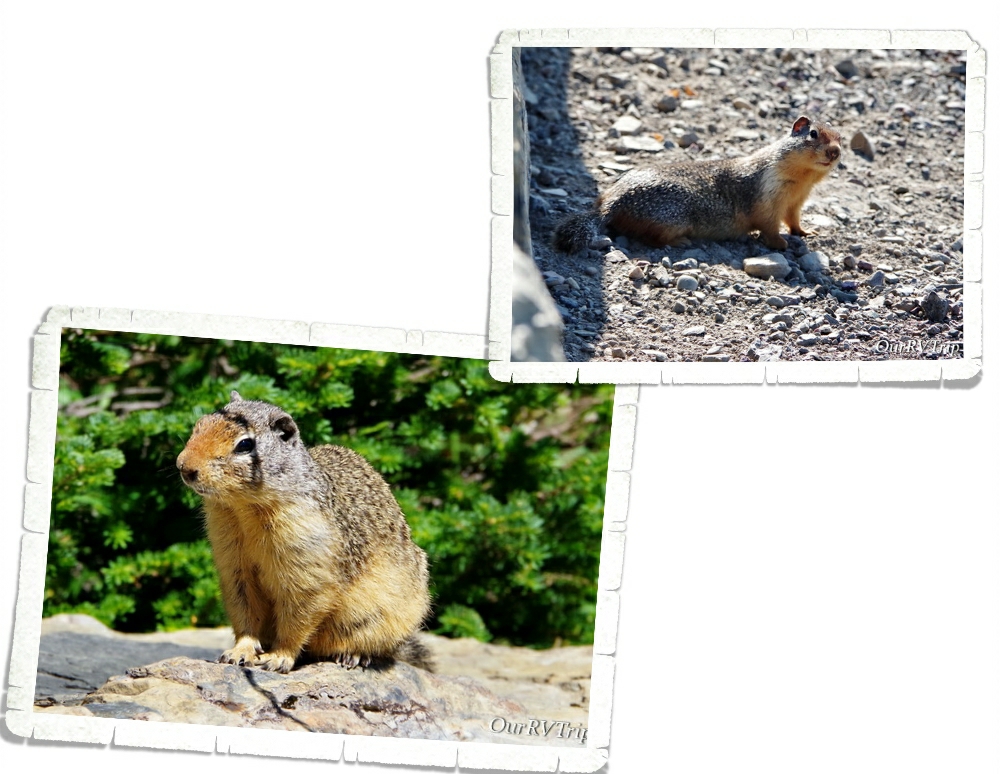
While three of us decided to hangout at Haystack Pass and watch all of the Colombian Ground Squirrels scurry around (there were so many), two of us headed on down the trail for another half mile or so just to see what they could see. Alex took this picture when he and Jerl explored a bit farther down the trail. We spent about an hour hanging out at the pass before making our way back to Logan Pass.
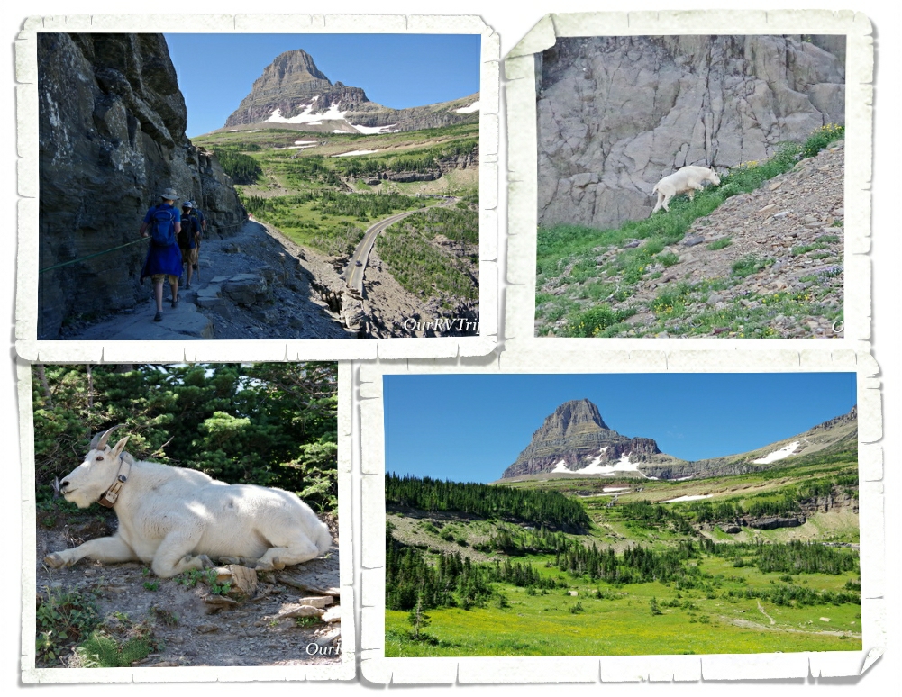
On our trek back to the trail-head, the crowds started to show up and we had to stop several times to let people pass on the narrow trail. We ended up seeing four different mountain goats and met back up with our mountain goat friend from the morning. He had taken up a spot right by the trail and was posing for all of the paparazzi snapping photos of him.
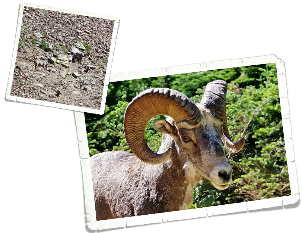
We also spotted some longhorn sheep. We saw a group of them way up on the hillside chilling out, avoiding the people…but one was romping around right by the trail and seemed a little panicky. He busted out of the trees onto the trail right as I was walking up and we sized each other up for a minute before I started yelling for Jerl and the sheep took off. Ha! I’m not sure which of us (me or the sheep) was more startled to see the other.
We had a great morning on the Highline Trail! We’ve decided it’s on our list of top five hikes and we all agree we would do it again. Between the views and the wildlife, I can see why this trail is so popular.
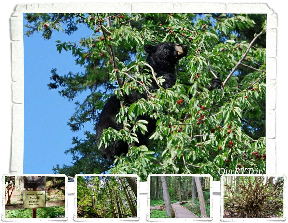
A couple of the trails we wanted to do were closed due to bear activity. We heard a couple of stories about bears and mauling and stealing backpacks… If you visit Glacier NP make sure you are prepared for bears. Educate yourselves and be bear aware.

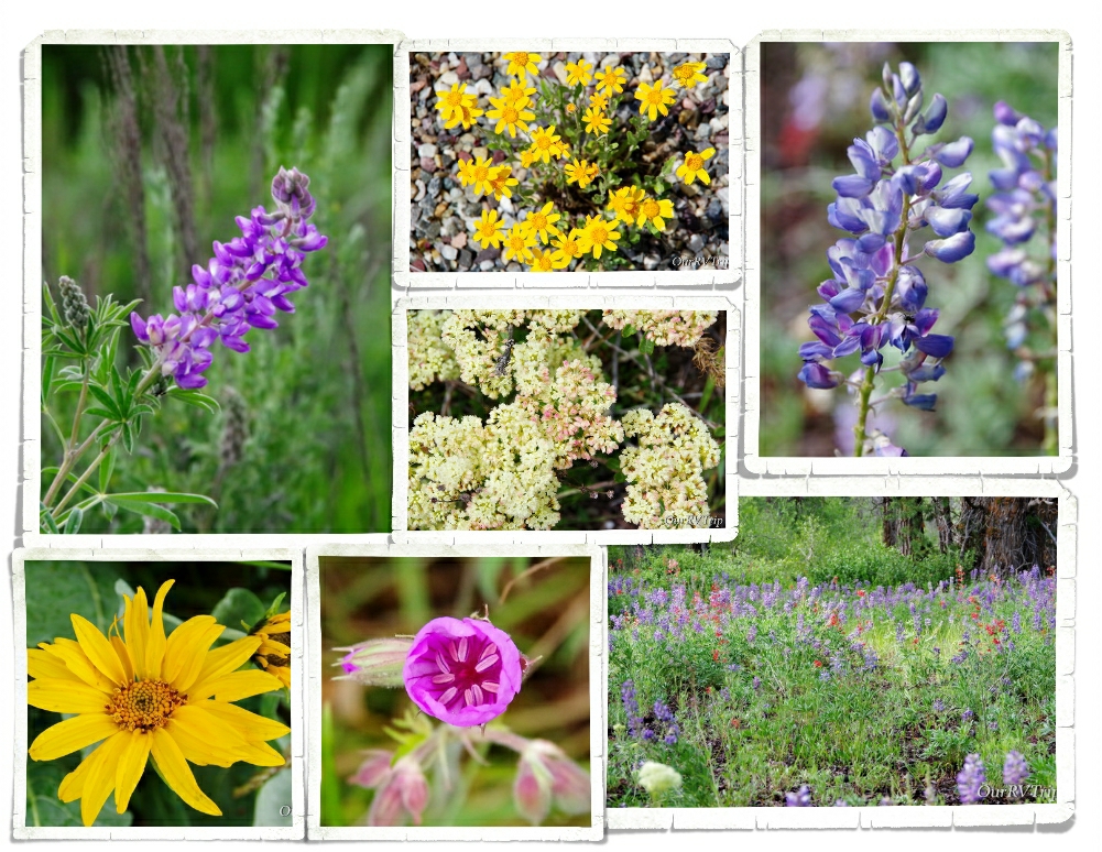
OK…let’s talk pretties. I know y’all are here for the pictures of flowers and Glacier National Park did not disappoint. Most of these pictures are from the Highline Trail. I was in flower heaven the entire hike!
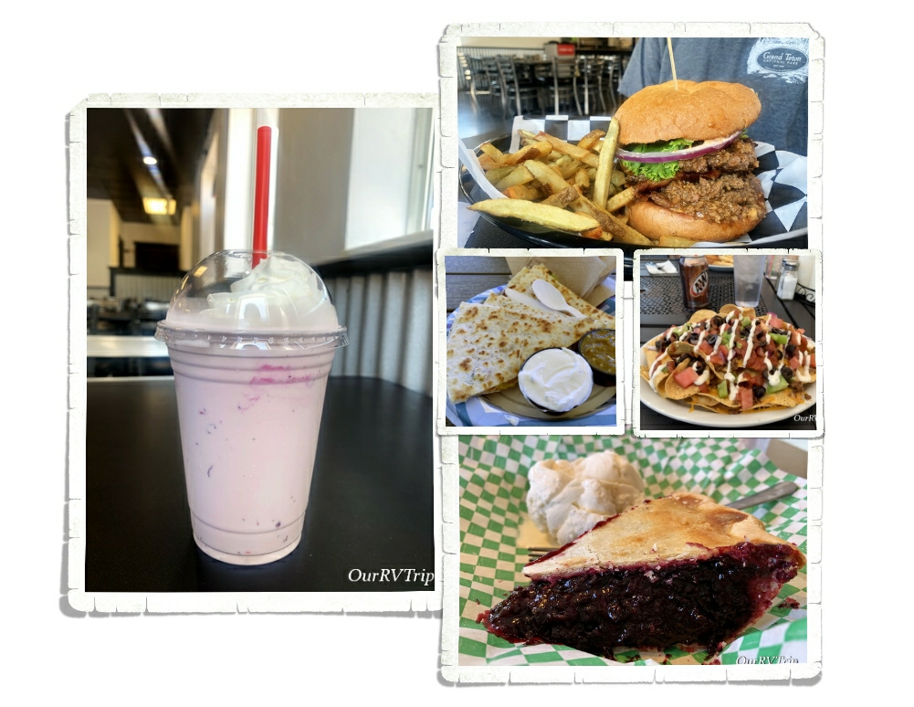
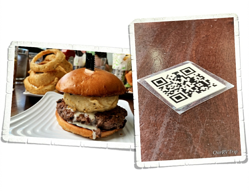
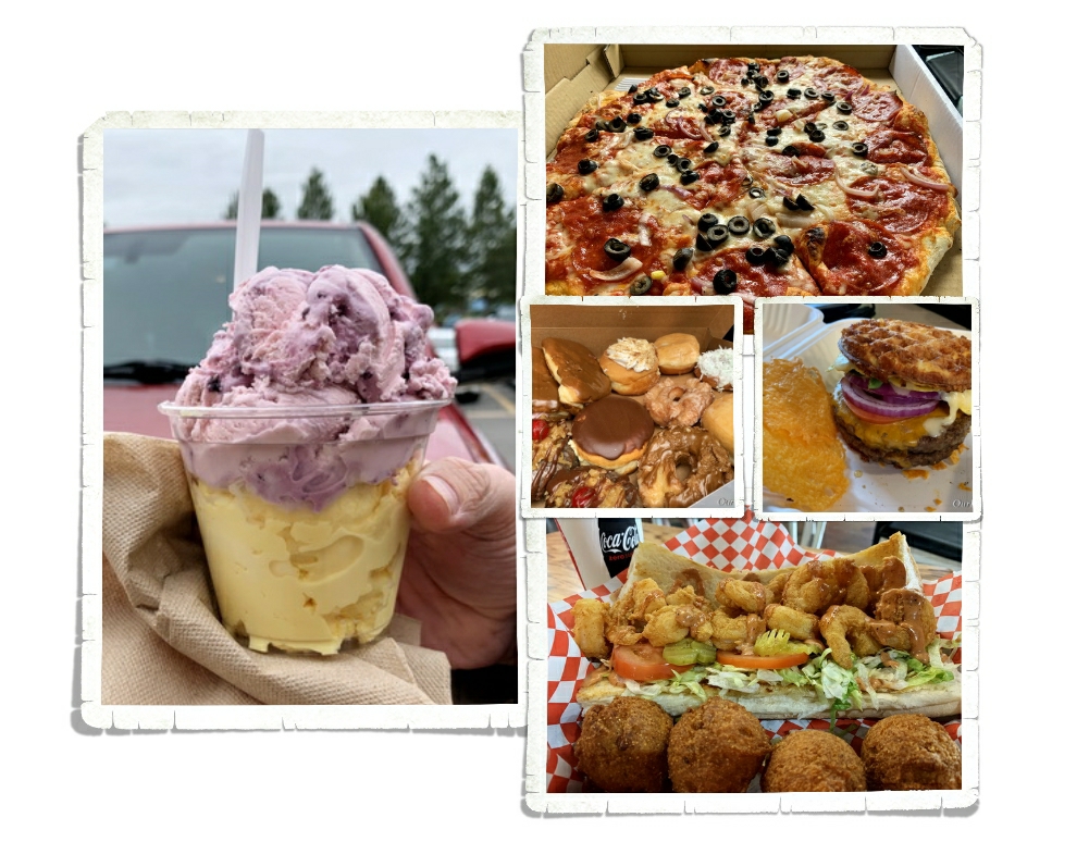
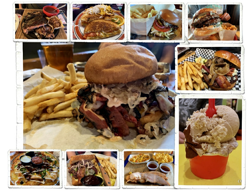
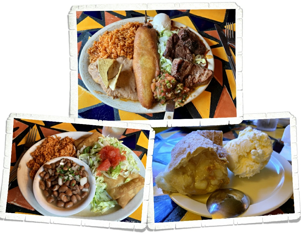
And…the foodies! We had our first huckleberry pie and it was pretty darn good! You can find huckleberry flavored everything in the Glacier area and yes, we totally had to try as much as we could. Our faves were the pie, ice cream, and preserves. We also found a great burger place called Mudman and a really tasty Mexican food truck called The Wandering Gringo that we ate at twice!
I guess Glacier National Park is called “Crown of the Continent” for a reason. We had our doubts, but in the end…the park won us over and easily earned a spot on our top ten list. We will definitely go back to explore the east side.
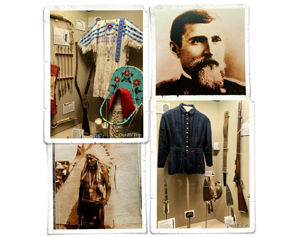
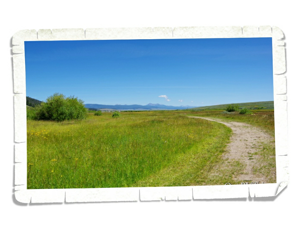
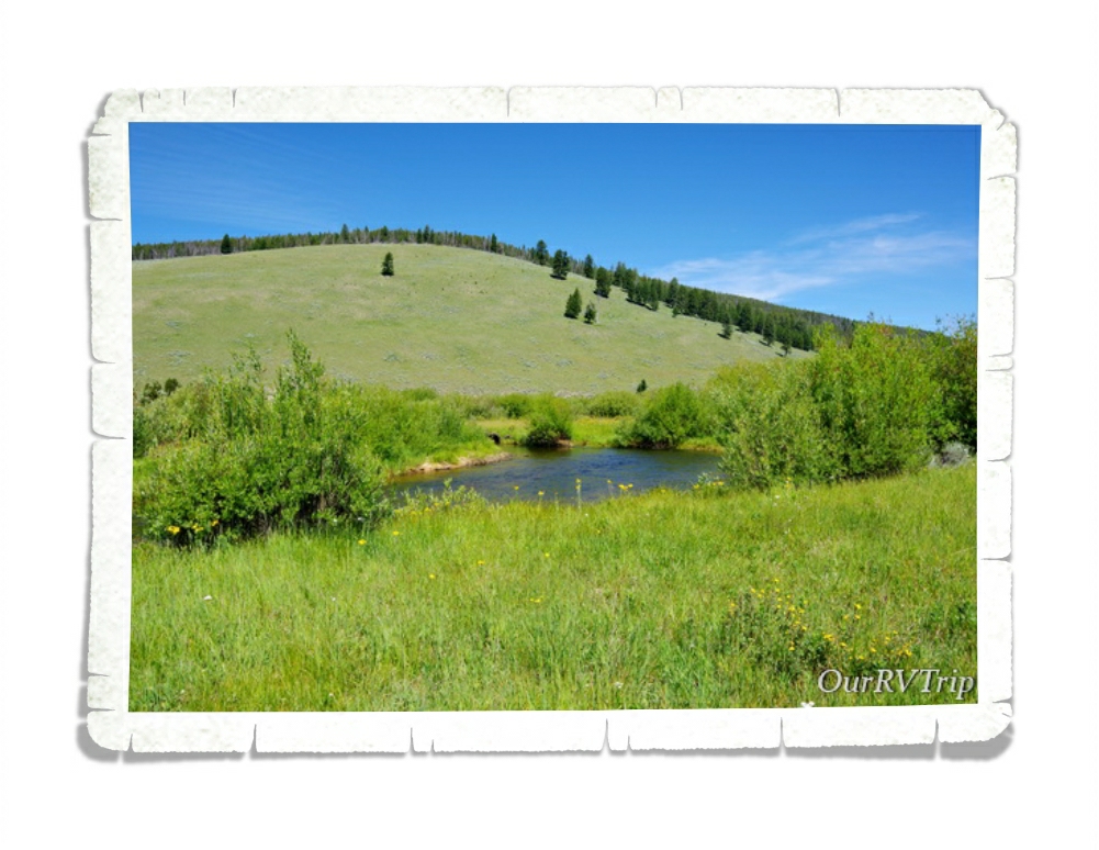
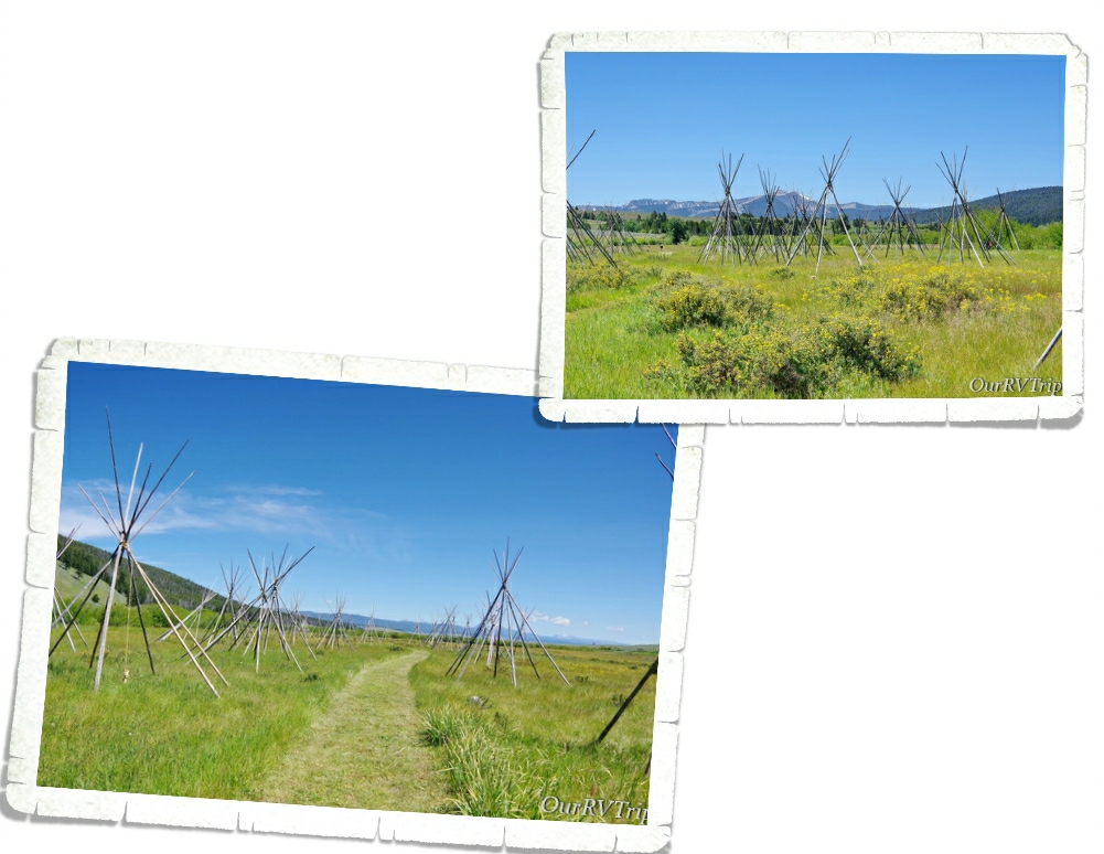
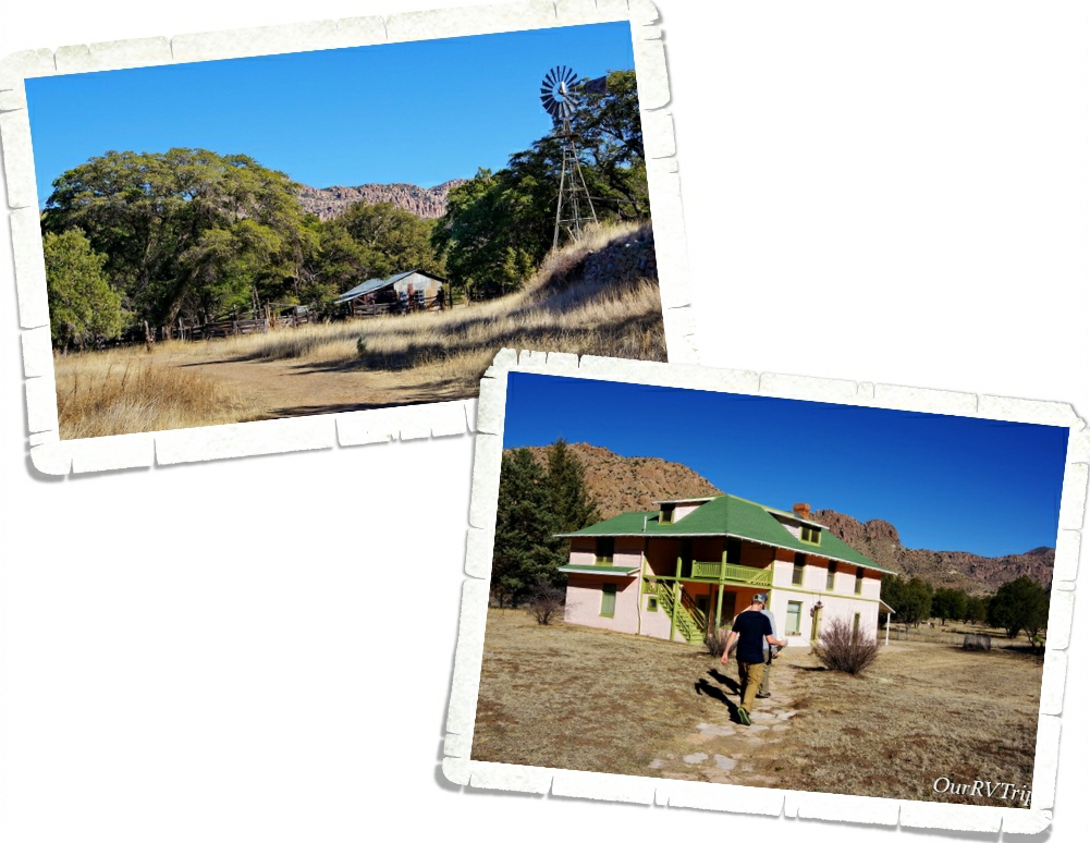
Bonus Park! We had two days to kill in between our Glacier reservations and our Yellowstone reservations so we stayed in Deer Lodge, MT for two nights just to see the Grant-Kohrs Ranch National Historic Site.
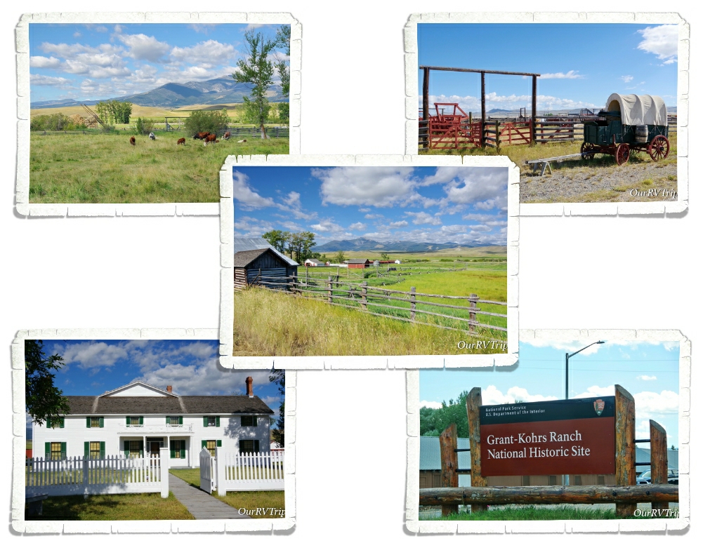
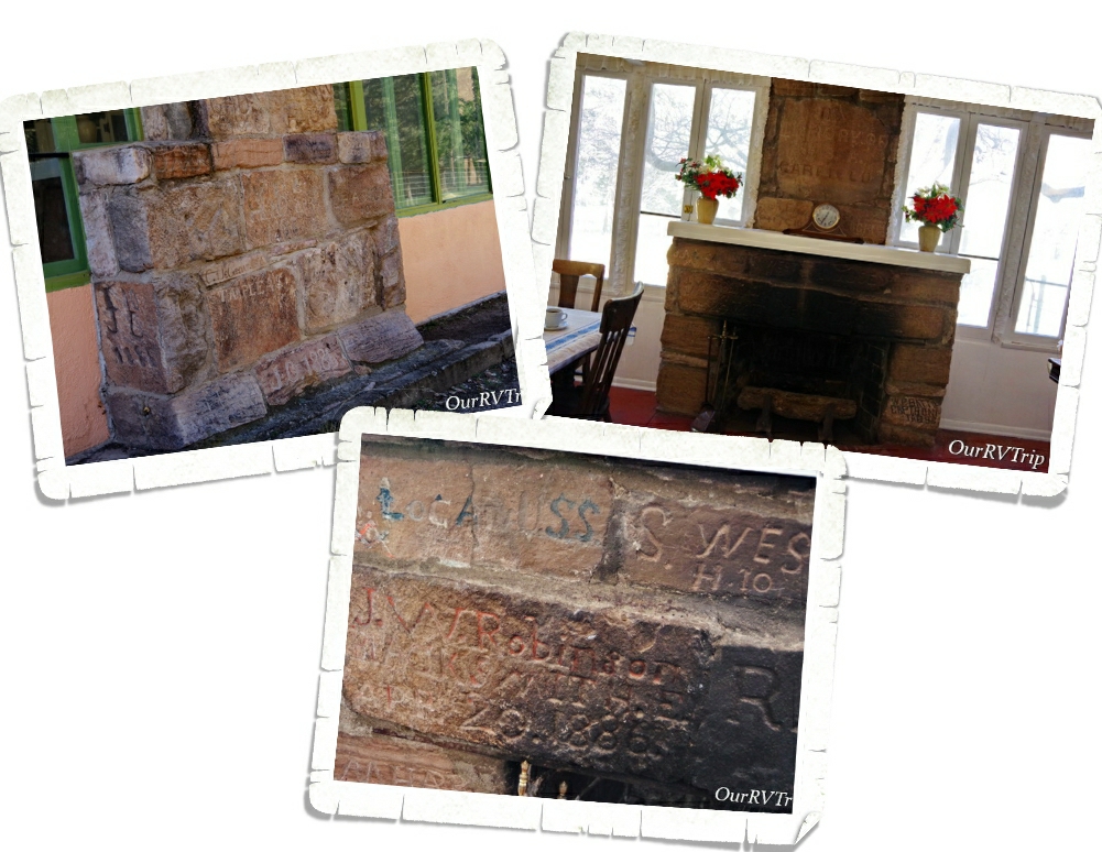
Grant-Kohrs Ranch was once the headquarters of a 10 million acre cattle empire. Today, this National Historic Site preserves the history and memory of two of the biggest symbols of the American West…the cowboy with his vast herds of cattle out on the open range. Grant-Kohrs Ranch was founded in 1862 by John Grant, a Canadian fur trader, and then expanded by a cattle baron named Conrad Kohrs. Dwindling bison herds and the growth of eastern cities led to a demand for beef.
Returning Civil War soldiers came back to Texas to find millions of unbranded cattle roaming around. There was too many cows in Texas which made the price of cattle go down to $2 a piece but the quickly growing cities in the north would buy a cow for $30. Nelson Story and his group of twenty-five cowboys made the first cattle drive from the open lands in Texas up to the rich grazing ranges of Montana in 1866.
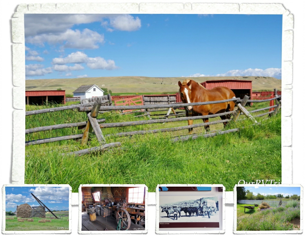
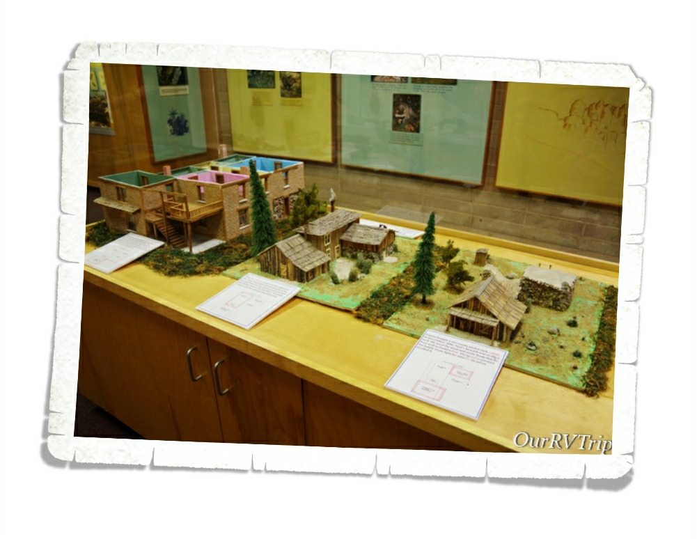
By 1885, cattle was the most lucrative industry on the High Plains but, it only lasted for three decades. Between a couple of extremely harsh winters and the Homesteaders Act that split up the open range into 160 acre barb-wired plots, the big cattle barons had to find a different way. Grant-Kohrs Ranch NHS helps preserve and tell the story of the Open Range Era. Today, it’s still a working ranch and you can see some cows, horses, chickens, and learn about a chapter of America’s history.
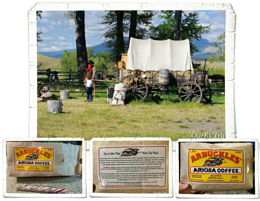
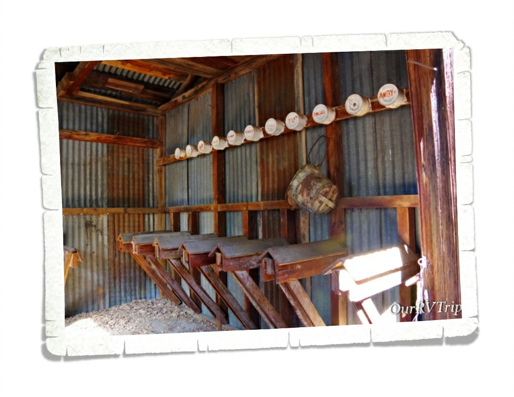
We learned a lot about cowboys and their life on the range. Most cowboys were teenagers who were willing to work long hard days and nights for very little pay. Chuck-wagons like the one above was home for cowboys out on the range. One of these wagons could carry enough food and supplies for ten to fifteen cowboys to live on the range for one month. The chuck wagon was where the cowboys would gather for food, sleep, and companionship.
One of the most memorable things we were able to do while exploring Grant-Kohrs Ranch was try Cowboy Coffee. The volunteer at the Chuck Wagon made up a pot of it the same way the cooks would have made it out on the range. The cooks would get the coffee in the same packages you can see above. Since the coffee came in whole beans, the cook would always ask for a volunteer to grind it all and he never had to ask twice. The cowboy who volunteered to grind up the coffee beans got to keep the sweet surprise hidden in the coffee package…a stick of peppermint. They sell packages of the coffee in the visitor center at the park. It’s from the same company that sold it to the Chuck Wagon cooks way back then for life on the range.
“Cowboys are smaller and less muscular than wielders of ax or pick, but they are as hardy and self-reliant as any man who ever breathed — with bronze, set faces, and keen eyes that look all the world straight in the face without flinching as they flash out from under their broad-brimmed hats. Peril and hardship and years of long toil, broken by weeks of dissipation, draw haggard lines across their eager faces, but never dim their reckless eyes, nor break their bearing of defiant self-confidence…” ~Theordore Roosevelt, 1888
See y’all down the road!
#NationalParkTour