The Apache Trail Drive
The Apache Trail drive is only 46 miles, but plan on spending the entire day exploring this scenic road.
The first thing you should know about this road is that 25 miles of it is dirt. What is it with us and dirt roads? We always seem to find ourselves driving down one. And it’s usually worth it. This drive was no exception. It was worth every dusty, washboard, bumpy mile.
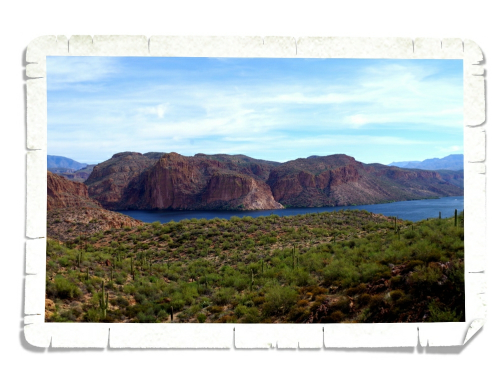
Our first oooo-ahhh view was the Canyon Lake. The sky was overcast so it was hard to see, but the water is a deep blue.
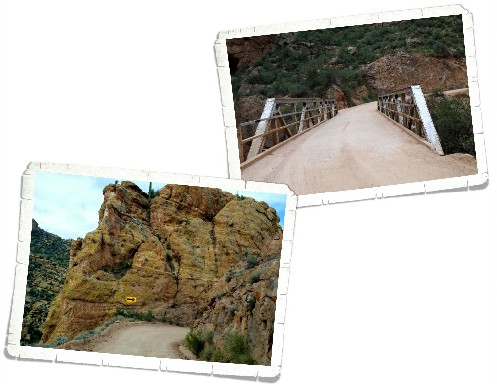
This drive shadows an ancient Apache Indian footpath and has quite a few narrow switchbacks. The dirt road should really have been a one way, but it wasn’t. We would have to find a wide-ish spot and pull over to let a car pass and if heights bother you, this might not be the road for you. There are also several one lane bridges.
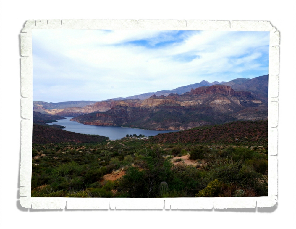
But, the views…were…stunning! In the photo above you can see the Painted Cliffs of the Mazatzal Mountains next to the Apache Lake. Guys, I really wish y’all could see this in person. Pictures don’t do it justice. Someone needs to come out with a way to easily and cheaply add 3D photos to blog posts.
Seriously, that should be a thing.
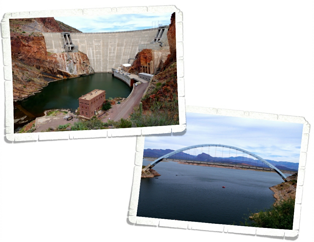
We also got to see the Theodore Roosevelt Dam which was the world’s largest masonry dam back when it was built in 1911. 280 feet high and 723 feet long, the Theodore Roosevelt Dam is impressive. On the other side of the dam is the 23 mile long Theodore Roosevelt Lake where the original town of Roosevelt is now laying underwater.
This is actually where the Apache Trail Drive ends and where the paved road picks back up, but we went on to the Tonto National Monument which was only five more miles down the road.
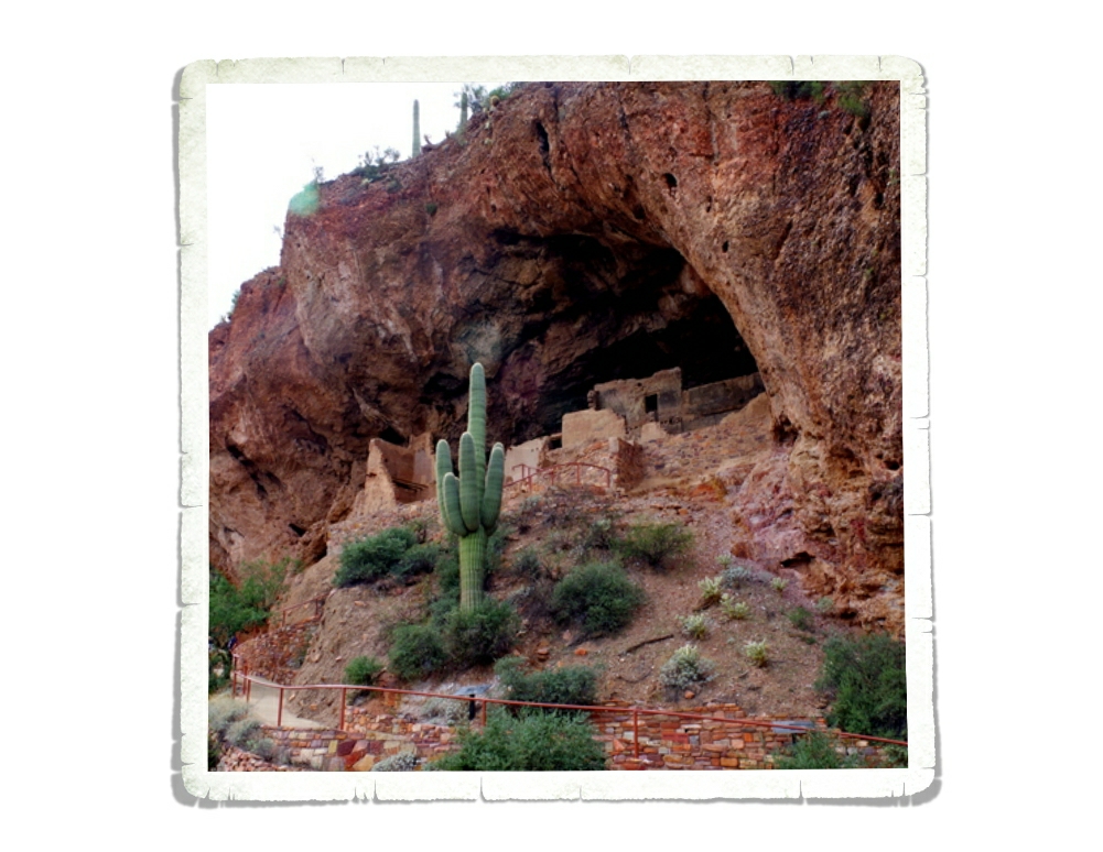
Tonto National Monument gives you a peek into the lives of the Salado people.
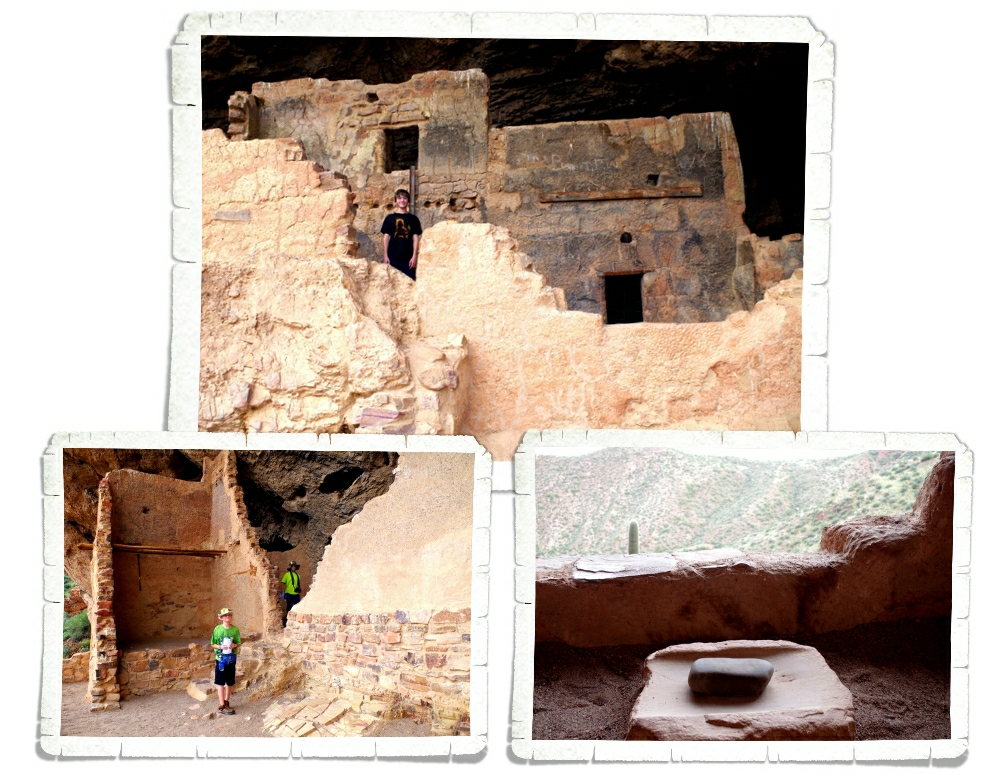
You can walk up the 350 feet to the Lower Cliff Dwelling where a Ranger is posted to not only answer any questions but to protect the artifacts. We got to walk around and through a few of the rooms while the Ranger told us what life was like for the Salado people. There are still a few artifacts left up in the dwelling. In the photo above, you can see a grindstone.
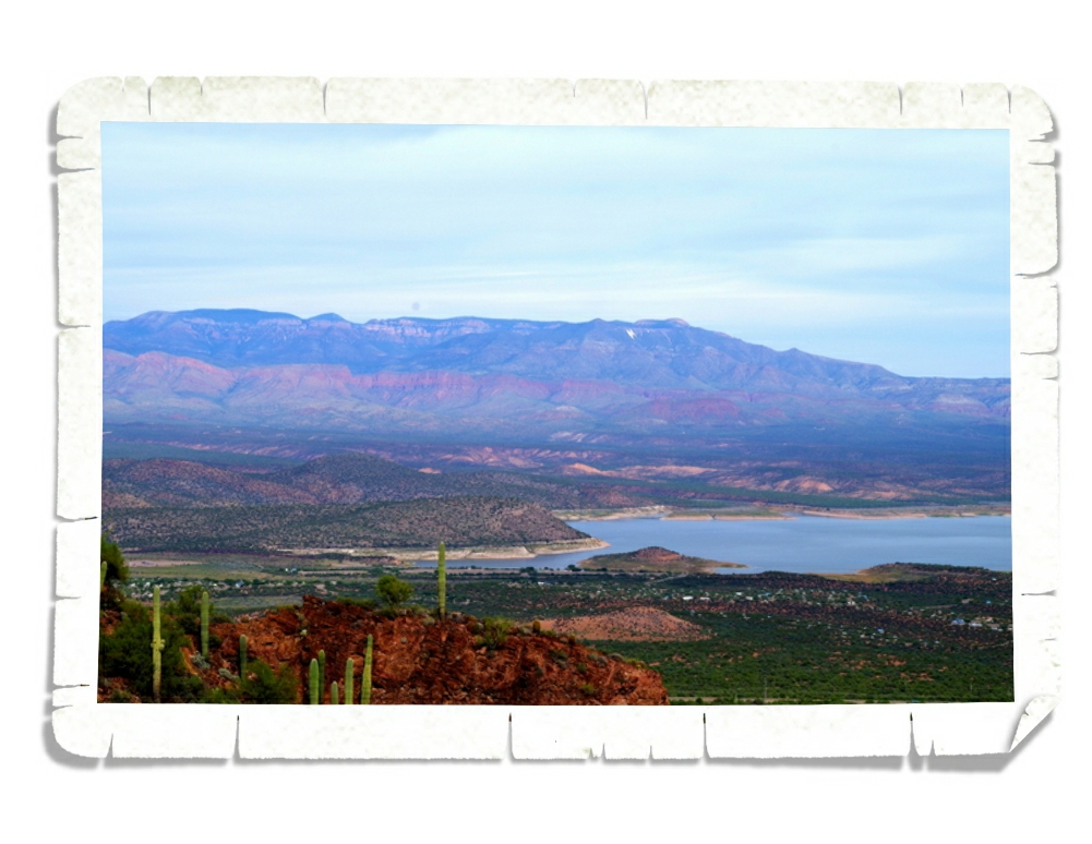
The view of Roosevelt Lake is spectacular from the Lower Cliff Dwelling.
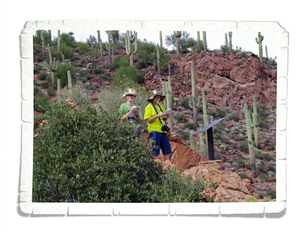
The boys took the opportunity to get another Junior Ranger Badge.
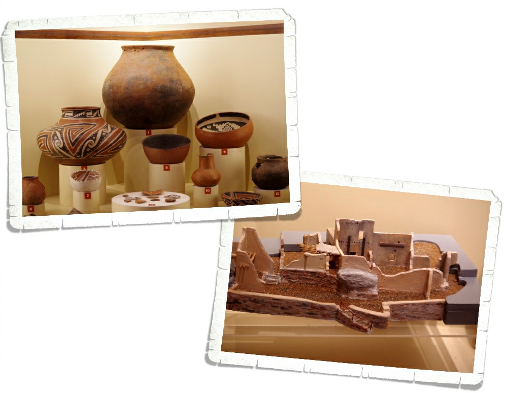
In the visitor center, you can see some of the more impressive artifacts they found in the dwellings. Apparently, until the 1930s people would steal, smash and deface the dwellings, which is why there’s now a Ranger posted there. I’ll never understand some people’s need to destroy. In the right photo you can see a model of the Lower Cliff Dwelling. There used to be 19 rooms and they think there were probably somewhere around 60 people living there. There’s also an Upper Cliff Dwelling that has 40 rooms, but it’s only open from November to April. I imagine we’ll come back someday to do the three mile Ranger hike to see it.
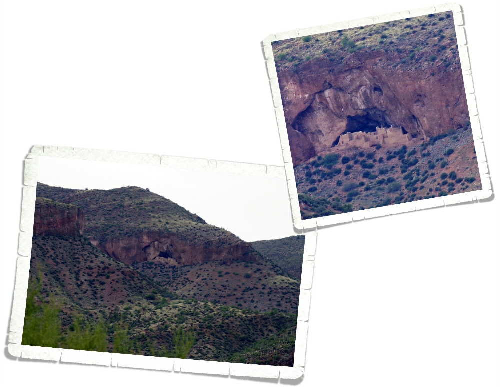
Down the road from Tonto NM there’s a scenic pull-off that gives you a faraway look at the Upper Dwellings. It looks really cool! We’d all like to do the hike there sometime.
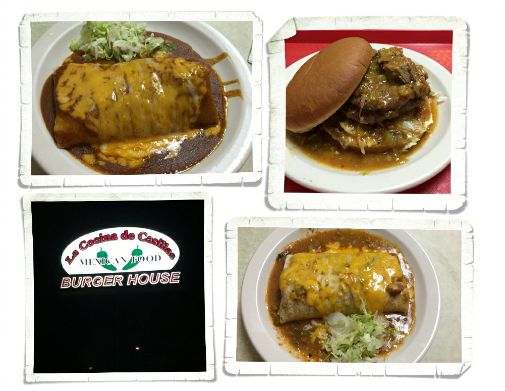
While we were exploring, we came across this gem of a place. You’re looking at the best burrito I’ve ever had. It’s called a Green Mix Burro, Enchilada Style. We liked this place so stinkin’ much we ate here twice in the seven days we were in the area. Charlie got the Burger Olé which is a double burger covered in the yummiest green chili. He had to eat it with a fork and knife, but he ate it all.
One of our favorite things to do is take the road less traveled. You never know what amazing vista or interesting foodie place you’ll find.
See y’all down the road!