Category: States

Denali

Denali

This post is picture heavy and long. I tried to weed out some of the pics, but when I’m talking about Denali National Park…it’s hard to choose which photos should be left out. I’ve been looking forward to Denali ever since we decided we were coming to Alaska.

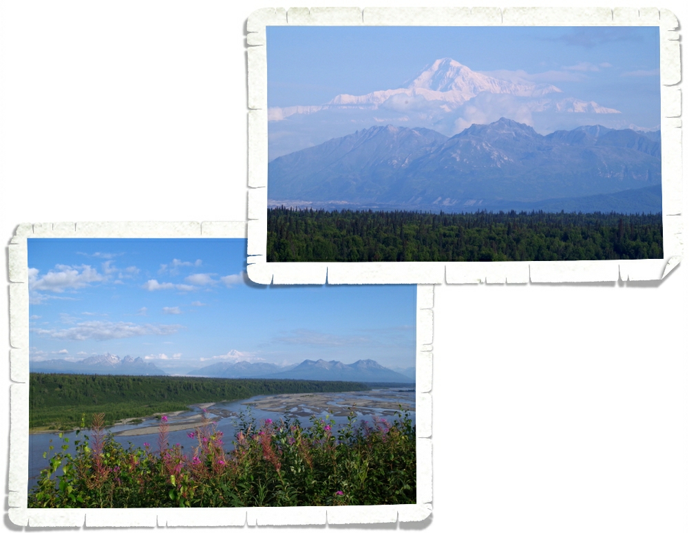
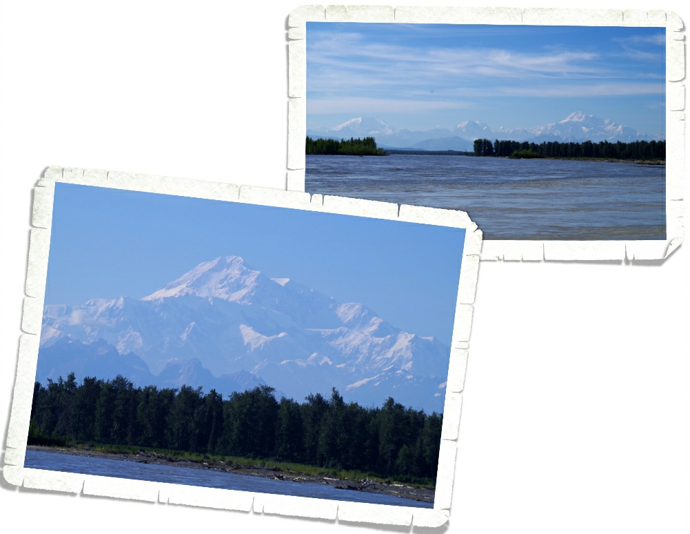
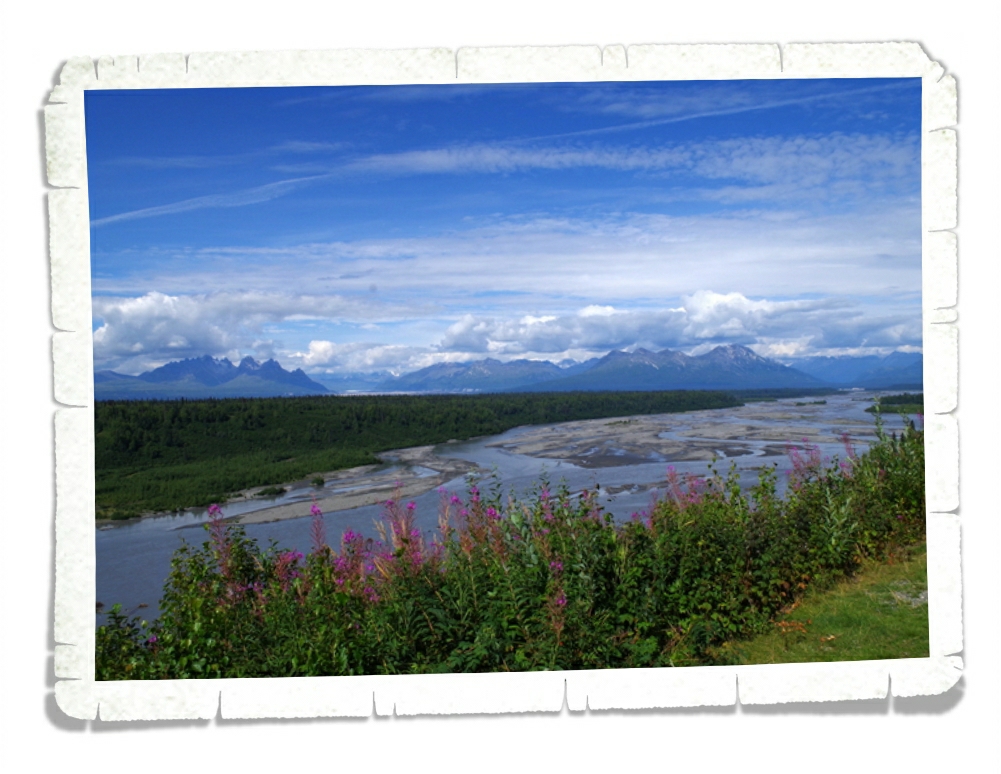
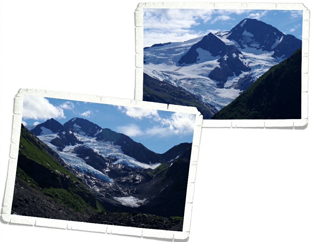
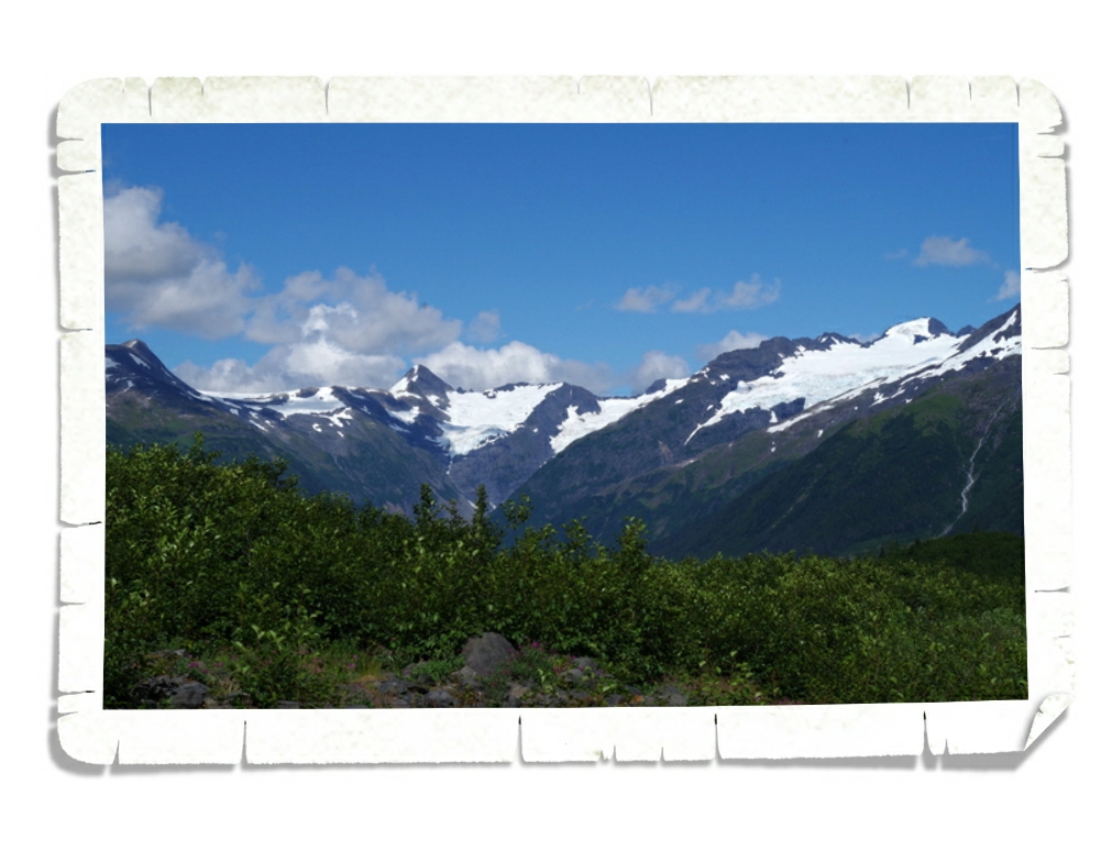
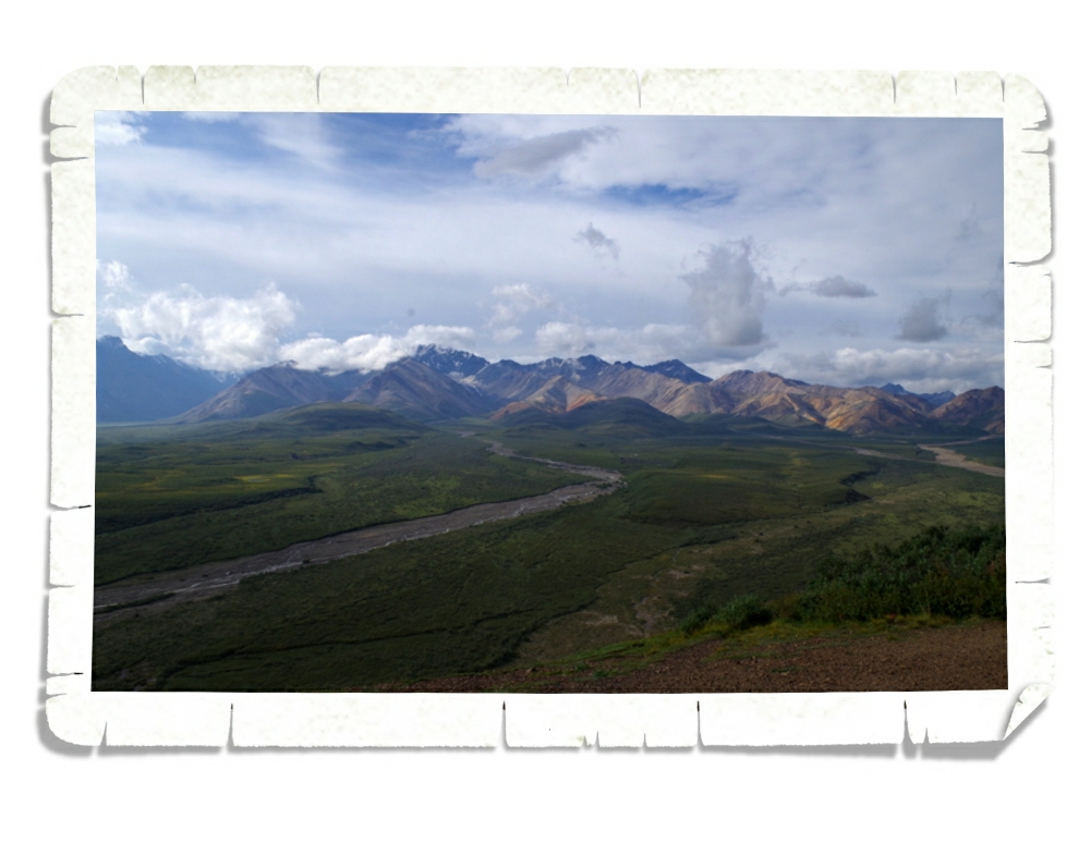
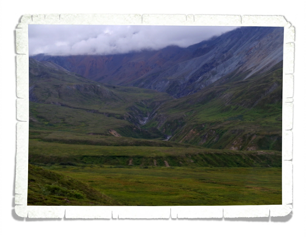
On the way to the Denali area from Talkeetna we stopped back by the South Denali Viewpoint because it was a gloriously clear day. Everyone keeps saying how only 30% of the visitors ever actually get to lay eyes on Denali (Mt. McKinley). We’ve been fortunate enough to see her on several days.

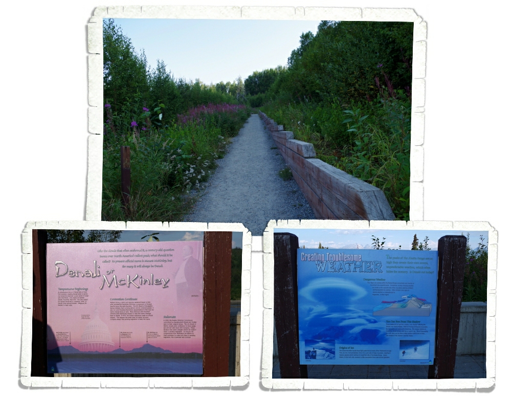
Denali Viewpoint South is laid out kind of weird. There is the main viewing area which has a pretty good view, but with a few trees that are starting to grow big enough to hinder your view. But, then there is this unmarked side path that leads to an even better view. You can see the view at the top of this post. It was odd that the trail wasn’t marked. Seventy-five percent of the people there never went up the path, which is sad because the view was so much better. There were also some great informational boards that talked about how the Alaska Range makes its own weather. While we were in Denali NP, our shuttle bus driver actually told us there was a funnel cloud spotted in the park three days before we got there. I would never have considered Alaska to be a tornado state. There’s also a big debate as to what the mountain should be called. All of the locals call it Denali, but most of the NP staff call it Mt. McKinley. The argument is that the mountain has been called Denali for thousands of years by the Athabaskan Tribes and it should never have been renamed…especially after someone who isn’t even from Alaska. I can kind of see their point.

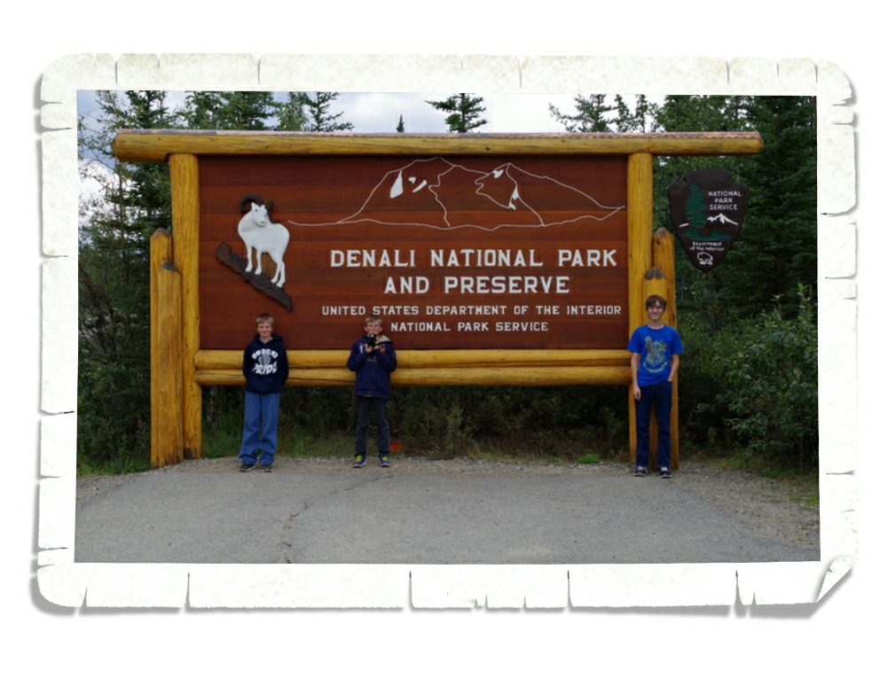
We finally made it to the park! Denali means the “High One” in the Athabascan language. In 1897 Denali was renamed Mt. McKinley in honor of President William McKinley, but the renaming has always been a topic of controversy. Denali tops the scale at 20,320 feet as of this year, but the mountain is still growing almost an inch a year! There are four Visitor Centers in the Park, but you have to shuttle into the park to get to two of them.  What you might be surprised to know is that there really aren’t many hiking trails within the park. There are a few in the first 15 miles but after that there are very few actual trails because they (the park officials) want you to get out and explore your park. Safely. There is a process to being allowed to roam the back of the park. If you’re interested, head over to the NPS website and check it out.

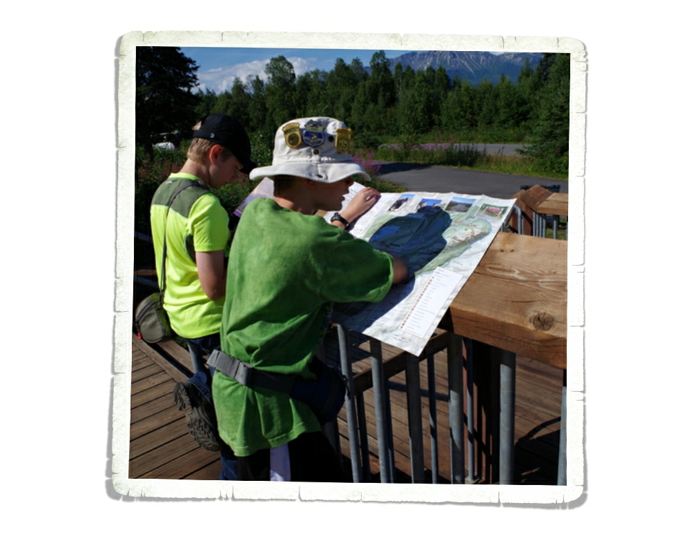
We got to the Denali area on a Friday afternoon and quickly got the RV set up and rushed to the park to reserve our shuttle bus tickets for the next morning. We lucked out on our shuttle tickets and then went to the Visitor Center to explore.

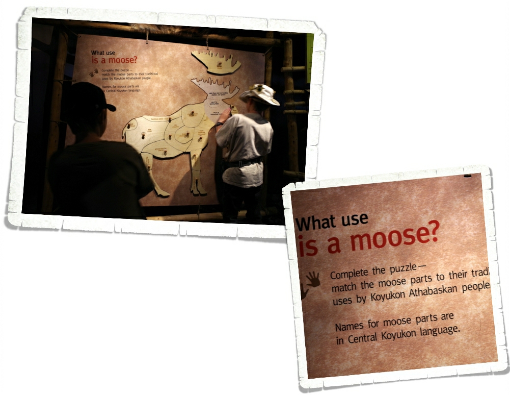
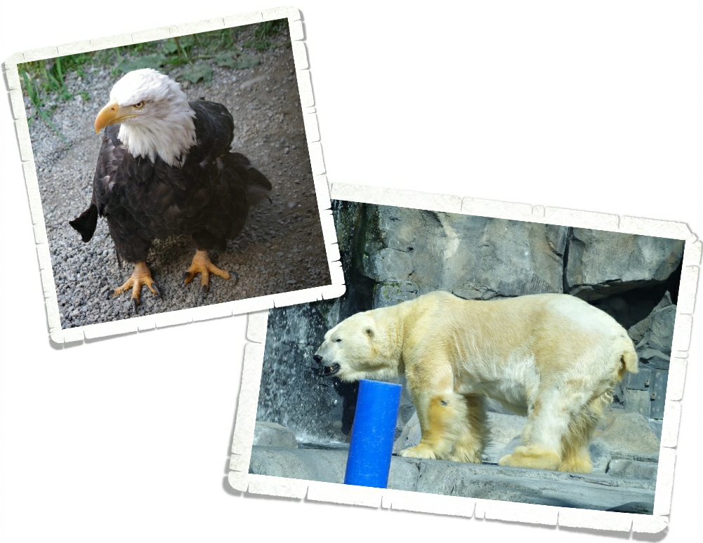
The Visitor Center has a great museum in it. There was this display about moose parts. All three boys took time with this exhibit.

Y’all know I love to bake, so this caught my eye. At this exhibit they explain what it took to make a pie back in the good ole’ days (actually, with so many Alaskan’s living off the grid, I would imagine this is still the process for a good percentage of the population) in Alaska. That’s a lot of work for some pie…

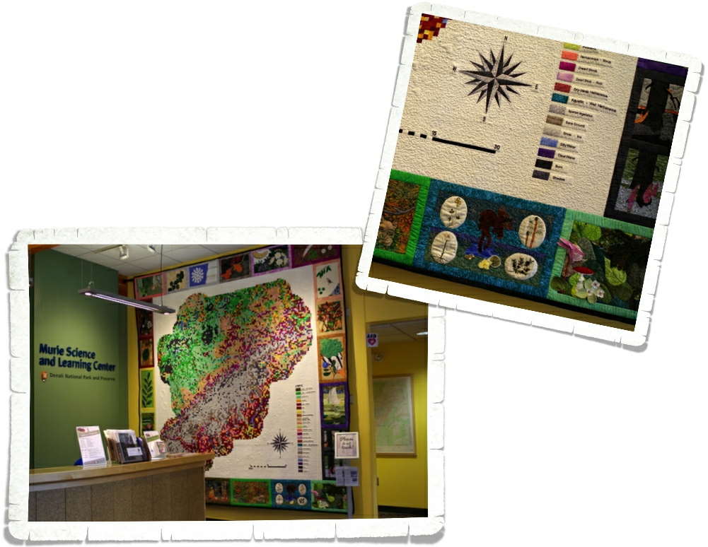
We then made our way over to the Murie Science and Learning Center. Check out that quilt on the wall! There was some amazing detail work done on it!

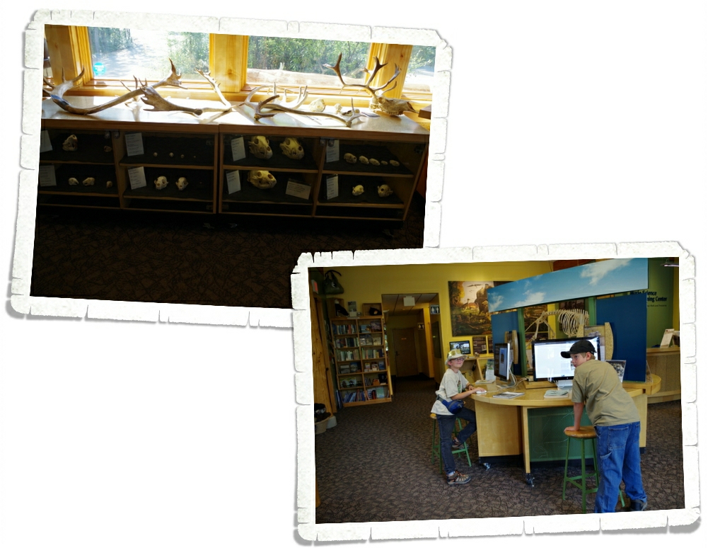
This was a great place for boys who love science. They had computers set up that told all about different aspects of the park along with the different experiments going on throughout the park. There was also the obligatory bone collection that we seem to find in all Visitor Centers.

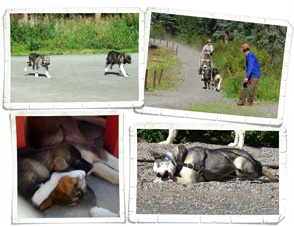
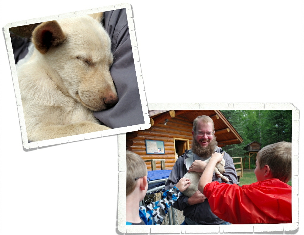
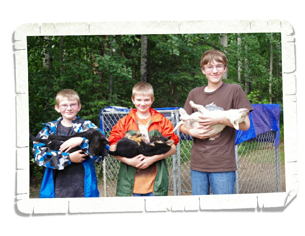
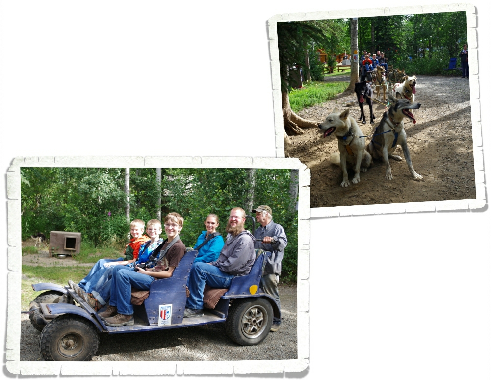
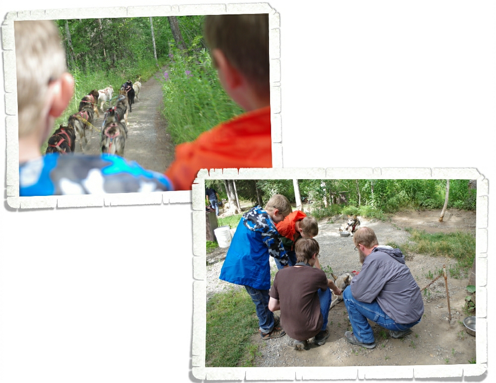
The dog kennels were next! We were all ready for some more sled dog action and these sled dogs did not disappoint. There are demonstrations three times a day (10, 2, & 4). We barely made it to the last one of the day. They harnessed up a few of the dogs and ran them around a small track for everyone to see. These sled dogs are different from the sled dogs we saw in Wasilla. The dogs here are bred for working while the dogs in Wasilla are bred for running. Big and stout versus small and fast. After they raced around the track they were given a treat (I think it was an antler) to gnaw on while an intern talked to all of us about the importance of sled dogs and what their routines are like summer vs. winter. In the winter these guys get close to five thousand calories a day! There were six puppies, but we didn’t get to hold them or handle them in any way. We were a little bummed about that. We were there at the end of the day so we got to see the puppies run for their dinner. As part of their training they run around the same track the older dogs ran around during the demonstration. There’s nothing much cuter than a bunch of puppies running as fast as they can to get back and eat.

A couple of the dogs were available for visitors to pet. I’m not sure who enjoyed it more…the boys or the dog.

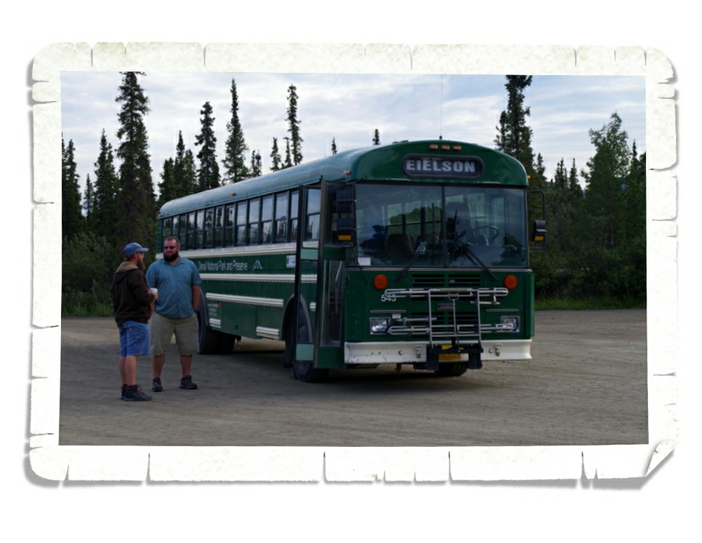
There are only a few ways you can gain access to Denali NP beyond mile 15…you can do what 98% of the people do and take a shuttle bus, you can apply to camp at one of the three campgrounds that are past the mile 15 mark, you can be a Park Ranger, or you can get permission to conduct an experiment within the park. We went with the shuttle bus. Now, interesting fact…there are two different shuttle bus options for taking trips back into the park. There is the green shuttle bus and the tan shuttle bus. The green shuttle bus has different options (or miles) you can choose from, We chose to go to the Eielson Visitor Center which is around the 66 mile marker, but there are a few other options. For our trip we paid $35/ for the two adults and all three boys were free. You will want to take any food you’ll want for the day and you can get off at any time, explore, then catch any other green shuttle bus to continue. For the tan shuttle bus, you have the same options of where to go within the park, but they will serve you a boxed lunch. The prices for adults were around $130 for adults and $50 or so for kids. You can’t get off, they stop at fewer places, and let me point out…you’re traveling the same road and seeing the same things that the people on the green shuttle buses are seeing. Hmmm…we can’t figure out why anyone would choose the tan shuttle bus. Our bus driver stopped every single time anyone saw an animal. Every. Single. Time! It was great! And he was a wealth of knowledge on the park! He narrated the whole trip so we actually knew what it was that we were looking at. You can see him in the photo above in the blue shirt.

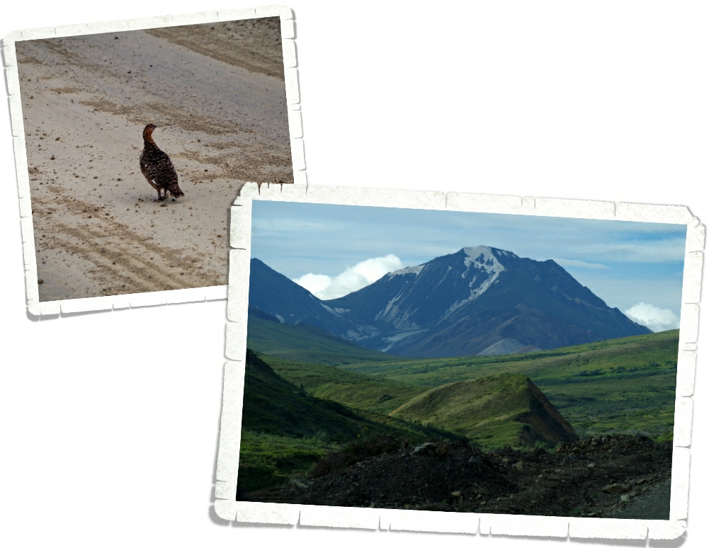
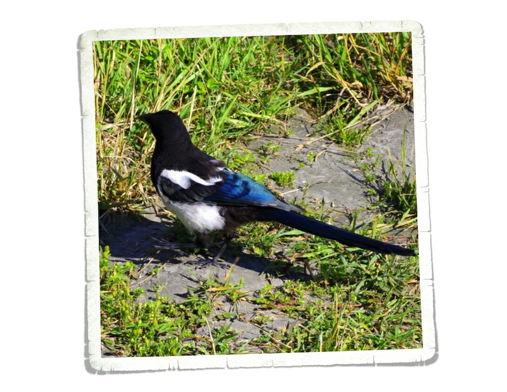
We started the tour off right with the Alaskan State Bird…the Ptarmigan. Did you know, you won’t even see the original National Park unless you take a shuttle bus tour? All you’ll see is the expansion of the park that happened in 1980.

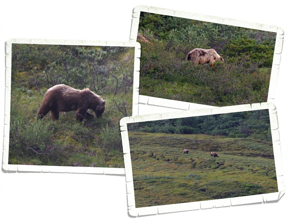
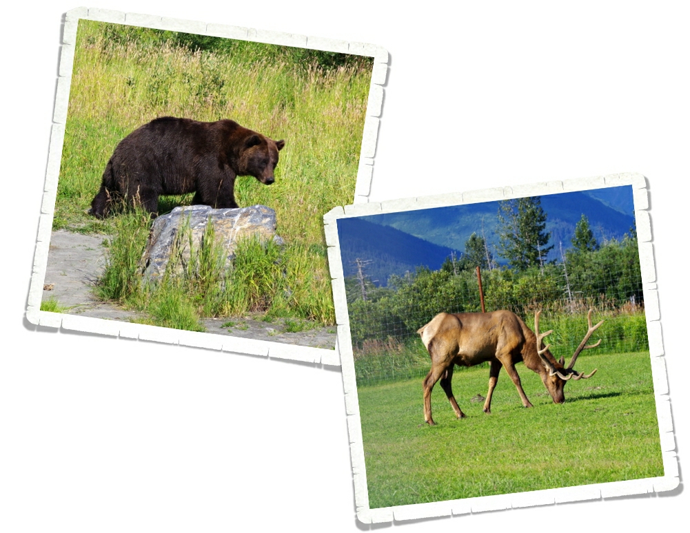
We started spotting the bears once we got to around the thirty mile mark. And boy were the bears out and about! These two in the bottom right photo above were chasing each other up the mountain and let me tell you…bears might look big and fat, but boy howdy…those beasties can move!!

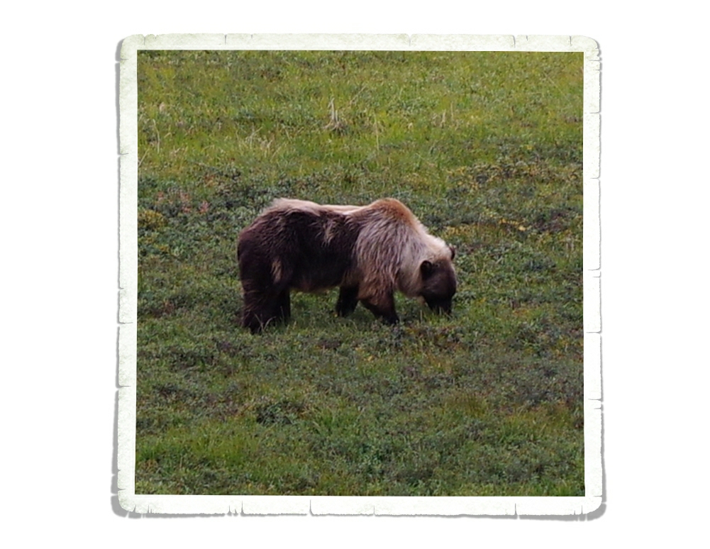
The bears in Denali are all on the blond side. This one was Nicholas’ favorite because it’s half blond and half brown. I think we ended up spotting ten grizzlies throughout the day!

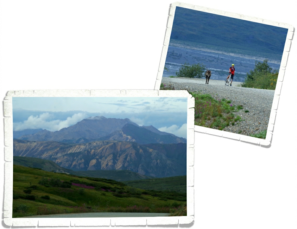
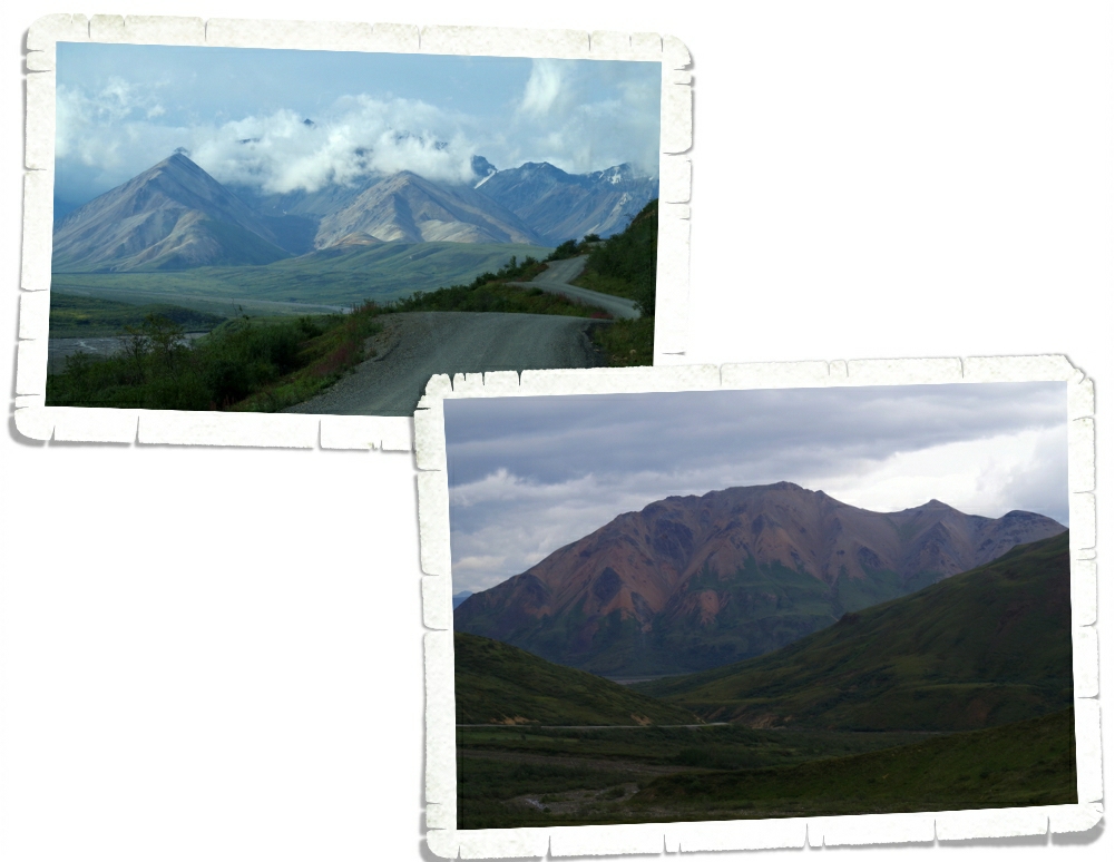
The park road past mile 15 is a dirt road. I’d read you could bike it, but it’s kind of a dangerous thing to do because of the condition of the road and all of the shuttle buses…not to mention all of the wild animals. We saw several people willing to bike the road anyway. All of them looked miserable. The guy in the photo above just about had a run in with a caribou.

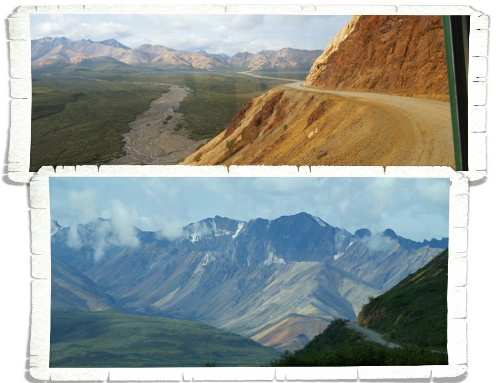
In the bottom photo above you can see a picture in the Colorful Rocks Area. Yup, it’s really called that. Denali NP is broken up into sections. You can also see the narrow winding dirt road…with no shoulder…that the bus took. The views were stellar! Really, they were just spectacular. So, when Ryan (our bus driver) told us that the views were getting ready to knock our socks off starting around the next turn…well, pictures don’t do it justice. Y’all really need to go see it for yourself.

I would forget to look for the wildlife because I would get so wrapped up looking at all the mountain views.

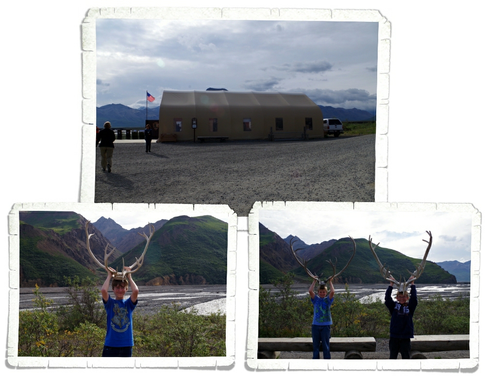
We got a ten minute rest stop at the Toklat Visitor Center at mile 53 in the park. There was a small store and restrooms for anyone in need. They also had some caribou antlers you could pick up and handle. Both Alex and Nicholas had to have help getting them all the way up to the top of their heads! Charlie didn’t have any trouble though!

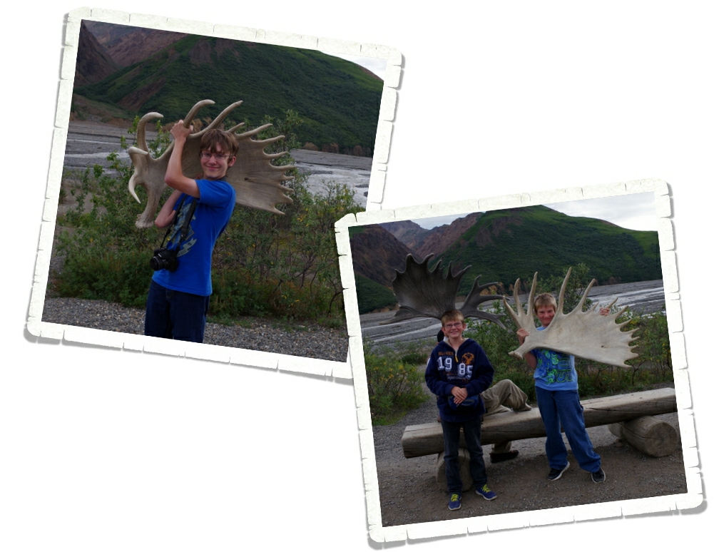
They also had a set of moose antlers. They were so incredibly heavy that Nicholas couldn’t even begin to get his lifted up so a guy held it up for him and Alex was struggling to get his up as high as he did. Charlie probably could have muscled it to the top of his head, but it was kind of awkward so we settled for the shoulder.

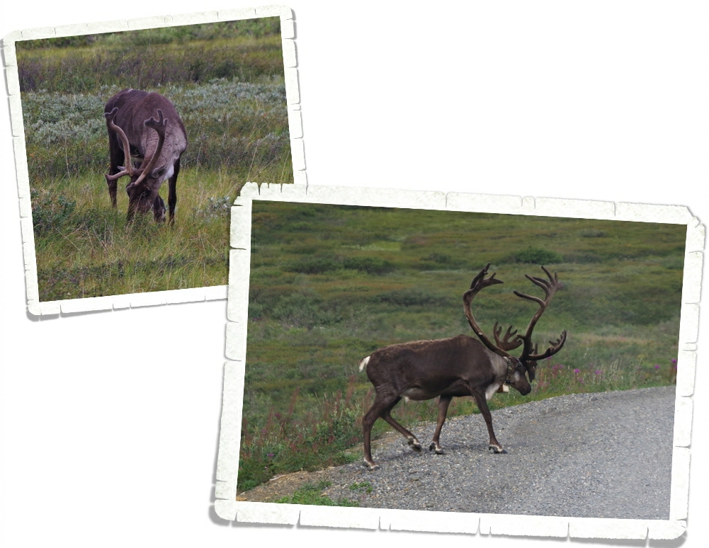
Right after the Toklat Visitor Center we started seeing all of the caribou. There were tons of them! The one in the photo above has a tracking collar on it. He jumped into the road and just sauntered down it for a bit. All of the buses have rules about what they can and can’t do near an animal. The rules are pretty strict. Basically, if it’s going to bother the animal in any way, don’t do it. If an animal is in the road you can’t shoo it away, you just have to stop and wait. These rules apply to all of the animals…even the small alpine ground squirrels.

It’s amazing how different mountains that are right next to each other can look. I love the colors of the mountain in the photo above.

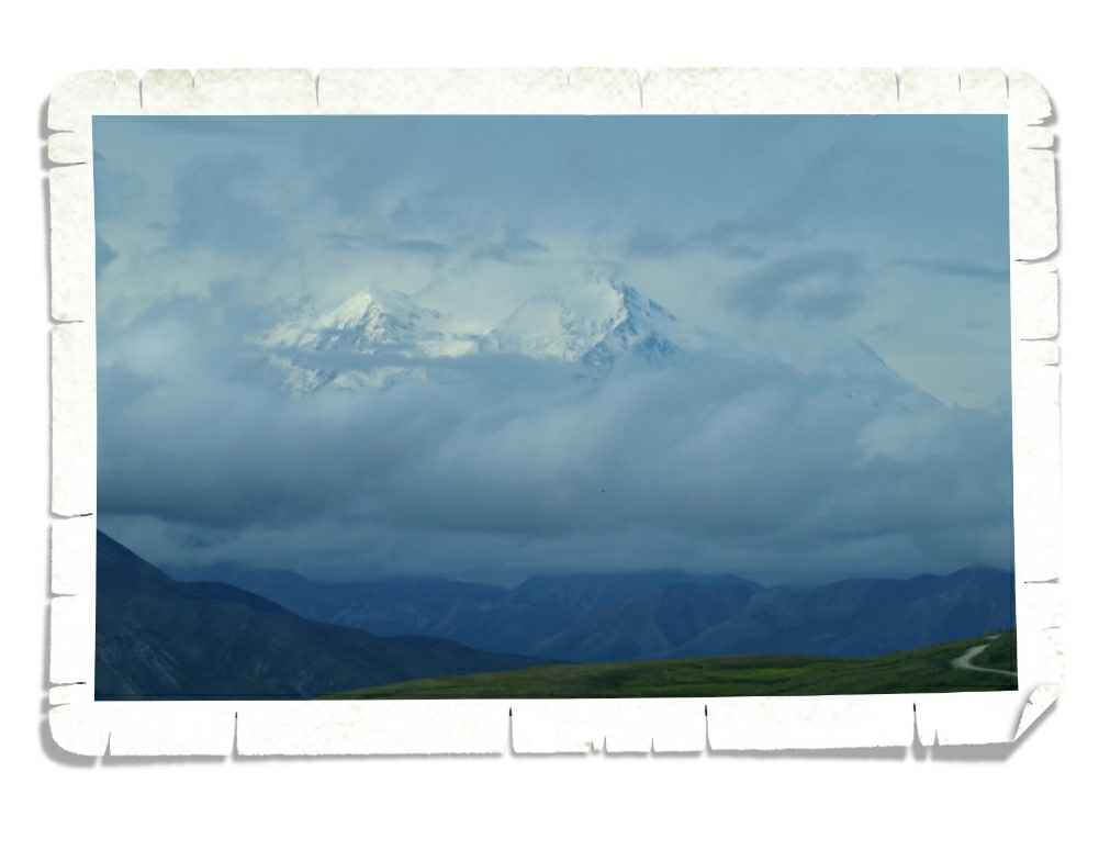
This was all we saw of Mt. McKinley. She peaked out at us in the morning, but was completely clouded over by the afternoon.

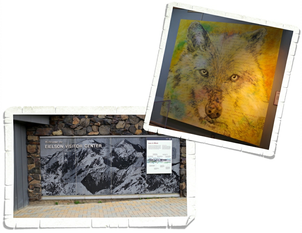
The Eielson Visitor Center at mile 65.9 in the park was our destination. You can go farther…all the way to the end of the road at mile 92.4, but be ready for at least a 12 hour ride (round trip). We went to Eielson because I’m collecting the passport stamps. Denali has seven passport stamps and two of them (Eielson and Toklat) are only available if you take a shuttle into the park. It was worth it. I really wish we’d done the Kantishna (92.4 mile) shuttle. When we come back, we will definitely do that one. This painting was in the Eielson Visitor Center. I wish they had it on a postcard…I love it, but I don’t think it will fit in the RV…

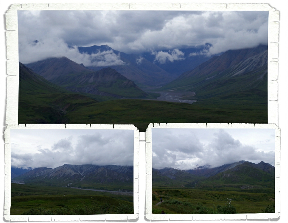
Here are some views from the visitor center. In the bottom right photo above, you can see a weather tracker thing-a-ma-bob from one of the ongoing science experiments. It was at this point that I realized we should have gone all the way to Kantishna.

After Eielson we headed back to the front of the park and I took the opportunity to get pictures of the other side of the road. I kept seeing all of this great landscape on the left side of the bus heading to our destination…so I made sure to sit on the same side of the bus going back so I could get photos of everything! I sat on the right side of the bus in the front and Charles sat on the left side with his new camera so we would have both sides covered!

You can see the narrow, winding, dirt road over on the left side of the photo above. I’m so glad we didn’t have to drive it ourselves. Some of the switchbacks and mountain passes were…well…Ryan would warn us when we came to one that was bad so people afraid of heights could switch sides of the bus if they needed to. I shot the left photo above out the front window of the bus to give you an idea of just how windy and narrow the road really is. Two shuttle buses wouldn’t fit side by side. one of them would have to pull over and let the other one pass.

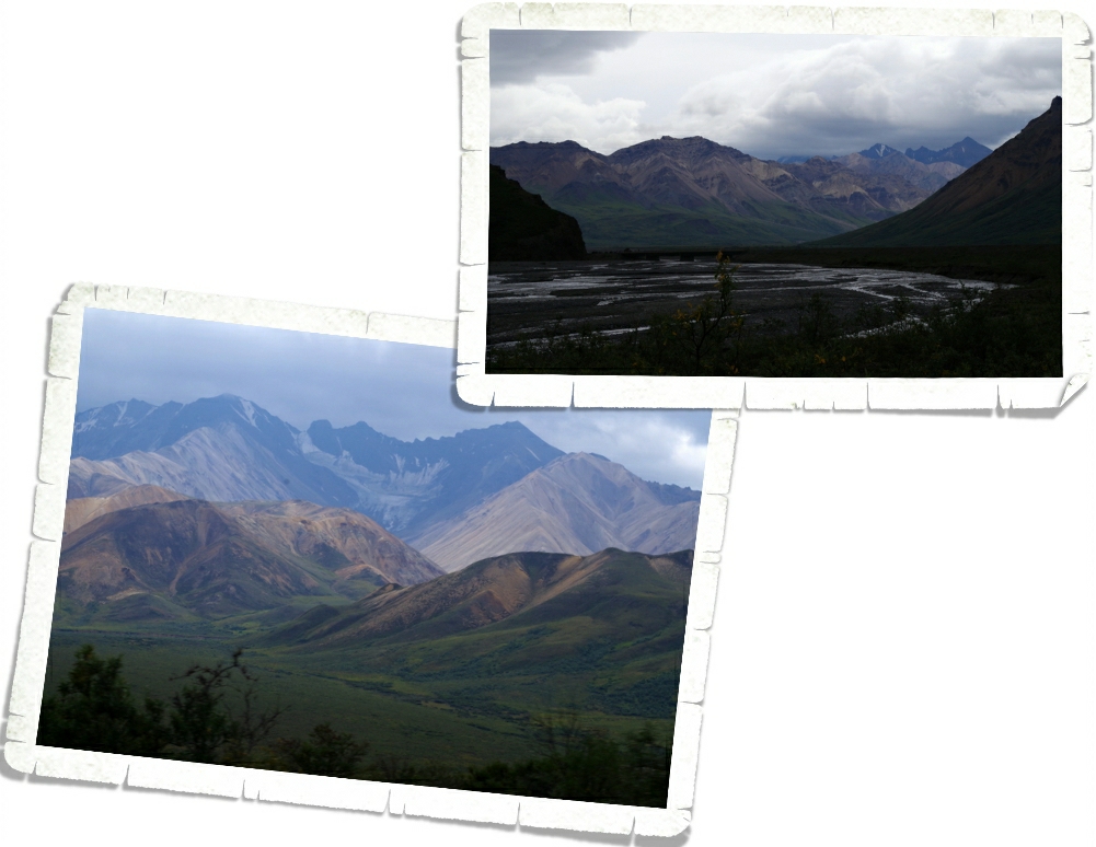
I might be a little obsessed with mountainous landscapes. The colors and shapes…love them! Sometimes the mountains look so perfect they look fake. I have so many landscape shots from this one bus trip…it took me forever to decide on which ones to include.

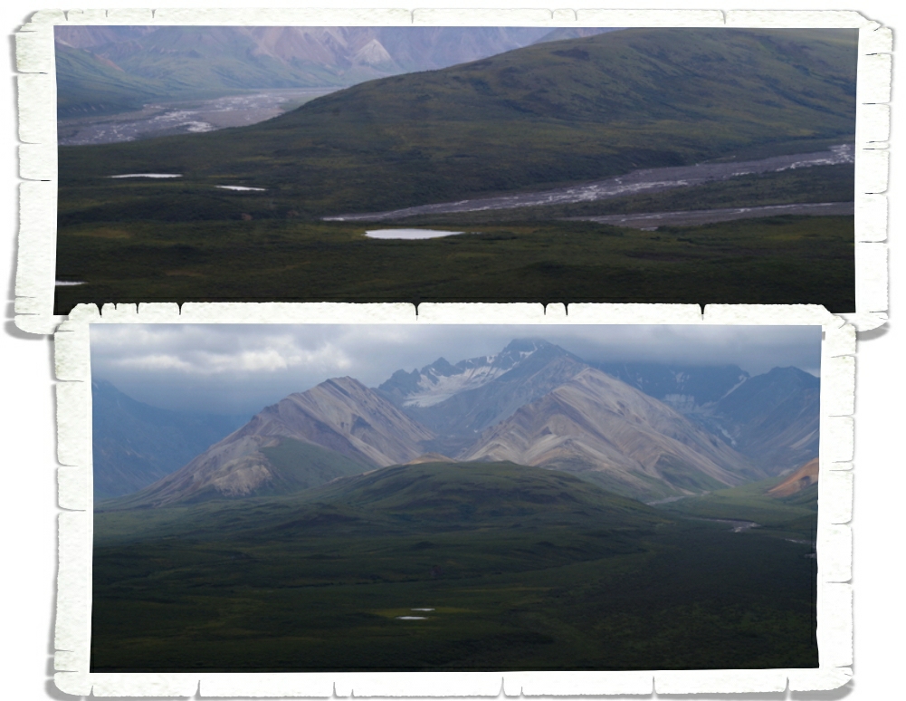
Ok, do you see all of the little ponds? Those were created when the glacier was moving through this valley and chunks of it would fall off and melt and voila! A pond!

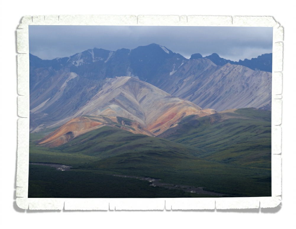
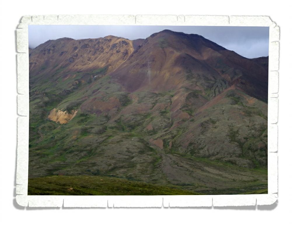
This mountain is called Polychrome and is my favorite mountain in the park. Look at all the colors! The picture just doesn’t even begin to do it justice…

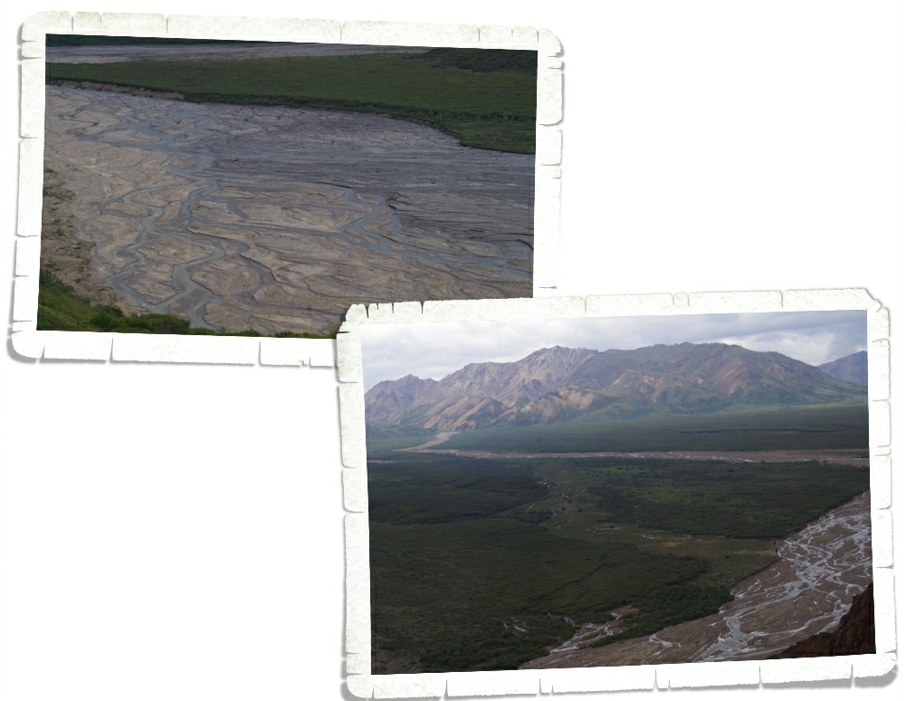
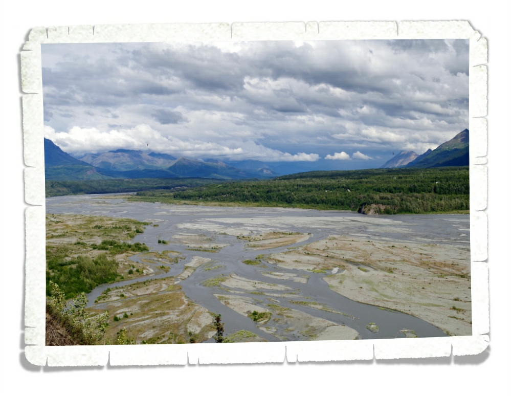
This is something else I thought was really cool. This is a braided river. Cool name, right?! This braided river has many different water sources which make many different paths that all wind around each other.

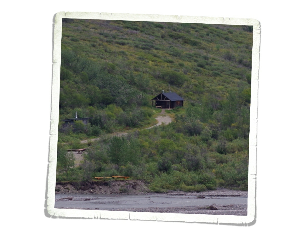
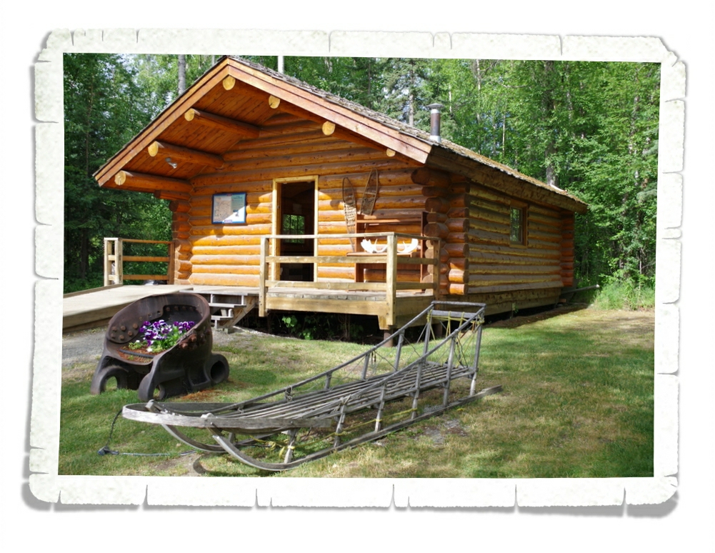
There are a few…maybe four…cabins throughout the park that were all built in the 1920s and are still being used today by the rangers, scientist, or resident artists.

One of the hardest animals to see in the park is the wolf. There are 52 wolves in the park that have tracking collars, a new pack of 4 that haven’t been collared yet, and 3 new cubs. We actually got to see one wolf…well, let me rephrase that…Jerl and I along with the bus driver got to see one wolf. There are advantages to sitting in the front!

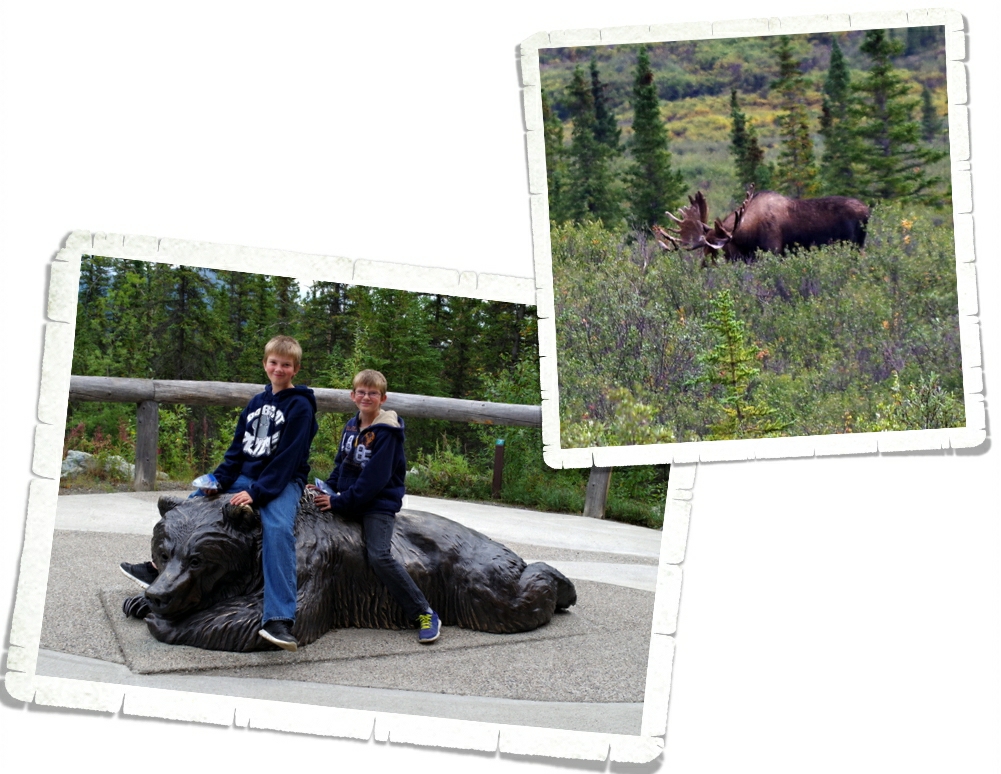
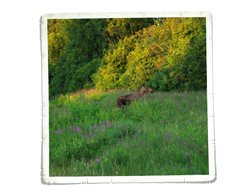
In Denali National Park there is a group of animals called The Big Five. The group consists of the grizzly bear, wolf, dall sheep, caribou, and moose. It is extremely rare to see all five in one day. We did!! Now…the dall sheep all looked like fluffy rocks way, way up high on the mountains, and…this is the best view of a moose we got, but I’m counting it! There are over 2,000 moose in the park and we only see this one. Oh well, we got to finally see some bears!!! Big, big grizzly bears!!

 We spent two full days in Denali National Park and we had the absolute best time!

See y’all down the road!

#alaskabound

#myalaska

Talkeetna, AK

Talkeetna, AK

Talkeetna is a tiny touristy town. We spent the first week in August there and enjoyed a relaxing week off from zipping all over the place to get everything done in the small amount of time we have. You see, there’s not a lot to do in Talkeetna. It reminds me of Eureka Springs, AR but smaller and not as hilly…if you can imagine that.

In the photo above, you can see Main St. All of it. Everyone in Talkeetna walks because the town is so small and there’s not very many parking spaces. There was a general store that wasn’t really a general store. It didn’t have anything useful in it. Maybe I looked in the wrong section?

Talkeetna is geared for three main things…mountain climbing, river rafting, and plane tours. We really weren’t interested in doing any of those things so we spent our evenings walking down by the river or at a park…just relaxing while the boys played on the equipment.

This was our view of Denali from the river. Nice view, right? We had a few days where the views were just spectacular with no clouds at all!

There’s a railroad right next to town. We found a path to it one evening and walked out on the foot path next to it. There was a sign there that said the residents of Crow, AK use the bridge as a way to get to and from their homes on the other side of the river. There are no streets there.

There was a fantastic park! It had a wooden xylophone that Nicholas enjoyed! All of the parks in Alaska that we’ve seen have been decorated with a tribal theme. Alaskan’s seem to be very proud of their heritage…it’s woven into every aspect of their life. I think that’s great…we should have pride in where we’re from. At this park there was a climbing wall. I’ve noticed that the parks here also start prepping the kids for what it takes to survive in Alaska. Rock climbing is very big in Talkeetna…they start them young building the coordination and muscles that will allow them to excel at this.

At the elementary school playground there were more xylophones and drums right on the playground! What a great way to develop a love of music while scaring away any bears in the area!

So, this place is my favorite place in Talkeetna. We went one afternoon and took a tour of the facilities and learned how they make birch syrup. Birch syrup is made from the sap of birch trees, which are in abundance in this part of Alaska. Birch sap can only be collected for three weeks out of the whole year. They have just three short weeks to harvest enough sap to make the syrup for the entire next year. They run these tubes between the trees to collect the sap faster. It takes 110 gallons of birch sap to make 1 gallon of birch syrup. The sap looks and tastes much like water when it comes from the tree.

They then send the sap through a reverse-osmosis energy efficient machine to concentrate the sugars to 67% which gives the syrup its fine color and flavor. From the reverse-osmosis machine they put the syrup into this cooker. It boils the syrup and has to have constant attention to stay at the right heat. The syrup is stirred almost constantly to prevent any hot spots. Once the syrup has reached the right temp/color/thickness, it’s poured into buckets and is ready for packaging. They bring the sap to the kitchen and it’s turned into syrup within 24 hours and they start all over with the next day’s collections.

During the tour we got to taste the syrup. If you look at the picture above, you’ll notice that the bottles in the front have colored stickers on them. Each bottle represents one day during the three weeks of the syrup season. The yellow bottle is batch one, the pink bottles right after that represent the early runs. The green bottles are the mid run, while the red bottles after the greens were the final run. Amazingly, each run has a very different color and taste and is good for different uses. While the early batches are very sweet and better for things like candies and pancakes or even ice cream, the middle batch is not as sweet, but still very tasty on pancakes. The final batches were less sweet…almost bitter…and would be best used for cooking or in sauces.

In the gift shop you could buy the syrup, but they also offered some tea and candies and jams that had all been made with the birch syrup. I bought some caramel creams that are my new favorite candy. It’s soft, mild, not too sweet…it’s delightful, and lucky you…you can order it online if you want!! It’s called Alaska Gold Nuggets. The 2015 year was their 26th harvest. They tapped eleven thousand trees and purchased sap from a few families to get a combined harvest of 120,000 gallons of sap. This produced 1100 gallons of syrup. This year, with the colder weather, the trees produced a sweeter, lighter syrup. Each of their trees ended up producing about 13 ounces of syrup a piece.

We learned so much about making syrup on this tour! I never knew it took so much sap to get just one gallon of syrup or how labor intensive the whole process is! The boys loved learning about the whole thing and have talked about having some birch trees or perhaps maple trees once we stop nomading around!

One morning we drove out to Denali State Park just to see what there was. There wasn’t much there. We did get a map of the state park that the boys both loved to look at, but we didn’t do any hikes.

We did stop at the Denali State Park South View Point to check out this amazing view! Mt. McKinley is there…behind the clouds. It’s still a great view! I love the braided river and all of the flowers with the mountains in the back!

See y’all on the road!

#alaskabound

Seward, AK

Seward, AK

We spent two weeks in the Seward area, using it as our basecamp for all the other places we wanted to visit on the Kenai Peninsula.

We really enjoyed Seward! It was pretty small and definitely had plenty of touristy stuff, but it had a nice balance of non-touristy stuff too.

There was a cute little boardwalk along the harbor consisting of all the tours and gift shops. Out of all of the small-town coastal harbors we’ve seen in Alaska, Seward is my favorite so far. It was super clean, the views were amazing, and there were boats of all sizes. It was beautiful!

Seward is located on the shore of Resurrection Bay.

We went on a scenic drive and ended up on the other side of the bay from Seward. You can see it in the photo above. There were a ton of people fishing right along the coast there…right by the waste water factory…there was a sign that warned against eating the fish raw…we didn’t fish there. Or touch the water…

Seward is also the starting point (one of them) for the Iditarod. We found the Mile 0 marker for it!

There were over 20 murals all over town. It really added to the beauty of the town!

We spent an afternoon at the Alaska SeaLife Center getting up close with some of the animals found in the local waters.  At the Alaska SeaLife Center, the habitats were large enough to keep the animals happy, the animals looked healthy and well cared for, and we could get really close to all of them, safely. The Center was crowded, but it was big enough that you didn’t feel like you were tripping over people all the time. The Harbor Seals were so cute and playful!

Right across from the seals were the Sea Lions…who had a very different idea of how to spend the day.

There was a whole room for birds that you could walk into. The birds were free to fly about the room…we could have reached out and touched them they were so close! There were several different species in the room, but my favorite was the Horned Puffin. These little birds are amazing! Did you know, puffins can dive down to 300 feet in the water? They will work together to herd the fish into balls and then push them to the surface.

There was a touch pool where we were encouraged to touch several different types of sea life while learning all about what we were touching. Charles had no trouble with reaching in and touching everything, but Alex and Nicholas needed some persuasion. I think the favorite was the sea anemone that would hug your finger if you put it near it the right way.

There was a great view of Resurrection Bay out on a deck you could go out on.

We didn’t get to touch these, but I thought they were interesting. Can you spot the fish in the left photo above? I would not want to pull one of those out of the water on my fishing line! I would suggest going to the Alaska SeaLife Center and the Alaska Wildlife Conservation Center and skipping the Alaska Zoo. I really hate to say that…but it’s so true.

The only place we ate at in Seward was Red’s Burgers. We ate there twice. You place your order in the building and then go sit in the school bus to eat. The owners had converted the inside of the bus to booths. It was different and fun. The boys thought it was so cool to be sitting on a school bus eating.

I got the garlic burger with garlic fires. The chef wasn’t playing around with the garlic. I thought there would be some garlic worked into the burger patty, but there was about a quarter cup of minced garlic on top of that patty! That’s a lot of garlic. I wish I’d known that before I ordered the garlic fries too. It’s a good thing everyone else had garlic fries with their burgers… The first time we went there, the owner was working the window and it was near closing time. We scored two free mystery cups that are magical mixtures of the ice cream flavors Red’s made through the day. At the end of each batch of ice cream they empty the containers into cups and just layer it up until the cup is full. We had pineapple and strawberry in the cup above. The second time we went we ended up with banana, strawberry, and cookies & cream! So good and only $3! In the top left photo is Reds #1 Burger. It has caramelized maple bacon, grilled ham, onions and mushrooms, jalapenos, cheddar and swiss on it. And it was huge! Charles got this one and ate it all plus his fries. The chili cheese fries were super good! Now, I mentioned we ate there twice…the first time we ate there it was so amazingly good we couldn’t’ stop talking about it and decided we had to eat there again before we left. We didn’t even contemplate eating anywhere else. It was that tasty. But, the second time…I don’t know…something was off. Maybe they were having an off night? The burgers tasted freezer burnt. It was weird.

We did a very short, very steep hike on the Jeep Trail in Seward. We didn’t go all the way up the trail because we were still recovering from our Harding Icefield adventure. It’s hard to tell in the pictures…but you’re looking at a 40 to 50 percent grade there. The Seward area is considered to be in the rainforest section of the Kenai Peninsula. The plants are huge and there’s moss everywhere. Everything is so…green and alive!

Pretty flower, right? Watch out, it’ll bite you! What is it with Alaska? If the wildlife doesn’t get you, the plant life will!!

We only hiked maybe a quarter of a mile to this waterfall and then headed back down.

So, there you have it! This completes our time on the Kenai Peninsula! We enjoyed every minute of it and had the most amazing weather while we were there!

See y’all down the road!

#alaskabound

#keepingitreal

Portage Valley, AK

Portage Valley, AK

Y’all know I’ve got my list of what is available to do in each place we will be going. On the way to Seward is the very small hamlet of Portage Valley. We didn’t think we were going to be able to do any of the activities I’d found in the Portage area because of time and the distance it ended up being from our base camp, but on a whim on the last afternoon we were in the Seward area we loaded up and went. We didn’t get to go to Whittier (which is also in that area), but we did get to go to the Portage Lake and the Alaska Wildlife Conservation Center (which are the two things I really wanted to do anyway!).

Thought y’all might like to see what traffic can be like even here in Alaska. It’s always for road work. We sat here for maybe 15 minutes waiting. Not a bad view though!

We went to Portage Lake and the Begich, Boggs Visitor Center first. In the picture above you can see two of the six glaciers in the area. Five of those glaciers are hanging glaciers, but the Portage Glacier is a valley glacier that comes all the way down to the water. In the picture above you’ll see the Burns Glacier and the Shakespeare Glacier.

We saw several big chunks of ice floating in the lake. We didn’t get to see the Portage Glacier up close because you have to take a boat to get there. The boys had to see how cold the water in the lake was. It was cold and someone may or may not have been splashed…

We were a little disappointed with the visitor center. It was a little…lacking. There was a small museum you could pay to go through which we thought was kind of odd. So far, we haven’t had to pay to go through a visitor center. We passed on it and headed outside for a hike to the Byron Glacier.

Byron Glacier was beautiful. We stopped at the end of the trail, but you could venture closer. We thought about it, but The Harding Icefield Trail was still too fresh in our minds (and muscles) for anyone to really want to try and climb closer. So, we sat on the bench and enjoyed the view and watched as other people tried to scramble up the moraines to get as close to the ice as they could.

We turned to leave and got another beautiful view. It’s funny how on a hike you can be so single minded….you’re only thinking about getting to the end of the trail and seeing what’s in front of you. I don’t know how many times we’ve turned around and were just as amazed at what was behind us too. We’ve gotten into the habit of hiking for a bit then stopping and turning around to really take in the surroundings before moving on.

We stopped at a little turn out along the road to our next stop and found this little gem of a pond. You’ll see Explorer Glacier in the picture above. The water was that wonderful turquoise color and was as smooth as glass. The beauty of Alaska is unbelievable! You don’t have to go to the touristy stops to find the most breathtaking spots…In Alaska those postcard worthy views are everywhere.

Our next stop was the Alaska Wildlife Conservation Center! I had been looking forward to this stop for awhile. The AWCC takes in injured and orphaned animals and works to rehabilitate them so they can be released back into the wild. It’s never their intention to keep the animals for the expanse of the animals life. For those animals that can’t be released back into the wild, the AWCC works closely with several facilities in the lower 48 to find homes.

All of the enclosures were huge and not crowded. I feel like the animals here are well cared for. The moose in the picture above is scheduled to be released next year. On all of the enclosures there was the story of the animal. Why it was there, if it would be released… This porcupine was munching on his dinner and didn’t worry about us gawking at him at all.

This big elk was cracking us up! He was snoring! All of the females were awake and watching while this lazy guy was just sawing logs. We walked back by later and the whole herd was up munching. Mr. Snoring Guy watched us walk by like he knew we’d been laughing at him earlier.

These two baby elk were having some fun in the left photo. There were also a few orphaned, Sitka black-tailed fawns. They were pretty skittish and stayed away from the front of the enclosure.

This black bear was huge! He’d just had dinner and was out prowling around. The bear enclosure was the biggest there…almost 19 acres! There was a boardwalk that takes you up and over a part of it so you can see the whole enclosure. There was a brown bear enclosure too, but she was hiding. It was a hot day for the animals so I’m pretty sure she was in the shade somewhere.

The elk herds were kept in separate enclosures. The AWCC rotate the enclosures for the grazing animals. There was a field that was empty that is worked into the mix.

This guy wasn’t part of the AWCC, but I thought he was too pretty not to include in the post. He was scavenging in the black bear enclosure.

At the back of the park is a boardwalk that lets you see the Turnagain Arm. We were there at low tide so we got to see the mud flats. The mud flats are a very dangerous mixture of the glacier silt and water that makes quick sand. People go out and get stuck and when the tide comes back in…well…it’s not good. Starting in Anchorage, we were warned against going out onto the mud flats. The tide here is a 20 to 30 foot tide and many people every year foolishly think they won’t get stuck. We had no desire to set foot on the mud flats, but hey were really cool to see!

There were four huge enclosures for the wood bison. All scheduled for release later this year. We saw quite a few of these big beasts out in the wild on our way to Alaska. Meet Chena the Lynx! Isn’t he gorgeous!! He and his brother Venetie have been at the AWCC since they were young kittens and won’t be released because they don’t have the hunting skills to survive. There was also a small caribou herd. We’ve been looking for caribou out in the wild, but so far we haven’t seen them. There have been a few places a herd was rumored to graze, but they weren’t there when we were.

We enjoyed the AWCC more than the Alaska Zoo. If you have to choose just one…I would suggest the Alaska Wildlife Conservation Center.

See y’all down the road!

#alaskabound

Day Trip To Homer

Day Trip To Homer

While we were in the Seward area we decided to take a day trip over to Homer. We had no plans of actually staying over on that side of the peninsula, but we did want to see it.

kenai_peninsula_map

I thought a map might help you visualize where we went. We started in Seward and went all the way around to Homer. It doesn’t really look that far, does it? We left around eight in the morning and got back just after midnight. It was a very long day, but we feel like it was worth the drive!

The first city we stopped in was Kenai. And, the first thing we did was get lunch. We were starving! We asked at the Visitor Center where a good place to eat would be and was pointed over to the Burger Bus which was within walking distance…so that was a plus because we were wanting to stretch our legs after the long drive. The portions were big and the food was hot! It was better than your typical fast food burger…you could tell the meat had been frozen…but it was a decent burger.

Once we were certain no one would wilt away from hunger, we set off to see Kenai and head toward Homer.

Kenai was the first European settlement on mainland Alaska when it was colonized by Russian fur traders. You can see the Russian influence in some of the buildings. The church and the chapel above were the prettiest and best preserved. You can still see quite a bit of what was left over from the Russians in certain parts of Alaska.

Welcome to the Cook Inlet. That big peak you see in the photo above is a volcano. I didn’t know that there are still a string of active volcanoes just off the Alaskan coast.

The entire beach around the Cook Inlet was covered with fishermen. Alaskan’s take their fishing seriously and the birds are always near to try and steal a catch. It was kind of crazy the number of fishermen that were lined up on that beach! I would be afraid I’d catch someone’s hook as they were wildly casting…No thank you.

We found this huge patch of fireweed in a park in Kenai. I wanted to show y’all how big this stuff can get!! I love this plant! And the fact that it’s my favorite color doesn’t hurt. Ha!

From Kenai we went back to Soldotna. Alaskan’s are serious about their fishing, but they’re also very serious about preserving their land. All around Soldotna and several of the other towns we passed through, there are fishwalks on the banks. The fishwalks are to ensure that the river banks don’t get ruined which would cause the fish to stop going there to spawn. You can see a fishwalk in the picture above. Notice there are even stairs that lead right down into the river. The fishwalk above is right behind the Soldotna Visitor Center. That’s the Kenai River you can see in the photos! It doesn’t really show up that great in the photo, but the water is turquoise! If you look closely, you’ll see all of the fishing docks along the right side of the river. Every available space was crammed with fishermen trying to get their daily limit. A lot of Alaskans live the subsistence lifestyle where they spend the whole summer preserving veggies, catching fish and hunting everything they can so they can financially make it through the winter.

And, of course, there were amazing flowers everywhere! Tell me I’m not the only one who takes pictures of flowers! Alaska is overflowing with amazing flowers. All of that sunlight does wonderful things for plants!

Right in the middle of Soldotna is one of the busiest places we saw. The Moose is Loose Bakery! We stopped in and got a few goodies to have the next morning! They were tasty…and big! The chocolate covered donut you see there…it was the size of a plate.

On our way out of Soldotna we stopped by the Kenai National Wildlife Refuge Headquarters. Above, you’ll see a life size statue of a moose. They get big! Everything in Alaska is big!! But the moose…wow! And moose are dangerous! They will run you down and stomp all over you if they feel the least bit threatened.

Nicholas and Alex worked for their first Fish & Game badge while we were at the National Wildlife Refuge Headquarters. We walked down a short trail to a lake near the NGWR as part of their Junior Ranger requirements. The lake was calm and beautiful. I snuck out on the dock to get the picture above…we were pretty sure they didn’t want anyone on it.

I wasn’t there long…shhh…don’t tell anyone.

We spent about an hour there and the boys completed all of the requirements for the badge. This is one of their favorite badges so far. I really like that’s it’s blue and not just the standard gold that all the other National Park badges are.

This beauty is called Devil’s Club. We see it all over the place. It’s not a nice plant. Pretty, but not nice. Look at all of those thorns! And the berries are poisonous too. There was an abundance of Devil’s Club on the trail to the lake. We tried our best to avoid it, but it would reach out and grab one of us occasionally.

Our next stop was Homer! We stopped by the city sign for the obligatory photo. Alex and Nicholas don’t mind posing for me but Charlie doesn’t always want to…he’s at that age.

On the into downtown Homer we pulled off at Bay Crest Hill to get a view of the area. Not a bad view, right? We were told that line of mountains in the distance area all volcanoes. I don’t know if that’s true…but…dang that’s a lot of volcanoes! I got a picture of the Homer Spit from our vantage point. You can really see how it juts out into the Kachemak Bay…and looks so flat!

We drove all the way out to the tip of the Homer Spit to get a good look at Kachemak Bay. It was gorgeous! We haven’t found a bad view of coastal Alaska anywhere.

We headed back up the Spit to check out what else it offered. Now, we had heard from a few people about The Salty Dawg Saloon. Y’all know saloons are not really our thing, but we went to check it out anyway. The boys stayed outside while we stuck our heads inside. There’s a story about The Salty Dawg…I don’t know how true it is…but a long time ago someone went in and left a dollar for his friend who was coming in later. Ever since then, it’s a tradition to leave a dollar. It was neat to see all of those dollar bills posted up on all of the walls and ceiling. We didn’t leave a dollar…we didn’t get anything to eat or drink there so we didn’t really feel like we should.

There’s also a small boardwalk with shops along the Spit. They are, as you would imagine…for the tourists. We saw the highest prices yet while in Homer. In fact, we walked into a seafood restaurant, sat down and got a look at the prices on the menu and got up and walked out. We aren’t going to pay over $20 for a kids menu item. We just aren’t going to do it…even in Alaska. It wasn’t a fancy place so the prices really shocked us. We left and found a burger place that fit us much better.

The Spit looks flat from above, so I was surprised to see actual houses right in the middle of the Spit. I love the bright colors of the houses in front of the mountains.

The last thing we did on The Spit was walk by the Boat Graveyard…which ended up being someone’s privately owned property. So, we didn’t get to walk through it, but we got to see some neat boats. The owner of the Boat Graveyard actually lived in a huge, ancient boat right there on the Spit. I didn’t get a picture of it…I felt weird taking a picture of someone’s house.

On the way back to Seward, we stopped at Anchor Point to snap a picture at North America’s most westerly highway point. We’ll have to get one at the most easterly point too!

We stopped at a pull off not too far from Anchor Point because the sunset was too good to not get this shot. It was around 10PM and the sun was finally starting to make it’s way to the horizon. There was a small rainbow above the peak on the left…I believe those area called sundogs… We milled about a few minutes and headed back to our home-on-wheels.

We even saw a few moose grazing by the side of the road! This shot was taken just after 11PM. Dusk for this area.

We had a very long, very memorable day driving to Homer. We missed some of the things we wanted to stop and see, but there are only so many hours in the day.

See y’all down the road!

#alaskabound

#myalaska

Kenai Fjords National Park

Kenai Fjords National Park

Kenai Fjords National park is 607,805 acres of unspoiled wilderness on the southeast coast of Alaska’s Kenai Peninsula. There are three ways you can visit the park in Seward: 1. Take a cruise, 2. Go to the visitor center in downtown Seward and do a Ranger Walk (the Ranger Walk isn’t technically in the NP), and 3. Go to the Exit Glacier portion of the park (this is the only part of the park you can drive to). We did all three of these things! I posted about the cruise in a separate post because it would have made this post too long.

We did our Ranger Walk on a beautiful Sunday afternoon. The Ranger Walk is only offered on Sunday afternoon and is geared toward kids. Our ranger was a college student working on her Master’s degree in Zoology. It was at this point, our 15 year old decided that maybe rangers weren’t all that bad. ;-P The boys had a great time walking along the shore line while learning about glaciers and fjords and what kinds of things Rangers do. They also earned their Fjords Ranger Patch!

We went to the Exit Glacier portion of the park twice. The first time we went we did the easy one mile hike to the Exit Glacier viewing area. Alex and Nicholas did the Explorer Packs on this visit. The NP lets you check out a backpack that has all kinds of activities you can choose from. Alex kept track of water temperature in different places during the hike and Nicholas identified several plants and trees. The loved this hands-on activity and it got them the Glacier Patch!

The trail was a great path with stairs. This was our first glimpse of the glacier while on the hike. You can’t really get very close to Exit Glacier because they’ve got it all roped off to try and protect it and…let’s be honest…to try and protect the dorks that would go out onto the glacier and get hurt.

We saw this little vole on the way back down to the Visitor Center. He’s a red backed vole and he was amazingly not afraid of us. At all. I walked right by him on the path and he didn’t budge. In the left photo above you can see some of the glacier washout. All of the water running off the glacier runs through there. People camp out there too! I wouldn’t. It’s all rocky and prone to high water. That just doesn’t sound like a good time to me. Not to mention the bears…

Now, I like to keep it real for you so I’m going to tell you about the hardest hike we’ve made on this trip so far. And boy is it a doozy.

The second time we went to the Exit Glacier area we decided to do the Harding Icefield Trail. We planned ahead and brought our hike packs with water and snacks…we even brought a couple of jackets because on prior hikes we’d run into rain and cold on top of the mountain. Remember Whistler Mountain in the Oh Canada post? This hike is an eight and a half mile (round trip) hike. It gains 1,000 feet of height per mile on the way up.

It started off great!! A gentle upward hike through the forest to the trail board where you’re supposed to check in and out so the park can keep track of everyone. The up started right after the trail board. It was still pretty gentle. We’ve decided the NP was trying to lull us into a false sense of security.

We would hike a while then stop and rest a few minutes. Nicholas and Alex decided to do the Explorers workbook (which is meant for 13+ years) this time so they could get all four of the available badges offered at this NP. They would work on it during our breaks. Everyone was still feeling pretty good about the hike at this point. We’d gone maybe a mile…but we thought we’d gone farther than that. Because it really felt like we’d gone two miles…at least.

The views were amazing! We would huff and puff up to a flat-ish place and look up and see things like what’s in the photo above. When they said the trail gains 1,000 feet every mile, they weren’t joking. Right around here we got to a place in the hike that had a trail marker that told us we still had over two miles left in the hike. We were all really feeling all of that up. We were hot, our legs were wobbly, and the trail was more advanced than what we had ever hiked before.

We talked to some people coming down the trail and they assured us that the hard part was almost over. If we could just make it up the switchbacks, we’d be home free…the trail would flatten out. So, we pushed on after taking in the great view.

The views during this entire hike were absolutely breathtaking. It’s hard to be in a bad mood when you’re surrounded by the wild beauty of Alaska. It was during the switchbacks that Jerl’s legs started cramping up and we all started to really feel the burn. If you work out, think about a leg day that you pushed yourself way too hard…that’s where we were and we still had about 2 more miles of up to go. Any normal family would have called it quits and gone back down while they could still move. Not us though. Oh, no…we kept getting told how we were soooo close and how if we made it up to this certain point it all flattens out. We didn’t’ want to wimp out so close to the finish. We had some serious FOMO going on.

We met up with this marmot. He chirped and chattered at us the whole time we shuffled by him. He was super cute!

We finally made it past the switchbacks and all of the huge rocks you have to get up and over. They put them cleverly on the path to act as steps…I’m sure giants have no trouble with them. By this point I was really ready to just head down. The boys were miserable, I was beyond done, and Jerl was having issues with his legs. But…we thought maybe we’d finally reached the promised “flattened out” area. We couldn’t stop now! Right?

This is also where the landscape changed. We’d hiked up past all of the trees and shrubbery to where it’s just rock and snow. I love the way the melting snow made little waterfalls. It was so nice to be able to reach into a stream of cold water and wipe off your face. The boys loved seeing all of the snow!

The change in the trail gave us a second wind. It never flattened out…I don’t know why those crackpots told us the trail flattened out, but it never did. Not even a little! I think they felt bad for us and were trying to encourage us to go on. It worked…we kept going… We got a second wind and the trail wasn’t quite as hard as it had been and the views…well…look at the photo above. That was the view Jerl had to sit and look at for a while the boys and I went ahead. He would try and catch up when he could.  We really were so very close to the prize.

The boys and I went on. We all had fun slipping and sliding over the snow. The boys were amazed with all the snow and kept saying, “There’s snow in the summer!” And asking if they could play in it.

We hiked up the incline in the previous photo and turned a corner only to come face to face with the view in the right photo above. We were eye level with a mountain top! Eye Level! We marveled and guessed at just how high we really were as we hiked on. As soon as we started seeing snow, the boys wanted to make snow angels. They asked every time we came to a snowy patch, but it wasn’t until this patch that I felt like it would be safe enough. They took off their packs and had a good time playing for a few minutes. The snow will look flat and sturdy, but it can be hiding crevasses that will plunge you down many many feet. I had to be sure it was safe for them to play.

We rounded another corner and saw came face to face with this view. We really were surrounded by beauty! It felt kind of like we’d been zapped to another world. I had a hard time trying to keep the camera still through all of my huffing and puffing. Ha!

There’s a storm shelter near the top. We had maybe half a mile left at this point. We took a small breather to explore the cabin and then pushed on.

And this…this is the reason we hiked all the way up there. This is the Harding Icefield! This icefield spawns off more than forty glaciers! It stretched on so far we couldn’t’ tell where it ended and the clouds started. It really looked like it just went on forever. Another family at the top offered to take a picture of us.

We had finally made it to the top!

We started back down and found Jerl had made his way up to almost the top! He’d stopped again just before the last climb, but when he found out just how close he was he made it up to the top too! I’m so glad we all got to see the Icefield! We didn’t stick around long. It had taken us five hours to get up to the top. Yup, you read that right…Five. Hours. Five hours for just over four miles and now we had to trek back down those same four-ish miles to get to the bottom. Thank goodness it doesn’t really get dark here.

We turned around to head back down and  we noticed the mountain goats! There were two different herds of them just hanging out on the slopes. They were so far away they looked more like fluffy white rocks. Thank goodness for binoculars and zoom lenses!

We made better time going down. Gravity was in our favor. The trail changes abruptly form rocks (in the left photo) to this brushy vegetation (in the right photo). It looks lovely, but if you brush against most of those plants, they’ll try to eat you. There was a ton of the wild celery which you want to avoid at all costs. There were also a ton of wild raspberry and rumors of a bear in the area. We never saw the bear, but that marmot we saw earlier was squaring off and arguing with a different marmot. We had to walk between them to get down the path.

This was on our last rest stop when we still had two and a half miles to go. We didn’t stop after this until we got to the car. I don’t think Jerl and I could have gotten up and gotten going again if we’d sat down. We made it to the car just before 9PM. It took us nine hours, but we did it! The boys were troopers. They were just as miserable as we were, but they didn’t whine or complain. We’re so incredibly proud of how they handled the whole hike.

So there you have it…the hardest thing we’ve done so far on this trip. We really should have turned back. I guess what they say is true, what doesn’t kill you makes you stronger.

Lesson learned…we can do hard things and come out the other side stronger.

We now know our limit. We gave the boys the day off after our hike. We didn’t do much of anything…mainly because none of us could move. We were all so soo sore!

We did go back to the visitor center the next day so the boys could turn in the workbook they’d completed.

The boys earned all four patches/badges available at the Kenai Fjords National Park! They sure are proud about it and are hoping other NPs will have a Junior Ranger and a Senior Ranger badge to earn.

See y’all down the road!

#alaskabound

#keepingitreal

Kenai Fjords Cruise

Kenai Fjords Cruise

The Orca Voyager and her crew took us out on an eight and a half hour cruise around the Kenai Fjords Peninsula. We’d been looking forward to this cruise for a long time and it did not disappoint! I’ll be honest, I’m not sure how much commentary you’ll get on this post…the pictures kind of speak for themselves, but I’ll do my best to point out what I can.

The majority of this cruise was actually in the Kenai Fjords National Park which is about the only way you can visit this part of this particular NP. I’m going to concentrate on the cruise this time, but I’ll do another post specifically about Kenai Fjords National Park later.

Before we even got out of the bay, we had our first wildlife encounter. Sea Otters! They spent most of their time diving down to get food then floating on their backs to eat it.

The landscape along the waterline was really impressive. In this little cove we found a bunch of Seals. Our boat Captain was an expert at getting us up close to the wildlife. The seals lifted their heads to check us out then went back to snoozing in the sun. They seemed pretty unbothered by the big boat of paparazzies.

Something you should know about these day cruises… There are plenty of seats for everyone inside, but only a few seats outside. Now, if I’m going to invest in one of these cruises, I want to be outside where I can get a really good view of everything. We made sure to get to the boat early then claimed a row of seats (there were only four) outside near this back corner of the boat.

We couldn’t get over the color of the water and how the shoreline felt so dramatic. In most of the coves we went into closer to Seward there were small fishing boats. I thought the picture above would help give you a sense of just how massive some of these islands in the coves really were. I call them small fishing boats…but they were the size of an RV.

And, because I’m going to keep it real for y’all, I’ll admit to you…when the pod of orcas showed themselves…I was stuck in the bathroom. I could hear the Captain telling everyone where to look and talking about them, but I couldn’t for the life of me get out of the door. So, I missed most of it. I was super bummed about that. Luckily, Charles was there with his brand new camera and snapped several great shots! Both of the shots I’m posting are ones he took.

This is what Charles looked like for most of the day. I think at the end of the day he had somewhere around 200 to 300 pictures. He likes to combine them and make new landscapes for stories he’s working on.

I lost count of all the glaciers we saw. This one was pretty spectacular the way it just went on forever. And then there were the waterfalls! I’ve never seen so many waterfalls! They were in every nook and cranny of every cove we saw.

The day started off overcast, but the farther out to sea we got, it became more of a cloud dappled sky. We would get these moments of brilliant sunlight that would make us say “oh wow!” I’m not sure how many times we found ourselves saying that. It seemed to be the theme of the day.

This group of sea lions started calling out to us as we passed by. It was like they were telling us to go away so they could enjoy their sunny rock in peace. Apparently, sea lions are very territorial and some actually jumped into the water to try and chase us off.

It was right around noon-ish in the trip that the crew passed around a light lunch. It was nothing spectacular, but it was very appreciated and tasted really good. The lunch consisted of a chicken Cesar wrap, a bag of sun chips and a granola bar. They did a modified wrap for Charles since he’s allergic to dairy…we thought that was really great…and very appreciated.

This spot was probably the highlight of our day! We got to sit close to this glacier for a while watching it. We heard it moan and groan and then crack.

We got to see it calve several times! It was really amazing!

There was ice floating in the water and the crew scooped some out for everyone to touch and feel. I was informed by both Nicholas and Alex that glacier ice out of the sea is way cooler than regular ice. These two monkeys grabbed a chunk of ice that had fallen off the big one the crew brought around. The glacier ice had tons of air bubbles in it. It was really neat to see!

If you look to the left of the picture above, you’ll see a boat that was about the same size as the boat we were on. This picture really gives you a feel for how massive this glacier is.

This glacier was the farthest out our cruise would go so after we left there, we started back toward Seward.

The boat stopped by an island covered in puffins. Two different kinds of puffins! The one in the picture above is the horned puffin (I think). The other one is called a tufted puffin. These little guys are probably some of my favorite birds! Puffins can actually dive 300 feet into the water to catch fish. Their bones are denser than most bird bones so they’re heavier and can travel farther down into the water at a faster rate. See the group of birds in the picture above? Now look right in the middle of them at the dark blob in the water. That blob is called a bait ball. Groups of different kinds of birds will work together to gather fish into a tight ball to eat. Puffins will dive down and scare the fish upward while other birds will start bringing them in from a shallower depth around the sides and then the birds feast. We saw several of these and they are kind of amazing to see!

We saw a few humpback whales too! They never came all the way up out of the water…just up for a breath then back down. I did catch the tail of a momma and the hump of the calf. We stopped in this area for several minutes hoping to see more of them, but the Captain had a schedule to keep and was trying to get us to Fox Island for our dinner. He apologized for not being able to stay longer but he was afraid the Chef would get after him for making us late for dinner. Ha! We didn’t mind. Fresh, hot food sounded so good by this time! Honestly, anything hot sounded good by this point! It was really cold out on the water!

This is Fox Island. We docked here and unloaded for a steak and salmon dinner! The dinner was buffet style. Sorry for the blurry pictures, but…well…food. I was lucky to get these two shots off before grabbing a plate. We only had an hour to eat and do any exploring we wanted to do. There were some cabins on the island that you could rent. The food was great! The service was spot on! And there was a Park Ranger there who gave a presentation about Kenai Fjords NP while we ate. We enjoyed every minute of this meal!

The crew passed around freshly baked chocolate chip cookies as we were leaving Fox Island. They were still gooey and warm… It was such a treat!

Any guesses as to what animal this skull belongs to?

It’s an orca skull! Look at all of those sharp teeth!

The boys wanted to get their picture taken with Captain Eric. He was a great Captain! He really was amazing at getting us right up close into the tight spaces so we could experience Kenai Fjords better. See those cups the boys are holding? Those are $7 souvenir cups that you can buy and get free refills in all day. We definitely got our money’s worth with them!

Here’s a picture of the boys with the First Mate and the Crew! I really feel like we lucked out with the Captain and Crew that we got. They were stellar! They made the day fun and entertaining and made sure everyone had everything they needed. If y’all ever find yourselves in Seward make sure you go to Kenai Fjords Cruise and ask for Captain Eric! You won’t regret it!

See y’all down the road!

#alaskabound

Hatcher Pass

Hatcher Pass

Our absolute favorite thing to do in the Palmer/Wasilla area was to explore Hatcher Pass in the Talkeetna Mountains.

In 1906 Robert Lee Hatcher staked the first gold claim in the Willow Creek district. Gold contained in quartz veins within solid rock is called “hard-rock” or lode gold. With the discovery of the Hatcher claim, gold mining switched from panning in the streams to digging underground. In 1937, construction began on the Independence camp and mill which later became Independence Mine. By 1941, the Independence mill, camp, and mine employed 206 men and 16 families who recovered 140,000 ounces of gold before the mine was shut down in 1943 after gold mining was classified as nonessential during World War II. In 1974 the Independence Mine was placed into the National Register of Historic Places and in 1981 it was dedicated as a Historic Landmark. Today, Independence Mine is open to the public to explore and learn what life was like for the miners and their families back in the 1940s.

There are several trails and plenty of buildings to explore. We only had two hours before the gates closed so we kind of rushed through the Independence Mine area. I always find it interesting to compare the cost of living then to the cost of living now.

The Visitor Center closed forty five minutes after we got there so we quickly borrowed a few gold pans and tried our hand at panning for gold in the stream that ran through the Independence Mine area. We didn’t find any this time, but we aren’t giving up! The boys all tried their hand at it and had a good time trying not to fall into the stream!

Some of the buildings have been preserved so nicely, while many other buildings have fallen into ruins. I think it added to the landscape. To see buildings standing that looked like they could (with a little work) be used again today while not far away from them were collapsed buildings…it really gave it a ghost town feel.

The photo above gives you a good idea of the landscape and how the Mine was dotted about the natural land formations.

There were views in every direction. We could make a whole postcard book from the shots we got here!

In the left photo above you’ll see the only tunnel left. You can walk to the back of it and feel the temperature drop several degrees. I believe it was called a water tunnel. I’m not entirely sure of all of the details about it, but it was neat to see. The train tracks in the right photo had long ago fallen. We thought they looked cool and wondered what happened to make them twist and become misshapen.

It looks like when the Mine was closed down, the residents got their belongings and left without any thought to the supplies left in the shops. In the right photo you can see part of an old train. The carts could dump things to the front or to the side. We must be nerds because we love learning all about these kinds of things!

We had to hurry through the gates before they closed for the night. They won’t wait for you if you’re late and if you’re unlucky enough to get stuck there the park impounds your car and it’s a very long walk back to the RV Park.

A few days later we came back to Hatcher Pass to explore the Summit Lake State Recreation Area where you can drive to nearly 4,000 feet above sea level on a winding dirt road to be rewarded with an alpine tundra meadow to explore. There were several hiking options. We chose the April Bowl Trail. The April Bowl Trail climbs up to a height of 4,811 feet. It was a steep, rocky climb! I wasn’t prepared for how I would react to it. I had a little melt down after slipping and almost falling for the umpteenth time…I was done with it. I was stressed and worried about breaking my camera. The boys were up the trail some so they didn’t see me melt down… Jerl talked me down from it. We definitely balance each other. Once I gathered myself we headed on up the trail.

The path takes you right by a lovely turquoise tarn called April Bowl which is where the hike gets it’s name. You can see it in the bottom photo above. Once we got a little higher, we saw more of April Bowl and noticed there’s still snow and ice around one of the little ponds. Excuse the water drops on the lens…it started sprinkling on us.

The views from the top were stellar! We were rewarded with 360° views. I was so thankful that Jerl was able to talk me into continuing! I would have missed some absolutely stunning views.

On the way back down, we stopped to play in the snow. Since we moved to Texas, the boys haven’t had the opportunity to really play in the snow. They had a great time throwing snowballs and just being boys.

And, of course, there were the flowers! There were flowers everywhere. Flowers and moss, but no grass. It was really…spongy walking around the alpine meadow.

This is the final post about the Palmer/Wasilla area. We had the best time in this area and we’ve all decided we’ll have to go back to this area if we ever get to come to Alaska again.

See y’all down the road!

#alaskabound

Palmer/Wasilla Area Fun

Palmer/Wasilla Area Fun

We thoroughly enjoyed the Palmer/Wasilla area. It was exactly the combination of being close enough to the stores we need and being far enough from the rush of the city that we like.

One of the things I’ve been looking forward to doing is learning more about the Iditarod Sled Dog Race. We were able to go to the Headquarters in Wasilla for a few hours.

The Iditarod Trail started out as a mail and supply route from the coastal towns of Seward and Knik to the interior mining camps. Mail and supplies went in and gold came out all by sled dog. The Iditarod Sled Dog Race is a commemoration of the years mushers spent running desperately needed supplies to the mining camps.

You really can’t compare any other competitive event to the Iditarod. The Mushers and their dog teams have to go through a thousand miles of the roughest terrain Mother Nature has to offer. Jagged mountain ranges, frozen rivers, desolate tundras, and dense forest…lets add in the weather now…temps far below zero, winds that cause complete loss of visibility, and the long hours of darkness that make up the Alaskan winters. Sound fun? Yeah, you couldn’t pay me enough to do this race. Maybe that’s what makes me so curious about it. Why would anyone willingly do this?

The race starts the first Saturday in March when the racers line up in Anchorage and race all the way to Nome. Every year, people come from all over the world to participate in this historic race. It takes a lot of people to make this race possible, from the veterinarians that come to check each dog to the volunteers that help man the outposts that dot the raceway. It’s been called the “Last Great Race On Earth” and it’s easy to see why.

While we were in the main office of the Iditarod Wasilla Headquarters, we were told that we should go play with the puppies. That, in fact, playing with the puppies is a vital part of their training because it helps them get used to being around a lot of different people.

Well, OK…twist our arms…we’ll go play with your adorable puppies! I mean, look at that sweet little face…how could we turn down the opportunity to cuddle…I mean…help train Iditarod Sled Dogs?

We tried our best to wake them up. We passed them around, jiggled them, pet them, talked to them…and they slept and grunted through the whole thing. The boys hated every minute of it…can’t you tell by the looks on their faces?

After we got our fill of puppy lovin’ we headed over for our turn on the sled. Meet our dog team. Here we are on the…er…sled/buggy. The owner actually asks if you want her to take pictures. We didn’t have to ask, we didn’t have to pay… We thought that was a really great touch. The owners genuinely seemed pleased that people were coming to see their dogs and help them train them.

Our team was quick and nimble. One kept trying to lick all of the bushes and another one kept trying to jump over the dog in front of it. Hey, we did tell you they were in training. Nicholas and Alex spent the entire ride giggling and laughing while Charlie had a huge grin plastered on his face! All three boys talked about it for days. We had to do a little more Sled Dog lovin’ after our ride. They really are awesome dogs. I had four boys (you can see them in the picture above) who were wanting to sneak a puppy home. I would have agreed if I’d thought we would actually get away with it. *wink*

In the picture above you can see one of the older sleds used in the race. It really amazes me to think of what that sled has been through. How many races did it see?

That same day we went to the Matanuska Valley Musk Ox Farm in Palmer. Musk Ox is a descendant from the last ice age which means they used to roam around with woolly mammoths and saber tooth tigers.  The musk ox is known to the Alaskan Natives as “Oomingmak”, which means “The Bearded One”.

There was a great little museum with all kinds of touch and feel itmes for the boys to look through while we waited for the tour to start. The farm had around eighty muskoxen. We got to see maybe thirty of them. Apparently, muskox are twitchy little beasties with horrible eyesight. They think kids or someone bending down to take a picture is a wolf and they act aggressively. We actually got to experience this right at the end of our tour when a momma beastie tried to protect her baby from the kiddies (and me) looking at them through the fence. We moved along quickly.

You can see the momma beastie in the left picture above…and if you look very closely you can see the hooves of the baby beastie she was protecting from the wolf/kiddies. Moms…whattya gonna do…we protect our beasties. In a different area of the farm, there were some juvenile muskox who were all too friendly. The boys got to feed them some tasty morsels. Nicholas wasn’t to sure about his hand getting so close to a muskox mouth, but he did it and then thought it was the coolest thing ever.

The muskox on this farm are pampered and fed nicely. Their whole purpose is to produce as much qiviut (qiv-ee-ute) as they possibly can. Qiviut is the underwool of the muskox. It’s eight times warmer than wool, softer than cashmere, and stronger than pretty much any other kind of fiber out there.

It also cost $95 an ounce. Nicholas was extremely dismayed at this. He had been really looking forward to buying some to crochet a scarf for himself. He had to settle for a $5 sample.

We stopped at a pull-off near the Muskox Farm to gawk at this view. No matter how many amazing views we see…it never gets old.

See y’all down the road!

#alaskabound

Anchorage, AK

Anchorage, AK

Anchorage is one of those towns I was really looking forward to seeing. I had grand visions of seeing moose right on the streets of the city…bears waddling around our RV park. I mean, it’s Anchorage, Alaska…it should be rugged and wild and embody everything that makes Alaska…Alaska.

When we were in Valdez we struck up a conversation with a couple who live in Anchorage and they started telling us how unsafe the city is. Now, to be honest, we’d heard a few disconcerting things about Anchorage before that, but chalked it up to people visiting the wrong parts. Every city has good and bad parts, but this couple actually lived there. So, we changed our plans and decided to stay in the Palmer area. We’re very pleased with our decision. The RV park we stayed in is really nice. It was close enough to grocery stores but far enough from a city that we felt like we weren’t right in the middle of town. We’ve really enjoyed the Palmer area! I’ve been trying to do a post for each area we stay in, but I’ll have to break this one up into three posts!

So! Anchorage! We got to spend two afternoons exploring Anchorage.

The first place we went was the Information Center. It was a log cabin! I was looking for rustic…it doesn’t get much more rustic than a log cabin. The rest of the city was, well, very city like. So, I was pleased to see at least some of my Anchorage vision was true. This part of Alaska is always boasting about it’s huge vegetables. They even have some cabbages planted right by the info center. I loved all of the flowers!

There was this fantastic mural! I wish I could have gotten a better picture of it, but it was right beside a busy street.

Every Saturday in the summer, Anchorage has Saturday Market. It’s a farmer’s market plus craft show plus vendor market. We saw some of those huge vegetables there! Squash and zucchini twice the size I’ve ever seen them!

Totem poles are big in Alaska. Every town we’ve been in has had them. This one is the best one I’ve seen so far.

We found a beach and had to skip some rocks. All of the beaches we’ve seen have been rock beaches. We’ve seen tons of sand here…just not at the beaches! There was quite a bit of graffiti at this beach, but  the views were stellar.

The second afternoon we spent in Anchorage, we went to the Alaska Zoo! We really enjoyed this zoo. It was laid out a bit weird and some of the exhibits were empty, but all of the animals were healthy and happy and the habitats were all huge! Oh! And, all of the animals were indigenous to the Alaskan climate! We really enjoyed getting to see some of Alaska’s wild animals up close.

Here are some of our favorite pictures from the zoo.

Leopard. *Picture taken by Charles. There was an entire wolf pack. The Dall Sheep seemed to be napping.

These two bear cubs are orphans. The zoo has an orphan center. We’ve seen tons of Trumpeter Swans in the wild, but we’re always driving down the road and I haven’t been able to get a picture of one.

Of course the Alaska zoo would have polar bears!! They’re getting ready to expand the polar bear habitat and it’s going to be huge! I’d love to be able to go back and see it when it’s done someday! Last but not least is the Bald Eagle! There were two of them in this exhibit and they were gorgeous!

Most of the animals at the Alaska Zoo are either orphaned or they were injured in some way and can’t be released back into the wild. We’re keeping a list of our top zoos. Houston still has the top slot, but Alaska is firmly in the number two slot!

Am I the only person who goes to the zoo and takes pictures of the flowers?

We ended our Anchorage adventure the only way any self-respecting tourist would…with chocolate. We went to the Alaska Wildberry Products store and got some chocolates made right there in the store! When you walk into the store all you smell is the chocolate from this huge chocolate fountain!

So, my overall thoughts on Anchorage…it’s the largest city in Alaska and just like any large city there will be good parts and bad parts. We saw both of these parts, but overall, we enjoyed our day trips there. You just have to be smart about where you go and when you go to some places. I wouldn’t want to stay there. We heard from several sources that there are a lot of shootings in Anchorage. We didn’t see any shootings…but, we did have a couple of people try to come up to us and sell us drugs (me and the boys) while Jerl was running back to the car. I gathered the boys close and gave them a look that told them that this momma dragon will eat you alive if you try to hand her baby dragons drugs. It’s best to not poke the dragon…or really any mother…when her babies are around.

My advise would be to stay in one of the surrounding cities (we love Palmer) and day trip into the city.

See y’all on the road!

#alaskabound