Category: State Park

Fredericksburg, TX

Fredericksburg, TX

Guten Tag! Willkommen to Fredericksburg! Sprechen Sie Deutsch?

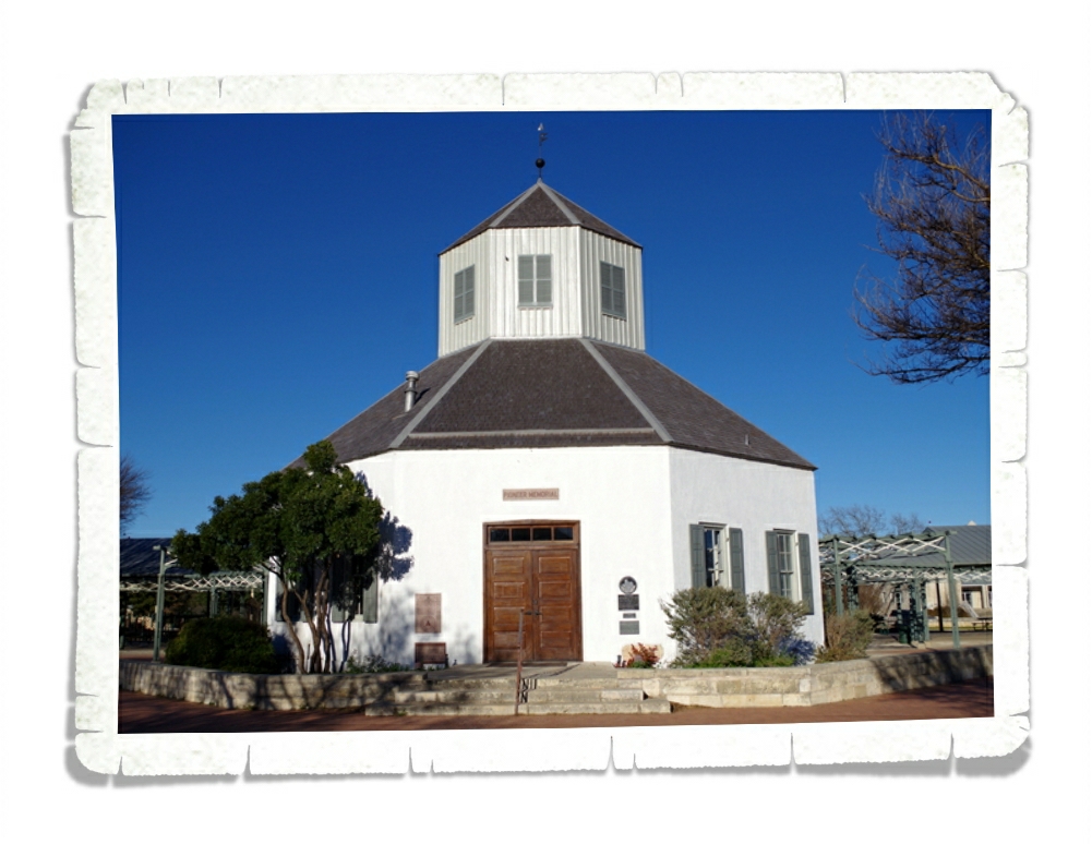
The language the German settlers brought with them to this area back in the 1800s can still be seen in most of the signs and buildings around town and if you listen carefully, you can even hear it when you listen to the locals. The building in the photo above is called Vereins Kirche and has been a church, a fort, a storehouse, a meeting hall, a library, and an office before becoming the museum it is now. It was first built as a church but was demolished in 1896 and was rebuilt in 1935 and is considered a landmark for the city of Fredericksburg.

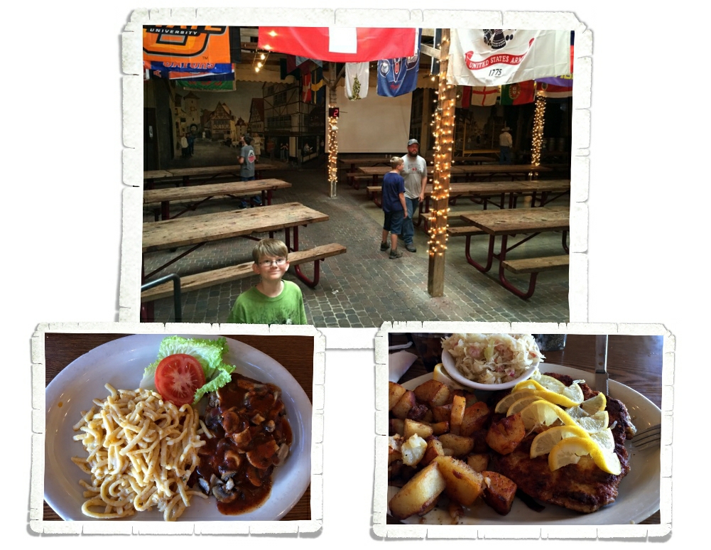
If you get to visit Fredericksburg, come hungry and be prepared for some amazing food! The pictures above are from a place called The Old German Bakery. We found it close to the end of our stay which was a bummer. I would have loved to have eaten there a few more times! We ate at several locations during our nine day visit and only once did we get a meal that was just so-so. We found some seriously cool places to indulge in our love of German food!

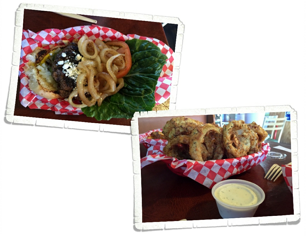
If German food isn’t your thing…never fear! We also found some of the best burgers we’ve had there. The one above is from a place called Alamo Springs Café. It’s out in the middle of nowhere and has some amazingly good onion rings! It’s definitely worth the drive if you’re anywhere in the area.

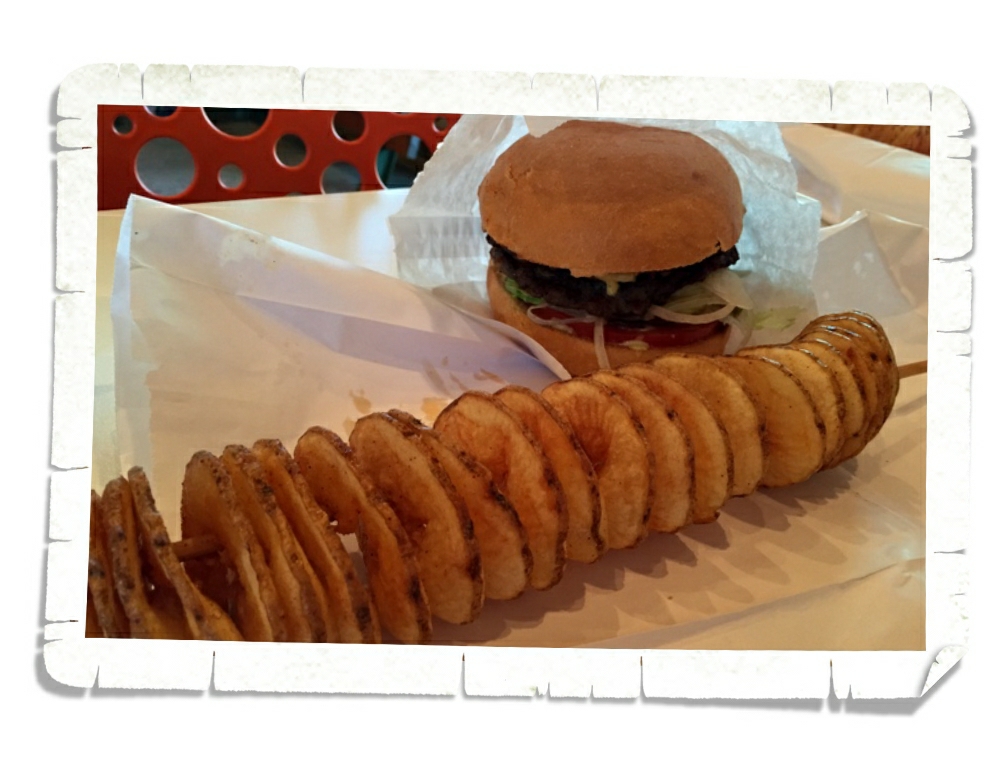
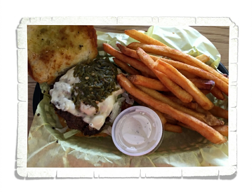
It doesn’t really look that impressive. Just a regular burger. But then you bite into it and you realize you’ve stumbled on to greatness. Now, I’ll be honest here…we were interested in this place initially because of the name. Jennie’s Smoked Burgers & Tornado Fries. And come on…smoked burgers… Guys, these are amazing burgers. They’re made from smoked brisket. Charles has declared that these burgers are his absolute favorite. I kind of agree with him. I know we say we found the best burger a lot…we love burgers…but if I had to choose one to eat the rest of my life…it would be this burger.

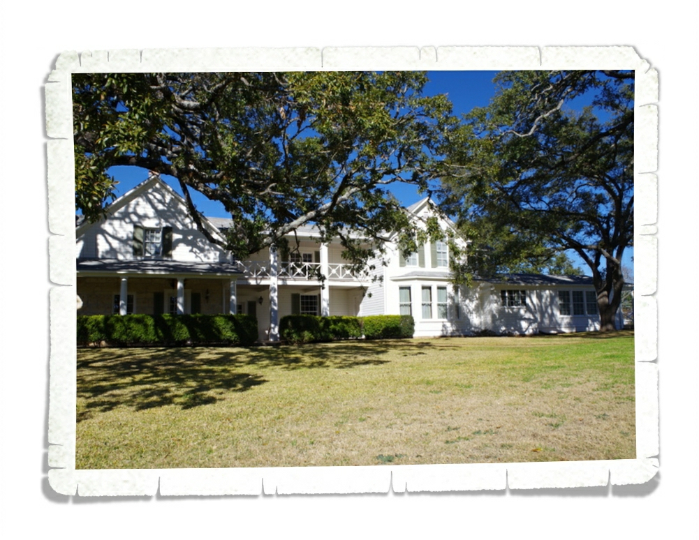
We did other things besides eat our selves silly. I promise. We visited the Lyndon B. Johnson National Historic Park. The photo above is his house on the ranch. The house became known as “The Texas White House” because he spent more time there than at the DC White House.

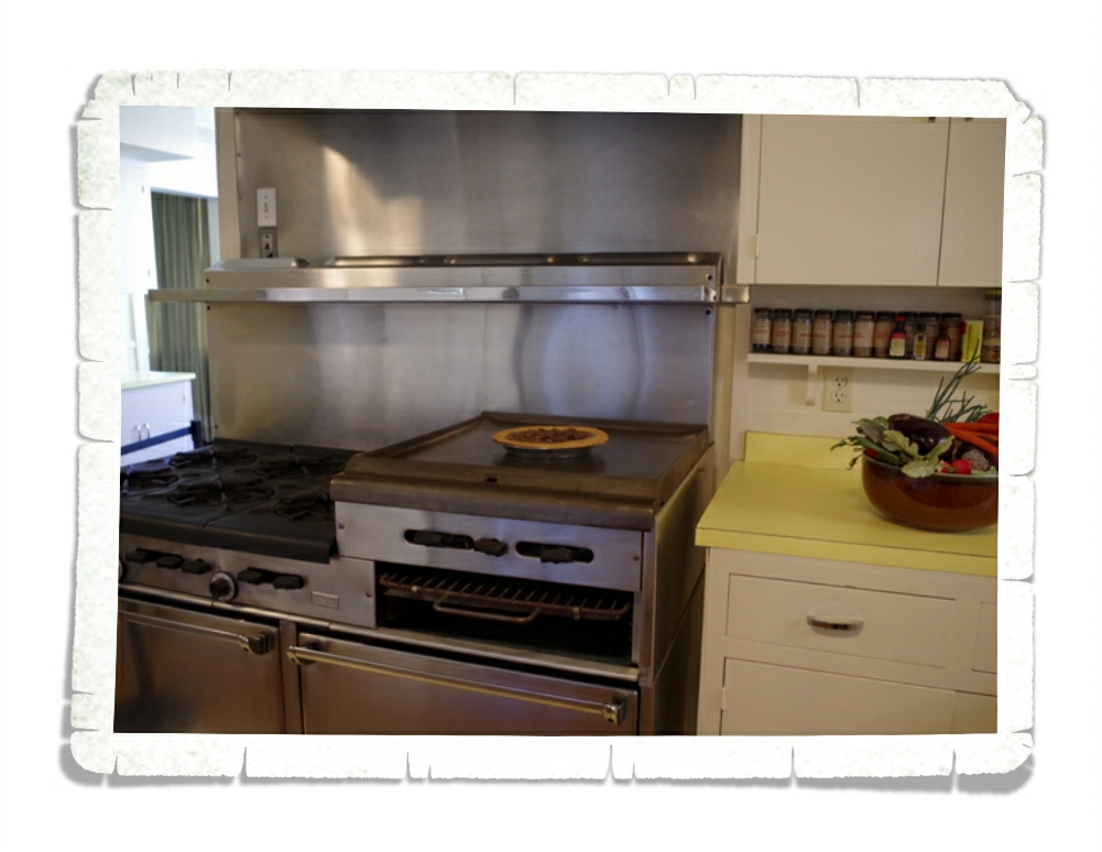
We took a tour of the inside of the house. If you go, I really suggest you do the tour. The stories they tell of LBJ, the house, and the staff are interesting and really give you an insight as to what life was like for him. See the pie on the stove? It’s not a real pie, they leave it there because of the significance of it. On November 22, 1963 the staff were all preparing for some very special guests that were to arrive the next day. The guest had never had pecan pie. As the pie was coming out of the oven, the House got a call to let them know that they were now all employed in the President’s house. LBJ was the new President because JFK had been assassinated. JFK was scheduled to come to the house the next day. They’d been preparing for him.

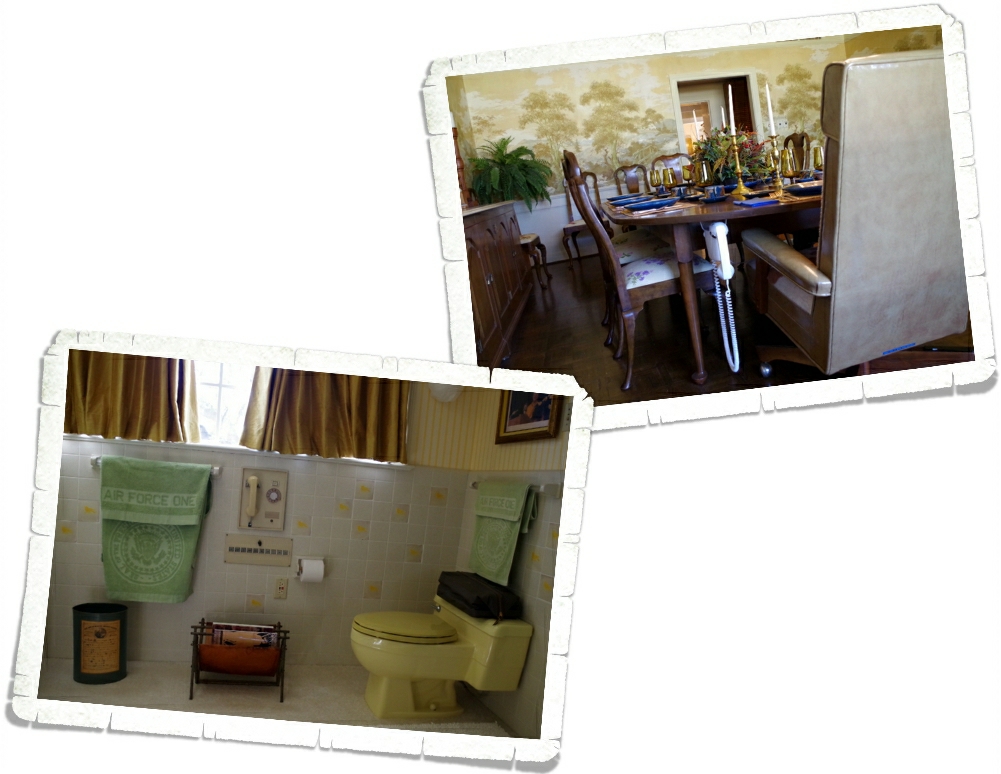
We also got to hear about LBJ’s love of phones and televisions. Basically, anything that would give him information about what was going on in the world. There were phones in every single room of this house. And I do mean…every…single…room. Can you imagine what he would have been like with today’s technology?

We also visited the Johnson City part of the LBJ National Historic Park to see his childhood home. I won’t put any pics up since this post is already picture heavy. But it was very interesting to hear stories of the boy LBJ was. It really seems as though he was destined to be President.

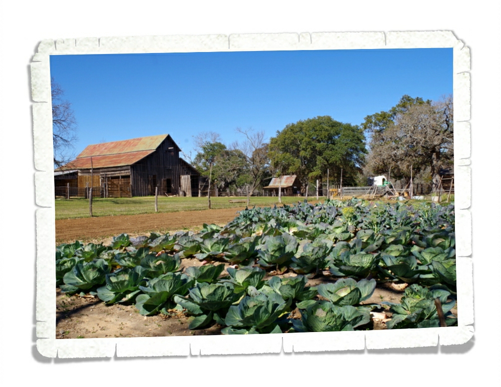
 We walked around the Sauer-Beckmann Farm for an hour or so. This is a living history German farm that shows what life was like during 1900-1918. There are volunteers that stay here in seasons to work the farm.

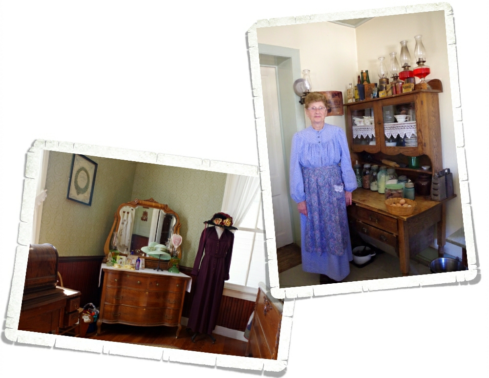
The volunteers dress in period outfits and work the farm with period appropriate tools. We got there right at lunch time for them, but they invited us in and told us all about what they do. We didn’t get to sample the delicious smelling lunch, and let me tell you…it smelled good! We found it really interesting how the house was broken up into separate sections. The kitchen was completely separate from the living quarters.

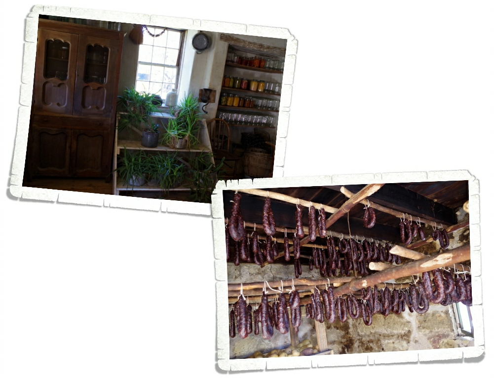
There was a building for the gardening/food canning and storage. We loved learning about all the gadgets they had for separating cream from milk to husking corn to making their own sausages. The boys are convinced we need them all. Speaking of sausages…we even got to see their smokehouse! It smelled heavenly!

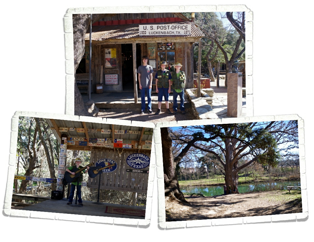
We were so close, we had to make a detour to Luckenbach! It’s not really much of a town now. Nicholas got the chance to stand on one of the stages. The town is really just a business now. They have live music pretty much daily and hold special events often. If you go, make sure to go behind all the business stuff and cross the bridge. Head down to the river for some gorgeous live oaks.

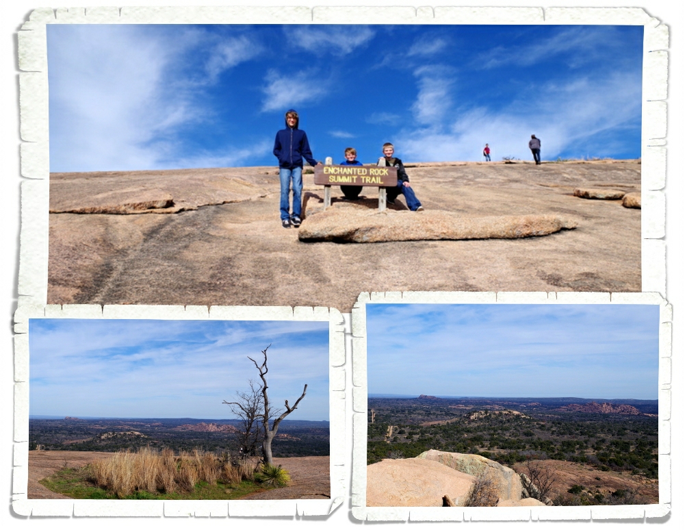
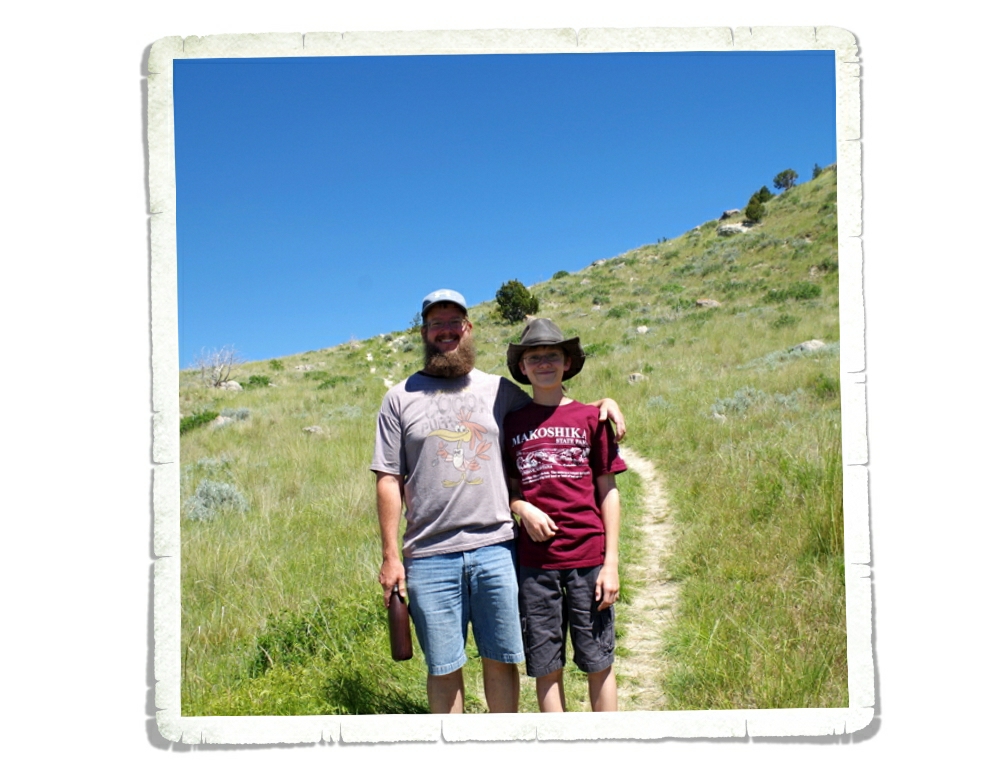
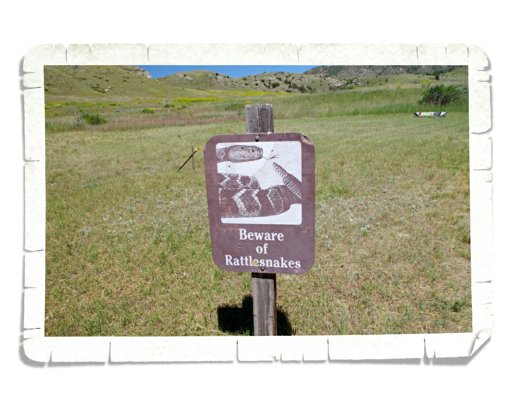
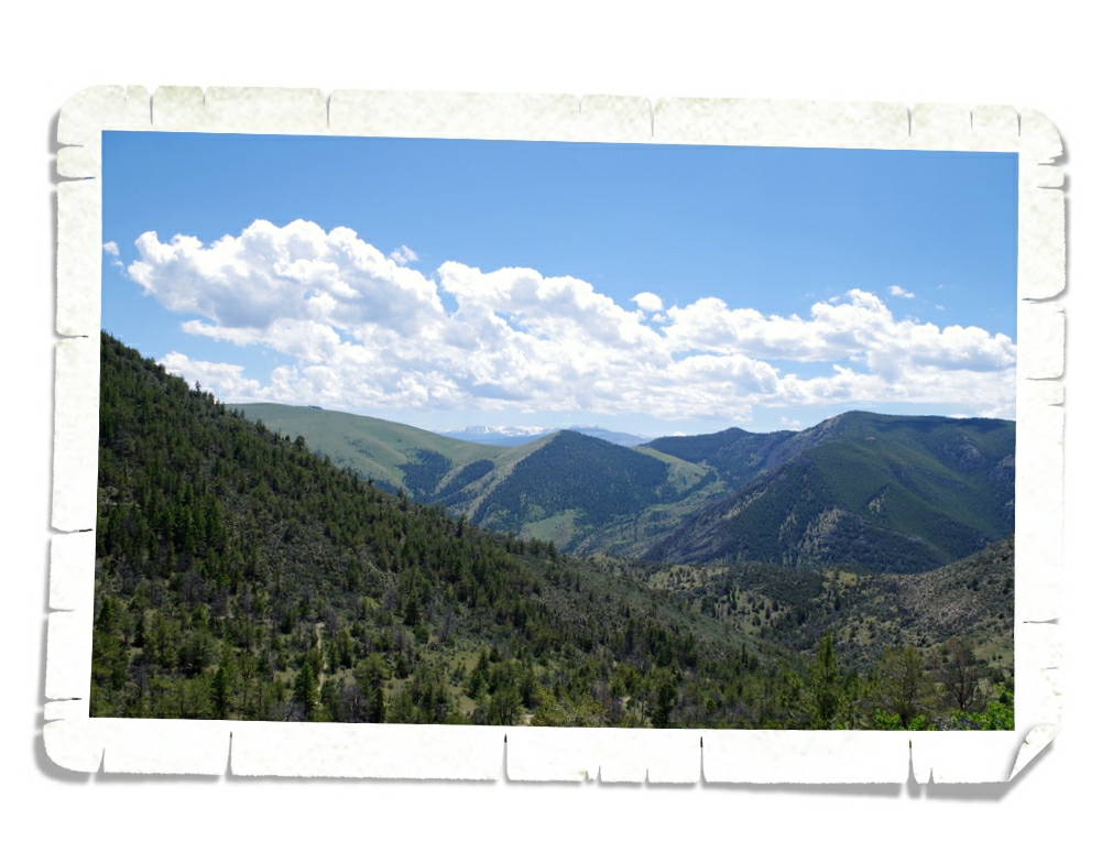
We spent a couple of hours hiking around the Enchanted Rock State Natural Area. We, of course, had to do the hardest hike there. The Summit Trail…the trail that marches you right up the side of the rock that the park is named for. I don’t have the details of how far up we went…it was steep and it was maybe a mile. But, holy jumpin’, the view was stellar! We were surprised to find small pools and grass with a few trees at the top.

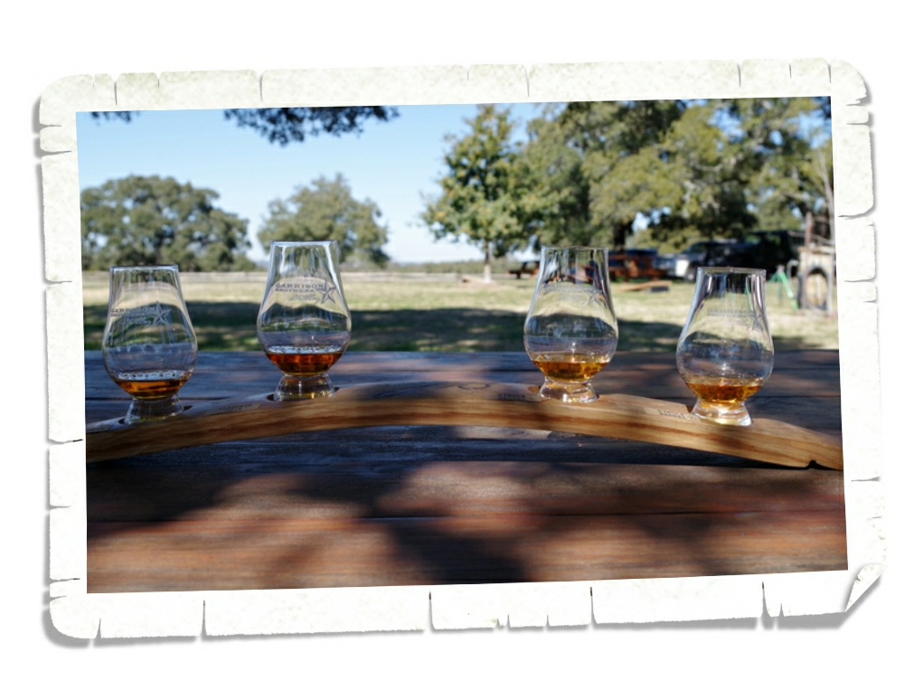
We were able to visit two distilleries. The one above is called Garrison Brothers. It has a really cool set up. You can go get a flight (where you can taste the different bourbons they have) then take it outside to one of the many tables they have set up and take your time sipping and tasting. There are some outdoor games (washers, boccie…) that you can play and then they have a tour of their distillery you can take.

We also went to the Hill Country Distillery. This is a smaller operation. You can go in for a tour and a tasting of their products. Both distilleries had some good stuff and both offer you a different perspective on the business.

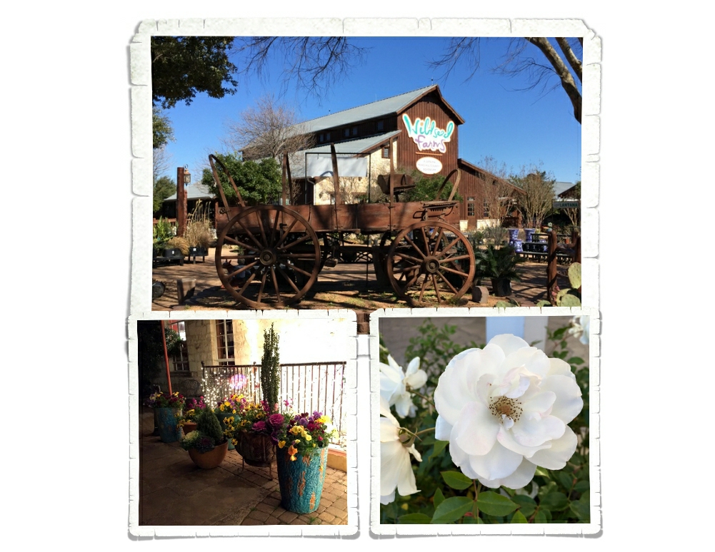
We stopped in at the Wildseed Farms, but there wasn’t anything blooming since it’s the wrong time of the year for wildflowers. We did get to mosey around their store and look at all the seeds. They’ve got any wildflower seed you could want! We might have even bought some. It might have been the wrong time of the year for wildflowers, but there were plenty of flower gardens to enjoy! And the flower gardens/boxes/planters were everywhere in Fredericksburg!

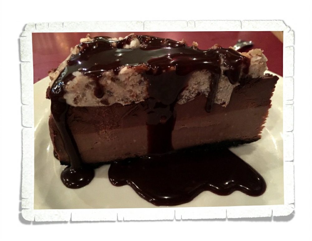
Should we talk sweets now?

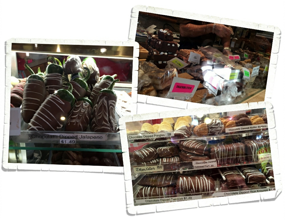
If you’ve got a hankerin’ for something sweet…you’ll find it in Fredericksburg.

Burgers, bbq, German food, breweries, wineries, distilleries, museums, National/State Parks, shopping…there is something for everyone in Fredericksburg!

Aufwiedersehen!!

See y’all down the road!!

Alamogordo

Alamogordo

We’d heard that there was going to be a snow storm the day we were supposed to drive down to Alamogordo, NM so we got started as early as we could and hoped for the best. We hadn’t driven but maybe an hour before we ran right smack dab into the front edge of a blizzard. Luckily, we kept just ahead of it the entire time we high-tailed it down to our RV park in Alamogordo. The people at the RV Park told us they’d heard the area would get 7 inches of snow that night. We had big plans for the next day so 7 inches of snow didn’t sound great. When we got up the next morning, we didn’t see any snow at all, but when we got out we quickly discovered all of the roads leading out of town were closed. Apparently, the rest of New Mexico was closed due to the blizzard. We went back to the RV and regrouped. We spent that first day at a Hastings where we checked out the movies, games, and books. It was kind of a nice relaxing day. Usually, our weekends are go, go, go.

We ended up eating lunch at Rockin’ BZ Burgers where we had the best green chili cheeseburger in New Mexico. This place is solidly at the top of our list for burgers. Nicholas got the fried pickles and they were surprisingly good! We ended up eating there twice…in one week!

The main reason we came to Alamogordo was to visit White Sands National Monument. In the photo above you can see the Sierra Blanca which is 67 miles away from WSNM.

The RV Park we stayed at had sleds we could borrow so we could go sand sledding! Yup, you read that right…sand sledding! If you don’t have your own sleds, the visitor center has them for $10 apiece. We had to find the highest sand dune we could to slide down and then we had a contest as to who slid the farthest.

When we got there, the visitor center was packed. It was so bad I had second thoughts about going into the park. I was afraid we’d just be waiting in line to go down the dune. You can see how crowded it was in the picture above. Ha! There was enough room for everyone to spread out and stay out of each other’s way. It was wonderful! There’s not much wildlife at this National Park, but we did see a few signs of birds and some tracks we thought were from a kit fox.

We had the best time at this National Park! There wasn’t a ton of trails to hike and the park isn’t the biggest one or the prettiest we’ve been to, but there were so many opportunities for fun here. I think we’ll be back for more!

We spent an entire day driving the Billy The Kid National Scenic Byway.

Our first stop on the scenic byway was the Lincoln Historic Site where we learned everything you could possibly want to know about Billy The Kid  and the Lincoln County War. I won’t give you an entire history lesson here…but I will tell you I didn’t know the whole story. In a time and place where the law wasn’t really the law, The Kid stood up for what he believed to be right and he paid for it with his life.

Many of the buildings that were around during the Lincoln County War are still standing. We got to see the Courthouse that Billy escaped from. And a hole in the wall that might have been from a bullet Billy fired as he was attempting his famous escape.

The boys earned probably the coolest badge so far at Lincoln Historic Site. It looks like a Sheriff’s badge!

After we left Lincoln, we stopped at Fort Stanton. We saw a short video about the Fort and walked around the grounds. The Fort opened in 1855 and was used for several different purposes through the years until it was designated as a state monument in 2007.

Our next stop on the scenic byway was at Capitan, NM and the Smokey Bear Historical Site. The boys had been looking forward to this for a long time. They both are Smokey Bear fans. We spent a couple of hours going through the museum and working on the Junior Ranger booklets. While there, we got to see where Smokey is buried. This was one of the hardest Junior Ranger booklets they’ve done, but they got some pretty cool S.W.A.G. for their effort!

 We were starving by the time we made it out of the Smokey Bear Historical Site so we headed for Ruidoso, NM and a burger joint called Hall Of Flame Burger. It was a super good burger, but I didn’t get any pictures. We were that hungry. We, of course, got the green chili cheese burgers, but we couldn’t really taste the green chilies. Beyond that, the burger was top notch. The place was small and packed and we were lucky to get seats.

I finally got a picture of a Roadrunner! They are so difficult to get a photo of! Fast little buggers.

It’s a pistachio. There were two different pistachio orchards right across the highway from where we stayed. We could see one from our RV and it was constantly busy. So, we thought we should probably check it out. We stopped at both, but our favorite was McGinn’s Pistachio Tree Ranch. You could go in and taste pistachios and pecans and…wine! The store smelled heavenly when we walked in and I was super excited to see that they had ice cream! It was a fun way to spend a few hours and we walked away with just a few purchases!

This was our last week in New Mexico and we started panicking about the prospect of no New Mexican chilies…so we stocked up. This isn’t all of what we ended up with, but it’s a good portion of it. And yes, we are already planning a return trip to The Land Of Enchantment…and chilies.

See y’all down the road!

#newmexicochiliaddict

So Much Awesome

So Much Awesome

We spent two weeks in the Sedona/Verde Valley, AZ area and we get it now. We understand why people flock to this area. This area is a hiker’s dream!

So many hikes…so little time! I think every cairn we saw had multiple hikes with arrows pointing you in the right direction.

And then you’ve got the views. Nice, right? It’s hard to be in anything but a good mood when you’re surrounded by views like the one in the picture above. And those views are in every direction! So postcard worthy!

We spent as much time as we could getting in as many hikes as we could. We ended up getting nine hikes in with a combined total of about twenty miles and we didn’t even scratch the surface when it comes to all of the available hikes in this area! I won’t go in to great detail about each one of our hikes, but I’ll give you some of the highlights.

One of the first hikes we did was the Baldwin Trail. This was a loop trail that gave us some amazing views of Cathedral Rock. You can see Nicholas and Alex standing in front of Cathedral Rock in the picture above.

We spent an afternoon hiking around four miles of the trails at the Red Rock State Park. The leaves in Sedona were starting to change to fall colors. I thought the yellows and oranges next to the red of the House of Apache Fire was pretty.

One of our favorite hikes was the Boynton Canyon hike. We started off surrounded by the red rocks this part of Arizona is known for, but ended up in a ponderosa pine forest where we had to stop and smell…the trees! Ponderosa pine trees smell like vanilla and sometimes they smell like butterscotch! The bigger the tree the stronger the scent. We got to see some fall colors in the forest. It’s been awhile since we’ve experienced actual fall colors and weather and we thoroughly enjoyed it.

At the end of the Boynton Canyon hike is a wonderful view of the box canyon you just hiked through. The sun was in the wrong spot for me to really get any great shots, but you can get an idea of what our view was in the picture above.

Another of our favorite hikes is the Devil’s Bridge hike. We were lucky enough to have a four-wheel drive vehicle so what would have been more like a six mile hike was only a two mile hike! This hike had some truly Harding Icefield worthy hiking!

The views even rivaled what we saw during the Harding Icefield hike! Can you tell we still compare everything to Alaska?

This is the Devi’s Bridge. It was spectacular! There was a path to the top of the bridge and a path that takes you under it. We, of course, had to check out both paths.

We did one hike twice. What you’re looking at in the picture above is Bell Rock. You can hike to it then climb all over it! The view from part way up Bell Rock is pretty fantastic!

See those teeny tiny white dots in the middle of the above photo? Those teeny tiny, dots are Jerl and the boys. I scrambled up about half way then decided to sit and enjoy the view, but Jerl and the boys wanted to see how far up they could get. They got pretty far!

A fun thing to do in the Sedona area is look for the rock formations that have names. You can get a map pretty much anywhere with the rock formations and their locations. We saw a few during our explorations. The one in the top right photo is The Sphinx. The one in the bottom left is The Teapot. There’s one called Snoopy Rock. We tried our hardest to find it, but never saw it.

We saw a few flowers on our many hikes. Not many though. Even here in sunny Arizona, it’s the wrong season for most flowers. We did see a ton of agave. The stuff is seriously everywhere!

There’s just so much awesome in the Sedona area, I’m going to break it up into two posts. In the next post I’ll tell you about one of the towns we went to and the National Monuments we visited. We drove one of the many four-wheel drive roads which Jerl just loved! It was a new driving experience for us!

See y’all down the road!

The Lost Dutchman State Park

The Lost Dutchman State Park

The Lost Dutchman State Park is a 320 acre patch of paradise sitting near the base of the Superstition Mountains in the Sonoran Desert. The Superstition Mountains got their name from Pima Indian legends. The Sonoran Desert is so different than the desert we found in Nevada. Far from the desolation of the Nevada desert, the Sonoran Desert is filled with an abundance of plants and animals that have adapted to survive.

Who is the Lost Dutchman? Well, there are several different versions of the Dutchman’s story. In all of the stories, the Dutchman is Jacob Waltz. A popular version of the tale states that Jacob and a friend found a lost gold mine and hid several caches of gold in the Superstition Mountains, but Jacob was killed before he could properly claim the gold. Now, there are more than a few theories as to how Jacob met his demise. The two version I found the most were that Jacob was killed by the Apaches or that he was killed by his friend. Either one of those ways, wouldn’t be a nice way to go.

We did as many of the hikes as we could. The hiking trails were wonderful! We could see all the way across the valley to Phoenix (bottom left photo above) . And then there were the views of the mountains. I could have found a spot and just sat there looking out at the views for hours.

I mentioned the cholla cactus to you before…the way the spines will fall off of the cactus with just a light brush and embed themselves into things like…skin. At Lost Dutchman State Park, there are Chain Fruit Chollas. If you look at the bottom of the cholla in the left photo above, you can see the little balls of spines that fall off of the cholla cactus. Those sneaky little balls are a menace!

That’s Jerl’s hiking boot. He nudged the cholla ball very lightly. When he kicked to try to get the cholla ball off, it moved it’s way to the top of his boot. He had to use a rock to remove it. Talk about tenacity! See the spines it left in his boot? That’s hard rubber, guys. Just imagine what those spines would do to skin. We avoided chollas as much as we could!

There are a good number of saguaro cactus’ here too. Guys, the saguaros still amaze me!

I thought I would show you what the inside of a saguaro looks like. The Native Americans use the saguaro ribs to get to the saguaro fruits that grow way up on the top of the cactus. Pretty ingenious if you ask me!

We found this really cool sun dial on one of the hikes. It was pretty accurate! And we saw some coyotes while we were there. We heard them a lot. Apparently, the park has some issues with them stealing food from the camp sites…even during the day.

Now, I’ve shared with you our foodie find, but I’ll put it in this post too just in case you missed it. It’s known as The Burger House and it was a 45 minute drive (one way) from where we were staying. Guys, we went there twice in the seven days we stayed at the Lost Dutchman SP. Both times I got the same thing…the Green Mix Burro, Enchilada Style. In the bottom right photo you can see the French fries enchilada style. They were a gooey cheesy mess of yum, but they weren’t as good as the Green Mix Burro.

I have a confession. Until our time here at The Lost Dutchman, I wasn’t super impressed with Arizona. I mean, yeah, it was pretty and yeah, I was seeing new things…but, I hadn’t seen anything that really made me say “Oh, wow!”. Plus, I hadn’t found any truly amazing Mexican food. And, they call their burritos burros…doesn’t burro mean donkey in Spanish? I’ve always wanted to go to Arizona, and I was pretty disappointed with my experience. Our time at Lost Dutchman SP changed that though. I feel like Arizona has redeemed itself some…which is good since we still have a month left in Arizona!

See y’all down the road!

Valley of Fire State Park

Valley of Fire State Park

We spent a day visiting the Valley of Fire State Park while we were in the Las Vegas area. It was well over 100° the day we went. We’d planned on doing some hikes, but once we got there…it was just too hot so we stuck to the scenic road and saw as much as we could. We spent the week before this exploring Death Valley National Park and to be honest, I really thought Valley of Fire would be pretty much the same kind of stuff we’d been looking at. It wasn’t. You drive into the park and boom! There’s this bright red rock everywhere! It was pretty neat. The formation above is called The Beehive. You can see why with all of the holes in it.

These little ground squirrels were everywhere and they weren’t too shy.

In the photo above, you can see some of the petroglyphs at Atatl Rock. We saw quite a few petroglyphs in this park. It was really something to walk along and look at all of the ancient graffiti and wonder why the Indians chose that spot and what they were really trying to convey?

This is Arch Rock. We drove by it and missed it. It took us a bit to actually see it because it was up higher than what we thought it would be. There were several arches throughout the park, but this is probably the biggest one we saw.

We almost missed this kit fox relaxing in the shade. He looked up as we passed and I caught sight of his ears and Jerl backed up. We had two cameras going and probably took twenty pictures of him and he just sat there watching us like we were paparazzi or something.

It’s hard to beat a good scenic vista.

We stopped for a picnic lunch at a rock formation called The Seven Sisters where the park had some covered tables set up. We had this whole side to ourselves…except for the little beggars that showed up. We may or may not have dropped a few peanuts…and the ground squirrels may or may not have gotten them.

So, the rocks were neat…the vistas were grand…but my favorite thing at Valley of Fire SP is the area with the cabins. These cabins were built in the 1930s by the Civilian Conservation Corps for travelers to use as shelter along the Arrowhead Trail. There’s a small fireplace in each cabin. I love how they blend into the background!

We were the only ones in the cabin area for quite some time and we thoroughly enjoyed exploring it without a crowd!

While we were hiking up to Elephant Rock I turned around and caught sight of this vista. I love those “oh, wow” moments. 

On the way home we stopped by Lake Mead and the boys earned a Junior Ranger Badge. The Visitor Center was trying to close when we got there, but the Ranger was nice enough to let the boys mostly finish their workbooks and get their badge before kicking us all out.

Our last stop of the day was Hoover Dam. We didn’t take a tour of it…we just walked across the bridge and enjoyed the view. It was probably the windiest bridge I’ve ever been on! Oh, my goodness!! It about blew my hair right off of my head and pushed me along the walkway. The boys thought it was funny and we all laughed about it as we ran back to the car.

See y’all down the road!

Carson City, NV

Carson City, NV

We made it to Nevada! You can’t get much different from Alaska than Nevada. Where Alaska is cool, lush, and green, Nevada is a hot, desolate desert. We’re loving it! We stayed in Carson City for a week. There’s not much to do in this area but we wanted to hit the Capitol City and a couple of other close-ish places.

The Nevada State Capitol Building is the smallest we’ve been in so far. In fact, I didn’t really take pictures of the inside. I snapped a couple pics of the marble floor that ran partially up the wall, but that’s really it. The outside of the building was more intriguing. We haven’t seen a Capitol Building made from sandstone. I did some digging and found out all of the sandstone for the building was obtained from the Nevada State Prison quarry. The silver colored dome on top was also a unique touch. I liked walking around the grounds with its many trees and monuments, but I feel like it was lacking a little in the way it didn’t really feel like a Capitol Building. It felt more like a park with a pretty building that happened to be in it.

There were several casinos in the area, but casinos aren’t really our thing so we skipped those.

 We were more interested in finding some good Mexican food! Something we’d been missing since we left the Missouri area. Thanks to the internet, Jerl found two places he wanted to try. We stopped at El Paisano first. The restaurant was small, everything was served on disposable plates, and the food was amazingly good! And just like a true Mexican place, you had several choices for meat. Being the foodies we are…it’s no great surprise Charlie got some of the…not so common meats. I believe he ended up with pork stomach, beef head, and the beef tongue. He ate it all and went back for another taco.

The second place we tried was The Lady Tamales. Supposedly this place had the best tamales in town…how could we possibly pass that up? This place did not disappoint. We all wolfed down our food and then got two dozen tamales to go. Yep, they really were that good! This place not only had some of the best tamales we’ve ever had, it also had probably the best rice and beans. I would’ve gone back just for some more of the beans. Interestingly, neither of the places we ate at served chips and salsa the way we’re used to, but hey, when the food is that good…you don’t want to fill up on fluff before the main event.

We spent an afternoon in Reno to get some shopping done. New shoes and some groceries from the first Whole Foods we’d seen in months. We drove by the Reno Arch on our way out of town.

We managed to fit in an afternoon at Lake Tahoe State Park! Alex and Nicholas did the Junior Ranger program, but weren’t able to get a badge because all of the Rangers were at a wildfire that had popped up just that afternoon. We walked around Sand Harbor. Even in the late afternoon with a storm coming in, the water was beautiful.

We marveled at the big boulders sitting haphazardly all over the place. We didn’t really get to spend as much time as we would have liked at Lake Tahoe, and someday, we plan on going back. Carson City was a nice change for us. No overwhelming green…it never actually rained…and it was hot!

The boys got to swim at the RV park pool which they loved!

See y’all down the road!

Talkeetna, AK

Talkeetna, AK

Talkeetna is a tiny touristy town. We spent the first week in August there and enjoyed a relaxing week off from zipping all over the place to get everything done in the small amount of time we have. You see, there’s not a lot to do in Talkeetna. It reminds me of Eureka Springs, AR but smaller and not as hilly…if you can imagine that.

In the photo above, you can see Main St. All of it. Everyone in Talkeetna walks because the town is so small and there’s not very many parking spaces. There was a general store that wasn’t really a general store. It didn’t have anything useful in it. Maybe I looked in the wrong section?

Talkeetna is geared for three main things…mountain climbing, river rafting, and plane tours. We really weren’t interested in doing any of those things so we spent our evenings walking down by the river or at a park…just relaxing while the boys played on the equipment.

This was our view of Denali from the river. Nice view, right? We had a few days where the views were just spectacular with no clouds at all!

There’s a railroad right next to town. We found a path to it one evening and walked out on the foot path next to it. There was a sign there that said the residents of Crow, AK use the bridge as a way to get to and from their homes on the other side of the river. There are no streets there.

There was a fantastic park! It had a wooden xylophone that Nicholas enjoyed! All of the parks in Alaska that we’ve seen have been decorated with a tribal theme. Alaskan’s seem to be very proud of their heritage…it’s woven into every aspect of their life. I think that’s great…we should have pride in where we’re from. At this park there was a climbing wall. I’ve noticed that the parks here also start prepping the kids for what it takes to survive in Alaska. Rock climbing is very big in Talkeetna…they start them young building the coordination and muscles that will allow them to excel at this.

At the elementary school playground there were more xylophones and drums right on the playground! What a great way to develop a love of music while scaring away any bears in the area!

So, this place is my favorite place in Talkeetna. We went one afternoon and took a tour of the facilities and learned how they make birch syrup. Birch syrup is made from the sap of birch trees, which are in abundance in this part of Alaska. Birch sap can only be collected for three weeks out of the whole year. They have just three short weeks to harvest enough sap to make the syrup for the entire next year. They run these tubes between the trees to collect the sap faster. It takes 110 gallons of birch sap to make 1 gallon of birch syrup. The sap looks and tastes much like water when it comes from the tree.

They then send the sap through a reverse-osmosis energy efficient machine to concentrate the sugars to 67% which gives the syrup its fine color and flavor. From the reverse-osmosis machine they put the syrup into this cooker. It boils the syrup and has to have constant attention to stay at the right heat. The syrup is stirred almost constantly to prevent any hot spots. Once the syrup has reached the right temp/color/thickness, it’s poured into buckets and is ready for packaging. They bring the sap to the kitchen and it’s turned into syrup within 24 hours and they start all over with the next day’s collections.

During the tour we got to taste the syrup. If you look at the picture above, you’ll notice that the bottles in the front have colored stickers on them. Each bottle represents one day during the three weeks of the syrup season. The yellow bottle is batch one, the pink bottles right after that represent the early runs. The green bottles are the mid run, while the red bottles after the greens were the final run. Amazingly, each run has a very different color and taste and is good for different uses. While the early batches are very sweet and better for things like candies and pancakes or even ice cream, the middle batch is not as sweet, but still very tasty on pancakes. The final batches were less sweet…almost bitter…and would be best used for cooking or in sauces.

In the gift shop you could buy the syrup, but they also offered some tea and candies and jams that had all been made with the birch syrup. I bought some caramel creams that are my new favorite candy. It’s soft, mild, not too sweet…it’s delightful, and lucky you…you can order it online if you want!! It’s called Alaska Gold Nuggets. The 2015 year was their 26th harvest. They tapped eleven thousand trees and purchased sap from a few families to get a combined harvest of 120,000 gallons of sap. This produced 1100 gallons of syrup. This year, with the colder weather, the trees produced a sweeter, lighter syrup. Each of their trees ended up producing about 13 ounces of syrup a piece.

We learned so much about making syrup on this tour! I never knew it took so much sap to get just one gallon of syrup or how labor intensive the whole process is! The boys loved learning about the whole thing and have talked about having some birch trees or perhaps maple trees once we stop nomading around!

One morning we drove out to Denali State Park just to see what there was. There wasn’t much there. We did get a map of the state park that the boys both loved to look at, but we didn’t do any hikes.

We did stop at the Denali State Park South View Point to check out this amazing view! Mt. McKinley is there…behind the clouds. It’s still a great view! I love the braided river and all of the flowers with the mountains in the back!

See y’all on the road!

#alaskabound

Madison Buffalo Jump State Park

Madison Buffalo Jump State Park

Madison Buffalo Jump was used by numerous Native American tribes for about 2000 years. Young men called ‘runners’ were trained in speed and endurance. The ‘runners’ would wear buffalo, antelope, or wolf skins and cause entire herds of buffalo to stampede off the cliff. By using logs, the tribes would funnel the buffalo to certain points on the cliff where other members of the tribe would be waiting to start the long process of utilizing all parts of the fallen animals. It’s pretty amazing to think they did all of this without the aid of horses or guns.

 We walked the quarter mile to the interpretive center where they had great signs explaining the whole process. In the picture above you can see the cliff where the buffalo would fall. There are still tons of bones at the base of the cliff where the women of the tribe would prepare the buffalo to be used as food, clothing, shelter and tools. They used everything they could.

There’s a mile hike that takes you to the top…so of course we did it! The path started off just fine until we got to the part where it took us right up the side of the cliff. That’s when we started huffing and puffing and I started slowing down to take pictures of all the pretty flowers…and to catch my breath…but really I was distracted by the flowers. No one complained when we stopped every few feet for me to snap another few pictures! The view from the top was amazing! We stood there catching our breath and appreciating the view…and the fact that the hard part was over. It’s always hard while we’re in the middle of it, but we’re always so glad we did it. Especially, this particular hike. The lease for the land that this state park sits on is up soon and there’s talk of not renewing it.


Once we got to the top of the cliff it was another quarter mile or so to the front of the cliff. The path was flat and no one complained…I’m not sure if that’s because we were all enjoying the views or because we were all still out of breath.

See that dot toward the center of the left photo above? That teeny tiny dot is the interpretive center we started at! We found a side path while we were on top that led over to a different view of the cliff.

Going down was so much easier!! Gravity really can be nice sometimes. You can see that for most of the hike we were surrounded by pretty tall grass.

We didn’t run into any of these guys…but I was constantly looking for one. We’ve been in rattlesnake country for a month now and haven’t seen or heard one. I’m not complaining.

See y’all down the road!

Lewis & Clark Caverns State Park

Lewis & Clark Caverns State Park

This is the sign that greets you at the beginning of the hike to the entrance of the Lewis & Clark Caverns cave and let me tell you…it’s a doozy of a hike! You gain 300 vertical feet in less than a mile. Now, that might not sound like a big deal and to someone used to an altitude of close to 5,000 ft, it’s probably not a big deal at all, but we’re used to something a little closer to sea level. We huffed and we puffed our way up to the entrance and I think by half way there we all thought we were gonna die right there on the trail! It was a beautiful sunny Montana afternoon and I thought seriously about just laying down right there on the trail and telling the boys I’d meet them back at the visitor center…until I remembered we happened to be in rattlesnake country. So, I forged ahead and we finally dragged ourselves to the entrance of the cave. Believe it or not we weren’t even the last ones in our group to arrive so we got to appreciate the view and catch our breath once we got to the top.

And oh, what a view it was!

Once our entire group got there (we had to wait for a couple that decided to go at the last minute and who showed off by running up the entire path while the rest of us were still trying to recover) we started on our cave tour. It felt amazingly good in that dark cave! It was around 80ish degrees outside and a steady 50ish inside the cave! The cave entrance sits at about 1,400 ft above the Jefferson River. I don’t know why it’s called the Lewis & Clark cave, they didn’t even know it was there when they passed by this area back in 1805. Two guys from a nearby town found it. Tom Williams and Burt Pannel found it in 1882 and in 1911 it became Montana’s first state park.


We walked in and walked down a couple hundred stairs and then we started to see some of the formations the cave is known for. The stuff you can see in the right photo above is called cave popcorn. I don’t know… I think I would’ve called it cave cauliflower or something. It doesn’t look much like popcorn to me. I’ll apologize now for the shoddy camera work. I am by no means a professional and this cave was really dark and we weren’t allowed to use a flash, so I was working with the tiny bit of light that was available.

Do you see the rock formations running down the side of the wall in the picture above? That stuff is called bacon.

Yup, bacon.

You’ve got to wonder how they come up with the names they do. What about this looks like bacon?

We didn’t actually get to go into the room in the picture above, but I snuck a picture of it anyway. I love the formations in it! The tour guide said the name of this room is the Princess Room. There’s a separate tour you can take (at night) that allows you access to other parts of the cave and this room is part of that tour.

When that sign at the beginning of the trail warned of having to bend and stoop to get through the cave it forgot to mention you also have to slide down a rock slide too. Look at all of those lovely layers in that rock! We were smart here and went last on the slide so everyone else cleaned and dried it off for us! The boys…who am I kidding…we all had fun sliding down the rock slide in the cave!

And just like with all cave tours…the guides take great pleasure out of scaring the buh-jeez-us out of all of us by turning off the lights to show us just how dark it really is in the cave. All I could think of after this part was how glad I am we all have phones with flashlights on them now!

This room was called The Garden Of The Gods Room. Everything in this room was pink! The lights were still white. I looked. Not only was this room colorful it was also the room with the biggest formations in the cave. It was impressive!

When our tour was over, we were spit out of the mountain a half mile from the visitor center, we were all glad we huffed and puffed up that trail. The guided tour covers 2 miles, is 2 hours long and you travel 600 or so stairs in the cave. It was all worth it. The formations were amazing, the tour guide was entertaining, and the time spent learning something new with our boys was definitely an afternoon well spent!

If we ever get to go back for a second visit, we’ll try to go earlier in the day and do one of the several hikes that are available outside of the cave. The whole area is beautiful with postcard worthy views!

See y’all down the road!!

Makoshika State Park

Makoshika State Park

We thoroughly enjoyed our time at Makoshika (muh-KOH’-shih-kuh) State Park! What we thought would be an hour activity ended up being an entire day of hiking, gumbo, and other worldly rock formations!

It had rained in the area the entire day before we went to Makoshika. We knew we were in for some mud…but we didn’t expect the gumbo. What is gumbo? It’s not what you think. There’s no shrimp or sausage or okra in it…you don’t eat this gumbo. This particular type of gumbo is a fine silty soil that forms an extremely sticky mud when it gets wet. It sticks to everything and makes perfectly good hiking boots completely useless. See that dark blackish brown stuff they’re all standing on in the above photo? Yup, that’s gumbo. We slipped and slid up and down the Cap Rock Trail on this stuff for a good hour that morning and ended up having to turn back because we felt it was too dangerous to go on. The rock formations were really other worldly. It felt like we’d been transported to the moon!

The fact that we were the only ones on the trail added to the other worldly feeling. I think we would have spent another hour or so just on this trail if the gumbo hadn’t slipped us up so much. And honestly, if we’d known it was a loop trail we would have probably pushed on through, but the thought of having to climb back up some parts of the trail we had slipped down made us turn back. We want to go back when it’s dryer so we can finish the trail without worrying about slipping down the slopes and never getting back out.

Once we slowly made our way back to the trail head we had to spend some time cleaning all of that gumbo out of our hiking boots. It was quite the task.

We took the scenic drive to check out more of the park…and hopefully avoid any more gumbo. It was full of wonderful views, some wildlife and more mud than we want to remember. We’re still cleaning it off our 4Runner! We were so glad to have a 4 wheel drive on this scenic drive…there were many parts we would have missed otherwise. Plus, Jerl had fun getting to actually use the 4 wheel drive function in all the mud and on all the hills!

After the drive and some lunch we headed out for another hike. This hike was supposed to be easy peasy and it was…until we lost the trail. It was after we had scrambled up a hill to get the view above that we realized the trail was gone. We could have just turned around and gone back the way we came, but where’s the fun in that?

Thankfully, by that time of the day, the gumbo and dried and hardened and what would have been thick, slippery, sticky mud was now hard with what seemed like loose gravel on top…so it was still kind of slippery, but at least it wasn’t sticking to everything. After we slid down the picture above we spent some time trying to find the trail again.

We never found the trail and we couldn’t be talked into climbing back up the hill we’d just uncontrollably slid down… so we blazed our own trail! We eventually found a way across a wet, sandy stream and through the field above to the park road…after we ran from a big ol’ danger noodle (snake). I’m not sure who was more surprised. Us or the snake… It was us. We were more surprised and I’ll be honest…I think I ran on top of the grass to get away from it. It’s a good thing Jerl led the boys out of the tall grass back to the road because I don’t do nope ropes. No thank you.

We never found out what kind of danger noodle we saw. We all have different ideas of what it looked like.

We left Makoshika State park very muddy, very tired, with some very cool memories of working together to find our way! We also learned that some of us can run on top of the grass like the elves in Lord of the Rings.

See y’all down the road!