Category: National Park

Phoenix Fiasco

Phoenix Fiasco

Hey Guys! Let’s see…where did I leave you hanging?

Let’s recap just a bit… It was Tuesday and we were in one of our favorite RV parks in the Sedona area soaking up that awesome Sedona vibe, trying to figure out what was wrong with the engine of our home-on-wheels when a dealership in Phoenix called us back. If we got there that day they could get us in. Well, sweet chickens! Let’s get going! We let the office know of our early departure (no refund…we were paid up to Saturday) and we took off trying to get to Phoenix before the RV guy at the dealership left for the day.

We made it to the dealership where the RV guy listened to our engine and proclaimed he didn’t really know what was wrong with it, but that we were going to need a brand new engine. Hmmm…what? Oh, and they couldn’t even start working us in until after the first of the year. And, the RV guy made it seem like our engine was on it’s last leg. This was very new news to us since the other two dealerships we’d had it at couldn’t really find anything wrong and told us it wouldn’t hurt to keep driving.

It was Dec 19th (a Tuesday) in southern Arizona and our reservations at Lost Dutchman State Park didn’t start until that Saturday the 23rd. Well, what the hay-diddly were we going to do? Have y’all ever tried to get last minute reservations in the middle of the winter in southern Arizona? It’s nearly impossible if you’re not 55+ and you have kiddos. We called over to Lost Dutchman SP and miraculously found spots for the rest of the week. Unfortunately, you can’t reserve a spot for the same day…it’s first come…but we were told there were six available spots if we could get there. We didn’t really have a choice…we didn’t feel safe sitting in the dealership parking lot.

We chanced it. Worst case scenario we would have to dry camp for a night in one of our favorite state parks. It took us close to 2 hours to go the 46 miles from the dealership to Lost Dutchman SP.

When we got there the park office was already closed and it was getting dark. Luckily, we’d been there before and we knew our way around. Arizona gave us a pretty spectacular sunset as we were searching for a spot for the night.

We woke up in our favorite spot in Lost Dutchman. It was such a welcome sight! We’d been able to make reservations for the rest of the week until our original reservations would kick in, but we were going to have to move pretty much daily. It was going to be a week of site hopping. But, hey…at least we had a place! It could definitely have been worse. We headed up to the Ranger’s station to try and figure out what we were going to do for the three days that we needed to gap from when our reservations would run out and we could get into the dealership to get the work done. Guys, these Rangers and Volunteers were amazing. They bent over backwards trying to figure something…anything out for us and it worked. They pieced together places so that we would have someplace to stay through the end of the year.

We spent the first week spot hopping. It became a routine to get up and start watching for the people in our new spot to leave so we could move. Most days we were just a few spots over.

Let’s be totally honest here, there are no bad views at Lost Dutchman State Park. I mean, look at that view? How could anyone be in a bad mood with that view out their window? Plus the weather was ah-mazing! It was mid 70s during the day and low 50s at night. I could think of worse places to unexpectedly be stuck.

And…all of the moving made utilizing the dump station easier. The only downside to Lost Dutchman SP is that there aren’t any full hookup sites. But, geez, with those views…who cares.

It was the week before Christmas so we put engine issues on the side burner and started on our Christmas traditions. One of our traditions is to have tamales for our Christmas dinner. Some years it’s a challenge to find tamales, but this year we hit the jackpot! We ended up at a place called Old El Paso Tamales and Guys…they were soooo good!

We were able to sneak in a visit to a National Monument while we were in the Phoenix area. Casa Grande National Monument is preserving what remains of an ancient Hohokam (ho ho KAHM) farming village. Casa Grande (“Great House”) is one of the most prominent examples of the Ancestral People’s society.

In 1932 a steel and concrete canopy was built to protect Casa Grande from the harsh Arizona environment. At one time this Great House was four stories high and sixty feet long. This site is the largest known structure left by the Ancestral People of the Sonoran Desert. The builders of this Great House were very in tune with the sky. The walls face the four cardinal points of the compass and there are holes in the walls that align with the sun/moon at different times of the day/year. It took 3,000 tons of a concrete like mixture of sand, clay, and limestone to complete Casa Grande in 1350. We learned a lot at this National Monument and met another traveling family from Hawaii! Meeting other travel families is always fun!

We made it back to Burger House in Miami, AZ!! We drove 45 mins one way just to eat a Green Mix Burro Enchilada Style. I got one to eat there and one to take home. Yum!! If it’s possible my take home burro was even better!

Meanwhile, Arizona was showing off with all of the gorgeous sunsets.

We made it through our week of musical spots and settled into our original reservation spot. It was really nice to be able to stay put for longer than two days. Between all of the moving around, Christmas prep, and Casa Grande we only made it out to the trails once.

We hiked a portion of the Siphon Draw Trail one afternoon. I really enjoy this trail, but can’t work up the nerve to go all the way to the top of it. We’ve heard it takes about six hours to go all the way to the top and back. Now, y’all know we don’t shy away from a hiking challenge…the Guadalupe Peak and Harding Ice Field hikes are proof of that…but this trail has tons of loose gravel once it reaches a certain point. It’s at this point that I turn around. I stood there…at my turn around point…and watched countless people slip and slide and fall and I totally chickened out. Again. It’s hard enough to hike on loose rock as it is, but I’m carrying my camera in one hand so that only leaves me one hand to balance, catch myself, and climb. I’m looking into a solution to this. I’m determined to reach the top of Siphon Draw one day.

Until then, I’ll just soak up the views and the sun as much as I can! I’m always amazed at how green the Sonoran desert is. One day I’ll make it to the Sonoran desert during the spring so I can see all of the cactus flowers! I’ve heard it’s spectacular!

Let’s talk foodies! We ate at a few new places, the two worth mentioning are both called Taquitos Jalisco. No joke. We were at an office store getting my calendar printed out and asked someone where some good Mexican food could be found. She pointed us to Taquitos Jalisco. Problem was…there were two and we weren’t really sure which one she meant. So, of course, we had to try both! Guys, both places were so good! Very different from one another, but both very good! We will definitely hit both again next time we get back to the area!

Y’all might remember that Jerl had to have eye surgery back in late September 2017. Well, it was time for another post-op eye check and we coordinated with his eye doc (Dr. Benedett) to find someone to do the exam in the Phoenix area. We love Dr. Benedett, by-the-way.  December 28th we headed to Jerl’s check-up and found out that his retina was re-detaching. We didn’t really go into panic mode until the young doctor we were seeing started giving us conflicting information. That worried us. A lot. He couldn’t even tell us if Jerl would be under general anesthesia or local anesthesia during the process.

We spent the afternoon talking about all of our options. There weren’t really that many. I jumped online and tried to find an RV park that we would be able to stay at for 2 months in the Phoenix area and guess what…nadda. As good as the Ranger’s at Lost Dutchman are, there were no available spots. Not even for one night after our reservations ended. For several reasons we decided to chance a 1,425 mile dash back to Missouri on an engine that was acting up and through winter weather to get back to Dr. Benedett. Yup, he’s that good.

In the next post I’ll fill y’all in about our mad dash to Missouri and give you an update on Jerl’s eye and the RV engine.

See y’all down the road!

#grandwesternloop

Santa Fe Area

Santa Fe Area

Hey Guys! We spent one week in the Santa Fe area trying to hit everything we missed last time and revisit a few of our favorites.

The first thing we did was hit one of our very favorite pizza places. Back Road Pizza. We’ve been talking about this pizza since we discovered it two years ago! The New Mexican pizza is probably our all time favorite.

We also managed to hit three National Park Units! It’s amazing how many NPS Units are in this area!

The Pecos National Historical Park preserves two Pecos Pueblo ruins along with old church ruins. Most of the pueblo ruins looked like the pic above. Not much was left. Around 2/3 of the South Pueblo ruins remain in an unexcavated mound. I wanted to include a picture of this sign to give y’all an idea of what one of these pueblos used to look like. Pecos, at its peak, was a trading place for the Plains Apaches and would have been home to around 2,000 people.

We saw several Kivas. I think I saw that there are 20 kivas at the Pecos Pueblo. You can see the remains of one in the pic above. (top right picture) During the Fall of 1540, the Pecos’ lives would be changed forever when a Spanish expedition claimed the land for their king and demanded the Pecos become Christians. The first mission built was finished in 1625. It’s estimated that the builders used around 300,000 forty-pound adobe bricks to complete the 1625 mission. This first mission functioned for 55 years but burned during a rebellion in 1680. The Pecos people tied a certain number of knots in ropes and handed them out to everyone. Each day they would untie one knot. When the last knot was untied, the rebellion started. The second mission was finished in 1717. By 1821 Pecos was almost a ghost town and in 1838 the last inhabitants left the pueblo to join their relatives at the Jemez Pueblo eighty miles away.

Fort Union National Monument protects what’s left of the three forts once built here. When the US acquired the New Mexico Territory at the end of the Mexican-American War, Fort Union was built to guard and aid in the American expansion into the Southwest.

Fort Union was positioned where the Santa Fe Trail’s two main branches met. Some years over 3,000 wagons made a trip up or down the Santa Fe Trail’s 900 miles. For many, Fort Union was the end of a long 800 mile journey through the Great Plains under constant threat of attack. At Fort Union there was someone on watch at all hours for incoming riders/wagon trains on the trail. When riders or wagon trains were spotted Fort riders were sent out to get everything organized and into a single file line by the time they reached the Fort. So, what was a trail wide enough that it would allow up to four wagons to ride side by side ended up being a single file trail closer to Fort Union. Can you imagine having that job? Telling riders at the end of an 800 mile wagon ride that they need to slow down and get in single file line? I imagine they were met with some grumpy people.

Fort Union protected the Santa Fe trail and it’s travelers, aided in protecting against Native American attacks, and was a major supplier for the US Army. There were three forts built here from 1851-1891 each fort getting bigger and stronger than the one before it.  What once was the largest fort west of the Mississippi River is falling into ruins today. The NPS isn’t allowed to do anything but try to preserve what’s left. They’re trying their hardest to preserve this part of our history.

The grass has grown up over the trail. If there wasn’t a sign, you’d never know you were looking at one of the most important trials in US history. Can you imagine setting off on a 900 mile wagon journey across the Great Plains? Wagons could only cross in the summer or early fall when there was enough grass to feed the mules and oxen that pulled the wagons and they would only make around 8 to 10 miles a day. I’m not sure I’m cut out for that kind of travel. I feel like we’re crawling when we’re going 55 mph down the highway in our home-on-wheels!

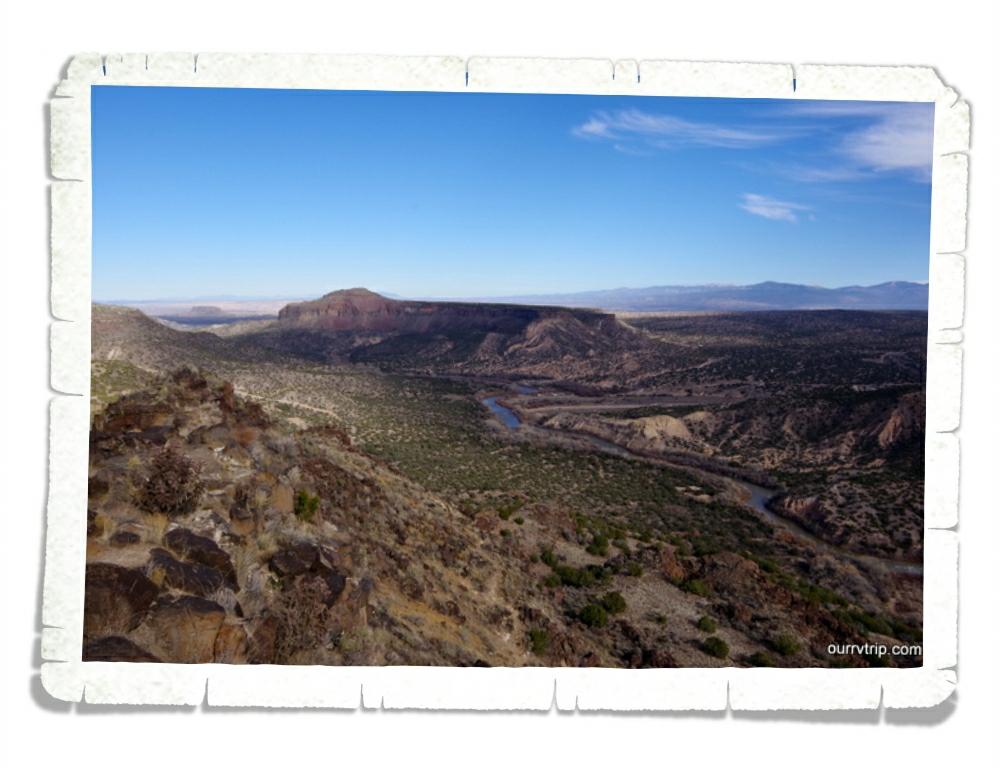
The last NPS Unit we made it to in our week in the Santa Fe area was the Valles Caldera National Preserve. Valle Grande, in the picture above, was formed around one million years ago when a series of huge volcanic eruptions spewed a volume of material 500 times greater than the May 1980 eruption of Mt. St. Helens. There’s a visitor center here and some trails, but we didn’t get to do much because it was cold and icy the day we went. I’d love to go back during the spring when it’s all green!

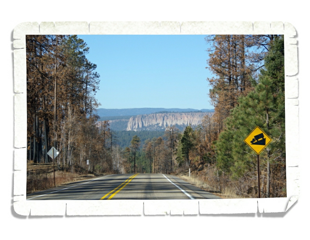
Valles Caldera looks like a big bear paw on a map. Can you see it?  (top picture) We heard some of the Natives in the area call it that. This area is gorgeous even with the forest healing from a big fire a few years back.

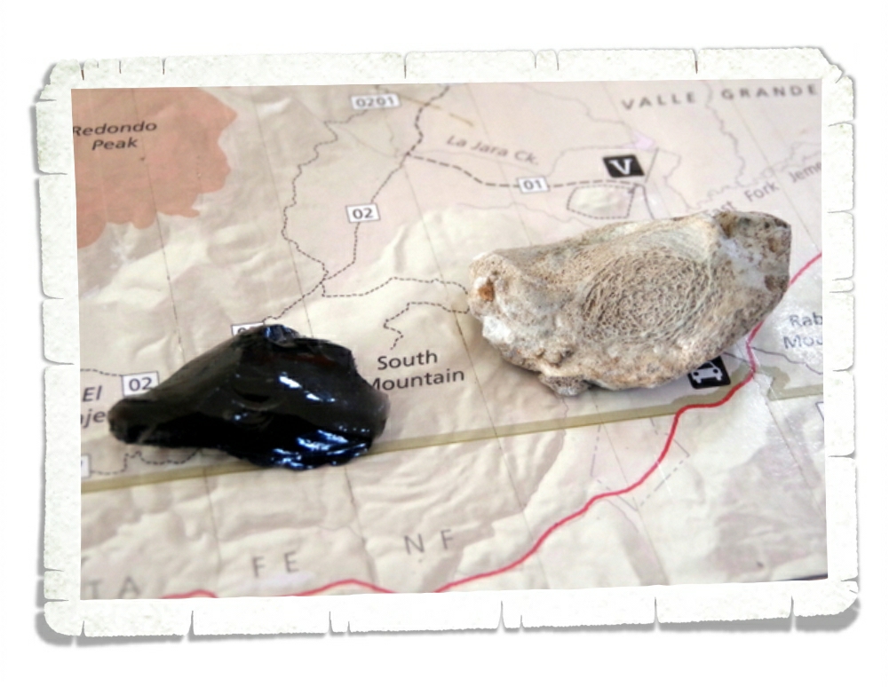
One of the neat things about this NPS Unit is due to all of the volcanic activity. There are tons of obsidian laying around! What you might not know (we didn’t) is that when obsidian reaches a certain temperature it turns into poofy obsidian. A what obsidian? Poofy. In the picture above, you can see a normal shiny, black piece of obsidian. Next to it is the poofy obsidian. Poofy obsidian is soooo light and airy! It was pretty neat to see and feel the difference. If you step on it, it poofs. If you hold it too tight, it poofs. Due to the large fire there are tons of poofy obsidian in the park now. If you visit this park, please don’t poof their obsidian.

We also stopped back by Bandelier National Monument to revisit it in hopes of seeing it without snow, but the main trail was closed due to maintenance…so, we hopped back in the car and drove on. The views in this area are pretty stellar!

New Mexico is one of our favorite states. The views, the hikes, the NPS Units, the foodies, and the vibe all speak to us. There are so many postcard worthy vistas in this gorgeous state!

I imagine we will go back to New Mexico again and again throughout the years!

See y’all down the road!

#grandwesternloop

Sand, Science, and Chilies

Sand, Science, and Chilies

Hey Guys! We spent one jam packed week in the Alamogordo area of New Mexico. This was our second visit to the Alamogordo area and we still didn’t get through our entire to-see list!

The first thing we did when we got back to town was grab one of our absolute favorite burgers! Rockin’ BZ Burgers is still as good as we remembered them to be.

The second thing we did was revisit White Sands National Monument to get some sled time in!

Alex thought his sled was going a little slow so he waxed his sled up for some speed, then he found the tallest dune he could find! We expected a scene out of Christmas Vacation when Clark sprays his varnish on the bottom of his sled. It wasn’t quite that fast, but he did say he could tell a difference!

We did a Ranger guided sunset stroll one evening at White Sands. I love how bright white the sand looks next to the vivid blue the sky on a bright sunny day, but I have to admit…I’m kind of digging how soft everything looks in the late afternoon lighting.

And Guys, check out this sunset!

We finally made it to the New Mexico Museum of Space History! We tried to make it last time we were in Alamogordo, but we ran out of time. We learned about Ham, the worlds first Astrochimp who traveled into space in that little capsule you see in the above top picture. Nicholas had a good time dressing up in astronaut gear! :-}

There was a whole section on Star Trek. Beam me up Scotty!! There were some very cool exhibits! This one in the right picture was a rumble pad where you felt the power of a shuttle take off. It was a really cool exhibit!

We had way too much fun with the Whisper Dish! We all took turns whispering and listening to each other from across the Museum park. The nerd always comes out of us when we find an interactive museum! Our nerd hearts were very happy at this one.

We found an old train trestle while we were out exploring Cloudcroft. Check out the view we found! Can you find White Sands NP in the pic above? It’s there! Check the left side of the picture.

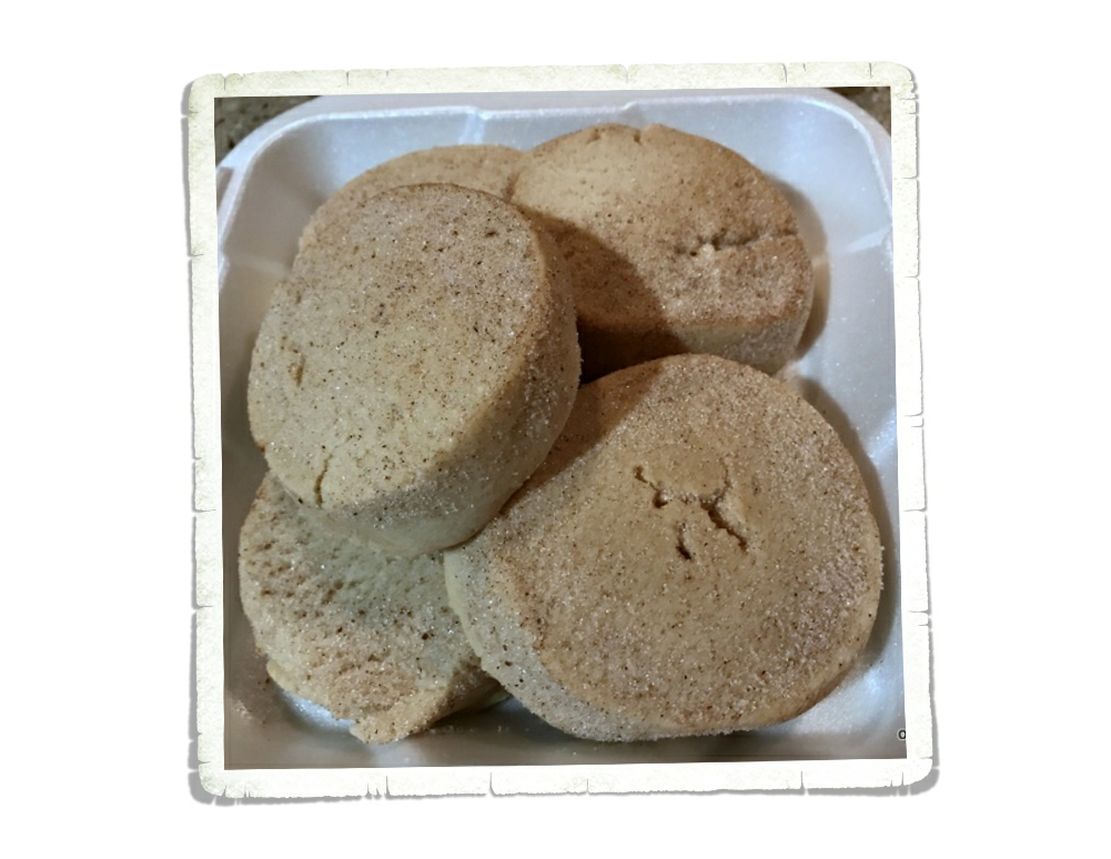
Oh! We found these really yummy and super huge biscochitos at a place called Rizo’s! They were fresh baked and so so good.

We never know what the grocery store is going to be like. The first time we visited Alamogordo we found Lowes and fell in love with it! We were all excited to go back to the tortillaria for some fresh made tortillas and to grab some roasted chilies from the produce section!

We had to stock up on our favorite treats before we left town. What’s not in the picture is the 10lbs of frozen green chilies we bought. We love green chilies!! The only other thing we had time for was hitting up the two pistachio farms to stock up on some tasties!

Alamogordo was one of our favorite places from our first loop back in 2015. When I added it to this loop I worried that it really wasn’t as great as we remember it to be. That burger wasn’t really that good. White Sands really wasn’t that fun. But Guys, it totally was! Alamogordo is definitely one of our favorite places and after two visits…we still have new things to do there!

See y’all down the road!

#grandwesternloop

The Top Of Texas

The Top Of Texas

Hey Guys!! While we were in the Carlsbad, NM area we spent a couple of days at the Guadalupe Mountains National Park in Texas.

The Guadalupe Mountains sit right on the New Mexico-Texas state line. We were so close, we couldn’t pass up the opportunity to explore another Texas National Park Unit!

Our first day at Guadalupe Mountains NP we did two hikes and the boys completed the Junior Ranger program. We did the Pinery Trail which is a short trail to the ruins of an old stagecoach stop from the 1800s called the Butterfield stagecoach station. This was a super easy almost one mile paved trail.

The second trail we hiked was the Devil’s Hall Trail. This trail started off great with about a mile of constructed trail. We saw some really pretty fall colors on this trail! Just when we thought the Devil’s Hall trail was going to be easy peasy, the constructed trail ended and dumped us out at a wash and the “trail” followed the wash for about a mile or so. This was a difficult trail due to the fact that there wasn’t really a trail. There were several times where you could tell which direction you needed to go, but there wasn’t a definite way to get there. And there were a couple of time when we weren’t really sure if we were going the right way. The wash was littered with big boulders and slippery round rocks. So…the going was slow.

One of the things we learned while doing the Junior Ranger program here is what an Alligator Juniper looks like! The bark looks like gator hide! We had fun pointing out the different trees while we were picking our way down the wash.

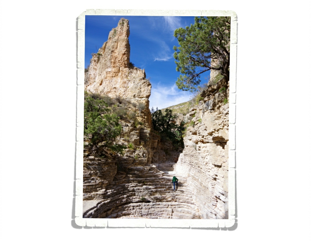
At the end of the wash you get to a natural staircase that they call a “hiker’s staircase”. You can see Alex making his way up the staircase in the picture above. It was a little tricky to get up with a camera around my neck. I ended up having to hand the camera up then scale the “staircase” myself.

Once you make it to the natural staircase you’re almost there! I probably took way longer than necessary because I kept stopping to take pictures. Devil’s Hall turned out to be a short narrow canyon. We walked down it and explored the area for a little bit before turning around to traverse the wash again.

We decided to do a hike on Thanksgiving Day. We did the Guadalupe Peak Trail which is a strenuous trail that gains a total of 3,000 feet of elevation.

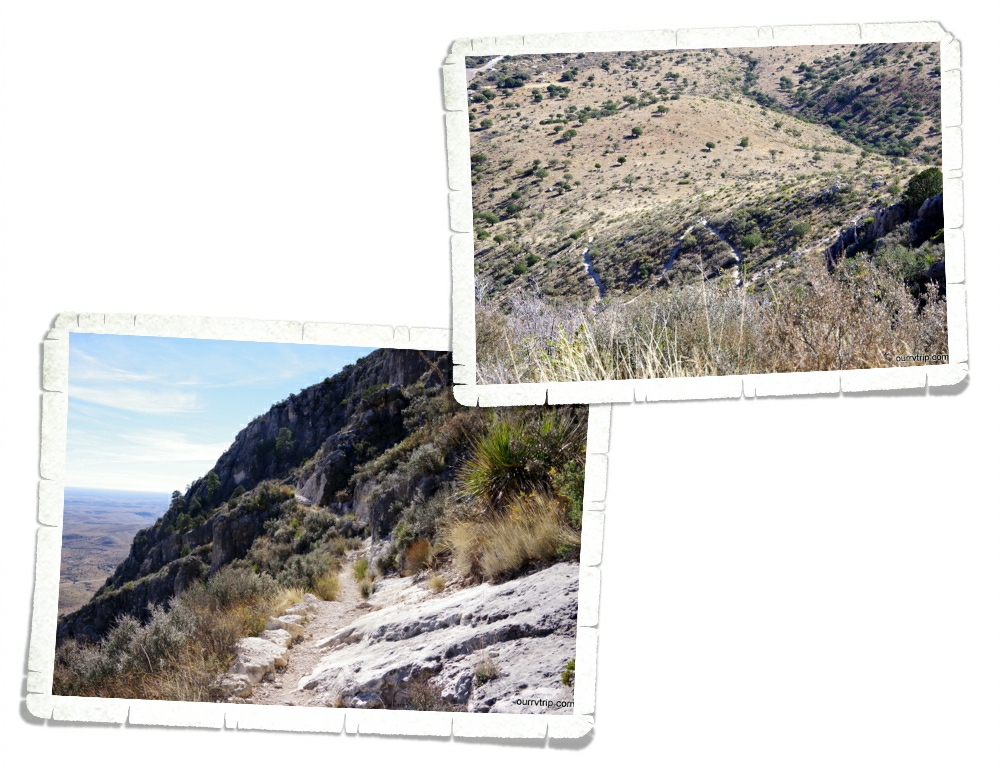
I try to do my homework when it comes to trails like this. Everything I saw said that if you can make it past the first 1,000 feet or first mile and a half then you won’t have any problem finishing the hike. What they failed to mention is that after that first mile you’ve worked so hard going almost straight up that your legs are shot for the rest of the hike. So, while the rest of the hike isn’t quite as hard…it feels just as hard because your legs are jello! And, I would like to point out…the entire hike is hard. Not just that first mile. Check out the switchbacks we hiked up in the pic above (top picture). Parts of this trail are on exposed cliffs where if you slip…you slide a loooong way down.

Now that I’ve warned you how strenuous and possibly dangerous this hike is…lets enjoy some of the views! Because lets be honest…the views are the whole reason to hike trails like this. This view was about half way up at the end of one of the many switch-backs. I stood there a good few minutes catching my breath and ogling the vista.

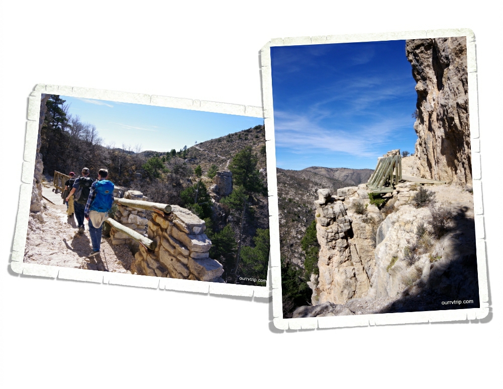
I thought this bridge was so neat the way it’s right on the edge of the cliff! Once I got across it and to the other side I got a better look at it and wowzers! It really is right on the edge of a very high cliff!!

Funny story…there was a part right toward the end of this trail where we couldn’t really tell which way we were supposed to go. The couple in front of us each went a different way. I chose to follow the girl and well…we didn’t exactly take the easy way. See those two hikers on top of that rock in the pic above? Yeah, that’s the way we took up to the top. Notice we’re on the trail on the way down. It was much easier! But wait!! I’ve left out the best part!!!

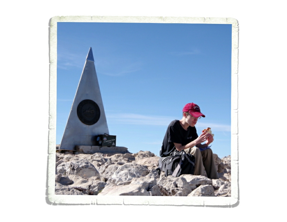
Welcome to the top of Texas, y’all!!

Not a bad place to have a Thanksgiving picnic! We were so hungry from all of our hard work that we promptly sat down on the most comfortable rocks we’d ever found and ate lunch before we actually looked around at the views. You’ve got to have priorities, you know. Food is very important. ;-P

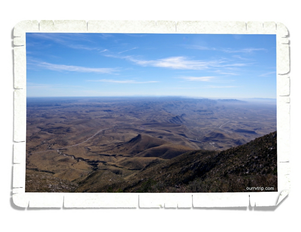
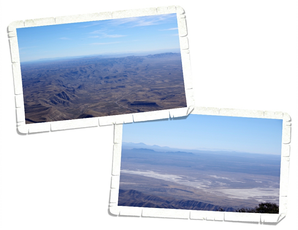
We wolfed down our lunch in record time and then took in the awesome views at the highest peak in Texas! Things sure look different at 8,751 feet up. Oh, I know…there are mountains that would make this one look like a mole hill…but y’all…check out that view! We spent a good half hour or so eating lunch and taking in the views. We wrote our names in the log book and then started the looonng hike down!

It was faster going down than up and we made it back to our car and the most comfortable seats in the world! Some of us (I’m not telling who…it might have been me) started to worry that our legs weren’t going to make it the whole way down.

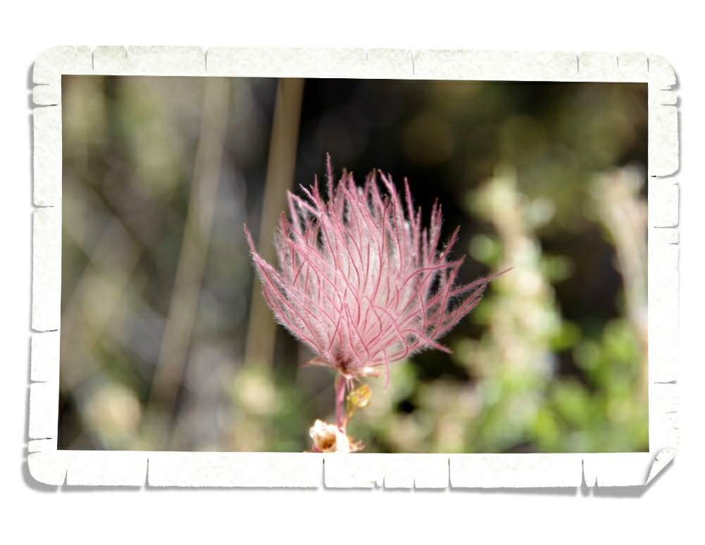
Do you remember those little pencil trolls that used to be so popular with the wild hair that went all over the place? That’s what this pretty reminds me of. Troll hair.

Well y’all, we made it to the top of Texas and survived the hike! I would say the Guadalupe Peak hike is rated as the second hardest hike we’ve done so far. The Harding Ice Field hike still holds first place.

See y’all down the road!

#grandwesternloop

Carlsbad Caverns National Park

Carlsbad Caverns National Park

Hey Guys! When I was planning the New Mexico/Texas part of our trip back in 2015 (the first time we were in NM) I skipped the Carlsbad area. I kept reading all of these sketchy reviews for the RV parks in and around the Carlsbad area. We were so bummed to pass this area by because we’d heard how amazing the Carlsbad Caverns NP is. But, without a place to park our home-on-wheels…we had to miss it.

This year as I started planning our #grandwesternloop I thought about the Carlsbad area again. There are two National Parks available in the Carlsbad area and we do love our National Park Units! So, I dug into the RV park search again. And again, the park reviews weren’t the best. But I felt a little better about one in Carlsbad so we took a chance and booked a spot for two weeks. We were completely prepared to move on down the road if the park ended up being totally sketchy, but it wasn’t! It was a decent park and we spent two very full weeks exploring as much as we could!

We finally made it to Carlsbad Caverns National Park! We didn’t make it during the bat flight program, but honestly…I’m ok with that. The thought of around 400,000 Brazilian free-tailed bats flying over my head just isn’t really appealing to me. I wonder if they offer ponchos to keep the bat guano off of the people watching? The amphitheater where you can sit and watch the bat flight program is in the top picture above.

Speaking of bat guano…some of the early settlers used to mine the guano to sell as natural fertilizer. I can’t imagine what that would smell like. We were there several weeks after the bats had moved on this year and we could definitely still smell them.

I really wanted to see the natural entrance to the cave so we walked the steep, narrow trail down 750 feet to get into the cave.

I’m not a professional photographer. Far from it. I point and shoot. Seriously. So when I get into a cave with dim light…well, I take several hundred pictures of everything and just hope for the best. Fun fact: the first pictures taken in Carlsbad Cavern were taken way back in 1915 by Ray V. Davis. There are more than 110 caves in Carlsbad Caverns National Park and Carlsbad has one of the deepest and most ornate caves ever found. It’s hard to believe that around 250 million years ago the whole area where Carlsbad Caverns is found was under a shallow tropical sea. Yup, you read that right…a tropical sea! It was this start along with some twists and turns from Mother Nature that made all of the rock formations you’ll find in Carlsbad Caverns possible.

It’s amazing all of this was created one drop of water at a time over thousands and thousands of years.

There are several Ranger led tours you can take plus a self-guided tour. We opted for the self-guided tour. When it was all said and done, we walked about 3 miles. The thought of having to walk nearly 800 feet back up to the surface was a little daunting. Y’all, I was sooo glad to see an elevator! It only took a couple of minutes to get back to the surface and the visitor center! Sweet! You can also go into the cave by way of the elevator, but I really wanted to see the natural entrance. And…going down steep inclines is usually easier than huffing your way back up. Usually.

The CCC built all of the buildings in the picture above. They’re still being used today. If you don’t know what the CCC is…go look it up. It was a vital program and should definitely still be in place today. We’re fans.

You might think the only thing to do at Carlsbad Caverns National Park is to explore the cave, but you’d be wrong. There are several hiking trails and even a 9 mile scenic drive! It’s a one way loop that isn’t as bad as it looks. We were told it’s better to have a high-clearance 4×4 vehicle, but we didn’t see anything bad. I wouldn’t recommend trying a trailer or RV on this road, but a car would work alright (in my unprofessional opinion).

We found this magnificent view on the scenic drive. I think…don’t quote me on this…that this was the Rattlesnake Canyon Overlook. There was a little pull off so we all got out of the car and walked down a small trail to stand there with our mouths hanging open just gawking at the view before us. Luckily, I remembered to take a few pictures.

I did find one pretty! I love that light lavender color!

The day we went to explore Carlsbad Caverns NP it was bitterly cold and extremely windy. We did one small hiking trail up top, but that’s all we could stand. It was too cold for us and the wind was absolutely insane. We thoroughly enjoyed trekking through the cave and the scenic drive! We ended up spending almost the entire day here and we really could have spent more time if it hadn’t been so windy and cold.

See y’all down the road!

#grandwesternloop

Heading West

Heading West

Hey Guys! We’re back on the road and heading west this loop! We’ll spend the next year making our way through twelve states before heading back to Missouri to visit family again. The plan is to finish up the remaining six states in the contiguous US left on our map, grab a few places we missed as we went through some of the states the first time, as well as, revisit a few of our favorite places. We’ll (hopefully) hit around 40 different National Park Units as we make our way through our #grandwesternloop!

We spent two weeks in the Amarillo, TX area. We don’t normally stop at “roadside attractions”, but we found ourselves at two different roadside attractions while we were in Amarillo. Cadillac Ranch was created in 1974 along Route 66 just west of Amarillo by Chip Lord, Doug Michels, and Hudson Marquez . For those traveling The Mother Road this roadside attraction is a must. And don’t worry…it’s completely legal to spray graffiti on the cars at Cadillac Ranch.

We had to leave our mark. Can you find it?

We’ve heard that the city is thinking about closing Cadillac Ranch down because of all of the spray paint cans being left there. We saw quite a few littering the ground near the Cadillacs. We brought our own cans and we threw them away in the handy dumpsters the city has provided when we left. If you go…make sure to do your part and put trash where it goes.

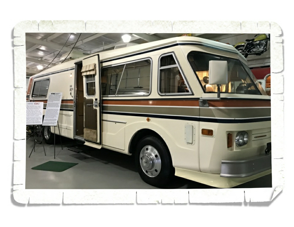
The other roadside attraction we found ourselves at was the Jack Sisemore RV Museum. We weren’t really sure what to expect here, but we’d heard it was a neat stop and at a great price. Free!

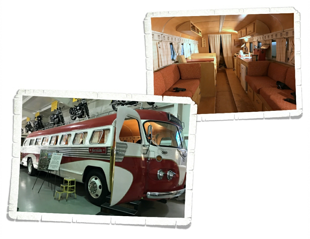
Jack Sisemore has been collecting old RVs for over 25 years. He’s redone some of them and left some in the condition he found them in. He has several RVs in his collection put together to make this museum that you can walk through and see how much RVs have changed over the years. The oldest one he has is the 1921 Ford Lamsteed Kamkar you can see in the pic above. The Kamkar body was mounted onto a standard Model T Ford and came with everything you needed. It was made by Anheuser-Busch and sold for a grand total of $535.00 in St. Louis, MO.

This is a 1976 FMC and was owned by Max Factor, Jr. You might know him as the president of Max Faxtor Cosmetics. We had way more fun going through these old RVs than we thought we would.

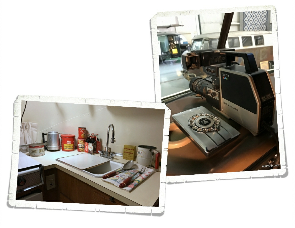
Each RV that had been restored also had been set up with items popular the year the RV was made. Check out that video camera! The kitchens were stocked with items from the specific year of the RV. Check out the old tins!

You might recognize this bus from the movie RV! It’s the one they used to film the movie! The inside of the bus was…a little lackluster. I’m going to have to rewatch that movie and pay attention to the scenes shot inside the bus.

Some of the vehicles in the museum aren’t strictly…RVs, but they’ve been used as one. I love this old VW bus! Talk about vintage vanlife!

At the back of the museum they had an old gas station set up. Check out the air conditioner on this car! Here, let me give you a better look at this beast of an air conditioner. Can you imagine sitting right by it? My head would be frozen! It was a true feat of engineering and could be yours for the low price of only $12.85!!

We snuck in a National Park that we hadn’t planned on. The Alibates Flint Quarries National Monument was a very cool place to visit. When we got there we almost didn’t make it inside due to an infestation of paper wasps. I didn’t get any photos…I was more worried about being stung, but oh my word…there had to have been a couple hundred wasps flying around the visitor center. It was slightly terrifying.

Unfortunately, we didn’t get to see the actual quarry because we’d just missed the last tour. We did peruse the museum and watch a film about the area before heading out to see what we could of the park. This area was known for it’s flint. The Native Americans would come here to get the flint to make their weapons and tools. We were able to see and touch some of the flint! Somehow, we ended up on this one lane (but not one way) dirt road. We hoped it would lead to some amazing overlook of the flint quarry, but it just kind of wound it’s way around the area where Lake Meredith used to be. Our GPS was convinced we were driving through Lake Meredith. Ha!

Let’s talk foodies…we found an awesome burger joint called Hil’s Burgers in Canyon, TX! If you go…make  sure to get the onion rings. We also found a Torchy’s Taco in Amarillo…so we had to eat there. Once… or twice…or more.

We also went to a very cool state park, which I’ll tell you about in the next post because this post is getting to be way too long!!

See y’all down the road!

#grandwesternloop

George Washington Carver National Monument

George Washington Carver National Monument

Hey Guys!! This week we’ll finish up the National Park Units we squeezed in during our 16 week travel hiatus. I’ve only got one more park to tell you about, so let’s get into it!

George Washington Carver was born a slave on the Carver farm around 1864. He and his mother were both kidnapped from the Carver farm. George was found and returned to the Carvers, but they never found his mother. He was orphaned and nearly dead from a bad case of whooping cough so he was excused from most of the daily chores. This extra time gave him the opportunity to explore and start learning about plants. In the visitor center museum, you can learn all about George’s life from his early explorations in the forest all the way to his teachings and findings as an adult.

George Washington Carver had many accomplishments throughout his long life, but he’s most notably linked to his discovery of 300 uses for peanuts.

The day we went to GWCNM it happened to be Prairie Days where the park sets up all kinds of interactive displays to show what life used to be like on the prairie for early settlers. The picture above shows some of the medicines a field doctor during the Civil War might have had in his medical bag.

Volunteers (adults and children) came dressed in period appropriate garb to spend the day showing the public what it might have been like on a typical day during prairie life. We walked around learning about the different skills needed to survive during the 1800s.

We found a candle maker and two of the boys learned how to make a candle. They thought it was pretty cool…plus they got a souvenir that they made.

There were also wagon ride through the prairie available! The bumps and bruises were free of charge. We didn’t take a ride but it looked so neat. Reminded me of a scene from Little House On The Prairie.

The boys earned two different badges at George Washington Carver National Monument! There was a special book and badge for completing ten Prairie Day activities…so, of course, they had to do both booklets. They never pass up an opportunity to earn a specialty badge.

There were sooo many pretties out on the prairie! So…many! I only got pics of these two though. I didn’t really want to go traipsing through the tall prairie grass to get pics…sorry guys. The itchy threat of ticks and chiggers along with my fear of all the venomous danger noodles (snakes) totally outweighed my need to show you all the pretties.

We ended our day with a trip to one of our favorite foodie places. Eagle Drive-In in Joplin! My parents had never been before so we were able to show them one of our favorite places!

National Park Units are a huge part of our travels. I did an official count on the number of NPS Units we’ve visited during our travels. As I’m typing this…the count is 89! We loved getting to share the experience with my parents during our hiatus!

The next post is the last post for our travel hiatus. It wasn’t all fun and games, Guys and I’ll tell y’all about the many projects we got done while we were moochdocking.

See y’all down the road!

Battlefields

Battlefields

Hey Guys!! We managed to sneak in four National Park Units during our 16 week travel hiatus! One of them, Homestead, I’ve already posted about. I’m going to try and squeeze both of the battlefields into one post. We’ll see how it goes.

I’ve confessed to y’all before that when we started this nomadic lifestyle, I didn’t plan any battlefields at all. Not a single one. I wasn’t interested in walking around a big field that so many people had died in, but then we toured our first battlefield. Little Bighorn Battlefield was…eye opening. It was also during this visit that we all realized how important it is to go to these battlefields. To learn, to see, to remember. The boys learn more history in one day at a battlefield than they do in a week of history lessons. They retain the information. They get to put a physical place with the stories. Needless to say…we visit every battlefield we can. It makes me sad to realize everything we would have missed if Jerl had never talked me into Little Bighorn.

The first of the two battlefields we visited was Wilson’s Creek National Battlefield. We spent some time going through the museum and getting ourselves acquainted with the overall view of what happened at Wilson’s’ Creek before we set off on the auto tour. I feel like you can get a better idea of what the soldiers’ lives were like and who they really were when the National Park Service has displays like the one above set up with personal items.

It’s always nice when there are a few trails that lead you off the main auto tour road. We hiked this short one to see Wilson’s Creek. The spot was kind of grown over so I didn’t get a good shot of the creek itself. We were impressed with the size of it though.

The Ray house was used as a Confederate field hospital during the battle, but was originally used as a post office since it was built along Wire Road. It was called Wire Road because of all of the telegraph lines that lined the road linking the nation.

The battle at Wilson’s Creek in 1861 was the first official battle of the Civil War to take place in Missouri. Missouri saw fighting for the next three and a half years as raiders destroyed anything military or civilian that might possibly aid the enemy.

There were so many pretties at this battlefield, but in the interest of keeping this post semi-short I’ll just share these three. The one on top is my favorite. I have no idea what it is, but I  absolutely love the way it looks and come on…that purple!

We ended the day with some grub. We went to the Black Sheep in Springfield and got one of the biggest burgers we’ve ever seen! It tasted as good as it looks!

The second battlefield we visited was the Pea Ridge National Military Park in Arkansas. I love it when there are interactive displays! It keeps the kiddos more engaged and curious.

Are you wondering what the answer is to the question? What did soldiers carry into battle? Half of a two man tent, a miniature bible, a blanket, letters and photos from home, tobacco, a small sewing kit, and some personal hygiene stuff like a razor, brush, soap…and if they were lucky they might have a spare set of socks and a shirt. This, of course, would vary from soldier to soldier and what they could afford to bring with them from home.

I can’t tell you how many battlefields we’ve been to off the top of my head…quite a few. This was the first time we were able to actually hold one of the guns the soldiers carried. The guns were heavier than we thought.

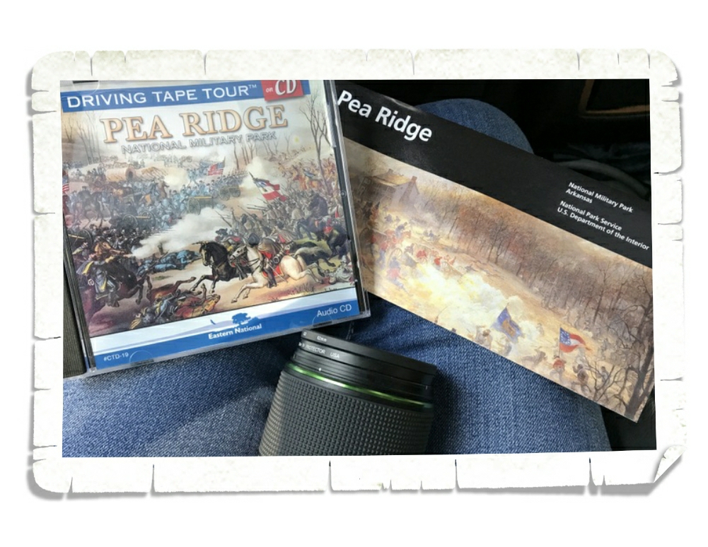
After we perused the museum, we set off to explore the battlefield armed with a map, the audio tour, and my trusty camera. We encourage y’all to purchase the audio tour any time it’s available at a battlefield. It truly adds so much to the whole experience.

In all of our travels, we’d yet to actually set foot on the Trail of Tears. The boys have learned about it…we were close to it several times, but this was the first time to walk a part of Telegraph Road. Telegraph Road would later be renamed Wire Road.

Pea Ridge was the battle that kept Missouri in the Union. Each battlefield is different. Different landscape, different feel, different story.

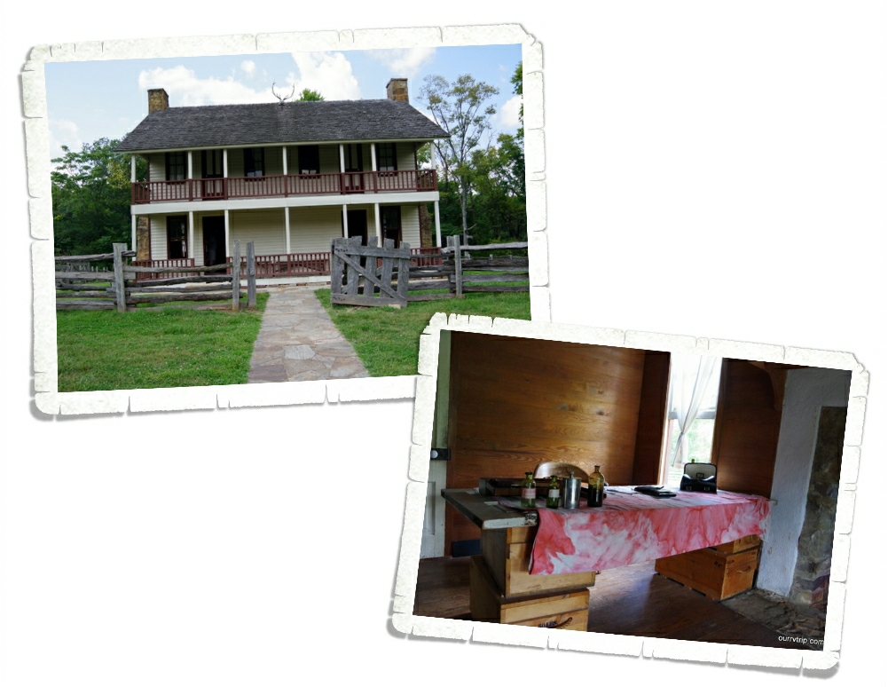
Elkhorn Tavern was used as a supply base for the Union until it was captured and held by the Confederate troops. It ended up being a field hospital caring for both Union and Confederate wounded. The original tavern was burned in 1863 by Confederate guerrillas.

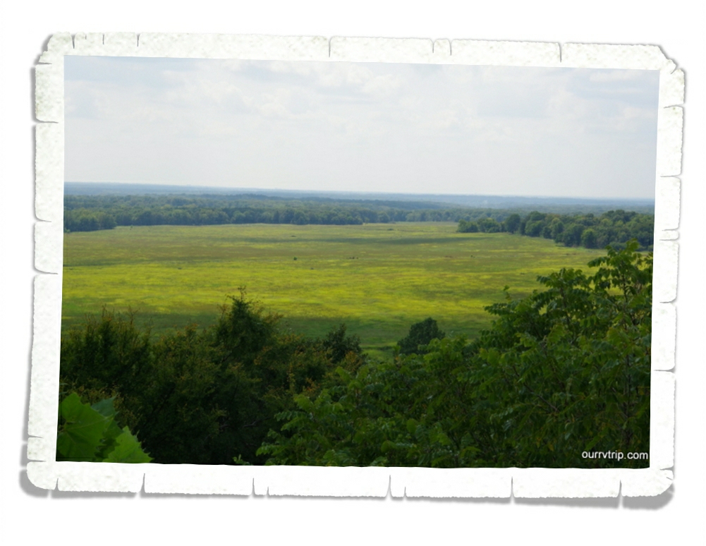
This field was the main battlefield at Pea Ridge. There are some traces of the trenches the soldiers dug. If you look very closely, you can see a cannon here and there. And if you listen hard enough…you might be able to hear the echoes of the gun shots, the shouts of the men, and the canons going off.

The boys learned some valuable history and earned another Junior Ranger badge at Pea Ridge National Military Park. It’ll be our last Civil War battlefield for a while since we’re heading west for the next year.

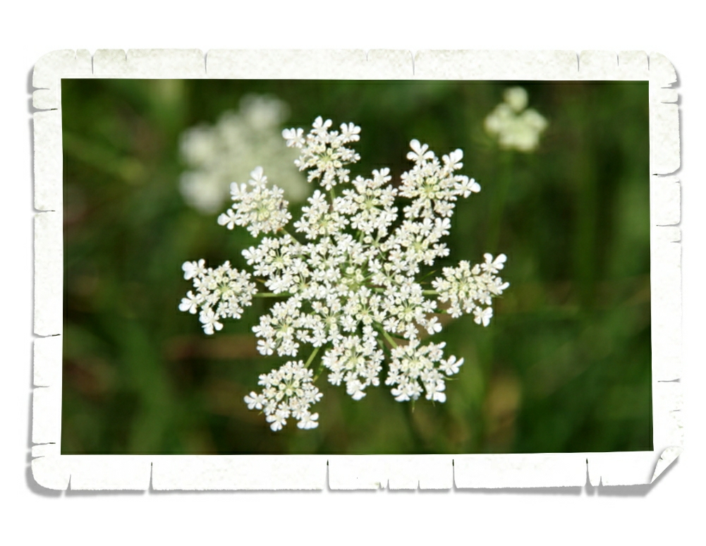
There weren’t as many pretties at Pea Ridge, but I do love this one.

In the next post I’ll finish up with the National Park Units we visited while on our travel hiatus! There’s just one left, but I thought this post was long enough as it is. So, stay tuned!

See y’all down the road!

Little Rock, AR

Little Rock, AR

Hey Guys! Are you ready for the second part of our Arkansas adventures?

The main reason we were in the Little Rock area was to visit the Arkansas State Capitol Building. Y’all know about our rule of visiting the SCB before we can put the state sticker on our map…so we try to make it to the SCB once we get to a new state as soon as we can. Sometimes that’s the first day and sometimes we’ll be in a state for a month before we can get to the Capitol Building.

We enjoyed the Arkansas SCB. It has a lovely dome! There’s something to be said for clean lines and modest decorations. It had not one, but two of these fantastic staircases.

Both of the House and Senate Chambers were locked. We didn’t get to go inside, but I did snap the picture above (right) through the window. I do love stained glass domes! And check out these big brass doors in the picture on the left! I had Alex stand in front of them so you could get a better perspective of their size.

I would have to say the best part of the Arkansas SCB for us was the State Treasury room where they let us hold half a million dollars!! Guys!! Wow!! Have you ever touched so much money at once? We couldn’t pass up the opportunity to hold the money ourselves. We each got to hold the stack of money while the tour guide (I’m so bad with names) told us a bit about the history of the safe. He also gave the boys some perspective on how much money it takes to go to college and raise a kid. I think they were pretty surprised. We asked if he’d ever had anyone try to take off with the money. He said he hadn’t, but they do school fieldtrips there and he had one kid refuse to give the money back to him. I would like to have seen that conversation.

The other place we really wanted to visit in Little Rock is the Little Rock Central High School National Historic Site. One of the things we really love about being nomads is the ability to take the boys to places where our Country’s history actually happened. We feel like it makes a bigger impact to see it in person rather than just reading about it in some book.

We weren’t alive in May of 1957. We’d, of course, learned about what happened at the Little Rock Central High School during that turbulent time, but we hadn’t learned much about it with the watered down version that’s taught in schools. We really didn’t know anything. The Visitor Center laid it out really well. There’s so much information you could spend the better part of a day reading though it all and watching the videos. I’d never heard them called “the Little Rock Nine”, never thought about how brave they must have been, how hard they had to work to stay in school while so many wanted to find reasons to kick them out, and how they were representing an entire group of people. The whole world was watching these nine high school kids…just waiting to see if they failed or succeeded. That’s a lot of pressure. Reading about each of their stories was eye opening for all of us.

The Little Rock Central High School National Historic Site includes the Visitor Center, this gas station where protests took place, and the High School itself.  The high school is still a working school so the only way to tour it is on a Ranger led tour. We, unfortunately, didn’t get to go on one. I would have liked to, but timing didn’t work out.

We made a quick stop at The Old Mill Park which is a re-creation of an 1880s water-powered grist mill. You might recognize it from the opening scenes of “Gone With The Wind”. It was a busy little park! You can go into the mill and look around. The Old Mill Park is dedicated to the memory of the Arkansas pioneers. The park is nestled at the end of a finger of Lake Number Two.

If you’ve followed us for long, you know that we love our burgers. We found a great foodie spot called Big Orange. The burger above (on the right) is the Farmer’s Burger with a fried egg, bacon, lettuce, tomato, red onion, and aioli. It must have been good because it didn’t last long! I had the Smashed Avocado Burger with avocado, pepper salad, Havarti cheese, lettuce, tomato, and garlic aioli! It was delicious! Those fries you see in the background are the State Fair Fries which include chili, cheese dip, two different kinds of shredded cheese, pickled jalapenos, fresh jalapenos and red onion. They were totally not on my diet and I didn’t care at all…they were definitely worth it!

Pretties! There were tons of them! I’m sure I took way more pictures of pretties than I needed to.

That’s all for Arkansas! See y’all down the road!

This is the last post for the #minieasternloop2017

Hot Springs National Park

Hot Springs National Park

Hey Guys! We only spent one week in Arkansas, but we crammed so much into that one week I’m going to break up our Arkansas adventures into two separate posts. We’re going to start with Hot Springs National Park!

Confession:  I didn’t really want to go to Hot Springs National Park. I couldn’t figure out what could be so interesting about a hot spring. Did I really want to devote an entire stop to this area? When we visit some place it’s not just for a weekend. We devote an entire week to two weeks to each stop. I questioned whether or not this National Park was worth the hassle of staying so far from Little Rock (which is the main reason we were going to be in the area). Now, don’t get me wrong…we love our National Parks…it’s just that usually, National Parks are…well…bigger. I’m talking about Parks and not Monuments or Historic Sites or Battlefields.

Fordyce Bathhouse/National Park Visitor Center.

The day we went it was soooo busy. Finding a parking spot wasn’t easy. Let’s just say, I was still skeptical when we walked into the Fordyce Bathhouse. It wasn’t looking so hot for Hot Springs, so far.

Ladies’ Bath Hall.

The boys grabbed their Junior Ranger booklets and we set about exploring the museum in the Fordyce Bathhouse. The National Park Service has restored quite a bit of the Fordyce to what it looked like back in it’s heyday. In the picture above you can see one of the stalls used for a women’s bath. The uniform you see is what the attendant would have worn.

Treatment room.

The museum in Fordyce Bathhouse lets you walk through the “ritual” of a bathhouse visit. These visits were a three week long regime of daily baths, workouts in the state-of-the-art gymnasium,

massages with the newest devices and tinctures, and a variety of specialty treatments.

 The room above was for podiatry…all afflictions dealing with the feet.

When all that steam from the hot spring water ruined your hair, you could stop into the beauty salon and have it fixed. Check out all of the old beauty equipment!

During the mid- 19th century, Hot Springs catered to the wealth of America. People came from all over the country to have a spa vacation at one of the famous Bathhouse Row’s “temple of health and beauty”, but the wealthy weren’t the only people lining up to get into one of the spas. The mineral rich, hot spring water was said to be a cure for what ails you no matter what that ailment was. Many people came for physical therapy in specialized tubs like the one above.

While the bedrooms were on the small side, the bathhouses offered ample rooms and activities to allow for socializing in the evenings. The mannequin in the photo above kind of gave me the creeps. I really kept expecting it to move. Maybe I’ve watched too much sci-fy.

The first bathhouses weren’t really bathhouses. They were wooden planks surrounding excavated rock where the bathers would soak their feet. The first “bathhouse” which was more like a log cabin was built in 1830. During the height of Bathhouse Row, the spas were very elegant with stained glass, fountains, and works of art to make an establishment that rivaled those found in Europe.

Please do not urinate in vapor. The things you have to tell people not to do.

 There was a time when the opulent spas attracted not only the wealthy, but also sports heroes, politicians, and even mobsters. Hot Springs became just as known for gambling, prostitution, and organized crime as it was known for its water. The success of Bathhouse row has gone up and down through the years. During the 1940s there were twenty-four bathhouses in operation. Only two spas are operating today. You can go to the Quapaw or Buckstaff Bathhouses and soak in the hot spring water for a fee. The Buckstaff has been in continuous operation since it opened its doors back in 1912 and is the only continuously run bathhouse on Bathhouse Row.

While most of the springs have been covered and sealed off to prevent contamination, you can still see some springs bubbling up and running down the mountain to collect in pools of 140° water.  So, why is the water so hot? It may surprise you to find out that Hot Springs isn’t in a volcanic region. The water you see in the picture above started its journey about 4,000 years ago as rain water seeping into the ground. The rain water is heated naturally by rock that’s under immense pressure at a rate of 4° every 300 feet. The rain water is then forced back up though fractures where it will take about a year to return to surface. The park collects 700,000 gallons a day. Here’s a tidbit for you: the water that you see flowing in the picture above started as rain water when the ancient Egyptians were still building the pyramids!

Not far from Bathhouse Row is the Hot Springs Mountain Tower where you can get a bird’s eye view of the area. Not a bad view!

There are even some hiking trails around! We hiked to Goat Rock to check out the view. It was an easy one mile TAB (there and back) trial, but it was so incredibly hot. We ran into an older couple who had hiked from a nearby campground. They were lost with no water and no map, but didn’t seem to be worried about it. Guys, if you’re going to hike…have a map and please carry water. Be smart about your explorations.

We saw tons of these little lizards during our hike. They were everywhere! We even ran into this little lady. Can you see her in the left picture? This little deer is a master at hiding and camouflage.

Ready for some pretties? There were quite a few different pretties around during our hike. We were there late Spring, early Summer. Some pretties were still just waking up. I know, I know…the bottom left picture is of a weed. But, it reminds me of a serious case of bedhead. 😛

We had a great day learning about the springs, tasting the water, and exploring Hot Springs National Park! Even though it’s the smallest and one of the oldest National Parks, there’s quite a bit to see and do. We easily filled an entire day and could have spent another day hiking more. So, what did we learn? Sometimes there’s more than meets the eye when it comes to National Parks.

See y’all down the road!

#minieasternloop2017