Category: Hiking

The Easternmost Point in the US!

The Easternmost Point in the US!

We only spent one weekend in Lubec, Maine, but we wish we’d spent a couple of weeks.

Lubec was founded in 1811 and was once the home of fishing fleets and smugglers, but is now known for being the easternmost point in the US. The area has 20 foot tides and has 96 miles of coastline…so it should come as no surprise that there were quite a few lighthouses.

Right across the International Bridge is Campobello Island, New Brunswick where you can spend time exploring Roosevelt Campobello International Park. Franklin D. Roosevelt grew up spending summers on Campobello Island and later when he had a family of his own, he took them to spend summers there. You can wander through the 34 room Roosevelt summer home. There are interpreters there to answer any questions. The boys were curious about the huge megaphone you can see in the photo on the right. When the Roosevelt’s were staying at the cottage, the megaphone would be hanging up on the porch right outside the door in the photo on the left. Eleanor would use it to call the children home. We were told her voice could be heard over a mile away.

The first thing we did when we got to Lubec was find a place to eat. We ended up at Fisherman’s Wharf. It was fantastic! The food was amazing and the service was spot on! They talked us into trying some periwinkles. We tried them and guess what…we liked them! Except Nicholas. He stalwartly refused to try one. In his defense, they do look gross.

You can’t come to Maine and not get some lobster…or lobstah!

The RV park we stayed at told us where we could go get some lobstah right from the boat! We drove half an hour to get to Little River Lobster Co in Cutler, ME and let me tell you…it was soooo worth it! We walked right out onto the dock and had our pick of lobsters that had just come in that morning. Talk about fresh seafood! We loaded our cooler up with almost 15 pounds of lobster and then put some seaweed on top of them to get them home. Did you know you can pack lobsters in seaweed? It worked beautifully! And because I know you’re curious…we got all of that lobster for around $80. Lobstah for days!!! Remember that lobster roll in one of the pics above? That one lobster roll cost around $16. We found that price to be pretty consistent throughout the area.

The lobsters were all alive and well when we made it back home and were talking to each other when we opened the cooler. Magnus was not amused. He didn’t like the noises they were making and he wasn’t fond of the smell either. He sat guarding the cooler until we took it outside. Magnus is always certain that his death is imminent. He’s also afraid of his own shadow.

Sunset RV Park has lobster gear to loan out to anyone who stays there. For free. They even came down and told us how long the lobsters needed to cook! We cooked our lobster in sea water. Jerl braved the cold weather and cold water to wade out and fill the pot. He made a few hoops and hollers while doing it. I might have had a good laugh at his expense… The day we did this it was a balmy 57° outside so you know the water was cold.

Let’s talk lobstah. Did you know that lobster used to be so plentiful that they would wash up on the shores of Maine? They could be plucked up right of the shores. In the mid-1800s lobster was selling for 8¢ apiece. The big boy you see in the photo above is on a 16 inch tray. He’s what they call a Select. He was hard shelled while the rest of the ones we got were called Chixs and they were all soft shell.

Vocabulary time!

A Chix lobster is the yougest and weigh 1 pound.

A Quarter lobster weighs 1¼ pounds.

A Select lobster is a choice lobster and weighs at least 1½ pounds.

The one we got was close to 4 pounds! What’s the difference between hard shell and soft shell? A lobster will molt about 14 times before it reaches maturity. Every time it molts it sheds its hard shell and is left with a softer shell until the shell has time to harden.

While lobster was a definite highlight of our time spent in Lubec, we also did a couple of awesome hikes!

Thanks to an Instagram friend we found out about the Bold Coast Trail. I highly recommend it! The trail wasn’t difficult and it spits you out with the view in the left photo above. We had the place to ourselves so we spent quite a bit of time taking in the scenery.

On the way to Eastport, Maine we made a little side trip to a place called Reversing Falls. There’s not a waterfall. It’s called that because you can stand there and watch the current reverse its direction with the tide. Remember those 20 foot tides I told you about? We didn’t get to see it reverse, but we did enjoy another small hike and had the place to ourselves!

Eastport, Maine is the easternmost town in the United States. We spent an afternoon there where we found another lobster roll to try. I mean…we were in Maine…we had to eat lobster, right?

We stopped by Raye’s Mustard Mill. You could try all 20 or so flavors of mustard. I think we tried them all. And then we bought more mustard than one family really needs. Looks like we’re set for a while!

The only thing we didn’t love about the Lubec, Maine area was the road getting there. It was sooo bad. It might have bumped the ALCAN out of our worst road ever spot. It was that bad! Now, having said that…we made it there fine. And we would travel that road again to go back.

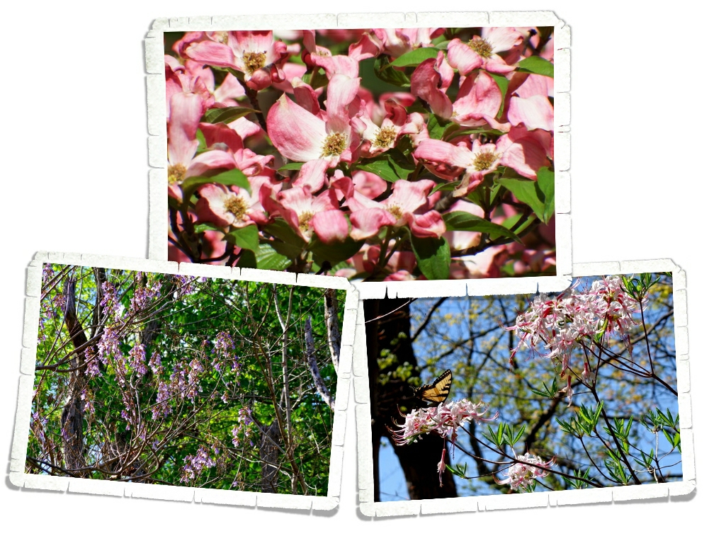
There were a few flowers. The wild roses were everywhere and smelled so good! And Guys….we found fireweed!! In Maine! It’s official…Maine is a mini-Alaska!!!

We loved the Lubec area so much we’ve decided that once we’re done with the fifty state tour we could easily spend one or two months there…someday!

#easterloop2016

Clifftop, WV

Clifftop, WV

We stayed at Babcock State Park while we were in Clifftop for our two weeks of exploration of the area and it was wonderful!

Our first day in the area was pretty cold and misty. We’d heard about the grist mill so we went to check it out. It’s a gorgeous area. I mean, just look at the Glade Creek Grist Mill!

We walked in thinking we would take a look around and move on, but when we found the Miller there…well, one thing led to another and suddenly we had plans to come back after lunch so the boys could help grind some corn. The Miller was a wealth of knowledge. He explained the process and actually put the boys to work. In the left picture you can see Alex and the Miller as the Miller explained some of the grinding process.

Each boy took part in each job. They scooped the corn kernels into the hopper. The Miller explained about the phrase “nose to the grind stone”. When you’re grinding corn (or whatever you might be grinding) the stones will get hot. You don’t want them too hot or they’ll ruin whatever your grinding so you have to smell around the grindstone to make sure you’re not going too fast and getting too hot. As the ground corn comes out of the meal spout it lands on a big wire mesh screen where it needs to be sifted. You get corn flour, corn meal, corn grit, and then the waste which was used to feed the animals. Nothing was thrown away. You can see Nicholas sifting through some of the grain in the left picture.

 I’m watering down the details here. There’s more to it than this, but I’m not a miller and I don’t remember all of the technical jargon. In the right picture, Charlie holds some freshly ground corn meal. In the jars in the left picture you can see the different products that could come out of a grist mill.

For their effort, they were each given a certificate and we got to keep a bag of the corn meal they’d just ground! We’ve got some plans for this corn meal!! Freshly ground corn meal is so different from what you’ll get at the store. So much better!

We pretty much had the campground to ourselves…except for all of the wildlife. We counted nine deer grazing outside our front door one afternoon. The cats were very interested!

We were fairly close to the New River Gorge Bridge so we took the opportunity to go check it out. The boys snagged a badge and a patch there. It’s called New River, but it’s actually one of the oldest rivers in the world. It’s older than the Appalachian Mountains. At 876 feet, New River Bridge is the third highest bridge in the country.

While you’re at the visitor center you can walk down the hundreds of stairs to get an ok view of the bridge. Don’t get me wrong…it’s a nice view…but, I’d heard about a hike you can do to get a better view. The hike is called Long Point Hike for anyone interested. It’s a bit strenuous, but not terrible. I definitely earned the burger I had after that. We ended up hiking a total of around four miles round trip. It was so worth it! Check out the view from Long Point in the photo above! You come out on this point and you’re looking straight at the bridge and you’re far enough away that you can get the whole bridge with the river below it in your shot! Just watch out for the red wasps. It’s a long way down if you fall off the edge as you’re dodging the wasps… We had to talk Nicholas into going out there because he doesn’t like red wasps at all.

We also made it to Cathedral Falls! I don’t really know anything about Cathedral Falls except its super easy to get to. It’s always hard to judge how big something is in a picture unless you’re given a size comparison. If you look closely in the left picture, you’ll see Jerl and Alex checking out some tadpoles just to the left of the falls.

We only had time for one more place so we hit Nuttallburg. It is impressive!

In the 1870s John Nuttal wanted to take advantage of the rich coal deposits along the New River gorge and began buying up the land around it. By the turn of the century, Nuttallburg was a pretty busy mining community, but after his death it didn’t do so well. In the 1920s Henry Ford leased the town’s mines to provide for his company’s steel mills. He spent $100,000 to build the “button and rope” conveyor system you can see heading up the hill. Ultimately, his plan failed when he couldn’t control or buy the railroad, he needed to carry the coal form the mine to his mills and he sold his interests in the Nuttallburg mines in 1928.

There was an entire community at Nuttallburg. Homes, stores, schools…  In the two photos above, you can see the same plot of land then and now. The ruins of the home in the info sign are still visible. It’s amazing how different the area looked back when the house was new.

The row of coke ovens are still there. You can see where the Company Store was. You’ve heard the song 16 Tons by Tennessee Ernie Ford? “I owe my soul to the company store…” wasn’t far from the truth. Miners worked long hours in dangerous conditions to earn their pay. When the only store around was owned by the mining company…well, prices weren’t fair and miners usually ended up owing the Company Store more money than they made each week.

Yup, that’s coal! We saw it everywhere while we were exploring the Nuttallburg ruins. The only other place we’ve seen it so easily available is in Alaska.

We took advantage of the fire pit and had roasted hot dogs and s’mores several nights. You might be surprised to know that most of the RV Parks we go to don’t have a fire pit and don’t allow fires at the campsites. So…we indulged and took advantage of the fire pit while we stayed at Babcock State Park!

Flower report! The dogwood trees were everywhere and in full bloom!! I thought the blooms & butterfly in the tree in the bottom right picture with its delicate pink blooms on it were so pretty! These purple flowering trees you can see in the bottom left picture were growing all along rivers, railroads, and roads. We were told by a Ranger that they came over on trains from China. She also told us the name of the tree, but for the life of me I can’t remember. They were super pretty though!

We loved West Virginia more than we expected to! One of our favorite things to do as we move around is talk to the locals of each area. You really get a feel for an area when you chat with the people who live there. West Virginia is filled with hard working, genuinely nice folks that are trying to make ends meat in a dying state. Every time a mine is closed it’s taking jobs and livelihoods away from an entire community. I encourage everyone to take a trip to West Virginia this summer. Go explore and support the small towns and communities that depend on tourism to stay alive.

See y’all down the road!

#easternloop2016

Santa Fe Area Hiking

Santa Fe Area Hiking

Hey y’all! We stayed in the Santa Fe area for two weeks and managed to squeeze an amazing amount of adventure into our time there. I’m going to break this area up into two different posts. This first post will be about the hiking we did.

We spent an entire day at Bandelier National Monument! Bandelier is located in the Frijoles (free-HOH-lace) Canyon and the first evidence of habitation goes back 10,000 years.

We got to see Bandelier covered in snow and it was beautiful! Bandelier, NM is part of the Pajarito Plateau, which was formed by two separate eruptions of the Jemez (HAY-mess) Volcano more than one million years ago. Each of the two eruptions was six hundred times more powerful than the 1980 eruption of Mount St. Helens. Think about that for a minute. Can you imagine how destructive those eruptions were?

The boys had a great time playing in the snow while we explored Bandelier. It was perfect for snowballs!

 You’re looking at the village of Tyuonyi (QU-weh-nee). This is just one of several large pueblos located in Bandelier National Monument. This one would have been two stories tall, contained about 400 rooms and housed around 100 people. Access to this village was by a singular ground-level opening.

If you’ve been following us along on our journey, you know we’ve gone to quite a few different pueblos. Usually, we don’t get to climb into them. The boys were super excited that at Bandelier, not only do you get to climb the ladders, you get to go inside the pueblo rooms! I managed to get all three kiddos to stop climbing around long enough to snap a picture. The calm didn’t last long before they were off exploring again. Ha!

When we got to the park that day we were told the trail to the Alcove House was closed due to icy conditions. We hung out in the Visitor Center while the boys did their Junior Ranger booklets and I asked a couple different Ranger’s about the trail. Before we headed out, we were told we could go ahead and do the Alcove Trail, but to be aware of the ice. The Alcove Trail led us through the woods and across several bridges. It was a wonderful hike through the quiet snowy forest. We loved it!

We made it to the Alcove House without trouble and checked out the ladders. They had some ice, but they were in good shape so we climbed up the few very long ladders to ascend 140 ft to the top. At the top is this Kiva (KEE-vah), which was excavated in 1908. They found almost perfectly preserved specimens of red corn and matting. It was all closed up when we got there so we didn’t get to see inside, but it looks like there are times when you can view the inside of it.

There’s a separate section of Bandelier National Monument you have to drive to. On our way there we stopped at the Whiterock Canyon scenic overlook. The view was stellar! I managed to get a photo of all five of us in front  of it! It’s rare to get a photo with all of us in it!

The Tsankawi (sank-ah-WEE) unit of the Bandelier National Monument is just as good as the main unit. It’s a loop trail that takes you up a couple of ladders to a lower and upper cliff. Tsankawi is located on the Pajarito (pa-ha-REE-toe) Plateau and was home to the Ancestral Tewa Pueblo people during the 1400s. When the Jemez Volcano erupted over a million years ago, this land was covered in thick layers of volcanic ash. Over the years, the ash was compacted and formed rock known as tuff. Tuff is a soft stone so it was perfect for the ancient peoples to carve out their homes in. The softness of the rock is also what caused the paths to be worn down. In the left photo above, you can see the path we followed while in Tsankawi. These paths weren’t’ carved out, they were worn down by the 1000s of times people walked the same path.

The view from the upper cliff was fantastic. We took a minute to appreciate it then headed on since we were losing the light.

You can see where people have placed their feet over the years to get back down the ladder.

 The village of Tsankawi contains about 275 rooms. Some of the structures here were two story. The cave rooms, like the one in the right photo above, is called a cavate (CAVE-eight). These rooms were usually plastered in some kind of mud mixture and painted while the ceilings were blackened by smoke. Smoking the ceilings hardened the volcanic tuff and made the tuff less crumbly. We were climbing down the last ladder as the sun started to disappear. It was a long full day. We highly recommend Bandelier National Monument to anyone who will be in the Santa Fe area!

We also had a fantastic day exploring the Kasha-Katuwe Tent Rocks National Monument. While it’s designated a National Monument, the National Park Service doesn’t take care of this park. It’s managed by the Bureau of Land Management. When we started our trip back in May of this year (2015), I would have probably hated this hike. I preferred the nice neat paths. Oh, how times have changed. I’ve come to realize that if you want the big scenic payoff, you have to be willing to work for it. Now, our favorite trails are the ones that are more…primitive…with some scrambling.

We scrambled over, through, around, and under while we made our way along the trail…it was awesome!

This trail takes you a mile and a half through a slot canyon made out of volcanic tuff and carved from flash floods over the years.

At the end of the slot canyon, the trail climbs a steep 630 feet up to the mesa top. In the photo above, you can see part of the steep climb up…notice it’s covered in snow and ice. It made for a very interesting, very slippery trek.

The Kasha-Katuwe Tent Rocks National Monument was designated in 2001 to protect the unique geological landscape known for its light colored, cone shaped tent rock formations that are the result of the big volcanic eruptions we talked about earlier in this post. The tuff, ash, and pumice from the eruptions were over 1,000 feet thick. Here’s the view from the top.

Kasha-Katuwe means “white cliffs” in the traditional Keresan language. You can see in the picture above how they look white.

We had a wonderful time doing a few of the many hikes in the area. We were bummed we didn’t have time to fit more in, but that just gives us a reason to come back to the Santa Fe area again! I think I can safely say that we’ll be back!

See y’all down the road!

Petrified Forest National Park

Petrified Forest National Park

We spent a week in Holbrook, AZ so we could explore Petrified Forest National Park. Holbrook is a pretty small town right on Route 66. We had some below freezing temps while staying in Holbrook and saw some of the windiest days we’ve seen in Arizona. I would suggest coming to this area before November.

The park was a good twenty or so miles away from where we were staying, so we didn’t get to spend as much time there as we would have liked. We ended up spending three days there getting in as much as we could. We stopped at all the official view points and did all seven of the maintained trails and even snuck in two “Off the Beaten Path” trails!

This National Park is broken up into two parts. The Petrified Forest and The Painted Desert. It really needs to add one more section. The Badlands. Yup, there are badlands in Arizona! If you’re looking at a park map, you’d see that the Petrified Forest is at the southern end and the Painted Desert is at the northern end. The Badlands are right in the middle and to be totally honest, it might have been my favorite part of the whole National Park! This section is called Blue Mesa, but it looks way more pink and purple to me! So, what makes land bad? A badland area is an area of soft rock strata that is cut and eroded into gullies and weird shapes where vegetation just can’t take hold. Notice the lack of vegetation in the photo above.

We were all a little obsessed with the petrified wood. The colors…the textures… A short one mile loop would take us twice as long as usual because we would constantly stop to check out a piece of petrified wood that had a new color we hadn’t seen or it had crystals growing in it or a different texture. It seems so weird to think that this hot, dry landscape we see today was once a lush, green, humid prehistoric rainforest.  Around 216 million years ago, the petrified wood we see at the park died and fell into a river. Over time they were buried under layers of silt, mud, sand, and volcanic ash. These layers protected them from decay while the mineral rich ground water seeped through the layers to the tree. The brilliant colors you see in the petrified wood are formed over time from the minerals found in the layers they were buried under. Silica or quartz crystals slowly bonded with the cells of the tree and eventually, they replicated the tree. So the wood turned to stone.

This log is called Old Faithful. It measures 35 feet long and weighs about 44 tons…give or take a few pounds. Albert Einstein stood for a picture with this exact tree. We all felt a little smarter having walked in the footsteps of Albert Einstein.

We thought this seven room pueblo constructed of petrified wood was really neat! We walked all around it and looked up close at the walls. It’s called The Agate House and they think this was a single family home built sometime between 1050 and 1300. When they found it, they thought it was unique, but they’ve found several other pueblo structures built from petrified wood within the park.

These logs were so big! In the photo above, you can see how long one of these logs really is. Jerl, Alex and Charlie are standing at one end while Nicholas is at the other. The log stretches between them.

The Painted Desert Inn was originally built in the 1920s of petrified wood. During the 1930s it was given a makeover to the adobe facade you can see today. You can no longer stay at the Painted Desert Inn. It’s been turned into a museum and is now a National Historic Landmark. The stained glass ceiling was gorgeous!!

Behind the Painted Desert Inn is one of the “Off the Beaten Path” hikes. Some of our favorite places in National Parks are the areas set aside for visitors to get off the path and explore. The trails are nice, but you’re never really going to truly experience all that a park has to offer if you stick to them.

Did you know that Petrified Forest National Park is the only National Park unit to protect a section of Route 66? They’ve got this 1932 Studebaker sitting where Route 66 originally cut right through the park.

The sun is your friend at a park like this. The shadows make it hard to see the brilliant colors. And there are some truly brilliant colors in this park!

One of the other “Off The Beaten Path” trails takes you to the Billings Gap. It’s about a three mile round trip hike with some amazing vistas. There’s more to do in this park than you might think!

In Holbrook, right on Route 66, is the Wigwam Motel. Y’all might recognize its likeness from the movie Cars. If you look closely at the photo above you might see Mater and some of the other vehicles from the movie at one of their favorite places. The boys (especially Alex) really got a kick out of seeing it!

Well, I think that’s all of the highlights from our week in Holbrook. I’ll leave you with this photo of just one of the vivid sunsets Arizona gave us. Arizona doesn’t mess around with sunsets!

See y’all down the road!

So Much Awesome

So Much Awesome

We spent two weeks in the Sedona/Verde Valley, AZ area and we get it now. We understand why people flock to this area. This area is a hiker’s dream!

So many hikes…so little time! I think every cairn we saw had multiple hikes with arrows pointing you in the right direction.

And then you’ve got the views. Nice, right? It’s hard to be in anything but a good mood when you’re surrounded by views like the one in the picture above. And those views are in every direction! So postcard worthy!

We spent as much time as we could getting in as many hikes as we could. We ended up getting nine hikes in with a combined total of about twenty miles and we didn’t even scratch the surface when it comes to all of the available hikes in this area! I won’t go in to great detail about each one of our hikes, but I’ll give you some of the highlights.

One of the first hikes we did was the Baldwin Trail. This was a loop trail that gave us some amazing views of Cathedral Rock. You can see Nicholas and Alex standing in front of Cathedral Rock in the picture above.

We spent an afternoon hiking around four miles of the trails at the Red Rock State Park. The leaves in Sedona were starting to change to fall colors. I thought the yellows and oranges next to the red of the House of Apache Fire was pretty.

One of our favorite hikes was the Boynton Canyon hike. We started off surrounded by the red rocks this part of Arizona is known for, but ended up in a ponderosa pine forest where we had to stop and smell…the trees! Ponderosa pine trees smell like vanilla and sometimes they smell like butterscotch! The bigger the tree the stronger the scent. We got to see some fall colors in the forest. It’s been awhile since we’ve experienced actual fall colors and weather and we thoroughly enjoyed it.

At the end of the Boynton Canyon hike is a wonderful view of the box canyon you just hiked through. The sun was in the wrong spot for me to really get any great shots, but you can get an idea of what our view was in the picture above.

Another of our favorite hikes is the Devil’s Bridge hike. We were lucky enough to have a four-wheel drive vehicle so what would have been more like a six mile hike was only a two mile hike! This hike had some truly Harding Icefield worthy hiking!

The views even rivaled what we saw during the Harding Icefield hike! Can you tell we still compare everything to Alaska?

This is the Devi’s Bridge. It was spectacular! There was a path to the top of the bridge and a path that takes you under it. We, of course, had to check out both paths.

We did one hike twice. What you’re looking at in the picture above is Bell Rock. You can hike to it then climb all over it! The view from part way up Bell Rock is pretty fantastic!

See those teeny tiny white dots in the middle of the above photo? Those teeny tiny, dots are Jerl and the boys. I scrambled up about half way then decided to sit and enjoy the view, but Jerl and the boys wanted to see how far up they could get. They got pretty far!

A fun thing to do in the Sedona area is look for the rock formations that have names. You can get a map pretty much anywhere with the rock formations and their locations. We saw a few during our explorations. The one in the top right photo is The Sphinx. The one in the bottom left is The Teapot. There’s one called Snoopy Rock. We tried our hardest to find it, but never saw it.

We saw a few flowers on our many hikes. Not many though. Even here in sunny Arizona, it’s the wrong season for most flowers. We did see a ton of agave. The stuff is seriously everywhere!

There’s just so much awesome in the Sedona area, I’m going to break it up into two posts. In the next post I’ll tell you about one of the towns we went to and the National Monuments we visited. We drove one of the many four-wheel drive roads which Jerl just loved! It was a new driving experience for us!

See y’all down the road!