Tag: national park

The Plains

The Plains

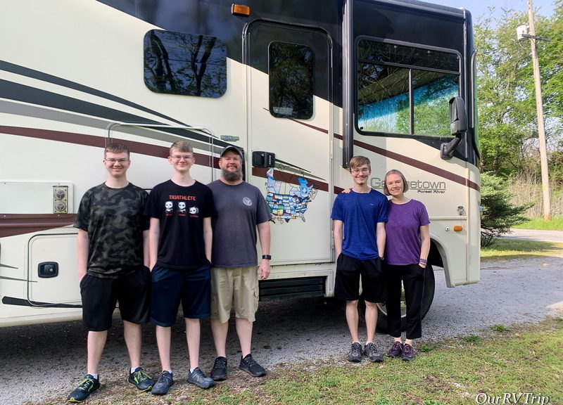
Hey Guys! We’ve spent six years criss-crossing all over our Country, but we haven’t really spent much time in the plains area. Why?

Storms.

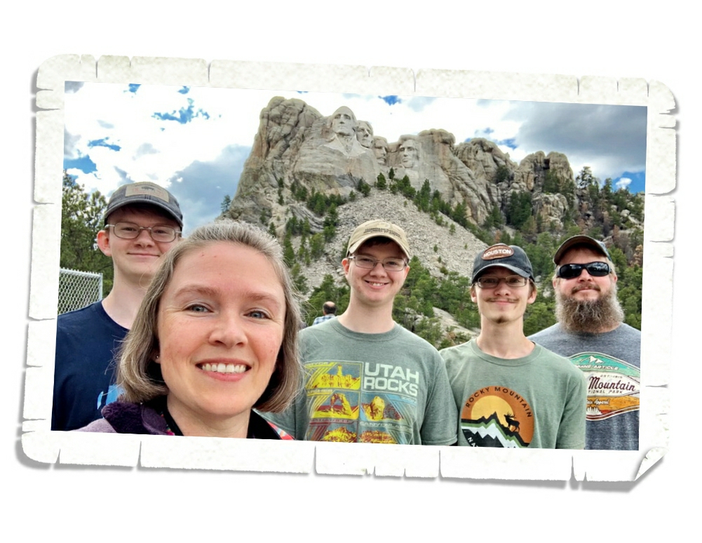
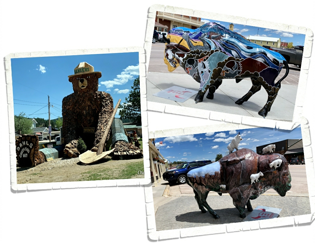
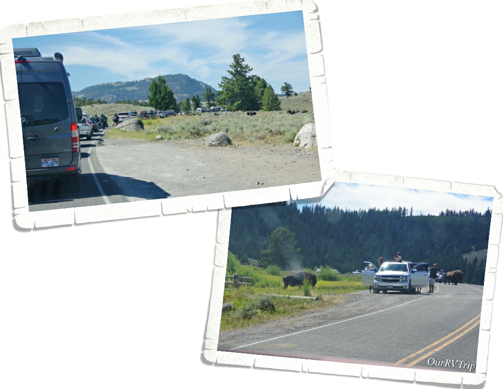
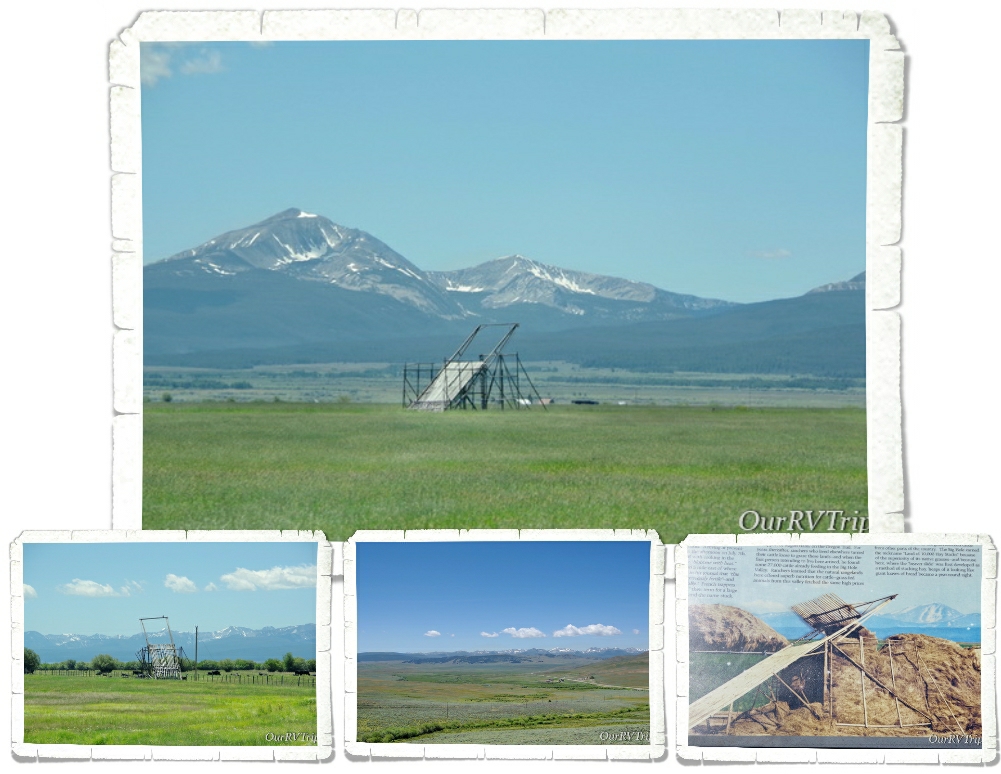
The plains are known for their huge storms that pop up and roll through. When you live in an RV…storms are a pretty big deal. The plains section of our Country has always made me nervous so I haven’t had us spend much time there over the last six years. We’ve always just hopped through on our way one way or the other. But this year… this year we spent two weeks in Scottsbluff, NE. We were on our way back to Missouri from our South Dakota loop and we’d already had some nerve-wracking weather. The tornado that almost hit us while we were in Custer and the wind storm that blew over us in Sundance…I was pretty nervous about staying out in the middle of nowhere Nebraska where the plains are so vast and the storms can rage through. We did have some storms while we were in Scottsbluff, but thankfully, they were just regular old summer storms. Not a ton of wind and no hail.

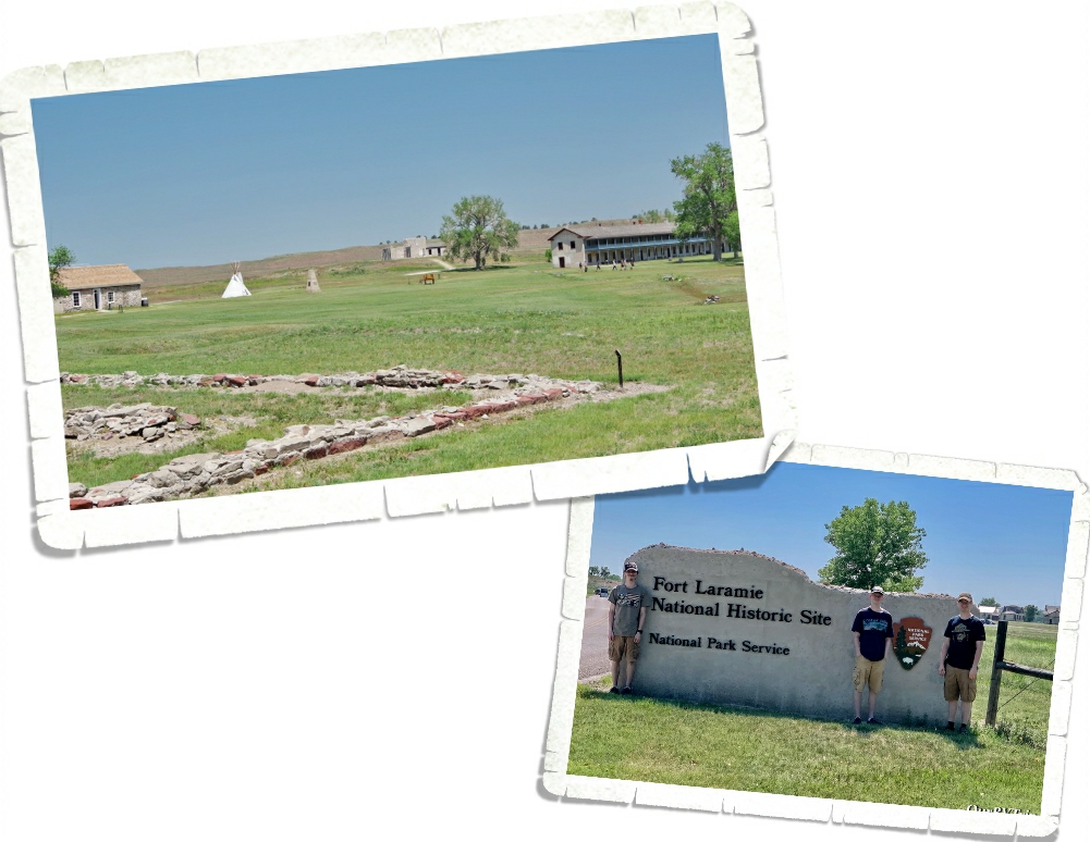
We used Scottsbluff as our basecamp to explore three National Park Units. The first one we went to was Fort Laramie National Historic Site up in Wyoming. Fort Laramie was originally named Fort William and was opened as a trading post in 1834. In the 1840s it was sold to the American Fur Company. Improvements were made and the name was changed from Fort William to Fort John. In 1849, the US Army purchased Fort John to use as a post of protection at the crossroads of America for those traveling on the Oregon Trail, California Trail, and the Mormon Trail. Over time the name gradually changed from Fort John to Fort Laramie as travelers shortened the phrase “Fort John at the Laramie River”.

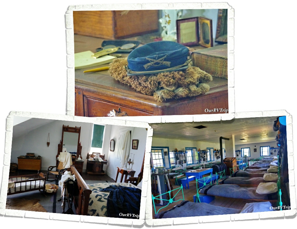
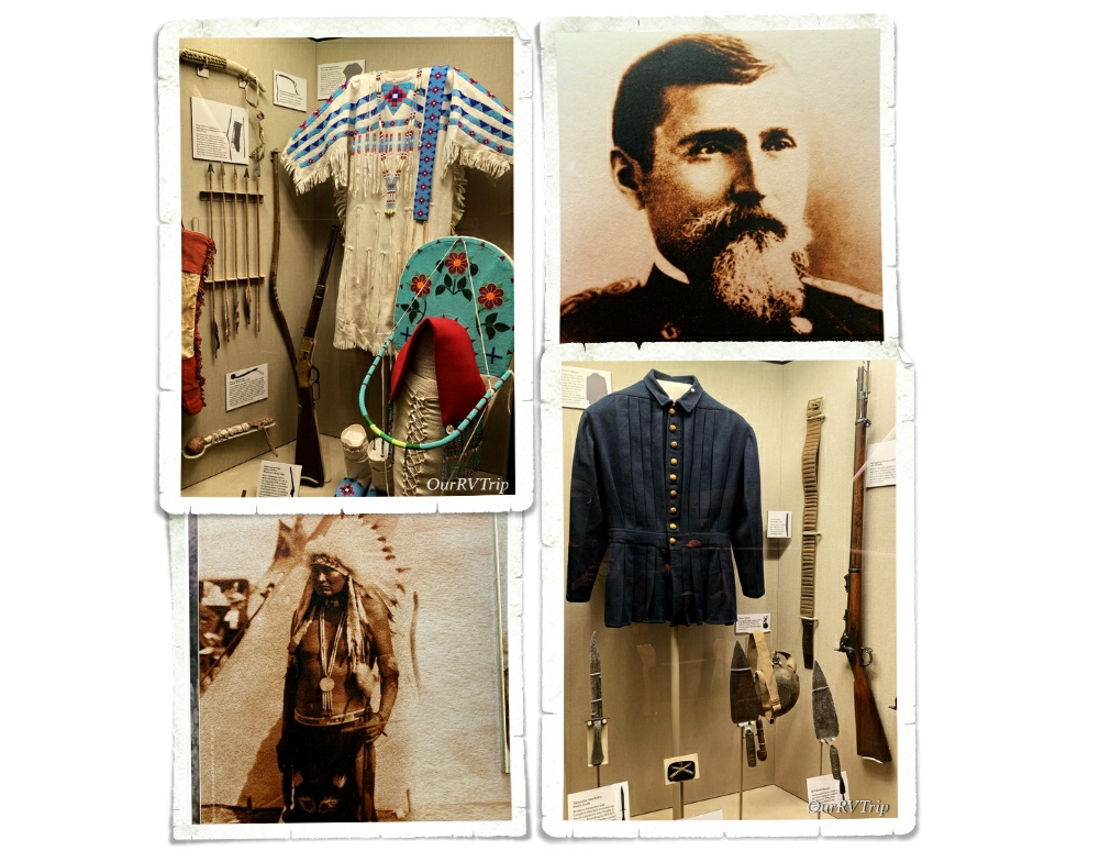
One of our favorite things about visiting National Historic Sites is the glimpse into the lives of the past. The National Park Service does such a great job at staging rooms and giving us a little look into how people lived in the past.

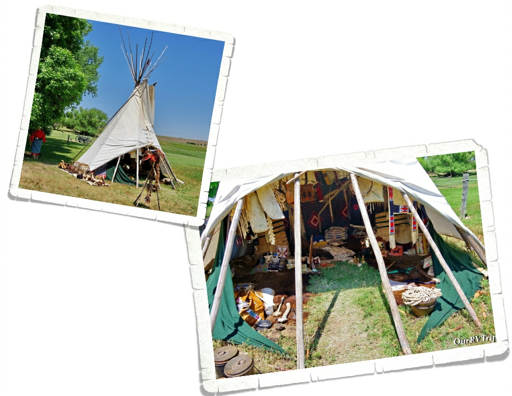
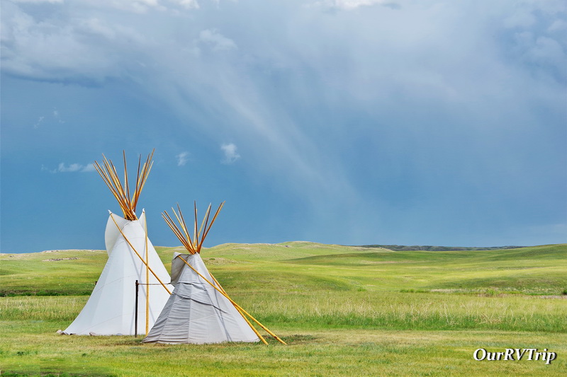
The day we were at Fort Laramie, there was a Living Historian there to show and explain what the inside of a tipi most likely looked like. We’ve seen tipis before, but hadn’t seen one set up like this. The historian talked to us about what life was like on the plains as a woman in a tribe. It was really interesting!

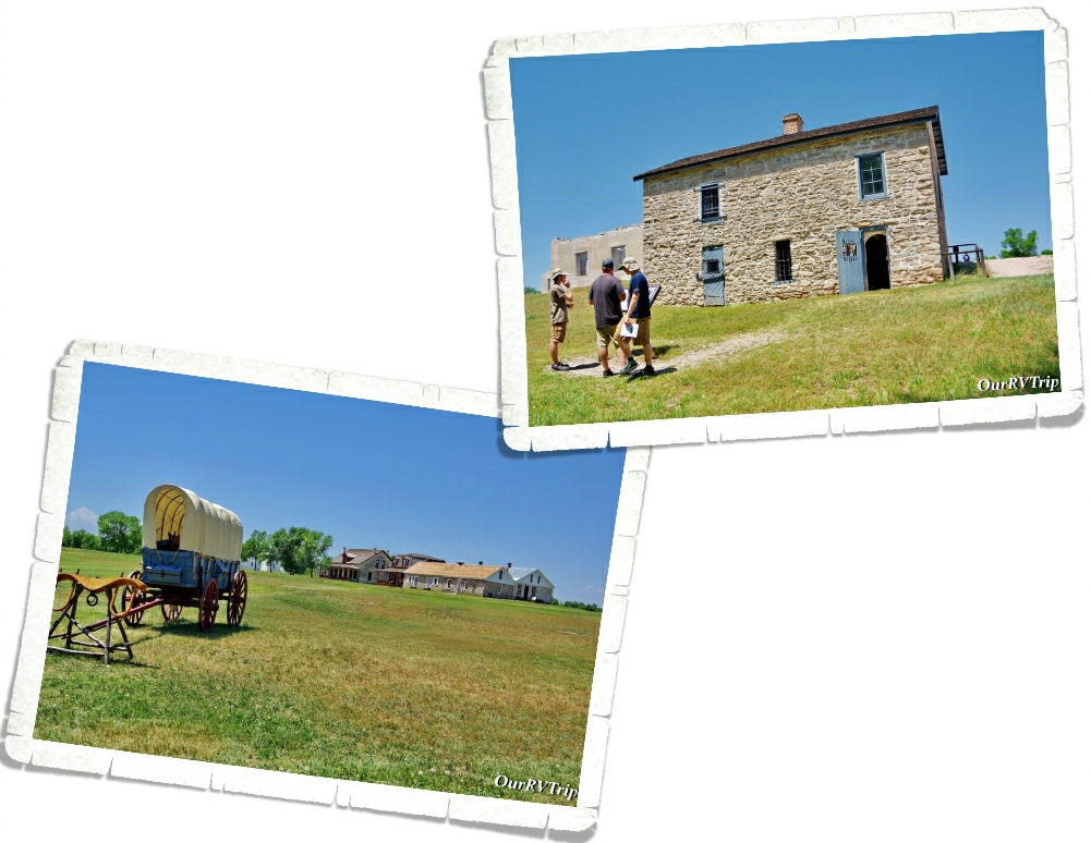
Other important trails that went through Fort Laramie were the Bozeman Trail, Pony Express, Transcontinental telegraph route, and the Deadwood & Cheyenne Stage Route. Fort Laramie National Historic Site preserves one of the most important locations of the westward expansion.

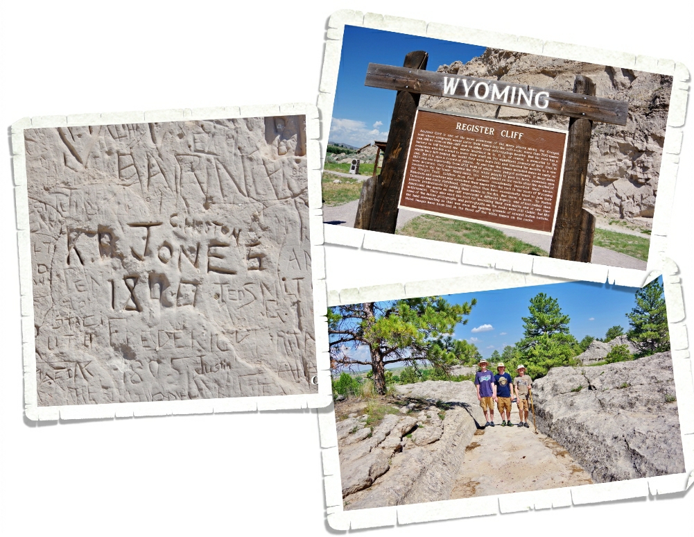
Not far from Fort Laramie, we found a place where we could stand on the ruts made from the thousands of wagons on the Oregon Trial. The wheels of the heavy wagons actually cut right through the rock and made a permanent path. We also found a place called Register Cliff. We’ve seen a few of these during our travels…there’s one in Utah and one in New Mexico that are both part of the NPS and are great! We always enjoy looking at all of the names carved into the rock by passing emigrants. There were quite a few newer names that had been carved into this particular Register Cliff.

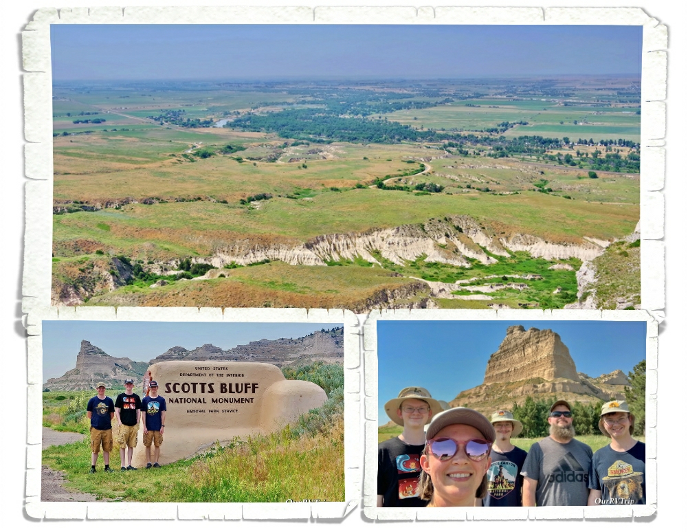
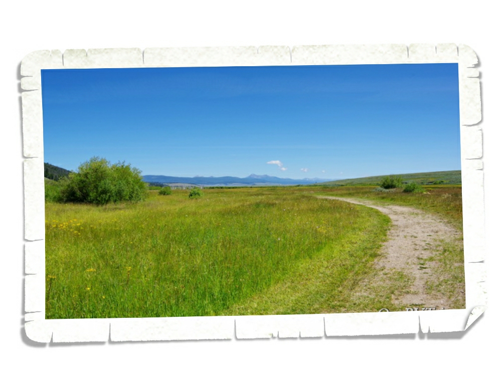
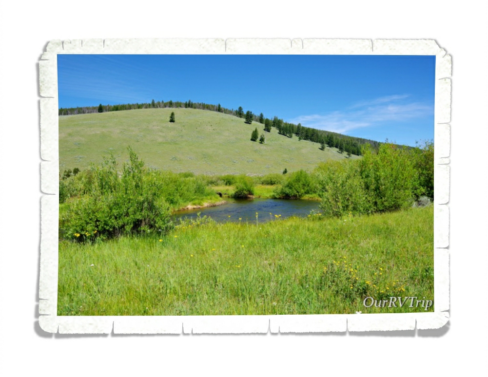
Scotts Bluff National Monument protects about 3,000 acres and consists of towering bluffs, badlands, mixed-grass prairie (watch out for those rattle snakes) and a rich riparian area. Rising 800 feet above the North Platte River, Scotts Bluff has been an important landmark to emigrants traveling along the Oregon Trail, Mormon Trail, Pony Express and the California Trail.

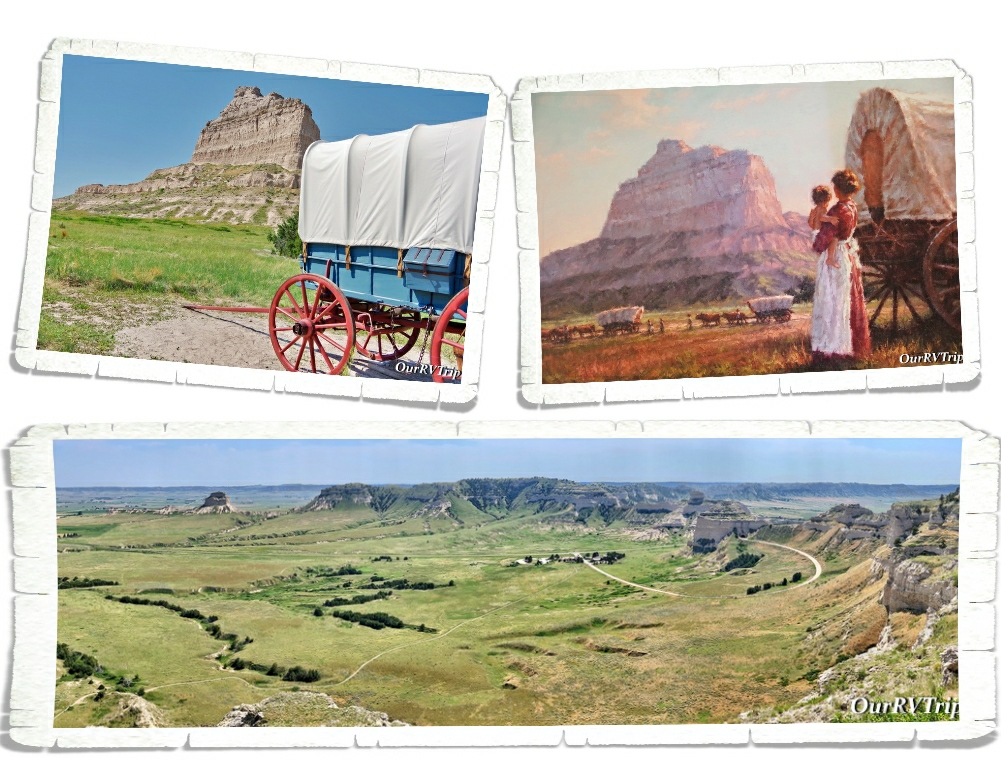
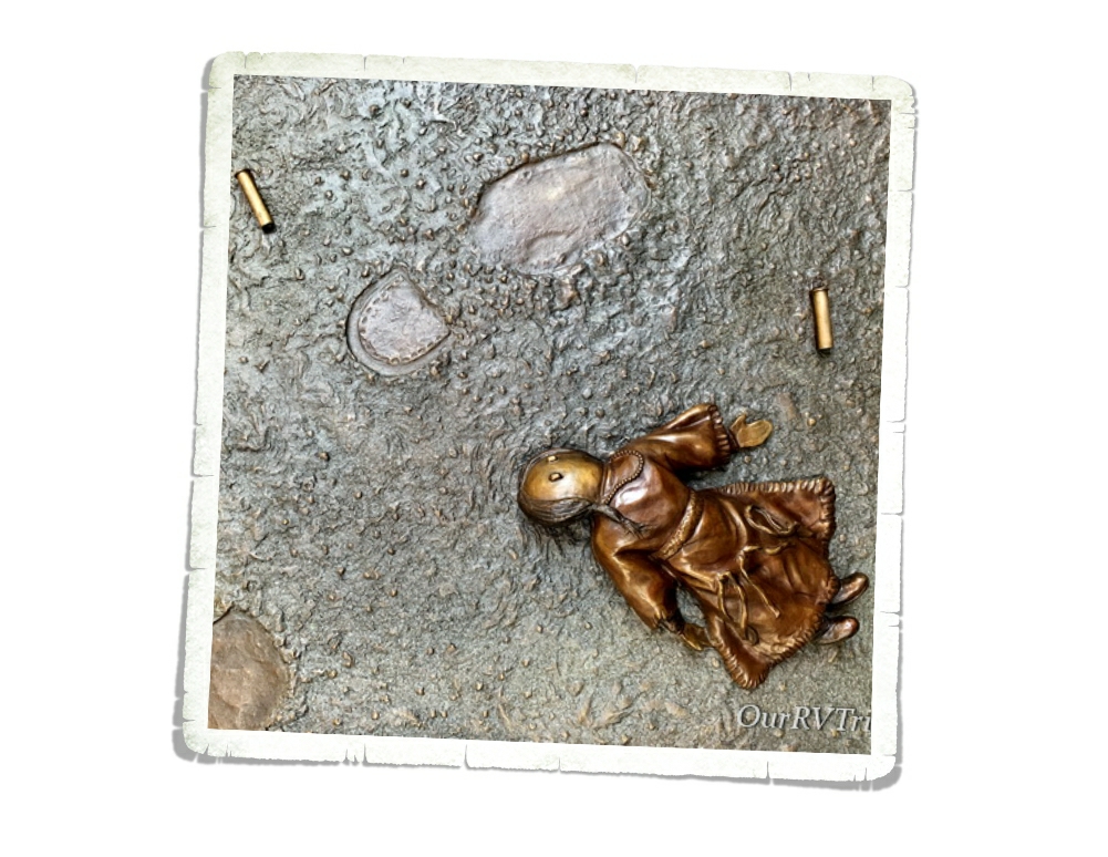
We enjoyed driving up to the top of the bluff and doing both of the hikes available. The views were spectacular! We spent quite a bit of time in the little museum at this park. It has a surprising amount of information. We started to walk the Oregon Trail path outside of the visitor center, but the day we went to this park, the temps were triple digits and we decided against doing the whole trail. I found this painting of a woman holding her toddler while watching a line of wagons in front of Scotts Bluff in the visitor center…Guys, I can’t imagine how hard life was for the trail blazers who made their way west. They were truly made of tougher stuff than we are now. This was a great little park and totally worth the time to visit!

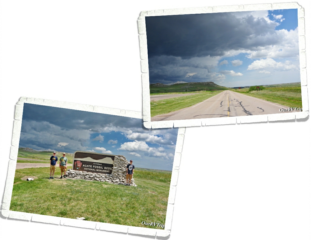
Agate Fossil Beds National Monument was the last place we explored during our week in Scottsbluff. The day we went…it stormed. We still managed to explore the visitor center and get in one hike…but check out those dark clouds. Those dark clouds came with a decent amount of wind and some really cold rain along with some hail too.

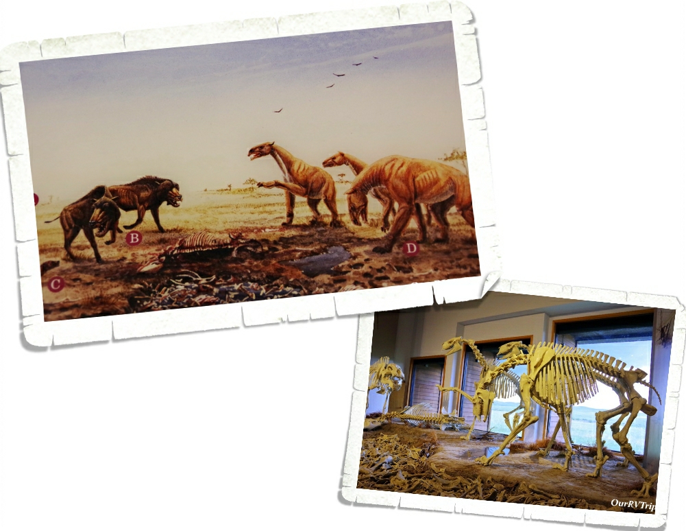
Originally, this area was a working cattle ranch called Agate Springs Ranch owned by Capt. James Cook. Then, in the early 1900s some paleontologists found a treasure trove of complete skeletons belonging to extinct Miocene mammals. When I first saw these skeletons…I thought they looked like little t-rex dinos but then I looked at the info sign and found out that they were huge pig like creatures that stood over six feet tall. Wow! That’s a lot of bacon! ;-P Seriously though…I would not want to run into something like that out on the trail.

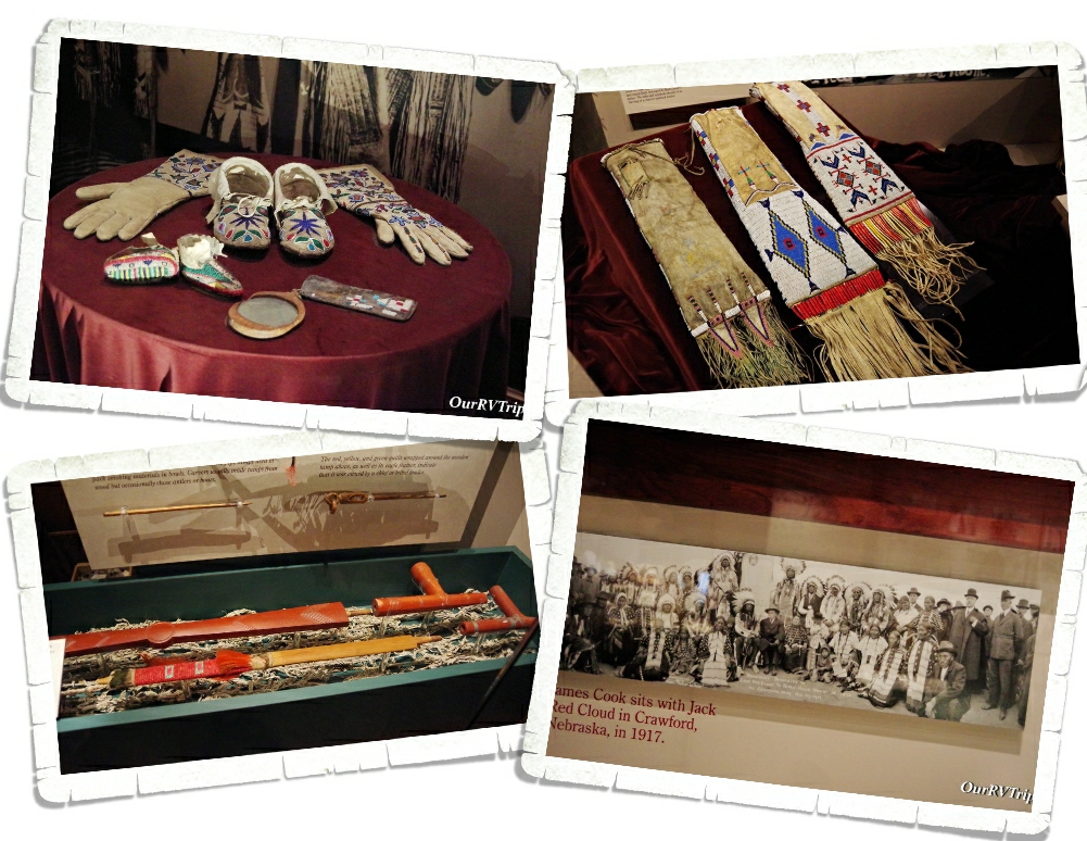
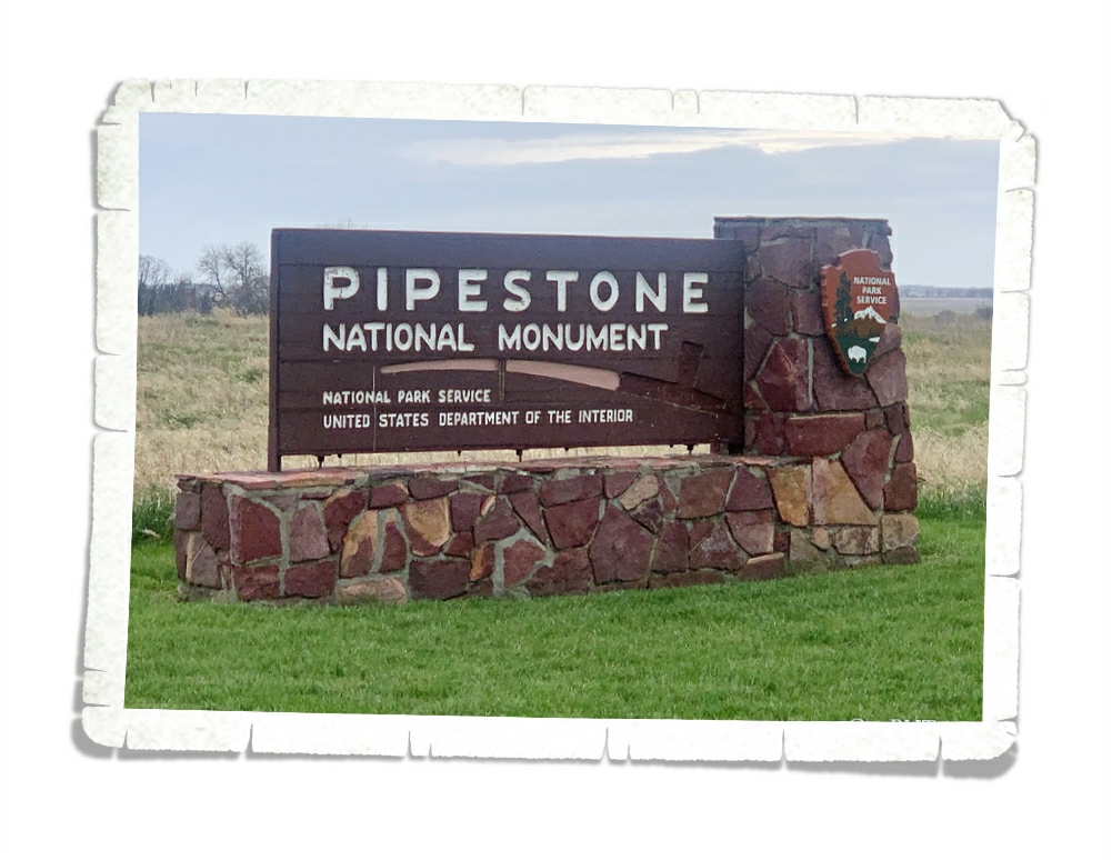
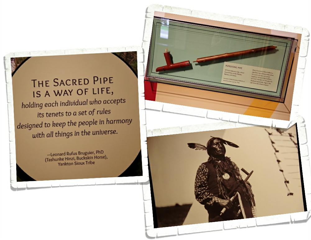
Around the same time, a friendship between James Cook and Chief Red Cloud of the Lakota began. The museum in the visitor center has a wonderful collection of artifacts given to James Cook by his friends in the Lakota Tribe. I thoroughly enjoyed looking at all of the beautiful bead work in the museum. There was also a peace pipe made with red pipestone…from the Pipestone National Monument we went to earlier this year! If you missed that post, you can find it here. It was really something to see one of the pipes out and know where it came from and the history behind it. We’ve learned so much during this Grand Adventure/crazy nomad life of ours!

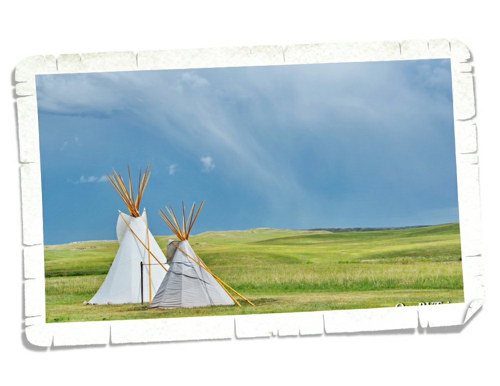
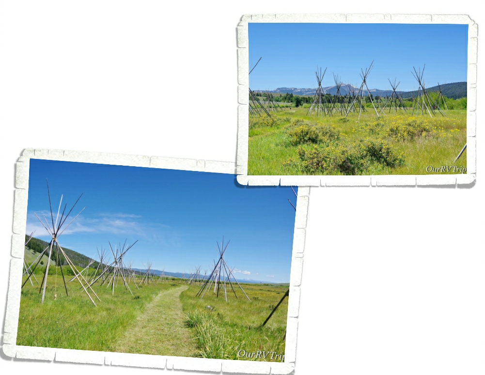
A big storm went over while we were in the visitor center. It got windy and hailed and poured rain. The lights flickered and I rushed to make our souvenir purchase just incase the electric totally went out. These tipis are right outside the visitor center…I braved the elements to grab the shot above so I could show you what one of those great big plains storms looks like. It was an impressive storm. I’m glad we weren’t out on a trail hiking when it hit.

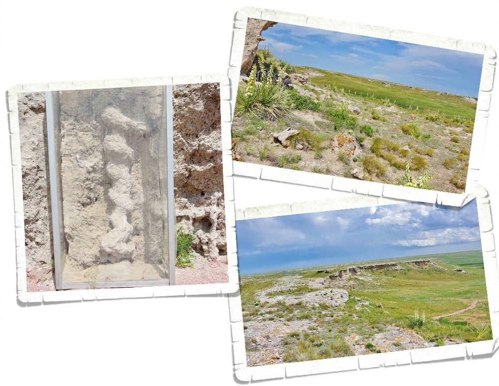
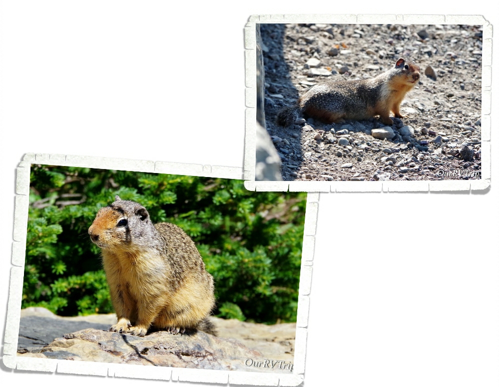
Once the storm blew through (it was moving pretty darn fast), we headed out to one of the shorter hiking trails. The one we did was about two miles and super easy, but it had some breathtaking views of the plains! And…we got to see some of the actual fossils that make this park important. It looks like a corkscrew and it took paleontologists a while to figure out what exactly it is. It’s the fossilized burrow of an ancient prairie dog type animal. No joke. We can’t seem to get away from prairie dogs this year! LOL!! It was really neat to see and our nerd family learned so much.

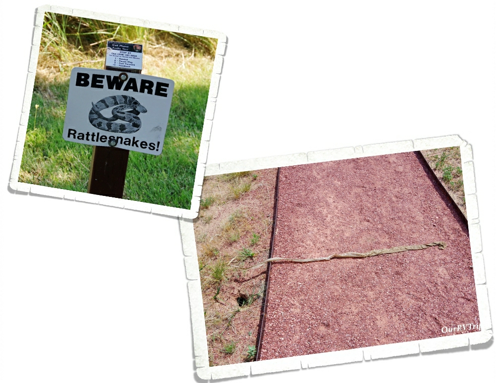
You know all of those warning signs about danger noodles on the trails…well, they aren’t lying! We found this big snake skin on the trail on the way back to our car. So…this big ol’ nope rope was somewhere close by. I don’t handle snakes very well. I think I just about flew to the car after that.

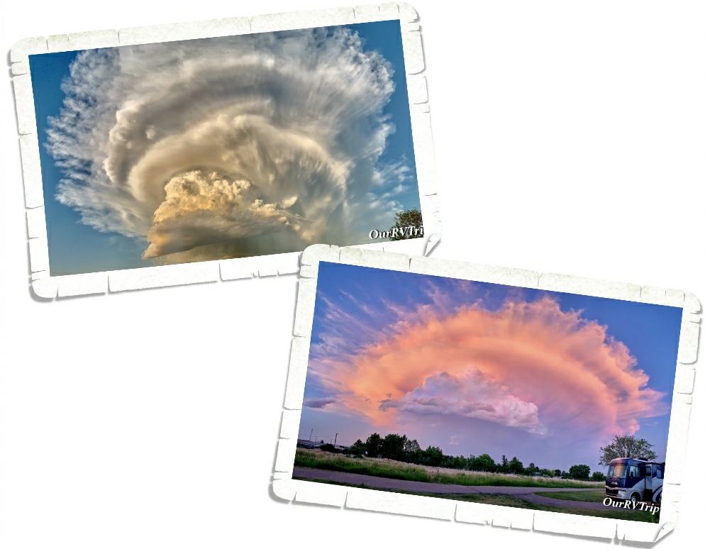
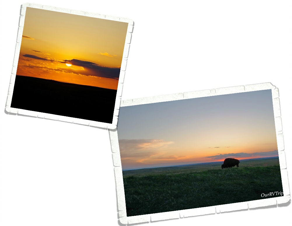
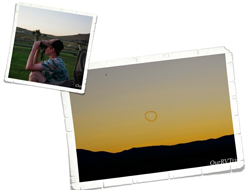
I love sunsets…I love sunsets even more when they’re mixed with amazing cloud formations! Jerl and I were out walking in the RV park when we spotted this amazing cloud! We walked around then sat outside and watched it turn colors as the sun sank behind Scotts Bluff over at the National Monument.

We also had some electrical issues while we were at this park. They weren’t our issue…it was with the town…but the temps outside were close to triple digits. I don’t know if you know this…but when you live in an easy bake oven, it gets hot real quick when there’s no AC. It ended up getting to 93* in the RV. We were struggling to stay cool! Our AC units had already been struggling, but I think that when the eclectic blipped on and off and then went out, it did something to our AC units. They never seemed to get quite as cold or keep up with the heat after that. Guess we’ll need to look into replacing those sooner rather than later.

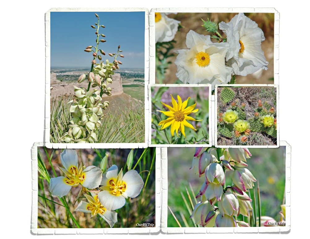
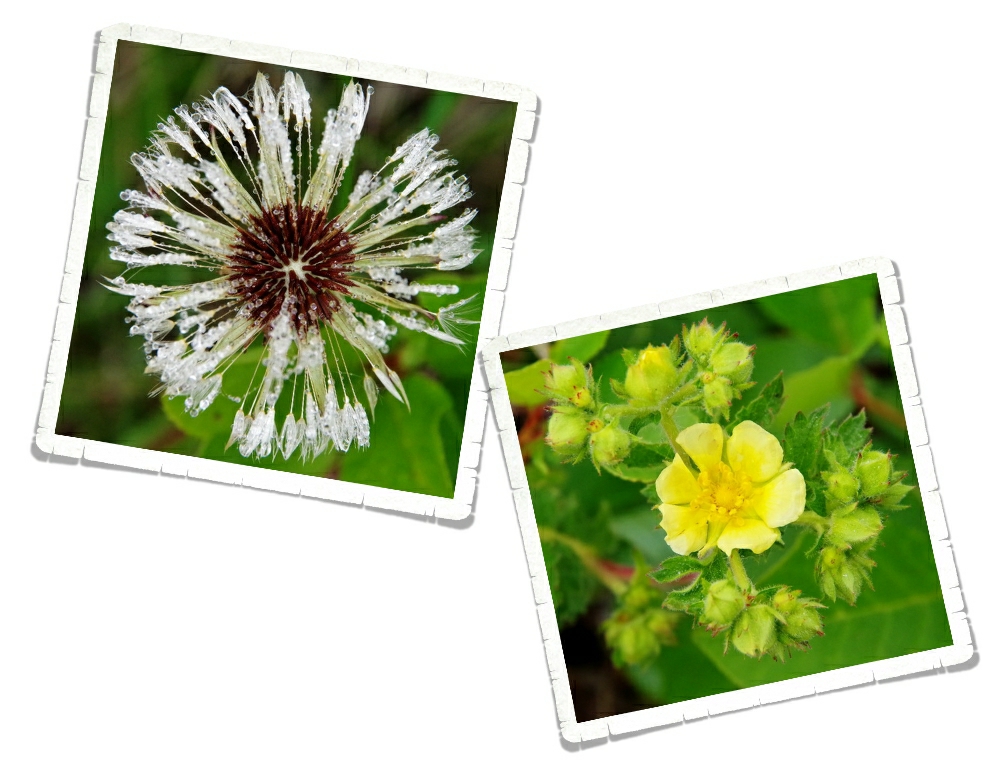
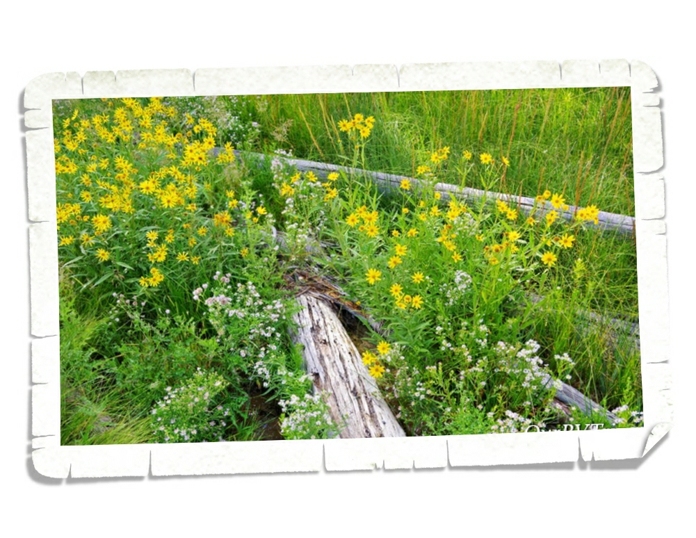
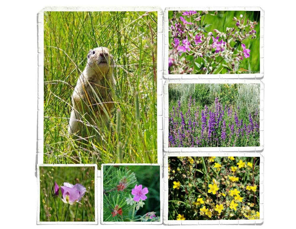
Guys…there were so many pretties blooming! It took me twice as long (maybe longer) than usual to hike because I kept stopping to snap pictures of all of the different flowers. Love them!!

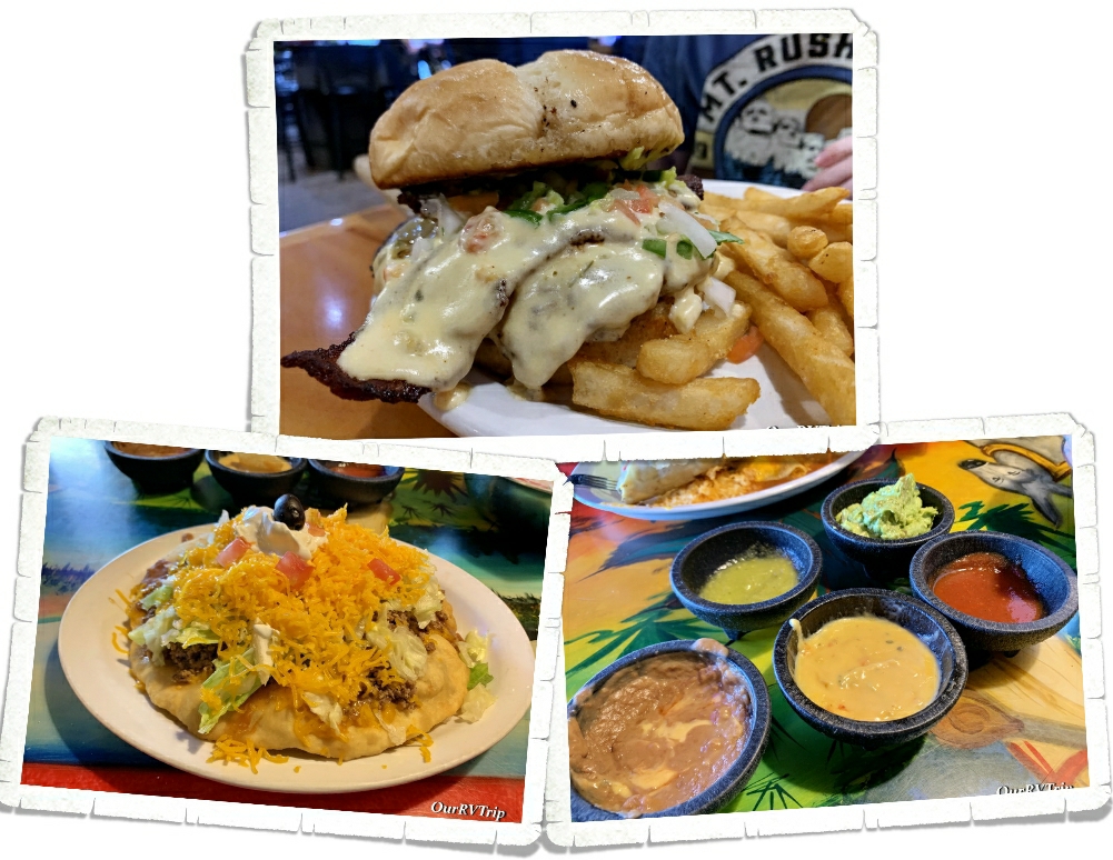
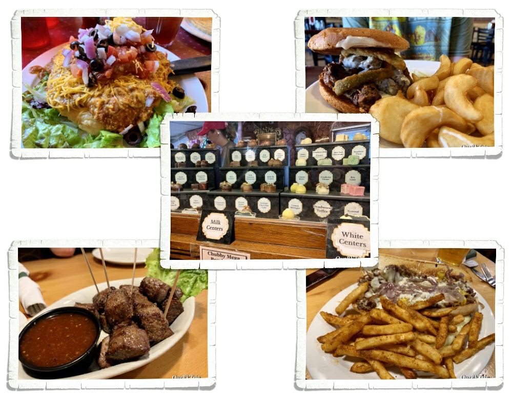
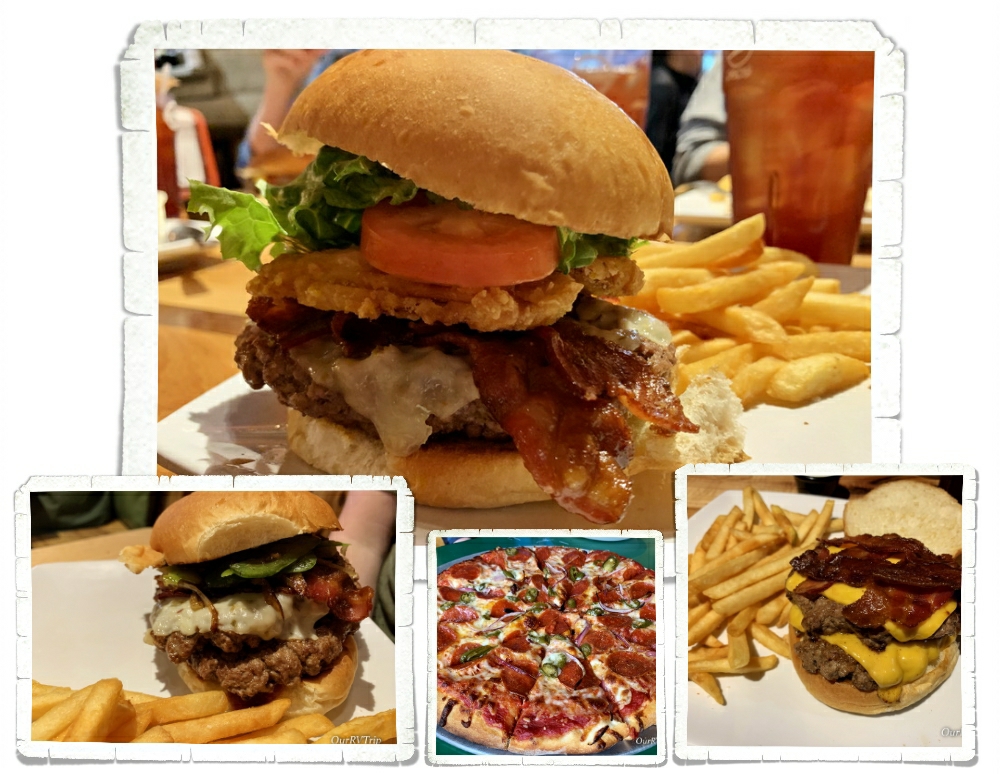
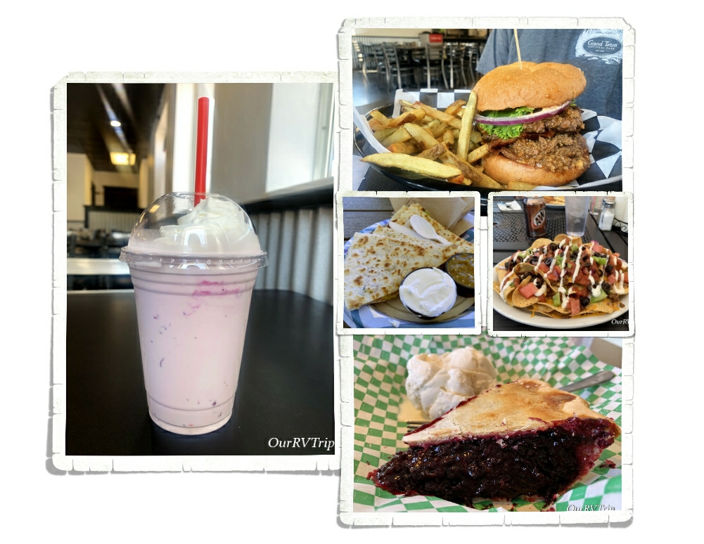
We found a really great burger place called Goonies! We were going to go back, but we didn’t have time since we were only there for a week. We also made it to a Mexican food place and somehow ended up getting all of the dips. I’m a dip person…are you?

Well Guys, we crammed all of that into one week! It was an incredibly busy week and to be honest, we were all ready for a vacation from our crazy nomad life after the South Dakota loop!

See Y’all down the road!

#NationalParkTour

Towers, Canyons, and Waterfalls

Towers, Canyons, and Waterfalls

Hey Guys! After we left Custer, we headed to Sundance, WY to check out Devil’s Tower National Monument.

The plan was to have a slightly more relaxed week in Sundance, but well…that didn’t really happen. We found out about a few more things to see/do in the area so buckle up and lets go!

The main reason we went to Sundance was to visit Devils Tower NM. It ended up being about a thirty minute drive from Sundance and we ended up having to go twice. The first time we went happened to be the only day of the week that the visitor center was closed. *palm slap* And yes, before you ask, I did check the website before we went and didn’t see anywhere that they’d be closed that day. So, we hiked up to the base of the tower and checked it out with about a hundred other people before heading on. It was neat to see. We were really disappointed with the lack of info about the tower or lore of the area in the park. When we went back… we checked the visitor center for info and didn’t find anything in the visitor center. We did notice that the local Tribes still put prayer bundles in the trees. That tells us they still see this land as scared. When I did some digging, I found that over twenty Tribes consider the site sacred.

Established in 1906, Devils Tower National Monument is America’s first National Monument. Wyoming is the home to the first National Park and the first National Monument! The tower is really a butte made of igneous rock from the cooling of magma. Over the years, the softer earth around it eroded away revealing the 1,267 foot butte we see today. For some reason, we’d all gotten it into our heads that the whole area would be more…desert like, but there was a nice forest surrounding the Tower! We were also surprised to see so much red dirt! It was almost like being back in the southwest! Almost. ;-} We found another prairie dog town! Is it just me, or are prairie dogs one of those animals you can watch for hours. They get up to so much mischief with one another! So much drama…LOL!

All of the Tribes have different names for the Tower…several of the names center around Bear. There are several different legends that go with the names, a few of them have a huge bear in them. I don’t know them well, but the one I can kind of remember goes like this… One day seven little Kiowa girls were playing far from their village and were chased by a bear. They ran on top of a rock and begged it to save them so the rock began pushing them up. The bear scratched up the rock and broke it’s claws as it was trying to get to the little girls. The bear kept jumping and the rock kept growing higher and higher until the little girls were in the sky where they still are today…the stars that make up The Pleiades.

We ended up doing two scenic drives here…one of them retraced a bit of the other…but the area is so pretty, no one really minded. We stopped by the Aladdin Tipple to see what we could see. The area is fenced off now because the darn thing is going to collapse any day. It looked like a strong breeze would knock it down, but it was neat to see. This mine was a coal mine used to supply coal to the gold mines of Lead and Deadwood. There were three different coal mines that used this tipple to supple coal to the train that would take it on to the gold mines. The last train left Aladdin in 1927.

We found the Sanford Lab Homestake Visitor Center by accident. We were driving through and needed a place to stop and figure out our route. We pulled in the the parking lot of Sanford…and well…being the nerds we are, we spent time geeking out in the little museum learning about the Homestake Mine and the science lab that’s connected to the building that does dark matter experiments. We were really hoping a tour of the lab would be available…but nope. We were so incredibly bummed. Apparently, you have to be a legit scientist…with some letters after your name… to get into the lab.

In the little town of Belle Fourche (Bell Foosh), SD you’ll find a memorial for the geographical center of our Nation. This includes Alaska and Hawaii. And…if we’re being nit-picky…it’s not the actual location of the geographical center. That can be found in a field about twenty miles away, and I think it might be on private property, but this little memorial is close enough. We had a good time wandering around all of the flags and reading each state’s stats. It even has a plaque that looks a lot like an official geological marker where you can snap a picture! Totally worth the stop!

We were so close to Deadwood…and we knew y’all would ask us if we went… So, we stopped in and took a walk down the main street of Deadwood. Back in 1876, thousands of people made their way to the city of Deadwood in hopes of finding gold and like most gold mine towns back then…Deadwood was a wild, rough and lawless type of place. We saw the place where Wild Bill Hickok was shot by Jack McCall and the place where McCall was caught. We saw the famous Brothel and the historic Adams House. We opted not to take any of the tours. While we enjoy the history of places like this, none of us like the showy tourist side of it. We did find a wooden dragon (Toothless) that was pretty darn cool.

We skipped the daily shoot out/gun fight street show, but found our way up to the Mount Moriah Cemetery where we got our daily steps in walking up and down the steep hills. We found both Wild Bill Hickok’s and Calamity Jane’s grave sites. There were some beautiful lilac bushes blooming while we were there and I spent quite a bit of time with my nose stuck in them!

Spearfish Canyon Scenic Byway snakes through a nineteen mile gorge with thousand foot high cliff sides and is filled to the brim with postcard worthy pullovers and hikes. You can easily fill an entire day or two hitting all of the hikes and sights on this scenic drive. We were there in the spring, but I’ve heard it’s absolutely gorgeous in the fall with the leaves changing colors. I’d love to go back someday!

I’ve had the Chapel In The Hills on the list for quite a while. It’s an exact reproduction of the famous Borgund Stavkirke in Laerdal, Norway and was built by a local Lutheran Church as a home for their radio ministry. Today, visitors are welcome to roam around and enjoy the peaceful area or walk the meditation trail. The chapel is gorgeous and definitely needs to be seen in person.

You’ll also find an authentic grass-roofed store house or “Stabbur” that is used as a welcome center/store. It was built in Norway and then reassembled in it’s current spot. We went in and bought a few Norwegian items. There’s also a little cabin that was built by a Norwegian immigrant gold prospector back in 1876 and is now used as a small museum. I loved walking around the little chapel and the grounds. We got there in the evening and had the place almost to ourselves. We were lucky with our timing…apparently, the chapel is a very popular wedding spot.

We were only in Sundance for a week but man-oh-man did we squeeze a lot of adventures into that one week! We found some pretty good foodies too! We had to have chislic one more time and we found the Deadwood location of the Chubby Chipmunk for some more hand dipped truffles! Jerl had one of the best Philly Cheesesteaks he’s ever had while we were in Deadwood…it was at a place called Mavericks. It’s a casino, but they let families go up to the restaurant. I found an Indian Taco at a little diner called Cheyenne Crossing in Lead, SD. I was skeptical about getting an Indian Taco in a state other than New Mexico, but someone at the RV park we were staying in told me that she grew up in New Mexico and thought the Indian Tacos were really good. And Guys…they are. Its not the same as the Navajo Tacos you get in the Southwest that are covered in spicy green chilies (those are still my fave), but the Indian Tacos at Cheyenne Crossing are so good I would totally go back just for another!

Well, Guys…I think I’ve covered everything we did in the Sundance area! We saw a lot, but missed just as much. I should have scheduled two or three weeks instead of just the one!

See Y’all down the road!

#NationalParkTour

Basecamp Custer

Basecamp Custer

Hey Guys!! We made Custer, SD our basecamp four two weeks as we explored the black hills area of South Dakota and Guys…there was so much to see and do! Lets get started!

Y’all know we’re on a National Park Tour, so it shouldn’t surprise you that our first stop in the area was Mount Rushmore National Memorial. We drove the Iron Mountain Road to get to Mount Rushmore because I’d heard that there were some interesting views of the Memorial on the way there. There are three tunnels on the Iron Mountain Road and they all frame Mount Rushmore NM. The first one you’ll come to (and probably the most photographed) is the Doane Robinson Tunnel, but the other two are just as good. You can also stop at the Peter Norbeck Scenic View for another view of the Memorial.

Before it was known as Mount Rushmore, it was known as “The Six Grandfathers” and “Cougar Mountain” by the Lakota Sioux. American pioneers knew it by several names…some of them are Cougar Mountain, Slaughterhouse Mountain and Sugarloaf Mountain. In 1885 David Swanzey, Bill Challis and Charles Rushmore started coming to the mountain for prospecting expeditions. They visited so often that Charles Rushmore, a wealthy investor, started joking that he was going to have the mountain named after himself. In June 1930, the US Board of Geographic Names officially changed the name to Mount Rushmore…five years after Charles Rushmore donated $5k towards Gutzon Borglum’s sculpture project.

In 1924, Doane Robinson conceived the idea of a sculpture cut from the needles of the black hills to represent “American West heroes”. He thought people like Lewis & Clark, Sacagawea, Lakota Chief Red Cloud, Buffalo Bill Cody and Lakota Chief Crazy Horse should all be represented. Renowned sculptor, Gutzon Borglum (pictured above) was brought on to the project. He immediately threw out the idea of carving on the needles section of the black hills due to the fragility of the rock there. He suggested the carving be done on what was then known as Cougar Mountain. By the end of the planning phase of the project, the subjects had been changed to George Washington, Thomas Jefferson, Theodore Roosevelt and Abraham Lincoln to represent the nation’s birth, growth, development and preservation. Peter Norbeck, a US Senator from South Dakota, sponsored the project and found the federal funding to make it happen.

Gutzon Burglum started carving out George Washington’s likeness in 1927, but sadly passed away before he could see the project to completion. His son, Lincoln Borglum, who had been working with him, stepped in and finished the sculpture in 1941. There’s a great museum where you can watch a film about the Memorial and see some very interesting exhibits that include actual tools used, old photos, and information about the entire project from start to finish. We got there late in the afternoon and only had about 45 minutes to see everything in the building before it closed, but you could easily spend a couple of hours there.

Over two million people visit Mount Rushmore National Memorial each year to see what has become to many, a symbol of freedom and hope. We’ve been to quite a few National Park units now and Guys, I’ve never seen a parking set up at a NPS unit like what we saw at Mount Rushmore. I told the boys as we were driving in that I felt like we were going to Universal Studios instead of a National Memorial due to the number of parking garages and attendants to guide you to the correct one. That was definitely a first for us at a National Park unit. We felt like this park was…OK…and maybe that’s because of all the hype about it? I don’t know…but it kind of fell flat for us. Maybe it was the number of people there? Maybe it was the construction going on? I’m glad we went and learned about it…but I’m also glad we didn’t come to the area to see just this particular Memorial.

When we first planned this area of our South Dakota loop, Jewel Cave National Monument was completely closed, but as our visit drew closer, parts of the park started opening up. When we went, the only thing that wasn’t open…was the cave. The park is currently updating the elevator that takes you in and out of the cave. Now, I know what you’re probably thinking…something like, “Why the heck would you visit a NP unit about a cave if you can’t actually go down into the cave?” I know, I know…I hear you. But, there are some scenic hikes and a video that lets you see the cave and since we’ve been into several other caves…we went.

Jewel Cave was found in 1900 by Frank and Albert Michaud as they were exploring Hell Canyon. They felt cold air blowing out of a small hole and became curious about what was in it. They came back and enlarged the hole with dynamite to find a cavern lined with calcite crystals lining the walls and sparkling in their lamplight…which is why they named the cave “Jewel Cave”. Frank and Albert developed the cave and tried to capitalize on the beauty of the cave but their plans ultimately failed.

Word of the cave’s beauty made it all the way to President Theodore Roosevelt and on February 7, 1908, Jewel Cave National Monument was made official. Today, the 1,279 acre park protects the world’s third longest cave (208 miles of mapped passages) along with the forest above it where you can enjoy a few different scenic hikes.

Jewel Cave National Monument is known for its jewel like frostwork and hydromagnesite balloons, but you’ll also see stalactites, stalagmites, draperies, flowstone and a little bit of boxwork. This cave is also an important hibernaculum for nine species of bats! Stay with me here…I know I’m nerding out a bit… hibernaculum is just a fancy way of describing a winter home for a hibernating animal… and yes, there are some types of bats who hibernate instead of migrate. And yes…we probably spent way longer than most in the little park museum as we nerded out over the science found at this park. We’re nerds. It’s what we do. We definitely want to come back to Jewel Cave National Monument to take a tour of the cave!

When we first planned this section of our South Dakota loop, Wind Cave was closed just like Jewel Cave. Luckily, it opened back up before we got there. Tour spots were offered on a first come basis and we squeaked in on the last tour of the day (we got there just after they opened). We spent the day hiking around and seeing what else Wind Cave NP had to offer as we waited for our tour that afternoon.

Wind Cave has been around for a long long time. The Lakota call it Maka Oniye or “breathing earth”. Wind Cave and the area around it is a sacred, spiritual place to Native people and should be treated with respect during your visit. The Lakota believe that this small hole is where their people first emerged into the world. One of the best things you can do is learn about the culture, beliefs and history of another culture. You’ll be better for it.

So….we had our tickets and we had an entire day to fill until we could go on our cave tour. We hit several hikes to enjoy the rolling hills of the largest remaining natural mixed grass prairie in the US and forests that make up the above ground portion of this park. It wasn’t the worst way to spend a day. The views were pretty stellar.

What would become Wind Cave NP had been known by Native Americans for a long time before it was found by Jess and Tom Bingham in 1881 as they were exploring the area. Jess and Tom are credited with being the first western explorers to find the cave. They were out riding their horses up a draw and heard a loud whistling noise. When they got off their horses to explore further, the wind coming out of a small hole blew Jesse’s hat off his head. Well, some say it was Jesse’s hat that got blown off his head…other accounts say it was Tom’s… Someone’s hat was blown of their head when they looked into the small hole.

Eventually, we would learn that this cave actually “breathes” as the air constantly moves in and our of it in concert with the outside atmospheric pressure. It’s this barometric wind you feel at the entrance and what the cave is named for.

Wind Cave became a National Park on January 3, 1903 to preserve the world’s largest concentration (95%) of boxwork. Boxwork is a honeycomb looking formation made of calcite fins that is as fragile as a potato chip. This large concentration of such a rare formation is what led President Theodore Roosevelt to set aside the 33k+ acres and make Wind Cave National Park the first cave to be designated a national park in the world.

We did the Natural Entrance Tour which is about 2/3 of a mile in length and includes about 300 stairs. No, I didn’t count them…I felt them…but, I did look up the number of stairs on the official website. Guys, this cave isn’t going to win any beauty contests. People don’t tour it to see pretty shining gem like formations (like Jewel Cave), and you’ll probably only see the boxwork and a little bit of cave popcorn (even though you’re supposed to see some snowballs and frostwork too)…but it’s worth taking a trek into Wind Cave to see the massive amount of delicate boxwork. The stairs were mostly all going down and we got to take an elevator back to the surface (thank goodness!!).

We saw a surprising amount of wildlife during out Wind Cave NP explorations! We saw another badger and another coyote! Guys, if you want to see badgers and coyotes…go check out the prairie dog towns because that’s where we seem to always find them! The fluffy cows were definitely out and about. We ran into one while out on a hike and it got a little…puckery. He was startled…we were startled…he did some stomping and grunting…we did some fast back stepping and tried not to piddle right there on the trail… All kidding aside, it was nerve-wracking to pop up over a hill and come face to face with this battle cattle. He, of course, had the right-of-way and we just tried not to trigger his charging instincts as we crept away. It all turned out fine, but we were done hiking for the day after that. Fluffaloes might look like big fluffy cows, but Guys, they will kill you dead. Dead! They’re really fierce battle cattle that can run faster than you.

I saved the best for last. Custer State Park is definitely the crown jewel of the Black Hills. Custer State Park is South Dakota’s first and largest state park. I, honestly, can’t believe it hasn’t been made into a national park. Custer SP has it all. Scenic drives, epic views, wildlife, hiking, lakes and ponds for watersports…. It’s 71,000 acres of jaw-dropping beauty. We spent two weeks going in and out of Custer SP and it was by far our favorite adventure of the area.

Custer State Park is a drivers dream. You’re not into hiking…no problem! There are three scenic drives that will get you to some of the best views in the park. I mentioned the Iron Mountain Road earlier in the post during the Mount Rushmore section. What I didn’t tell you was that the Iron Mountain Road was designed in the 1930s by Peter Norbeck and he purposely made it narrow with one lane tunnels and pigtail bridges…the road is meant to be a slow scenic drive so you can appreciate the beauty you’re driving through.

Needles Highway is a fourteen mile scenic drive that winds its way in, out and around the high granite “needles” and the ponderosa/spruce forests that make up this part of the black hills. Two narrow tunnels have been carved right through the granite wall…you’ll find scenic views and trailheads and if you’re lucky…you’ll spot some mountain goats. We didn’t see any goats, but we were told by a few different people that they like to hangout in the needles section of the park. Funny story about the mountain goats…they’re not native to the area. Back in the 1920s the park wanted to put in a zoo and they started with mountain goats…they didn’t count on the goats escaping after only six days. The zoo idea pretty much stopped after that.

The last of the three scenic drives in Custer State Park I’m going to tell you about is the Wildlife Loop Road. This is where you go to find the fluffy cows and the begging burros. We saw sooo many baby bison…affectionately called red dogs by some due to their size and their red coloring. I’d been looking forward to seeing some red dogs during our South Dakota loop…we didn’t see any in Badlands…none at Wind Cave… I was getting pretty bummed at the thought of not seeing any at all but, we found them at Custer! So many mammas and babies!!

Alright, let’s talk about the begging burros. You can see them in the pictures above with their heads stuck into a vehicles windows. These burros are the decedents of a pack of hard working burros that used to take visitors of the park from Sylvan Lake Lodge up to a nearby summit. When the pack animals weren’t needed any more, the lodge let them loose in the park. The burros you’ll meet today don’t have nearly as hard of a life as their ancestors and they’re not above begging for food. Any food will do. They’re not picky. The Rangers do request that you stick with apples or carrots to help keep the burros healthy.

One more tip for Custer SP area… the Peter Norbeck Scenic Byway includes the three scenic drives I told you about plus a bit more. Make sure to check it out if you’re in the area!

For a smaller town, Custer has some really good foodie spots! We found a place called Black Hills Burgers and Buns…Guys…this place has The. Best. Burgers! I’m drooling just thinking about those burgers…

We found these Chubby Chipmunk Hand-Dipped Chocolate truffles at a little market right next to Black Hills Burger…they’re a little pricey, but so good! Tip: You can find them in Deadwood too!!

Nicholas celebrated a birthday and started his senior year in high school while we were in Custer. I can’t believe our youngest is almost done with high school!! My mama heart is feeling a little weepy about it.

Custer and the surrounding towns are all fun to explore. You’ll find little hidden gems in all of them. We really enjoyed looking at all the bison art throughout Custer and the huge Smokey in Hill City.

We didn’t make it to the Crazy Horse Memorial this trip. I’m looking forward to going back to the area someday and spending an entire day there. The museum and cultural demonstrations look amazing!

That’s all we had time to do while we were in the Custer area. We had some pretty bad weather while we were there. A tornado landed close enough to the RV park we were staying in that we could hear the tornado and feel the pressure changes that come along with it. It was probably the scariest day we’ve had as Nomads. South Dakota weather is no joke, but we’ve definitely found another favorite state!

See y’all down the road!!

#NationalParkTour

Badlands, Bison and Burgers

Badlands, Bison and Burgers

Hey Guys! When I planned this loop I gave us two weeks in Wall, SD to explore Badlands National Park and the Minuteman Missile National Historic Park. After reading that most people just drive through Badlands on their way to or from somewhere else, I wondered if I’d made a mistake by giving us so much time in one spot for just these two National Park Units. I almost changed it to one week. I’m so glad I didn’t…we had such a good time exploring Badlands NP!!

Badlands National Park protects 244,000 acres of buttes, canyons, pinnacles, spires and grasslands along with one of the world’s richest fossil beds. For thousands of years the Lakota people have called this area Mako Sica which means land bad and I can see why. Between the clay that gets slick and sticky when wet to the jagged canyons…along with the brutally cold and windy winters to the amazingly hot and dry summers, this land was difficult to pass through. Add to that the lack of year round drinkable water…living in the badlands was pretty much impossible.

Archaeologists have found evidence of over 300 ancient campsites…some dating back to 12,000 years. It is believed that these campsites were just temporary camps for hunters as they traveled through the area.

It wasn’t until 1862 when President Lincoln signed the Homestead Act into law that pioneers, desperate to have a chance at a new life, started trying to build year round homes in the Badlands area. Thanks to the Homestead Act, a US citizen could claim a 160 acre parcel of land out west. All they had to do was fill out an application, live and work the land for five years and then file for a deed within seven years. In 1907 with the completion of the Milwaukee Railroad through the White River Valley, homesteaders poured into the Badlands area to take advantage of the Homestead Act. With little to no water and soil not fit to farm on, most of the homesteads became “Starvation Claims” and were abandoned or sold. The Stock Raising Homestead Act of 1916 turned things around though…this Act promised 640 acres of land for ranching purposes and lowered the time pioneers had to live on the land down to three years instead of five. Ranching turned out to be better and today the ranches are measured in thousands of acres instead of 160 or 640 acre plots. The unpredictable land and weather still test the resolve of the ranchers pretty much like it did the old homesteaders of the past, but now there are machines that help with the hardships of working and living in the Badlands area.

Badlands National Park protects one of the largest mixed grass prairies in the US and it blends so beautifully with the ravaged land that’s been eroded into buttes, pinnacles, spires and canyons. The erosion has uncovered a colorful…and bizarre landscape that’s so picturesque it’s hard to believe your own eyes.

Guys, we saw soooo much wildlife in this park!! Most of it was found on the Sage Creek Rim Road…the sheep we found all over the park…the ones with the babies liked to stay up higher on the rock formations and could be seen at several different spots. We really wanted to see some baby bison, but all of the mammas and babies were in the middle of the grasslands where the roads didn’t go.

We didn’t do many hikes while we were at Badlands NP. There really aren’t too terribly many hikes to do, but we did one called the Notch Trail. It’s not a long trail (1.5 miles roundtrip), but you get to walk through a scenic canyon then climb a wooden ladder right up the side of the canyon wall! There’s nothing too hard about this hike and it ends in a spectacular view.

Personally, my favorite part of the park is the Yellow Mound area. There’s a pull off…it’s really just a wide spot in the road…that has the best views of the yellow mounds! There’s a place down the road from the Yellow Mounds Overlook that’s wide enough for your car to safely pull to the side at 43.84947914, -102.21353146 where I took the pics above.

There’s a 39 mile scenic drive with 16 pull-offs for scenic views…most people will spend will spend less than an hour in Badlands NP, driving the scenic drive on their way through the area from one destination to another. Slow down and stretch your legs on one of the short hikes or drive down a bit of the Sage Creek Rim Road and you’ll find out just how breath taking the Bad Lands can be.

The other National Park Unit we visited was the Minuteman Missile National Historic Site. The Minuteman Missile NHS preserves two former Minuteman Missile facilities (Delta-01 Launch Control Facility & Delta-09 Launch Facility Missile Silo). You need to reserve a Ranger led tour to see Delta-01 but you can drive out to Delta-09 and look around on your own. We missed out on tour tickets due to the whole pandem thing.

The Cold War: duck & Cover drills in school, Sputnik, fallout shelters, the Iron Curtain… The Cold War was primarily fought with politics, economics, indirect military confrontation and MAD (Mutually Assured Destruction). Our nation’s backyards became the frontline of an unwinnable war as the government hid 15 Minuteman II launch control centers with 1000 missiles that covered 13,500 sq. miles…all hidden in plain sight amongst the peaceful rolling hills of South Dakota.

Minuteman Missile National Historic Park is the first National Park in the world that is dedicated to commemorating the events of the Cold War that led to fear and distrust and a nuclear arms race between the US and the Soviet Union. Two countries built up their nuclear arsenals so that each could destroy the other. There would be no winner so no one would start the fight.

“Our arms must be mighty, ready for instant action, so that no potential aggressor may be tempted to risk his own destruction.” ~President Eisenhower

The power to destroy the world was hidden in plain sight, ready to be used in a seconds notice. Twenty-four hours a day/ seven days a week/ three hundred and sixty-five days a year for thirty years.

Welcome to Wall Drug. Guys, this place is crazy…I’ve never seen so many people show up every single day just to walk through a souvenir shop. We stayed at the RV park right down the road from Wall Drug so we got to watch the daily crazy as people started showing up by 7am to stand in line for the donuts and sticky buns…and the crowds never let up. It was busy every day all day the entire two weeks we were there! I get it though…I do. We went several times to walk around and look at the art on the wall or peruse all of the souvenirs. They have absolutely anything you could want as a souvenir… and if I’d known how sparse the selection would be at Custer…I would totally have gotten all of my South Dakota souvenirs at Wall Drug.

Wall Drug has been run by the Hustead family since 1931 when they took a leap of faith and bought Wall Drug. The town of Wall was tiny and mostly populated by poor farmers who were struggling due to the Great Depression or drought. Wall was a blip on the dusty road with no reason to stop and spend some time. The family decided to give it five years…if they couldn’t make it work after five years, they’d leave. The summer of 1936 was hot and dry and that was when they figured out how to entice people to the store…free ice cold water. It worked and helped make the store the phenomenon it is today…where…you can still get a cup of free ice water. You really need to see Wall Drug to appreciate it for what it is. Stop in and get a free ice water and snag yourself freshly made maple donut, then spend some time learning the history of the store. It really is a true American Dream come true.

Wall, SD is a pretty small town, but there’s still some foodies to be found. We found a place called Red Rock Café and Guys…we ate there five times in two weeks. It was fantastic! We also stopped at a place called Sickies Garage in Rapid City when we went to get groceries…it’s another great find…but the star of our time in Wall was definitely Red Rock Café.

Well Guys…that’s all for this stop!

See y’all down the road!

#NationalParkTour

Sioux Falls & Pipestone

Sioux Falls & Pipestone

Hey Guys!!

After we finished our Tennessee loop, we headed back to Missouri for a couple of weeks while we prepped to head north to South Dakota. We were trying to time our South Dakota visit so that we not only missed the massive summer crowds but also avoided the summer hail storms. We found out from another traveling family that South Dakota has some hellacious hail storms during the summer…and not just the small pea sized hail…no, they said it was golf ball sized hail and that they experienced a storm every afternoon while they’d been in South Dakota. Thanks but no. I think we’ll pass on that weather.

One of the projects we did while we were back in Missouri was install a shelf on the side of our kitchen counter for extra space. Guys, I don’t know why we didn’t do this six years ago when we first started this whole nomad/tiny kitchen life. We found an untreated board at a local hardware store and sanded/stained it then had Nicholas (our youngest) draw our logo on it. I think he did a great job! We love the finished product! And Y’all…we totally use this extra space daily. It’s been so nice to have.

Our first stop on our South Dakota loop was Sioux Falls. That was too far to drive in one day so we stopped in the Omaha, NE area for a quick visit to some friends (waves to Omaha friends…you know who you are) before heading on the next day. One of the best things about living in a home-on-wheels is having the ability to visit family and friends who live all over the country.

The entire reason we stayed in Sioux Falls was to visit Pipestone National Monument. I feel like these small parks are usually overlooked, but Guys, they’re worth the trip. Especially this one.

Pipestone National Monument was brought into the protection of the National Park Service in 1937 to preserve the site where, for many generations, various American Indian tribes have come to quarry the red pipestone used to make the pipe bowls for their ceremonial pipes.

“When you pray with this pipe, you pray for and with everything.” ~Black Elk~ (not pictured)

The various tribes have differing beliefs, but many believe that when you pray with a ceremonial pipe, your prayers are carried to the Great Spirit with the smoke from the pipe.

Archeologist have found evidence that the area of Pipestone National Monument has been used for over 3,000 years. This area is still considered sacred to twenty-three different Tribal Nations & Indigenous peoples from all across the country. These tribes keep their traditional quarrying practices alive as they come back to Pipestone NM time and again to quarry for the pipestone. This park remains an active quarry site and is considered sacred ground to these Tribal Nationals and Indigenous peoples so if you go, please respect that and go with a humble heart and an open mind to learn about their beliefs, culture, and traditions.

There’s a short hike you can take through the tallgrass prairie to get up-close to some of the red pipestone. The day we went it was cold (no one bothered to take jackets because we weren’t expecting it to be that cold) and rainy, but we still made the short hike. It was totally worth it and we highly recommend it.

There are some rock formations that have names. I always appreciate it when a park puts up signs that help you figure out which rock they’re talking about. It’s always helpful!

If the amazing red rocks don’t impress you (and they totally should) then the Winnewissa waterfall will. The whole park really is beautiful and has a peaceful vibe. We encourage everyone to make a trip to Pipestone National Monument to learn and appreciate the history, culture and traditions this park protects and preserves.

On our last night in Sioux Falls we found Falls Park where you can see the falls that the city is named for and what remains of the Queen Bee Mill. It’s a great place to get some fresh air and walk around…right in the middle of the city.

The most exciting thing we did while in Sioux Falls was celebrate Alex’s (our middle kiddo) graduation from high school! We’re so very proud of the young man he’s becoming and I know that our travels are a big part of that.

Shall we talk foodies?! We found some great burgers from a few different places, but what stood out the most…and was new for us was the

South Dakota foodie known as chislic! Chislic is deep fried or flash grilled pieces of meat. We had steak chislic, but it can also come in lamb or venison. I’ll admit…I was a skeptic, but it was really good! What we got was an appetizer served with fries and ranch and honestly, it could have been a meal on it’s own.

We only spent a week in the Sioux Falls area, but we could have easily spent two or three weeks. There are several things to go see and do. Hopefully, one day we’ll make it back and finish up our “to see” list!

See y’all down the road!

#NationalParkTour

Tour of Tennessee

Tour of Tennessee

Hey Guys!!

I’m going to smash the rest of our time in Tennessee into one post. We were able to visit two more battlefields and a cave…and while they’re all really interesting and important places in our history…none of them are really big enough for their own post. I mean, I could go into detail about each battle, but Guys…I’m not here to give y’all an in-depth history lesson. I’m hear to entice you to go visit these places for yourself!

Lets get started!

In September of 1889, close to ten-thousand Union and Confederate Veterans went back to the Chickamauga Battlefield…this time as united countrymen under one flag. This meeting (the Blue & Grey BBQ) led to the creation of the Chickamauga and Chattanooga National Military Park in 1890…the nation’s very first official Military Park. Originally, the park was managed by the War Department but was turned over to the National Park Service in 1933.

Chickamauga and Chattanooga National Military Park is the oldest and largest National Military Park. We spent hours going through the various museums that can be found on park property.

Chattanooga, the gateway to the Deep South, was considered vital to both the Union and Confederate armies. Very little went as planned for either side and thousands of soldiers lost their lives. In the end, the battle at Chickamauga was the last major Confederate victory of the Civil War.

The park service was tasked with preserving the history and telling the stories of the battles that took place during the Chickamauga/Chattanooga battles by giving equal attention to both the Confederate and Union. We’ve always felt like the NPS has done an extraordinary job of staying neutral. They give you the facts that they know from every angle and let you make up your own mind.

While we drove the tour route through the park, we kept seeing acorns on many of the monuments. Being the curious nerds that we are…we learned that the acorn represents General George Henry Thomas’s 14th Army Corps because they stood “like an oak tree” on Snodgrass Hill during the conclusion of the battle. Most corps at this time didn’t have an individual identifying symbol but some did. Later, when Thomas was traveling with General Daniel Butterfield, Thomas asked Butterfield if he would suggest an emblem to represent the 14th Army Corps. Butterfield said, “If I had command of the Fourteenth Corps, which stood firm as an oak at Chickamauga, I would give it the acorn for a badge in honor of its bravery.” As the Union and Confederate Veterans started placing monument within the park, the acorn started to appear.

Russell Cave National Monument preserves an archeological site that represents over 10,000 years of use starting with prehistoric cultures around 6500 BCE and running through 1650 CE. There’s a small museum that has artifacts and reproductions of things found within the cave that show the life and tools used by the people who’ve called the cave home over the years. We really enjoyed the short walk to the mouth of the cave. There are some signs that talk about the different layers of time the archeologist have uncovered. The cave has 7.1 miles of mapped cave system and is considered the 3rd longest mapped cave in Alabama. And…if you go…watch for danger noodles. There were signs everywhere warning about venomous snakes.

The last National Park Unit we explored while we were in Tennessee was the Stones River National Battlefield. Stones River is the site of one of the most bloodiest battles of the Civil War with nearly 24,000 casualties. The battle lasted from December 31, 1862 to January 2, 1863 and is considered a strategic Union victory that bolstered support for the Emancipation Proclamation.

The park preserves only a fifth of the nearly 3,000 acres of the original battlefield and includes a National Cemetery. You’ll also find the Hazen Brigade Monument (1863), the oldest surviving American Civil War monument still standing in its original location. The monument was built by surviving members of William Babcock Hazen’s Brigade to commemorate the battle.

One of the coolest things we found while we were park hopping in Tennessee is the Junior Civil War Historian patch. We’d never heard of it before, but one of the Ranger’s in the visitor center told us about it after he saw Alex in his vest with all of his badges. Usually, you have to ask about any special patches or badges…so it was really nice that this Ranger told us about this hard to get/not made anymore patch. The boys were super excited to add this special patch to their collection.

We didn’t just visit NPS units…we had a lovely Easter and played some new games as well as…

eat ourselves silly. I admit it…we stayed in a couple places purely to eat. What can I say? Foodies are a huge part of our travels. #willtravelforfood

Well, I think that’s it for our tour of Tennessee. We’ll actually be back in Tennessee for a month later this year and we’re excited to get back! We really enjoy the area.

See Y’all down the road!

#NationalParkTour

Shiloh National Military Park

Shiloh National Military Park

Hey Guys! When we first started this whole quest to see America, we knew we wanted to visit a few National Parks…but National Battlefields/National Military Parks weren’t even on our radar. Back in 2015, as we were passing through Montana, some people at the RV park we were staying at talked us into going to visit Little Bighorn Battlefield National Monument. We went, but didn’t think we’d enjoy it. Well, long story short…we loved it. We all learned so much that we now seek out the historical/battlefields/military park/fort National Park Units.

We enjoy touring and learning about our Country’s history so much that we spent a month earlier this year touring some of Tennessee’s battlefields. We started our Tennessee battlefield tour on March 20 (2021) with Shiloh NMP. Our tour was fast and furious as we jumped to a new location every Saturday. Our weeks were a combination of work/school and trying to squeeze every minute we could out of the nearby National Park Units.

Shiloh National Military Park preserves the history of one of the first major battles in the western theater of the Civil War. Two days…nearly 110,000 American soldiers…23,746 casualties. The two day battle didn’t end in a decisive winner for either side, but was just the beginning of a six month struggle to control this vital area.

Shiloh NMP is considered to be one of the best preserved battlefields in our Country with 156 monuments and 650 interpretive markers. The interpretive markers are especially interesting here since many of the surviving soldiers were still alive when this particular National Military Park was being built. There are many first-hand accounts you can read. It makes the battle feel more personal…more real…not just words on a page.

At the end of the first two days, nearly 8,000 wounded and dying Confederate soldiers made their way to the nearby town of Corinth, MS. Corinth was a small town of around 1,500 people that sat on the crossroads of the Memphis & Charleston and the Mobile & Ohio Railroads. The black and white pictures are all pictures I took of pictures we found in the various Shiloh NMP visitor centers.

You can imagine what 8,000 wounded soldiers would do to a town the size of Corinth. The town’s people tried their best to help the soldiers, but in the end…the town suffered greatly. Eventually, the water supply ran out, food ran out and people left as the battle for the area took over the little town. By the end of the Battle of Shiloh, the Union captured Corinth and controlled the vital railroad junction.

During the Civil War a Contraband Camp was a place that freed men, women, and children would gather together to make a life for themselves. Some of the residents freed themselves by escaping the plantations they were being kept on. The Corinth Contraband Camp had over 110 buildings that included homes, a school, a church, a commissary, a hospital, blacksmith, seamstress, shoemaker and offices. It became the model town for other townsites. By May of 1863, the residents had 300 acres that they were cultivating and making a profit of $4,000 to $5,000 a month. The population varied greatly and tended to fluctuate between 1,500 to 6,000. You can go walk a small portion of the land that the Corinth Contraband Camp sat on. There are some statues that show what parts of their daily lives might have been like. The Contraband Camps were a part of our Country’s history I didn’t know about. It was eye-opening and we learned a lot.

Meet “Billy Yank” and “Johnny Reb”. They were bitter enemies during the battles, but would often times help one another by the end of the war. They would swap stories of home, trade supplies, and offer what little help they could.

While you’re at Shiloh NMP you should make sure to visit the Shiloh Indian Mounds National Historic Landmark to learn about the first people who called this area of our Country home.

The sheer number of casualties of the Shiloh/Corinth battles shocked the Country and had both economic and psychologic impacts on civilians for both sides of the war. The lessons learned during these battles resulted in better standards and procedures of care implemented by both sides.

During our time in this area, the redbud trees came to life! They were everywhere!

We were only in this area for one week but we, of course, found a few foodies. It was a smaller town so we were pleasantly surprised by the foodies we found.

We also celebrated Alex’s birthday…I can’t believe he’s 18! He asked me to make a Pecan Cobbler for his bday this year. He graduates this year and he’s ready to get his life started!

Well, that’s it for this location…

See y’all down the road!

#NationalParkTour

Yellowstone National Park

Yellowstone National Park

Hey Guys! We spent almost two weeks in West Yellowstone, MT so we could explore Yellowstone National Park. This is a park that everyone seems to compare all other parks to. We were both excited and a little… weary about exploring this park. We don’t have the best track record when it comes to enjoying the super popular parks. We’re not fans of overly crowded areas plus sometimes we’ve heard the hype and built it up so much in our minds that the park doesn’t have a chance to live up to our high expectations.

Yellowstone National Park is not only our Nation’s very first National Park it’s also the world’s very first National Park. When people find out we’re on a National Park Tour there are two parks they always ask about…Yellowstone and Glacier. And they were usually shocked when we told them that we hadn’t been to either park yet but had plans to…eventually.

At the heart of Yellowstone National Park sits the remnants of a supervolcano. This supervolcano last erupted somewhere around 631,000 years ago and now is the power behind all of Yellowstone’s hydrothermal features. You see signs everywhere warning about the fragile crust and the heat of the water. Another words…stick to the trails! Even with all of the signs, we saw people getting off the trails. This not only puts them in danger of falling through the thin crust and getting burned by the boiling water that’s sitting just under the surface of the crust…but it also damages fragile ecosystems that will take years to recover.

We liked to get into the park early in the morning. Not only were we avoiding the major crowds by getting out early, it was also easier to see where all the geysers were. It looked so otherworldly looking out over the land and seeing so many steam columns coming up from the various hydrothermal geysers, hot springs, steam vents and mud pots.

When you ask most people what first comes to mind when they think of Yellowstone National Park, more often than not they’re going to say Old Faithful. We spent almost an hour waiting for the famous geyser to do it’s thing. The park has tons of benches around the viewing area so people can sit and wait. It was…ok. I mean, I’m glad we saw it…but once was enough.

Old Faithful was first documented in 1870 and is one of Yellowstone’s more predictable geysers erupting about every 90 minutes. So, what’s a geyser? Basically, a geyser is a hot spring that has a narrow space somewhere in its “plumbing” system where steam and water will escape as pressure builds up. When pressure reaches a critical temp and the water bubbles harder…the geyser expels water and steam until the pressure in the plumbing has dropped again.

Old Faithful might be the most well known geyser in the Upper Geyser Basin, but it’s definitely not the only one. There are 150 different geysers, hot springs and steam vents found along a boardwalk trail. Honestly, I enjoyed the boardwalk trail more than Old Faithful. But that’s just me.

Even with the whole covid virus thing happening there were still tons of people at Yellowstone during our visit.

So many people. Everywhere.

We were told by one of the volunteers that the NPS had, for some reason, cut the Ranger numbers down to a quarter of what they usually were. I believe it. We hardly ever saw a Ranger out. We did see tons of people treating the park like their own personal playground. We saw someone moving a fence so they could park there. It was crazy.

Yellowstone is home to close to 10,000 hydrothermal features… that’s over half of the total hydrothermal features found worldwide. All of those hydrothermal features are evidence that the Yellowstone volcano is still very much alive and active.

They’re called thermophilic communities. Bacterial microbes from thick structures and mats…communities made of a descendant of an ancient bacterium called Thermocrinis. The colors and shapes of the communities depend on the types of microbes, pH, and temperature of the water. Mats can be as thin as a single piece of paper or as thick as a 600 page book. Cyanobacteria form columns or pedestals. These communities are made up of layers and can be a mix of thermophilic microbes.

Another hydrothermal feature you can find in Yellowstone National Park is called a mudpot.

A what?

A mudpot is exactly what it sounds like. A bubbling stinky mud pool. A mudpot forms when a hot spring is very acidic and has a limited water supply which causes the rock around it to dissolve into a thick slurry type substance. While I don’t love the smell…I do love the different colors and formations you can find in the area.

The Grand Canyon section of Yellowstone has several overlooks where you can get a good look at the Upper and Lower falls of the Yellowstone River. I wasn’t expecting canyons like this in Yellowstone. The canyon is just over 20 miles long and has some really pretty colors along the walls of the canyon.

Mammoth Hot Spring Terraces are constantly changing shapes and colors as hot springs go dormant and then suddenly come back to life. Hot water combined with dissolved limestone bubbles up to the surface and over time builds steps and terraces that can be different colors based on the temperature of the water.

We spent a couple of hours exploring the different terraces of Mammoth Hot Springs. We got there early one morning and beat the crowd. I’d read that it’s a popular spot and to get a parking spot you need to get there before 10am. We were finishing up as the crowds started to descend and people were circling the parking lots trying to find a spot.

“For the benefit and enjoyment of the people.” President Roosevelt was visiting Yellowstone National Park in 1903 during construction of the north entrance arch and was asked to lay the cornerstone. The arch was then called the Roosevelt Arch. We drove all the way up to the north entrance just to see the Roosevelt Arch. I saw a picture of this arch in a textbook in elementary school and decided I would one day go see it. Seeing the arch in person after having it on my “bucket list” for so many years was amazing. The northern entrance was the first and main entrance into the park.

Yellowstone NP protects over 2.2 million acres of land. To give you some size perspective…that is larger than Delaware and Rhode Island combined. There are five entrances that will get you into the park and get you to the Grand Loop Road which is the way to get around the park. The loop road looks more like a figure eight and is about 142 miles long. We did it in two very full days. On day one we did the bottom half and then the next day we did the top half.

The main loop road might only be142 miles long but there are 300 miles of paved roads in the park that will take you off the beaten path.

If Old Faithful is the first thing people think of when you mention Yellowstone, Grand Prismatic is the second. This is what I really wanted to see. We tried to see it three times while we were in the park, but never made it there before the crush of people. Our last day in the park we went super early to beat the crowds…but…it was smoky from nearby wildfires and it was cold, so steam blocked most of the view. I really wanted to see those bright vibrant colors…but I have to admit, I’m not mad at the softer pastel morning lighting that we got.

We drove to both Lamar and Hayden Valleys to see the bison herds. Yellowstone NP is the only place in the United States where bison have continuously lived since prehistoric times. The herds here are the largest found on public lands. We saw so many bison and they pretty much go wherever they want to go…whenever they want to. We got to Yellowstone right as bison rut was starting. The bison bulls were pretty aggressive with each other and anyone else they felt might get in their way or challenge them. Including cars on the road. One bison charged a car and busted a tire. I guess he was tired of the paparazzi taking pictures. ;-p

Bison and elk roadblocks were a frequent thing. We also saw tourons trying to get killed by two ton bison bulls as they were taking pictures of it. I can’t believe we didn’t see anyone get hurt. It was close a few times though.

We saw tons of bison, loads of elk…pronghorn antelope, dragonflies galore…but no wolves or bears. We did see a bear print on a hike…but no actual bears.

We enjoyed our time in Yellowstone National Park. I’m not sure it made our top ten list. I mean…Yellowstone is definitely the most colorful and smelliest NP we’ve been to…but Guys, you can only look at so many geysers and hot springs before they kind of all start looking the same. I hate to say that…but I like to keep it real with y’all. While we totally appreciate the history of Yellowstone National Park and love the history/story this park is preserving…we probably won’t go back any time soon.

Our Yellowstone visit was cut short by two days when Jerl’s retina detached in his right eye. If you’ve been with us for a while, you’ll know that he’s had two other detachments (both in his left eye) so… we knew what to expect and headed back to Missouri three weeks before schedule. I’ll tell you more about that in the next post.

See y’all down the road!

#NationalParkTour

Glacier National Park And A Ranch

Glacier National Park And A Ranch

Hey Guys!! We spent two weeks in West Glacier so we could explore Glacier National Park!

Confession: We didn’t want to like Glacier National Park.

It’s true. For years, we’ve heard so many people say how awesome Glacier NP is. We heard the same things about a couple of other parks that are wildly popular and…well…we’re not too fond of those particular parks. So, when we headed to Glacier, we’d already made up our minds (but tried to stay hopeful) that Glacier was going to be another dud for us. I should tell you here…the entire east side of the park (according to most, the east side is the best side) was closed so that also factored into our feelings that this park was going to be a miss for us.

And honestly, after the first day…we thought maybe we’d been right…that Glacier was a dud for us. Our first day was filled with super grumpy Rangers, so many people we felt like canned sardines, and some pretty spectacular views.

We also saw an alarming number of tourons (tourist+moron) trying to get selfies with wildlife. Guys, don’t be a touron. Just don’t. It’s not cool…wild animals don’t like it…and Ranger’s will have to step in and try to save your life while putting their lives in danger. Please remember to stay 100 yards from bears and wolves and 25 yards from all other wild animals.

The next time we went into the park we decided to head out to Kintla Lake to hopefully get away from the crush of people. We had a relaxing day at the lake with about twenty other people. We just about had the place to ourselves. The boys spent about an hour or so floating around in the glacier fed lake before we headed to Bowman Lake to check it out. Bowman was super crowded so we walked to the edge, got a look, then left. On the way out to the main road we got our first glimpse of a black bear in Glacier NP. It was off the side of the road, up the hill, gorging on berries. He knew we were there (there was a group of us), but couldn’t have cared less. He was more interested in the fresh berry bushes.

The next day, we drove Going To The Sun Road and stopped at all of the stops we could find a parking space. It was ridiculously busy but, we found a spot at a few key pull-offs.

When Glacier National Park was established in 1910 there were over 100 glaciers within the park boundaries. Today, there are 25 active glaciers. So, what makes a glacier a glacier? A glacier forms when an area of snow doesn’t melt over the summer then accumulates layers of snow over the years. Eventually, the bottom layers will compress under the weight of snow and turn to ice. The weight of the snow mass along with some of the yearly melt will cause the bottom layers of ice to become flexible and slick and the snow mass will start to move downhill…becoming a glacier. A glacier has to have enough mass to “flow” downhill under gravity due to it’s own weight.

Most of the trail-heads we wanted to stop at were full by 9am so we found ourselves pulling into any pull-off that had an available spot. That’s how we ended up at the St. Mary Falls trail. We hadn’t planned on doing this hike, but we were there and y’all know I love a good waterfall. We were checking out the trail-head sign when we met a couple of ladies just finishing up so we talked to them about the trail and if it was worth the mileage with the 90­°+ temps. You can see in the picture above that there had been a fire and all of the trees for most of the trail were burned which means…no shade. The ladies who were finishing up insured us that it was worth it so…we headed down our first trail in Glacier NP.

We made it to St. Mary Falls (in the pic above) without any trouble and decided to head on to Virginia Falls. We saw so many small waterfalls along the trail! It was kind of amazing… Now, having said that, y’all know I like to keep it real for you…a couple of us really struggled on the way back to the car. It was right in the heat of the day, it was 93°, there was zero shade or cloud cover and there was a pretty good incline we had to make it up to get back to the car. We had taken our water and we were all wearing hats, but the heat just zapped us. If we were to do this hike again, we would be on the trail by 7am if not earlier to escape the heat of the day. It was a great trail, and I would highly recommend it…just be prepared for the heat and the lack of shade. But Guys, look at the color of that water!! We decided after this hike that maybe…just maybe…Glacier NP was going to be ok.

Speaking of waterfalls… Oh. My. Goodness!! There were so many waterfalls!!

So. Many!

Glacier National Park has a whopping 200 waterfalls scattered throughout the park. You’ll see everything from a trickle making its way down the side of a cliff to a full out gushing beauty. I think I might have taken more pictures of waterfalls than anything else in this park.

The big trail I wanted to get in while we were there was the Highline Trail. The Highline Trail is said to be the one trail in Glacier that you have to do. You start at the Logan Pass Visitor Center. We learned from our friends at the St. Mary Falls trailhead that if we wanted to get a parking spot at Logan Pass, we would need to be there by 7am at the latest. So, we got there at 6am and scored a spot. I wanted to start this trial early because the temps were still brutal and the only shade on this trail is provided by the shadow of the mountain. Starting mid-day, there’s zero shade and I’d made that mistake once…I wasn’t going to do that again.

The Highline Trail begins on the Continental Divide where you follow it for a while. This section of the trail is known as the “Garden Wall” and is roughly 100 feet or more above the Going to the Sun Road which means you get some amazing views right from the beginning of the trail. We started our trek as the sky was starting to lighten up with temps in the high 30s. We froze, but none of us complained. We prefer to hike in the cold rather in the sweltering heat.

About a quarter mile or so from the trail-head you get to the part of the trail that gives anyone with a height issue some problems. In some places along this portion of the trail, the trail is only about four to six feet wide with steep drop-offs on one side. The park has installed a cable for people to use. I noticed a couple of us holding pretty tightly to that cable…this part of the trail seemed pretty tame to me after hiking Angel’s Landing in Zion last year. Until, we met up with a mountain goat. He was coming at us down the narrow trail, but seemed totally unfazed by our presence. He politely got off the trail when he got to us and perched precariously on some rocks along the steep drop-off while we scurried by him.

Remember all of those waterfalls I told you about? Well, you get to hike through the tops of several of them while on the Highline Trail. Between the morning dew and the slick wet rocks and the mud…well, I had a few little moments of panic while going through the waterfalls. None of them were deep. We were all wearing regular hiking shoes and none of us got wet feet or anything, but every time we would walk through one of the waterfalls, I would look down, down, down, and down to how far we would slide if we happened to slip right then. There wasn’t a ledge to catch yourself. This aspect of the trail is the only part that would give me pause about doing it again. But let’s be honest, I’d still do it again…some moments of panic are worth it.

I’ll also confess to you that I did slip and fall on some mud. It wasn’t on a waterfall crossing (thank goodness) but it was in front of several people and on some slippery rocks. It happened so fast I didn’t even know it was happening until I was on the ground with a sharp rock trying to wedge itself somewhere I’d prefer it not be. I had a humongo bruise that lasted three weeks and I messed up my forearm from landing on it (that only lasted a couple of days). Honestly, I think my ego was hurt worse than my body, but it did make me slow down when walking over those slick rock areas and hesitate even more before walking over a waterfall crossing.

We had planned on only going about two or three miles into the hike then turning around. The entire hike is anywhere between 13 and 30 miles depending on how far you go and any trails you take off on that meet up with the Highline Trail. When we got to the two mile point none of us were ready to turn back. When we made it to three miles we could see the switch backs up to the pass and decided to push on to get to the view so, we ended up hiking up to the Haystack Pass. Haystack Pass sits at an elevation of 7,024 feet and has plenty of great rocks to sit on and have a snack.

While three of us decided to hangout at Haystack Pass and watch all of the Colombian Ground Squirrels scurry around (there were so many), two of us headed on down the trail for another half mile or so just to see what they could see. Alex took this picture when he and Jerl explored a bit farther down the trail. We spent about an hour hanging out at the pass before making our way back to Logan Pass.

On our trek back to the trail-head, the crowds started to show up and we had to stop several times to let people pass on the narrow trail. We ended up seeing four different mountain goats and met back up with our mountain goat friend from the morning. He had taken up a spot right by the trail and was posing for all of the paparazzi snapping photos of him.

We also spotted some longhorn sheep. We saw a group of them way up on the hillside chilling out, avoiding the people…but one was romping around right by the trail and seemed a little panicky. He busted out of the trees onto the trail right as I was walking up and we sized each other up for a minute before I started yelling for Jerl and the sheep took off. Ha! I’m not sure which of us (me or the sheep) was more startled to see the other.

We had a great morning on the Highline Trail! We’ve decided it’s on our list of top five hikes and we all agree we would do it again. Between the views and the wildlife, I can see why this trail is so popular.

A couple of the trails we wanted to do were closed due to bear activity. We heard a couple of stories about bears and mauling and stealing backpacks… If you visit Glacier NP make sure you are prepared for bears. Educate yourselves and be bear aware.

OK…let’s talk pretties. I know y’all are here for the pictures of flowers and Glacier National Park did not disappoint. Most of these pictures are from the Highline Trail. I was in flower heaven the entire hike!

And…the foodies! We had our first huckleberry pie and it was pretty darn good! You can find huckleberry flavored everything in the Glacier area and yes, we totally had to try as much as we could. Our faves were the pie, ice cream, and preserves. We also found a great burger place called Mudman and a really tasty Mexican food truck called The Wandering Gringo that we ate at twice!

I guess Glacier National Park is called “Crown of the Continent” for a reason. We had our doubts, but in the end…the park won us over and easily earned a spot on our top ten list. We will definitely go back to explore the east side.

Bonus Park! We had two days to kill in between our Glacier reservations and our Yellowstone reservations so we stayed in Deer Lodge, MT for two nights just to see the Grant-Kohrs Ranch National Historic Site.

Grant-Kohrs Ranch was once the headquarters of a 10 million acre cattle empire. Today, this National Historic Site preserves the history and memory of two of the biggest symbols of the American West…the cowboy with his vast herds of cattle out on the open range. Grant-Kohrs Ranch was founded in 1862 by John Grant, a Canadian fur trader, and then expanded by a cattle baron named Conrad Kohrs. Dwindling bison herds and the growth of eastern cities led to a demand for beef.

Returning Civil War soldiers came back to Texas to find millions of unbranded cattle roaming around. There was too many cows in Texas which made the price of cattle go down to $2 a piece but the quickly growing cities in the north would buy a cow for $30. Nelson Story and his group of twenty-five cowboys made the first cattle drive from the open lands in Texas up to the rich grazing ranges of Montana in 1866.

By 1885, cattle was the most lucrative industry on the High Plains but, it only lasted for three decades. Between a couple of extremely harsh winters and the Homesteaders Act that split up the open range into 160 acre barb-wired plots, the big cattle barons had to find a different way. Grant-Kohrs Ranch NHS helps preserve and tell the story of the Open Range Era. Today, it’s still a working ranch and you can see some cows, horses, chickens, and learn about a chapter of America’s history.

We learned a lot about cowboys and their life on the range. Most cowboys were teenagers who were willing to work long hard days and nights for very little pay. Chuck-wagons like the one above was home for cowboys out on the range. One of these wagons could carry enough food and supplies for ten to fifteen cowboys to live on the range for one month. The chuck wagon was where the cowboys would gather for food, sleep, and companionship.

One of the most memorable things we were able to do while exploring Grant-Kohrs Ranch was try Cowboy Coffee. The volunteer at the Chuck Wagon made up a pot of it the same way the cooks would have made it out on the range. The cooks would get the coffee in the same packages you can see above. Since the coffee came in whole beans, the cook would always ask for a volunteer to grind it all and he never had to ask twice. The cowboy who volunteered to grind up the coffee beans got to keep the sweet surprise hidden in the coffee package…a stick of peppermint. They sell packages of the coffee in the visitor center at the park. It’s from the same company that sold it to the Chuck Wagon cooks way back then for life on the range.

“Cowboys are smaller and less muscular than wielders of ax or pick, but they are as hardy and self-reliant as any man who ever breathed — with bronze, set faces, and keen eyes that look all the world straight in the face without flinching as they flash out from under their broad-brimmed hats. Peril and hardship and years of long toil, broken by weeks of dissipation, draw haggard lines across their eager faces, but never dim their reckless eyes, nor break their bearing of defiant self-confidence…” ~Theordore Roosevelt, 1888

See y’all down the road!

#NationalParkTour

Battlefields and Ghost Towns

Battlefields and Ghost Towns

Hey Guys! We spent one week in the Dillon, MT area as we were making our way up to Glacier National Park. This stop was basically just a big hopping point between Ketchum and West Glacier, but I chose it specifically so we could visit Big Hole National Battlefield and Bannack State Park. I figured…we might as well make the best of the week, right? Let’s stop someplace where we can continue our National Park Tour.

Every single National Park Unit tells a story. Battlefield stories are usually hard to hear, but I feel like they need to be remembered. History should never be forgotten…our history reminds us of how far we’ve come and how far we could fall if we make the same mistakes. Learning our history…all of our history…not just the history that’s pretty or makes us feel good… helps keep us from making those same mistakes again. We’ve learned. We’ve grown. Let’s not forget it.

Every story has two point of views. We’ve found that the National Park System is excellent at portraying both sides of the story equally and without prejudices. Our school system could learn a thing or two from the National Park System about teaching the true history of our country.

Like so many battlefields, Big Hole National Battlefield is considered a sacred place…a place where blood was spilled and life was extinguished. This National Park Unit tells of the battle between the Nez Perce (nimí•pu) and US Army troops. But really, it’s the story of the Nez Perce’s struggle to survive. The Nez Perce can trace their heritage and their life on the land back 9,000 years. They were one of the biggest tribes in the US with around thirteen million acres of land spanning across what is now Idaho, Montana, Oregon, Washington and up into Canada. As the US struggled to find it’s footing as a new nation, the Nez Perce lost most of their land and conflicts began to occur.

In 1855 the US government proposed a treaty. The Nez Perce would give up over half of their traditional lands to the growing US nation but they would still keep the right to hunt, fish, and gather on those lands. Everything seemed to work for five years, but then gold was found which led to an influx of over 15,000 miners and settlers and once again conflicts started to occur.

In 1863 the US government met with all of the leaders of the different Nez Perce bands to try and come to an agreement that would cut the Nez Perce lands by another ninety percent and the Nez Perce would go live on specified land reservations. During the meetings the leaders of five bands were so disgusted by what they were hearing, they got up and left the meetings. The meetings didn’t stop though. They continued with the leaders who stayed and in the end the leaders who stayed agreed to the treaty because it didn’t affect their bands as much. Those leaders signed the treaty for all Nez Perce…even the bands who had left the meetings. The bands who left refused to acknowledge the new treaty and would become known as the non-treaty Nez Perce.

The US government gave the non-treaty Nez Perce thirty days to move onto the reservation or they would be put there by force. The Nez Perce had lived on this land for thousands of years and didn’t see what gave the US government the authority to tell them where they should and shouldn’t live. In the end, the non-treaty Nez Perce gave in and started the long process of gathering all of their things and livestock to make the journey to the reservations. Before they could reach their destination though, conflict and fighting broke out as they were going through land that had once been theirs, but had since been claimed by settlers. This started the the long chain of events that would be known as the Nez Perce War.

On August 7, 1877 around 800 non-treaty Nez Perce made their way to a place they knew well from past buffalo hunts. They called it The Place of the Buffalo Calf (Iskumtselalik Pah). They knew there would be fresh water, a big field for their horses to graze and the nearby forest would provide trees for the tipi poles. They had been relentlessly pursued… fighting and fleeing for several long weeks and they were all weary and worn. The leaders of the five non-treaty Nez Perce bands believed that by moving across the Idaho border into Montana that they would leave the war behind.

The next day, August 8, they spent the day setting up camp. Eighty-nine tipis were set up throughout the field. They spent the day hunting and gathering food and water, looking after their tired horse herds (close to 2,000 horses), and planning the next step.

In the early morning on August 9, a Nez Perce elder went down to the river to check on some horses. What he didn’t know, was that during the night the US Army, led by Colonel Gibbon, had caught up with them and was positioned for an ambush at the river front. What happened next was pure chaos. One of the military volunteers got itchy and shot the elder. The Nez Perce woke to gunshots and screams. At one point soldiers started setting fires to tipis with women and children hiding in them.

I should point out that this particular unit of the US Army had just come from Little Bighorn where they saw what was left of Custer and his unit (not much). They were worked up and scared for their lives. Most of this unit was new to fighting. I don’t think you can ever really justify the brutality of what they did though.

When it was over, 90 Nez Perce and 30 military/civilian volunteers had been killed. The US Army had expected the Nez Perce to be surprised and to quickly surrender, but that’s not what happened. The Nez Perce fought back to protect their families and pushed the military back across the river and up the bank. The military retreated and dug shallow rifle pits to hole up in. Several Nez Perce volunteered as sharp shooters to hold the US military troop pinned down so their families could quickly do what they could for their dead and then flee.

After the sharp shooters left, the unwounded soldiers did their best to help the injured. There wasn’t a doctor and they really weren’t sure if the Nez Perce would come back or not. With no medical supplies, equipment, clothing, or food Colonel Gibbon decided to camp where they were until reinforcements could arrive.

This was just one battle in the Nez Perce War. From Big Hole, the Nez Perce eventually made their way up to the Canadian border where some of them crossed over and continued to fight and some chose to stay and surrender. It had be a long hard journey stretching over 126 days and close to 1200 miles that spanned over 4 different states. Today, the Nez Perce visit the Big Hole Battlefield to honor the memories of those who were killed on August 9 and 10 of 1877.

We only spent a few hours at Big Hole Battlefield, but what we learned will stay with us for the rest of our lives. We remember and we honor all those who fell.

On the way to Big Horn Battlefield, we kept seeing these unusual structures out in the fields. Being the inquisitive nerds we are…when we got to the National Park unit, we asked a Ranger if she knew what they were. Luckily, she knew exactly what we were trying to describe. Which…look at that structure, how would you describe it?

They’re called beaverslides. Yup, you read that right. A beaverslide is a hay stacker. Invented by two ranchers in the Big Hole Valley in 1910, the ranchers of this valley used them to stack hay up to 35 feet high and contain close to 20 tons of hay so they could feed their cattle from it all winter. There was a time when the Big Hole Valley was known as the Valley of 10,000 Hay Stacks. Most ranchers in the valley have switched to more modern methods, but there are still a few who are using the beaverslides.

The other place we wanted to explore while in the Dillon area was Bannack State Park. Bannack is said to be one of the best preserved ghost towns in the US. We’ve been to our fair share of ghost towns and I have to agree. Bannack is the best we’ve seen.

One of the best things about this ghost town is that you actually get to go into the buildings. And I don’t mean go in and look through some plexiglass at a few decorated rooms…nope…you can actually go in and explore. The Hotel Meade was one of our favorite buildings to go through. We were able to go through the rooms downstairs and then venture upstairs to see most of the actual rooms that guests stayed in. They’ve been left alone, but preserved…if that makes sense. Montana Fish and Wildlife oversees Bannack and has done an excellent job of keeping the buildings authentic but as safe as possible. Quite a few buildings had a sign at the entrance that warned people to enter at their own risk. They are old buildings…

This building, built in 1874, served as both a school and the Masonic Lodge. The first floor was used as a public school for grades K-8th while the second floor was used as Masonic Lodge Number 16. We were able to go into the first floor school, but the second floor was closed off the day we went.

Like so many towns of that time, Bannack (named for the Bannock Indians who frequented the area) started as a mining camp when gold was found in July of 1862 at the nearby Grasshopper creek. The camp grew from around 400 people that fall to over 3,000 people the next spring. During the winter of 1862, Governor Sidney Edgerton named Bannack the first capital of the Territory of Montana. The Post Office was established in November of 1863.

And, like most mining towns of that time…Bannack wasn’t a safe place…especially after dark. We found a hidey hole in the floor of every building we went into. And…there was a rumor that Sheriff Henry Plummer and his posse were actually a gang of thieves and murderers called “The Innocents”.

Most people came to Bannack to find their fortunes in gold mining. Some, came to start businesses like butcher shops, saloons, craftsmen, and ranching. Any supplies had to be brought into Bannack from a great distance and at a pretty big expense. While the town of Bannack wasn’t exactly hard up for money…the residents found that most of their earnings were going to the high cost of goods and services. $500,000 in gold was mined in the area by the end of 1862.

When World War II started, all non-essential mining was prohibited. Bannack’s existence was dependent on the mining of gold. Mining did start back up as soon as the war was over, but the price of gold was so low that the mining town couldn’t survive. People went elsewhere to find jobs and by the late forties, most of the population had moved on. The Post Office closed in 1938, the school closed sometime in the early 1950s and just like that the mining town of Bannack became a ghost town. The gold rush is over, but the spirit of the old west can still be found at Bannack State Park.

We spent a few nights trying to see the Neowise Comet that was visible at the time. We were so far north and the comet was so bright that we didn’t have to wait too long each evening to try and spot it. We think we saw it one night. I circled it in the right picture…It’s not the best shot, but it’s all I got.

Our week flew by. We didn’t really do much of anything else since we’re still trying to avoid going out too much. We mainly just go get groceries and stay home…when we’re not out adventuring in the wild places.

See y’all down the road!

#NationalParkTour