I’m going to smash the rest of our time in Tennessee into one post. We were able to visit two more battlefields and a cave…and while they’re all really interesting and important places in our history…none of them are really big enough for their own post. I mean, I could go into detail about each battle, but Guys…I’m not here to give y’all an in-depth history lesson. I’m hear to entice you to go visit these places for yourself!
Lets get started!
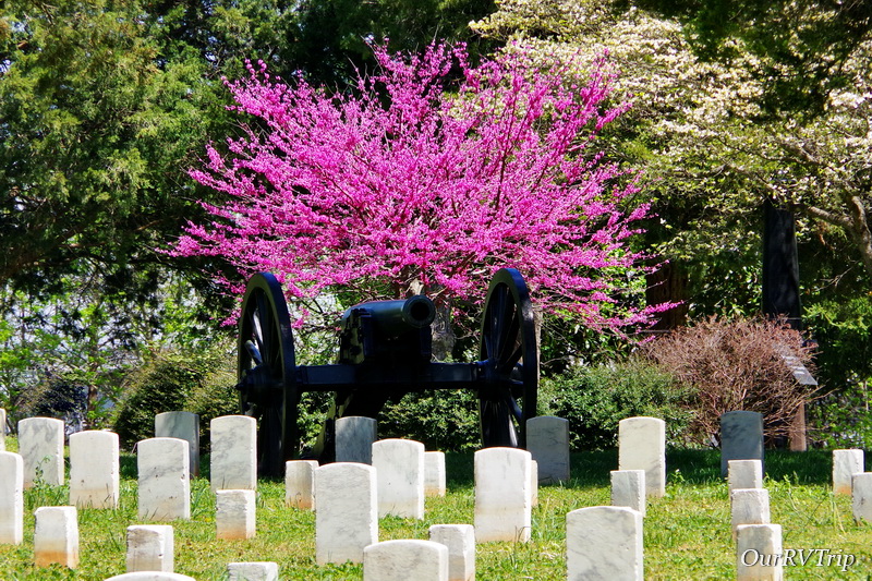
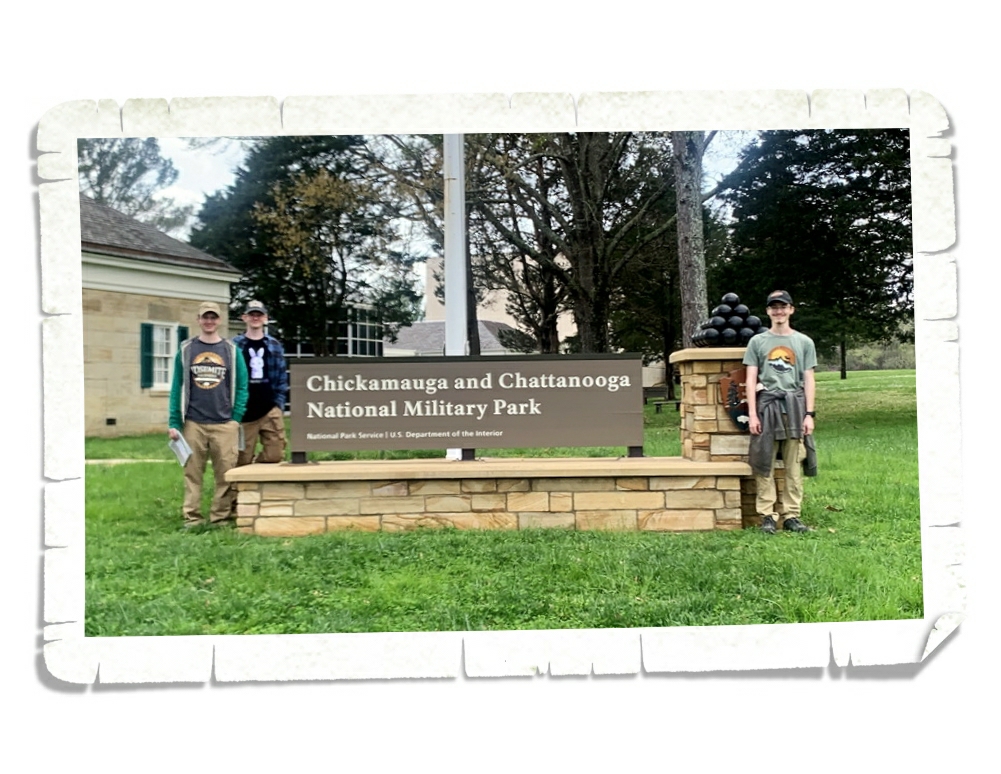
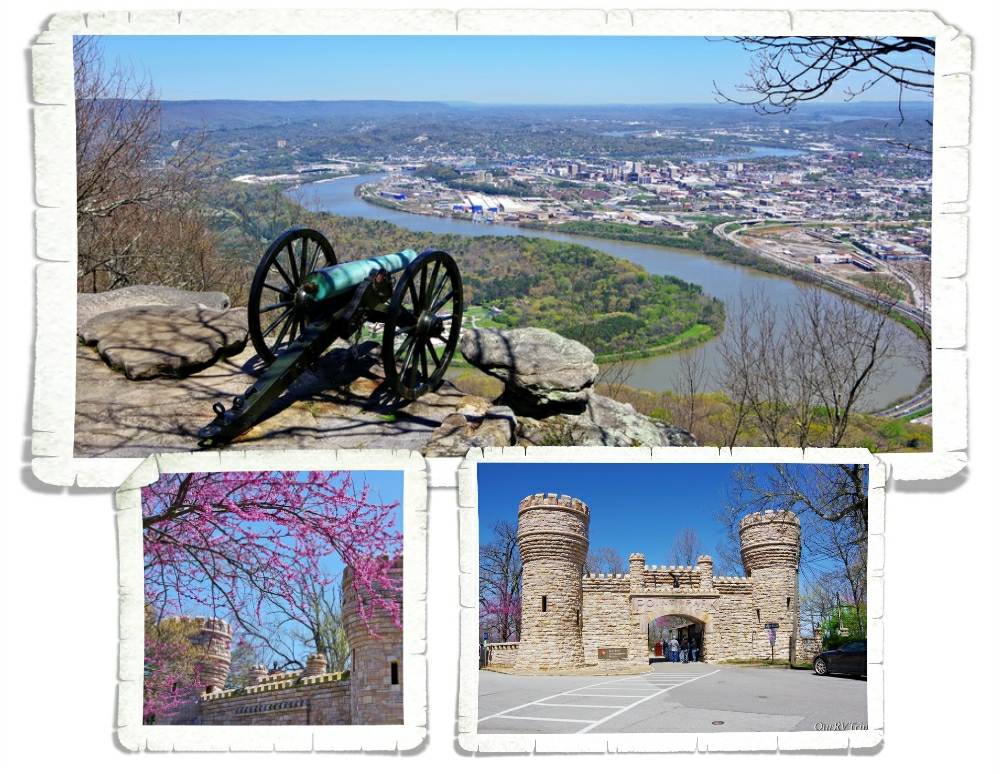
In September of 1889, close to ten-thousand Union and Confederate Veterans went back to the Chickamauga Battlefield…this time as united countrymen under one flag. This meeting (the Blue & Grey BBQ) led to the creation of the Chickamauga and Chattanooga National Military Park in 1890…the nation’s very first official Military Park. Originally, the park was managed by the War Department but was turned over to the National Park Service in 1933.
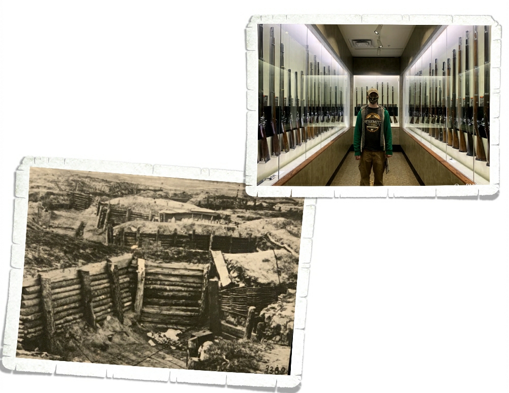
Chickamauga and Chattanooga National Military Park is the oldest and largest National Military Park. We spent hours going through the various museums that can be found on park property.
Chattanooga, the gateway to the Deep South, was considered vital to both the Union and Confederate armies. Very little went as planned for either side and thousands of soldiers lost their lives. In the end, the battle at Chickamauga was the last major Confederate victory of the Civil War.
The park service was tasked with preserving the history and telling the stories of the battles that took place during the Chickamauga/Chattanooga battles by giving equal attention to both the Confederate and Union. We’ve always felt like the NPS has done an extraordinary job of staying neutral. They give you the facts that they know from every angle and let you make up your own mind.
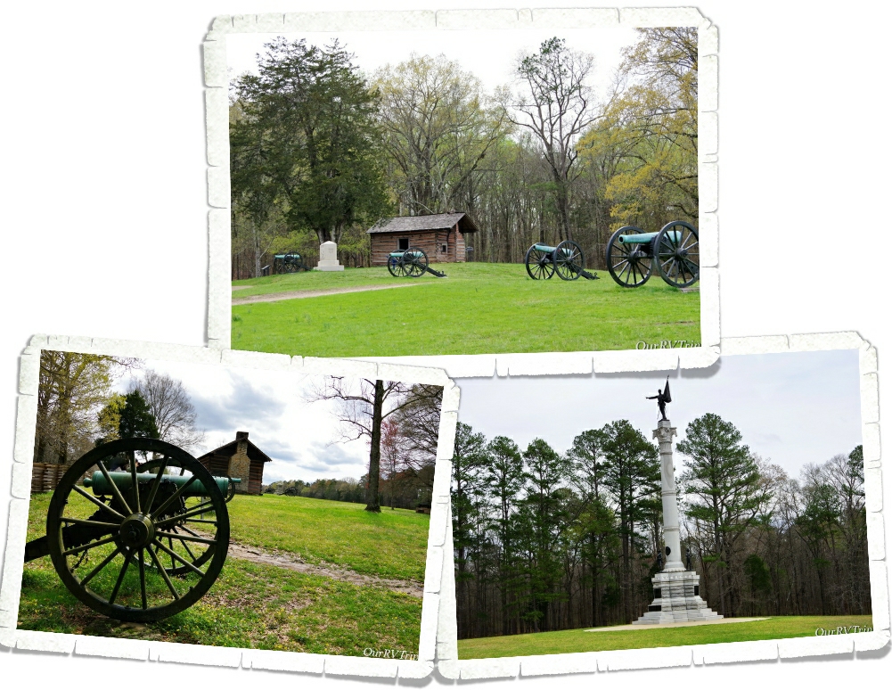
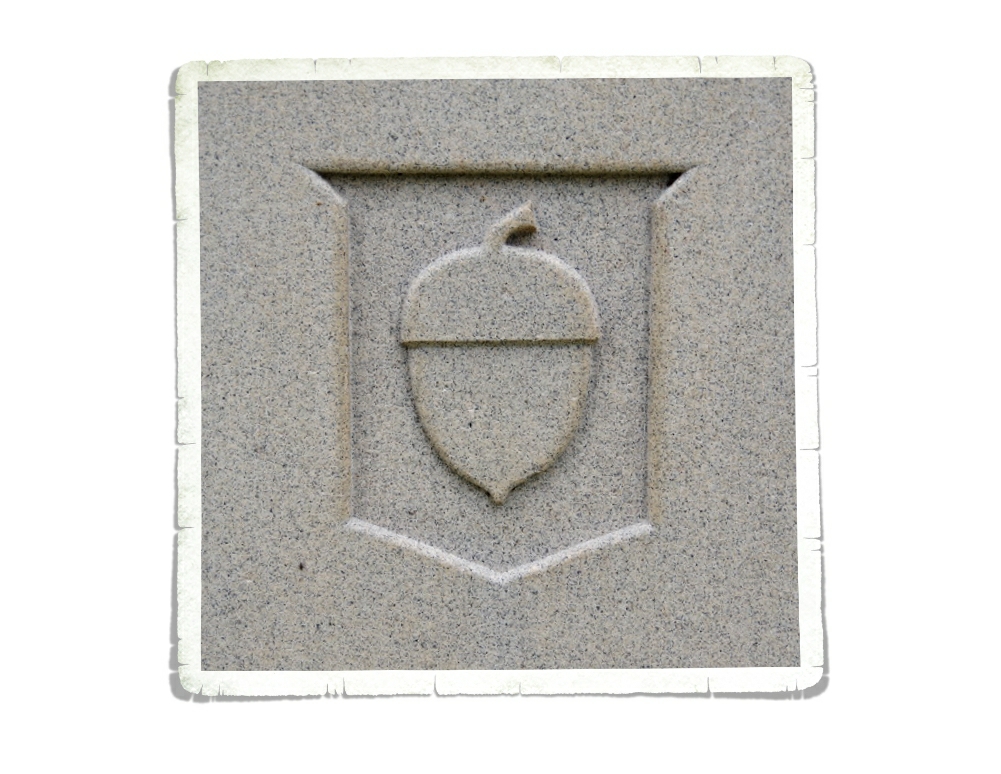
While we drove the tour route through the park, we kept seeing acorns on many of the monuments. Being the curious nerds that we are…we learned that the acorn represents General George Henry Thomas’s 14th Army Corps because they stood “like an oak tree” on Snodgrass Hill during the conclusion of the battle. Most corps at this time didn’t have an individual identifying symbol but some did. Later, when Thomas was traveling with General Daniel Butterfield, Thomas asked Butterfield if he would suggest an emblem to represent the 14th Army Corps. Butterfield said, “If I had command of the Fourteenth Corps, which stood firm as an oak at Chickamauga, I would give it the acorn for a badge in honor of its bravery.” As the Union and Confederate Veterans started placing monument within the park, the acorn started to appear.
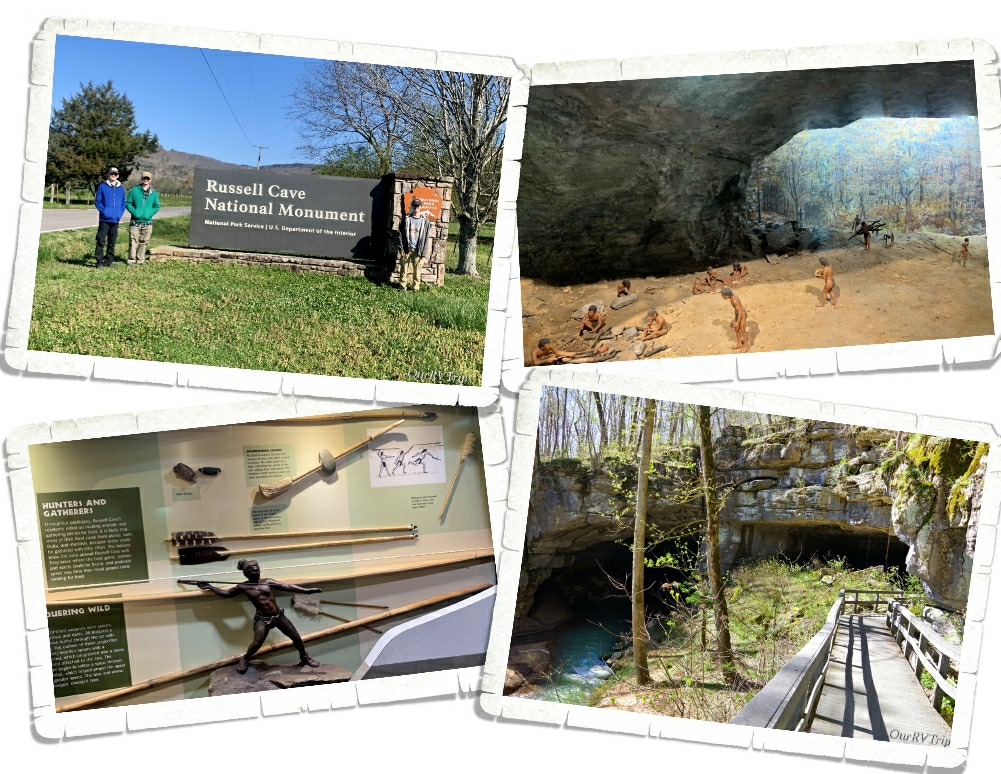
Russell Cave National Monument preserves an archeological site that represents over 10,000 years of use starting with prehistoric cultures around 6500 BCE and running through 1650 CE. There’s a small museum that has artifacts and reproductions of things found within the cave that show the life and tools used by the people who’ve called the cave home over the years. We really enjoyed the short walk to the mouth of the cave. There are some signs that talk about the different layers of time the archeologist have uncovered. The cave has 7.1 miles of mapped cave system and is considered the 3rd longest mapped cave in Alabama. And…if you go…watch for danger noodles. There were signs everywhere warning about venomous snakes.
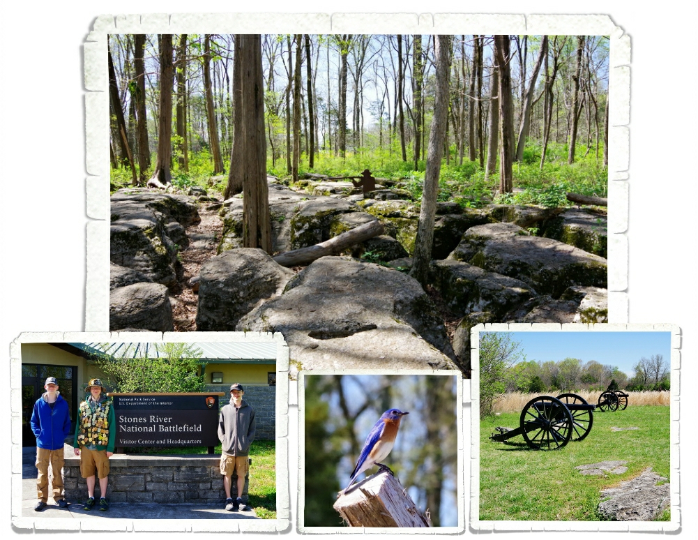
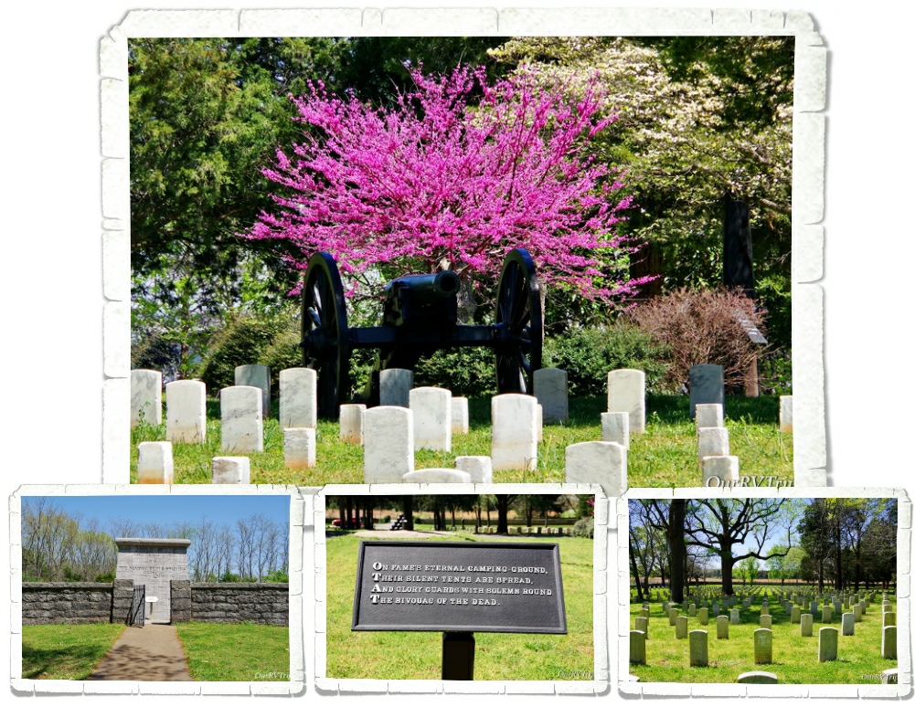
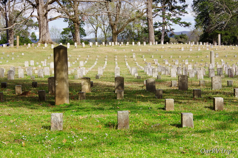
The last National Park Unit we explored while we were in Tennessee was the Stones River National Battlefield. Stones River is the site of one of the most bloodiest battles of the Civil War with nearly 24,000 casualties. The battle lasted from December 31, 1862 to January 2, 1863 and is considered a strategic Union victory that bolstered support for the Emancipation Proclamation.
The park preserves only a fifth of the nearly 3,000 acres of the original battlefield and includes a National Cemetery. You’ll also find the Hazen Brigade Monument (1863), the oldest surviving American Civil War monument still standing in its original location. The monument was built by surviving members of William Babcock Hazen’s Brigade to commemorate the battle.
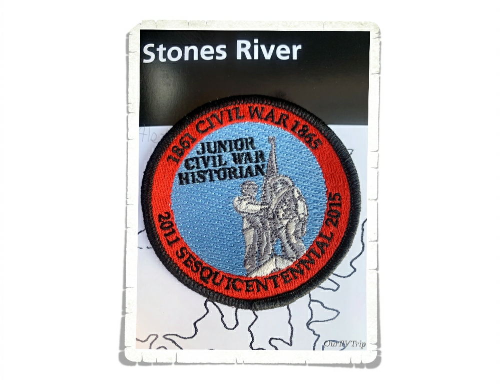
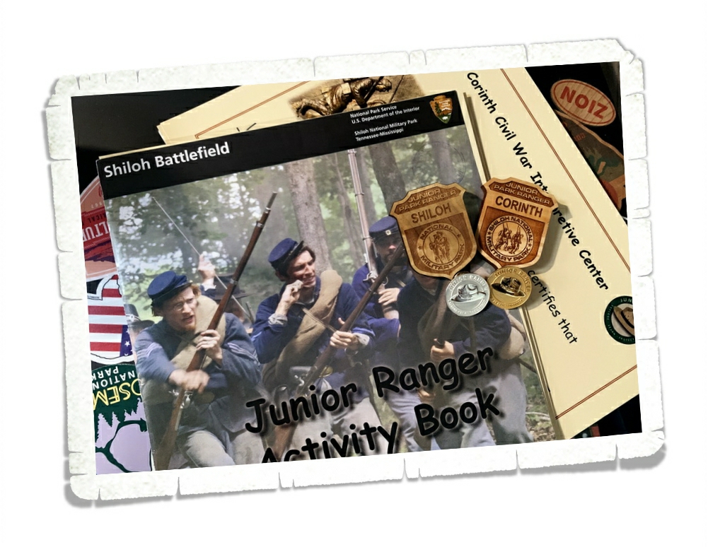
One of the coolest things we found while we were park hopping in Tennessee is the Junior Civil War Historian patch. We’d never heard of it before, but one of the Ranger’s in the visitor center told us about it after he saw Alex in his vest with all of his badges. Usually, you have to ask about any special patches or badges…so it was really nice that this Ranger told us about this hard to get/not made anymore patch. The boys were super excited to add this special patch to their collection.
We didn’t just visit NPS units…we had a lovely Easter and played some new games as well as…
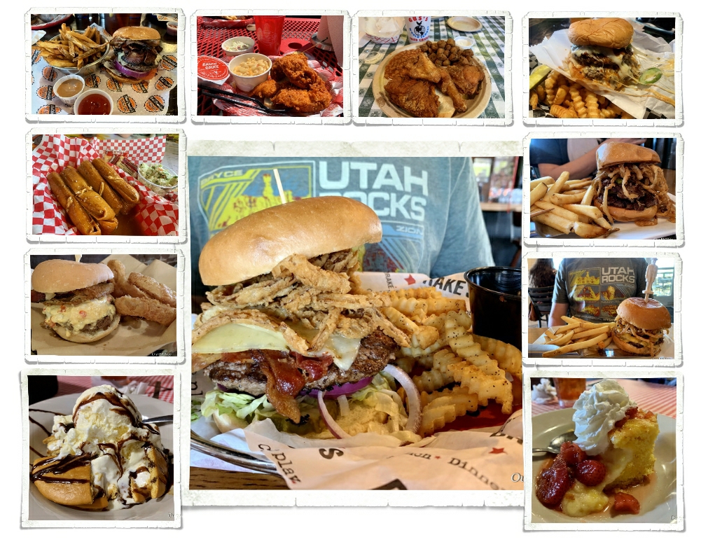
eat ourselves silly. I admit it…we stayed in a couple places purely to eat. What can I say? Foodies are a huge part of our travels. #willtravelforfood
Well, I think that’s it for our tour of Tennessee. We’ll actually be back in Tennessee for a month later this year and we’re excited to get back! We really enjoy the area.
Hey Guys! When we first started this whole quest to see America, we knew we wanted to visit a few National Parks…but National Battlefields/National Military Parks weren’t even on our radar. Back in 2015, as we were passing through Montana, some people at the RV park we were staying at talked us into going to visit Little Bighorn Battlefield National Monument. We went, but didn’t think we’d enjoy it. Well, long story short…we loved it. We all learned so much that we now seek out the historical/battlefields/military park/fort National Park Units.
We enjoy touring and learning about our Country’s history so much that we spent a month earlier this year touring some of Tennessee’s battlefields. We started our Tennessee battlefield tour on March 20 (2021) with Shiloh NMP. Our tour was fast and furious as we jumped to a new location every Saturday. Our weeks were a combination of work/school and trying to squeeze every minute we could out of the nearby National Park Units.
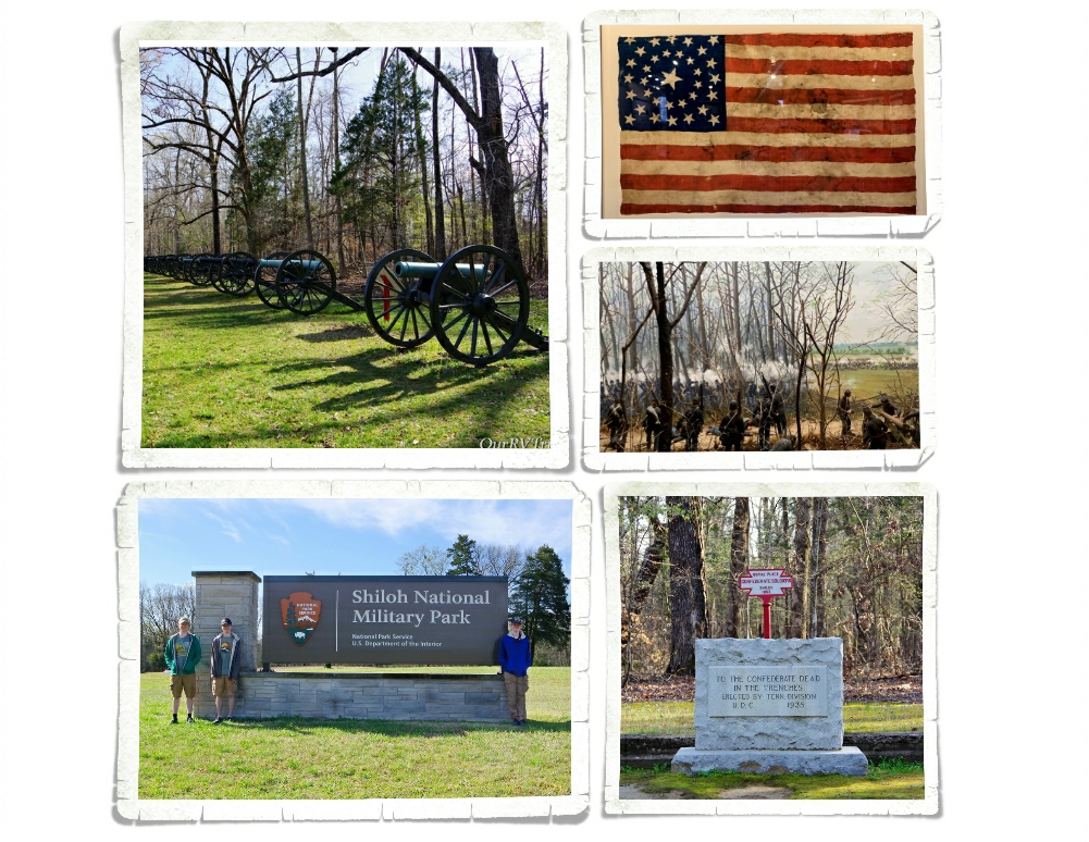
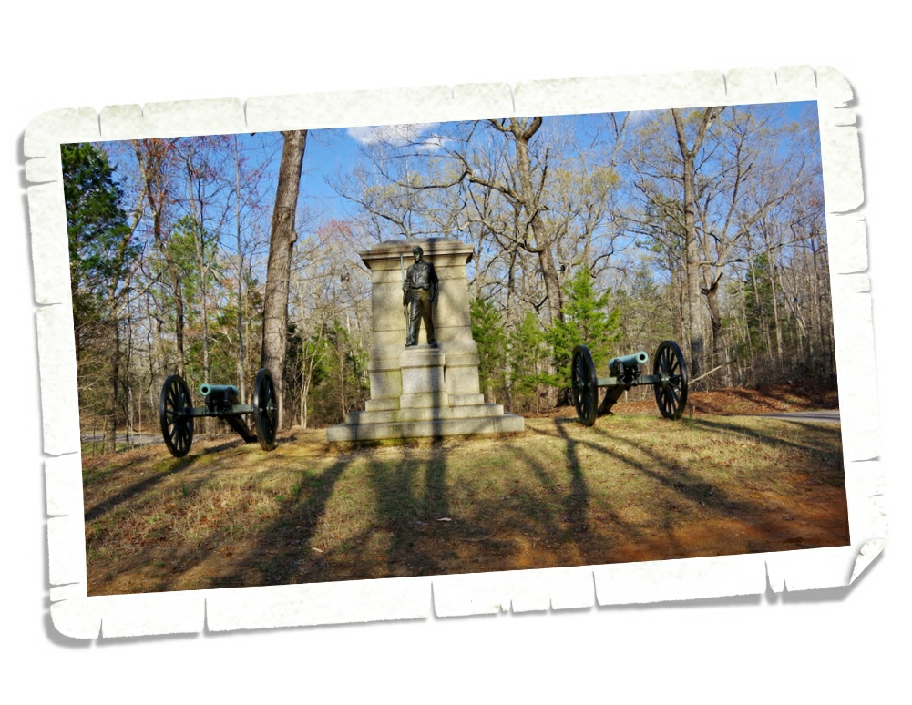
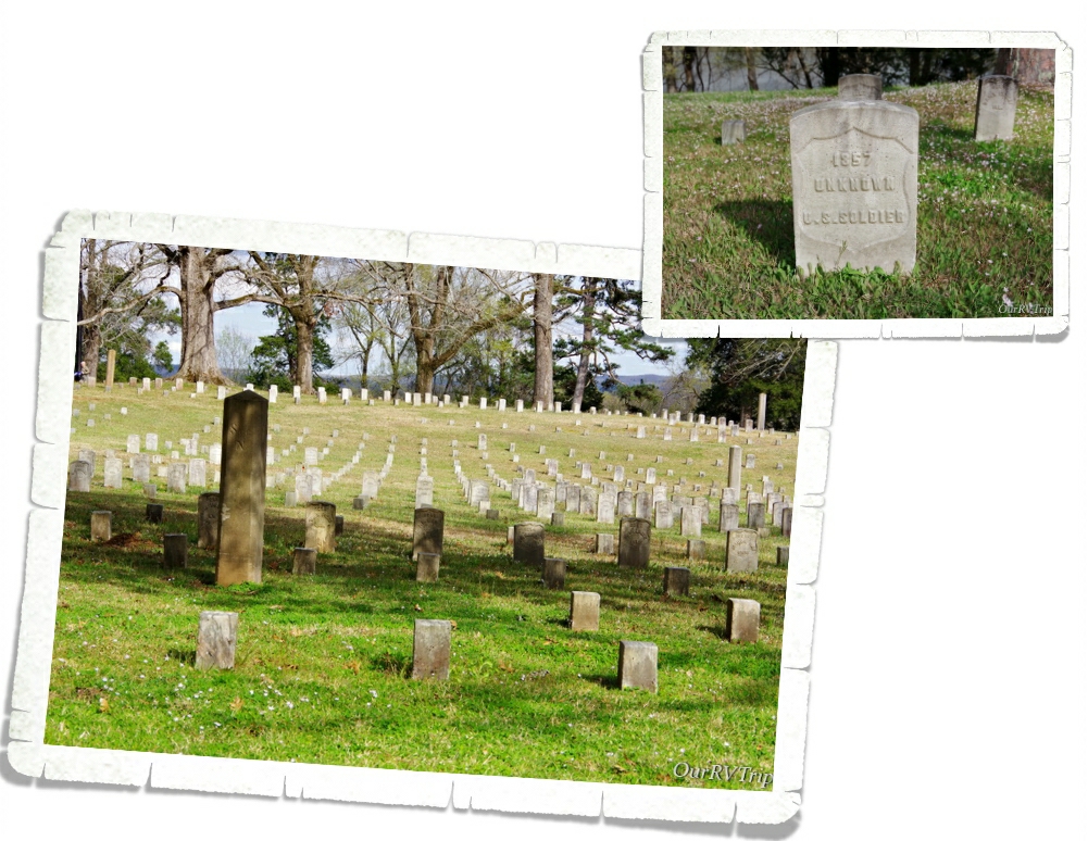
Shiloh National Military Park preserves the history of one of the first major battles in the western theater of the Civil War. Two days…nearly 110,000 American soldiers…23,746 casualties. The two day battle didn’t end in a decisive winner for either side, but was just the beginning of a six month struggle to control this vital area.
Shiloh NMP is considered to be one of the best preserved battlefields in our Country with 156 monuments and 650 interpretive markers. The interpretive markers are especially interesting here since many of the surviving soldiers were still alive when this particular National Military Park was being built. There are many first-hand accounts you can read. It makes the battle feel more personal…more real…not just words on a page.
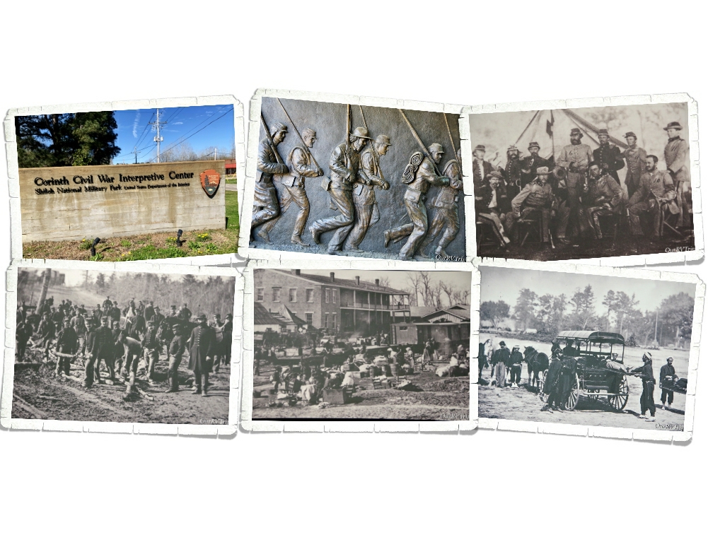
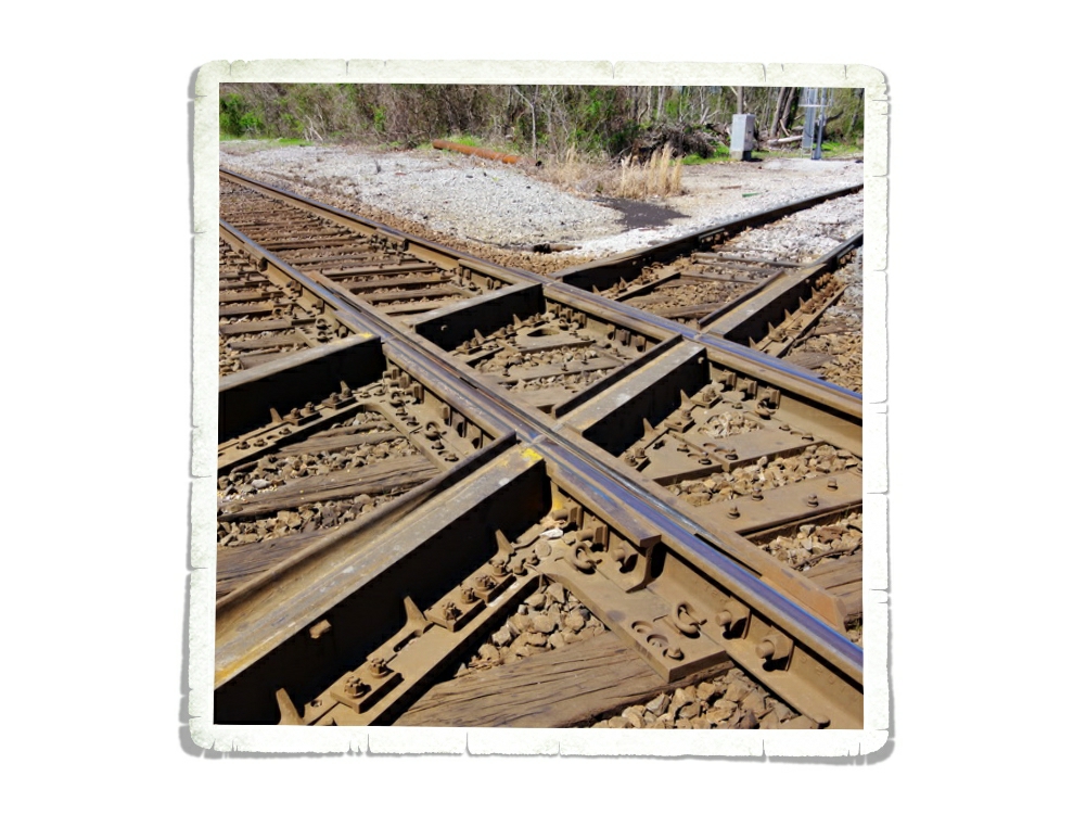
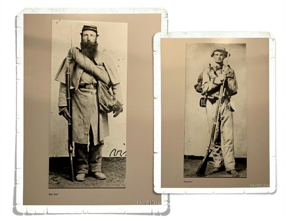
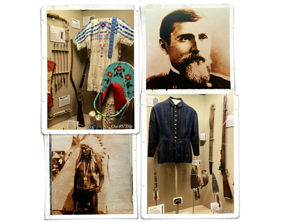
At the end of the first two days, nearly 8,000 wounded and dying Confederate soldiers made their way to the nearby town of Corinth, MS. Corinth was a small town of around 1,500 people that sat on the crossroads of the Memphis & Charleston and the Mobile & Ohio Railroads. The black and white pictures are all pictures I took of pictures we found in the various Shiloh NMP visitor centers.
You can imagine what 8,000 wounded soldiers would do to a town the size of Corinth. The town’s people tried their best to help the soldiers, but in the end…the town suffered greatly. Eventually, the water supply ran out, food ran out and people left as the battle for the area took over the little town. By the end of the Battle of Shiloh, the Union captured Corinth and controlled the vital railroad junction.
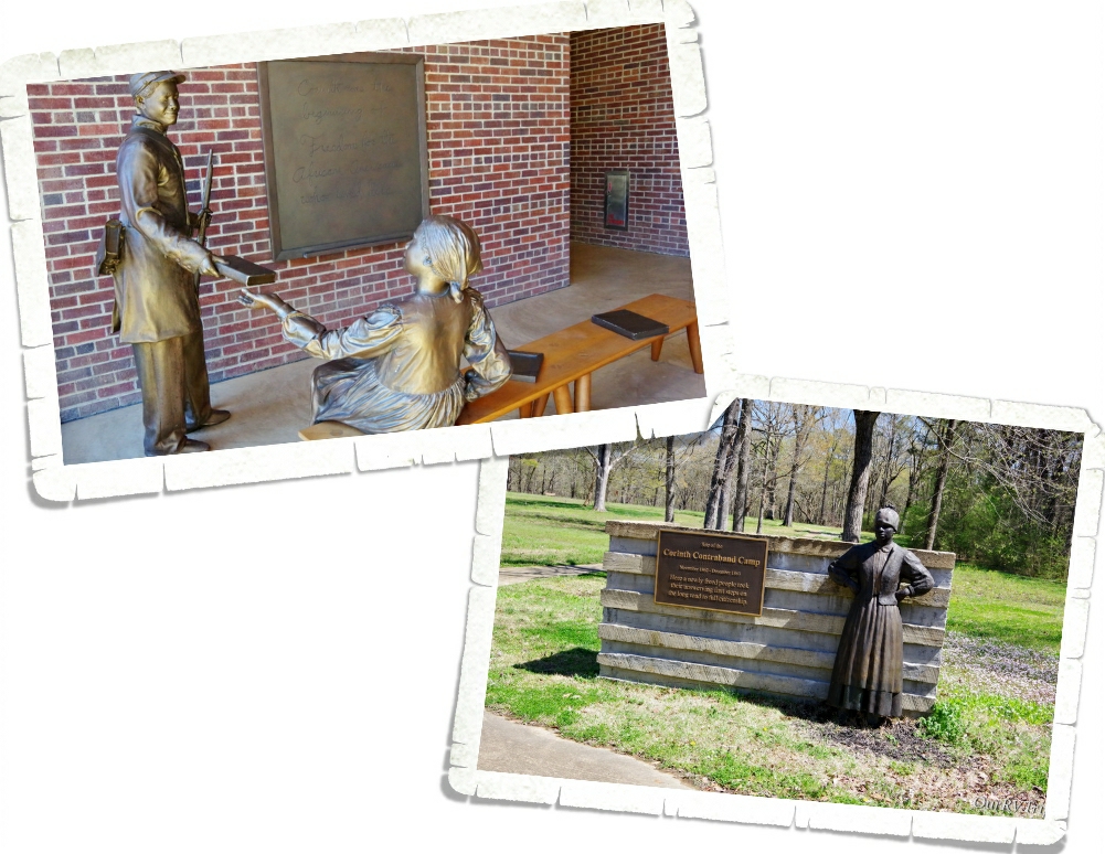
During the Civil War a Contraband Camp was a place that freed men, women, and children would gather together to make a life for themselves. Some of the residents freed themselves by escaping the plantations they were being kept on. The Corinth Contraband Camp had over 110 buildings that included homes, a school, a church, a commissary, a hospital, blacksmith, seamstress, shoemaker and offices. It became the model town for other townsites. By May of 1863, the residents had 300 acres that they were cultivating and making a profit of $4,000 to $5,000 a month. The population varied greatly and tended to fluctuate between 1,500 to 6,000. You can go walk a small portion of the land that the Corinth Contraband Camp sat on. There are some statues that show what parts of their daily lives might have been like. The Contraband Camps were a part of our Country’s history I didn’t know about. It was eye-opening and we learned a lot.
Meet “Billy Yank” and “Johnny Reb”. They were bitter enemies during the battles, but would often times help one another by the end of the war. They would swap stories of home, trade supplies, and offer what little help they could.
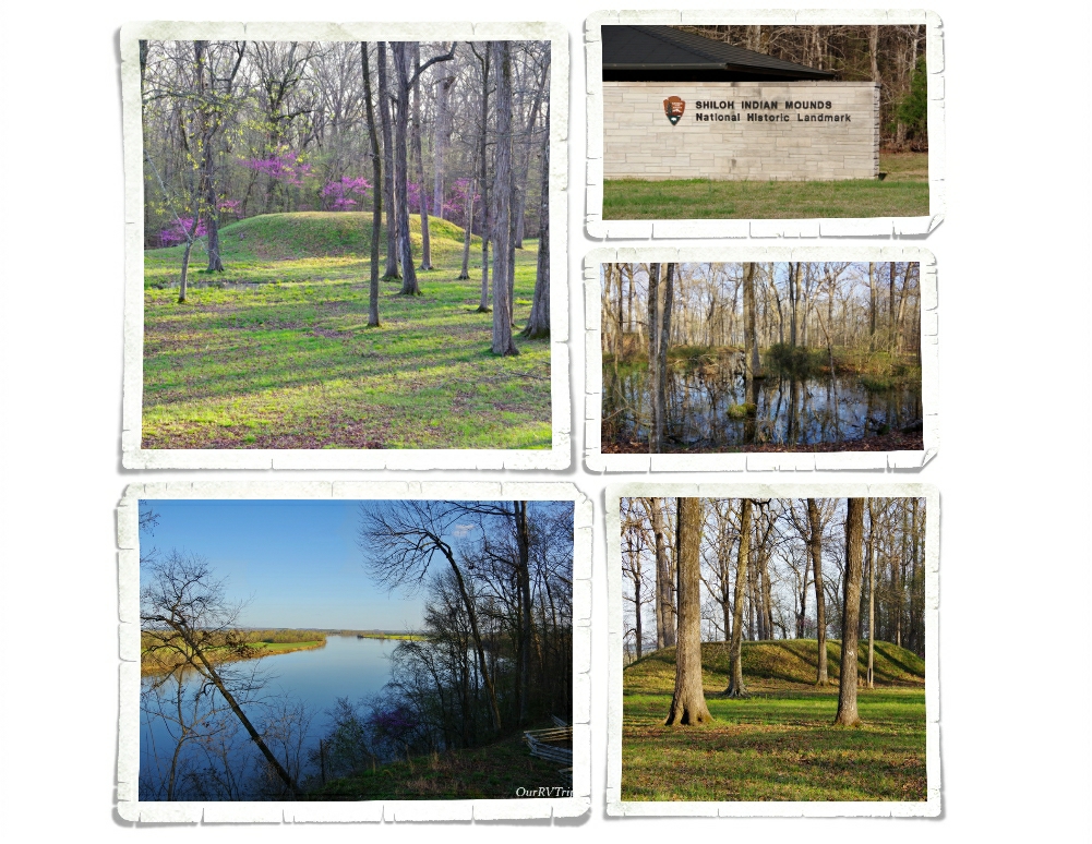
While you’re at Shiloh NMP you should make sure to visit the Shiloh Indian Mounds National Historic Landmark to learn about the first people who called this area of our Country home.
The sheer number of casualties of the Shiloh/Corinth battles shocked the Country and had both economic and psychologic impacts on civilians for both sides of the war. The lessons learned during these battles resulted in better standards and procedures of care implemented by both sides.
During our time in this area, the redbud trees came to life! They were everywhere!
We were only in this area for one week but we, of course, found a few foodies. It was a smaller town so we were pleasantly surprised by the foodies we found.
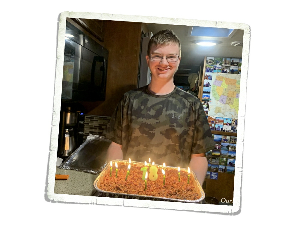
We also celebrated Alex’s birthday…I can’t believe he’s 18! He asked me to make a Pecan Cobbler for his bday this year. He graduates this year and he’s ready to get his life started!
Hey Guys! We spent one week in the Dillon, MT area as we were making our way up to Glacier National Park. This stop was basically just a big hopping point between Ketchum and West Glacier, but I chose it specifically so we could visit Big Hole National Battlefield and Bannack State Park. I figured…we might as well make the best of the week, right? Let’s stop someplace where we can continue our National Park Tour.
Every single National Park Unit tells a story. Battlefield stories are usually hard to hear, but I feel like they need to be remembered. History should never be forgotten…our history reminds us of how far we’ve come and how far we could fall if we make the same mistakes. Learning our history…all of our history…not just the history that’s pretty or makes us feel good… helps keep us from making those same mistakes again. We’ve learned. We’ve grown. Let’s not forget it.
Every story has two point of views. We’ve found that the National Park System is excellent at portraying both sides of the story equally and without prejudices. Our school system could learn a thing or two from the National Park System about teaching the true history of our country.
Like so many battlefields, Big Hole National Battlefield is considered a sacred place…a place where blood was spilled and life was extinguished. This National Park Unit tells of the battle between the Nez Perce (nimí•pu) and US Army troops. But really, it’s the story of the Nez Perce’s struggle to survive. The Nez Perce can trace their heritage and their life on the land back 9,000 years. They were one of the biggest tribes in the US with around thirteen million acres of land spanning across what is now Idaho, Montana, Oregon, Washington and up into Canada. As the US struggled to find it’s footing as a new nation, the Nez Perce lost most of their land and conflicts began to occur.
In 1855 the US government proposed a treaty. The Nez Perce would give up over half of their traditional lands to the growing US nation but they would still keep the right to hunt, fish, and gather on those lands. Everything seemed to work for five years, but then gold was found which led to an influx of over 15,000 miners and settlers and once again conflicts started to occur.
In 1863 the US government met with all of the leaders of the different Nez Perce bands to try and come to an agreement that would cut the Nez Perce lands by another ninety percent and the Nez Perce would go live on specified land reservations. During the meetings the leaders of five bands were so disgusted by what they were hearing, they got up and left the meetings. The meetings didn’t stop though. They continued with the leaders who stayed and in the end the leaders who stayed agreed to the treaty because it didn’t affect their bands as much. Those leaders signed the treaty for all Nez Perce…even the bands who had left the meetings. The bands who left refused to acknowledge the new treaty and would become known as the non-treaty Nez Perce.
The US government gave the non-treaty Nez Perce thirty days to move onto the reservation or they would be put there by force. The Nez Perce had lived on this land for thousands of years and didn’t see what gave the US government the authority to tell them where they should and shouldn’t live. In the end, the non-treaty Nez Perce gave in and started the long process of gathering all of their things and livestock to make the journey to the reservations. Before they could reach their destination though, conflict and fighting broke out as they were going through land that had once been theirs, but had since been claimed by settlers. This started the the long chain of events that would be known as the Nez Perce War.
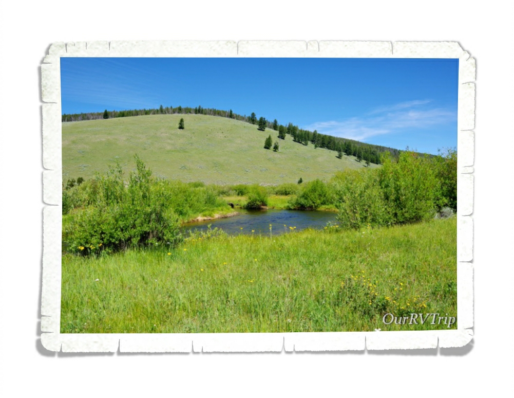
On August 7, 1877 around 800 non-treaty Nez Perce made their way to a place they knew well from past buffalo hunts. They called it The Place of the Buffalo Calf (Iskumtselalik Pah). They knew there would be fresh water, a big field for their horses to graze and the nearby forest would provide trees for the tipi poles. They had been relentlessly pursued… fighting and fleeing for several long weeks and they were all weary and worn. The leaders of the five non-treaty Nez Perce bands believed that by moving across the Idaho border into Montana that they would leave the war behind.
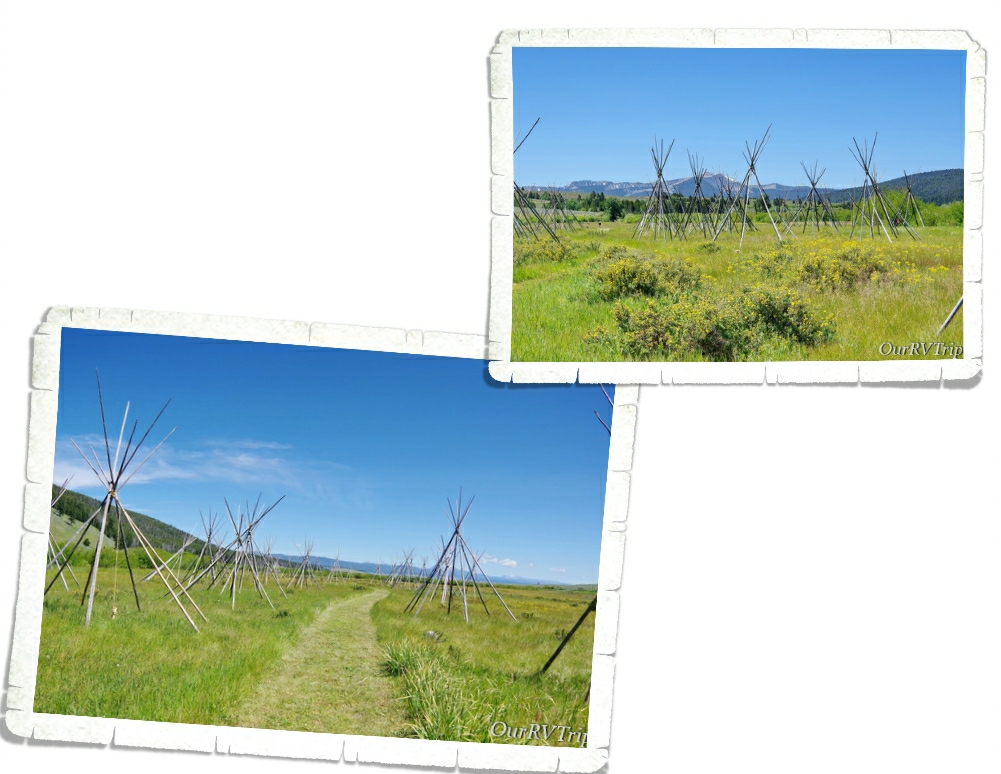
The next day, August 8, they spent the day setting up camp. Eighty-nine tipis were set up throughout the field. They spent the day hunting and gathering food and water, looking after their tired horse herds (close to 2,000 horses), and planning the next step.
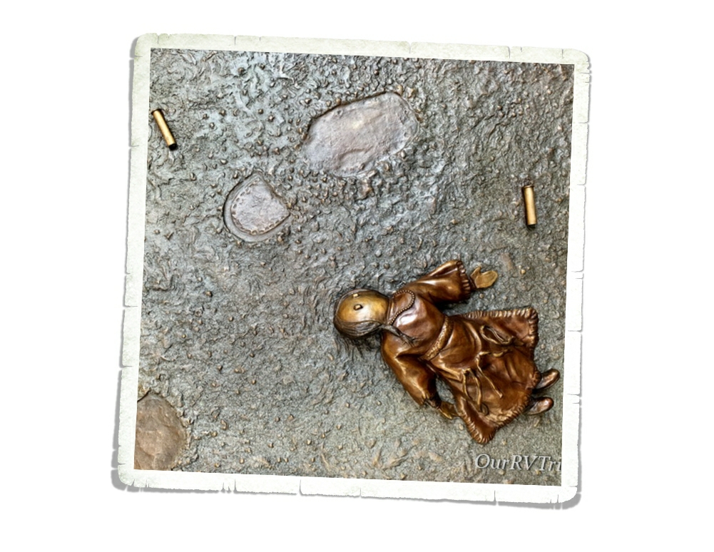
In the early morning on August 9, a Nez Perce elder went down to the river to check on some horses. What he didn’t know, was that during the night the US Army, led by Colonel Gibbon, had caught up with them and was positioned for an ambush at the river front. What happened next was pure chaos. One of the military volunteers got itchy and shot the elder. The Nez Perce woke to gunshots and screams. At one point soldiers started setting fires to tipis with women and children hiding in them.
I should point out that this particular unit of the US Army had just come from Little Bighorn where they saw what was left of Custer and his unit (not much). They were worked up and scared for their lives. Most of this unit was new to fighting. I don’t think you can ever really justify the brutality of what they did though.
When it was over, 90 Nez Perce and 30 military/civilian volunteers had been killed. The US Army had expected the Nez Perce to be surprised and to quickly surrender, but that’s not what happened. The Nez Perce fought back to protect their families and pushed the military back across the river and up the bank. The military retreated and dug shallow rifle pits to hole up in. Several Nez Perce volunteered as sharp shooters to hold the US military troop pinned down so their families could quickly do what they could for their dead and then flee.
After the sharp shooters left, the unwounded soldiers did their best to help the injured. There wasn’t a doctor and they really weren’t sure if the Nez Perce would come back or not. With no medical supplies, equipment, clothing, or food Colonel Gibbon decided to camp where they were until reinforcements could arrive.
This was just one battle in the Nez Perce War. From Big Hole, the Nez Perce eventually made their way up to the Canadian border where some of them crossed over and continued to fight and some chose to stay and surrender. It had be a long hard journey stretching over 126 days and close to 1200 miles that spanned over 4 different states. Today, the Nez Perce visit the Big Hole Battlefield to honor the memories of those who were killed on August 9 and 10 of 1877.
We only spent a few hours at Big Hole Battlefield, but what we learned will stay with us for the rest of our lives. We remember and we honor all those who fell.
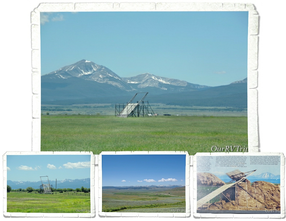
On the way to Big Horn Battlefield, we kept seeing these unusual structures out in the fields. Being the inquisitive nerds we are…when we got to the National Park unit, we asked a Ranger if she knew what they were. Luckily, she knew exactly what we were trying to describe. Which…look at that structure, how would you describe it?
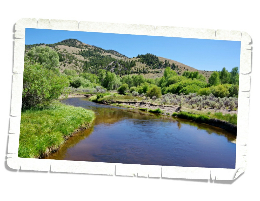
They’re called beaverslides. Yup, you read that right. A beaverslide is a hay stacker. Invented by two ranchers in the Big Hole Valley in 1910, the ranchers of this valley used them to stack hay up to 35 feet high and contain close to 20 tons of hay so they could feed their cattle from it all winter. There was a time when the Big Hole Valley was known as the Valley of 10,000 Hay Stacks. Most ranchers in the valley have switched to more modern methods, but there are still a few who are using the beaverslides.
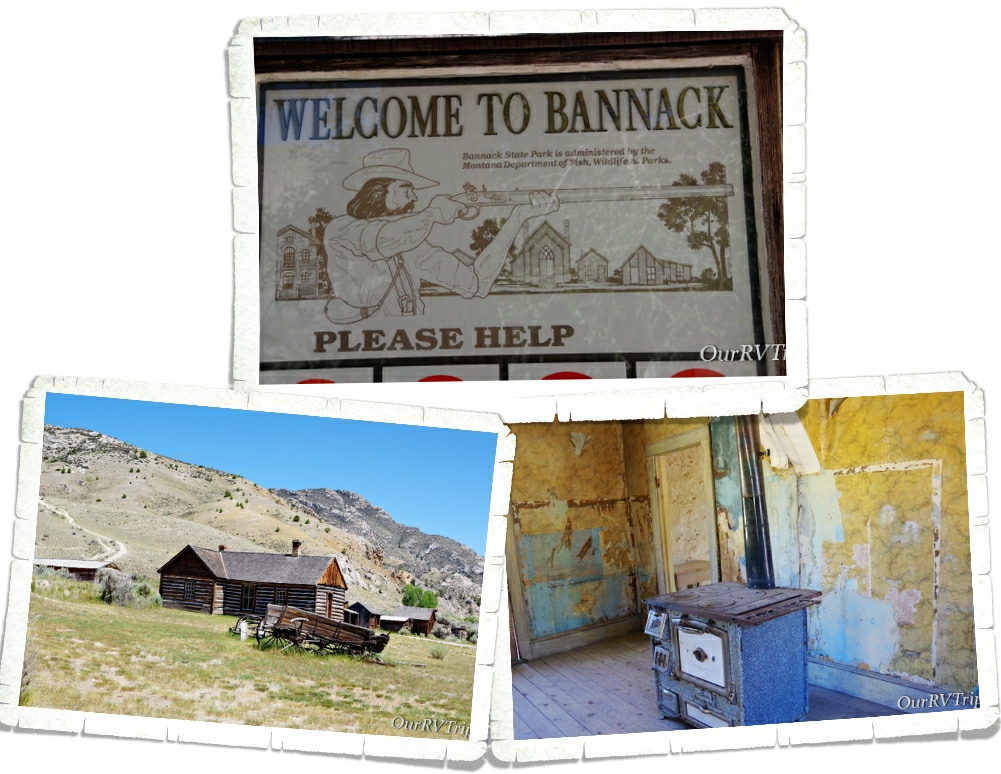
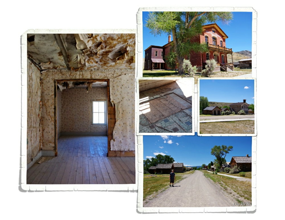
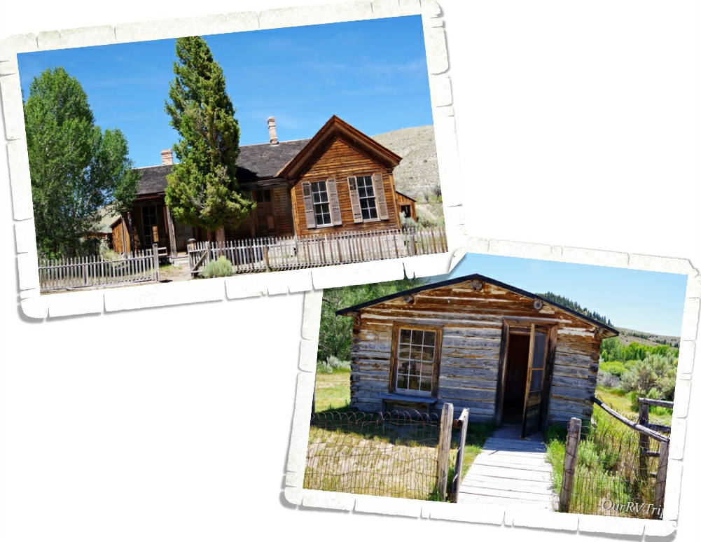
The other place we wanted to explore while in the Dillon area was Bannack State Park. Bannack is said to be one of the best preserved ghost towns in the US. We’ve been to our fair share of ghost towns and I have to agree. Bannack is the best we’ve seen.
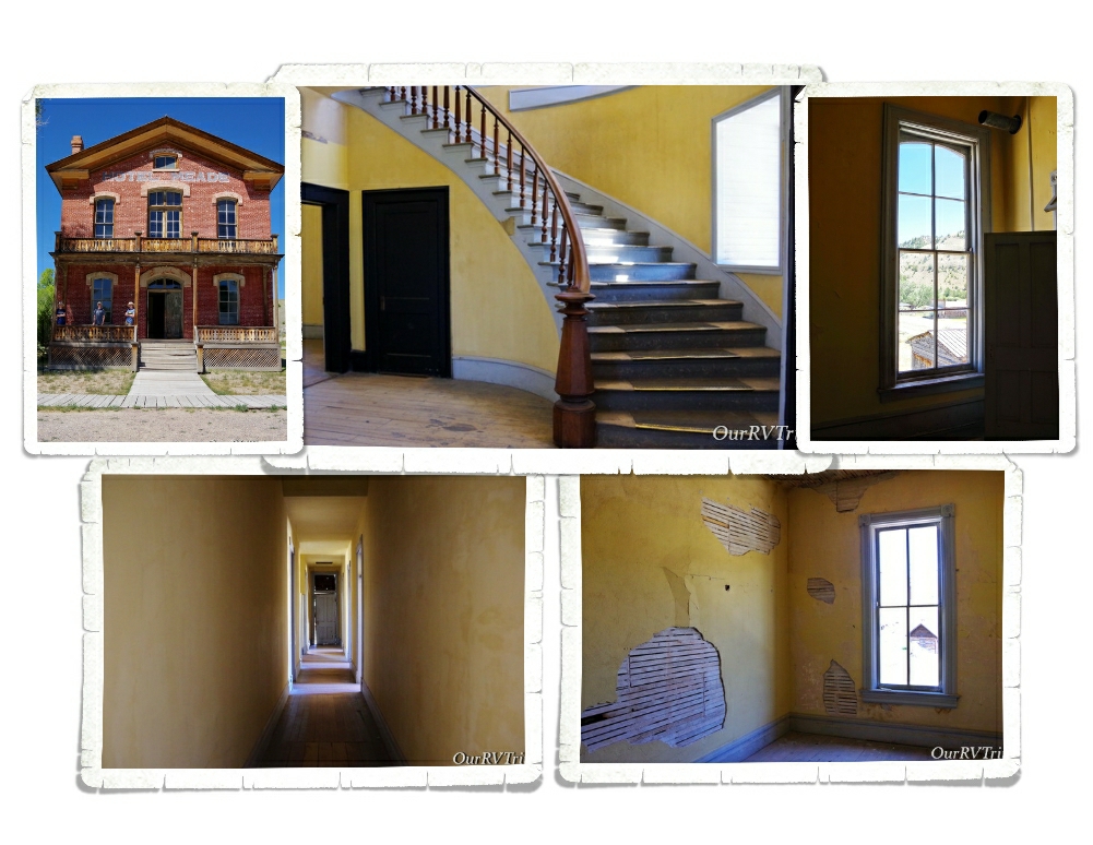
One of the best things about this ghost town is that you actually get to go into the buildings. And I don’t mean go in and look through some plexiglass at a few decorated rooms…nope…you can actually go in and explore. The Hotel Meade was one of our favorite buildings to go through. We were able to go through the rooms downstairs and then venture upstairs to see most of the actual rooms that guests stayed in. They’ve been left alone, but preserved…if that makes sense. Montana Fish and Wildlife oversees Bannack and has done an excellent job of keeping the buildings authentic but as safe as possible. Quite a few buildings had a sign at the entrance that warned people to enter at their own risk. They are old buildings…
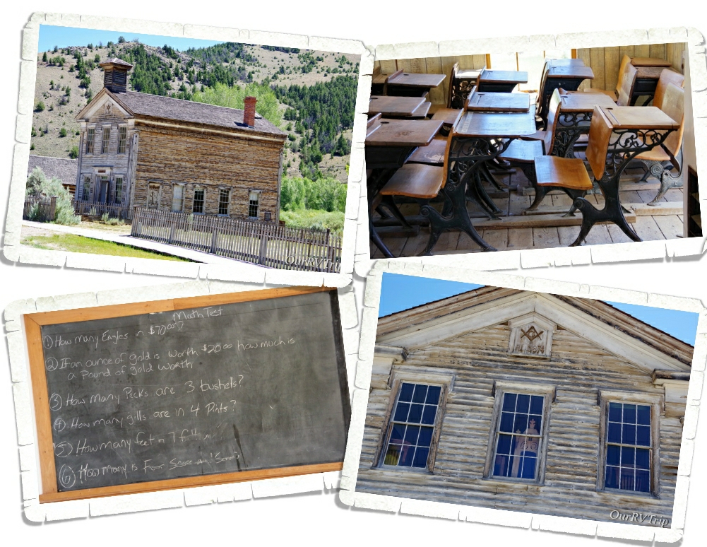
This building, built in 1874, served as both a school and the Masonic Lodge. The first floor was used as a public school for grades K-8th while the second floor was used as Masonic Lodge Number 16. We were able to go into the first floor school, but the second floor was closed off the day we went.
Like so many towns of that time, Bannack (named for the Bannock Indians who frequented the area) started as a mining camp when gold was found in July of 1862 at the nearby Grasshopper creek. The camp grew from around 400 people that fall to over 3,000 people the next spring. During the winter of 1862, Governor Sidney Edgerton named Bannack the first capital of the Territory of Montana. The Post Office was established in November of 1863.
And, like most mining towns of that time…Bannack wasn’t a safe place…especially after dark. We found a hidey hole in the floor of every building we went into. And…there was a rumor that Sheriff Henry Plummer and his posse were actually a gang of thieves and murderers called “The Innocents”.
Most people came to Bannack to find their fortunes in gold mining. Some, came to start businesses like butcher shops, saloons, craftsmen, and ranching. Any supplies had to be brought into Bannack from a great distance and at a pretty big expense. While the town of Bannack wasn’t exactly hard up for money…the residents found that most of their earnings were going to the high cost of goods and services. $500,000 in gold was mined in the area by the end of 1862.
When World War II started, all non-essential mining was prohibited. Bannack’s existence was dependent on the mining of gold. Mining did start back up as soon as the war was over, but the price of gold was so low that the mining town couldn’t survive. People went elsewhere to find jobs and by the late forties, most of the population had moved on. The Post Office closed in 1938, the school closed sometime in the early 1950s and just like that the mining town of Bannack became a ghost town. The gold rush is over, but the spirit of the old west can still be found at Bannack State Park.
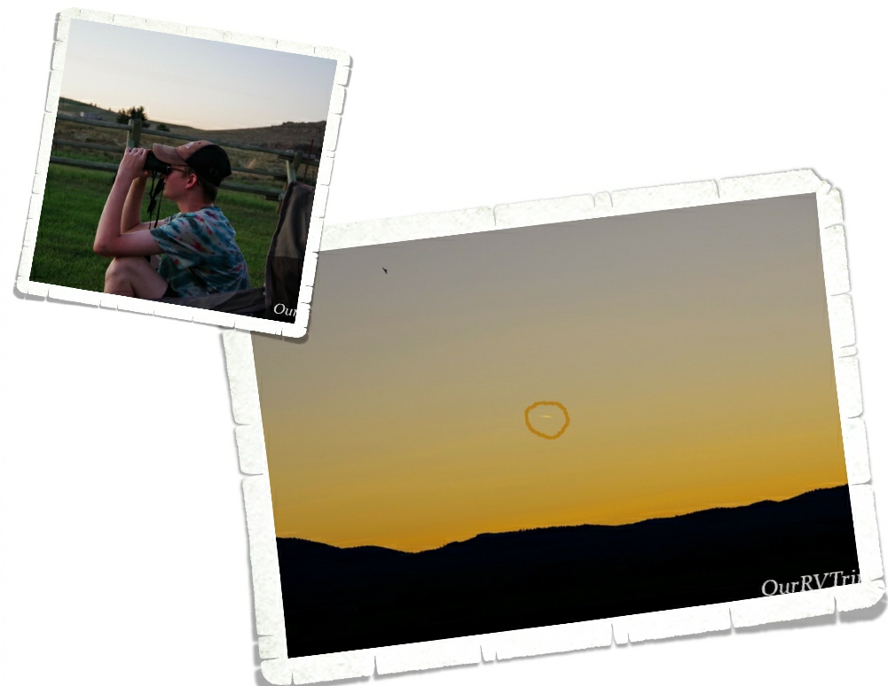
We spent a few nights trying to see the Neowise Comet that was visible at the time. We were so far north and the comet was so bright that we didn’t have to wait too long each evening to try and spot it. We think we saw it one night. I circled it in the right picture…It’s not the best shot, but it’s all I got.
Our week flew by. We didn’t really do much of anything else since we’re still trying to avoid going out too much. We mainly just go get groceries and stay home…when we’re not out adventuring in the wild places.