Category: Washington

Pizza Roundup Westside

Pizza Roundup Westside

To my fellow pizza lovers! I bring to you a post from Port Angeles, WA.

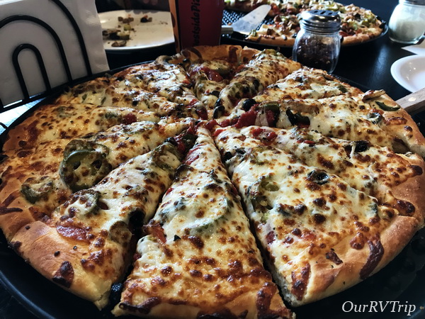
Westside is a pretty good pizza place with a fast food-ish vibe from the inside. But butter… I mean better.

Just look at these bread sticks! They were so good! Especially after a long day of exploring Olympic National Park. It did take a little bit for the food to come out, but not too long.

And when it did come out it was gooood! The service was good and the restaurant was clean.

On the pizza Mom and I shared there was so much cheese, and lots of cheese is not a bad thing at all. The sauce wasn’t super sweet like what we tend to get a lot.

Did I mention they had arcade games to keep you occupied while your food cooks? I didn’t? WELL, they do! I had to play some pinball. After we ate Dad and I played the racing games you see in the corner, unfortunately we couldn’t figure out the multiplayer.

Well I think Westside Pizza gets a 4.5 star review. Even though it was really good, it doesn’t quite make it up there with Potsy’s or Backroad.

See y’all next time on…

Pizza Street!!

#pizzastreet

Written by Nicholas

More OP Adventures

More OP Adventures

Hey Guys!! We spent two weeks exploring as much of the Olympic National Park as we could. We didn’t get to see nearly as much as we wanted to due to the amount of smoke from all of the nearby fires, but we saw enough to fall in love with the area.

National Parks are usually big. There are smaller monuments or historic sites…but the parks are…well, they’re huge. Usually, they’re more wilderness than not and unless you’re up for doing really long or overnight hikes, you’re not going to get to see most of the park. Olympic National Park is so accessible. You can explore coasts, tall trees, and mountains. The NPS has done a fantastic job with this park and it’s trails.

 On our first full day in the Olympic Peninsula (OP) we headed out to the coastal part of Olympic NP. When we started out it was an absolutely gorgeous day! No smoke in the are…the sun was shining…it was amazing. We stopped by Tongue Point on our way over to our first hike of the day. We got there really early in the morning and spent a few minutes exploring the tide pools. The tide wasn’t very low, so we didn’t see much. The view wasn’t bad though.

Our first hike that day was Cape Flattery. I’d done my research and knew ahead of time that the Cape Flattery hike is super popular and parking can be difficult to find. So, we headed there super early and had our choice of spots to park. There were already quite a few groups there…we weren’t the first that morning. I really love this trail. It’s mostly up on this boardwalk which is cool, but did make it kind of hard to pass people.

It was so sunny that morning when we started out! But Guys…look at all of that fog! I’d be lying if I didn’t say I was a little disappointed. I really wanted the unobstructed view here. But, look how gorgeous the view is even with the fog. I mean, when you’re surrounded by beauty it’s hard to be anything but in a good mood.

We were impressed with this tree. It looks like a candelabra to me. You can also kind of see how people were having to hang off and scoot around each other on that boardwalk trail. It was a little narrow, but workable.

It was lunch time when we made it to Rialto Beach and the place was packed! We circled around a couple of times then headed back down the road to find a parking spot. We had lunch in our car and then headed back to the beach to do some exploring. I’d seen online that there was a neat rock formation a little ways down the beach. There were some conflicting distances though, so I wasn’t sure just how far down the beach it was.

Check out the driftwood. It’s huge! And there was a ton of it lining the beach. The farther down the beach we got the fewer people we saw. If you squint at the upper right picture, you can see a couple of the boys next to that big rock. The look like ants. The bottom right pic is another look at how big those rocks were. The boys are standing down below them. It ended up being about a mile down the beach, but it was an enjoyable walk with only a few other people venturing that far. We did find a few little shallow tide pools on our walk. I was hoping to find some sea stars, but…we didn’t see any. Something to look forward to next time we’re in the area.

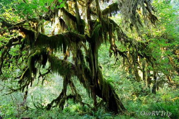
One of our favorite areas in the Olympic NP is the Hoh Rain Forest. We got to the visitor center right before they were closing, but the park was still open for a few more hours so we did the Hall of Mosses trail. Check out that moss! All of the trees on the trail were dripping with green moss. The entire area was green. Green fuzzy moss, green ferns, green grass in the water…it was a lot of green.

Before we made it to the Olympic National Park, I checked the website to do some last minute research on a trail I wanted to do. It’s always a good idea to check the alert section of the NP website you’ll be visiting. This time I learned about a wasp problem. And they weren’t lying. We had a whole group of wasps decide to take up residence under our car. We drove to a gas station and saw a few of them coming out from under the car, but didn’t think much of it. When we got to our next stop by Lake Crescent we’d lost several of them, but almost didn’t make it back in the car. The wasps that were left were not happy with us. We drove to the Sol Duc trail head and lost the rest of the wasps. We didn’t see any when we got out or came back after the hike. Thank goodness! We did see a whole nest of the same wasps on the Hall of Mosses trail.

We found another tall tree that’s now on our list of favorites. The Sitka spruce averages 220 feet tall and looks very cool dripping with moss.

We walked right by this fawn and its mom while we were on the Hall of Mosses trail. They weren’t terribly worried about us.

We found some decent foodies in the Port Angeles area. We had to stop by a local chain called Frugals. It’s a drive through only so we took it back to our home-on-wheels to eat it. It was pretty good considering it was pure fast-food.

There weren’t very many pretties around, but I found a few. I know this is a mushroom…technically a fungus. But I love the colors in it.

And then there was this pretty. It was all alone on one of the trails we hiked. I love how pristine white it is.

We absolutely loved the OP! More than we thought we would.

See y’all down the road!

#westernloop2018

Olympic Peninsula

Olympic Peninsula

Hey Guys! We made it all the way up to the Olympic Peninsula of Washington! This is the farthest north we will go on this loop before we turn south and head for Florida for the winter.

We’d spent the last month in smoky and hot Oregon. We started keeping track of where all of the wildfires were the first week we were in Oregon. It felt like the entire western US was on fire. We managed to keep ahead of it, but it got close a few times. Close enough for ash to fall on us. We’d seen a report that there was a wildfire in the eastern side of the Olympic National Park. So, as you can imagine, we were kind of thrilled to see the rain as we were driving into Washington.

We stayed at a great little RV park right near the old Elwha Dam in Port Angeles. We were there for two weeks, but due to the smoke, we spent quite a bit of that time inside. On days when the smoke receded enough, we headed out to explore. We walked down to the old Elwha Dam one afternoon. We could walk there from our RV park which was great. We meant to go back and follow a trail we found but it ended up not happening.

The Olympic Peninsula (OP) of Washington has quite a large population of Native Americans. I loved seeing the dual language signs everywhere!

Our first drive up to Hurricane Ridge (one of the Olympic NP areas) was a little…foggy. If you’ve been following along on our adventures for awhile, you might remember our Sequoia NP fog experience. If you need a refresher, you can find that here. We got a little worried as we drove up the mountain to get to Hurricane Ridge and it kept getting foggier and foggier. I thought, well…here we go again.

Thankfully, we drove up above the fog/clouds and this was our view. Not bad, right? Some of that is fog or clouds and some of it is smoke. It’s still an impressive vista even with the smoke.

We ended up going back up to Hurricane Ridge on a clear-ish day. You can see in the top picture above how the smoke hung around. The smoke was a constant, but the view was still beautiful. One of the cool things about Hurricane Ridge is that during the winter months, you can snow shoe and ski from there. The NP Service has a little snow cabin for the Ranger’s that’s manned during the winter months.

On one of our full days to explore, we headed out to hike and on the way there we drove by Lake Crescent. It was choked with smoke. We’d heard that the smoke would be coming in that day and we were hoping to get in a hike before we had to retreat back inside.

We made it to the Sol Duc Falls that day and it was gorgeous! You couldn’t even tell the smoke was hanging around while we were hiking. We did start to smell it as we were on our way back to our car though. But the hike was awesome.

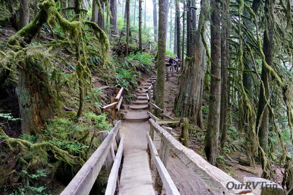
On a different day, we made it to Marymere Falls. The trailhead for this hike was right on the Lake Crescent shore. I loved the trail for this hike! Check out this bridge we walked over. (top right picture) It was an old log that the NPS had fashioned into a sturdy bridge across a stream. And check out all of the moss. This is what I’d always thought this area would look like. I had a specific vision in my mind of what hiking in the OP would be like…and this picture is it. This is what I thought it would be like…what I had hoped it would be like. You know how sometimes you get it in your head that something is going to be a certain way, but then when you get there it’s so different than what you’d thought that it’s a let down? This place totally held up to what I was hoping it would be. Actually, that’s not true…it was better. In the right picture you can see a little stream the bridge took us over. There was a path down to it. You can get a sense of how big the trees are in this area with this picture. Can you find the person in the lower right corner of this pic?

Here’s another picture of Lake Crescent for you. You can see more of it here and you can kind of see just a hint of the beautiful water color.

We saw so many deer! So, so many! And they weren’t real shy. Guys, don’t try to pet or feed the wildlife. We saw a few people actually trying to take selfies and feed/pet the wildlife. Don’t do that. If you frighten the animal and it harms you…the animal is the one who will suffer. Some parks are required to put down any animal who’s harmed a human. So, just don’t do it. Admire them from afar…take pics from afar, but let them stay wild. Oh! And Guys…check out the blue of this bird! It reminds me so much of the blue water in Crater Lake! There were a couple of these birds playing around while we did the Marymere Falls hike.

I’m realizing that there are tons more pics I want to add on to this post…so I’m going to break it up into two posts. I’m going to show you some foodies we found…and pick up with some more explorations on the next post!

Lets talk foodies for a minute! We hit a BBQ place our first night in the area. It was pretty good! Check out the sandwich one of the boys got. Huge! They ate it all. There wasn’t anything left. We found this little burger place in Forks while we were out exploring one day. You can’t tell, but that burger is huge! Huge! It’s sitting on a regular sized dinner plate. It was and 8″ or 9″ plate. Alex laid waste to this burger. Teenagers…whattaya gonna do? You’ve got to feed them. It’s a good thing we have a residential sized refrigerator in our home-on-wheels!

I found this pretty up on Hurricane Ridge during one of our excursions. Love the purple pretties!

Well, I’m going to leave off here this time. I’ll pick back up with some more OP adventures next time so stay tuned!

See y’all down the road!

#westernloop2018

Washington

Washington

We stayed in Washington for two weeks. We only did two things on our Washington list, but that’s ok…these two weeks were more about catching our breath after the long Alaskan Summer and the super long drive days through Canada to get back to the lower 48. We needed decompression time and we needed to get some maintenance/repairs done on the RV. The first thing we did once we crossed the US/Canadian border (after finding a spot for the night) was get some dinner. I don’t remember what the name of this place was…it was in Lynden, WA and it was good ole’ American food with good ole’ American prices!
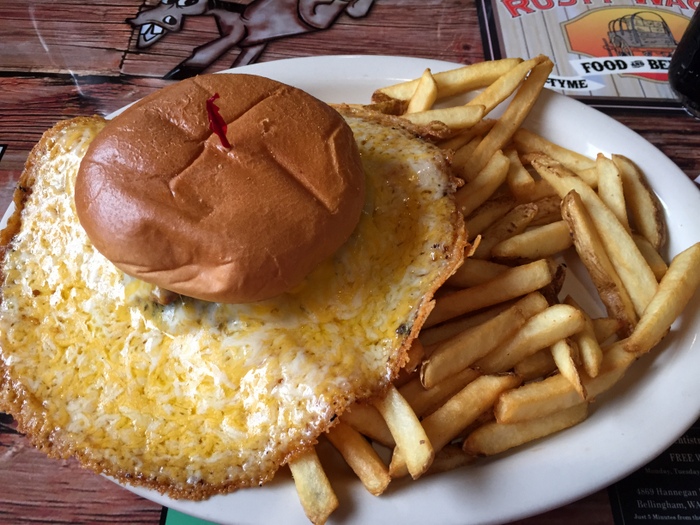
IMG_1209

I think this burger was called the There Can Never Be Too Much Cheese burger. It was amazingly good. We all got different things to eat, but I didn’t get pictures of anyone’s other than mine…we were too hungry and too tired to think of it.

The next day we headed to Olympia to check out the State Capitol Building.
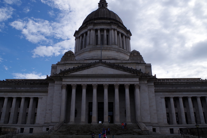
IMGP5831

It was very majestic, but then again…I do love the dome buildings with all of the columns.
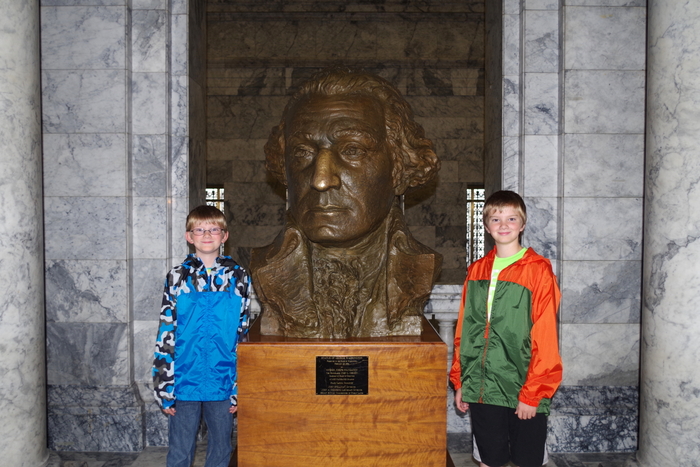
IMGP5813

We didn’t know until later that it’s supposed to be good luck to have your picture taken with this bust of Washington. The Little Boys are always up for being my models.
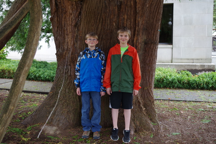
IMGP5852

We found this huge tree right next to the Capitol Building.
IMGP5863

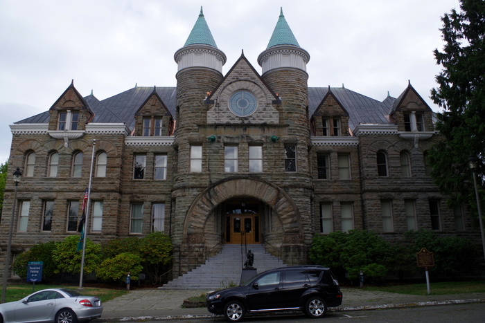
We found the original Capitol Building called “The Castle”.  I believe it’s aptly named.
IMGP5918

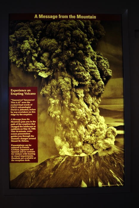
This year (2015) commemorates the 35th Anniversary of the May 18, 1980 eruption of Mount St. Helens. We spent two days exploring Mount St. Helens National Volcanic Monument. There are three sides of the volcano that you can explore and we hit things on all three sides.

map

The day we did the Johnston Ridge Observatory side of the volcano was rainy and cold.
IMGP5878

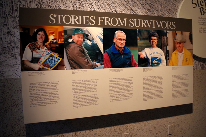
We started with the Forest Learning Center where we got our first real look at what happened the day Mount St. Helens blew her top. The Center had a short video to watch that had actual footage of that day shot by a cameraman who was close to the blast zone but not right in it. We were able to read stories from the survivors.
IMGP5882

IMGP5883

IMGP5884

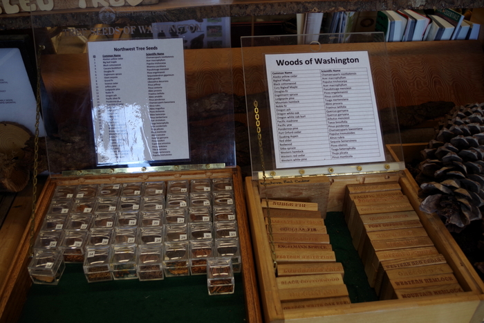
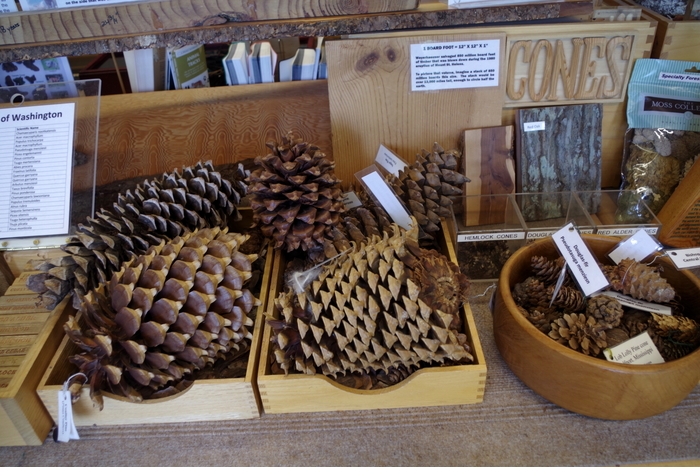
We spent quite a bit of time in the Discovery Room at the Forest Learning Center. I love it when there are things for the kids to pick up. We learned a lot that day about the forests of Washington in general.
IMGP5888

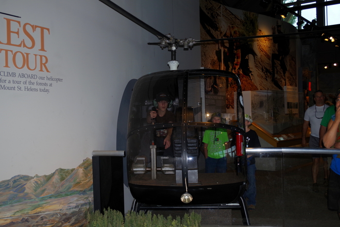
There was an actual helicopter at TFC that the boys could sit in and push all the buttons. They’re expert button pushers…
IMGP5949

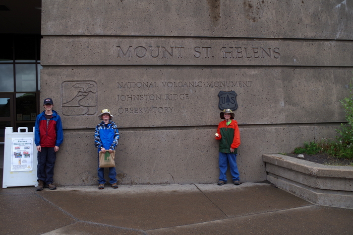
The Johnston Ridge Observatory is at the end of this road. We spent a good deal of time here exploring some of the hiking paths and listening to a Ranger Talk. The boys completed another Junior Ranger Program and got their eleventh badge.
IMGP5913

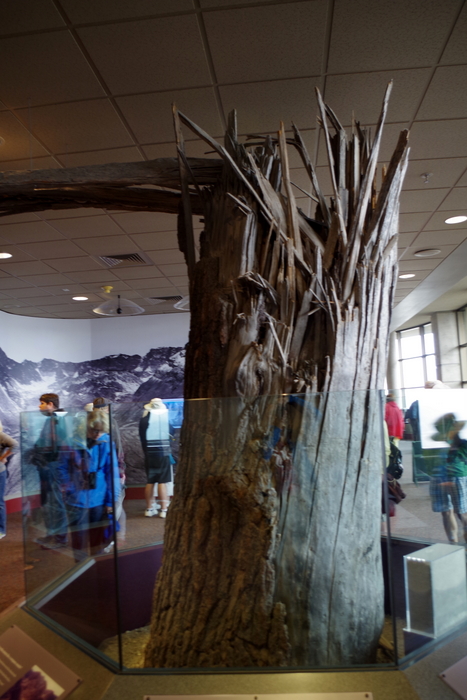
This is an actual tree. They’ve moved it into the Observatory. There’s a plaque that talks about how the force of the blast snapped trees like matchsticks.
IMGP5920

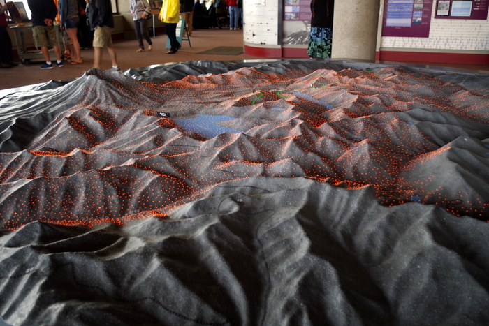
There’s also this really nice 3D model that explains what happened during the May 1980 eruption. There are colored lights that turn on and off as a recording explains the different stages of the blast.
IMGP5939

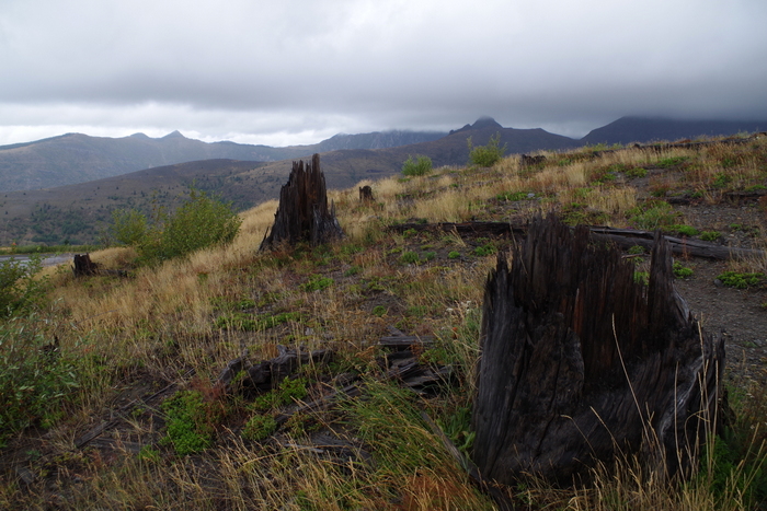
You don’t need a sign to tell you that you’ve entered the blast zone…you can tell. It’s still obvious 35 years later.
IMGP5945

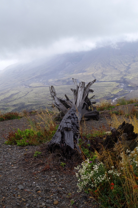
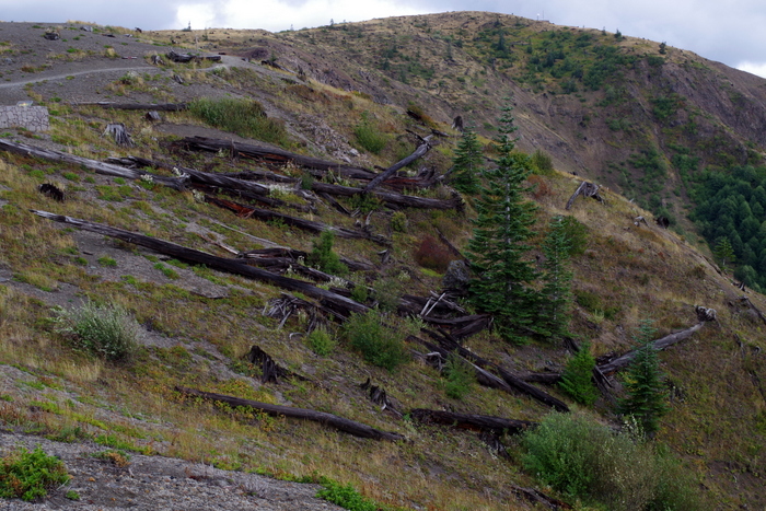
The forests around Mount St. Helens National Volcanic Monument were replanted and helped along, but the land within the Monument has been (for the most part) left alone so that scientist can see how nature takes it’s course.
IMGP5956

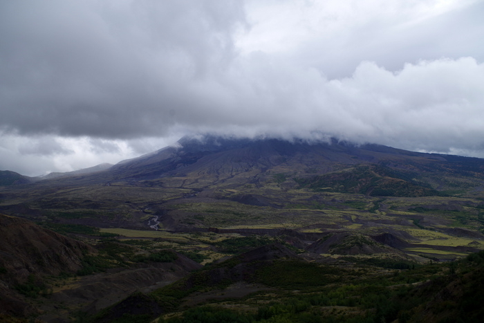
Because of this you can see trees laying right where they fell on that day back in 1980.
IMGP5955

This was the best view we got of Mount St. Helens that day.
IMGP5962

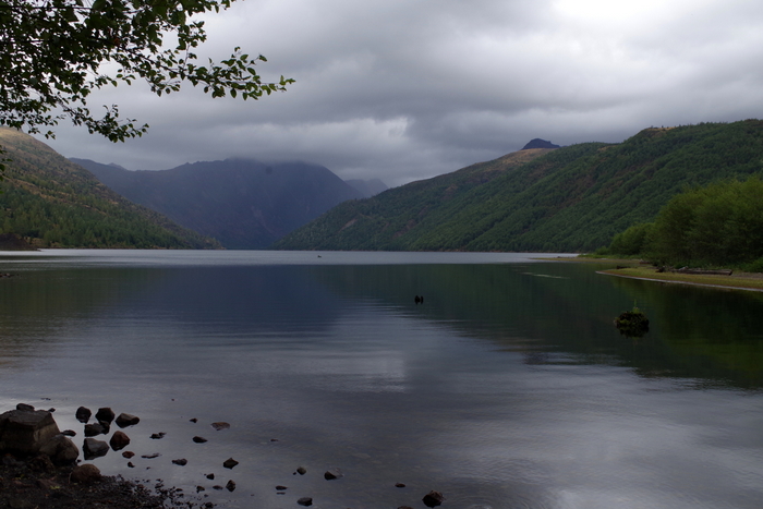
Some lakes, like the one above, were made because of the 1980 eruption.
IMGP6024

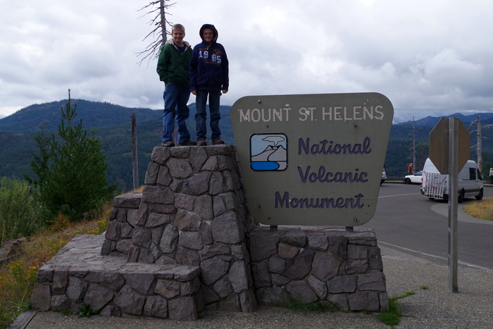
The next weekend we went to the other two sides of Mount St. Helens. While I enjoyed the Johnston Ridge side, I like the other two sides better. There aren’t any big visitor centers like over at Johnston Ridge, but there are more scenic views and trails with interpretive signs.
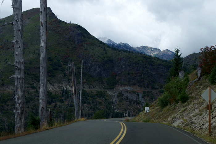
 IMGP6030This area is right at the edge of the blast zone. Not all of the trees were knocked over, but all of them were killed by the heat of the blast.
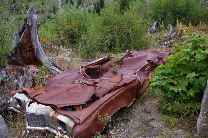
IMGP6044

In the photo above you’ll see what they call Miner’s Car. The Pontiac belonged to a family who hiked to the Black Rock copper mine claim, about 8 miles from Mount St. Helens. On the morning of the eruption, Mount St. Helens released a 300 mph lateral blast of searing gas, ash, and rock that flattened the forest and took the lives of the family. The NP leaves the car where it is to remind people of the 57 people who lost their lives.
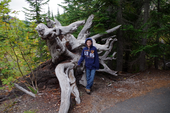
IMGP6056

At the Meta Lake site, there’s a small trail down to the water. All along the trail are reminders of what happened.
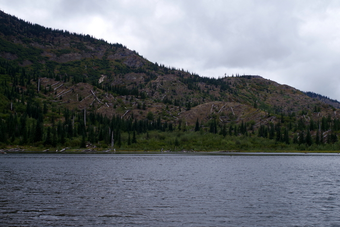
IMGP6057

Meta Lake was protected by a cover of mushy snow and ice when the blast came. The layer of snow and ice protected the small plants, bugs, and animals burrowed under it and by the next summer signs of life started returning to the mountain.
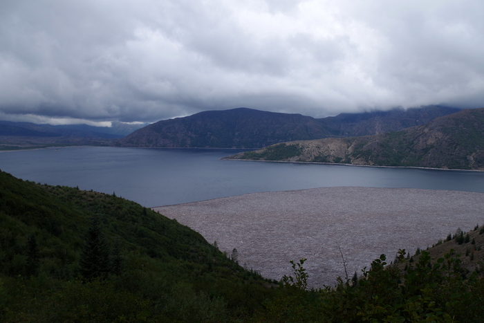
IMGP6070

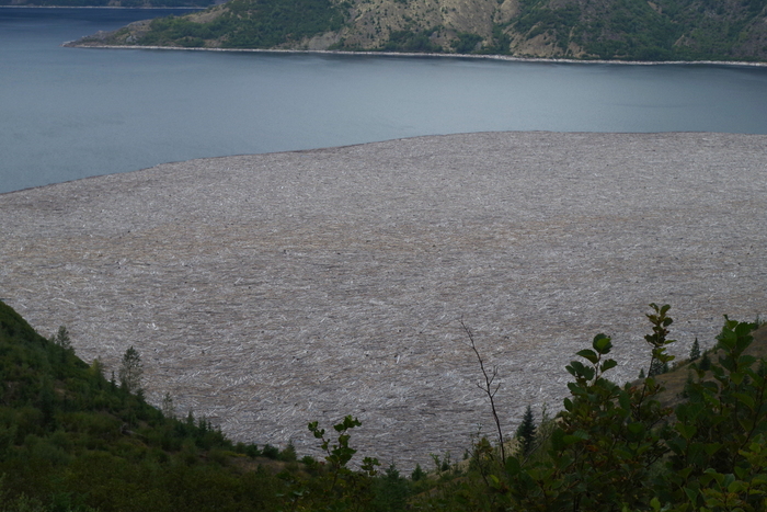
In a matter of seconds, the May 1980 eruption destroyed cabins, camps, and forests. The mud slide that came down the mountain plunged into Spirit Lake (seen above) causing the surface of the water to raise 200 feet and submerge the sites.
IMGP6072

With the mudslide came thousands of trees felled by the blast. You can still see them on Spirit Lake. There are signs up warning people not to try to walk on them because they’ll plunge to the bottom.
IMGP6110

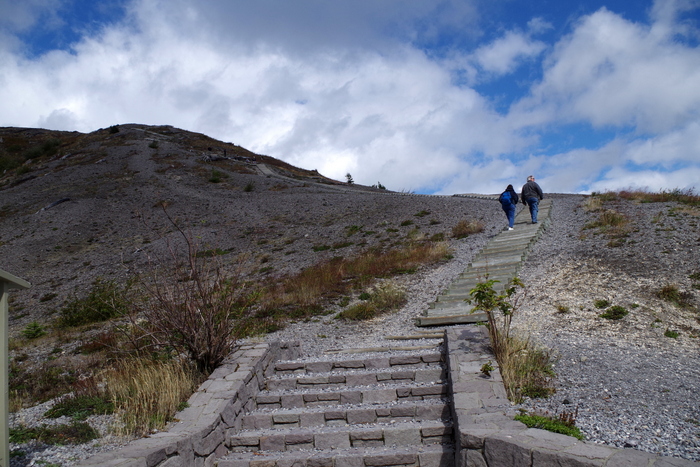
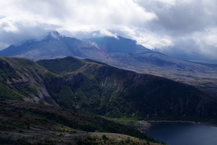
At the Windy Ridge Interpretive Site, you can walk up the nearly 400 stairs (yes, we counted) to get a view of Spirit Lake and the Crater of Mount St. Helens.
IMGP6104

It was cloudy this day too, but we got to see a little of the top and some of the glacier inside.
IMGP6111

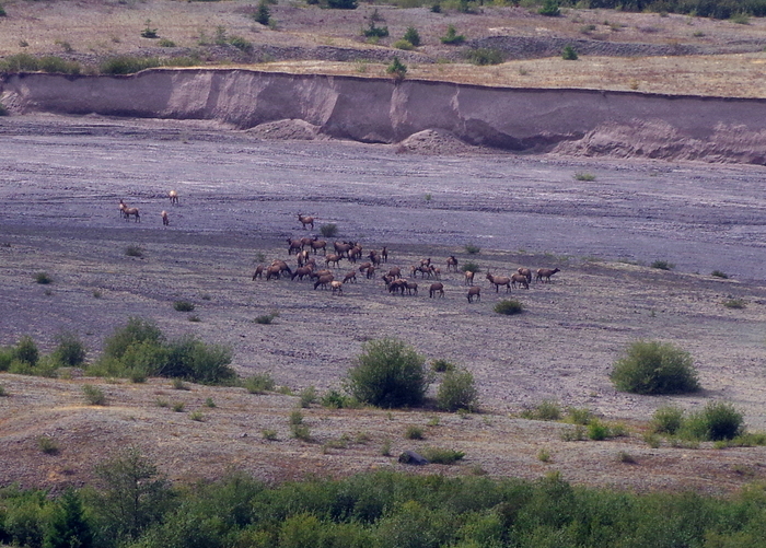
We sat in our car after climbing all of those stairs and had lunch. There was a big herd of Roosevelt Elk to watch while we ate. Elk were one of the first animals to come back to the mountain after the blast.
IMGP6120

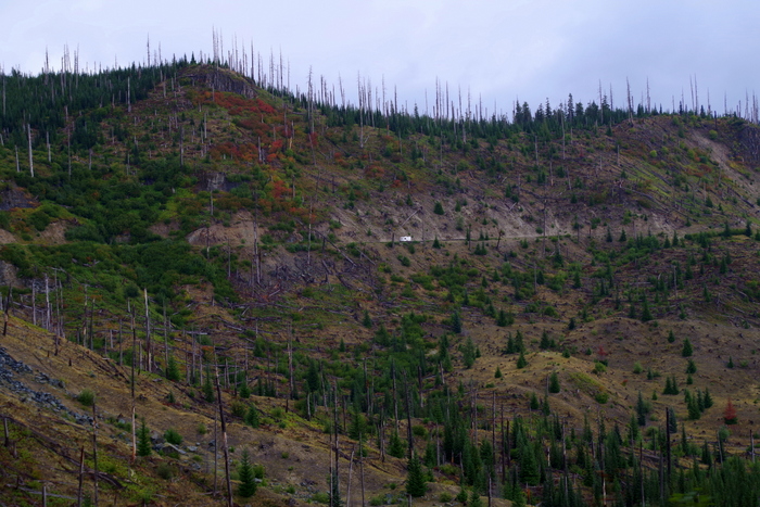
Here’s another picture of the edge of the blast zone and all of the dead trees still standing. If you look really closely toward the middle of the photo above, you can see an RV on the road. It kind of gives you a good idea of the size of the mountain.
IMGP6158

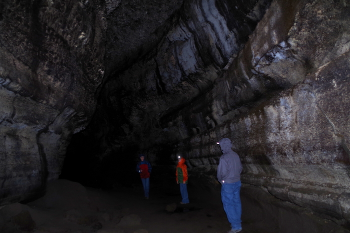
Our next stop was Ape Cave. Ape Cave is a lava tube that was formed about 1,900 years ago. Ape Cave marks an unusual part of Mount St. Helen’s eruptive history. It was the only time in it’s 300,000 year existence the volcano erupted red, hot flowing lava (like what you can see in Hawaii).  Mount St. Helen’s lava is thicker and doesn’t run…it’s more of an ooze.
IMGP6163

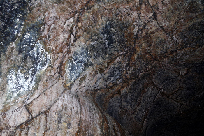
Can you see the white stuff in the picture above? That is mold. Fungus. And it’s apparently really important to the cave. We saw signs not to touch it because it takes a long time to grow back. Ape Cave is the third longest lava tube in North America. It has a constant temp of 42°F and is pitch black. Complete and total darkness. We had planned ahead and brought some flashlights and some headlamps. We saw people walking around with just small dingy lights though. I wouldn’t suggest that…the floor isn’t smooth…it was made from lava and if you fall you can slice your hand open.
IMGP6172

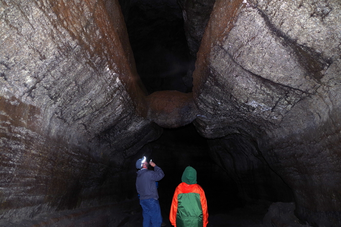
In the photo above, you will see Jerl and Alex looking at “The Meatball”. Yup. The Meatball. What the heck is The Meatball? Well, it a chunk of round lava that fell from the ceiling while lava was still flowing through the cave. The chunk floated on the surface of the lava and was carried downstream until it got wedged in the narrow spot you can see it in today.
IMGP6192

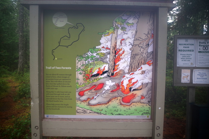
I didn’t really know what to expect with The Trail of Two Forests. When we got there, it was raining and we were the only people silly enough to still hike it. But it was on a boardwalk, so it wasn’t bad at all. At the Trail of Two Forests you get to walk among casts of old-growth trees buried by lava 1,900 years ago during one of Mount St. Helens previous eruptions.
20150905_184740

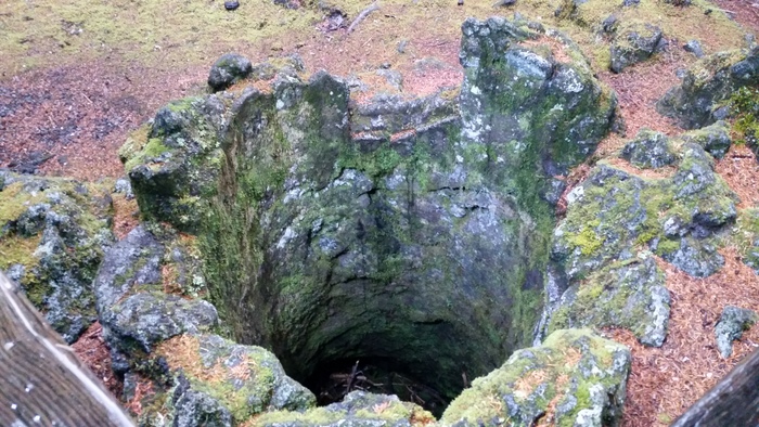
In the photo above you can see a tree cast or mold. The lava would flow around the tree and catch the trees on fire and then the trees would burn up. Over time, the charcoal left by the burning tree erodes away leaving behind a cast or mold of the tree. There’s a set of these molds that make a tunnel called “The Crawl” where you can actually crawl through the tunnel to an exit.
20150905_185209

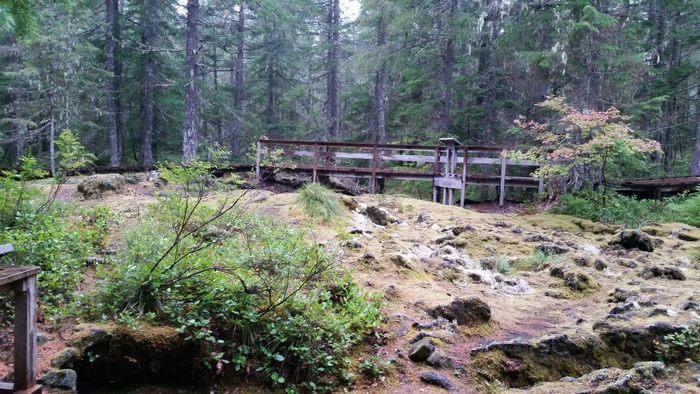
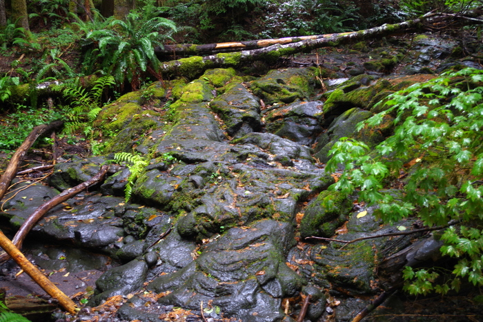
You can see the lava bed all around the ancient forest.
IMGP6144

It’s really pretty neat. We only had two days to explore this area. I would have loved to spend another two so we could’ve taken our time and done a few more hikes. I wanted to do the Lava Canyon hike, but we didn’t make it there this time. Luckily, we’ll be back to Washington to do the rest of the stuff on our list!
IMGP6005

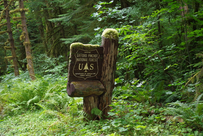
We drove in and out of the Gifford Pinchot National Forest during our Mount St. Helens explorations. I had to get a shot of this sign so y’all could see how the moss grows on everything in this part of Washington. It’s really everywhere. We’d originally planned on staying in Washington for a month or more to do our entire list for the WA state, but after Alaska…we were kind of done with cool, wet, and green. So, we decided to head South for the winter.
IMGP5988

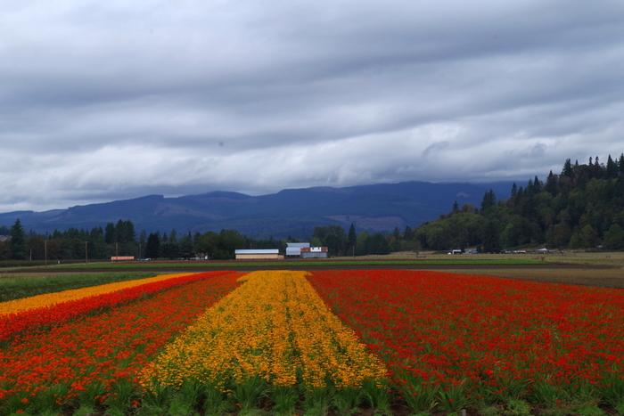
I wanted to share the only splash of color in the sea of green… This was a flower farm. I’m hoping to make it back to Washington in the Spring to see all of the tulips!

See y’all down the road!!