Category: California

Gilroy, CA

Gilroy, CA

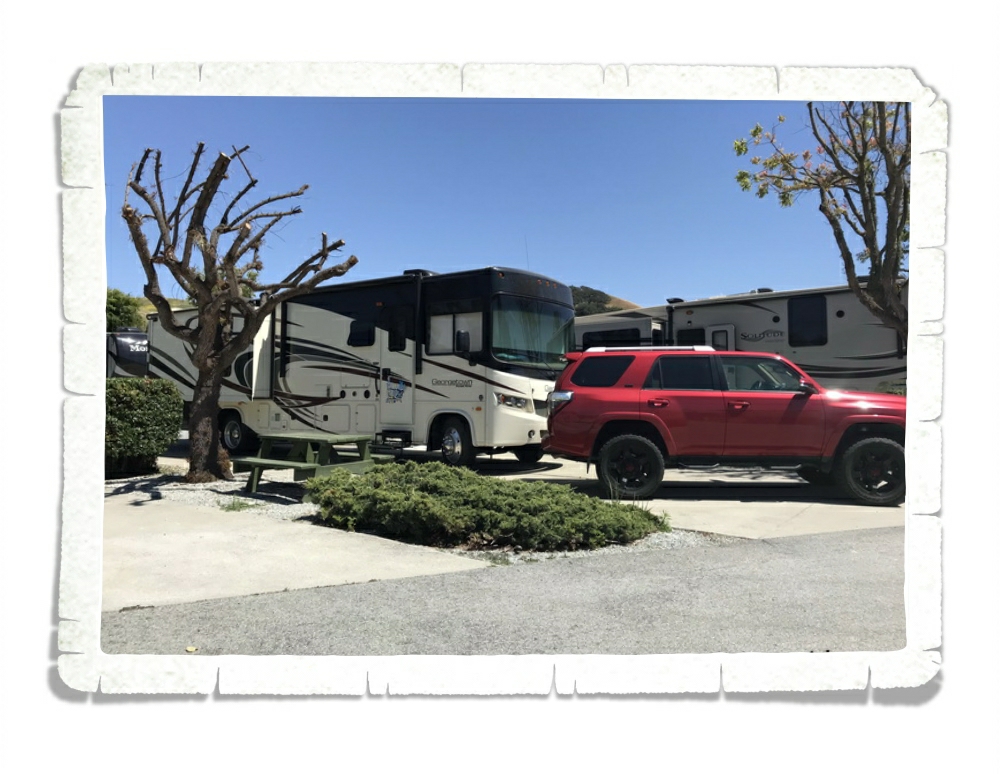
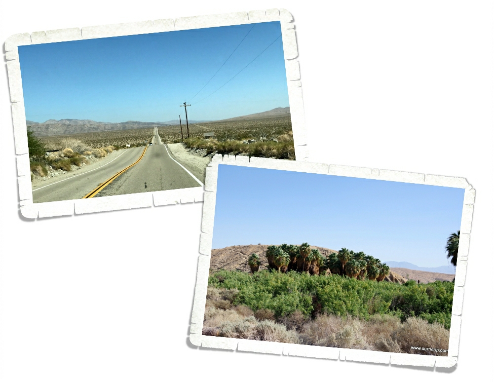
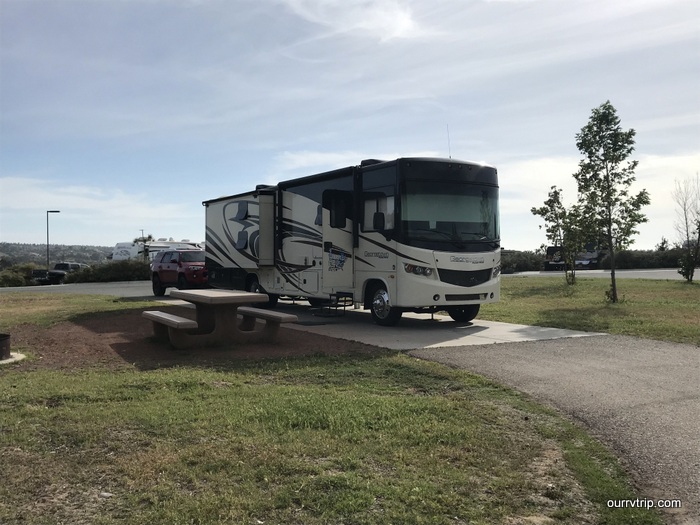
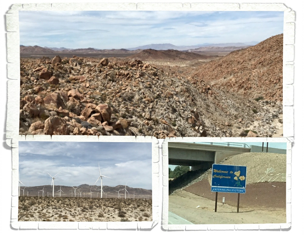
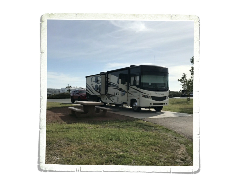
We spent two weeks in the Gilroy area of California. We wanted to explore some of the coast and hit a National Park there. When I pick places to stay, one of the things I look at is cell service strength. We have to have decent Verizon service so work can be done. In three years, we’ve only had to move once due to lack of cell single. We almost had to move from this area. We weren’t that far from a big city, but there were so many people the bandwidth was completely bogged down. It was bad. The area it’s self was pretty good! We enjoyed it!

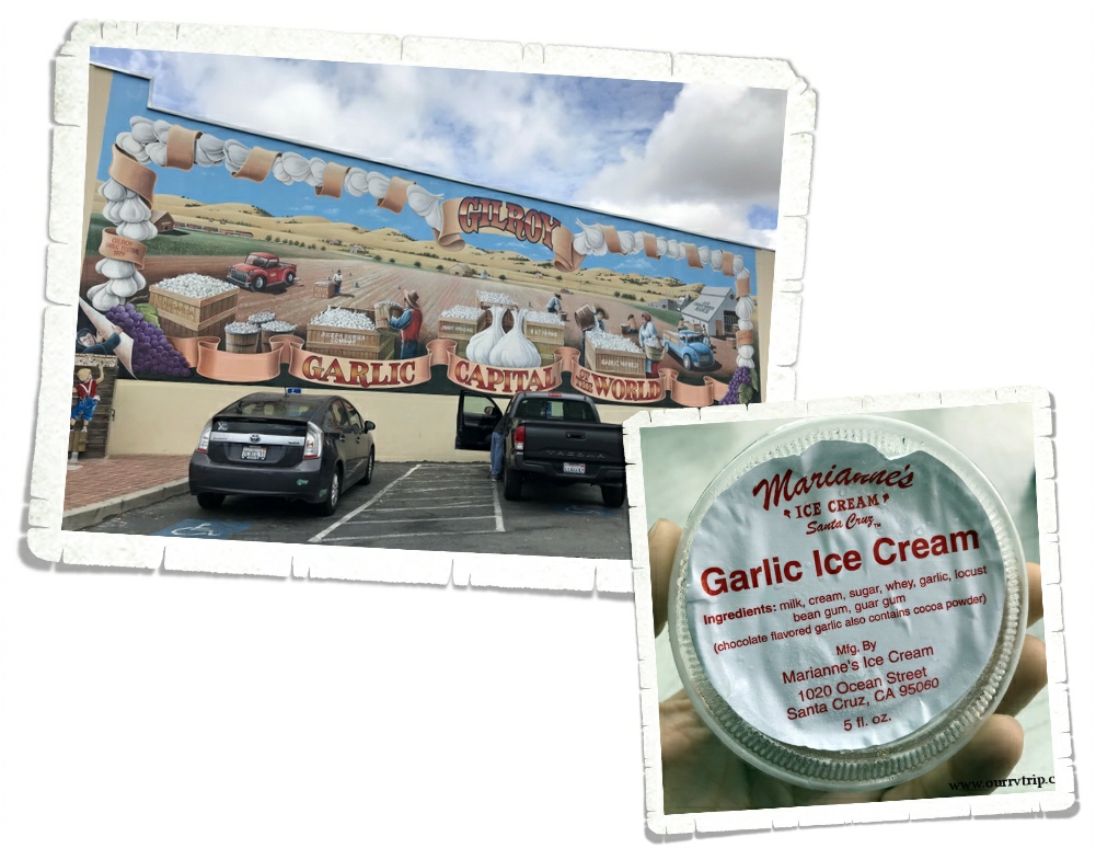
Welcome to the Garlic Capital of the World! Gilroy is all about the garlic. You can get garlic flavored…everything. And I do mean…everything. We tried the garlic ice cream. The garlic flavor was so light that we couldn’t really taste the garlic much.

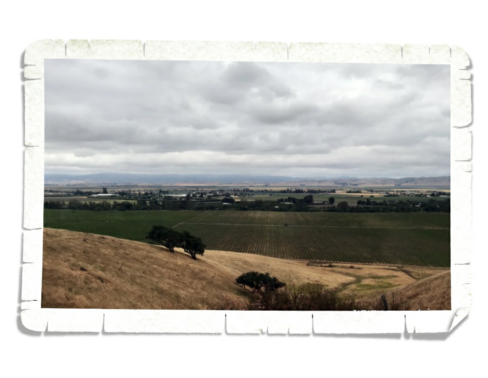
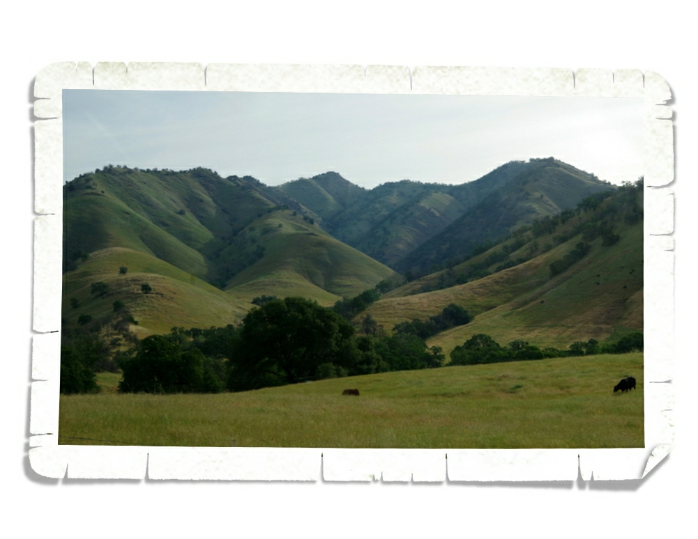
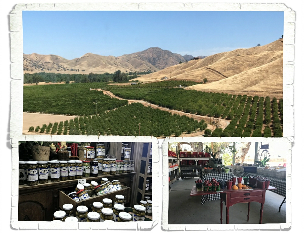
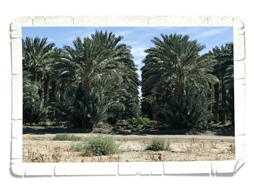
This entire part of California is a heavy agricultural area. If a house or business isn’t sitting on some land…it’s being used to grow something. One of our favorite things to do was try and guess what was growing in the different fields. Have you ever seen artichoke plants? They look pretty crazy!

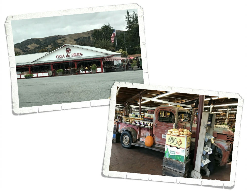
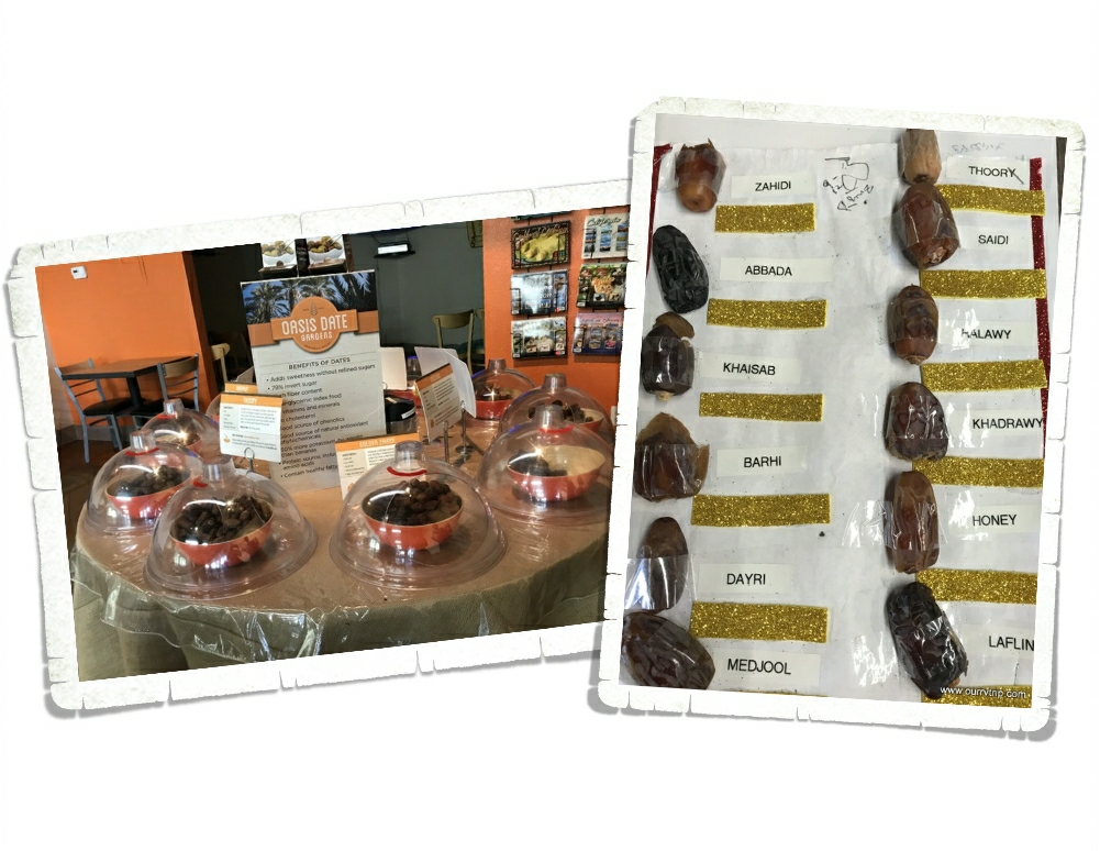
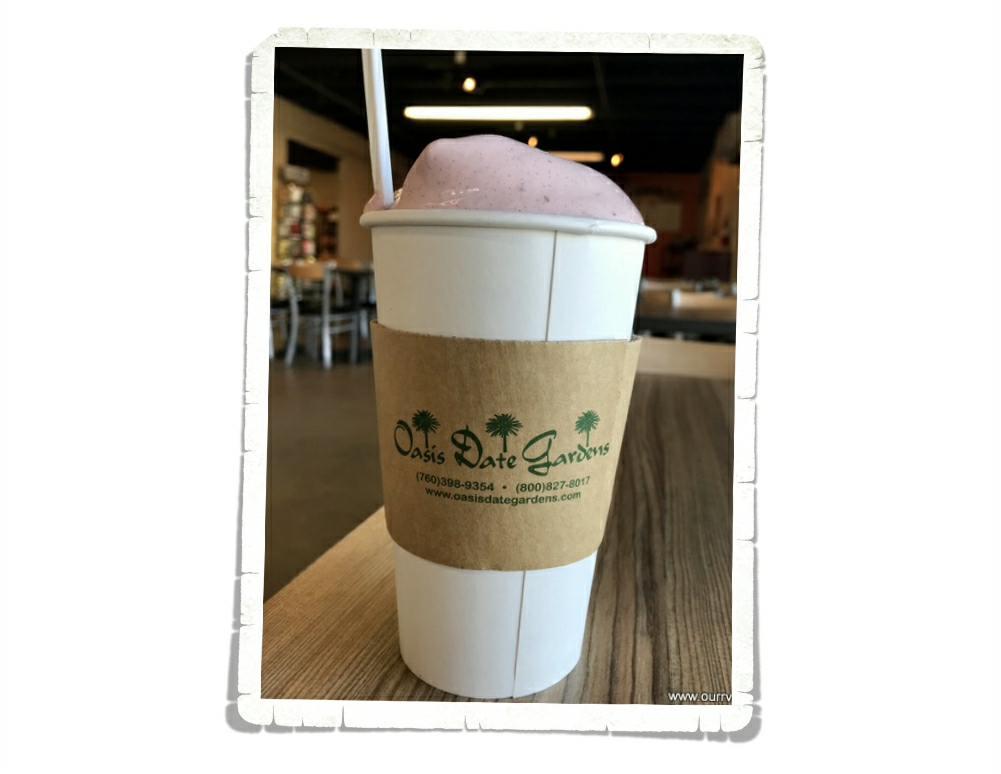
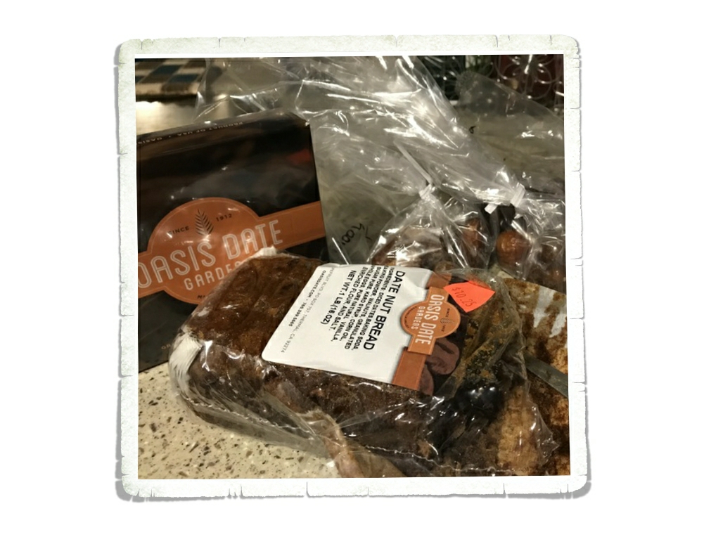
All those fields of veggies and fruits meant tons of little farm stands…and some not so little stands. Casa de Fruta is one of those touristy places we usually try to avoid, but a friend of ours told us we had to see it. She was right! We stopped on our way out of the area and it was pretty cool! So many different local fruits, veggies, nuts, and candies! I’d never seen so many different flavors and styles of garlic. There were honey, jams, jellies, dates and nuts…I could have spent several hours looking at everything.

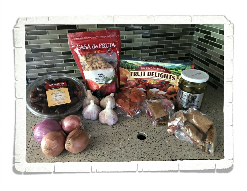
We had to stock up on a few things. We could have easily spent way too much on all of the yummy looking treats here!

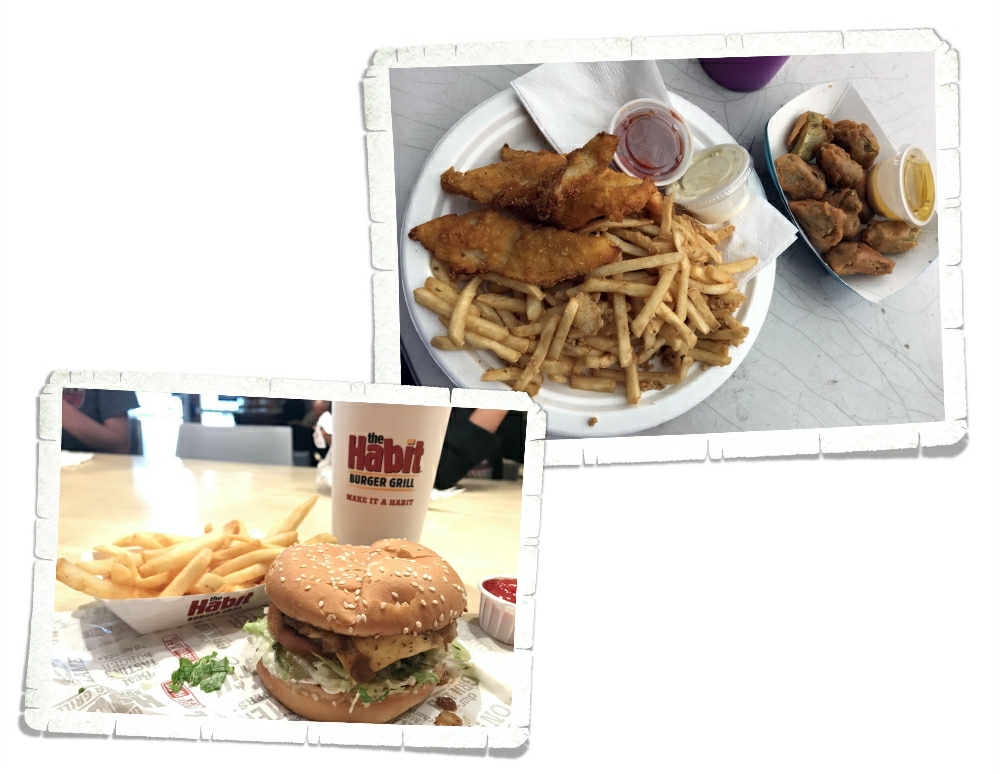
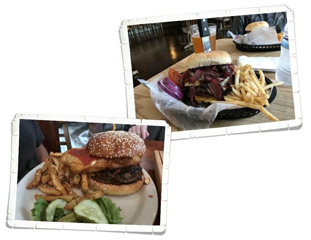
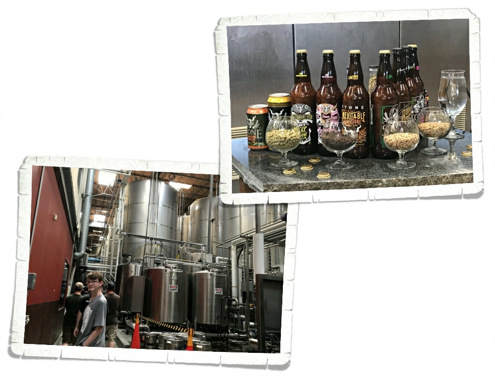
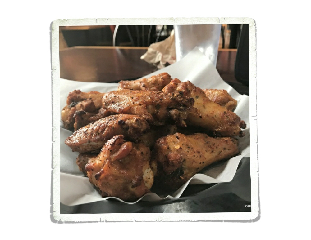
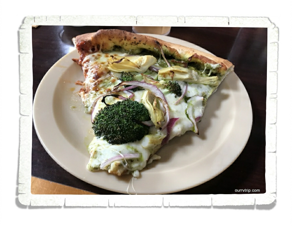
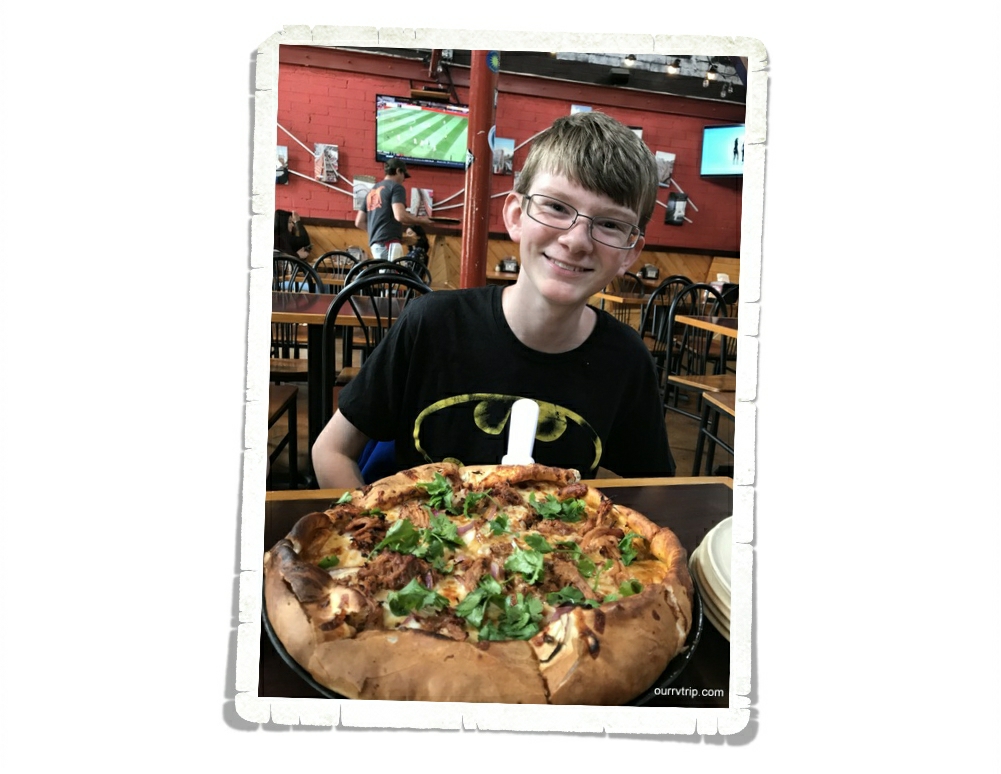
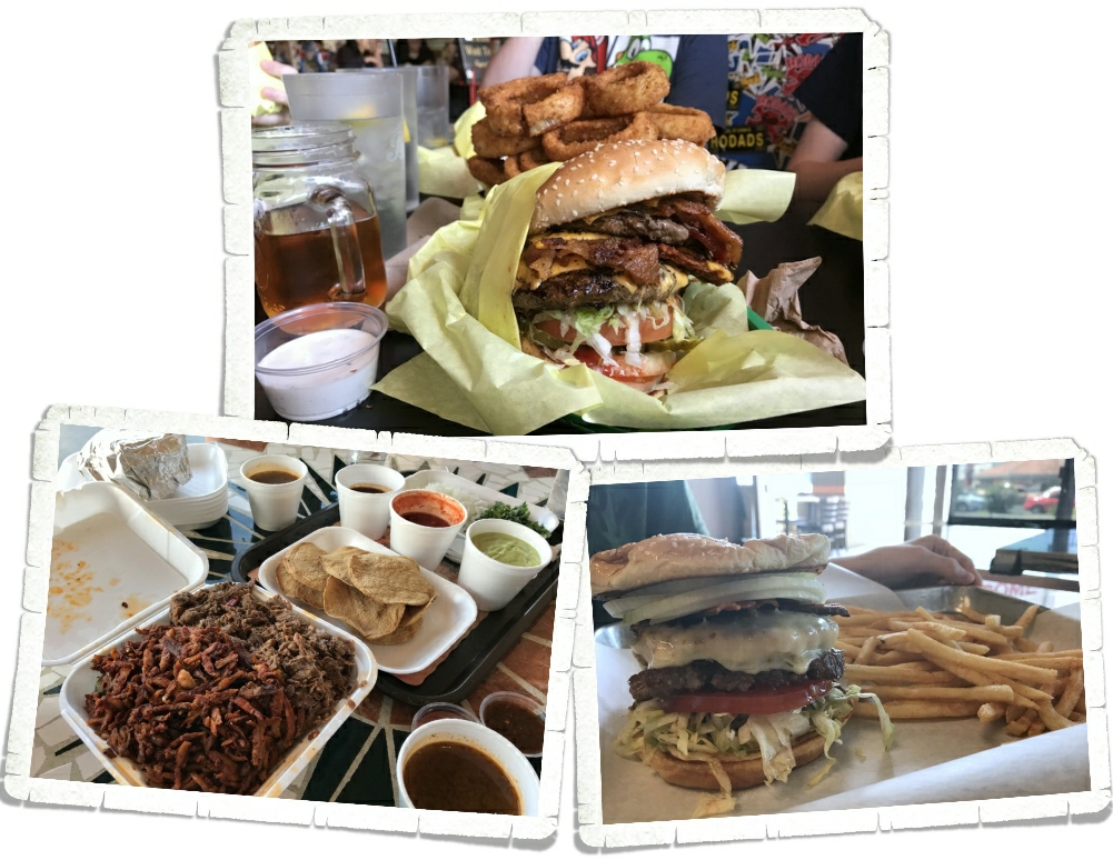
We found a fish-n-chips truck called Ketch It outside one of those fruit and veggie places. Guys…it was the best fried fish we’ve ever had. Ever. And the garlic fries…top notch! We went back twice…we would have gone one more time, but the timing was off. We will forever compare all other fish-n-chips to these. We also found a burger place. The Habit. It’s fast food, but better. We like them better than In & Out and Five Guys and so far in California we’ve seen Habit stores in most areas we’re staying in. We try not to eat out too often, but it does happen.

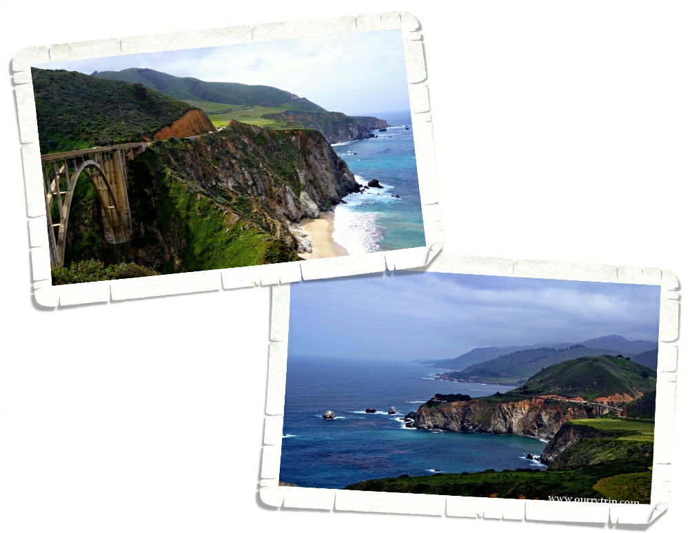
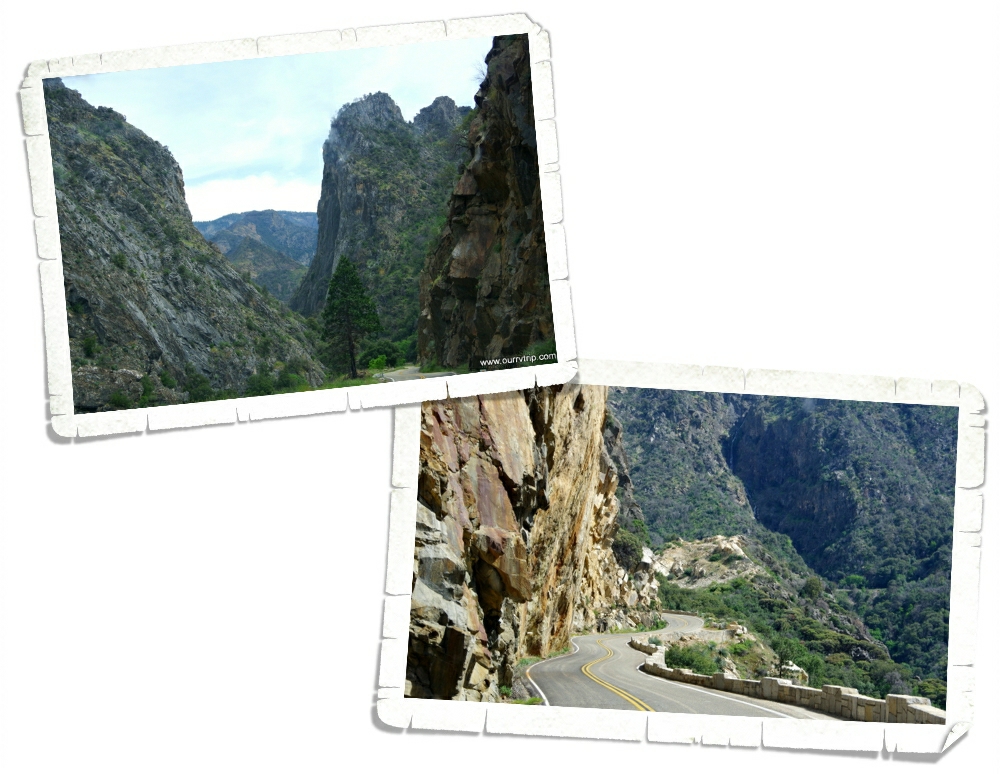
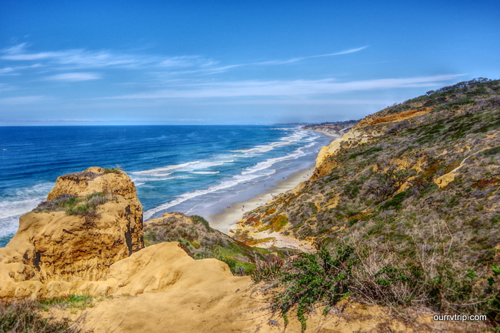
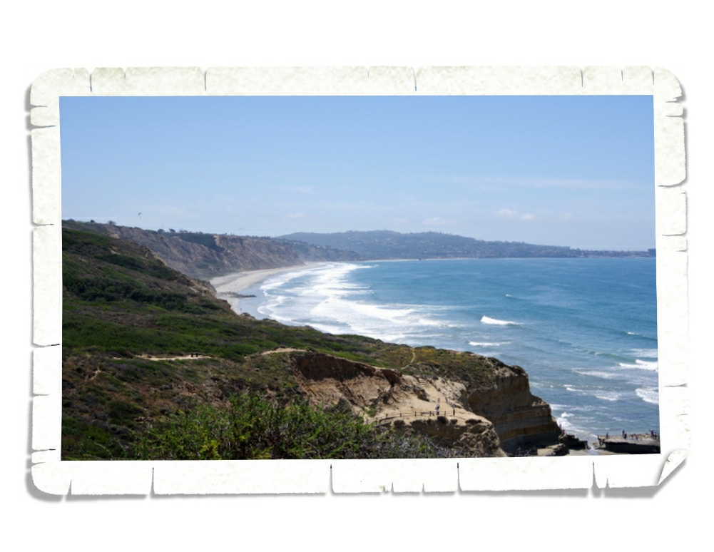
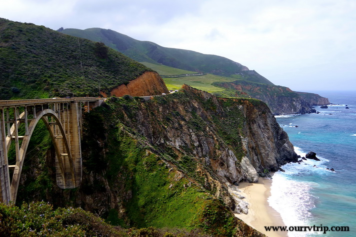
We spent a day driving highway one. The road is as snaky as you’ve heard and the views…are even better than you think they’re going to be. Luckily, there were tons of pull-offs so we could safely gawk. And we did. We gawked and ogled and said wow more times than we thought we would.

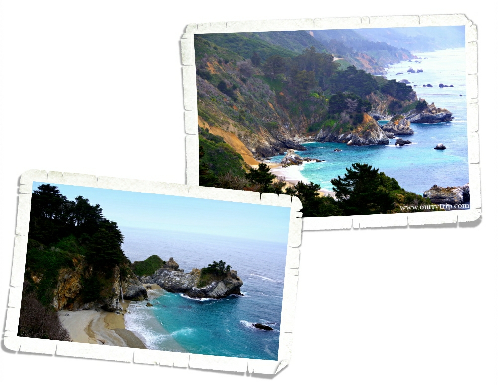
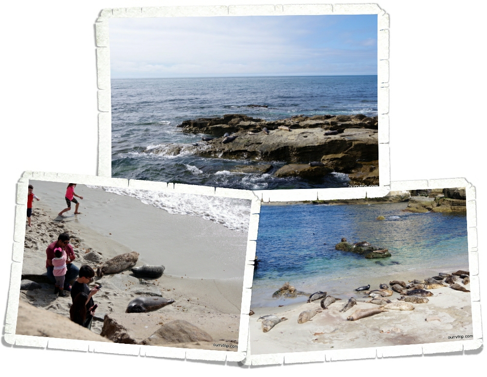
To be honest, it was better than I thought it would be. I’d seen pictures, but you know we compare everything to Alaska and Maine. I thought…how could it be anywhere near as great as Alaska or Maine…but Guys, it is. It’s gorgeous! And the color of the water even on a cloudy day was so pretty. We started near the Monterrey Bay area and made it down to the Julia Pfeiffer Burns State Park to see the little waterfall. We had to stand in line to get a glimpse of it. The crowd was not the best but it was pretty though! It was worth wading through the crowd and standing in line to get a glimpse.

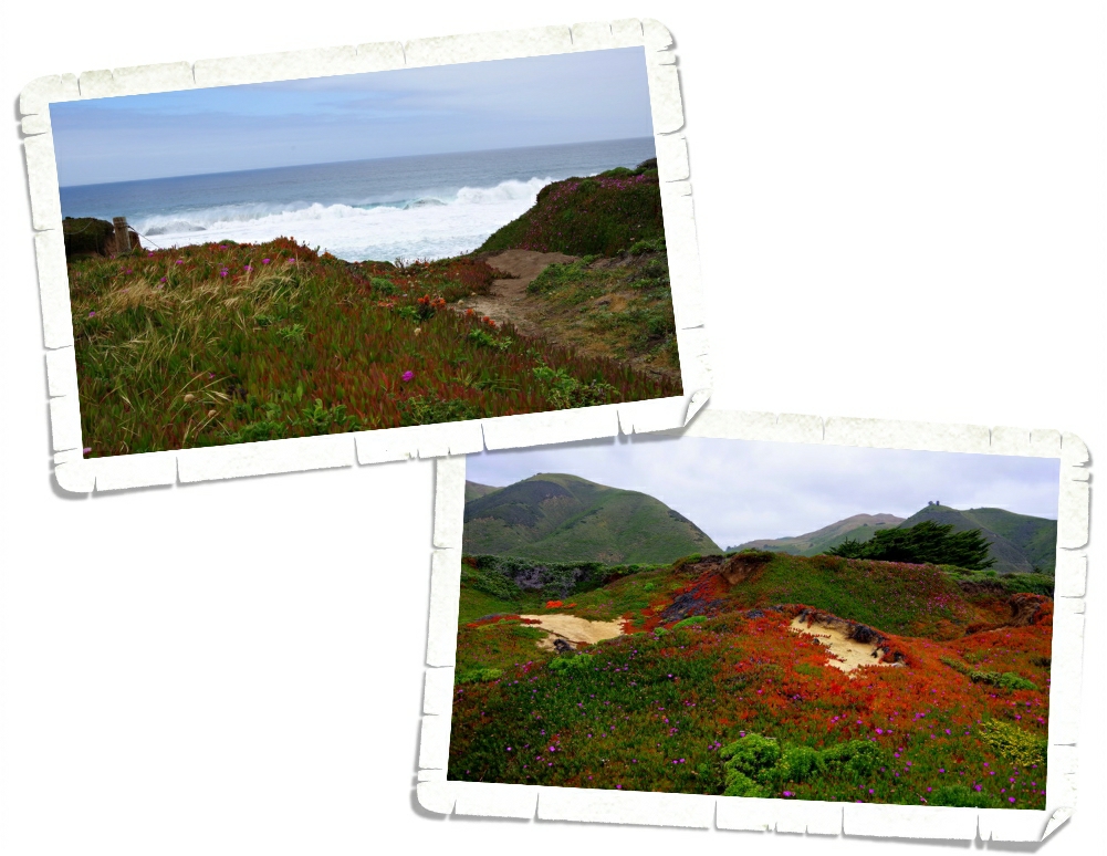
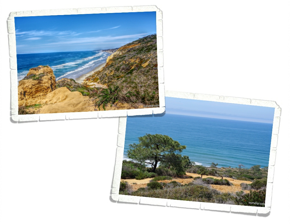
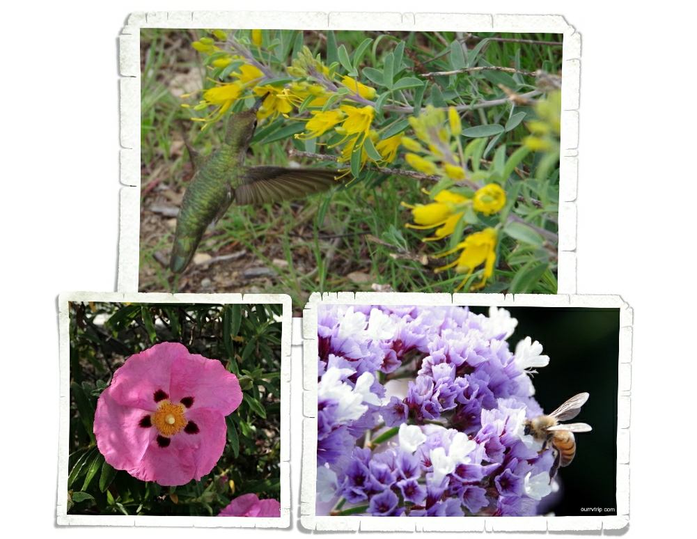
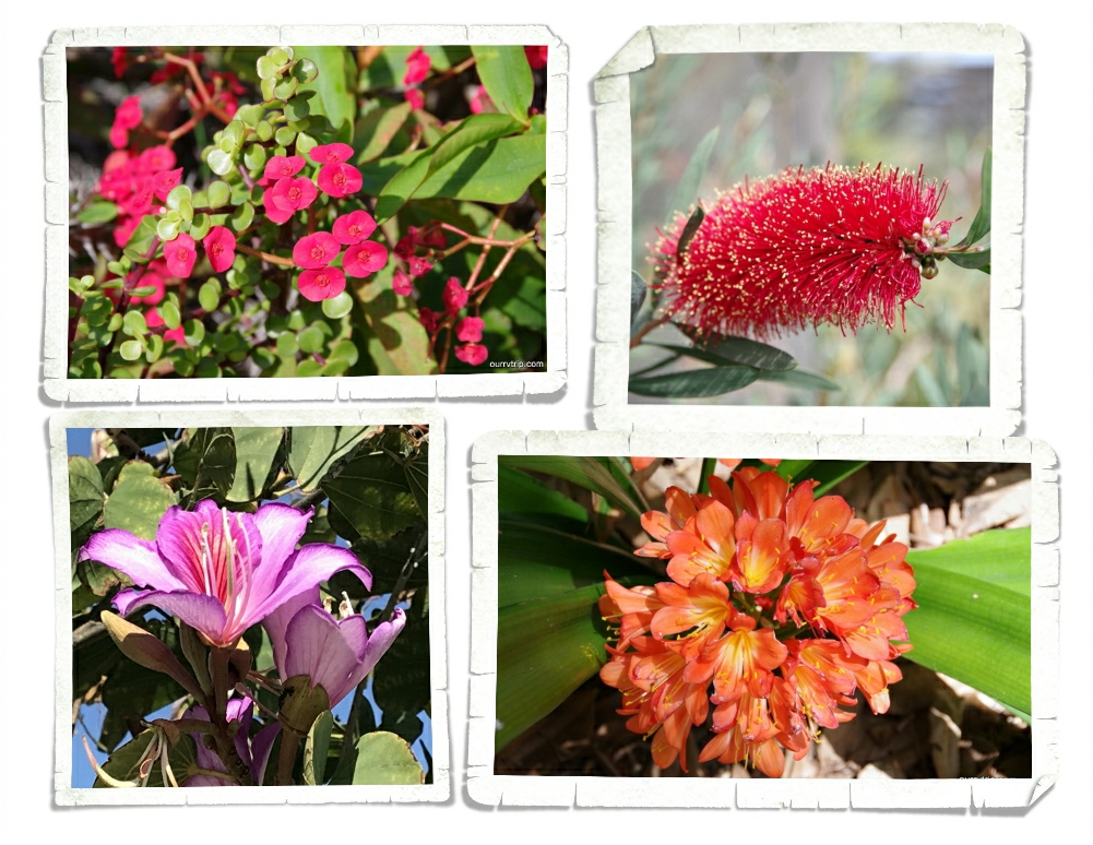
Garrapata State Park was probably my favorite stop of the day. I love love love all of the flowers right next to the beach! I mean…look at those colors!! When we started out that morning we were pretty much on our own. Not that many people out and about. But, by mid-morning the people found us and we decided to call it quits on the exploring.

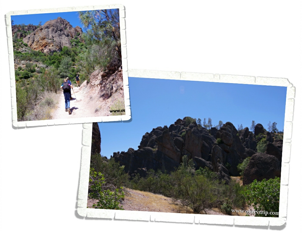
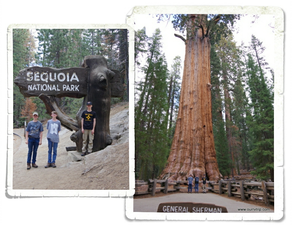
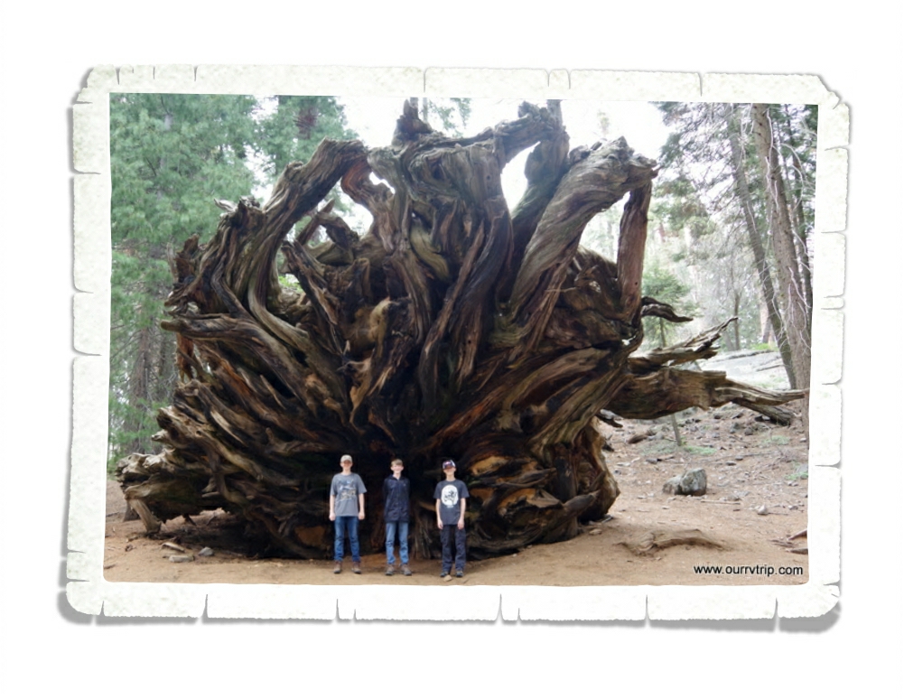
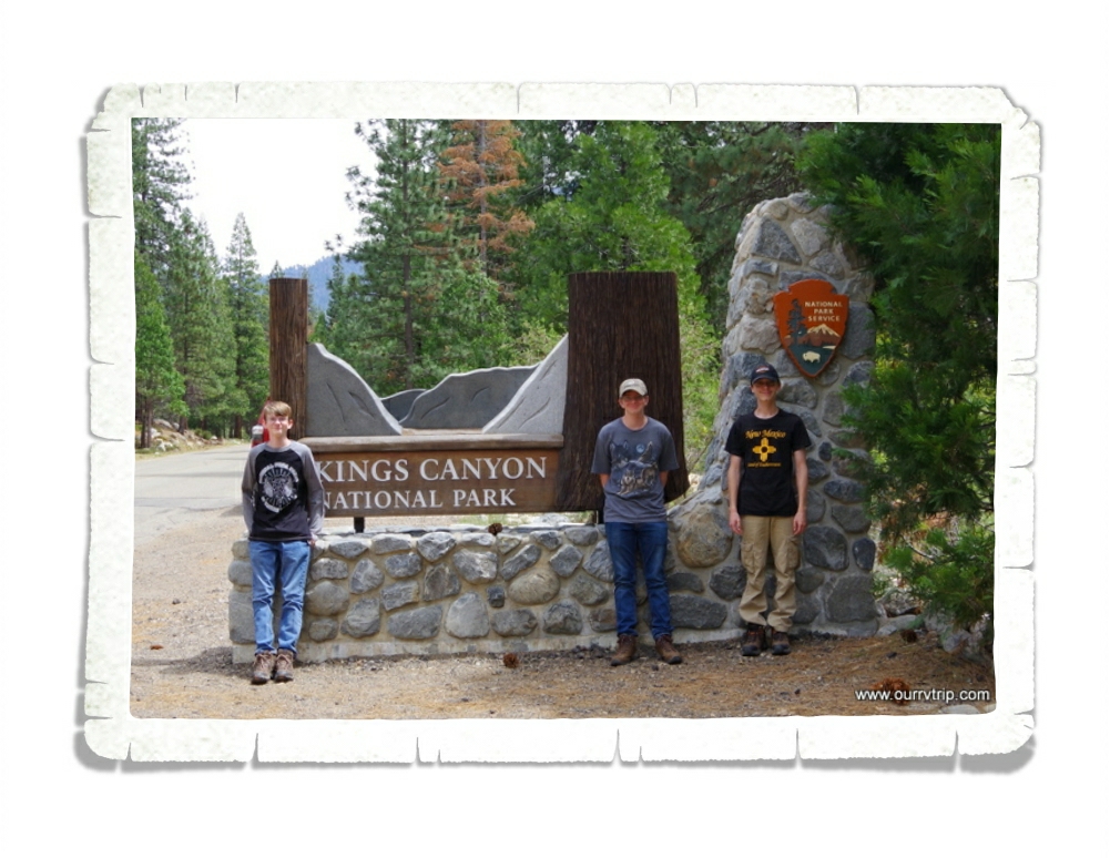
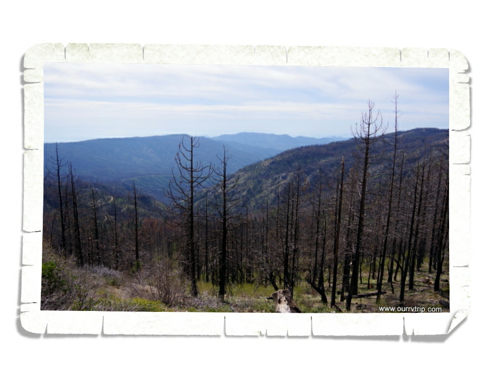
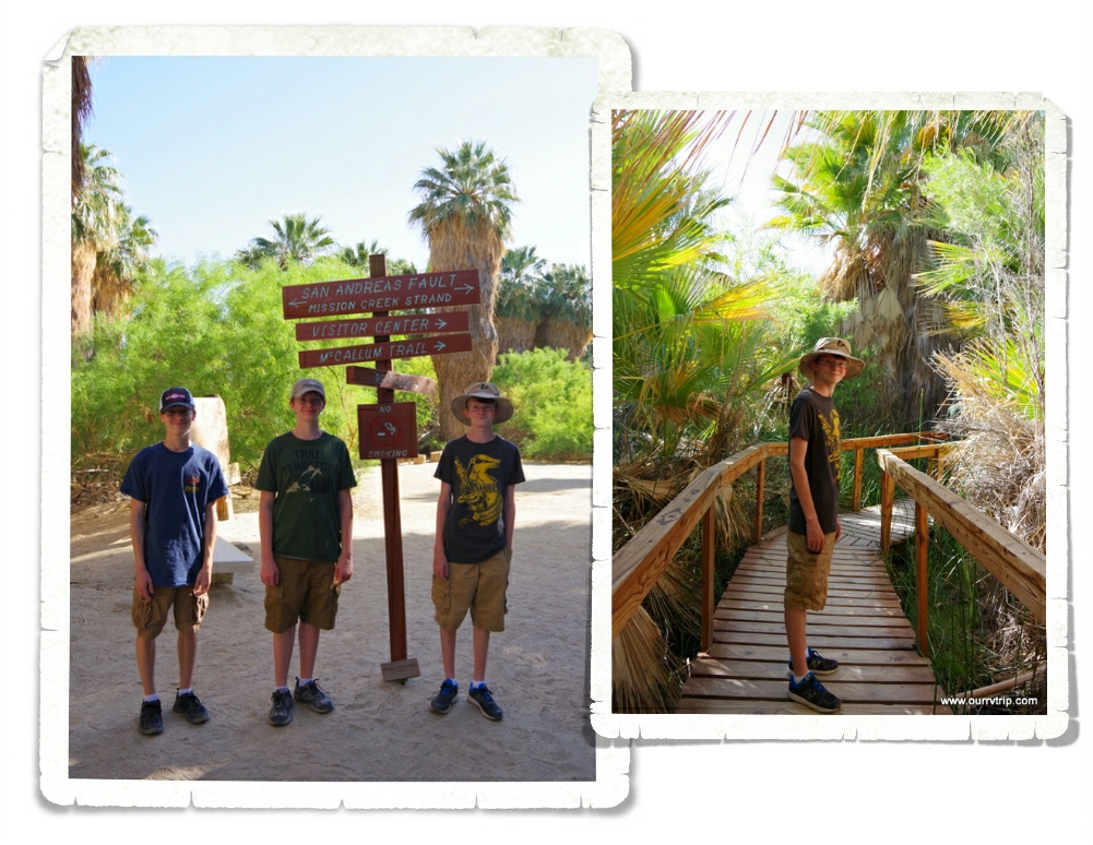
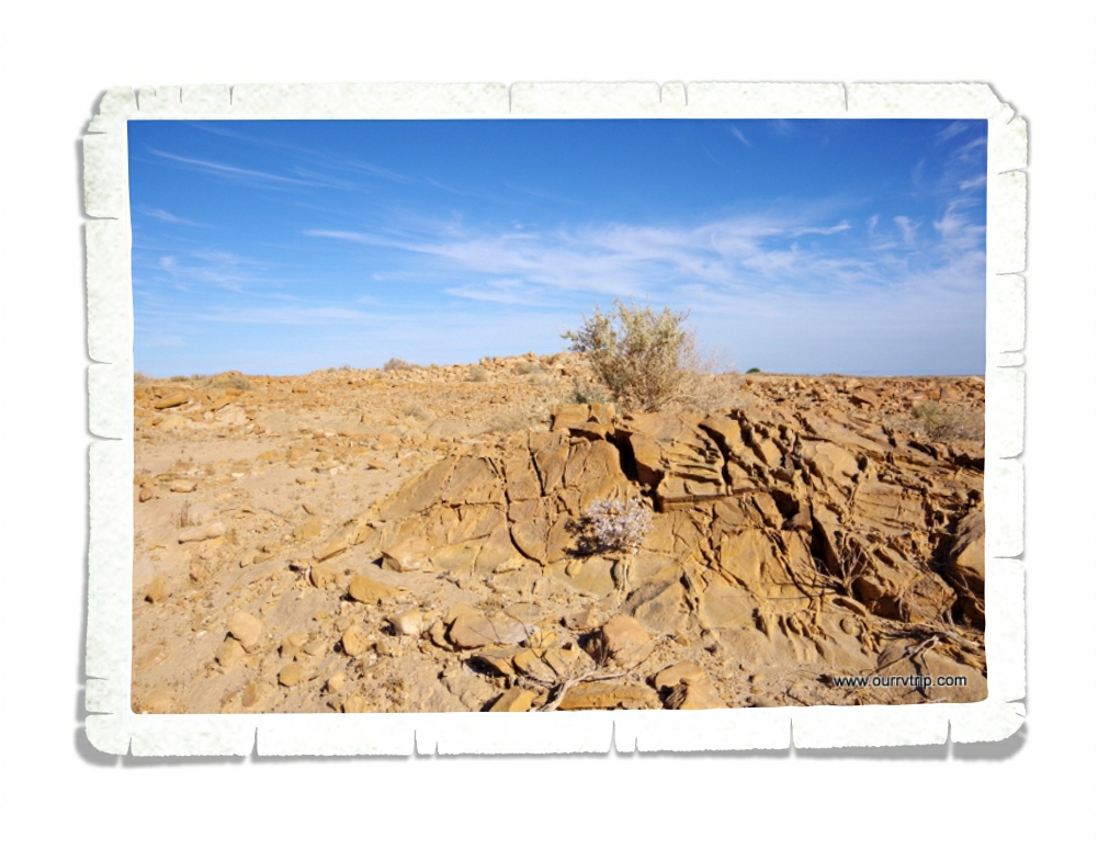
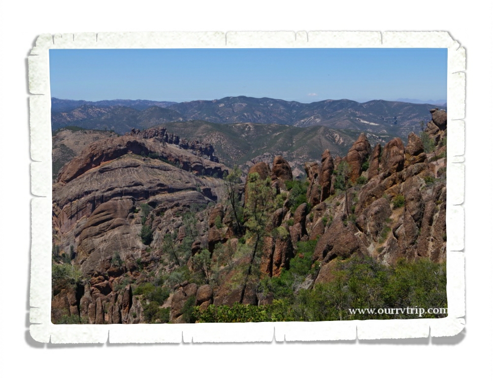
Pinnacles National Park was a surprise. I actually found it after I’d made our reservations. It was a happy coincidence that we were close enough to go check out Pinnacles NP. We only got to visit once, but there’s enough to do for several visits. Pinnacles NP is part of an old volcanic field that sits near the San Andreas Fault Zone. There’s not a lot of parking at this NP. You have to park at the visitor center then ride a shuttle bus back to the hiking. So be prepared for that.

We were about a mile into a five mile hike when Nicholas started not feeling well. He pushed on a little more, but just wasn’t feeling it. Nicholas, Alex, and I ended up turning around while Jerl and Charles finished out the hike. We were so bummed to miss the hike, but it was a really hot day and the heat was making Nicholas feel even worse. Luckily, we’d packed a lunch so the three of us made our way back down to the visitor center where we sat in the shade and had our lunch while we waited. The food and the cooler temps in the shade helped.

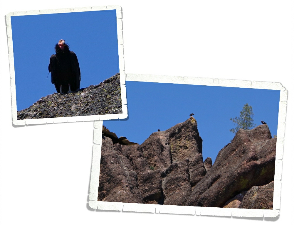
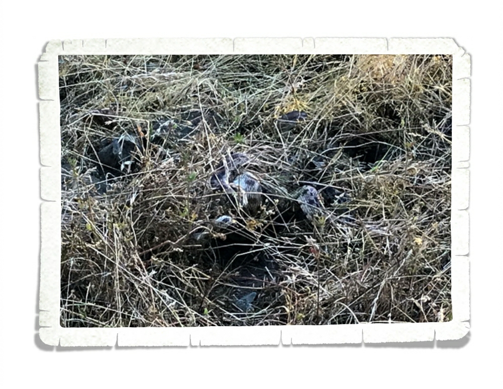
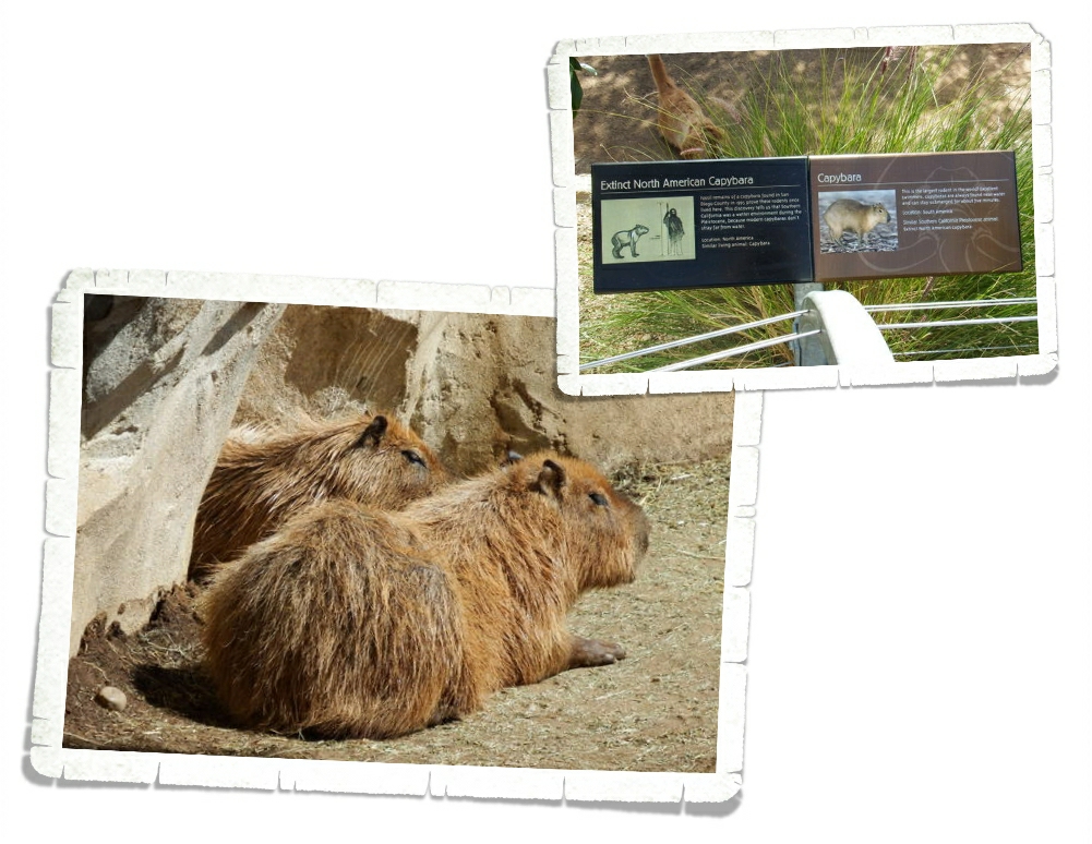
The main reason we wanted to visit Pinnacles was to see the California condors. Pinnacles National Park is a nesting area for them and is one of very few release sites in the US for the big birds. Weighing in at around twenty pounds with a wingspan of nine and a half feet, the California condor is one of the largest birds in North America. They’re certainly not the prettiest bird…but they are awe inspiring.

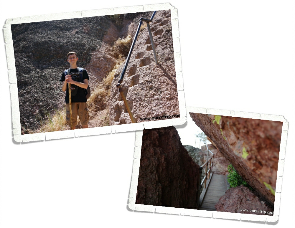
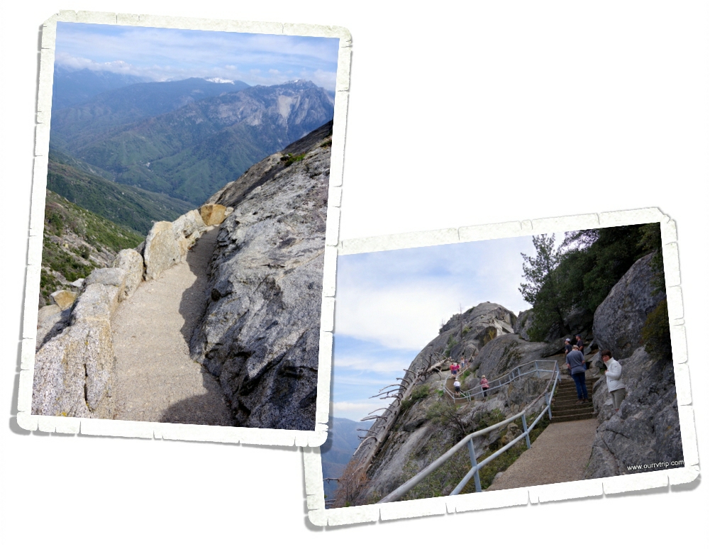
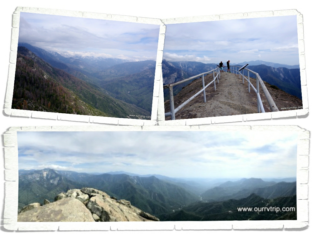
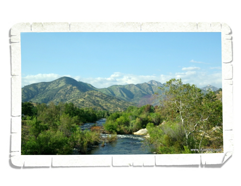
While the little boys and I were relaxing in the shade, Jerl and Charles were working hard on the trail. Check out those foot holds in the pic above! I’m a little jealous I didn’t get to finish this trail. It looks totally awesome! Jerl and Charles came back with tales of how difficult it was all while raving about the views!

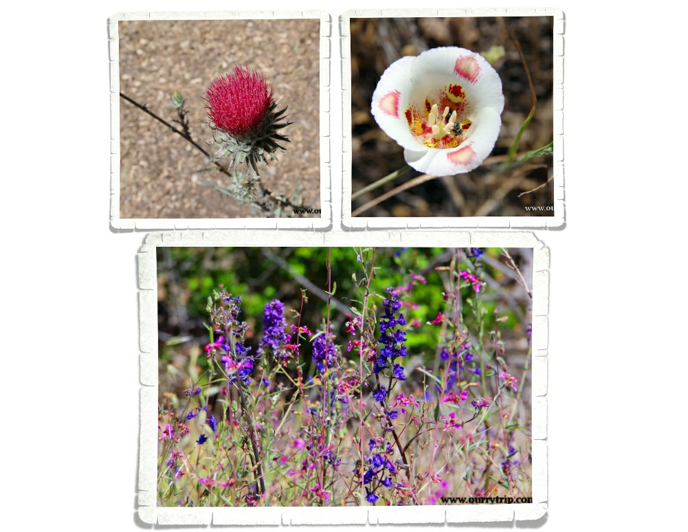
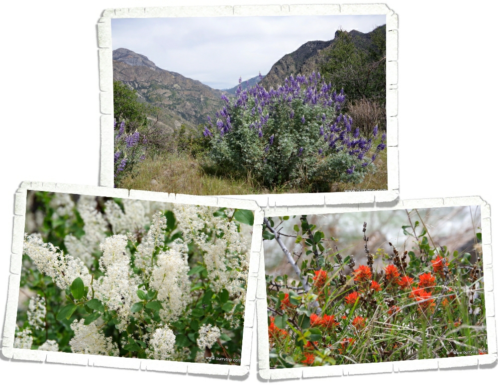
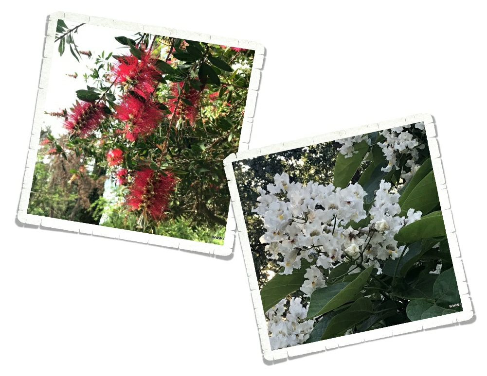
It’s a thistle…but it’s pink. I’d never seen a pink thistle before. They’re usually purple…but the ones at Pinnacles were all this vibrant pink color. Love! The other beauties pictured above were also at Pinnacles!

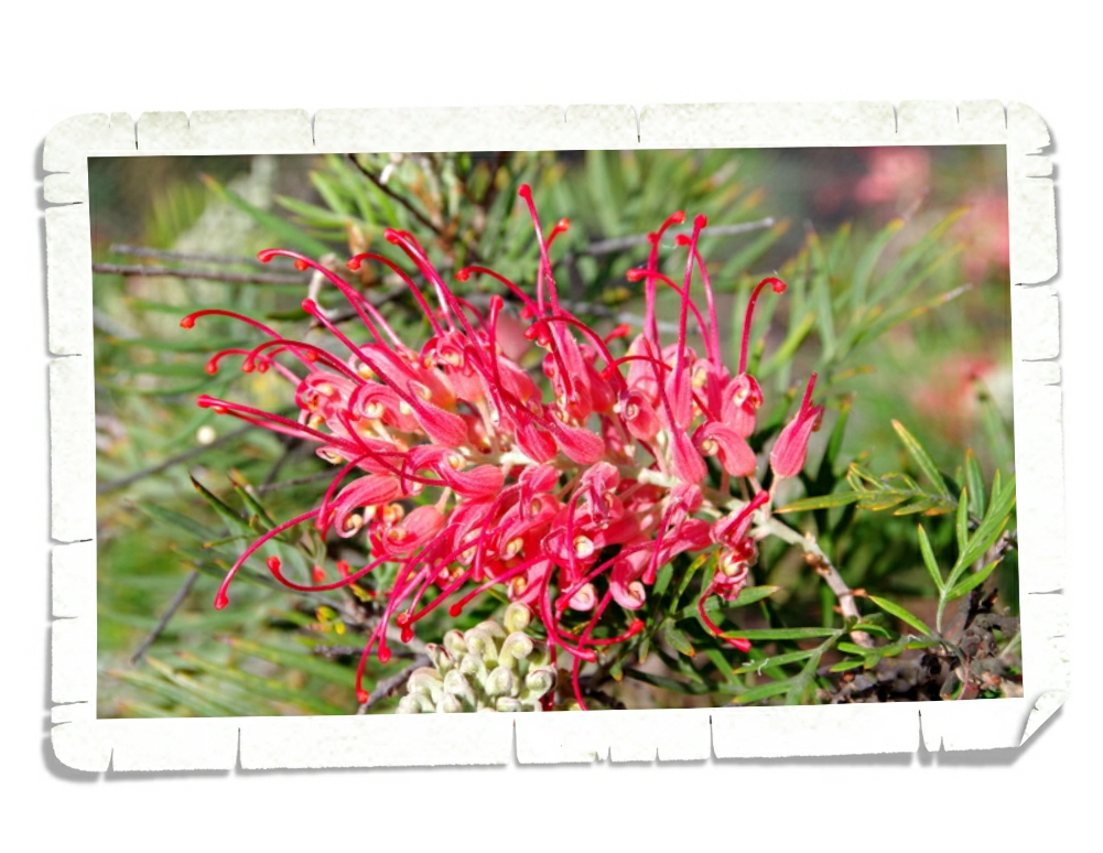
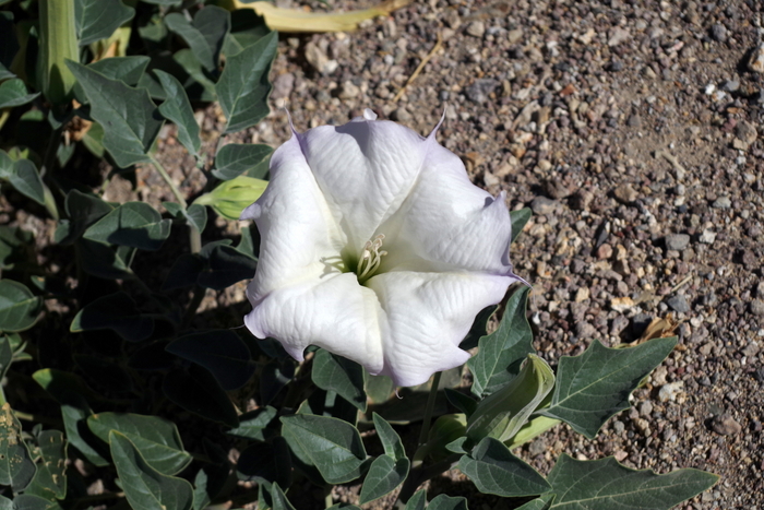
These pretties were all down highway one. I love them so much! I mean…Guys…it’s purple with a pink glow!!!

While this area presented a challenge with cell service, we really enjoyed our time in Gilroy, CA. So much so that we would consider going back one day even though it was extremely congested with people.

See y’all down the road!

#westernloop2018

Sequoia National Park

Sequoia National Park

Hey Guys!! We spent two weeks in Three Rivers, CA so we could explore Sequoia National Park and Kings Canyon National Park. We only made it to Kings Canyon NP once, but we were in Sequoia as much as we could be. It took us over an hour to actually get up into Sequoia National Park.

The road to get into Sequoia NP winds it’s way up a mountain with hairpin turns. Our first time into the park we were waiting in line to cross the construction area when some fog started to waft in. Well, it wasn’t so much wafting in as it was pouring in. It came in really fast and really thick. We thought it might just go on through so we headed on into the park anyway.

We made it to the Giant Forest Museum and went in to kill some time hoping the fog would roll out while we were in there. You can see the fog in the windows of the pic above. Did you know it takes 91,000 sequoia seeds to make one pound? Each seed is the size of an oat flake.

The fog was still rolling in, but we decided to try and push forward…until we couldn’t see the road in front of our car. It was slightly terrifying. We were stuck on a two lane, very narrow, mountain road going up the mountain into thicker fog. We finally found a place to turn around and start our slow, nerve wracking decent down the mountain. It was crazy how fast other people were driving…without their fog lights on. We made it down the mountain and went to get pizza. After all of that we were ready for some comfort food!

If you’re heading into Sequoia National Park this summer, be prepared for construction and lane closures. Depending on when we went up the mountain we would have anywhere between a 15 min to an hour delay.

Established in 1890, Sequoia National Park is the second oldest National Park. We had to hunt for this park sign. The one at the Three River’s entrance with the Indian Head that you’ve probably seen…it was taken down for restoration. We were super bummed, but at least we found this other sign.

Every year the General Sherman tree grows enough new wood to make a brand new sixty foot regular sized tree. You are looking at the largest living (by volume) tree on earth. The estimated volume is more than 52,000 cubic feet…which is about the same volume as sixteen blue whales.

This little marmot was out enjoying the sun at one of the less popular pull-offs. We try to check out a variety of pull-offs…sometimes the views are just as spectacular as the more popular super crowded pull-offs. And, sometimes you come face to face with some of the park residents. ;-}

One of the hardest things to portray in pictures (for me) is size. I snapped this picture of the Giant Tree Museum in the middle of some sequoias to try and show you how massive these trees are. The museum is a decent sized building and look how much taller those amazing trees are!

These giant sequoias only grow on the western slope of the Sierra Nevada range and can grow to almost 275 feet tall with a trunk circumference of around 100 feet. It’s hard to believe the little seedling in the pic above might one day reach 275 feet high.

We went to Sequoia NP before the official start of the summer season, so not all of the roads were open. One of the places we really wanted to visit was Moro Rock. You could park down by the Giant Forest Museum and walk up. It made the hike a few miles longer…one way. And we were totally going to do that…if we had to. We kept checking to see if the Moro Rock road was open every time we went into the park. On our last day in the park it was…open!! Sweet Chickens! When you can park in the parking lot by the trail head…Moro Rock is a short quarter mile hike up 400 steps along with several ramps. The trail was built by the CCC back in 1931 and takes you up to 6,725 feet. Before this nice trail was built, early visitors had to use ropes to scale Moro Rock. I’m not sure we would have attempted that particular hike. I like to think we’re adventurous and daring…but there’s a limit to what I’ll do with kids in tow.

When you reach the top and after you catch your breath… you can walk out to the end of the trail and enjoy unobstructed views of the Great Western Divide. We stood up there for awhile. The views were…well, they were pretty darn amazing in every direction! We finally moved on when other people started nudging us out of the way. I get it. We all want to take in the view and get pictures with that vista. We moved out of the way and started back to the car excited that we could check Moro Rock off of our list.

Buttress Tree fell without warning on June 3, 1959. Most sequoia trees die from toppling over. The roots are shallow and they don’t have a taproot to help anchor them. We found Buttress Tree after we left Moro Rock and found a wide spot in the road so we could pull over to get a closer look. I had to snap a picture of the boys with the root system to show how big the roots get.

Hale Tharp was the first settler of European descent to move into the Sequoia NP area. He built a cabin out of an old hollowed-out sequoia. Tharp’s Log has been pretty much left alone. You can step inside the door and see how Hale Tharp had it set up. Did you know that Sequoia bark is up to 2 feet thick and is a poor conductor of heat? Sequoia bark also has some natural immunity to bugs and fungi which means a fallen sequoia can stick around for a very very long time under natural circumstances. How cool would it be to have a house built from fallen Sequoia logs?!

Sequoias rarely die of old age. Many of the oldest sequoias are close to 3,000 years old. Sequoias live so long that we’re only just now seeing the second generation of these gigantic trees. Think about that… We still don’t really know how these amazing trees will evolve over time. They’re really just getting started.

Sequoia NP is in bear country so all of that stuff you carry around when you hike that has any kind of smell at all… lotions, lip balms, repellents, snacks, cans and bottles (even unopened)…bears can smell them up to a mile away. The park has provided tons of these bear boxes to store all of your stuff in. Oh, and bears have been known to claw their way into cars…in the middle of a crowded parking lot…so, do yourself a favor and use the bear boxes.

Did you know that sequoia trees actually need fire to regenerate? A sequoia pine cone needs fire in order to release all of those tiny, oat flake sized seeds. The NPS now conducts prescribed burns in order to keep the forest healthy. They’ve sectioned off the park and rotate burn sections.

We weren’t sure we were going to get to drive through Tunnel Log. This is up the same road as Moro Rock. We actually got to drive through it twice. Everyone we saw driving though it stopped for a picture or two or three. We even saw some tourists having a full on photo shoot in front of it. Seriously, how many pics do you need of yourself in front of the same tree? Ha!  But really…move it along. Tunnel Log fell naturally and instead of reworking the roads, the NPS tunneled through the tree so cars could get through. Oh! We also made it to an old fallen tree that you used to be able to actually pull your car up on and then get a pic of it…while it was on the log! So cool! It’s blocked off now. You can’t get your car up on it anymore, but you can walk and climb all over it. So fun!

Springtime in the mountains means pretties everywhere! I loved all of the flowers in bloom! These yuccas were amazingly huge and dotted all over the foothills of the park. We also spotted quite a few dogwood trees! I love dogwoods with their delicate white and pink blooms!

We loved Sequoia National Park so much more than we could have imagined. There was something very humbling about standing next to a living thing that’s been around for thousands of years. There’s a sense of being so small in the grand scheme of things.

It’s hard to grasp the sheer size and feel of a giant sequoia until you’re standing next to one.

See y’all down the road!

#westernloop2018

Kings Canyon National Park

Kings Canyon National Park

Hey Guys!!  Kings Canyon National Park is usually lumped together with Sequoia National Park but, Kings Canyon is so amazing…it really deserves a post all of it’s own.

 We found all of those California happy cows we hear so much about on television. Seriously though, we love this topography! The big rolling hills with little groves of trees here and there…This area of California is gorgeous!

It took us two hours to get to Kings Canyon from where we were staying. The road started out fine…narrow and windy, but paved. And then, the GPS Lady in all of her infinite wisdom decided we needed to be more adventurous and took us down an old forest service road to get into Kings Canyon NP. Truthfully… we loved it! We ended up driving though a section of the park not very many people get to see. Redwood Canyon is home to one of the largest sequoia groves and is one of the largest areas of old growth sequoias.

We had this area all to ourselves as we bumped and bounced our way up the old dirt forest service road filled with deep ruts. We feel like we should have seen a bear. Or mountain lion. Or any wildlife…but, we didn’t.  We loved that we didn’t see another car until we were almost into the park. Sometimes the GPS Lady totally messes up and sometimes…she’s spot on. We loved driving through the largest remaining grove of sequoia trees (over 15,000)!

Kings Canyon National Park was originally established in 1890 as General Grant National Park. It was expanded and renamed Kings Canyon National Park in 1940.

General Grant Grove is home to the General Grant Tree (in the picture above). At a whopping twenty-seven stories in height, the General Grant Tree is the world’s second largest living tree. Not tallest…but second largest…based on trunk volume. Want the numbers? The General Grant Tree stands at 267.4 feet in height and has a circumference of 107.6 feet. The General Grant Tree is a memorial to US soldiers killed in war and is also known as “the Nation’s Christmas Tree”.

It takes hundreds of years for one of these fallen giants to completely deteriorate. If you get to visit Grant’s Grove take your time and explore some. We found this fallen tree near the trail. As impressive as these giant trees are from the outside…they’re just as impressive on the inside. That’s Jerl’s silhouette at the end of the sequoia.

There’s a little general store and a pretty descent restaurant in Grants Grove. We ate at the restaurant, but I would suggest grabbing something to go at the general store and heading down into the canyon for a picnic lunch. Alex was so hungry he had a big burger and a potpie. Teenagers…

Kings Canyon Scenic Byway takes you to the bottom of the canyon via a road with hairpin turns, steep drop offs, and sheer granite cliff faces. This road isn’t for the faint of heart, but the payoff is huge. At the bottom of the canyon you can stand and look up at the canyon walls that rise thousands of feet up.

We only did a couple of hikes in Kings Canyon. One of them took us on a bridge over the Kings River. The water was amazingly clear and pretty darn cold.

Grizzly Falls is a must stop while you’re exploring Kings Canyon. It’s just feet away from the parking area and it’s a great spot for a picnic! I was standing at our car when I snapped the left shot of Grizzly Falls. If you’re not into hiking, this stop is good place to see one of the many waterfalls in the canyon.

The Kings River flows through the canyon. The road follows it most of the time so you have ample opportunity to gawk at the swiftly moving river. There are some pull-offs where you can get out and take a closer look. Just don’t fall in. Can you spot our red 4Runner in the picture above? It gives you a size comparison as to just how massive this canyon is.

On the way back up and out of the canyon we stopped at several of the vista pull-offs…and there are several! You can see the Kings River snaking it’s way through the canyon in the pics above. See how all of the mountain tops are rounded? That’s evidence that Kings Canyon is a glacier carved valley. With extreme elevation ranging between 1,500 feet to 14,500 feet, Kings Canyon National Park has a wide variety of habitats. Keep your eyes open and you never know what you might find…and always hike bear aware.

We saw some evidence of fires. This one happened back in 1955 when over 17,000 acres was burned. Now, Rangers know more about preserving these wild forests and do a prescribed burn to help prevent wildfires that rage out of control.

It was spring time while we were in Kings Canyon NP so all of the flowers were waking up from their winter nap. I love these bright orange pretties! They remind me of a wildflower called Indian Paintbrush. I don’t know if that’s what these are, but they’re very similar. The purple pretties are gorgeous!  It’s hard to tell, but these bushes were huge…and everywhere!

John Muir once said that Kings Canyon National Park is “a rival to Yosemite”. He was right. With it’s multiple 14,000 foot peaks and some of the worlds largest strands of giant sequoia trees…the Kings River and the canyon that is more than a mile deep…Kings Canyon National Park is definitely a rival to Yosemite.

See y’all down the road!

#westernloop2018

Three Rivers, Two Parks, Snakes and Spotty Cell Service

Three Rivers, Two Parks, Snakes and Spotty Cell Service

Hey Guys! We spent two weeks in the Three Rivers area of California so we could explore Sequoia and Kings Canyon National Parks. Y’all know that this blog is really my digital scrapbook…my journal of our nomadic life. I like to put my favorite pics up here and after going through the pics for the last two weeks…Guys, I tried to cut pics out, but we really loved this area and these parks. So, I think I’m going to have to do this area in three posts. I’ll start with the shortest one because I’m pressed for time today…we’re heading out to explore soon. :-}

We stayed at the Sequoia RV Ranch in Three Rivers, CA. This was a hopping park! Lots of turnover throughout the week. All of our neighbors were super nice. We knew our first day here that we were going to love this area. It felt like Canada and Alaska to us. The forest…the smells. After coming from the stifling heat of the Desert Hot Springs area, it felt a little like taking that first deep breath after swimming all the way across the swimming pool underwater. Yes, the park was crowded. Yes, we were packed in like sardines. But, it didn’t matter. We loved it. There was a nice river that ran through the back of the RV park. We walked the shore several times. It was cooler by the water, and it was usually less crowded there.

I believe the bright orange and yellow patches in the picture above are California Poppies. They were gorgeous! We saw tons of them up on hills in the distance as we drove around, but the closest I got to them was at the RV park. There were three or four little sparse patches of them…kind of pathetic looking after seeing such huge fields of them, but at least I finally got to see them up close!

Check out this tiny post office. Established in 1890, this Kaweah Post Office has been handling mail for 128 years. I’m pretty sure this is the smallest post office we’ve ever seen.

We’ve been amazed at all of the agriculture around California. In the Three Rivers area we saw grove after grove of oranges and olives! Tons of them! The best part though…all of the fruit and veggie stands! We found the best oranges at the little stand in the pic above. Big, juicy, sweet…and a great price! At the little market down the road from the RV park, there was an orange juice press where you could get freshly squeezed orange juice made from oranges taken from the tree just down the road. The boys have declared it to be the best orange juice they’ve ever had. I’m pretty sure they each tried to drink their weight in the stuff while we were there. Ha! We also found some good olives at one of the stands. The olive grove was about twenty minutes down the road. Charles has been hooked on green olives ever since we brought home a jar of them.

Another reason this area felt like Alaska, was the remoteness of it. We had to drive a good forty-five minutes to get to an actual grocery store. There was one little market close to us (the one with the orange juice) that had a surprising amount of options…just like the little general markets we would find throughout Alaska. And check out that statue. It kind of screams Alaska…ok, so maybe it doesn’t…buy we did see quite a few similar ones while we were in Canada and Alaska.

Jerl had an eye checkup. Everything is looking good. He’s still in the healing process from his two surgeries, but the doc we saw said everything seemed to be healing the way it should. It was a relief to hear it.

We, of course, found some foodies! This was a chili relleno burger from one of the local-ish breweries. This burger (the one on the right)…I don’t know what this burger was called, but it was huge and delicious! You’re looking at three patties with three different cheeses, pastrami, and bacon. Pastrami on burgers must be a California thing. We’ve seen them on menus since we crossed into CA. Every little town has their own version of it.

Both of these pretties were in our RV park!

You know what else was in our RV park? These guys. It’s hard to see…I’ll give you a minute to really look.

See them yet?

There are three rattlesnakes in that picture. Three! I about lost my ever lovin’ mind when we walked up on them! They were pretty occupied with each other, but we warned all of the campers who were just feet from them. It must be a bad year for snakes. We’ve been running into them since we were in New Mexico back in March! We’ve also heard about several snake bites this year. Y’all be careful while you’re out exploring.

The only thing that wasn’t that great about our RV park in the Three Rivers Area was the super spotty cell service. It was workable while we were in the RV, but for some reason as soon as we stepped out…it was gone. No service. I guess we’re lucky we got the spot we did.

It’s funny how some places you travel to really resonate with you. This was one of those places for us. For the first time in…well, since we started this trip, we were sad to leave an area.

You know one thing Alaska doesn’t have that Three Rivers does? Snakes. We didn’t see a single snake while we were in Alaska. I think it’s time for another Alaskan summer. ;-P

See y’all down the road!

#westernloop2018

Desert Hot Springs

Desert Hot Springs

Hey Guys! We spent one very hot, very windy week in the Desert Hot Springs area of California. We were there at the end of April and the daily temps reached a scorching 90* by 10 every morning.

We spent a day exploring Joshua Tree National Park. If you’re going to visit this National Park come in the winter. Winter daytime temps are in the 60s vs. summer when the day time temps exceed 100*. Everyone says the best time to visit is March and April. We were there at the end of April and it was already too hot.

We didn’t do very much hiking here. It was just too dang hot and windy. We wanted to see all of the gigantic boulders so we hiked the Hidden Valley loop. This area is very popular with rock climbers so it can be a bit crowded.

We made it out to Keys View. Guys…check out that view! If you look hard enough you can see the Salton Sea and the San Andreas Fault in the pic above. Keys View is a quarter mile loop…so it’s pretty short, but we found some of the best views in the park here.

Did you know…a Joshua Tree isn’t actually a tree? Its actually the largest species of yucca! What?!? Crazy, right? For the first ten years, the Joshua tree grows about three inches a year. They can live for hundreds of years but unlike the saguaro I told y’all about…Joshua trees only grow to about forty feet tall. Driving through this National Park felt a little like driving through a Dr. Seuss book. Ha!

Yup, we found a dirt road to explore while we were in Joshua Tree NP. Are you surprised? ;-p We drove the 18 mile Geology Tour Road. It was a pretty narrow dirt road, but it wasn’t bad at all. We never had to kick it up into four-wheel drive and the views were all pretty stellar!

Scattered throughout Joshua Tree NP are the remnants of old mines. The one above is what’s left of the Silver Bell Mine. Gold in the 30s, lead in the 40s, and copper in the 50s. There are several old mines you can hike to, but most of them are unsafe. So, this is as close as we got.

It’s not technically a sea any more, but a long, long time ago it was part of what is now the Gulf of California. The Salton Sea is California’s largest lake at around 35 miles long and 15 miles wide. It sits 235 feet below sea level. Most lakes have a natural outlet flowing to the ocean, but the Salton Sea doesn’t. The only water it gets is through rain and agricultural runoff.

The lake you see today is only the current form of the many different lakes that have filled this area over millions of years. Because of all of the agricultural runoff there is a peanut butter type sludge that sits at the bottom of the lake. Fishing for tilapia is a popular recreation at Salton Sea, but I don’t think I would eat anything that came out of this lake. You think it’s sand until you get closer. It’s the skeletons of thousands and thousands of barnacles and fish. Neat but gross at the same time. There are old motels and and boarded up yacht clubs all over the shores. If you go exploring here, do it in a safe spot. We’ve read horror stories of people sinking to their ankles and then having to throw their shoes away due to some residue on them that eats the shoe. We didn’t encounter that at all, but we didn’t stray from the state park head quarters.

Those…are date palms. The first date palms in the US were planted by missionaries in California in 1769. There are a few different date farms in the Desert Hot Springs area. We went to Oasis Date Gardens.

Oasis Date Gardens was established in 1912 and is a whopping 175 acres full of date producing palm trees. YUM! The Oasis Date Gardens doesn’t give tours but they have a video you can watch and there are dates set out for sampling! We had no idea there were so many different kinds of dates. And that they tasted so differently!

I had to try the prickly pear date shake. Had to. There just wasn’t any way around it. It was soooo good. If we’d found this place our first day in the Desert Hot Springs area…I would have gone back to Oasis Date Gardens at least four…maybe five times just for this shake.

We walked out with some goodies. The boys didn’t waste any time getting into the date bread. It didn’t last long.

Over in Palm Springs there’s plenty of green. Big palm trees…lots of lush bushes…but the rest of this area looks…well, brown. Along with some very nice shades of tan. We drove about 15 miles down this road and found a natural oasis. A spot of green in the middle of the desert.

There were several hiking trails here. We stuck to a short boardwalk hike because we were warned that the rattlesnakes were waking up and were very active. And…they like to hide in the trees. Um…nope. Nope. Nope. That’s a great big nope from me. It was bad enough to worry about danger noodles in bushes and near big rocks…but to have to worry about them falling out of the trees onto us…I’m gonna pass on that every time. We saw everything we wanted to see. It was really cool to walk among the huge fan palms. This particular oasis sits on top of the San Andreas Fault. The boys are standing on it in the pic above. You really can’t tell. If the sign didn’t tell you, you’d never know.

We were told of a different place to see the San Andreas Fault in it’s more natural state. It was out in the middle of nowhere and the whole area was in upheaval. It was something else to see it.

We stayed at the KOA. There was zero shade and temps of over 100* every day. It was a very very hot week. They KOA had its own hot springs spa. We didn’t use it because…we were hot enough as it was. The thought of getting into hot water was not at all appealing. We did, however, utilize the pool! Most of the time we were the only ones there.

I can’t leave out the pretties. Even in the desert there is color. Spring in the desert is so full of color and life. Not all of it from cacti! This palo verde tree (top picture) is lovely with it’s green bark and yellow blooms!

There was a surprising amount of things to see and do in the Desert Hot Springs area and if we ever go back… it’ll be in the winter. It was just too hot and too windy for us. While we thought what we saw was neat, it was kind of a looong miserable week.

See y’all down the road!

#westernloop2018

World of Zoo San Diego

World of Zoo San Diego

To my fellow animal lovers! I bring to you a post from San Diego, CA.

At this zoo, they have over 3,000 animals! We spent ALL day there and still missed some!

Their Koala’s are just too pampered, so happy and fluffy… Turns out koalas are very picky eaters, and will only eat certain types of eucalyptus leaves.

The Meerkats are on the lookout for any predators, this one kept darting it’s head back and forth at every bird and plane! A meerkat family will use about 5 burrows at a time, each being roughly 5 meters long.

The koalas weren’t the only sleepy ones, this lion was so tired that his tongue was sticking out! Reminds me of our cat Sadi…she’s always laying around with her tongue sticking out.

The polar bears were happy and sleepy too, I think we hit them all at siesta time!

All of the enclosures were HUGE and very clean. San Diego knows how to do a zoo.

They’ve got a sun bear… Look at those claws! They need them too, being the smallest bears around.

This little arctic fox has a little limp due to a surgery. And the zoo tells you that! They put a sign up telling why an animal has an injury so you don’t worry.

Animals aren’t the only thing they have, Look at this flower! They’ve got flowers and interesting plants all over the place!

They have Capybara in with the Llamas. Most of the exhibits have a sign showing you how big the animals used to be or how they have evolved. Like the one in the right picture! It’s not the same species but it’s their cousin from North America (which turn out to be extinct), and they were much bigger than they are now.

The tiger was just laying there looking around. I think he was too comfortable to move.  A tiger’s roar can be heard up to three kilometers away!

And then there was the hippo. While we were there we learned that hippos don’t actually swim, but walk. And all this time I thought they swam!

Elephants are super smart. The zookeepers put up contraptions with treats, and it didn’t take long for the elephants to learn how it works! Once one elephant got it, the others watched and found out.

Now the giraffes are something else. Let’s just say after watching them for a little, I will never let one lick my hand…

I think these flowers are called Paradise Birds and they look so neat! Almost like a bird…

They have a neat Skyfari. While you can’t really see any of the animals while you’re on it, it is a really nice view. It runs real smoothly. The San Diego Zoo has actually been open for over 100 years! It opened in 1916!

I have never been to  a zoo that has a Serval in it. At first I thought it was an ocelot but after getting a closer look I realized I was wrong. Servals are very successful hunters, catching fifty percent of their prey. Other big cats only catch about ten percent!

The flamingos were very pretty, and the smell wasn’t as bad as it was at other zoos!

This little magpie is a talkative bird! It would fly around and say hi to us!

This is the Secretary bird, I couldn’t help but think of Fawkes the phoenix on Harry Potter.

They had a peacock roaming around and yelling at people, I am pretty sure this one was trying to fight the tour bus they have. It looked right at the bus and yelled at it.

They raise their cheetahs with some big dogs, I think it’s really nice. The reasoning behind it is pretty interesting. A zoologist found that dogs have a calming effect on cheetahs, and since this cheetah is an ambassador animal (goes to offsite events for demonstrations and what not) then she’ll need all the calmness she can get!

Now before we go any further, I must warn you, you are about to see awesomeness. You have been warned.

It’s time for the best part of the zoo. THE PANDAS!!! They have a nice enclosure for the pandas, but if you want to see them get there early, the line gets pretty long. Make sure you grab a map at the front too, you’re going to need it. While they do have red pandas, we couldn’t find them. They are masters of stealth! I am bummed about not being able to see the red pandas but we saw the giant pandas!!

Well this zoo definitely deserves 5 stars, it’s so clean and big. I didn’t see a single animal that wasn’t happy and healthy! Well done San Diego, you made it to the top 5 zoos on my list.

See y’all at the zoo!!

#worldofzoo

Written by Nicholas

San Diego Part Two

San Diego Part Two

Hey Guys!! We spent two weeks in the San Diego area and didn’t even scratch the surface on everything in the area to do. I went through most of what we did in our post Seen in San Diego, but there is a little left to tell you…so let’s get started.

We went to La Jolla to see the seals. I have mixed feelings about this. On one side, it was really neat to see the seals chilling out on the beach!  But, on the other side…people were actually making their children touch and sit right next to wild seals. I mean…really? They’re wild animals! And they will bite! Sheesh people!

One of my favorite things we did while in the San Diego area was a hike at Torrey Pines State Natural Reserve where they are preserving one of the nation’s rarest pine trees, the Pinus torreyana. I mean…Guys…look at that view! We spent an entire morning hiking around on various trails, soaking up the sun and enjoying the view.

We spent quite a bit of time near the ocean in 2016 as we explored the east coast. We’ve missed it. I don’t think we realized how much we missed it until we were standing there looking at that view and feeling the ocean breeze on our faces.

One of Jerl’s favorite breweries is Stone. We made it up to Escondido to take a tour. We’ve been to a few other brewery tours, but none were on the scale that Stone was. They brew hundreds of gallons at a time. That’s a lot of beer! It’s always fun to see the differences in the breweries and hearing the stories of how they got started.

One of the main reasons we visited San Diego was to go to the zoo. Nicholas had been looking forward to this zoo visit for a very long time. The San Diego zoo is by far the biggest zoo we’ve visited so far. We spent the entire day there and we still somehow missed a whole section. There is a bus tour you can take if your feet get tired. And, there’s a skyfari that you can ride from the back of the zoo to the front! There are some shows…but we missed them all.  I think you really need two full days to see this entire zoo.

Nicholas, of course, was all about the panda exhibit. He’s doing a whole zoo review next week so I’ll let him give you all the details on the zoo visit.

And…the pretties! When we were in New Mexico and Arizona I kept looking for tons of spring flowers, but didn’t see very many so when we got to San Diego…and there were flowers everywhere…I loved it!! I was in flower heaven! I can’t believe I got a picture of a hummingbird feeding in the top picture!

Well, that’s it for the San Diego area this time. We left so much undone that we will have to come back at some point.

See y’all down the road!

#westernloop

Pizza Roundup Woodstock Pizza

Pizza Roundup Woodstock Pizza

To my fellow pizza lovers! I bring you a post after long break! This time from San Diego, CA.

Woodstock has some really tasty pizza, and a good deal on all you can eat by the slice!

But if you decide to go with a full pie then there are some arcade games you can play while you wait! (I had to play some pinball.)

As you can see they weren’t super busy. Works for us, we got our food faster! The restaurant is nice and clean and service is great! Now I didn’t have any wings but…

They look REALLY good! My brother said they had a really good flavor.

They have a variety of pizza to choose from for by the slice, and the options look good!

The one time I decided not to get pepperoni was at a pizza place that has all you can eat pepperoni pizza, but I couldn’t pass up on a carnitas pizza! They rolled the crust at the outside and it really added, they had sauce under that rolled part! Now I don’t know about y’all, but this place needs 5 stars.

See y’all next time on…

Pizza Street!!

#pizzastreet

And don’t forget to check out my new Instagram account! Come find me @ https://www.instagram.com/rvkid04

Written by Nicholas

Seen in San Diego

Seen in San Diego

Hey Guys! We spent two very full weeks in the San Diego, CA area and we still didn’t see it all, but we got in as much as we could.

But first, let’s talk about the drive from Tucson to San Diego. It’s not one that I will want to do again any time soon. Not too far after Yuma…just past the CA border you get to this area of well…wind and heat and hills. There wasn’t anything at all for miles and miles. Except the intense heat (we crossed in April and the temp got up to 95) and the wind that tried to blow us off the road every so often with a mighty gust.

The conditions are bad enough that California put in pullovers every few miles for radiator water and call boxes. Because, yeah…there’s no cell service here either. Along with the radiator water, call box, and hill percent grade warnings there was a sign that urged motorist to turn off their air conditioning…you know…so maybe your vehicle will actually make it through this little slice of the H word. I was a nervous wreck by the time we got though all 20 to 30 miles of it and if we ever decide to go back to San Diego, we are definitely going to need a different route.

When I was planning this area I had a hard time finding an RV Park that fit us. I don’t want something right downtown in the middle of all the traffic. It needs to be a safe area, kid friendly, and not cost $90 a night. I stumbled onto the Sweetwater Summit Regional Park in Bonita, CA right as I was about to give up on seeing the San Diego area. Guys, this is a great park! Look how big our yard was! And…fullhookups for right around $30 a night! Score! We were only half an hour from the coast…so not too far away from the touristy stuff we had planned, but far enough away that we weren’t stuck in the middle of the rat race everyday.

We had some pretty cute neighbors here too. We had ground squirrels as neighbors at Catalina State Park back in Tucson as well, but these guys were twice the size! Just as fun to watch though. We also had tons of rabbits as neighbors here. The little jerks liked to get up on our steps at night and do their…potty business. So, there were rabbit pellets all over the steps and our mat for the first few nights. We stopped it by putting our steps in every night. Take that rabbits. We heard rumors of rattlesnakes, but we never saw one. And ants…we heard rumors that there are legions of ants just waiting to invade your RV, but we didn’t see any of those either. We got lucky.

All National Park units tell a story. Some, like Cabrillo National Monument, has more than one story to tell. Cabrillo National Monument tells three different stories. The stories of exploration, guidance, and protection. One of the stories told at Cabrillo NM is about it’s namesake, Juan Radriguez Cabrillo who set sail in New Spain in 1542 to explore and claim new lands for the King of Spain. Cabrillo was the first European to set foot on the west coast of what is now the United States.

Another story here is the story of the Old Point Loma Lighthouse which operated from 1855 to 1891. The lighthouse was in the perfect spot as long as the weather was good, but if there was any fog…the lighthouse couldn’t be seen. So, a new lighthouse was built closer to sea level in 1891. The old lighthouse has been preserved and is set up in the fashion it would have been during the time when the longest serving keeper and his family lived there. Robert Israel worked as the lightkeeper for 20 years. He was on duty 24 hours a day 7 days a week so he had very little time to spend with his family.

The last story we learned about was of Fort Rosecrans. Point Loma is a natural protective barrier located at the entrance of the San Diego Bay. Due to its strategic location Point Loma has had an important part in coastal defense since 1797 when the Spanish built Fort Guijarros at Ballast Point. Today, at Cabrillo NM, you can explore a bunker from WWII where many soldiers spent countless hours watching for enemy ships, planes, and submarines.

The boys really enjoyed this Junior Ranger book. It had them exploring different sections of the NM in order to answer questions. They like the interactive booklets that make them get up and explore more than the ones that just have them find answers in the visitor center museum.

We spent over four hours exploring the USS Midway. We’ve been to a few different battleships, but this was our first aircraft carrier. The USS Midway was built in 1945 during WWII in 18 months by women. Most of the women had never even picked up a tool before they were drafted to work in factories and plants to help with the war effort. You are looking at the first ship that was too big to go through the Panama Canal. At the time, it was the largest ship in the world. Our favorite thing about touring the Midway was hearing all of the personal stories from the Veterans who were volunteering as guides. Hearing someone recount their time and experience as a crew member made it more personal…more real…for us. It was different than just reading a sign about what this room was used for or what that lever does.

Let’s talk foodies! It is San Diego…they are kind of a foodie town. We took Alex out to lunch one day and he got a surf and turf burger (bottom left picture). He ate it all! We found a little taco shop that served Tijuana style street tacos (bottom right picture). It was originally started in Tijuana. You know you’re in the right spot to try ethnic food when there’s a language barrier. We got the family pack and it ended up being more than we could eat for only $40! Thanks to a cousin (waves at Dev) we found Hodad’s. I think the picture (top middle picture) tells you everything you need to know. The only one who finished their burger here was Charles. Those burgers were huge!

I think I’m going to have to break this area up into two posts. We did more touristy things here than we usually do. There were sooo many pretties in San Diego! I’ll share some with you now and some with you in the next post too! If I’m being totally honest here…I have enough pictures of pretties to do an entire post on just flowers. Ha!

Ok Guys! That’s it for this post…stay tuned for San Diego part two and watch out for Nicholas’ Pizza Street post and a new Zoo Review!

See y’all down the road!

#westernloop2018

Death Valley National Park

Death Valley National Park

IMGP6706

Hottest, Driest, Lowest…Welcome to Death Valley National Park! Situated on the California/Nevada border, Death Valley is known for it’s extremes and oddities. We spent one whole day and four partial days exploring DVNP. Near mile marker 10 as you drive into DVNP from Beatty, NV you get to experience what they call Hell’s Gate. You can roll down your windows and stick your hand out the window and feel the temp outside raise by 10 to 20 degrees within a 3 mile stretch of road.

IMGP6628

We like to stop at the Visitor Center first to get up-to-date info on the park. While we were there the little boys took the opportunity to grab another Junior Ranger Badge. We were lucky they were still doing the summer program and they were able to fulfill all the requirements in the air conditioned center.

IMGP6629

Outside the Furnace Creek Visitor Center was a tad bit hot. Just a bit.

IMGP6643

We visited Badwater Basin and stood 282 feet below sea level.

IMGP6648

Badwater expands clear across the valley floor to the base of the Panamint Range. It’s quite something to stand out there and see the seemingly endless salt flats stretch out all around you.

IMGP6652

We got to Badwater just before sunset and we watched as the sun dipped below the mountains. The heat in the valley instantly felt cooler. It’s quite something to look up into the Amargosa Mountains and see a “Sea Level” sign a few hundred feet above the ground.

IMGP6711

Can you believe I even found flowers in the desert? They were gorgeous and something I’d never seen before. I probably took a dozen pictures of the same cluster of flowers.

IMGP6715

Day two started with a castle. Scotty’s Castle. Walter Scott was a popular entertainer in Buffalo Bill’s “Wild West” show before he became known as Death Valley Scotty. He told tall tales of gold, took peoples money, then he spent it all on everything but mining for the promised gold. One of Scotty’s investors, Albert Johnson, found out about the dupe. Instead of being mad Johnson became friends with Scotty and even built the castle you see in the pic above in DVNP where Scotty was a regular visitor.

IMGP6741

There are tours you can take of the inside, but we didn’t. We spent about an hour just roaming around the grounds.

IMGP6757

Scotty’s Castle is unlike anything we’d seen. It seemed to fit perfectly with the desert it was built in.

IMGP6717

In the visitor center at Scotty’s Castle, you can see a 1914 Packard seven passenger touring car. This is the way people used to get around DVNP.

IMGP6820

Down the road, you can even see faint tracks left from the tour cars. If you look just under the sign in the photo above, you’ll see two tracks left over from a tour car.

IMGP6844

The Harmony Borax Interpretive Trail was short and hot. It told of life in DV for the borax miners and the twenty mule teams they used to pull carts around.

IMGP6874

After a quick picnic, we made it to The Devil’s Golf Course. Littlest thought he was being funny, taking a picture of me as I took a picture of him. At The Devil’s Golf Course, crystallized minerals reacting with groundwater have lifted themselves into tightly packed ridges reaching up to two feet high.

IMGP6891

We walked the quarter mile trail to Natural Bridge. It was late afternoon and temps were soaring.  We tried to stay in the shade as much as possible.  As hot as it was in the sun (we could feel the sting of the sun on our skin), it wasn’t too bad in the shade.

IMGP6918

Artist’s Drive is one of my favorites in DVNP. We actually drove it twice because the first time was just after the sun set and we wanted to see the color in full sun. You can see Artist’s Pallet in the photo above.

IMGP6948

The colors of the desert were amazingly vivid. I took more pictures than I will ever need.

IMGP6978

We had the chance to explore not one but two ghost towns! The easiest to get to was Rhyolite. You can see one of the abandoned houses in the photo above.

IMGP6983

We walked past several crumbling buildings.

IMGP7009

It’s kind of sad, really. To think of the families that used to live there and the hardships they must have gone through. Several buildings from Rhyolite were moved to the nearby town of Beatty.

IMGP7032

We spent almost four hours navigating the Titus Canyon drive. It’s a one way 26.8 mile dirt road that winds it’s way through the Grapevine Mountains, past a ghost town, and through Titus Canyon.

IMGP7042

The vistas were simply amazing. You can see our winding road in the pic above.

IMGP7061

The second ghost town was called Leadville. 300 people lived here between August 1926 and February 1927. There’s a spot you can pull of the road and walk around the ruins. We wandered around for a bit and headed on down the road. We were racing the sun. I didn’t want to be on the narrow dirt road in the dark.

IMGP7068

Here’s another shot of the wonderful colors of the desert. We’d just left Leadville when we came upon this sight.

IMGP7077

We spotted our first snake. It was small and fast as it slithered it’s way across the road and up the side.

IMGP7100

Titus Canyon with it’s limestone cliffs.

IMGP7103

We could try to tell you how tall the canyon walls are…but you know what they say…”a picture’s worth a thousand words”.  The last 1.5 miles of the canyon are pretty narrow, in some places the walls are less than 20 feet apart.

IMGP7112

On our last afternoon we headed to Zabriskie Point. There’s a short walk up a paved path to get to the view.

IMGP7116

The point was nice…but this two tone formation was more interesting to me.

IMGP7126

We drove through Twenty Mule Team Canyon on another dirt road. It was short and we took the time to climb up on a small rock to play with shadows. The boys thought it was too hot to get out so they waited in the car…I think they’d had all of DVNP that they could handle.

IMGP7145

Our last stop in DVNP was atop Dante’s View. You can see Badwater Basin in all its glory.

On our ride back to the RV one evening, we stopped at Ash Meadows for a super quick drive through. Ash Meadows is a National Wildlife Refuge that covers over 23,000 acres of spring-fed wetlands in the middle of a desert.

IMGP7172

We were losing light fast so we didn’t get to see much, but what we saw was really pretty.

 See y’all down the road!