Category: California

Our 2018 Year In Review

Our 2018 Year In Review

Hey Guys! Happy New Year’s Eve!!

I thought we’d end the year with a quick post to share some of our favorite memories from this year.

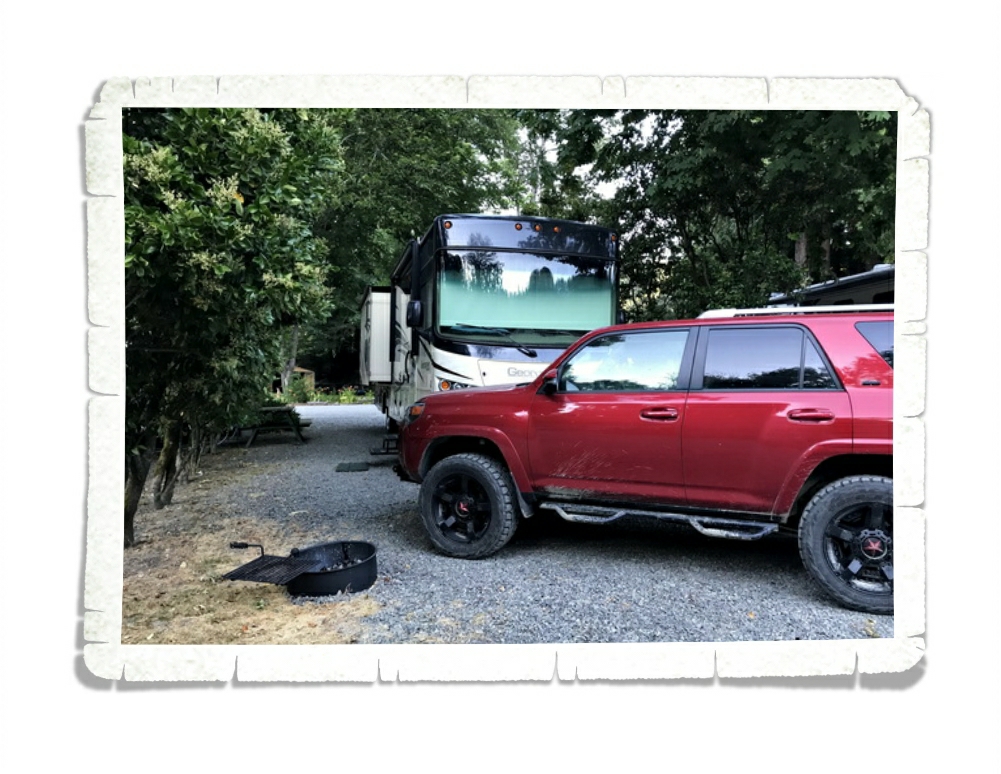
Our year started off…well…not the best. We spent last New Year’s Eve driving through an ice storm to get back to Missouri so Jerl could have eye surgery and our home-on-wheels could get a new engine. It was a stressful start to the year, but it got loads better!

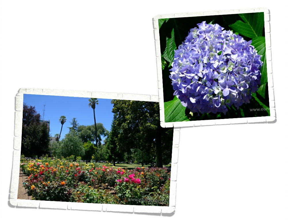
We made it to twenty-one different National Park Units this year! Twenty-one! Two of those were revisits, but nineteen were new for us…so it shouldn’t come as a surprise that seven of our top ten memories for this year are about National Parks.

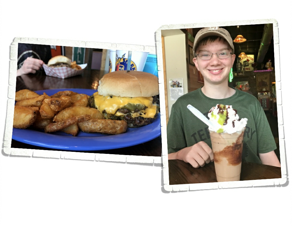
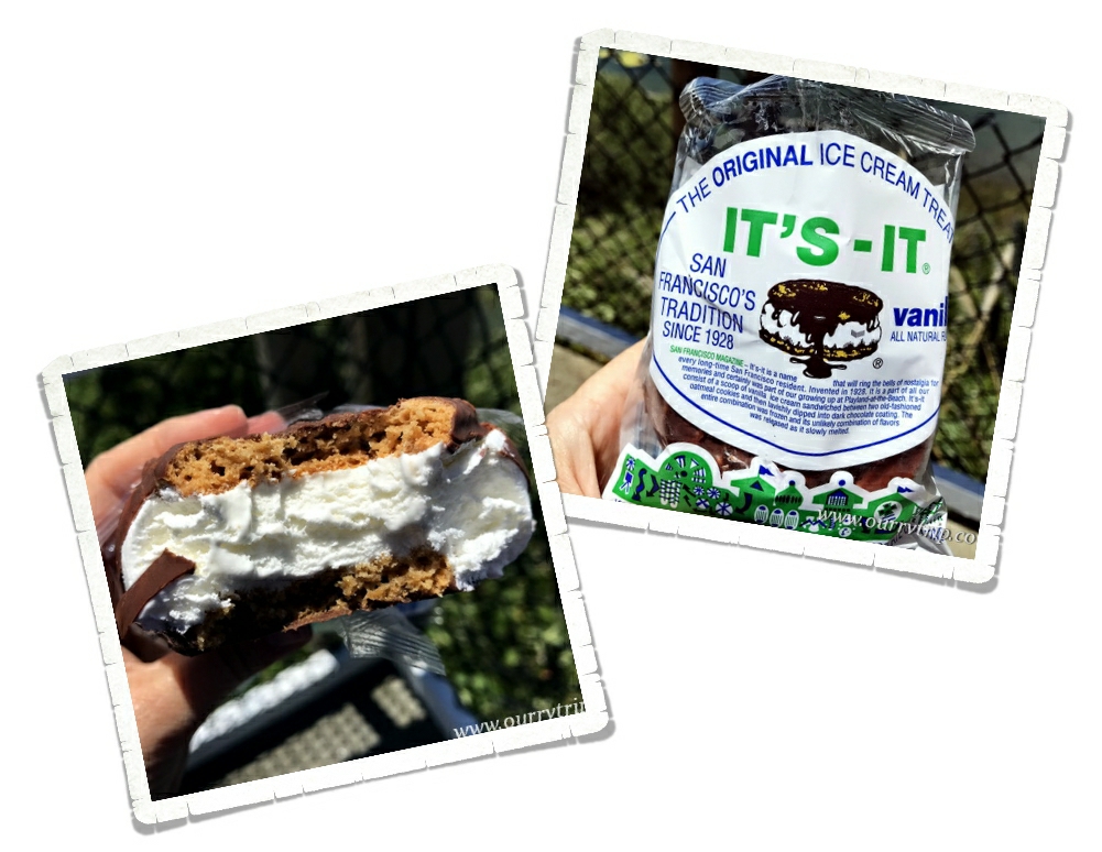
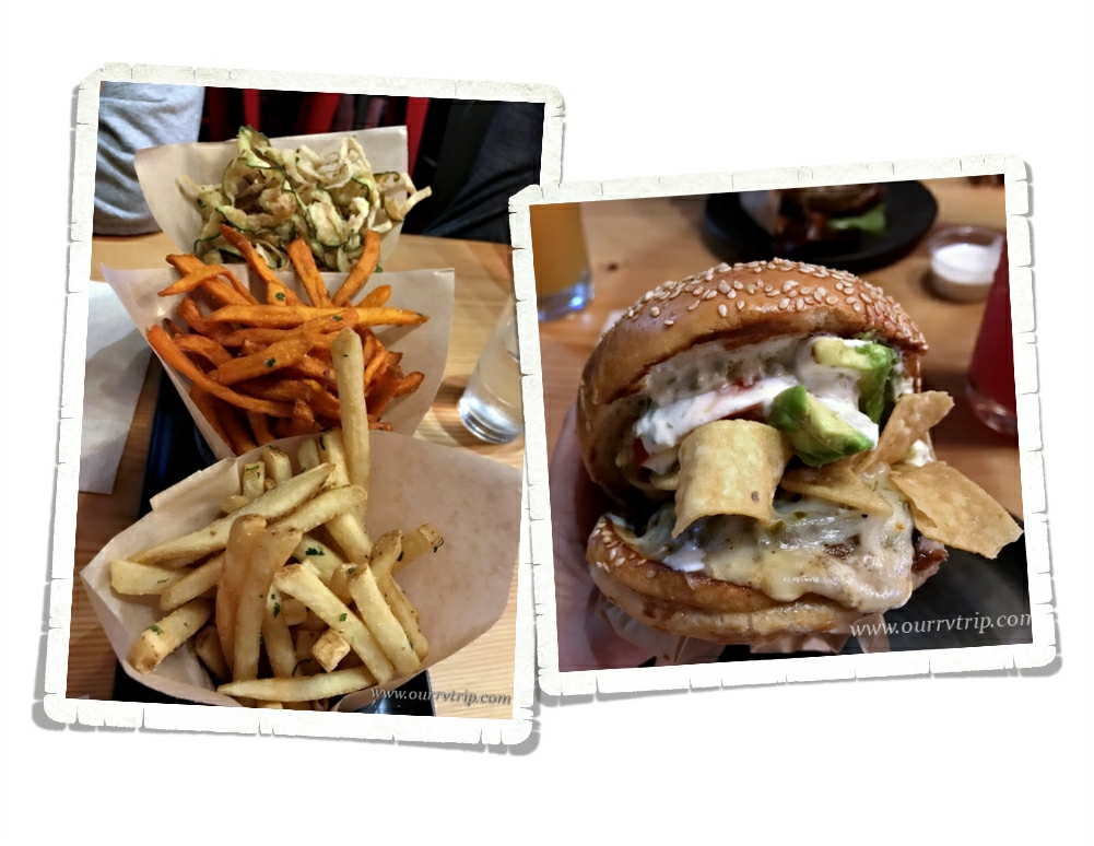
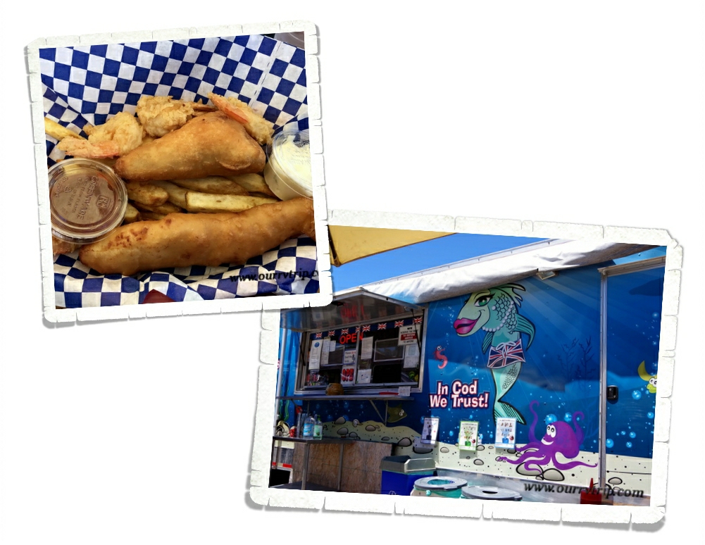
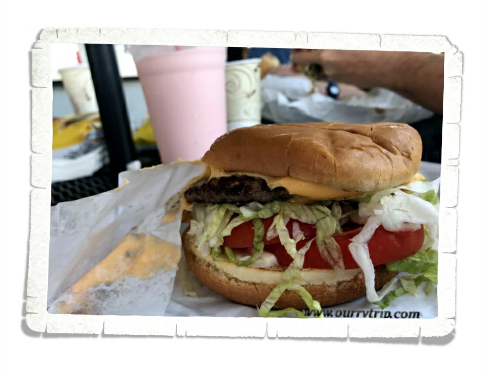
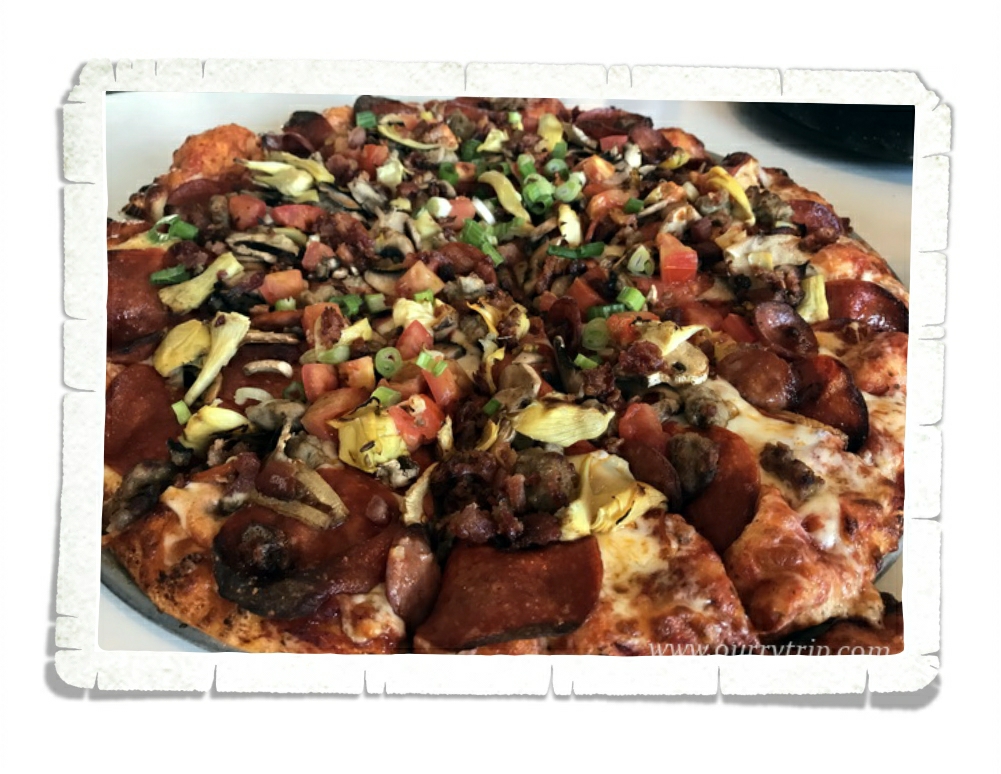
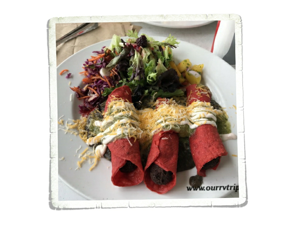
Let’s start with our honorable mention…Sparky’s Burgers in Hatch, New Mexico just missed our top ten, but we all like it so much we decided it really should at least get an honorable mention! We’d been eyeing Sparky’s for a couple of years now. We found out about it in 2015 while we were in Alamogordo, but didn’t want to drive that far in the time we had in the area. This year, however, we made it! And Guys…it’s so good! We got there right as they were opening and it’s a good thing because when we left, the line was already starting to curve around the block. Alex had to try one of Sparky’s famous green chili shakes. He chose chocolate and raved about it the whole time. I think next time I may have to get one too!

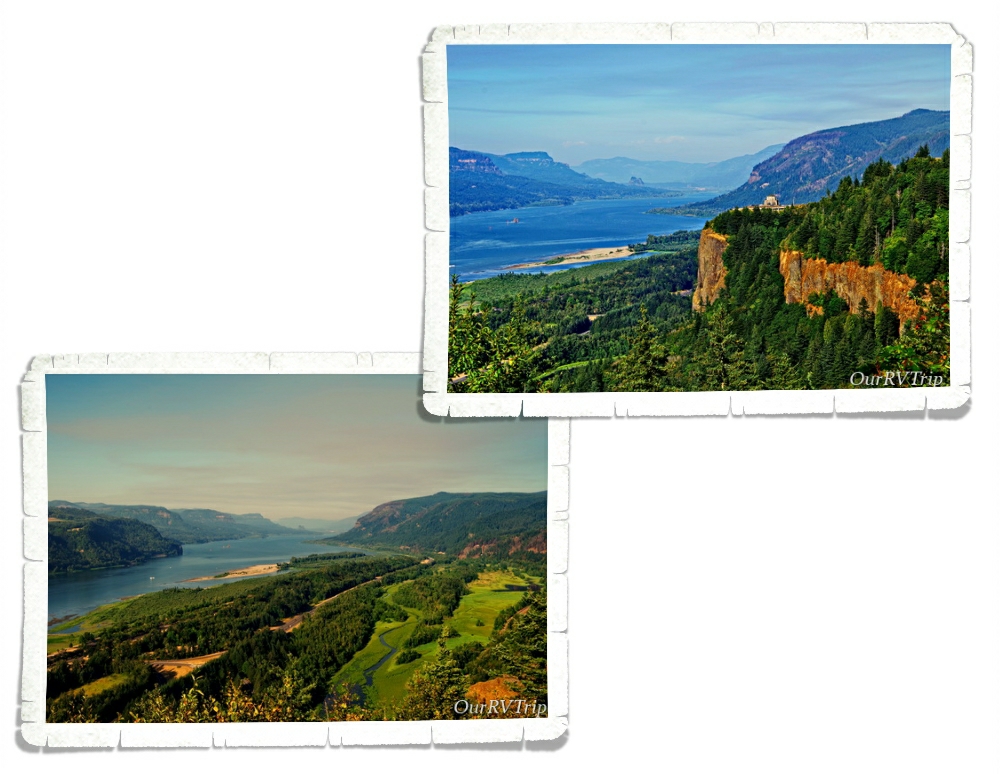
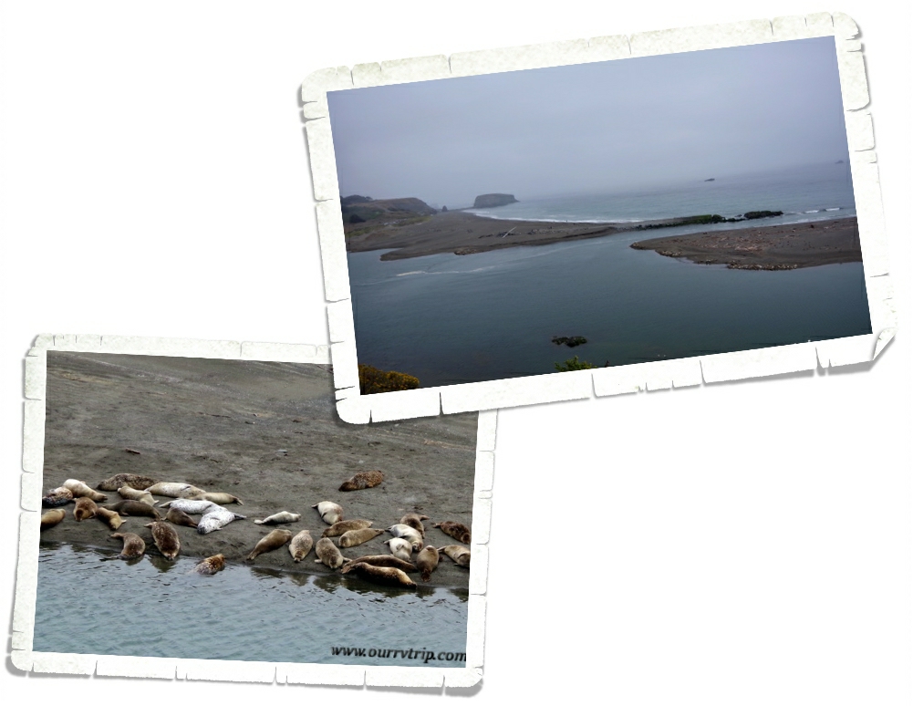
Our number ten spot isn’t a foodie or city or state…it’s not a National or State Park…it’s a view. The Columbia River Gorge from the Portland Women’s Form State Scenic Viewpoint in Corbett, OR was spectacular even though the smoke from some nearby fires was wafting through. We had this entire viewing area to ourselves…well…there was one other person there and he was busy having a conversation with himself…so…yeah. But, that view!

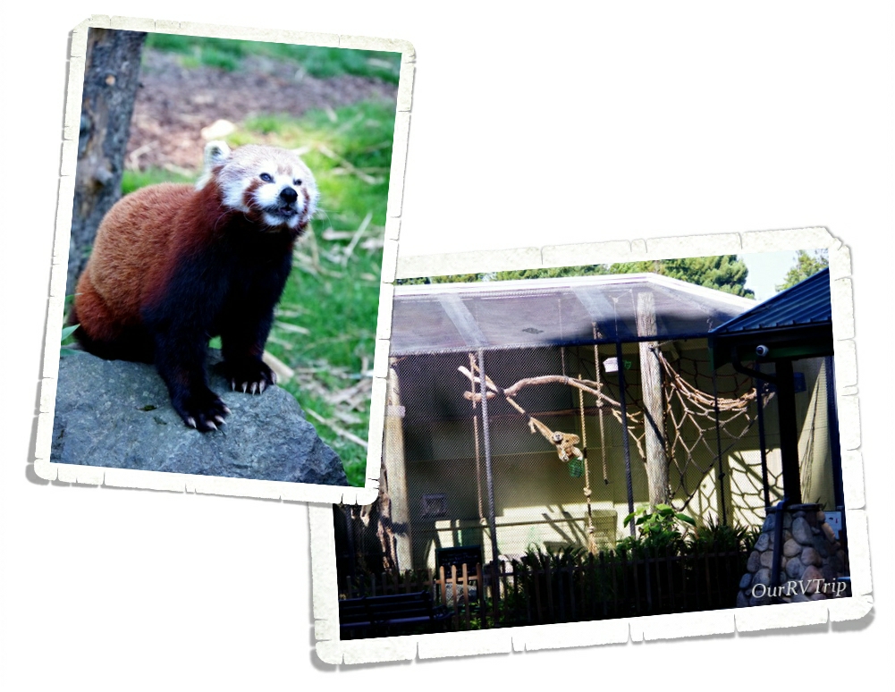
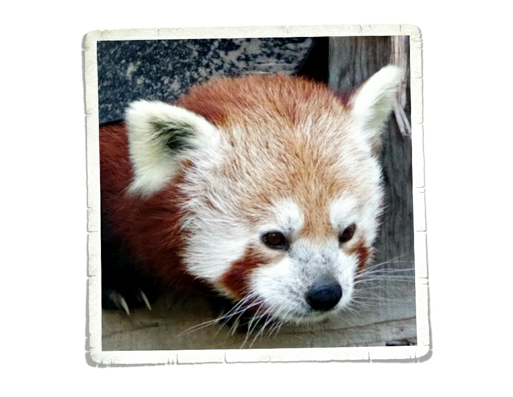
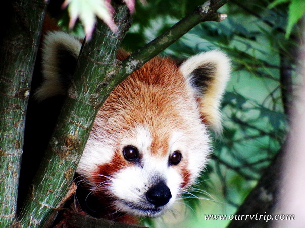
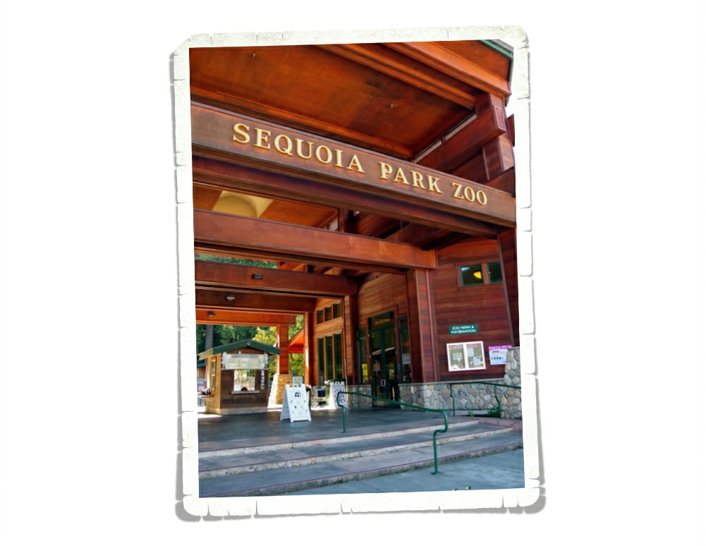
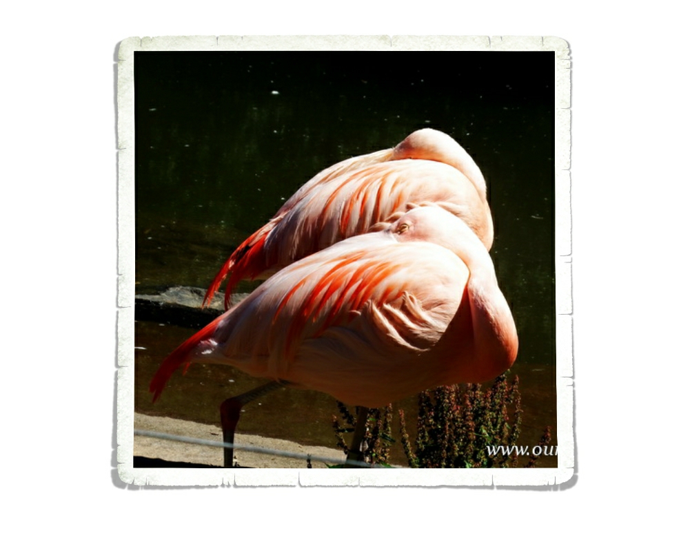
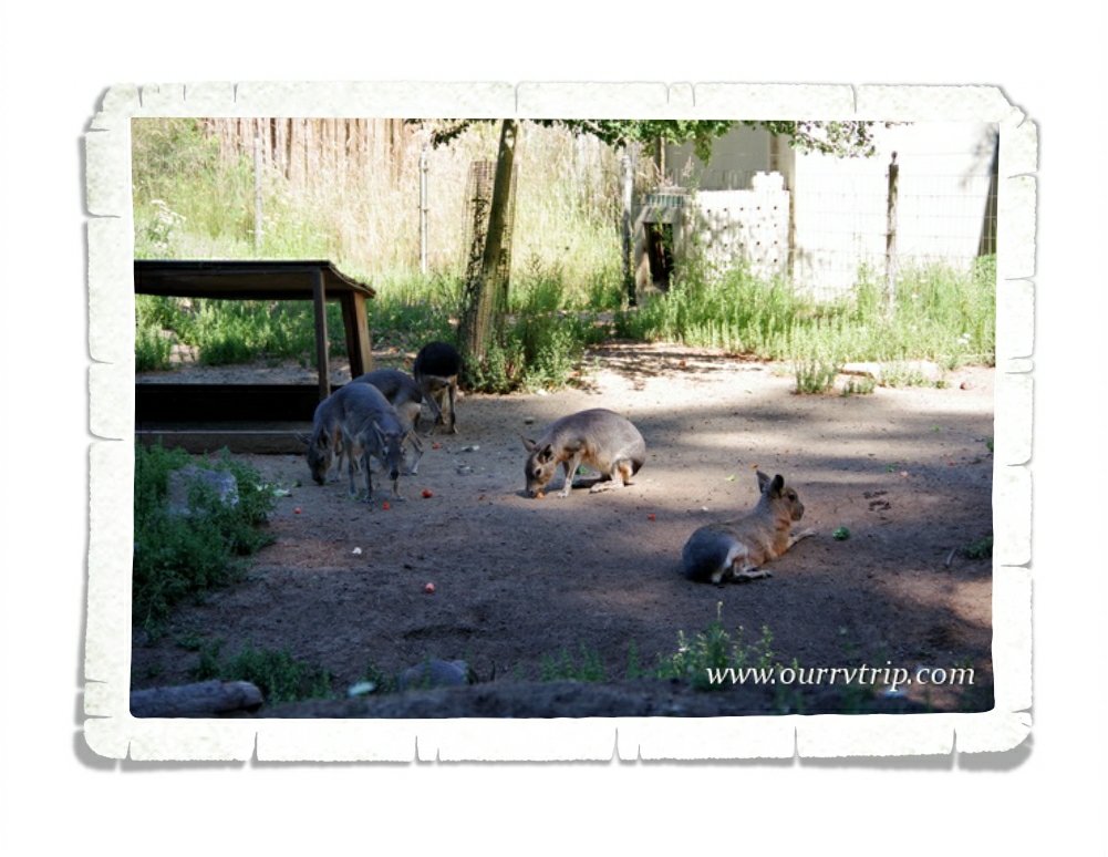
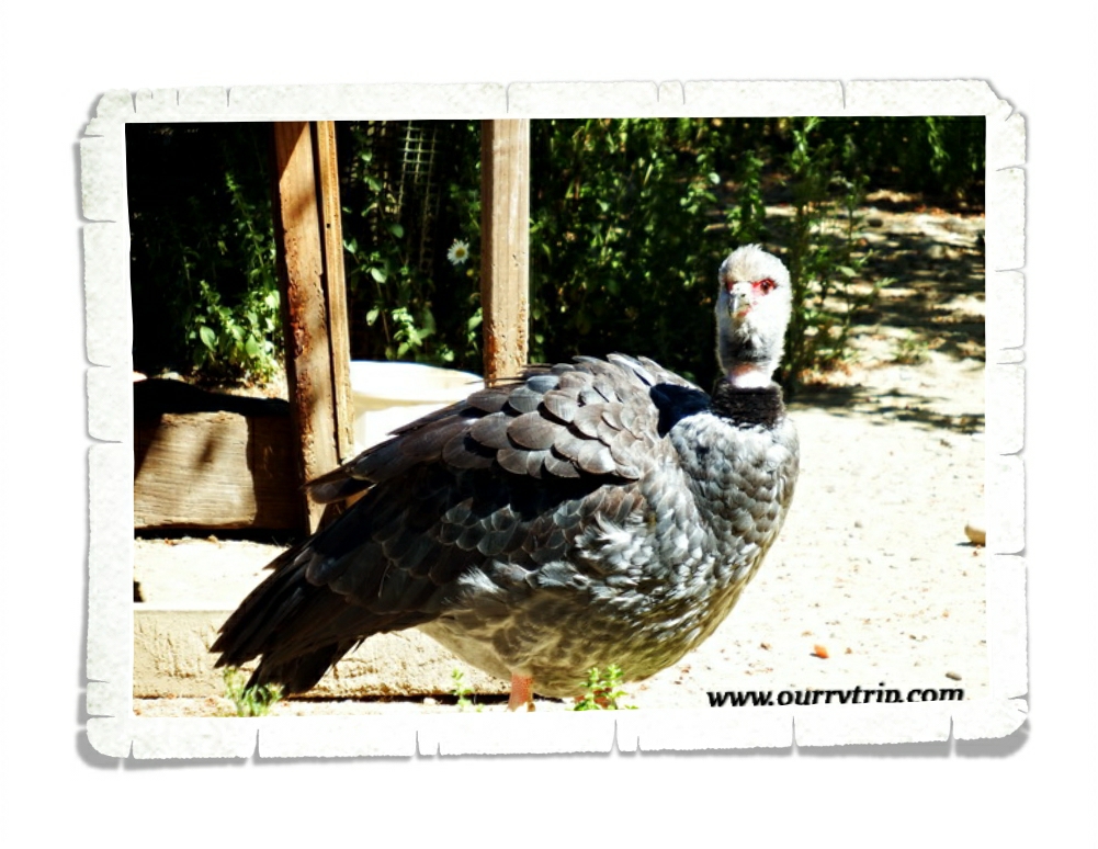
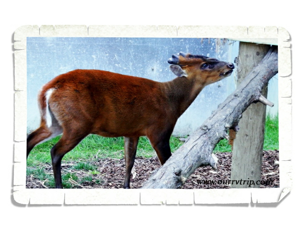
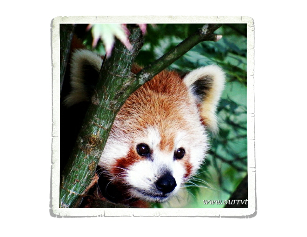
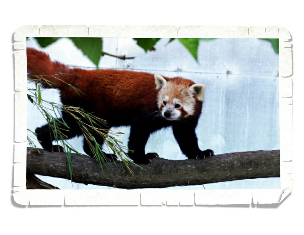
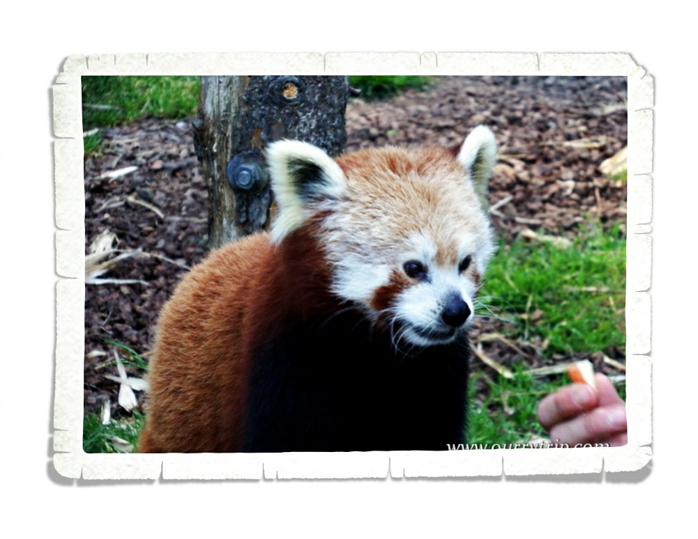
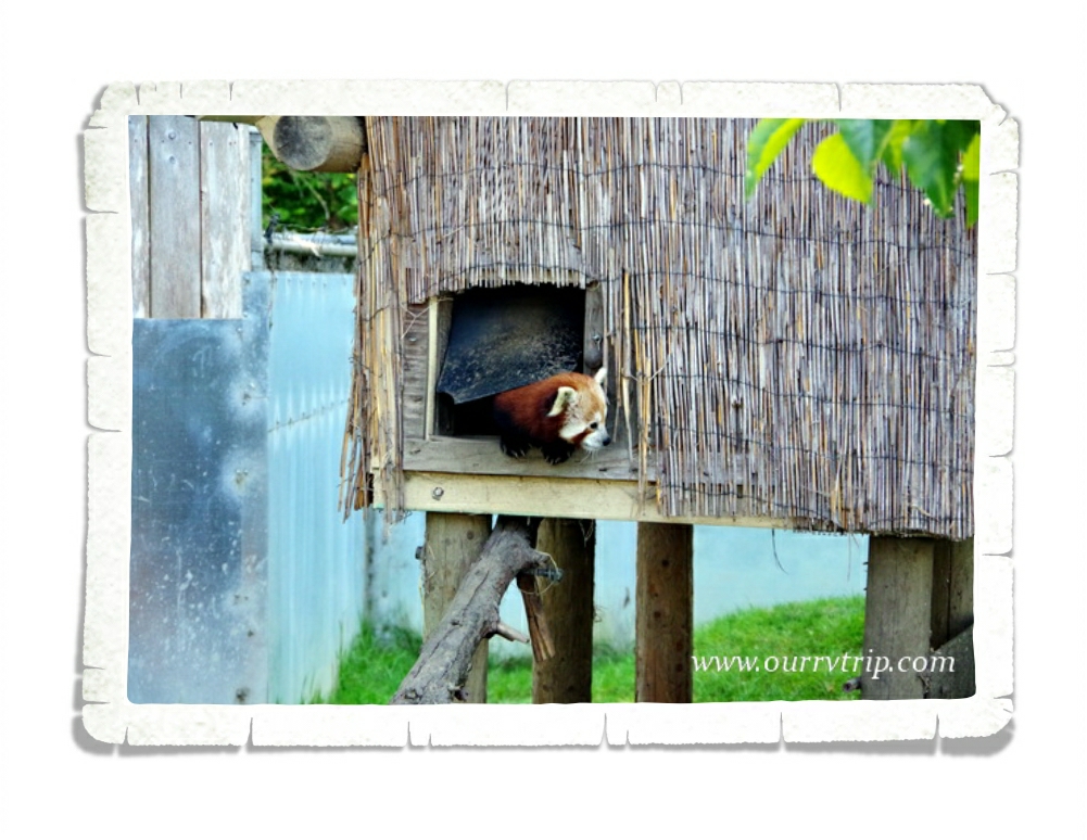
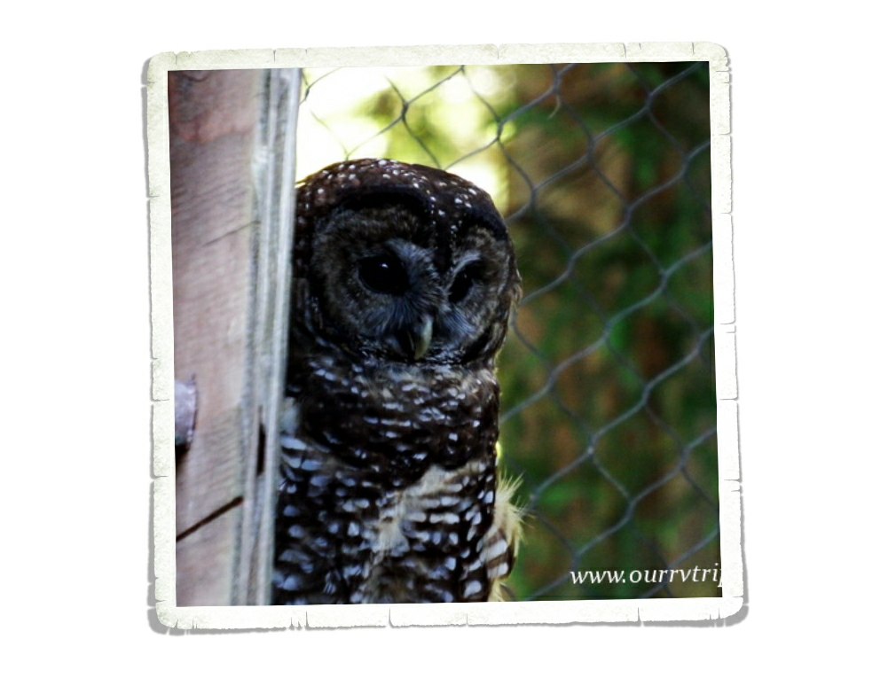
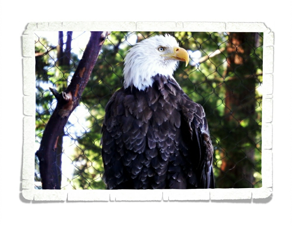
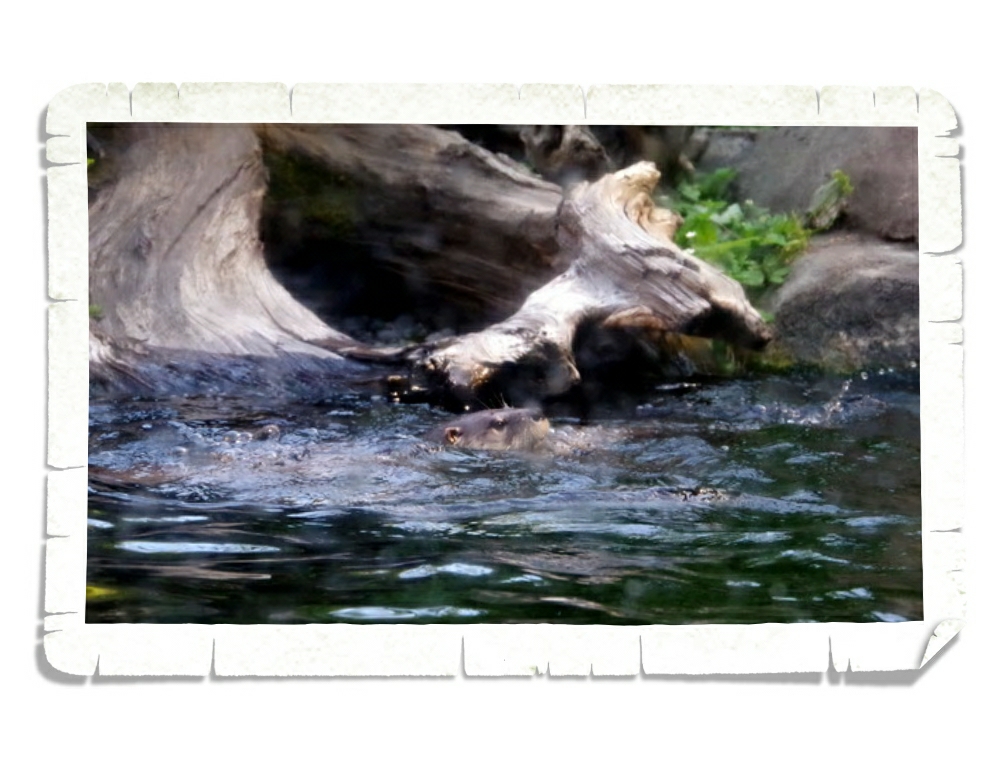
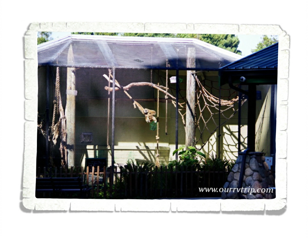
Sequoia Park Zoo comes next. We found this little zoo in Eureka, CA and made time to visit right at the end of a day of exploration. We got there just in time for the red panda feeding and zoo talk. We’ve been to some of the top rated zoos in the country and this little zoo is one of our favorites. Happy animals, clean and big exhibits…what more does a zoo need? What it lacks in size, it more than makes up for in heart.

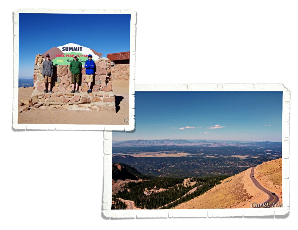
One of the things we love is a good view and what better place to get a view than atop one of Colorado’s tallest mountains. Pikes Peak is the most expensive mountain we’ve explored…but Guys…that view. When we were there, the summit was torn up for construction of the new Summit House. It’ll be fantastic when it’s done! We just might have to go back and see it completed!

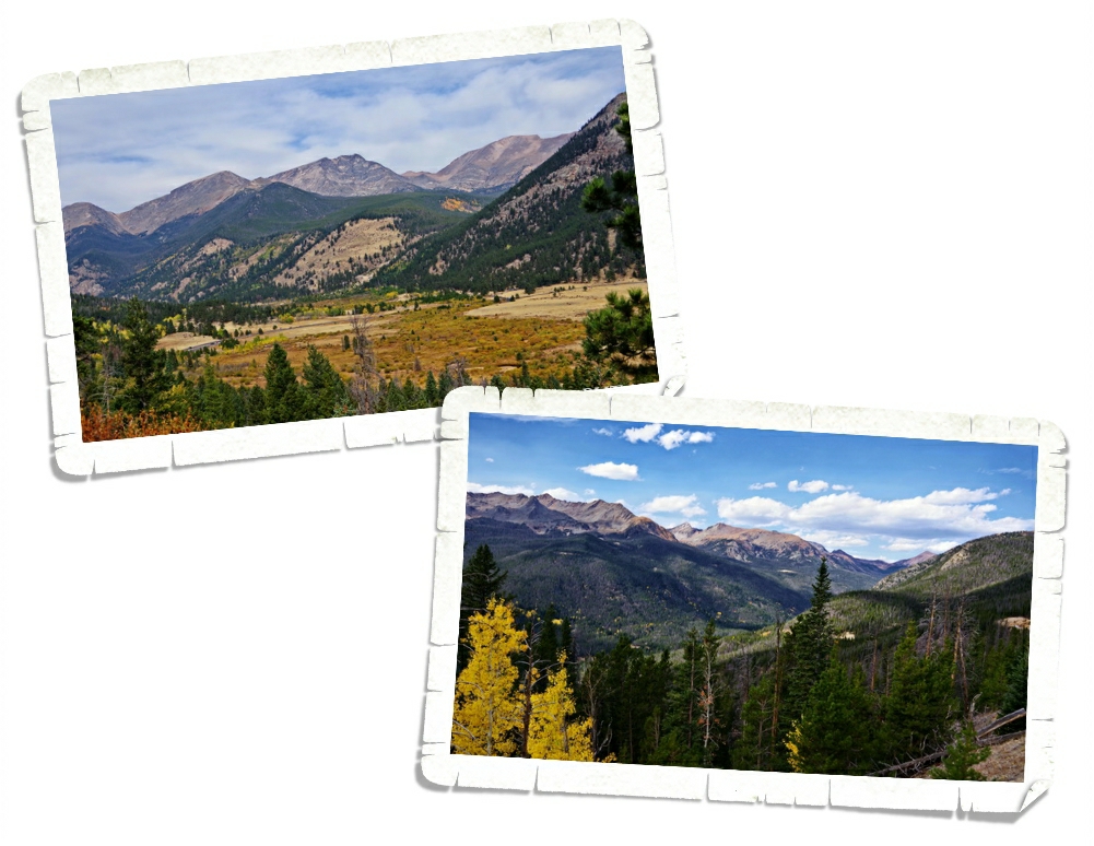
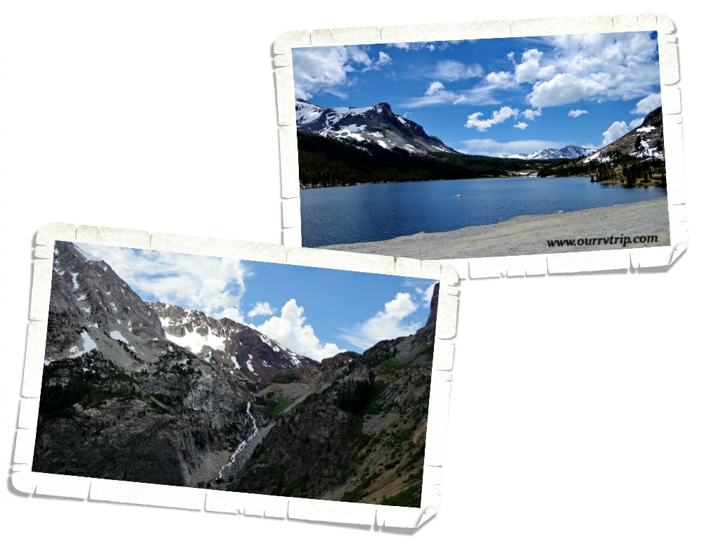
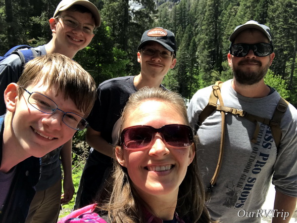
One of the states that Jerl has been looking forward to the most is Colorado. The mountains have called his name for many years so it shouldn’t be a surprise that Rocky Mountain National Park is on our top ten list. We were only able to spend one day exploring this giant park and hope to go back one day to see more of it.

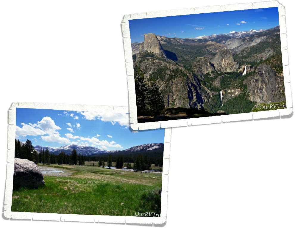
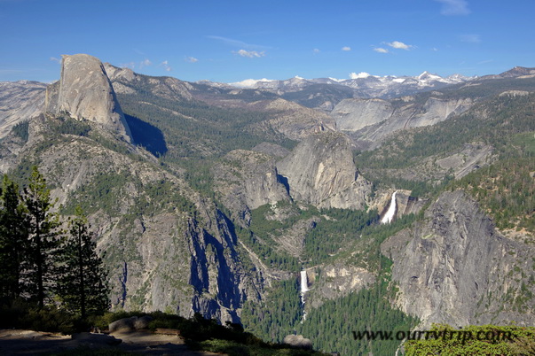
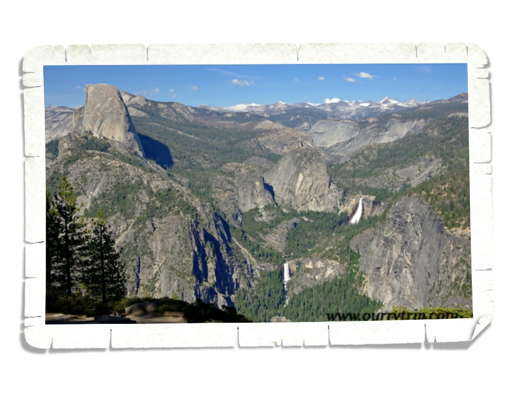
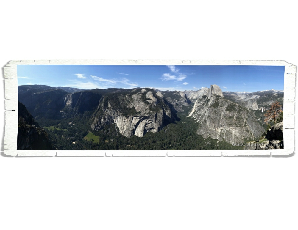
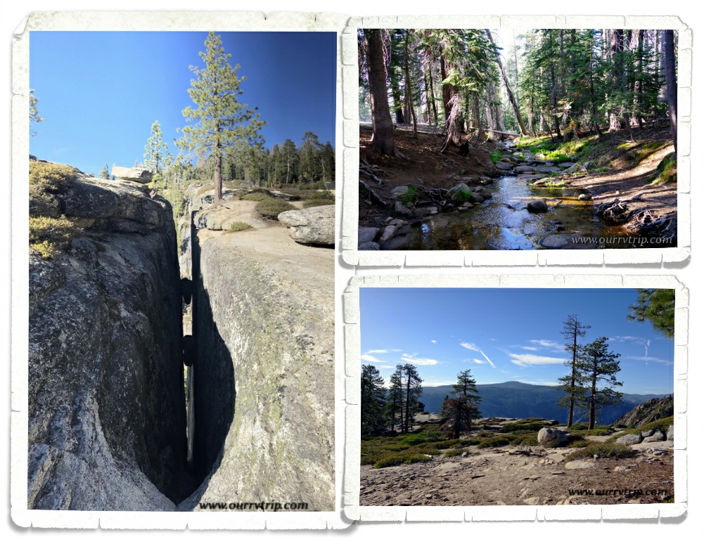
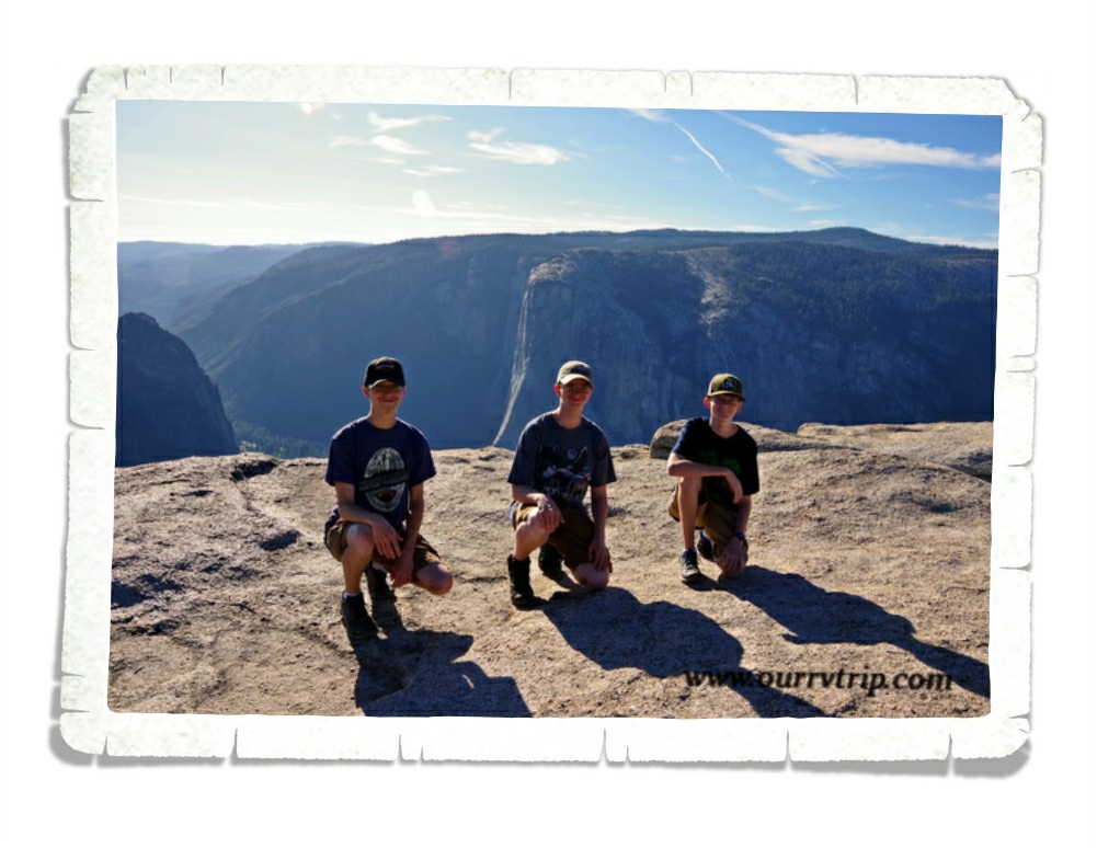
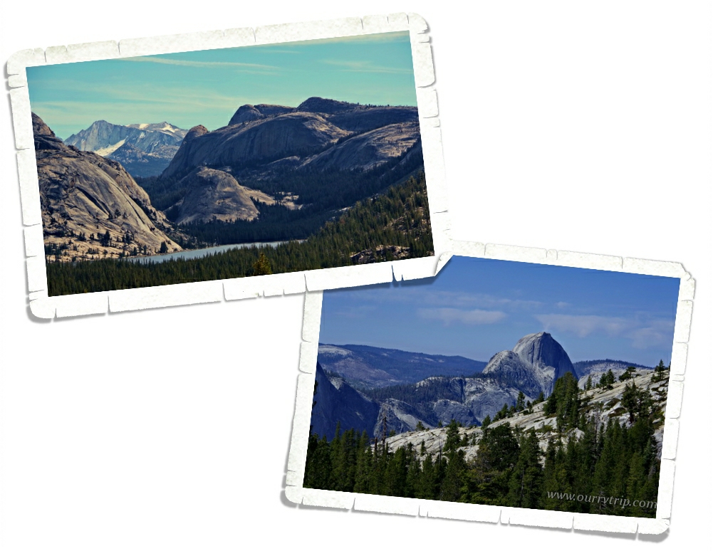
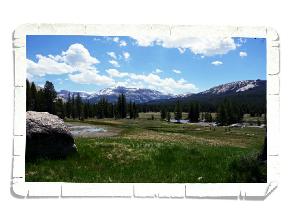
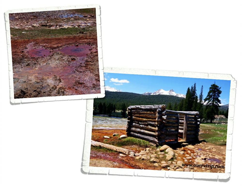
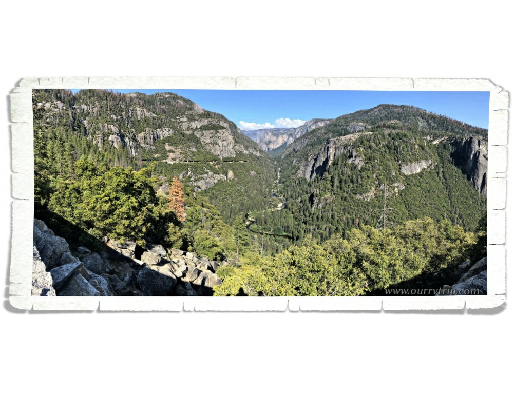
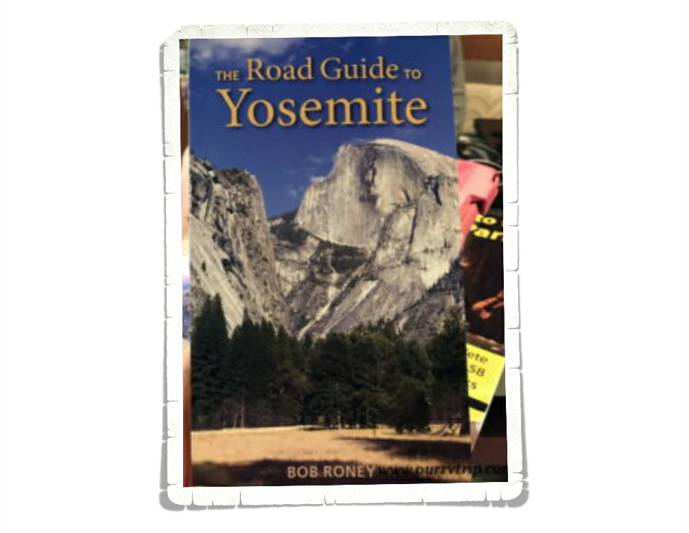
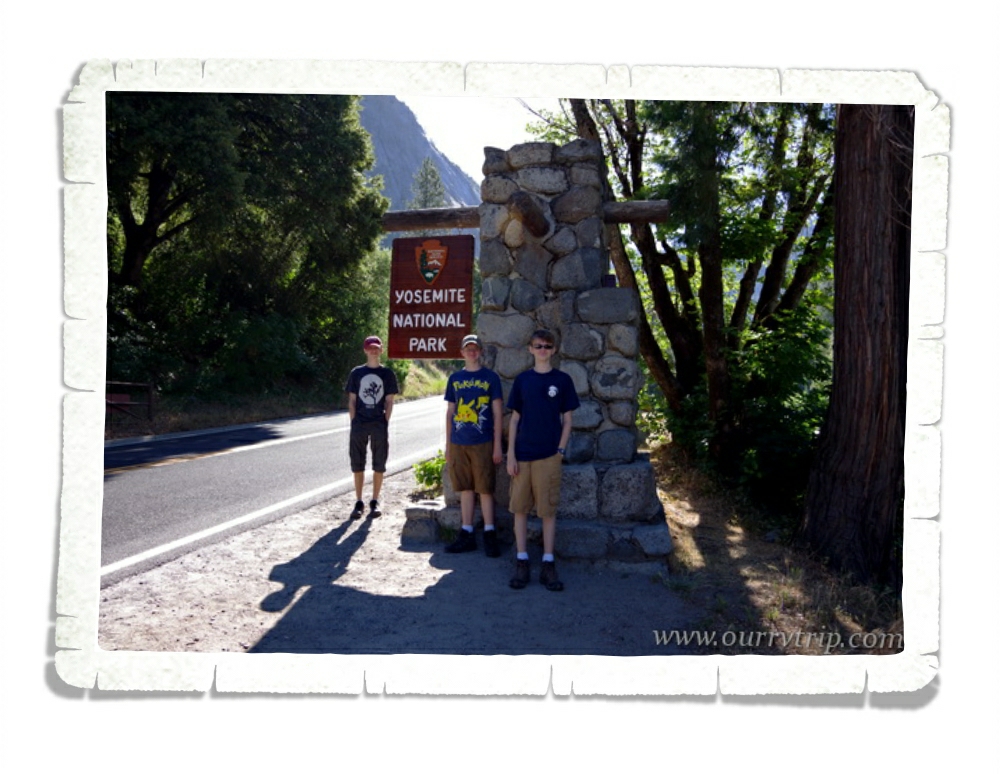
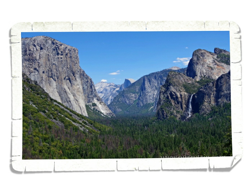
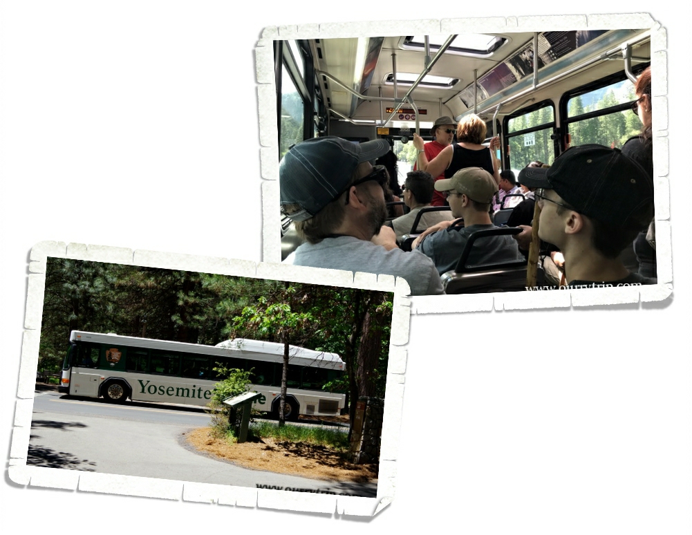
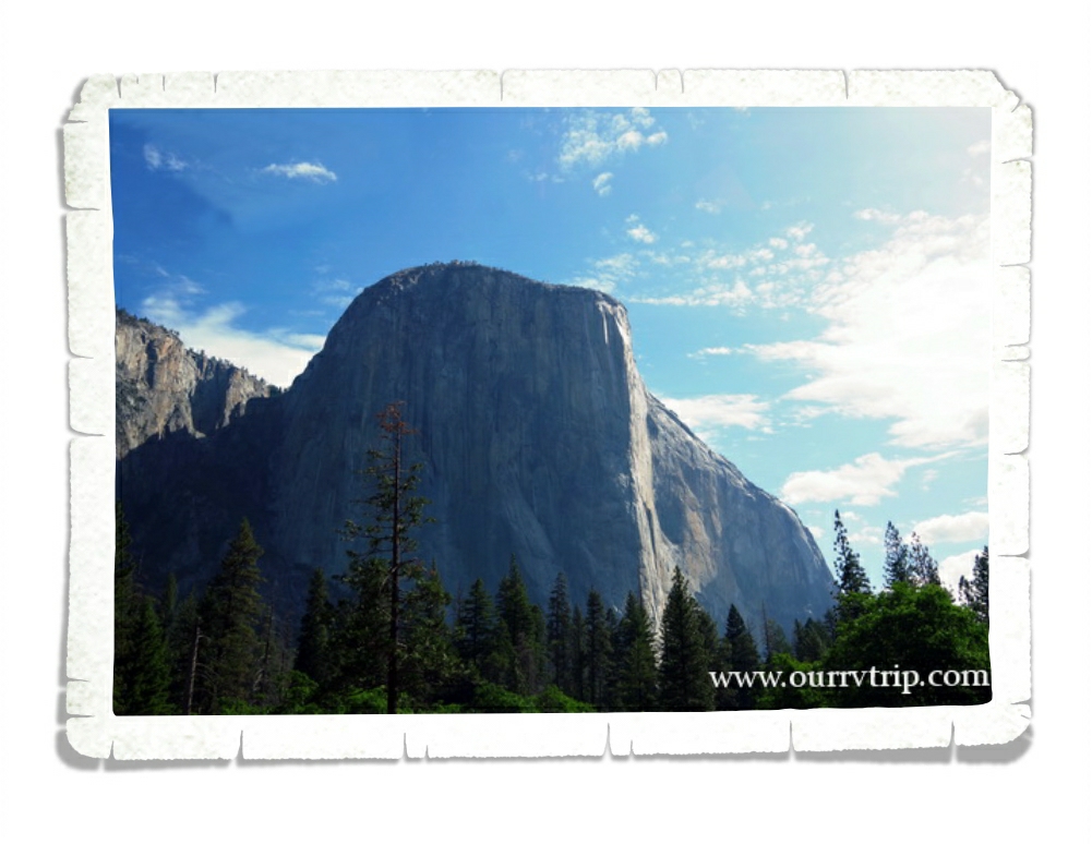
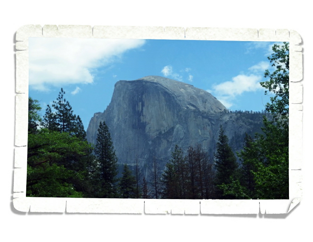
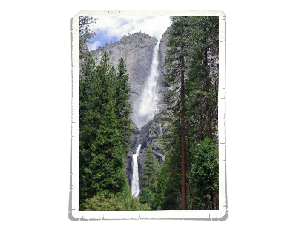
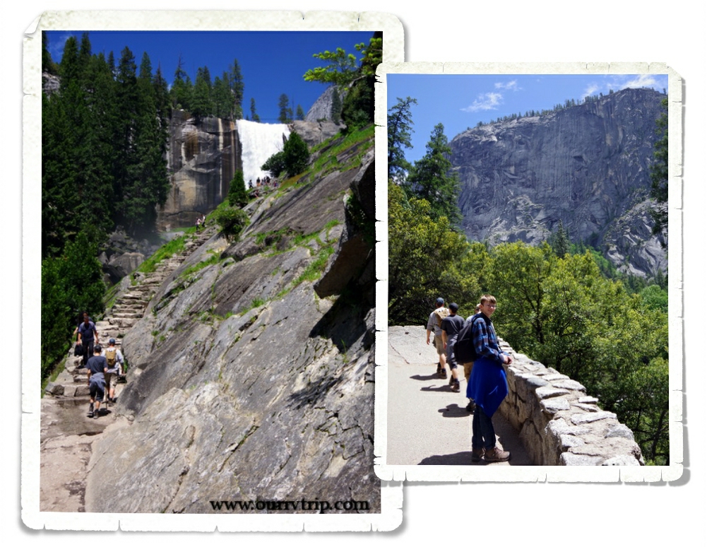
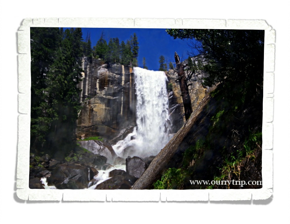
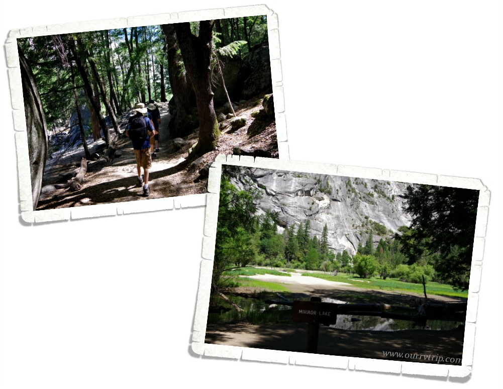
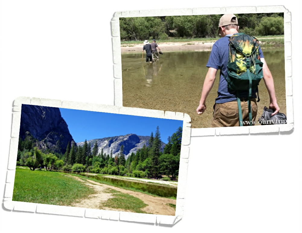
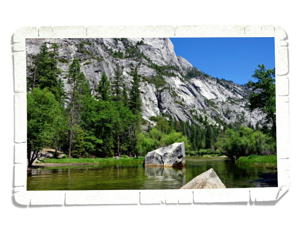
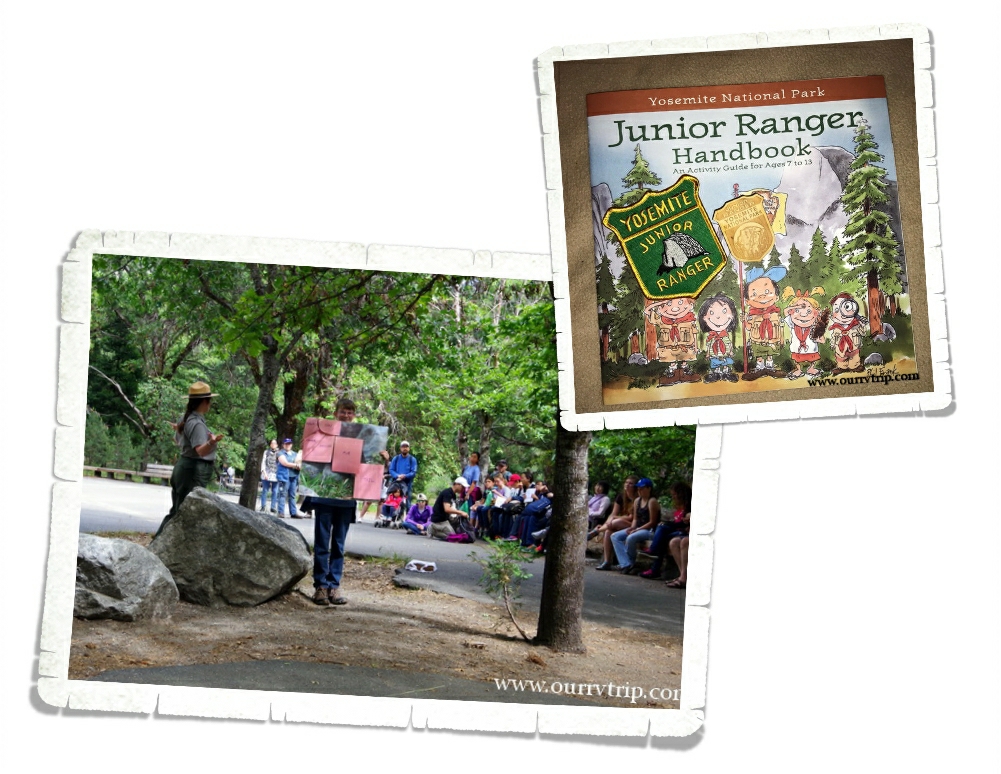
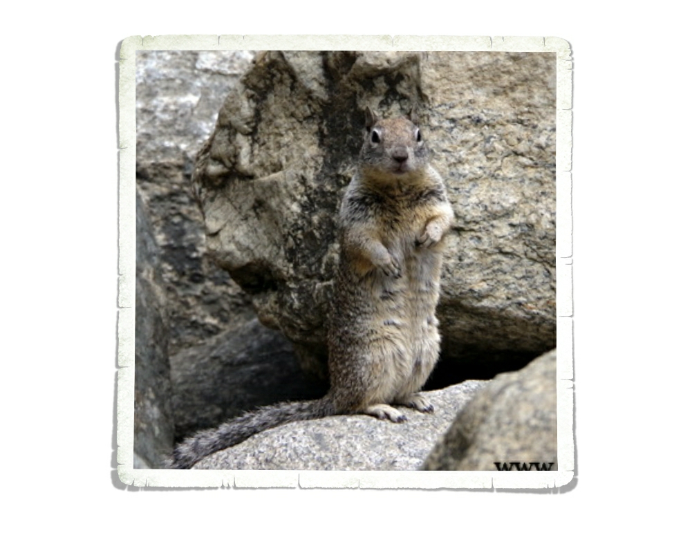
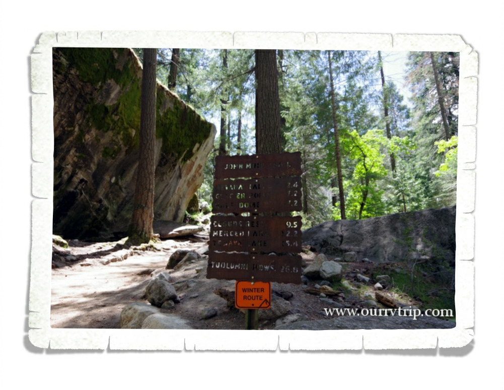
Yosemite National Park is in the number six spot on our top ten list for 2018! We were there right before the busy season, but there were still so many people. The few days we ventured into Yosemite Valley the crowds were insane! It wasn’t our thing…all of the crowds. But, when we drove Glacier Road and Tioga Road…the crowds weren’t nearly as bad and the views were ah-mazing!

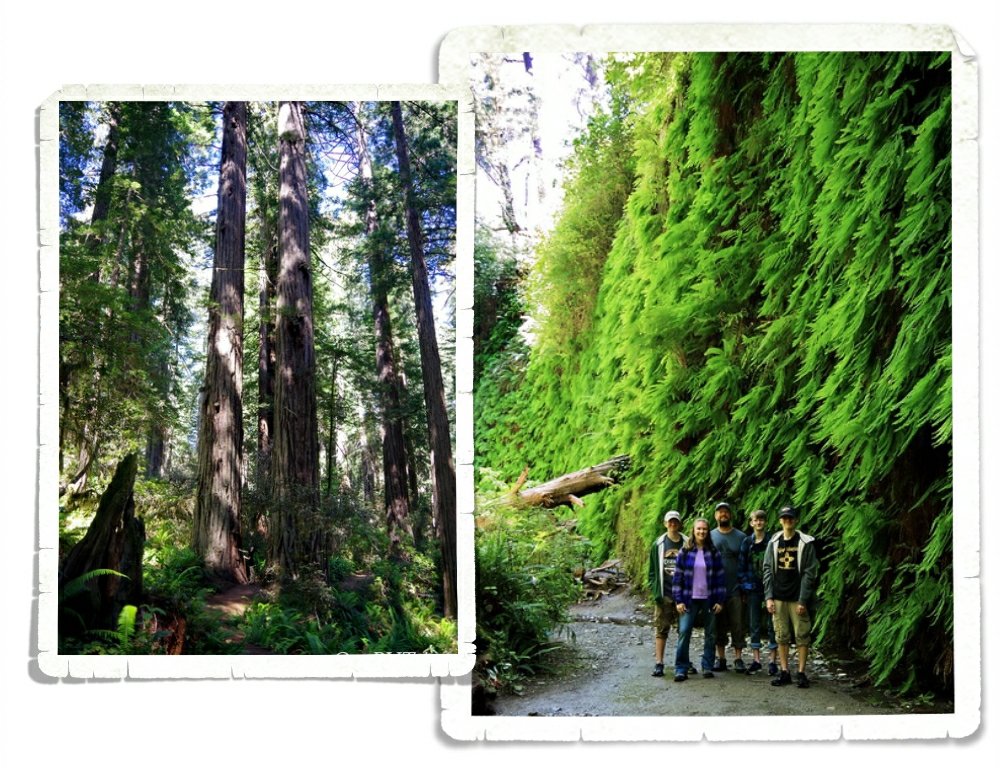
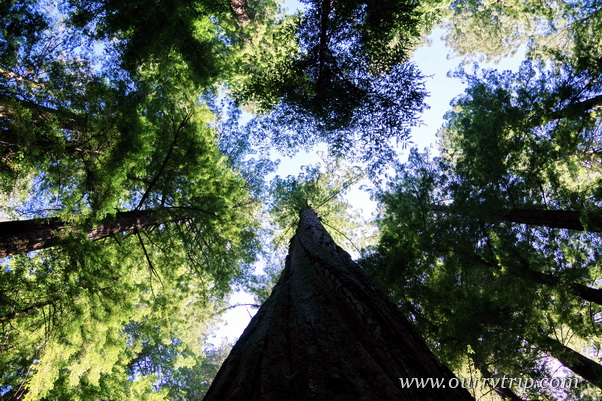
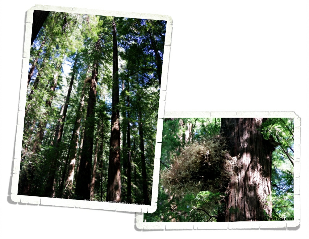
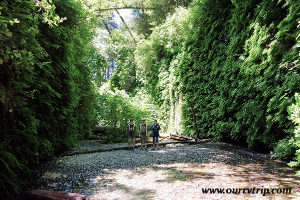
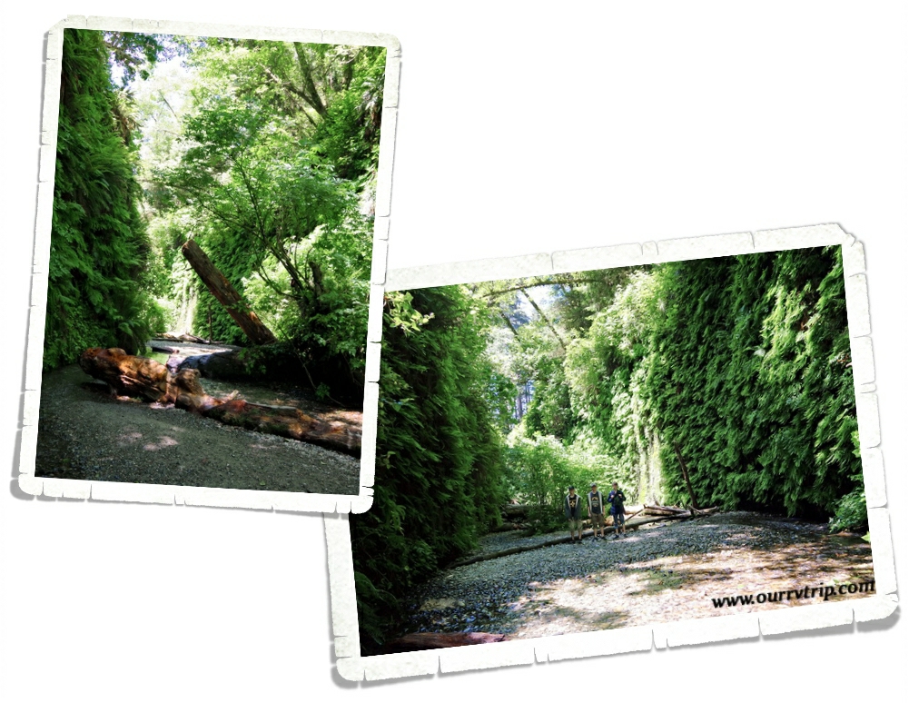
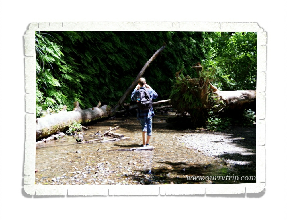
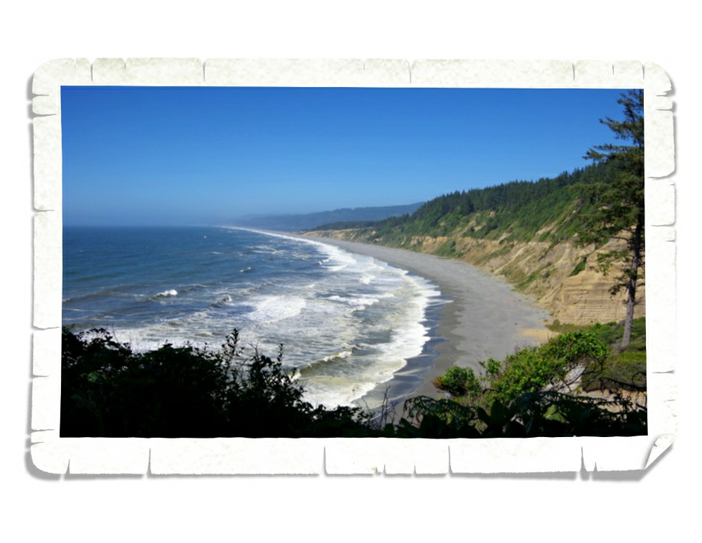
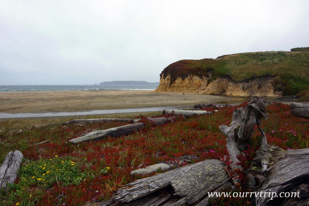
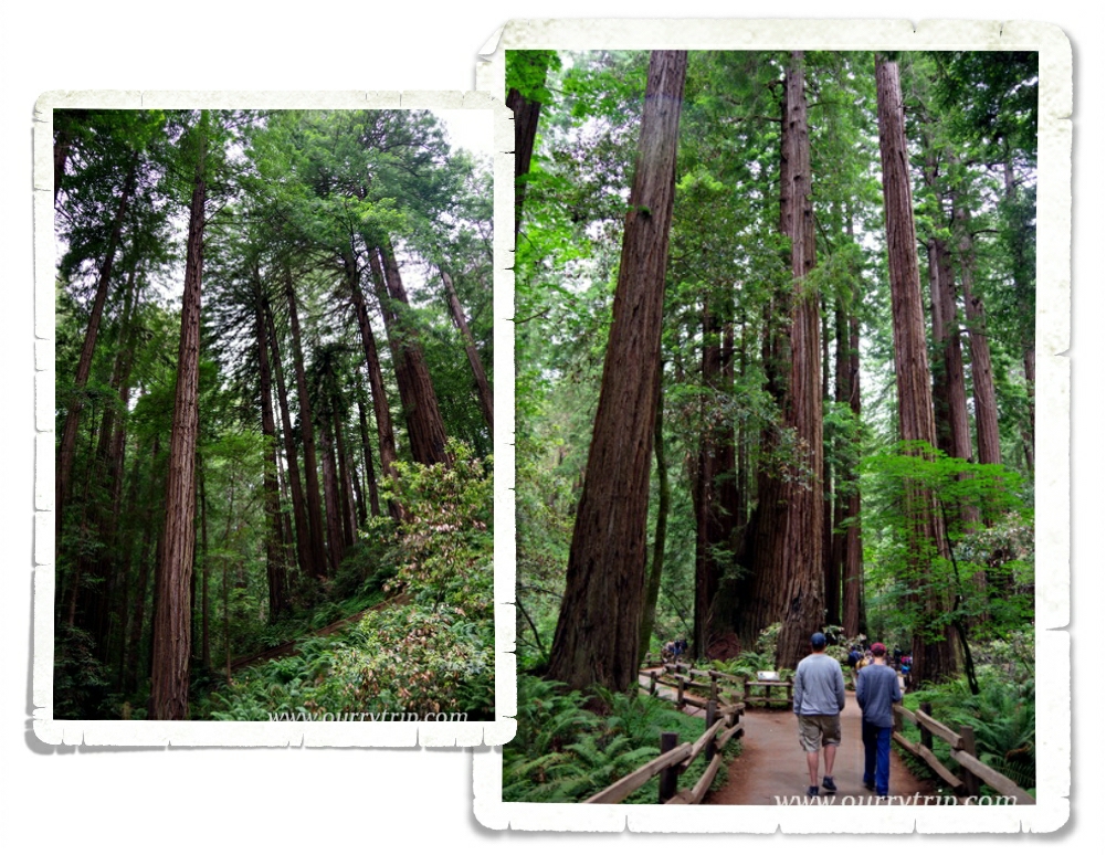
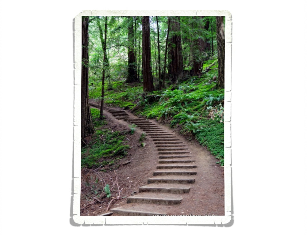
One of the places I’d been looking forward to visiting is Redwood National and State Park! These two parks work together to preserve one of the largest tracks of old growth coastal redwoods left in the US. And! There’s Fern Canyon! This canyon has fifty feet walls covered in several types of ferns. It was so fun to wade down the small creek! If traveling isn’t your thing…you can take a look at Fern Canyon without leaving your home…it was used to film parts of Jurassic Park II.

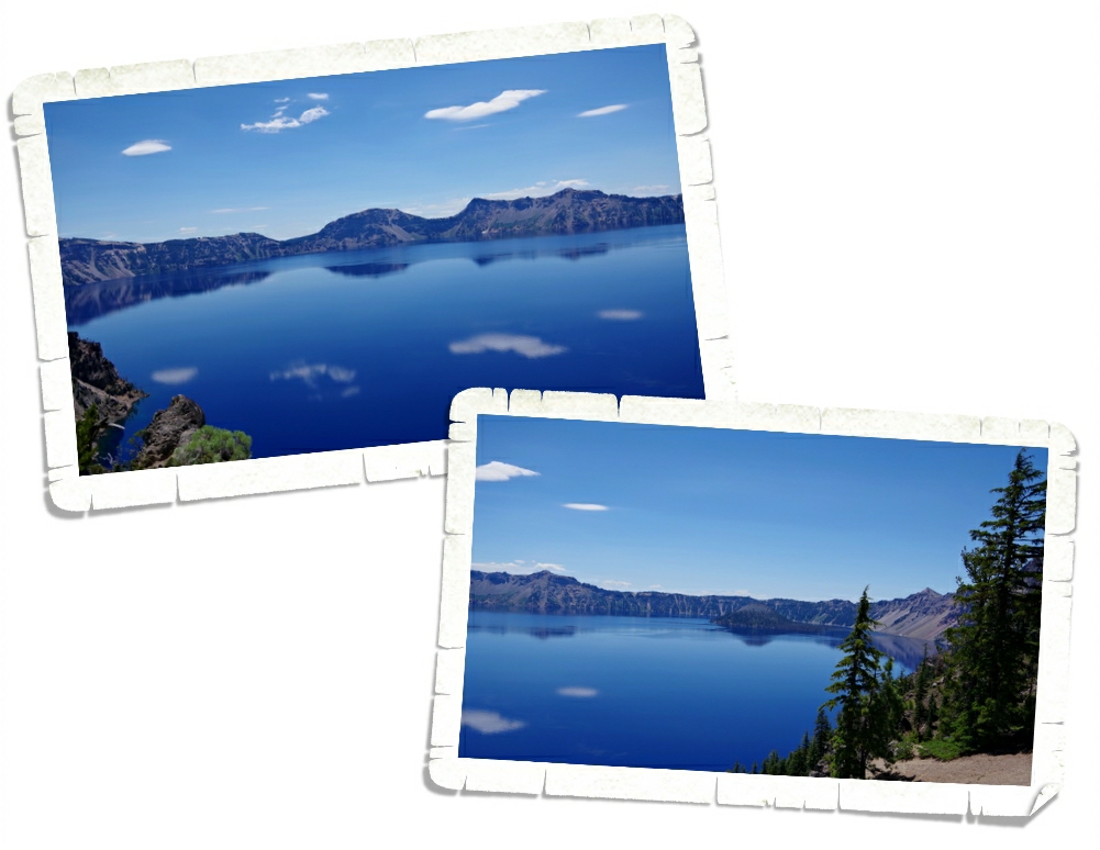
We made it to Oregon right as the burn season was revving up. We could see the smoke from one of the fires at the park we were staying in. We were worried we wouldn’t make it up to Crater Lake National Park due to the fires. I’m so glad we did! Crater Lake is gorgeous! The blue of that water!! There’s a bit of lore that says the blue bird used to be black before it dipped into the waters of Crater Lake.

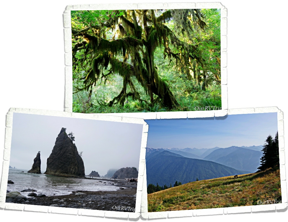
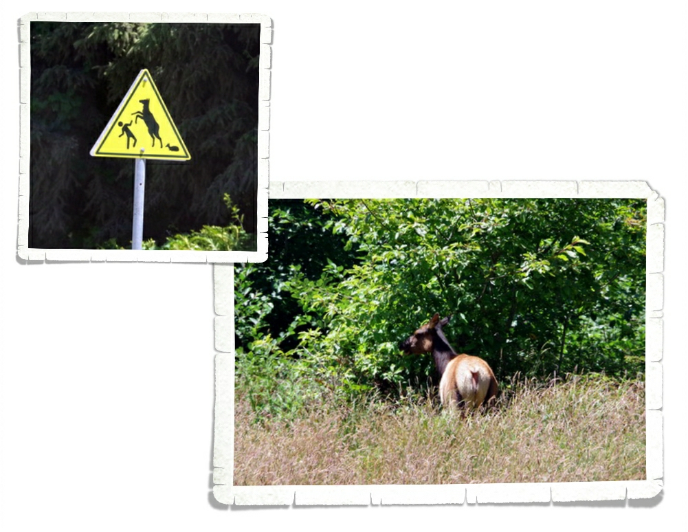
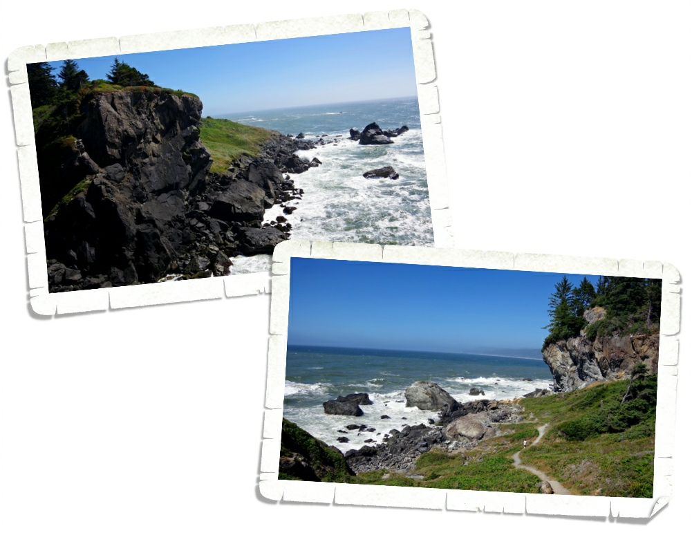
Olympic National Park rests in the number three spot on our top ten list for this year! This place…Guys, I could totally spend a season or two in this area of Washington. There is so much to love about Olympic National Park! You get beaches, mountain vistas, and forests of moss covered trees to hike through!

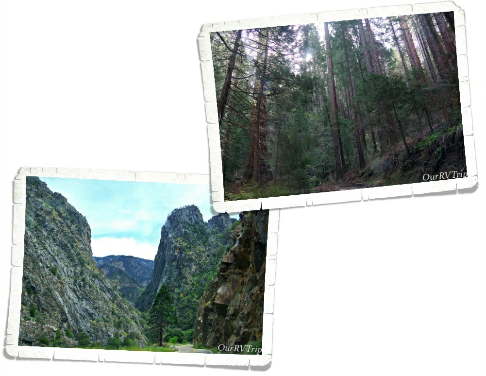
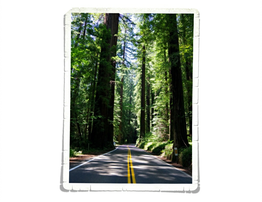
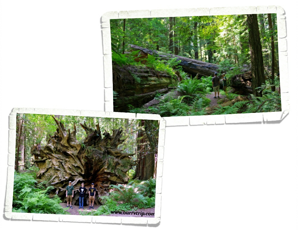
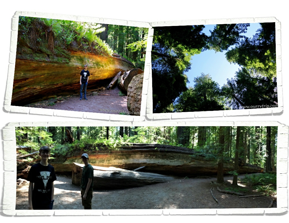
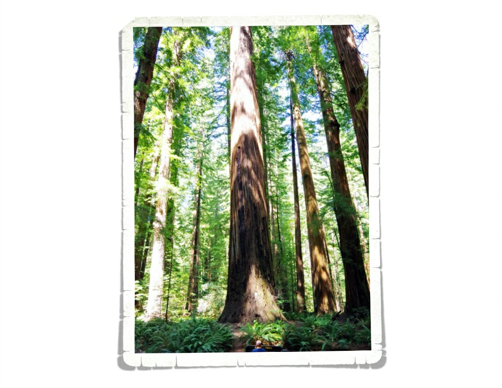
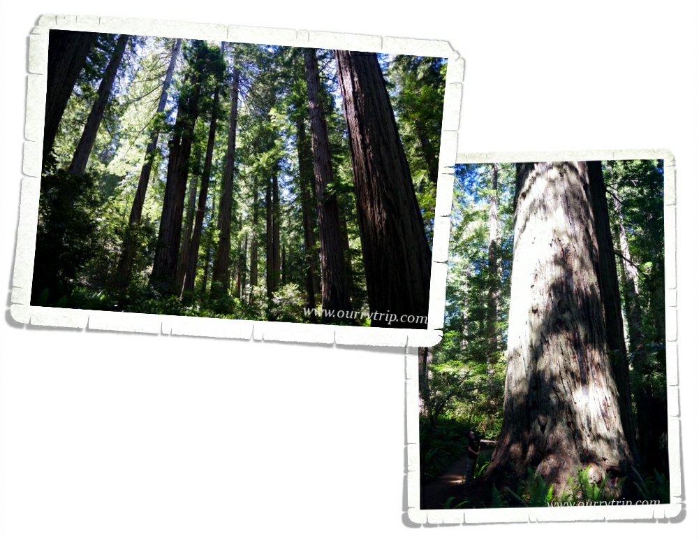
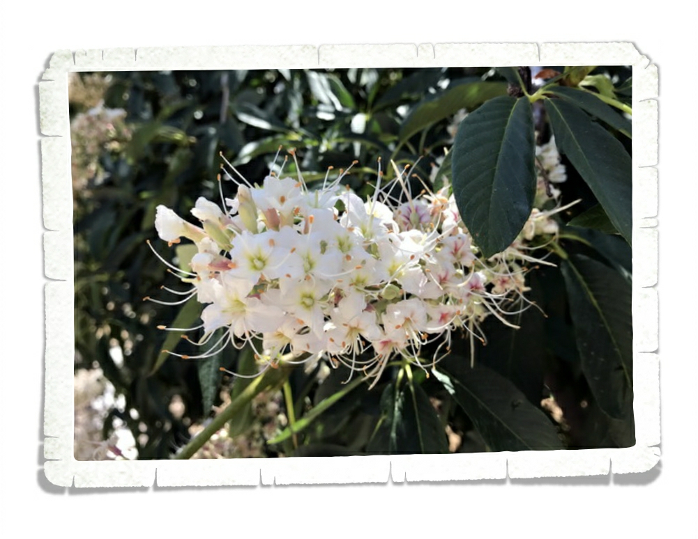
This next park is not only in our number two spot, but was the biggest surprise for us. We weren’t entirely sure of what to expect from Kings Canyon National Park, but we loved it! You get the gorgeous tall trees and you get to explore a huge canyon! We somehow ended up taking an old forest service road to get into the park and in doing so drove right through one of the largest groves of redwood old growth left. We had it to ourselves and it was fantastic! The canyon was a total surprise. There are views for days, hikes and waterfalls to explore!

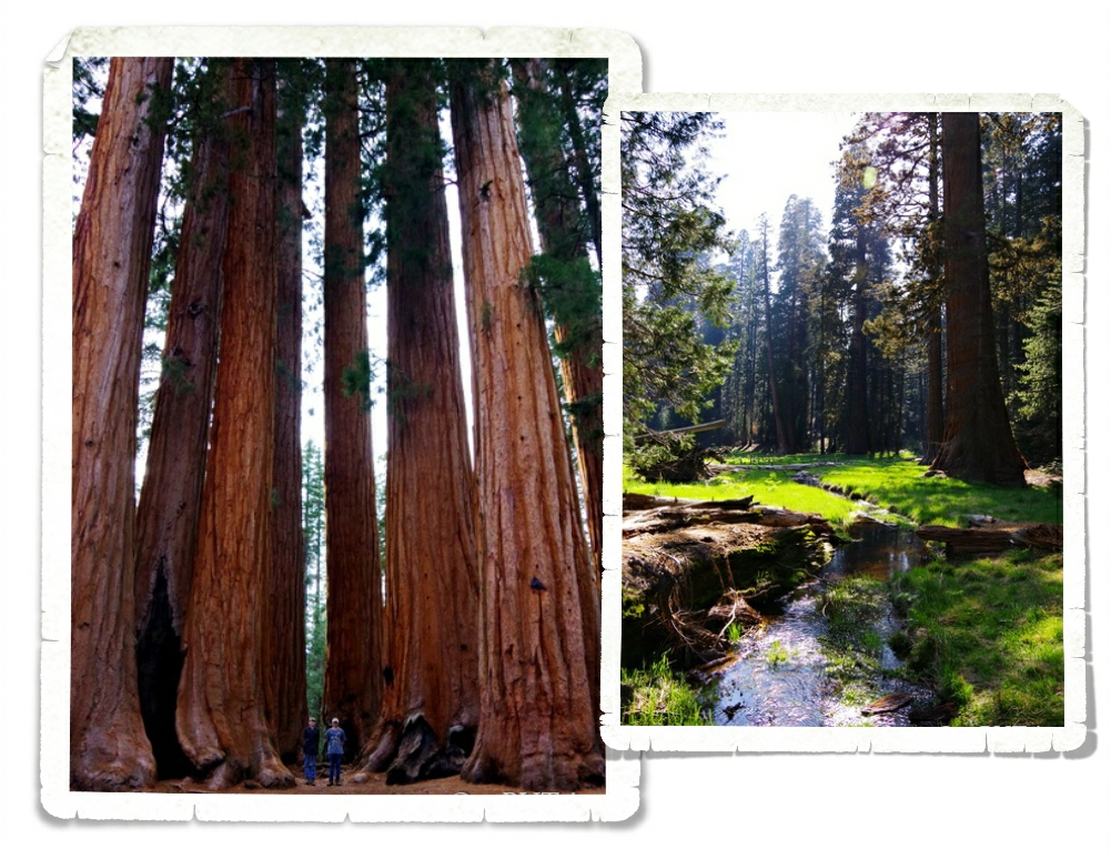
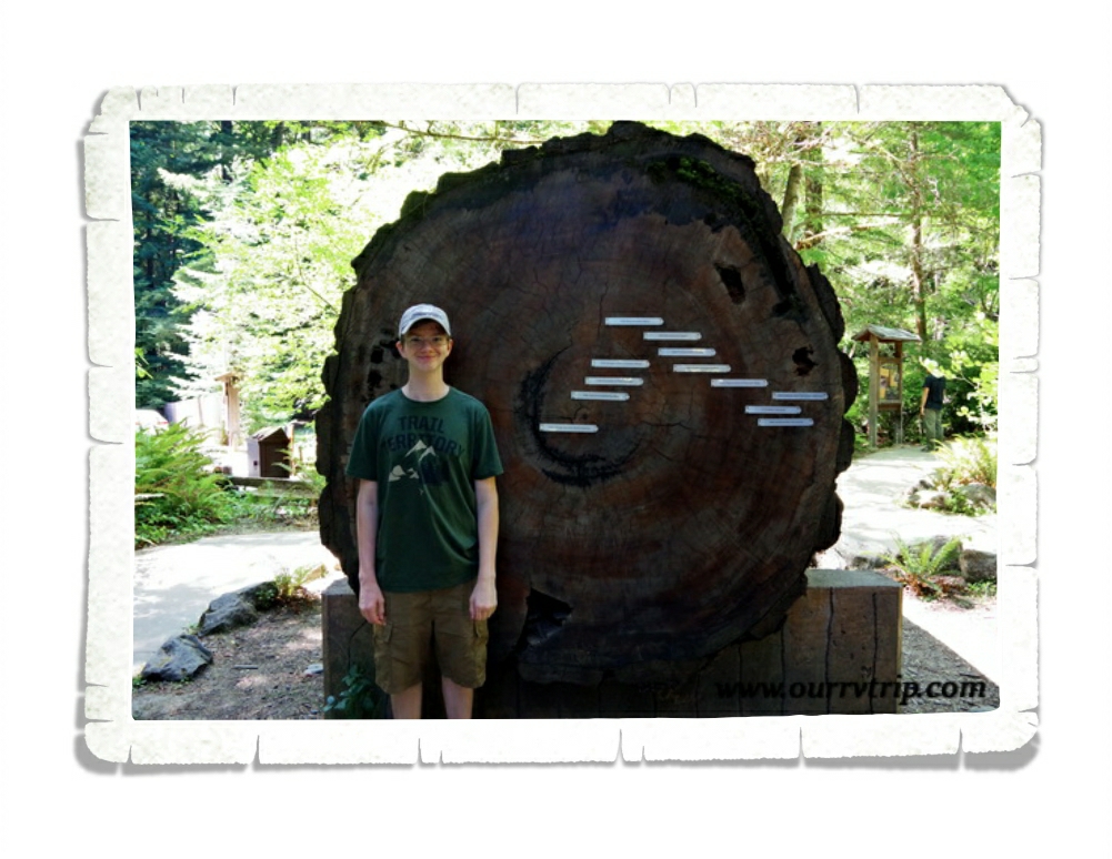
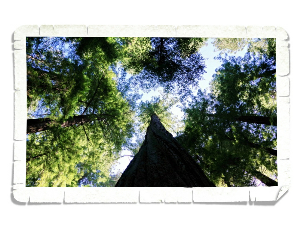
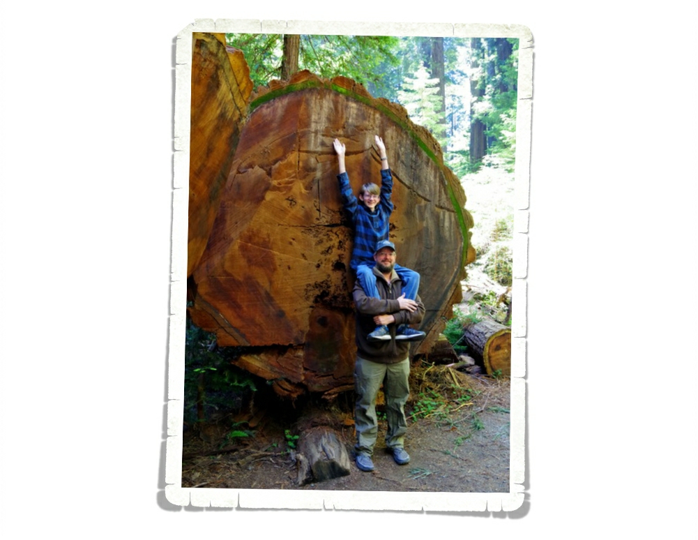
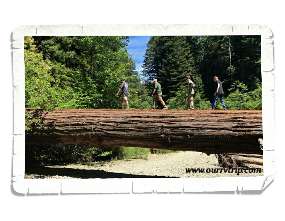
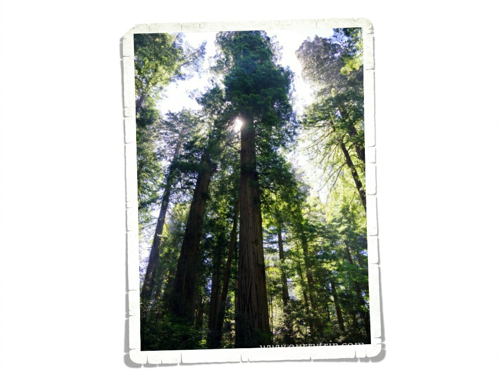
Our number one memory of 2018 is Sequoia National Park! We heart tall trees in a serious way. We can’t get enough of them. We stayed in the Sequoia National Park area for two weeks and we spent every spare minute we could up the mountain, in the park walking amongst the tall trees. I’m already trying to plan our next trip to Sequoia.

We’ve wrapped up our State Tour. Y’all haven’t seen the last few posts about those explorations yet, but they’re coming! We hope that each of you have a wonderful New Year’s Day and a blessed 2019! Thank you for being a part of our crazy nomad journey!

See y’all down the road!

Avenue of the Giants

Avenue of the Giants

Hey Guys!! We spent one very full week in Myers Flat trying to spend as much time among the tall trees as we could. Our RV park was actually on the Avenue of Giants road. There were some pretty nice sized redwoods right in our neighborhood that week.

The Avenue of the Giants is a 31 mile scenic drive through part of Humboldt Redwoods State Park. The huge trees line the road as you drive through one of the largest remaining old growth redwood forests in the world.

The coastal redwoods can live a loooong life. Some reach upwards of 2,000 years old. See the marker closest to Alex? That marks how big the tree was when the Viking’s discovered North America in the year 1000. The last one…was the year the California State Park system was established in the year 1928.

We saw some really big trees when we were in Sequoia National Park…we saw some tall trees while we were in Redwood National Park…but this tree was our first taste at just how incredibly tall the coastal redwoods can get. The Founders Tree stands at 346.1 feet tall and has a circumference of 12.7 feet.

Have you ever heard of an albino tree? No? We hadn’t either, but in one of the brochures I picked up there was a mention of albino redwoods hidden somewhere within the many groves of redwoods along the Avenue of Giants. We asked around and actually managed to lay eyes on one. An albino tree has to grow off of another tree. Don’t feel bad if you didn’t spot it on the picture on the left, they’re kind of hard to see. This one was growing almost two hundred feet off the ground out of the side of another redwood. We looked for others as we explored, but we never found another one.

Redwoods can grow to weigh more than 500 tons and reach a height taller than the Statue of Liberty, but their root systems are amazingly shallow…which is why most of them die from toppling over from either wind or to much water from storms. I think we might have seen just as many redwoods lying down as there were standing tall.

The Dyerville Giant once stood an astonishing 370 feet high. Guys, that’s 200 feet taller than the Niagara Falls! This tree was considered the tallest tree in the world until it fell in 1991 as another tree fell into it during a storm. The Dyerville Giant was so big that when it fell it shook the ground hard enough for a nearby seismograph to pick up the tremors. We walked the length of it a couple of times marveling at the sheer size of it. In the upper right picture, you can see the hole the Dyerville left in the canopy when it fell. While standing, the Giant had a crown spread of seventy-four feet.

A redwood’s trunk can grow up to twenty-two feet in diameter with a bark that can be more than twelve inches thick.

The Big Tree area of Humboldt Redwoods State Park is in the Rockefeller Forest section. Some of the trees in the Rockefeller Forest are close to 2,000 years old.

This is Tall Tree. It stands at 359.3 feet with a circumference of 42 feet. It’s big. I took way more pictures of trees in this one week than I’ve ever taken in my life. Trees. It’s hard to explain why these titan trees fascinate us so much. There’s something about standing next to a living thing that’s been in the world for so long…

We did other things too. We found a great little zoo in Eureka. Nicholas just told you all about that though, so I won’t go into it. I will say, that the red panda exhibit was the best we’ve seen yet!

We found a great little pizza place in Miranda, CA…right down the road from where we stayed.

Well, I could ramble on forever about tall trees. I took enough pictures of them to fill several posts. If I ever talk Jerl into going back to California it will be to see the tall trees.

See y’all down the road!

#westernloop2018

#wehearttalltrees

World of Zoo Sequoia Park Zoo

World of Zoo Sequoia Park Zoo

World of Zoo

To my fellow animal lovers! I bring to you a post from Eureka, CA.

Sequoia Park Zoo is a definite must do if you’re ever in the area.

The zoo is really clean and they really care for all of their animals.

They even have some animals I’ve never see before and we’ve been to a few zoos! Like Patagonian cavys,

crusted screamers and…

Montjacs! Montjacs are small but interesting animals. The folds on their noses and forehead are scent glands, and they mark their territory by head bumping a tree or a rock. The antlers on a montjac get about 4 inches long, this guy had just shed his.

In with the montjac (named Jack) are three red pandas! (I am very proud of taking this pic). They have the best exhibit for seeing red pandas I’ve ever seen!

The red pandas have trees for lounging in, it also provides a good escape route just in case Jack gets troublesome, but that doesn’t happen often.

When we got to the pandas (I was rather frantic) they were about ready to start feeding them. The keeper fed them some apple cubes after putting out they’re bamboo and taught us a little bit about them. Now, this was the first time I ever saw them move, so I got to see how slow they really are. Eating only bamboo will kinda do that to ya.

Did I forget to mention they have their own hut? Man, I want my own hut!

They’ve got some peccarys on the hunt for food, always hunting for food.

This owl was REALLY on the hunt. The keepers put mice in the owl exhibit and this one was zeroed in on one.

The eagles weren’t doing much, just sitting there all majestically saying “Look at me hooman, I’ze amazing!”.

The otters were pretty active. They were racing each other all around their habitat and playing around! It was fun to watch, but hard to get a picture of.

The otters weren’t the only ones playing around, check out the spider monkey! He was swinging back and forth on a rope. I’m pretty sure it was eating something too. Based on cleanliness, habitat size for the animals and all of the happy, healthy animals, Sequoia Zoo certainly deserves 5 stars.

See y’all at the Zoo!!

#worldofzoo

Written by Nicholas

Redwoods and Fern Canyons

Redwoods and Fern Canyons

Hey Guys!! We spent one week in Myers Flat so we could spend some more time amongst the tall trees we’ve come to love so much.

When we got to our RV park we realized that the Verizon service they’d promised on the phone wasn’t there. I couldn’t even pull up Facebook on my phone and Jerl had a real bugger of a time trying to work. If we’d been planning on staying for more than a week we would have had to find a place with better connectivity and move.

Redwood National and State Parks are home to the world’s tallest trees. The two parks protect almost half of the remaining old growth redwoods left in the world. We spent some time in the midst of the giant sequoia trees earlier this year while we were in Sequoia National Park and completely fell in love with tall trees. The first full day we had in the area we went to Redwood National and State Parks. We started in the National Park with the Lady Bird Johnson Grove trail where we spent some time tripping on things in the trail because our necks were craned back looking up at the tall trees.

The coastal redwood is the tallest living thing on earth. It’s hard to believe that something so big can grow from something the size of a tomato seed.

There’s a good sized herd of Roosevelt Elk in the area. We’ve seen a lot of warning signs in our travels, but this was the first time we’ve seen a sign like this. Don’t mess with the mamas. They will hoof you.

Fern Canyon. You might recognize it from Jurassic Park II. I can’t remember where I first heard about Fern Canyon, but I knew right away it was a spot I really wanted to see. In all of the pics I saw of the one mile gorge, there were little bridges over all of the water crossings…but when we got there…there weren’t any bridges. None. Plenty of water in the little creek that runs through the gorge though! At first we tried to keep our shoes dry by walking on strategically placed rocks and logs.

It wasn’t long before we realized we were going to get wet so we rolled up our pant legs and waded through the water. We had the best time! Fern Canyon has fifty foot walls that are draped with seven different kinds of ferns. When you’re walking through it, it’s easy to imagine huge dinosaurs rambling through the canyon munching on all of the ferns.

When we know that we’re going to be out all day exploring in remote areas we like to pack a picnic lunch. Most times we end up eating in our car somewhere, but check out the view we had at this picnic! Not bad, right? It was a gorgeous day for a picnic by the ocean.

On the way home we stopped at Patrick’s Point State Park. We walked the trail out to Wedding Rock. The view was pretty amazing. And check out that black rock! We’d seen some black sand beaches around…I guess we know where the black sand comes from.

We also walked out to Agate Beach. We were told you can find agates there. We picked up some rocks, but I really don’t know if they’re actually agates. It doesn’t matter though…we love them. It’s hard to tell in this picture, but the sand was a black-ish sand.

So, I’ve only told you about one day of the week that we spent in Myers Flat. Instead of making one really long post, I’m going to break this week up into two posts. We found the pink flower in the Lady Bird Johnson Grove. There were several trees with the blooms on them throughout the trail. Bright pops of pink in a sea of green. It was pretty magical.

See y’all down the road!

#westernloop2018

Bodega Bay

Bodega Bay

Hey Guys! Remember when we had to change all of our plans because of engine trouble and eye surgery? Bodega Bay wasn’t originally in our plans, but when I was reworking our schedule I added it in on a whim. It’s just north of San Francisco and I don’t usually have such small travel jumps, but something about the area called to me…so I answered.

Bodega Bay is, as you might guess…right on the water. It’s kind of a white knuckley drive down highway one to get there, but Guys, we loved the area! The RV park we stayed in was near enough to the coast that we could hear the boats and water, but far enough that we were somewhat protected from the wind that seems to be a constant on the west coast.

We only had one week in Bodega Bay. That means we really only had one full day of exploration. We started out early in the morning and headed down to Point Reyes National Seashore. When we took off that morning it was a gorgeously sunny day with just a few specs of clouds but as we drove south to Point Reyes NS the clouds and fog started creeping in.

By the time we made it to Point Reyes it was sooo foggy and windy!! We tried to go out to the Point Reyes Lighthouse, but Guys…it was so incredibly windy and foggy we could barely see the road that you have to walk up to get to the lighthouse. We talked to the Ranger sitting in his car up at the lighthouse gate (it was bad enough that even he didn’t want to get out of his car) and he let us know that the lighthouse was open, but it was about a half mile walk to get to it. We opted out. As much as we love lighthouses…it was just too windy, wet, and cold. We did stop at Drake’s Beach! Love those cliffs!

I always try to give you a size comparison. Here’s a shot of the boys standing next to those cliffs on Drake’s Beach. With the weather being kind of…miserable…we didn’t have to share the beach with too many people. I mean, really, what kind of a nutter goes to the beach when it’s in the 40s and is super windy with fog? Well, the nomad nutters do. Yup. When you have a set time at a location, you go explore no matter what the weather (within reason) does or you miss out.

We found several sand dollars, a few shells, and some tide pools! They weren’t big tide pools, but we did enjoy the little sea anemones in them.

While I prefer to have beautiful sunny days to explore, I have to admit…I’m kind of digging the moodiness that the fog gave my pictures of Drake’s Beach. I guess it’s ok to have mood…sometimes.

The weather was so miserable that day we almost gave up on adventuring and went home. I’m so glad we stuck it out and headed up to Fort Ross State Historic Park which was about an hours drive north of where we were staying. We got there later in the day and only had about an hour to explore it. We do love our forts. It’s not unusual for us to get lost in a fort for half a day or more. So, we really had to rush through this one.

Fort Ross was established in 1812 for the primary purpose of finding food and hunting sea otters for their furs to support the Russian outposts in Alaska. Some of the buildings have been reconstructed and decorated to look close to what they would have looked like during the time the fort was up and running. There’s so much history that can be learned at forts like this. Most of what we’ve learned by visiting all of these forts isn’t taught in the general history books, but history is an important lesson.

On our way home from our foggy day of exploration we stopped at this pull-off to take in the view of the spot where the Russian River dumps into the pacific ocean. We noticed a crowd of people down on the beach all ogling a particular spot on the beach in between us. Guys! Seals! There was a ton of them! We found out later that the beach is called Goat Rock Beach and apparently, the seals are there often.

This is another shot of Goat Rock Beach on a different day. We tried to get out each afternoon during our week in the Bodega Bay area to get some more exploring done.

There are tons of pull-offs to take in the amazing views all along this section of highway one. We spent most of the afternoons at one of the pull-offs or beaches in the Sonoma Coast State Park. We loved our week along this rugged coast. I don’t think any of us were really ready to move on.

Let’s talk foodies. Right in front of where we stayed was this great little Mexican restaurant. We stopped in our first night and kind of wished we hadn’t. It was really good and way too close…we walked there. We also found a place right on the wharf where we got some great fish-n-chips! We’re getting our fill of all of the coastal fish-n-chips while we can.

I started seeing these in the supermarkets when we were in San Diego, but I kept resisting. We found them for sale singely at a little market in Bodega Bay though…so we tried them. Guys…do you see the two oatmeal cookies? These were so wrong that they were so right. I thought I’d be safe enough…we only had one more week in California at this point. I was really hoping I wouldn’t be able to find them once we got out of California…but, we’re in Oregon right now and…I saw them in the grocery store here! I may have to grab a box before we leave…I’m trying to be strong…but y’all know I’m a sugarholic… The struggle is real.

I love love love these pink and purple pretties! We found these at Fort Ross.

We had a great week exploring the coast here!

See y’all down the road!

#westernloop2018

San Francisco Part Two

San Francisco Part Two

Hey Guys!! We stayed in the Vacaville area for two weeks while we explored the San Francisco area.

Vacaville was about forty-five minutes away from San Francisco so it really suited us well. Far enough away to avoid the crush of so many people on a daily basis, but close enough that we were able to spend two days explore San Francisco.

We passed by this field every time we went toward the Bay area. Do you see the little outhouse? It’s quite the outhouse! Complete with modern plumbing…but no door…and facing a highway. Oh the things we see…

Y’all know that big cities aren’t really our thing. In fact, we usually skip them, but I wanted to see the big red bridge. Our first day in San Francisco was on a weekend and boy let me tell you…the crowds were insane! It took us quite a bit of time to find a parking space anywhere near the bridge, but we eventually did. It was cold and super windy. Apparently, that’s a typical summer day for San Francisco. By the time we walked to the bridge that famous San Francisco Bay fog had started rolling in.

We waded through the crowds to snap some pictures of the view then hightailed it back to the warmth of our car. This was as close as we got to Alcatraz. Timing and tickets weren’t on our side this trip. I’m hoping to revisit the area someday, but like I said before…big cities aren’t really our thing…so, we’ll see. We made our way down to Fisherman’s Wharf to do some more sight seeing, but the crowds were just too thick for us so we decided to leave.

We headed out in search of food and found ourselves at a place called Roam. Do you see that burger in the picture? I somehow got my mouth around it (no comments please) and promptly realized that this burger was definitely on my list of top five burgers…near the top. We got the Fry-Fecta to go along with our burgers. My favorite of the three choices was the fried zucchini/onion spirals. We left reminiscing about all of the other burgers we’ve had while trying to decide which burger is on the top of our list of favorites. We all agreed it was a green chili cheeseburger, but we’re divided as to exactly which one.

By the time we were crossing back over the bridge to head home the fog had rolled fully in. It was a little eerie crossing over the water without being able to see it.

Our second excursion into the city was during the week. We made the trip first thing in the morning to avoid as much of the crowd as we could. We found Fisherman’s Wharf much less crowded. And Guys, check out the famous San Francisco hills. It’s hard to really see how steep it is in pictures…you can see the slope of it better in the bottom picture. Driving up one of the steeper hills felt kind of like the beginning of a roller-coaster. You know…the very beginning when you’re click, click, clicking slowly to the top of the hill so you can plummet down the other side. I feel like it would definitely be more terrifying to go plummeting down one of these steep San Francisco hills.

Our first stop was the San Francisco Maritime National Historical Park where we learned about the city’s seafaring past. There’s a nice little museum at the Visitor’s Center where the boys got their Junior Ranger booklets, but the best part is right across the street, over at the Hyde St. Pier where you can walk around and explore some older ships.

We walked around an old passenger ferry named Eureka. Eureka started out as a ship named Ukiah that used to transport munition filled railroad cars. We loved walking through all of the old cars and the upper level where the passengers would ride.

Years ago…I don’t remember where I first got some…I had my first taste of See’s Candies. It’s been my favorite boxed chocolate since then. So, when we saw a See’s Candies store on Fisherman’s Wharf…I had to go in. And…come out with a few…souvenirs.

We ended up at a fish-n-chips place called The Codmother Fish & Chips. There’s something about having fish just feet from the water it was caught in…so good!

Our last stop in San Francisco was the Sutro Baths. At one time, the Sutro Baths were once the world’s largest indoor swimming complex. The building itself is all but gone, but there are still remnants of what once was. This picture of what the Sutro Baths used to look like was in the Visitor Center. Adolph Sutro, a German immigrant, used the money he made as an engineer of a ventilation tunnel for the silver mines of Nevada’s Comstock Lode to purchase the real estate called Lands End and build the Sutro Baths. The swimming and bathing complex was covered in three acres of stained glass and steel and seemed to be built right into the seaside cliffs.

Confession…I’m a little bit of a sugarholic. Just a little. Well, if I’m being completely honest, I might as well tell you…I’m a huge sugarholic. Huge! Some of my friends and family have told me that sugar runs through my veins instead of blood. While I’ve made an effort to cut back on the amount of sugar I have a day…er…I mean a week. We couldn’t pass up touring through the factory of one of my favorite sugary treats. Jelly Belly!

The Goelitz family has been in the candy business since 1869. That’s a lot of candy making! At the Fairfield factory, you can take a free self-guided tour of their candy making process and see the factory in action. In the picture above you can see what Jelly Belly bean centers look like. When the centers get their shells, they’ll be 40% bigger! The center bean of a Jelly Belly is made from a slurry made of sugar, water, corn syrup, and corn starch. Every Jelly Belly bean starts with the same basic slurry and then the flavor and color is added. The Fairfield Jelly Belly factory can make around 800 Jelly Belly bean centers per second. Once the bean centers have been made they have to cure, rest and dry.

Have you ever wondered how they mix the Jelly Belly beans for the bags of mixed flavors? They pour boxes of each bean in the mix on this long conveyor belt. The belt moves and the beans work their way up to a big barrel where the beans are all mixed up together. The beans are then moved by another conveyor belt to those big white containers in the picture (top left a bit) above where they wait to go to the packaging area.

There’s a bean artist who gets to spend all of their time making these Jelly Belly bean works of art. How fun would that be?! Some fun facts:  each work of art is typically 4’x5′, each picture weighs about 100 pounds with the frame, it takes around 100 hours from start to finish, and it takes somewhere around 12,000 beans to make one masterpiece.  

One of the best things about the Jelly Belly factory…they’ve got all of the flavors! And I do mean all of them. We, of course, had to take home some samples. Just a few. **wink, wink**

We really enjoyed exploring the San Francisco area! There was so much to see and do that we didn’t even scratch the surface with two very full weeks of adventuring. Maybe someday we’ll travel through the area again so we can hit some of the things we missed…when we’re ready to face the huge crowds again.

See y’all down the road!

#westernloop2018

San Francisco Area Part One

San Francisco Area Part One

Hey Guys! We spent two weeks in the San Francisco area. We crammed so much into those two weeks that I’ve decided to break up this area into two separate posts. I could easily do four posts…we saw that much…but I’ll cram it all into two to save some time. The RV park we were staying in was in the town of Vacaville and it was in a great location for exploring the area without being right in middle of the San Francisco crowds all the time.

We went to five National Park Units while we were in the San Francisco area. Five! We missed a few…they either weren’t open or we didn’t plan far enough ahead and we missed out on tickets. Y’all know how far out we plan our travels so the fact that we missed out on tickets…sigh…should tell you how fast tickets are snatched up at popular parks.

 John Muir is known as the “Father of the National Parks” and the “Patron Saint of the American Wilderness”. He devoted most of his life to preserving the wild places that he loved so much. We’re big fans of John Muir and what his perseverance to save the wild spaces did for future generations. All over our Country, in the many National Park Units we’ve visited we’ve heard his name spoken with a kind of reverence. It is because of him, that we have National Parks. We visited Muir National Historic Site in Martinz, CA one afternoon. It was just as thrilling to us to walk in John Muir’s home as it was for us to walk through the home of Abraham Lincoln or Lyndon B. Johnson or well, any of the other great homes we’ve visited during our travels across the US.

Muir spent quite a bit of his time in solitude as he explored and studied nature. Around the time John was turning forty, some of his friends started to urge him to return to society. Upon his return, a friend of his introduced him to his future wife, Louisa Strentzel. Louisa was the daughter of Dr. Strenzel who owned a 2,600 acre fruit orchard. Muir and Dr. Strentzel went into business together and within five years, Muir had earned enough money to keep his family living well for the rest of their lives. Muir spent the next ten years working on the orchard. He was a devoted husband and father to his two daughters, but his heart was still yearning for the wild places. Louisa encouraged him to go back to the mountains for some respite. He went. Sometimes he would go alone and other times he would take his daughters.

Muir called it his “scribble den”. This is the room where John Muir wrote most of his books and published articles. He would worry about the wording of his books and articles in his determination to make others see how important the preservation of wilderness is. Many of his journals helped in the preservation of National Parks even after his death in 1914.

Muir Woods National Monument was established in 1908. When John Muir found out that they’d named this park after him he said, “This is the best tree lover’s monument that could possibly be found in all the forests of the world.”

Muir Woods National Monument was our first glimpse of the coastal redwoods. The coastal redwoods are in the same family as the giant sequoia trees we fell in love with while we were exploring Sequoia National Park. Coastal redwoods are known as the tallest living things on Earth. In Muir Woods, there’s a tree that reaches up to 258 feet above the forest floor. To give you some perspective…that is about the height of a 23 story building. These giant trees need the moderate temperatures and fog that the northern California coast provides them with in order to survive.

Muir Woods National Monument is a little tricky to get to. You have to make prior arrangements to either claim one of the few parking spots at the park or to get a ticket with a shuttle bus. We chose to take the first shuttle bus of the day in hopes of avoiding the mass of people. This park gets over a million visitors a year. Our plan worked. We were leaving when the park started to feel crowded. We had a great morning walking through the giants…listening to their stories…and marveling at their height. And freezing. We weren’t prepared for how cold it was!

In December of 1941 everything changed for America. Men were sent to fight in the war which left a gaping hole in the American workforce. To fill that hole, the government turned to the women left behind. Around six million women joined the workforce during the war. Rosie the Riveter/ World War II Home Front National Historic Park tells the story of the American workforce during World War II. Women and other minority groups answered the call to help their Country by joining the workforce. It wasn’t easy for them. Many of these women had never worked outside of their home before. They weren’t accepted or welcomed by the men left in the factories.

I didn’t really know what to expect at this NPS Unit. We arrived late in the day and was rushed to get through it all. I could have easily spent hours here reading all of the memories. I hope to revisit this one again someday.

We finally made it to the California State Capitol Building in Sacramento! I’m going to be totally honest with you. I’m behind on writing posts…it’s been almost two months since we were at the California SCB and while I do love this dome…it’s really all I remember about the building itself…other than an awful lot of pink. Don’t get me wrong…it’s a lovely building. We took a guided tour and our docent was very enthusiastic about how big and powerful California has always been. This was pointed out numerous times. It was also admitted that the reason this SCB looks so much like the National Capital Building is because the plans for the NCB somehow fell into the hands of the California SCB planners…so yeah, there’s that too. It was for sure, the oddest docent led tour we’ve ever had of a SCB.

The day we went there was a parade and several protests. We didn’t’ stick around for any of it. Crowds aren’t really our thing. At all.

There was a really nice rose garden! So many different colors of roses! There were also some other really pretty flowers on the SCB’s grounds. It really was a very pretty campus.

We found a really good old fashioned diner in Martinez, CA while we were visiting the John Muir National Historic Site. Great burgers and milk shakes!

Stay tuned for part two of our San Francisco area adventures!

See y’all down the road!

#westernloop2018

Pizza Roundup Round Table Pizza

Pizza Roundup Round Table Pizza

To my fellow pizza lovers, I bring to you a post on Round Table Pizza.

Now walking in I expected a fast food Cicis like pizza but once we got the pizza, I thought differently. Round Table is a chain pizza place that is really good.

We had to go back it was so good!

The Round Table Pizza we went into was pretty clean and had good service…

oh don’t mind the stack of pizza crust, dad just wanted more room for the toppings. You have to admit, it’s an impressive stack of pizza crust!

Round Table really surprised me with how good it is, so it deserves a 5 star review!

See y’all next time on…

Pizza Street!!

Written by Nicholas

Yosemite National Park Part Two

Yosemite National Park Part Two

Hey Guys! Yosemite Part Two! We spent a day and a half in Yosemite Valley and well…I was kind of disappointed. The views were stellar. The hikes were available. But, it was so incredibly crowded that it really felt more like a day at an amusement park. We couldn’t get away from the crowd no matter what time we got to the park or where in the valley we went.

If you look at a map of Yosemite National Park, you’ll see it’s actually separated into different regions. You’ve got Yosemite Valley where most people go…but then you’ve also got Wawona, Glacier Road, Hetch Hetchy, and Tioga Road areas. We tried to go to Mariposa Grove in the Wawona area but it was closed for restoration. Hetch Hetchy was a three hour drive from where we were staying which means six hours of just travel time…that’s half the day gone. We had already planned on driving Tioga Road…but we met a great family at Park Sierra (where we were staying) and they gave us tips on not only Tioga Road but also Glacier Road.

We drove a lot during all of our Yosemite NP explorations. One of my biggest tips for you if you’re heading to Yosemite is to get gas before heading into the park. Check out those gas prices. We saw two different gas stations that were close-ish to the park and both of them were super pricey.

The first time we tried to explore Glacier Road was during a weekend. It was a Sunday afternoon and we thought maybe the weekend crowds would’ve started thinning out. We were wrong. So very wrong. We got there and there was an hour wait just to go up the road. So, we skipped it for later. We were able to take an afternoon mid-week to explore Glacier Road and it was so much better. Not nearly the amount of people and no waiting. There are several pull outs for trails but we passed them to head to the very end of the road and Glacier Point.

Glacier Point is an overlook that sits 3,000 feet above the Yosemite Valley floor. You get unobstructed views of Yosemite Valley, upper and lower Yosemite Falls, Vernal and Nevada Falls, Half Dome, and some High Sierra snow capped peaks in the distance. Talk about eye candy. It was my favorite view of the entire valley. We were told that sunset from Glacier Point is phenomenal. We didn’t get to stay for it, but I would love to go back one day and see it.

One of my favorite hikes in Yosemite National Park is on Glacier Road. The Taft Point trial is only one mile (one way). You start out in a lovely forest setting and the trail meanders through a meadow before dropping down and spitting you out on this canyon rim. Now, one of the interesting things about this steep sided canyon is that it has these really cool fissures! Guys! Check out this fissure! There are several of them all along Taft Point. These fissures plunge 2,000 feet straight down. Some are wide and some of the fissures are narrow.

Taft Point gives you an amazing view of El Capitan. We spent some time out on the point wandering around. We pretty much had the place to ourselves. A couple of groups of people were getting there right about the time we were heading back. I have four books on National Parks and what to see and do in each park. The Taft Point hike was only in one of them and it was by far my favorite hike we did in the park. It was only two miles round trip, the hike was easy enough for any physical level, and the views were pretty darn amazing. Plus, we had the place to ourselves. We didn’t have to wait in line to get a glimpse.

It took us an entire day to explore Tioga Road. It might only be a 39 mile scenic drive, but there is so much to see and do. Tioga Road is closed during the winter months. We lucked out and it opened a couple of weeks before we got there. At Olmstead Point you can see granite exposed by years of weathering and erosion. Olmstead Point is also a great place to get a birds-eye-view of Tenaya Lake. At 8,149 feet, Tenaya Lake is one of Yosemite’s biggest natural lakes. The Native Americans called it Py-we-ack which means shining rocks. Thousands of years ago the rocks around the lake were polished smooth by glacier movement and they still reflect and “shine” in the golden glow of the setting sun.

Toulumne Meadows started out millions of years ago under a sea of ice that was more than 2,000 feet deep. This is the view…right here in this spot back in 1889, where John Muir and Robert Underwood Johnson sat around a campfire discussing ways to protect this area of the Sierra Nevadas. One year later, in 1890, Yosemite National Park was born.

Toulumne Meadows has panoramic vistas of snow capped mountains and domes. It’s one of the largest sub-alpine meadows in the Sierra Nevadas…and it’s where you’ll find Soda Springs. The biggest part of the spring is protected within the enclosure in the pic above. Soda Springs has carbonated water bubbling and percolating up right out of the ground. The minerals in the soda water has turned the area around it a rusty red color. It was fun to stand there and watch it. It would bubble for a bit and then stop…then start back up. We found fresh tracks around it so we’re pretty sure the animals in the area are drinking it. People used to drink it too, but the Park Service now discourages people from drinking it due to possible ground contamination.

Tioga Road is Yosemite’s only road through the High Sierra country. From 6,200 feet all the way up to almost 10,000 feet at Tioga Pass is California’s highest automobile pass. Once you cross Tioga Pass, you exit Yosemite NP and start to descend down to the small town of Lee Vining.

We got a tip about a place to eat in Lee Vining. Whoa Nellie Deli shares its space with a gas station and a gift store. You might expect their food to be “fast food”, but it’s not even close to fast food. I had the lobster and crab Tioga Taquitos and they were the bomb!! Is that saying even still used? We have to thank our new friends, the Buoy family, for letting us know about this place.

Right down the road from Whoa Nellie Deli is Mono Lake Tufa State National Reserve. We didn’t have much time, but we drove down and took a quick peak at the lake. What the heck is tuffa? See those structures out in the water? That, is tuffa. Basically, it’s a limestone tower that forms over a freshwater spring within the lake. If we could figure out a way that didn’t require taking our home-on-wheels over huge scary mountain passes we could totally spend some time in the Lee Vining area. Between the lake and a few state parks…I was bummed our RV park was so far away from the area.

We ended up enjoying Yosemite National Park way more than we thought we would after our first experience in Yosemite Valley. There are places that still feel wild and while you might have to work a little harder to get to them, your efforts are completely worth it.

I wish we’d had this book from the start of our Yosemite National Park exploring. All of the park roads have little numbered signs at different points along the roads. This book tells you what all of those signs and areas are. Plus there’s a ton on Yosemite history and geology. We bought ours at the Toulumne Meadows Visitor Center but, it’s also available on Amazon and would be a great planning tool.

There were a few pretties in the area. I love these bright pink ones! These light lilac colored blooms were sprinkled throughout the park. I’m a sucker for purple…

We enjoyed our time in Yosemite. It’s easy to see why it has inspired so many people throughout it’s history. Between the sheer size of the park and the number of people who visit, planning is essential to seeing everything you want to see in this park.

“It is by far the grandest of all the special temples of Nature I was ever permitted to enter.” ~John Muir

See y’all down the road!

#westernloop2018

Yosemite National Park

Yosemite National Park

Hey Guys! We spent two weeks in Coarsegold, California so we could explore Yosemite National Park. Originally we’d planned on staying in a park in Groveland, but when we took a closer look at the road to get there…we changed our mind. We like to avoid narrow, winding, mountain roads in our home-on-wheels. When I called Park Sierra in Coarsegold a couple of weeks before we needed a spot, I didn’t really expect them to have a spot for us. But, we totally lucked out and they had a spot for us!

We arrived Memorial Day weekend and had no desire to go up into Yosemite National Park over a holiday weekend. I took a morning before the heat of the day set in to get some of the grime off of our roof. You can see the line between clean and dirty in the top picture above. I really only took off the top layer of grime, but it looks so much better. It’s amazing how much dirt can accumulate in a short amount of time. I never thought I would have to mop the roof of my home…that’s RV life though! The only spot available to us was in direct sunlight all day and unfortunately, the temps were high 90s and even into the low 100s while we were there. Our front air conditioning unit decided to have issues. Luckily, Jerl was able to get it fixed one morning and we stayed…well, not really cool, but semi-comfortable.

Other than the no shade issue, we really enjoyed our time at Park Sierra. One of the coolest things about the park was all of the walking we could do. One afternoon we found ourselves down by a little creek. The boys made some friends and they all spent some time wading in the creek on the hot days.

Nicholas celebrated his birthday while we were there. He’s obsessed with pizza. His goal in life is to have pizza in all fifty states. A pizza game board is perfect for this pizza loving kid!

There are a few different ways to get into Yosemite National Park, but only one that’s open year round. The year round road had a little rock slide at some point so now there’s a detour that takes you over this one lane bridge that also takes you over the river. It looks like they’ve been working to clean up the rock slide, but it might be awhile before the road is opened back up. If you’re heading to Yosemite any time soon, be prepared for some delays getting into the park.

Welcome to Yosemite National Park! We spent three and a half days exploring the park and while we got to see most of the highlights, we missed quite a bit.

This is the famous Tunnel View that you come to right out of the Wawona Tunnel. There are two different parking areas so you can pull over and spend some time soaking in the view. From here you can see Yosemite Valley…it’s been called the most photographed vista on Earth. I don’t know if that’s true, but there were certainly tons of people there when we were.

Yosemite is one of the most popular National Parks to visit. More than four million people from all over the world come to soak in the beauty of Yosemite National Park every year. That’s a massive amount of people and more than a few cars. In order to help preserve the park, Yosemite has a free shuttle service. And Guys, it’s totally the way to go. The shuttles can take you all over the valley. We went at the very beginning of the busy season (the week after Memorial Day weekend) and it was already pretty insane with the amount of people everywhere. There were several times on the shuttles that we were crammed in like sardines in a can. On an average summer day there is usually around 14,000 people in Yosemite Village. 14,000!!! I can’t even imagine! I don’t think we’ll ever want to visit during the busy season.

Did you know that Yosemite Valley is only 3% of the parks total land area? The valley is a one mile wide and seven mile long canyon that was started by a river and then widened by a glacier a long long time ago. El Capitan can be seen from the park valley road. I snapped the pic above from the shuttle. El Capitan is 3,593 feet from base to summit making it one of the world’s largest granite monoliths.

Half Dome, one of Yosemite’s iconic granite formations, rises 4,800 feet above the valley floor.  The first visitors to Yosemite National Park…way back before it was officially Yosemite National Park…would take four to five days to get from San Francisco to the valley by carriage or by horse.

Upper, Middle, and lower Yosemite Falls combine to form the highest waterfall in North America and the second highest in the world. Yosemite Falls is fed mostly by snow melt and is often dry by August. There’s a short trail to the base of Yosemite’s lower fall. It’s worth a side trip.

We did two hikes in the valley. The first one was the Mist Trail. This was a hard trail due to it’s 14% grade. The trail it’s self was a great trail! It’s about a mile to the 317 foot Vernal Fall and then you start up the 600 granite steps. Right about the time you reach the steps you also realize where the trail got it’s name.

The mist off of the Vernal and Nevada Falls pretty much soaks you. On a hot day, it’s refreshing! We didn’t make it all the way up those 600 steps to the Nevada Fall. We could see what we wanted to see from where we were and we were trying to make it to a Ranger program. The Mist Trail was our favorite hike in the park. It’s the most popular trail in the park so go early or it’ll feel more like a day at a crowded amusement park than a hike in nature. Remember that 14% grade? Yeah, I was really feeling that the next day, but it was the walk back down that got me.

The second hike we did was to Mirror Lake. The trail there was enjoyable and well maintained. We were on the first shuttle of the day, so we were among some of the first ones there that day. I should probably tell you that Mirror Lake isn’t actually a lake. Nope, it’s a small part of the Tenaya Creek. Honestly, I was a little disappointed with it. Just a teeny bit.

It’s hard to be too disappointed when you’re standing in a place like this. I mean…come on…look how gorgeous it is! We were standing there taking it all in when one of us realized they really needed to find a restroom. We’d been told there was a restroom on the way there, but we didn’t see it. Which meant we were on the wrong side of the river. Three of us made it all the way across the icy cold river. Two of us chickened out after making it only about a foot from the banks edge and immediately turned around. Yup, Nicholas and I (Jennie) couldn’t handle the cold. It was so cold!!! So, we split up. Three went off to find the restrooms on the other side of the river while two of us moseyed back down the trail we’d come in on.

The crowds were showing up and getting thick by the time we made it back to the shuttle stop. Can you believe there were people stripping down to their tidy whiteys and swimming in that frigid water?! I couldn’t even walk in it and they were swimming!! No. Thank. You!

We made it to the Ranger program. The boys needed to go to one to complete the Junior Ranger booklet. Nicholas volunteered to help the Ranger during the program. In over 100 National Park Units, we’ve only had to pay for the Junior Ranger booklets twice. Yosemite was one of those we had to pay for. The boys got both a cool wooden badge and a patch. And…with the sheer number of people that go though the park per year…it is understandable that the NPS would need a little help paying for the Junior Ranger stuff.

There were so many squirrels in Yosemite Valley. I can’t tell you how many people were trying to feed them by hand and pet them. Guys, the fleas that live on these squirrels can carry the plague and those little fleas can jump like 15 feet! Not to mention, squirrels will bite. But, we saw countless numbers of people treating the squirrels like they were pets. Human food is actually bad for squirrels. Did you know that squirrels can develop diabetes from eating human food? It’s true. Keep wild animals wild by not feeding them or touching them.

Every NP unit has it’s own feel to it and it’s own way of doing things. Like signs. I love the sheet metal signs in Yosemite. They’ve got torched letters giving them a rustic feel. Back in the mid 1950s there was some concern regarding the potential for the paint smell on the classic trail signs might attract bears. Bears…they’ll eat anything! Can you imagine coming up on a bear trying to eat a trail sign?

Well, this post is getting kind of long…and we’ve only covered Yosemite Valley…remember, that’s only 3% of the park…and it’s not even our favorite part. I’ll show you our favorite parts in next weeks post! So stay tuned!! For now, I’m going to leave you with this picture of the pretty that was right out side our home-on-wheels in Park Sierra.

See y’all down the road!

#westernloop2018