Category: Arizona

Page, AZ: Take Two

Page, AZ: Take Two

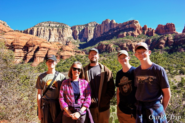
Hey Guys! After two months of sitting still in Camp Verde, AZ…we’re on the move again! I have to admit, it feels very uncertain this time. We’re in the thick of the whole Corona Virus thing and at this point it’s making us second guess and doubt everything we’re doing/not doing.

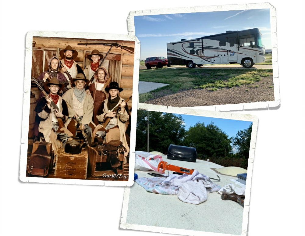
We’d already called ahead to our next RV Park to make sure it was open and that we would be allowed in. We keep hearing about other fulltime RV families who are struggling to find a place that they can stay. State parks, federal campgrounds, BLM land, and county parks are all closing down and kicking people out. Private parks are starting to either close down or refuse any new arrivals. It’s a stressful time for everyone, but being a nomad has a bit of extra stress to it now. We don’t have a sticks-n-bricks home we can go to and hunker down in until this all blows over. So, for now, we’re moving forward and trying to make due…and not stress too much.

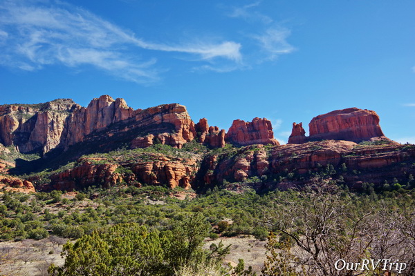
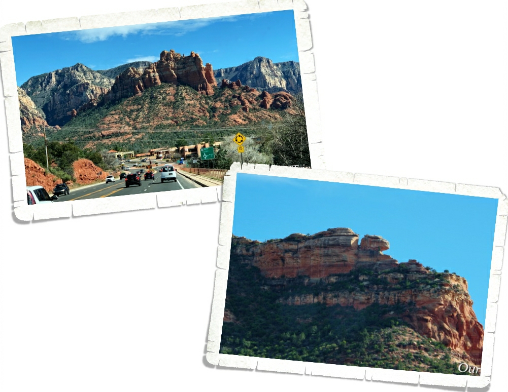
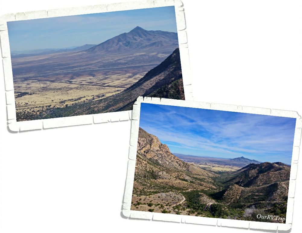
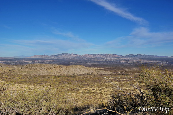
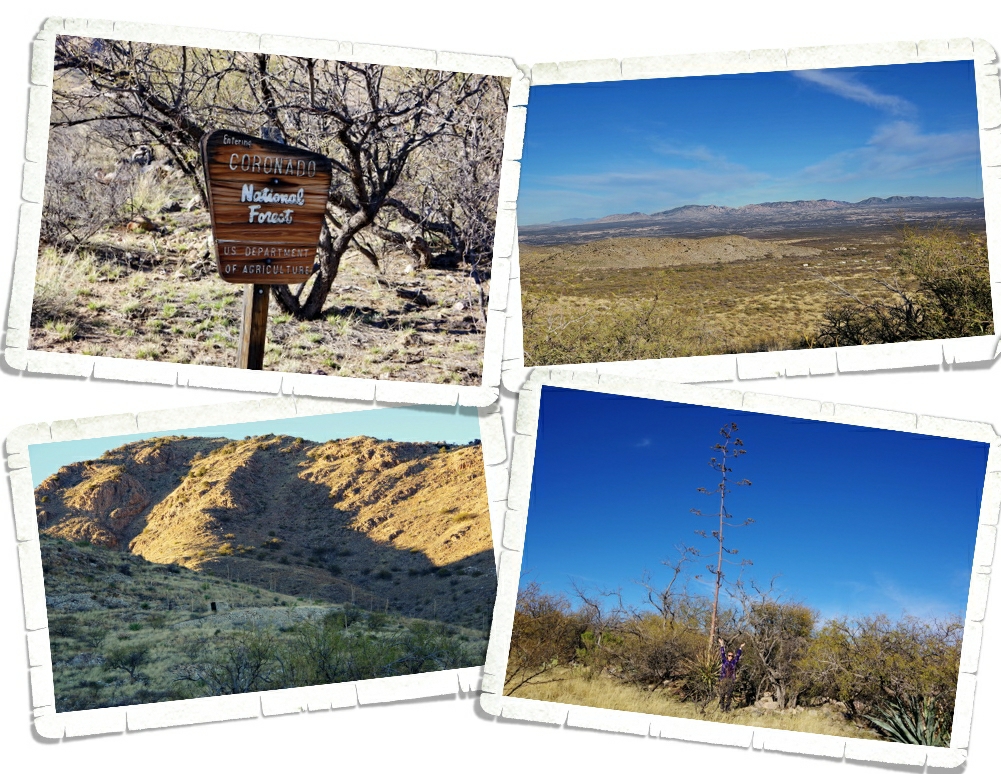
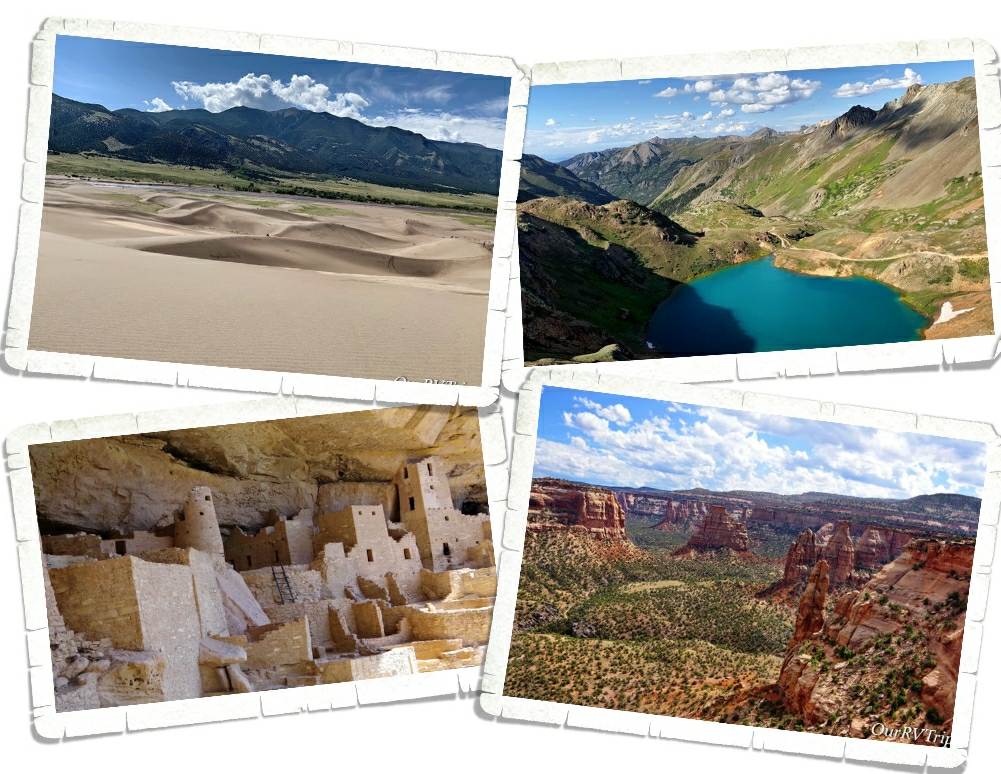
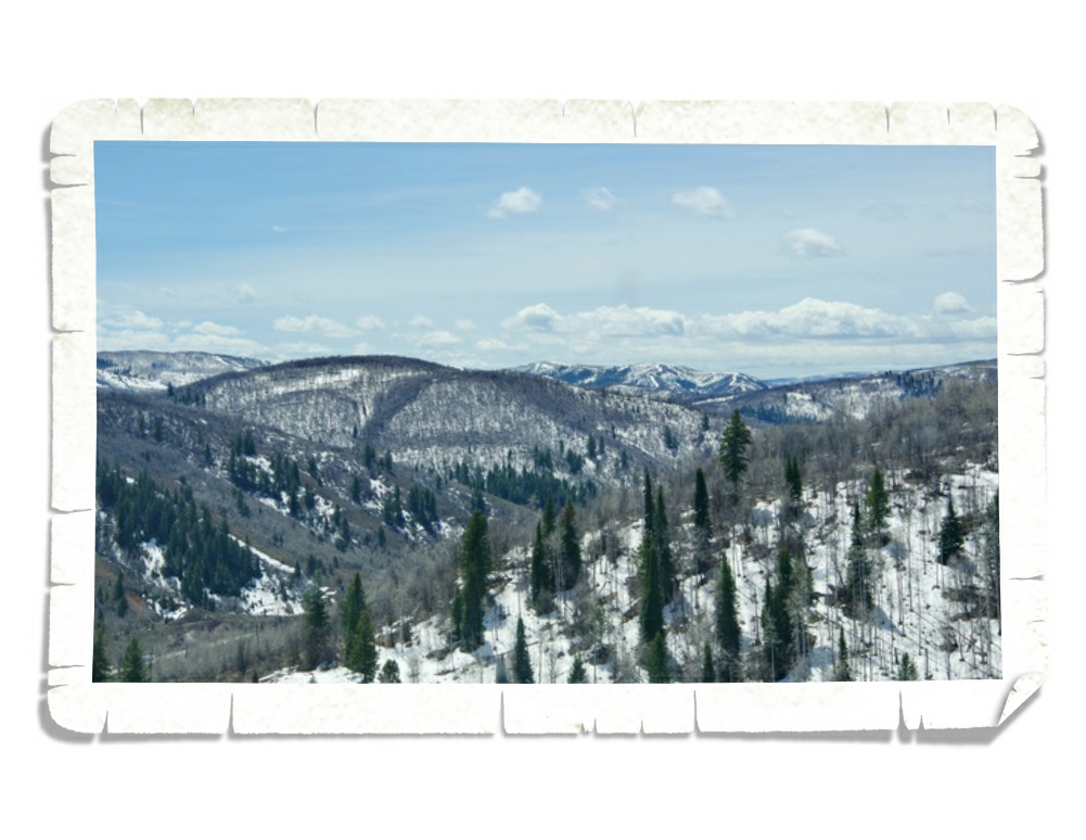
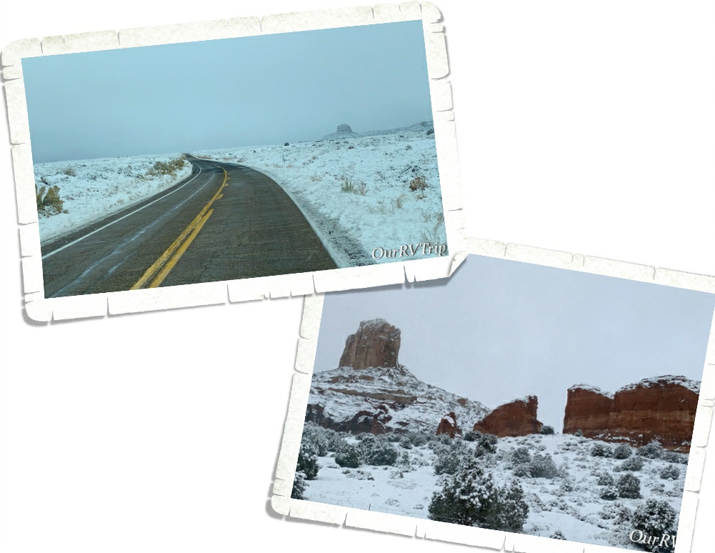
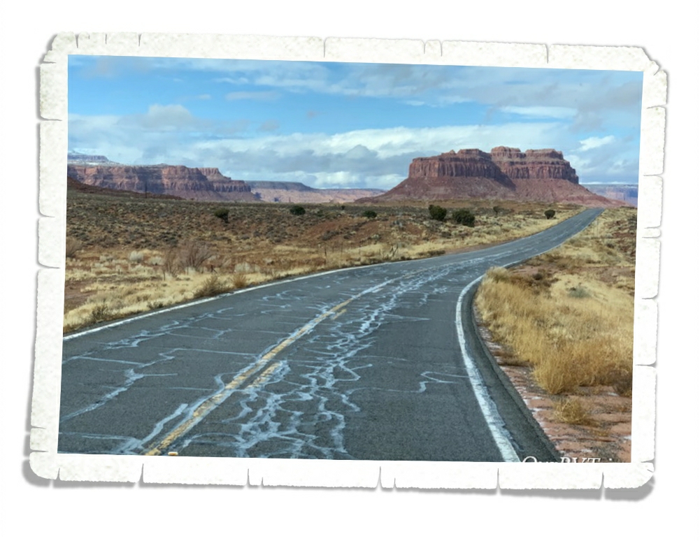
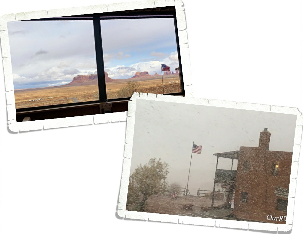
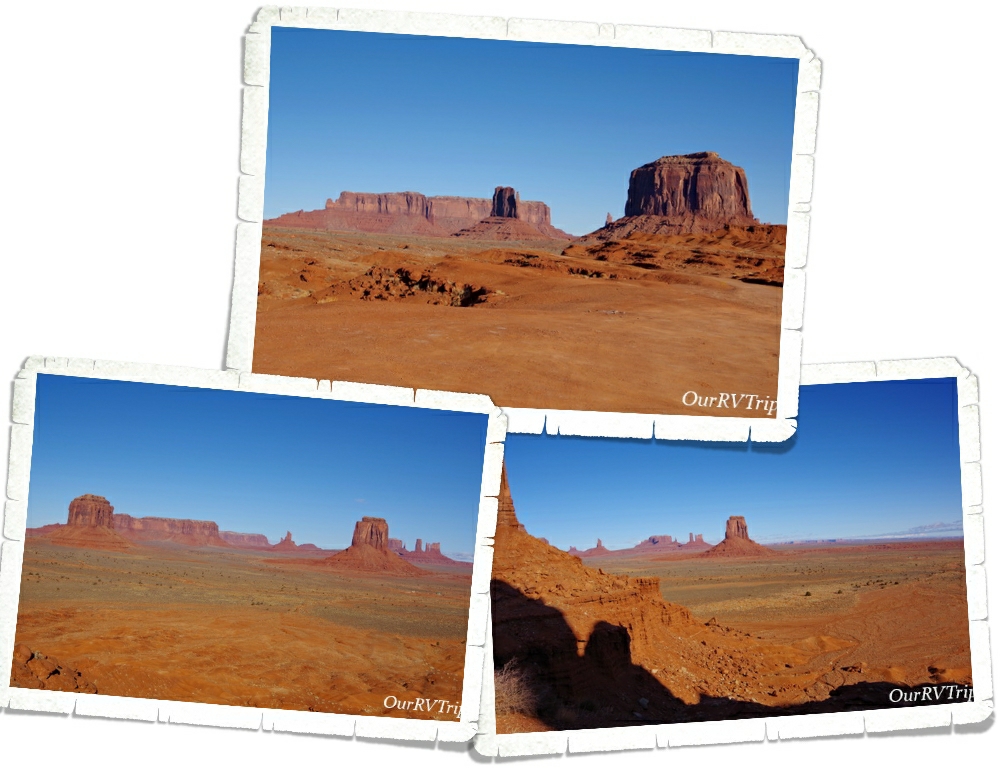
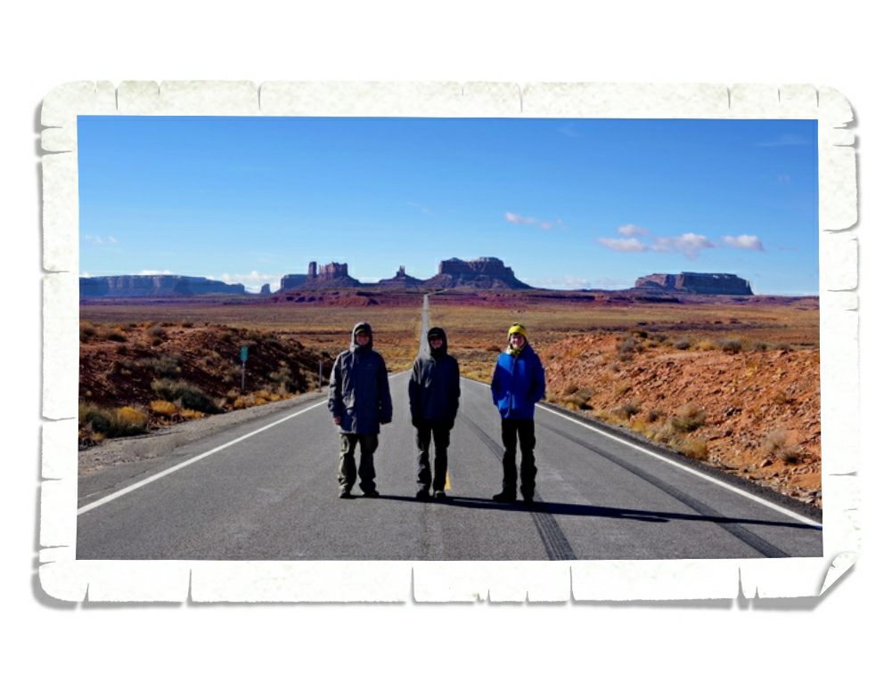
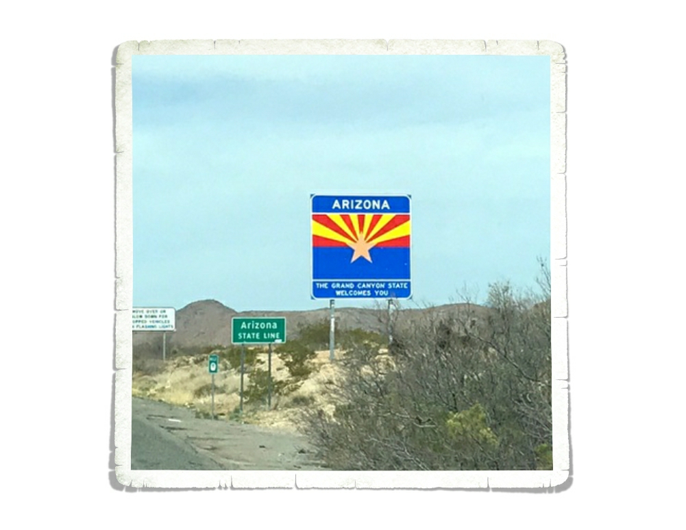
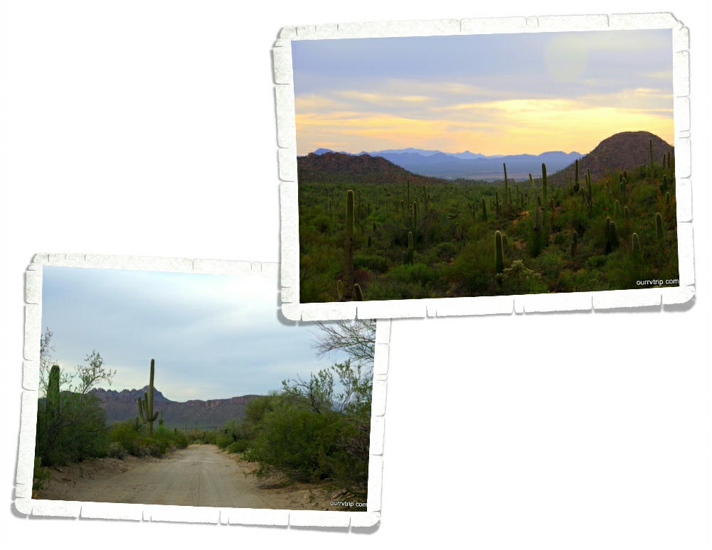
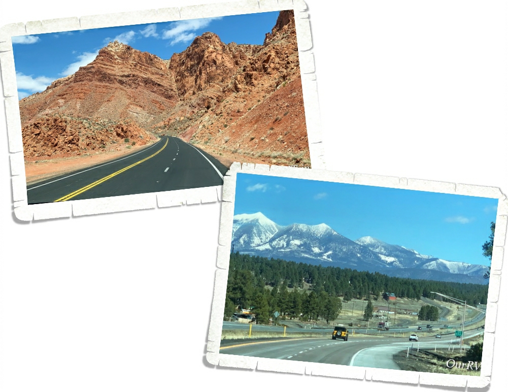
On our way to Page, we passed through the snowy town of Flagstaff and made our way back to the high desert region. It was neat to watch all of the geographical changes that came with that.

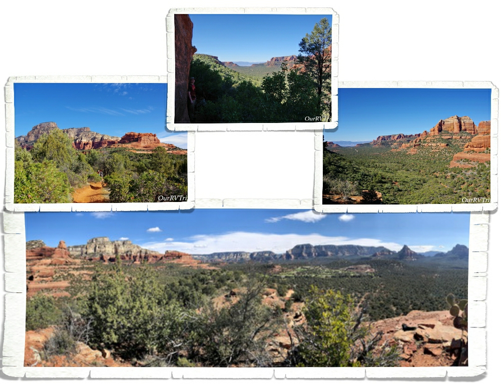
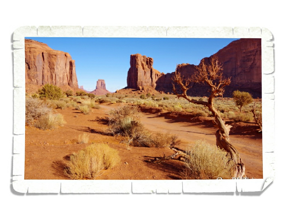
This wasn’t our first visit to Page. In fact, we’d been there just a few months before. There are so many things to see and do in Page…some great views and some awesome hikes. I had an entire list of things to see and do while we were back in Page, but due to the virus…pretty much everything was closed.

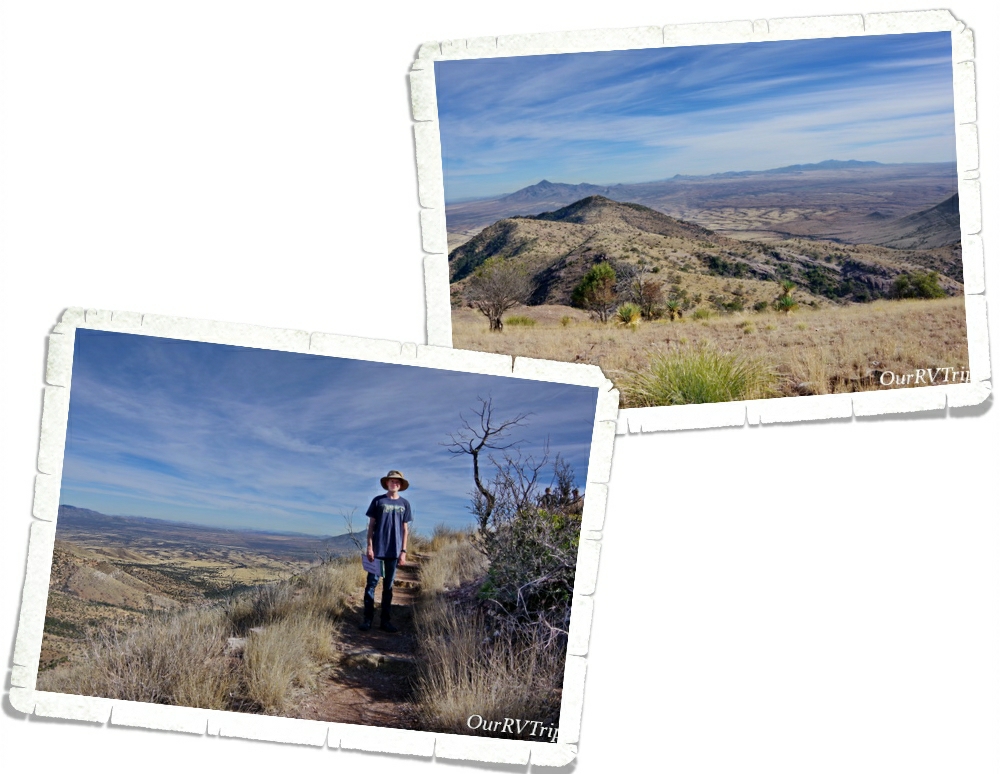
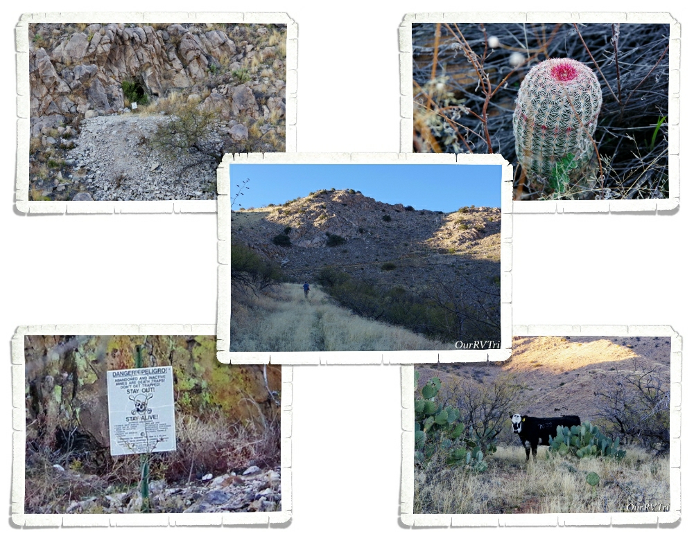
We usually move spots on Saturdays and then go adventuring on Sundays. Jerl went to the grocery store early Sunday morning to see what we were going to be dealing with on the food/necessities problem that the country had been dealing with. The little grocery store in Camp Verde had been struggling to keep up with it all. We wanted to assess the situation in our new spot to see if we needed to go back to Camp Verde and stay longer. Jerl was surprised to see that pretty much all of the isles were decently full…except the paper isles. He also had the chance to talk to a couple of policemen who were there to protect the delivery truck (I never thought I would be typing that kind of sentence…I mean…police protection for a regular ol’ delivery truck?) Anyway, Jerl asked the police officers if hiking was allowed in Page at that time and they both encouraged us to go have a great hike and get some fresh air…while staying away form anyone that looks sick.

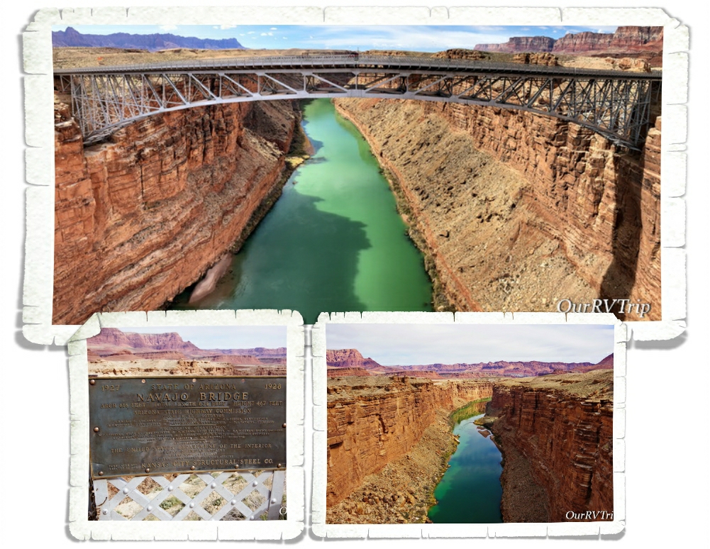
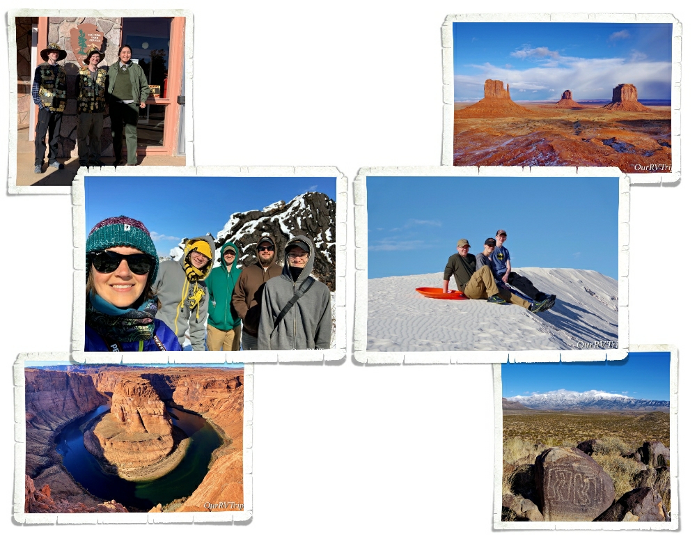
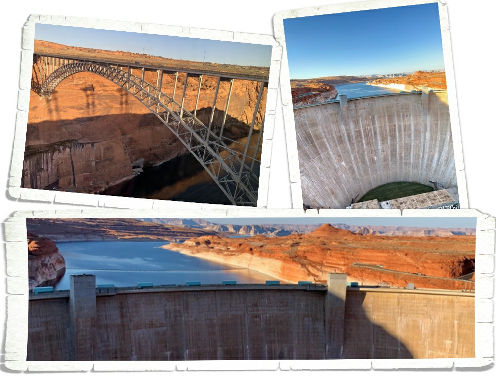
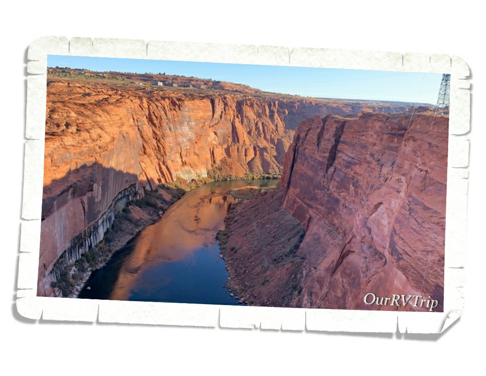
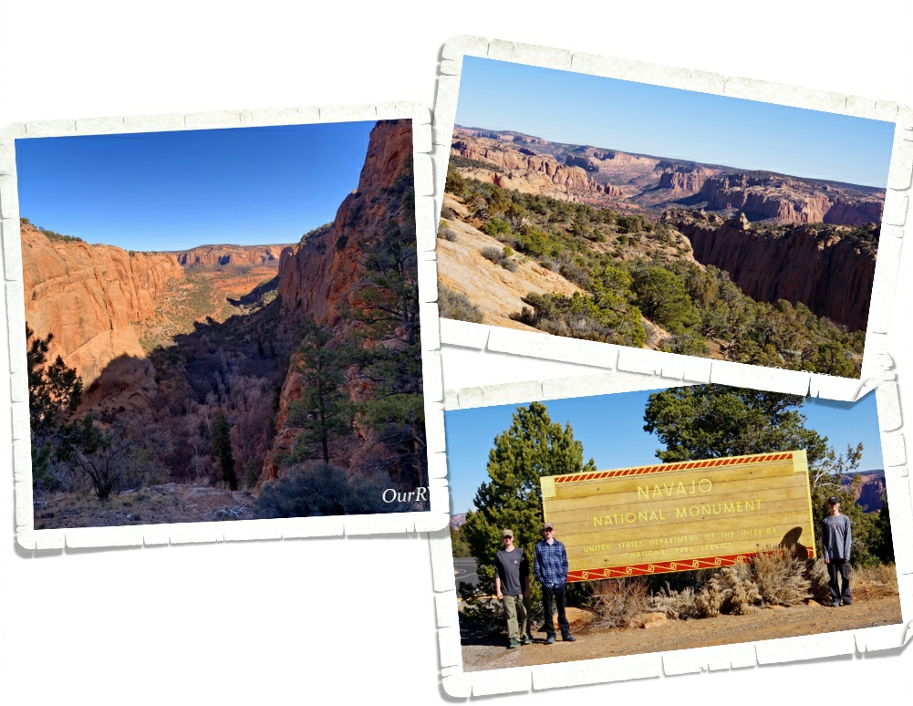
With the police officer’s approval, we headed out to do a little social distancing on a hiking trail. I had a few things on my list that we could hit all in one day and luck would have it…they were all still open. The first spot we hit was the Navajo Bridge. Did you know that there are only seven land bridges across the Colorado River for around 800 miles? Before the Navajo Bridge was built, travelers had to go several hundred miles out of the way to get across the Arizona/Utah border. Can you imagine having to do that with a horse and buggy? That would add weeks to a trip.

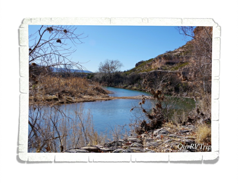
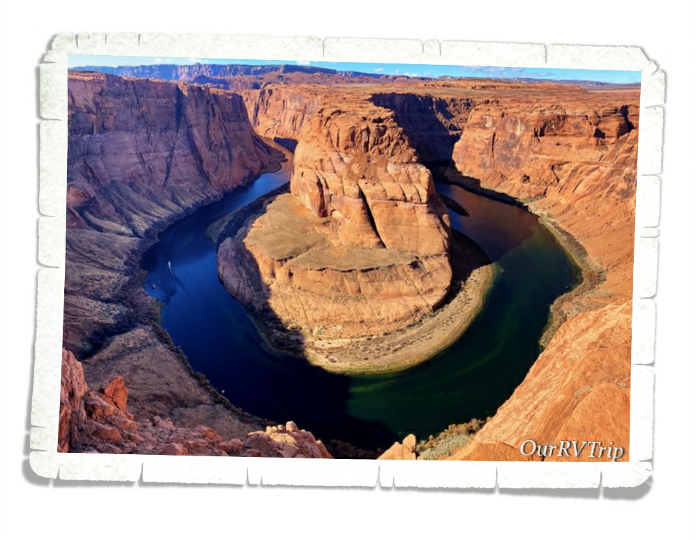
Guys, look at the color of that water! We stood on that bridge way longer than we’d planned.

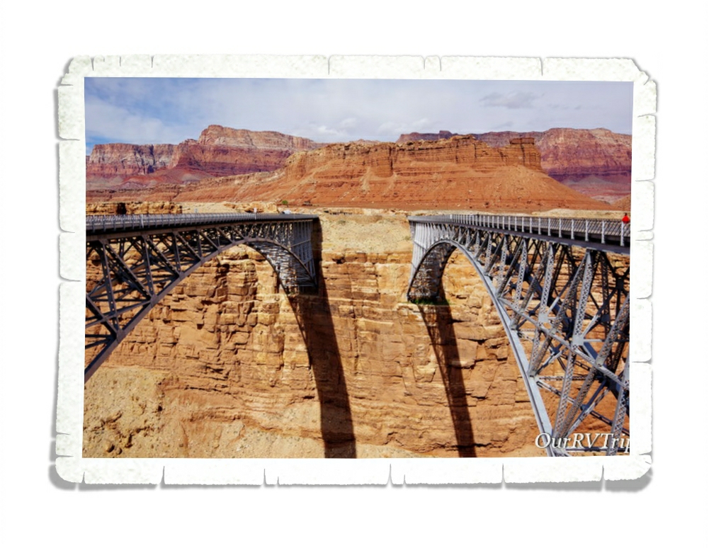
The original bridge opened in 1929 and was called the Grand Canyon Bridge, but in 1990…there was a need for a newer and wider bridge. So now, the old bridge (on the right) is open to pedestrian use only while the new bridge (on the left) is open for everything else. These two bridges are tied in ninth spot for highest bridges in the US.

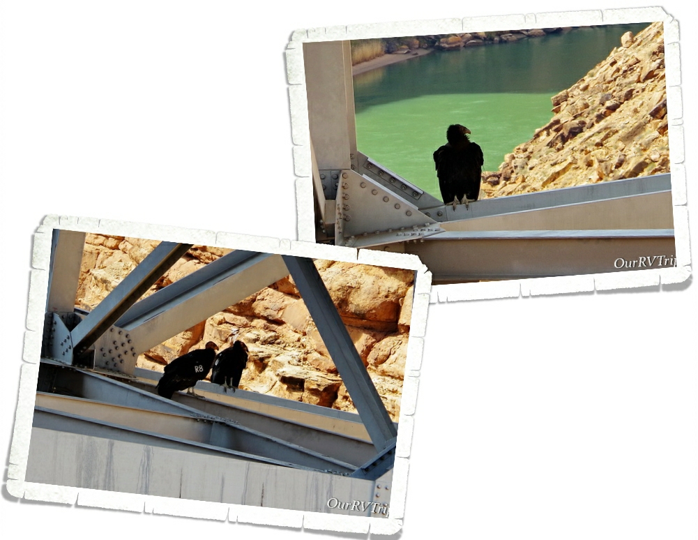
I knew from my research that California Condors call the area around Page home, but we didn’t expect to actually see any. We found four of them hanging around the Navajo Bridge! Did you know that you can look up the California Condor numbers and find out where they were born and what their family lines are?!

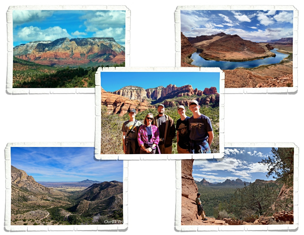
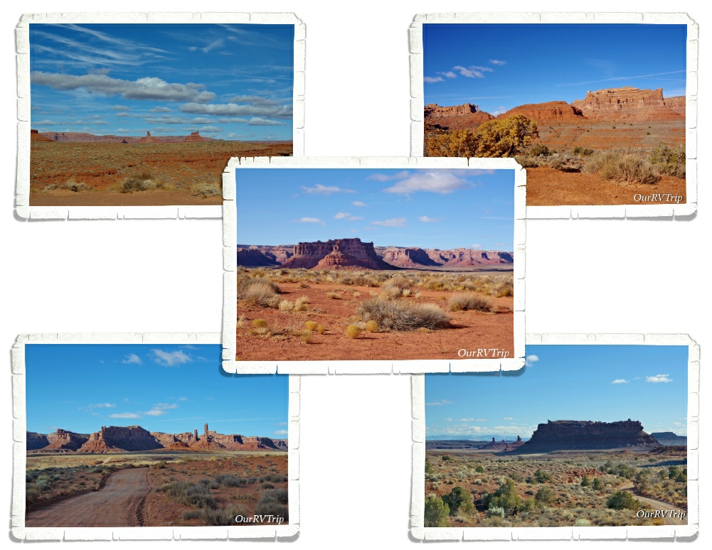
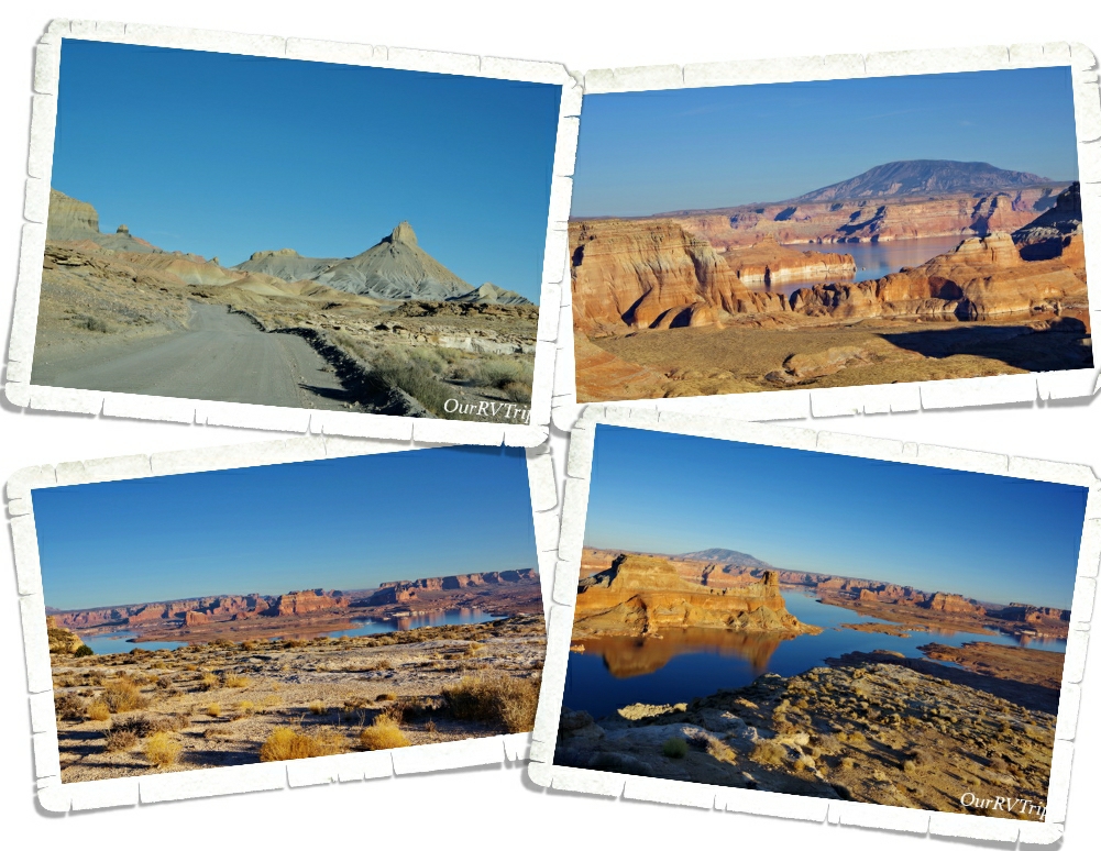
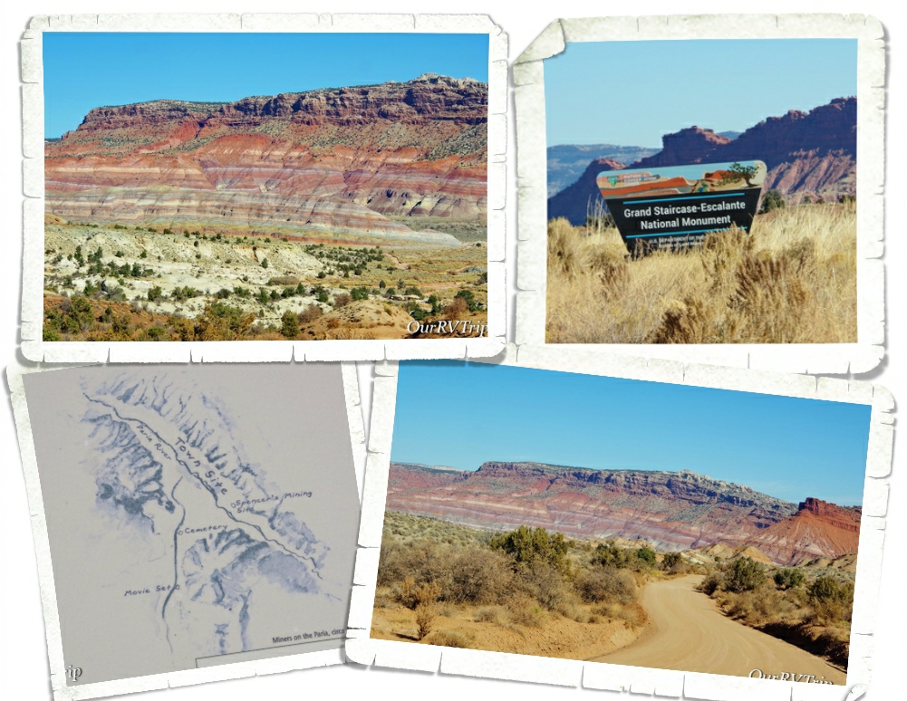
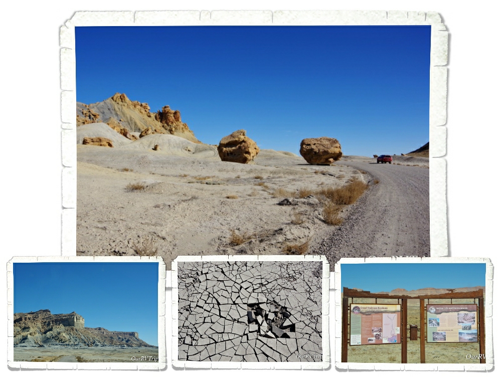
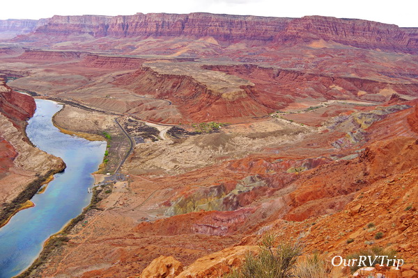
Lonely Dell Ranch and Lees Ferry are both part of the Glenn Canyon National Recreation Area. We had planned on visiting the area the last time we were in Page, but simply ran out of time. I’m so glad we got to visit during our second visit to the area!

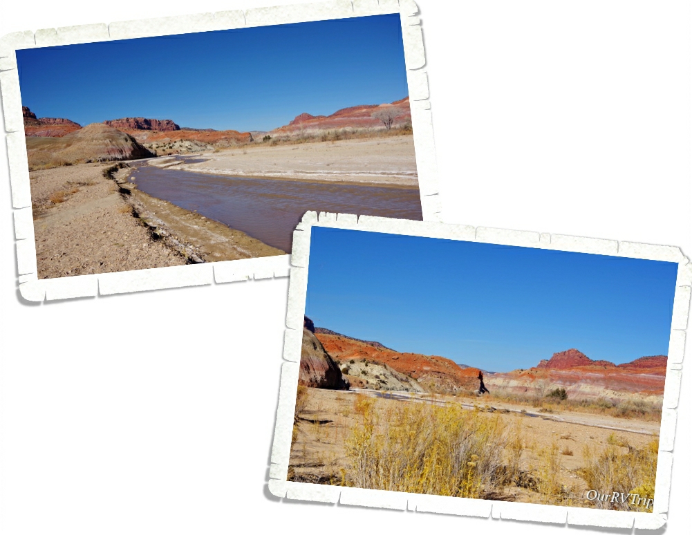
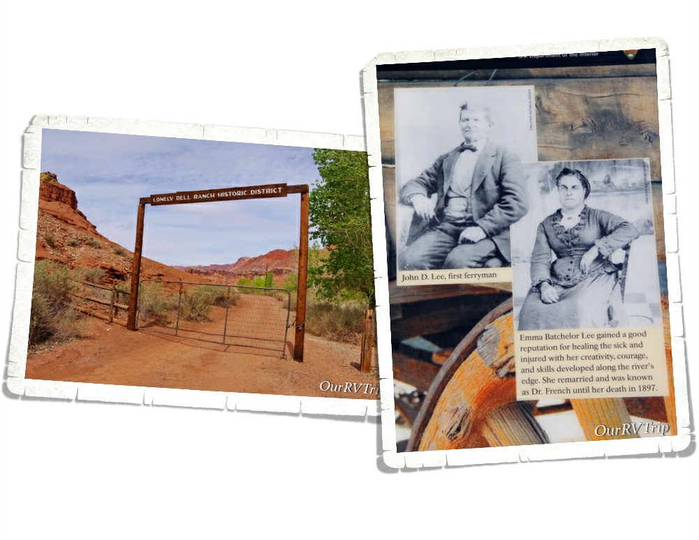
For a long time, the Colorado River was a major obstacle while traveling between Utah and Arizona. At one spot, where the Paria River runs into the Colorado River, there’s an area where the cliffs aren’t quite as impassible and the Colorado River isn’t rushing with rapids. It’s here, at this spot where the Utah Territorial Governor, Brigham Young, sent John Lee to set up and operate a ferry.

So, in 1872 John Lee loaded up two of his families and headed out to make a life as a ferryman. Some people say he was sent there to hide from the authorities due to his part in the Mountain Meadow massacre and the slaughter of over one hundred pioneers from Arkansas who were passing through the Utah territory in 1857.

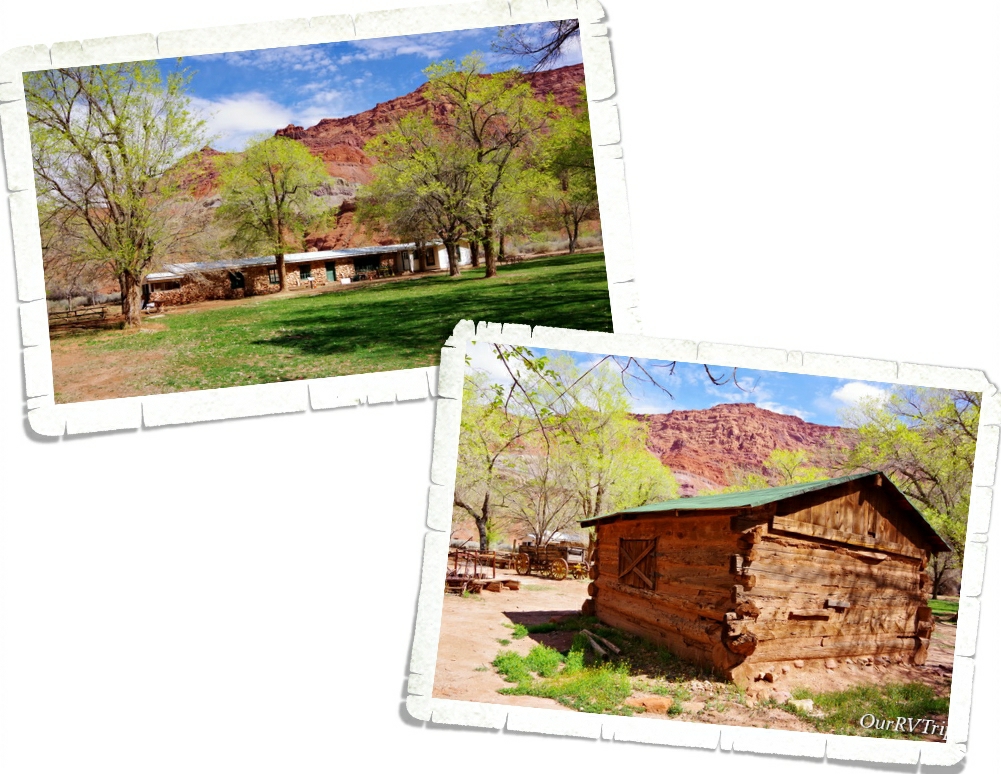
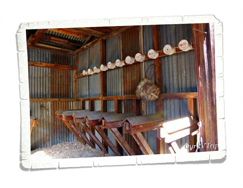
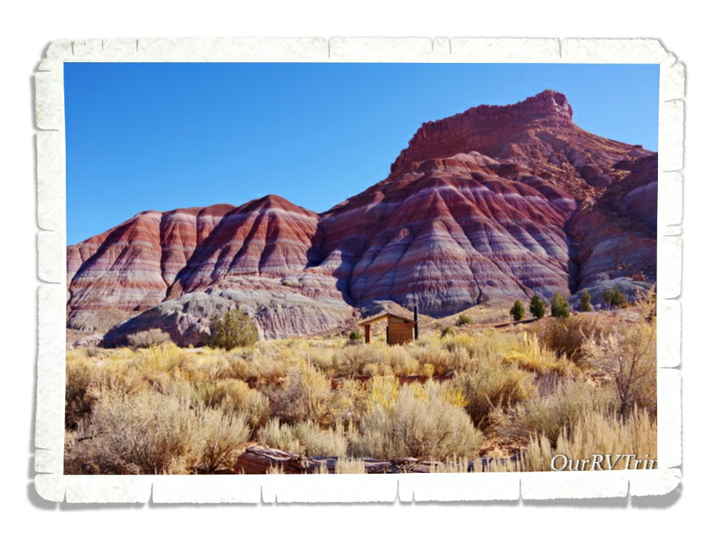
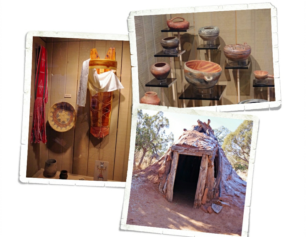
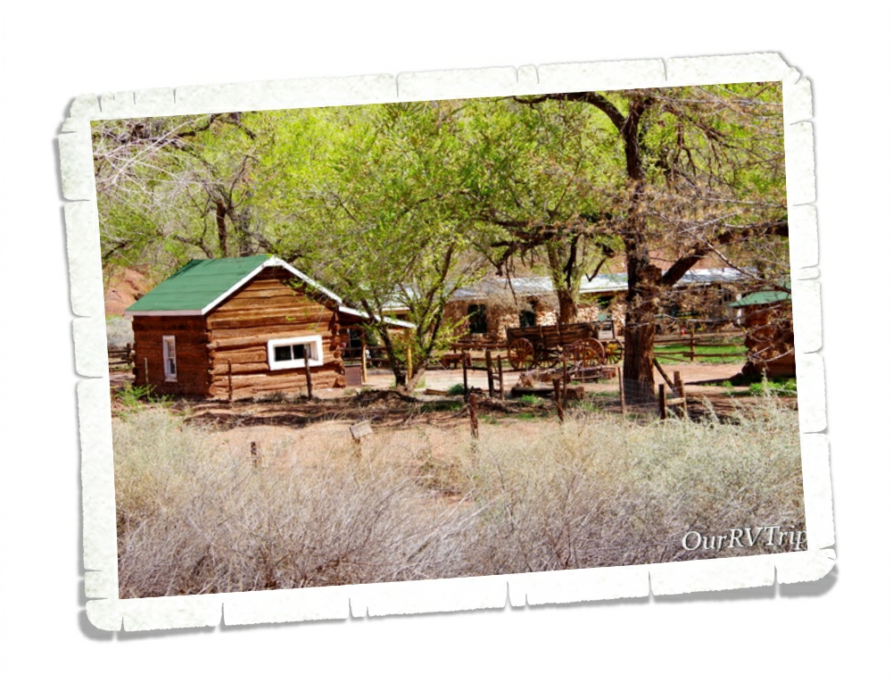
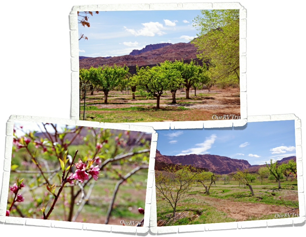
Lee spent the first few years building homes for his family and a ferry to cross the river. Since the area was so remote, the family had to be completely self-reliant. They needed to grow their own food and set up irrigation for not only household use, but to water their crops. There’s still an orchard there that you can walk though and pick some ripe fruit as you’re exploring the ranch. In 1874, the law caught up with Lee and executed him. His wife, Emma, ran the ferry until 1879 when the LDS church bought it from her and sent a new family to run it.

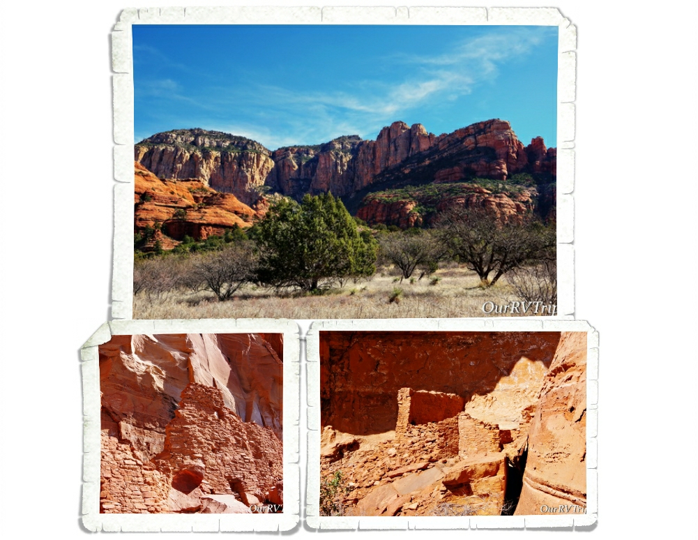
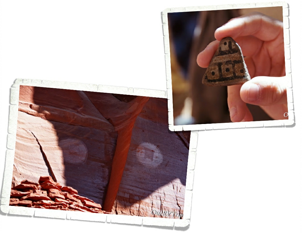
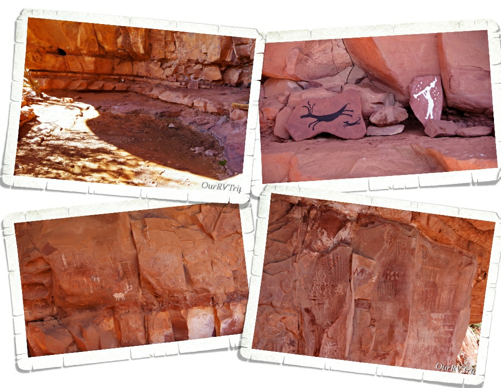
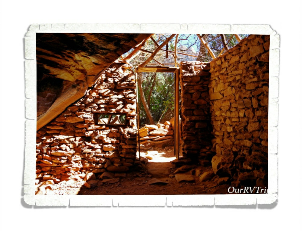
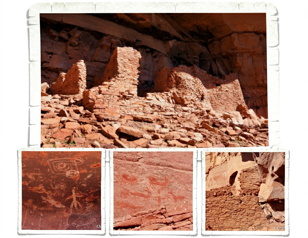
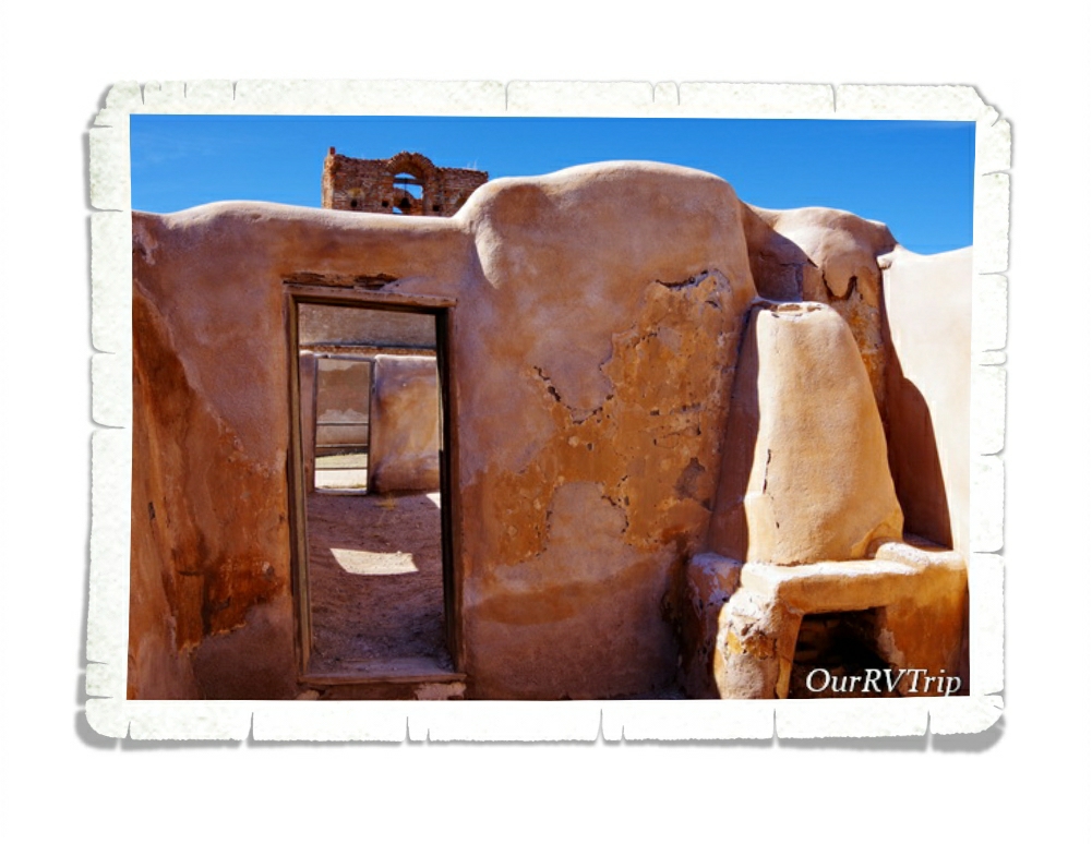
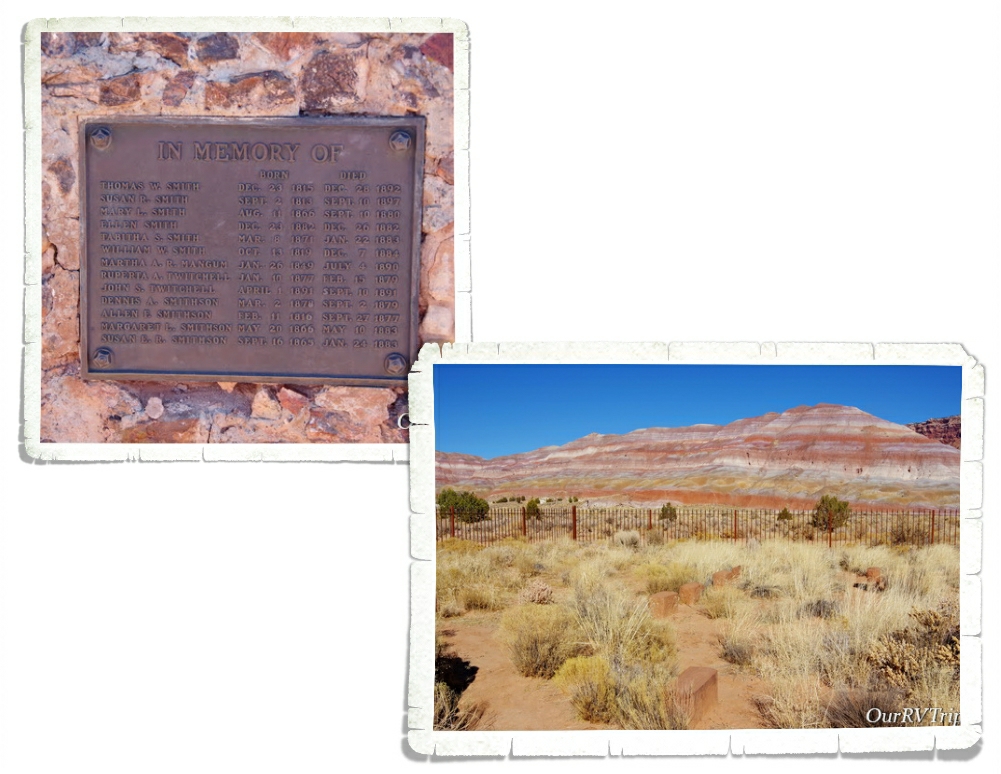
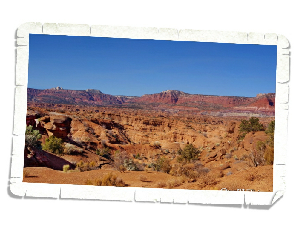
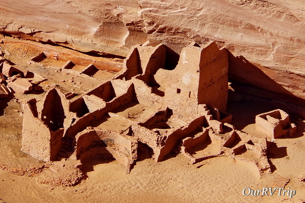
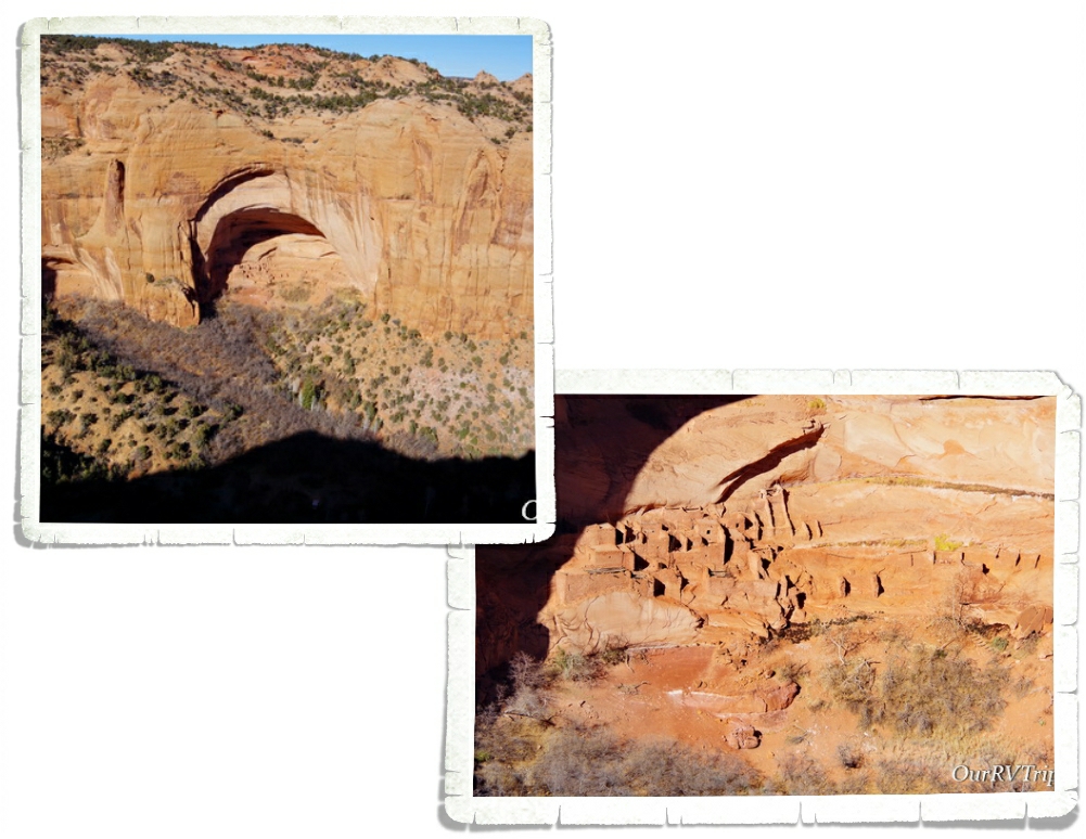
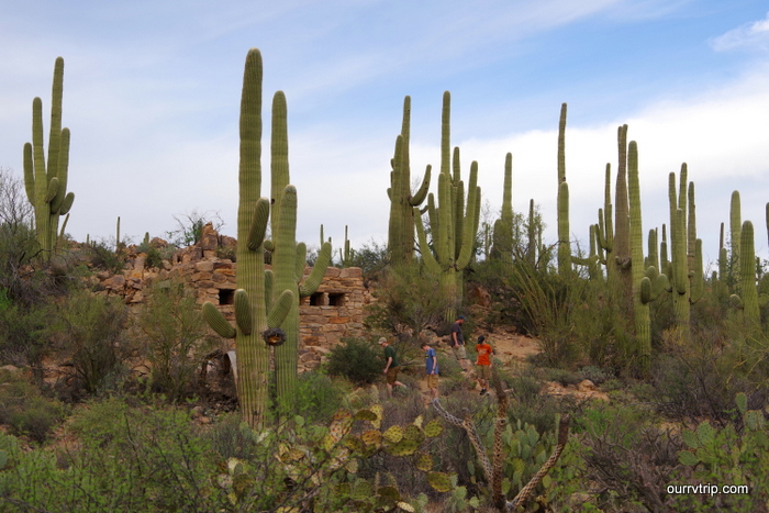
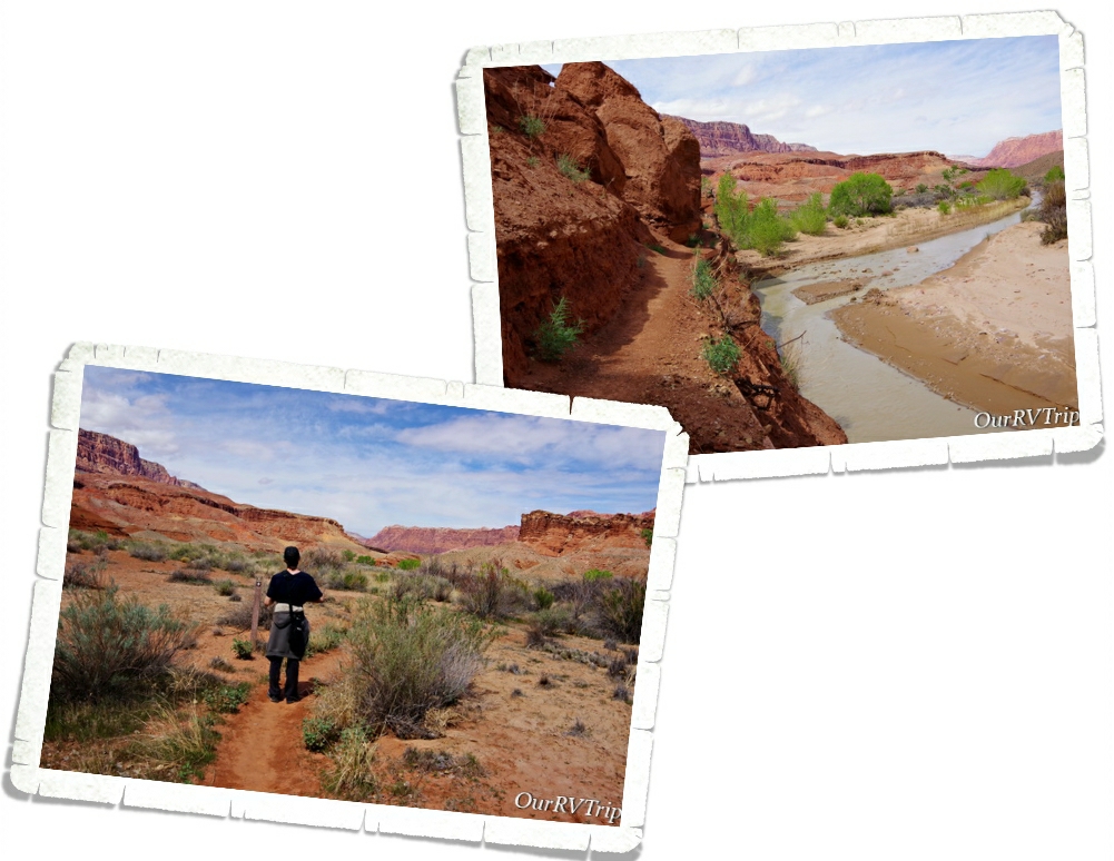
If you go on past the ranch, you can see remnants of the people who once made Lonely Dell Ranch their home. Over the years, LDS members continued to run the ferry and the ranch was expanded to include different families and community members.

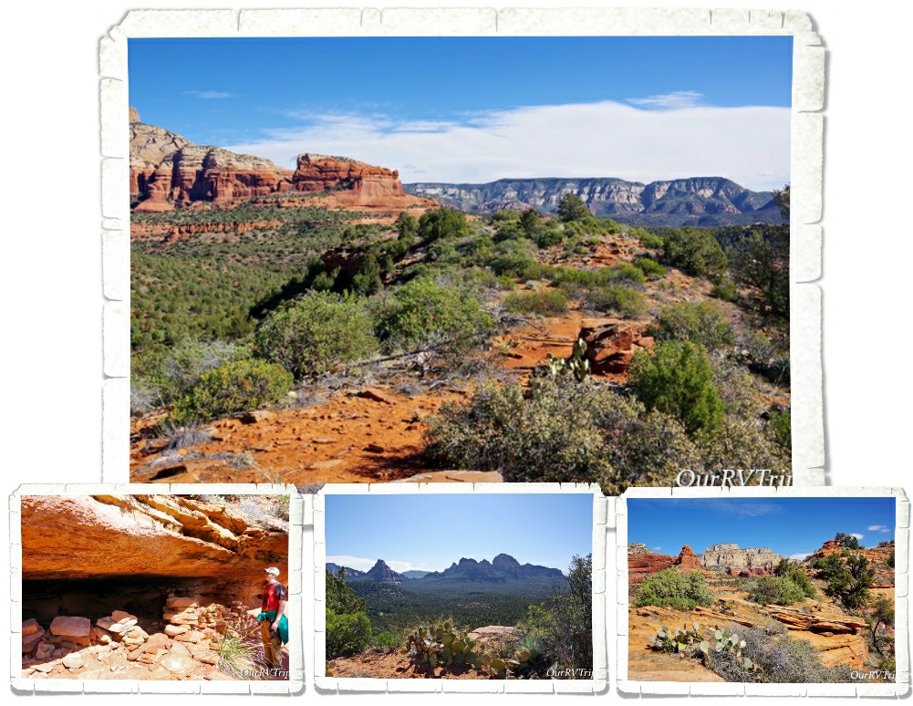
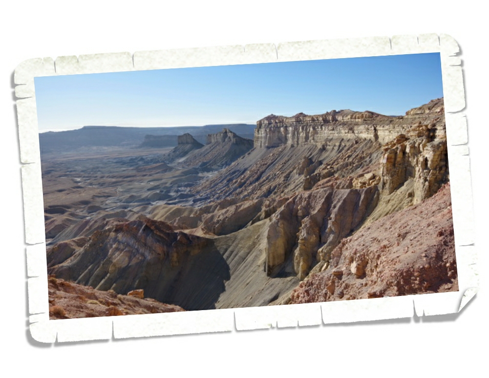
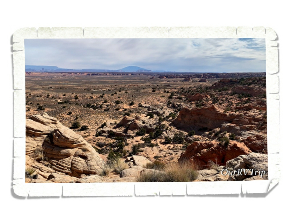
The trail goes for quite a ways…but, this wasn’t the trail we’d come for so we headed back after a mile and a half or so. I wish we’d had a few more days to explore here. We would have loved to continue on this trail. The area was gorgeous!

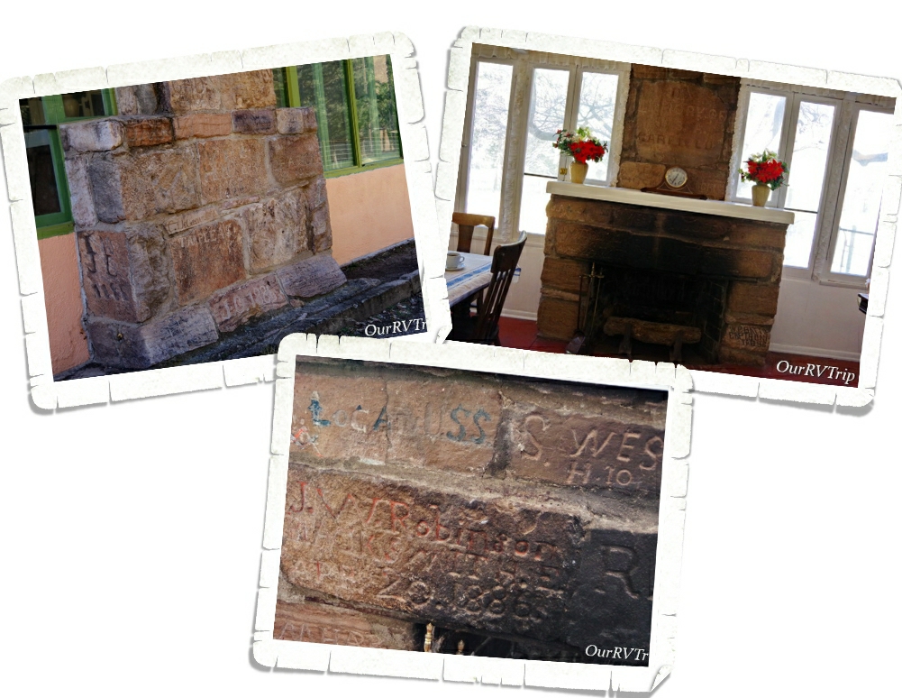
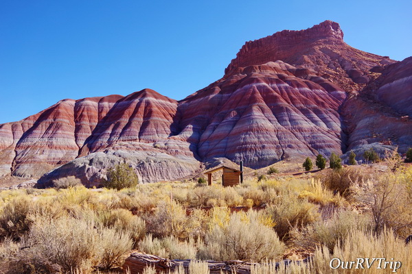
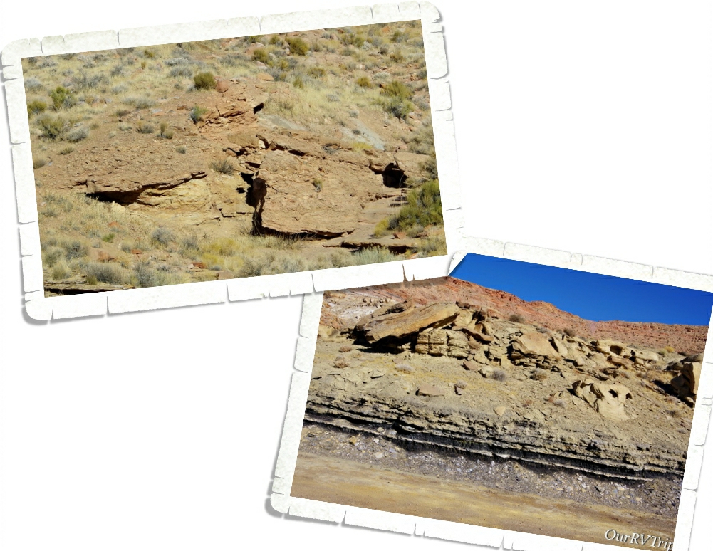
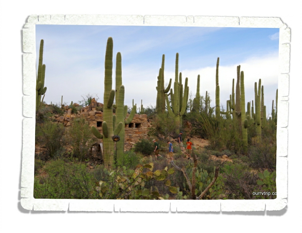
In the early 1900s the gold rush hit southern Utah/northern Arizona and miners ascended on Lees Ferry. One of them was Charles Spencer who led the American Pacer Company. Spencer was more of a salesman than a miner. He hauled tons of equipment up to Lees Ferry. Spencer left the area broke in 1912. He abandoned everything there when left. All that remains of his time there are a couple of stone buildings, part of a steamship and an old boiler.

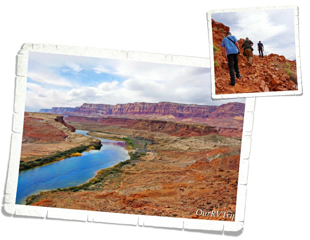
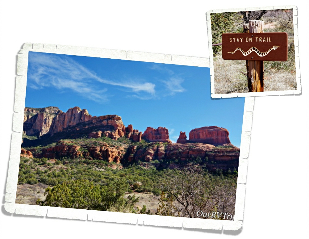
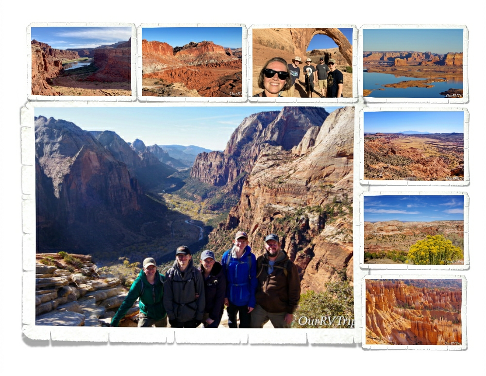
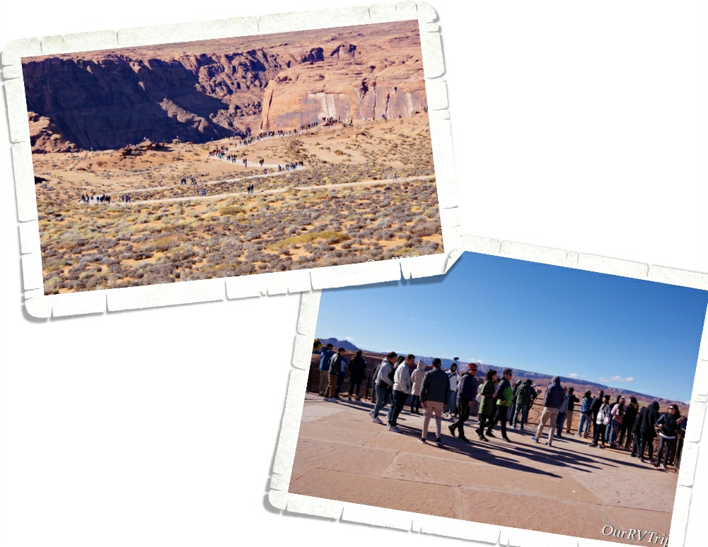
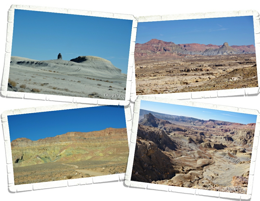
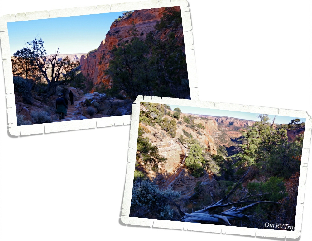
Today, you can hike up the 4.4 mile Spencer Trail. The trail eventually leads to an old coal mine. This trail climbs over 1,500 feet in less than a mile. It’s steep!

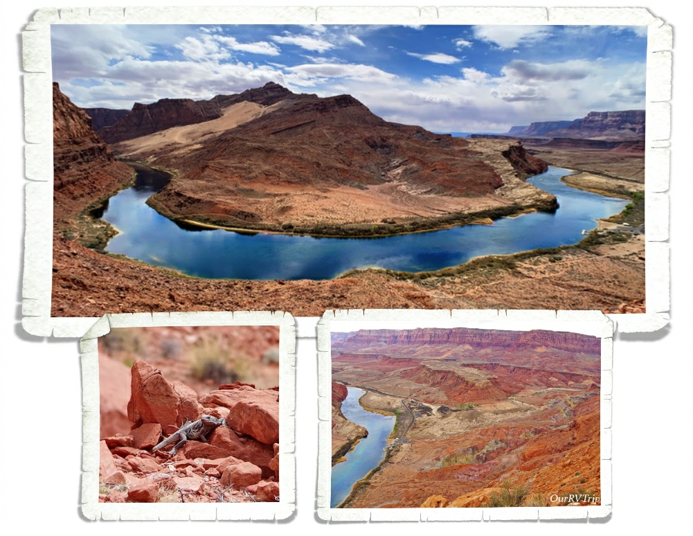
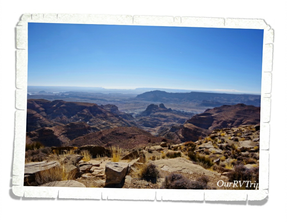
The higher we went on the trail…the better the views got. This was a rough trial…three of us only made it half way up then called it quits. The other two almost made it to the top but the trail got too dicey for them so they turned back. In the group of pictures above, you can see a shot that was taken near the top. If you look closely, you can see the Lonely Dell Ranch.

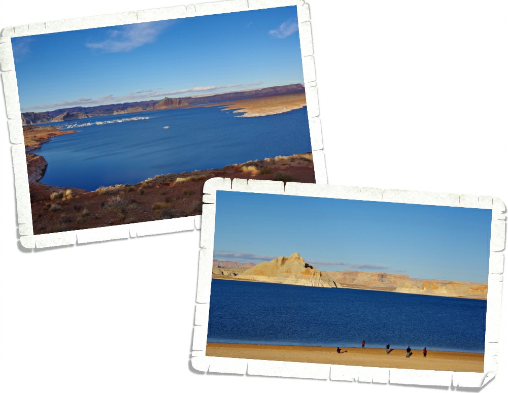
The last ferry crossing was in 1928 and it ended up sinking…killing three people. Seven months later, the Navajo Bridge opened. Now, the Lees Ferry area is mile zero for launching boat trips down the Colorado into the Grand Canyon. In the summer the beach there is lined with rafting boats and adventurous boaters prepping for trips down the mighty Colorado.

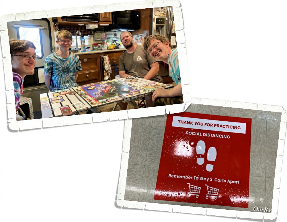
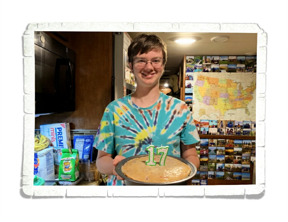
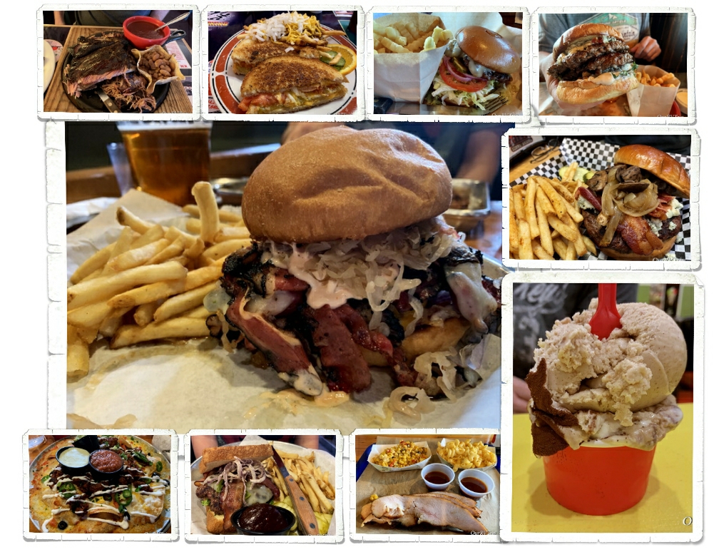
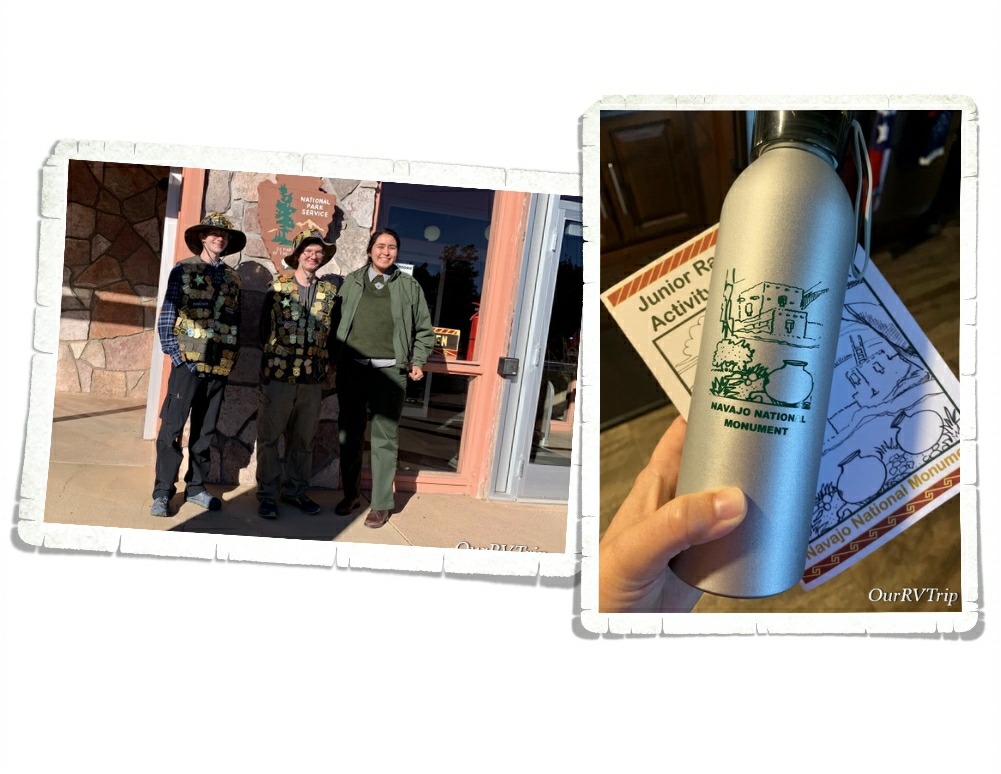
Other than our excursion to Lees Ferry and the Lonely Dell Ranch…we hung out at home. Alex got the National Park version of Monopoly for his birthday and we’ve enjoyed adding it to our collection. When we had to get out to get groceries, we found signs to tell us where to stand for social distancing while standing in line. This time in our world is truly bizarre.

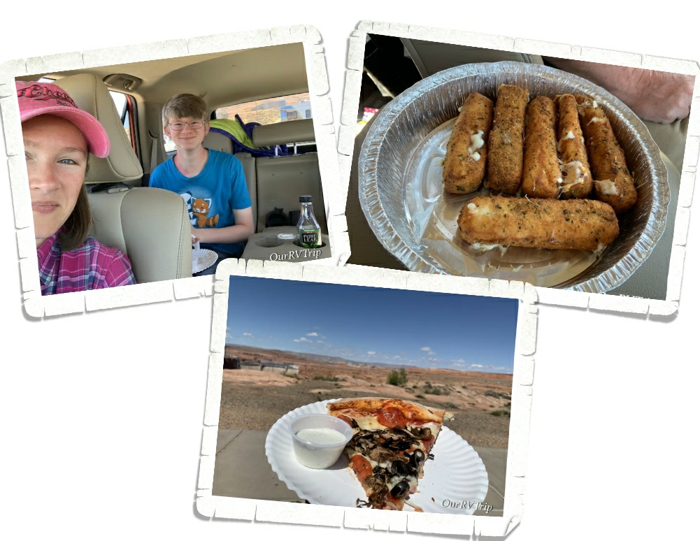
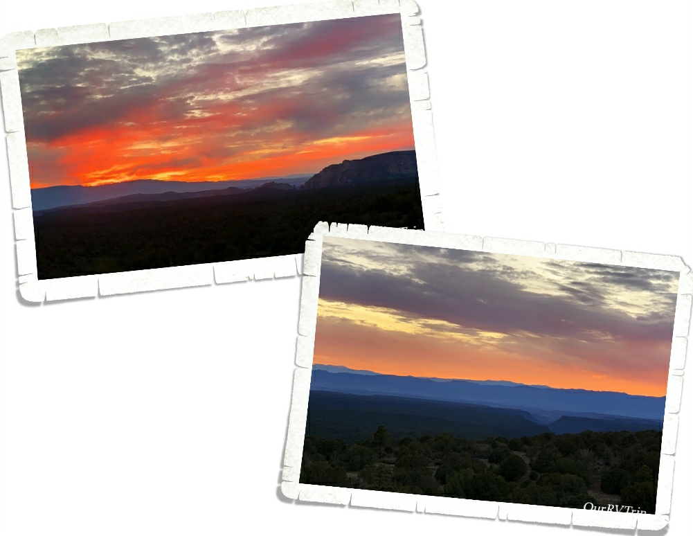
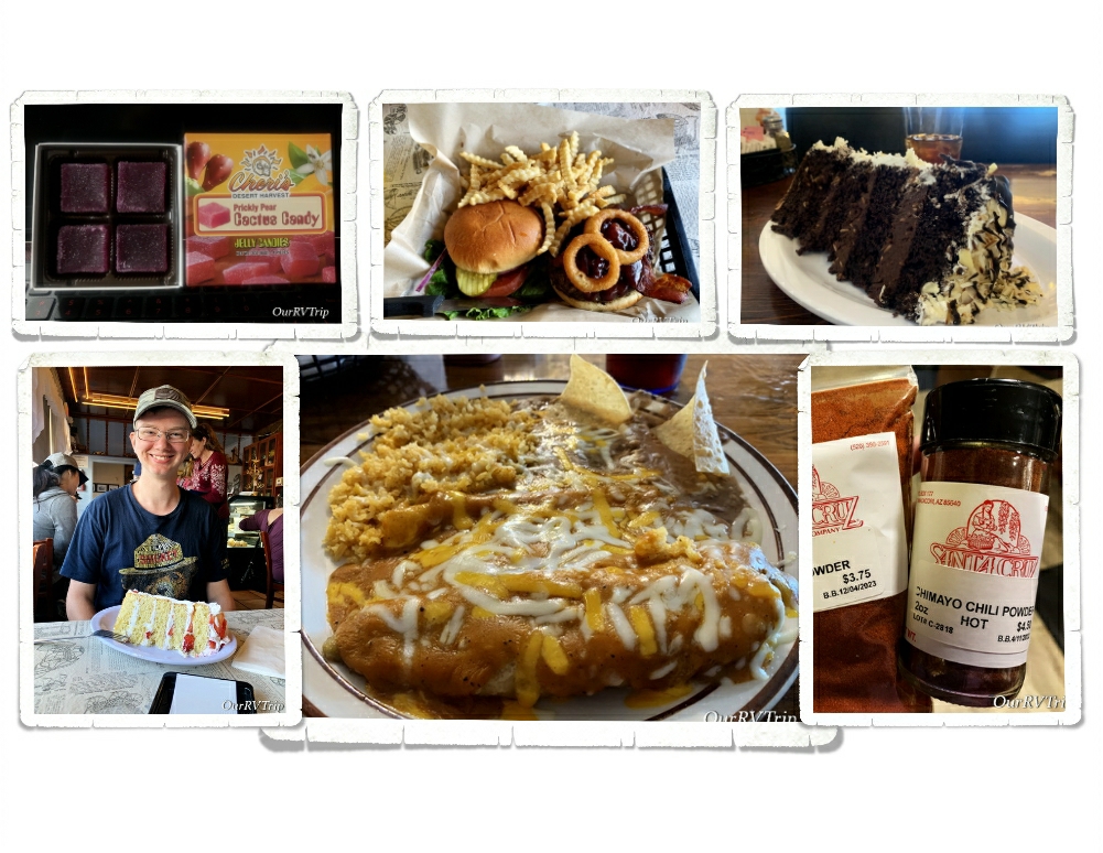
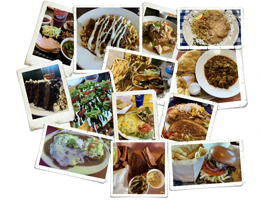
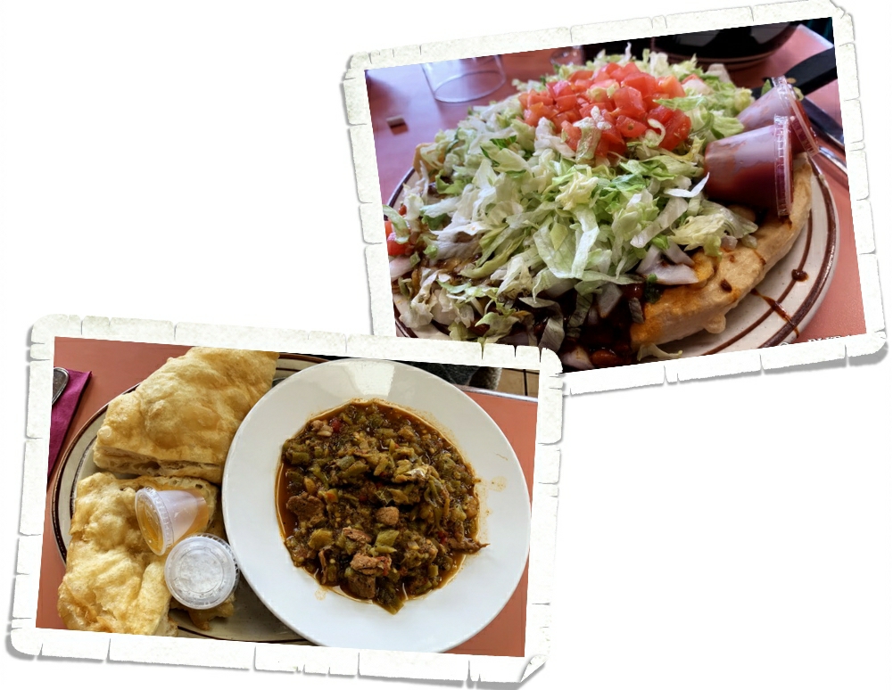
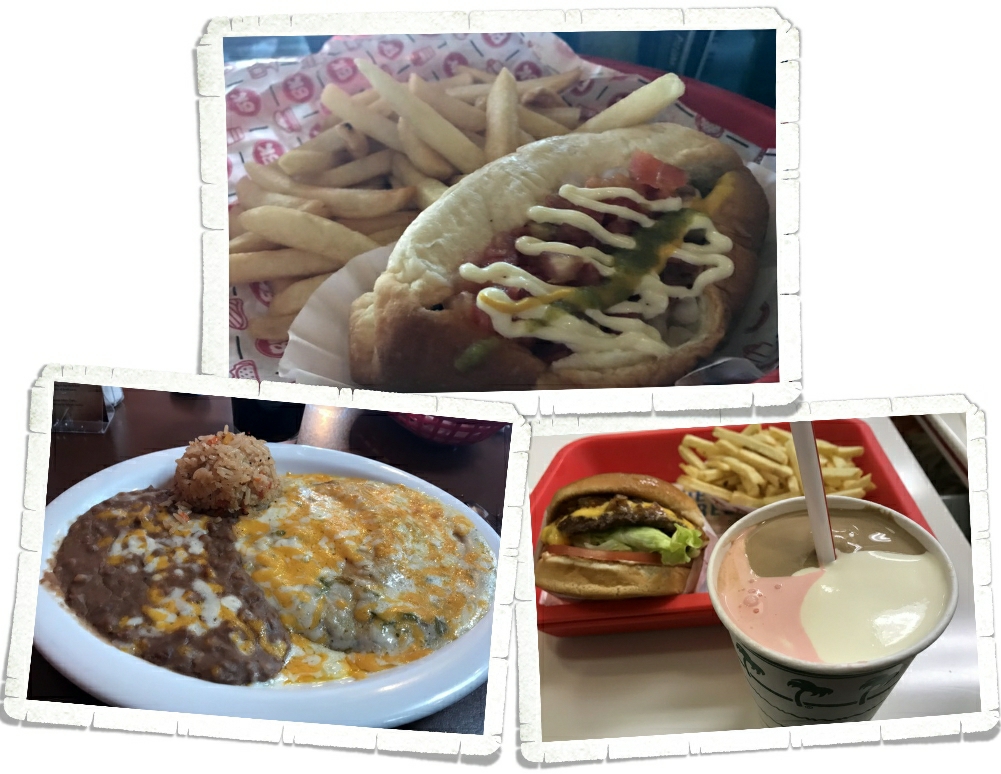
We still made our weekly lunch with one of the boys happen. We got take out then found a scenic view to enjoy some one-on-one time with Nicholas. He, of course, chose pizza. Actually, we found this pizza place the last time we were in Page. It’s a great little place called Stromboli’s…if you’re ever in the area, do yourself a favor and go grab some cheese sticks and pizza! They have the best cheese sticks at this place!!

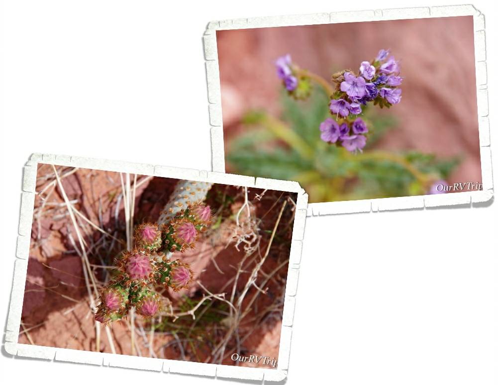
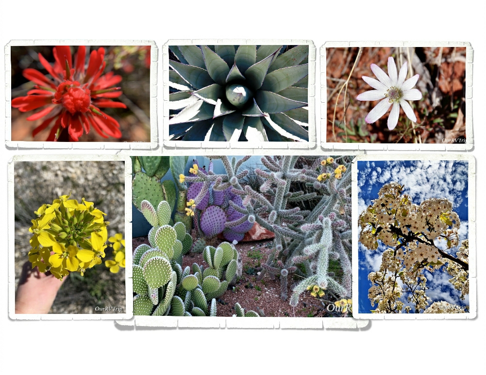
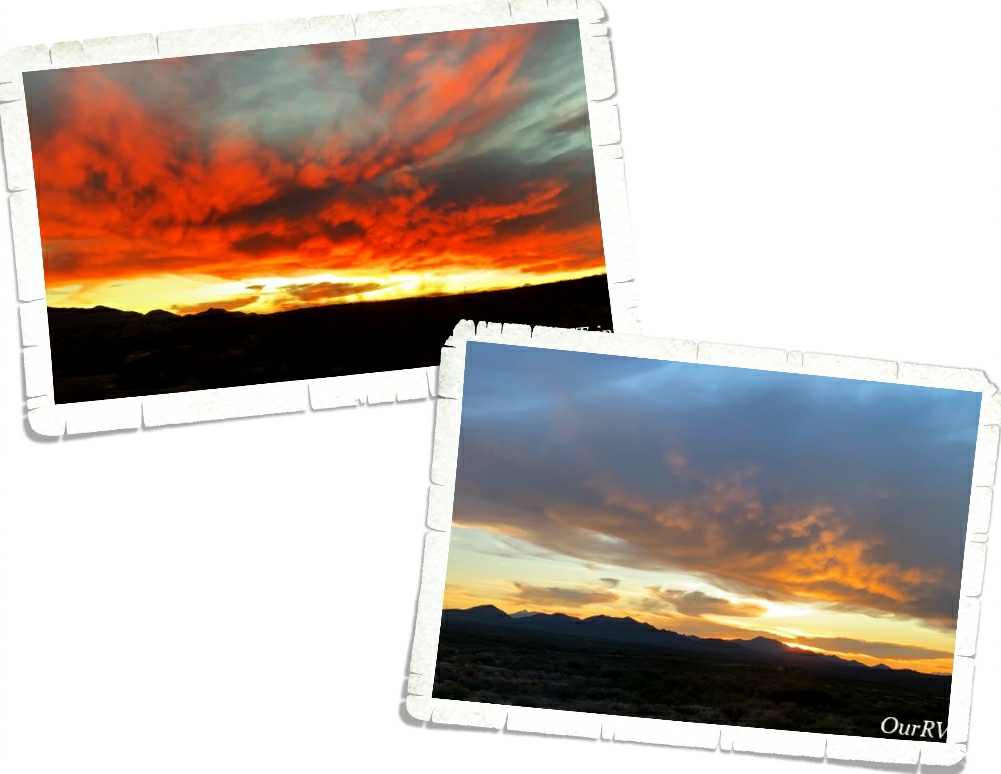
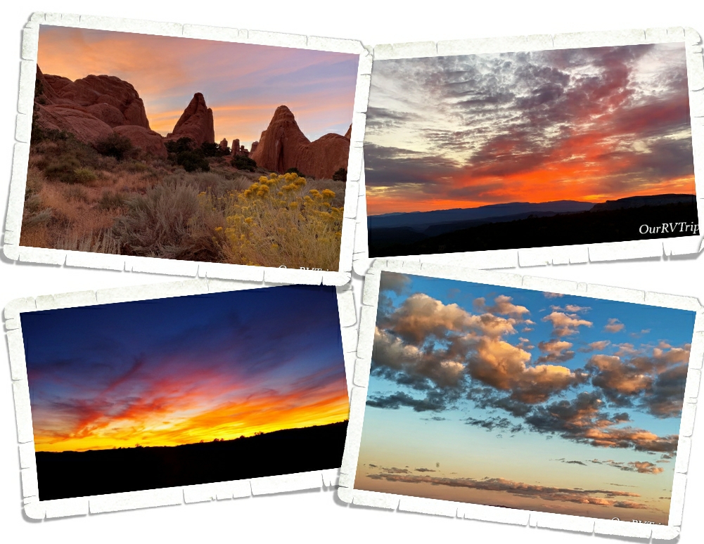
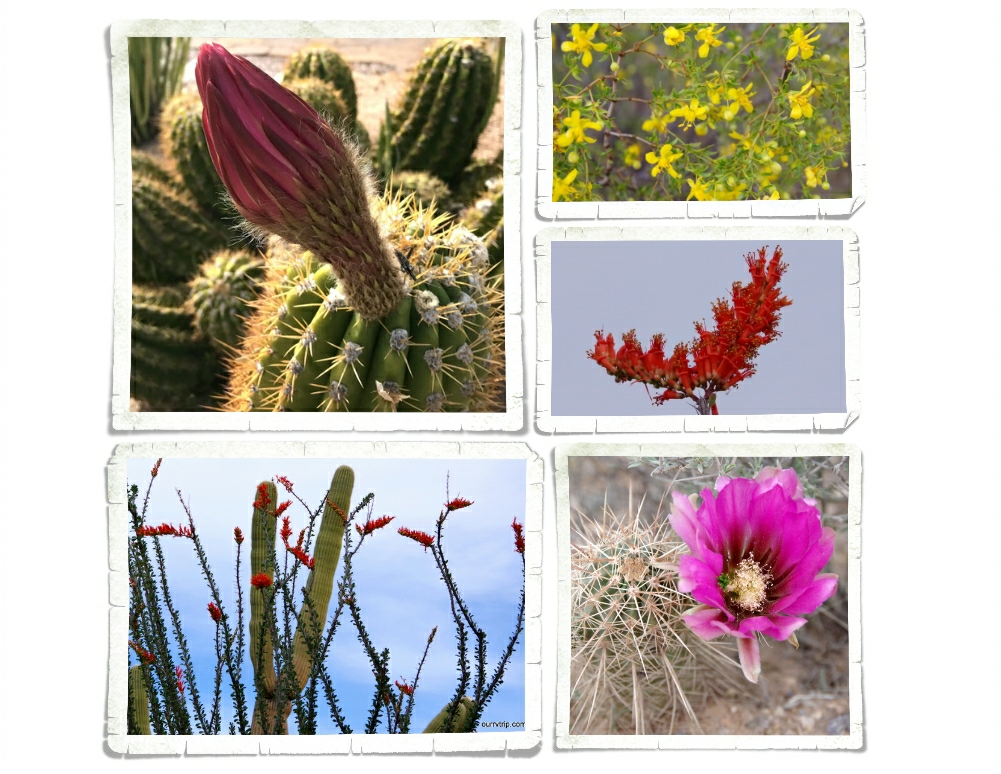
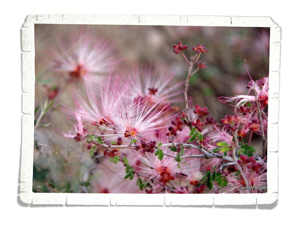
We saw signs of Spring everywhere during our one week stay in Page. We will definitely spend more time in this area! We’ve spent three weeks there now and haven’t even scratched the surface on available activities!

That’s it for now, Guys!

See y’all down the road!

#NationalParkTour

Waiting For Spring

Waiting For Spring

Hey Guys!! Our original plan was to hop our way up Arizona, hitting a few of our favorite state parks. Unfortunately, I waited a week or two too long to try to reserve them and we couldn’t get in without site hopping each day…and that’s such a pain. So, we headed up to one of our all time favorite areas of Arizona…Sedona…to park our home-on-wheels for two whole months as we waited for Spring.

We’ve been to Montezuma Castle National Monument before, but it’s been a few years so we decided to visit it again since we were right down the road from it. And as one of our Nation’s first National Parks…it’s worth revisiting.

President Theodore Roosevelt signed the Antiquities Act in Dec of 1906 and declared four sites of historical and cultural significance our first four National Monuments. Montezuma Castle was one of those first four.

The dwellings that Montezuma Castle National Monument protects and preserves aren’t really a castle. They’re more like…a prehistoric apartment building, built by the Sinagua people sometime between 1100 and 1425 AD.

Montezuma Castle sits in a recess in a limestone wall about 90 feet above the ground. When the Monument first opened, you could actually climb up a series of ladders into the Castle. Due to the damage visitors were causing, access to the Castle was discontinued. Now, you’ll have to check out the diorama they have set up to see what the inside of the Castle looks like.

Sometimes when you’re looking at ancient dwellings, it’s hard to see what it once was. I love that they put this sign (pic on the above right) up to make it easier to see what used to be there. The Sinagua people lived and farmed here over 600 years ago.

The Sinagua people built their homes near Beaver Creek which floods every year during monsoon season. They built their homes higher to not only protect themselves from other tribes, but also to protect their homes form the yearly flooding. The Castle housed around 40 or so people and consisted of 20 rooms. There’s another section of the wall that the Castle is built on that has evidence of an even larger dwelling.

We had so much fun revisiting this National Monument and seeing all of the improvements the park has made!

I stumbled on the Palatki Red Cliffs Heritage Site as I was looking for a specific trailhead in Sedona. When I did some research on it, I found that it’s run by the US Forest Service. Sedona is known for it’s gorgeous red rocks, and the area Palatki is in, is no different. We took just as many pictures of the surrounding area as we did of the ancient dwellings and rock art!

There are two ancient Sinagua dwellings at Palatki. The West Alcove has deteriorated to the point that it’s no longer safe to let people explore it. You do get up close to East Alcove, but you don’t get to go into it. East Alcove is a nine room dwelling that is tucked up under an alcove and faces south. If you think about where they built their homes…it’s really pretty smart. The overhang of the alcove provided protection from the rain (even during very hard rain) and having them face South would provide more sun exposure during the coldest part of the year.

One of the coolest things about visiting Palatki is that we got to hold some of the pottery that was found there. Another cool thing…and the first time we’d seen anything like it…are the two family shields or clan signs. They’re not sure if the two round shield like pictographs indicate a family or if they’re a clan sign. They do know that it tells who the dwellings belonged to. Scientist believe that two extended families called the two alcove dwellings home.

Snakes really aren’t my thing. Every time I see one of these warning signs, I get super paranoid about nope-ropes. I’m already hyper-aware of all of the places you usually find a danger-noodle… I spent most of the time at Palatki worrying about snakes. When we were there, it was almost Spring which is when most of the baby danger-noodles are born. Did you know that mother snakes are more aggressive and will chase you without being provoked? Totally not a fan of nope-ropes.

The other thing you’ll find at Palatki is The Grotto. Depending on when you go, you might see some water in the pool here, but what’s really neat about The Grotto is all of the rock art. There are pictographs from the Paleo Period (11,000 – 9,000 BC) and the Archaic Period (9,000 BC to AD 600). The walls are covered with pictographs! One of the Rangers took some of the materials that they believe was originally used to make the colors for the pictographs and made some new ones so we can see how bright the rock art was when it was new. You can see the new rock art in the top right picture of the above gallery.

The first homesteader in the area was Charles D. Willard. He took materials from the various ancient dwellings to build his own home. Charles arrived in 1923 and you can still see the one room structure he stayed in over by The Grotto, where he stayed until his house was completed in 1925. On the same field that the Sinagua people who used to live, Charles planted 500 fruit trees. He sold the property in 1938 and the Forest Service obtained the land in 1975 through a land exchange.

Palatki’s sister site is Honanki Cliffs Dwelling Heritage Site. We found out about it while we were at Palatki and headed over there right after we left Palatki. Honanki is one of the largest cliff dwellings and has the largest most diverse collection of pictographs in Verde Valley. The cliff dwellings found at Honanki were originally two stories tall and were made up of about 40 rooms on the ground floor. Sometime around 1300AD the residents of Honanki started to move on. The Sinagua left Verde Valley in the early 1400s. The Hopi and Zuni can both trace part of their heritage back to the Sinagua.

Sedona, Arizona is one of our favorite places to spend time. There are so many trails to hike in the Sedona area. I think you could do a different hike every week for a year and never have to do the same hike!

We had plans to do so many hikes in the two months we were going to be in the Sedona area. Due to the weather and other circumstances…we only got one of those hikes in. But, Guys…it was an awesome hike!

I found this place called the Birthing Cave on Instagram and really wanted to see it for myself. I did some research and found the trailhead in Sedona. I’d read that it was tricky to find. Quite a few people walk right by it because the trail isn’t marked that great. And…we did the same thing. We walked right by the side trail that takes you up to the Birthing Cave.

We found a different trail that turned off in the right direction at around the same distance as the trail was supposed to be… We ended up scrambling up the side of the mesa that the Birthing Cave is in. So…we were on top of it. The views were so good though, that we didn’t care. If we didn’t make it to the cave we were totally ok with it. We were having so much fun we felt like the day was a win no matter what.

We ended up meeting another hiker on top who told us how to get down to the Birthing Cave. Guys, it’s not really a cave. It’s more like an alcove that you can shimmy up the walls of. We got some neat pictures, but if I’m being honest…we had a better time and saw better views from being up on top of the mesa.

Alex celebrated his 17th birthday! Excuse the mess…we were in the middle of the Covid19 stock up thing. His birthday was a little different this year, but I think he had a good day!

Should we talk foodies? Now, keep in mind we were there for two months…so this was all spread out over the five or six weeks we were there before the Corona Virus thing really hit hard. After that, we continued to support the small local places by getting orders to go.

I also found some pretties! It was getting to be that time of the year again! There are so many colors in the desert. Those pops of color are just amazing!!

Around our sixth week in the Sedona area, the Corona Virus hit hard. Our life changed along with everyone else’s in the world. We stopped exploring so we could comply with the “social distancing” that was being requested by our government. The stores were running out of groceries and necessities. And every day we heard about more RV parks closing down. It was pretty stressful. We had to make a decision…do we keep with our reserved schedule or do we try to find a spot to hunker down and stay put until this all clears up?

We decided to keep with our schedule. As I’m writing this, we are planning our first move since the Covid 19 virus thing started. Our next spot is still in Arizona. We’ve been checking with the next place to make sure they’re still open and they have no plans to shut down…so, we’ll head that way. If you know me, you know I’m a planner. We do have a couple of backup plans. So, I guess we’ll see how it goes! If you follow us on Instagram you’ll get more timely updates…our blog posts are usually a month or more behind where we are for safety reasons.

Well Guys, that’s all for now! Even with the “social distancing” we had a great visit to the Sedona area!!

See y’all down the road!

#NationalParkTour

Old Missions and Ghost Towns

Old Missions and Ghost Towns

Hey Guys!! This is the last post for our Benson, Arizona area adventures! We spent two weeks in the area and crammed a ton of explorations in and still didn’t get to everything on our list.

We’re always up for a ghost town! I found out about Fairbank from a brochure I found at one of the stores in Benson and it immediately went on our list. Fairbank is part of the San Pedro Riparian National Conservation Area and is run by the BLM. It’s pretty much out in the middle of nowhere.

There’s a small visitor center/museum set up in the old schoolhouse. When a volunteer is available to man it, the schoolhouse is open. We lucked out and it was open the morning we went. It’s a neat little schoolhouse. There are all kinds of trinkets and memorabilia that’s been found in Fairbank on display.

It’s hard to believe Fairbank was once one of the largest cities in the West. Three different railroad lines passed through Fairbank plus it was the closest railroad stop to the still famous town of Tombstone. First settled in 1881, Fairbank grew to a booming population of 15,000 residents by 1882. When the Tombstone mines closed due to flooding in 1886, Fairbank started its decline.

Fairbank had full-time residents until the early 1970s. They kept a small general store going but eventually, everyone moved away and the BLM acquired the land in 1986. There has been some restoration of a few of the buildings. They’re hoping to eventually restore the general store and the saloon. We had a fun time walking around looking at the buildings…imagining what life would have been like there when it was booming.

TumacĂ¡cori National Historical Park consists of about 360 acres and is split into three separate units. Each unit protects the ruins of a Spanish mission community. Two of the units are in such disrepair that they’re closed to the public and only available for private tours through the winter. We only made it to the main park to see Mission San Jose TumacĂ¡cori.

The very first Mission San Jose TumacĂ¡cori was built in January 1691 by the Spanish Jesuit padre Eusebio Francisco Kino and was the very first Jesuit mission in Arizona. Due to a rebellion in 1751, the mission was moved and rebuilt.

Part of the granary, where they kept the food, still stands. They’ve put some big pots in it to give you an idea of what it would have looked like while it was being used. I thought it was smart that there was an indention in the shelf to keep each pot in place.

You can also find the ruins of a small cemetery and a mortuary chapel on the grounds. I found the mortuary chapel interesting…we’ve been to several missions before, but had never seen a mortuary chapel before.

Before the Spanish arrived, this land was home to the O’odham. The Spanish called the ones that lived near the river Pima and the ones that lived in the desert Papago. The O’odham were farmers and excellent basket weavers. You can see a reproduction of a traditional O’odham home (called a ki) on the park grounds as well. The O’odham were a peaceful people unless they had to defend their homes…they would spend the next one hundred years in an uneasy and often times violent relationship with those that called the mission home.

In 1768 the Jesuits were replaced by Franciscan Catholics due to a political change. The Franciscans started to redecorate the mission and build a much larger church in 1880. They worked on the new church for twenty years, but never completely finished. The new, bigger…more grand church was only used until 1828. At that time, the Mexican government forced all Spanish born settlers out of their territory…this included the mission’s last resident priest.

In 1848, following the Mexican-American war, the mission was completely closed and the last residents were forced to leave. The entire area became the property of America in 1853 during the Gadsden Purchase when land south of the Gila River was transferred to Arizona. The mission sat empty until 1908 when President Theodore Roosevelt declared it TumacĂ¡cori National Monument and the NPS started restorations and repairs.

The day we went there were some volunteer demonstrators on the grounds. The boys loved watching and helping the blacksmith. They helped make a coat hook…which we got to keep. It’ll hang in our home someday when we get a sticks-n-bricks. They also had someone making fresh flour tortillas and beans. You could get a sample of beans and salsa rolled in a fresh tortilla. It wasn’t the worst thing. I would have gladly paid for an entire plate of them. We always spend money in the visitor centers when we visit the parks. They need the funds and a portion of every dollar you spend at a park goes to that park.

We found a place called Wisdom’s CafĂ© just down the road to grab some grub. The food was excellent, but the service was incredibly slow. Unfortunately, it was just our waitress. We saw all of the other workers hustling. If you ever go to Wisdom’s CafĂ© make sure you get one of their famous fruit burros! You can get them with or without ice cream, but who are we kidding…I know y’all will get the ice cream!

On the way home, we noticed all of the street signs were in kilometers instead of miles. We were pretty close to the border…but we’ve been pretty close to the border quite a few times and had never noticed that before.

We saw some ah-mazing sunsets while we were in the Benson area! Just truly gorgeous! The southwest doesn’t play around when it comes to sunsets and sunrises.

That’s it Guys!! It took three posts to get through our Benson area adventures! I hope y’all are enjoying seeing some places you might not have known about and maybe you’ve learned a little something too. đŸ™‚

See y’all down the road!

#NationalParkTour

Land Of Standing Up Rocks

Land Of Standing Up Rocks

Hey Guys!! We’re back in the Benson area for this post. We crammed so many adventures into our two weeks I might have to make this area a three post series. This is post number two of our Benson explorations…so lets get into it!

Chiricahau National Monument was established in April of 1924 and protects a small portion (around 12,000 acres) of the Chiricahau Mountains in southeast Arizona. I have to admit, I hadn’t done any research on this park before we went so I didn’t really know what to expect. On the way there we were out in the middle of nowhere with a pretty flat landscape and I kept thinking that this park might be a quick hour or two type of thing and then we’d head to a different park. So, when we rounded a corner and all of a sudden found ourselves in a forest…things got interesting.

The Chiricahua Apache call this place “The Land Of Standing Up Rocks” because of all of the hoodoos. But Guys, these aren’t your normal hoodoos. The hoodoos, pinnacles, columns, and balanced rocks you’ll find in this park are all made up of rhyolite, a grey rock made up of super heated ash that’s been melted together.

When you drive up into Chiricahua National Monument, you’re driving onto one of the many sky islands of southeastern Arizona. Sky Islands are actually mountain ranges that are isolated from each other due to valleys, deserts, or grasslands that act sort of like barriers. Because of these barriers, plants and animals can become isolated on these sky islands.

Sometime around twenty-seven million years ago the Turkey Creek Volcano erupted and spewed ash over 1,200 square miles. The super heated ash compressed together, cooled, and formed rock formations. The rock formations you see today were created from years and years of weathering and erosion. Scientist have estimated that the Turkey Creek eruption was 1,000 times bigger than the Mount St. Helens eruption in 1980.

While we were driving to the end of the eight mile scenic drive, we realized this park would definitely take the whole day. We did a hike that took us down into the heart of a section of the standing up rock formations and somehow missed a turn and ended up hiking longer than we’d intended. It was a gorgeous day though so we weren’t too irritated by it.

After we finished our hike, we found a picnic table and had a late lunch. The entire time we ate, we had an audience of Mexican Jay birds. They showed up by the dozens and worked so hard at giving us a show so that we’d maybe feed them. We didn’t. We like to keep the wildlife wild. I wanted to feed them though. Man, did they work so hard for a little treat. I felt horrible walking off and not leaving them some food.

After lunch we headed to the Faraway Ranch which is also protected on the Chiricahua National Monument lands. In 1877, after the final surrender of the Apache leader Geronimo, a couple (Neil and Emma Erickson) set up a homestead on the land that would become Faraway Ranch. Eventually, the land around the homestead became the Chiricahua Forest Reserve and Neil became it’s first Ranger. He used his home at Faraway Ranch as the Forest Reserve’s headquarters for a time.

In 1917 the Erickson’s daughter, Lillian, decided to invite guests to stay at Faraway Ranch as a vacation to relax. While the guests were there, they could ride horses, explore the nearby rock formations, or even help out on the ranch with cattle chores. Riding horses through the canyons to see the rock formations was the most popular activity.

Today, you can take a tour of Faraway Ranch and learn of it’s history. One of my favorite things about the ranch is the unique fireplace. In 1885-1886 an encampment of Buffalo Soldiers was set up not far from the ranch to help protect the area. While there, the soldiers built a stone monument where many of them would carve their name. After the troops left, the monument started to disappear form weather and from settlers carrying the stones off to use. In the 1920s, Ed Riggs (Lillian’s husband), salvaged quite a few of the stones and made a fireplace with them in the ranch house to help preserve them.

In the visitor center, you can see how the Faraway Ranch changed and evolved over the years. When the Erickson family first settled there, it was a small rustic cabin with a stronghold in the back to protect from Apache attacks. Over time, as the role of the ranch changed so did it’s size and shape.

We really loved this park! It was totally unexpected and amazing. If you’re ever anywhere near Chiricahua National Monument…you need to go. It’s so worth the drive. Not far from it is Fort Bowie National Monument. We had planned to visit that one on the same day, but we spent so much time at Chiricahua that we ran out of daylight and had to pass on it. Unfortunately, we never made it back to the Fort. But, we will definitely go back to the area someday.

We’re on this whole National Park Tour…that includes Memorials, Monuments, Battlefields, Historical Sites….you get the point. So when I found Coronado National Monument I immediately added it to our list without much of a thought. It wasn’t until later that I realized the park hugs the border with Mexico and might be a bit dangerous to visit. We’ve been very close to the border on several occasions. We even crossed it once in Big Bend National Park to go to the small town Bouquillas to get some lunch and look around. Safety really depends on where along the border you are. This particular spot along the border is very close to a huge military station so we felt safe-ish. We saw so many border agents driving around…in fact, we saw several border agents every single time we’d leave the park we were staying in. But, we’ve heard all kinds of stories (first hand accounts) that kept us very on edge the whole time we were at Coronado National Memorial.

Coronado National Memorial was originally designated Coronado International Memorial when the United States came to an agreement with Mexico as a sign of goodwill and cooperation. Mexico never developed their side of the park though so in 1952 Congress changed the designation to Coronado National Memorial. In the above left picture, you can see the border between the US and Mexico. It looks like a long dark line.

We hiked the Coronado Peak Trail while we were there. It starts at Montezuma Pass and takes you up 300 feet to Coronado Peak. It was a quick easy hike that gave us some breathtaking views of Sonora, Mexico right across the border.

Coronado National Memorial commemorates the 1540 expedition of Francisco VĂ¡squez de Coronado as the first known Europeans to visit the United States. Coronado’s expedition consisted of around 300 Europeans, several Franciscan priests, well over 1,000 Aztec/Mexica allies and “scores of servants and enslaved peoples” along with as many as 6,000 head of livestock (cattle and sheep) and supplies. The main purpose of this Memorial is to interpret Coronado’s two year expedition to find the fabled Seven Cities of Cibola and explore unknown territories.

Coronado thought he was going to find cities laden with gold and priceless jewels. What he found when he finally reached his first Zuni Pueblo was a farming community. He eventually made it all the way up to what is known today as Salina, Kansas before he gave up and went back to Mexico. The tribe that was helping him thought he was looking for bison so they took him to Kansas where there were thousands of bison.

Coronado’s dreams of fame and fortune disappeared with his failure to fine the Seven Cities of Cibola. He died ten years after his return in relative obscurity. His expedition failed, but actually, his two year exploration was like a pebble in a pond setting ripples into motion. Not only did he change the Native Tribe’s religion by their interactions with the Franciscan priests, Coronado’s expedition opened the door for Spanish explorers and missionaries to start colonizing the Southwest.

The Spanish brought with them the technique of decorating tin with small holes that will allow light to shine through. Punched tin is still a common decoration of the American Southwest and is still being produced in both Mexico and the Southwest.

Well Guys, I think I’m going to pause here and finish up in the next post so stay tuned! I’ll leave you with a picture of Nicholas dressed up and being a bit silly at the Coronado National Monument Visitor Center.

See y’all down the road!

#NationalParkTour

Back In Arizona

Back In Arizona

Hey Guys!! We made it back to Arizona! We stayed two weeks at a state park called Kartchner Caverns that looked interesting when I found it online…plus, there aren’t very many RV parks in this area of AZ.

The Benson area of Arizona is really close to several National Parks so we used it as a base camp to knock a few parks and places off of our to-see list.

One of those places was the old mining town of Bisbee. We’ve had a lot of cool experiences on this grand adventure we call OurRVTrip, but we hadn’t toured a mine yet so we headed to Queen Mine for a tour down into an old mine. We hadn’t made reservations for the tour, but managed to snag spots on one of the earlier tours of the day. Everyone gets a light that hangs around your neck, a cool neon safety vest and a super stylin’ hardhat to wear for the duration of the tour.

We also stopped by the Bisbee Mining and Historical Museum. I’ll be mixing the pictures I got from both of these places…just FYI.

While we were on the mine tour, we learned about the mule trains they used to have down in the mine. The mules were only supposed to pull four carts at a time and if the miners got in a hurry and tried to tack on another cart…the mules refused to move. Ha! We also learned that the mules spent so much time down in the mines that the iris/pupil in their eyes would stop working after a certain time. The mining company would watch it closely and when it happened the mules had a special hood that would go on and they would be taken back up to the surface. Every day or so a slit in the hood near their eyes would be made bigger until their eyes were back to normal. Once their eyes were normal, the mules were retired to a nice field where they got to live out the rest of their days in comfort.

In 1877, while on a mission to find renegade Apaches up in the Mule Mountains of southern Arizona, tracker Jack Dunn found signs of mineralization. Not long after, the first mining claim was staked in what would eventually become the city of Bisbee. It wasn’t long before Bisbee became known as the “Queen of the copper camps.”

By the early 1900s Bisbee was the largest city between St. Louis and San Francisco. People from all over came to the area to try and get a piece of the mining dream. In true mining town fashion, the mining company owned the town and all of the stores.

Over the years, Queen Mine produced almost three million ounces of gold, more than eight billion pounds of copper, and over three hundred different minerals…including silver, lead, and zinc. Bisbee’s minerals still rank as some of the world’s best.

In the mid 1970s the mine closed down even though the minerals weren’t depleted. There are still tons of minerals in the mine. But the company moved to other parts of the country and world where they’re still mining today. It’s said…that eventually, the company will go back to Bisbee and continue mining the Queen Mine. When the company left, they gave all of the buildings and businesses to the residents of Bisbee.

We really enjoyed our day in Bisbee. Walking around the town, checking out some of the old businesses that are still open. If you’re ever over in that part of Arizona, Bisbee is definitely worth a day or two of exploration!

It always feels more like camping when we stay at a state park. You’d think that most RV parks would have fire rings, but they don’t. At least…not the ones we stay at. So, when we get a spot with a fire ring…we thoroughly enjoy some actual camping.

Kartchner Caverns State Park is really known for its…well…caverns (caves). We were looking forward to doing a tour, but decided that the $25 a piece plus not being able to take any pictures or videos…made it less interesting for us. So, we went hiking instead. We couldn’t complain about the views.

The day we pulled into the park, we spotted a trail that meandered its way up the hill. We went into the park visitor center to ask about it, but the Rangers there told us that the trail we were looking at wasn’t a trail and that it wasn’t even in the park…that there was no way to get to it from the park.

We actually found our way up to that old mining road. There was a trail right from the back of the park up to it. I’m not sure what that Ranger thought we were talking about. We saw several old mines on our hike…all with signage for people to stay out. We didn’t get anywhere near them, but they were neat to spot.

We also found a cow. Just one cow out chilling by herself…she didn’t seem to appreciate us popping up over the trail on our way back to the campground. We figured if the area was safe enough for a single cow…we should be safe from any big predators (mountain lions).

In Benson, we found quite a few really neat murals. I somehow only got pictures of these two…but the others were all just as good.

We were pleasantly surprised by the foodies we found in Benson! We spent several meals at the Horseshoe CafĂ©. If you go there make sure to get the Almond Joy Cake…it’s probably the best cake I’ve ever had out. We also found a spice store and Prickly Pear gummies!!

In the next post I’ll tell you all about the National Monuments we visited while we were in the area!

See y’all down the road!

#NationalParkTour

Five Year Nomadiversary!!

Five Year Nomadiversary!!

Hey Guys!! It’s that time again…it’s our Nomadiversary!! Today marks five full years of being digital nomads and living our American Dream. You know, we started this whole journey to show our boys that not all American Dreams have to look the same. Some might include a white picket fence, some have you wearing suits and working in offices, sometimes it means you go to work outside and some dreams might look like a home-on-wheels that takes you wherever you want to go. Everyone has different goals and dreams…and that’s ok. It’s those differences that make life so interesting and our Country so great. We really believe that if you can dream it, you can do it. You just have to be willing to put in the effort to make it happen.

It’s been quite the year! We started our year in Texas eating our way though BBQ places and then we spent a couple of months in Missouri visiting family. Every time we’re in Missouri we seem to have a never ending list of projects we need to work on. We did make it to Branson with my (Jennie) parents for a long weekend of family fun. And, the boys got to have Shop Class with Grandpa. We always look forward to our time with family.

We spent almost two months in Colorado finding the wild places and visiting National Parks. Colorado is, with out a doubt, one of the most beautiful states in our country. Our favorite day in Colorado was the day we went exploring up in the mountains on old mining roads.

Utah was in a word…amazing. We did some hard hikes, found some breathtaking views, drove down some awesome dirt roads and woke up with ice on the inside of our walls a few times.

We spent several weeks in Northern Arizona. before heading to New Mexico. I always forget how cold New Mexico gets in the winter. A few of us wanted an actual winter with a white Christmas so we ended our 2019 in New Mexico. We visited some new NPs and revisited an old favorite. Even as nomads we’ve developed family traditions…ours just revolve around certain places. Is it weird we feel at home in several different states?

Arizona was home to us for most of our nomadic year. We were just starting our time there when the Corona Virus started to do its thing. Luckily, we did get a little exploring done before everything closed down. Sedona has been one of our favorite areas since our very first visit back in 2015.

Ok, let’s talk about the real reason you’re all here…the foodies. We do love our local mom and pop foodie shops. And, Guys…we found some ah-mazing places this nomadic year!!

We had big plans for 2020 with tons of National Park units on the schedule. In February and March while we were in the Sedona area, we realized things weren’t going to go as planned. Due to the Corona Virus, everything started shutting down and it became almost impossible to find things in the grocery store. State and National campgrounds closed, some private RV parks were ordered to close, and…all of the National Parks closed. All of them. It’s hard to go on a National Park tour when the parks are closed and there’s no definitive answer as to when they’ll open back up.

When our reservations in Sedona ran out we decided to go ahead and keep with our planned reservation schedule. Our next stop was back to Page, AZ and honestly, we didn’t mind that it was basically a ghost town. Mostly locals. It was so different from the last time we were there when there were people in every nook and cranny.

For now, we’re hanging out in Utah, waiting to see what happens with the National Parks and the campgrounds. We’ve been enjoying the scenic drives that are close by…and the snow topped mountains aren’t the worst thing ever. ;-P

It’s been quite the eventful year for us even with this whole corona virus mess! During our fifth year of nomadary we: explored six states, visited thirty-two National Park units, drove a total of 4,689 miles, and made countless memories.

A few of our favorites from this year are hiking Angel’s Landing, exploring the mountains of Colorado, getting to talk to some Navajo while visiting their home, and hiking the Peekaboo/Spooky slot canyons.

All in all…I’d say our fifth year of living the nomad life was a success. Thanks for coming along for the ride!

See y’all down the road!

#nomadiversary

Monument Valley

Monument Valley

Hey Guys!! We spent a long weekend in Monument Valley and we crammed as much as we could in… so let’s get started!

The morning we left Page to head for Monument Valley, we woke up to snow. Our main concern was the condition of the roads, but they were totally fine. Honestly, I was beyond thrilled at the thought of getting some shots of Monument Valley with snow.

We turned off the main road and pretty much drove right out of the snow. Boo. But look how pretty the area is! I’ve always wanted to go to Monument Valley. I can remember watching old Westerns on Sundays with my dad and thinking how cool it would be to go see Monument Valley in person one day.

The first thing we did when we got there was grab some grub… because… well, that’s what we do. We’re foodies. And the Navajo Tacos were screaming my name. Screaming!

We were sitting at our table with the awesome view, eating our tasty foodies, when the snow we drove out of earlier caught up with us. It was so neat to watch it move in! And I thought…ooooo, we’re going straight over to the valley so I can grab some snowy pictures!! And it snowed until we were almost there…but then we drove out of it again. Guys, it snowed like a block away from the valley…but not in the valley. I mean, what-the-hey-diddly-do!?! Come on Mother Nature…work with me here!!

After realizing the snow wasn’t going to work with us, we took our time in the museum they have at the visitor center. There are some really beautiful jewelry and weavings on display along with some educational exhibits on the Navajo culture. We spent the most time in the Code Talkers exhibit. I don’t know if you know this about us…but we’re nerds. It always takes us so much time to go through museums.

Our first day there, we never actually made it into the valley, but I did get some very moody shots of the that iconic view. With the storm blowing through, it was extremely windy and so cold that we didn’t stick around outside too long.

We got up early the next day and headed to the valley to try and get some shots off before the crowds moved in. Yup, it was crowded. Tour buses would show up with tons of people. We didn’t see too many people out and about that morning though. I think the freezing temps and the arctic wind kept the saner people at bay.

Monument Valley is a Navajo Tribal Park and there are still families who live in the valley itself. The park spans two states…Utah and Arizona and is somewhere close to 90,000 acres. The Navajo (they call themselves DinĂ© which means ‘the people’) call Monument Valley TsĂ© Bii’Ndzisgaii (the valley within the rock). The valley drive is a seventeen mile unpaved very bumpy road. You can drive it yourself or take a guided tour. Next time we go, I’d love to do one of the tours!

We would have been tempted to take a guided tour this time, but it was freezing and so windy…and the only tour trucks we saw were all open to the elements. In the picture above you can see the dust blowing around.

The Hub has a few hogans around it. The Navajo see the Hub as a fireplace in the middle of a giant hogan. A hogan is the traditional Navajo home and if you look closely as you travel through Navajo land, you’ll see that pretty much every modern home as a hogan near it. The traditional hogan is still used by the Navajo today for ceremonial purposes.

We had to do the obligatory Forrest Gump Point photo. This was a surprisingly busy road. People would dash out for pictures in between cars. But, it’s a fun shot.

We stayed at Gouldings RV Park and you can see by the picture that we were pretty much the only ones there. I think one night we had four other campers there, but that was the most we saw at our RV Park. I think the Lodge and the hotel over in the valley were all pretty busy.

One afternoon we did the short hike from the RV Park to the Gouldings Arch. It was pretty short but it was nice to stretch our legs. I don’t really have any info on the arch, it’s not huge…but it’s a good size.

We took the opportunity to hit some places in the Monument Valley area while we were there. We went to see Mexican Hat (picture on the right). You can drive right up to it. It’s called Mexican Hat because it looks like a big sombrero. We saw quite a few horses on our explorations. I’m not sure if they were wild or not. There weren’t a lot of fences around.

Goosenecks State Park is a great little park near Blanding, UT. You can see the San Juan River makes a few tight twists and turns, making a gooseneck…or if you want to get really technical it’s called an entrenched meander. The river runs about a 1,000 feet below the overview. When we were there, we had the place to ourselves. It was wonderful. I took several pictures, but I don’t have a wide angle lens, so I settled for a panorama on my phone to capture all three bends in the gooseneck. I think we had to pay $5 at the self-pay station. There were some picnic tables around and a few primitive campsites along with a vault toilet.

After we left Goosenecks State Park we headed to Valley of the Gods. It’s kind of like a mini Monument Valley. We stopped here for a picnic lunch and had the entire place to ourselves…the view was pretty superb. You’ll have a hard time finding a restaurant with views like that. Valley of the Gods is run by the BLM and doesn’t really have any hiking trails, but you can roam around to your hearts content as you take in all of the buttes, mesas, sandstone towers, and pinnacles. This remote area used to be a part of Bears Ears National Monument. The coolest part though…two episodes of Doctor Who were filmed in Valley of the Gods! This family of Whovians was pretty stoked to find that out. It’s always fun to try and spot areas from shows/movies as we explore someplace.

We had some amazing foodies while we were staying in the Monument Valley area. We ate at The Lodge and everything we had was amazing. I had to have a Navajo Taco (right). Someone else had the Spicy Pork in Green Chili Sauce with Fry Bread (left). The menu is filled with Navajo specialties and didn’t disappoint.

We had a great time exploring the Monument Valley area! We’d like to go back one day when the weather is a little warmer…not in the summer…but warmer than frigid, so we can take a guided tour through the valley. You get to go to other parts of the valley on the guided tour so we’ll get to see something new!

See y’all down the road!

#NationalParkTour

Ghost Towns and Smoking Mountains

Ghost Towns and Smoking Mountains

Hey Guys!! We have so much to get through in this post…so lets just dive right in!

The first place we went when we got to Page is the Carl Hayden Visitor Center. This is the visitor center for Glenn Canyon National Recreation Area and where you can find all the most up-to-date information on the hiking trails and dirt roads in the area. While we were there, the boys did the Junior Ranger program and we walked across the bridge to check out the view of the Glenn Canyon Dam.

The Glen Canyon Bridge is 700 feet above the Colorado River which makes it the second highest steel arch bridge in the world! From the walkways along the bridge, you get a pretty stellar view of the river below. We walked to the center on one side then crossed the road to see the other side.

One of our favorite adventures at Glenn Canyon NRA was driving out to Alstrom Point to get a view of Lake Powell. To get there, we found ourselves on a dirt road out in the middle of nowhere. The road started off pretty good…really we commented about how smooth it was. But I think that after a certain mileage, they decided to just let the “road” return to nature. There were a couple of times that we weren’t sure we were even on the path anymore. And then we reached the slick rock section where you have to try and follow the little cairn stacks. We got lost on this section and had to turn around and take a better look at where we thought they wanted us to go. Needless to say, it was quite the adventure! And we loved it! We made it to Alstrom Point right before sunset and had the entire place to ourselves!! The water was so still and had some amazing reflections of the redish/orange rocks. This…this is what we look for when we set out on an adventure. No crowds. Nothing but nature.

We also drove out to the Lake Powell Campground and Marina for some more views. We were there right around sunset and there weren’t too many other people there. I think the bitterly cold wind kept everyone else inside. We woke up the next day (the day we left) to find that it had snowed. There was a very light dusting of snow around Page. I wasn’t able to snag any pictures of the lake with snow…but it was pretty!

Horseshoe Bend. I’ve wanted to see Horseshoe Bend in person for years. We’d driven by the parking lot several times during our stay in Page and every single time the parking lot was jam-packed with cars and huge tour buses. And every time I thought…well, maybe next time it won’t be so crowded. But, it always was. I was running out of time to see it during our stay so we bit the bullet and went during the time of day that was supposed to offer the best lighting for it. And…it was pandemonium. Just soooo many people everywhere. Standing in line to wait for my turn at the railing I kept looking around at everyone getting those Instagram shots. What’s funny is when you see those shots on social media, it looks like that person is all alone out in the wilderness with some meditative look…but in reality…they’re surrounded by chaos. People climbing every rock trying to get that just right angle…taking seventy or more selfies…the whole thing left a bad taste in my mouth.

I took a few pictures of the bend itself, snapped some of the insane amount of people and then we left. It is pretty. And from the picture above you can’t tell that the family right next to me was doing an entire photo secession and kept sticking their arms in my shot. Or that the couple on the other side of me kept pushing at me trying to get into the perfect spot. But, I got to see it and the picture doesn’t look half bad…all things considering.

We found ourselves back in Grand Staircase-Escalante National Monument again! We can’t seem to stay out of this park. This time we entered from it’s southern border and headed for the ghost town of Paria. There’s not really anything left of the Paria town sight or the movie set. We really loved the colors in the rocks though!

Between a fire or two and the seasonal flooding, the only structure we saw was this vault toilet put in place by the park. And Guys, one of us (Charles) got stuck in it. I’m not even kidding. Charles got stuck in the bathroom while we were out in the middle of nowhere. The door closed and didn’t want to open back up. It took a combined effort to get him out. I can’t imagine having that happen when you’re all alone out there…with no cell service. But look at those stripes and colors on the rocks!!

We did find a little pioneer cemetery. None of the markers had names on them. Instead, there was a little plaque toward the front that had the names of everyone buried there.

We made it all the way to the river where the original town sight is rumored to have been. Again, we never saw any traces of what was once there, but we enjoyed the drive and the scenery. We used our imaginations a bit and tried to decide what buildings would have been where and talked about good and bad places to build a town.

The whole adventure to Paria took us a couple of hours and we only saw a few other people. But boy-howdy…Guys, just look at that view. It really was like that the entire drive. One amazing thing to see after another. So, even though we didn’t get to explore a ghost town, we spent some time outside soaking up some vitamin D in a gorgeous setting. I call that a win.

The last thing we did in the Page area was head back into one of our favorite National Parks, Grand Staircase-Escalante, for one more adventure. Smoky Mountain Scenic Backway will take you all the way up to the All American Scenic Byway 12, but we didn’t go the entire 78 miles.

We kind of felt like we were driving around on another planet as we drove through stark canyons and some desert slick rock. The colors of the rocks kept changing…different sections had different colors. There was very little plant life. The first picture above…with the grey rocks…that area is called The Moon and parts of the movie Planet of the Apes was filmed there. It really felt otherworldly and remote.

Sometimes, if you’re lucky (or just plan better than we did), you’ll see smoke wafting up from one of the vents of the 100 year old coal seam fire still burning deep in Smoky Mountain. Which, is where the mountain got it’s name. In the upper right picture, you can see some of the coal seams that run through the mountain and in the left picture you can see what one of the vents looks like. To see the smoke, you have to be near a vent when it’s below freezing. So…we didn’t see any smoke.

We made it to the Kelly Grade Overlook and that’s as far as we went. We’ve driven a lot of dirt roads…but the road to get up to this overlook at 6,500 feet was so narrow with blind turns…I really don’t know what we would have done if we’d met someone going the other way on this road. We sat and ogled the view while we ate lunch. Not a bad view…you know, if you like that sort of epic landscape.

I know that people call these landscapes “badlands” because they’re not really good for anything…but I find them so beautiful and interesting. I’m so thankful that our government saw the need to set aside places like this for us to explore.

We found this pizza place…Strombolli’s Italian Restaurant… Guys, it was so good! We got the sampler appetizer platter and it was so big that we didn’t have that much room for pizza. Oh! And the mozzarella sticks were so huge and obviously house made. They were amazing! The pizza was delicious. The crust had that chew that we look for with a savory sauce (not sweet). When we’re back in Page this Spring…we’re totally going back here.

Ok, Guys!! That’s it for Page!! We didn’t do some of the activities that we’d initially planned on, but we knew we’d be back in the area soon.

See y’all down the road!

#NationalParkTour

Ancient Dwellings

Ancient Dwellings

Hey Guys!! We’re in Arizona!! Utah was so much better than I thought it would be. I mean, I knew it was going to be amazing…I’d seen all of the pictures of the various National Park Units throughout the state, but Guys, the whole two months we spent exploring Utah were way better than we’d expected.

Utah was harder than we expected too. The remoteness of it…the lack of good groceries stores…not even a Walmart in most areas that we stayed. It was really great to pull into Page and see some major chain stores! Ha!! It’s all about the little things…like being able to find the right brand of cat litter or the right dish soap.

The RV park we stayed at had these really cool covered wagons that you can book and stay in! So neat! I kept seeing people walk up to the wagons and try to get into them. I guess out of curiosity, but sheesh…can you imagine staying in one and having a constant stream of people trying your door handle? We’ll actually be back in this park on our way North after the winter passes and I think I’m going to ask someone in the office if I can see the inside of one! I’m super curious.

We stayed in the Page area so we could explore a few different National Park Units. Canyon de Chelly National Monument was quite the drive from Page, but we were the closest we would be and we all really wanted to see this park. We found out about this park back in 2015 while we were exploring Wupatki National Monument. The Ranger there told us about Canyon de Chelly and we immediately stuck it on our need-to-see list.

Canyon de Chelly National Monument is actually still home to several Navajo families. They live down in the canyon during the summer months then move up to the rim community during the winter months. I worried it would be super awkward driving around their community to the various viewpoints, but it wasn’t. Not really. Everyone we met was welcoming and had stories of their life in the canyon to tell along with some beautiful handmade jewelry or pottery to sell. If you make it to Canyon de Chelly…and I highly recommend it…make sure to take cash because you’ll want to take home some of their wonderful wares. We ended up with several things. We bought some jewelry as well as the items pictured. Everything was fairly priced. Everything was expertly made. And everything came with the opportunity to get to know one of the residents.

One thing I didn’t know before we visited Canyon de Chelly is that the National Monument is actually split up into two different canyons. Canyon del Muerto (North Rim) and Canyon de Chelly (South Rim). You drive down one then turn around and drive the other. I honestly didn’t think this park would take long. We had no plans of taking a tour down in the canyon…so I figured a couple of hours and that would be it. I didn’t plan on two different canyons with a very low speed limit! But, its all a residential area, so the speed limit makes total sense.

North Rim Drive is 34 miles round trip and has several stops along Canyon del Muerto. The maze of canyons known as Canyon de Chelly has been occupied for close to 5,000 years and has encompassed many different cultures. The current residents, the Navajos, have made this canyon their home since the 1700s.

The canyon walls go from around thirty feet at the canyon entrance to a soaring 1,000 feet in some places. At each viewpoint along the rim drive you can see evidence of both past and present residents. Right by the ancient dwelling (the Navajo don’t like to call them ruins because they don’t see them as ruins), you’ll find a freshly plowed field waiting for the seasonal planting.

When you visit Canyon de Chelly National Monument, make sure you bring some binoculars…you’ll need them. We appreciated these view finders we found at almost every spot. When you’re trying to find something all the way across the canyon…it can be hard to pinpoint exactly where you’re supposed to be looking. The view finders they have up are super helpful. We would locate the ancient dwelling with the view finder then use our binoculars to get a better look at it.

Established in 1931, Canyon de Chelly National Monument preserves and protects nearly 5,000 years of human history within the 84,000 acres that make up the park. When you visit any National Park you should be respectful of what the park is trying to preserve, but I feel like at parks like Canyon de Chelly, you should be extra careful…extra respectful. You’re essentially visiting someone’s home and when you’re a guest in someone’s home you try to learn, respect and observe their customs and beliefs.

We also made a trip to Navajo National Monument. This NPS unit protects three ancient Ancestral Puebloan dwellings built into the cliff walls of the Tsegi Canyon System. Tsegi is pronounced SAY-ih and means a spiritual and physical home.

Navajo National Monument is a smaller park with only around 360 acres. There’s a great little museum and gift shop at the visitor center. We learned so much about the Navajo culture from this park and Canyon de Chelly. The structure in the picture above is an old style hogan. A hogan is the traditional home of the Navajo people. The word hogan comes from the Navajo word hooghan (ho-won). Everything about the construction and the elements of the hogan have meaning and purpose. Everything. Even the direction you walk when you enter a hogan. The hogan is round because the Navajo (they call themselves DinĂ©) have always believed that the world is round and that everything in our world is connected within a circle.

Navajo National Monument protects three puebloan dwellings. You can only see one of them from the trails. The Sandal Trail is only about a mile long (round trip) and it takes you down to an overlook for the Betatakin dwelling. You can also take a guided tour to see this dwelling. We would have loved to do that, but we were there in the wrong season. The Betatakin dwelling was used for about fifty years before it was abandoned. They think there were close to 100 people living here while it was occupied. The cliff dwellings are so often built in an alcove because that is a source of water. The alcoves are made from water seeping through the sandstone and they would collect the water to use while they lived there.

The Keet Seel dwelling can be seen through a guided 17 mile round-trip tour. That’s a long hike, but it’s to see one of the best preserved dwellings in the Southwest. Keet Seel is the biggest of the three dwellings protected in Navajo National Monument and was occupied much longer than Betatakin. The Inscription House is currently closed to the public because it’s unstable and not safe for people to explore.

The boys got some pretty cool swag at Navajo National Monument for completing the Junior Ranger program! We really enjoyed chatting with the Rangers there! The Ranger in the photo wanted to get her picture taken with the boys because she hadn’t seen that many Junior Ranger Badges before. It’s always fun to watch the Rangers check out all the different badges Alex and Nicholas have earned.

Let’s talk foodies! We were pleasantly surprised with the foodies in Page! Not only did we find some really good Texas BBQ…I found my absolute favorite chili rellenos! We also found prickly pear tea. We’re huge fans of anything prickly pear so we were pretty stoked to find a tea made of it!

We had a busy two weeks in the Page area. I’m going to pause here on our Page area adventures. I’ve got more adventures, more National Park Units, and more foodies to tell you about next time!

See y’all down the road!

#NationalParkTour

Tucson Times

Tucson Times

Hey Guys! We made it back to Arizona! The drive to Tucson was blessedly boring. Our toad obediently followed along behind our home-on-wheels the entire time.

The last time, back in 2015, when we were in the Tucson area we stayed at an RV park right downtown. We didn’t care for it much. In fact, in our opinion, the only thing Tucson had going for it was Saguaro National Park. This time we tried out a state park that’s just north of Tucson. Catalina State Park is totally the way to go if you’re going to visit the Tucson area! We loved it!

State Parks are some of our favorite places to stay while exploring an area. One of the best things about them is that you’ve got trails right outside your door. Unfortunately that means you’ve got wildlife right outside your door too. We met this guy (left picture) out on the trail early one morning. He never rattled at us but we gave him a wide berth on the trail. It was also the last time we walked the trails for this park because I was just coming off of the whole “chased by a rattlesnake down the trail” by someone at a previous park and…we’d been told they were getting more active. I like to walk trails, but I don’t like snakes. At all. Not even a little. No thank you. There were tons of these little ground squirrels! (right picture) I had a hard time getting a photo of one because they were in constant motion. This little guy’s home was in our yard for the week. Our cats thoroughly enjoyed stalking all of the little squirrels.

We spent an entire day driving the Sky Island Scenic Byway up Mt. Lemmon. We hadn’t planned on spending the entire day doing it, but there were tons of great pull-offs that had small hikes where we could get out and climb around on some rocks and scenic vista points with amazing views.

We started at around 2000 feet and drove all the way up to 9000 feet. The temps dropped 40 degrees on us. It was 90 in Tucson and 50 at the summit! At the summit is a little ski town called Summerhaven. There were a few shops and restaurants nestled in between all of the ski lodges. We didn’t stick around because it was pretty crowded and we were getting hungry since the drive up took a few more hours than we’d planned. I hadn’t packed a lunch and teenage boys need food…often.

Oh! And just in case I thought hiking wouldn’t be as dangerous up on the mountain vs. the desert trails at the state park…It’s bear country. Bears and snakes?

It was hard to be upset at anything with views like that though. Every corner we turned we were wowed. Even when we were going back down the mountain…we were still wowed.

We made it back to Saguaro National Park! Did you know that the saguaro cactus won’t start growing an arm until they’re at least 75 years old?

The boys had already done the Junior Ranger work at Saguaro NP so this time they did the Not So Junior Ranger work and got a new badge! I believe Nicholas (rvkid04) put up a picture of it on his Instagram if you’re interested in checking it out.

We ended up driving down a dirt road we’d somehow missed the first time (back in 2015) and had it pretty much to ourselves. We stopped at an old CCC picnic area right around sunset. This is the view from one of the picnic areas. (right picture) Not a bad view! We didn’t see any snakes here…but we were being super vigilant about watching for them. Did you know that there are six different species of rattlesnakes in Saguaro National Park? Six!! Because one isn’t enough?!

Let’s talk foodies! When we were in Tucson the first time we all tried the Sonoran Dog. What is a Sonoran Dog? (top middle picture) It’s a hot dog wrapped in bacon topped with mayo, mustard, tomatoes, jalapeno salsa, pinto beans and onions all on a bolillo style hot dog bun. None of us were really impressed last time, but I wanted to give it another try. It was better than last time. I would totally get it again! It was a little sweet though. The bun is a sweet style bun and makes the whole thing almost like a dessert rather than a lunch. We also gave In and Out Burger another chance. (bottom right picture) We first tried In and Out while we were in Carson City, NV and none of us liked it. Not even a little. We’ve spent the last three years wondering what everyone sees in this place. I’ll be totally honest here…I really wanted to give it another try just so I could have this shake. A Neapolitan shake? Yes please! And Guys…it wasn’t as bad as we remembered it to be. And it was cheap! We all ate…and got full…for less than $50! Oh, and the shake…it was worth it. Every week we take one of our boys to lunch. It’s a chance to spend some one-on-one time with each of our boys. While we were in Tucson it was Charles’ week and he wanted New Mexican food. We found a place and boy-howdy…they did not mess around with the spice!(bottom left picture) The restaurant is called Goyita’s and it’s in Oro Valley, AZ if any of you are interested. Everything we had was fantastic! I got the stacked enchiladas and they were as good as anything I’ve gotten in New Mexico. Maybe even a little better.

Ok…I’ve held off as long as I can to talk about the pretties. Everywhere we looked there were pretties just starting to bloom. The ocotillo is a favorite cactus of mine. (bottom left picture) Let’s take a closer look at the ocotillo blooms! (middle right picture) I just love them! They give a splash of bright orange color throughout the Sonoran desert! I also found these little yellow beauties. (top right picture) These were pretty prevalent as well. These guys were at the very beginning of their bloom cycle. (top left picture) I was lucky enough to find three different plants in bloom, but most of them were still tightly closed up.

I have no idea what this bush is, but I love the pink wispy puffs!

We had a great time in Tucson and just like last time, we left with more items on our “to-see” list than when we’d come. Ha!

Until next time, Tucson!

See y’all down the road!

#westernloop2018