Category: Arizona

Mad Dash To Missouri

Mad Dash To Missouri

Hey Guys!! Are you ready for more of the story?

It took us three days to drive the 1,400 miles or so to get back to Missouri. We were in sunny and warm Arizona when we started out. We said goodbye to Lost Dutchman State Park early Friday and took off for Las Cruces, NM. Now, there are three ways to get from Phoenix to Las Cruces. One path goes up and over and takes you up the steep Colorado Plateau, one path takes you straight east through Globe, NM and some steep grade mountain passes and the other path takes you down to Tucson and then over.

We chose the down and around route to avoid the steep grades since our engine was acting up. We ended up at the Hacienda RV Resort the first night after a fairly uneventful day. We’ve stayed at…I don’t know…close to 100 RV parks and this was the first one to give us treats for our cats! I thought it was super cute and the cats appreciated the treat. I don’t know how the RV park is other than the treats. We got in right before they closed and we left before anyone was in the office the next day.

We started out even earlier on day two. We had a long day ahead of us and there would be some elevation gain that would slow us down. Our route took us through El Paso. You’re looking at Mexico in the picture above on the left. We’ve heard a lot of…not so great…things about El Paso. We didn’t stop. We just drove on through. It’s a big city and took forever to get through, but we made it with no issues. The engine was behaving.

We got to our RV Park in Abilene pretty late that night. It was so dark on the road we weren’t really sure we were in the right spot at first. Thank goodness the office had the forethought to put us in an easy in and out spot. It was dark when we got there and dark when we left.

We woke up to ice on day three. We’ve driven in a blizzard, we’ve driven in wind storms, and torrential rain…but, Guys…driving on a sheet of ice was a whole new ball game.

We crept along at around 20mph and noticed our windshield wipers were freezing up so we thought we’d be smart…and safe…and stop at a gas station to recoup and fix a few things. We didn’t know we were driving onto a thick sheet of ice until it was too late. Our only course of action was to go with it and try not to run into anything. We slid past the gas tanks with the cars…we slid past the propane fill up…and somehow we got stopped without hitting anything. I think Jerl and I were in shock at this point and  sat wondering how the heck we were going to get out of the ice covered parking lot. The only out we had a chance at making it to was the one in the pic above and we watched car after car slip and slide up and down it. My (Jennie’s) dad had the idea to use cat litter to get enough traction to get out. Luckily, the gas station had one bag of it left. It worked and we made it out of the parking lot an hour and a few heart-attacks later.

It took us four hours to go 90 miles that morning.

We made it though. It took us 15 hours that third day to make it to Missouri, but we made it safely. It was the most stressful day of driving we’ve had in the three years we’ve been nomads…I’m getting all stressed out again just thinking about that day.

I’ll leave y’all here and next week I’ll give you all the updates and the plans for the rest of the year!

See y’all down the road!

#itsnotallfunandgames

Phoenix Fiasco

Phoenix Fiasco

Hey Guys! Let’s see…where did I leave you hanging?

Let’s recap just a bit… It was Tuesday and we were in one of our favorite RV parks in the Sedona area soaking up that awesome Sedona vibe, trying to figure out what was wrong with the engine of our home-on-wheels when a dealership in Phoenix called us back. If we got there that day they could get us in. Well, sweet chickens! Let’s get going! We let the office know of our early departure (no refund…we were paid up to Saturday) and we took off trying to get to Phoenix before the RV guy at the dealership left for the day.

We made it to the dealership where the RV guy listened to our engine and proclaimed he didn’t really know what was wrong with it, but that we were going to need a brand new engine. Hmmm…what? Oh, and they couldn’t even start working us in until after the first of the year. And, the RV guy made it seem like our engine was on it’s last leg. This was very new news to us since the other two dealerships we’d had it at couldn’t really find anything wrong and told us it wouldn’t hurt to keep driving.

It was Dec 19th (a Tuesday) in southern Arizona and our reservations at Lost Dutchman State Park didn’t start until that Saturday the 23rd. Well, what the hay-diddly were we going to do? Have y’all ever tried to get last minute reservations in the middle of the winter in southern Arizona? It’s nearly impossible if you’re not 55+ and you have kiddos. We called over to Lost Dutchman SP and miraculously found spots for the rest of the week. Unfortunately, you can’t reserve a spot for the same day…it’s first come…but we were told there were six available spots if we could get there. We didn’t really have a choice…we didn’t feel safe sitting in the dealership parking lot.

We chanced it. Worst case scenario we would have to dry camp for a night in one of our favorite state parks. It took us close to 2 hours to go the 46 miles from the dealership to Lost Dutchman SP.

When we got there the park office was already closed and it was getting dark. Luckily, we’d been there before and we knew our way around. Arizona gave us a pretty spectacular sunset as we were searching for a spot for the night.

We woke up in our favorite spot in Lost Dutchman. It was such a welcome sight! We’d been able to make reservations for the rest of the week until our original reservations would kick in, but we were going to have to move pretty much daily. It was going to be a week of site hopping. But, hey…at least we had a place! It could definitely have been worse. We headed up to the Ranger’s station to try and figure out what we were going to do for the three days that we needed to gap from when our reservations would run out and we could get into the dealership to get the work done. Guys, these Rangers and Volunteers were amazing. They bent over backwards trying to figure something…anything out for us and it worked. They pieced together places so that we would have someplace to stay through the end of the year.

We spent the first week spot hopping. It became a routine to get up and start watching for the people in our new spot to leave so we could move. Most days we were just a few spots over.

Let’s be totally honest here, there are no bad views at Lost Dutchman State Park. I mean, look at that view? How could anyone be in a bad mood with that view out their window? Plus the weather was ah-mazing! It was mid 70s during the day and low 50s at night. I could think of worse places to unexpectedly be stuck.

And…all of the moving made utilizing the dump station easier. The only downside to Lost Dutchman SP is that there aren’t any full hookup sites. But, geez, with those views…who cares.

It was the week before Christmas so we put engine issues on the side burner and started on our Christmas traditions. One of our traditions is to have tamales for our Christmas dinner. Some years it’s a challenge to find tamales, but this year we hit the jackpot! We ended up at a place called Old El Paso Tamales and Guys…they were soooo good!

We were able to sneak in a visit to a National Monument while we were in the Phoenix area. Casa Grande National Monument is preserving what remains of an ancient Hohokam (ho ho KAHM) farming village. Casa Grande (“Great House”) is one of the most prominent examples of the Ancestral People’s society.

In 1932 a steel and concrete canopy was built to protect Casa Grande from the harsh Arizona environment. At one time this Great House was four stories high and sixty feet long. This site is the largest known structure left by the Ancestral People of the Sonoran Desert. The builders of this Great House were very in tune with the sky. The walls face the four cardinal points of the compass and there are holes in the walls that align with the sun/moon at different times of the day/year. It took 3,000 tons of a concrete like mixture of sand, clay, and limestone to complete Casa Grande in 1350. We learned a lot at this National Monument and met another traveling family from Hawaii! Meeting other travel families is always fun!

We made it back to Burger House in Miami, AZ!! We drove 45 mins one way just to eat a Green Mix Burro Enchilada Style. I got one to eat there and one to take home. Yum!! If it’s possible my take home burro was even better!

Meanwhile, Arizona was showing off with all of the gorgeous sunsets.

We made it through our week of musical spots and settled into our original reservation spot. It was really nice to be able to stay put for longer than two days. Between all of the moving around, Christmas prep, and Casa Grande we only made it out to the trails once.

We hiked a portion of the Siphon Draw Trail one afternoon. I really enjoy this trail, but can’t work up the nerve to go all the way to the top of it. We’ve heard it takes about six hours to go all the way to the top and back. Now, y’all know we don’t shy away from a hiking challenge…the Guadalupe Peak and Harding Ice Field hikes are proof of that…but this trail has tons of loose gravel once it reaches a certain point. It’s at this point that I turn around. I stood there…at my turn around point…and watched countless people slip and slide and fall and I totally chickened out. Again. It’s hard enough to hike on loose rock as it is, but I’m carrying my camera in one hand so that only leaves me one hand to balance, catch myself, and climb. I’m looking into a solution to this. I’m determined to reach the top of Siphon Draw one day.

Until then, I’ll just soak up the views and the sun as much as I can! I’m always amazed at how green the Sonoran desert is. One day I’ll make it to the Sonoran desert during the spring so I can see all of the cactus flowers! I’ve heard it’s spectacular!

Let’s talk foodies! We ate at a few new places, the two worth mentioning are both called Taquitos Jalisco. No joke. We were at an office store getting my calendar printed out and asked someone where some good Mexican food could be found. She pointed us to Taquitos Jalisco. Problem was…there were two and we weren’t really sure which one she meant. So, of course, we had to try both! Guys, both places were so good! Very different from one another, but both very good! We will definitely hit both again next time we get back to the area!

Y’all might remember that Jerl had to have eye surgery back in late September 2017. Well, it was time for another post-op eye check and we coordinated with his eye doc (Dr. Benedett) to find someone to do the exam in the Phoenix area. We love Dr. Benedett, by-the-way.  December 28th we headed to Jerl’s check-up and found out that his retina was re-detaching. We didn’t really go into panic mode until the young doctor we were seeing started giving us conflicting information. That worried us. A lot. He couldn’t even tell us if Jerl would be under general anesthesia or local anesthesia during the process.

We spent the afternoon talking about all of our options. There weren’t really that many. I jumped online and tried to find an RV park that we would be able to stay at for 2 months in the Phoenix area and guess what…nadda. As good as the Ranger’s at Lost Dutchman are, there were no available spots. Not even for one night after our reservations ended. For several reasons we decided to chance a 1,425 mile dash back to Missouri on an engine that was acting up and through winter weather to get back to Dr. Benedett. Yup, he’s that good.

In the next post I’ll fill y’all in about our mad dash to Missouri and give you an update on Jerl’s eye and the RV engine.

See y’all down the road!

#grandwesternloop

Sedona Take Two

Sedona Take Two

Hey Guys!! From Santa Fe we headed to the Sedona, AZ area where we were supposed to spend two glorious weeks hiking, hiking, and hiking some more. It didn’t quite work out that way…well, I’ll explain all of that later.

Excuse the poor quality of the top picture. Between the dirty windshield and the sun right in my face…this is as good as I could get from my phone. So! When you go to Sedona from the north you have to make your way down from the Colorado Plateau that northern Arizona sits on. This makes for a hair raising…sometimes white knuckled, puckery trip as you make your way down 18 full miles of lots and lots of down. It’s not a steep grade. I don’t think it ever goes above 7%…it’s just that it’s 18 miles of it and you have to watch out that you don’t burn up your breaks before you get down to the bottom. Fortunately for those whose breaks don’t hold up, the builders of this road put in several runaway truck ramps along with just as many pull-offs so over heated breaks can cool off before continuing on. You have to be smart when driving a big rig down this portion of the highway and if it’s your first time, I would suggest you do it during the daylight hours.

Don’t worry though, we made it to our RV park and into our spot with no troubles! One of our favorite things about our life is all the people we get to meet. We met a couple from Montana (one of our neighbors) who quickly became friends. It’s always fun to meet back up with friends we make in our travels.

We spent most of Sunday going to Jerome. Jerome has some amazing views from it’s perch on the side of Cleopatra Hill where it overlooks the Verde Valley. Originally a copper mining town, Jerome has faced some pretty big disasters and today is said to be very haunted with a local myth about lost gold in the nearby Sycamore Canyon. There are still remnants of Jerome’s colorful past scattered throughout town. Apparently, it was a really rough and dangerous place to live at one time.

We went for the views…and the burgers. The first time we were in the Sedona area we drove up to Jerome in hopes of eating at The Haunted Hamburger, but we couldn’t find a single place to park. Anywhere! So, we turned around and headed on. This time, we got there earlier and found a spot not too far from our destination. To be totally honest, we weren’t overly impressed with the burgers here. They were just kind of ok for us and the prices…we don’t mind paying for a good meal, but if I’m paying $15 for a burger…it had better be one of the best burgers I’ve ever had in my life! The view from our table was awesome though! And…according to their story, the place really is haunted! We didn’t have any paranormal experiences while we were there, but it made for some fun conversation while we waited for our food.

The boys have been talking about Bell Rock since we were there back in 2015. It’s a fun place to do some rock scrambling and see how far up the rock formation you can make it. Personally, I like to go up part way then find a spot to sit and relax and just take in the epic view of all of those red rocks.

One of the reasons we have the tow vehicle we have is so we can venture down roads like the one in the picture above. We really loved the Devil’s Bridge hike the first time we were in the area and decided to tackle it again. The hardest part about this hike (and possibly the best part for Jerl since he gets to do some 4x4ing) is getting to the official trail head. For those that don’t have the right kind of vehicle, there’s a parking lot you can park in that adds about 2 miles to your hike.

The trail isn’t one of those smooth, flat, well maintained trails…it’s very much a wilderness type of trail where you have to watch where you’re walking. There’s quite a bit of up with this trail, but none of it is terribly hard. There are a few places that can be a challenge for people with short legs.

Devil’s Bridge is a great TAB (there and back) trail that ends up being around a mile and a half if you can drive to the official trail head. It’s a popular trail so be prepared to share the trail and take turns at the bridge for pictures.

The only other trail we had time for was the West Fork Oak Creek Trail. This is another TAB trail and runs about 4 miles one way. Oh, and you cross Oak Creek 13 times…one way…so that makes 26 chances to fall into the creek. The boys were thrilled at the prospect of “accidentally” falling in. Ha! At the beginning of the trail you can explore a few old structures left over from days gone by when there was a small log cabin back in the 1860s which later became Mayhew Lodge in the 1920s.

All four of the boys had to smell the ponderosa trees. A ponderosa is a type of pine tree and if you’ve never stopped to smell one…well, you’re definitely missing out. We’ve smelled vanilla, butterscotch, toasted marshmallow…it mainly depends on the age of the tree and the smell can even change a bit with the season. Try it next time you see one!

The morning we hiked the West Fork trail it was a chilly 30° and the creek was mostly frozen over so we had to plan out our creek crossings. The ice made the rocks especially treacherous so we took our time at each crossing.

For the most part, this trail was super easy! The only challenge to this trail were the creek crossings…and I’ll be honest, even those weren’t bad. West Fork Oak Creek Trail ended up being one of our favorite trails in the area. We’ve already talked about going back during warmer weather to hike it again. And if you’re wondering, only a couple of us fell in the creek…a few times…you’re going to have to guess who it was though. I’m not telling.

Let’s talk foodies! We found Hog Wild BBQ during our 2015 trip to the area. Places like this are why it’s so hard to pay the high price for an ok burger. (Top right picture) This was an awesome burger for half the price. Juanita’s Taqueria was a recommendation from someone who worked in the RV park. This place has the best shredded beef tacos we’ve ever had. (bottom left picture) We had plans to eat there again before we left the area, but a monkey wrench was thrown into our plans.

We started having engine troubles when we left Amarillo. We’d had our home-on-wheels to two different Ford dealerships and none of the techs could tell us really what was wrong, only that they weren’t big enough to work on an RV and to check with a different dealership. While we were in Sedona we ended up at a dealership in Cottonwood which led us to contacting a dealership in Phoenix. The dealership in Phoenix told us they were pretty busy and that it would be a week before we could get in…which was cool because we had about a week left in the Sedona area before heading to the Phoenix area for our next stop anyway.

Ready for the monkey wrench? The Phoenix dealership ended up calling us on Tuesday telling us if we could get our RV there that day they could get us in. Now, I should mention here that we’d been hearing horror stories of how long it can take to get stuff done at these dealerships… so we jumped at the chance to get our process going. We left the Sedona area (without a refund for the week we’d already paid for at the RV park) and headed to Phoenix. Guys, when we got there…the techs spent 20 minutes (maybe) guessing and then told us they couldn’t get us in until after the first of the year. That would be two weeks from then. So…we were stuck in southern Arizona during the winter snowbird rush without reservations.

I hate to leave you with a cliffhanger, but you’ll have to wait until the next post to see what happens since we’re into the Phoenix area post now.

I’ll leave you with this video of our Sedona adventures!

See y’all down the road!

#grandwesternloop

Petrified Forest National Park

Petrified Forest National Park

IMGP9811

We spent a week in Holbrook, AZ so we could explore Petrified Forest National Park. Holbrook is a pretty small town right on Route 66. We had some below freezing temps while staying in Holbrook and saw some of the windiest days we’ve seen in Arizona. I would suggest coming to this area before November.

IMGP9661

The park was a good twenty or so miles away from where we were staying, so we didn’t get to spend as much time there as we would have liked. We ended up spending three days there getting in as much as we could. We stopped at all the official view points and did all seven of the maintained trails and even snuck in two “Off the Beaten Path” trails!

IMGP9843

This National Park is broken up into two parts. The Petrified Forest and The Painted Desert. It really needs to add one more section. The Badlands. Yup, there are badlands in Arizona. If you’re looking at a park map, you’d see that the Petrified Forest is at the southern end and the Painted Desert is at the northern end. The Badlands are right in the middle and to be totally honest, it might have been my favorite part of the whole National Park! This section is called Blue Mesa, but it looks way more pink and purple to me! So, what makes land bad? A badland area is an area of soft rock strata that is cut and eroded into gullies and weird shapes where vegetation just can’t take hold. Notice the lack of vegetation in the photo above.

IMGP9684

We were all a little obsessed with the petrified wood. The colors…

IMGP9677

the textures…

IMGP9699

A short one mile loop would take us twice as long as usual because we would constantly stop to check out a piece of petrified wood that had a new color we hadn’t seen or it had crystals growing in it or a different texture.

IMGP9676

It seems so weird to think that this hot, dry landscape we see today was once a lush, green, humid prehistoric rainforest.  Around 216 million years ago, the petrified wood we see at the park died and fell into a river. Over time they were buried under layers of silt, mud, sand, and volcanic ash. These layers protected them from decay while the mineral rich ground water seeped through the layers to the tree. The brilliant colors you see in the petrified wood are formed over time from the minerals found in the layers they were buried under. Silica or quartz crystals slowly bonded with the cells of the tree and eventually they replicated the tree. So the wood turned to stone.

IMGP9682

This log is called Old Faithful. It measures 35 feet long and weighs about 44 tons…give or take a few pounds. Albert Einstein stood for a picture with this exact tree. We all felt a little smarter having walked in the footsteps of Albert Einstein.

IMGP9717

We thought this seven room pueblo constructed of petrified wood was really neat! We walked all around it and looked up close at the walls. It’s called The Agate House and they think this was a single family home built sometime between 1050 and 1300. When they found it, they thought it was unique, but they’ve found several other pueblo structures built from petrified wood within the park.

IMGP9700

These logs were so big! In the photo above, you can see how long one of these logs really is. Jerl and two of the boys are standing at one end while Littlest is at the other. The log stretches between them.

IMGP9560The Painted Desert Inn was originally built in the 1920s of petrified wood. During the 1930s it was given a makeover to the adobe facade you can see today. You can no longer stay at the Painted Desert Inn. It’s been turned into a museum and is now a National Historic Landmark.

IMGP9548

The stained glass ceiling was gorgeous!!

IMGP9845

Behind the Painted Desert Inn is one of the “Off the Beaten Path” hikes.

IMGP9853

Some of our favorite places in National Parks are the areas set aside for visitors to get off the path and explore. The trails are nice, but you’re never really going to truly experience all that a park has to offer if you stick to them.

IMGP9591

Did you know that Petrified Forest National Park is the only National Park unit to protect a section of Route 66? They’ve got this 1932 Studebaker sitting where Route 66 originally cut right through the park.

IMGP9651

The sun is your friend at a park like this. The shadows make it hard to see the brilliant colors.

IMGP9771

And there are some truly brilliant colors in this park!

IMGP9786

One of the other “Off The Beaten Path” trails takes you to the Billings Gap. It’s about a three mile round trip hike with some amazing vistas. There’s more to do in this park than you might think.

IMGP9804

In Holbrook, right on Route 66, is the Wigwam Motel. Y’all might recognize its likeness from the movie Cars. If you look closely at the photo above you might see Mater and some of the other vehicles from the movie at one of their favorite places.

IMGP9799

Well, I think that’s all of the highlights from our week in Holbrook. I’ll leave you with this photo of just one of the vivid sunsets Arizona gave us.

See y’all down the road!

Old Stuff And A Big Hole

Old Stuff And A Big Hole

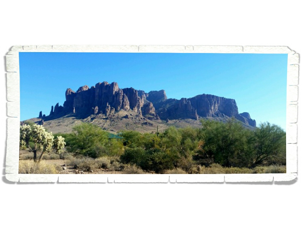
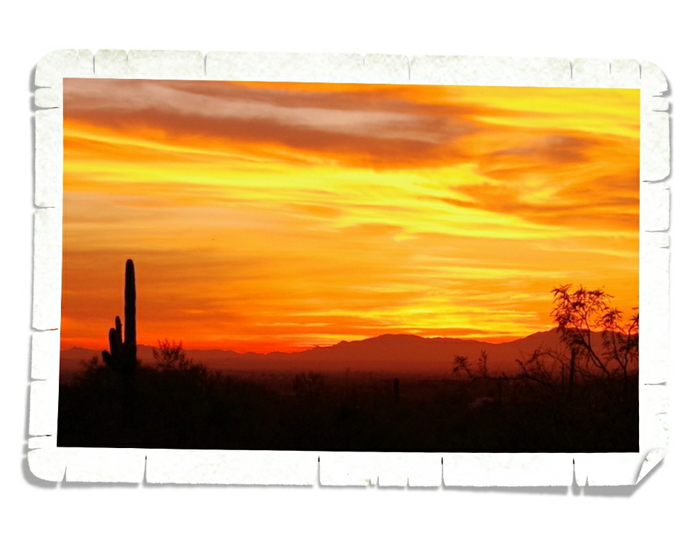
That’s quite the title for a post, right? Old Stuff And A Big Hole. Usually, I’ll name a post based on the town we’re staying in, but that doesn’t really work for this area. We stayed 20 miles from Winslow and 30 miles from Flagstaff at the Meteor Crater RV Park. I couldn’t call this post Meteor Crater because that was such a small part of what we saw. So, I went with the title you see. It fits.

Moving on!

The northeast corner of Arizona is chock full of ancient pueblos and dwellings. We find them fascinating and can’t seem to get enough of them. So far, each dwelling or pueblo we’ve seen has been a little bit different than the others. Each providing a new hint or clue as to how people once lived.

IMGP9209

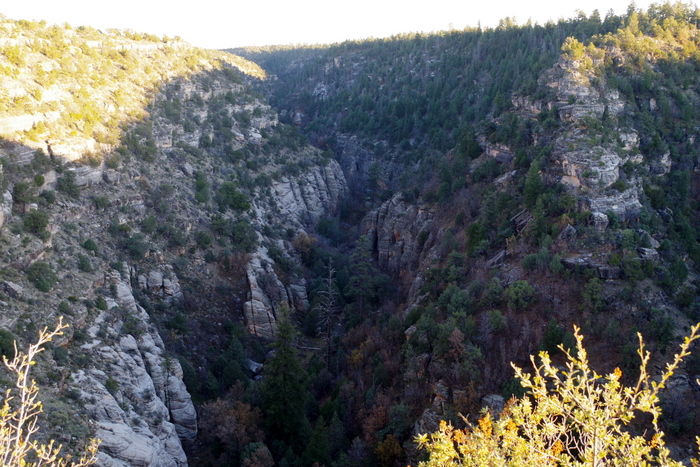
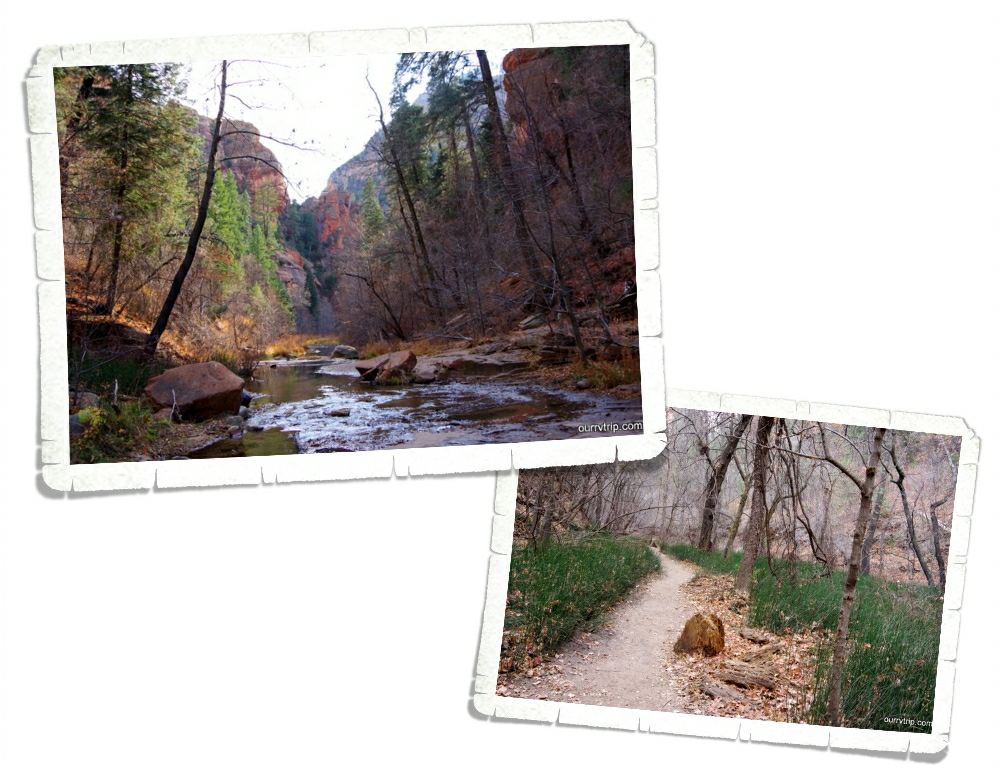
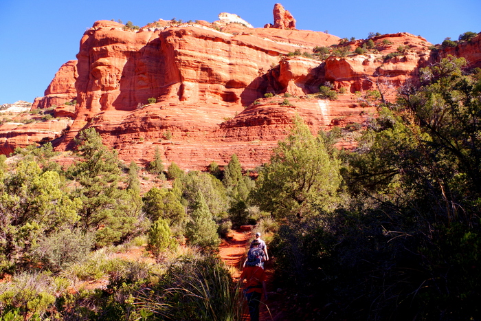
Welcome to Walnut Creek Canyon.

IMGP9210

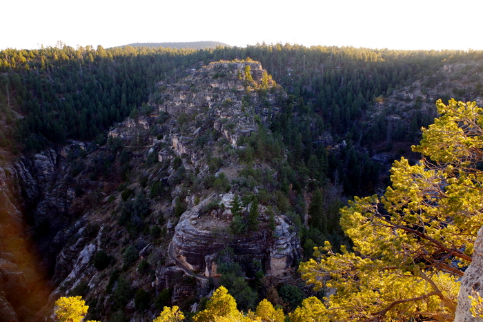
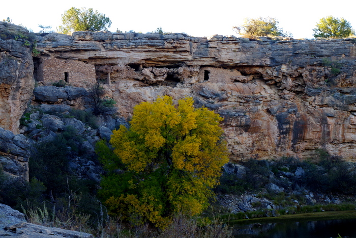
We spent an afternoon walking the Island Trail at Walnut Canyon National Monument where the Sinagua people lived more than 800 years ago.

IMGP9174

The Sinagua weren’t the first to live in Walnut Canyon. Artifacts found there show people were in the area more than 1,400 years ago.

IMGP9176

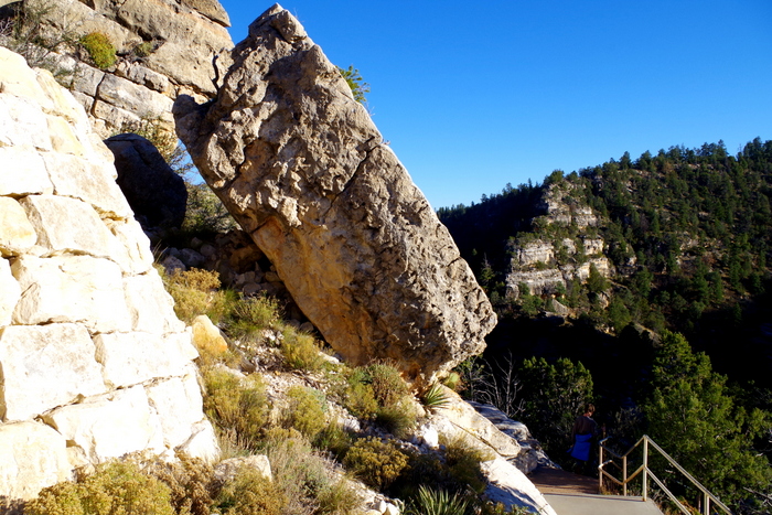
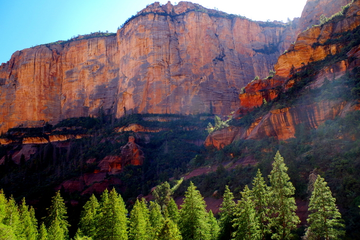
The Island Trail takes you by big boulders perched precariously above the trail and down 240 stairs. It’s not the down that gets you…it’s the up and the fact that you’re almost 6,000 feet above sea level.

IMGP9185

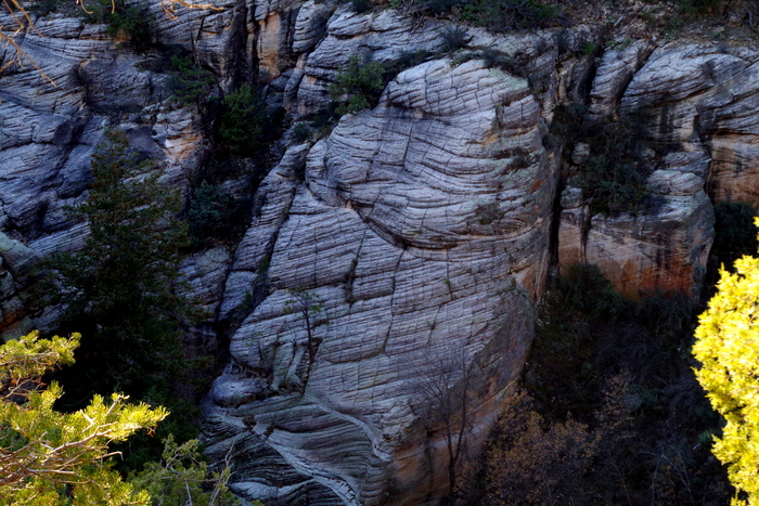
Down in the canyon there are these sandstone rock formations. The diagonal lines or cross-bedding shows a record of the changing winds. Those used to be sand dunes.

IMGP9194
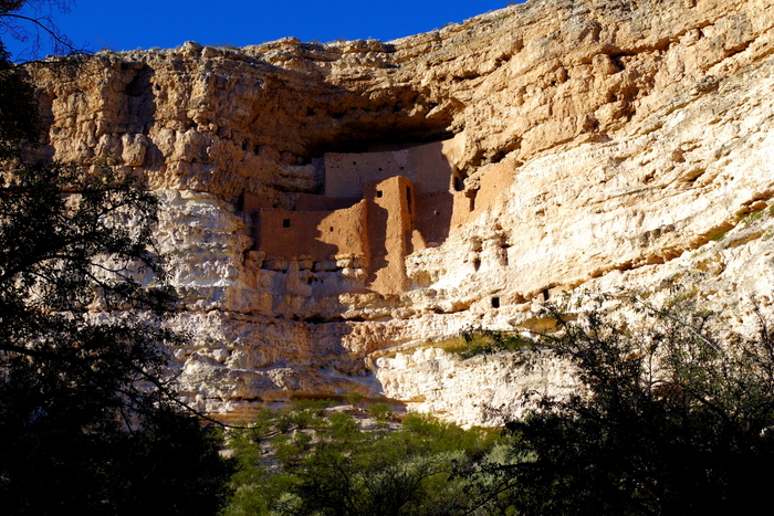
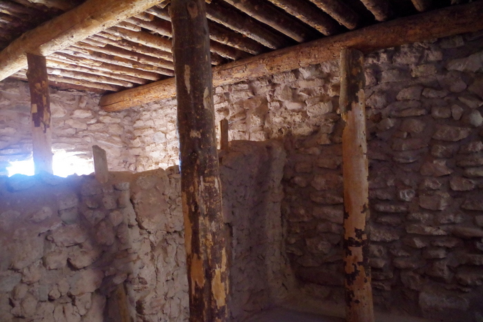
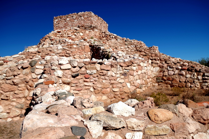
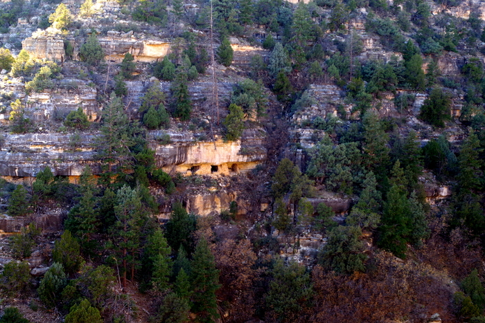
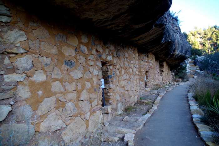
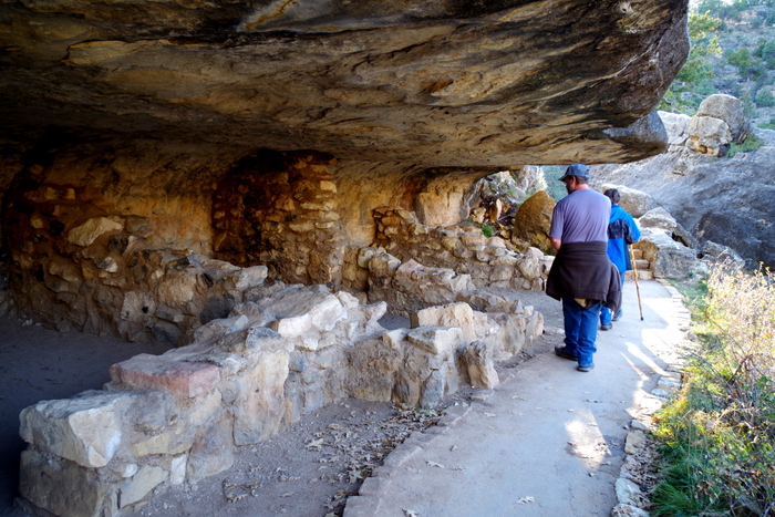
The cliff dwellings were built between 1125 and 1250. The builders took advantage of natural recesses in the limestone walls to build their homes.

IMGP9199

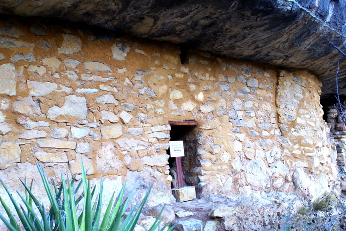
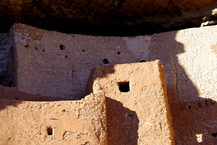
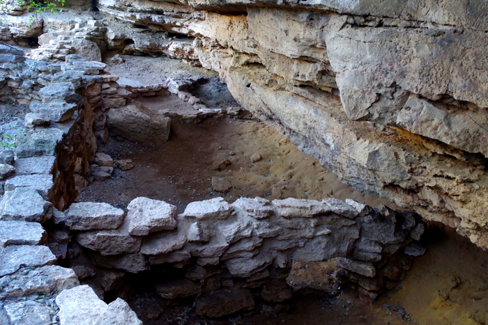
There are some amazingly preserved homes at Walnut Canyon. The doors would have been covered with whatever they had (like an animal skin) with a gap at the bottom. See the little cutout in the wall above the door? It’s a pretty ingenious design. The air enters the home through the gap in the door then circulates through the home and takes the smoke from the fire with it out through the hole at the top of the wall above the door.

IMGP9198

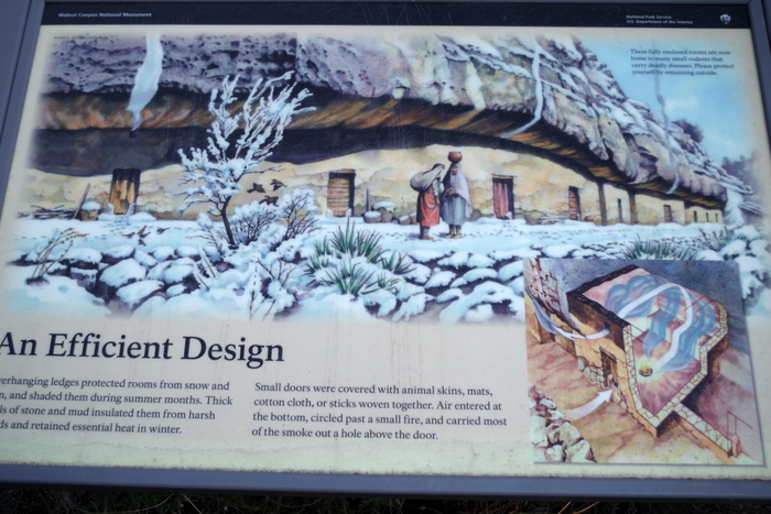
Sometimes a picture will explain it better. See the square at the bottom right of the photo above? That shows how the smoke would be carried out of their home.

IMGP9201

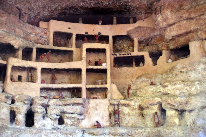
This photo gives you a better idea of what the dwellings used to look like.

IMGP9218

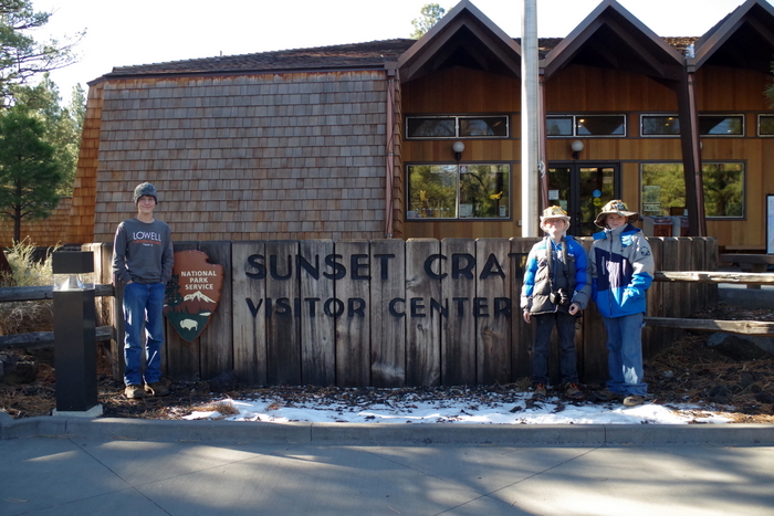
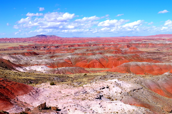
We spent an entire day between the Sunset Crater Volcano National National Monument and the Wupatki National Monument. There’s a 35 mile scenic drive that connects these two parks.

IMGP9225

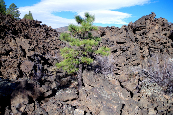
Sunset Volcano last erupted about 800 years ago. This eruption is the most recent in a six-million-year history of volcanic activity in this area. The photo above was taken on the A’a Trail.

IMGP9231

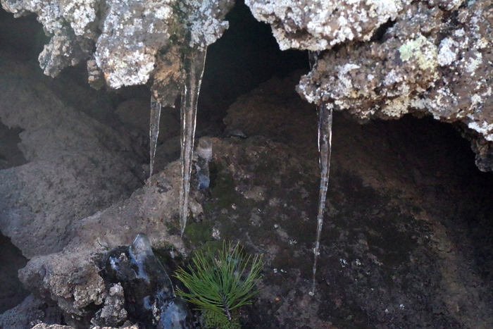
The boys loved seeing icicles hanging from the old lava flow.

IMGP9233

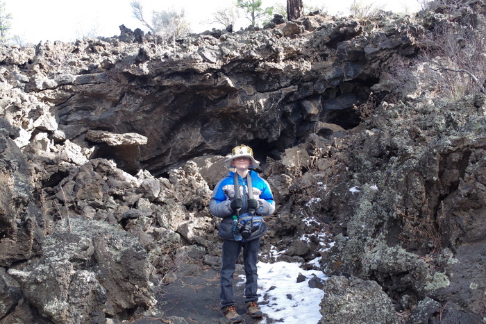
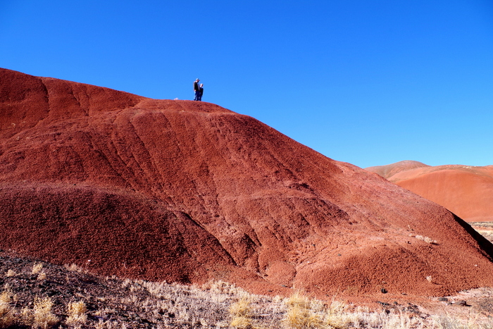
Here’s a picture of Littlest standing in front of one of the flows so you can see how tall they are. And yep, that’s snow you see!

IMGP9242

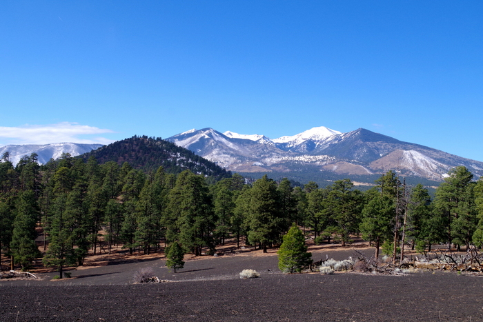
At the top of the Lenox Crater Trail we were rewarded with a wonderful view of the San Franciso Peaks. Interesting fact…the San Franciso Peaks used to be one big volcano.

IMGP9247

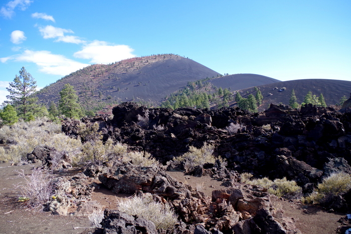
Here’s a shot of Sunset Volcano. There’s not a trail to the top to actually see the crater which we thought was a big bummer. But apparently there was so much damage done by people trekking up there it’s now a big no no. Personally, I think if you name a National Park after something there should be a maintained trail to see it.

IMGP9262

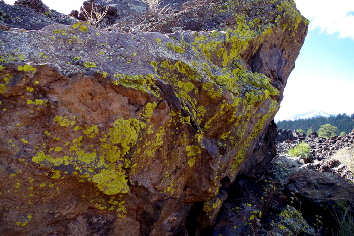
After an eruption lichens begin breaking down rock into soil.

IMGP9307

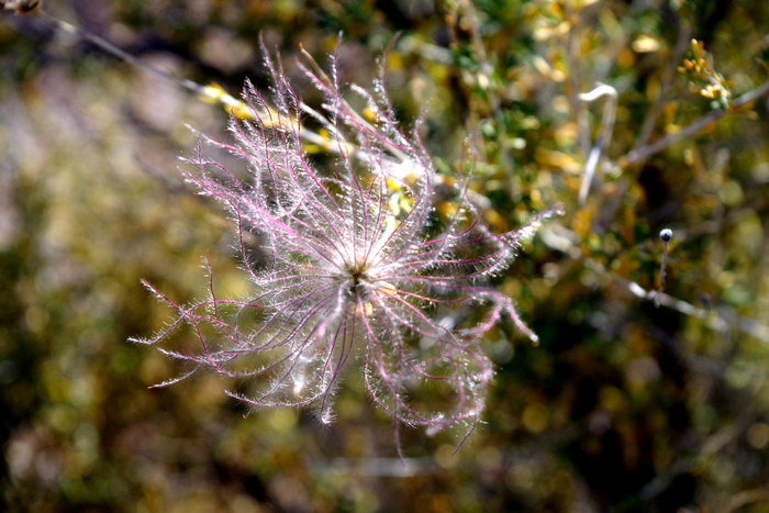
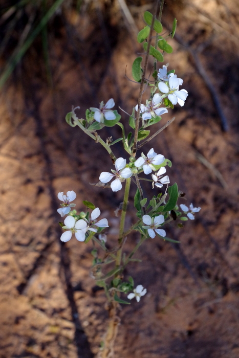
I didn’t find any flowers, but I did find a ton of these Apache Plume that had gone to seed.  We thought they were very cool.

IMGP9346

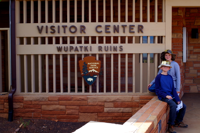
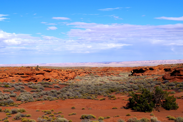
Next up was the Wupatki National Monument. There are several pueblos in this park and we tried to see as many as we could even as a snow storm was moving in.

IMGP9317

This is the Wukoki Pueblo. Wukoki means “Big House” in modern Hopi.

IMGP9321

The Wukoki has a pretty nice view from its porch.

IMGP9328

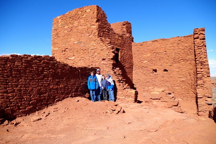
Wukoki was once home to two or three families that they believe came from the Kayenta Anasazi culture.

IMGP9331

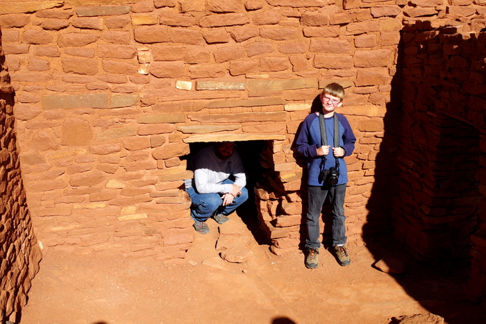
One of the things we found so interesting about this pueblo is how small the doors are. That’s Jerl crouching in the doorway and Littlest standing beside it so you can get an idea of the size.

IMGP9351

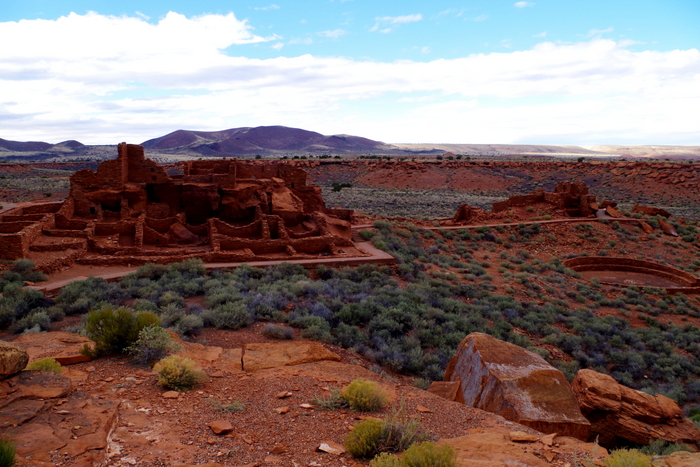
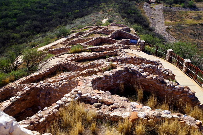
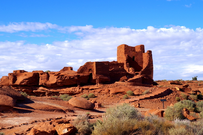
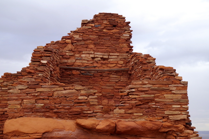
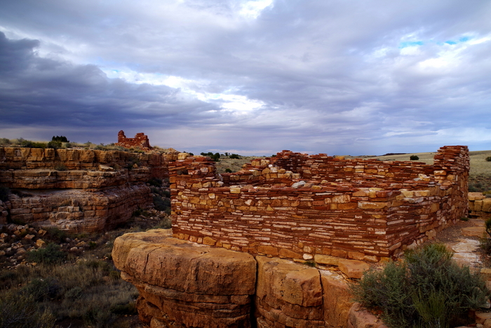
This is the Wupatki Pueblo.

IMGP9389

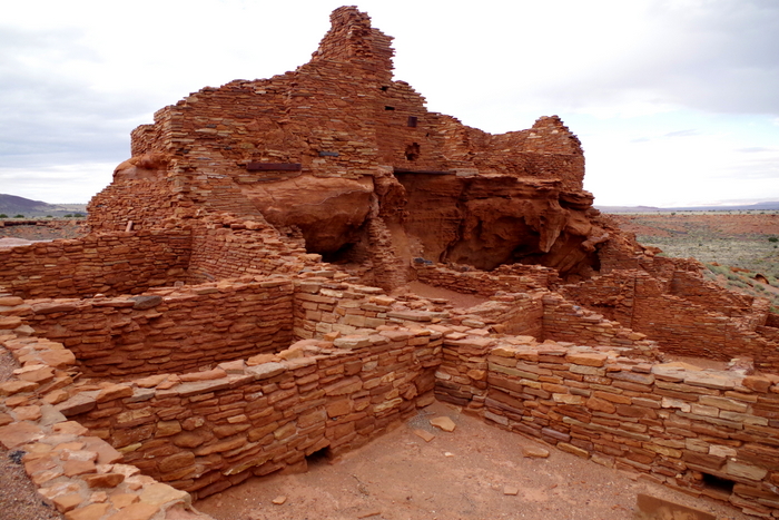
The location and size (100 rooms) of the Wupatki Pueblo makes archaeologists believe that this wasn’t a typical village but a special meeting place for the surrounding areas.

IMGP9366

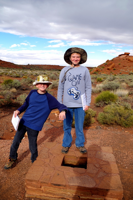
One of the coolest things at the Wupatki Pueblo was the blowhole. I’m not going to pretend I completely understand how it works…something with light warm air and cold heavy air.

IMGP9373

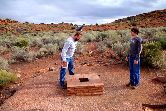
We all had to take turns standing and leaning over it. Jerl wasn’t expecting the wind to be so strong and his hat blew right off his head!

IMGP9378

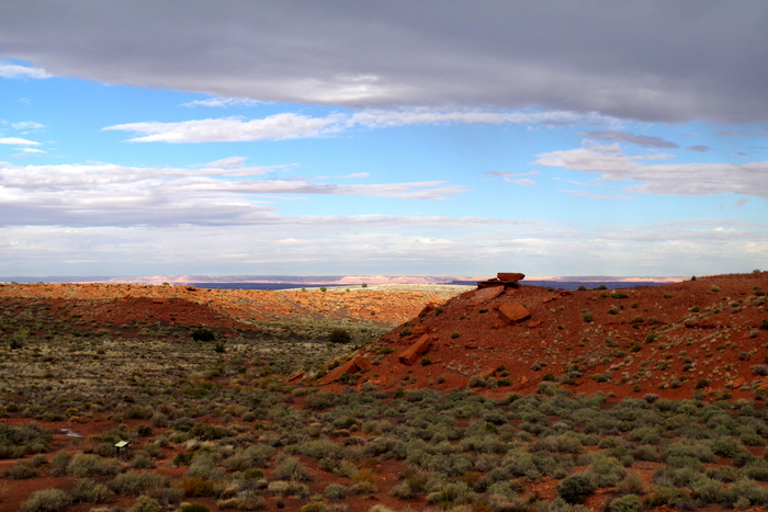
The Wupatki Pueblo had a pretty fantastic view too.

IMGP9387

See the two wooden beams in the photo above? They’ve been in place for over 800 years.

IMGP9402

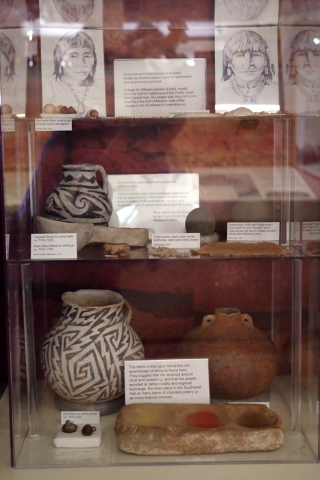
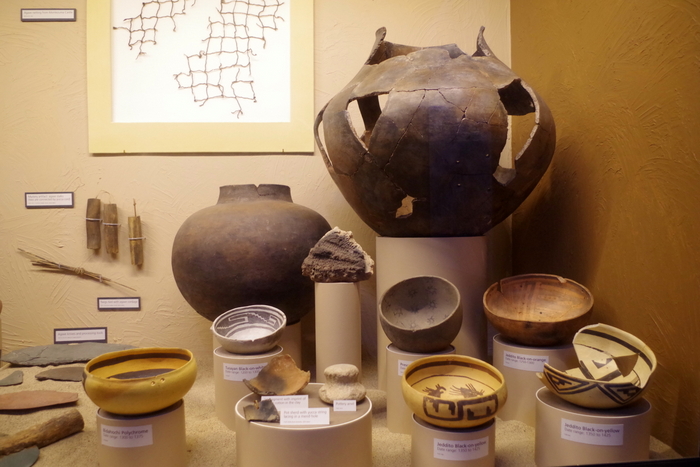
There was some amazing pottery found in the area.

IMGP9407

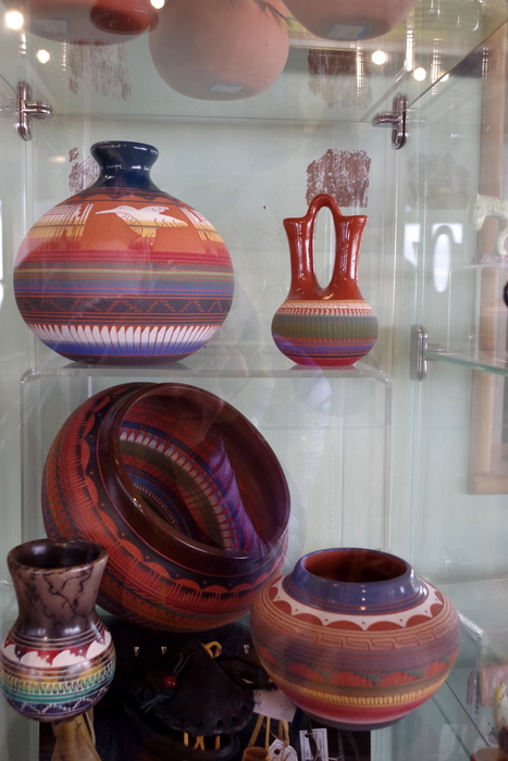
And some newer pottery for sale. I would have taken any of the ones in the picture. Love them!

IMGP9417

This was the Nalakihu Pueblo. Farmers once lived here. See the snow clouds getting closer? We got snowed on back at Sunset.

IMGP9425

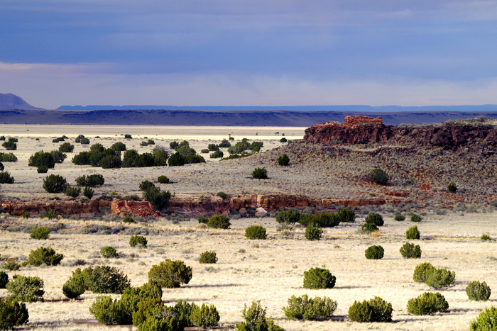
The ruins really do dot the landscape. Can you see the two different ruins in the photo above?

IMGP9448

These two pueblos were built on the edges of a canyon. We saw these while we were walking the trail to get to the Lomaki Pueblo.

IMGP9459

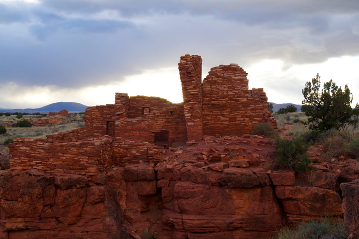
And this is the Lomaki Pueblo. Notice the leaning walls? I wonder how long they’ll stay standing. Interesting fact…when a family or village would decide to move to a new area they would take all of their valuables with them, including the roof support beams or sometimes they would plug all openings to the building and leave some of their valuables there, as if they had plans to come back. One of the things that has really stuck out to us about pueblos is the way the structures are melded into the landscape and are oriented to the sun and seasons.

IMGP9463

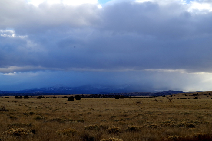
It spit snow on us a couple of time that day. Nothing bad. We enjoyed watching the snow clouds.

IMGP9464

I stuck this picture in to show y’all how many cinder cones dot this area.

IMGP9490

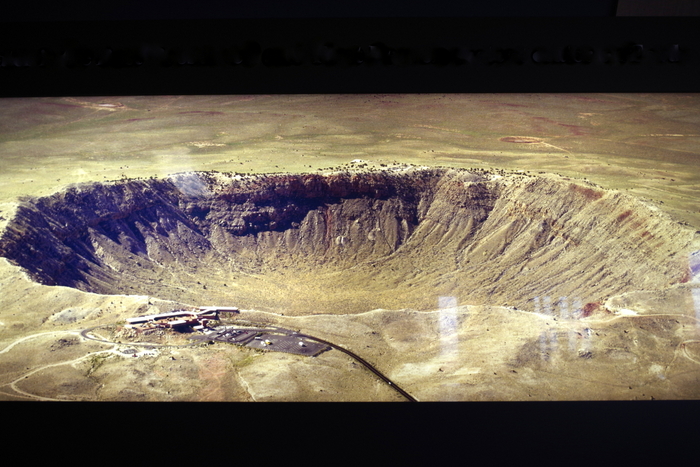
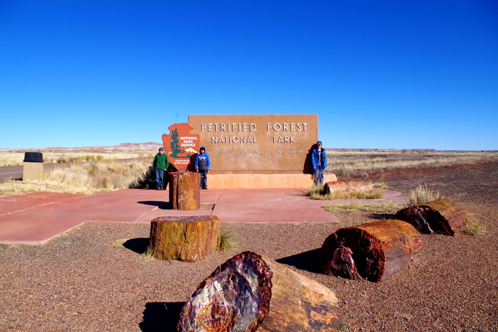
So, the other thing we did on this stop is visit Meteor Crater. I snapped a picture of a picture so you could see the whole thing. The real photo is in the Meteor Crater Visitor Center.

IMGP9494

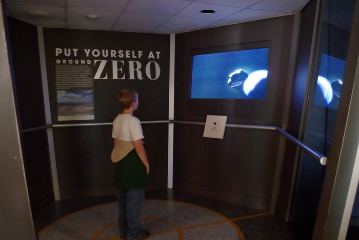
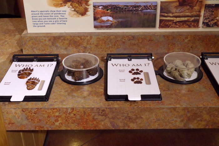
There was a neat little museum. The boys loved this booth.

IMGP9500

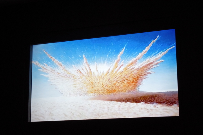
The booth played a video of what scientist think happened about 50,000 years ago.

IMGP9516

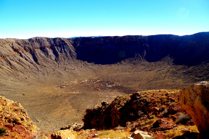
We took the guided tour along the Crater rim. It was interesting and the guide made it fun. I don’t have a wide enough lens to get the whole crater in one shot. The Crater is 4,000 feet across, and 550 feet deep. It used to be about 700 feet deep but because of erosion, it’s being slowly filled in. To help you visualize just how stinkin’ big this crater is…there could be 20 different football games going on along the bottom and around 2 million fans could line the sides to watch. Big, right?

IMG_1761

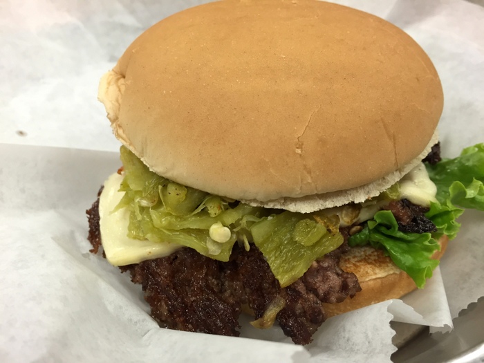
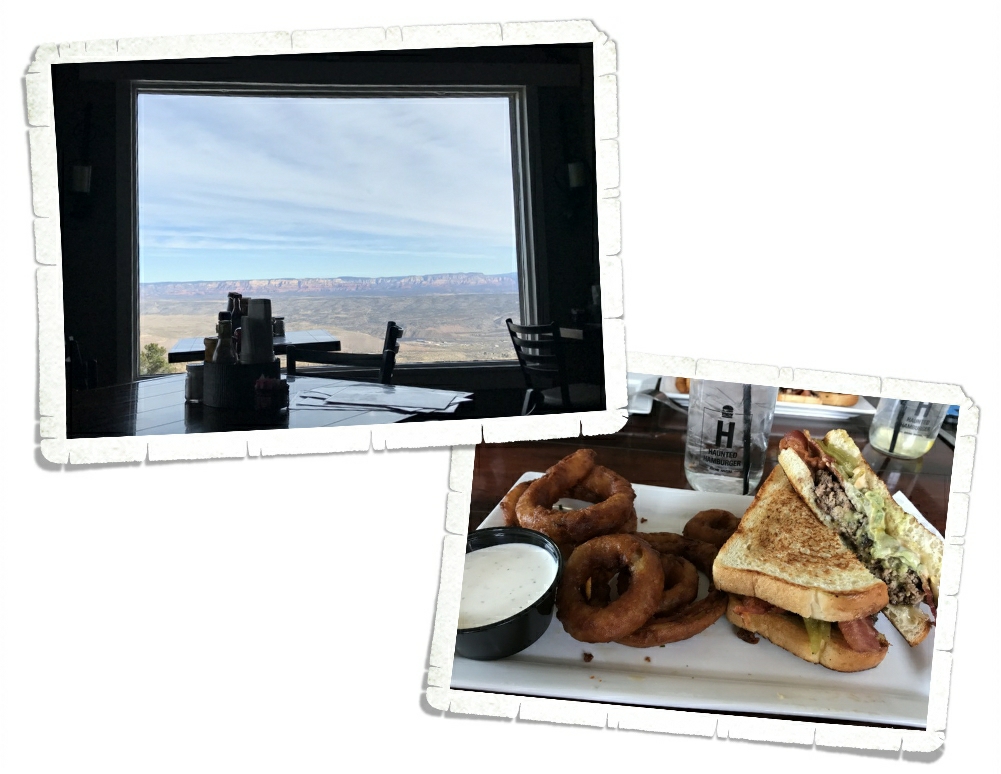
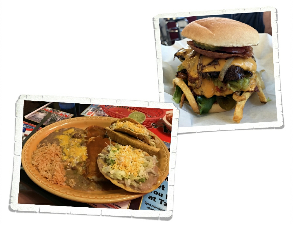
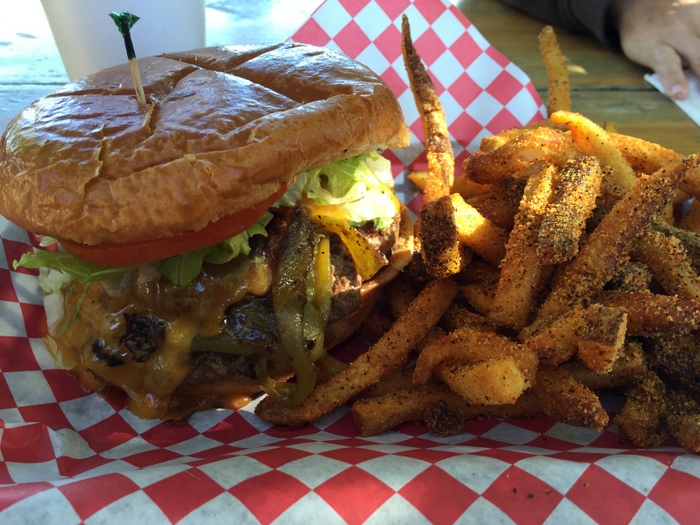
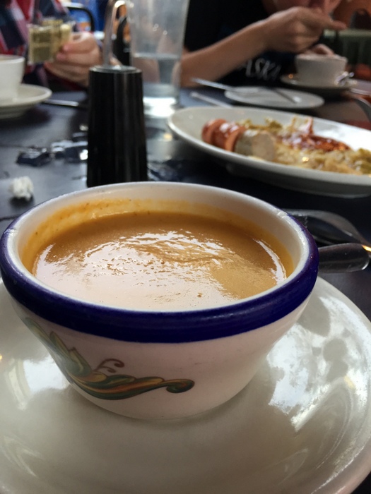
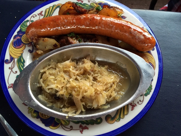
I can’t leave the food out! We ate at a place called Mama Burger in Flagstaff. My burger had green chilies, jack cheese and hot sauce. I’ve been a little obsessed with the green chilies lately. I think it’s because they’re so good.

IMG_1763

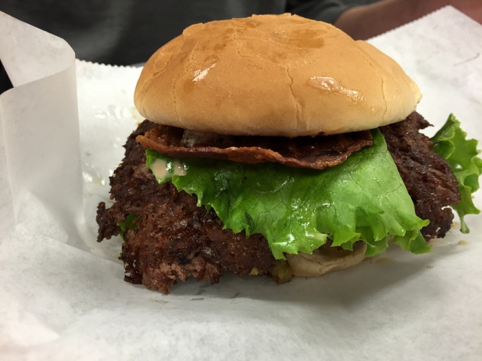
This was the burger Mr. Man got. I don’t remember everything on it but it was huge and messy with bacon…and he ate it all!

IMG_1762

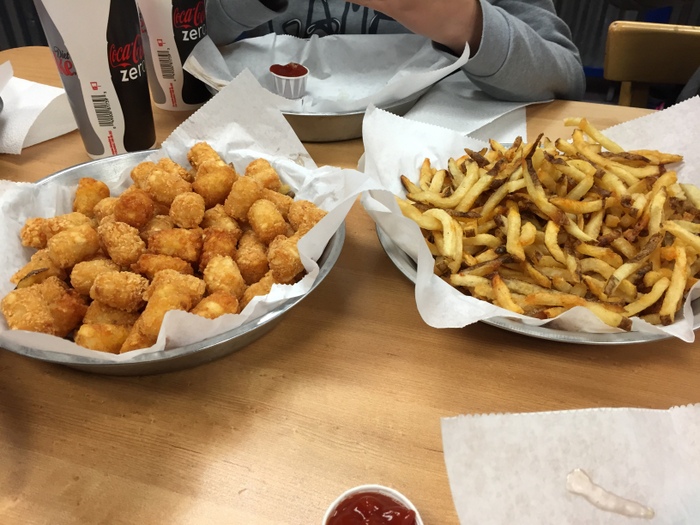
We ordered fries and tots to have along with our burgers. We didn’t realize they were going to come out in completely filled pie plates. And the price was really decent! If you’re ever in the area you should definitely go to Mama Burger!

See y’all down the road!

High clearance required

High clearance required

One of the requirements before starting this trip was to have a four wheel drive vehicle. The Sedona area has over a dozen drives that are a little more, adventurous. We wanted to do one of these drives, as the views were said to be spectacular…and they were.
 IMGP9154
The drive we chose to do is called Schnelby Hill Road. Schnelby Hill Road is a semi-maintained dirt road that runs from Sedona to I-17 along 12 miles of very bumpy driving.

Also not for RVs

I was excited to drive up and see this sign. Soon after, the pavement ran out, that’s when things became interesting.
IMGP9090
 Where the pavement ends…
You can see a couple more warning signs in the distance.  I’m pretty sure people don’t read those, we saw several people trying to drive low clearance vehicles along this road. We actually talked to one guy and suggested he turn back…he did.
IMGP9149
 This area is not so bad, pick your path and just about anything can drive along that…but that’s not all there was.
IMGP9091
I have to say, the car looks pretty good going through there.
IMGP9151
Here’s another shot, showcasing the road…and the car.
IMGP9158
The views were amazing the whole way.
  IMGP9106
We stopped occasionally to do some exploring.  This is a bowl that has been washed out of the sandstone from running water when it rains.  Just beyond the edge there is about a 20 foot drop.
IMGP9115
TEQUILA…or at least where we get it.  Agave grows everywhere around here.
IMGP9143
Some more exploring, this was as far as we went, about 4 miles in.
IMGP9129
We were greeted with this view at the end.
I put together a map of the route we took using a Garmin eTrex. I pulled the track off the GPS unit, converted it into something I can use and added it to the map. It’s fun to see where we went. The whole trip was about 8 miles and took us almost 2 1/2 hours.
So Much Awesome Part Two

So Much Awesome Part Two

The Sedona/Verde Valley area has so many things to see and do. From the hikes I told you about in the last post to National Monuments to Ghost Towns. You should plan on spending at least a few weeks in this area to see it all.

We started with the Red Rock District of the Coconino National Forest.

IMGP8668

We went to the Visitor Center where the boys worked on a Junior Ranger program and we got some good advice about surrounding hikes.

IMGP8672

The view from the Visitor Center was pretty stellar. We got our first good look at Castle Rock, Bell Rock, and Courthouse Butte (in that order from left to right).

IMG_1722

The Native American culture is strong here. We stayed right across the highway from the reservation.

IMGP8805

We call it Montezuma Castle today, but the descendants of the people who once lived there know it by other names. The Hopi call it Sakaytaka which means “place where the step ladders are going up”.  We spent an hour strolling around the grounds. We were bummed when we learned you can’t go up into the Castle anymore.

IMGP8779

Montezuma Castle was used by many different clans. The Parrot, Bear, Water, Cloud, Bluebird, and Spider clans are just some of the clans to have called it home.

IMGP8802

Here’s a model they put up of the inside of Montezuma Castle after they stopped letting people go inside.

IMGP8783

The Dude and Littlest are standing in front of some Arizona Sycamore trees. I love the way the bark looks camouflaged!

IMG_1718

The boys ended up with a pretty cool badge. We actually had to buy the one in the picture, but since they completed the booklet and got the free badge, they decided they should have the cooler badge too. We don’t see these badges much. Some parks won’t put them out for sale because they don’t want just anyone to get one.

IMGP8992

In the Montezuma Junior Ranger book there’s a few pages that require you to go to Montezuma Well. You can still get the Castle Badge, but if you complete the whole book you get a special button…so…of course, the boys had to have it. I honestly didn’t think the Well would be that interesting. I thought it was just…well…what you see in the photo above.

IMGP9006

To my surprise, there are some dwellings at the Well! The Well contains over 15 million gallons of water and is replenished with 1.5 million gallons of new water every day.

IMGP9003

For many cultures, Montezuma Well is a sacred place. The Hopi, Zuni, and Yavapai can all trace their ancestors to a time when they were living at the Well.  You can’t drink the water now, since it has arsenic in it.

IMGP8812

Tuzigoot National Monument is one of my favorites so far.

IMGP8815

The Visitor Center had some really amazing artifacts that were found there.

IMGP8825

One of the coolest things about Tuzigoot is that you get to go inside a dwelling and then go up some stairs for a great view.

IMGP8830

Here’s the view from the top. When the archaeological team got to the Tuzigoot site it was just a big pile of rocks. They knew something was under it because the rocks were so uniformly piled.

IMGP8832

Funny story about how Tuzigoot got it’s name…when the archaeologists were looking for a name for the site a Tonto Apache suggested Túzogoot (TWO-see-WHOODT) which means “crooked water”, but the archaeologists spelled and pronounced it as Tuzigoot (TWO-zee-goot) which is nonsensical in Apache. Unfortunately, the Tuzigoot name stuck so that’s what it’s called today. A nonsensical word.

IMGP8845

While we were at Tuzigoot we got to see a weaving demonstration. This guy was so good! He was having conversations and pausing, but he never lost his place in the weave design. I’m pretty sure he’s done it a time or two.

The boys left the Sedona/Verde Valley area with two National Park badges plus two special pins, a State Park badge, and a National Forest pin. They work hard to earn the badges. They have to fill out a booklet that requires you to find items, problem solve, hike, and think outside the box. Then, the Ranger goes over it with them to make sure it’s done and they actually understand it all (I think it’s to see if the parents did the book or the kids).

IMGP8861

What you’re looking at is the town of Jerome, AZ. Jerome is known as “America’s Most Vertical City”. We drove through it trying to find a place to park so we could grab a burger at the Haunted Hamburger, but we couldn’t find a single place to park. I didn’t get any pics of the town as we drove through and I wish I had. It was a really neat town! Jerome is an old copper mining town and was once known as the wickedest town in the west. It’s supposed to be very haunted. We really wanted to spend time there and if we ever make it back to Verde Valley, we will definitely stop back in.

IMG_1726

We didn’t spend the whole time hiking and exploring National Monuments. Nope. We, of course, had to find some good food! We found Hog Wild BBQ in Cottonwood, AZ. It was so good, we ate there twice. What you see in the photo above is the Mingus Mountain Burger and garlic fries! The Mingus Burger has cheese, bacon, and green chilies on it along with all the usual burger stuff!

So, there you have it! That was our two weeks in the Sedona/VerdeValley area. Usually when we stay someplace for two weeks by the second Wednesday, I’m ready to go. I’m itching to move on. But that wasn’t the case here. On that second Wednesday I started to panic about the lack of remaining time and the abundance of hikes to still do. We’ve had to start a list of places to revisit. Can you guess what the first place on the list is?

See y’all down the road!

So Much Awesome

So Much Awesome

We spent two weeks in the Sedona/Verde Valley, AZ area and we get it now. We understand why people flock to this area. This area is a hiker’s dream.

IMGP8716

So many hikes…so little time! I think every cairn we saw had multiple hikes with arrows pointing you in the right direction.

IMGP9019

And then you’ve got the views. Nice, right? It’s hard to be in anything but a good mood when you’re surrounded by views like the one in the picture above. And those views are in every direction!

We spent as much time as we could getting in as many hikes as we could. We ended up getting nine hikes in with a combined total of about twenty miles and we didn’t even scratch the surface when it comes to all of the available hikes in the area! I won’t go in to great detail about each one of our hikes, but I’ll give you some of the highlights.

IMGP8738

One of the first hikes we did was the Baldwin Trail. This was a loop trail that gave us some amazing views of Cathedral Rock. You can see Littlest and The Dude standing in front of Cathedral Rock in the picture above.

IMGP8873

We spent an afternoon hiking around four miles of the trails at the Red Rock State Park. The leaves in Sedona were starting to change to fall colors. I thought the yellows and oranges next to the red of the House of Apache Fire was pretty.

IMGP8939

One of our favorite hikes was the Boynton Canyon hike. We started off surrounded by the red rocks this part of Arizona is known for,

IMGP8943

but ended up in a ponderosa pine forest

IMGP8956

where we had to stop and smell…the trees! Ponderosa pine trees smell like vanilla and sometimes they smell like butterscotch! The bigger the tree the stronger the scent.

IMGP8951

We got to see some fall colors in the forest. It’s been awhile since we’ve experienced actual fall colors and weather and we thoroughly enjoyed it.

IMGP8967

At the end of the Boynton Canyon hike is a wonderful view of the box canyon you just hiked through. The sun was in the wrong spot for me to really get any great shots, but you can get an idea of what our view was in the picture above.

IMGP9050

Another of our favorite hikes is the Devil’s Bridge hike. We were lucky enough to have a four-wheel drive vehicle so what would have been more like a six mile hike was only a two mile hike!

IMGP9052

This hike had some truly Harding Icefield worthy hiking!

IMGP9054

The views even rivaled what we saw during the Harding Icefield hike! Can you tell we still compare everything to Alaska?

IMGP9060

This is the Devi’s Bridge. It was spectacular!

IMGP9077

There was a path to the top of the bridge and a path that takes you under it. We, of course, had to check out both paths.

IMGP8679

We did one hike twice. What you’re looking at in the picture above is Bell Rock. You can hike to it then climb all over it!

IMGP8690

The view from part way up Bell Rock is pretty fantastic!

IMG_1755

See those white dots in the middle of the above photo? Those teeny tiny, dots are Jerl and the boys. I scrambled up about half way then decided to sit and enjoy the view, but Jerl and the boys wanted to see how far up they could get. IMGP9086

A fun thing to do in the Sedona area is look for the rock formations that have names. You can get a map pretty much anywhere with the rock formations and their locations. We saw a few during our explorations. The one above is The Sphinx.

IMGP9120

This one is The Teapot. There’s one called Snoopy Rock. We tried our hardest to find it, but never saw it.

IMGP8729

We saw a few flowers on our many hikes. Not many though.

IMGP8678

Even here in sunny Arizona, it’s the wrong season for most flowers.

IMGP8695

We did see a ton of agave. The stuff is seriously everywhere!

There’s just so much awesome in the Sedona area, I’m going to break it up into two posts. In the next post I’ll tell you about one of the towns we went to and the National Monuments we visited. We drove one of the many four-wheel drive roads. Jerl is going to do a post on that for you. It was quite the adventure!

See y’all down the road!

Pizza Roundup Pisa Lisa

Pizza Roundup Pisa Lisa

Pisa Lisa has some of the best pizza ever with super tasty gelato, but let’s talk gelato later.

IMG_1645

Pisa Lisa is in Sedona, AZ.

IMG_1633

I had a really good feeling about this place. It started off right with some of the best blueberry soda I’ve ever had!

IMG_1635

The menu has pizza, salads, panini’s, tapas, and more.

IMG_1636

We just got pizza.

IMG_1701

I got a nice picture of one of the chefs tossing dough.

IMG_1639

Now, let’s talk gelato! They had lots of flavors like strawberry cheesecake, raspberry, pistachio, mango, that is all the flavors I remember but there were more.

IMG_1640

They also had tiramisu on the dessert menu. This is my dad’s favorite!

IMG_1642

The decor was top notch!

The bathrooms were clean and the service was good. Pisa Lisa is definitely getting a 5 star review.

Typing this review made me drool!

See you next time on

Pizza Street!

Phoenix, AZ

Phoenix, AZ

IMGP8546

We’ve been in Arizona for about a month and we finally made it to the State Capitol Building! We don’t add the state sticker to our map until we’ve been to the Capitol Building, so we’d been looking forward to Phoenix.

IMGP8583

See the pretty statue on top of the copper dome? It moves! We thought that was a nice touch. I’ve decided the Capitol Campus in Phoenix is my favorite so far.

IMGP8555

It’s not my favorite because of the Capitol Building it’s self…although the fact that the original section of the Capitol Building has been made into a wonderful museum, definitely helped put this Campus on the top of my list. The building isn’t the prettiest, the architecture isn’t the most interesting, but the museum was brilliant!

IMGP8563

We got a look at what life was like in the State Capitol Building in the early years.

IMGP8573

And, we got to see the state flag made from Legos! How cool is that?

IMGP8574

We found examples of all the state symbols.

IMGP8594

The rest of the campus was very lovely with several memorials dedicated to the wars.

IMGP8603

We spent a couple of hours perusing through the museum and the grounds.

IMGP8590

And, of course, there were the flowers!

IMG_1607

These pink ones were everywhere.

IMG_1596

We ended up eating dinner that night at a German place called Haus Murphey’s.

IMG_1594

The weather was perfect for eating outside.

IMG_1599

I knew it was going to be a wonderful meal when it started off with creamed pumpkin soup that even Littlest, who doesn’t like soup, loved.

IMG_1601

The meals came and we all made appreciative noises as each plate was presented.

IMG_1604

Everything we had was amazing and best of all, there was enough leftovers for everyone to have lunch the next day! Score!!

We’ve put Haus Murphey’s on our list of places to visit again!

See y’all down the road!