Month: September 2015

Washington

Washington

We stayed in Washington for two weeks. We only did two things on our Washington list, but that’s ok…these two weeks were more about catching our breath after the long Alaskan Summer and the super long drive days through Canada to get back to the lower 48. We needed decompression time and we needed to get some maintenance/repairs done on the RV. The first thing we did once we crossed the US/Canadian border (after finding a spot for the night) was get some dinner. I don’t remember what the name of this place was…it was in Lynden, WA and it was good ole’ American food with good ole’ American prices!

IMG_1209

I think this burger was called the There Can Never Be Too Much Cheese burger. It was amazingly good. We all got different things to eat, but I didn’t get pictures of anyone’s other than mine…we were too hungry and too tired to think of it.

The next day we headed to Olympia to check out the State Capitol Building.

IMGP5831

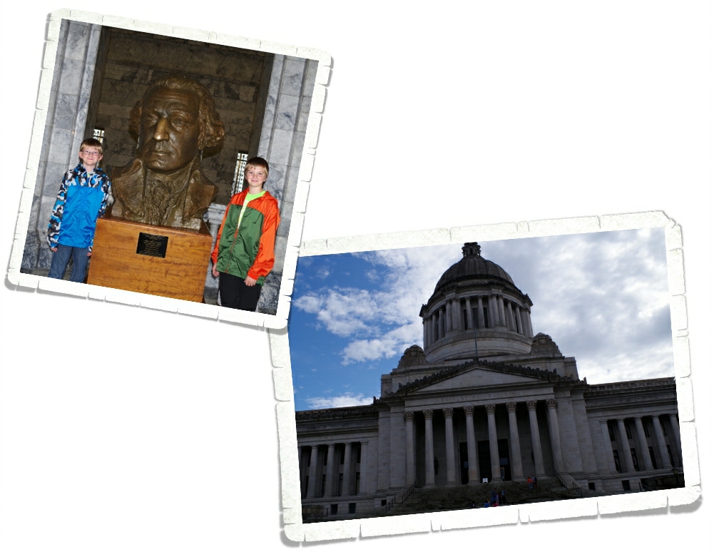
It was very majestic, but then again…I do love the dome buildings with all of the columns.

IMGP5813

We didn’t know until later that it’s supposed to be good luck to have your picture taken with this bust of Washington. The Little Boys are always up for being my models.

IMGP5852

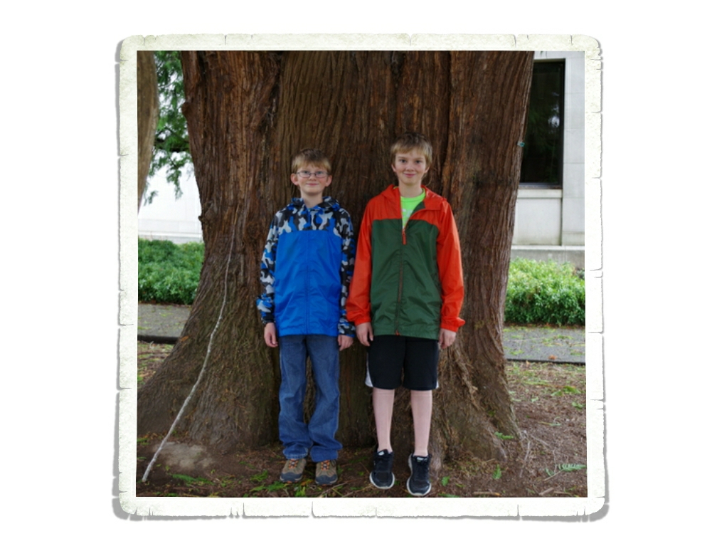
We found this huge tree right next to the Capitol Building.

IMGP5863

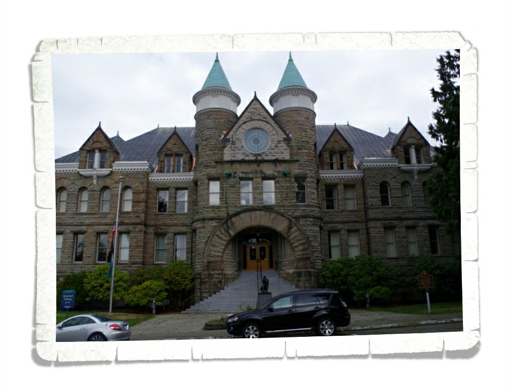
We found the original Capitol Building called “The Castle”.  I believe it’s aptly named.

IMGP5918

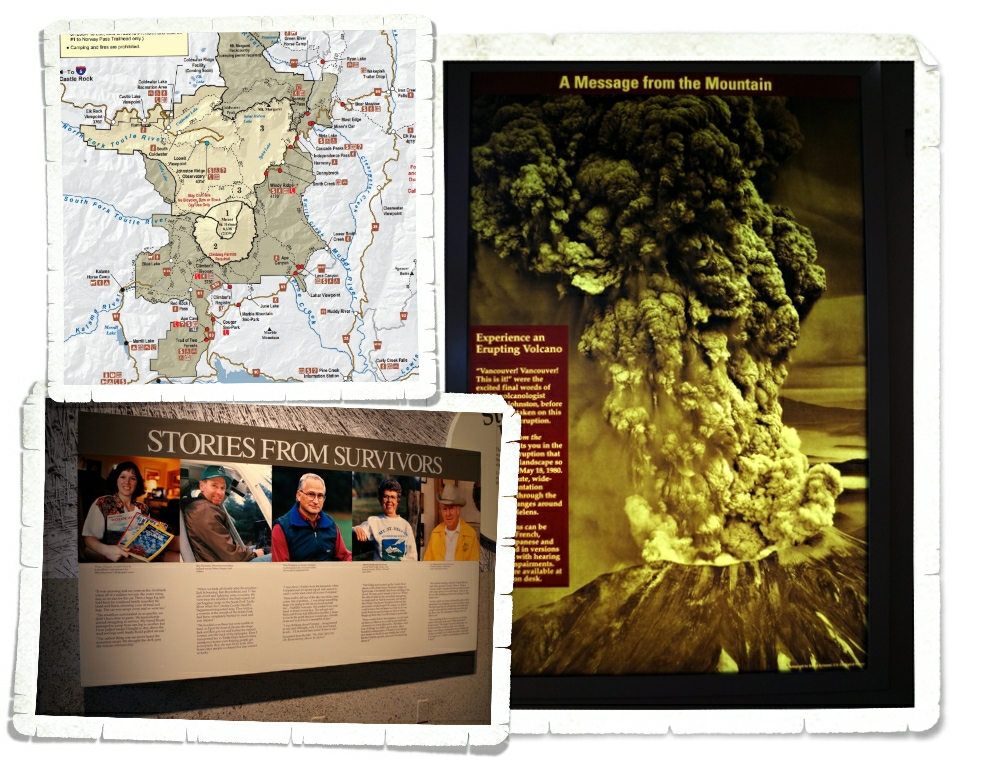
This year (2015) commemorates the 35th Anniversary of the May 18, 1980 eruption of Mount St. Helens. We spent two days exploring Mount St. Helens National Volcanic Monument. There are three sides of the volcano that you can explore and we hit things on all three sides.

map

The day we did the Johnston Ridge Observatory side of the volcano was rainy and cold.

IMGP5878

We started with the Forest Learning Center where we got our first real look at what happened the day Mount St. Helens blew her top. The Center had a short video to watch that had actual footage of that day shot by a cameraman who was close to the blast zone but not right in it. We were able to read stories from the survivors.

IMGP5882

IMGP5883

IMGP5884

We spent quite a bit of time in the Discovery Room at the Forest Learning Center. I love it when there are things for the kids to pick up. We learned a lot that day about the forests of Washington in general.

IMGP5888

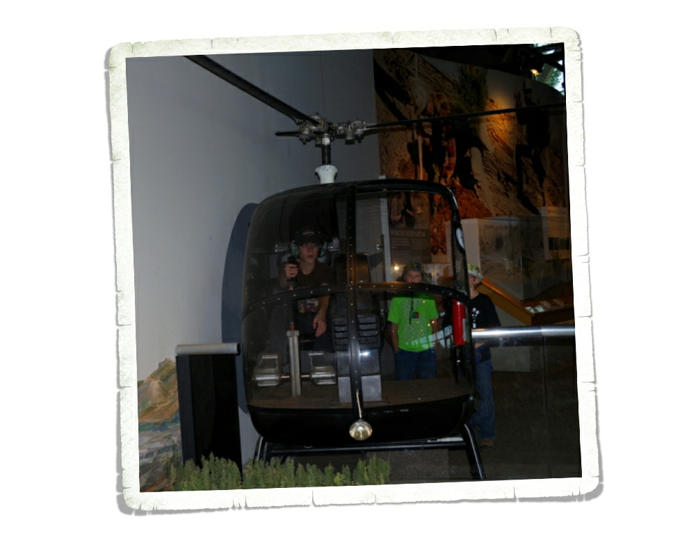
There was an actual helicopter at TFC that the boys could sit in and push all the buttons. They’re expert button pushers…

IMGP5949

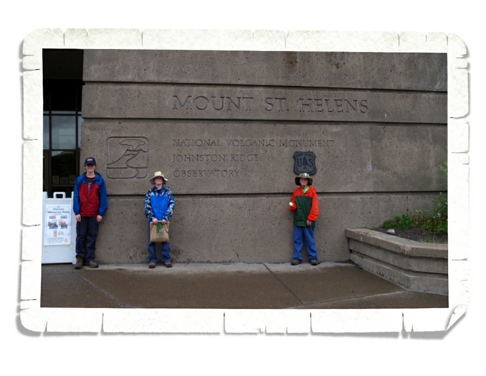
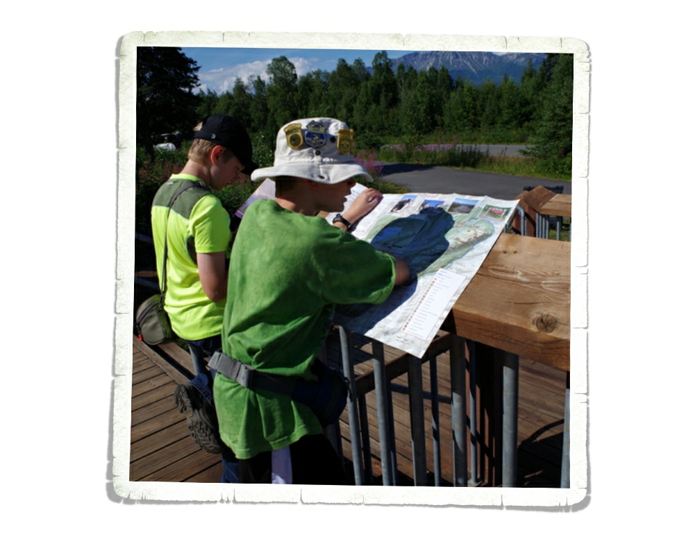
The Johnston Ridge Observatory is at the end of this road. We spent a good deal of time here exploring some of the hiking paths and listening to a Ranger Talk. The boys completed another Junior Ranger Program and got their eleventh badge.
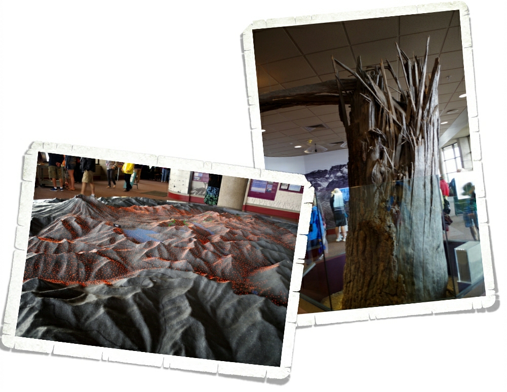
IMGP5913

This is an actual tree. They’ve moved it into the Observatory. There’s a plaque that talks about how the force of the blast snapped trees like matchsticks.

IMGP5920

There’s also this really nice 3D model that explains what happened during the May 1980 eruption. There are colored lights that turn on and off as a recording explains the different stages of the blast.

IMGP5939

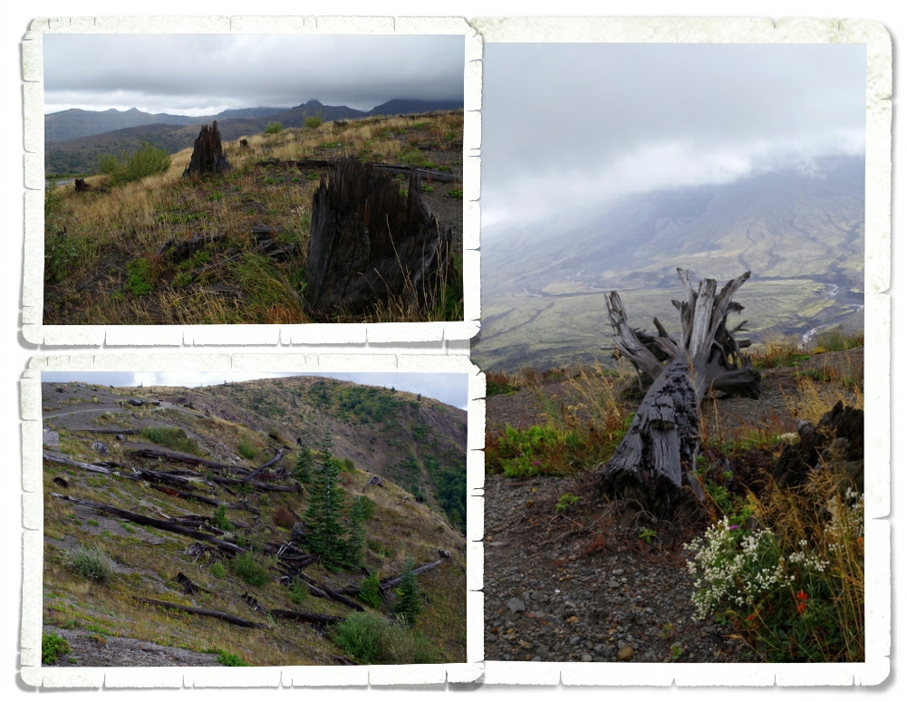
You don’t need a sign to tell you that you’ve entered the blast zone…you can tell. It’s still obvious 35 years later.

IMGP5945

The forests around Mount St. Helens National Volcanic Monument were replanted and helped along, but the land within the Monument has been (for the most part) left alone so that scientist can see how nature takes it’s course.

IMGP5956

Because of this you can see trees laying right where they fell on that day back in 1980.

IMGP5955

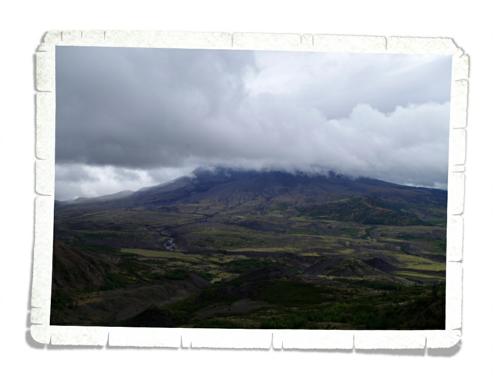
This was the best view we got of Mount St. Helens that day.

IMGP5962

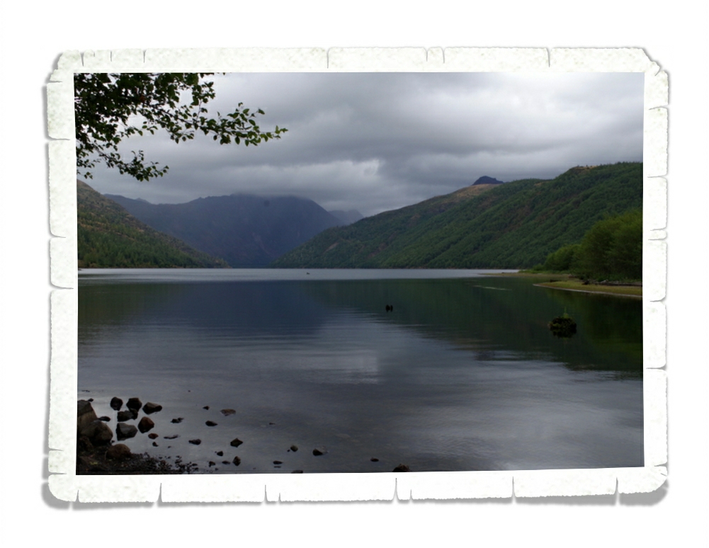
Some lakes, like the one above, were made because of the 1980 eruption.

IMGP6024

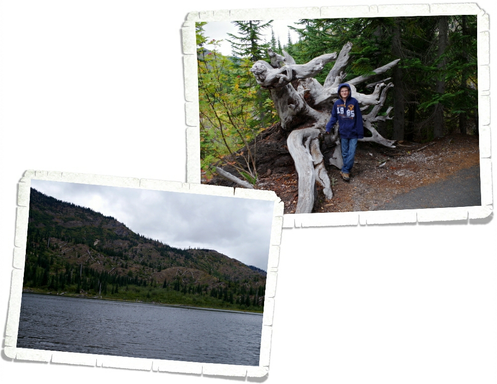
The next weekend we went to the other two sides of Mount St. Helens. While I enjoyed the Johnston Ridge side, I like the other two sides better. There aren’t any big visitor centers like over at Johnston Ridge, but there are more scenic views and trails with interpretive signs.

 IMGP6030This area is right at the edge of the blast zone. Not all of the trees were knocked over, but all of them were killed by the heat of the blast.

IMGP6044

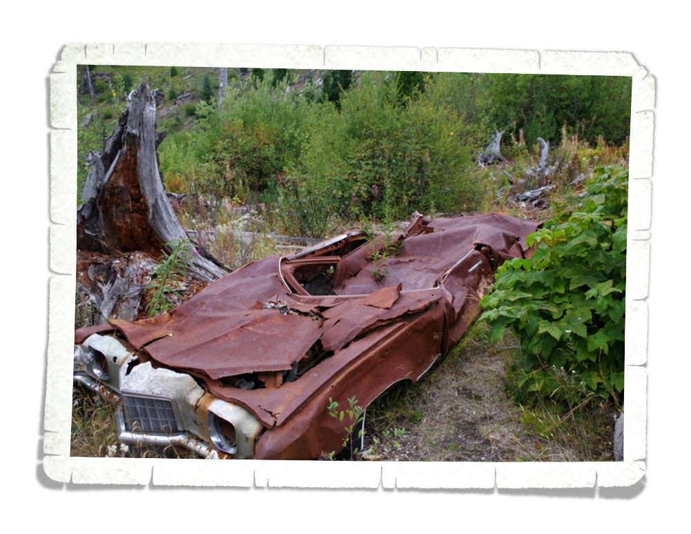
In the photo above you’ll see what they call Miner’s Car. The Pontiac belonged to a family who hiked to the Black Rock copper mine claim, about 8 miles from Mount St. Helens. On the morning of the eruption, Mount St. Helens released a 300 mph lateral blast of searing gas, ash, and rock that flattened the forest and took the lives of the family. The NP leaves the car where it is to remind people of the 57 people who lost their lives.

IMGP6056

At the Meta Lake site, there’s a small trail down to the water. All along the trail are reminders of what happened.

IMGP6057

Meta Lake was protected by a cover of mushy snow and ice when the blast came. The layer of snow and ice protected the small plants, bugs, and animals burrowed under it and by the next summer signs of life started returning to the mountain.

IMGP6070

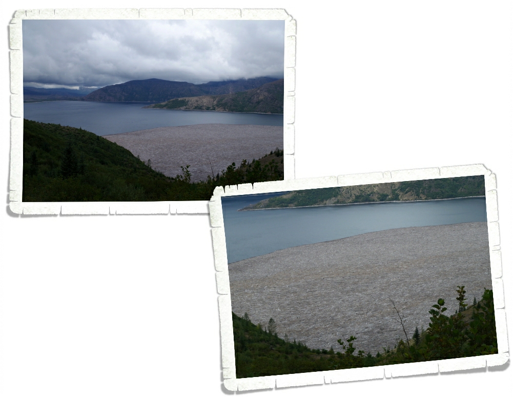
In a matter of seconds, the May 1980 eruption destroyed cabins, camps, and forests. The mud slide that came down the mountain plunged into Spirit Lake (seen above) causing the surface of the water to raise 200 feet and submerge the sites.

IMGP6072

With the mudslide came thousands of trees felled by the blast. You can still see them on Spirit Lake. There are signs up warning people not to try to walk on them because they’ll plunge to the bottom.

IMGP6110

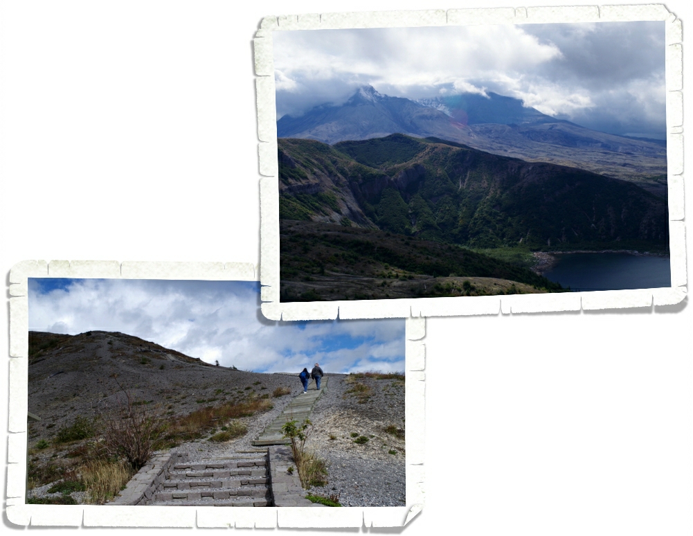
At the Windy Ridge Interpretive Site, you can walk up the nearly 400 stairs (yes, we counted) to get a view of Spirit Lake and the Crater of Mount St. Helens.

IMGP6104

It was cloudy this day too, but we got to see a little of the top and some of the glacier inside.

IMGP6111

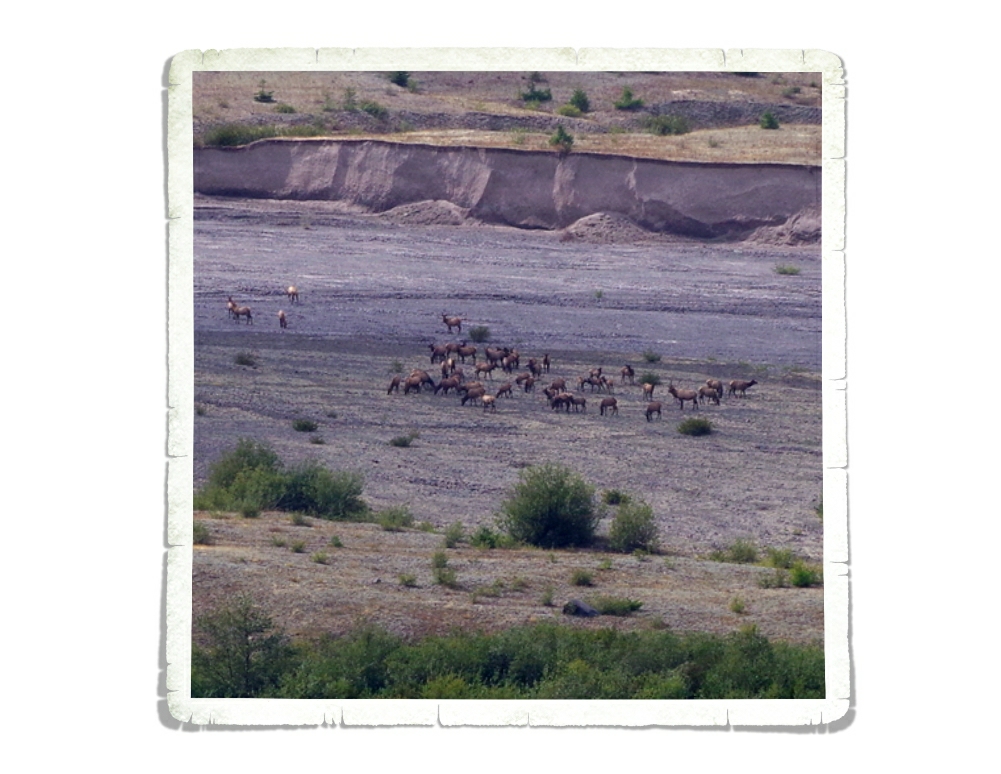
We sat in our car after climbing all of those stairs and had lunch. There was a big herd of Roosevelt Elk to watch while we ate. Elk were one of the first animals to come back to the mountain after the blast.

IMGP6120

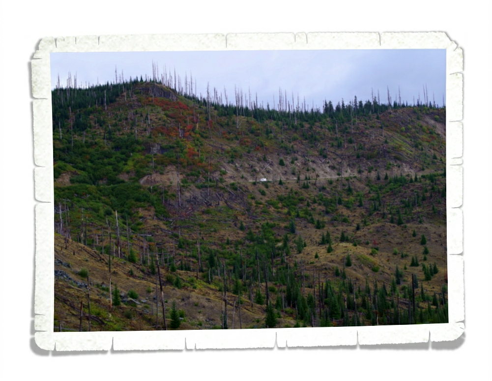
Here’s another picture of the edge of the blast zone and all of the dead trees still standing. If you look really closely toward the middle of the photo above, you can see an RV on the road. It kind of gives you a good idea of the size of the mountain.

IMGP6158

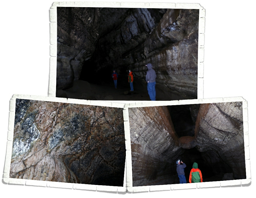
Our next stop was Ape Cave. Ape Cave is a lava tube that was formed about 1,900 years ago. Ape Cave marks an unusual part of Mount St. Helen’s eruptive history. It was the only time in it’s 300,000 year existence the volcano erupted red, hot flowing lava (like what you can see in Hawaii).  Mount St. Helen’s lava is thicker and doesn’t run…it’s more of an ooze.

IMGP6163

Can you see the white stuff in the picture above? That is mold. Fungus. And it’s apparently really important to the cave. We saw signs not to touch it because it takes a long time to grow back. Ape Cave is the third longest lava tube in North America. It has a constant temp of 42°F and is pitch black. Complete and total darkness. We had planned ahead and brought some flashlights and some headlamps. We saw people walking around with just small dingy lights though. I wouldn’t suggest that…the floor isn’t smooth…it was made from lava and if you fall you can slice your hand open.

IMGP6172

In the photo above, you will see Jerl and Alex looking at “The Meatball”. Yup. The Meatball. What the heck is The Meatball? Well, it a chunk of round lava that fell from the ceiling while lava was still flowing through the cave. The chunk floated on the surface of the lava and was carried downstream until it got wedged in the narrow spot you can see it in today.

IMGP6192

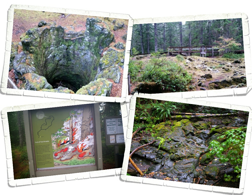
I didn’t really know what to expect with The Trail of Two Forests. When we got there, it was raining and we were the only people silly enough to still hike it. But it was on a boardwalk, so it wasn’t bad at all. At the Trail of Two Forests you get to walk among casts of old-growth trees buried by lava 1,900 years ago during one of Mount St. Helens previous eruptions.

20150905_184740

In the photo above you can see a tree cast or mold. The lava would flow around the tree and catch the trees on fire and then the trees would burn up. Over time, the charcoal left by the burning tree erodes away leaving behind a cast or mold of the tree. There’s a set of these molds that make a tunnel called “The Crawl” where you can actually crawl through the tunnel to an exit.

20150905_185209

You can see the lava bed all around the ancient forest.

IMGP6144

It’s really pretty neat. We only had two days to explore this area. I would have loved to spend another two so we could’ve taken our time and done a few more hikes. I wanted to do the Lava Canyon hike, but we didn’t make it there this time. Luckily, we’ll be back to Washington to do the rest of the stuff on our list!

IMGP6005

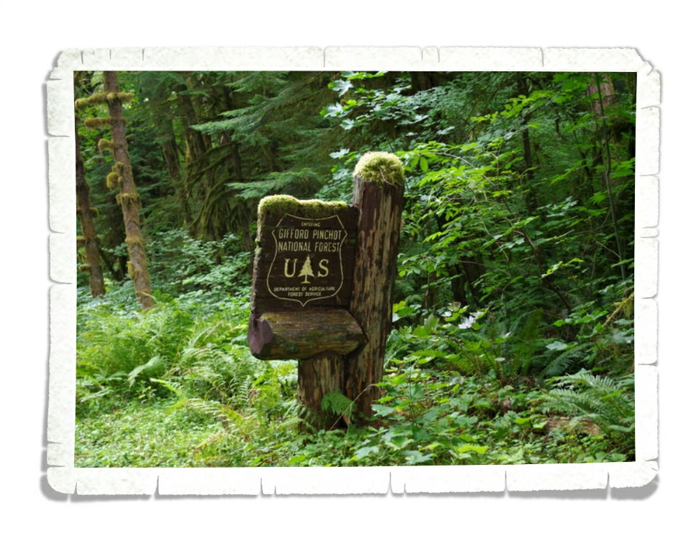
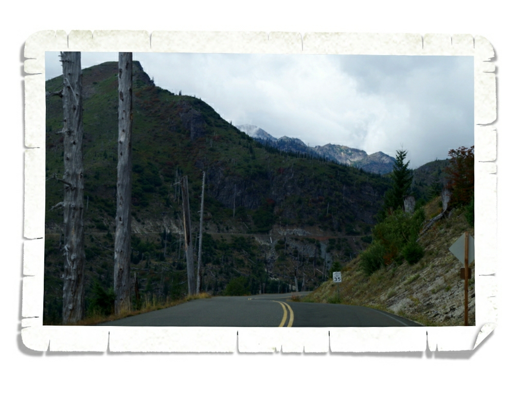
We drove in and out of the Gifford Pinchot National Forest during our Mount St. Helens explorations. I had to get a shot of this sign so y’all could see how the moss grows on everything in this part of Washington. It’s really everywhere. We’d originally planned on staying in Washington for a month or more to do our entire list for the WA state, but after Alaska…we were kind of done with cool, wet, and green. So, we decided to head South for the winter.

IMGP5988

I wanted to share the only splash of color in the sea of green… This was a flower farm. I’m hoping to make it back to Washington in the Spring to see all of the tulips!

See y’all down the road!!

Canada…The Return Trip

Canada…The Return Trip

tripback

We drove 2,049 miles in five days. We left Fairbanks on Monday morning and crossed the US border into Washington on Friday. We decided to go a different route back than what we took to get to Alaska. On the way to Alaska we took the ALCAN so on the way back we took the Cassiar. I’d heard different things about the Cassiar, but after driving the ALCAN…well, it couldn’t get worse than that. We did have to backtrack the first 846 miles to Junction 37 Services in the Yukon. The area around Destruction Bay is the worst section of road known to man. I believe it got it’s name because it does its best to destroy your rig.

IMGP5515

We drove by a herd of mountain sheep (perhaps Dall Sheep).

IMGP5521

We’d seen loads of sheep in Alaska, but they all looked so tiny…perched on their rocks way up in the mountains. Honestly, they resembled fuzzy rocks more than sheep so it was neat to see some up close.

IMGP5530

We got our daily quota of snowcapped mountains.

IMGP5534

And then the Yukon threw in this amazingly bright rainbow! It was the widest, brightest rainbow we’ve ever seen.

Once we got to Junction 37, where we stayed overnight, the road was better. Not great, but better. The next morning, we got up and headed down the Cassiar Highway.

 The Cassiar has only been paved for about five years now. It’s narrow, very serpentine, and has some gorgeous views.

IMGP5596

I told you it was narrow…it wasn’t much wider than one lane in some places.

IMGP5548

One morning we got up and headed off and it was so foggy.  We got some beautiful views of the fog lifting from the valley.

IMGP5549

The fog was really dense in some places and slowed us down a bit, but it didn’t last long.

IMGP5559

Once we turned off the ALCAN back at Junction 37, we followed rivers and lakes all day.

IMGP5575

The road snaked around and over rivers, ponds, lakes, and streams of all sizes. It made for some great views!

IMGP5610

I wish we could have taken our time with this drive, there were a ton of photo opportunities that I didn’t really get to shoot because…well…it’s hard to get a decent shot from a bouncing, moving vehicle with bug splattered windows. There was an abundance of bugs.

IMGP5620

If fact, almost all of the photos in this post were taken as we bounced over frost heaves and swerved around potholes while we were driving down the road.

IMGP5638

Once we got into southern British Colombia, the road improved immensely. It was a welcome change. We also went from wild wilderness with towns dotted along the highway to farmland…something we hadn’t seen all summer.

IMGP5649

I should probably tell y’all about the logging. This highway is a logging route and there were tons of lumber mills, logging camps,

IMGP5664

and logging trucks. We didn’t have any incidents with them, but we did give them space.

IMGP5672

We felt like we were driving into Fall. The colors changed almost as soon as we left Fairbanks.

IMGP5682

As we made our way into Fraser Canyon, the lush green farmlands started changing into a landscape we didn’t expect to see in British Columbia…dry and very desert like, but with rolling hills. It reminded us a lot of Montana and even had the sage brush.

IMGP5696

In the photo above you can see a set of the train tunnels. Train tunnels dotted the tracks the whole way through the canyon.

IMGP5712

It was fun to see the trains slithering their way through the tunnels along the canyon wall.

IMGP5725

We went through seven tunnels like the one above. The one in the photo is one of the longest tunnels in North America. The China Bar Tunnel was built in 1960 and is almost 2,300 feet long.

IMGP5729

The only touristy thing we did on the way back, was the Hell’s Gate Airtram. The tram takes you 500 feet down and across the river to a small shopping center and a suspension bridge you can walk across.

IMGP5744

Here’s a shot of the bridge. It was cold, rainy, extremely windy and you could feel the bridge sway and bounce. It was awesome!

IMGP5766

Here’s a shot of the river from the middle of the bridge.

The stop was a nice way for us to stretch our legs before we made the final sprint to the border. It’s definitely a tourist trap, but it is neat.

IMG_1210

They were selling fresh fudge…so, of course, we had to buy some. We ended up with just over a pound of fudge in three different flavors: Naniamo, Praline Chew, and Salted Caramel. They didn’t last long.

After we got out of Fraser Canyon, we got to an actual highway! It was bliss!

IMGP5789

We crossed the US/Canadian border six times during our Alaskan Summer. We heard horror stories from other campers…and they were bad…but we never had any problems getting through. It was all very straight forward and very quick.

We’re so glad to be back in the lower 48! We had the best summer we’ve ever had…we learned a lot and saw more than we could have ever hoped to see…but the whole trip was very stressful. We’re planning on doing an Alaskan Summer review post with all the sticky details we didn’t put in all of the destination posts so stay tuned!

See y’all down the road!

Fairbanks, AK Part Two

Fairbanks, AK Part Two

Fairbanks is different from all of the other Alaskan towns we’ve been to. It’s not so tourist, there aren’t gift shops on every corner and there’s really not much to do. We did everything “touristy” in Fairbanks in one day. It was a full, long day, but not the longest we’ve had in Alaska.

One of the coolest things we’ve done in Alaska is The Gold Dredge No. 8!

IMGP5153 You start off with a train ride where they stop every so often to explain the different types of or equipment used in gold mining.

IMGP5144

The train would stop and they would actually demonstrate the old equipment.

IMGP5151

In the photo above you’ll see pipes strewn across the ground and rods stuck into the ground. One guy would be in charge of driving 20 to 30 of those rods into the frozen ground each day. Then, water would be pumped through the pipes into the rods and in the ground to try and thaw the ground enough to dredge for gold. I always here the term “get rich quick” associated with the Gold Rush…but there really isn’t anything quick or easy about finding gold.

IMGP5158

At the end of the train ride, we ended up at Gold Dredge No. 8

IMGP5164

where they gave us a gold panning demonstration

IMGP5171

and then let us try panning for gold on our own. We all got a bag of dirt, a pan, and a little container to put our findings in.

IMGP5173

There were big water troughs set up with benches so that we could pan for gold. We all found gold! All of us! When you’re done panning, you can take your findings into the main building and they’ll weigh if for you and tell you how much your gold is worth. Yup…your gold…you get to keep everything you find. Alex was the luckiest and found $38 worth. In all we found a combined $116 in gold. Not bad, right? After you get your gold weighed, they have a gift shop to roam around. The prices weren’t bad and the selection was good. If you need to do some last minute gift shopping in Fairbanks, this is about the only place in town worth checking out.

IMGP5188

On top of all the other awesome at Gold Dredge No. 8, you can actually go into the dredge and look around.

IMGP5191

It was old, dirty, and smelly. But it was really neat to look through. With very little imagination, you could picture what it must have been like when the dredge was running.

IMGP5201

There were informational signs near each of the dredge stations explaining what you were looking at. Things are always more interesting when you know what it is you’re looking at.

IMGP5215

At the end of your short two hour tour, the whole crew of Gold Dredge No 8 lines up outside as you ride the train back to your car. Gold Dredge No 8 is one of our top ten experiences in Alaska.

IMGP5246

Just down the road from the dredge, is the Felix Pedro Memorial. Felix Pedro is the guy who first found gold in the Fairbanks area. You’ll learn all about him during the Gold Dredge No 8 tour.

IMG_1115

Y’all know we’re foodies. Alaska has been…well…it doesn’t have the best selection of restaurants. We found Bad 2 Da Bone BBQ in Fairbanks and we were skeptical. First of all, it’s in a gas station…and secondly, it’s smoked meat. We walked into one of the cleanest gas station restaurants we’ve ever seen.

IMG_1109

It was expensive, but everything in Alaska is. The portions were bigger though.

IMG_1149

 I got the loaded fries. You can see them in the photo above. We liked Bad 2 Da Bone so much we went there twice! We were all pleasantly surprised, but when a restaurant’s slogan is “Sauce on the side cause the meat don’t hide”…well, we were hopeful.

IMGP5134

There’s a place just outside Fairbanks that you can see the Alaskan Pipeline. You can see it in quite a few places in Alaska running near the road, but this place has informational signs and is designed for people to actually come close and touch it.

IMGP5117

We all had to touch it.

IMGP5233

One of the locals told us about a place to go that had good views. It’s called SkiLand and it’s just down the road from Gold Dredge No 8. We drove up to it and found, not only great views of the area,

IMGP5241

we also found blueberries! There was a couple there when we got there and they told us about the blueberries. They also mentioned that the bears don’t usually visit the area, but the moose do. We didn’t see any wildlife, but we got to taste some wild Alaskan blueberries!

IMGP5244

We weren’t the only ones picking berries so we felt pretty safe to wander around.

IMGP5236

SkiLand was in pretty bad disrepair. Apparently, they don’t do much business with the ski-lift, but they do really well with the aurora tours during the winter months.

IMG_1124

Our first Sunday in Fairbanks we spent an afternoon hitting a couple of “touristy” things just outside of the city. We went to The Knotty Shop because we’d heard it’s one of those places you have to go to. We went (it’s 45 miles from Fairbanks). We looked.

IMG_1121

IMG_1122

The statues were neat. The inside was a gift shop. I’d already finished all of my souvenir buying so we didn’t buy anything here.

IMGP5339

On that same Sunday, we drove through North Pole, Alaska. The street lights looked like candy canes and all the street names had something to do with Christmas.

IMGP5352

We stopped at the Santa Clause House where all things Christmas have a home all year. It was a huge gift shop for all things Alaskan Christmas.

IMGP5355

It’s pretty easy to find with the 50 ft. Santa out front.

IMGP5348

The two little boys took turns sitting in Santa’s chair.

IMG_1128

We bought the obligatory Christmas tree ornament.

Fairbanks was the last stop on our Alaskan Summer tour. We found some really cool things here and some really…not so cool things, but Fairbanks should definitely be on everyone’s must visit Alaskan list.

See y’all down the road!

#alaskabound

Fairbanks, AK – The Good, The Bad, & The…Weird

Fairbanks, AK – The Good, The Bad, & The…Weird

We started our Fairbanks visit off on…well, not the best foot. Y’all know I’m a planner. When we decided to do Alaska this summer, I mapped out and plotted the entire trip. I researched each place we were going to stay and then we made reservations. When I planned the Fairbanks portion of our trip (the last place we would stay in Alaska), I found an RV park called Northern Moosed. I couldn’t really find anything about it other than it was in The Milepost…so we took a chance on it. According to The Milepost, Northern Moosed its the northern most full-service RV park in Alaska.

IMGP5226

We were really excited to stay here and had hoped to see some of the moose that supposedly roam through the camp daily.

IMGP5106

When we pulled in I had a feeling we should just turn around and get out of there. It was…rustic, but hey…it’s Alaska, right? Camping is supposed to be rustic? I thought it would get better when we went inside to register, but as the Camp Host kept telling us about the place, that little feeling of unease kept growing. We’d been told it was full service…that we would have full hookups. But, as it turned out, we wouldn’t want to use the water there….it was full of rust. Sigh. Well shoot. We went ahead and pulled in and found a place. You can see in the picture above, that there were random items strewn about. FYI…rustic does not mean trashy.

IMGP5102

The site we settled on was the best of the lot. We had our pick. That was another red flag…but it was late in the season…maybe the main season was over? After we got set up and Jerl saw just how bad the water was we decided we would have to get some extra filters or just move. We spent our first afternoon in Fairbanks trying to figure out what the best course of action would be. After hitting the Lowes and Home Depot and talking with some locals (who told us all the water in the area was unusable due to arsenic) we decided to move to a different park. One that was on city water that had been cleaned and was totally drinkable.

IMGP5110

The next morning, we started packing up. Jerl had talked to the owner of Northern Moosed and told her we would have to move due to lack of phone service (which happened to be true) and they gave us a full refund (which was super nice and we weren’t really expecting). While we were packing up and trying to get the heck out of Camp Weirdo, the goat you see in the photo above decided to terrorize us all. He was extremely, aggressively charging at the boys. He was trying to get into the RV. What’s sad is we could tell this place had once been someplace very cool to stay.

IMGP5105

There were signs that someone actually put some time and effort into making Northern Moosed a good place. It’s been with the current owners for six years and it’s obvious to us that they’ve done nothing to it. The Camp Host was pretty sure the goat was from her neighbor (who she’s convinced is a crack addict). The RV park we moved to was wonderful! It was very clean and kept. We could use the water. And most importantly…there weren’t any crazy goats trying to kill us!! The whole Northern Moosed experience was just…bad.

IMGP5359

We went to two museums while in Fairbanks. The first one we went to was actually free. It was at the Fairbanks Visitor & Cultural Center.

IMGP5406

The museum inside was great. It had some great displays all about the Alaskan’s heritage and history.

IMGP5418

The bead work was my favorite.

IMGP5415

Here’s another shot of the amazing bead work. The beads they use are called seed beads and are tiny.

IMGP5388

While the inside of the museum was really interesting, I preferred all the stuff outside. There were five different murals around the grounds all based on Native art techniques. This one was based on a basket weave.

IMGP5380

There was a small garden to demonstrate how ridiculously big the veggies get in Alaska. The cabbages above were absolutely huge!

IMGP5428

And, of course, the flowers…

IMGP5373

With all the Alaskan sunshine, the flowers were out of control.

IMGP5366

I took more pictures of flowers than I did the displays inside the museum. I won’t post all of them up…there are too many.

IMGP5382

There was an arch made of moose and caribou sheds. I have a friend back in Texas (you know who you are) who needs to do this on her ranch!

IMG_1104

The boys earned another badge at this museum. In the photo above, you can see them getting sworn in. Alex got to wear an actual Ranger hat. He was really excited about that.

The second museum we went to was at the University of Alaska.

IMGP5287

The Museum of the North was one of the best museums we’ve been to.

IMGP5292

This is the first museum we’ve been to that had hands on things for the boys to do (that wasn’t a kids museum).

IMGP5296

The main exhibit was sectioned off into the sections of Alaska and had items specific to the section of Alaska it dealt with.

IMGP5316

IMGP5300

The weaving techniques were quite impressive.

IMGP5325

There was even equipment out for the kids to use. At this station, you could use a microscope to check out some fossils.

IMGP5315

Some of the interaction stations allowed the boys to feel actual bones and fur or what a mastodon tooth feels like. My only issue with this museum is that the lighting was really dim. It was hard to see some things and taking pictures was a challenge for a newb like me.

IMGP5249

Pioneer Park was a big disappointment for us. We had heard about it from several people and we’d seen advertisements for it in several places so we had high hopes for it. Admission is free, but anything you want to do inside you have to pay for. That’s fine. Gotta pay the bills somehow, right? But, the park is very rundown.

IMGP5253

There were some neat displays. No rides.

IMGP5257

A small portion of the park looks like a small pioneer village with shops in a few of the buildings. The shops were…odd. Mostly handmade items or things that looked like leftovers from the year before. We didn’t stay long. It was…weird.

I’m going to do Fairbanks in two parts so stay tuned for Fairbanks part two!!

See y’all down the road!

#alaskabound

#keepingitreal

Denali

Denali

This post is picture heavy and long. I tried to weed out some of the pics, but when I’m talking about Denali National Park…it’s hard to choose which photos should be left out. I’ve been looking forward to Denali ever since we decided we were coming to Alaska.

IMGP4661

On the way to the Denali area from Talkeetna we stopped back by the South Denali Viewpoint because it was a gloriously clear day.

IMGP4657

Everyone keeps saying how only 30% of the visitors ever actually get to lay eyes on Denali (Mt. McKinley). We’ve been fortunate enough to see her on several days.

IMGP4662

Denali Viewpoint South is laid out kind of weird. There is the main viewing area which has a pretty good view, but with a few trees that are starting to grow big enough to hinder your view. But, then there is this unmarked side path that leads to an even better view. You can see it at the top of this post. It was odd that the trail wasn’t marked. Seventy-five percent of the people there never went up the path, which is sad because the view was so much better.

IMGP4663

There were also some great informational boards that talked about how the Alaska Range makes its own weather. While we were in Denali NP, our shuttle bus driver actually told us there was a funnel cloud spotted in the park three days before we got there. I would never have considered Alaska to be a tornado state.

IMGP4665There’s also a big debate as to what the mountain should be called. All of the locals call it Denali, but most of the NP staff call it Mt. McKinley. The argument is that the mountain has been called Denali for thousands of years by the Athabaskan Tribes and it should never have been renamed…especially after someone who isn’t even from Alaska. I can kind of see their point.

IMGP4935

We finally made it to the park! Denali means the “High One” in the Athabascan language. In 1897 Denali was renamed Mt. McKinley in honor of President William McKinley, but the renaming has always been a topic of controversy. Denali tops the scale at 20,320 feet as of this year, but the mountain is still growing almost an inch a year! There are four Visitor Centers in the Park, but you have to shuttle into the park to get to two of them.  What you might be surprised to know is that there really aren’t many hiking trails within the park. There are a few in the first 15 miles but after that there are very few actual trails because they (the park officials) want you to get out and explore your park. Safely. There is a process to being allowed to roam the back of the park. If you’re interested, head over to the NPS website and check it out.

We got to the Denali area on a Friday afternoon and quickly got the RV set up and rushed to the park to reserve our shuttle bus tickets for the next morning. We lucked out on our shuttle tickets and then went to the Visitor Center to explore.

IMGP4688

The Visitor Center has a great museum in it. There was this display about moose parts.

IMGP4689

All three boys took time with this exhibit.

IMGP4690

Y’all know I love to bake, so this caught my eye. At this exhibit they explain what it took to make a pie back in the good ole’ days (actually, with so many Alaskan’s living off the grid, I would imagine this is still the process for a good percentage of the population) in Alaska. That’s a lot of work for some pie…

IMGP4697

We then made our way over to the Murie Science and Learning Center. Check out that quilt on the wall!

IMGP4695

There was some amazing detail work done on it!

IMGP4699

This was a great place for boys who love science. They had computers set up that told all about different aspects of the park along with the different experiments going on throughout the park.

IMGP4698

There was also the obligatory bone collection that we seem to find in all Visitor Centers.

IMGP4705

The dog kennels were next! We were all ready for some more sled dog action and these sled dogs did not disappoint. There are demonstrations three times a day (10, 2, & 4). We barely made it to the last one of the day. They harnessed up a few of the dogs and ran them around a small track for everyone to see. These sled dogs are different from the sled dogs we saw in Wasilla. The dogs here are bred for working while the dogs in Wasilla are bred for running. Big and stout versus small and fast.

IMGP4713

After they raced around the track they were given a treat (I think it was an antler) to gnaw on while an intern talked to all of us about the importance of sled dogs and what their routines are like summer vs. winter. In the winter these guys get close to five thousand calories a day!

IMGP4718

There were six puppies, but we didn’t get to hold them or handle them in any way. We were a little bummed about that.

DSCF0859

We were there at the end of the day so we got to see the puppies run for their dinner. As part of their training they run around the same track the older dogs ran around during the demonstration. There’s nothing much cuter than a bunch of puppies running as fast as they can to get back and eat.

IMGP4729

A couple of the dogs were available for visitors to pet.

IMGP4731

I’m not sure who enjoyed it more…the boys or the dog.

IMGP4753

There are only a few ways you can gain access to Denali NP beyond mile 15…you can do what 98% of the people do and take a shuttle bus, you can apply to camp at one of the three campgrounds that are past the mile 15 mark, you can be a Park Ranger, or you can get permission to conduct an experiment within the park. We went with the shuttle bus. Now, interesting fact…there are two different shuttle bus options for taking trips back into the park. There is the green shuttle bus and the tan shuttle bus. The green shuttle bus has different options (or miles) you can choose from, We chose to go to the Eielson Visitor Center which is around the 66 mile marker, but there are a few other options. For our trip we paid $35/ for the two adults and all three boys were free.  You will want to take any food you’ll want for the day and you can get off at any  time, explore, then catch any other green shuttle bus to continue. For the tan shuttle bus, you have the same options of where to go within the park, but they will serve you a boxed lunch. The prices for adults were around $130 for adults and $50 or so for kids. You can’t get off, they stop at fewer places, and let me point out…you’re traveling the same road and seeing the same things that the people on the green shuttle buses are seeing. Hmmm…we can’t figure out why anyone would choose the tan shuttle bus. Our bus driver stopped every single time anyone saw an animal. Every. Single. Time! It was great! And he was a wealth of knowledge on the park! He narrated the whole trip so we actually knew what it was that we were looking at. You can see him in the photo above in the blue shirt.

IMGP4748

We started the tour off right with the Alaskan State Bird…the Ptarmigan.

IMGP4756

Did you know, you won’t even see the original National Park unless you take a shuttle bus tour? All you’ll see is the expansion of the park that happened in 1980.

IMGP4762

We started spotting the bears once we got to around the thirty mile mark.

IMGP4780

And boy were the bears out and about!

IMGP4806

These two were chasing each other up the mountain and let me tell you…bears might look big and fat, but boy howdy…those beasties can move!!

IMGP4847

The bears in Denali are all on the blond side. This one is Littlest’s favorite because it’s half blond, half brown. I think we ended up spotting ten grizzlies throughout the day!

IMGP4769

The park road past mile 15 is a dirt road. I’d read you could bike it, but it’s kind of a dangerous thing to do because of the condition of the road and all of the shuttle buses…not to mention all of the wild animals.

IMGP4829

We saw several people willing to bike the road anyway. All of them looked miserable. The guy in the photo above just about had a run in with a caribou.

DSCF0902

Here’s a picture in the Colorful Rocks Area. Yup, it’s really called that. Denali NP is broken up into sections. You can also see the narrow winding dirt road…with no shoulder…that the bus took.

IMGP4783

The views were stellar! Really, they were just spectacular. So, when Ryan (our bus driver) told us that the views were getting ready to knock our socks off starting around the next turn…well, pictures don’t do it justice. Y’all really need to go see it for yourself.

IMGP4791

I would forget to look for the wildlife because I would get so wrapped up looking at all the mountain views.

IMGP4801

We got a ten minute rest stop at the Toklat Visitor Center at mile 53 in the park. There was a small store and restrooms for anyone in need.

IMGP4798

They also had some caribou antlers you could pick up and handle.

IMGP4804

The little boys had to have help getting them all the way up to the top of their heads!

IMGP4880

They also had a set of moose antlers. They were so incredibly heavy that Littlest couldn’t even begin to get his lifted up so a guy held it up for him and Alex was struggling to get his up as high as he did.

IMGP4882

Mr. Man probably could have muscled it to the top of his head, but it was kind of awkward so we settled for the shoulder.

IMGP4811

Right after the Toklat we started seeing all of the caribou. There were tons of them! The one in the photo above has a tracking collar on it. He jumped into the road and just sauntered down it for a bit.

IMGP4820

All of the buses have rules about what they can and can’t do near an animal. The rules are pretty strict. Basically, if it’s going to bother the animal in any way, don’t do it. If an animal is in the road you can’t shoo it away, you just have to stop and wait. These rules apply to all of the animals…even the small alpine ground squirrels.

IMGP4825

It’s amazing how different mountains that are right next to each other can look. I love the colors of the mountain in the photo above.

IMGP4827

This was all we saw of Mt. McKinley. She peaked out at us in the morning, but was completely clouded over by the afternoon.

IMGP4836

The Eielson Visitor Center at mile 65.9 in the park was our destination. You can go farther…all the way to the end of the road at mile 92.4, but be ready for at least a 12 hour ride (round trip). We went to Eielson because I’m collecting the passport stamps. Denali has seven passport stamps and two of them (Eielson and Toklat) are only available if you take a shuttle into the park. It was worth it. I really wish we’d done the Kantishna (92.4 mile) shuttle. When we come back, we will definitely do that one.

IMGP4831

This painting was in the Eielson Visitor Center. I wish they had it on a postcard…I love it, but I don’t think it will fit in the RV…

IMGP4835

Here are some views from the visitor center.

IMGP4837

In the photo above, you can see a weather tracker thing-a-ma-bob from one of the ongoing science experiments.

IMGP4841

One more view from Eielson. It was at this point that I realized we should have gone all the way to Kantishna.

IMGP4846After Eielson we headed back to the front of the park and I took the opportunity to get pictures of the other side of the road. I kept seeing all of this great landscape on the left side of the bus heading to our destination…so I made sure to sit on the same side of the bus going back so I could get photos of everything! I sat on the right side of the bus in the front and Mr. Man sat on the left side with his new camera so we would have both sides covered! But, when it comes to landscapes, our tastes differ and I wanted to get my own photos.

IMGP4865

You can see the narrow, winding, dirt road over on the left side of the photo above. I’m so glad we didn’t have to drive it ourselves. Some of the switchbacks and mountain passes were…well…Ryan would warn us when we came to one that was bad so people afraid of heights could switch sides of the bus if they needed to.

IMGP4784

I shot the photo above out the front window of the bus to give you an idea of just how windy and narrow the road really is. Two shuttle buses wouldn’t fit side by side. one of them would have to pull over and let the other one pass.

IMGP4884 I might be a little obsessed with mountainous landscapes. The colors and shapes…love them…

IMGP4898

Sometimes the mountains look so perfect they look fake. I have so many landscape shots from this one bus trip…it took me forever to decide on which ones to include.

IMGP4908

Ok, do you see all of the little ponds? Those were created when the glacier was moving through this valley and chunks of it would fall off and melt and voila! A pond!

IMGP4909

So, I told myself I was putting this one in because it’s another example of the ponds…but really I just love the mountains.

IMGP4913

This mountain is called Polychrome and is my favorite mountain in the park. Look at all the colors! The picture just doesn’t even begin to do it justice…

IMGP4915

This is something else I thought was really cool. This is a braided river. Cool name, right?!

IMGP4914

This is a better shot of the river. This braided river has many different water sources which make many different paths that all wind around each other.

IMGP4921

There are a few…maybe four…cabins throughout the park that were all built in the 1920s and are still being used today by the rangers, scientist, or resident artists.

IMGP4925

One of the hardest animals to see in the park is the wolf. There are 52 wolves in the park that have tracking collars, a new pack of 4 that haven’t been collared yet, and 3 new cubs. We actually got to see one wolf…well, let me rephrase that…Jerl and I along with the bus driver got to see one wolf. There are advantages to sitting in the front!

IMGP4937

In Denali National Park there is a group of animals called The Big Five. The group consists of the grizzly bear, wolf, dall sheep, caribou, and moose. It is extremely rare to see all five in one day. We did. Now…the dall sheep all looked like fluffy rocks way, way up high on the mountains, and…

IMGP4985

this is the best view of a moose we got, but I’m counting it! There are over 2,000 moose in the park and we only see this one. Oh well, we got to finally see some bears!!! Big, big grizzly bears!!

 We spent two full days in Denali National Park and we had the absolute best time!

See y’all down the road!

#alaskabound

#myalaska

Talkeetna, AK

Talkeetna, AK

Talkeetna is a tiny touristy town. We spent the first week in August there and enjoyed a relaxing week off from zipping all over the place to get everything done in the small amount of time we have. You see, there’s not a lot to do in Talkeetna. It reminds me of Eureka Springs, AR but smaller…if you can imagine that.

IMGP4645

In the photo above, you can see Main St. All of it. Everyone in Talkeetna walks because the town is so small and there’s not very many parking spaces.

IMGP4644

There was a general store that wasn’t really a general store. It didn’t have anything useful in it. Maybe I looked in the wrong section?

IMGP4651

Talkeetna is geared for three main things…mountain climbing, river rafting, and plane tours. We really weren’t interested in doing any of those things so we spent our evenings walking down by the river or at a park…just relaxing.

IMGP4630

This was our view from the river. Nice view, right? Mt. McKinley is the tallest one on the right.

IMGP4634

We had a few days where the views were just spectacular with no clouds!

RIMG0357

There’s a railroad right next to town. We found a path to it one evening and walked out on the foot path next to it. There was a sign there that said the residents of Crow, AK use the bridge as a way to get to and from their homes on the other side of the river. There are no streets there.

RIMG0318

There was a fantastic park!

RIMG0322

It had a wooden xylophone!

RIMG0328

All of the parks in Alaska that we’ve seen have been decorated with a tribal theme. Alaskan’s seem to be very proud of their heritage…it’s woven into every aspect of their life.

RIMG0329

At this park there was a climbing wall. I’ve noticed that the parks here also start prepping the kids for what it takes to survive in Alaska. Rock climbing is very big in Talkeetna…they start them young building the coordination and muscles that will allow them to excel at this.

RIMG0331

At the elementary school playground there were more xylophones and drums right on the playground! What a great way to develop a love of music while scaring away any bears in the area!

IMGP4607

So, this place is my favorite place in Talkeetna. We went one afternoon and took a tour of the facilities and learned how they make birch syrup.

IMGP4600

Birch syrup is made from the sap of birch trees, which are in abundance in this part of Alaska.

IMGP4603

Birch sap can only be collected for three weeks out of the whole year. They have just three weeks to harvest enough sap to make the syrup for the entire next year. They run these tubes between the trees to collect the sap faster. It takes 110 gallons of birch sap to make 1 gallon of birch syrup. The sap looks and tastes much like water when it comes from the tree.

IMGP4599

They then send the sap through a reverse-osmosis energy efficient machine to concentrate the sugars to 67% which gives the syrup its fine color and flavor.

IMGP4597

From the reverse-osmosis machine they put the syrup into this cooker. It boils the syrup and has to have constant attention to stay at the right heat. The syrup is stirred almost constantly to prevent any hot spots.

IMGP4598

Once the syrup has reached the right temp/color/thickness, it’s poured into buckets and is ready for packaging. They bring the sap to the kitchen and it’s turned into syrup within 24 hours and they start all over with the next day’s collections.

IMGP4595

During the tour we got to taste the syrup. If you look at the picture above, you’ll notice that the bottles in the front have colored stickers on them. Each bottle represents one day during the three weeks of the syrup season. The yellow bottle is batch one, the pink bottles right after that represent the early runs. The green bottles are the mid run, while the red bottles after the greens were the final run. Amazingly, each run has a very different color and taste and is good for different uses. While the early batches are very sweet and better for things like candies and pancakes or even ice cream, the middle batch is not as sweet, but still very tasty on pancakes. The final batches were less sweet…almost bitter…and would be best used for cooking or in sauces.

IMGP4602

In the gift shop you could buy the syrup, but they also offered some tea and candies and jams that had all been made with the birch syrup. I bought some caramel creams that are my new favorite candy. It’s soft, mild, not too sweet…it’s delightful, and lucky you…you can order it online if you want!! It’s called Alaska Gold Nuggets.

IMGP4606

The 2015 year was their 26th harvest. They tapped eleven thousand trees and purchased sap from a few families to get a combined harvest of 120,000 gallons of sap. This produced 1100 gallons of syrup. This year, with the colder weather, the trees produced a sweeter, lighter syrup. Each of their trees ended up producing about 13 ounces of syrup a piece.

IMGP4584

One morning we drove out to Denali State Park. There wasn’t much there. We did get a map of the state park that the boys both loved to look at.

IMGP4591

We stopped at the Denali State Park South View Point for this view. Mt. McKinley is there…behind the clouds. It’s still a great view!

See y’all on the road!

#alaskabound

Seward, AK

Seward, AK

We spent two weeks in the Seward area, using it as our basecamp for all the other places we wanted to visit on the Kenai Peninsula.

IMGP3594

We really enjoyed Seward! It was pretty small and definitely had plenty of touristy stuff, but it had a nice balance of non-touristy stuff too.IMGP3902

There was a cute little boardwalk along the harbor consisting of all the tours and gift shops.

IMGP3906

Out of all of the small-town coastal harbors we’ve seen in Alaska, Seward is my favorite. It was super clean, the views were amazing, and there were boats of all sizes.

IMGP3891

Seward is located on the shore of Resurrection Bay.

IMGP3958

We went on a scenic drive and ended up on the other side of the bay from Seward. You can see it in the photo above. There were a ton of people fishing right along the coast there…right by the waste water factory…there was a sign that warned against eating the fish raw…we didn’t fish there.

IMGP3889

Seward is also the starting point (one of them) for the Iditarod. We found the Mile 0 marker for it.

IMGP3904

There were over 20 murals all over town.

IMGP4068

The mural above was across the street from the Alaska SeaLife Center. We spent an afternoon there getting up close with some of the animals found in the local waters.

IMGP3992

At the Alaska SeaLife Center, the habitats were large enough to keep the animals happy, the animals looked healthy and well cared for, and we could get really close to all of them, safely.

DSCF0655

The Center was crowded, but it was big enough that you didn’t feel like you were tripping over people all the time. The Harbor Seals were so cute and playful!

DSCF0660

Right across from the seals were the Sea Lions…who had a very different idea of how to spend the day.

DSCF0661

There was a whole room for birds that you could walk into. The birds were free to fly about the room…we could have reached out and touched them they were so close! There were several different species in the room, but my favorite was the Horned Puffin. These little birds are amazing! Did you know, puffins can dive down to 300 feet in the water?

IMGP4054

Here’s one in action! Sorry about the blur…they’re wicked fast!

DSCF0685

There was a touch pool. We were encouraged to touch several different types of sealife while learning all about what we were touching.

IMGP4025

Mr. Man had no trouble with reaching in and touching everything. The two little boys needed some persuasion.

IMGP4023

IMGP4024

I think the favorite was the sea anemone that would hug your finger if you put in near it the right way.

IMGP4041

There was a great view of Resurrection Bay.

IMGP4037

We didn’t get to touch this one, but I thought it was so pretty.

IMGP4051

Can you spot the fish in the photo above? I would not want to pull one of those out of the water on my fishing line! I would suggest going to the Alaska SeaLife Center and the Alaska Wildlife Conservation Center and skipping the Alaska Zoo. I really hate to say that…but it’s so true.

IMG_0956

The only place we ate at in Seward was Red’s Burgers. We ate there twice. You place your order in the building and then go sit in the school bus to eat.

IMG_0949

The owners had converted the inside of the bus to booths.

IMG_0950

It was different and fun. The boys thought it was so cool to be sitting on a school bus eating.

IMG_0951

I got the garlic burger with fires. The chef wasn’t playing around with the garlic. I thought there would be some garlic worked into the burger patty, but there was about a quarter cup of minced garlic on top of that patty! That’s a lot of garlic. I wish I’d known that before I ordered the garlic fries too. It’s a good thing everyone else had garlic fries with their burgers…

IMG_0953

The first time we went there, the owner was working the window and it was near closing time. We scored two free mystery cups. What are mystery cups? They are magical mixtures of the ice cream flavors Red’s made through the day. At the end of each batch of ice cream they empty the containers into cups and just layer it up until the cup is full. We had pineapple and strawberry in the cup above. The second time we went we ended up with banana, strawberry, and cookies & cream! So good and only $3!

IMG_0988

This is the Reds #1 Burger. It has caramelized maple bacon, grilled ham, onions and mushrooms, jalapenos, cheddar and swiss on it. And it was huge. Mr. Man got this one and ate it all plus his fries.

IMG_0991

These are the chili cheese fries! Super good! Now, I mentioned we ate there twice…the first time we ate there it was so amazingly good we couldn’t’ stop talking about it and decided we had to eat there again before we left. We didn’t even contemplate eating anywhere else. It was that tasty. But, the second time…I don’t know…something was off. Maybe they were having an off night? The burgers tasted freezer burnt. It was weird.

IMGP4408

We did a very short, very steep hike on the Jeep Trail in Seward. We didn’t go all the way up the trail because we were still recovering from the Harding Icefield fiasco.

IMGP4407

It’s hard to tell in the pictures…but you’re looking at a 40 to 50 percent grade there.

IMGP4423

The Seward area is considered to be in the rainforest section of the Kenai Peninsula. The plants are huge and there’s moss everywhere. Everything is so…green.

IMGP4074

Pretty flower, right?

IMGP4076

Watch out, it’ll bite you! What is it with Alaska? If the wildlife doesn’t get you, the plant life will!!

IMGP4417

We only hiked maybe a quarter of a mile to this waterfall and then headed back down.

So, there you have it! This completes our time on the Kenai Peninsula! We enjoyed every minute of it and had the most amazing weather while we were there.

See y’all down the road!

#alaskabound

#keepingitreal