Category: Arizona

Wildlife Watch: Lost Dutchman State Park

Wildlife Watch: Lost Dutchman State Park

IMGP8612

We did a lot of hiking and exploring while we were in the Lost Dutchman area!

IMGP8651

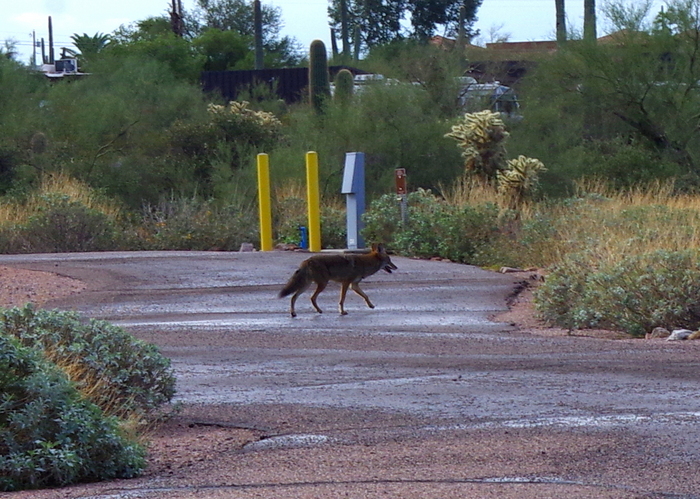
We didn’t have to go far to see Wiley Coyote. This coyote was hanging around our campground. We heard a pack of them howling during the nights, but this one was not in a pack and was attacking cats (and maybe Roadrunners). The Camp Host told us the coyotes in that area will try to eat any food left out on the picnic tables even if it’s just for a few minutes.

We also saw a lot of Gamble’s Quail . They are VERY noisy!!! We didn’t get a picture of any because they wouldn’t hold still. They ran in flocks of five or more and were constantly moving.

We saw several Cactus Wrens. Cactus Wrens like to build their nests in Palo Verde trees, Cholla, and Saguaro cacti. The Cactus Wren is Arizona’s State Bird. Cactus Wrens will stand on their nest of twigs and mud chirping loudly to let others know that this tree/cactus is claimed, so they’re hard to miss.

DSCF1681

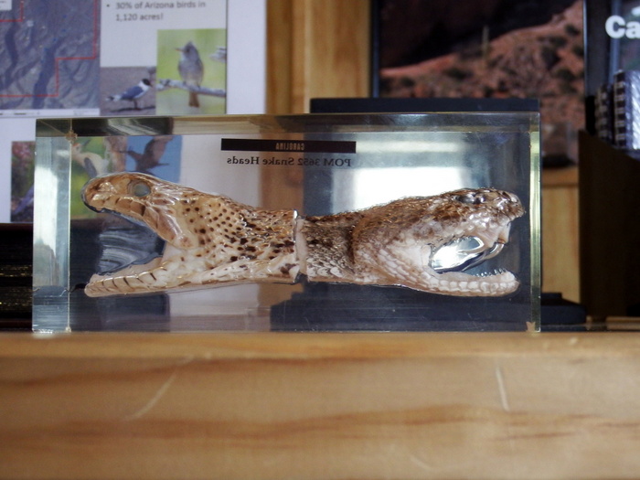
While we were at Tonto National Monument, we saw these snake heads. We don’t know what kinds of snakes they are, but we think one is poisonous and the other one isn’t. Either way, that’s a lot of teeth!

DSCF1682

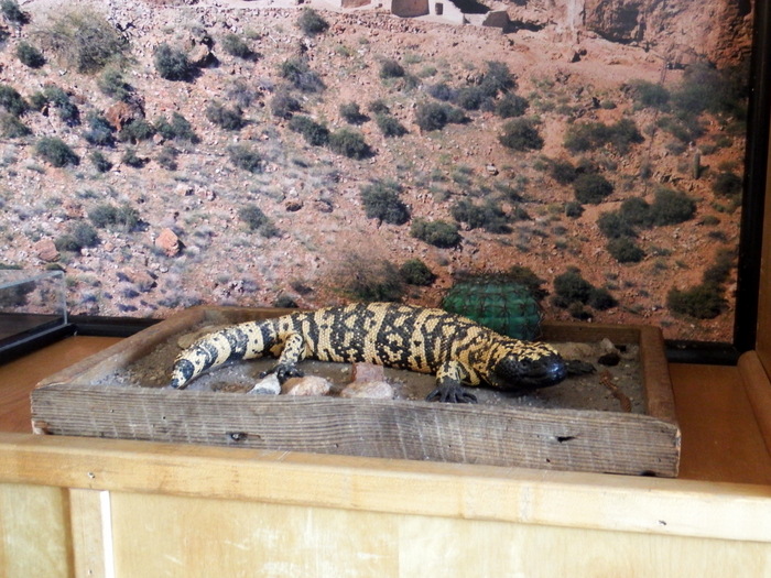
We also saw a Gila Monster replica at Tonto National Monument. The Ranger warned us about how the gila monster is poisonous. We looked all over the place, but we never got to see a real one.

DSCF1684

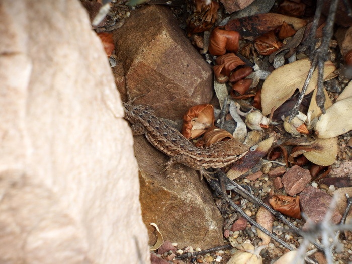
We saw a bunch of these lizards,

IMG_1588

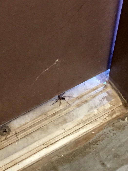
big spiders (this one was in the bathroom),

IMGP8361

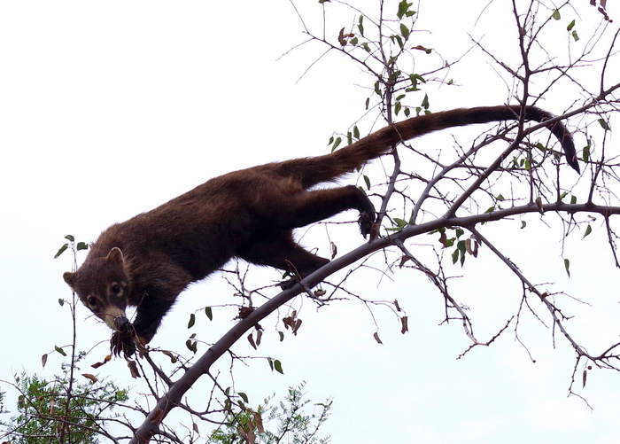
and a White-nosed Coati!  We saw the White-nosed Coati while we were on a drive. I think White-nosed Coati’s look similar to a Red Panda except they have gray short fur. They actually belong to the raccoon family. You can see how long their claws are! They use their tail to help balance and climb. The one in the picture was really curious about us. We stopped and backed up in the car and it just watched us for a while.

IMGP8493

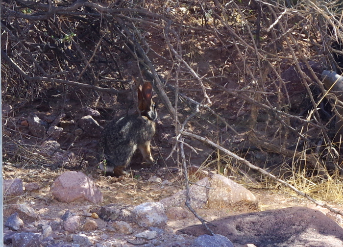
We saw a lot of Jackrabbits. They blend in well with their surroundings and are really quiet so you have to look carefully to find them.

IMGP8645

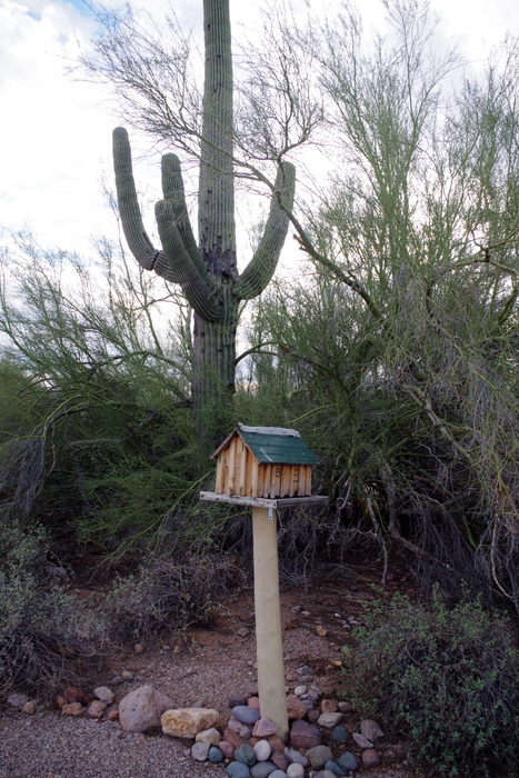
There were also bat houses. We never saw bats going in or out of one, but we did see bats in the area.

Those are the animals we saw at this time! Maybe we’ll find more down the road!!!

The Lost Dutchman State Park

The Lost Dutchman State Park

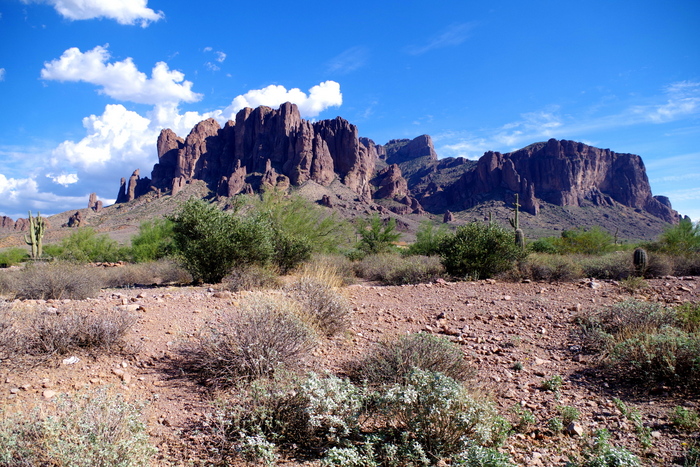
The Lost Dutchman State Park is a 320 acre patch of paradise sitting near the base of the Superstition Mountains in the Sonoran Desert.  The Superstition Mountains got their name from Pima Indian legends. The Sonoran Desert is so different than the desert we found in Nevada. Far from the desolation of the Nevada desert, the Sonoran Desert is filled with an abundance of plants and animals that have adapted to survive.

IMGP8492

Who’s the Lost Dutchman? Well, there are several different versions of the Dutchman’s story. In all of the stories, the Dutchman is Jacob Waltz. A popular version of the tale states that Jacob and a friend found a lost gold mine and hid several caches of gold in the Superstition Mountains, but Jacob was killed before he could properly claim the gold. Now, there are a few more theories as to how Jacob met his demise. The two version I found the most were that Jacob was killed by the Apaches or he was killed by his friend. Either one of those ways, wouldn’t be a nice way to go.

IMGP8506

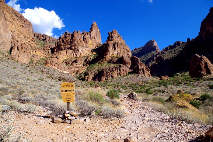
We did as many of the hikes as we could. The hiking trails were wonderful!

IMGP8616

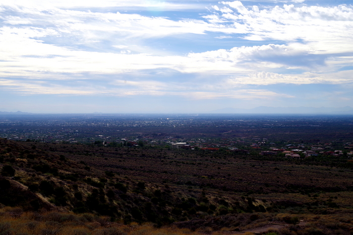
We could see all the way across the valley to Phoenix.

IMGP8623

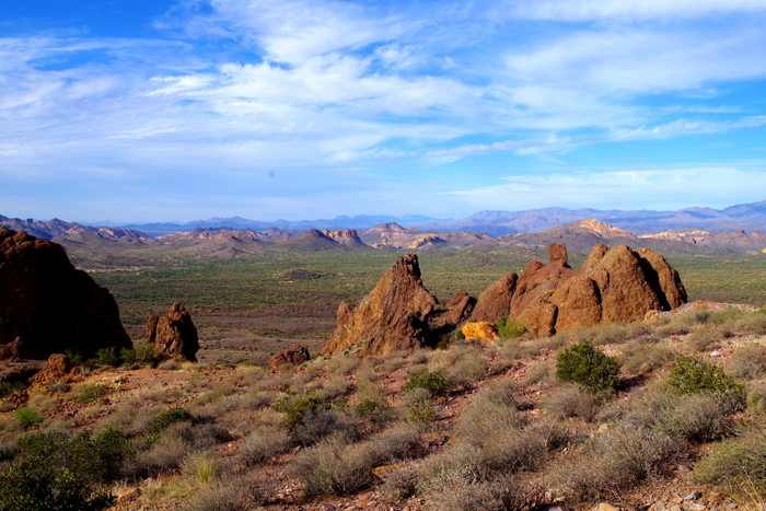
And then there were the views of the mountains. I could have found a spot and just sat there looking out at the views for hours.

IMGP8417

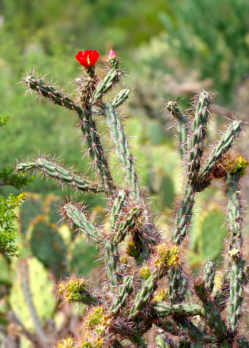
I mentioned the cholla cactus to you before…the way the spines will fall off of the cactus with just a light brush and embed themselves into things like skin…

RIMG0404

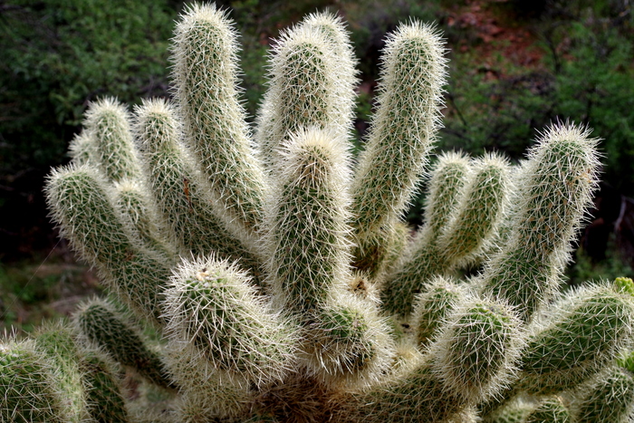
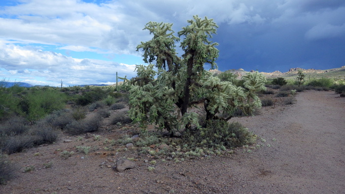
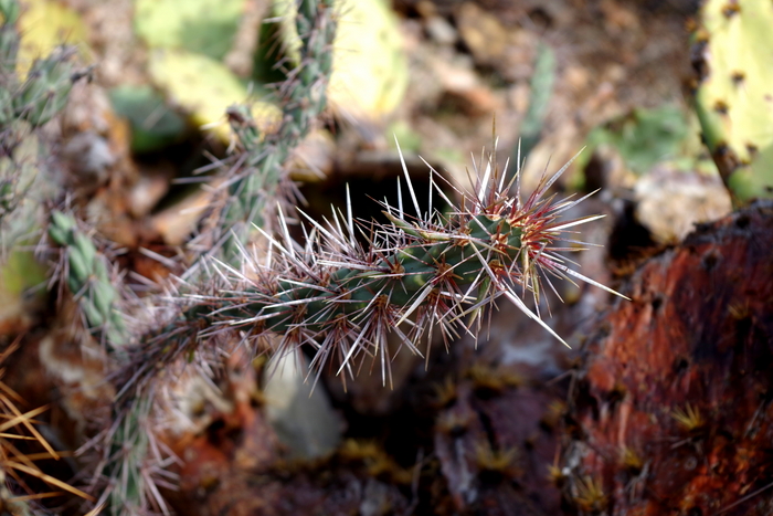
At the Lost Dutchman State Park, there are Chain Fruit Chollas. If you look at the bottom of the cholla in the picture above, you can see the little balls of spines that fall off of the cholla cactus. Those sneaky little balls are a menace!

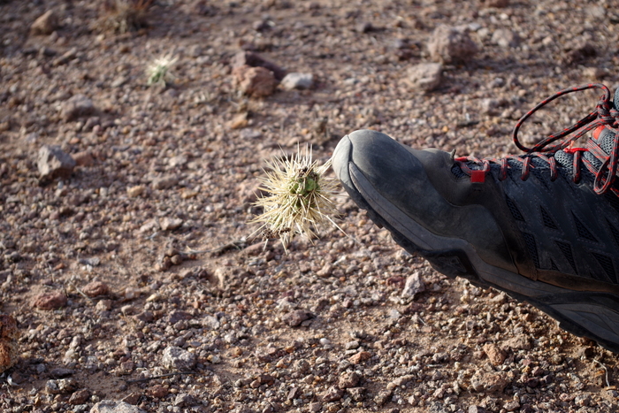
IMGP8634

That’s Jerl’s hiking boot. He nudged the cholla ball very lightly. When he kicked to try to get the cholla ball off, it moved it’s way to the top of his boot. He had to use a rock to remove it. Talk about tenacity!

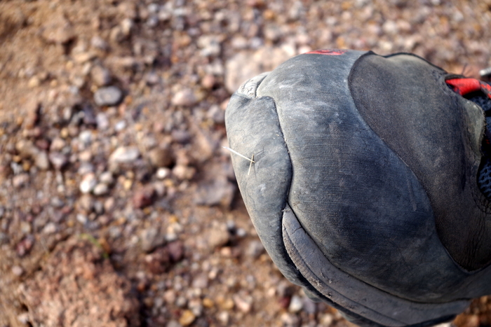
IMGP8635

See the spines it left in his boot? That’s hard rubber, guys. Just imagine what those spines would do to skin.

IMGP8638

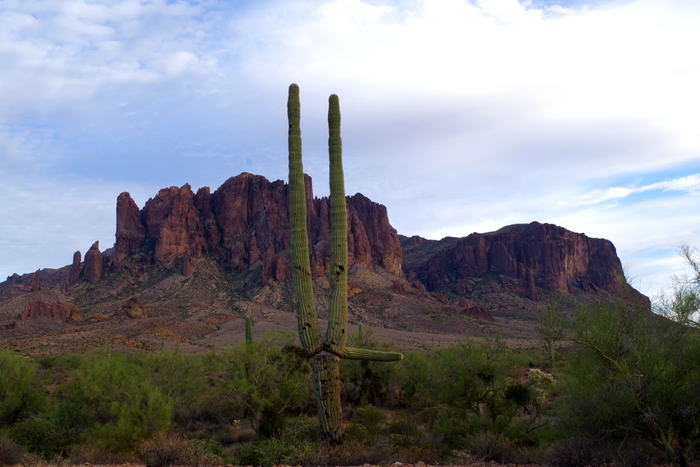
There are a good number of saguaro cactus’ here too. They still amaze me.

IMGP8637

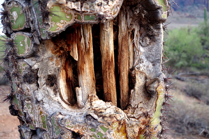
I thought I would show you what the inside of a saguaro looks like.

IMGP8646

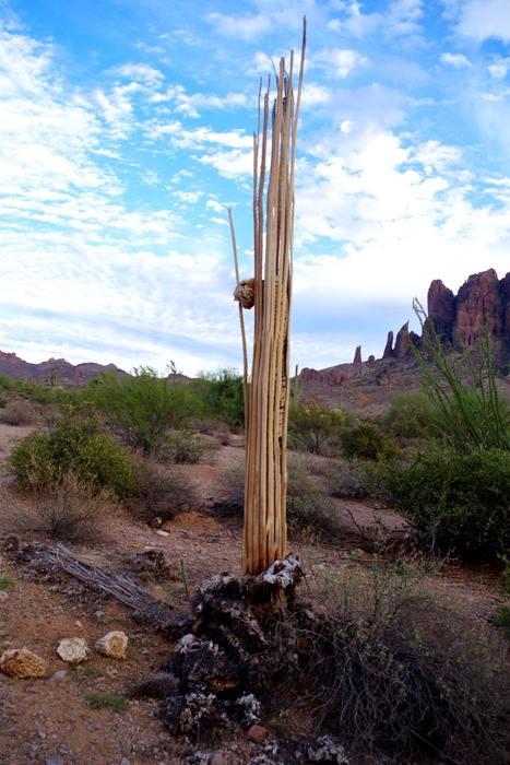
The Native Americans use the saguaro ribs to get to the saguaro fruits that grow way up on the top of the cactus. Pretty ingenious if you ask me!

IMGP8643

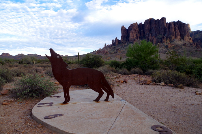
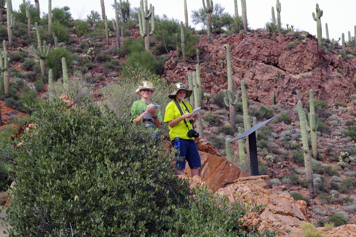
We found this really cool sun dial on one of the hikes. It was pretty accurate!

IMG_1625

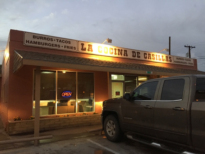
Now, I’ve shared with you our foodie find, but I’ll put it in this post too just in case you missed it. It’s known as The Burger House and it was a 45 minute drive (one way) from where we were staying.

IMG_1564

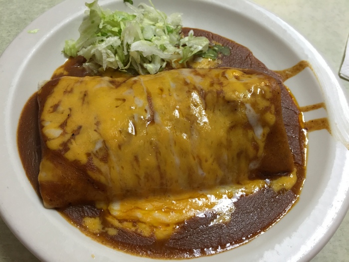
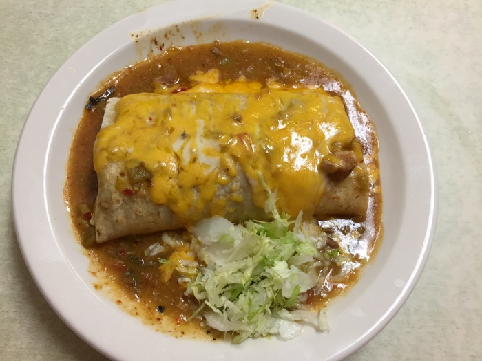
We went there twice in the seven days we stayed at the Lost Dutchman SP. Both times I got the same thing…the Green Mix Burro, Enchilada Style.

IMG_1623

Now these are the French fries enchilada style. They were a gooey cheesy mess of yum, but they weren’t as good as the Green Mix Burro.

I have a confession. Until our time here at The Lost Dutchman, I wasn’t impressed with Arizona. I mean, yeah, it was pretty and yeah, I was seeing new things…but, I hadn’t seen anything that really made me say “Oh, wow!”. Plus, I hadn’t found any truly amazing Mexican food. And, they call their burritos burros…doesn’t burro mean donkey in Spanish? I’ve always wanted to go to Arizona, and I was pretty disappointed with my experience. Our time at Lost Dutchman SP changed that though. I feel like Arizona has redeemed itself some…which is good since we still have a month left in Arizona!

See y’all down the road!

The Apache Trail Drive

The Apache Trail Drive

The Apache Trail drive is only 46 miles, but plan on spending the entire day exploring this scenic road.

The first thing you should know about this road is that 25 miles of it is dirt. What is it with us and dirt roads? We always seem to find ourselves driving down one. And it’s usually worth it. This drive was no exception. It was worth every dusty, washboard, bumpy mile.

IMGP8323

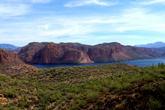
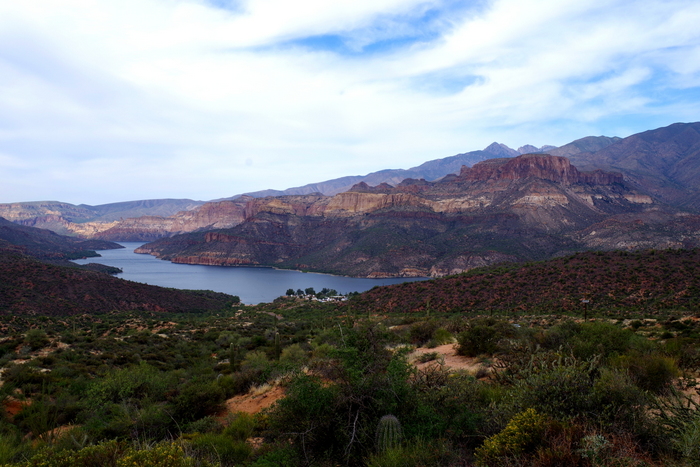
Our first oooo-ahhh view was the Canyon Lake. The sky was overcast so it was hard to see, but the water is a deep blue.

IMGP8344

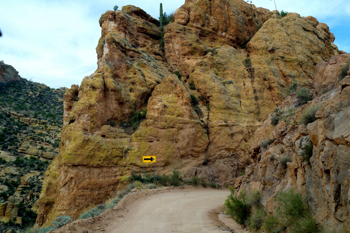
This drive shadows an ancient Apache Indian footpath and has quite a few narrow switchbacks. The dirt road should really have been a one way, but it wasn’t. We would have to find a wide-ish spot and pull over to let a car pass and if heights bother you, this might not be the road for you.

IMGP8351

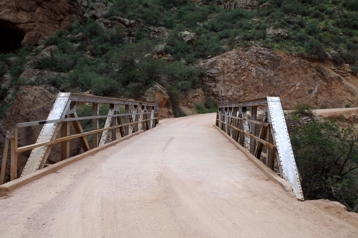
There are also several one lane bridges.

IMGP8365

But, the views…were…stunning. In the photo above you can see the Painted Cliffs of the Mazatzal Mountains next to the Apache Lake. Guys, I really wish y’all could see this in person. Pictures just don’t do it justice. Someone needs to come out with a way to easily and cheaply add 3D photos to blog posts.

Seriously, that should be a thing.

IMGP8388

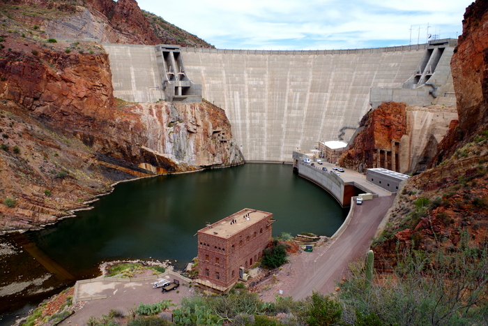
We also got to see the Theodore Roosevelt Dam which was the world’s largest masonry dam back when it was built in 1911. 280 feet high and 723 feet long, the Theodore Roosevelt Dam is impressive.

IMGP8396

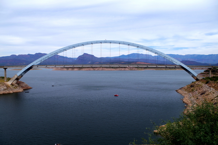
On the other side of the dam is the 23 mile long Theodore Roosevelt Lake where the original town of Roosevelt is now laying underwater.

This is actually where the Apache Trail Drive ends and where the paved road picks back up, but we went on to the Tonto National Monument which was only five more miles down the road.

IMGP8431

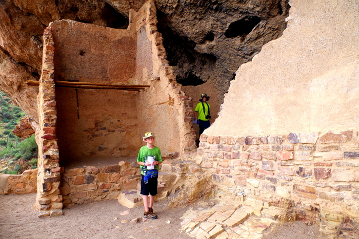
Tonto National Monument gives you a peek into the lives of the Salado people.

IMGP8435

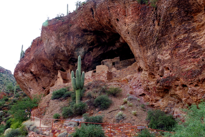
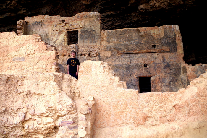
You can walk up the 350 feet to the Lower Cliff Dwelling where a Ranger is posted to not only answer any questions but to protect the artifacts.

IMGP8438

We got to walk around and through a few of the rooms while the Ranger told us what life was like for the Salado people.

IMGP8440

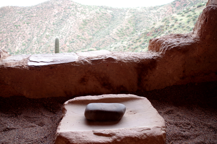
There are still a few artifacts left up in the dwelling. In the photo above, you can see a grindstone.

IMGP8460

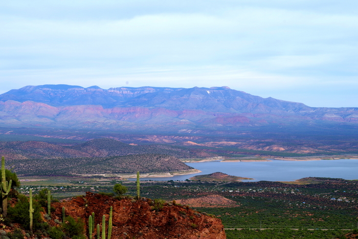
The view of Roosevelt Lake is spectacular from the Lower Cliff Dwelling.

IMGP8464

The boys took the opportunity to get another Junior Ranger Badge.

IMGP8475

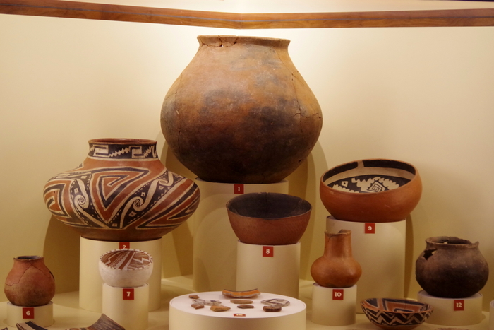
In the visitor center, you can see some of the more impressive artifacts they found in the dwellings. Apparently, until the 1930s people would steal, smash and deface the dwellings, which is why there’s now a Ranger posted there. I’ll never understand some people’s need to destroy.

IMGP8478

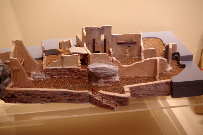
This is a model of the Lower Cliff Dwelling. There used to be 19 rooms and they think there were probably somewhere around  60 people living there. There’s also an Upper Cliff Dwelling that has 40 rooms, but it’s only open from November to April. I imagine we’ll come back to do the three mile Ranger hike to see it.

IMGP8485

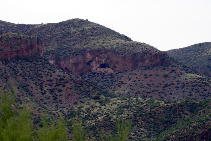
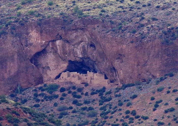
Down the road from Tonto NM there’s a scenic pull-off that gives you a faraway look at the Upper Dwellings.

IMGP8484

Here’s a better look at the 40 room Upper Cliff Dwelling.

IMG_1567

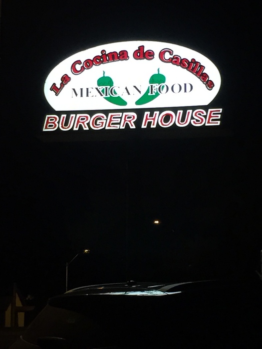
While we were exploring, we came across this gem of a place.

IMG_1564

You’re looking at the best burrito I’ve ever had. It’s called a Green Mix Burro, Enchilada Style.

IMG_1563

We liked this place so stinkin’ much we ate here twice in the seven days we were in the area.

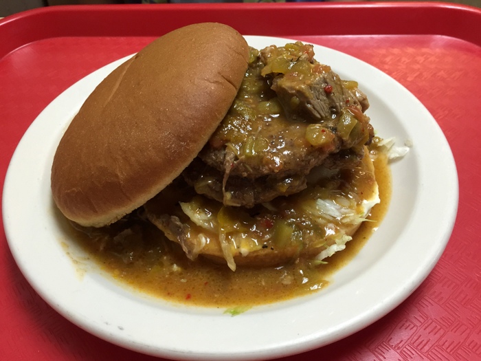
IMG_1565

Mr. Man got the Burger Olé. A double burger covered in the yummiest green chili. He had to eat it with a fork and knife, but he ate it all.

One of our favorite things to do is take the road less traveled. You never know what amazing vista or interesting foodie place you’ll find.

See y’all down the road!

Tucson, AZ

Tucson, AZ

IMGP7975

Welcome to Tucson, where there’s 350 days of sun a year!

Wait, what?

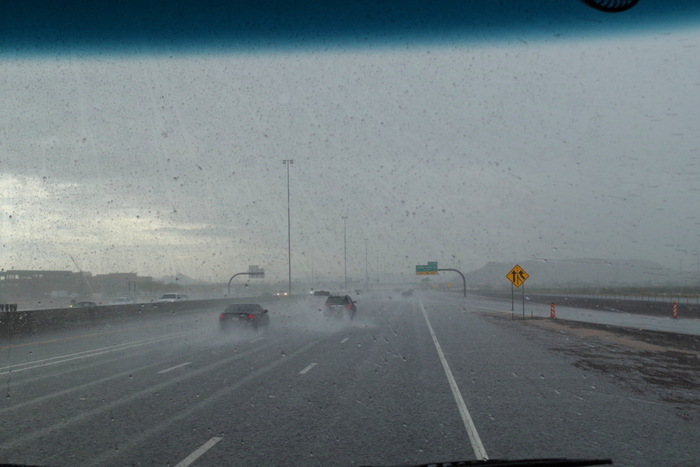
Yup, we picked the week it rained three out of the seven days we were there to visit Tucson, AZ. Who goes to a desert to get rained on? We do. Kind of like when we were hiking through a rain forest in Alaska and it didn’t rain single a drop. Oh well, what are ya going to do?

 We still had four glorious days of sun to explore the area.

IMGP7990

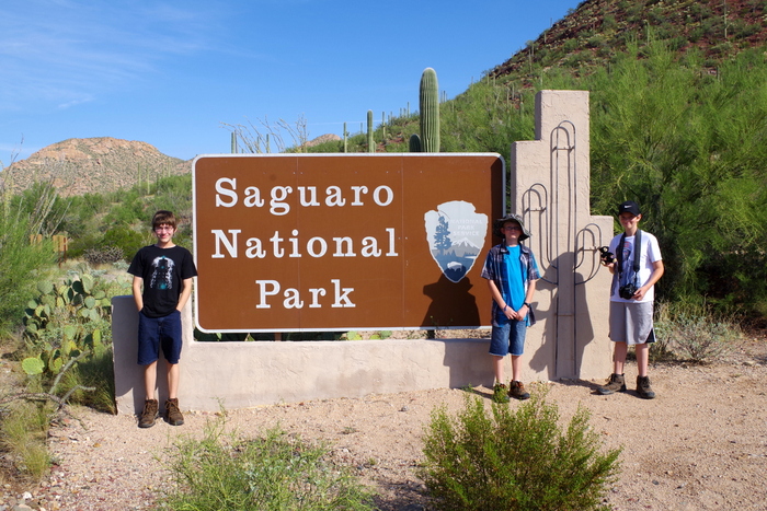
Saguaro National Park was at the top of our list of places to see. Saguaro (suh-WAHR-oh) NP is made up of two districts with Tucson in the middle.

IMGP7986

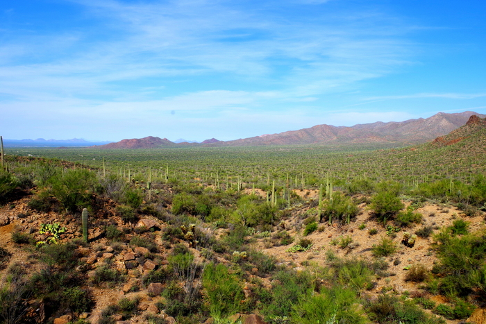
I wasn’t expecting so much green and life and…mountains.

IMGP8024

We cautiously did a few hikes here. Between the six different kinds of rattle snakes, the Africanized “killer” honey bees, and the fact that all of the plants are trying to kill you…we didn’t really stray off the beaten path.

IMGP8030

It’s a desert with tons of different cacti…they really do reach out and grab you. There’s a type of cactus called cholla that has barbed spines that detach from the plant easily and embed in your skin. Sounds fun, right? No?

IMGP8019

There was also an unexpected beauty there.

IMGP8061

The bright colors really stood out next to all of the green and brown.

IMGP8060

Even the pretties have teeth in the desert.

IMGP8072

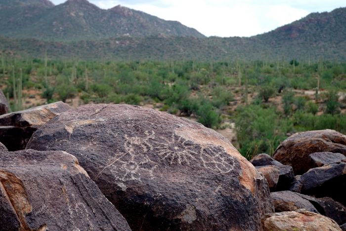
We never saw any snakes, but we did see some petroglyphs!

IMGP8078

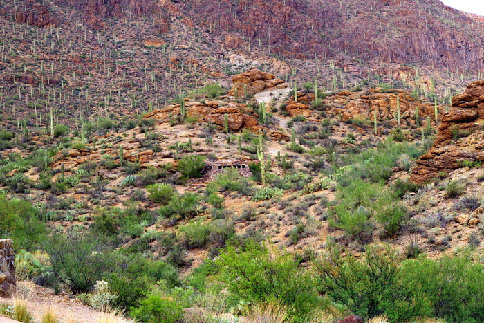
We found some shelters built by the CCC! Can you spot them?

IMGP8138

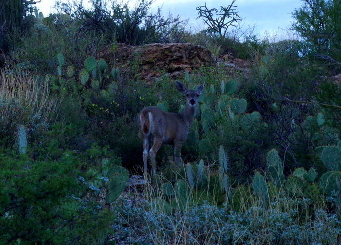
The only wildlife we saw was this mule deer. Actually, there were two of them, but we only saw a flash of the other one.

IMG_1518

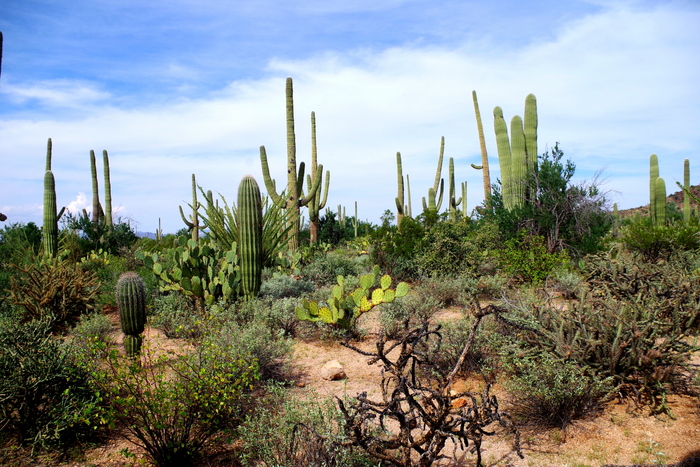
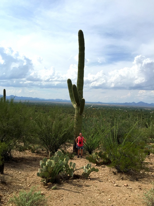
The saguaro cactus is an icon of the American southwest. In a single rainfall, a saguaro may soak up as much as 200 gallons of water, they can live more than 150 years, grow over 60 feet tall, and weigh up to 8 tons. They were impressive in their almost human-like shapes, towering above the rest of the desert.

IMGP8089

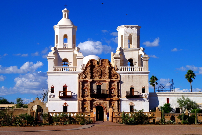
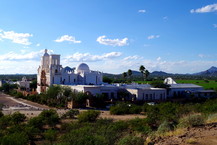
Mission San Xavier del Bac is called the “White Dove of the Desert”. This is the oldest intact European structure in Arizona.

IMGP8102

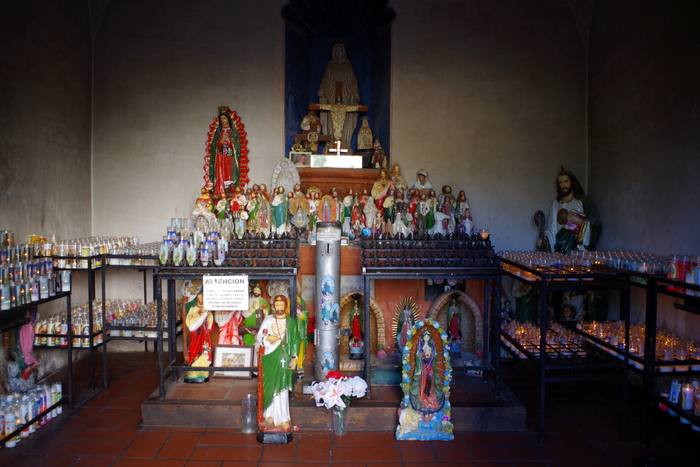
The church is open to the public unless there’s mass taking place. We roamed around the open rooms and the grounds.

IMGP8122

If you’re ever in the Tucson area, make sure you stop by.

IMGP8146

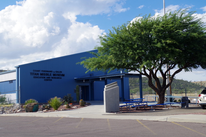
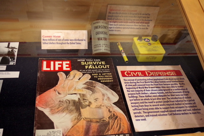
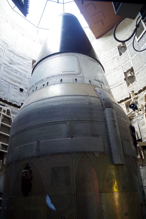
I’ll be honest with y’all…I wasn’t really looking forward to the Titan Missile Museum. I like the outdoor stuff….the hikes and the scenery. Museums aren’t really on the top of any of my lists, but this is one of those times I’m glad we went. The docent did a great job of keeping it interesting and informative.

IMGP8149

They had some memorabilia out on display. See the canned drinking water? They had those for sell. The cans reminded us of when the tornado hit our house and someone came by handing out…canned drinking water.

IMGP8179

They took us into the control room and explained what life was like for those working at this facility and we got to see the Titan Missile. The boys did the Junior Missileer book while we were there and earned a patch for their effort. We got a surprise when the woman in the gift shop signed their certificate, identifying herself as one of the soldiers that used to work there at the facility.

IMGP8194

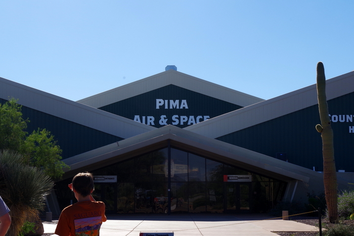
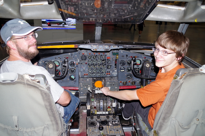
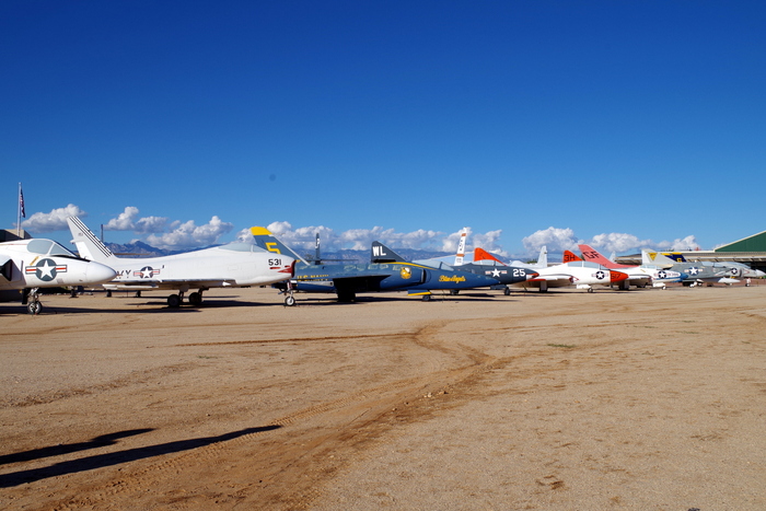
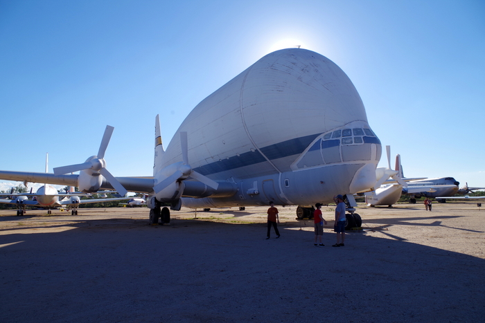
We found this place as we drove by it. It’s hard to miss with all of the huge planes sitting out front. We got there in the late afternoon and had to rush through it before they closed at 5pm, but we got to see pretty much everything.

IMGP8197

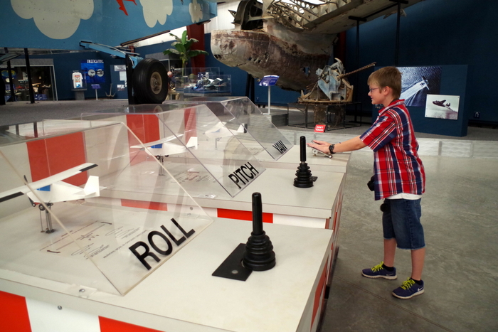
The boys learned a little about airplane controls.

IMGP8265

Hmmm…I think I’ll take a different flight if these two are at the controls.

IMGP8217

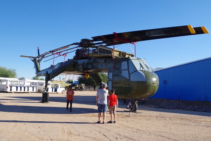
The Pima Air & Space Museum is one of the world’s largest non-government funded aerospace museums.

IMGP8225

There are over 300 aircraft spread over 80 acres of land.

IMGP8241

We would have liked to have been able to slow down and get a better look at some of the different kinds of aircraft. It’s definitely worth a visit.

IMG_1500

Of course we had to try some of the Mexican food in town. How could we not?

IMG_1499

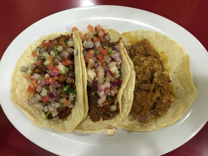
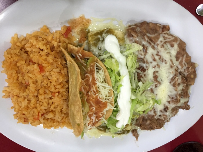
We ended up eating at four different places. Two were fantastic (Taqueria el Pueblito, and St. Mary’s) and one was, well…it was food…I think.

IMG_1549

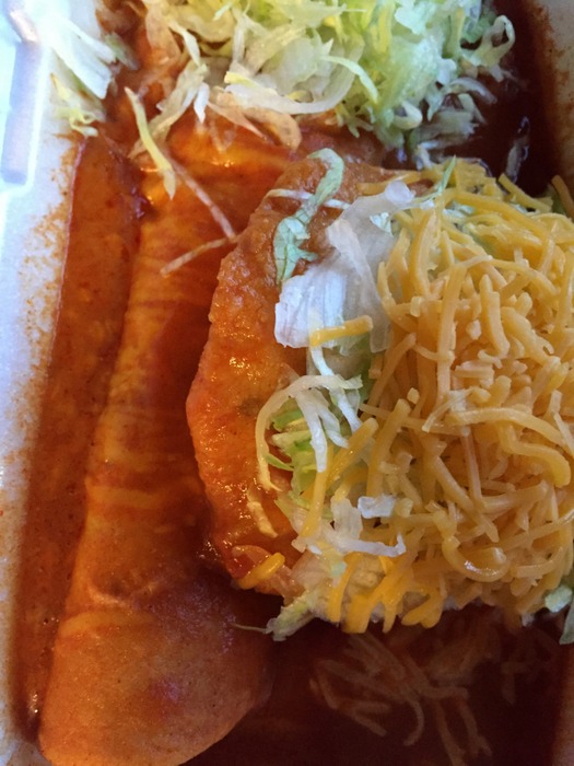
At St. Mary’s I found out there are rolled enchiladas and flat enchiladas…so, of course, I had to try them both. The rolled enchilada is what most of you are familiar with (the one on the left in the pic above) and the flat enchilada is kind of like a fried disk of the masa that’s on the outside of tamales and then it’s covered with the toppings you want. They were both very good!

22912

The other place we ate is called El Guero Canelo. We ate there because we heard that it’s the place to go to try a Sonoran Style Hotdog. What is a Sonoran Hotdog? It’s a bacon wrapped hotdog with beans, grilled onion, fresh onion, tomato, mayo, mustard, and jalapeno sauce. It’s a big mess. The bun is made in house and is the sweetest hotdog bun I’ve ever had. It was good, but I can’t see myself ever really wanting one again. Jerl didn’t even finish his…it’s not his type of thing.

Tucson is an interesting town. There’s enough to do in the area to keep a family busy for two to three weeks. We’ll probably be back in the Spring sometime so we can see the saguaro cactus’ bloom…and for more food.

See y’all down the road!

A Change Of Plans

A Change Of Plans

We had originally intended to spend two weeks at the Grand Canyon National Park, but when we got to the RV park we’d planned on staying at, things changed. The park was a total dump and on top of that, Jerl didn’t have good enough cell service to work. We went in search of a new place and ended up staying at a much better place that was even closer to the GCNP, but it was twice the cost and we didn’t have full hookups. So, we changed our plans and only stayed for one week then headed south to Williams, AZ which is about half an hour outside of Flagstaff, AZ. The RV park in Williams was wonderful and the town is right on Route 66 so it’s got some nostalgia.

Since, we were leaving the GCNP a week early we had intended to take that week and get some work done, but then we found the Lowell Observatory and all of our work plans kind of just flew out the window. We ended up spending one entire day and then three evenings at the Lowell Observatory. Yes, we are those kinds of geeks.

The Lowell Observatory was started by a guy named Percival Lowell back in 1894 because he was convinced there were Martians on Mars. Percival was from one of, if not the, wealthiest families of that time. The whole family was made up of brainiacs who were known for spending their money on worthwhile endeavors. IMGP7929

For those of you who don’t know, the Lowell Observatory is the place where Pluto was discovered by Clyde Tombaugh in 1930. With all of the recent Pluto pictures coming out from New Horizons…well, the staff at the Lowell Observatory were all extremely excited.

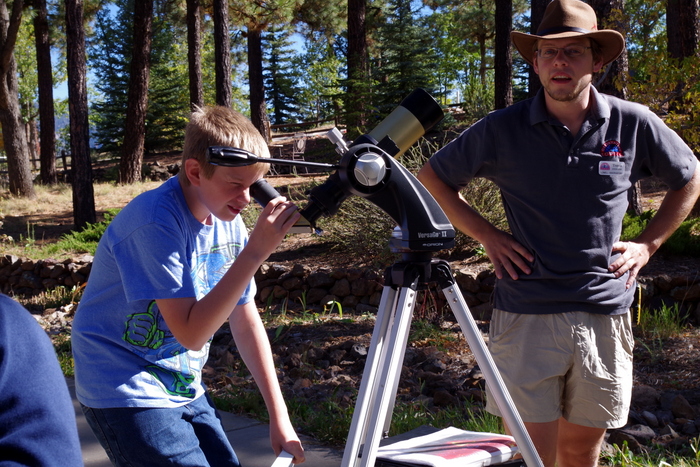
The first day we spent at the Lowell Observatory was during the daylight hours. You might not think there would be anything to do at an Observatory during the day, but there’s actually quite a bit! We started the day off by looking through a special telescope at the sun.

IMGP7899

You can see The Dude and our guide, Travis, in the picture above. We all had a few chances to look at the sun and a huge prominence that was coming off the sun at that moment.

IMGP7940

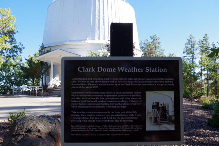
We spent time walking around and looking at the different buildings. The Clark Dome just opened back up to the public a week and a half before our visit. It had been closed for renovations for over a year.

IMGP7935

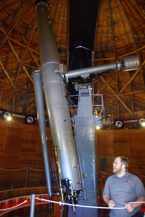
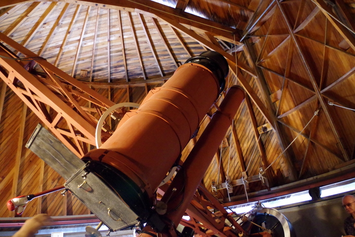
The Clark Telescope dome is the oldest standing building at the Lowell Observatory. The Clark Telescope was built in 1896 and was used to discover the first evidence of the expanding nature of the universe. It’s a pretty big deal. All of the scientists working at the Lowell Observatory were super excited about it. We got the chance to actually look through this telescope at one of the evening programs. We saw M2 through it. You don’t know what M2 is? Well, it’s the core of a galaxy that our galaxy absorbed. It was really amazing to see and…it was pretty.

IMGP7914

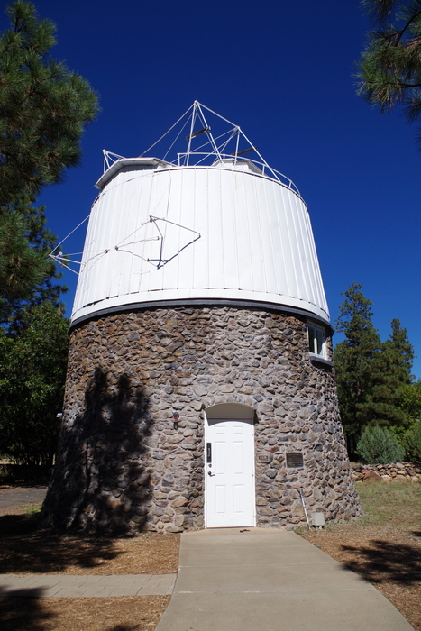
Because Pluto is such a big deal at this particular observatory and there’s been some really exciting developments with the New Horizons project, we learned quite a bit about Pluto. The Pluto Dome, in the picture above, houses the telescope used to discover Pluto. Now, what’s funny, is that the guy who found Pluto wasn’t actually employed as an astronomer. Nope, Clyde Tombaugh was actually on the grounds staff. When Percival Lowell decided to spend time finding Planet X, no one wanted to do it because it was such a tedious project and they thought it was kind of beneath them, so it got assigned to the “lower” staff. Clyde Tombaugh was a poor boy from Kansas who wanted to go to college to become an astronomer, but couldn’t afford it so he took a job at the Lowell Observatory in hopes of learning more. He found the work fascinating and spent as much time at night as he could searching. As you can imagine, once he found Pluto, he had offers from several colleges for a full ride. He ended up going and getting his Astronomy Degree then working at the Lowell Observatory as an Astronomer.

IMGP7918

This is the astrograph telescope used to discover Pluto. An astrograph telescope is a type of telescope used exclusively to take pictures. You can see the big square at the bottom of the telescope where they would put the glass slides in.

IMGP7930

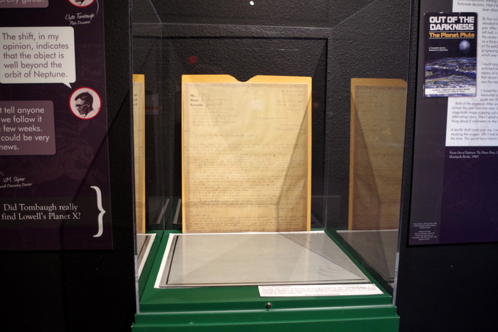
Finding a planet in this manner is painstaking work. You’re basically comparing little blips on glass plates to see if they’ve moved. In the picture above, you’ll see one of the two glass plates used to confirm the discovery of Pluto. Since planets move and stars don’t, these plates allowed Tombaugh to see the slight movement of Planet X (Pluto) when compared to the background stars. Some of Tombaugh’s ashes were placed in a little container on the New Horizons space probe and when New Horizons passed by Pluto…well, the guy who discovered the planet was the first to go there.

IMGP7936

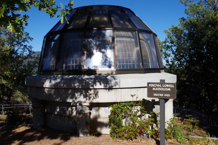
Percival Lowell was so passionate about his work in astronomy, his mausoleum is on the grounds right next to the Clark Dome. Notice the glass dome on the mausoleum? Someone said that’s so he can always see the stars.

IMG_1473

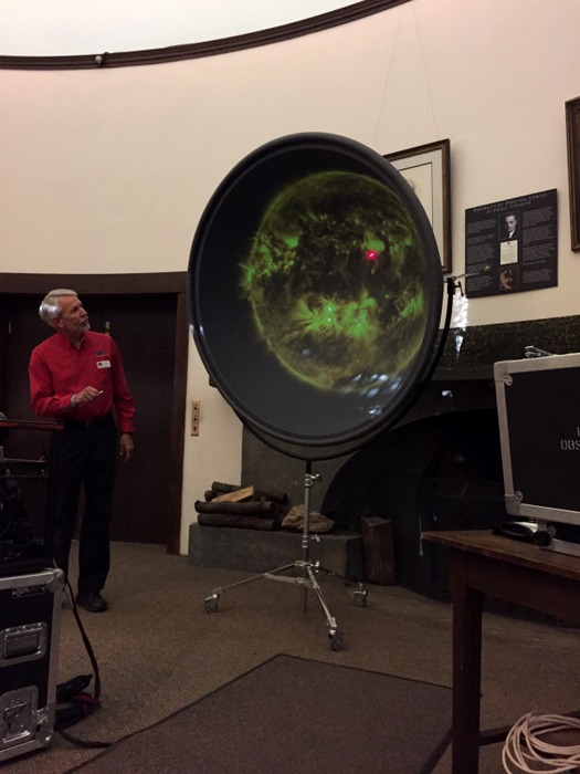
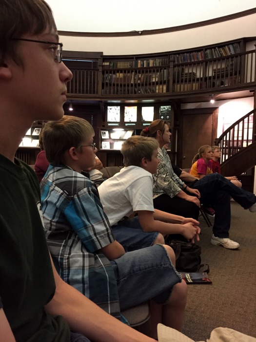
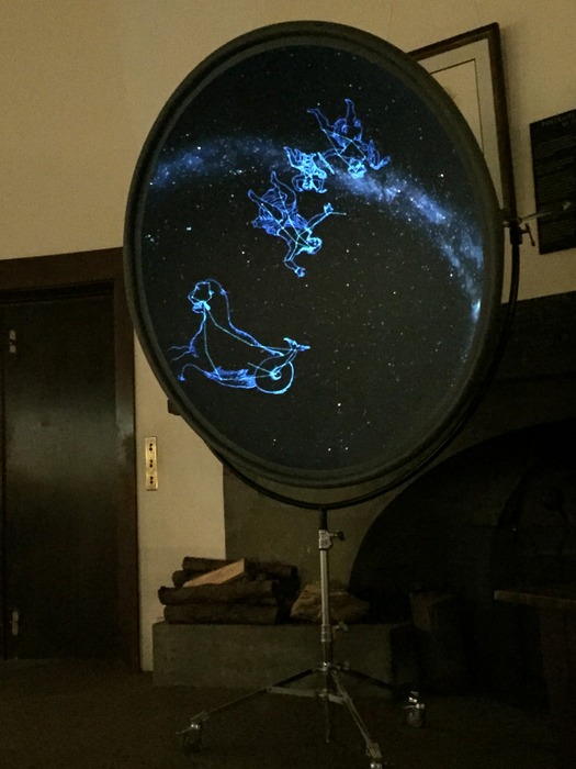
We ended up going back three nights in a row because we didn’t want to miss any of the lectures. We had a couple of favorites. In the picture above you can see part of the Cosmic Zoom lecture where we got a virtual tour of our solar system and the universe. This guy (in the red shirt) was great! He kept it flowing and entertaining. And the projector they used was super cool!

IMG_1477

Our little geeks were completely absorbed with the lectures.

IMG_1478

We also heard the Sky Tonight lecture. It was with a different guy…who wasn’t quite as good. But the material was still interesting.

IMG_1481

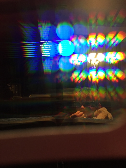
There was a section of the night where they did some science experiments. We got to look at some pretty spectrum lights through some special glasses. I could’ve spent a long time looking at the different gasses through the spectrometer. Each gas had a different color range that showed up. I didn’t get any pics because the lights were all out and I didn’t want to be that lady.

IMG_1487

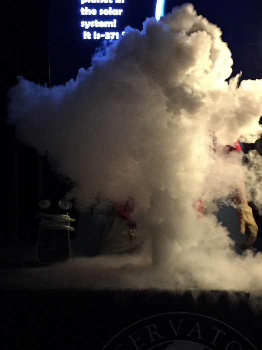
This experiment was probably the boys’ favorite. Liquid Nitrogen is always fun. All of the experiments were great and they did a wonderful job explaining space in terms kids could easily understand at any age.

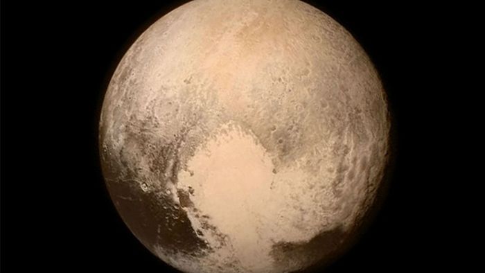
pluto-nasa.0

We did make it to the Pluto & NASA’s New Horizons lecture. Kelly, the lecturer, was really knowledgeable and extremely passionate about Pluto. She did a great job at keeping it entertaining. We got to see some very amazing photos of Pluto. In the picture above, you can see what they’re calling The Heart. What’s super amazing is that the surface of Pluto is still alive. It’s still changing and moving! Very exciting!

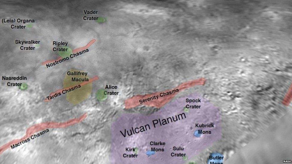
_84551394_4d7654c3-cf30-478c-925c-e24ae6a83abb

There’s been a naming frenzy going on now that scientist have been able to really get a good look at Pluto and some of it’s moons. I pulled the picture above off the internet so you can see some names that have been unofficially chosen for some of Charon’s craters, plains, and chasms. For those of you who don’t know, Charon is Pluto’s biggest moon. My personal favorites are Tardis Chasma, Gallifrey Macula, and Vader Crater. There’s a large dark feature on Pluto that’s being called Balrog. None of these names are official, but it’s fun for right now. The IAU will eventually officially name everything, but maybe some of these names will stick. Don’t worry, I won’t totally geek out on you. I’ll leave the lecturing to the pros at the Lowell Observatory.

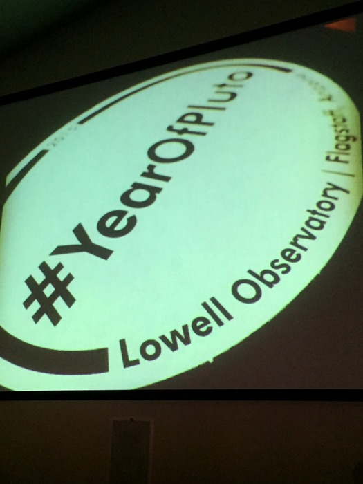
IMG_1490

If you want to keep up on all things Pluto you can search the hashtag above.

We enjoyed the observatory so much we ended up getting a membership that gets us into around 300 other observatories and places of geekery. The little boys have decided that not only are they going to be Park Rangers…they are going to be Astronomy Park Rangers and work in the dark sky parks so they can give Ranger Walks at night.

See y’all down the road!

Wildlife Watch Grand Canyon

Wildlife Watch Grand Canyon

One of my favorite things about being outside is seeing all of the animals. Here are some of the wild animals we saw while visiting the Grand Canyon National Park.

I’ll start with the squirrels because we saw so many of them. We saw 3 different species of squirrels.

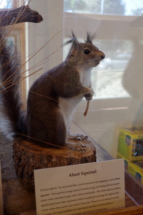
IMGP7867

Abert’s squirrel (we didn’t get a picture of one of these, but this is what they look like),

DSCF1358

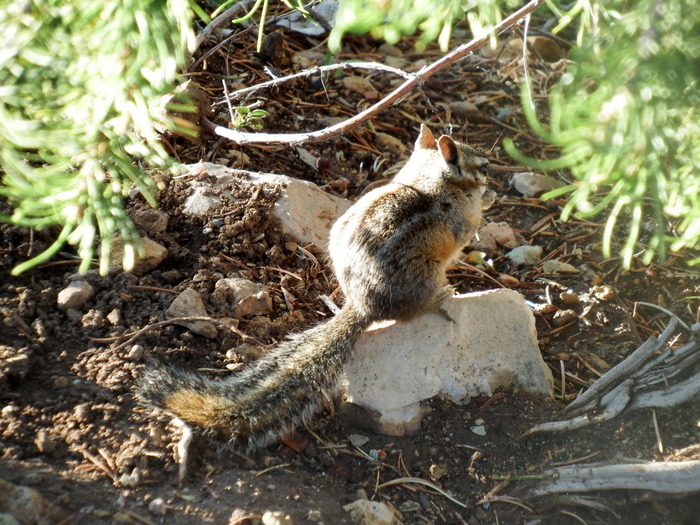
Golden mantled squirrel (we saw these everywhere!),

DSCF1412

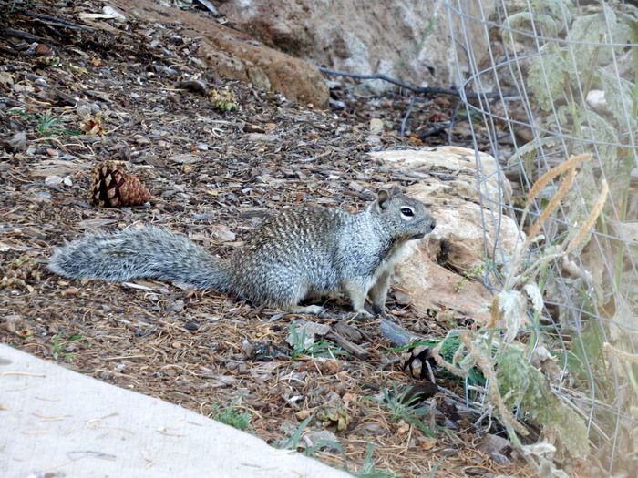
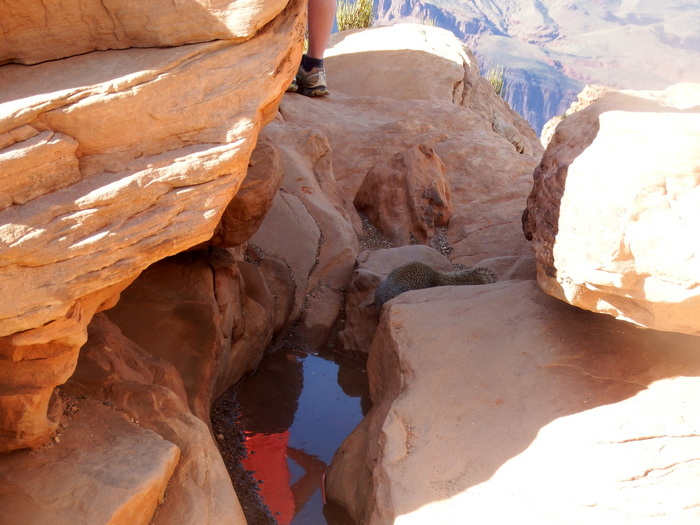
and  the common tree squirrel. There were signs all over warning about how dangerous the squirrels are. They have fleas that carry the plague and the squirrels are known to bite. The squirrel bite can get infected fast. One of the Rangers told us that out of all of the animals at GCNP, squirrels are the most dangerous because they beg for food or water and will sometimes bite.

DSCF1393

The squirrels at GCNP are NOT afraid of humans. You can see how close the squirrel in the picture above gets to a group of humans.

IMGP7746

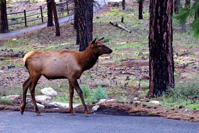
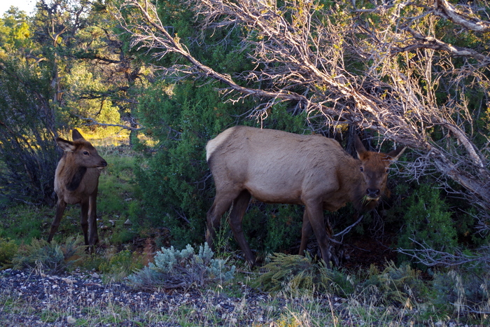
Outside of the Grand Canyon Market Place we saw a herd of elk munching on the grass and leaves scattered through the trees. When it is hunting season, the elk go to Grand Canyon NP for shelter because hunting is not allowed at the National Park.

IMGP7660

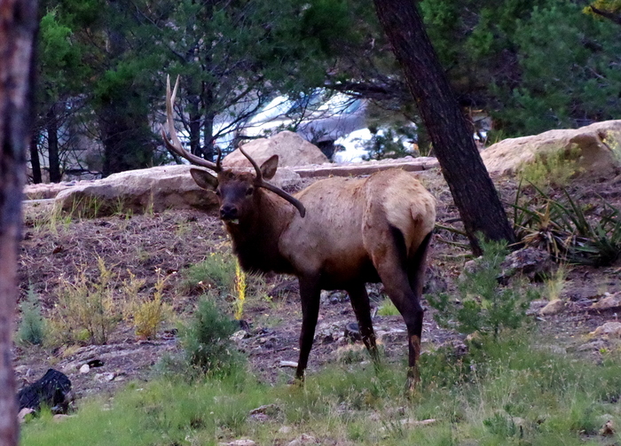
We saw about 7 females and 1 male at the market place. One of the female elk was on the sidewalk close to us, on our side of the fence. She was just walking and eating grass and leaves and didn’t seem to mind the humans gathering to watch.

IMGP7758

The male elk (buck) had one side of his antlers messed up. One side pointed downward and wasn’t as big as the other side.  We saw a lot of elk at GCNP, but didn’t get to take pictures of the others.

DSCF1364

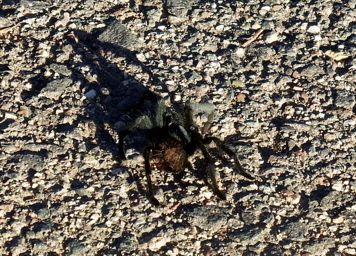
When we walked the rim trail, we saw a tarantula with its front two legs disconnected from its body. The unattached legs were twitching on the ground.

IMGP7861

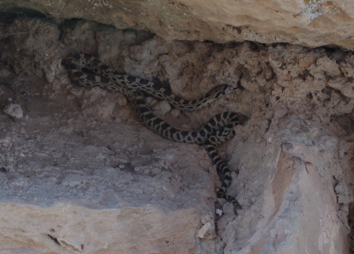
On hermits Rest we saw a snake witch we believed was a baby California king snake in a hole on the side of a statue.

DSCF1458

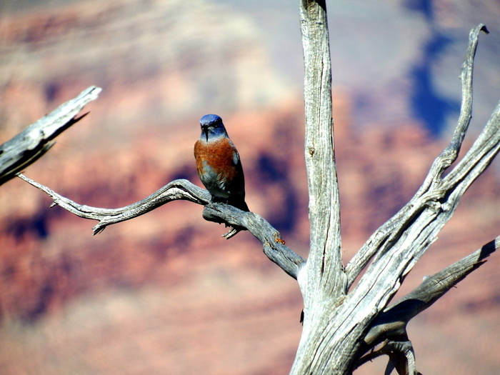
There were a ton of different kinds of birds at GCNP. We didn’t get pictures of very many of them. It’s hard to get a good picture of something that doesn’t hold still for long. My brother took the picture of the bird above.

Those are the animals we saw at Grand Canyon National Park, maybe we will find more down the road.

Grand Canyon National Park

Grand Canyon National Park

IMGP7893

The Grand Canyon measures 277 miles long, up to 18 miles wide and more than one mile deep. That’s big. We spent a week exploring what Theodore Roosevelt declared as “the one great sight which every American should see.”

The Grand Canyon is split in to the North Rim and the South Rim. We only visited the South Rim on this visit.
GCNPmap

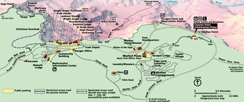
Before we get into what we did, let me explain how the GCNP is laid out. The GCNP South Rim is basically split up into two parts. On the east side, you have the Desert View Drive that you can use your own vehicle to get around (except for Yaki Point and the South Kaibab Trailhead). The west side is where you’ll find the Village, Market Plaza, the Visitor Center and some campgrounds and is mainly navigable by shuttle bus. There are a few places you can drive in the Village and Market Plaza, but Hermit Road is shuttle bus only. You can get the gist of it in the map above.
IMGP7536

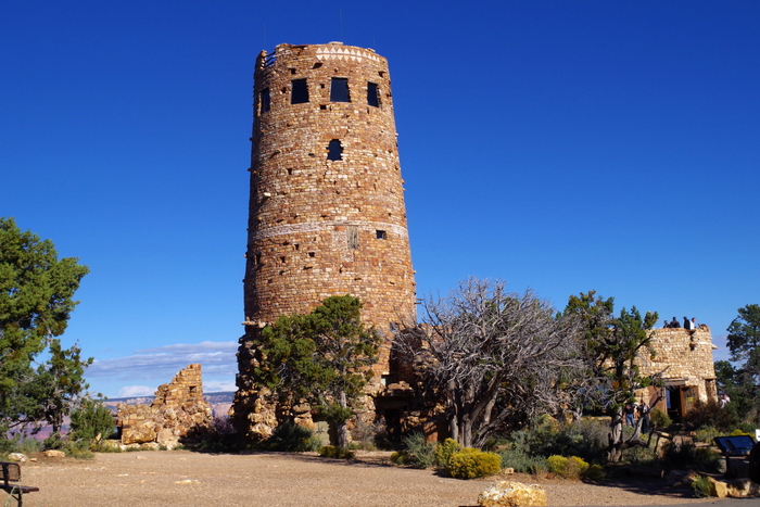
Our first day at the GCNP we decided to check out the east side of the park and the Desert View Drive where we headed out to the Desert View Watchtower. It was built in 1932 and looks old, but it was designed to look that way so it would add to the ambiance of the Grand Canyon experience.
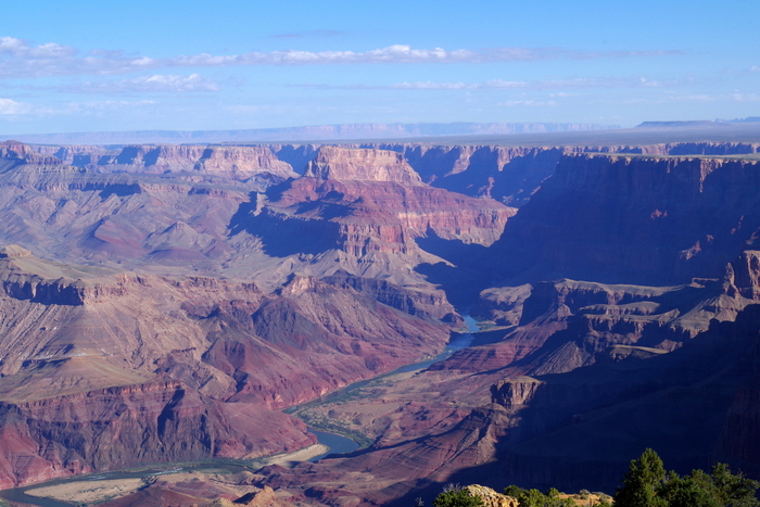
IMGP7546

The view off of the balcony of the Watchtower gives you a great view of the Colorado River snaking it’s way through the canyon.
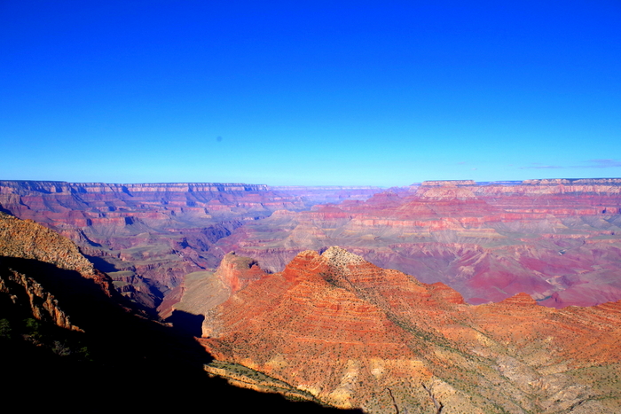
IMGP7551

There’s really not a bad view anywhere here. This is at one of the other stops on Desert View Dr. I don’t remember which one…they all kind of run together after a while.
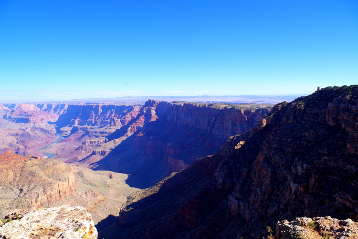
IMGP7579

This is one of my favorite shots because you can see the Colorado River and if you look very carefully, you can see the Desert View Watchtower on the right hand side toward the top of the cliff.
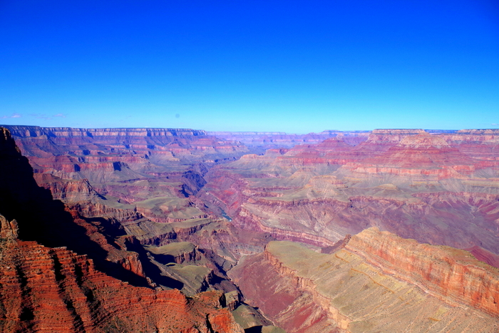
IMGP7593 I really love the colors here.

IMGP7666

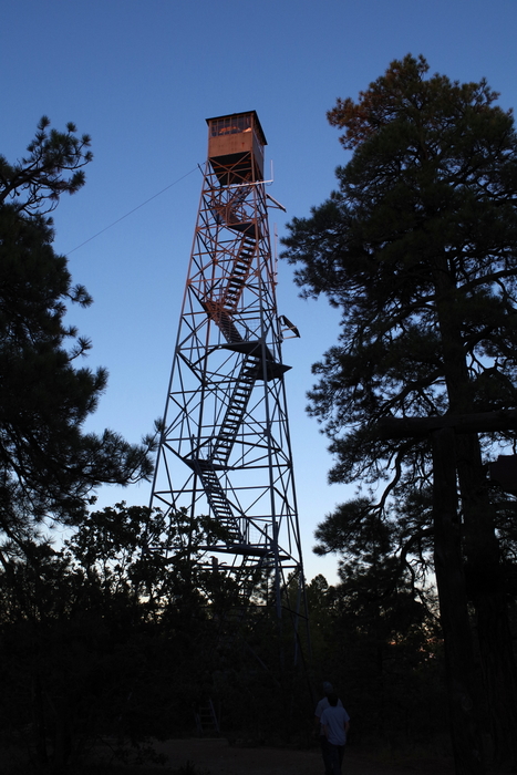
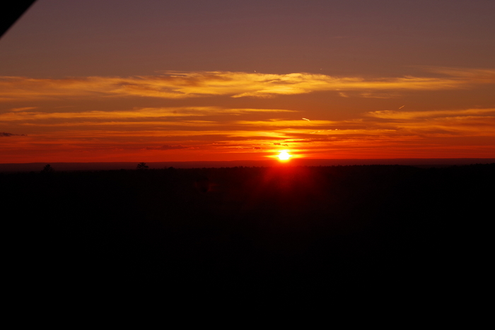
We’re going to let y’all in on a secret place not many people know about. Ok, it’s not really a secret…but not many people know about it. This is the Grandview Watchtower. It’s not in the GCNP but it’s right on the edge in the Kiabab National Forest. We went here right at sunset and had the whole place to ourselves.
IMGP7672

The view was spectacular. We could see some of the canyon, but the coolest part was the way the forest stretched out forever.

On the west side of the park it’s best if you arrive early and secure a parking spot then utilize the free shuttle buses for the rest of the day. We spent one day and hit everything we wanted on the west side.
IMGP7836

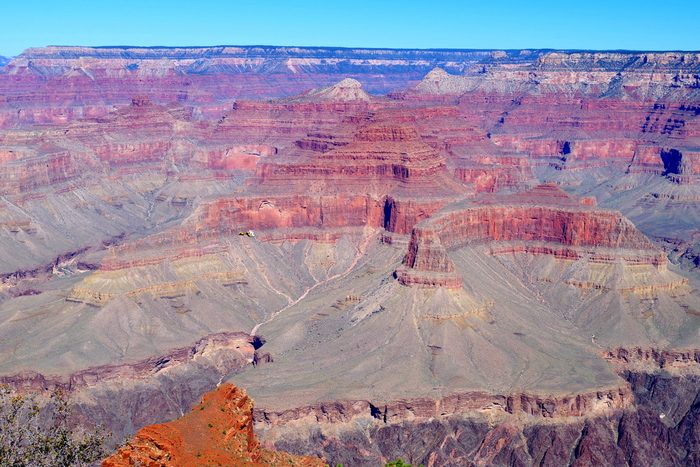
You can expect more great views. It’s harder to catch a glimpse of the Colorado River on the east side. There are helicopters all over the place. You might even find one in the picture above, if you look close enough. It kind of gives you some perspective on how big the Grand Canyon is.
IMGP7851

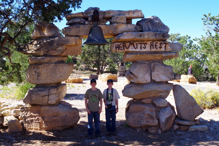
We rode the shuttle all the way to Hermits Rest and the end of the road.
IMGP7854

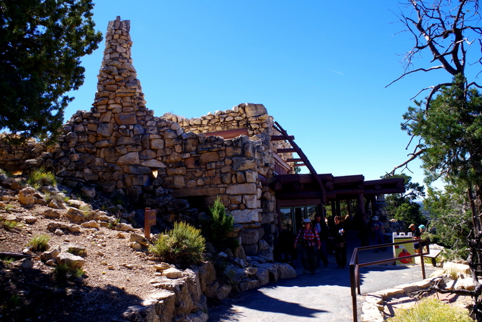
Inside the Hermits Rest building you’ll find a curio shop along with a snack shop. This is also where you’ll find the Hermit Trailhead. It’s one of the steepest, most strenuous trails and they warn everyone that it will take around nine hours to make the seven mile hike…if you’re in decent shape. We walked around the area and took in the views.
IMGP7862

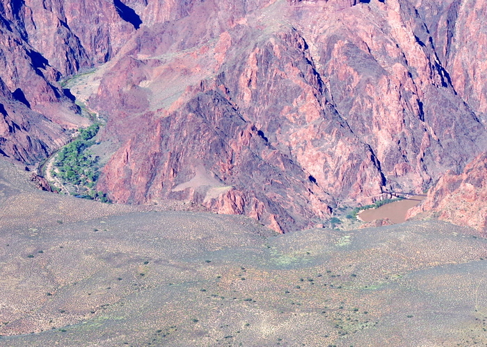
Just outside of the Yavapai Point Geology Museum, you can actually see one of only two bridges that cross the Colorado River in GCNP for the hikers who brave the trails. You can also see Phantom Ranch. In the picture above, on the right side you can see the bridge and then on the left side in that green spot, is the Phantom Ranch. What is Phantom Ranch? Well, it’s a place for hikers to stay overnight on the canyon floor in a lodge. You can get hot, fresh food and a shower before sleeping in an actual bed. You can, of course, bring your own tent and food.
IMGP7847

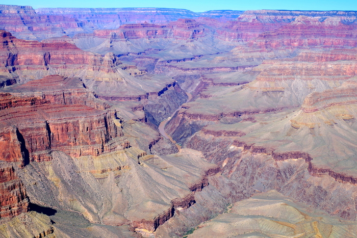
You can see the Colorado River from a couple of places on the east side.
IMGP7884

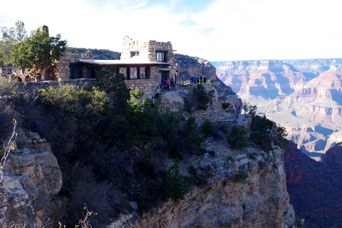
One of the neatest places you’ll find on the east side is The Lookout. It was built right on the side of the canyon and offers a great view.
IMGP7872

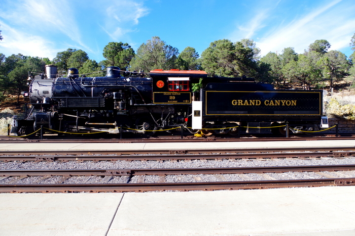
You can also stay in the nearby town of Williams, AZ and ride the train into the park. For almost a quarter of a century, the railroad provided the most comfortable way to get to the Grand Canyon. Built in 1901, the Grand Canyon Railroad Depot is still in use today and is right in the middle of the Village where passengers can find lodging and shuttle buses.
IMGP7888

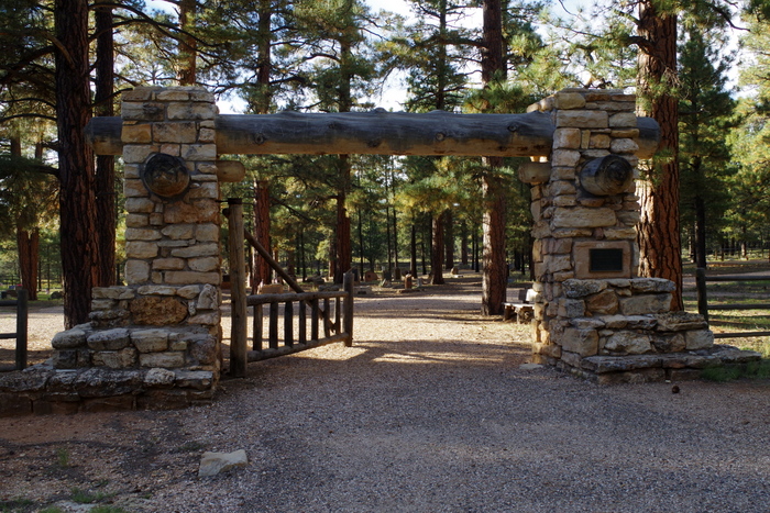
Did you know there’s a cemetery at the GCNP? I didn’t. We heard about it from one of the shuttle bus drivers and went to check it out.
IMGP7890

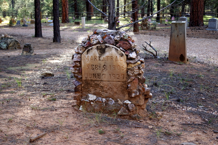
I thought there would only be really old graves like the one in the picture above. Rustic and old. But there were some newer graves too. We walked through to look at some of the more unique tombstones.
IMGP7695

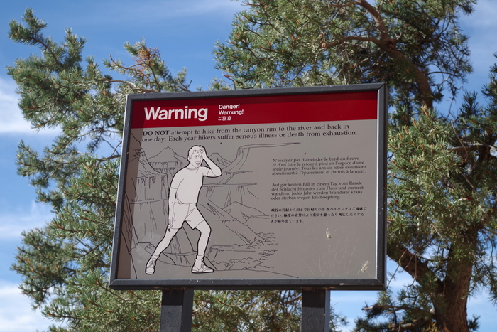
There are five hiking trails at the South Rim. Only five. Now, of these five, four are considered to be strenuous and two of those four are so long they warn you about trying to do the trail all in one day.  The South Kaibab and the Bright Angel trails are the two trails that will take you all the way into the canyon to the river.  For us, hiking some of the trails in a park is kind of a must so, we hiked part of three of the trails. More than 250 people are rescued from the canyon each year because they over estimate how in shape they are and under estimate how long it will take them to hike back out of the canyon. If you decide to hike there, know your limits and plan accordingly.
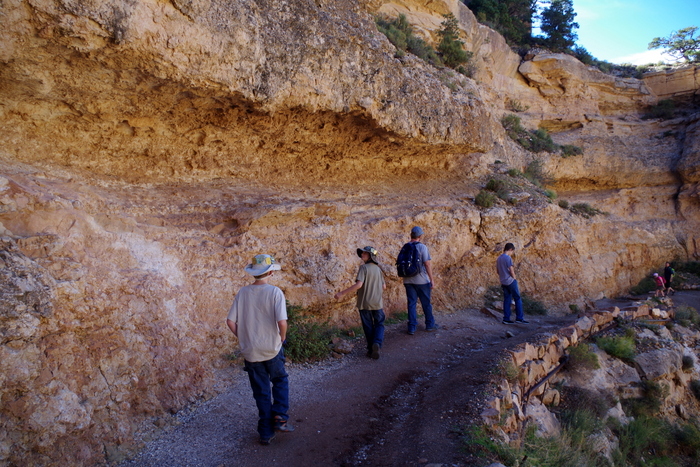
IMGP7690The first trail we hiked was the South Kiabab Trail. We did this one in the afternoon when it was the hottest part of the day, but that’s when we had time to do it and we didn’t want to miss out.
IMGP7687

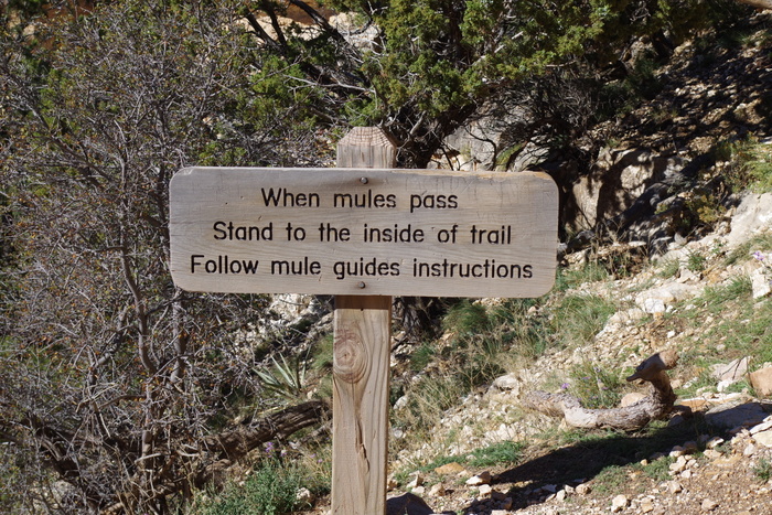
Pretty early on the trail we found this sign. We already knew mules used the trail from the…smell. Some parts of the trail were worse than others. The boys thought they were going to pass out from the stench of all of the scat left behind by the mules. It was pretty ripe.
IMGP7692

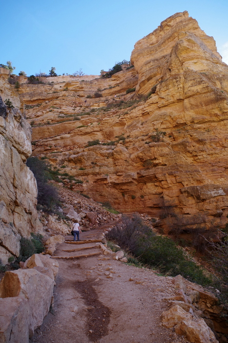
South Kiabab Trail is the most direct route to the canyon floor. Do you know what that means? It’s steep and strenuous. For me this trail was harder than Bright Angel because of the way the trail was laid out with all of these steep “steps”. You can see a few of the more gradual steps in the picture above.
IMGP7733

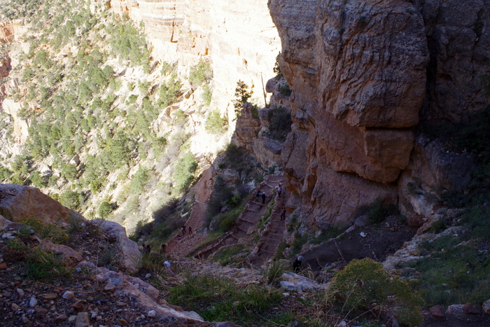
Here’s another shot of all of the “steps”.
IMGP7721

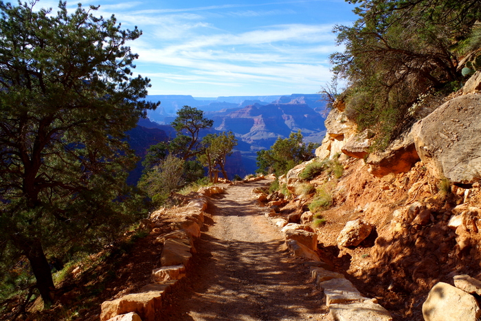
To be fair…the trail wasn’t all like that. Some of it was nice and smooth with a more gradual incline.
IMGP7708

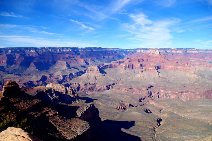
We only went to Ooh-Aah Point which is about a two mile round trip hike.  At the point you can walk out onto some rocks to get to the view.
IMGP7712

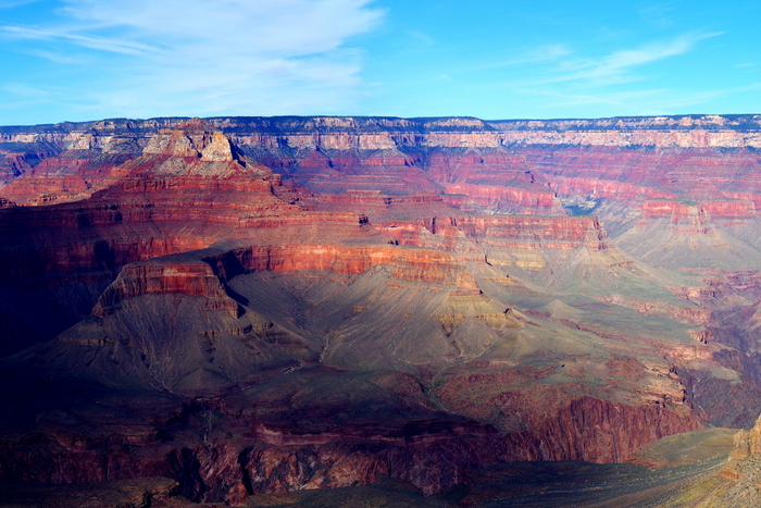
It was a great view. It only took us about a half an hour to get there and it was worth the effort.
IMGP7724

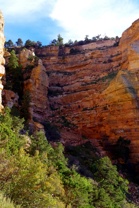
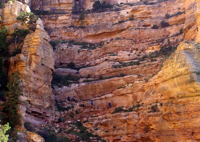
It took us an hour to get back out of the canyon. Can you spot the trail in the picture above? That cliff is the way out.
IMGP7725

Here, let me zoom in for you. Can you see the tiny people walking up the side of the cliff now?
IMGP7816

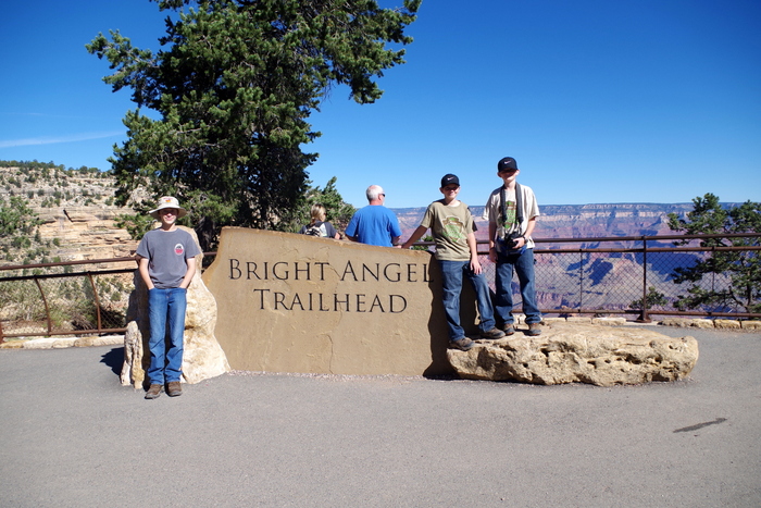
The other big hike we did was Bright Angel Trail. We did this one early in the morning when it was still mostly in shade and the temps were still low.
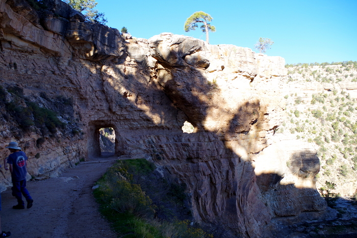
IMGP7761

There are two tunnels on Bright Angel. This one is the upper tunnel.
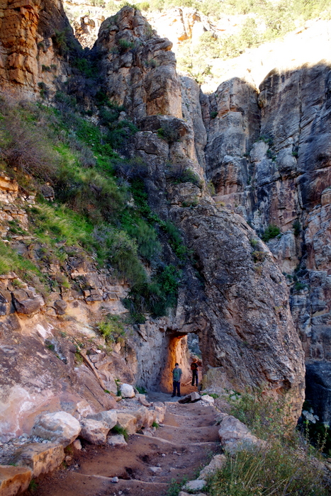
IMGP7778

And this one is the lower tunnel. This is as far as we went on Bright Angel. It made for about a two mile round trip hike.
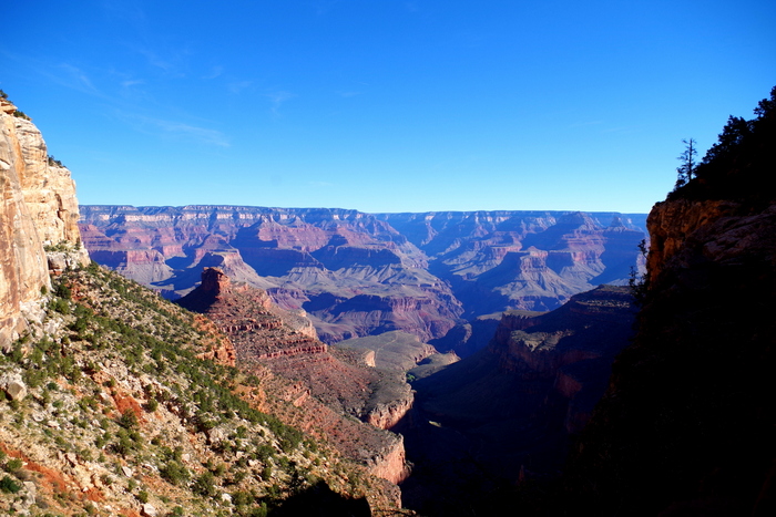
IMGP7782

Here’s the view from the lower tunnel.
IMGP7799

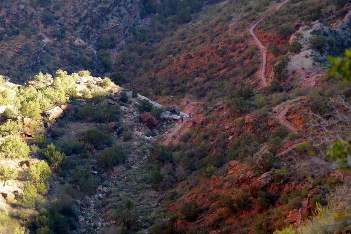
You could see quite a bit of the trail from the lower tunnel. It was mostly in the shade and was more of a smooth, gradual decent.
DSCF1419

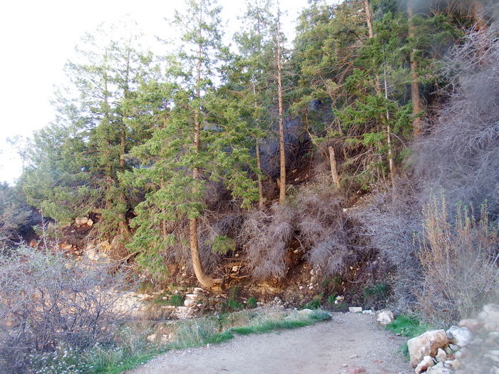
We kept marveling at the way the trees grew out of the side of the canyon wall. Littlest took this shot on the way back up the Bright Angel Trail.
IMGP7805

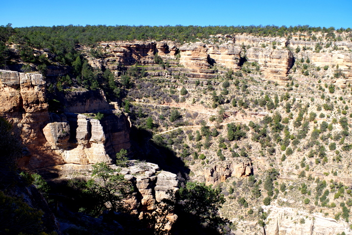
We were racing the sun to get out of the canyon. We didn’t have too much sun. We made better time on this trail. I think it only took us a little over an hour to do it. I can see why it’s the Grand Canyon’s most popular trail. We would have liked to have been able to hike more of Bright Angel, but we had an extremely full day planned and we were running out of time to get everything done.

The third trail we hiked was some of the Rim Trail. This trail will take you from the Grand Canyon Village all the way to Hermit’s Rest and is the South Rim’s only above-rim hiking trail. We hiked this trail between Hopi point and Mohave Point (just shy of a mile) instead of waiting for the shuttle bus. It was a nice flat-ish hike that stayed right by the canyon edge. We enjoyed it and if we’d had another full day to spend at the GCNP we would’ve hiked some more of the rim trail.

We also did an Astronomy Ranger Walk. It was one of my favorite things we did while at the GCNP. We met Ranger Mike in front of the Visitor Center at 8PM and he took us on an hour long walk along the rim of the canyon where we saw the brightest, best Milky Way we’ve ever seen. We learned about stars and planets and we got to hear some very cool stories about the park from a Ranger who’s worked there for over twenty years. Ranger Mike had the best laser pointer I’ve ever seen. All of the boys (all four of them) immediately wanted a laser pointer like Ranger Mike’s.
DSCF1326

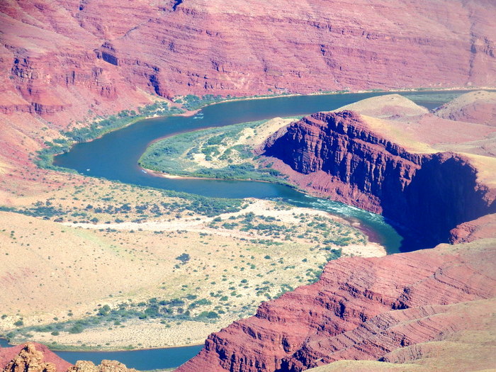
The Colorado River looked very different on the east side than the west side. Above you can see the pretty blue water of the east side.
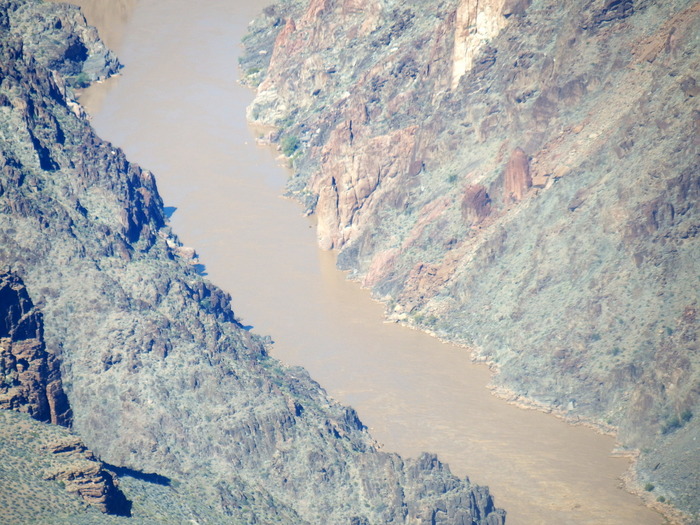
DSCF1440

And…here’s the murky, muddy water of the west side. Big difference, right?
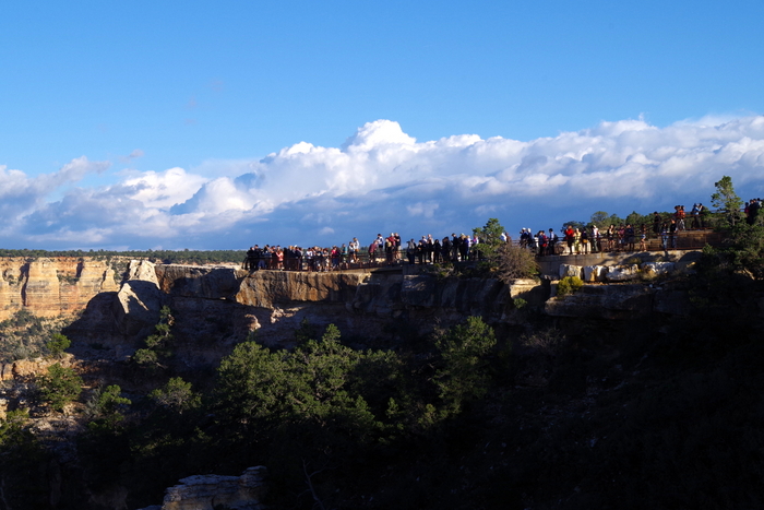
IMGP7649

This was the busiest park we’ve been to so far. There were tons of people everywhere. And 90% of them weren’t speaking English. Maybe that’s just an off season thing?
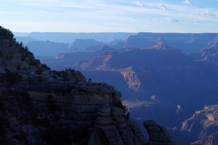
IMGP7650

So many of the people we saw were climbing out as far as they could to the edge of the canyon for a selfie. I’m really surprised we didn’t see anyone fall.

Are you wondering where the pictures of the flowers are? Y’all know how I am about flowers…
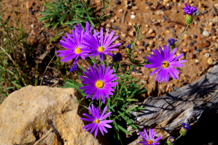
IMGP7621

I realize they’re weeds, but I couldn’t pass up the bright purple.
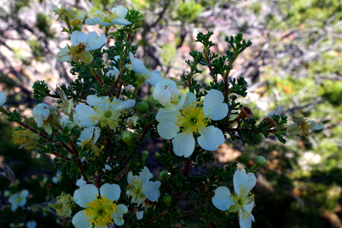
IMGP7609

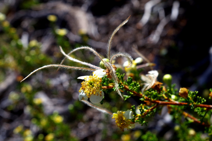
These are Mexican Cliffroses.

IMGP7620

The Mexican Cliffrose does something very different when it goes to seed. Check out those feathery seeds! So cool!
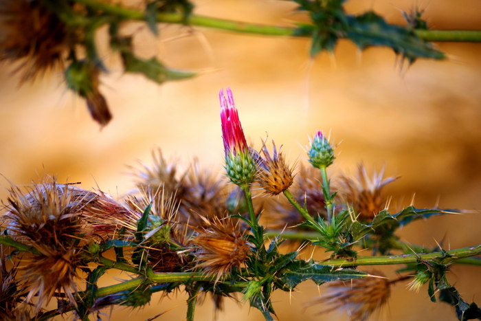
IMGP7791

Yup, it’s another weed, but I really liked the bright pink of the bud with the brown and all of those thorns.

We saw tons of wildlife at GCNP. The Dude (our middle son) is going to start doing Wildlife Watch posts so I’ll let him tell you about the wildlife we saw.

The boys ended up with the GCNP badge, a Paleontology badge, and an Astronomy patch.

I like to keep it real for y’all so I’m going to be very honest here. The Grand Canyon National Park will probably never be on my top ten list of National Parks. It was big…it had nice views…but it was a lot of the same view for me. We felt like we couldn’t really immerse ourselves in the park. Maybe it was all the hype…maybe we were expecting more? It’s on pretty much everyone’s bucket list for a reason and you should go see it at least once. We do plan on visiting the North Rim eventually. We enjoyed the view, but if we ever go back it will be to hike into the canyon and stay overnight at Phantom Ranch before hiking out.

See y’all down the road!