Tag: fulltime travel

The All-American Scenic Byway

The All-American Scenic Byway

Hey Guys!! While we were staying in the Torrey, UT area we stayed right at the beginning of Highway 12…also known as The All-American Road Scenic Byway. With a name like that, we couldn’t help but explore at least some of it! The entire scenic byway is 124 miles with sooo many stops, hikes, and scenic backway roads that lead off to even more adventures.

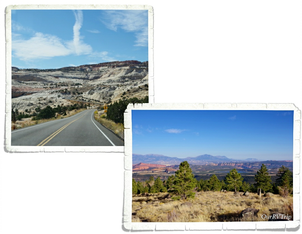
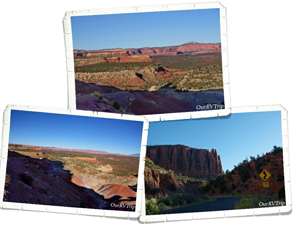
All along highway 12 are scenic pulloffs to some absolutely stunning panoramic vistas.

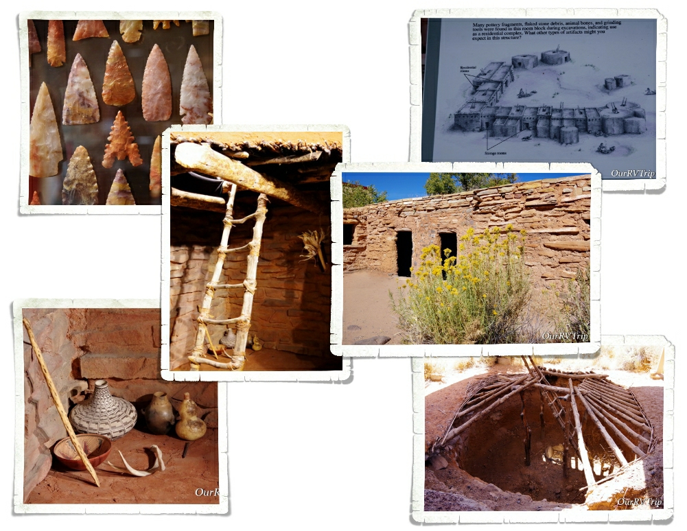
You’ll also find three State Parks spaced out along highway 12. We stopped at one of them during our day of exploring. Anasazi State Park Museum sits at the site of an Ancestral Puebloan community that was used between 1050 to 1200 AD. Most of the site has been left unexcavated, but they have uncovered ninety-seven rooms along with several pit structures. There is a small replica (that you can explore) of what some of the structures would have looked like when the Ancestral Puebloan people were there. We spent a couple of hours checking this small State Park out.

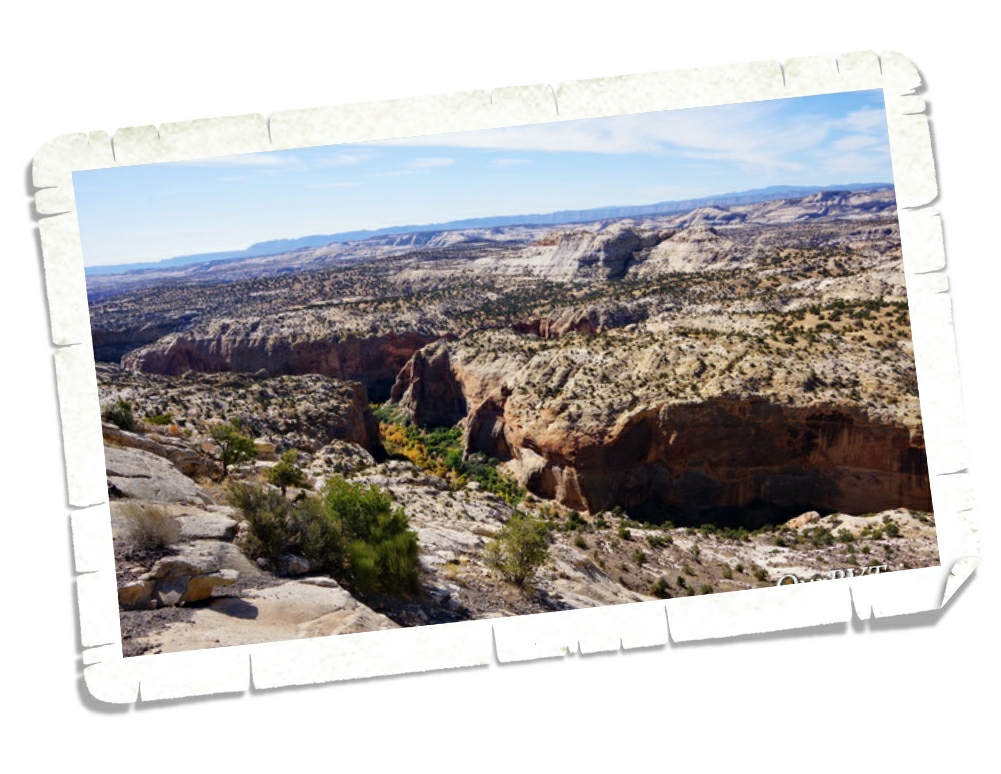
One of the best…maybe the best… section of The All-American Road Scenic Byway is what they refer to as The Hogsback. This is the part of the highway that follows the thin razorback ridge of a mesa with steep drop offs on each side of the highway. Luckily, they put in a nice wide pulloff right at the top where you can get out of your vehicle and ogle the breathtaking views. I think I must have taken twenty pictures of just this pulloff alone.

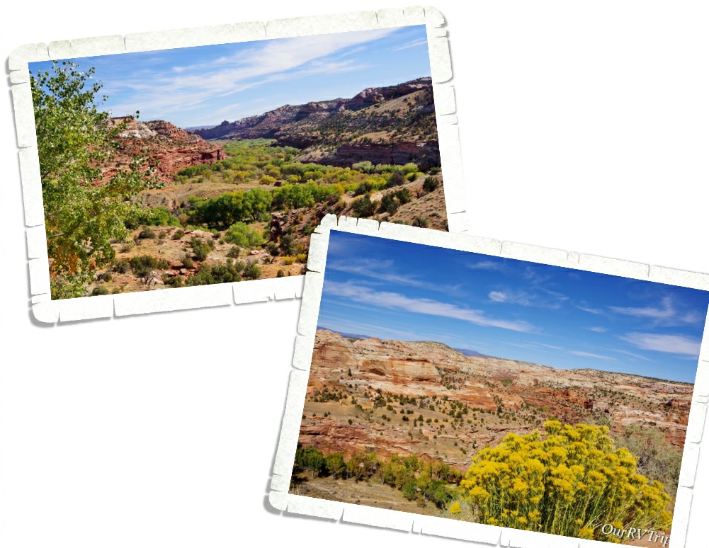
When I did my research on places to stop and things to see on highway 12, one place kept coming up. Kiva Koffeehouse. Everyone said to stop for a snack and soak in the view…Guys, they weren’t lying. The view here was spectacular and the food was super fresh and tasty! We sat outside while we ate and the picture on the left was our lunch view. Then we drove around the corner and ran into the view in the right picture. And for probably the 100th time that day we all stood there saying wow!

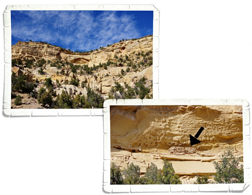
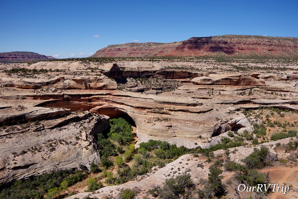
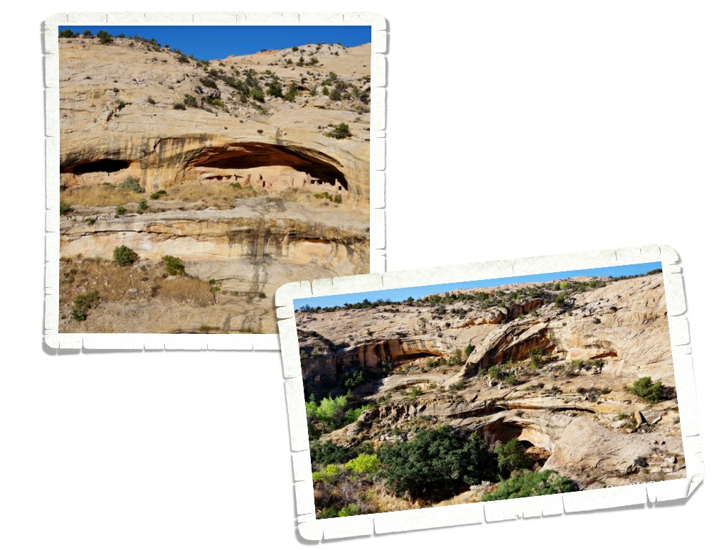
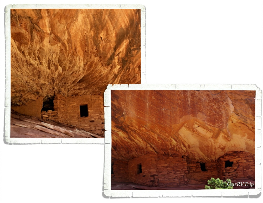
Ancestral Puebloans used this area long before highway 12 was built. If you look closely, you can see the upper valley granaries still stored. A granary is where food was stored to keep it safe. They would wall up the area to keep animals and other people from getting to their storage. If you don’t know where to look, I’ve zoomed in and put an arrow pointing to the granary. It really blends in with the cliff side.

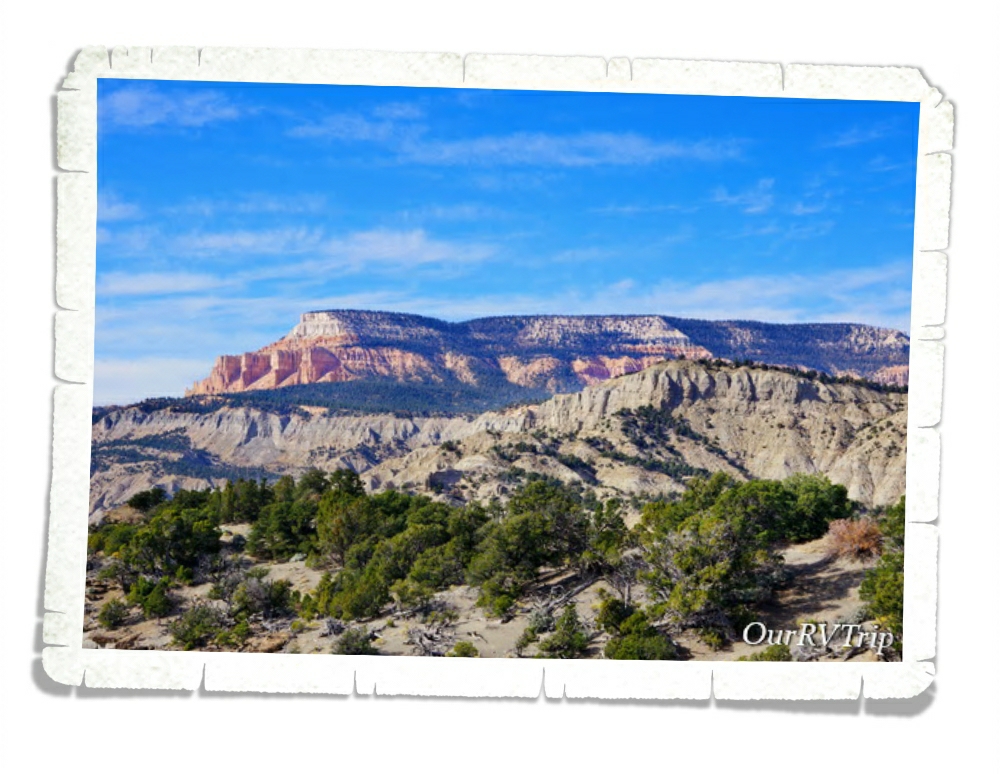
We made it all the way to Powell Point before we turned around. At Powell Point you can see the very topmost layer of the Colorado Plateau’s Grand Staircase. You can also see this same layer at Bryce Canyon NP.

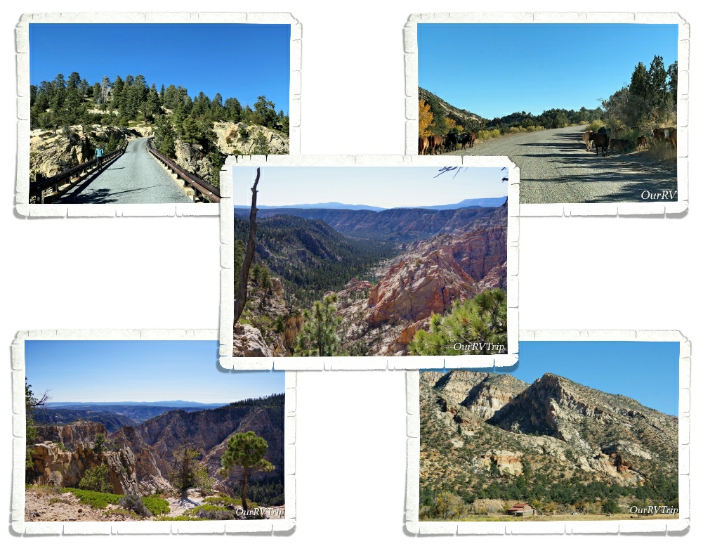
On a different day we went back to highway 12 to tackle the scenic backway known as Hells Backbone. This is a thirty-eight mile dirt road built by the CCC to connect two mountain towns. So many of the reviews I read about this road kept saying how dangerous it is and under the wrong circumstances, I can see how it would be dangerous. You’d definitely want dry weather and no snow or ice on the road, but Hells Backbone is a great short scenic drive. Just watch out for the cows along the road (upper right picture).

We still had some light left, so we headed over to the Burr Trail Scenic Backway. Yup…another scenic trail! Ha! Burr Trail started out as a cattle trail to get cattle from their summer grazing pastures to their winter ones. We drove to the end of the paved part and found the view above. Not a bad view of the Circle Cliffs with the Henry Mountains in the background.

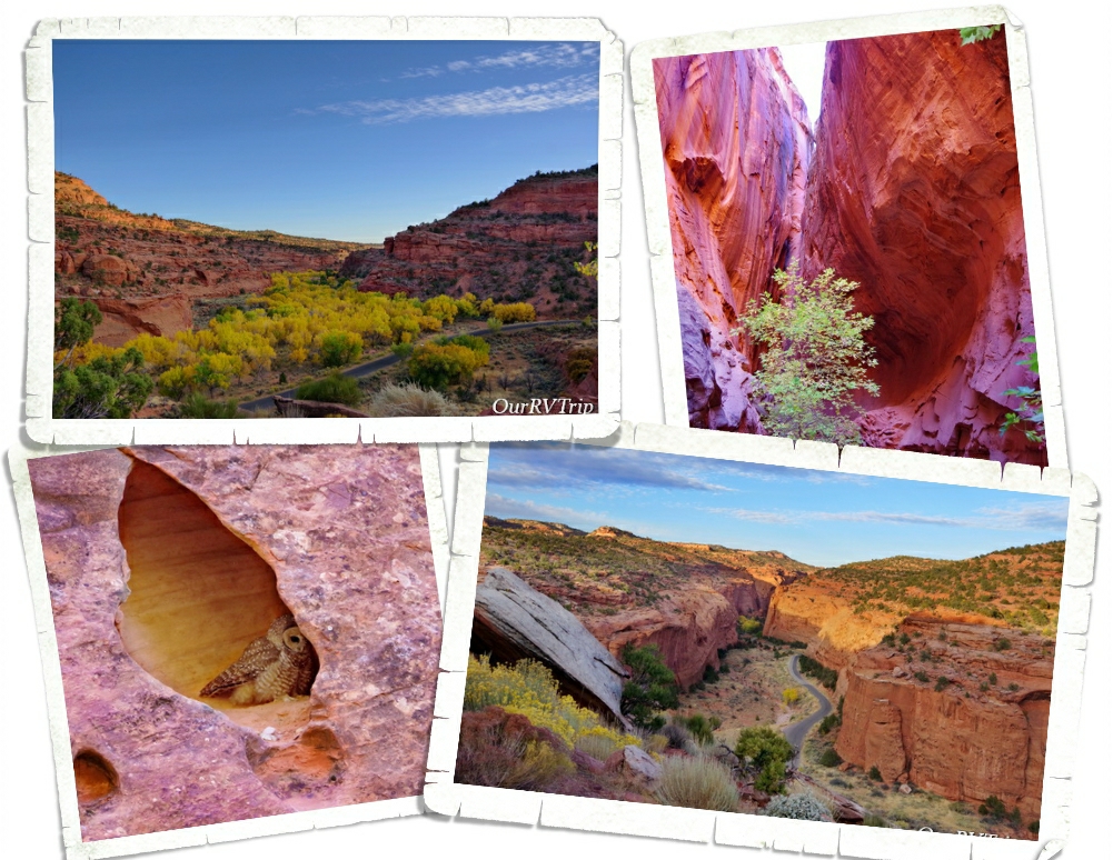
On the way back out of the Burr Trail, we stopped at a pulloff that led to a deep cleft in the side of the canyon wall. When we walked up to the cleft, there was a family there with two girls who were singing songs from The Sound of Music and Guys…the acoustics in this cleft were amazing! The girls sounded wonderful. While we were chatting with the family, a small owl flew out of a nearby tree, floated right over our heads, and landed in a little alcove in the canyon wall. It took us all by surprise! It was a really cool experience.

Hells Backbone Road and Anasazi State Park Museum are actually part of a bigger National Monument. Grand Staircase-Escalante National Monument is divided into three different units and spans across close to one million acres. Besides the fact that this is one huge National Monument, the area within it is the last place in the US to have been mapped. We explored some of this park from Torrey and some from our next stop, Panguitch…so stay tuned for more on this amazing National Monument!

I have one more post for our time in Torrey! We’re going to need a vacation once we finish with Utah so we can get some rest… There’s so much to see and do here.

See y’all down the road!

#NationalParkTour

A Day of Monuments

A Day of Monuments

Hey Guys! Since we’re on a National Park Tour we decided to cram three National Monuments into one very long day. Three. I’m not sure that was one of our better ideas…but we did it and we all survived…barely. Ha!

Our first stop was in the Shash Jaa Unit of Bears Ears National Monument. Bears Ears is made up of two different units and is bursting with ancestral dwellings, rock art, and amazing rock formations. The whole National Monument is contained within about 228,000 acres. The Shash Jaa Unit has some incredible cliff dwellings tucked into the sides of cliffs and in caves.

Bears Ears NM is so big…and we were trying to squish three different National Monuments into one day…so we had to pick and choose what we made time for during this visit. My main interest was a place I’d found out about several years ago…House on Fire. The trick is to get there during the right time of day so that the sun bounces off the canyon floor and hits the cliff dwelling giving it a fiery glow. We got there too early and joined the small group who were also there to see the phenomenon of House on Fire. While we waited I took pictures from several angles at several different times. I took some with my good camera…I took some with my phone camera…I took some up-close…far away… You get the point. I was covering all of my bases trying to capture the amazing effect I’d seen on the interwebs. I got it! I had several different pictures that I deemed worthy. And, honestly, my phone camera picked up the effect just as good as my expensive camera.

Bears Ears National Monument is a newer National Park. There’s not an official visitor center yet. It seemed to us that the area BLM Rangers and National Park Service Rangers were all kind of sharing the stewardship of this particular park. We hope to one day go back and explore more of this amazing park. BTW…Bears Ears NM is named for the two towering buttes that stand out against the surrounding landscape. You can see them in the picture on the right.

Natural Bridges National Monument was our second stop of the day. This might be a good time to tell you the difference between an arch and a natural bridge. An arch has to have an opening of three feet and is the remnants of geological stone formations such as fins, ridges, or rock cliffs. A natural bridge is formed when running water cuts through a canyon wall. Natural bridges are actually more rare than arches. Another noteworthy difference is that bridges tend to be lower in canyons while arches are usually higher up and easier to spot. Both are formed from different types of erosional forces.

Natural Bridges National Monument is the home to three of the world’s largest natural bridges and all of them are within the same canyon. Sipapu Bridge is actually taller than the National Capitol Building. There are short but steep hikes down to each of the three bridges. You can see them from some well placed viewpoints as well. We’d already done some hiking this day and the boys were starting to make noise about lunch, so we opted to gaze at the natural bridges from afar instead of hiking down to each of them.

Our last stop of the day was Hovenweep National Monument. This National Monument tells the story (or at least what we know of the story) of a group now known as the Ancestral Puebloan people. There have been people living in and around Little Ruin Canyon for thousands of years. They started out as hunter/gatherers and somewhere around AD 900, settlements began appearing along the cliff walls and around the top of the canyon. In the 1200s, the Ancestral Puebloans started adding pit houses, kivas, and pueblos to the community that was now around 2,500 members strong.

Most of the ruins you can see standing today were built in the mid to late 1200s. This little community was just one in a whole system of settlements. Each community was a days walk to the next community. There’s a bit of a puzzle as to why so many stone towers were built in this particular location and why they were placed in sometimes precarious positions along the canyon rim or within the canyon. No one knows why the Ancestral Puebloan people seemed to suddenly disappear or why they left or even where they went.

We’ve always enjoyed learning about our country’s history. Some of our favorite National Park Units tell the story of the first people to call our country home. We had several great conversations as we walked through these ancient dwellings. Where did they go…why did they leave…why did they build the towers? Sometimes we leave a National Park with more questions than when we got there and that’s ok. One of the reasons we go to National Parks is to learn and sometimes you have to learn what questions to ask before you can find the answer.

Well, Guys…I think I’m going to hit the pause button again on the Moab area adventures. I’ve got more to share with you so stay tuned!

See y’all down the road!

#NationalParkTour