Tag: foodie

Badlands, Bison and Burgers

Badlands, Bison and Burgers

Hey Guys! When I planned this loop I gave us two weeks in Wall, SD to explore Badlands National Park and the Minuteman Missile National Historic Park. After reading that most people just drive through Badlands on their way to or from somewhere else, I wondered if I’d made a mistake by giving us so much time in one spot for just these two National Park Units. I almost changed it to one week. I’m so glad I didn’t…we had such a good time exploring Badlands NP!!

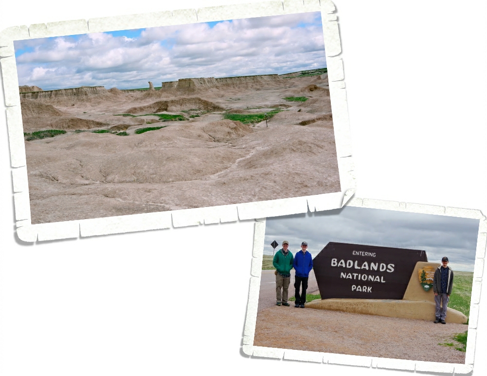
Badlands National Park protects 244,000 acres of buttes, canyons, pinnacles, spires and grasslands along with one of the world’s richest fossil beds. For thousands of years the Lakota people have called this area Mako Sica which means land bad and I can see why. Between the clay that gets slick and sticky when wet to the jagged canyons…along with the brutally cold and windy winters to the amazingly hot and dry summers, this land was difficult to pass through. Add to that the lack of year round drinkable water…living in the badlands was pretty much impossible.

Archaeologists have found evidence of over 300 ancient campsites…some dating back to 12,000 years. It is believed that these campsites were just temporary camps for hunters as they traveled through the area.

It wasn’t until 1862 when President Lincoln signed the Homestead Act into law that pioneers, desperate to have a chance at a new life, started trying to build year round homes in the Badlands area. Thanks to the Homestead Act, a US citizen could claim a 160 acre parcel of land out west. All they had to do was fill out an application, live and work the land for five years and then file for a deed within seven years. In 1907 with the completion of the Milwaukee Railroad through the White River Valley, homesteaders poured into the Badlands area to take advantage of the Homestead Act. With little to no water and soil not fit to farm on, most of the homesteads became “Starvation Claims” and were abandoned or sold. The Stock Raising Homestead Act of 1916 turned things around though…this Act promised 640 acres of land for ranching purposes and lowered the time pioneers had to live on the land down to three years instead of five. Ranching turned out to be better and today the ranches are measured in thousands of acres instead of 160 or 640 acre plots. The unpredictable land and weather still test the resolve of the ranchers pretty much like it did the old homesteaders of the past, but now there are machines that help with the hardships of working and living in the Badlands area.

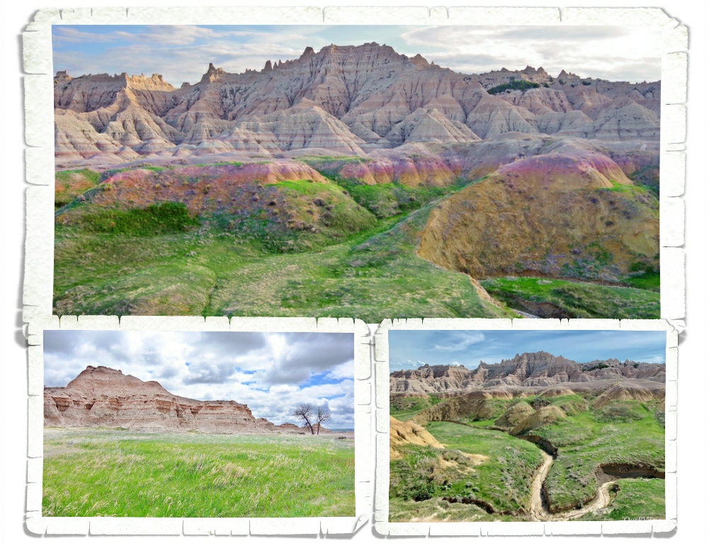
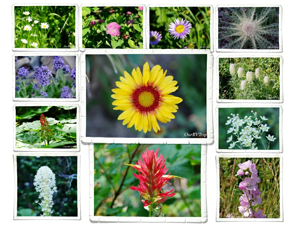
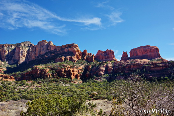
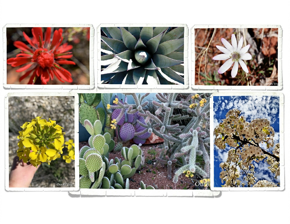
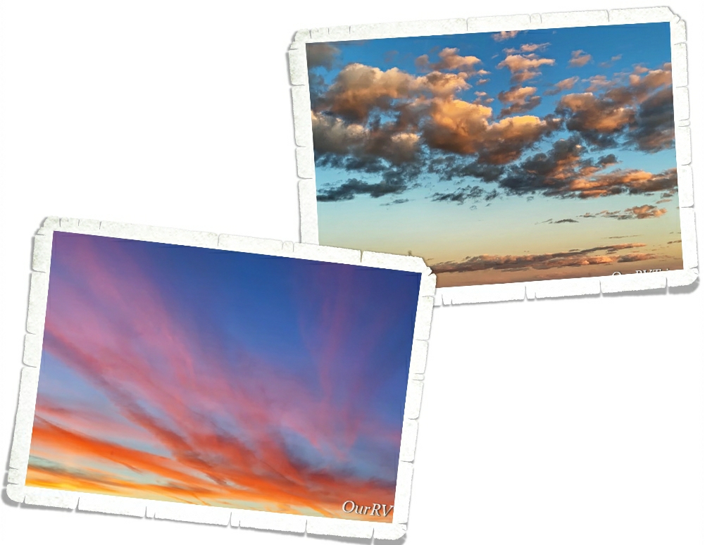
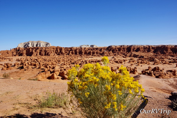
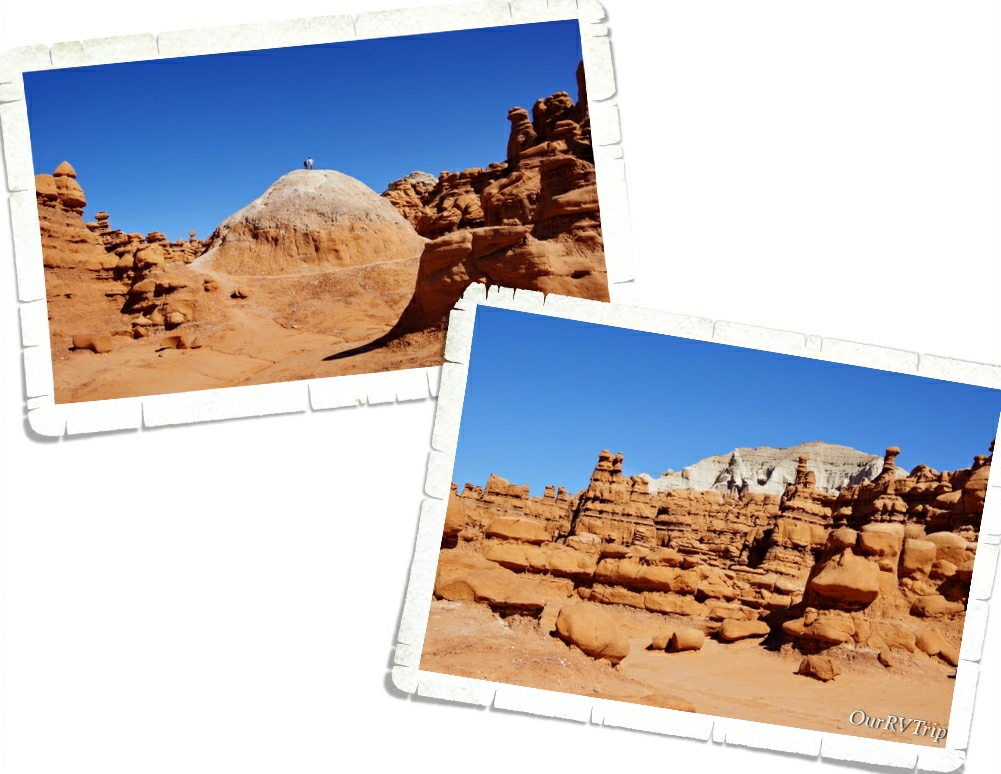
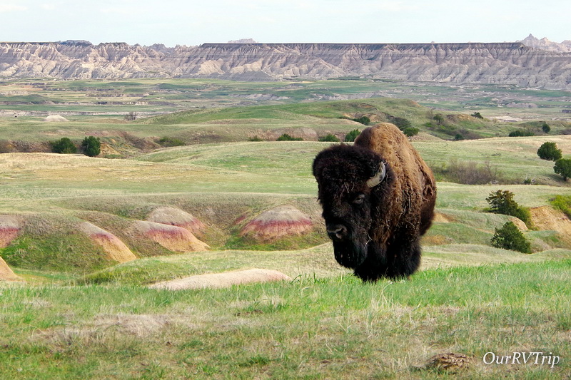
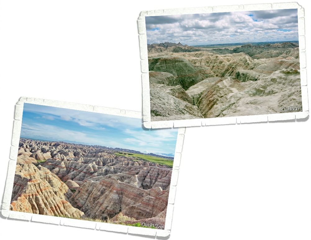
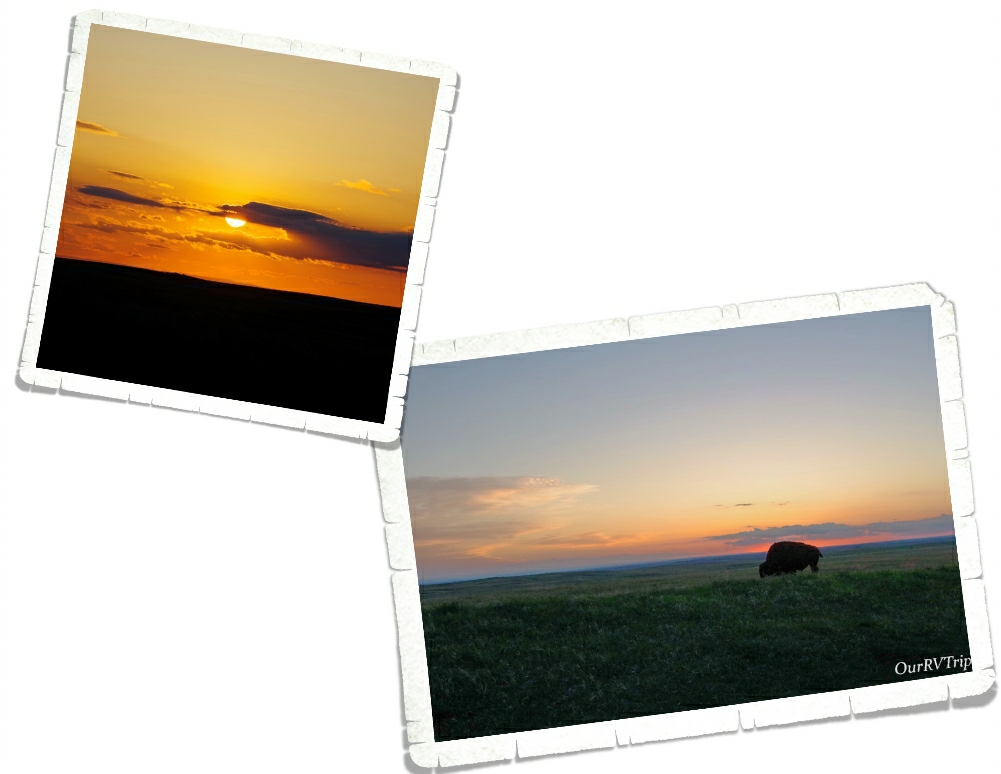
Badlands National Park protects one of the largest mixed grass prairies in the US and it blends so beautifully with the ravaged land that’s been eroded into buttes, pinnacles, spires and canyons. The erosion has uncovered a colorful…and bizarre landscape that’s so picturesque it’s hard to believe your own eyes.

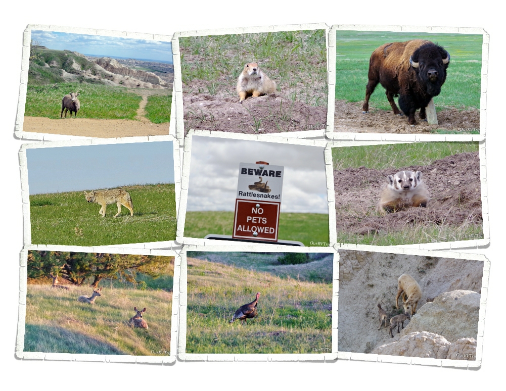
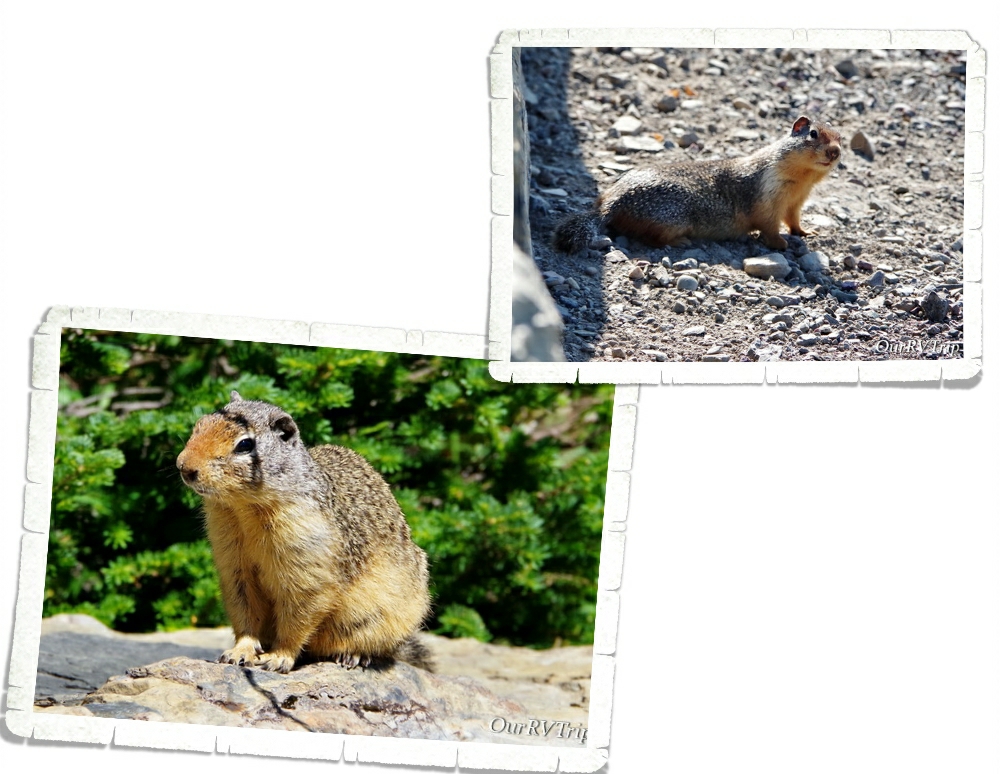
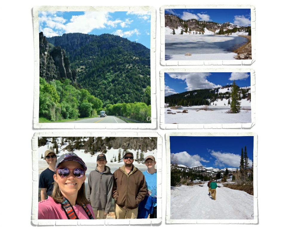
Guys, we saw soooo much wildlife in this park!! Most of it was found on the Sage Creek Rim Road…the sheep we found all over the park…the ones with the babies liked to stay up higher on the rock formations and could be seen at several different spots. We really wanted to see some baby bison, but all of the mammas and babies were in the middle of the grasslands where the roads didn’t go.

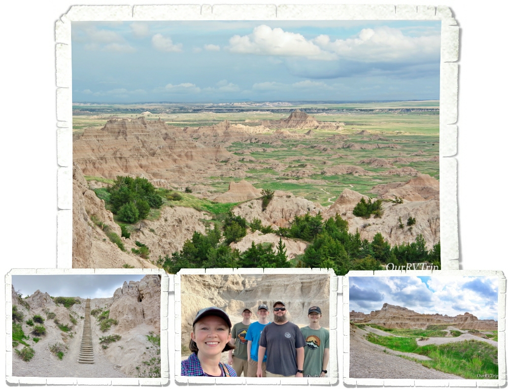
We didn’t do many hikes while we were at Badlands NP. There really aren’t too terribly many hikes to do, but we did one called the Notch Trail. It’s not a long trail (1.5 miles roundtrip), but you get to walk through a scenic canyon then climb a wooden ladder right up the side of the canyon wall! There’s nothing too hard about this hike and it ends in a spectacular view.

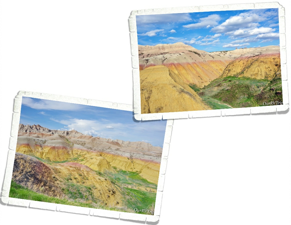
Personally, my favorite part of the park is the Yellow Mound area. There’s a pull off…it’s really just a wide spot in the road…that has the best views of the yellow mounds! There’s a place down the road from the Yellow Mounds Overlook that’s wide enough for your car to safely pull to the side at 43.84947914, -102.21353146 where I took the pics above.

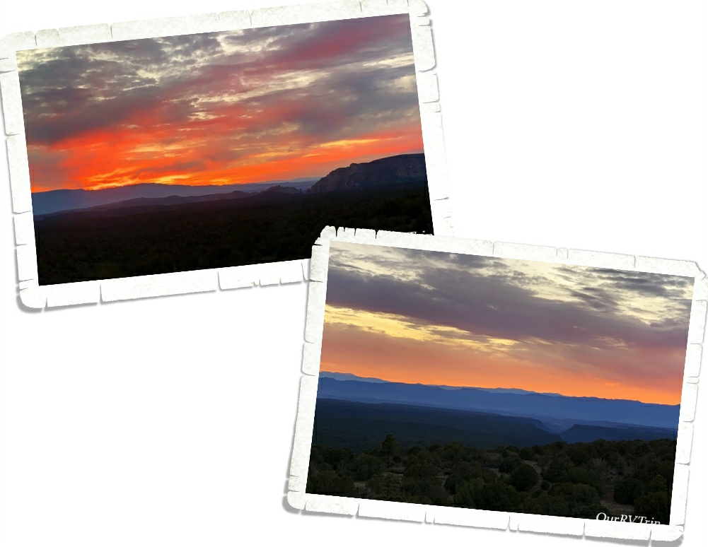
There’s a 39 mile scenic drive with 16 pull-offs for scenic views…most people will spend will spend less than an hour in Badlands NP, driving the scenic drive on their way through the area from one destination to another. Slow down and stretch your legs on one of the short hikes or drive down a bit of the Sage Creek Rim Road and you’ll find out just how breath taking the Bad Lands can be.

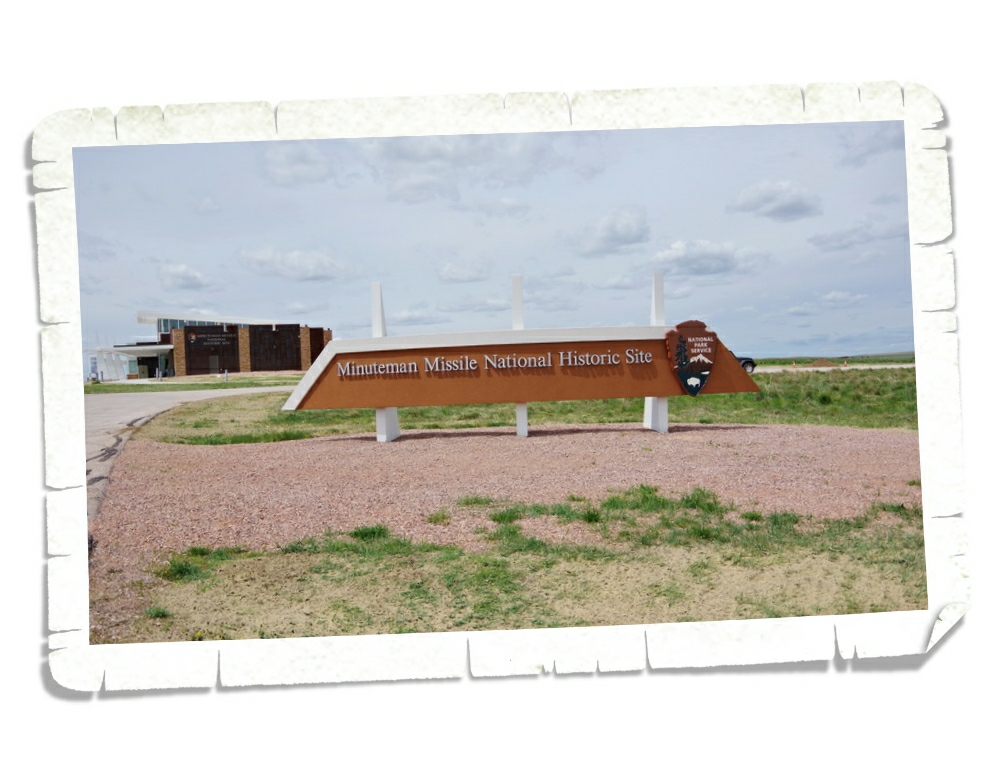
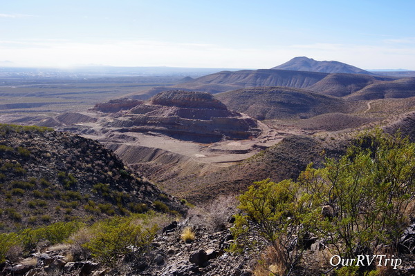
The other National Park Unit we visited was the Minuteman Missile National Historic Site. The Minuteman Missile NHS preserves two former Minuteman Missile facilities (Delta-01 Launch Control Facility & Delta-09 Launch Facility Missile Silo). You need to reserve a Ranger led tour to see Delta-01 but you can drive out to Delta-09 and look around on your own. We missed out on tour tickets due to the whole pandem thing.

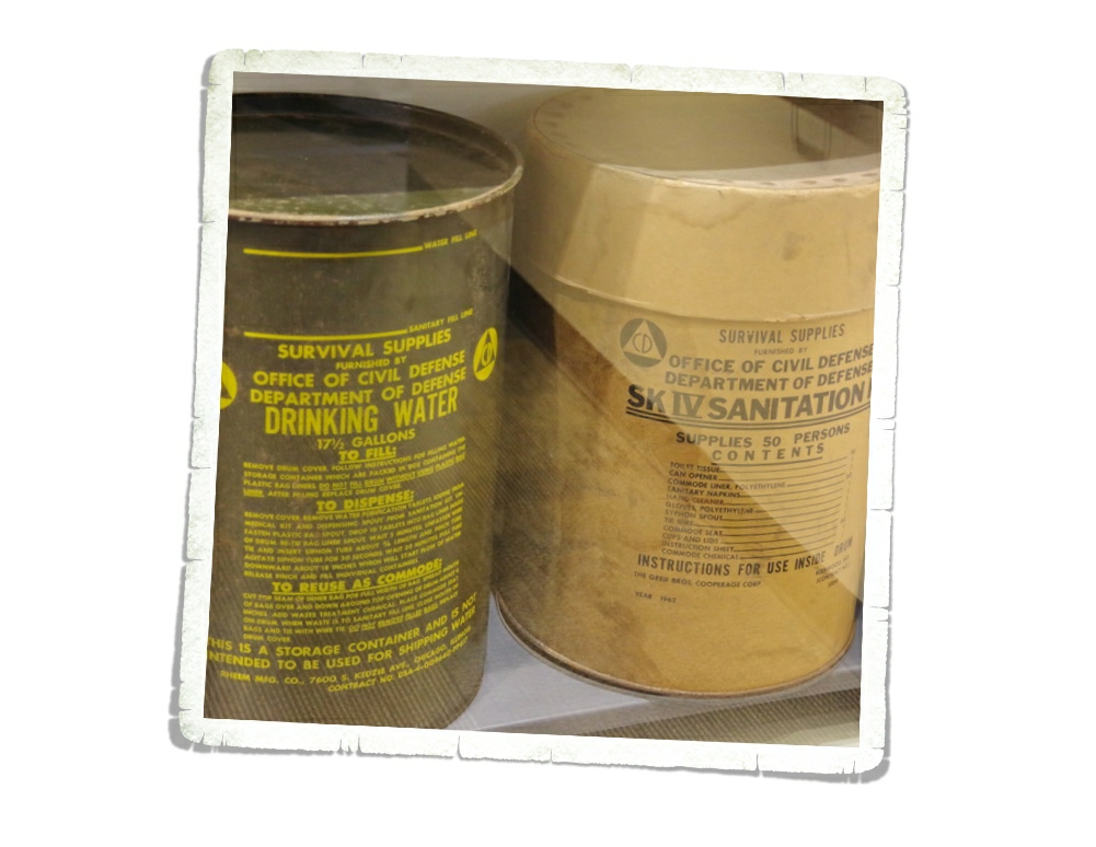
The Cold War: duck & Cover drills in school, Sputnik, fallout shelters, the Iron Curtain… The Cold War was primarily fought with politics, economics, indirect military confrontation and MAD (Mutually Assured Destruction). Our nation’s backyards became the frontline of an unwinnable war as the government hid 15 Minuteman II launch control centers with 1000 missiles that covered 13,500 sq. miles…all hidden in plain sight amongst the peaceful rolling hills of South Dakota.

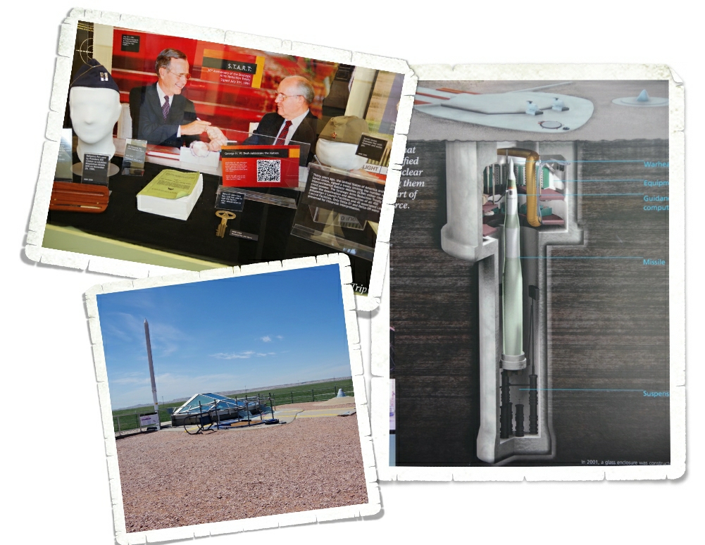
Minuteman Missile National Historic Park is the first National Park in the world that is dedicated to commemorating the events of the Cold War that led to fear and distrust and a nuclear arms race between the US and the Soviet Union. Two countries built up their nuclear arsenals so that each could destroy the other. There would be no winner so no one would start the fight.

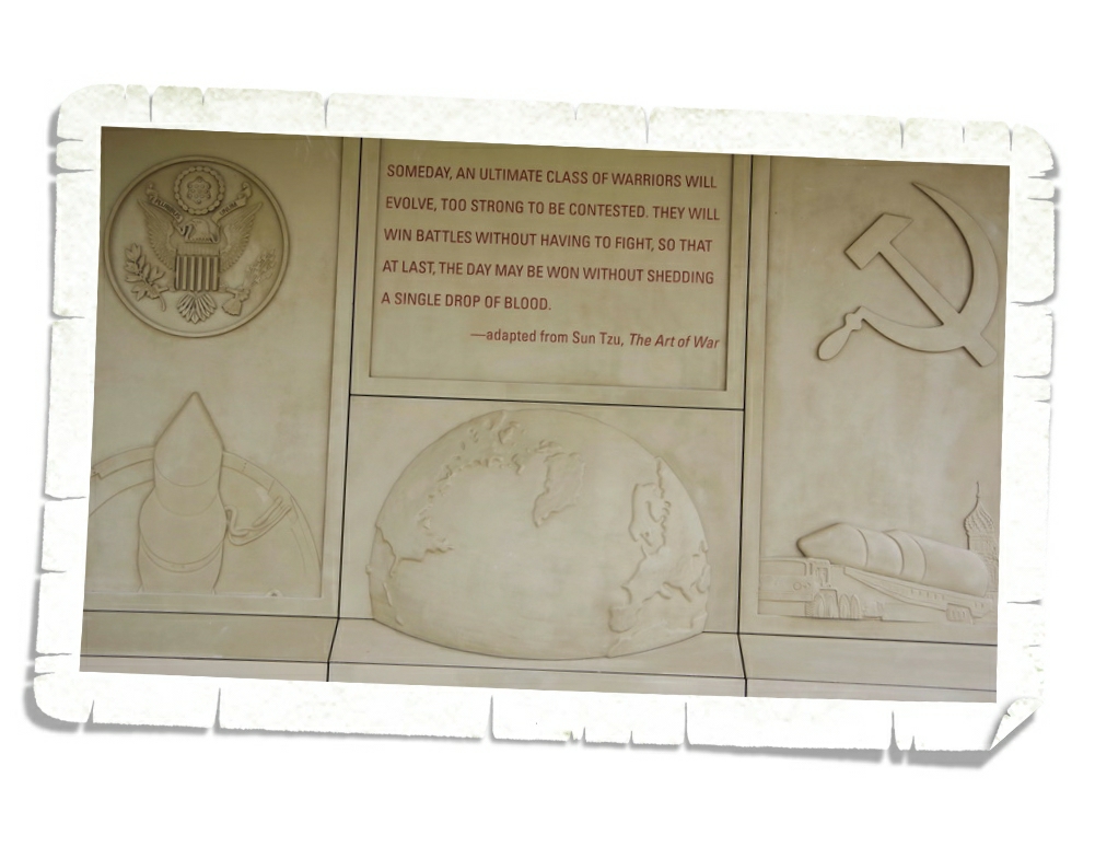
“Our arms must be mighty, ready for instant action, so that no potential aggressor may be tempted to risk his own destruction.” ~President Eisenhower

The power to destroy the world was hidden in plain sight, ready to be used in a seconds notice. Twenty-four hours a day/ seven days a week/ three hundred and sixty-five days a year for thirty years.

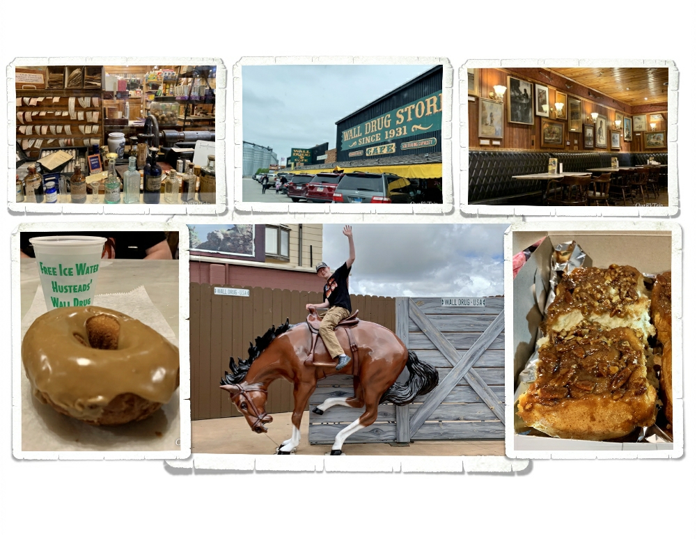
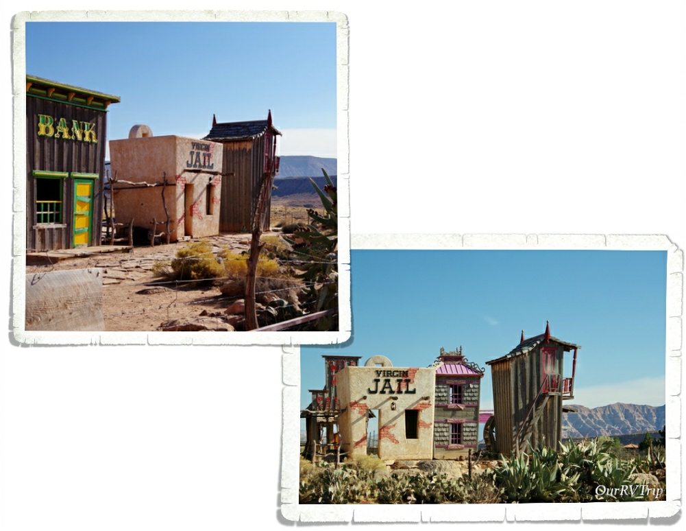
Welcome to Wall Drug. Guys, this place is crazy…I’ve never seen so many people show up every single day just to walk through a souvenir shop. We stayed at the RV park right down the road from Wall Drug so we got to watch the daily crazy as people started showing up by 7am to stand in line for the donuts and sticky buns…and the crowds never let up. It was busy every day all day the entire two weeks we were there! I get it though…I do. We went several times to walk around and look at the art on the wall or peruse all of the souvenirs. They have absolutely anything you could want as a souvenir… and if I’d known how sparse the selection would be at Custer…I would totally have gotten all of my South Dakota souvenirs at Wall Drug.

Wall Drug has been run by the Hustead family since 1931 when they took a leap of faith and bought Wall Drug. The town of Wall was tiny and mostly populated by poor farmers who were struggling due to the Great Depression or drought. Wall was a blip on the dusty road with no reason to stop and spend some time. The family decided to give it five years…if they couldn’t make it work after five years, they’d leave. The summer of 1936 was hot and dry and that was when they figured out how to entice people to the store…free ice cold water. It worked and helped make the store the phenomenon it is today…where…you can still get a cup of free ice water. You really need to see Wall Drug to appreciate it for what it is. Stop in and get a free ice water and snag yourself freshly made maple donut, then spend some time learning the history of the store. It really is a true American Dream come true.

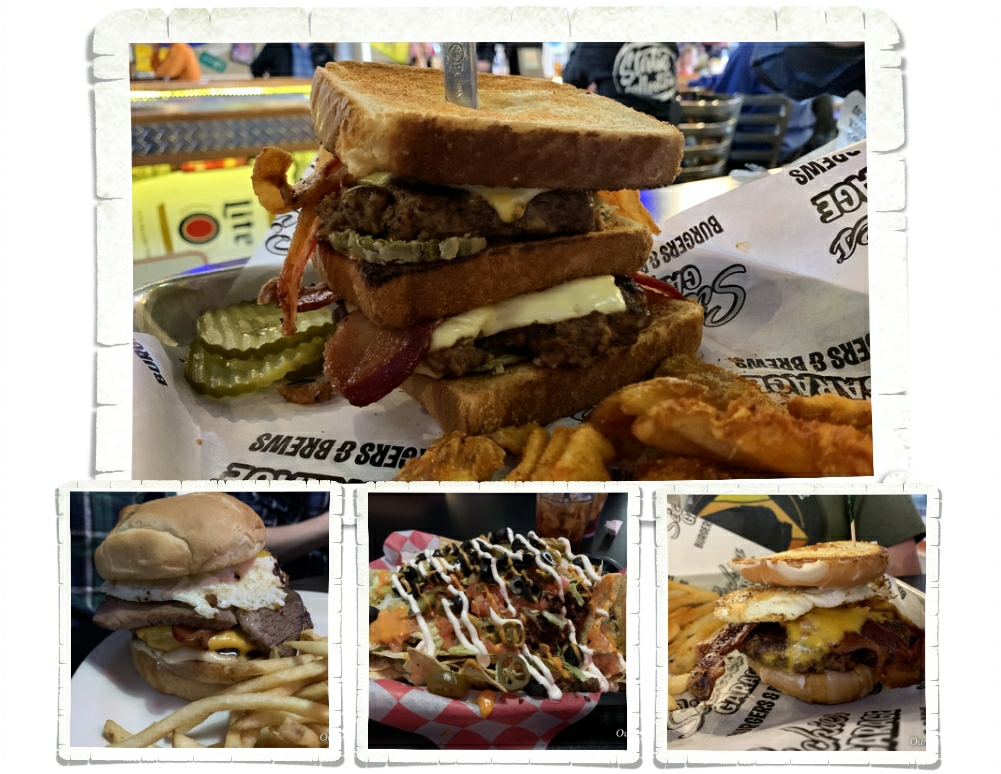
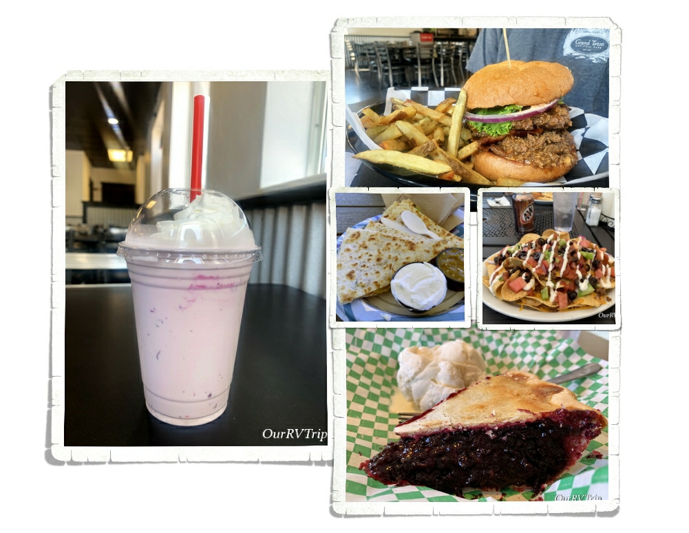
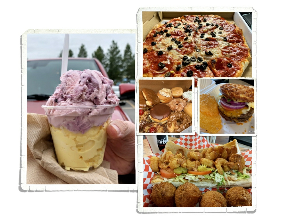
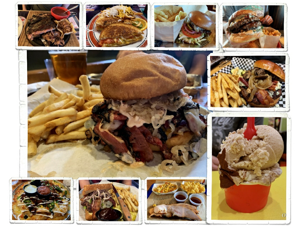
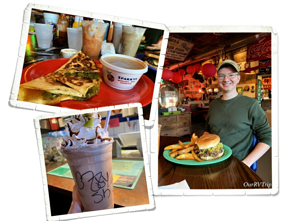
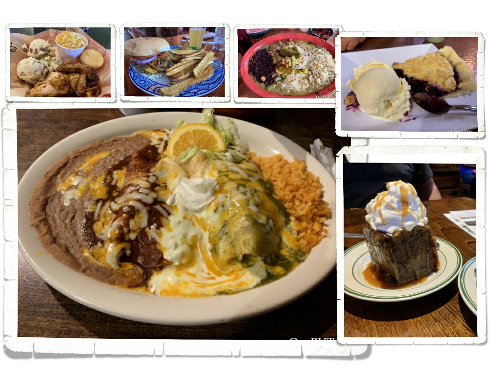
Wall, SD is a pretty small town, but there’s still some foodies to be found. We found a place called Red Rock Café and Guys…we ate there five times in two weeks. It was fantastic! We also stopped at a place called Sickies Garage in Rapid City when we went to get groceries…it’s another great find…but the star of our time in Wall was definitely Red Rock Café.

Well Guys…that’s all for this stop!

See y’all down the road!

#NationalParkTour

Glacier National Park And A Ranch

Glacier National Park And A Ranch

Hey Guys!! We spent two weeks in West Glacier so we could explore Glacier National Park!

Confession: We didn’t want to like Glacier National Park.

It’s true. For years, we’ve heard so many people say how awesome Glacier NP is. We heard the same things about a couple of other parks that are wildly popular and…well…we’re not too fond of those particular parks. So, when we headed to Glacier, we’d already made up our minds (but tried to stay hopeful) that Glacier was going to be another dud for us. I should tell you here…the entire east side of the park (according to most, the east side is the best side) was closed so that also factored into our feelings that this park was going to be a miss for us.

And honestly, after the first day…we thought maybe we’d been right…that Glacier was a dud for us. Our first day was filled with super grumpy Rangers, so many people we felt like canned sardines, and some pretty spectacular views.

We also saw an alarming number of tourons (tourist+moron) trying to get selfies with wildlife. Guys, don’t be a touron. Just don’t. It’s not cool…wild animals don’t like it…and Ranger’s will have to step in and try to save your life while putting their lives in danger. Please remember to stay 100 yards from bears and wolves and 25 yards from all other wild animals.

The next time we went into the park we decided to head out to Kintla Lake to hopefully get away from the crush of people. We had a relaxing day at the lake with about twenty other people. We just about had the place to ourselves. The boys spent about an hour or so floating around in the glacier fed lake before we headed to Bowman Lake to check it out. Bowman was super crowded so we walked to the edge, got a look, then left. On the way out to the main road we got our first glimpse of a black bear in Glacier NP. It was off the side of the road, up the hill, gorging on berries. He knew we were there (there was a group of us), but couldn’t have cared less. He was more interested in the fresh berry bushes.

The next day, we drove Going To The Sun Road and stopped at all of the stops we could find a parking space. It was ridiculously busy but, we found a spot at a few key pull-offs.

When Glacier National Park was established in 1910 there were over 100 glaciers within the park boundaries. Today, there are 25 active glaciers. So, what makes a glacier a glacier? A glacier forms when an area of snow doesn’t melt over the summer then accumulates layers of snow over the years. Eventually, the bottom layers will compress under the weight of snow and turn to ice. The weight of the snow mass along with some of the yearly melt will cause the bottom layers of ice to become flexible and slick and the snow mass will start to move downhill…becoming a glacier. A glacier has to have enough mass to “flow” downhill under gravity due to it’s own weight.

Most of the trail-heads we wanted to stop at were full by 9am so we found ourselves pulling into any pull-off that had an available spot. That’s how we ended up at the St. Mary Falls trail. We hadn’t planned on doing this hike, but we were there and y’all know I love a good waterfall. We were checking out the trail-head sign when we met a couple of ladies just finishing up so we talked to them about the trail and if it was worth the mileage with the 90­°+ temps. You can see in the picture above that there had been a fire and all of the trees for most of the trail were burned which means…no shade. The ladies who were finishing up insured us that it was worth it so…we headed down our first trail in Glacier NP.

We made it to St. Mary Falls (in the pic above) without any trouble and decided to head on to Virginia Falls. We saw so many small waterfalls along the trail! It was kind of amazing… Now, having said that, y’all know I like to keep it real for you…a couple of us really struggled on the way back to the car. It was right in the heat of the day, it was 93°, there was zero shade or cloud cover and there was a pretty good incline we had to make it up to get back to the car. We had taken our water and we were all wearing hats, but the heat just zapped us. If we were to do this hike again, we would be on the trail by 7am if not earlier to escape the heat of the day. It was a great trail, and I would highly recommend it…just be prepared for the heat and the lack of shade. But Guys, look at the color of that water!! We decided after this hike that maybe…just maybe…Glacier NP was going to be ok.

Speaking of waterfalls… Oh. My. Goodness!! There were so many waterfalls!!

So. Many!

Glacier National Park has a whopping 200 waterfalls scattered throughout the park. You’ll see everything from a trickle making its way down the side of a cliff to a full out gushing beauty. I think I might have taken more pictures of waterfalls than anything else in this park.

The big trail I wanted to get in while we were there was the Highline Trail. The Highline Trail is said to be the one trail in Glacier that you have to do. You start at the Logan Pass Visitor Center. We learned from our friends at the St. Mary Falls trailhead that if we wanted to get a parking spot at Logan Pass, we would need to be there by 7am at the latest. So, we got there at 6am and scored a spot. I wanted to start this trial early because the temps were still brutal and the only shade on this trail is provided by the shadow of the mountain. Starting mid-day, there’s zero shade and I’d made that mistake once…I wasn’t going to do that again.

The Highline Trail begins on the Continental Divide where you follow it for a while. This section of the trail is known as the “Garden Wall” and is roughly 100 feet or more above the Going to the Sun Road which means you get some amazing views right from the beginning of the trail. We started our trek as the sky was starting to lighten up with temps in the high 30s. We froze, but none of us complained. We prefer to hike in the cold rather in the sweltering heat.

About a quarter mile or so from the trail-head you get to the part of the trail that gives anyone with a height issue some problems. In some places along this portion of the trail, the trail is only about four to six feet wide with steep drop-offs on one side. The park has installed a cable for people to use. I noticed a couple of us holding pretty tightly to that cable…this part of the trail seemed pretty tame to me after hiking Angel’s Landing in Zion last year. Until, we met up with a mountain goat. He was coming at us down the narrow trail, but seemed totally unfazed by our presence. He politely got off the trail when he got to us and perched precariously on some rocks along the steep drop-off while we scurried by him.

Remember all of those waterfalls I told you about? Well, you get to hike through the tops of several of them while on the Highline Trail. Between the morning dew and the slick wet rocks and the mud…well, I had a few little moments of panic while going through the waterfalls. None of them were deep. We were all wearing regular hiking shoes and none of us got wet feet or anything, but every time we would walk through one of the waterfalls, I would look down, down, down, and down to how far we would slide if we happened to slip right then. There wasn’t a ledge to catch yourself. This aspect of the trail is the only part that would give me pause about doing it again. But let’s be honest, I’d still do it again…some moments of panic are worth it.

I’ll also confess to you that I did slip and fall on some mud. It wasn’t on a waterfall crossing (thank goodness) but it was in front of several people and on some slippery rocks. It happened so fast I didn’t even know it was happening until I was on the ground with a sharp rock trying to wedge itself somewhere I’d prefer it not be. I had a humongo bruise that lasted three weeks and I messed up my forearm from landing on it (that only lasted a couple of days). Honestly, I think my ego was hurt worse than my body, but it did make me slow down when walking over those slick rock areas and hesitate even more before walking over a waterfall crossing.

We had planned on only going about two or three miles into the hike then turning around. The entire hike is anywhere between 13 and 30 miles depending on how far you go and any trails you take off on that meet up with the Highline Trail. When we got to the two mile point none of us were ready to turn back. When we made it to three miles we could see the switch backs up to the pass and decided to push on to get to the view so, we ended up hiking up to the Haystack Pass. Haystack Pass sits at an elevation of 7,024 feet and has plenty of great rocks to sit on and have a snack.

While three of us decided to hangout at Haystack Pass and watch all of the Colombian Ground Squirrels scurry around (there were so many), two of us headed on down the trail for another half mile or so just to see what they could see. Alex took this picture when he and Jerl explored a bit farther down the trail. We spent about an hour hanging out at the pass before making our way back to Logan Pass.

On our trek back to the trail-head, the crowds started to show up and we had to stop several times to let people pass on the narrow trail. We ended up seeing four different mountain goats and met back up with our mountain goat friend from the morning. He had taken up a spot right by the trail and was posing for all of the paparazzi snapping photos of him.

We also spotted some longhorn sheep. We saw a group of them way up on the hillside chilling out, avoiding the people…but one was romping around right by the trail and seemed a little panicky. He busted out of the trees onto the trail right as I was walking up and we sized each other up for a minute before I started yelling for Jerl and the sheep took off. Ha! I’m not sure which of us (me or the sheep) was more startled to see the other.

We had a great morning on the Highline Trail! We’ve decided it’s on our list of top five hikes and we all agree we would do it again. Between the views and the wildlife, I can see why this trail is so popular.

A couple of the trails we wanted to do were closed due to bear activity. We heard a couple of stories about bears and mauling and stealing backpacks… If you visit Glacier NP make sure you are prepared for bears. Educate yourselves and be bear aware.

OK…let’s talk pretties. I know y’all are here for the pictures of flowers and Glacier National Park did not disappoint. Most of these pictures are from the Highline Trail. I was in flower heaven the entire hike!

And…the foodies! We had our first huckleberry pie and it was pretty darn good! You can find huckleberry flavored everything in the Glacier area and yes, we totally had to try as much as we could. Our faves were the pie, ice cream, and preserves. We also found a great burger place called Mudman and a really tasty Mexican food truck called The Wandering Gringo that we ate at twice!

I guess Glacier National Park is called “Crown of the Continent” for a reason. We had our doubts, but in the end…the park won us over and easily earned a spot on our top ten list. We will definitely go back to explore the east side.

Bonus Park! We had two days to kill in between our Glacier reservations and our Yellowstone reservations so we stayed in Deer Lodge, MT for two nights just to see the Grant-Kohrs Ranch National Historic Site.

Grant-Kohrs Ranch was once the headquarters of a 10 million acre cattle empire. Today, this National Historic Site preserves the history and memory of two of the biggest symbols of the American West…the cowboy with his vast herds of cattle out on the open range. Grant-Kohrs Ranch was founded in 1862 by John Grant, a Canadian fur trader, and then expanded by a cattle baron named Conrad Kohrs. Dwindling bison herds and the growth of eastern cities led to a demand for beef.

Returning Civil War soldiers came back to Texas to find millions of unbranded cattle roaming around. There was too many cows in Texas which made the price of cattle go down to $2 a piece but the quickly growing cities in the north would buy a cow for $30. Nelson Story and his group of twenty-five cowboys made the first cattle drive from the open lands in Texas up to the rich grazing ranges of Montana in 1866.

By 1885, cattle was the most lucrative industry on the High Plains but, it only lasted for three decades. Between a couple of extremely harsh winters and the Homesteaders Act that split up the open range into 160 acre barb-wired plots, the big cattle barons had to find a different way. Grant-Kohrs Ranch NHS helps preserve and tell the story of the Open Range Era. Today, it’s still a working ranch and you can see some cows, horses, chickens, and learn about a chapter of America’s history.

We learned a lot about cowboys and their life on the range. Most cowboys were teenagers who were willing to work long hard days and nights for very little pay. Chuck-wagons like the one above was home for cowboys out on the range. One of these wagons could carry enough food and supplies for ten to fifteen cowboys to live on the range for one month. The chuck wagon was where the cowboys would gather for food, sleep, and companionship.

One of the most memorable things we were able to do while exploring Grant-Kohrs Ranch was try Cowboy Coffee. The volunteer at the Chuck Wagon made up a pot of it the same way the cooks would have made it out on the range. The cooks would get the coffee in the same packages you can see above. Since the coffee came in whole beans, the cook would always ask for a volunteer to grind it all and he never had to ask twice. The cowboy who volunteered to grind up the coffee beans got to keep the sweet surprise hidden in the coffee package…a stick of peppermint. They sell packages of the coffee in the visitor center at the park. It’s from the same company that sold it to the Chuck Wagon cooks way back then for life on the range.

“Cowboys are smaller and less muscular than wielders of ax or pick, but they are as hardy and self-reliant as any man who ever breathed — with bronze, set faces, and keen eyes that look all the world straight in the face without flinching as they flash out from under their broad-brimmed hats. Peril and hardship and years of long toil, broken by weeks of dissipation, draw haggard lines across their eager faces, but never dim their reckless eyes, nor break their bearing of defiant self-confidence…” ~Theordore Roosevelt, 1888

See y’all down the road!

#NationalParkTour

Lava and Mountains

Lava and Mountains

Hey Guys! We stayed in Ketchum, ID for two weeks and had some pretty cool adventures! Originally, before the whole CV 19 thing, we hadn’t planned on being in this area. I couldn’t make it work around getting to the other places we had planned. We’re still bummed to have missed out on some of the other adventures we’d planned, but being able to make it to this area takes some of the sting out of it.

At this time, CV 19 numbers were on the rise again and some states were starting to close back down. In Ketchum and the surrounding areas, face masks were required anytime you were out and couldn’t socially distance or anytime you were in a store. We were worried that we’d have to miss the rest of this travel year.

Because we were worried about National Parks closing back down (some of them were), the first thing we did was go to Craters of the Moon National Monument. There were more people there than I thought there would be, but it was by no means crowded. Pretty much everyone wore a mask when in close proximity to other people.

Craters of the Moon National Monument is a collection of three major lava flows with cinder cones sprinkled here and there created between 15,000 to 20,000 years ago. The NP Monument was created in 1924 and then expanded in 2000. Lava tubes, tree molds, lava rivers, spatter cones…there’s a lot to explore at this National Monument.

You can see some of the cinder cones in the picture above on the left. There are a couple of trails that lead up to two of them where you can look down into them. We were surprised to see snow in one of them since it was close to 90° the day we were there.

We also made it out to see some tree molds. We’ve seen these before and they never cease to amaze us. The lava here didn’t erupt out of volcanoes like Mount St. Helens, but rather oozed out of fissures and occasionally spewed out of vents. A tree mold is made when lava flows through an area with trees. The lava coats the outside of the tree and cools just enough to make a cast or mold of the tree, but the tree inside burns up.

We were surprised to find flowers in an old lava flow. The flowers and trees offered a vibrant pop of color in an otherwise monochromatic landscape.

We spent an entire day trying to soak up as much of the Sawtooth Mountains as we could. We stopped several times to ogle the Salmon River.

Guys, we found some geothermal hot-springs coming right out of the side of the mountain! Right across the road from the river. People have used boulders and rocks in the river to make soaking pools. It was really cool to see. We didn’t have our swimsuits so we didn’t try any. We did walk up to where the water was coming out of the ground and let me tell you…that water comes out HOT!! Wowza!

When we headed out that morning, we had two specific destinations in mind. Both of them are part of Land of the Yankee Fork State Park. The first one was the Bayhorse Ghost Town. Y’all know we love to explore ghost towns. We go to as many as we can. Bayhorse is probably one of the better ones we’ve seen. Tucked back in a narrow, rocky canyon, the old mining town of Bayhorse was built on steep slopes. Only the most determined prospectors ventured here to make a life.

During it’s heyday, the Bayhorse Mining District produced ten million dollars worth of different metals. In the end, a horrible fire and dropping silver prices doomed the town of Bayhorse. For a long time, the town was closed to visitors due to hazardous conditions, but in 2006 Bayhorse became part of the Idaho State Park System and they began to clean it up and make it safe for people to visit. When we arrived we were handed some info pamphlets…one of them was a safety brochure about all of the hazardous minerals still found in the town-site. So, if you go…don’t lick anything or crack any rocks open and you should be just fine. 😉

The second place we were hoping to see that day was the Yankee Fork Gold Dredge…which is another unit of the Land of the Yankee Fork State Park. Yankee Fork is a tributary of the Salmon River. Due to the sever winters, this area was called “Land of the Deep Snows” by the tribes who hunted there. The dredge is 112 feet long and weighs 988 tons. They brought it to the Yankee Fork in pieces starting with the huge pontoons it sits on.

From 1940 to 1952, the dredge worked non-stop. In the end, they’d dredged up over a million dollars in gold. Today, the dredge is one of the best preserved in the lower 48. When we were in Fairbanks, AK we went to Gold Dredge No. 8 and toured it. We found the two dredges to be extremely different. Maybe that was just our novice eyes? There were a few volunteers stationed around the dredge the day we went and they all did an amazing job educating us about the daily workings of the dredge.

After spending an entire day in the car, we had to talk the boys into getting back out the next day for a hike. We tempted them with a trial through an ancient pine forest to Titus Lake. The info we had said this hike was an easy trail with only a 500′ elevation gain. It sounded like it was going to be an easy peasy walk in the park…it wasn’t. When you start your hike at almost 9,000 feet…it doesn’t take much to feel winded. Honestly, I was too busy swooning over the flowers to mind the work. I was in summer wildflower heaven and stopped frequently to take pictures. And breath. The views were spectacular, the flowers were vibrant and the lake was a brilliant emerald color! What more could you ask for?

We celebrated Charlie’s birthday while we were in Ketchum. Our oldest is twenty years old. Twenty! Guys…how is that even possible? I mean, I’m way too young to have a twenty year old, right? He got a new board game called 7 Wonders for his birthday and we love it. It’s quickly become one of our faves.

We went out for some foodies a few times. Surprisingly, we found a bbq place called Smokey Bones that was pretty darn good! Nicholas, of course, had to hit up a pizza place during our lunch date.

I know y’all only come to see the pictures of flowers…that’s why I leave them for the end. You have to make it all the way though the post to see the pretties. Ha!!

We had a great time adventuring in the Ketchum, ID area! We’re a fan!

See y’all down the road!

#NationalParkTour

Killing Time In Utah

Killing Time In Utah

Hey Guys!! Well, the whole Rona thing totally threw a monkey wrench in our grand plans for this summer. Pretty much everything closed down…toilet paper became a hot commodity (go figure)…and it was a struggle to find an RV park that was not only open but also accepting new arrivals.

We threw out all of our previously made plans (the ones that took me months to nail down and reserve) and had to come up with a brand new plan and then hope that things started opening up. For someone who’s an OCD planner…this was a super stressful time.

Disclaimer: I realize that pretty much everyone in the world was going though stressful times at that point…and we’re so grateful that we really weren’t affected other than having to rearrange our plans and struggling to find supplies…but, since this blog is basically my journal…I’m going to focus on our experience. I can’t comment on what other people’s thoughts and feelings were as they were navigating “the new normal”. I can only tell you what our thoughts, feelings, and experience were. I am in no way trying to take away from other people’s hardships.

Now that I have the disclaimer out of the way…let’s move on.

We ended up spending a total of two months hanging out in Utah…killing time…watching the world struggle with the Corona Virus. We didn’t really do much during those two months so I’m going to cover our entire Utah visit in this one post. It won’t be super long…promise.

Our first stop was Fillmore, UT. Originally, we’d planned on visiting Great Basin NP from this stop. That didn’t happen. What did happen was the plumbing in our middle bathroom sink breaking on the way to the RV park and leaking all over the place. Sigh. We were able to find a hardware store that was actually open and had the right parts so Jerl could fix the plumbing. It’s always something, right? We also were able to visit with my (Jennie’s) aunt and uncle while we were there! We hadn’t seen them for a long time so we really loved being able to spend some time with them. **waves at aunt and uncle**

The RV park we stayed at was pretty with nicely manicured grassy areas, a pool and some walking trails close by. We were surprised that it filled in for the weekend since we were right in the middle of everything being shut down. I guess everyone was looking for a reason to get out of the house for a weekend.

We put off getting haircuts the entire two months we were in Arizona. The plan was to get fresh cuts right before we started our jaunt north. I don’t know if you know this…but, it’s hard to get a haircut when all of the salons are closed. Ha! We ended up doing some home haircuts. Well, three of us did. Two of us opted to wait until the professionals were back to work.

The RV park we stayed in was right across the road from this place called Iceberg.

Right. Across. The road.

We were only there for a week…any guess how many times we went to Icebergs? I’m not going to tell you the exact number of times we were at Icebergs, but it was way more than we needed to be. Stress eating at its finest. The struggle is real.

Our second stop in Utah was Brigham City. We stayed there for three weeks while we were trying to figure out what we were going to do. Our second weekend there was National Park Day. We’d planned on going to Golden Spike National Historic Park from this stop…so…we went. The visitor center wasn’t open. I’m still not sure if I’m going to count it since we didn’t get any of our usual souvenir stuff or Junior Ranger badges. We did a couple of hikes and then headed to the spot where the golden spike was driven in to connect the Central Pacific and Union Pacific railroads, completing the transcontinental railroad.

There were a few other families there. We all stayed away from each other while we pretended not to. It was nice to get out of our home-on-wheels and get some dirt under our hiking shoes…but honestly, it was kind of a bummer and a huge reminder of all the yuck that was currently happening in the world. Pass the hand sanitizer…I need to douse everything in it before even thinking about touching it. Someone in one of the other groups kept coughing…I kept moving us away from people…it was a mess. I was a stressed out basket case by the time we got home.

It was during our second week in Brigham City that we went to the grocery store and found these directional signs all over the place. No one was paying any attention to them. We were still trying to find toilet paper, hand sanitizer, tissues, paper towels and cleaning spray. And, meat products were being limited to two. Um, have you ever tried to feed three teenage boys? We were going to the grocery store almost daily just to get enough food.

On a positive note…everything was blooming and there were pretties everywhere! Oh, and…we found some amazingly good raspberry shakes. Who needs to be able to button up their jeans? I like to wear stretchy pants anyway. ;-P Ha!

We were in desperate need of an adventure, but the thought of getting out around a lot of other people wasn’t appealing. So, we headed out to do some scenic driving. We headed up to Bear Lake to see what we could see. On the way there we passed by the road to Tony Grove Lake and decided to go explore it. We got quite a ways up the road before we ran into the snow…and another car that was stuck. We watched then tried to help them. They eventually got out and headed back down the road. We eyed the snow and thought about trying it. We got to about the same spot the previous car had been stuck in and…got stuck. So, back down the road we went too…vowing to try again before we left Utah.

We made it to Bear Lake and was rewarded with some amazing blue water! There was an overlook that offered us a safe place to ogle the view. The restrooms were open and we found some brochures on the area’s attractions. Yes, I doused them all in sanitizer before I looked at them. I made a whole batch of hand sanitizer with 91% alcohol…we had plenty. Those virus germs didn’t stand a chance.

When we drove up to Bear Lake we passed through the town of Logan. We liked it so much that we decided to spend the next month there. It took a week of playing phone tag to snag a spot at pretty much the only decent RV park in the area. I was getting ready to go with plan B when we scored a spot! And Guys, we really love the Logan area.

We spent a month exploring the Logan area and getting to know the community as Utah started to open back up. We played quite a few board games in between working on some projects. Our dryer decided to die one day. Thankfully, Jerl was able to fix it. My aunt and uncle headed up our way the week before Memorial Day to place some flowers on family graves and they stopped by Logan for another visit! It was so good being able to visit with them! **waves again**

We also started the process of printing out our blog into book form. Our blog is really my (Jennie’s) digital journal. I’ve got five years worth of our nomad adventures journaled here on our blog. With everything that was happening in the world, I kept worrying that something would happen and my digital journal would disappear. I know…I’m a worrier. It’s genetic (gives side-eye to her mom). I found a company that will take a blog and print it out into books. I’m doing one book per calendar year and Guys…I’m totally loving them! Plus, it’s just one less thing for me to stress about. I’ll call that a win.

On our last weekend in Logan we drove back up Logan Canyon to Tony Grove lake again. We’d had some pretty warm days and hoped the snow was gone so we could see the lake. We ended up having to hike about a mile in the snow, but we made it to the mostly frozen Tony Grove Lake. We somehow timed it just right. We had the lake to ourselves until we were starting to leave. A couple of other groups showed up…some on snowshoes and some on snowmobiles. It felt so incredibly good to be back out in nature, stretching our legs and working our lungs! I think we were all in need of some fresh air therapy.

People have been visiting Tony Grove Lake since the 1800s. A Logan family (the Thatchers) would go to the lake for six weeks every year with some of their family and friends. The lake became known as Tony Grove Lake because the Thatcher family was known as the “tony’s” which is a Victorian era term for a socialite. Apparently, the Thatchers were the Kardashians of the 1800s. Back when they were having their annual six week camping trips, the area was known for bears and mountain lions. Today, you might see a moose but supposedly, there aren’t any bears or mountain lions left.

Shall we talk foodies?! As Utah started to open up even more…restaurants opened for dine in and we were able to grab a few meals out. Logan isn’t lacking for foodie spots. We found some new faves. One of the surprise spots was a Cajun place! Cajun in Utah? Um, yeah…we were pretty surprised too. But, Guys…it was really good. The owner is from Louisiana and he knows his foodies. If you’re ever in Logan go check out MayMoes Cajun Grill. If you’re looking for a good burger, head to Center Street Grill where you can get yourself a chaffle bun for your burger.

That’s if for our Utah adventures…this time. I have a feeling we’ll eventually be back in the Logan area. Utah ended up being just what we needed during a time of stress and worry.

We’re still on our National Park Tour…so stay tuned.

#nationalparktour

Page, AZ: Take Two

Page, AZ: Take Two

Hey Guys! After two months of sitting still in Camp Verde, AZ…we’re on the move again! I have to admit, it feels very uncertain this time. We’re in the thick of the whole Corona Virus thing and at this point it’s making us second guess and doubt everything we’re doing/not doing.

We’d already called ahead to our next RV Park to make sure it was open and that we would be allowed in. We keep hearing about other fulltime RV families who are struggling to find a place that they can stay. State parks, federal campgrounds, BLM land, and county parks are all closing down and kicking people out. Private parks are starting to either close down or refuse any new arrivals. It’s a stressful time for everyone, but being a nomad has a bit of extra stress to it now. We don’t have a sticks-n-bricks home we can go to and hunker down in until this all blows over. So, for now, we’re moving forward and trying to make due…and not stress too much.

On our way to Page, we passed through the snowy town of Flagstaff and made our way back to the high desert region. It was neat to watch all of the geographical changes that came with that.

This wasn’t our first visit to Page. In fact, we’d been there just a few months before. There are so many things to see and do in Page…some great views and some awesome hikes. I had an entire list of things to see and do while we were back in Page, but due to the virus…pretty much everything was closed.

We usually move spots on Saturdays and then go adventuring on Sundays. Jerl went to the grocery store early Sunday morning to see what we were going to be dealing with on the food/necessities problem that the country had been dealing with. The little grocery store in Camp Verde had been struggling to keep up with it all. We wanted to assess the situation in our new spot to see if we needed to go back to Camp Verde and stay longer. Jerl was surprised to see that pretty much all of the isles were decently full…except the paper isles. He also had the chance to talk to a couple of policemen who were there to protect the delivery truck (I never thought I would be typing that kind of sentence…I mean…police protection for a regular ol’ delivery truck?) Anyway, Jerl asked the police officers if hiking was allowed in Page at that time and they both encouraged us to go have a great hike and get some fresh air…while staying away form anyone that looks sick.

With the police officer’s approval, we headed out to do a little social distancing on a hiking trail. I had a few things on my list that we could hit all in one day and luck would have it…they were all still open. The first spot we hit was the Navajo Bridge. Did you know that there are only seven land bridges across the Colorado River for around 800 miles? Before the Navajo Bridge was built, travelers had to go several hundred miles out of the way to get across the Arizona/Utah border. Can you imagine having to do that with a horse and buggy? That would add weeks to a trip.

Guys, look at the color of that water! We stood on that bridge way longer than we’d planned.

The original bridge opened in 1929 and was called the Grand Canyon Bridge, but in 1990…there was a need for a newer and wider bridge. So now, the old bridge (on the right) is open to pedestrian use only while the new bridge (on the left) is open for everything else. These two bridges are tied in ninth spot for highest bridges in the US.

I knew from my research that California Condors call the area around Page home, but we didn’t expect to actually see any. We found four of them hanging around the Navajo Bridge! Did you know that you can look up the California Condor numbers and find out where they were born and what their family lines are?!

Lonely Dell Ranch and Lees Ferry are both part of the Glenn Canyon National Recreation Area. We had planned on visiting the area the last time we were in Page, but simply ran out of time. I’m so glad we got to visit during our second visit to the area!

For a long time, the Colorado River was a major obstacle while traveling between Utah and Arizona. At one spot, where the Paria River runs into the Colorado River, there’s an area where the cliffs aren’t quite as impassible and the Colorado River isn’t rushing with rapids. It’s here, at this spot where the Utah Territorial Governor, Brigham Young, sent John Lee to set up and operate a ferry.

So, in 1872 John Lee loaded up two of his families and headed out to make a life as a ferryman. Some people say he was sent there to hide from the authorities due to his part in the Mountain Meadow massacre and the slaughter of over one hundred pioneers from Arkansas who were passing through the Utah territory in 1857.

Lee spent the first few years building homes for his family and a ferry to cross the river. Since the area was so remote, the family had to be completely self-reliant. They needed to grow their own food and set up irrigation for not only household use, but to water their crops. There’s still an orchard there that you can walk though and pick some ripe fruit as you’re exploring the ranch. In 1874, the law caught up with Lee and executed him. His wife, Emma, ran the ferry until 1879 when the LDS church bought it from her and sent a new family to run it.

If you go on past the ranch, you can see remnants of the people who once made Lonely Dell Ranch their home. Over the years, LDS members continued to run the ferry and the ranch was expanded to include different families and community members.

The trail goes for quite a ways…but, this wasn’t the trail we’d come for so we headed back after a mile and a half or so. I wish we’d had a few more days to explore here. We would have loved to continue on this trail. The area was gorgeous!

In the early 1900s the gold rush hit southern Utah/northern Arizona and miners ascended on Lees Ferry. One of them was Charles Spencer who led the American Pacer Company. Spencer was more of a salesman than a miner. He hauled tons of equipment up to Lees Ferry. Spencer left the area broke in 1912. He abandoned everything there when left. All that remains of his time there are a couple of stone buildings, part of a steamship and an old boiler.

Today, you can hike up the 4.4 mile Spencer Trail. The trail eventually leads to an old coal mine. This trail climbs over 1,500 feet in less than a mile. It’s steep!

The higher we went on the trail…the better the views got. This was a rough trial…three of us only made it half way up then called it quits. The other two almost made it to the top but the trail got too dicey for them so they turned back. In the group of pictures above, you can see a shot that was taken near the top. If you look closely, you can see the Lonely Dell Ranch.

The last ferry crossing was in 1928 and it ended up sinking…killing three people. Seven months later, the Navajo Bridge opened. Now, the Lees Ferry area is mile zero for launching boat trips down the Colorado into the Grand Canyon. In the summer the beach there is lined with rafting boats and adventurous boaters prepping for trips down the mighty Colorado.

Other than our excursion to Lees Ferry and the Lonely Dell Ranch…we hung out at home. Alex got the National Park version of Monopoly for his birthday and we’ve enjoyed adding it to our collection. When we had to get out to get groceries, we found signs to tell us where to stand for social distancing while standing in line. This time in our world is truly bizarre.

We still made our weekly lunch with one of the boys happen. We got take out then found a scenic view to enjoy some one-on-one time with Nicholas. He, of course, chose pizza. Actually, we found this pizza place the last time we were in Page. It’s a great little place called Stromboli’s…if you’re ever in the area, do yourself a favor and go grab some cheese sticks and pizza! They have the best cheese sticks at this place!!

We saw signs of Spring everywhere during our one week stay in Page. We will definitely spend more time in this area! We’ve spent three weeks there now and haven’t even scratched the surface on available activities!

That’s it for now, Guys!

See y’all down the road!

#NationalParkTour

Waiting For Spring

Waiting For Spring

Hey Guys!! Our original plan was to hop our way up Arizona, hitting a few of our favorite state parks. Unfortunately, I waited a week or two too long to try to reserve them and we couldn’t get in without site hopping each day…and that’s such a pain. So, we headed up to one of our all time favorite areas of Arizona…Sedona…to park our home-on-wheels for two whole months as we waited for Spring.

We’ve been to Montezuma Castle National Monument before, but it’s been a few years so we decided to visit it again since we were right down the road from it. And as one of our Nation’s first National Parks…it’s worth revisiting.

President Theodore Roosevelt signed the Antiquities Act in Dec of 1906 and declared four sites of historical and cultural significance our first four National Monuments. Montezuma Castle was one of those first four.

The dwellings that Montezuma Castle National Monument protects and preserves aren’t really a castle. They’re more like…a prehistoric apartment building, built by the Sinagua people sometime between 1100 and 1425 AD.

Montezuma Castle sits in a recess in a limestone wall about 90 feet above the ground. When the Monument first opened, you could actually climb up a series of ladders into the Castle. Due to the damage visitors were causing, access to the Castle was discontinued. Now, you’ll have to check out the diorama they have set up to see what the inside of the Castle looks like.

Sometimes when you’re looking at ancient dwellings, it’s hard to see what it once was. I love that they put this sign (pic on the above right) up to make it easier to see what used to be there. The Sinagua people lived and farmed here over 600 years ago.

The Sinagua people built their homes near Beaver Creek which floods every year during monsoon season. They built their homes higher to not only protect themselves from other tribes, but also to protect their homes form the yearly flooding. The Castle housed around 40 or so people and consisted of 20 rooms. There’s another section of the wall that the Castle is built on that has evidence of an even larger dwelling.

We had so much fun revisiting this National Monument and seeing all of the improvements the park has made!

I stumbled on the Palatki Red Cliffs Heritage Site as I was looking for a specific trailhead in Sedona. When I did some research on it, I found that it’s run by the US Forest Service. Sedona is known for it’s gorgeous red rocks, and the area Palatki is in, is no different. We took just as many pictures of the surrounding area as we did of the ancient dwellings and rock art!

There are two ancient Sinagua dwellings at Palatki. The West Alcove has deteriorated to the point that it’s no longer safe to let people explore it. You do get up close to East Alcove, but you don’t get to go into it. East Alcove is a nine room dwelling that is tucked up under an alcove and faces south. If you think about where they built their homes…it’s really pretty smart. The overhang of the alcove provided protection from the rain (even during very hard rain) and having them face South would provide more sun exposure during the coldest part of the year.

One of the coolest things about visiting Palatki is that we got to hold some of the pottery that was found there. Another cool thing…and the first time we’d seen anything like it…are the two family shields or clan signs. They’re not sure if the two round shield like pictographs indicate a family or if they’re a clan sign. They do know that it tells who the dwellings belonged to. Scientist believe that two extended families called the two alcove dwellings home.

Snakes really aren’t my thing. Every time I see one of these warning signs, I get super paranoid about nope-ropes. I’m already hyper-aware of all of the places you usually find a danger-noodle… I spent most of the time at Palatki worrying about snakes. When we were there, it was almost Spring which is when most of the baby danger-noodles are born. Did you know that mother snakes are more aggressive and will chase you without being provoked? Totally not a fan of nope-ropes.

The other thing you’ll find at Palatki is The Grotto. Depending on when you go, you might see some water in the pool here, but what’s really neat about The Grotto is all of the rock art. There are pictographs from the Paleo Period (11,000 – 9,000 BC) and the Archaic Period (9,000 BC to AD 600). The walls are covered with pictographs! One of the Rangers took some of the materials that they believe was originally used to make the colors for the pictographs and made some new ones so we can see how bright the rock art was when it was new. You can see the new rock art in the top right picture of the above gallery.

The first homesteader in the area was Charles D. Willard. He took materials from the various ancient dwellings to build his own home. Charles arrived in 1923 and you can still see the one room structure he stayed in over by The Grotto, where he stayed until his house was completed in 1925. On the same field that the Sinagua people who used to live, Charles planted 500 fruit trees. He sold the property in 1938 and the Forest Service obtained the land in 1975 through a land exchange.

Palatki’s sister site is Honanki Cliffs Dwelling Heritage Site. We found out about it while we were at Palatki and headed over there right after we left Palatki. Honanki is one of the largest cliff dwellings and has the largest most diverse collection of pictographs in Verde Valley. The cliff dwellings found at Honanki were originally two stories tall and were made up of about 40 rooms on the ground floor. Sometime around 1300AD the residents of Honanki started to move on. The Sinagua left Verde Valley in the early 1400s. The Hopi and Zuni can both trace part of their heritage back to the Sinagua.

Sedona, Arizona is one of our favorite places to spend time. There are so many trails to hike in the Sedona area. I think you could do a different hike every week for a year and never have to do the same hike!

We had plans to do so many hikes in the two months we were going to be in the Sedona area. Due to the weather and other circumstances…we only got one of those hikes in. But, Guys…it was an awesome hike!

I found this place called the Birthing Cave on Instagram and really wanted to see it for myself. I did some research and found the trailhead in Sedona. I’d read that it was tricky to find. Quite a few people walk right by it because the trail isn’t marked that great. And…we did the same thing. We walked right by the side trail that takes you up to the Birthing Cave.

We found a different trail that turned off in the right direction at around the same distance as the trail was supposed to be… We ended up scrambling up the side of the mesa that the Birthing Cave is in. So…we were on top of it. The views were so good though, that we didn’t care. If we didn’t make it to the cave we were totally ok with it. We were having so much fun we felt like the day was a win no matter what.

We ended up meeting another hiker on top who told us how to get down to the Birthing Cave. Guys, it’s not really a cave. It’s more like an alcove that you can shimmy up the walls of. We got some neat pictures, but if I’m being honest…we had a better time and saw better views from being up on top of the mesa.

Alex celebrated his 17th birthday! Excuse the mess…we were in the middle of the Covid19 stock up thing. His birthday was a little different this year, but I think he had a good day!

Should we talk foodies? Now, keep in mind we were there for two months…so this was all spread out over the five or six weeks we were there before the Corona Virus thing really hit hard. After that, we continued to support the small local places by getting orders to go.

I also found some pretties! It was getting to be that time of the year again! There are so many colors in the desert. Those pops of color are just amazing!!

Around our sixth week in the Sedona area, the Corona Virus hit hard. Our life changed along with everyone else’s in the world. We stopped exploring so we could comply with the “social distancing” that was being requested by our government. The stores were running out of groceries and necessities. And every day we heard about more RV parks closing down. It was pretty stressful. We had to make a decision…do we keep with our reserved schedule or do we try to find a spot to hunker down and stay put until this all clears up?

We decided to keep with our schedule. As I’m writing this, we are planning our first move since the Covid 19 virus thing started. Our next spot is still in Arizona. We’ve been checking with the next place to make sure they’re still open and they have no plans to shut down…so, we’ll head that way. If you know me, you know I’m a planner. We do have a couple of backup plans. So, I guess we’ll see how it goes! If you follow us on Instagram you’ll get more timely updates…our blog posts are usually a month or more behind where we are for safety reasons.

Well Guys, that’s all for now! Even with the “social distancing” we had a great visit to the Sedona area!!

See y’all down the road!

#NationalParkTour

A Little Time in Las Cruces

A Little Time in Las Cruces

Hey Guys!! Our last stop in New Mexico this time was Las Cruces. We spent two weeks in the area, but didn’t really do a whole lot of adventuring.

The first thing we did when we got to Las Cruces was head to Hatch, NM for some spicy melt-your-face-off food. Our go to spot in Hatch is a joint called Sparkeys. Even the ice cream at Sparkeys is spicy!!

Prehistoric Trackway National Monument is a BLM run National Park that was established to protect a large collection of Paleozoic era fossilized footprints along what’s called a megatrackway.

The monument consists of over 5,000 acres and has been called by some scientists as possibly the most “scientifically significant Permian track sites in the world…and Guys…we couldn’t find a single track. We tried so hard. We looked around the trail for a couple of hours but didn’t see single track. We found a couple of shell fossils, but no tracks.

There are a few different hiking paths. There’s supposed to be a way to link a couple of them and make a loop. We tried to do that and we somehow got lost and ended up in a section that was supposed to be closed. It was great to get outside on a beautiful day with some great views though! We’ll call it a win even though we didn’t find what we were looking for.

We hit up some of our go to foodie spots while we were there and found a few new spots that were fantastic! If you’re in Las Cruces, go check out Chala’s Woodfire Grill and High Desert Brewing Co!! This was our last chance to get some authentic New Mexican food so we ate as much of it as we could.

So, as you can see, we didn’t really do a lot during the two weeks we were in Las Cruces. We ate a lot more than we probably should have, soaked up the beautiful sunsets, and made some plans for our 2020 adventures.

See y’all down the road!

#NationalParkTour

Longhorns in Utah?

Longhorns in Utah?

Hey Guys!! We’ve made it to the last stop on our Utah Big Five section of our National Park Tour. We stayed in a city called Hurricane for two weeks and after four weeks of tiny towns with tiny grocery stores and very few foodie options…we were loving this area of Utah!

The main reason we were in Hurricane was to explore Zion National Park. I’ll tell you all about our Zion shenanigans in the next post. Zion is getting a post all to itself. Yup, it was that epic.

So, what else did we do while in the area? Honestly…not a whole lot. We’d pretty much been going non-stop for three months straight and we were so worn out. We’d had plans to explore Zion, Pipe Spring, and then a few state parks in the area, but that didn’t happen. We needed some down time. Living in a small space does have its good points…we’re a close family…but it also has its drawbacks. We’re always within a few feet of one another. Personal space isn’t really a thing when you live in an RV and usually, that’s cool. Like I said, we’re a close family, but when you have five people who have zero personal space and they’re all tired and worn out…our home-on-wheels can feel a little more cramped than usual. We decided to, of course, explore Zion and Pipe Spring National Monument (since we are on a National Park Tour), but we skipped everything else…this time. We spent a lot of time just hanging out…trying the foodie spots…and resting.

Sometime in the early 1920s, Steven Mather (the first director of the National Park Service) was on his way from Zion National Park to the North Rim of the Grand Canyon when he stopped at Pipe Spring to rest. He became fascinated with the place and saw an opportunity to make a little money by having a place to stop on the way from one big National Park(Zion) to the other (Grand Canyon). So, he bought it with his own money and by 1923, Pipe Spring National Monument was born.

Back before it was known as Pipe Spring, this land was home to the Paiutes. They lived off of and cared for the land in and around the spring. In the mid 1800s, the Church of Jesus Christ of Latter-day Saints claimed 160 acres of the land to use as a ranch for cattle. The first thing they did was build a fort over a small section of the spring so they would always have access to fresh water. Relations between the Paiutes and the LDS members escalated horribly when the Paiutes started hunting the cattle since the LDS members were hunting the deer in the area. The Paiutes weren’t being malicious…they didn’t see a difference in hunting one thing over another. The cattle, after all, were on the land they’d called home for 1000s of years. One thing led to another, and the ranch was abandoned for a time.

Not wanting to give up the land and all of the profit it was bringing in for the church, the LDS members went back to Pipe Spring and built a stronghold. This strong hold became known as Winsor Castle. Winsor Castle and the ranch was out in the middle of nowhere and needed a fast way to communicate with people. By 1871, 995 miles of telegraph wire had been installed and Pipe Springs was connected to the Deseret Telegraph system. Eliza Stewart was the first telegraph operator at Pipe Spring.

The ranch prospered from 1871 to 1879 making bimonthly delivers of butter, cheese, and cattle to St. George, Utah while the LDS Temple was being built. When the Temple was built, the Church no longer needed the ranch and in 1895 the ranch was sold to Maggie Heaton. Maggie welcomed any and all to her home. She’d have fresh water, pies, cakes, and fresh bread. And the rest…is history.

I’ll be honest here…this is the first National Park Unit that I’m not really sure why it’s a National Park Unit. Every National Park Unit tells a story…it preserves an important building/town/canyon/section of our Country that needs protecting or needs to be remembered. The story we were told at Pipe Spring National Monument, while interesting…wasn’t really any different than 1000s of other stories/places of that time. In fact, the story told at Pipe Spring National Monument was mainly about LDS Members and early days of their church and if I’m being completely honest with y’all…it wasn’t a kind story about them or their early life practices. Perhaps this was a learning story…if we forget our country’s history/mistakes, then we’re more likely to repeat them. I’ve watered down the history of Pipe Spring National Monument here…my intention is to keep it real, but not offend anyone. I feel like this park would be better suited as perhaps a State Park or a privately owned museum.

Oh, and one more thing…Pipe Spring National Monument is actually in Arizona…not Utah…so the Texas Longhorn in the photo was in Arizona. 😉 We did see some in Utah on the way into Zion though. A whole herd of them! They were very cool!

Let’s talk foodies! Now, keep in mind…we’d been out in the middle of little towns that didn’t have many options for foodies…and keep in mind we were recuperating. Yeah, recuperating… we’ll go with that. **wink, wink**

We kind of went crazy with the options for foodies. And, Guys…we’re not even sorry about it. Not. Even. A little bit.

One of my all time favorite things to do is peruse the ice cream sections in the different areas/regions. I’m always on the look out for a different brand or flavor. We started seeing the Red Button Brand as soon as we crossed into Utah and well…we had to try a few flavors. Our favorite (and one that’s not pictured) was the Root Beer Float flavor. It was really good!

Every time we’d head into Zion, we would pass this place called Fort Zion. This place was a souvenir store/restaurant/petting zoo. It was a really neat place and the petting zoo price was super reasonable. My favorite thing here was the cute little old western town they’d made!

I didn’t get any pictures of pretty flowers so I’ll leave you with this sunset picture. In the next post I’ll tell y’all all about our Zion explorations…so stay tuned!

See y’all down the road!

#NationalParkTour

Goblins and Canyons and Foodies

Goblins and Canyons and Foodies

Hey Guys! This is the last post for our time in the Torrey, UT area. We crammed so much into the two weeks we were in the area.

Goblin Valley State Park is the home of hoodoos and goblins. One of the coolest things about Goblin Valley is that there isn’t a set trail. You get to wander around three square miles filled with thousands of varying sizes and shapes of hoodoos that the park affectionately calls…goblins.

Before the park was known as Goblin Valley, it was called Mushroom Valley. We spent a couple of hours roaming around the goblin city and exploring the valley. It’s weird to think that millions of years ago this dry desert was once a tidal flat area next to a huge ancient inland sea.

While we were at Goblin Valley State Park we went to Little Wild Horse Canyon where we got our very first taste of a slot canyon. We got there late in the day so we couldn’t do the whole hike. We went in a mile or so then turned around. We did go far enough in that we did some rock scrambling and get a feel for what a slot canyon is. The sun was setting so the lighting wasn’t there for the glowing slot canyon pics you normally see.

Our first slot canyon was a success…it gave us the bug for more and now I’m trying to find family friendly (non-technical) slot canyons near our next stops.

Torrey, UT is a small town, but we did find some tasty foodies there. At one of the nearby diners, we found a pie sampler that consisted of oatmeal pie, pinto bean pie, pickle pie, and buttermilk pie. Each piece was just big enough that we could each have a bite. Well, I’m going to let you guess at the two flavors that none of us liked. At least we tried it. The last night we were in town we tried a burger place called Capitol Burger. Guys, this was the best place in town and it was just a little food truck!

With all of the rock formations around, we started seeing animals and patterns in the rock. Can you see them? We found a turtle, heart, baby dragon, and a turtle.

We had such a good time exploring this part of Utah! I didn’t realize just how much we’d seen until I started setting aside pictures for the posts for this area.

See y’all down the road!

#NationalParkTour

The All-American Scenic Byway

The All-American Scenic Byway

Hey Guys!! While we were staying in the Torrey, UT area we stayed right at the beginning of Highway 12…also known as The All-American Road Scenic Byway. With a name like that, we couldn’t help but explore at least some of it! The entire scenic byway is 124 miles with sooo many stops, hikes, and scenic backway roads that lead off to even more adventures.

All along highway 12 are scenic pulloffs to some absolutely stunning panoramic vistas.

You’ll also find three State Parks spaced out along highway 12. We stopped at one of them during our day of exploring. Anasazi State Park Museum sits at the site of an Ancestral Puebloan community that was used between 1050 to 1200 AD. Most of the site has been left unexcavated, but they have uncovered ninety-seven rooms along with several pit structures. There is a small replica (that you can explore) of what some of the structures would have looked like when the Ancestral Puebloan people were there. We spent a couple of hours checking this small State Park out.

One of the best…maybe the best… section of The All-American Road Scenic Byway is what they refer to as The Hogsback. This is the part of the highway that follows the thin razorback ridge of a mesa with steep drop offs on each side of the highway. Luckily, they put in a nice wide pulloff right at the top where you can get out of your vehicle and ogle the breathtaking views. I think I must have taken twenty pictures of just this pulloff alone.

When I did my research on places to stop and things to see on highway 12, one place kept coming up. Kiva Koffeehouse. Everyone said to stop for a snack and soak in the view…Guys, they weren’t lying. The view here was spectacular and the food was super fresh and tasty! We sat outside while we ate and the picture on the left was our lunch view. Then we drove around the corner and ran into the view in the right picture. And for probably the 100th time that day we all stood there saying wow!

Ancestral Puebloans used this area long before highway 12 was built. If you look closely, you can see the upper valley granaries still stored. A granary is where food was stored to keep it safe. They would wall up the area to keep animals and other people from getting to their storage. If you don’t know where to look, I’ve zoomed in and put an arrow pointing to the granary. It really blends in with the cliff side.

We made it all the way to Powell Point before we turned around. At Powell Point you can see the very topmost layer of the Colorado Plateau’s Grand Staircase. You can also see this same layer at Bryce Canyon NP.

On a different day we went back to highway 12 to tackle the scenic backway known as Hells Backbone. This is a thirty-eight mile dirt road built by the CCC to connect two mountain towns. So many of the reviews I read about this road kept saying how dangerous it is and under the wrong circumstances, I can see how it would be dangerous. You’d definitely want dry weather and no snow or ice on the road, but Hells Backbone is a great short scenic drive. Just watch out for the cows along the road (upper right picture).

We still had some light left, so we headed over to the Burr Trail Scenic Backway. Yup…another scenic trail! Ha! Burr Trail started out as a cattle trail to get cattle from their summer grazing pastures to their winter ones. We drove to the end of the paved part and found the view above. Not a bad view of the Circle Cliffs with the Henry Mountains in the background.

On the way back out of the Burr Trail, we stopped at a pulloff that led to a deep cleft in the side of the canyon wall. When we walked up to the cleft, there was a family there with two girls who were singing songs from The Sound of Music and Guys…the acoustics in this cleft were amazing! The girls sounded wonderful. While we were chatting with the family, a small owl flew out of a nearby tree, floated right over our heads, and landed in a little alcove in the canyon wall. It took us all by surprise! It was a really cool experience.

Hells Backbone Road and Anasazi State Park Museum are actually part of a bigger National Monument. Grand Staircase-Escalante National Monument is divided into three different units and spans across close to one million acres. Besides the fact that this is one huge National Monument, the area within it is the last place in the US to have been mapped. We explored some of this park from Torrey and some from our next stop, Panguitch…so stay tuned for more on this amazing National Monument!

I have one more post for our time in Torrey! We’re going to need a vacation once we finish with Utah so we can get some rest… There’s so much to see and do here.

See y’all down the road!

#NationalParkTour