Slot Canyons, Petrified Wood, and Sand Pipes… Oh My!
Hey Guys! While we were in the Panguitch area the weather was so cold, but we didn’t let that stop us from exploring! We crammed in a National Park, two National Monuments, and two State Parks all in the two weeks we were there! This is the second post of our time in Panguitch, UT…let’s get started!
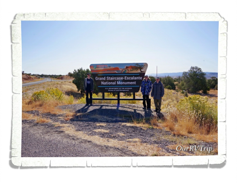
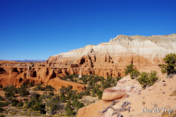
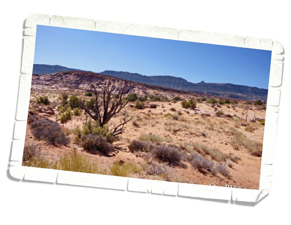
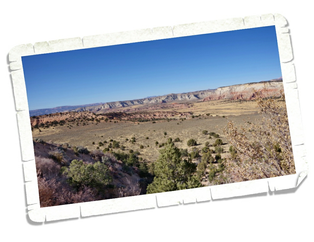
It’s not considered one of Utah’s Big 5…but it really should be on your list of must see National Park Units to visit while you’re in Utah. Grand Staircase-Escalante National Monument is so big (somewhere around 1.9 million acres) with so many diverse things to do and see…it’s easily one of our favorite NPS units. This National Monument is BLM managed so I think it tends to fly under the radar of most National Park enthusiasts.
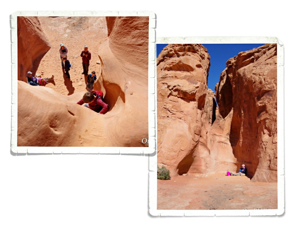
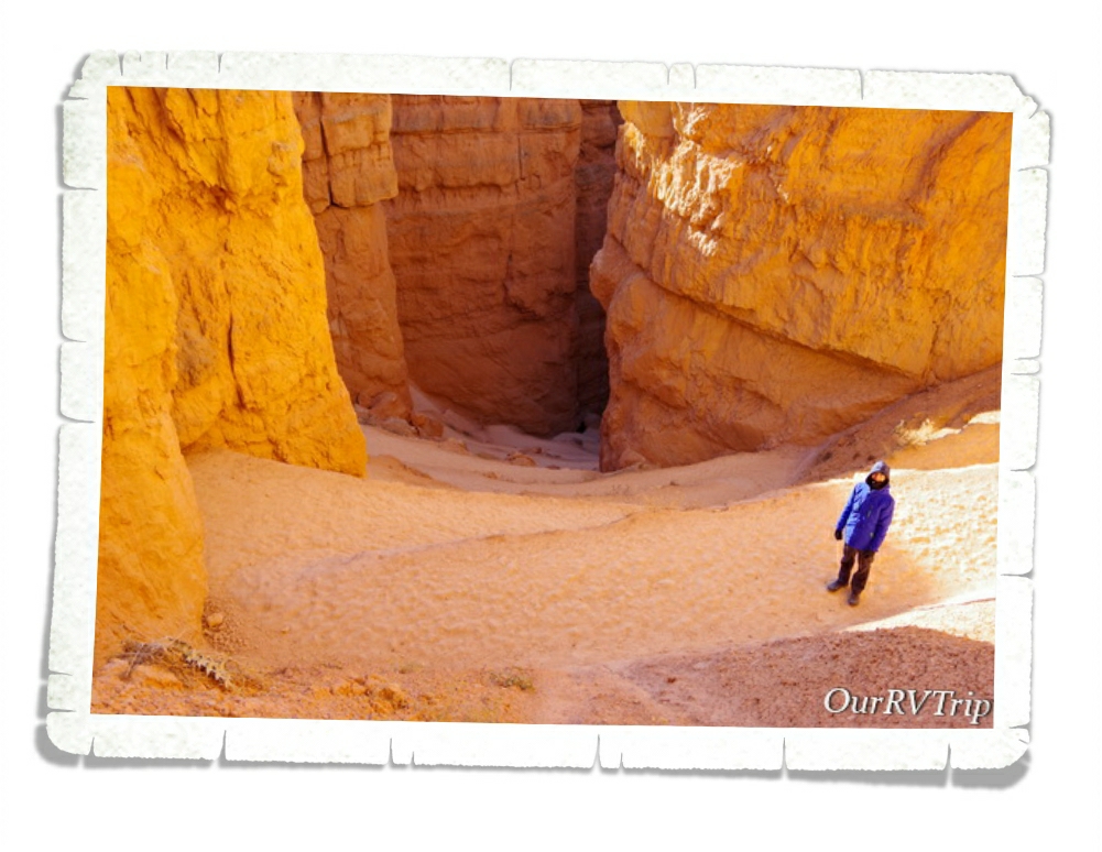
We got a taste of what a slot canyon is back at Little Wild Horse Canyon a couple of weeks before we got to Panguitch and we all loved it! The Peek-a-boo/Spooky slot canyon loop has been on my list for a while and I was really excited to finally get the chance to explore them. These are family friendly slot canyons…meaning, you don’t need technical gear or experience to explore them. They are still slot canyons though…so there’s some scrambling, climbing, and squeezing involved. To get into Peek-a-boo, you must first climb up a twelve foot entry wall. There are a few hand and foot holds that help a bit, but it’s still difficult. I wouldn’t have made it up on my own…Jerl had to help pull me up part of the way. But we all made it up!
Peek-a-boo was so fun! You had to climb through holes, squeeze between walls, and work your way around some easy and fun obstacles. It was like a playground. Grand Staircase-Escalante is divided up into three distinct sections. In the Canyons of Escalante section, you’ll find the most extensive network of slot canyons in Utah.
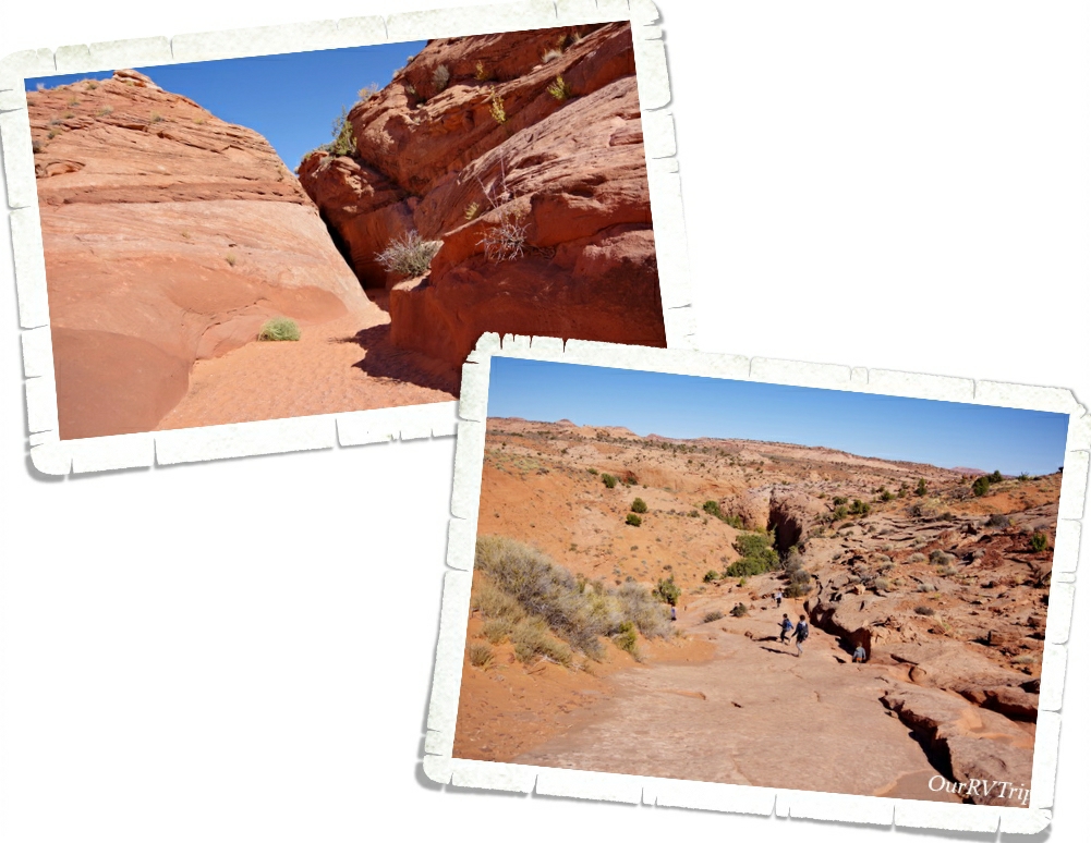
Once you make it through Peek-a-boo you climb up and out of it and follow the trail over to Spooky to continue the loop. Or you can retrace your steps and go back through Peek-a-boo to get out the way you came. Grand Staircase-Escalante is a unique park. It’s considered the flagship unit of the newly established National Landscape Conservation System. This new conservation initiative’s goal is to basically preserve the wildness of the land. You won’t find defined trails like you will in other NPS units. While there are trails, there is minimal change to the land. So, you’ll need a map and you’ll have to watch for the cairns that have been built on some of the trials. The trial system isn’t as defined as what you might be used to.
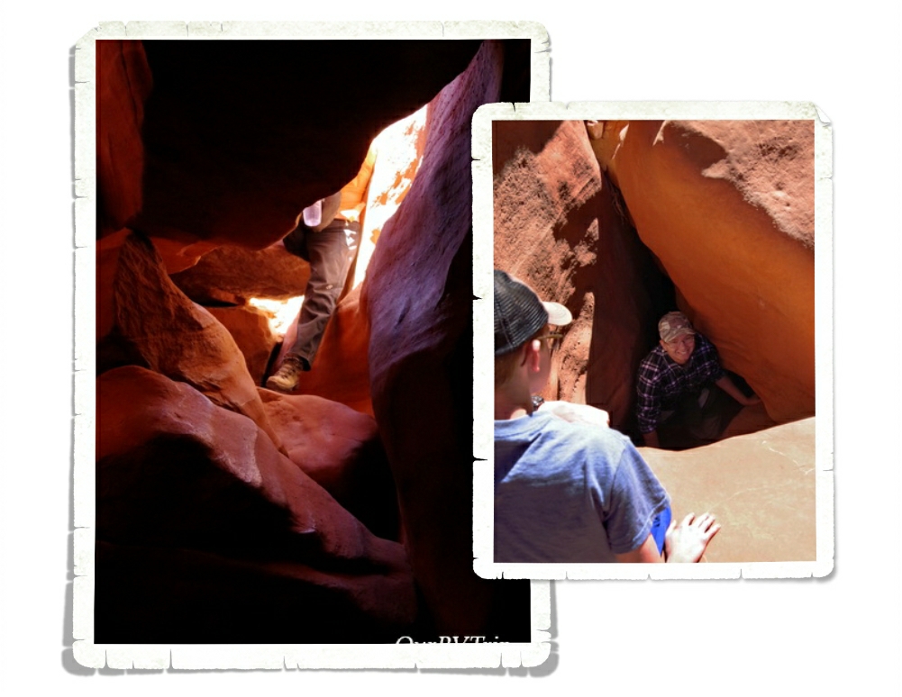
Once you reach Spooky, you have to make your way down a fifteen foot drop. Like I said…it’s still a slot canyon and you’ll still have to do some climbing and scrambling. This drop was the hardest part of the whole loop for us. You’re coming out of the bright sun down into a dark canyon so it was hard to judge where you were and how far of a drop it was. Jerl went first here and helped the rest of us down. He also might have cracked a rib or two here…
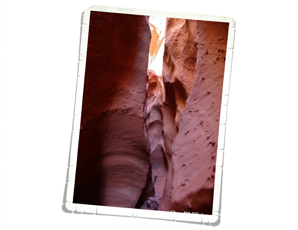
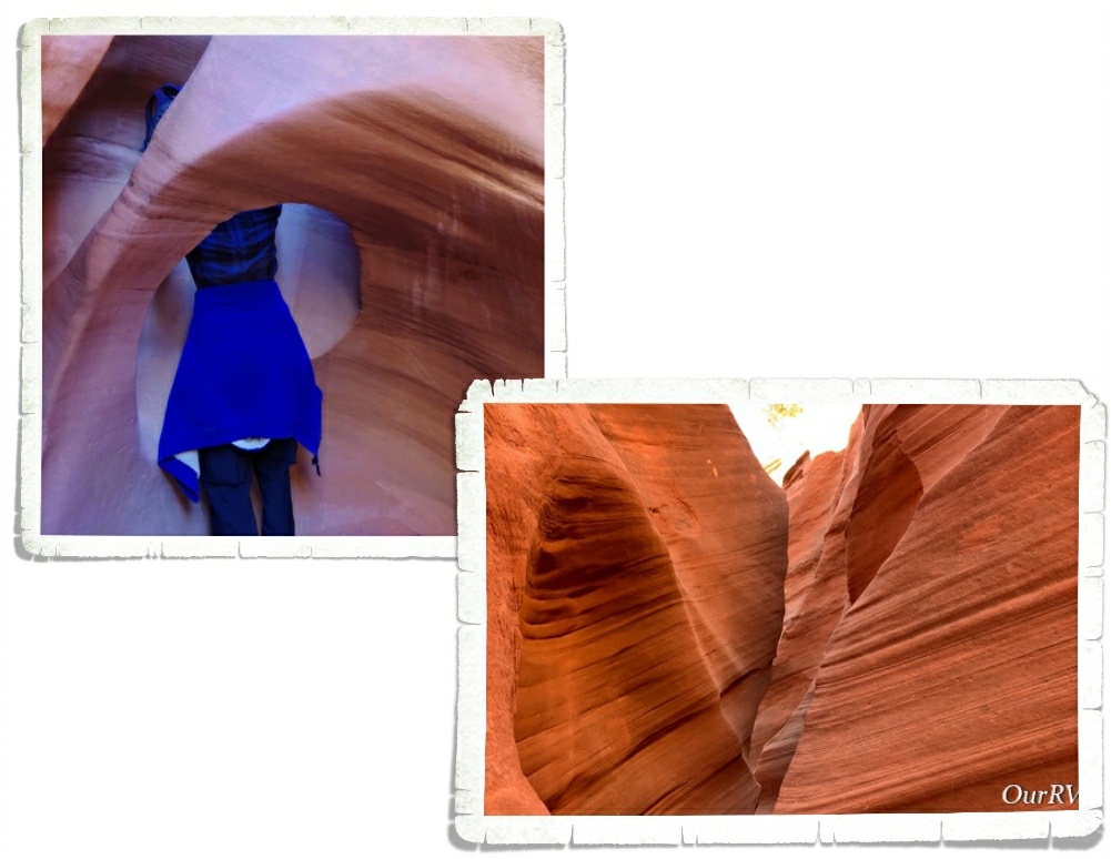
Once we all made it down the drop, we caught up to a big group that was in front of us and so we had to wait while we were in some of the tightest sections of Spooky…which are ten inches wide. Ten inches. If you’re claustrophobic at all, I would suggest skipping Spooky. If I started to feel a little closed in, I would just look up at the blue sky. It helped quite a lot knowing if I absolutely had to, I could climb up the canyon walls to get out. They were narrow enough and they weren’t so tall that I couldn’t have made it. There were places that Jerl had to exhale in order to squeeze through. Always research the hike you’re going on and know what you’re getting yourself into.
I have to give a shout out to Tanya from Florida. When I saw that first climb up into Peek-a-boo…I thought briefly about copping out. It was intimidating…especially with an audience. But, she totally called me out…and said we can’t wimp out now after coming all this way. And she was totally right! The group of people we found ourselves exploring these slot canyons with really made the hike so much fun. We all helped each other and encouraged one another to make it through. So, thank you Tanya from Florida for pushing me to not wimp out!
The Dry Fork Narrows where Peek-a-boo and Spooky Gulches are found is the perfect way to experience Grand Staircase-Escalante National Monument the way it was meant to be…wild and free. Go be adventurous. Step outside your comfort zone and find out who you really are. But, always know your limits and be prepared when you’re out in the wilderness. If you’re going to explore a slot canyon…or really any canyon…be weather aware. There was a sign at the beginning of this hike that said the two most common causes of death are dehydration and drowning. Don’t go if it looks like it might rain anywhere in the area and always take plenty of water.
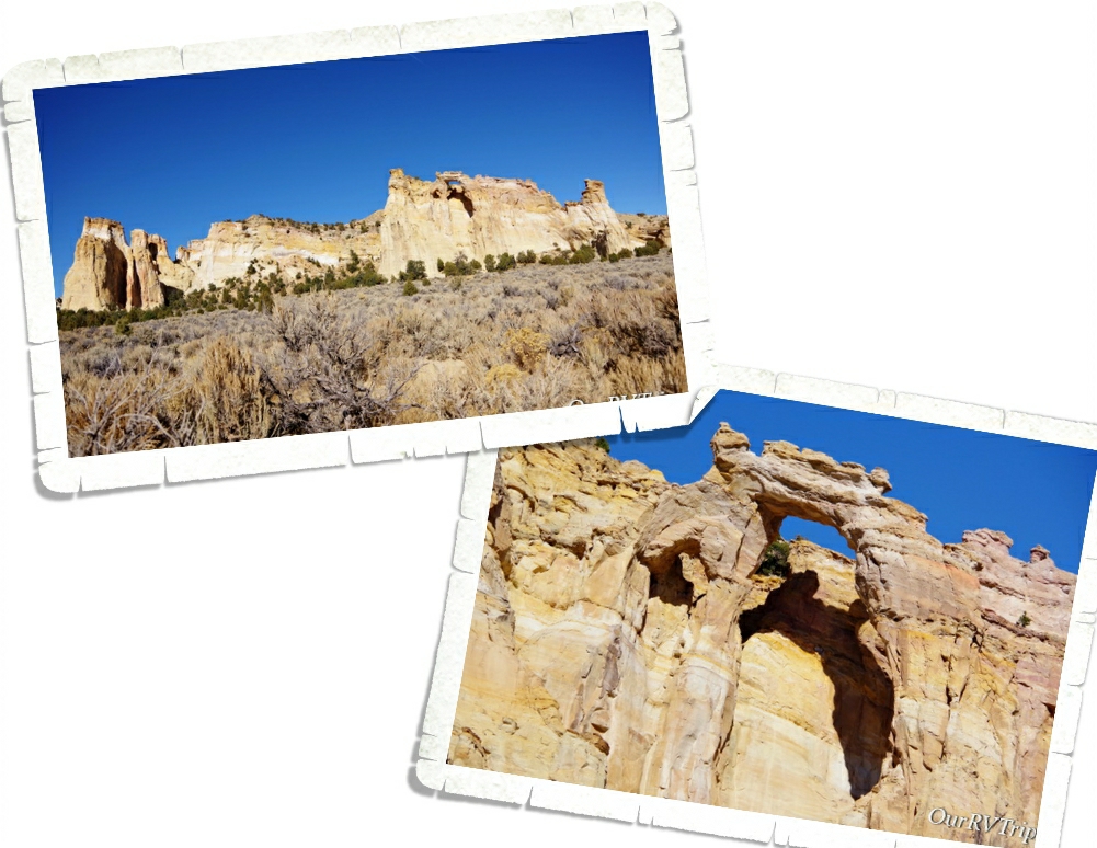
The last thing we did in Grand Staircase-Escalante National Monument was go see Grosvenor Arch. Like everything else we’d done in this National Monument, the drive to get there was on a dirt road. Ten bumpy and washboard miles down the road, you reach the little pulloff for Grosvenor Arch. You can see it from the parking lot, but if you want a closer look at the arch you can take the little “paved” trail out to it. We didn’t walk out there. I feel like the best view of an arch is from a distance. This arch is actually two arches that tower about 150 feet above the ground.
We had so much fun learning about and exploring Grand Staircase-Escalante National Monument!
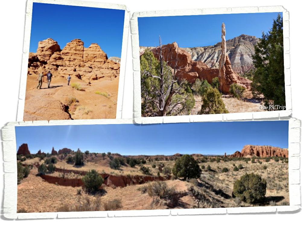
Kodachrome Basin State Park is known for it’s sand pipes and it’s red rock sandstone chimneys. Kodachrome was named by a National Geographic Society Expedition back in the late 1940s. They named it in honor of Kodak film for it’s color.
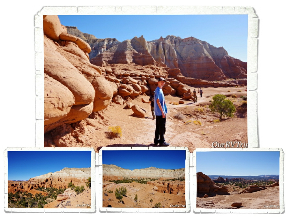
We did the Angel’s Palace Trail to catch some views of the sand pipes, hoodoos, and chimneys that the park is so known for. There are over sixty sand pipes that range in height from 6 to 170 feet throughout the park. This is a pretty easy, well marked trail that offers some fantastic views of the park and the surrounding area.
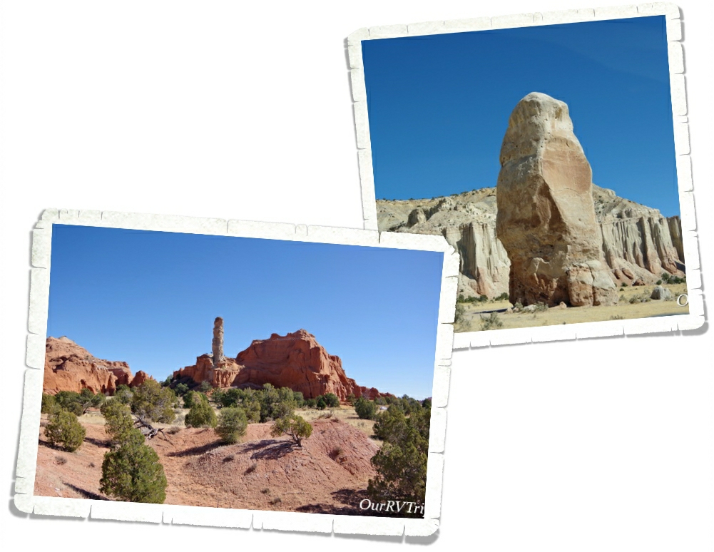
Kodachrome Basin is located on the Colorado Plateau. Most of the layers exposed in the park are made of the Carmel Formation (the white rocks) and the Entrada Formation (the red rocks). While scientist know what the sand pipes are made of…they’re not really sure how they were made. There are a few different theories out there, but no one has been able to prove exactly how these unique rock formations were formed.
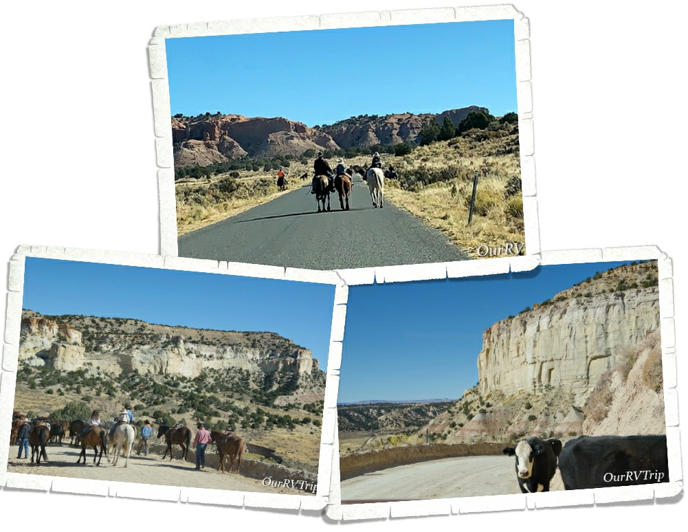
While we were exploring Kodachrome Basin State Park and Grosvenor Arch which are on the same road, we kept running into this group of cowboys (and girls) doing a roundup. They were moving their herd from the summer grazing field to the winter one. It was really neat to watch. We first encountered them on the way into Kodachrome, then caught up with them on the dirt road out to Grosvenor Arch…then met up with them one more time on our way back out. The cows didn’t think much of our car and they weren’t too inclined to walk around us. lol! A few of them bumped our car as if to say…”Hey, we’re walking here”… I think a couple of them were trying to hitch a ride on our bumper as we slowly moved through the herd. We stopped and asked the owners if we could drive through them…we were prepared to follow along behind them, but the owner assured us it was fine to drive next to them.
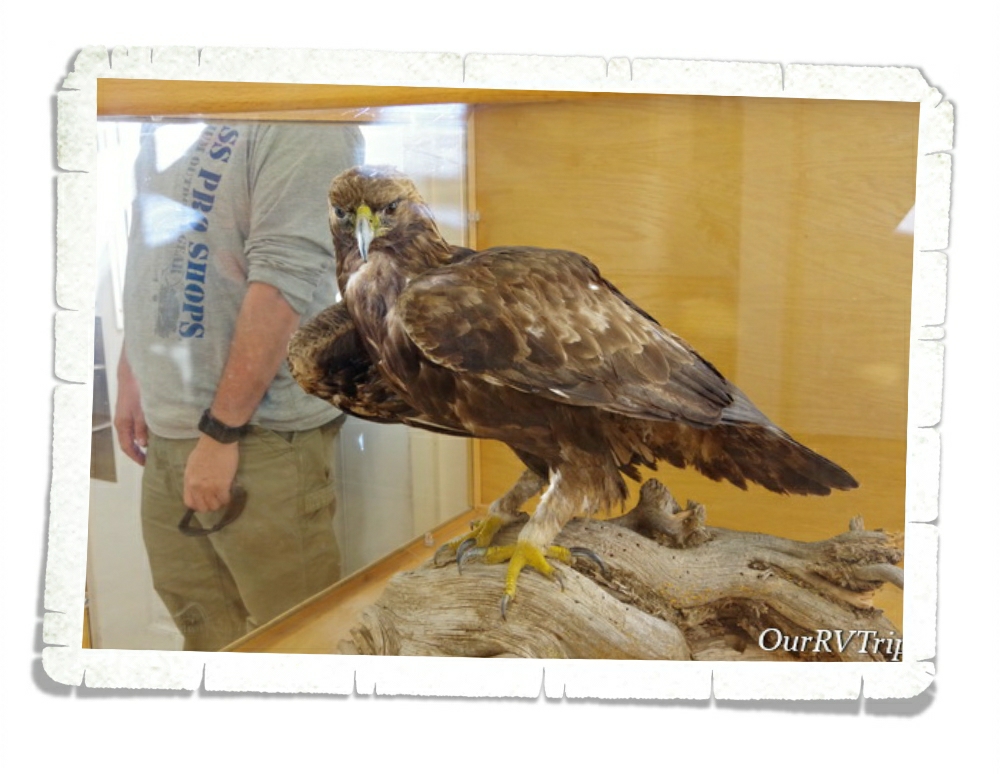
One day while we were driving around the area, we encountered three of these gorgeous Golden Eagles. Three! I, of course, didn’t have my good camera on me…and like the doofus I am, I just sat there too dumbstruck to even think of whipping out my phone to catch a video. We watched three giant golden eagles fight over something that one of them had just found in a field. It was…unforgettable.
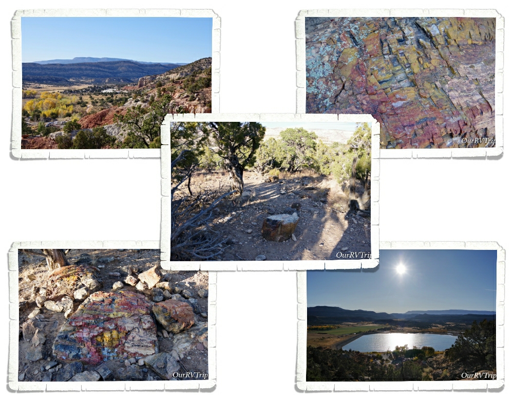
We stopped by Escalante Petrified Forest State Park late one afternoon on our way back to our home-on-wheels after a long day of exploring. We always take the chance to see petrified wood. On top of a mesa that used to be the bottom of an ancient flood plain, you can walk a trail and see several specimens of petrified wood. The trees this wood came from were standing close to 100 feet tall around 130 million years ago. One of my favorite things about petrified wood is the variety of colors! The minerals in the soil determine what colors you get. For example, iron oxide will produce an orange, red or yellow coloring while manganese oxide tends to create blue, black or purple coloring. Yes… we’re nerds…we know things like that. Ha!
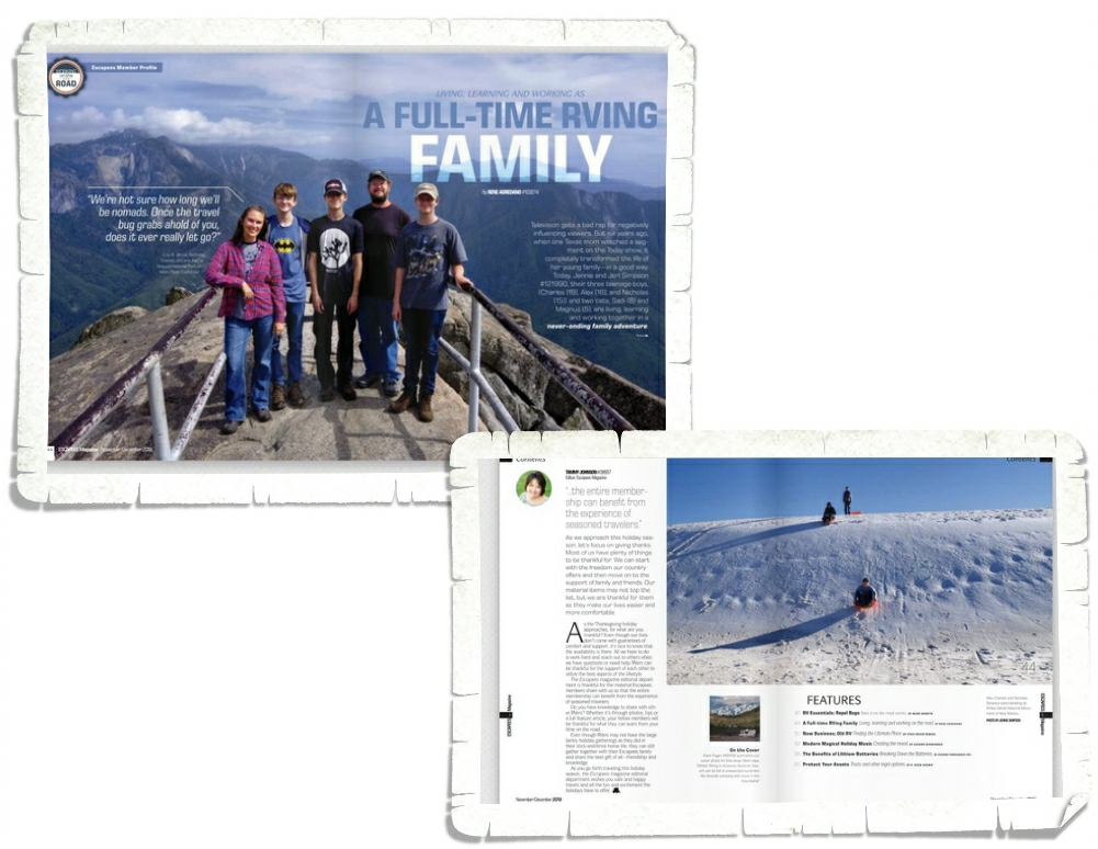
We had the honor of being featured in the November/December 2019 issue of Escapees Magazine. The whole process was a really fun learning experience. The author, Rene, is also an Escapees member and writes articles for the magazine on a regular basis. If you don’t know about Escapees, go check them out here. If you are living the Nomad life you definitely need to be an Escapee member. They make life so much easier and give Nomadic families, like ours, a community of likeminded individuals we can count on. We’ve made friends, learned from other members experiences and have found places to stay with Escapees help over the last almost five years.
That’s all for this post, Guys! I can’t believe our Utah explorations are almost over. It’s gone by so fast!
See y’all down the road!
#NationalParkTour