Tag: wyoming

The Plains

The Plains

Hey Guys! We’ve spent six years criss-crossing all over our Country, but we haven’t really spent much time in the plains area. Why?

Storms.

The plains are known for their huge storms that pop up and roll through. When you live in an RV…storms are a pretty big deal. The plains section of our Country has always made me nervous so I haven’t had us spend much time there over the last six years. We’ve always just hopped through on our way one way or the other. But this year… this year we spent two weeks in Scottsbluff, NE. We were on our way back to Missouri from our South Dakota loop and we’d already had some nerve-wracking weather. The tornado that almost hit us while we were in Custer and the wind storm that blew over us in Sundance…I was pretty nervous about staying out in the middle of nowhere Nebraska where the plains are so vast and the storms can rage through. We did have some storms while we were in Scottsbluff, but thankfully, they were just regular old summer storms. Not a ton of wind and no hail.

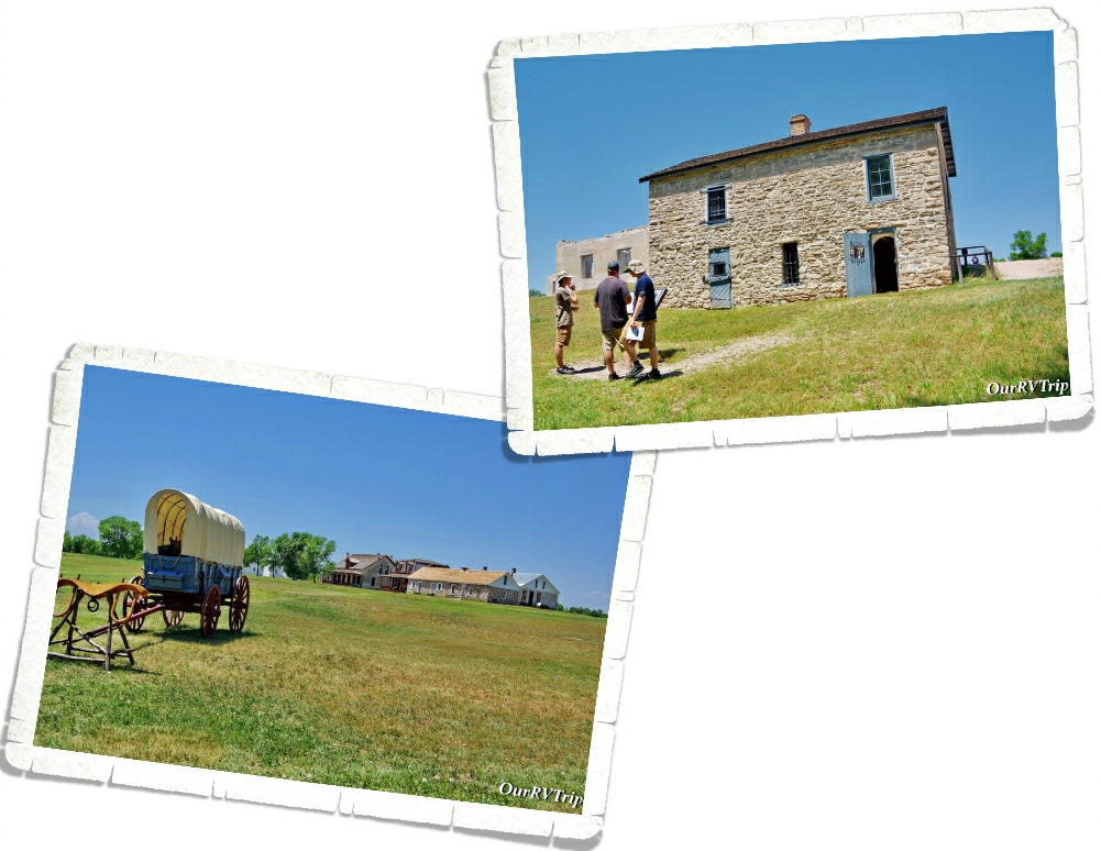
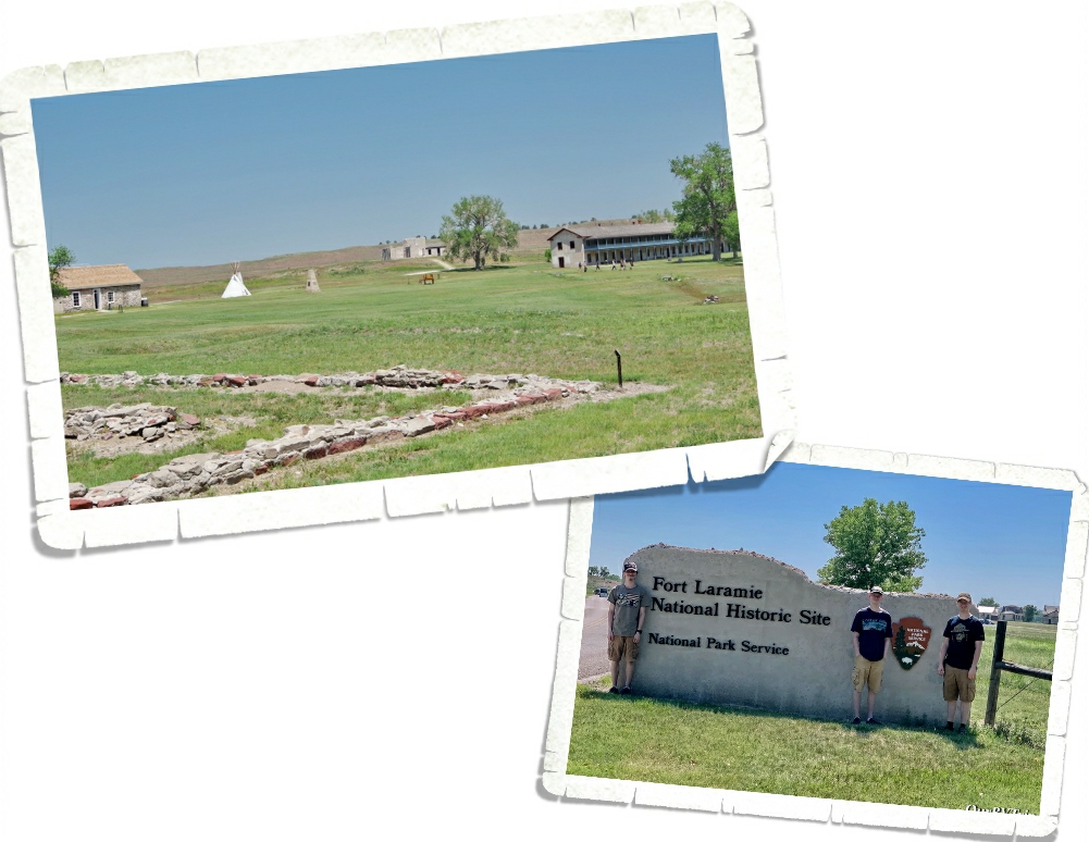
We used Scottsbluff as our basecamp to explore three National Park Units. The first one we went to was Fort Laramie National Historic Site up in Wyoming. Fort Laramie was originally named Fort William and was opened as a trading post in 1834. In the 1840s it was sold to the American Fur Company. Improvements were made and the name was changed from Fort William to Fort John. In 1849, the US Army purchased Fort John to use as a post of protection at the crossroads of America for those traveling on the Oregon Trail, California Trail, and the Mormon Trail. Over time the name gradually changed from Fort John to Fort Laramie as travelers shortened the phrase “Fort John at the Laramie River”.

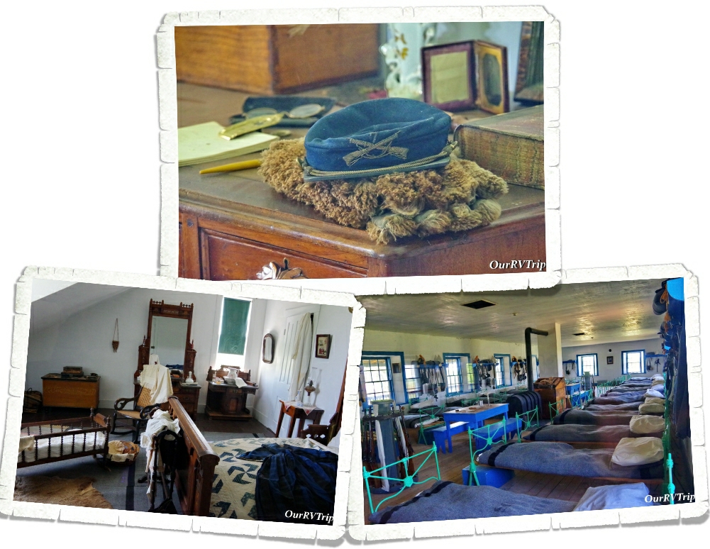
One of our favorite things about visiting National Historic Sites is the glimpse into the lives of the past. The National Park Service does such a great job at staging rooms and giving us a little look into how people lived in the past.

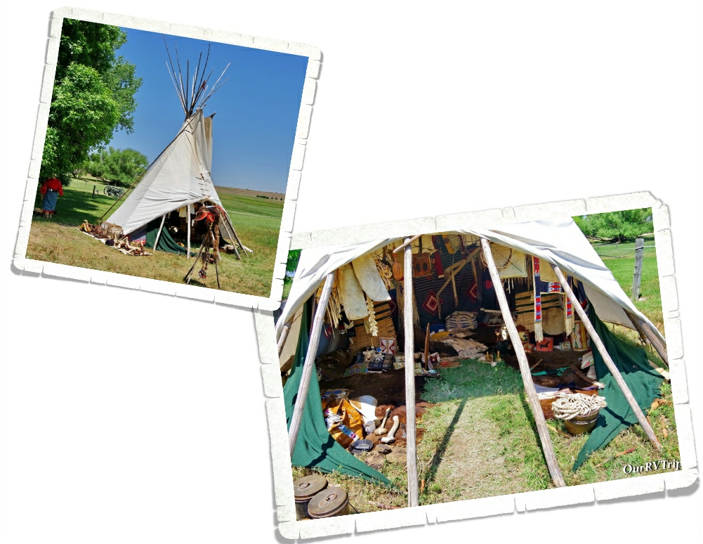
The day we were at Fort Laramie, there was a Living Historian there to show and explain what the inside of a tipi most likely looked like. We’ve seen tipis before, but hadn’t seen one set up like this. The historian talked to us about what life was like on the plains as a woman in a tribe. It was really interesting!

Other important trails that went through Fort Laramie were the Bozeman Trail, Pony Express, Transcontinental telegraph route, and the Deadwood & Cheyenne Stage Route. Fort Laramie National Historic Site preserves one of the most important locations of the westward expansion.

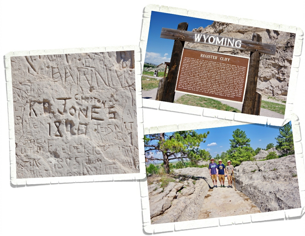
Not far from Fort Laramie, we found a place where we could stand on the ruts made from the thousands of wagons on the Oregon Trial. The wheels of the heavy wagons actually cut right through the rock and made a permanent path. We also found a place called Register Cliff. We’ve seen a few of these during our travels…there’s one in Utah and one in New Mexico that are both part of the NPS and are great! We always enjoy looking at all of the names carved into the rock by passing emigrants. There were quite a few newer names that had been carved into this particular Register Cliff.

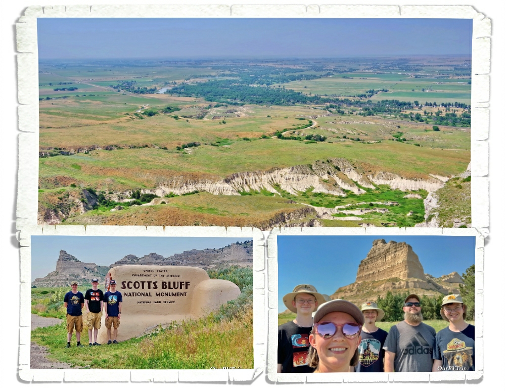
Scotts Bluff National Monument protects about 3,000 acres and consists of towering bluffs, badlands, mixed-grass prairie (watch out for those rattle snakes) and a rich riparian area. Rising 800 feet above the North Platte River, Scotts Bluff has been an important landmark to emigrants traveling along the Oregon Trail, Mormon Trail, Pony Express and the California Trail.

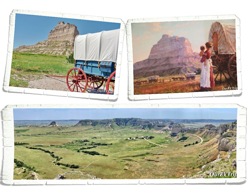
We enjoyed driving up to the top of the bluff and doing both of the hikes available. The views were spectacular! We spent quite a bit of time in the little museum at this park. It has a surprising amount of information. We started to walk the Oregon Trail path outside of the visitor center, but the day we went to this park, the temps were triple digits and we decided against doing the whole trail. I found this painting of a woman holding her toddler while watching a line of wagons in front of Scotts Bluff in the visitor center…Guys, I can’t imagine how hard life was for the trail blazers who made their way west. They were truly made of tougher stuff than we are now. This was a great little park and totally worth the time to visit!

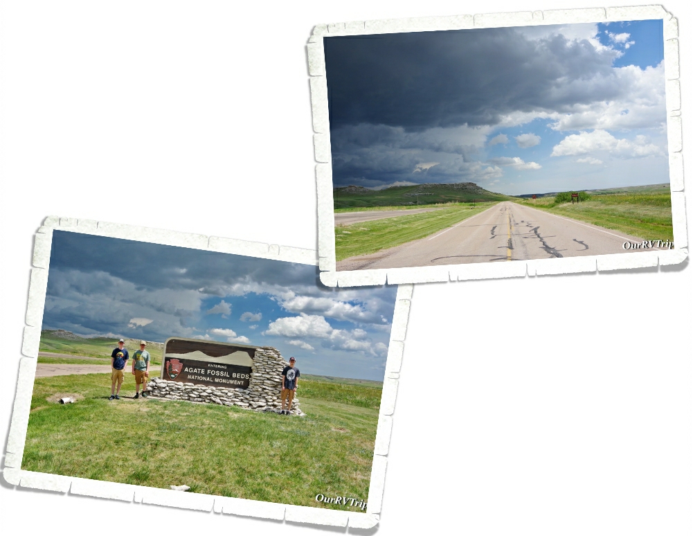
Agate Fossil Beds National Monument was the last place we explored during our week in Scottsbluff. The day we went…it stormed. We still managed to explore the visitor center and get in one hike…but check out those dark clouds. Those dark clouds came with a decent amount of wind and some really cold rain along with some hail too.

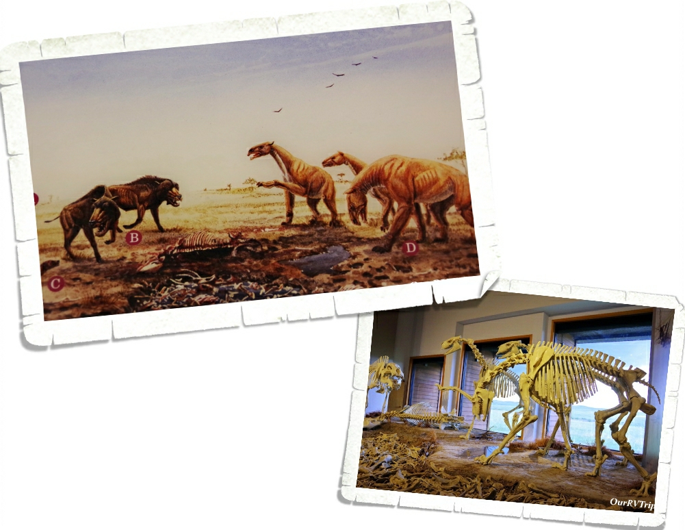
Originally, this area was a working cattle ranch called Agate Springs Ranch owned by Capt. James Cook. Then, in the early 1900s some paleontologists found a treasure trove of complete skeletons belonging to extinct Miocene mammals. When I first saw these skeletons…I thought they looked like little t-rex dinos but then I looked at the info sign and found out that they were huge pig like creatures that stood over six feet tall. Wow! That’s a lot of bacon! ;-P Seriously though…I would not want to run into something like that out on the trail.

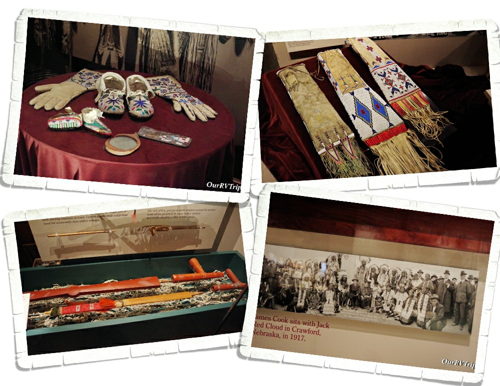
Around the same time, a friendship between James Cook and Chief Red Cloud of the Lakota began. The museum in the visitor center has a wonderful collection of artifacts given to James Cook by his friends in the Lakota Tribe. I thoroughly enjoyed looking at all of the beautiful bead work in the museum. There was also a peace pipe made with red pipestone…from the Pipestone National Monument we went to earlier this year! If you missed that post, you can find it here. It was really something to see one of the pipes out and know where it came from and the history behind it. We’ve learned so much during this Grand Adventure/crazy nomad life of ours!

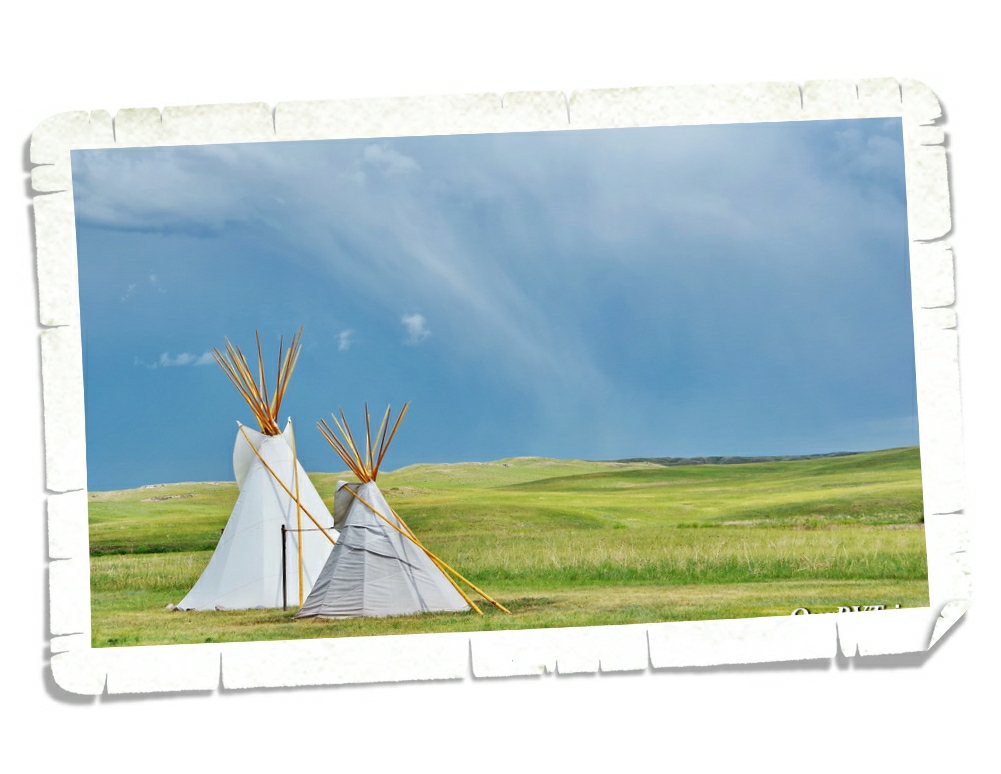
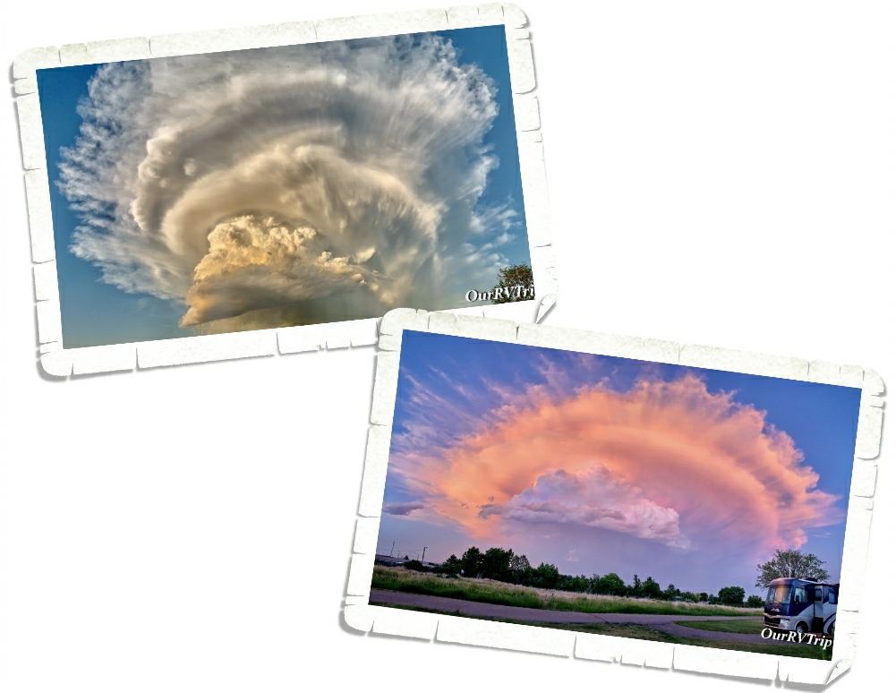
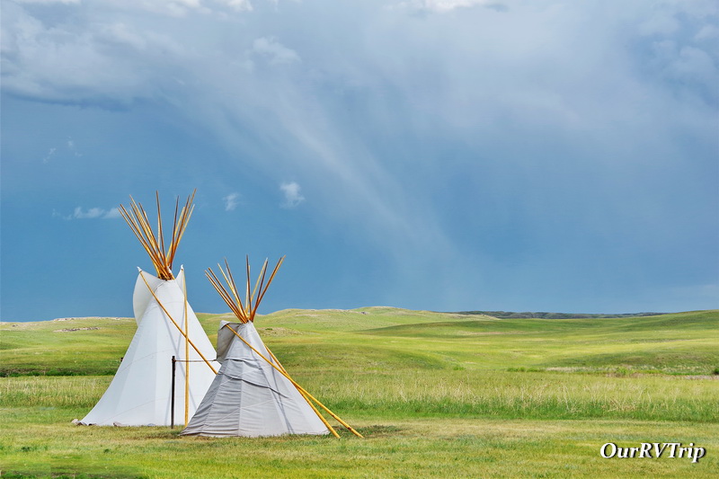
A big storm went over while we were in the visitor center. It got windy and hailed and poured rain. The lights flickered and I rushed to make our souvenir purchase just incase the electric totally went out. These tipis are right outside the visitor center…I braved the elements to grab the shot above so I could show you what one of those great big plains storms looks like. It was an impressive storm. I’m glad we weren’t out on a trail hiking when it hit.

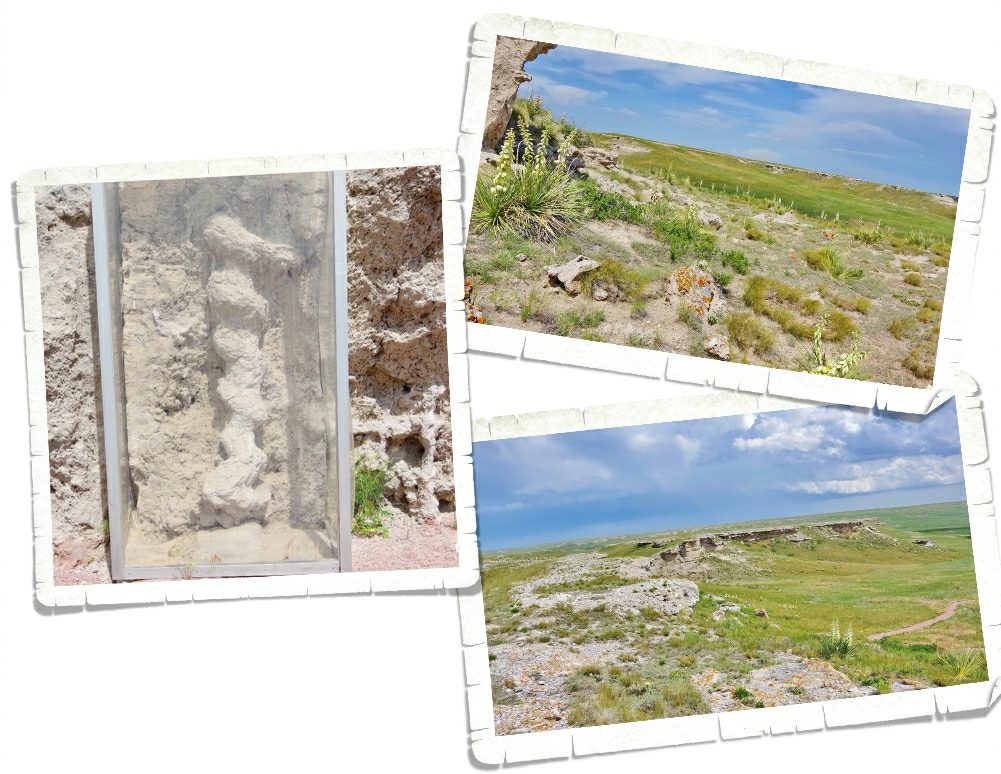
Once the storm blew through (it was moving pretty darn fast), we headed out to one of the shorter hiking trails. The one we did was about two miles and super easy, but it had some breathtaking views of the plains! And…we got to see some of the actual fossils that make this park important. It looks like a corkscrew and it took paleontologists a while to figure out what exactly it is. It’s the fossilized burrow of an ancient prairie dog type animal. No joke. We can’t seem to get away from prairie dogs this year! LOL!! It was really neat to see and our nerd family learned so much.

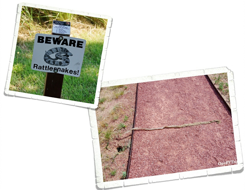
You know all of those warning signs about danger noodles on the trails…well, they aren’t lying! We found this big snake skin on the trail on the way back to our car. So…this big ol’ nope rope was somewhere close by. I don’t handle snakes very well. I think I just about flew to the car after that.

I love sunsets…I love sunsets even more when they’re mixed with amazing cloud formations! Jerl and I were out walking in the RV park when we spotted this amazing cloud! We walked around then sat outside and watched it turn colors as the sun sank behind Scotts Bluff over at the National Monument.

We also had some electrical issues while we were at this park. They weren’t our issue…it was with the town…but the temps outside were close to triple digits. I don’t know if you know this…but when you live in an easy bake oven, it gets hot real quick when there’s no AC. It ended up getting to 93* in the RV. We were struggling to stay cool! Our AC units had already been struggling, but I think that when the eclectic blipped on and off and then went out, it did something to our AC units. They never seemed to get quite as cold or keep up with the heat after that. Guess we’ll need to look into replacing those sooner rather than later.

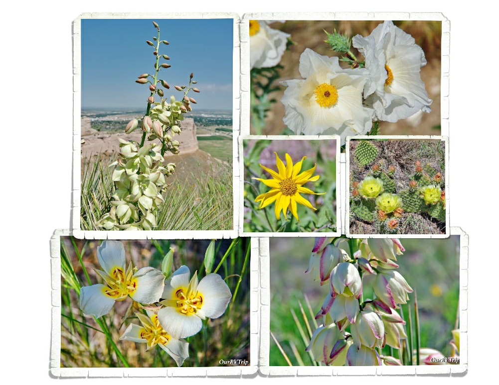
Guys…there were so many pretties blooming! It took me twice as long (maybe longer) than usual to hike because I kept stopping to snap pictures of all of the different flowers. Love them!!

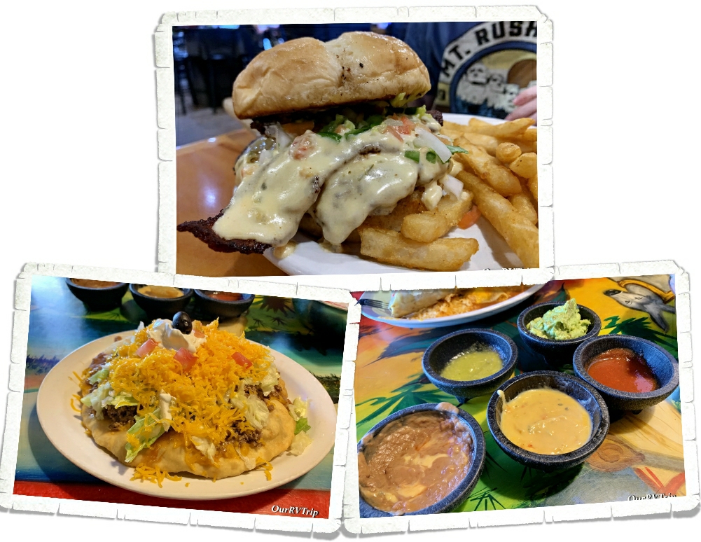
We found a really great burger place called Goonies! We were going to go back, but we didn’t have time since we were only there for a week. We also made it to a Mexican food place and somehow ended up getting all of the dips. I’m a dip person…are you?

Well Guys, we crammed all of that into one week! It was an incredibly busy week and to be honest, we were all ready for a vacation from our crazy nomad life after the South Dakota loop!

See Y’all down the road!

#NationalParkTour
Towers, Canyons, and Waterfalls

Towers, Canyons, and Waterfalls

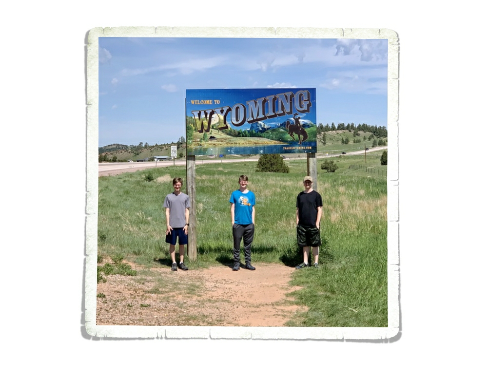
Hey Guys! After we left Custer, we headed to Sundance, WY to check out Devil’s Tower National Monument.

The plan was to have a slightly more relaxed week in Sundance, but well…that didn’t really happen. We found out about a few more things to see/do in the area so buckle up and lets go!

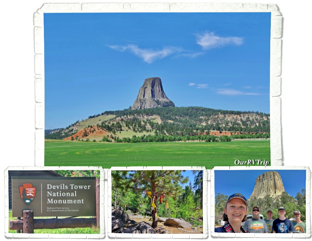
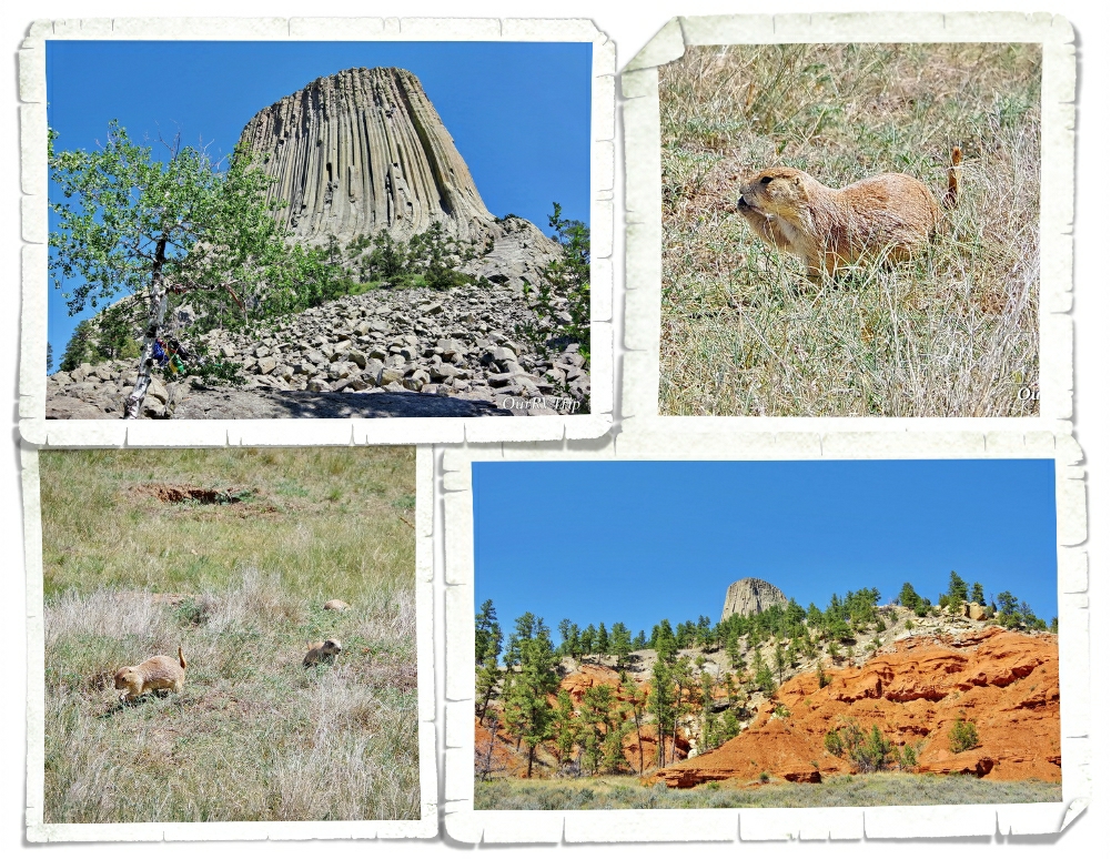
The main reason we went to Sundance was to visit Devils Tower NM. It ended up being about a thirty minute drive from Sundance and we ended up having to go twice. The first time we went happened to be the only day of the week that the visitor center was closed. *palm slap* And yes, before you ask, I did check the website before we went and didn’t see anywhere that they’d be closed that day. So, we hiked up to the base of the tower and checked it out with about a hundred other people before heading on. It was neat to see. We were really disappointed with the lack of info about the tower or lore of the area in the park. When we went back… we checked the visitor center for info and didn’t find anything in the visitor center. We did notice that the local Tribes still put prayer bundles in the trees. That tells us they still see this land as scared. When I did some digging, I found that over twenty Tribes consider the site sacred.

Established in 1906, Devils Tower National Monument is America’s first National Monument. Wyoming is the home to the first National Park and the first National Monument! The tower is really a butte made of igneous rock from the cooling of magma. Over the years, the softer earth around it eroded away revealing the 1,267 foot butte we see today. For some reason, we’d all gotten it into our heads that the whole area would be more…desert like, but there was a nice forest surrounding the Tower! We were also surprised to see so much red dirt! It was almost like being back in the southwest! Almost. ;-} We found another prairie dog town! Is it just me, or are prairie dogs one of those animals you can watch for hours. They get up to so much mischief with one another! So much drama…LOL!

All of the Tribes have different names for the Tower…several of the names center around Bear. There are several different legends that go with the names, a few of them have a huge bear in them. I don’t know them well, but the one I can kind of remember goes like this… One day seven little Kiowa girls were playing far from their village and were chased by a bear. They ran on top of a rock and begged it to save them so the rock began pushing them up. The bear scratched up the rock and broke it’s claws as it was trying to get to the little girls. The bear kept jumping and the rock kept growing higher and higher until the little girls were in the sky where they still are today…the stars that make up The Pleiades.

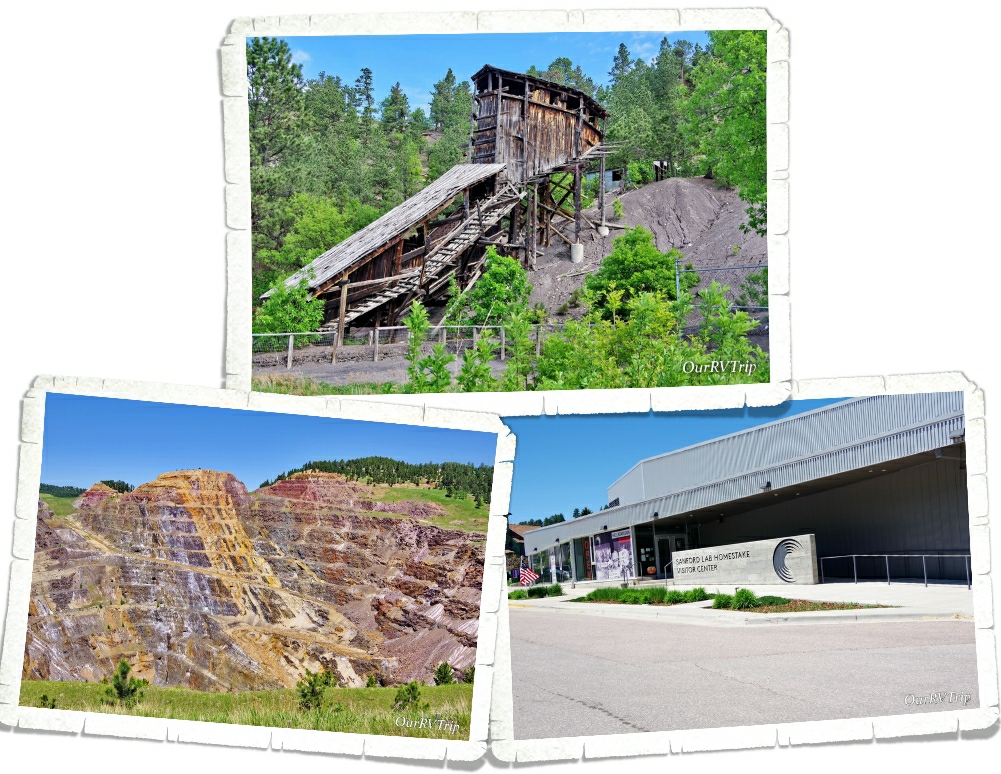
We ended up doing two scenic drives here…one of them retraced a bit of the other…but the area is so pretty, no one really minded. We stopped by the Aladdin Tipple to see what we could see. The area is fenced off now because the darn thing is going to collapse any day. It looked like a strong breeze would knock it down, but it was neat to see. This mine was a coal mine used to supply coal to the gold mines of Lead and Deadwood. There were three different coal mines that used this tipple to supple coal to the train that would take it on to the gold mines. The last train left Aladdin in 1927.

We found the Sanford Lab Homestake Visitor Center by accident. We were driving through and needed a place to stop and figure out our route. We pulled in the the parking lot of Sanford…and well…being the nerds we are, we spent time geeking out in the little museum learning about the Homestake Mine and the science lab that’s connected to the building that does dark matter experiments. We were really hoping a tour of the lab would be available…but nope. We were so incredibly bummed. Apparently, you have to be a legit scientist…with some letters after your name… to get into the lab.

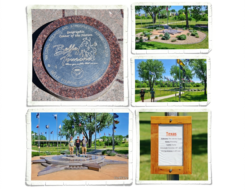
In the little town of Belle Fourche (Bell Foosh), SD you’ll find a memorial for the geographical center of our Nation. This includes Alaska and Hawaii. And…if we’re being nit-picky…it’s not the actual location of the geographical center. That can be found in a field about twenty miles away, and I think it might be on private property, but this little memorial is close enough. We had a good time wandering around all of the flags and reading each state’s stats. It even has a plaque that looks a lot like an official geological marker where you can snap a picture! Totally worth the stop!

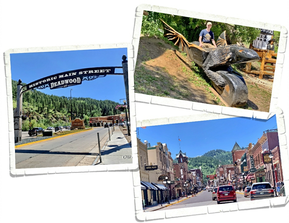
We were so close to Deadwood…and we knew y’all would ask us if we went… So, we stopped in and took a walk down the main street of Deadwood. Back in 1876, thousands of people made their way to the city of Deadwood in hopes of finding gold and like most gold mine towns back then…Deadwood was a wild, rough and lawless type of place. We saw the place where Wild Bill Hickok was shot by Jack McCall and the place where McCall was caught. We saw the famous Brothel and the historic Adams House. We opted not to take any of the tours. While we enjoy the history of places like this, none of us like the showy tourist side of it. We did find a wooden dragon (Toothless) that was pretty darn cool.

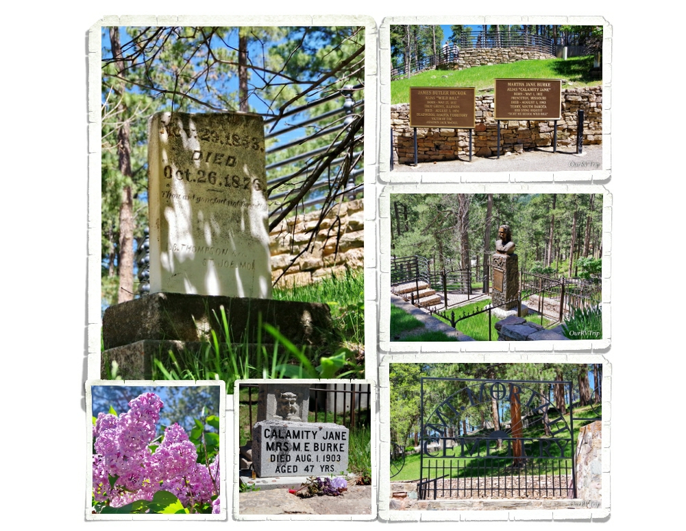
We skipped the daily shoot out/gun fight street show, but found our way up to the Mount Moriah Cemetery where we got our daily steps in walking up and down the steep hills. We found both Wild Bill Hickok’s and Calamity Jane’s grave sites. There were some beautiful lilac bushes blooming while we were there and I spent quite a bit of time with my nose stuck in them!

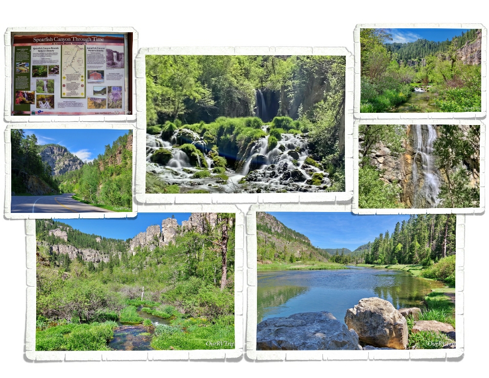
Spearfish Canyon Scenic Byway snakes through a nineteen mile gorge with thousand foot high cliff sides and is filled to the brim with postcard worthy pullovers and hikes. You can easily fill an entire day or two hitting all of the hikes and sights on this scenic drive. We were there in the spring, but I’ve heard it’s absolutely gorgeous in the fall with the leaves changing colors. I’d love to go back someday!

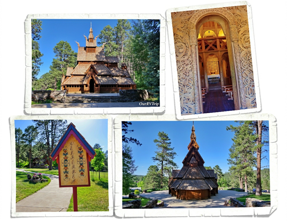
I’ve had the Chapel In The Hills on the list for quite a while. It’s an exact reproduction of the famous Borgund Stavkirke in Laerdal, Norway and was built by a local Lutheran Church as a home for their radio ministry. Today, visitors are welcome to roam around and enjoy the peaceful area or walk the meditation trail. The chapel is gorgeous and definitely needs to be seen in person.

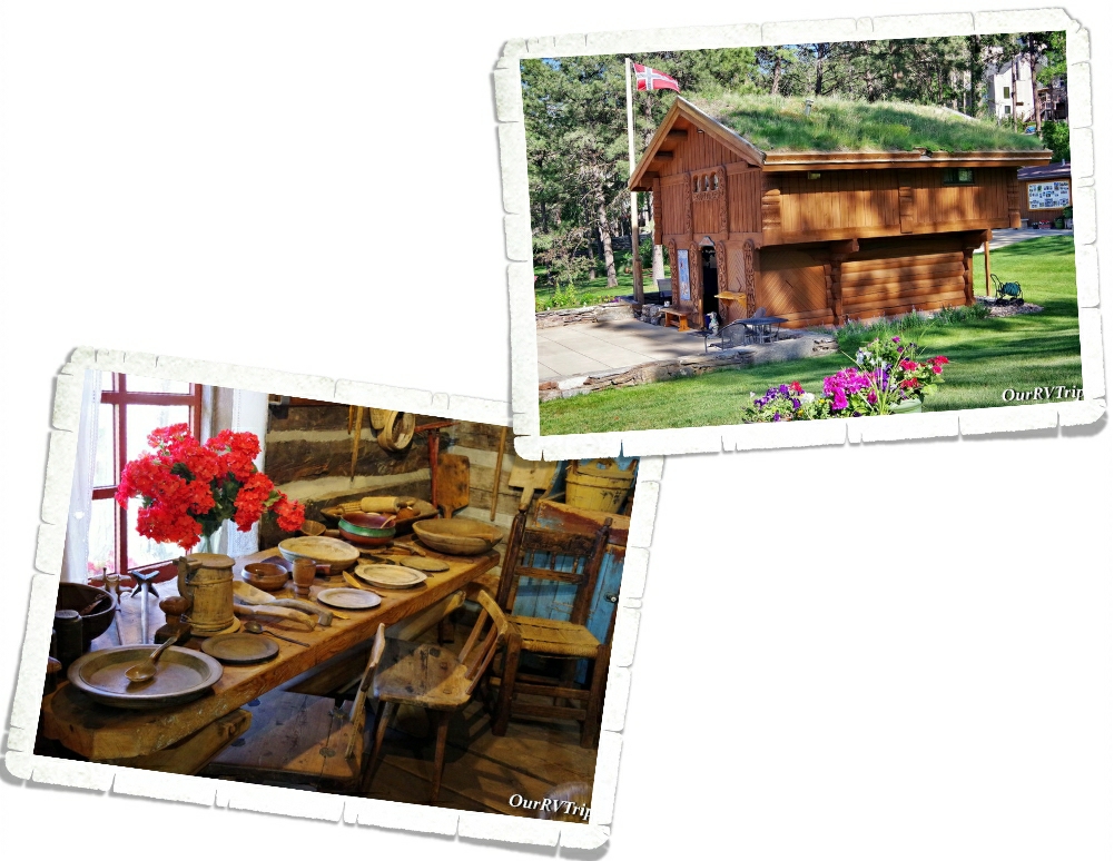
You’ll also find an authentic grass-roofed store house or “Stabbur” that is used as a welcome center/store. It was built in Norway and then reassembled in it’s current spot. We went in and bought a few Norwegian items. There’s also a little cabin that was built by a Norwegian immigrant gold prospector back in 1876 and is now used as a small museum. I loved walking around the little chapel and the grounds. We got there in the evening and had the place almost to ourselves. We were lucky with our timing…apparently, the chapel is a very popular wedding spot.

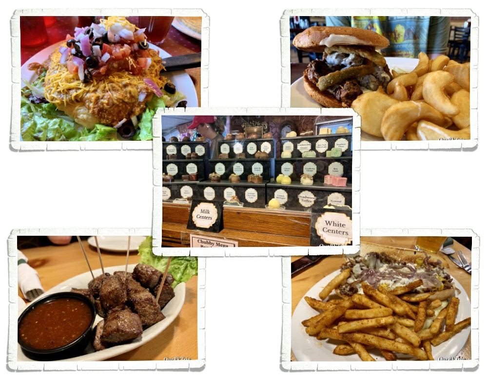
We were only in Sundance for a week but man-oh-man did we squeeze a lot of adventures into that one week! We found some pretty good foodies too! We had to have chislic one more time and we found the Deadwood location of the Chubby Chipmunk for some more hand dipped truffles! Jerl had one of the best Philly Cheesesteaks he’s ever had while we were in Deadwood…it was at a place called Mavericks. It’s a casino, but they let families go up to the restaurant. I found an Indian Taco at a little diner called Cheyenne Crossing in Lead, SD. I was skeptical about getting an Indian Taco in a state other than New Mexico, but someone at the RV park we were staying in told me that she grew up in New Mexico and thought the Indian Tacos were really good. And Guys…they are. Its not the same as the Navajo Tacos you get in the Southwest that are covered in spicy green chilies (those are still my fave), but the Indian Tacos at Cheyenne Crossing are so good I would totally go back just for another!

Well, Guys…I think I’ve covered everything we did in the Sundance area! We saw a lot, but missed just as much. I should have scheduled two or three weeks instead of just the one!

See Y’all down the road!

#NationalParkTour
Yellowstone National Park

Yellowstone National Park

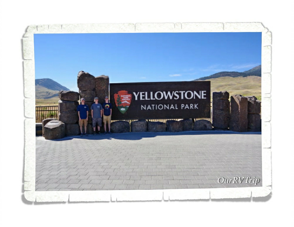
Hey Guys! We spent almost two weeks in West Yellowstone, MT so we could explore Yellowstone National Park. This is a park that everyone seems to compare all other parks to. We were both excited and a little… weary about exploring this park. We don’t have the best track record when it comes to enjoying the super popular parks. We’re not fans of overly crowded areas plus sometimes we’ve heard the hype and built it up so much in our minds that the park doesn’t have a chance to live up to our high expectations.

Yellowstone National Park is not only our Nation’s very first National Park it’s also the world’s very first National Park. When people find out we’re on a National Park Tour there are two parks they always ask about…Yellowstone and Glacier. And they were usually shocked when we told them that we hadn’t been to either park yet but had plans to…eventually.

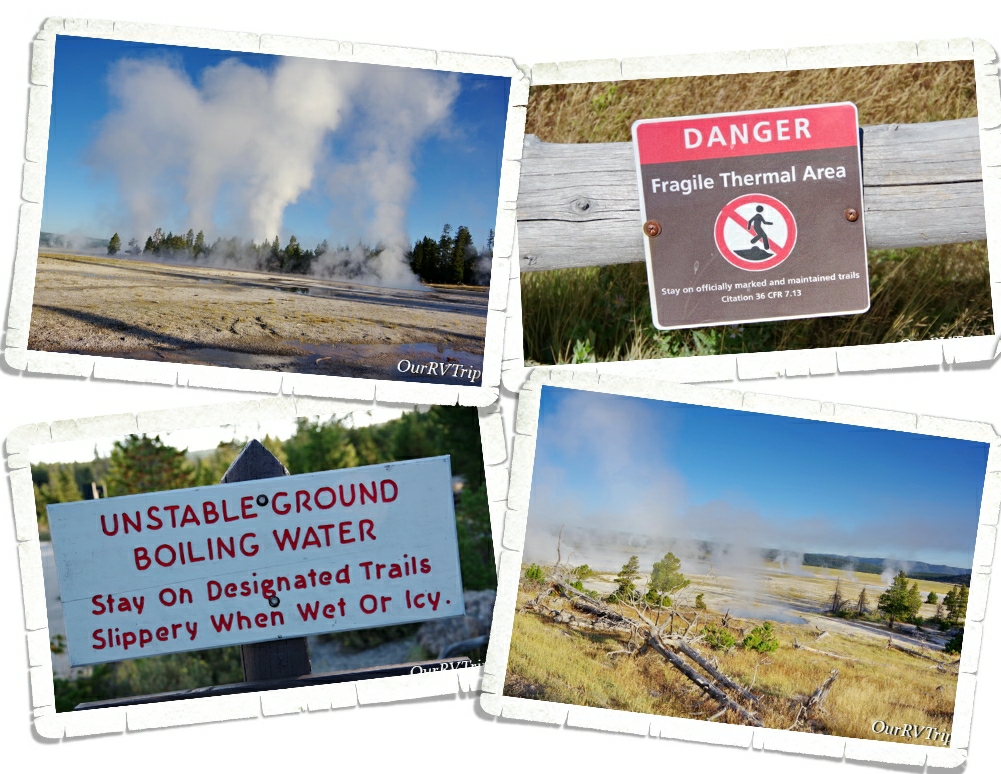
At the heart of Yellowstone National Park sits the remnants of a supervolcano. This supervolcano last erupted somewhere around 631,000 years ago and now is the power behind all of Yellowstone’s hydrothermal features. You see signs everywhere warning about the fragile crust and the heat of the water. Another words…stick to the trails! Even with all of the signs, we saw people getting off the trails. This not only puts them in danger of falling through the thin crust and getting burned by the boiling water that’s sitting just under the surface of the crust…but it also damages fragile ecosystems that will take years to recover.

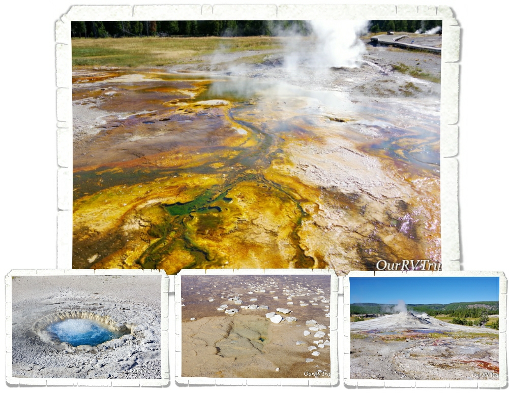
We liked to get into the park early in the morning. Not only were we avoiding the major crowds by getting out early, it was also easier to see where all the geysers were. It looked so otherworldly looking out over the land and seeing so many steam columns coming up from the various hydrothermal geysers, hot springs, steam vents and mud pots.

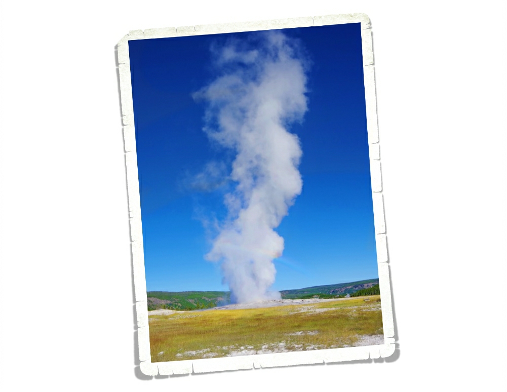
When you ask most people what first comes to mind when they think of Yellowstone National Park, more often than not they’re going to say Old Faithful. We spent almost an hour waiting for the famous geyser to do it’s thing. The park has tons of benches around the viewing area so people can sit and wait. It was…ok. I mean, I’m glad we saw it…but once was enough.

Old Faithful was first documented in 1870 and is one of Yellowstone’s more predictable geysers erupting about every 90 minutes. So, what’s a geyser? Basically, a geyser is a hot spring that has a narrow space somewhere in its “plumbing” system where steam and water will escape as pressure builds up. When pressure reaches a critical temp and the water bubbles harder…the geyser expels water and steam until the pressure in the plumbing has dropped again.

Old Faithful might be the most well known geyser in the Upper Geyser Basin, but it’s definitely not the only one. There are 150 different geysers, hot springs and steam vents found along a boardwalk trail. Honestly, I enjoyed the boardwalk trail more than Old Faithful. But that’s just me.

Even with the whole covid virus thing happening there were still tons of people at Yellowstone during our visit.

So many people. Everywhere.

We were told by one of the volunteers that the NPS had, for some reason, cut the Ranger numbers down to a quarter of what they usually were. I believe it. We hardly ever saw a Ranger out. We did see tons of people treating the park like their own personal playground. We saw someone moving a fence so they could park there. It was crazy.

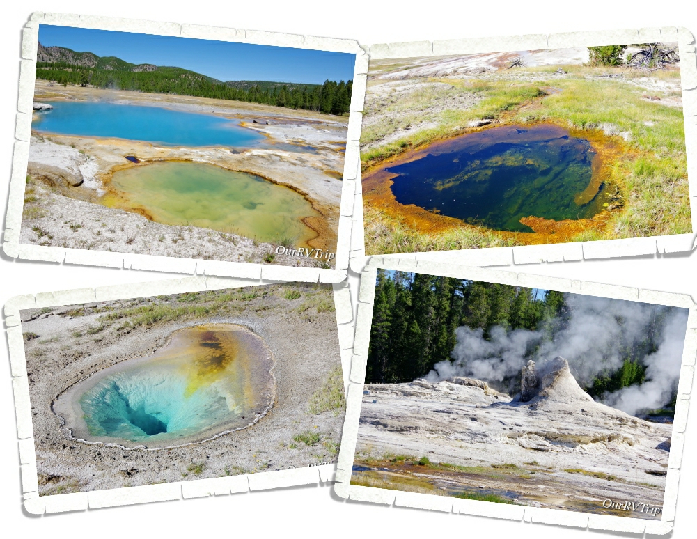
Yellowstone is home to close to 10,000 hydrothermal features… that’s over half of the total hydrothermal features found worldwide. All of those hydrothermal features are evidence that the Yellowstone volcano is still very much alive and active.

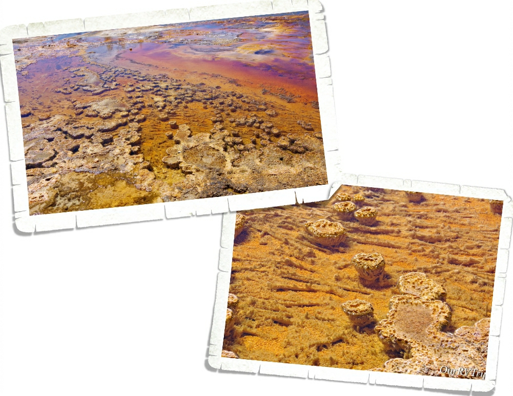
They’re called thermophilic communities. Bacterial microbes from thick structures and mats…communities made of a descendant of an ancient bacterium called Thermocrinis. The colors and shapes of the communities depend on the types of microbes, pH, and temperature of the water. Mats can be as thin as a single piece of paper or as thick as a 600 page book. Cyanobacteria form columns or pedestals. These communities are made up of layers and can be a mix of thermophilic microbes.

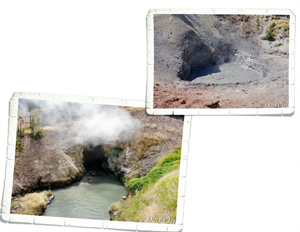
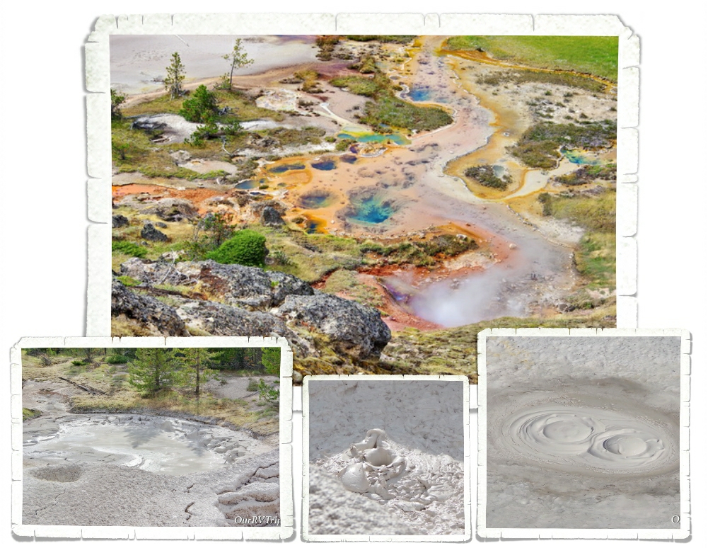
Another hydrothermal feature you can find in Yellowstone National Park is called a mudpot.

A what?

A mudpot is exactly what it sounds like. A bubbling stinky mud pool. A mudpot forms when a hot spring is very acidic and has a limited water supply which causes the rock around it to dissolve into a thick slurry type substance. While I don’t love the smell…I do love the different colors and formations you can find in the area.

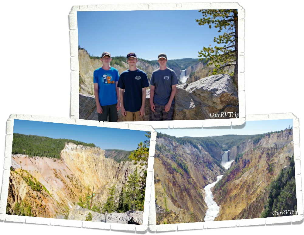
The Grand Canyon section of Yellowstone has several overlooks where you can get a good look at the Upper and Lower falls of the Yellowstone River. I wasn’t expecting canyons like this in Yellowstone. The canyon is just over 20 miles long and has some really pretty colors along the walls of the canyon.

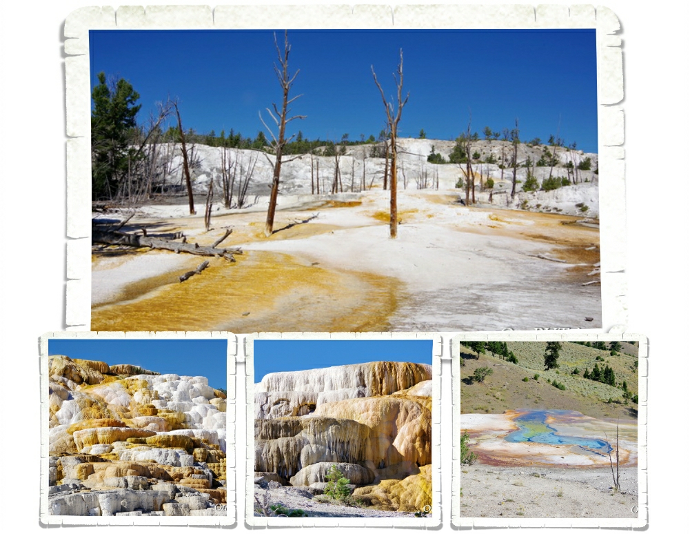
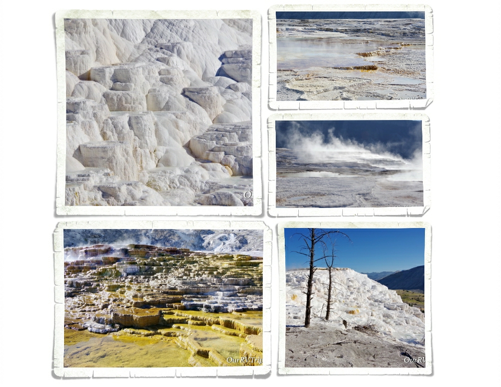
Mammoth Hot Spring Terraces are constantly changing shapes and colors as hot springs go dormant and then suddenly come back to life. Hot water combined with dissolved limestone bubbles up to the surface and over time builds steps and terraces that can be different colors based on the temperature of the water.

We spent a couple of hours exploring the different terraces of Mammoth Hot Springs. We got there early one morning and beat the crowd. I’d read that it’s a popular spot and to get a parking spot you need to get there before 10am. We were finishing up as the crowds started to descend and people were circling the parking lots trying to find a spot.

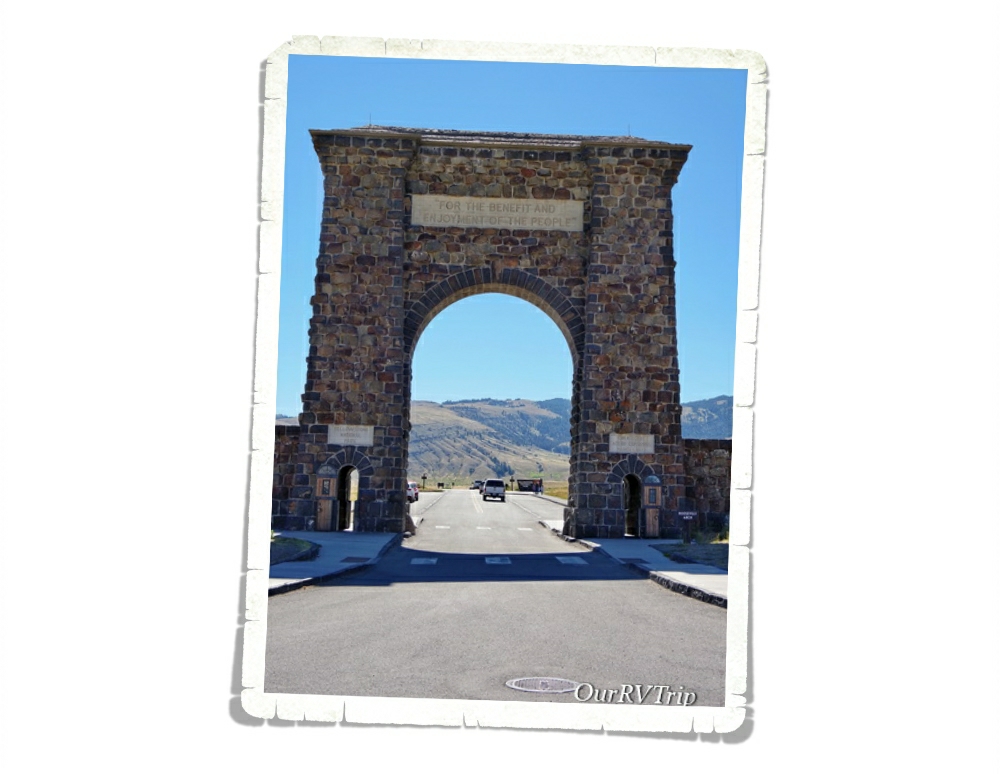
“For the benefit and enjoyment of the people.” President Roosevelt was visiting Yellowstone National Park in 1903 during construction of the north entrance arch and was asked to lay the cornerstone. The arch was then called the Roosevelt Arch. We drove all the way up to the north entrance just to see the Roosevelt Arch. I saw a picture of this arch in a textbook in elementary school and decided I would one day go see it. Seeing the arch in person after having it on my “bucket list” for so many years was amazing. The northern entrance was the first and main entrance into the park.

Yellowstone NP protects over 2.2 million acres of land. To give you some size perspective…that is larger than Delaware and Rhode Island combined. There are five entrances that will get you into the park and get you to the Grand Loop Road which is the way to get around the park. The loop road looks more like a figure eight and is about 142 miles long. We did it in two very full days. On day one we did the bottom half and then the next day we did the top half.

The main loop road might only be142 miles long but there are 300 miles of paved roads in the park that will take you off the beaten path.

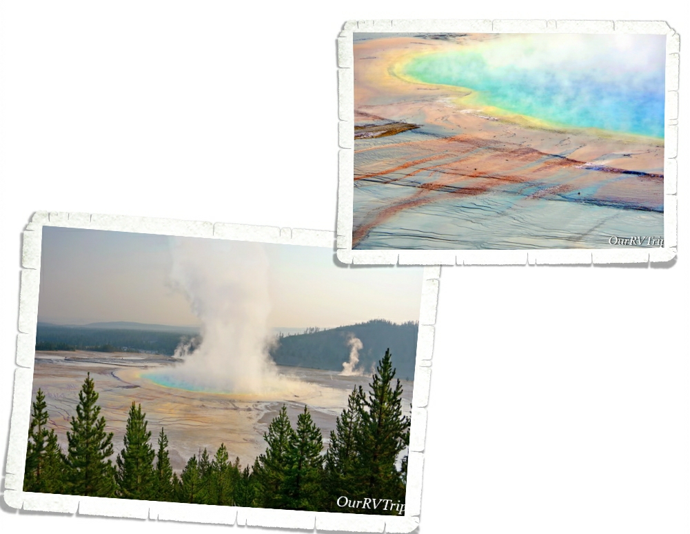
If Old Faithful is the first thing people think of when you mention Yellowstone, Grand Prismatic is the second. This is what I really wanted to see. We tried to see it three times while we were in the park, but never made it there before the crush of people. Our last day in the park we went super early to beat the crowds…but…it was smoky from nearby wildfires and it was cold, so steam blocked most of the view. I really wanted to see those bright vibrant colors…but I have to admit, I’m not mad at the softer pastel morning lighting that we got.

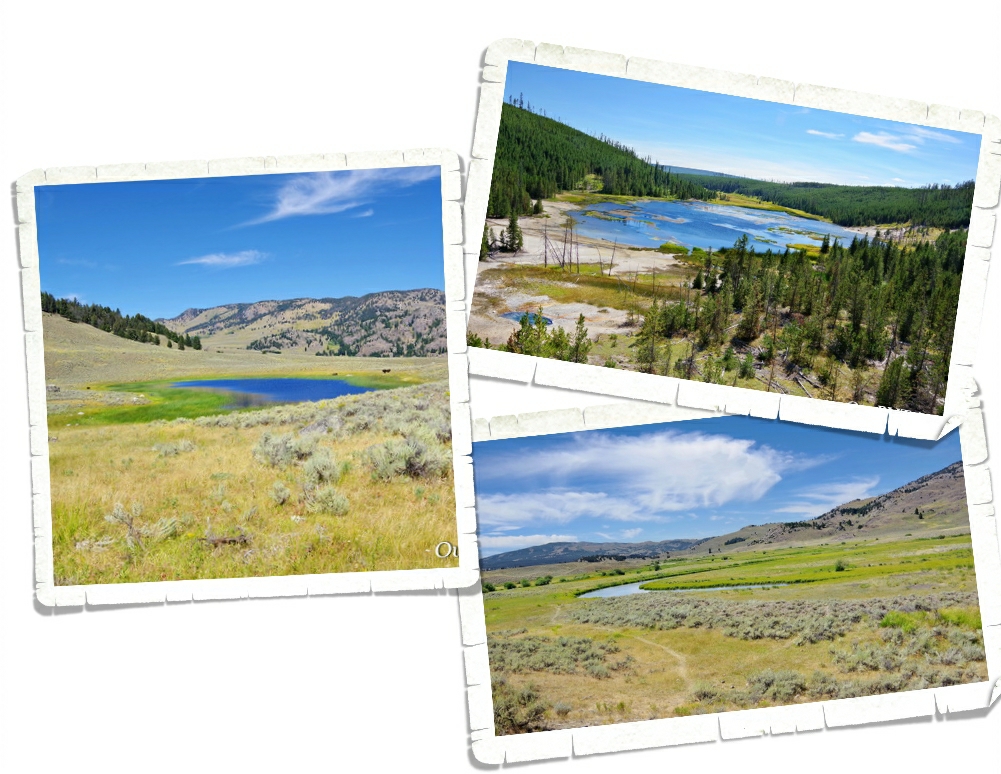
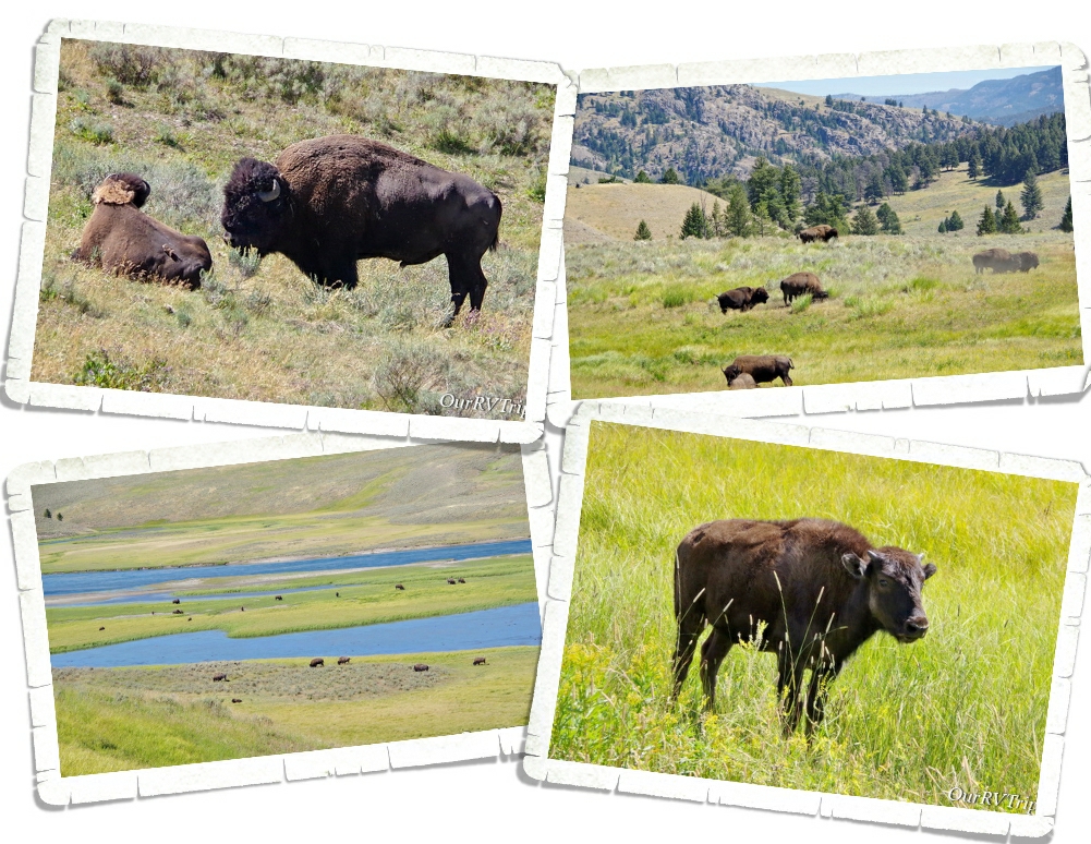
We drove to both Lamar and Hayden Valleys to see the bison herds. Yellowstone NP is the only place in the United States where bison have continuously lived since prehistoric times. The herds here are the largest found on public lands. We saw so many bison and they pretty much go wherever they want to go…whenever they want to. We got to Yellowstone right as bison rut was starting. The bison bulls were pretty aggressive with each other and anyone else they felt might get in their way or challenge them. Including cars on the road. One bison charged a car and busted a tire. I guess he was tired of the paparazzi taking pictures. ;-p

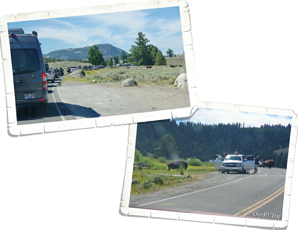
Bison and elk roadblocks were a frequent thing. We also saw tourons trying to get killed by two ton bison bulls as they were taking pictures of it. I can’t believe we didn’t see anyone get hurt. It was close a few times though.

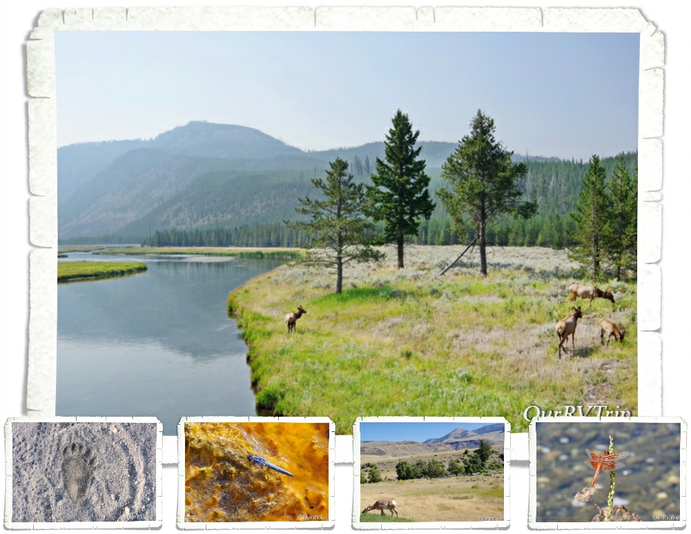
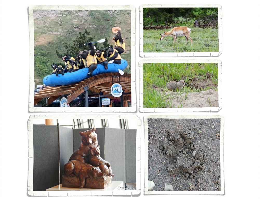
We saw tons of bison, loads of elk…pronghorn antelope, dragonflies galore…but no wolves or bears. We did see a bear print on a hike…but no actual bears.

We enjoyed our time in Yellowstone National Park. I’m not sure it made our top ten list. I mean…Yellowstone is definitely the most colorful and smelliest NP we’ve been to…but Guys, you can only look at so many geysers and hot springs before they kind of all start looking the same. I hate to say that…but I like to keep it real with y’all. While we totally appreciate the history of Yellowstone National Park and love the history/story this park is preserving…we probably won’t go back any time soon.

Our Yellowstone visit was cut short by two days when Jerl’s retina detached in his right eye. If you’ve been with us for a while, you’ll know that he’s had two other detachments (both in his left eye) so… we knew what to expect and headed back to Missouri three weeks before schedule. I’ll tell you more about that in the next post.

See y’all down the road!

#NationalParkTour
Grand Teton National Park

Grand Teton National Park

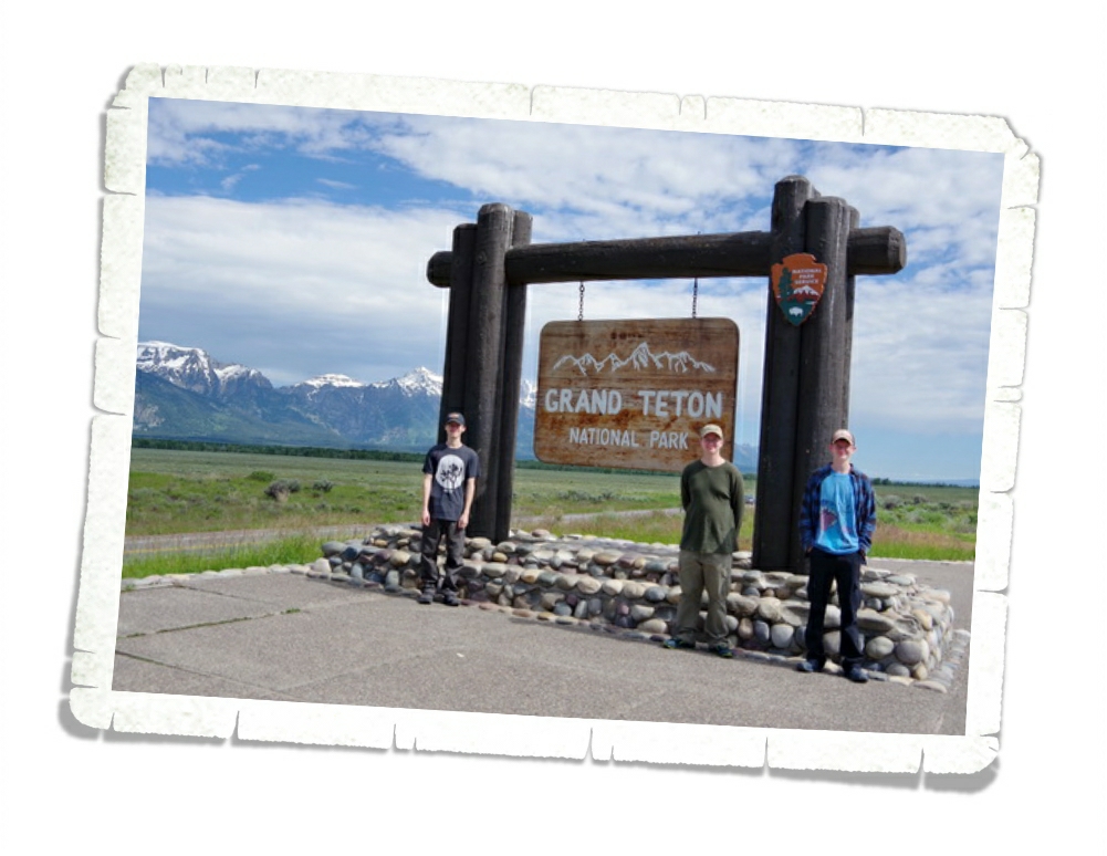
Hey Guys!! We spent five days in the Wilson, WY area so we could explore Grand Teton National Park. If you can believe it…we actually took a vacation. Zero work was done. It’s a shocker…I know.

We haven’t taken an actual vacation in…well…I honestly can’t remember the last true vacation we’ve had. It was kind of weird and oddly exhausting all at the same time. Who knew vacations were so tiring? By the end of it…we were all ready to get back to our normal nomad routine.
Grand Teton National Park was formed in 1929 to protect the forty mile long Teton Range, but it actually protects closer to 310,000 acres. People have been coming to the Tetons for more than 11,000 years. The first people to call this area home were nomadic tribes who would stay in the Teton area during the summer months to hunt and then move to a different area for the winter.

Our first day in the park was cold and rainy. The entire Teton Range was hidden behind clouds the whole day. I worried that our entire stay would end up a bust and we wouldn’t get to lay eyes on the mountains the park was formed to protect.
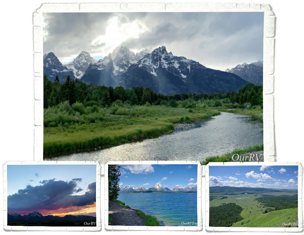
We explored the park anyway and made a game plan for the rest of our time there. We also saw a pretty spectacular sunset that first night as the clouds finally started to move out.

In 1807 John Colter, a member of the Lewis and Clark expedition, became the first Caucasian to see the Teton Range. Over the next thirty years, Jackson became a profitable fur trapping area. Beavers were one of the biggest draws.

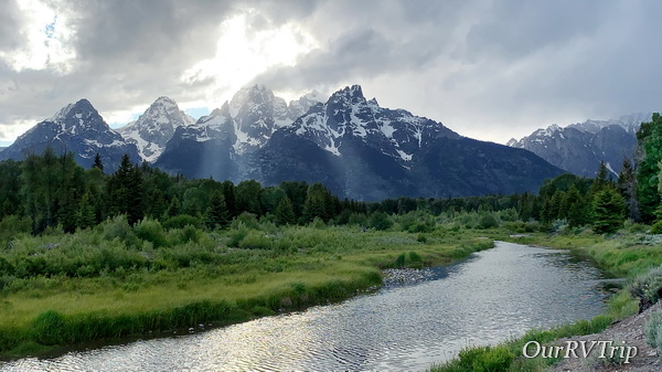
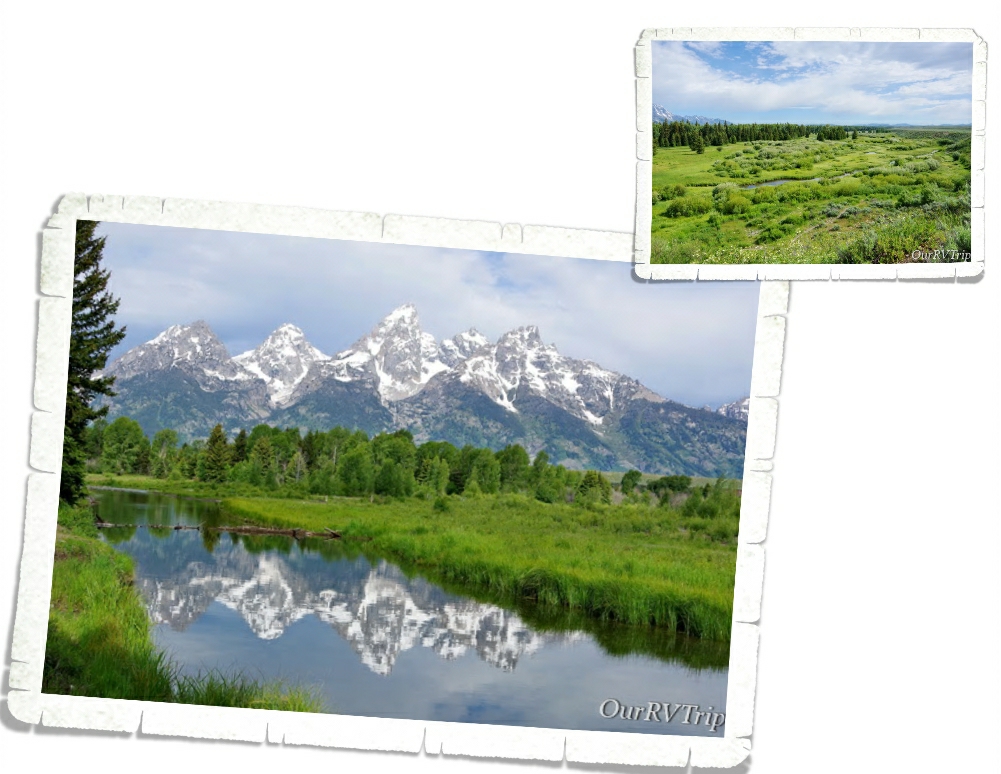
My favorite area of the park is the Schwabacher Landing and Blacktail Ponds area. Both give you access to the Snake River. At Schwabacher you can see a large beaver dam and if you’re lucky…some beavers and moose. We saw evidence, but not the actual animals. We did see a mama deer and her fawn one evening. When the wind is calm, you can catch the Teton Range reflection in water. At Blacktail Ponds you get a better view of the park’s wetland community. At one time, the Snake River flowed through this area with enough water that boats were able to launch. With the shifting of the river, it’s no longer viable to launch boats from this area. Blacktail Ponds is named for the blacktail deer that can be seen so frequently in this area.

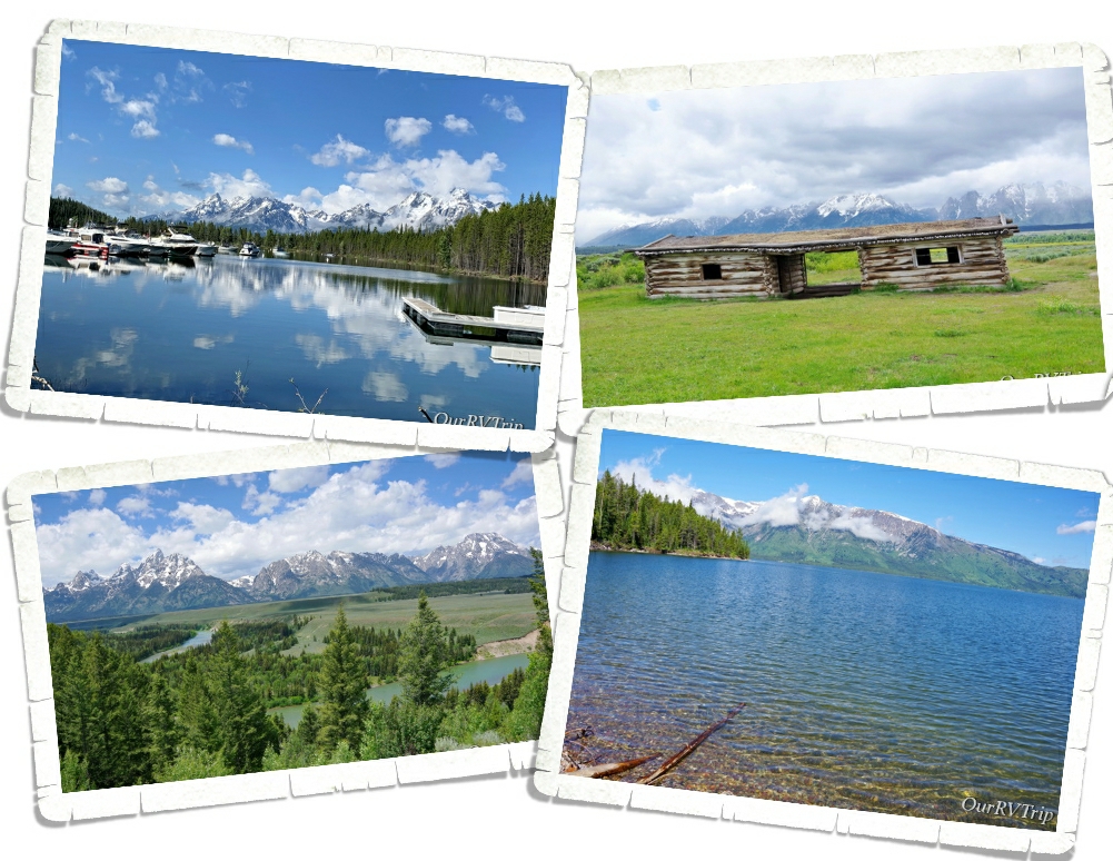
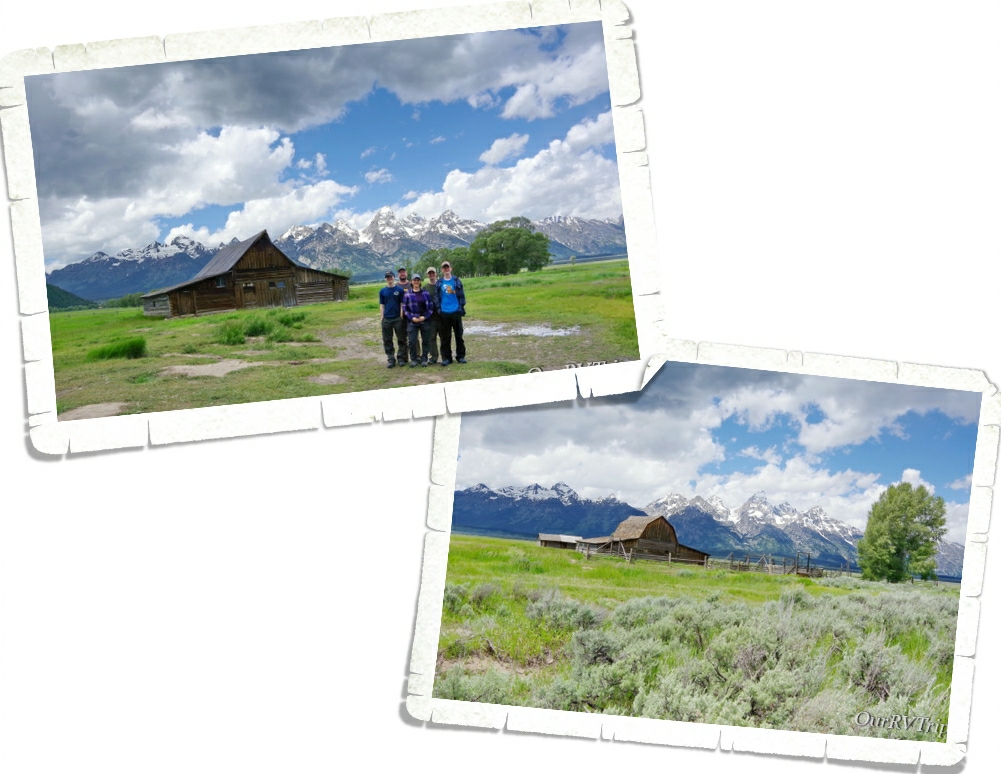
The Homestead Act of 1862 drew settlers to the area. The promise of 160 acres to any person willing to work the land for five years brought a vibrant community to what was originally known as Grovont, but is known today as Mormon Row. There are several settlements still standing today. We enjoyed exploring them and learning a little history about the first families to make the Teton Range area home.

We tried so hard to see wildlife. One morning three of us got up and 4am and headed into the park with hopes of spotting some mama bears and cubs. We saw tons of pronghorn (you can’t go anywhere in Wyoming without seeing pronghorns), elk, deer, squirrels… We found a footprint of something one morning at Schwabacher Landing. We can’t agree on what it’s from though. The closest we came to seeing a bear…we saw a black bear’s hiney as it was making its way back into the forest and we saw the fur of a grizzly (We know it was a grizzly because the Ranger told us. We wouldn’t have known otherwise.) for maybe a half a second. I don’t have photos of either encounter to share with you.

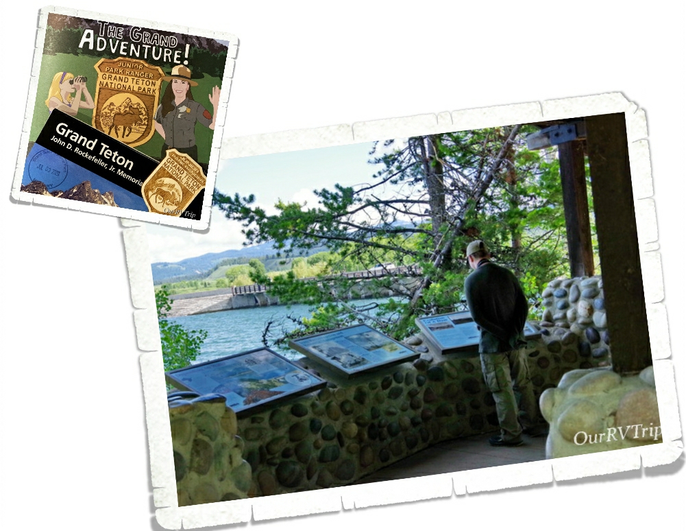
Alex wants to be a Ranger. He reads every sign we come across and devours the park map and newspaper for every drop of information he can get. He’s going to make an excellent Ranger one day.

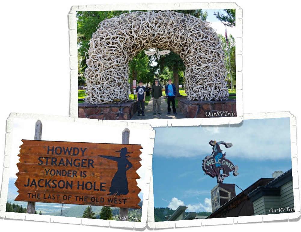
We stayed in Wilson, but the main town in the area is Jackson. We’d stocked up on food and groceries before we got there, but still went into town to check it out and see what we could see. It’s super touristy and reminds us of pretty much all of the other Ski Resort towns we’ve seen on our wanderings.

We did take one of the boys for a meal while we were there. See the little QR code in the picture? That was our menu. We had to scan it so we could bring the menu up on our phones. I actually liked this. It was one less thing for us to worry about having to touch and then eat. Our burgers were decent…mine was actually pretty good. It had an onion ring on it and they filled the onion ring with mushrooms.

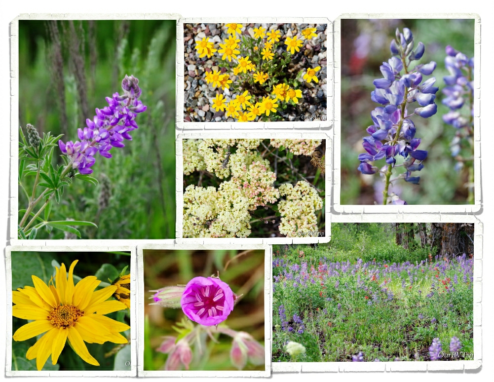
There were so many pretties! I was in flower heaven!! I’m not sure if I took more pictures of the mountain range or the pretties we found around it. 😉

If we ever go back to Grand Teton NP, we’ll have to figure out a better place to stay. The park we stayed in was horrible. Super tight spots, super muddy, and the hookups…were under the rig. Yup, we had to crawl under the RV to hookup and unhook our water and sewer. And Guys, this place was the most expensive place we’ve ever stayed in. It was bad. We heard pretty much everyone there complaining about it.

That’s it for this National Park Unit!! We had a great time in the park!

See y’all down the road!

#NationalParkTour