Tag: national monument

Our 2021 Travels

Our 2021 Travels

Hey Guys! It’s December 31…the last day of 2021…and I thought it would be fun to do a review of our travels for this year!

With everything that was going on this year, not only in our country, but worldwide…we weren’t sure how much traveling we would be able to get in. But, you know I had a plan and had us reserved just incase we could travel. Well, not only did things workout…we ended up spending time in sixteen states this year! We added twenty-nine new National Park Units to our overall NP count and managed to visit a new-to-us unit of the Manhattan Project National Historical Park in Oak Ridge…so 30 NPs all together for us this year. That puts our total National Park count at 189 of the official 423 National Park Units. So…we still have plenty to get to!!

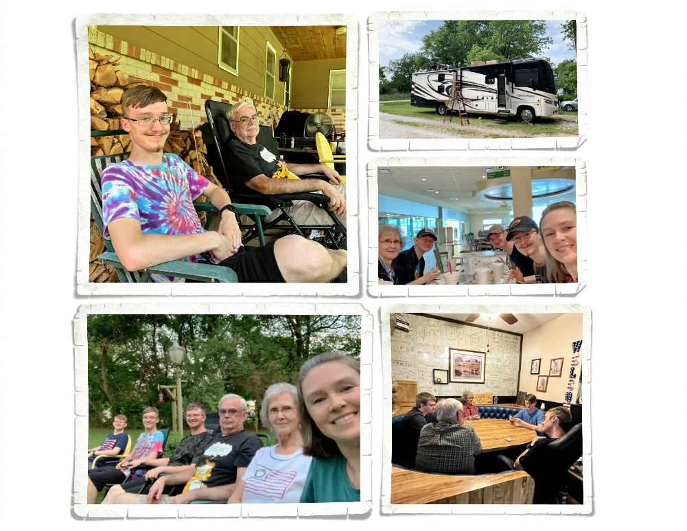
While we spent most of the year traveling, we still got in several weeks of mooch-docking with family in Missouri so we could spend time with some of our favorite humans and get some projects done on our home-on-wheels. It’s always good to go home and see family. It’s always hard to say goodbye when we leave. Some goodbyes are harder than others…

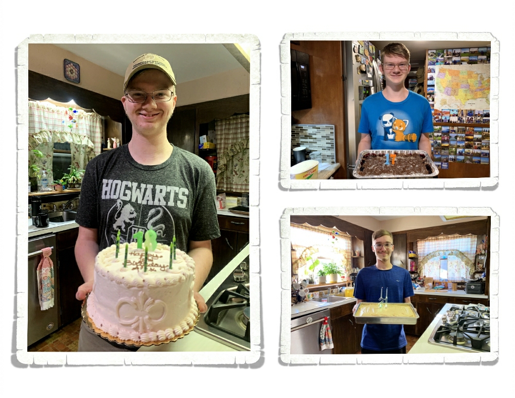
We also had some celebrations during 2021! The boys are now 21, 18 and 17…and we had two high school graduations this year! Two! That means that we are officially done with homeschooling. I’m not sure how I feel about it…it is bittersweet.

We went through all of our 2021 travels and picked out our top ten favorite places we explored this year…so let’s get into it.

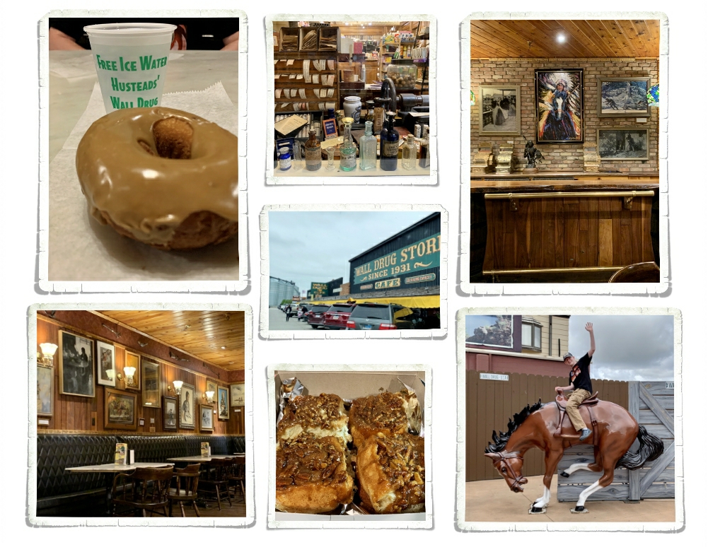
The first place we’re going to revisit on our top ten is Wall Drugs in South Dakota. Wall Drugs is in our number 10 spot. I know what you’re thinking…Jennie, Wall Drugs? Really?

Guys…Really. This place was unreal. We’ve explored quite a few places and have been to many many stores during our almost seven years of this crazy #nomadlife and we’ve never seen a store like Wall Drugs. We stayed about a block from it while we were in the area…so we got to see the crowds that came every…single…day. All Day. People would start lining up before they even opened, just to get their famous maple donuts or pecan sticky buns. Because we were staying so close for two weeks, we spent quite a lot of time in Wall Drugs perusing all it has to offer. If you ever need or want a souvenir for South Dakota…this is definitely your place. If you need a break from driving and some foodies…this is definitely your place. If you’re into quirky roadside attractions that have interesting history…this is definitely your place. If you’re anywhere near Wall, SD at all…Wall Drugs is SO worth a stop.

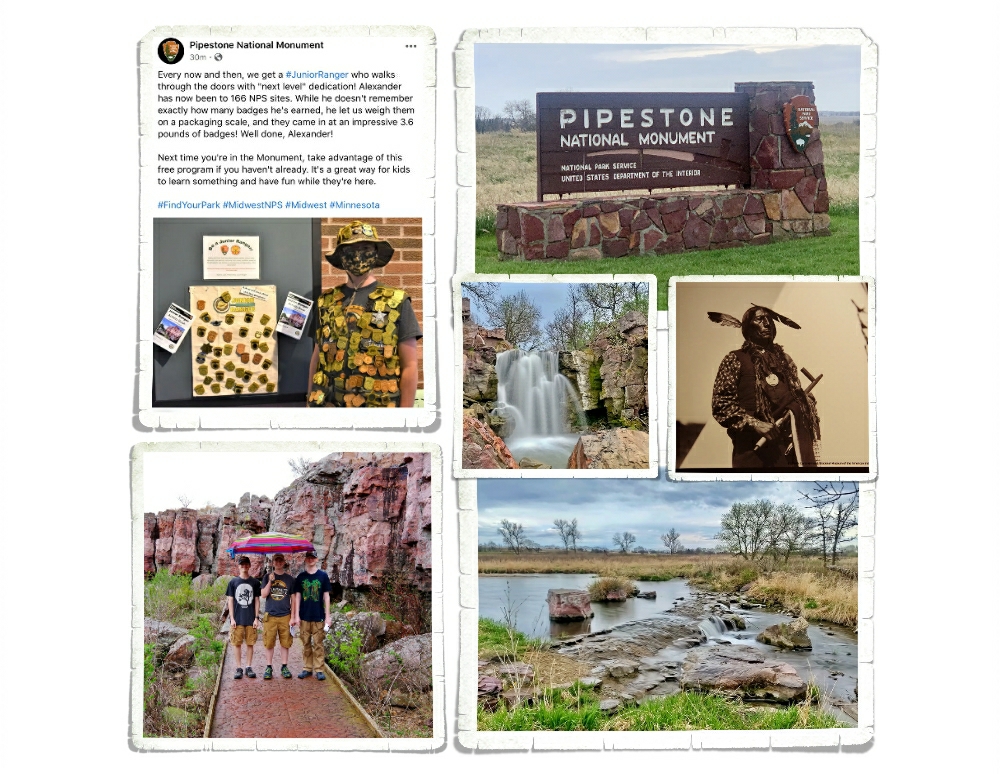
In the number 9 spot is Pipestone National Monument in Minnesota.

When we started this nomad life way back in 2015, we wanted to show our boys the Country they live in. We didn’t want to show them just the shiny pretty places, we also wanted to teach/show them our Nation’s history. Places like Pipestone National Monument, which preserves over 3,000 years of history, is a prime example of why we chose to live a nomad life in order to travel. We’ve learned so much history that we would have never even known about over the last almost seven years. There’s so much out there they don’t teach us in public schools. The historical National Parks like Pipestone NM are some of our absolute favorite National Park Units.

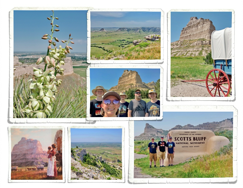
Keeping with our love of history lessons…it won’t surprise you that Scotts Bluff National Monument in Nebraska made it to the number 8 spot on our top ten for 2021.

Scotts Bluff NM has both amazing views and a rich history. We thoroughly enjoyed our visit to Scotts Bluff NM. It was late Spring/early Summer when we went so the flowers were still in full bloom and the heat was ramping up. The day we went, we saw temps in the 90s so we didn’t spend as much time hiking as we’d’ve liked, but we hiked some and spent time in the visitor center museum learning. I never thought of this kind of landscape when I thought of Nebraska…we were pleasantly surprised not only with this park, but with this area.

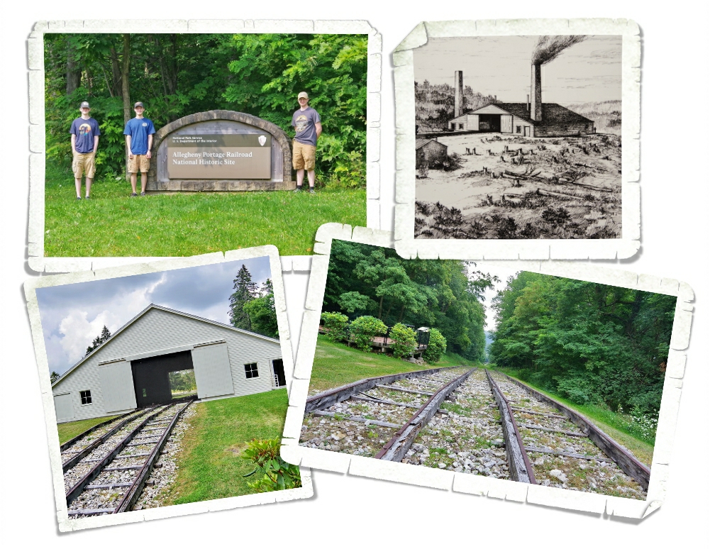
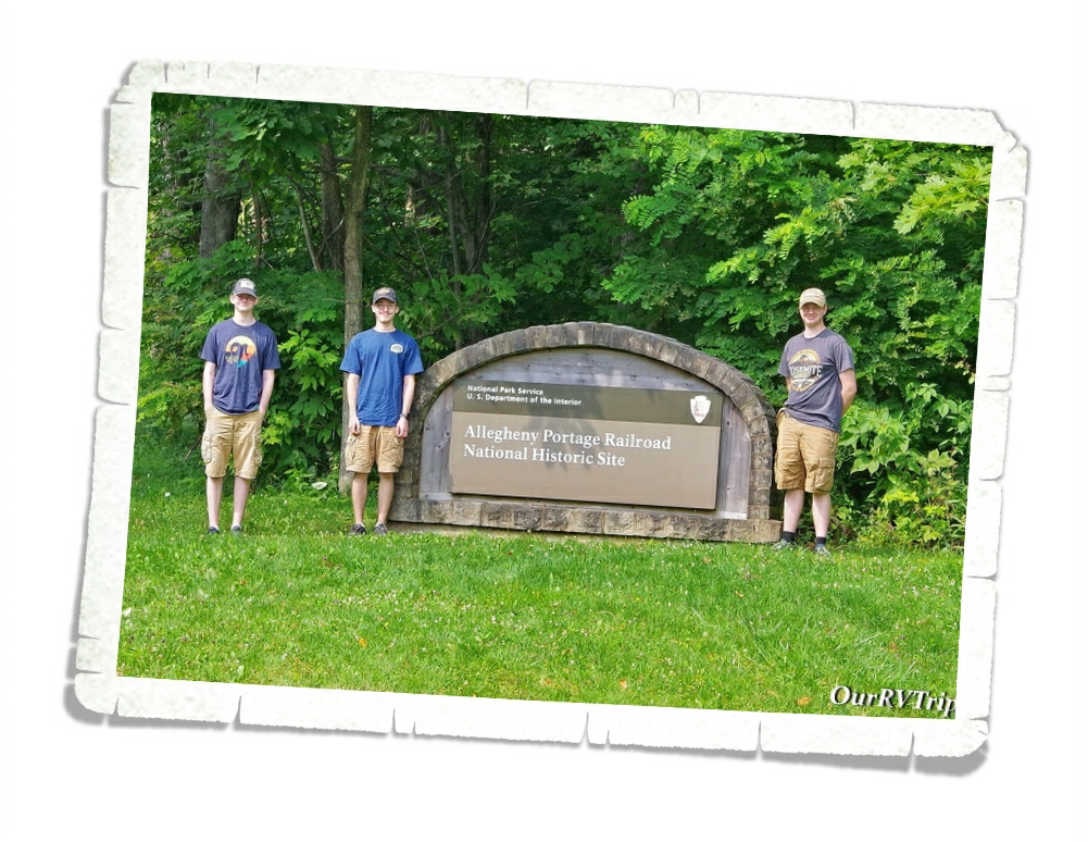
Allegheny Portage Railroad National Historic Site in Pennsylvania sits in the number 7 spot on our 2021 list.

When I asked the boys to name their favorite places we explored this year…it surprised me when more than one of them mentioned Allegheny Portage Railroad National Historic Site. This is one of the smaller parks we visited but it’s absolutely crammed with not only history…but also engineering. So, it probably shouldn’t have surprised me that my little nerds liked this NP unit so much. We learned about railroad engineering and the way railroads changed life along their routes.

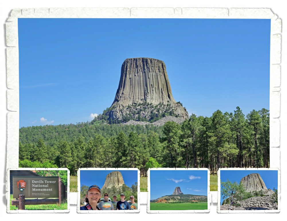
Sitting in the number 6 spot is Devils Tower National Monument in Wyoming.

Devils Tower NM is steeped in local Native American history and lore. We loved learning not only about the science of it, but also the lore woven around it. We visited this park on two separate days and it was insanely busy both days. If you go, make sure to pack your patience and since there’s not a lot of educational info available (no museum), which really surprised us, make sure to grab a Ranger and ask about the science and lore of the “tower”.

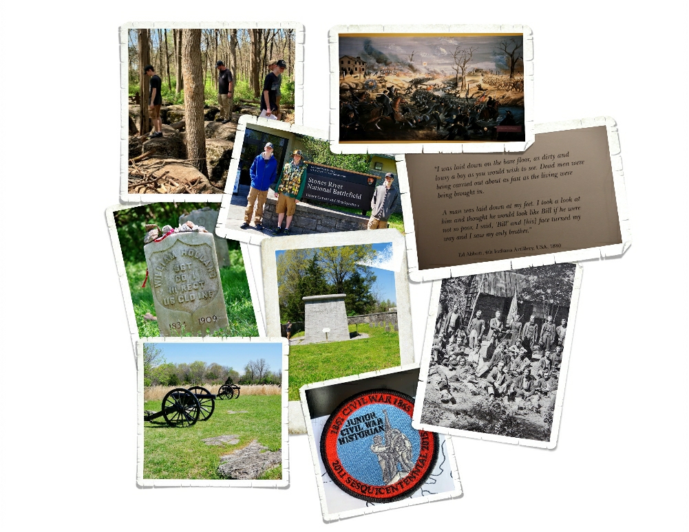
With our love of battlefields and history…it won’t surprise you to see Stones River National Battlefield in Tennessee sitting at the number 5 spot of our 2021 list.

If you’ve been following along at all, you’ll know battlefields are our jam. So much so, that earlier this year we did a battlefield tour of Tennessee. And while all battlefields have certain things in common…the cannons…the war…the death… there are also the stories of life and perseverance and love…and those are what draw us in. You can learn so much from the stories that surround the battlefields. Stones River was one of the bloodiest battles of the Civil War. The stories we read…especially one about two brothers…really touched the boys and made a lasting impact on their views of life. This is what National Parks will do…they’ll change you for the better.

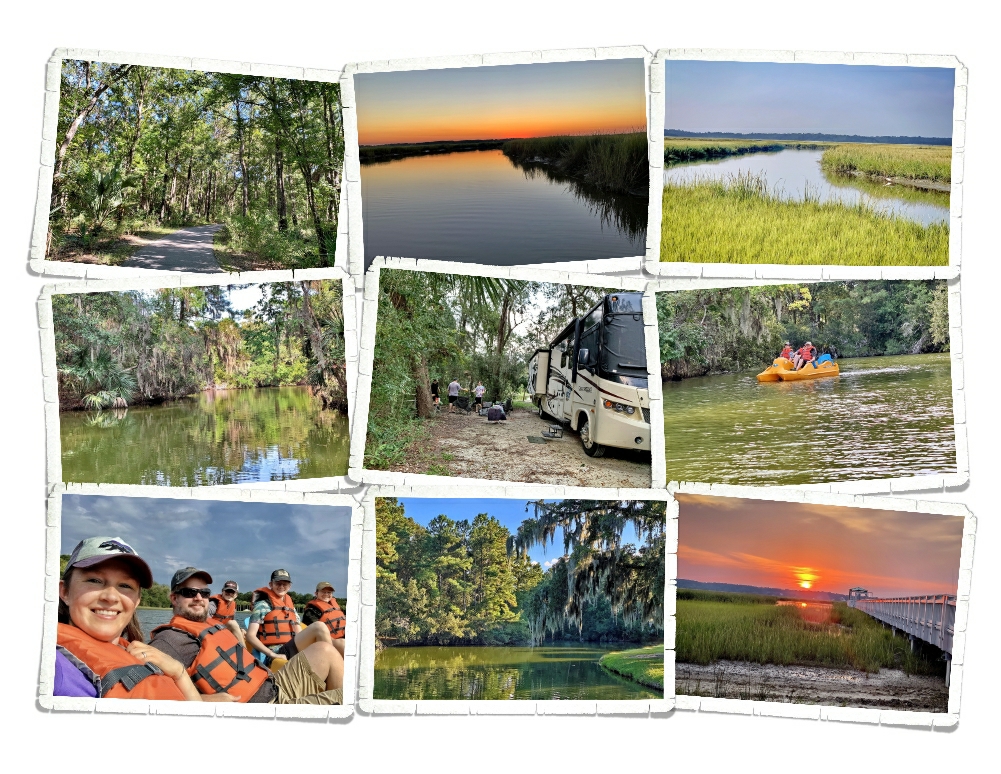
There are only three places that made it to our top ten that aren’t National Park units. The number 4 spot is one of those with James Island County Park in South Carolina.

Guys…this park is awesome! It’s not only on our top ten of 2021 list…it’s on our top places to stay list. I would go back to this area just to stay at this park. When I booked this place…it was a last resort. There aren’t a ton of places to stay in the Charleston area and when the place we usually stay wasn’t taking reservations because of the whole CV thing…and then the other places I tried were either closed or refusing to take reservations that far out…I ended up taking a chance on James Island County Park. It was the best decision. We love everything about this park. From the walking trails to the fishing pier (sunset pics) to the paddle boats (watch out for the gators) this park is the best one we’ve found in a long time.

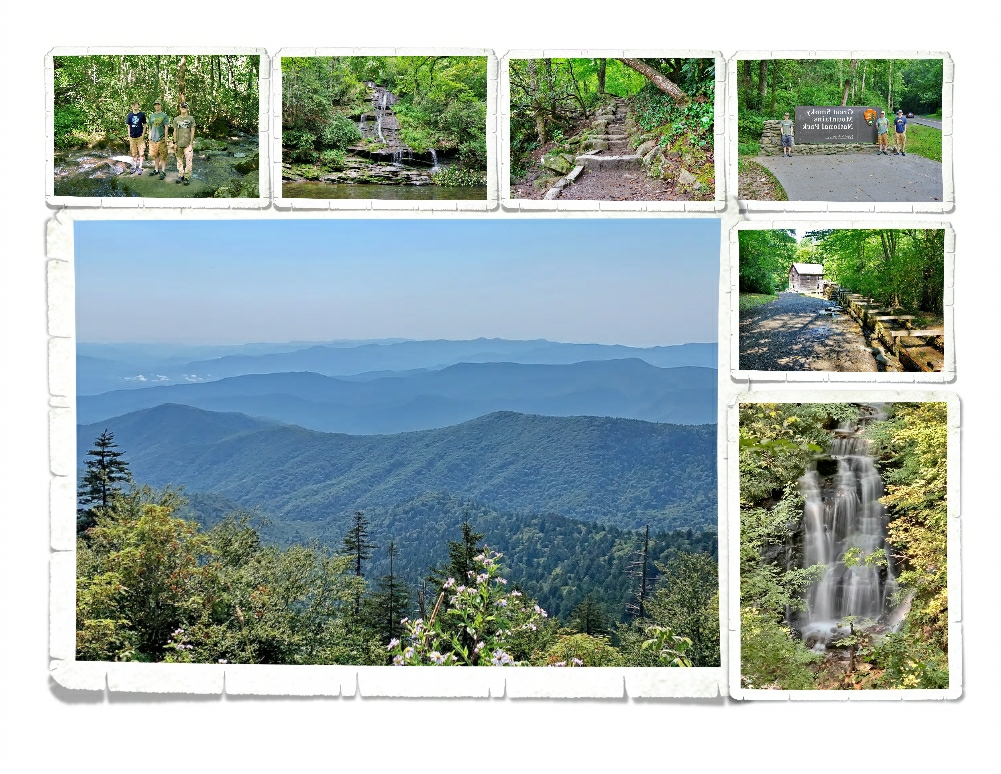
Great Smoky Mountains National Park in Tennessee has the number 3 spot on our 2021 list.

There are 423 National Park Units. Great Smoky Mountains is the most visited National Park unit in the United States. While the park was crowded every single time we went, we were still able to find a few quiet places. There is an underrated beauty to this park that is refreshing. We’ve found that while the “old man mountains” of the Smokies aren’t big and flashy…you won’t find the dramatic views like you’ll find in the Rocky Mountains or the Sierra Nevadas…there is a quiet calm and a beauty to the Smokies. Tranquil is the word that comes to mind…even with the crowds.

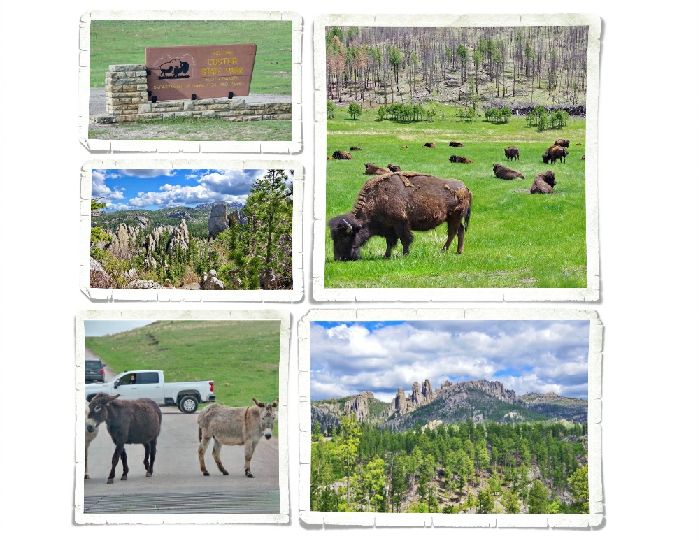
Custer State Park in South Dakota is firmly in the number 2 spot of our 2021 list.

Custer SP should definitely be a National Park. We stayed just outside it for two weeks and good grief…the whole area is amazingly gorgeous. This park has it all! Views, hikes, wildlife… We look forward to going back someday. Hopefully, without the tornado that went through while we were there.

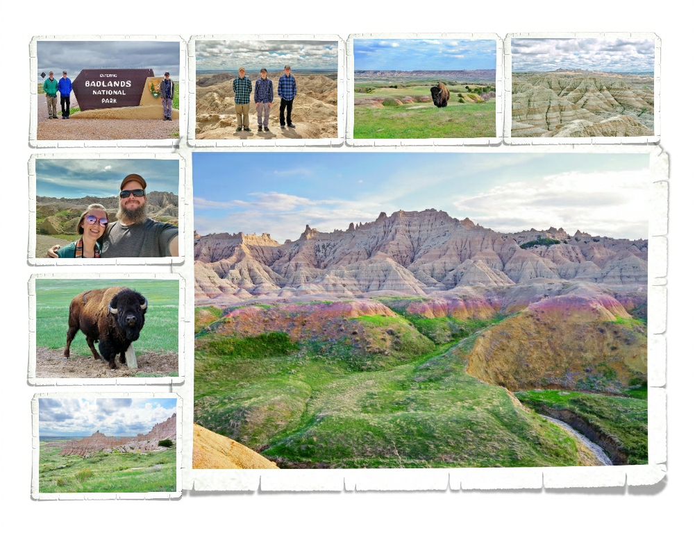
As soon as we started making a list of our favorite places of 2021, Badlands National Park was the first place we thought of. And, while we might have disagreed about which numbers the other places on the list fell…we all agreed that the number 1 slot definitely belongs to Badlands National Park in South Dakota.

Guys, this park blew us away! Badlands NP isn’t just on our favorites list for this year, it’s made its way onto our overall favorite list as well. We saw so much wildlife at this park…and the colors were just…amazing. We went in the Spring while everything was still green and the bison were starting to shed their winter coats and all of the baby animals were bouncing around. Badlands NP has got to be one of the most underrated NPs in the NPS system. We spent two weeks going in and out of Badlands and completely loved it.

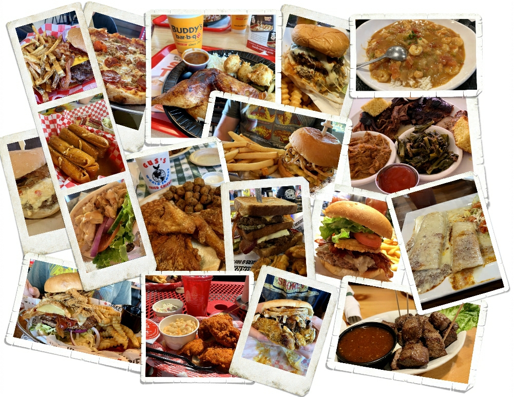
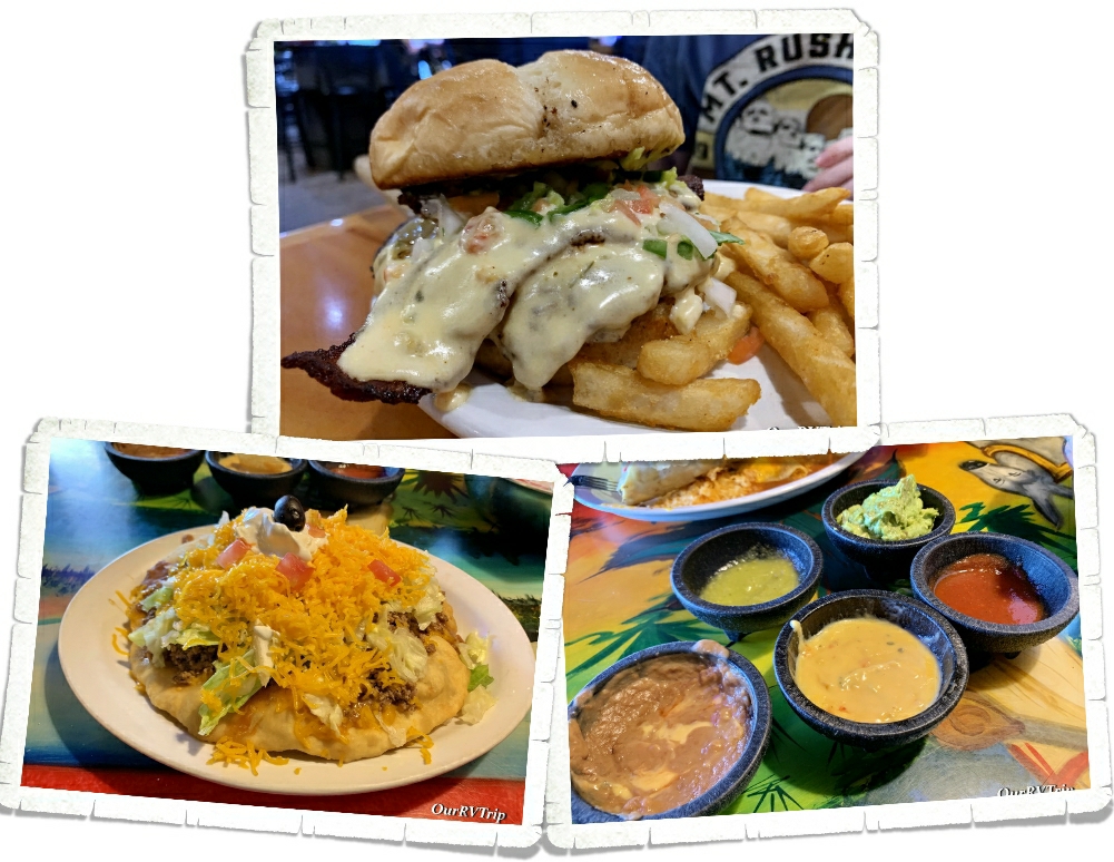
And….with a year of travel comes a year of foodies. We started listing the places that were fabulous…the places we wanted to include…and well, you can imagine that the list kept growing. So, I’ll leave this collection of foodie pictures here and tell you that we had a very very good foodie year. So good, we all gained a few extra pounds. Ha!!

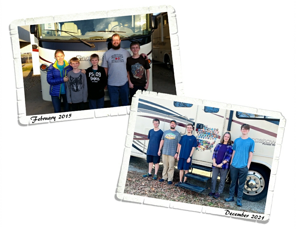
We’ve been living this crazy nomad life while we’ve been on our #grandadventure for almost seven years now. In those seven years we’ve seen so so many amazing places and made countless memories. We’ve learned more than I ever thought we would, traveled farther than I ever thought we would and did things I never thought we would have the chance to do together as a family. We’ve grown… in more than one way…some of us are quite a bit taller now than when we started this amazing journey all those years ago…and with that growth, comes a need for a change. We’ve decided that 2021 will be the last year we live the nomad life. It’s time we get a more permanent basecamp where the boys can learn how to adult “normally” and go to college and get jobs and start planning adventures of their own.

So…this is the end of our Grand Adventure as a #digitalnomadfamily and as fulltime RVers. When we started planning this whole crazy thing way back in 2014, we never thought it would become our life for almost seven years, take us to 49 states and shape us in the way that only traveling can. And, as with every end, there is the magic and promise of a new beginning. As 2021 ends and 2022 begins we look forward to the promise of adventures…of a new kind.

We hope y’all have a wonderful New Year filled with all of the amazing adventures your heart desires.

Thank you for coming along on this crazy nomadic ride with us…we’ve loved having you be apart of the journey!

Much Love,

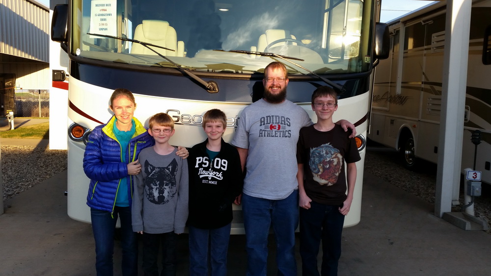
Jerl, Jennie, Charles, Alex and Nicholas

#theend
Basecamp Uniontown

Basecamp Uniontown

Hey Guys! We made it to Pennsylvania! This was a hard place to get to for a few different reasons. There aren’t too many RV parks in this area…they’re all pretty darn expensive…and even the KOA we ended up staying at was mostly seasonal. But, I found us a spot and even with some changing plans and pandemic stuff, we made it.

You’re probably wondering why we made such an effort to get to Uniontown, Pennsylvania. There are five National Park Units that are reachable from Uniontown. All of them are within an hour or so drive which made Uniontown a good basecamp to see all five parks. We gave ourselves two weeks and Guys…it rained almost every day. *palm slap* We made it work and got them all in though…so lets get this post started.

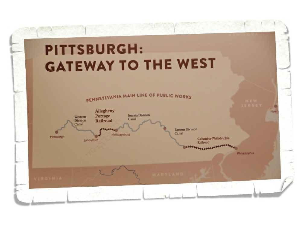
Allegheny Portage Railroad National Historic Site preserves a few important locations along the Allegheny Railroad. With the completion of the Erie Canal in 1825, the merchants in Pennsylvania found themselves being left behind as everyone started to take advantage of the easier route through the canal with new markets and new cities. The Allegheny Railroad was Pennsylvania’s answer to keeping commerce coming through their state.

Before the Allegheny Portage Railroad, Pennsylvania merchants and travelers wanting to reach Pittsburgh utilized a railroad then a series of canals to get to Hollidaysburg where they then had to slog their way through the Allegheny Mountains until they got to the next set of canals. The terrain was hard, often muddy, very steep and not very cost effective for merchants. When the Erie Canal offered merchants a faster, easier…and more cost effective route, Pennsylvania had to come up with a better solution to get goods and travelers over the Allegheny Mountains.

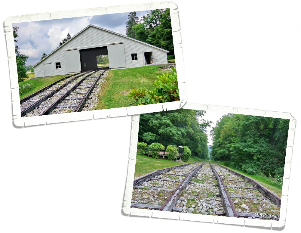
What they came up with was a daring engineering marvel when railroads were still considered experimental in the United States. The inclined plane railroad carried entire boats along a series of ten incline planes (five on one side and five on the other) up , over and through the Allegheny Mountains. In each of the engine houses along the incline, there were two steam powered stationary engines that utilized ropes to pull the railcars along the railroad. With the completion of the Allegheny Portage Railroad, a trip across Pennsylvania that used to take three weeks, only took a few days.

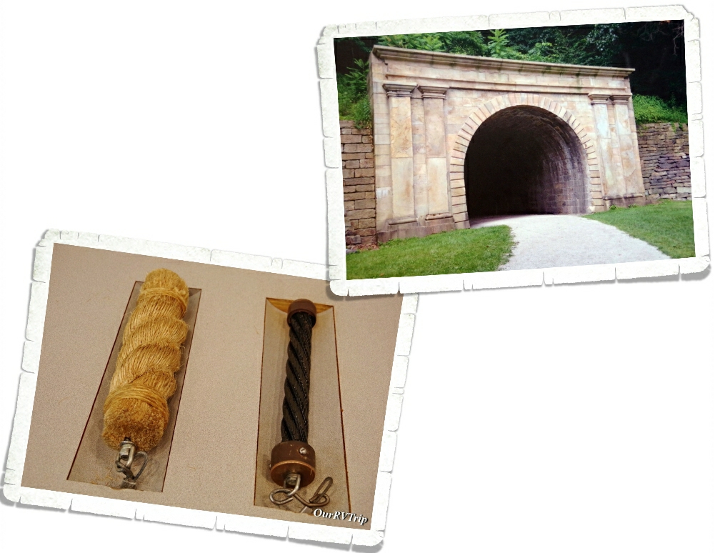
Railroads, steam engines and incline planes were all groundbreakingly new when Pennsylvania was figuring out how to make the Allegheny Portage Railroad…in fact, this would be the first time they were all used together. And…if that’s not impressive…how about the first railroad tunnel in the US? Staple Bend Tunnel took workers eighteen months to cut through 901 feet of sandstone. Keep in mind…dynamite sticks didn’t exist yet.
One of the most important innovations created during this whole endeavor is the wire rope, created by John Roebling to fix the problem with the hemp ropes previously used that were notorious for breaking within one season of use. Roebling would later go on to design the Brooklyn Bridge.

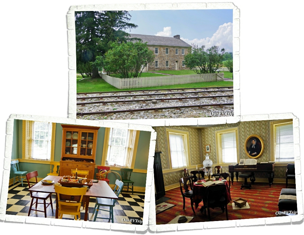
The Lemon House was owned and operated by Samuel & Jean Lemon and served as a tavern during the time the Allegheny Portage Railroad was used. As you can see from the photo above, it was located right off the tracks of engine house number 6 where passengers had to wait until the train started its decent. You can go in and explore a few of the rooms of Lemon House and get a feel for what life was like for people at that time.
As high tech as it was, the Allegheny Portage Railroad didn’t last that long…opening in 1834 and closing in 1854…for a variety of reasons, but mainly due to further advancements in the locomotive. In the early 1850s, Pennsylvania started work on the new and improved Portage Railroad effectively ending the usefulness of the old system. While short lived, no one can dispute the critical role it had in continuing the westward expansion and opening up the interior of the US.

Johnstown Flood National Memorial preserves the story of one of the worst disasters in American history which resulted in over 2,000 people dying.

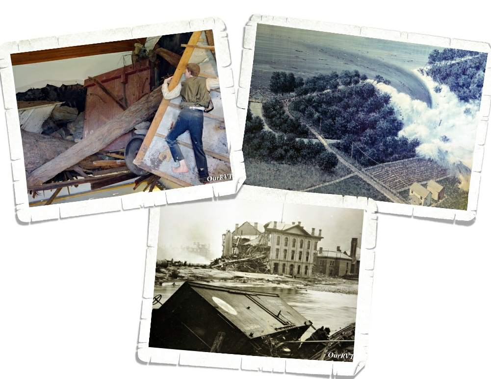
Johnstown, Pennsylvania was a steel and railroad town. Most of the 30,000 people who called it home were German or Welsh…a hard working, family oriented community. For whatever reason, the people who founded Johnstown did it in the middle of a floodplain so the town was used to some seasonal flooding.

Picture found in the visitor center and is not mine.

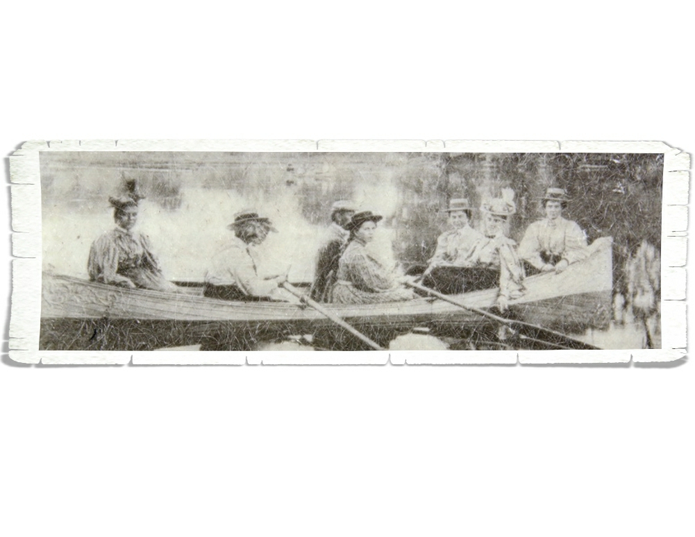
Lake Conemaugh was originally built as part of a canal system from 1838 to 1853. It was abandoned and sold to the Pennsylvania Railroad and then sold again to the South Fork Fishing and Hunting Club sometime after 1881. The Club was an exclusive and a very secretive retreat for fifty Pittsburg steel and coal magnates and their families. The Cub built cottages and a club house along the shore and stocked the lake for fishing. Unfortunately, they didn’t put much time or effort into the lake or dam maintenance. On May 31, 1889, after several hours of hard rain the South Fork Dam failed and somewhere around 20 million tons of water tore through several towns and destroyed Johnstown.

The Johnstown flood is the worst natural disaster of the 19th century and brought not only our nation but the world together to help the survivors of the Johnstown flood. This was also the first disaster relief effort led by Clara Barton through the American Red Cross.

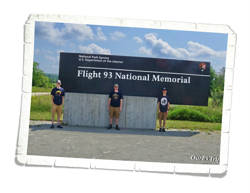
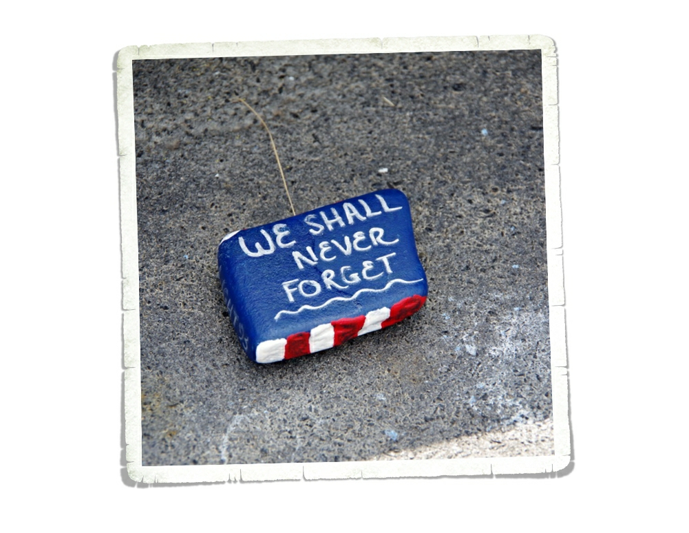
Flight 93 National Memorial was the whole reason we came to this area. We often take the opportunity to teach the boys things based on the NP unit we’re visiting and the lesson of Flight 93 is one they’ll never forget. September 11, 2001 is a date we, as Americans, should never forget. Only one of our boys was alive at the time and he was only one so everything they know about what happened that day is from watching documentaries and hearing us (their mom and dad) talk about it. Y’all know it’s different to see something on television or read about it in a book… but to stand in the place where people gave their lives to protect so many others will make it more real. These were regular people…not soldiers…who made the ultimate sacrifice to save others.

I’m not going to go through all the details here of what transpired on that day…y’all should already know. I’m just going to talk about the memorial in this post.

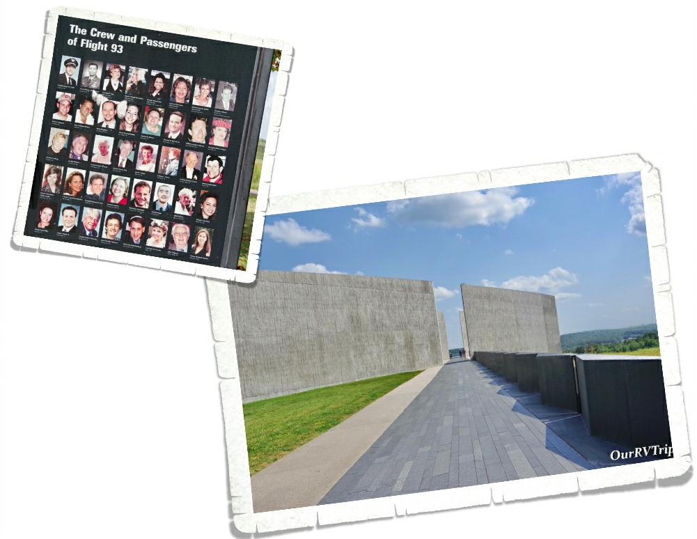
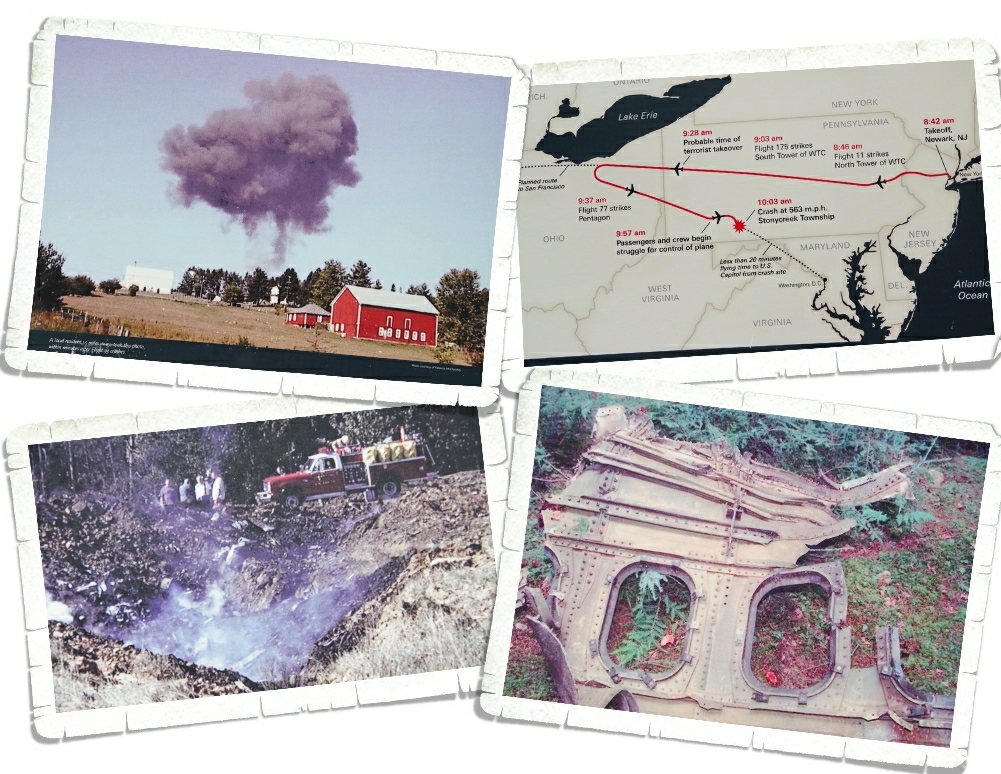
Flight 93 National Memorial preserves and honors the memory of the forty passengers and crew of United Airlines Flight 93. Everything about this memorial was thought out and has meaning starting with the flight path you walk to get to the visitor center and viewing deck. Along the flight path, you’ll see the time stamp of when each of the other three planes crashed.

While you’re in the visitor center, they ask that you not take any photos. Some of what’s being displayed is still under copyright law. I found these photos outside and asked a Ranger if I could photo them. I think they really put some of the pieces of the overall puzzle together.

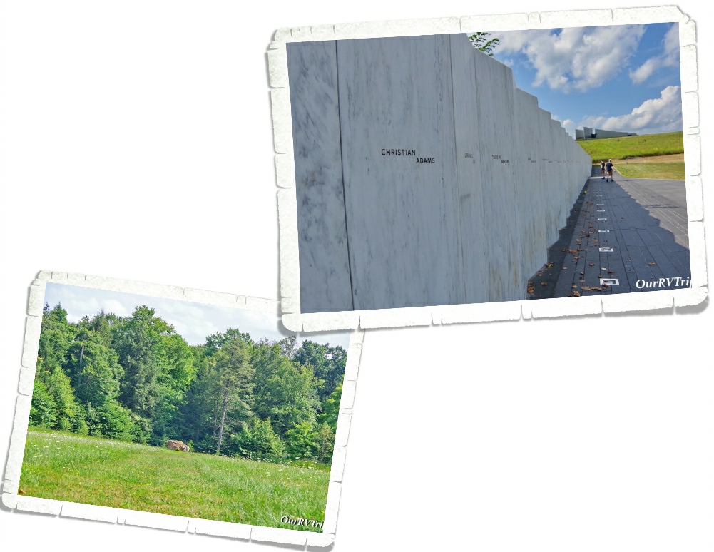
When you’re done going through the mountain of information in the visitor center, head down to Memorial Plaza where you can see the Wall of Names. The Wall of Names is made of forty individual marble panels. Each panel has the name of a passenger or a crew member engraved into the marble. Out in the field sits a seventeen ton piece of sandstone that indicates the location of impact.

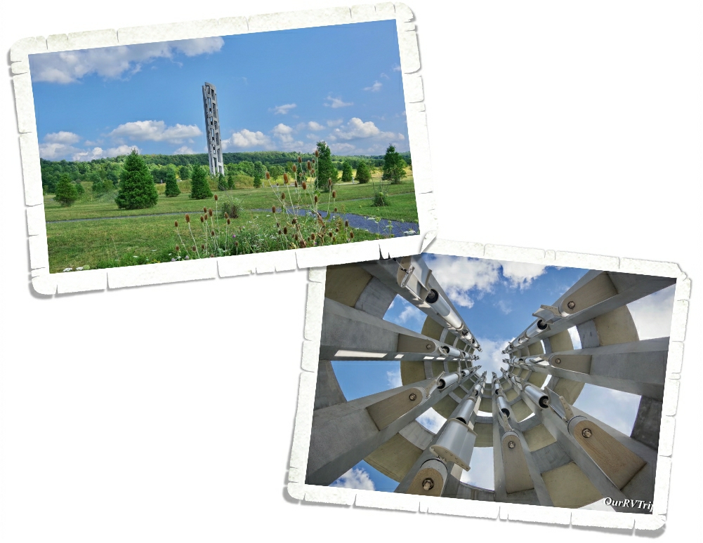
The Tower of Voices is 93 feet tall and holds 40 windchimes. One chime for each voice lost on Flight 93. The chimes are big so it takes a big wind to make them sing. We didn’t get to hear them while we were there, but you can go to the NPS website for Flight 93 National Memorial and hear it there.

We visited Flight 93 National Memorial in August 2021. I honestly expected there to be more people there since 2021 is the twenty year anniversary of 9/11, but there weren’t too many people there. We didn’t mind. We spent quite a bit of time at this little NP unit talking about what happened…remembering.

Once again, the NPS has done an excellent job of commemorating, honoring and preserving a pivotal event in American history that should never be forgotten. On a day when it’s easy to find so many stories of fear, destruction and death…if you listen, you’ll also find just as many stories of hope, unity, courage and heroes.

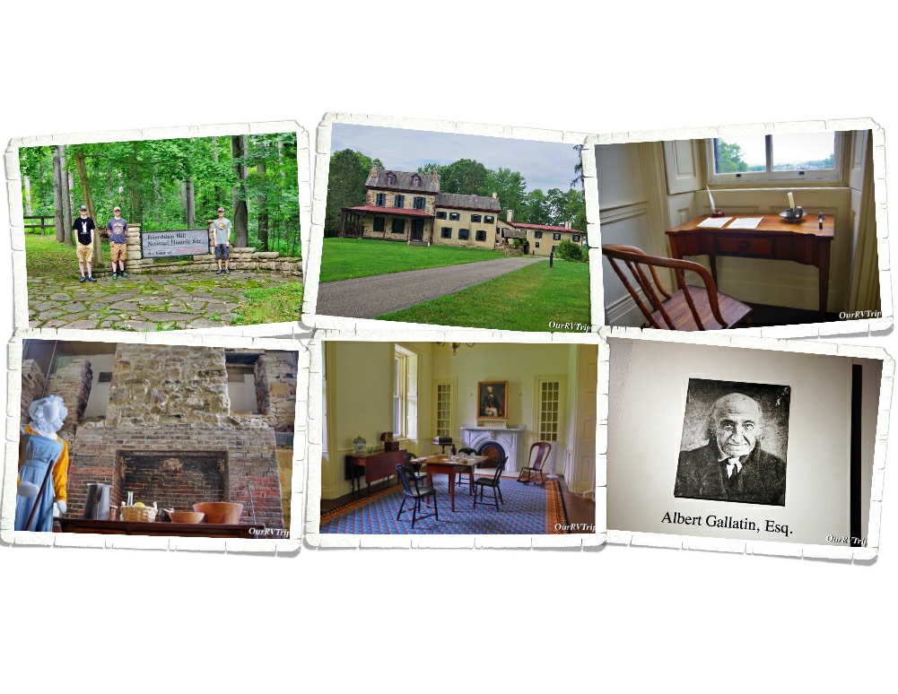
Friendship Hill National Historic Site is at the country estate of Albert Gallatin. The house is beautiful…but really, the NHS is about Albert’s life and his many accomplishments. We’d never heard of Albert Gallatin before we visited this NP Unit, but Guys…he had a hand in some of the biggest historical events for the US. Albert Gallatin spent thirteen years as Secretary of the Treasury under Presidents Jefferson and Madison…and while he was doing it…he actually reduced our National debt. He also had a part in the purchase of the Louisiana Territory and funded the Lewis & Clark expedition! Later in his life, he helped to negotiate an end to the War of 1812 and then moved his family to France where he served our Country one more time…this time as Minister to France.
We spent a few hours going through the house and learning all about Albert and his family. We also met a great Ranger and spent quite a bit of time chatting with him. We’ve said it before…but I’ll say it again… meeting people that we would never have had the chance to meet has been one of the best parts of living this crazy Nomad life that we live!

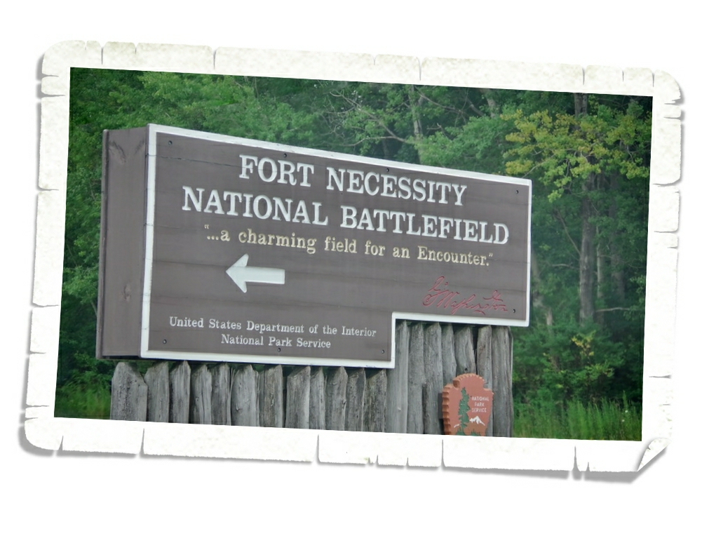
Fort Necessity National Battlefield was the last park we explored during our two weeks in the Uniontown area. This is another park that people always ask us if we’ve been to so we were expecting good things from this park.

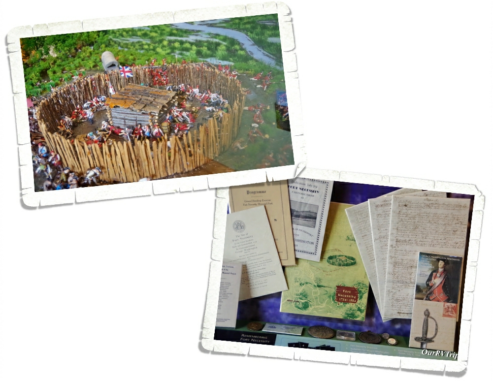
The museum at this park was a good one. It laid out all of the information and included some great pics/artifacts. For some reason, I didn’t get very many pics at this park. Sometimes it happens…sometimes I’m too busy being a nerd to remember the big camera in my hands. If you can (and we highly recommend it) you should do the Ranger talk/walk here. The Rangers do a fantastic job of presenting the information and highlighting the major points.

So, what’s so important about Fort Necessity?

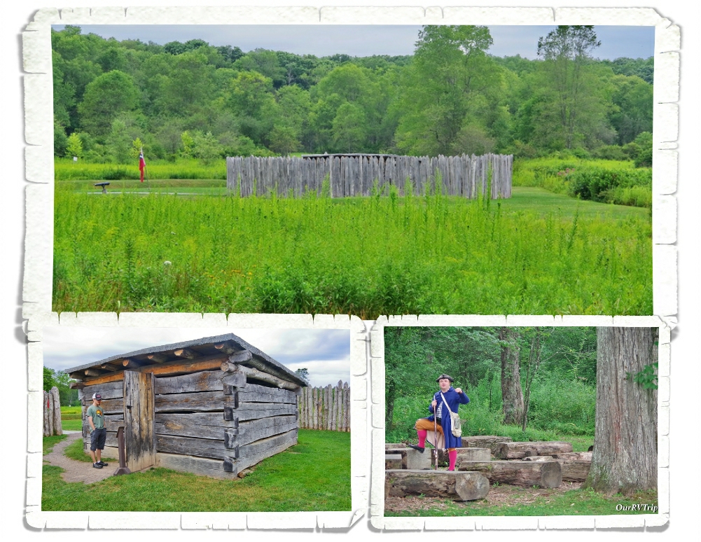
Fort Necessity is where a young (22yrs old) Colonel George Washington suffered his first military defeat in the summer of 1754 at the hands of the French. It’s this battle that leads to the beginning of the French and Indian War where Great Britain and France spent seven years fighting over who would control North America. I’ll be honest…I was really expecting…you know, a fort. But, Fort Necessity is really a stockade meant to keep the gun powder and the rum safe.

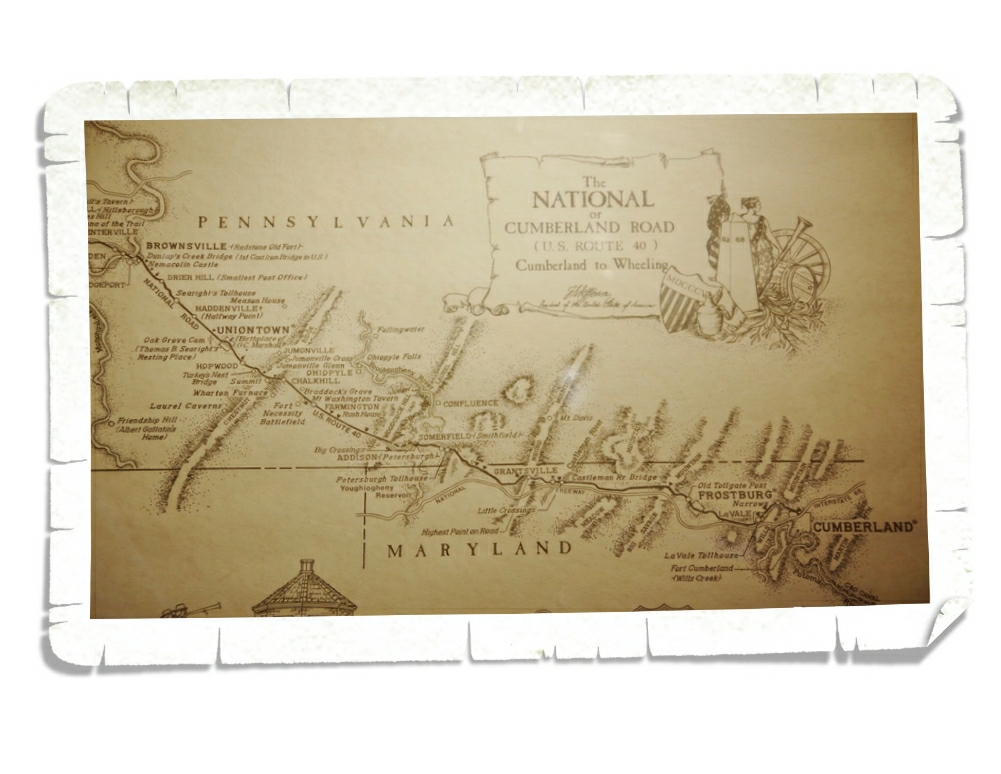
George Washington was in the area to build a road…the road that would come to be National Pike and was the first federally funded highway.

Most believe the battle that took place at Fort Necessity along with the resulting French and Indian War set the stage for the American Revolution. So yeah, the events that took place at this little NP Unit were…world changing.

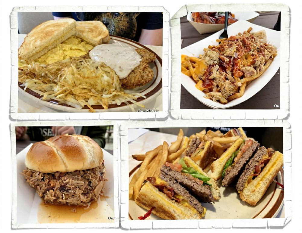
We found some pretty good foodies! One of the regional foodies we found was the Burger Club where the “buns” were actually grilled cheese sandwiches. And we found some pretty darn good smoked meat at a place called Stone House that’s right down the road from Fort Necessity.

Well Guys, that’s what we got done during our two weeks in Uniontown. We smashed quite a bit even with the shoddy weather. The RV park we stayed at had almost zero cell service. We couldn’t even make a phone call. Fortunately, they had decent wifi and we were able to make it work…it was a struggle…somedays were pretty frustrating as we tried to do work/school stuff. It makes us appreciate those blazing fast speeds when we find them! Ha!

And for those keeping track…we’re now up to 24 National Park Units for the 2021 adventure year…so far!

See y’all down the road!

#NationalParkTour

Here We Go Again!

Here We Go Again!

Hey Guys!! Here we go again! We’re off on our last adventure loop of the year and heading East again. Our first official stop on this loop is in Virginia, but that’s a really long drive from the southwest corner of Missouri. We had two long drive days and ended up in West Charleston, Ohio for six nights. Everyone has their own driving schedule. We like to keep our drive days down to under 400 miles and we’ll grudgingly do two in a row before we stop for at least a week. We don’t do it often and all of us pretty much hate the big long jumps…but sometimes we do them so we can spend more time in a certain area.

I try to pick our stop offs…those six nights we have to stay put to do work and school…based on what’s in the area. This area actually had a few different NP Units we could potentially visit. We made it to two in the six days we had!

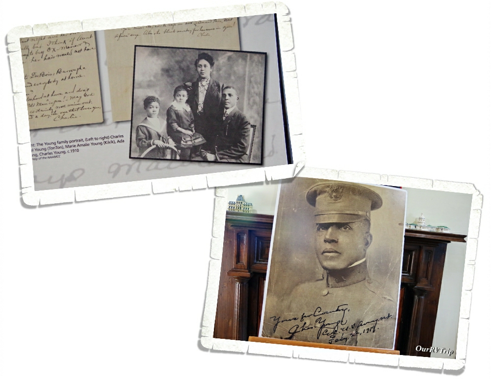
Over the years, we’ve seen Buffalo Soldiers mentioned at other National Parks, but had never seen a Unit devoted to them. Charles Young Buffalo Soldiers National Monument is new to the NPS and it’s in the process of getting officially set up with a visitor center/gift shop…but you can still visit and learn.

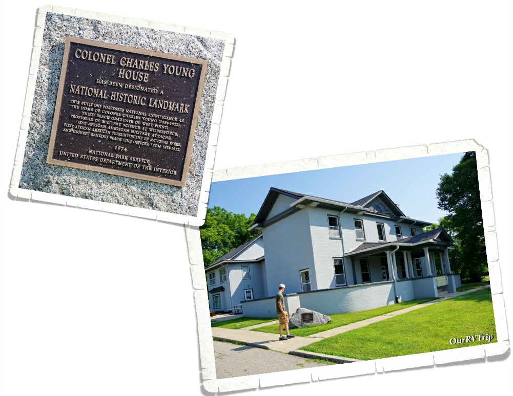
Charles Young Buffalo Soldiers National Monument was brought into the NPS in March of 2013 and pays tribute to the life and legacy of Charles Young. Born to two slaves in 1864, Charles started his life out with the cards stacked against him. His parents fled to a free Ohio when he was still an infant where his dad enlisted in the 5th US Colored Heavy Artillery Regiment. Education was important to Charles’ parents so they encouraged him to go to school and get the best education he could. Young always did the absolute best he could at whatever task he was given throughout his life. He was the third African American to graduate from West Point and has a long and impressive list of accomplishments…quite a few put him as the first African American to hold a particular position within the Military and National Park Service. Charles Young was a mentor to an entire generation of African Americans who aspired to be more in so many aspects of their lives. And to be honest, his life should inspire you no matter what color your skin is. He led a life of honor and dignity and wasn’t afraid to work hard to achieve the goals he set for himself.

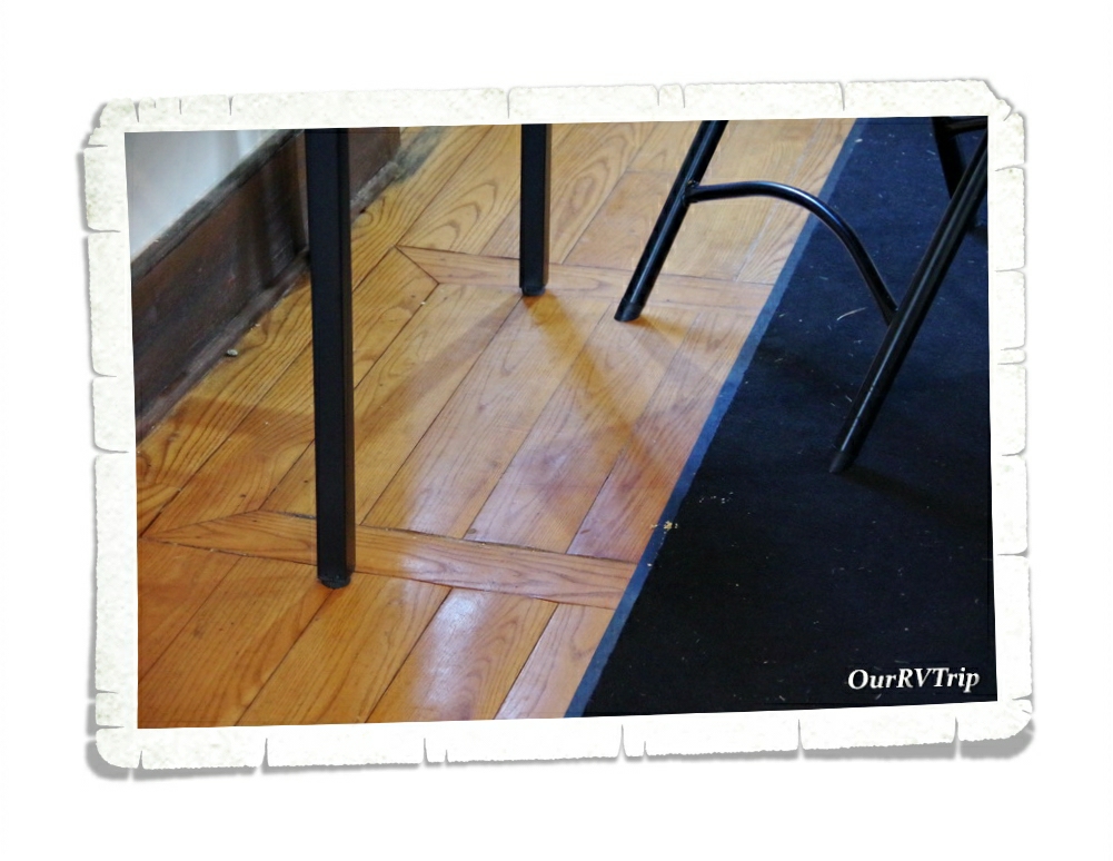
The National Monument consists of quite a few acres of land that they have plans to make into a walking trail and a house that Charles Young bought in 1907 while he was teaching Military Sciences & Tactics at Wilberforce University. The house was built in 1832 and was a waystation on the Underground Railroad. You can see the hatch that leads to the compartment that people would hide in while escaping on the Underground Railroad in the picture above. We were told that pre-pandemic, you could actually go down into the little space and see what it was like.

We learned a lot at this little park and highly recommend a visit.

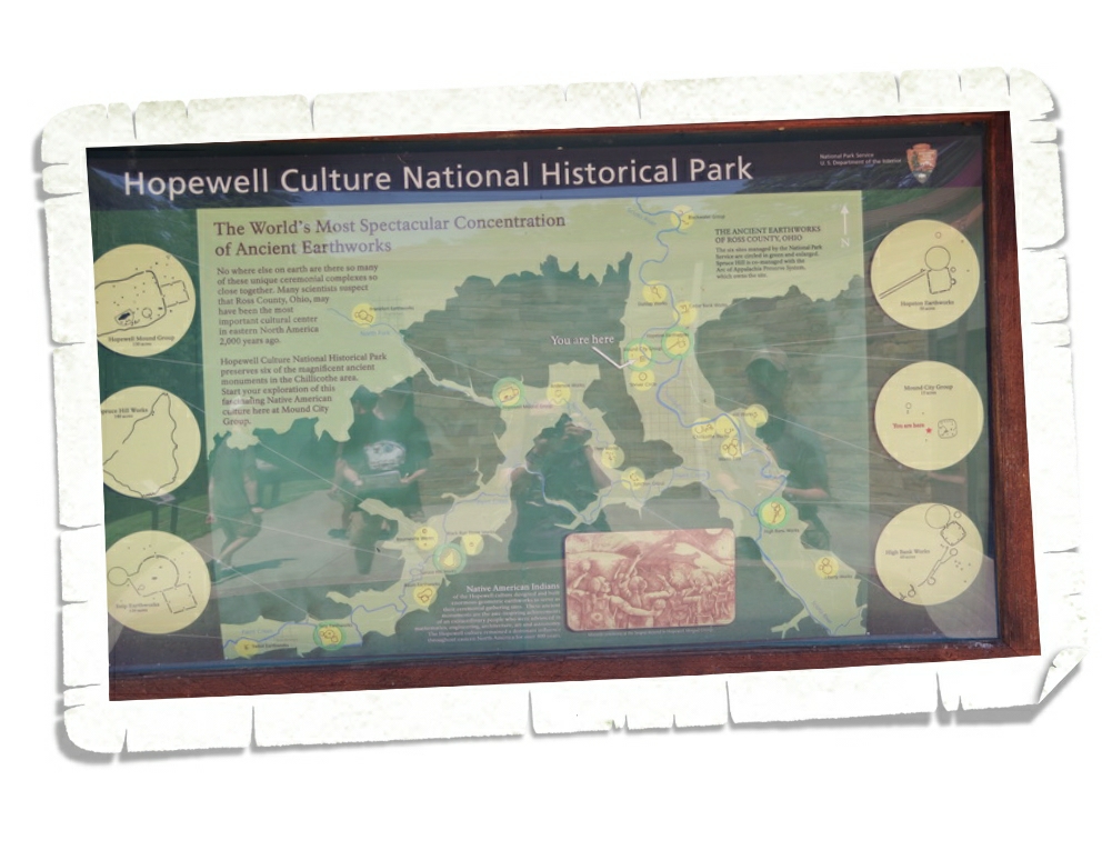
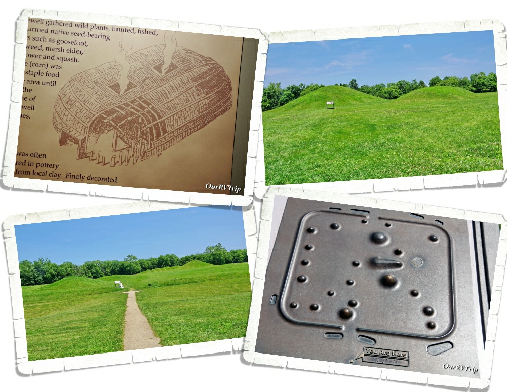
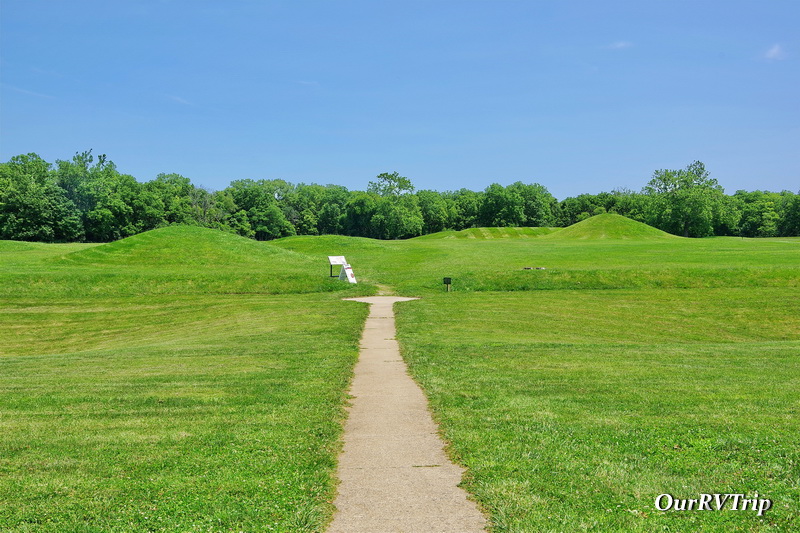
The second NP Unit we made it to was the Hopewell Culture National Historical Park. This park is actually broken up into several different locations, but only one is open to the public right now… the Mound City Group. Hopewell Culture National Historical Park preserves ceremonial earthworks and burial mounds made by the Hopewell Culture close to 2000 years ago.

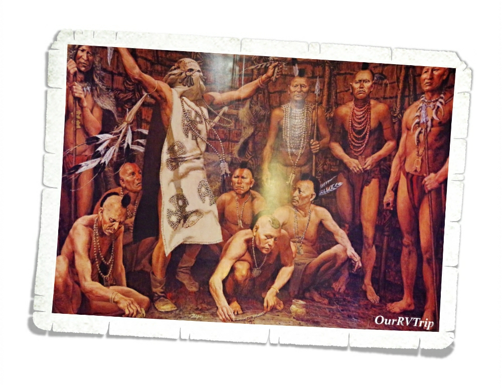
Prehistoric Hopewell Culture was primarily around between 200BC and 500AD and is characterized by their earthworks in various geometric shapes. The Hopewell culture had a large network of contacts with various other groups. Archeologists know from what they’ve found that the people of the Hopewell Culture had a network that reached from the Atlantic Coast all the way to the Rocky Mountains.

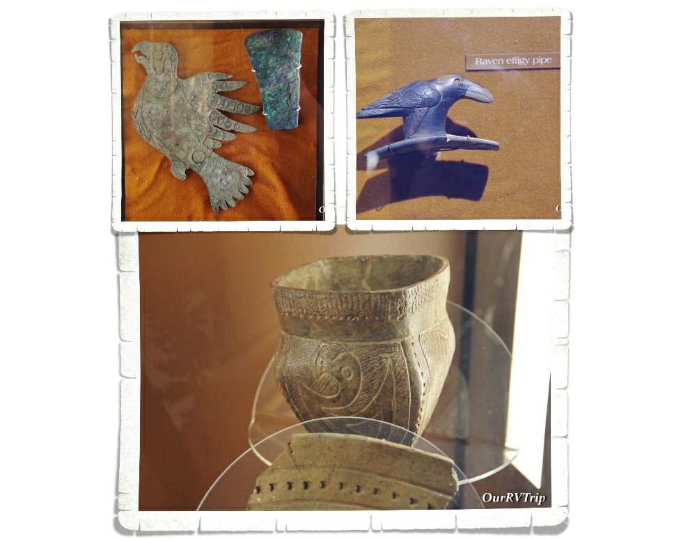
Much of the earthworks and ceremonial mounds were built on a monumental scale. It’s hard to tell from the pics…and what you’ll see at the park isn’t what was actually there…but, the earthen walls were often 12 feet high and 1000 feet across. Some of the mounds were thirty feet high. Mound City contains 23 earthen mounds. Each mound covers the remains a charnel house. After the Hopewell people cremated their dead, they burned the charnel house. The mounds are then built on top of what remains of the charnel house and special items important to that person or family were placed within the mound. Some of the items they’ve found are copper figures, projectile points, mica, pipes and shells.

Hopewell Culture National Historical Park gives invaluable insight into the complex lives of the Hopewell Culture. It’s an interesting little park and if you’re kiddo is doing the Junior Ranger programs…You can get two badges here. The park badge and a separate archeology badge.

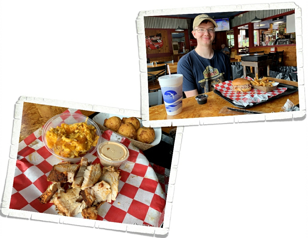
We found a pretty good BBQ place called Rudy’s while we were in Ohio! All of the meat we had was really good and they had an impressive list of sides and sauces!

We had planned on doing one more NP Unit while we were in Ohio, but I did some research on the city it was in (I always do this) and found that there had been several shootings in or close to the neighborhood we would be in…so we decided to skip it. The boys were super bummed to miss the chance at seeing a flight museum and a couple of original Wright Brothers buildings, but safety comes first.

We started this adventure loop out fast and furious! Hopefully, we can keep with the planned loop and this whole pandemic thing doesn’t flare back up and close things again.

See Y’all down the road!

#NationalParkTour

The Plains

The Plains

Hey Guys! We’ve spent six years criss-crossing all over our Country, but we haven’t really spent much time in the plains area. Why?

Storms.

The plains are known for their huge storms that pop up and roll through. When you live in an RV…storms are a pretty big deal. The plains section of our Country has always made me nervous so I haven’t had us spend much time there over the last six years. We’ve always just hopped through on our way one way or the other. But this year… this year we spent two weeks in Scottsbluff, NE. We were on our way back to Missouri from our South Dakota loop and we’d already had some nerve-wracking weather. The tornado that almost hit us while we were in Custer and the wind storm that blew over us in Sundance…I was pretty nervous about staying out in the middle of nowhere Nebraska where the plains are so vast and the storms can rage through. We did have some storms while we were in Scottsbluff, but thankfully, they were just regular old summer storms. Not a ton of wind and no hail.

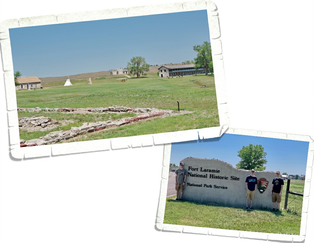
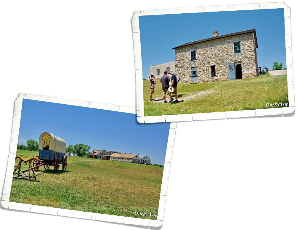
We used Scottsbluff as our basecamp to explore three National Park Units. The first one we went to was Fort Laramie National Historic Site up in Wyoming. Fort Laramie was originally named Fort William and was opened as a trading post in 1834. In the 1840s it was sold to the American Fur Company. Improvements were made and the name was changed from Fort William to Fort John. In 1849, the US Army purchased Fort John to use as a post of protection at the crossroads of America for those traveling on the Oregon Trail, California Trail, and the Mormon Trail. Over time the name gradually changed from Fort John to Fort Laramie as travelers shortened the phrase “Fort John at the Laramie River”.

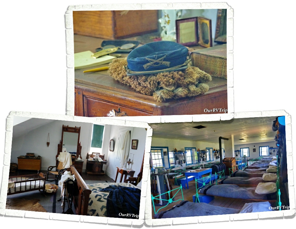
One of our favorite things about visiting National Historic Sites is the glimpse into the lives of the past. The National Park Service does such a great job at staging rooms and giving us a little look into how people lived in the past.

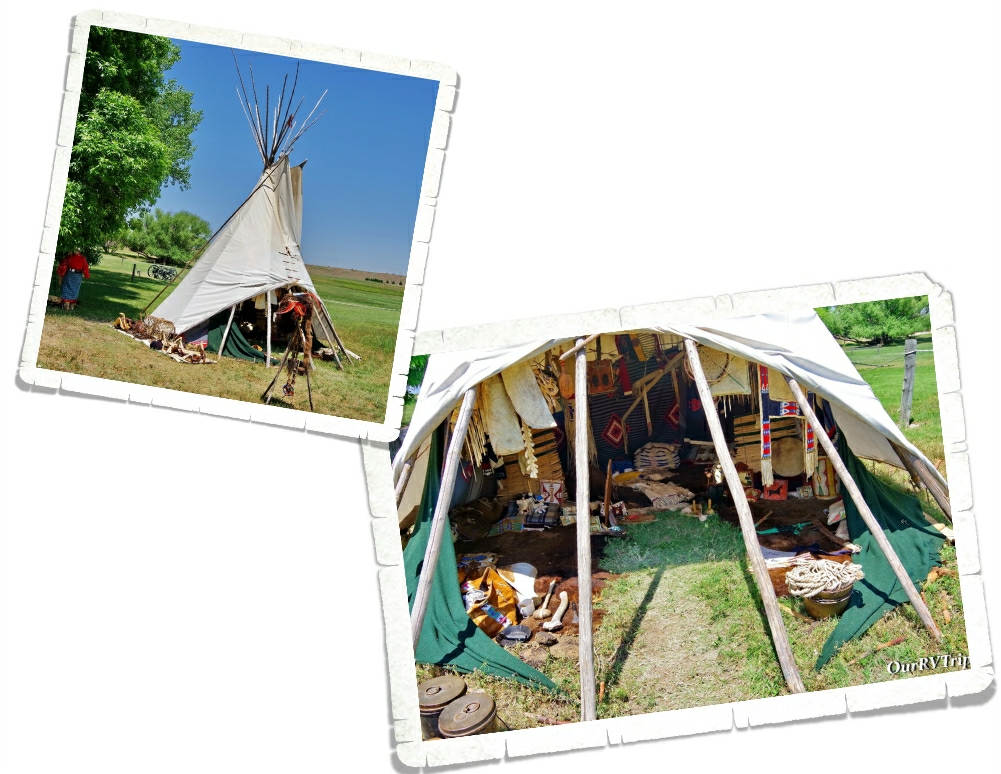
The day we were at Fort Laramie, there was a Living Historian there to show and explain what the inside of a tipi most likely looked like. We’ve seen tipis before, but hadn’t seen one set up like this. The historian talked to us about what life was like on the plains as a woman in a tribe. It was really interesting!

Other important trails that went through Fort Laramie were the Bozeman Trail, Pony Express, Transcontinental telegraph route, and the Deadwood & Cheyenne Stage Route. Fort Laramie National Historic Site preserves one of the most important locations of the westward expansion.

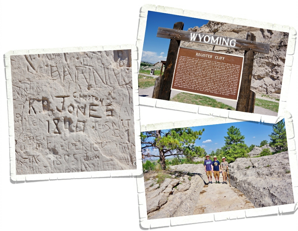
Not far from Fort Laramie, we found a place where we could stand on the ruts made from the thousands of wagons on the Oregon Trial. The wheels of the heavy wagons actually cut right through the rock and made a permanent path. We also found a place called Register Cliff. We’ve seen a few of these during our travels…there’s one in Utah and one in New Mexico that are both part of the NPS and are great! We always enjoy looking at all of the names carved into the rock by passing emigrants. There were quite a few newer names that had been carved into this particular Register Cliff.

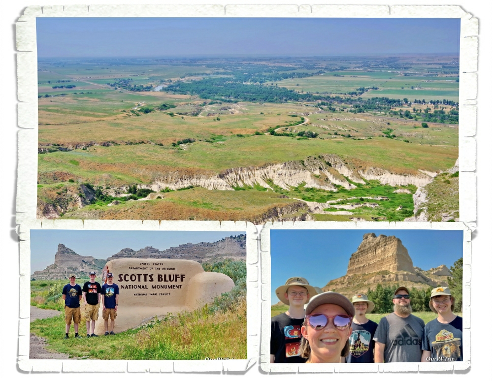
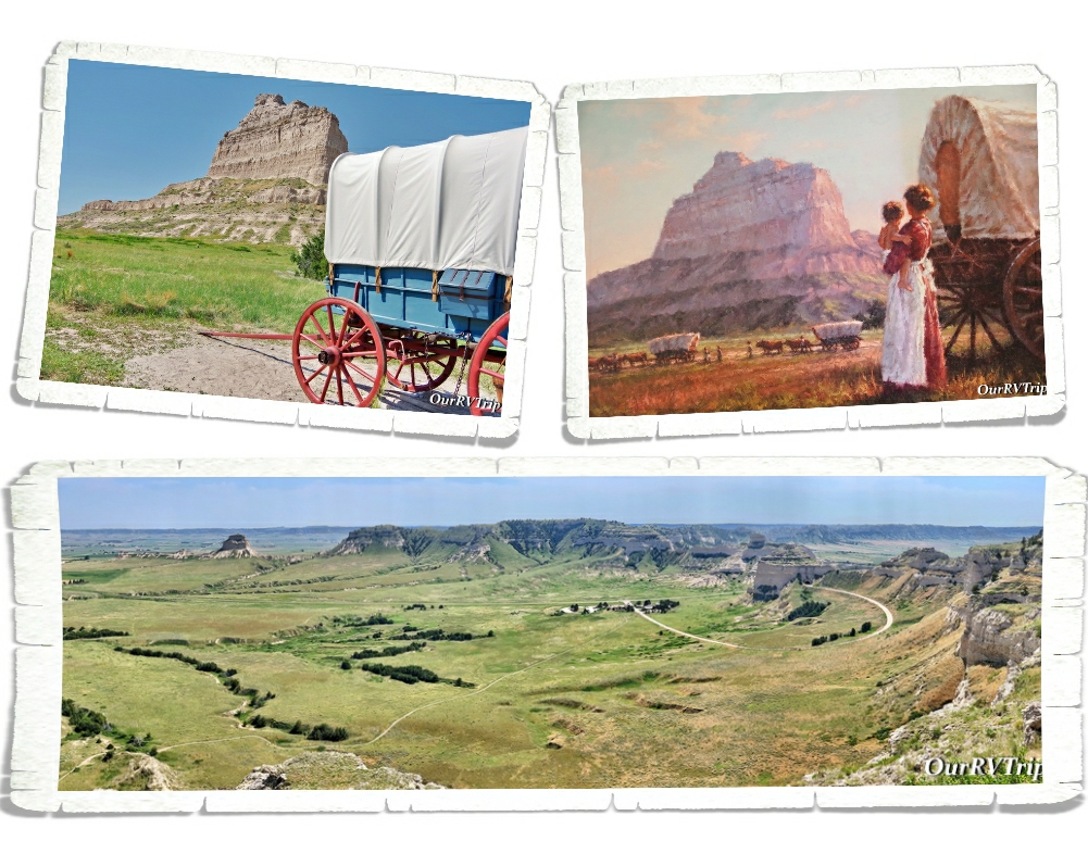
Scotts Bluff National Monument protects about 3,000 acres and consists of towering bluffs, badlands, mixed-grass prairie (watch out for those rattle snakes) and a rich riparian area. Rising 800 feet above the North Platte River, Scotts Bluff has been an important landmark to emigrants traveling along the Oregon Trail, Mormon Trail, Pony Express and the California Trail.

We enjoyed driving up to the top of the bluff and doing both of the hikes available. The views were spectacular! We spent quite a bit of time in the little museum at this park. It has a surprising amount of information. We started to walk the Oregon Trail path outside of the visitor center, but the day we went to this park, the temps were triple digits and we decided against doing the whole trail. I found this painting of a woman holding her toddler while watching a line of wagons in front of Scotts Bluff in the visitor center…Guys, I can’t imagine how hard life was for the trail blazers who made their way west. They were truly made of tougher stuff than we are now. This was a great little park and totally worth the time to visit!

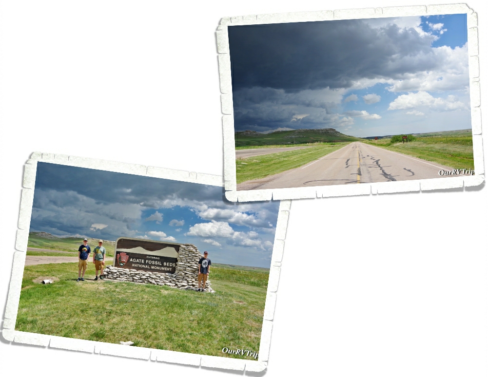
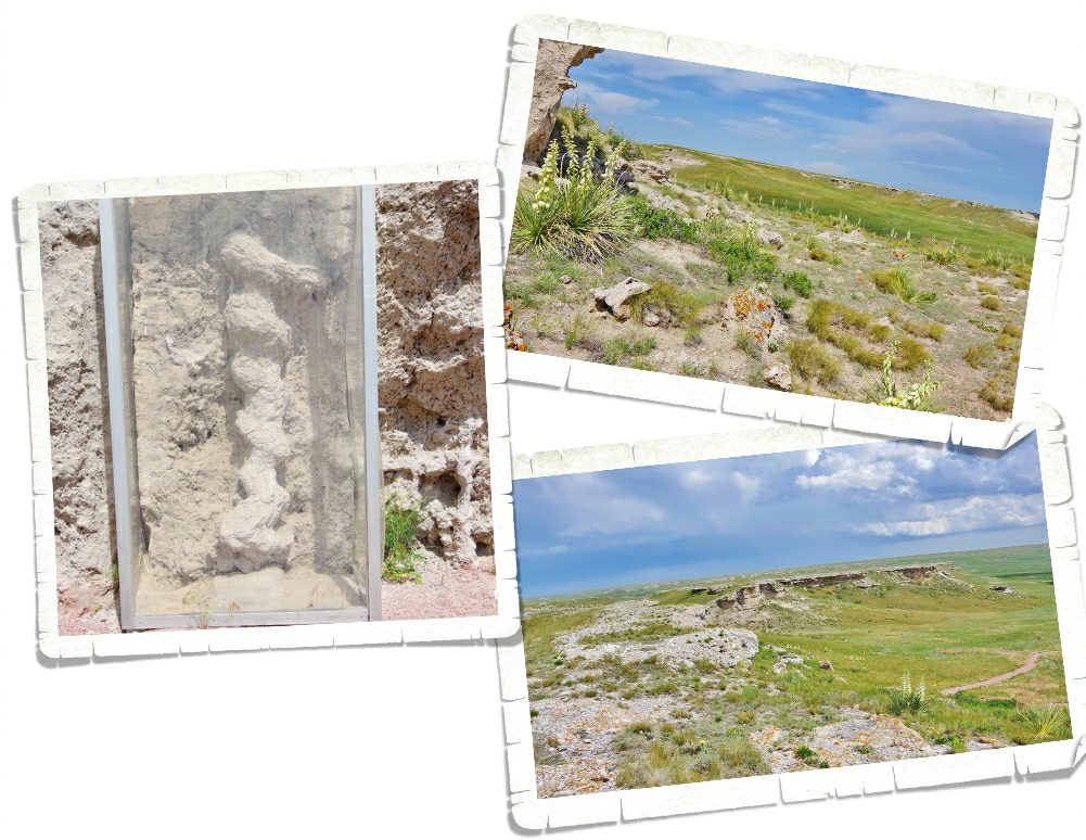
Agate Fossil Beds National Monument was the last place we explored during our week in Scottsbluff. The day we went…it stormed. We still managed to explore the visitor center and get in one hike…but check out those dark clouds. Those dark clouds came with a decent amount of wind and some really cold rain along with some hail too.

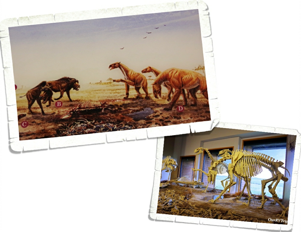
Originally, this area was a working cattle ranch called Agate Springs Ranch owned by Capt. James Cook. Then, in the early 1900s some paleontologists found a treasure trove of complete skeletons belonging to extinct Miocene mammals. When I first saw these skeletons…I thought they looked like little t-rex dinos but then I looked at the info sign and found out that they were huge pig like creatures that stood over six feet tall. Wow! That’s a lot of bacon! ;-P Seriously though…I would not want to run into something like that out on the trail.

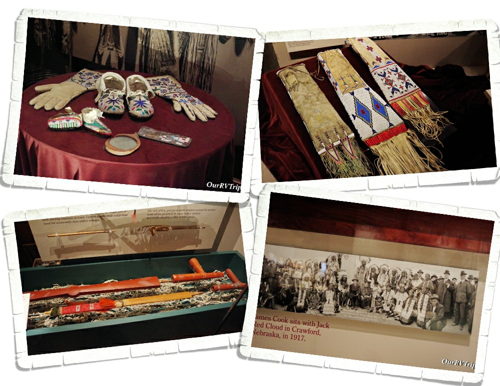
Around the same time, a friendship between James Cook and Chief Red Cloud of the Lakota began. The museum in the visitor center has a wonderful collection of artifacts given to James Cook by his friends in the Lakota Tribe. I thoroughly enjoyed looking at all of the beautiful bead work in the museum. There was also a peace pipe made with red pipestone…from the Pipestone National Monument we went to earlier this year! If you missed that post, you can find it here. It was really something to see one of the pipes out and know where it came from and the history behind it. We’ve learned so much during this Grand Adventure/crazy nomad life of ours!

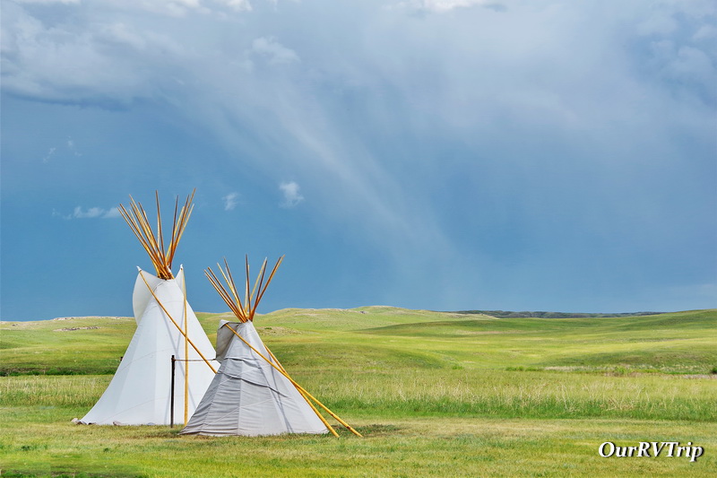
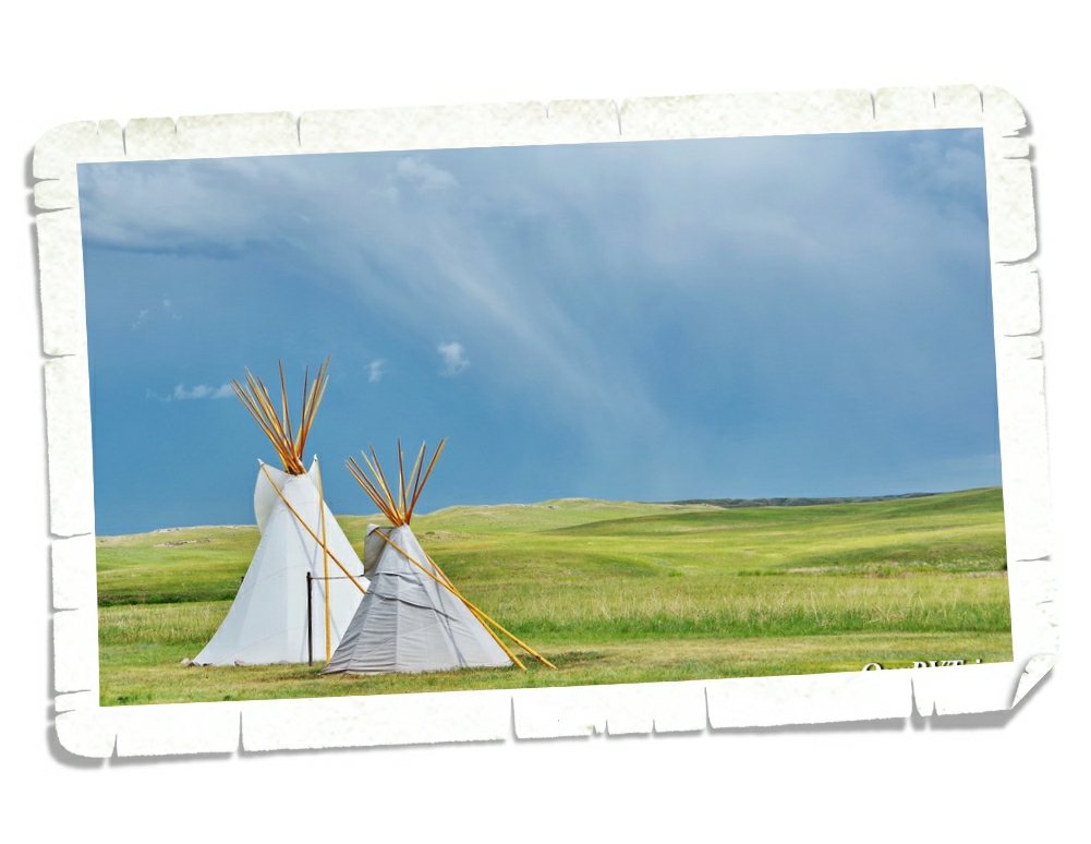
A big storm went over while we were in the visitor center. It got windy and hailed and poured rain. The lights flickered and I rushed to make our souvenir purchase just incase the electric totally went out. These tipis are right outside the visitor center…I braved the elements to grab the shot above so I could show you what one of those great big plains storms looks like. It was an impressive storm. I’m glad we weren’t out on a trail hiking when it hit.

Once the storm blew through (it was moving pretty darn fast), we headed out to one of the shorter hiking trails. The one we did was about two miles and super easy, but it had some breathtaking views of the plains! And…we got to see some of the actual fossils that make this park important. It looks like a corkscrew and it took paleontologists a while to figure out what exactly it is. It’s the fossilized burrow of an ancient prairie dog type animal. No joke. We can’t seem to get away from prairie dogs this year! LOL!! It was really neat to see and our nerd family learned so much.

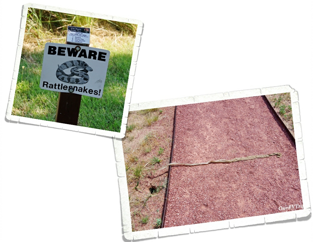
You know all of those warning signs about danger noodles on the trails…well, they aren’t lying! We found this big snake skin on the trail on the way back to our car. So…this big ol’ nope rope was somewhere close by. I don’t handle snakes very well. I think I just about flew to the car after that.

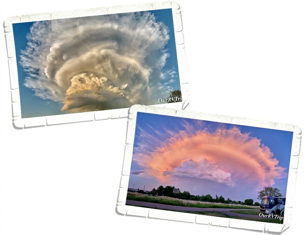
I love sunsets…I love sunsets even more when they’re mixed with amazing cloud formations! Jerl and I were out walking in the RV park when we spotted this amazing cloud! We walked around then sat outside and watched it turn colors as the sun sank behind Scotts Bluff over at the National Monument.

We also had some electrical issues while we were at this park. They weren’t our issue…it was with the town…but the temps outside were close to triple digits. I don’t know if you know this…but when you live in an easy bake oven, it gets hot real quick when there’s no AC. It ended up getting to 93* in the RV. We were struggling to stay cool! Our AC units had already been struggling, but I think that when the eclectic blipped on and off and then went out, it did something to our AC units. They never seemed to get quite as cold or keep up with the heat after that. Guess we’ll need to look into replacing those sooner rather than later.

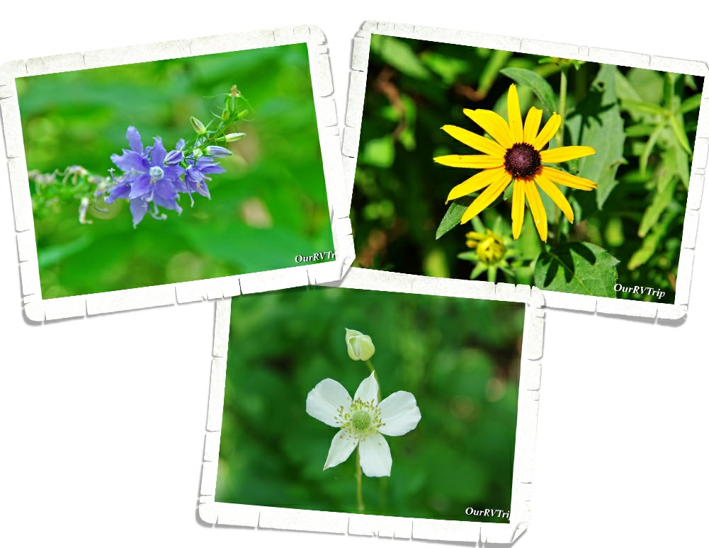
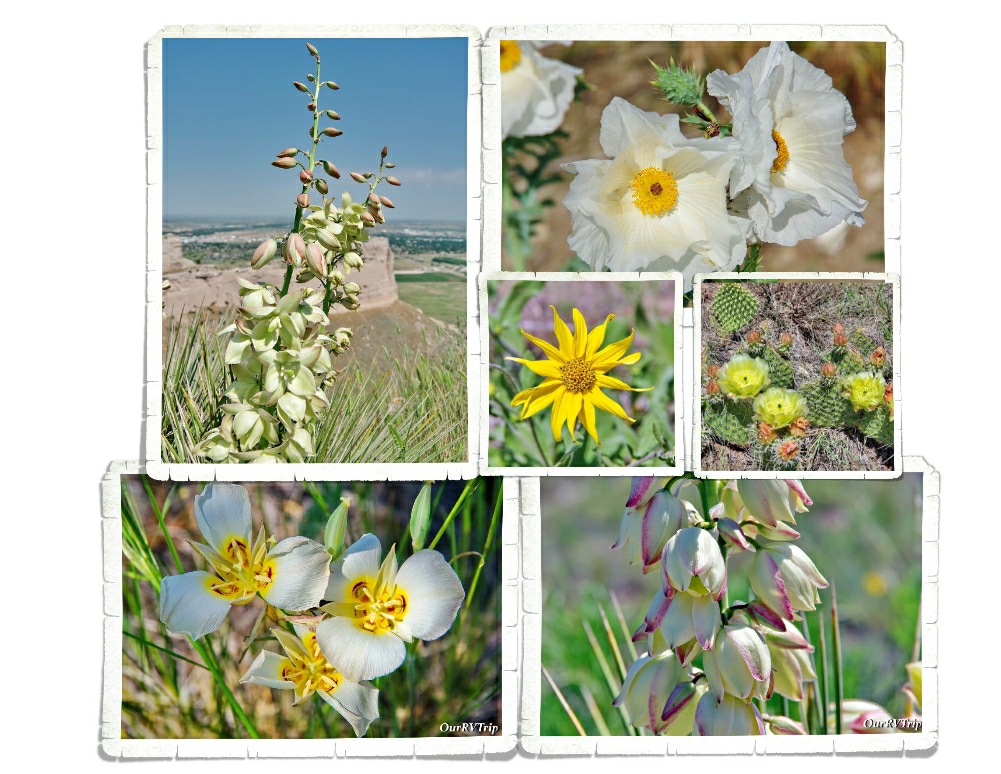
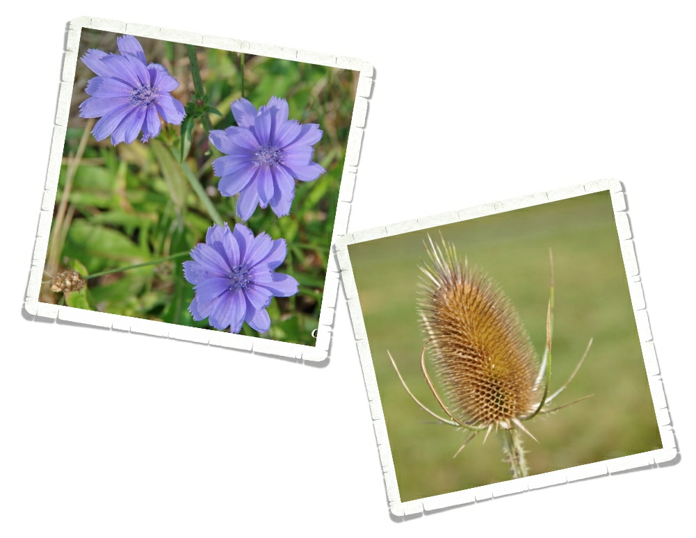
Guys…there were so many pretties blooming! It took me twice as long (maybe longer) than usual to hike because I kept stopping to snap pictures of all of the different flowers. Love them!!

We found a really great burger place called Goonies! We were going to go back, but we didn’t have time since we were only there for a week. We also made it to a Mexican food place and somehow ended up getting all of the dips. I’m a dip person…are you?

Well Guys, we crammed all of that into one week! It was an incredibly busy week and to be honest, we were all ready for a vacation from our crazy nomad life after the South Dakota loop!

See Y’all down the road!

#NationalParkTour

Lava and Mountains

Lava and Mountains

Hey Guys! We stayed in Ketchum, ID for two weeks and had some pretty cool adventures! Originally, before the whole CV 19 thing, we hadn’t planned on being in this area. I couldn’t make it work around getting to the other places we had planned. We’re still bummed to have missed out on some of the other adventures we’d planned, but being able to make it to this area takes some of the sting out of it.

At this time, CV 19 numbers were on the rise again and some states were starting to close back down. In Ketchum and the surrounding areas, face masks were required anytime you were out and couldn’t socially distance or anytime you were in a store. We were worried that we’d have to miss the rest of this travel year.

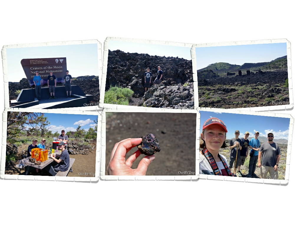
Because we were worried about National Parks closing back down (some of them were), the first thing we did was go to Craters of the Moon National Monument. There were more people there than I thought there would be, but it was by no means crowded. Pretty much everyone wore a mask when in close proximity to other people.

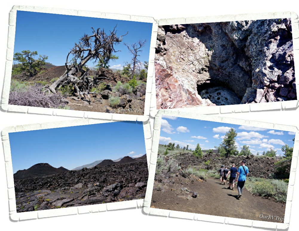
Craters of the Moon National Monument is a collection of three major lava flows with cinder cones sprinkled here and there created between 15,000 to 20,000 years ago. The NP Monument was created in 1924 and then expanded in 2000. Lava tubes, tree molds, lava rivers, spatter cones…there’s a lot to explore at this National Monument.

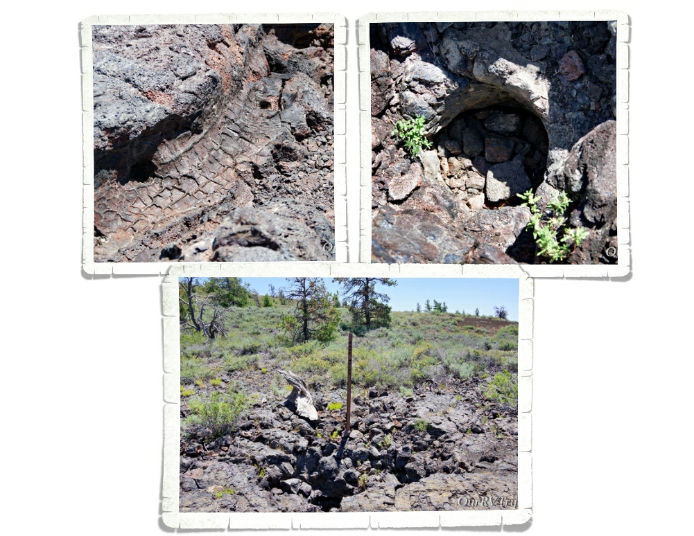
You can see some of the cinder cones in the picture above on the left. There are a couple of trails that lead up to two of them where you can look down into them. We were surprised to see snow in one of them since it was close to 90° the day we were there.

We also made it out to see some tree molds. We’ve seen these before and they never cease to amaze us. The lava here didn’t erupt out of volcanoes like Mount St. Helens, but rather oozed out of fissures and occasionally spewed out of vents. A tree mold is made when lava flows through an area with trees. The lava coats the outside of the tree and cools just enough to make a cast or mold of the tree, but the tree inside burns up.

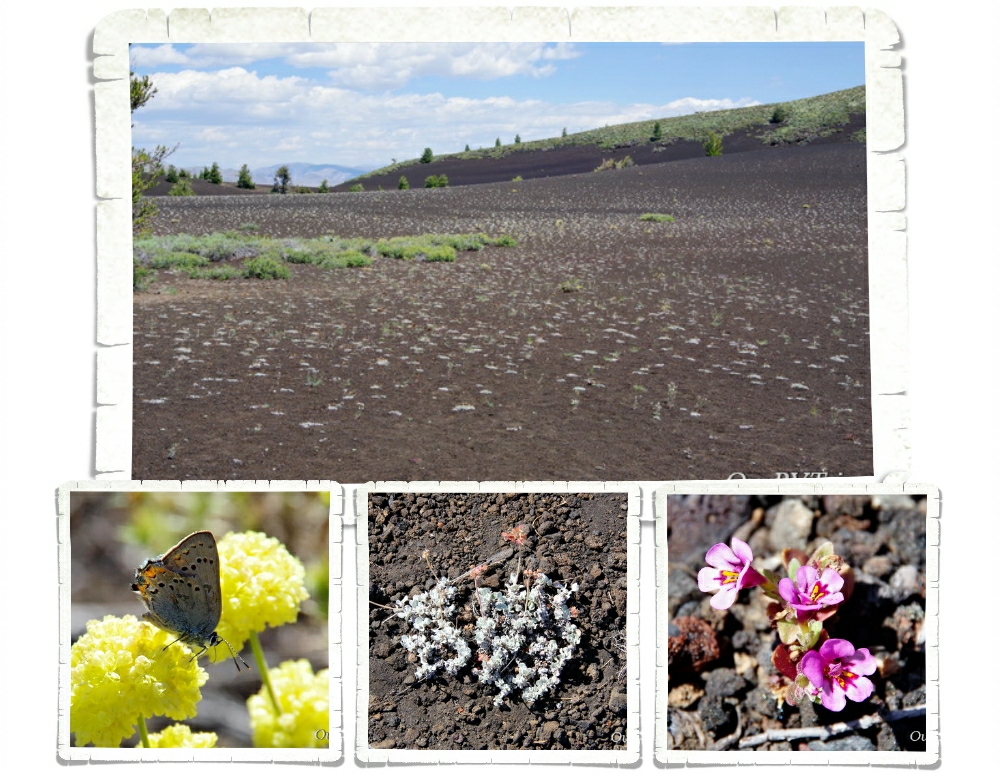
We were surprised to find flowers in an old lava flow. The flowers and trees offered a vibrant pop of color in an otherwise monochromatic landscape.

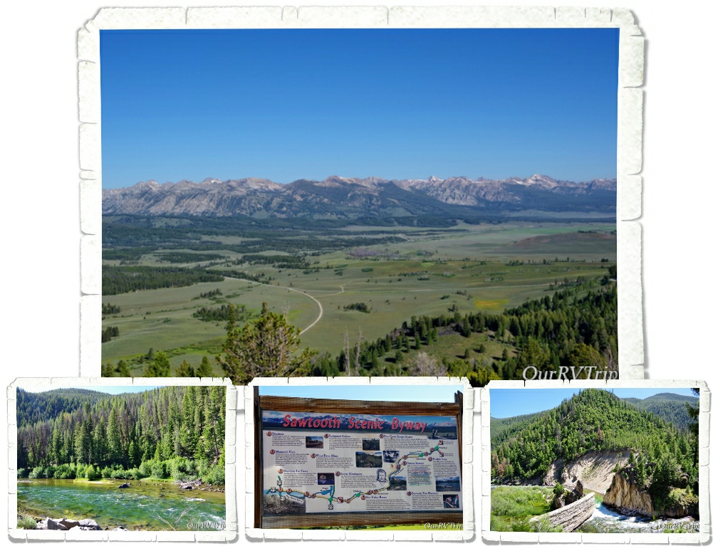
We spent an entire day trying to soak up as much of the Sawtooth Mountains as we could. We stopped several times to ogle the Salmon River.

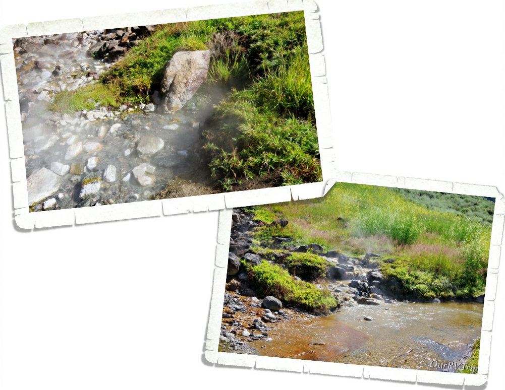
Guys, we found some geothermal hot-springs coming right out of the side of the mountain! Right across the road from the river. People have used boulders and rocks in the river to make soaking pools. It was really cool to see. We didn’t have our swimsuits so we didn’t try any. We did walk up to where the water was coming out of the ground and let me tell you…that water comes out HOT!! Wowza!

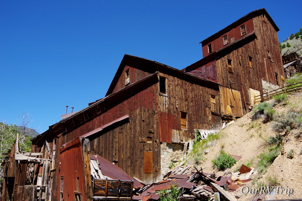
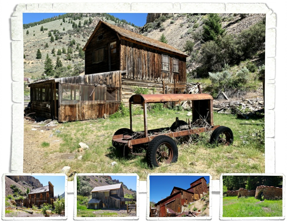
When we headed out that morning, we had two specific destinations in mind. Both of them are part of Land of the Yankee Fork State Park. The first one was the Bayhorse Ghost Town. Y’all know we love to explore ghost towns. We go to as many as we can. Bayhorse is probably one of the better ones we’ve seen. Tucked back in a narrow, rocky canyon, the old mining town of Bayhorse was built on steep slopes. Only the most determined prospectors ventured here to make a life.

During it’s heyday, the Bayhorse Mining District produced ten million dollars worth of different metals. In the end, a horrible fire and dropping silver prices doomed the town of Bayhorse. For a long time, the town was closed to visitors due to hazardous conditions, but in 2006 Bayhorse became part of the Idaho State Park System and they began to clean it up and make it safe for people to visit. When we arrived we were handed some info pamphlets…one of them was a safety brochure about all of the hazardous minerals still found in the town-site. So, if you go…don’t lick anything or crack any rocks open and you should be just fine. 😉

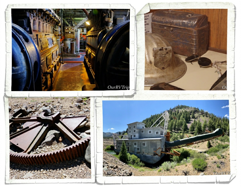
The second place we were hoping to see that day was the Yankee Fork Gold Dredge…which is another unit of the Land of the Yankee Fork State Park. Yankee Fork is a tributary of the Salmon River. Due to the sever winters, this area was called “Land of the Deep Snows” by the tribes who hunted there. The dredge is 112 feet long and weighs 988 tons. They brought it to the Yankee Fork in pieces starting with the huge pontoons it sits on.

From 1940 to 1952, the dredge worked non-stop. In the end, they’d dredged up over a million dollars in gold. Today, the dredge is one of the best preserved in the lower 48. When we were in Fairbanks, AK we went to Gold Dredge No. 8 and toured it. We found the two dredges to be extremely different. Maybe that was just our novice eyes? There were a few volunteers stationed around the dredge the day we went and they all did an amazing job educating us about the daily workings of the dredge.

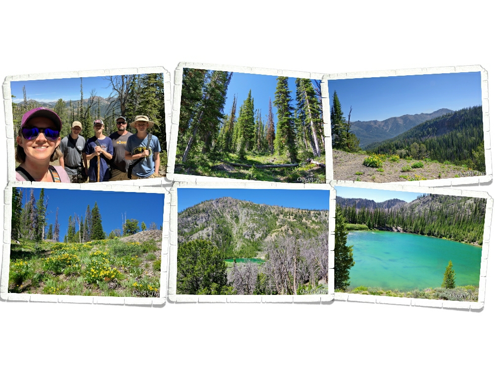
After spending an entire day in the car, we had to talk the boys into getting back out the next day for a hike. We tempted them with a trial through an ancient pine forest to Titus Lake. The info we had said this hike was an easy trail with only a 500′ elevation gain. It sounded like it was going to be an easy peasy walk in the park…it wasn’t. When you start your hike at almost 9,000 feet…it doesn’t take much to feel winded. Honestly, I was too busy swooning over the flowers to mind the work. I was in summer wildflower heaven and stopped frequently to take pictures. And breath. The views were spectacular, the flowers were vibrant and the lake was a brilliant emerald color! What more could you ask for?

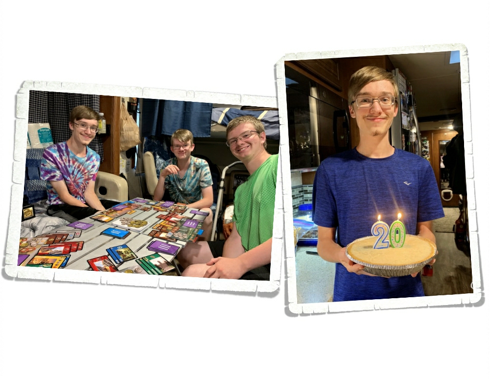
We celebrated Charlie’s birthday while we were in Ketchum. Our oldest is twenty years old. Twenty! Guys…how is that even possible? I mean, I’m way too young to have a twenty year old, right? He got a new board game called 7 Wonders for his birthday and we love it. It’s quickly become one of our faves.

We went out for some foodies a few times. Surprisingly, we found a bbq place called Smokey Bones that was pretty darn good! Nicholas, of course, had to hit up a pizza place during our lunch date.

I know y’all only come to see the pictures of flowers…that’s why I leave them for the end. You have to make it all the way though the post to see the pretties. Ha!!

We had a great time adventuring in the Ketchum, ID area! We’re a fan!

See y’all down the road!

#NationalParkTour

Waiting For Spring

Waiting For Spring

Hey Guys!! Our original plan was to hop our way up Arizona, hitting a few of our favorite state parks. Unfortunately, I waited a week or two too long to try to reserve them and we couldn’t get in without site hopping each day…and that’s such a pain. So, we headed up to one of our all time favorite areas of Arizona…Sedona…to park our home-on-wheels for two whole months as we waited for Spring.

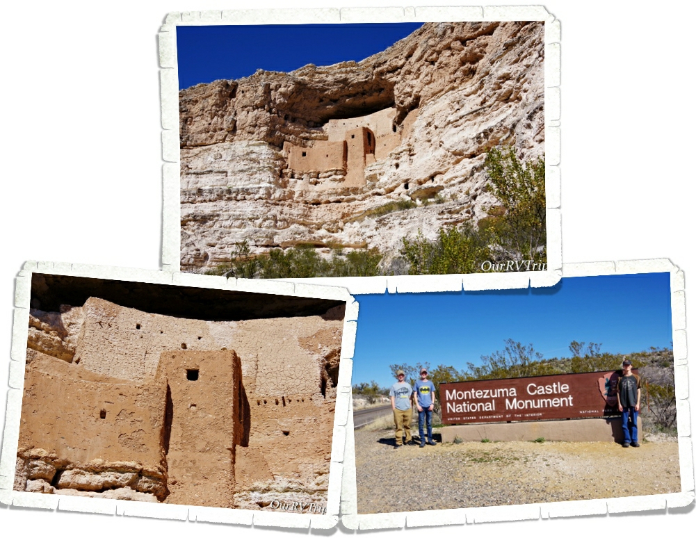
We’ve been to Montezuma Castle National Monument before, but it’s been a few years so we decided to visit it again since we were right down the road from it. And as one of our Nation’s first National Parks…it’s worth revisiting.

President Theodore Roosevelt signed the Antiquities Act in Dec of 1906 and declared four sites of historical and cultural significance our first four National Monuments. Montezuma Castle was one of those first four.

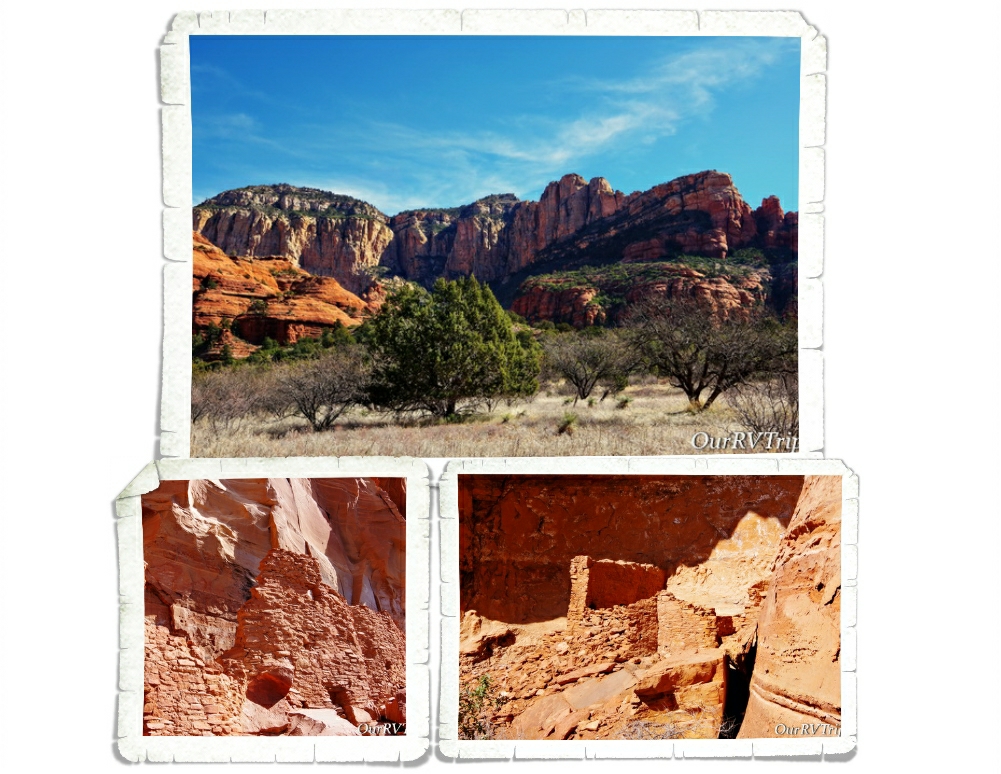
The dwellings that Montezuma Castle National Monument protects and preserves aren’t really a castle. They’re more like…a prehistoric apartment building, built by the Sinagua people sometime between 1100 and 1425 AD.

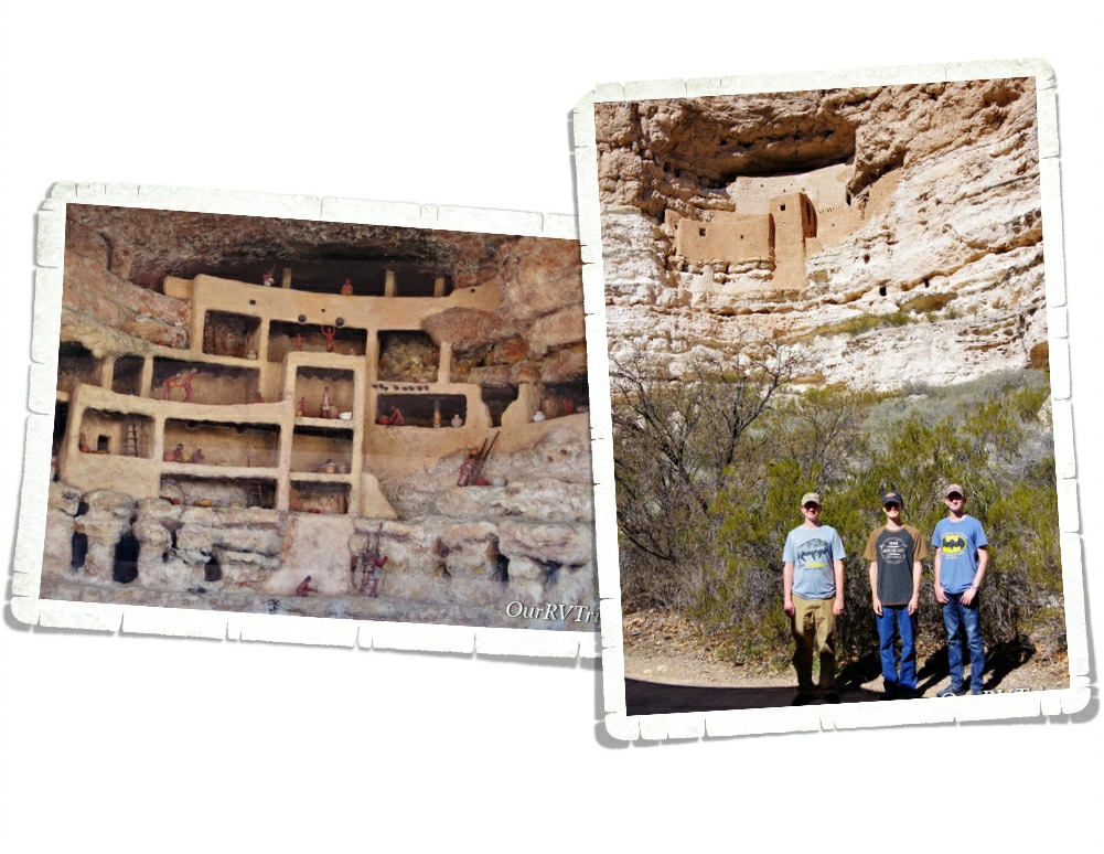
Montezuma Castle sits in a recess in a limestone wall about 90 feet above the ground. When the Monument first opened, you could actually climb up a series of ladders into the Castle. Due to the damage visitors were causing, access to the Castle was discontinued. Now, you’ll have to check out the diorama they have set up to see what the inside of the Castle looks like.

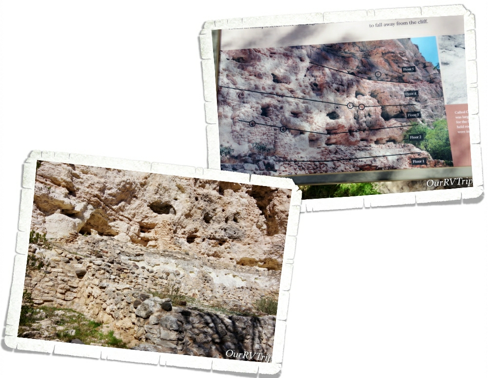
Sometimes when you’re looking at ancient dwellings, it’s hard to see what it once was. I love that they put this sign (pic on the above right) up to make it easier to see what used to be there. The Sinagua people lived and farmed here over 600 years ago.

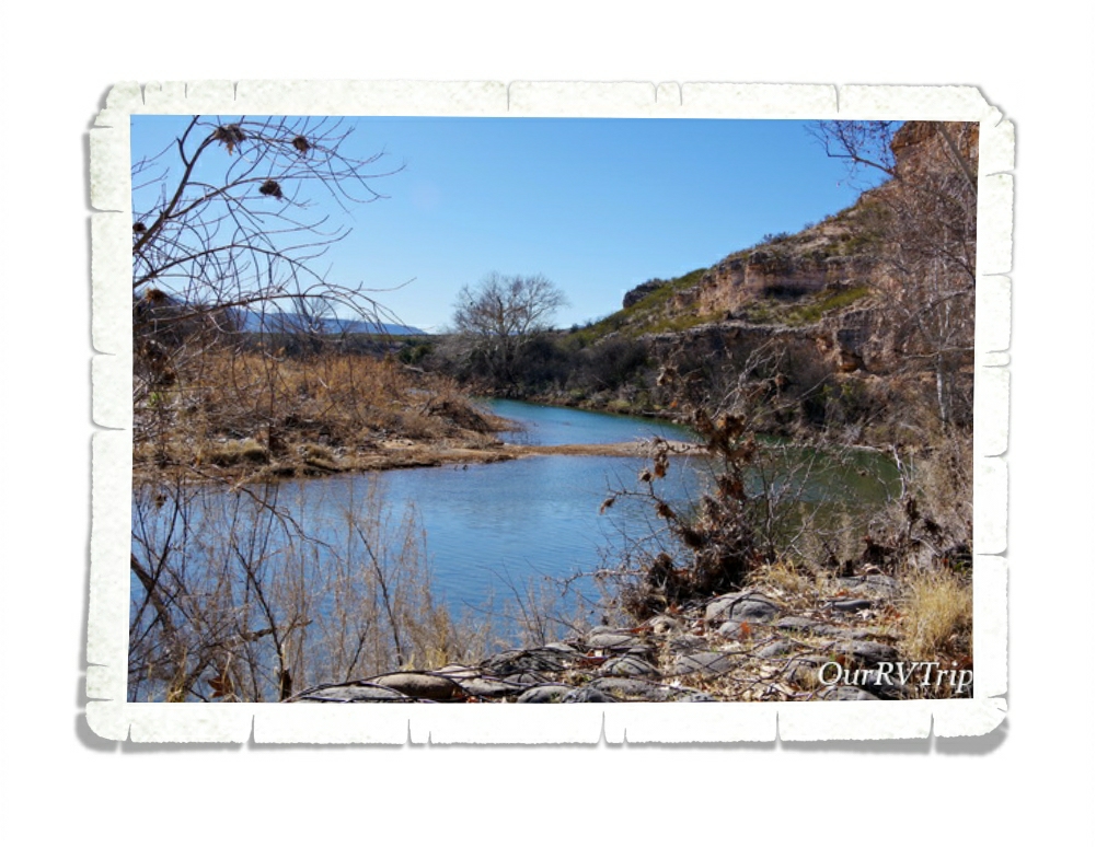
The Sinagua people built their homes near Beaver Creek which floods every year during monsoon season. They built their homes higher to not only protect themselves from other tribes, but also to protect their homes form the yearly flooding. The Castle housed around 40 or so people and consisted of 20 rooms. There’s another section of the wall that the Castle is built on that has evidence of an even larger dwelling.

We had so much fun revisiting this National Monument and seeing all of the improvements the park has made!

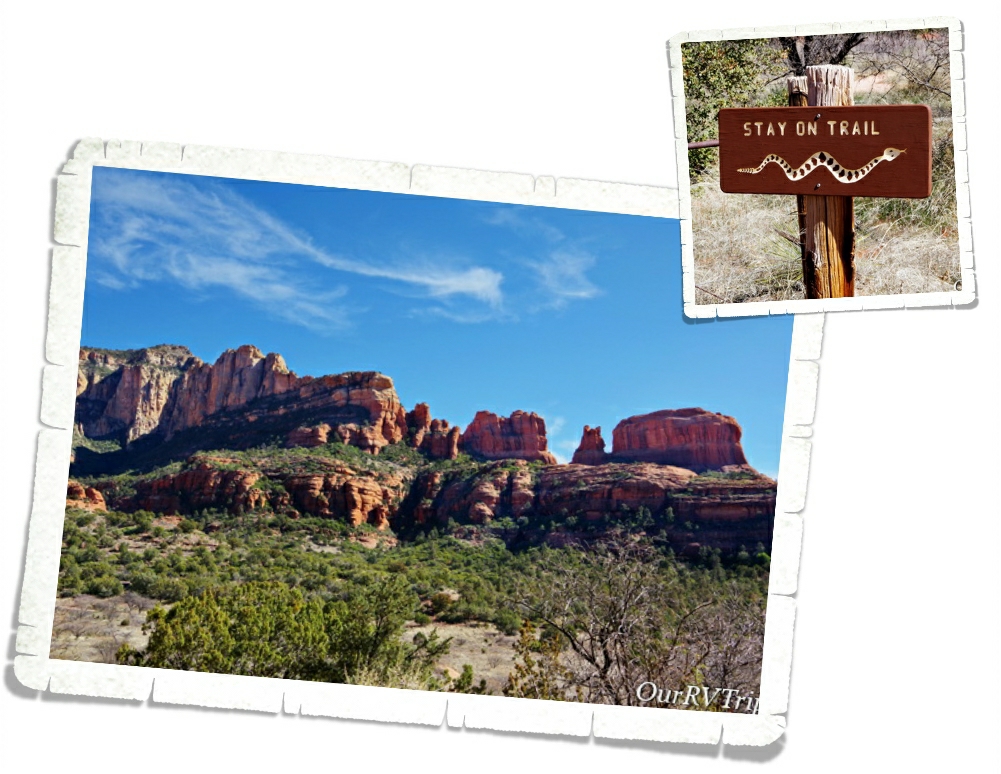
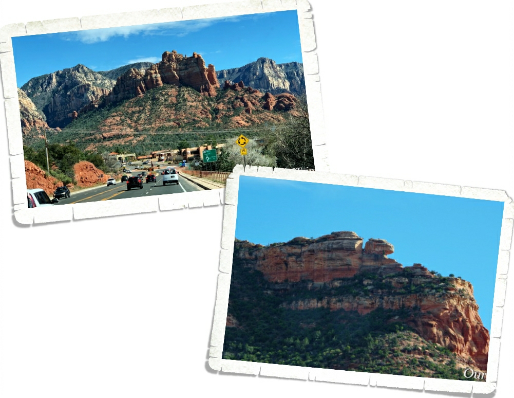
I stumbled on the Palatki Red Cliffs Heritage Site as I was looking for a specific trailhead in Sedona. When I did some research on it, I found that it’s run by the US Forest Service. Sedona is known for it’s gorgeous red rocks, and the area Palatki is in, is no different. We took just as many pictures of the surrounding area as we did of the ancient dwellings and rock art!

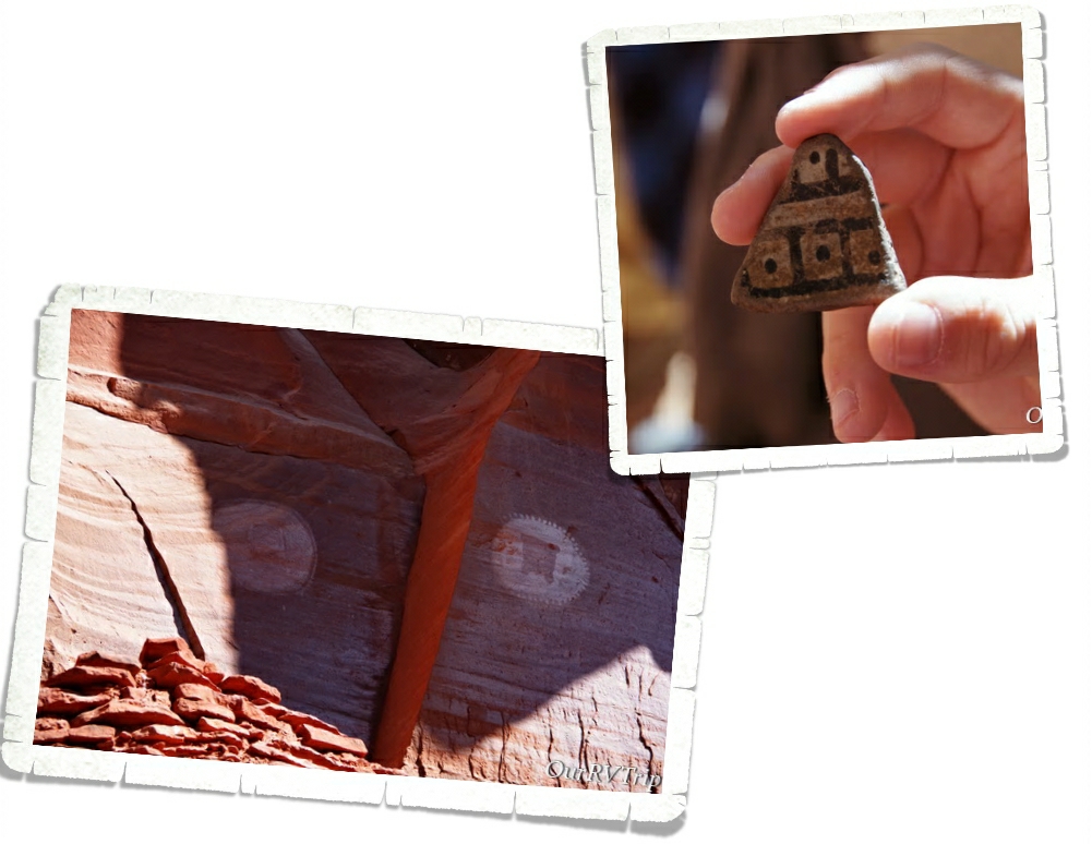
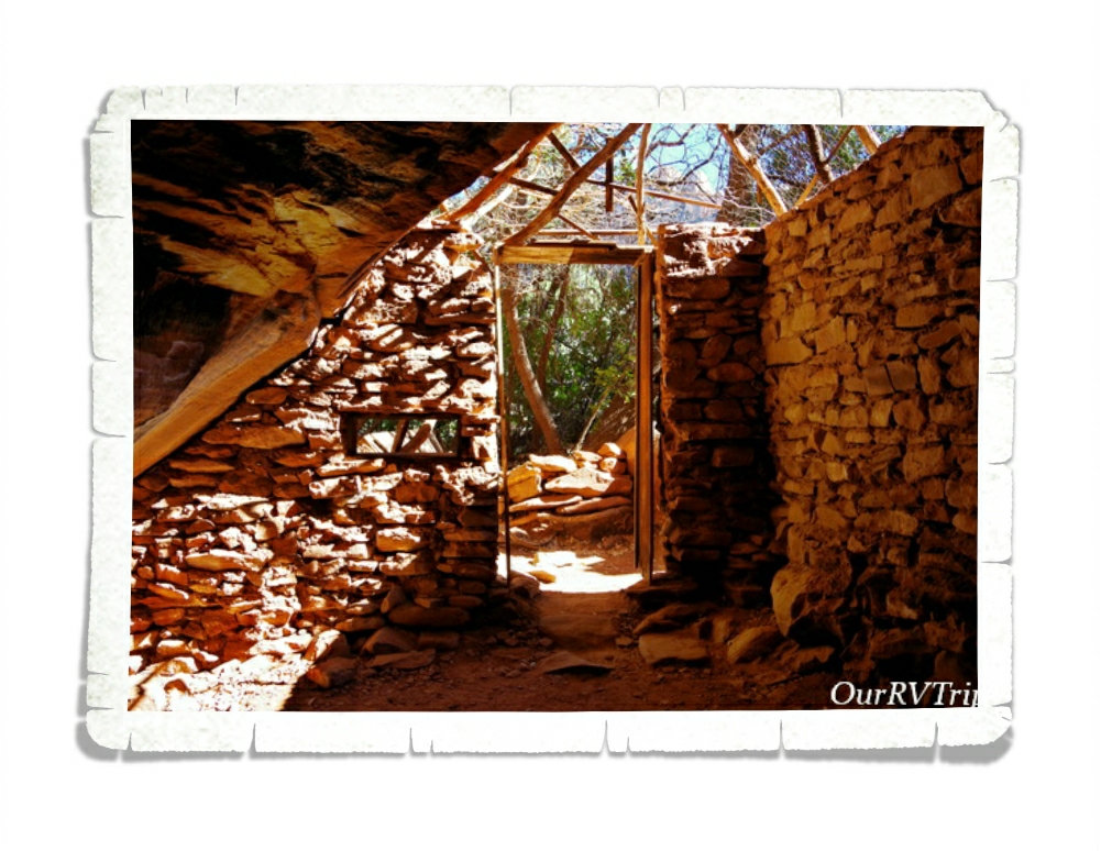
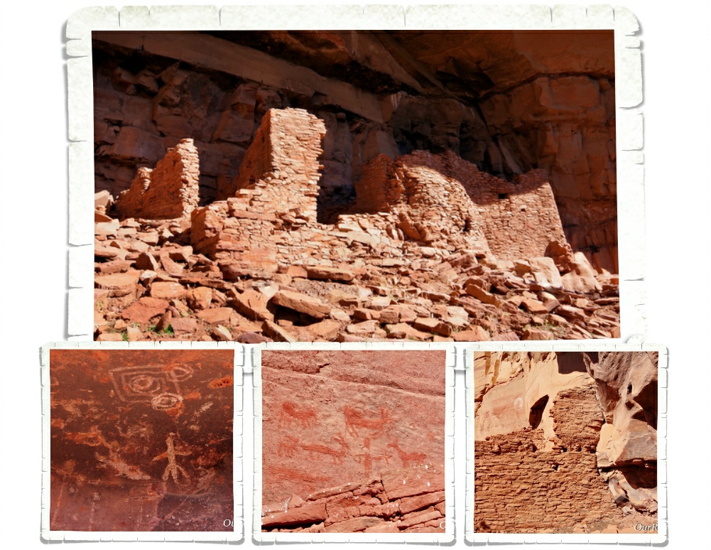
There are two ancient Sinagua dwellings at Palatki. The West Alcove has deteriorated to the point that it’s no longer safe to let people explore it. You do get up close to East Alcove, but you don’t get to go into it. East Alcove is a nine room dwelling that is tucked up under an alcove and faces south. If you think about where they built their homes…it’s really pretty smart. The overhang of the alcove provided protection from the rain (even during very hard rain) and having them face South would provide more sun exposure during the coldest part of the year.

One of the coolest things about visiting Palatki is that we got to hold some of the pottery that was found there. Another cool thing…and the first time we’d seen anything like it…are the two family shields or clan signs. They’re not sure if the two round shield like pictographs indicate a family or if they’re a clan sign. They do know that it tells who the dwellings belonged to. Scientist believe that two extended families called the two alcove dwellings home.

Snakes really aren’t my thing. Every time I see one of these warning signs, I get super paranoid about nope-ropes. I’m already hyper-aware of all of the places you usually find a danger-noodle… I spent most of the time at Palatki worrying about snakes. When we were there, it was almost Spring which is when most of the baby danger-noodles are born. Did you know that mother snakes are more aggressive and will chase you without being provoked? Totally not a fan of nope-ropes.

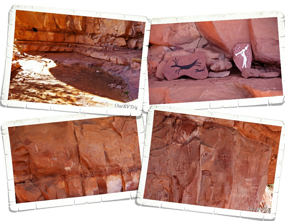
The other thing you’ll find at Palatki is The Grotto. Depending on when you go, you might see some water in the pool here, but what’s really neat about The Grotto is all of the rock art. There are pictographs from the Paleo Period (11,000 – 9,000 BC) and the Archaic Period (9,000 BC to AD 600). The walls are covered with pictographs! One of the Rangers took some of the materials that they believe was originally used to make the colors for the pictographs and made some new ones so we can see how bright the rock art was when it was new. You can see the new rock art in the top right picture of the above gallery.

The first homesteader in the area was Charles D. Willard. He took materials from the various ancient dwellings to build his own home. Charles arrived in 1923 and you can still see the one room structure he stayed in over by The Grotto, where he stayed until his house was completed in 1925. On the same field that the Sinagua people who used to live, Charles planted 500 fruit trees. He sold the property in 1938 and the Forest Service obtained the land in 1975 through a land exchange.

Palatki’s sister site is Honanki Cliffs Dwelling Heritage Site. We found out about it while we were at Palatki and headed over there right after we left Palatki. Honanki is one of the largest cliff dwellings and has the largest most diverse collection of pictographs in Verde Valley. The cliff dwellings found at Honanki were originally two stories tall and were made up of about 40 rooms on the ground floor. Sometime around 1300AD the residents of Honanki started to move on. The Sinagua left Verde Valley in the early 1400s. The Hopi and Zuni can both trace part of their heritage back to the Sinagua.

Sedona, Arizona is one of our favorite places to spend time. There are so many trails to hike in the Sedona area. I think you could do a different hike every week for a year and never have to do the same hike!

We had plans to do so many hikes in the two months we were going to be in the Sedona area. Due to the weather and other circumstances…we only got one of those hikes in. But, Guys…it was an awesome hike!

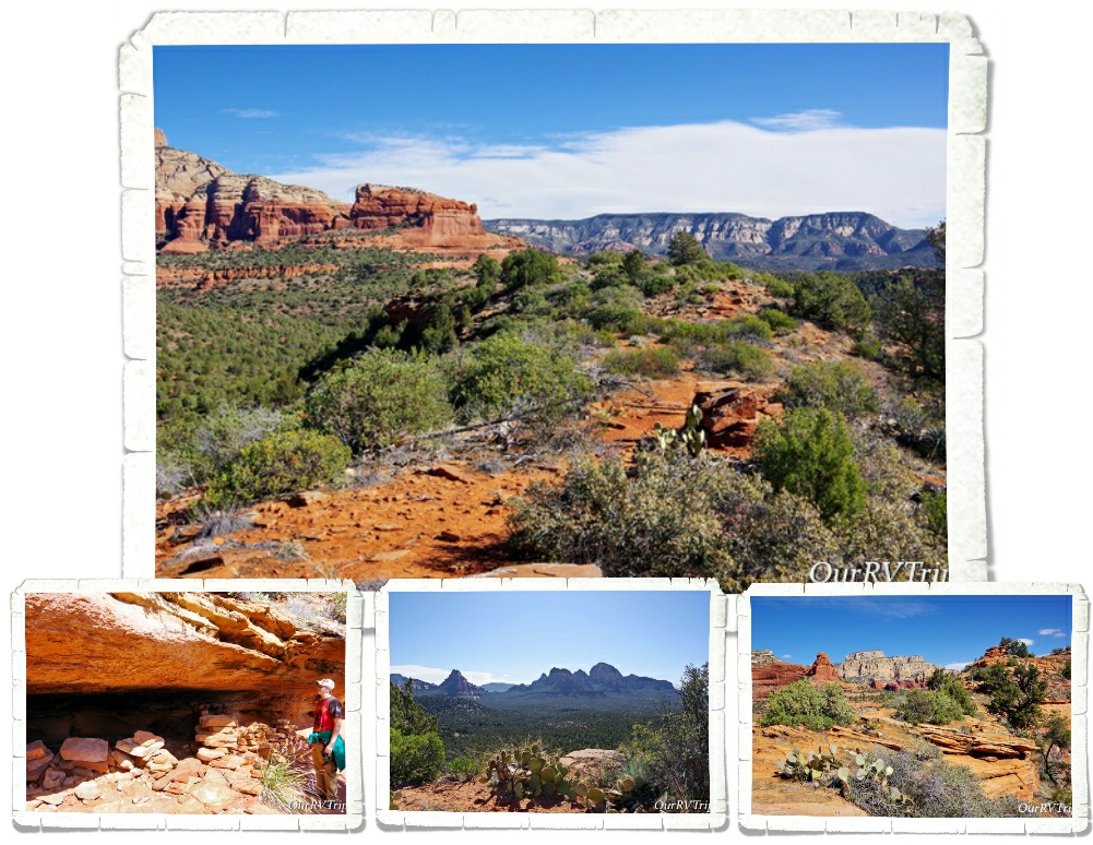
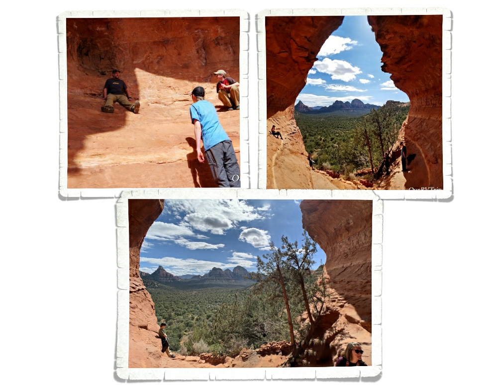
I found this place called the Birthing Cave on Instagram and really wanted to see it for myself. I did some research and found the trailhead in Sedona. I’d read that it was tricky to find. Quite a few people walk right by it because the trail isn’t marked that great. And…we did the same thing. We walked right by the side trail that takes you up to the Birthing Cave.

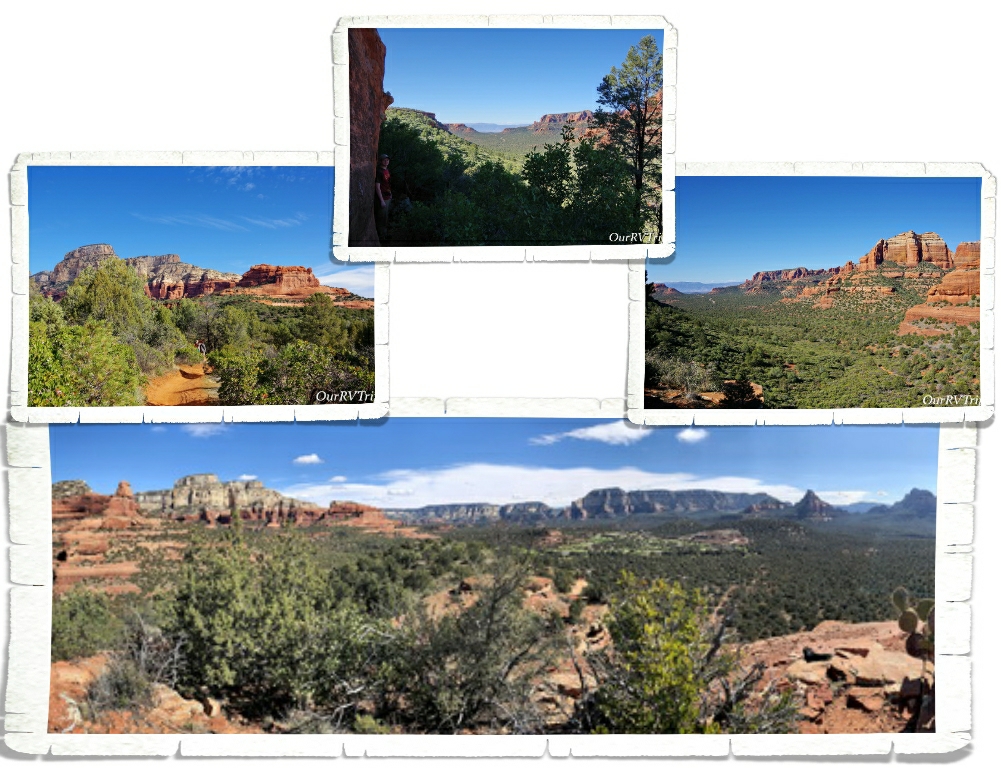
We found a different trail that turned off in the right direction at around the same distance as the trail was supposed to be… We ended up scrambling up the side of the mesa that the Birthing Cave is in. So…we were on top of it. The views were so good though, that we didn’t care. If we didn’t make it to the cave we were totally ok with it. We were having so much fun we felt like the day was a win no matter what.

We ended up meeting another hiker on top who told us how to get down to the Birthing Cave. Guys, it’s not really a cave. It’s more like an alcove that you can shimmy up the walls of. We got some neat pictures, but if I’m being honest…we had a better time and saw better views from being up on top of the mesa.

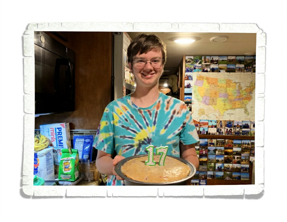
Alex celebrated his 17th birthday! Excuse the mess…we were in the middle of the Covid19 stock up thing. His birthday was a little different this year, but I think he had a good day!

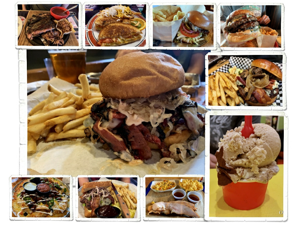
Should we talk foodies? Now, keep in mind we were there for two months…so this was all spread out over the five or six weeks we were there before the Corona Virus thing really hit hard. After that, we continued to support the small local places by getting orders to go.

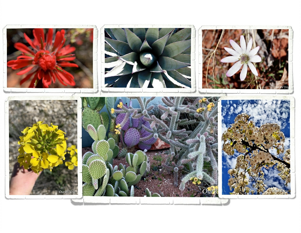
I also found some pretties! It was getting to be that time of the year again! There are so many colors in the desert. Those pops of color are just amazing!!

Around our sixth week in the Sedona area, the Corona Virus hit hard. Our life changed along with everyone else’s in the world. We stopped exploring so we could comply with the “social distancing” that was being requested by our government. The stores were running out of groceries and necessities. And every day we heard about more RV parks closing down. It was pretty stressful. We had to make a decision…do we keep with our reserved schedule or do we try to find a spot to hunker down and stay put until this all clears up?

We decided to keep with our schedule. As I’m writing this, we are planning our first move since the Covid 19 virus thing started. Our next spot is still in Arizona. We’ve been checking with the next place to make sure they’re still open and they have no plans to shut down…so, we’ll head that way. If you know me, you know I’m a planner. We do have a couple of backup plans. So, I guess we’ll see how it goes! If you follow us on Instagram you’ll get more timely updates…our blog posts are usually a month or more behind where we are for safety reasons.

Well Guys, that’s all for now! Even with the “social distancing” we had a great visit to the Sedona area!!

See y’all down the road!

#NationalParkTour

Old Missions and Ghost Towns

Old Missions and Ghost Towns

Hey Guys!! This is the last post for our Benson, Arizona area adventures! We spent two weeks in the area and crammed a ton of explorations in and still didn’t get to everything on our list.

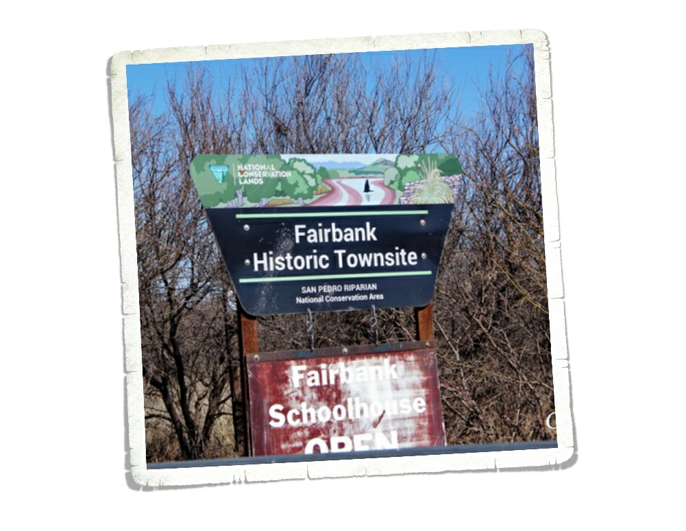
We’re always up for a ghost town! I found out about Fairbank from a brochure I found at one of the stores in Benson and it immediately went on our list. Fairbank is part of the San Pedro Riparian National Conservation Area and is run by the BLM. It’s pretty much out in the middle of nowhere.

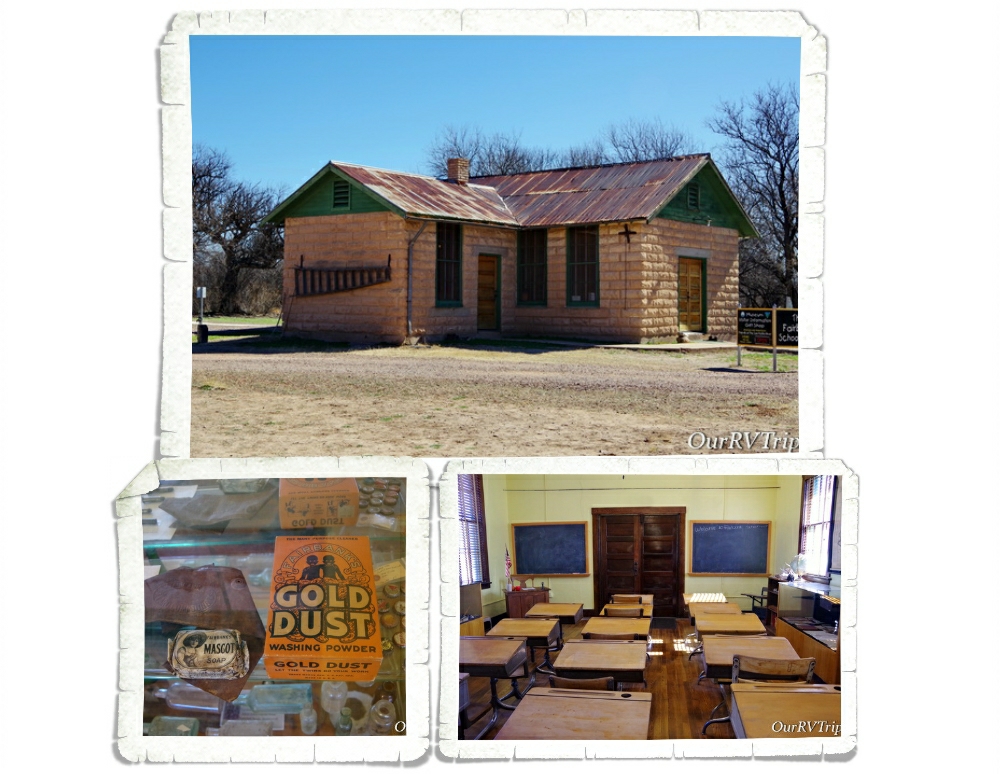
There’s a small visitor center/museum set up in the old schoolhouse. When a volunteer is available to man it, the schoolhouse is open. We lucked out and it was open the morning we went. It’s a neat little schoolhouse. There are all kinds of trinkets and memorabilia that’s been found in Fairbank on display.

It’s hard to believe Fairbank was once one of the largest cities in the West. Three different railroad lines passed through Fairbank plus it was the closest railroad stop to the still famous town of Tombstone. First settled in 1881, Fairbank grew to a booming population of 15,000 residents by 1882. When the Tombstone mines closed due to flooding in 1886, Fairbank started its decline.

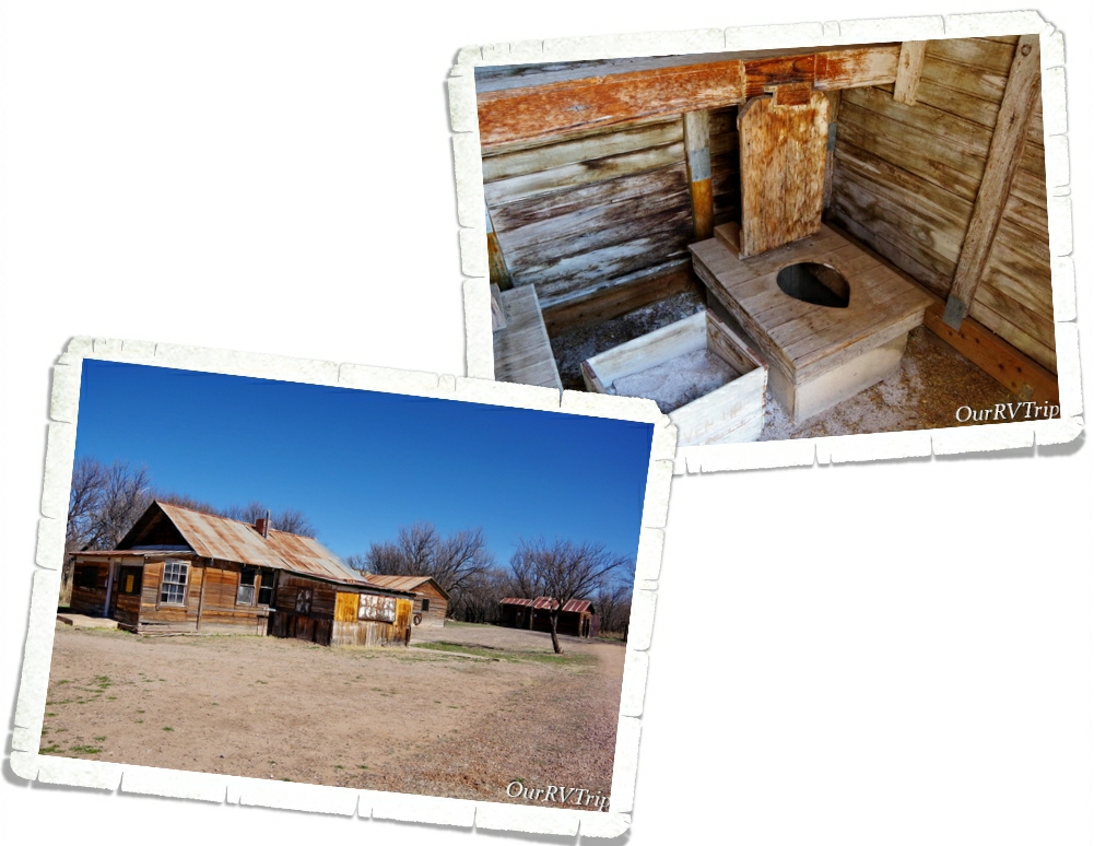
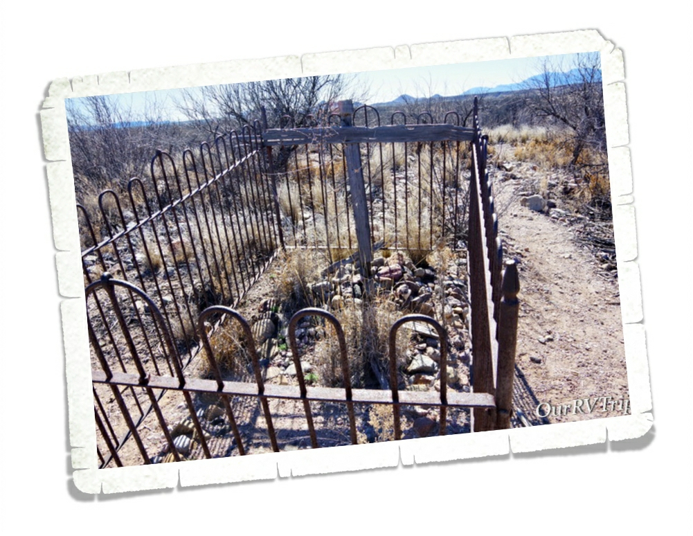
Fairbank had full-time residents until the early 1970s. They kept a small general store going but eventually, everyone moved away and the BLM acquired the land in 1986. There has been some restoration of a few of the buildings. They’re hoping to eventually restore the general store and the saloon. We had a fun time walking around looking at the buildings…imagining what life would have been like there when it was booming.

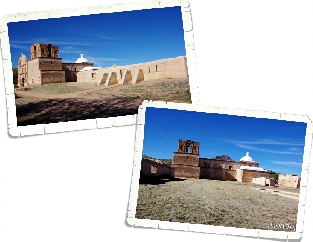
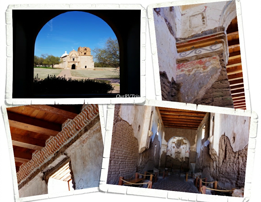
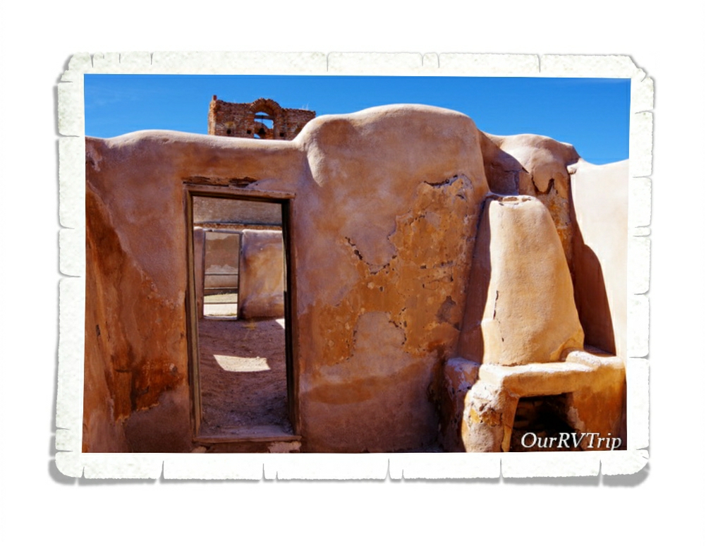
Tumacácori National Historical Park consists of about 360 acres and is split into three separate units. Each unit protects the ruins of a Spanish mission community. Two of the units are in such disrepair that they’re closed to the public and only available for private tours through the winter. We only made it to the main park to see Mission San Jose Tumacácori.

The very first Mission San Jose Tumacácori was built in January 1691 by the Spanish Jesuit padre Eusebio Francisco Kino and was the very first Jesuit mission in Arizona. Due to a rebellion in 1751, the mission was moved and rebuilt.

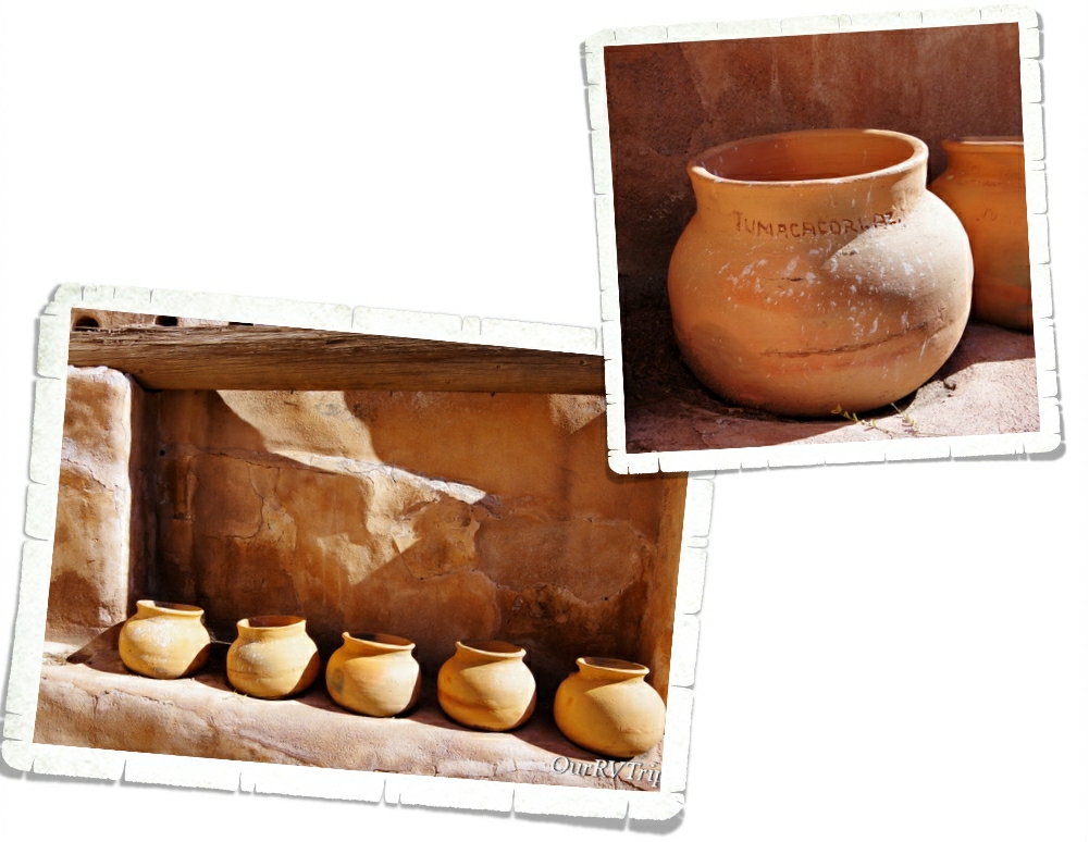
Part of the granary, where they kept the food, still stands. They’ve put some big pots in it to give you an idea of what it would have looked like while it was being used. I thought it was smart that there was an indention in the shelf to keep each pot in place.

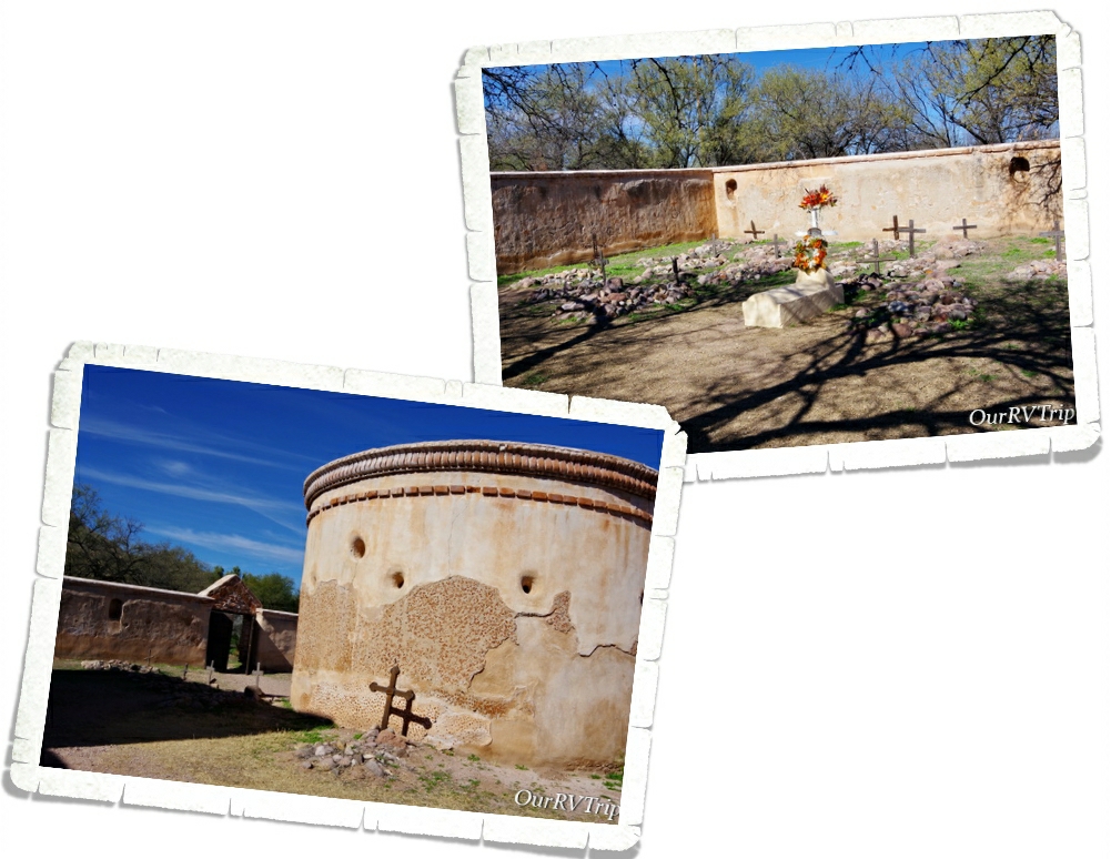
You can also find the ruins of a small cemetery and a mortuary chapel on the grounds. I found the mortuary chapel interesting…we’ve been to several missions before, but had never seen a mortuary chapel before.

Before the Spanish arrived, this land was home to the O’odham. The Spanish called the ones that lived near the river Pima and the ones that lived in the desert Papago. The O’odham were farmers and excellent basket weavers. You can see a reproduction of a traditional O’odham home (called a ki) on the park grounds as well. The O’odham were a peaceful people unless they had to defend their homes…they would spend the next one hundred years in an uneasy and often times violent relationship with those that called the mission home.

In 1768 the Jesuits were replaced by Franciscan Catholics due to a political change. The Franciscans started to redecorate the mission and build a much larger church in 1880. They worked on the new church for twenty years, but never completely finished. The new, bigger…more grand church was only used until 1828. At that time, the Mexican government forced all Spanish born settlers out of their territory…this included the mission’s last resident priest.

In 1848, following the Mexican-American war, the mission was completely closed and the last residents were forced to leave. The entire area became the property of America in 1853 during the Gadsden Purchase when land south of the Gila River was transferred to Arizona. The mission sat empty until 1908 when President Theodore Roosevelt declared it Tumacácori National Monument and the NPS started restorations and repairs.

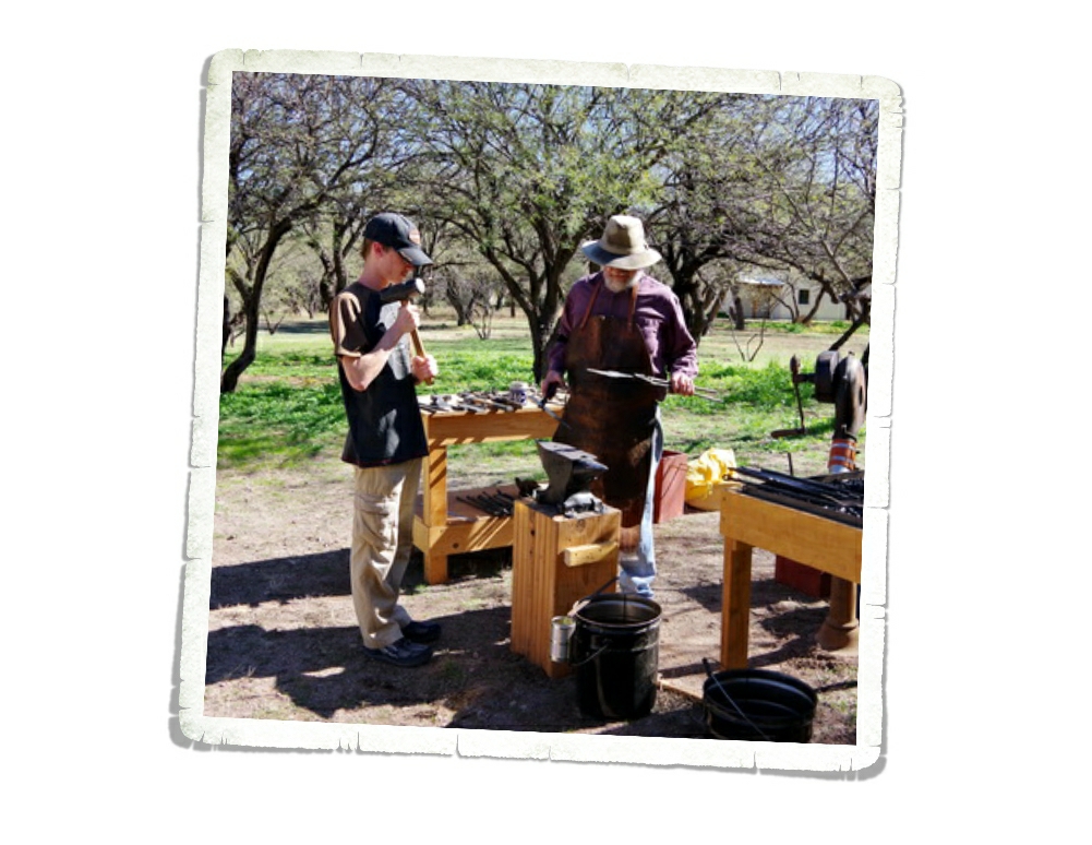
The day we went there were some volunteer demonstrators on the grounds. The boys loved watching and helping the blacksmith. They helped make a coat hook…which we got to keep. It’ll hang in our home someday when we get a sticks-n-bricks. They also had someone making fresh flour tortillas and beans. You could get a sample of beans and salsa rolled in a fresh tortilla. It wasn’t the worst thing. I would have gladly paid for an entire plate of them. We always spend money in the visitor centers when we visit the parks. They need the funds and a portion of every dollar you spend at a park goes to that park.

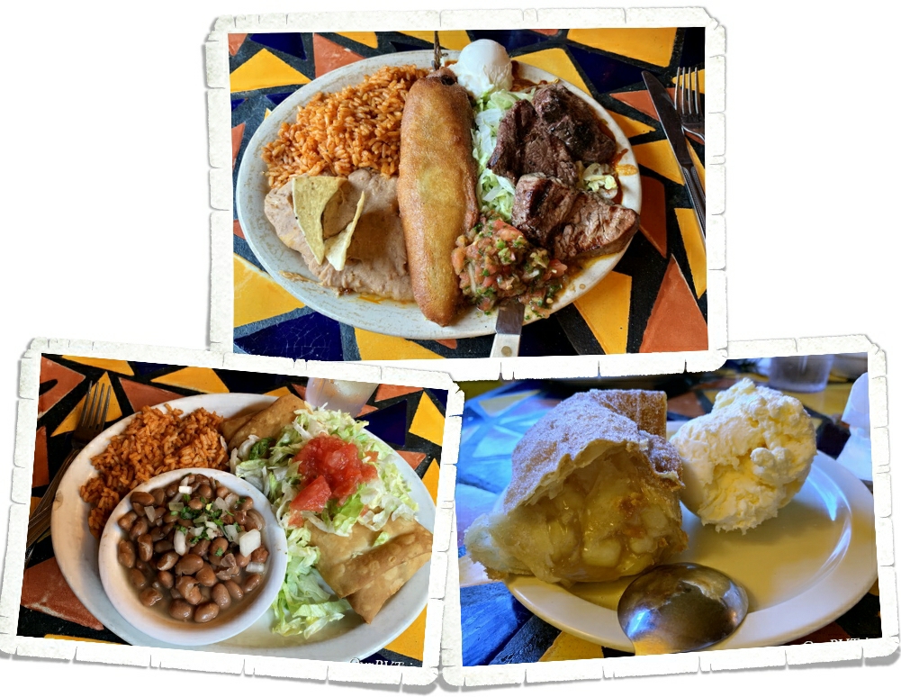
We found a place called Wisdom’s Café just down the road to grab some grub. The food was excellent, but the service was incredibly slow. Unfortunately, it was just our waitress. We saw all of the other workers hustling. If you ever go to Wisdom’s Café make sure you get one of their famous fruit burros! You can get them with or without ice cream, but who are we kidding…I know y’all will get the ice cream!

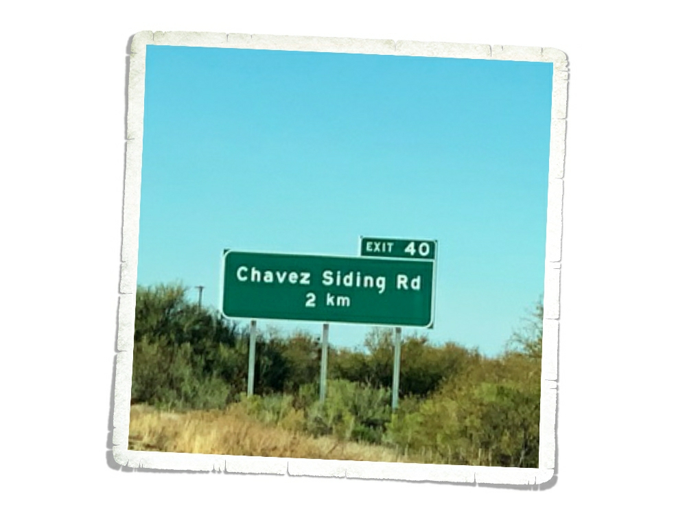
On the way home, we noticed all of the street signs were in kilometers instead of miles. We were pretty close to the border…but we’ve been pretty close to the border quite a few times and had never noticed that before.

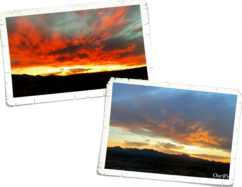
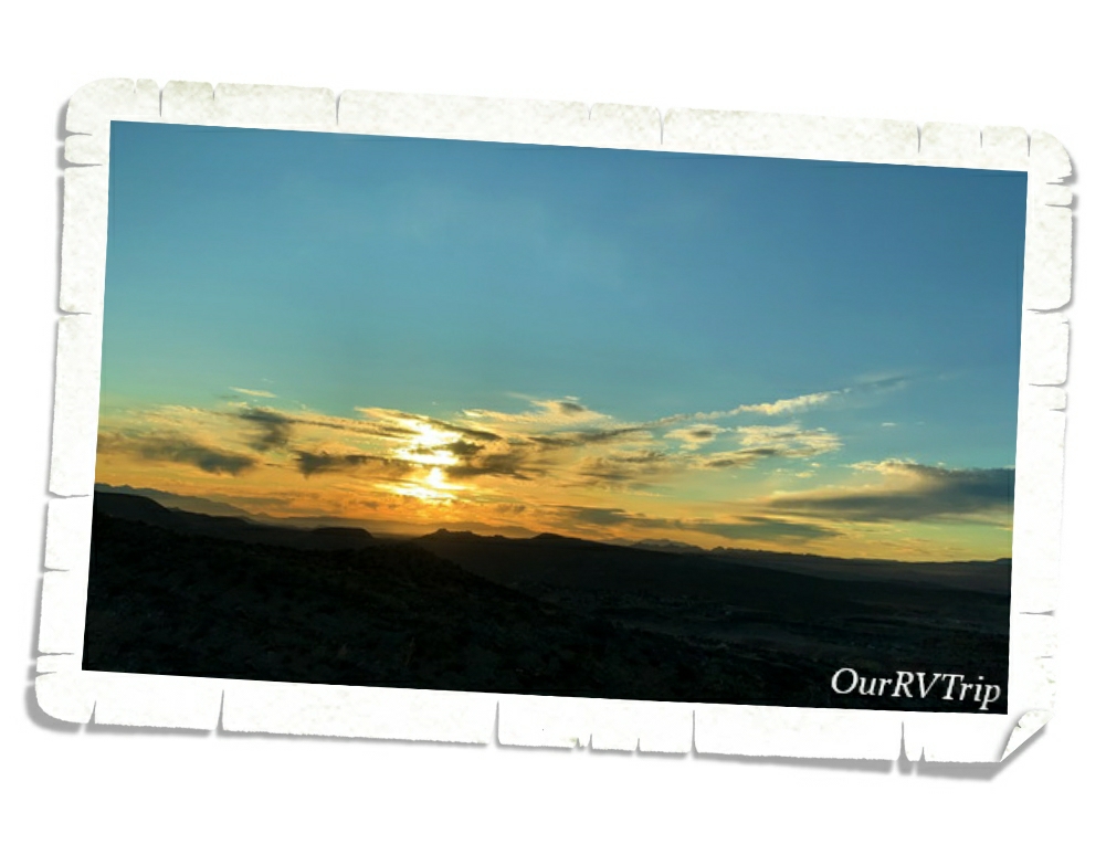
We saw some ah-mazing sunsets while we were in the Benson area! Just truly gorgeous! The southwest doesn’t play around when it comes to sunsets and sunrises.

That’s it Guys!! It took three posts to get through our Benson area adventures! I hope y’all are enjoying seeing some places you might not have known about and maybe you’ve learned a little something too. 🙂

See y’all down the road!

#NationalParkTour

Land Of Standing Up Rocks

Land Of Standing Up Rocks

Hey Guys!! We’re back in the Benson area for this post. We crammed so many adventures into our two weeks I might have to make this area a three post series. This is post number two of our Benson explorations…so lets get into it!

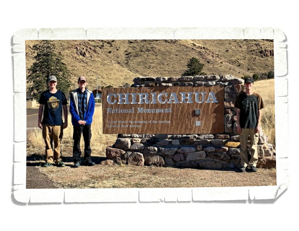
Chiricahau National Monument was established in April of 1924 and protects a small portion (around 12,000 acres) of the Chiricahau Mountains in southeast Arizona. I have to admit, I hadn’t done any research on this park before we went so I didn’t really know what to expect. On the way there we were out in the middle of nowhere with a pretty flat landscape and I kept thinking that this park might be a quick hour or two type of thing and then we’d head to a different park. So, when we rounded a corner and all of a sudden found ourselves in a forest…things got interesting.

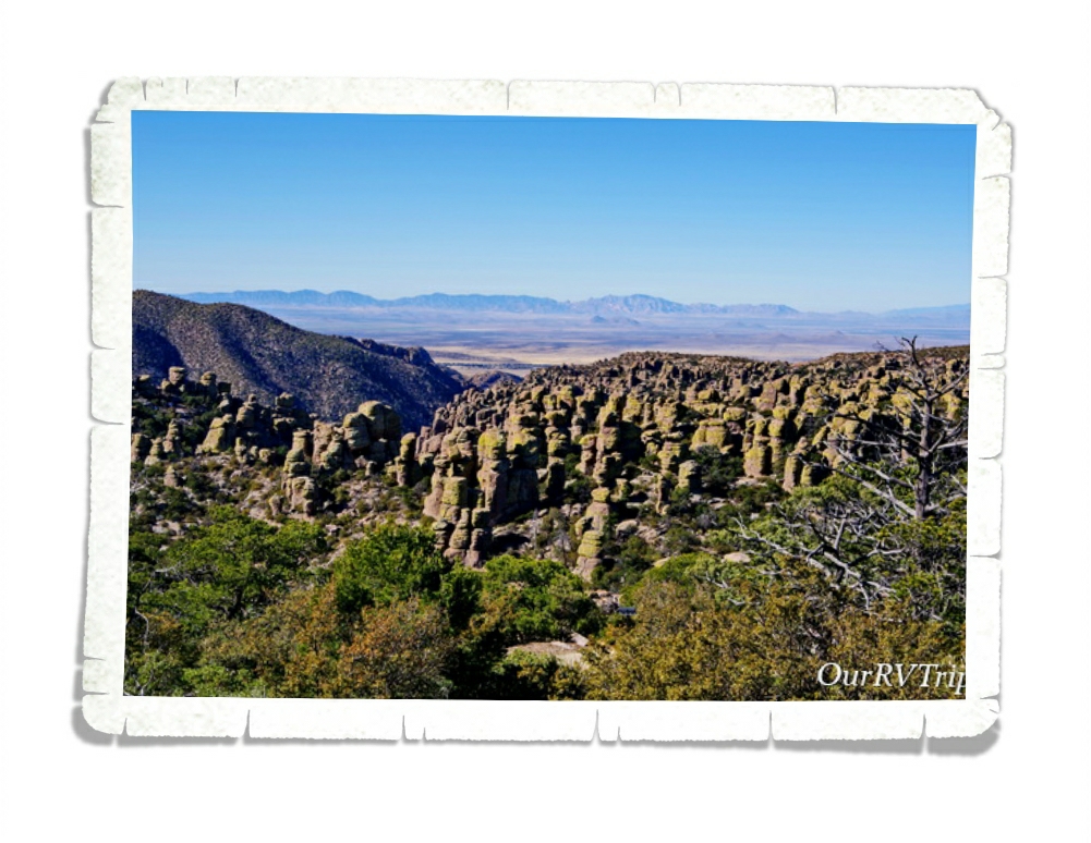
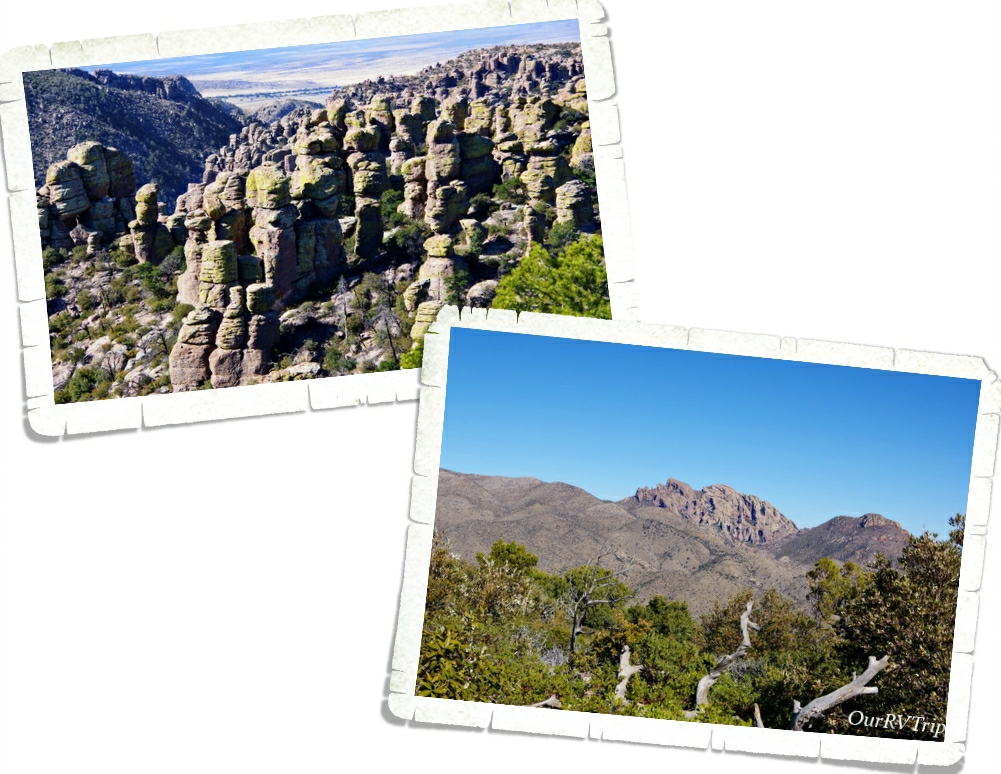
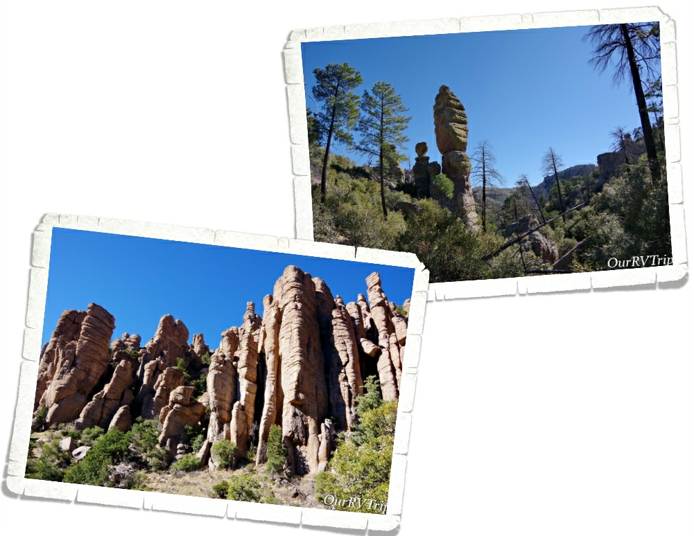
The Chiricahua Apache call this place “The Land Of Standing Up Rocks” because of all of the hoodoos. But Guys, these aren’t your normal hoodoos. The hoodoos, pinnacles, columns, and balanced rocks you’ll find in this park are all made up of rhyolite, a grey rock made up of super heated ash that’s been melted together.

When you drive up into Chiricahua National Monument, you’re driving onto one of the many sky islands of southeastern Arizona. Sky Islands are actually mountain ranges that are isolated from each other due to valleys, deserts, or grasslands that act sort of like barriers. Because of these barriers, plants and animals can become isolated on these sky islands.

Sometime around twenty-seven million years ago the Turkey Creek Volcano erupted and spewed ash over 1,200 square miles. The super heated ash compressed together, cooled, and formed rock formations. The rock formations you see today were created from years and years of weathering and erosion. Scientist have estimated that the Turkey Creek eruption was 1,000 times bigger than the Mount St. Helens eruption in 1980.

While we were driving to the end of the eight mile scenic drive, we realized this park would definitely take the whole day. We did a hike that took us down into the heart of a section of the standing up rock formations and somehow missed a turn and ended up hiking longer than we’d intended. It was a gorgeous day though so we weren’t too irritated by it.

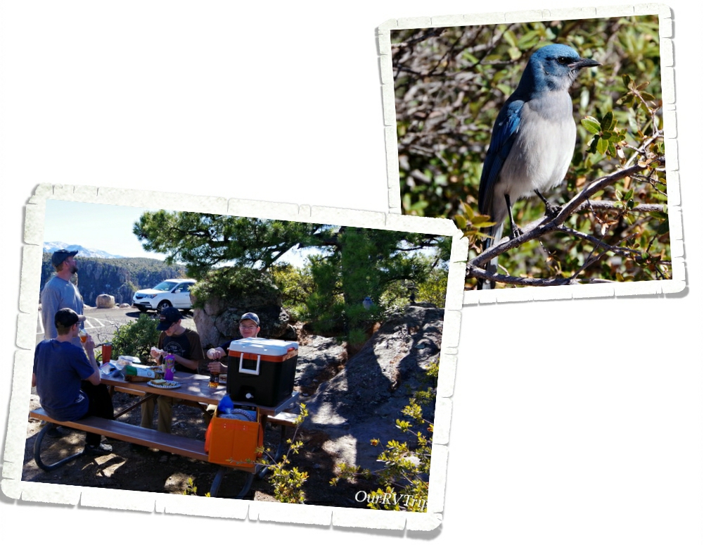
After we finished our hike, we found a picnic table and had a late lunch. The entire time we ate, we had an audience of Mexican Jay birds. They showed up by the dozens and worked so hard at giving us a show so that we’d maybe feed them. We didn’t. We like to keep the wildlife wild. I wanted to feed them though. Man, did they work so hard for a little treat. I felt horrible walking off and not leaving them some food.

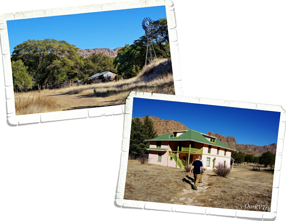
After lunch we headed to the Faraway Ranch which is also protected on the Chiricahua National Monument lands. In 1877, after the final surrender of the Apache leader Geronimo, a couple (Neil and Emma Erickson) set up a homestead on the land that would become Faraway Ranch. Eventually, the land around the homestead became the Chiricahua Forest Reserve and Neil became it’s first Ranger. He used his home at Faraway Ranch as the Forest Reserve’s headquarters for a time.

In 1917 the Erickson’s daughter, Lillian, decided to invite guests to stay at Faraway Ranch as a vacation to relax. While the guests were there, they could ride horses, explore the nearby rock formations, or even help out on the ranch with cattle chores. Riding horses through the canyons to see the rock formations was the most popular activity.

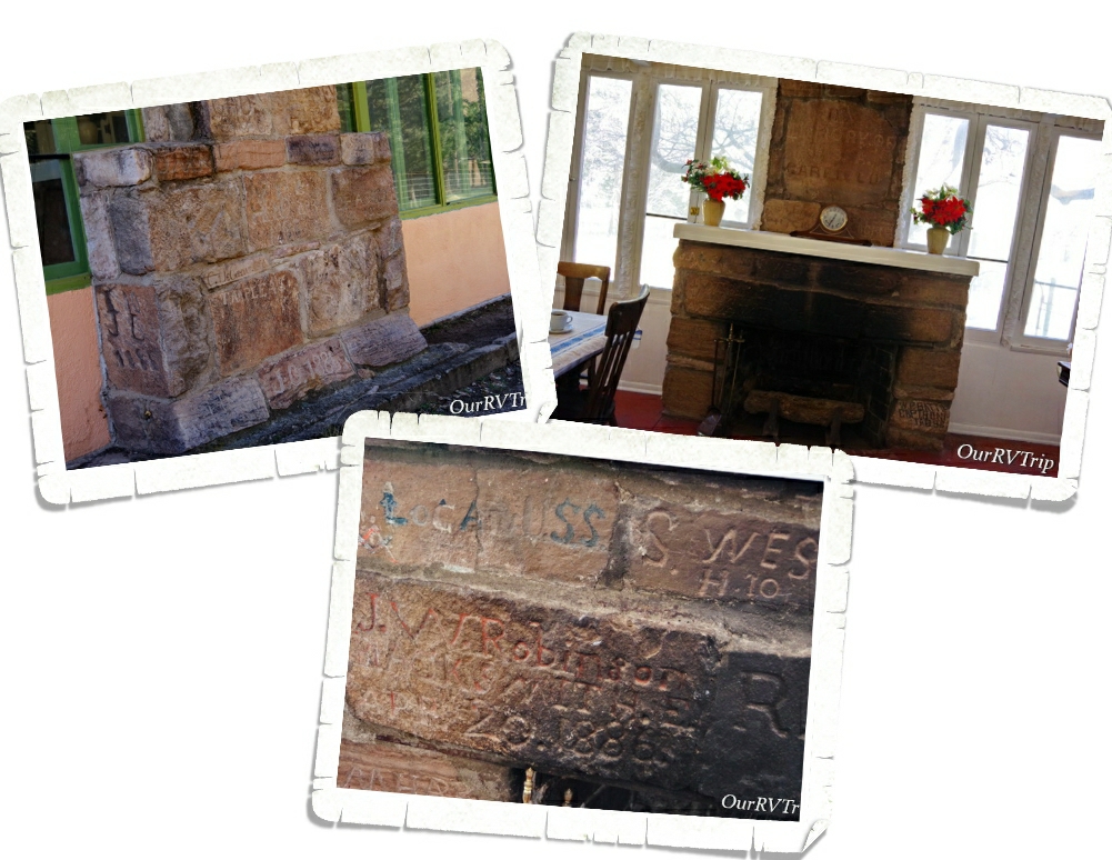
Today, you can take a tour of Faraway Ranch and learn of it’s history. One of my favorite things about the ranch is the unique fireplace. In 1885-1886 an encampment of Buffalo Soldiers was set up not far from the ranch to help protect the area. While there, the soldiers built a stone monument where many of them would carve their name. After the troops left, the monument started to disappear form weather and from settlers carrying the stones off to use. In the 1920s, Ed Riggs (Lillian’s husband), salvaged quite a few of the stones and made a fireplace with them in the ranch house to help preserve them.

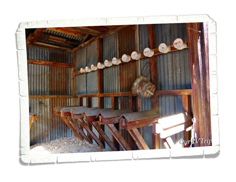
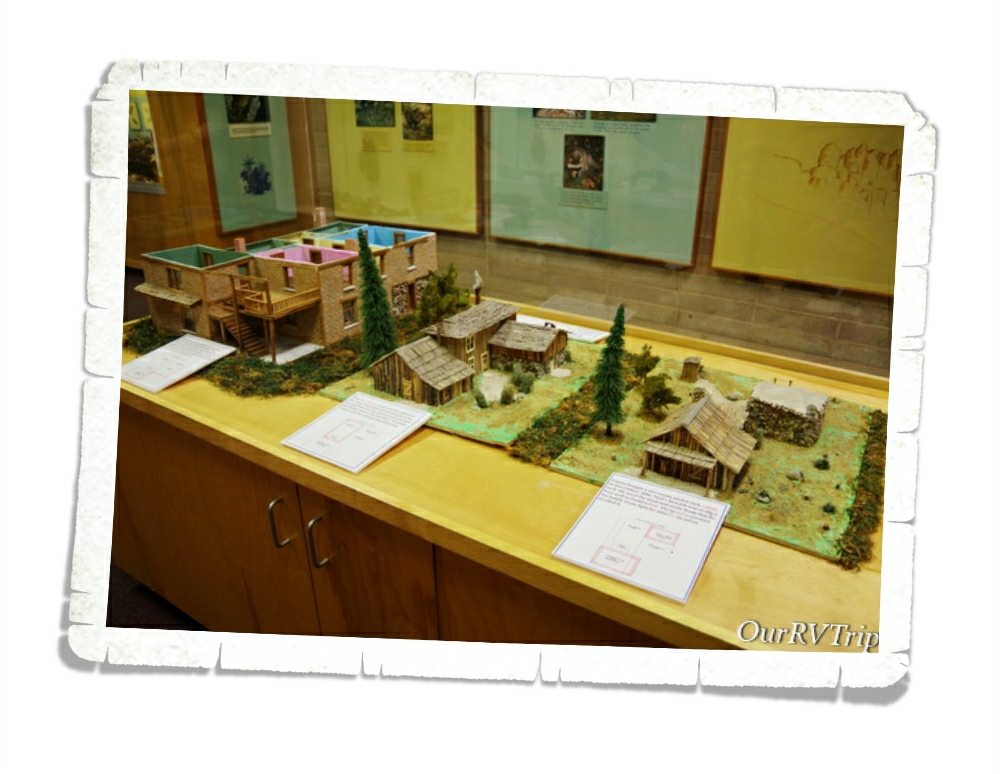
In the visitor center, you can see how the Faraway Ranch changed and evolved over the years. When the Erickson family first settled there, it was a small rustic cabin with a stronghold in the back to protect from Apache attacks. Over time, as the role of the ranch changed so did it’s size and shape.

We really loved this park! It was totally unexpected and amazing. If you’re ever anywhere near Chiricahua National Monument…you need to go. It’s so worth the drive. Not far from it is Fort Bowie National Monument. We had planned to visit that one on the same day, but we spent so much time at Chiricahua that we ran out of daylight and had to pass on it. Unfortunately, we never made it back to the Fort. But, we will definitely go back to the area someday.

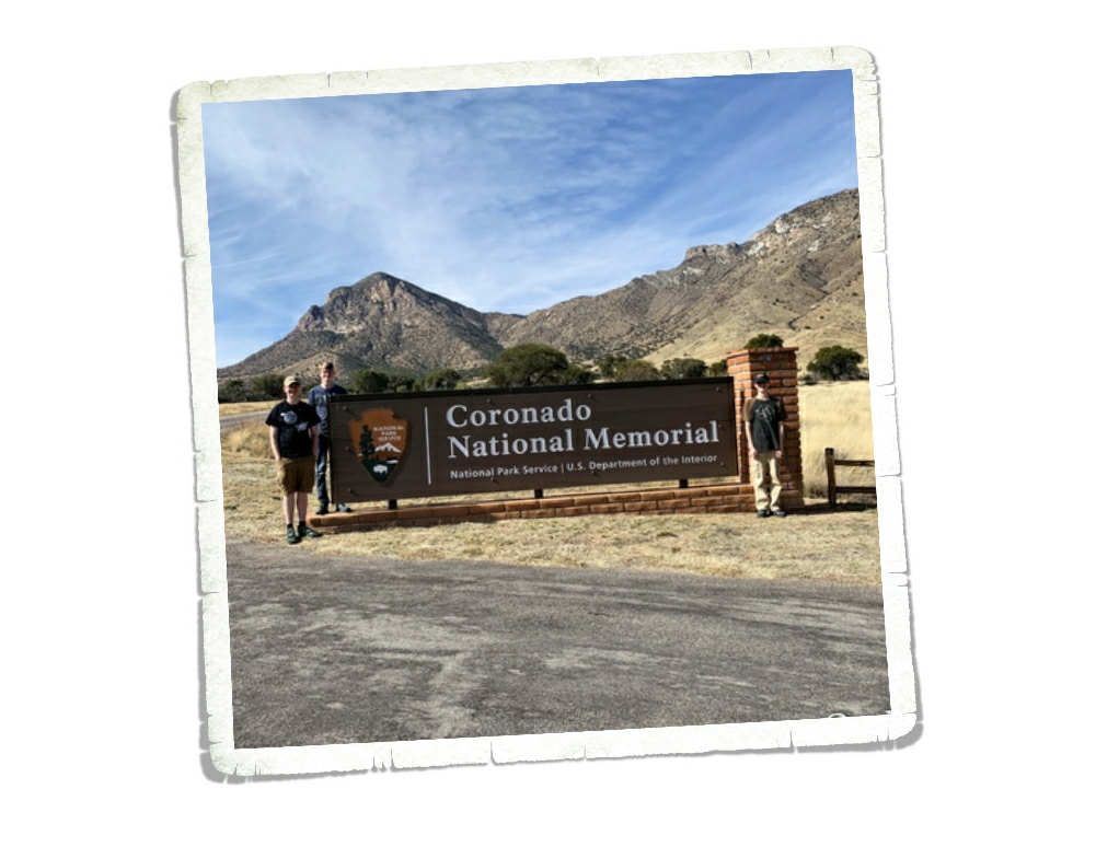
We’re on this whole National Park Tour…that includes Memorials, Monuments, Battlefields, Historical Sites….you get the point. So when I found Coronado National Monument I immediately added it to our list without much of a thought. It wasn’t until later that I realized the park hugs the border with Mexico and might be a bit dangerous to visit. We’ve been very close to the border on several occasions. We even crossed it once in Big Bend National Park to go to the small town Bouquillas to get some lunch and look around. Safety really depends on where along the border you are. This particular spot along the border is very close to a huge military station so we felt safe-ish. We saw so many border agents driving around…in fact, we saw several border agents every single time we’d leave the park we were staying in. But, we’ve heard all kinds of stories (first hand accounts) that kept us very on edge the whole time we were at Coronado National Memorial.

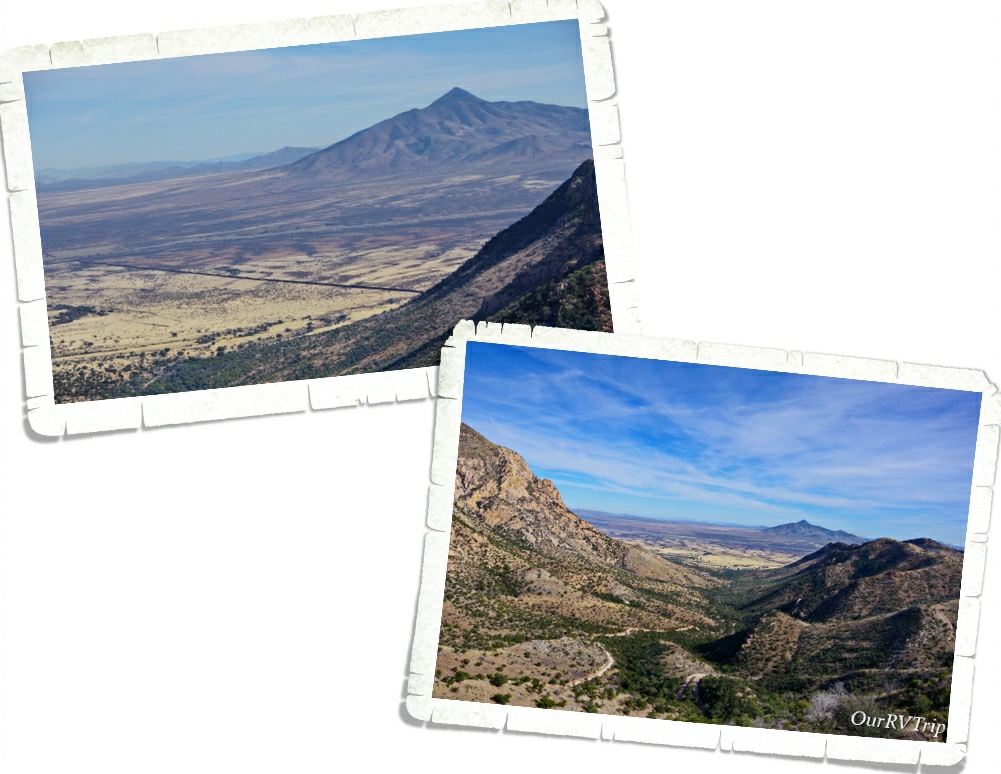
Coronado National Memorial was originally designated Coronado International Memorial when the United States came to an agreement with Mexico as a sign of goodwill and cooperation. Mexico never developed their side of the park though so in 1952 Congress changed the designation to Coronado National Memorial. In the above left picture, you can see the border between the US and Mexico. It looks like a long dark line.

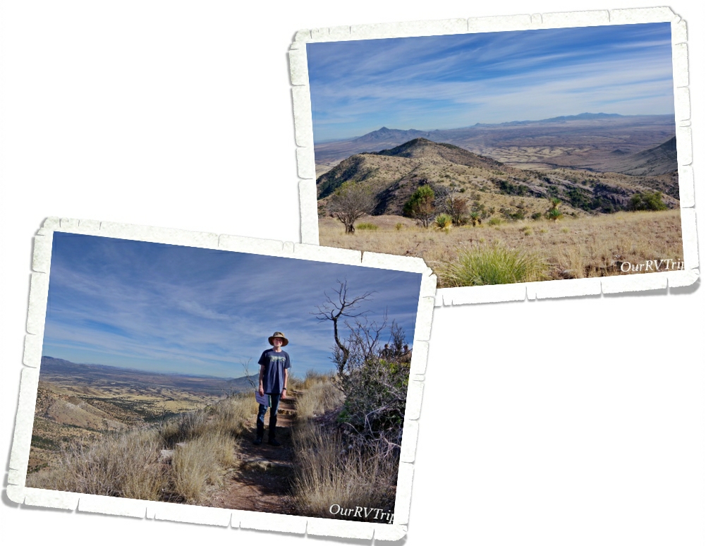
We hiked the Coronado Peak Trail while we were there. It starts at Montezuma Pass and takes you up 300 feet to Coronado Peak. It was a quick easy hike that gave us some breathtaking views of Sonora, Mexico right across the border.

Coronado National Memorial commemorates the 1540 expedition of Francisco Vásquez de Coronado as the first known Europeans to visit the United States. Coronado’s expedition consisted of around 300 Europeans, several Franciscan priests, well over 1,000 Aztec/Mexica allies and “scores of servants and enslaved peoples” along with as many as 6,000 head of livestock (cattle and sheep) and supplies. The main purpose of this Memorial is to interpret Coronado’s two year expedition to find the fabled Seven Cities of Cibola and explore unknown territories.

Coronado thought he was going to find cities laden with gold and priceless jewels. What he found when he finally reached his first Zuni Pueblo was a farming community. He eventually made it all the way up to what is known today as Salina, Kansas before he gave up and went back to Mexico. The tribe that was helping him thought he was looking for bison so they took him to Kansas where there were thousands of bison.

Coronado’s dreams of fame and fortune disappeared with his failure to fine the Seven Cities of Cibola. He died ten years after his return in relative obscurity. His expedition failed, but actually, his two year exploration was like a pebble in a pond setting ripples into motion. Not only did he change the Native Tribe’s religion by their interactions with the Franciscan priests, Coronado’s expedition opened the door for Spanish explorers and missionaries to start colonizing the Southwest.

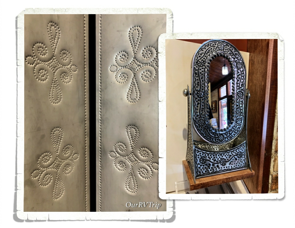
The Spanish brought with them the technique of decorating tin with small holes that will allow light to shine through. Punched tin is still a common decoration of the American Southwest and is still being produced in both Mexico and the Southwest.

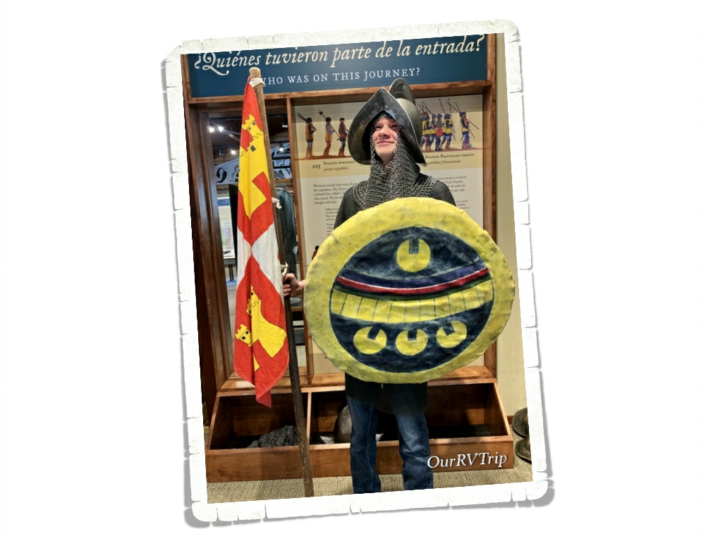
Well Guys, I think I’m going to pause here and finish up in the next post so stay tuned! I’ll leave you with a picture of Nicholas dressed up and being a bit silly at the Coronado National Monument Visitor Center.

See y’all down the road!

#NationalParkTour

Aztec Ruins National Monument

Aztec Ruins National Monument

Hey Guys!! We’re back in New Mexico!! This is one of our absolute favorite states to visit…and not just because the foodies here are sooo insanely good…we also really love the history and culture of New Mexico.

Each state has a feel. I know, I know…I’m getting all woo woo on you, but stay with me here… Every place has a feel to it. Usually, you associate certain feelings or emotions with a place based on your experiences there. But, sometimes you can visit a new place and you just click with it. It resonates with you in a way you might not understand, but you like. New Mexico is like that for us. We’ve liked it from the get-go…it resonates with us. So, we always look forward to spending time in New Mexico.

We spent two weeks in Farmington, NM so we could visit a couple of National Monuments and explore some close-ish by places we wanted to see that aren’t National Parks, but interesting.

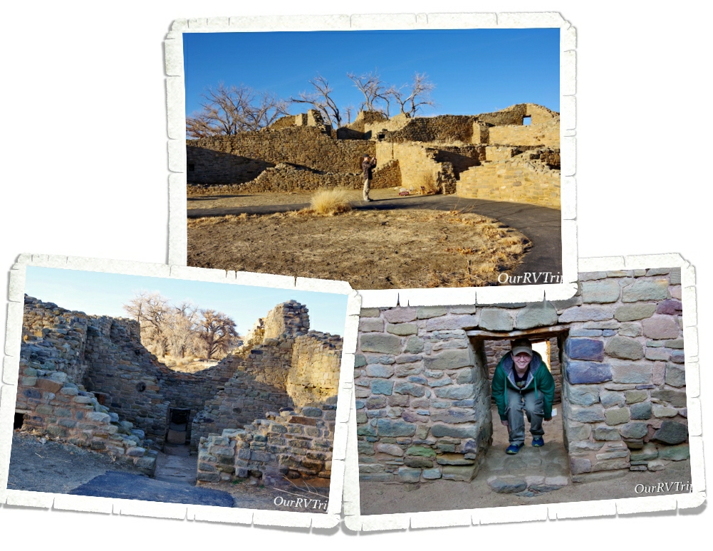
One of our first stops was Aztec National Monument. No, the Aztecs never lived there. This location got it’s name from early Spanish explorers who often used the name “Aztec” pretty much anytime they found ancient sites. The people who lived and built the ancient community of Aztec National Monument are known as ancestral Puebloan people. The descendants of the ancestral Puebloan people who are still in the area don’t like to call the ancient dwellings ruins. They’re not ruins to them. They believe the spirits of their ancestors still live in those ancient dwellings.

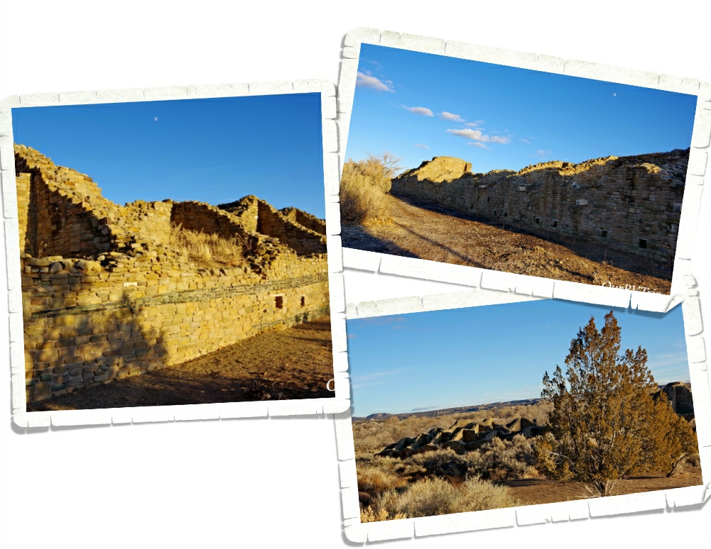
The ancient building you find at Aztec NM is called a great house and is considered to be part of the Chaco Phenomenon. This period of time saw members of the Chaco community move to the banks of the Animas River and start building the Aztec Community around 1100 CE. These Great Houses were used as community centers where business, politics, trade, and ceremonies would have taken place.

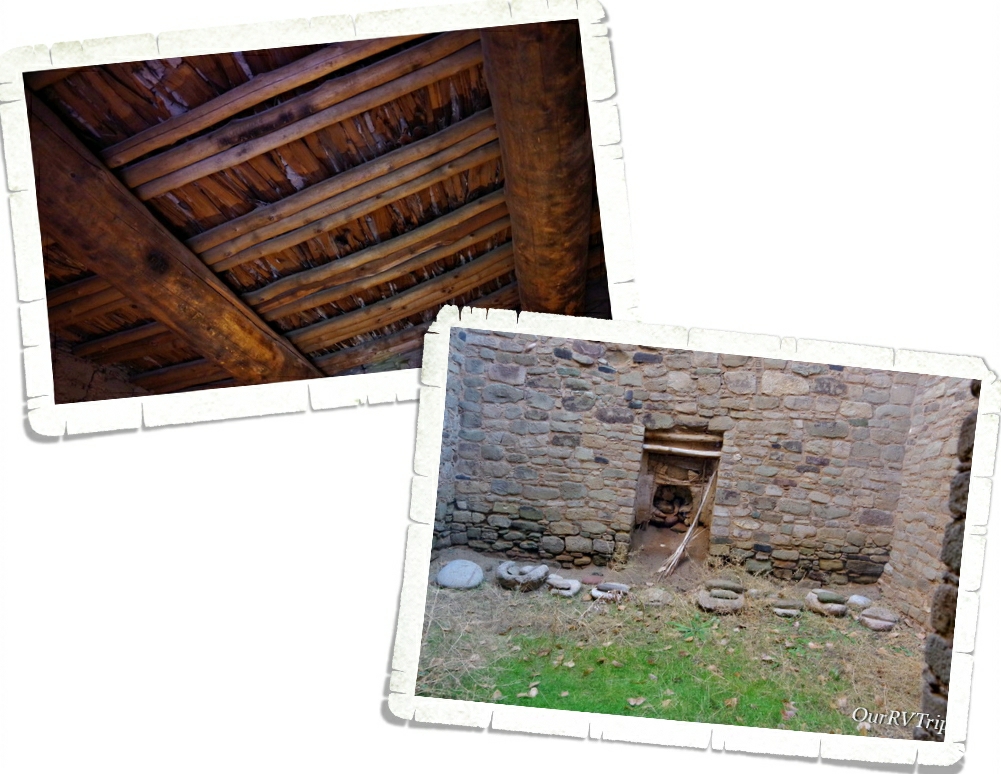
There are places within the ancient dwelling where you can see the original ceilings. Still holding up after 900 years of use. The wooden beams are made of trees like ponderosa pine, Douglas fir, spruce, or aspen. Most of these trees are all found in higher elevations and would have required at least a twenty mile walk to get them to this site. Because of how well preserved these ceilings are…the scientist have been able to do a test called dendrochronology where they take tiny little core samples of the trees to find out the age of them by counting the tree rings. This process tells the scientist when each room of the community was built and allows them to more precisely date the ancient dwelling.

Ancestral Peublo people were living in and building the Aztec NM site from the late 100s to sometime during late 1200s. The community was so large its thought to have rivaled the size of the community found in Chaco Cannyon.

The ancestral Puebloan people incorporated solar and lunar alignments into most of their structures and used these markers as a way to determine when to plant crops, when to do certain ceremonies, and to keep a balance within the community. The inhabitants of Aztec NM often included green stones within certain walls. You can see this in the above left picture. No one really knows why they did this. Did it have meaning or was it purely decorative? There are some archeologists who believe, based on shared ideas by some Pueblos and Navajos, that the stripes could have been associated with water and believed to protect the community.

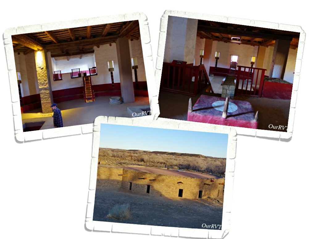
The Great Kiva was considered to be the heart and soul of the community. It is believed that great kivas would have been used as public buildings for the surrounding communities. A sanctuary. Possibly a place where different clans had meetings or held ceremonies. The great kiva at Aztec NM was excavated in 1921 by Earl Morris and then reconstructed in 1934 so that we could get an idea of what these amazing buildings would have looked like when they were being used. We’ve been to several ancient dwellings and have seen what’s left of kivas of all sizes. We’ve read what they were used for. We tried to picture in our minds what they would have looked like. We’ve listened to Rangers talk about what’s known and guessed about them…but being able to actually walk into one of the great kivas and explore it…even though it is a reconstructed one…was amazing.

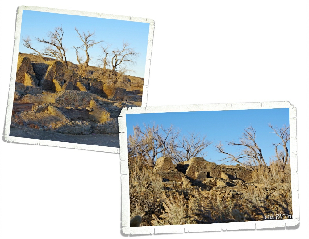
The dwellings at Aztec NM consisted of several different sites. The great house we’ve been talking about was a three-story building with over 500 rooms. It held quite a few smaller kivas and also had a great kiva as it’s community center. Sometime during the late 1200s people started moving away from this area. No one really knows why. There is speculation it was a long period of drought and perhaps some social factors that caused the move, but there’s no hard evidence. We know that from this area they traveled west, south and east to what are now Hopi and Zuni communities.

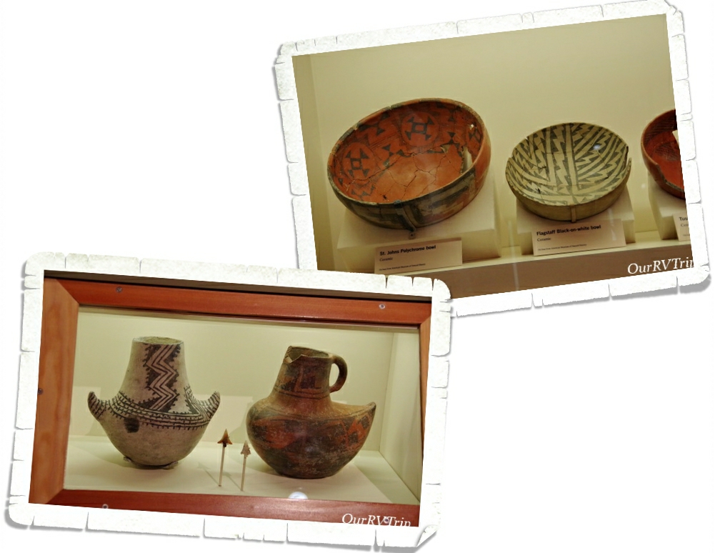
When the people left, they left pieces of their lives behind. I always enjoy seeing the pottery they made. It amazes the how detailed they are.

The ancestral Puebolan people might have moved on, but the descendants of those people still come to Aztec NM to remember. They still feel a connection to their ancestors as they walk the ancient dwellings. They believe their ancestor’s spirits are still there and that the ancient dwelling is still inhabited. So, when you go visit these places please respect them and those that are believed to still be living there.

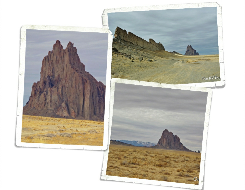
Shiprock is known by the Navajo as Tsé Bit’ a’í which means rock with wings. It stands at somewhere around 1500 feet high, making it’s peak close to 7,000 feet above sea level. Located on Navajo Nation land, Shiprock is very important to Navajo beliefs and culture. They ask that you don’t climb it or hike to it or it’s surrounding rocks. They also ask that you no longer drive down the dirt road leading to it. It is a sacred site and should be treated with reverence. Shiprock was created over a millennia ago and is at the center of three volcanic pressure points.

When we went to Shiprock, there was a group of people holding a public event along the dirt road leading up to the rock. We asked them for permission to drive a little on the road up to the rock and they told us we could. We didn’t go far and we didn’t climb on anything. In fact, we just took some pictures, marveled at the whole structure and left.

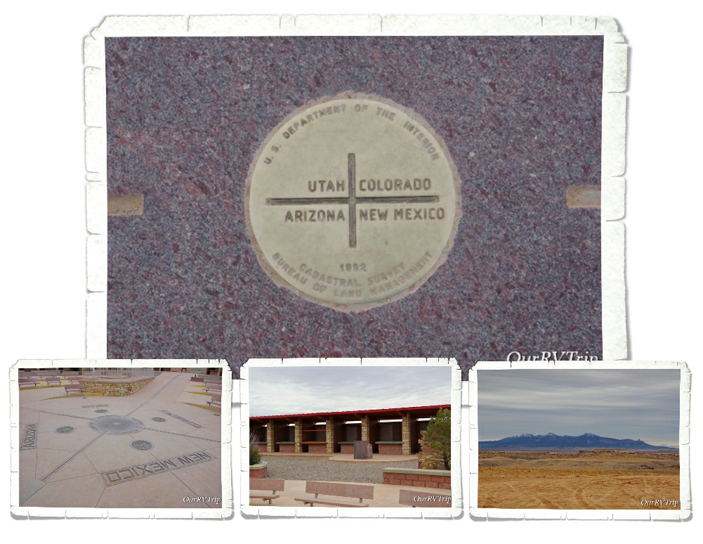
We also made it out to Four Corners where we stood in four states at once. The Four Corners complex is also on Navajo Nation land and there is a small fee to get to it. We went during the winter so there weren’t a whole lot of people. There are vendor stalls set up all around the complex so locals can sell their art. We chatted with a couple of them, bought a few things, and headed down the road. I’ve said it before…and I’ll say it again here…talk to the locals. They have some really great stories about their culture and beliefs…that they might be willing to share with you. We talked for quite a while to a woman selling sand art. She told us how she and her family go up into the surrounding mountains to find the different rocks to make the various colors needed for her art. Each color is made using a specific rock or mineral. Each has meaning. We find it all fascinating and really enjoy chatting with the local artists.

I’ll end this post with some foodies…because…well, yum! We found a pizza place called Pizza 9 and fell in love with it. We ate there several times in the two weeks we were in Farmington. Some of us have even declared it to be our favorite pizza place of all time while others still insist Back Road Pizza in Santa Fe is top of the list. We also ate a a couple of Mexican places…one was Fiesta Mexicana and I can’t remember where the other one was. Both were good! Not great…but good!

Well, that’s pretty much everything we did in the Farmington area. I’ll finish up with one more National Monument in the next post!

See y’all down the road!

#NationalParkTour

Longhorns in Utah?

Longhorns in Utah?

Hey Guys!! We’ve made it to the last stop on our Utah Big Five section of our National Park Tour. We stayed in a city called Hurricane for two weeks and after four weeks of tiny towns with tiny grocery stores and very few foodie options…we were loving this area of Utah!

The main reason we were in Hurricane was to explore Zion National Park. I’ll tell you all about our Zion shenanigans in the next post. Zion is getting a post all to itself. Yup, it was that epic.

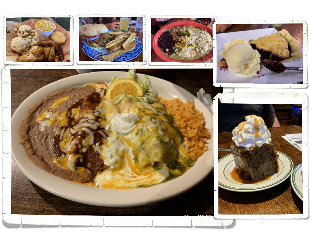
So, what else did we do while in the area? Honestly…not a whole lot. We’d pretty much been going non-stop for three months straight and we were so worn out. We’d had plans to explore Zion, Pipe Spring, and then a few state parks in the area, but that didn’t happen. We needed some down time. Living in a small space does have its good points…we’re a close family…but it also has its drawbacks. We’re always within a few feet of one another. Personal space isn’t really a thing when you live in an RV and usually, that’s cool. Like I said, we’re a close family, but when you have five people who have zero personal space and they’re all tired and worn out…our home-on-wheels can feel a little more cramped than usual. We decided to, of course, explore Zion and Pipe Spring National Monument (since we are on a National Park Tour), but we skipped everything else…this time. We spent a lot of time just hanging out…trying the foodie spots…and resting.

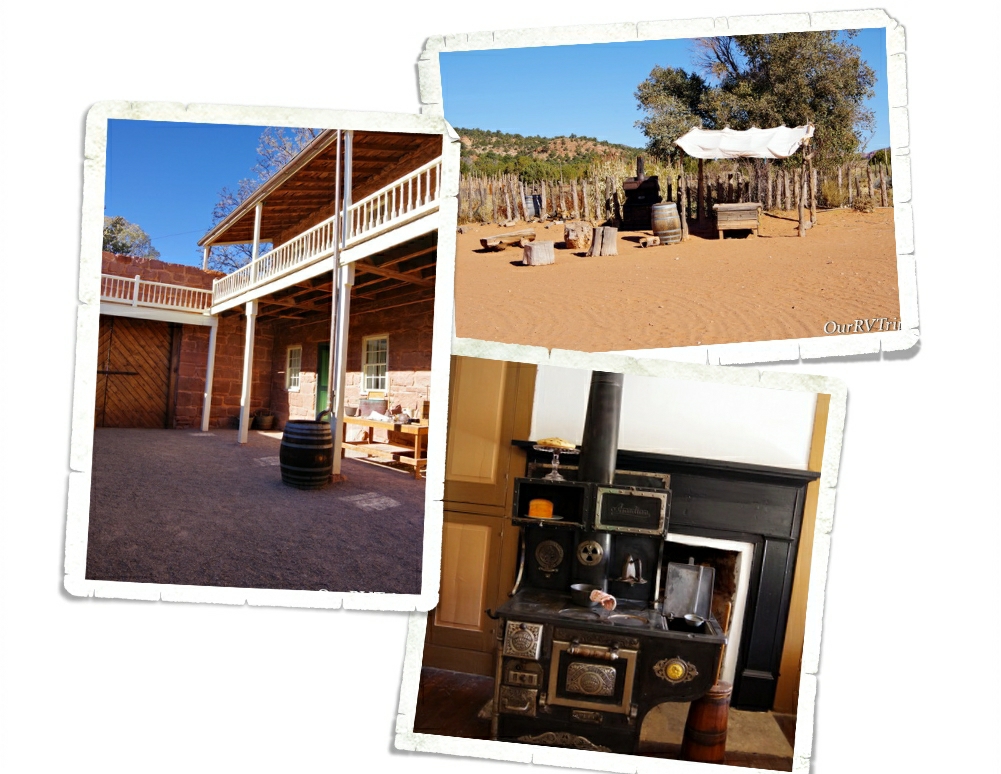
Sometime in the early 1920s, Steven Mather (the first director of the National Park Service) was on his way from Zion National Park to the North Rim of the Grand Canyon when he stopped at Pipe Spring to rest. He became fascinated with the place and saw an opportunity to make a little money by having a place to stop on the way from one big National Park(Zion) to the other (Grand Canyon). So, he bought it with his own money and by 1923, Pipe Spring National Monument was born.

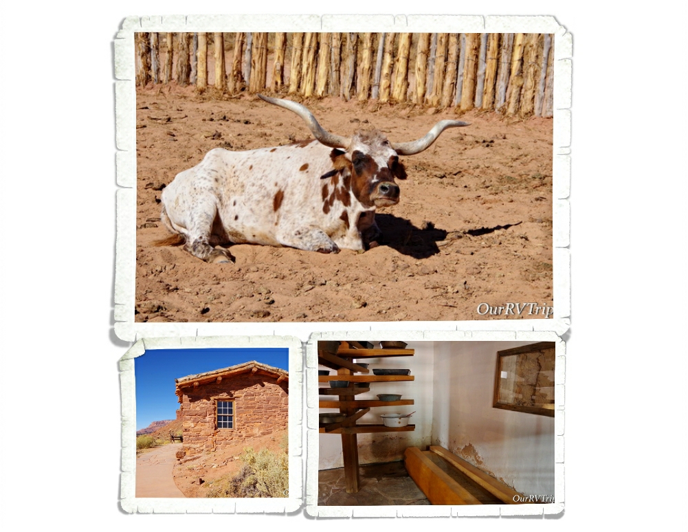
Back before it was known as Pipe Spring, this land was home to the Paiutes. They lived off of and cared for the land in and around the spring. In the mid 1800s, the Church of Jesus Christ of Latter-day Saints claimed 160 acres of the land to use as a ranch for cattle. The first thing they did was build a fort over a small section of the spring so they would always have access to fresh water. Relations between the Paiutes and the LDS members escalated horribly when the Paiutes started hunting the cattle since the LDS members were hunting the deer in the area. The Paiutes weren’t being malicious…they didn’t see a difference in hunting one thing over another. The cattle, after all, were on the land they’d called home for 1000s of years. One thing led to another, and the ranch was abandoned for a time.

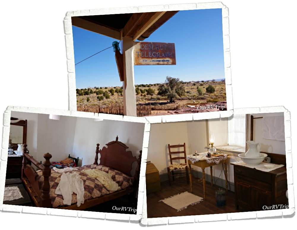
Not wanting to give up the land and all of the profit it was bringing in for the church, the LDS members went back to Pipe Spring and built a stronghold. This strong hold became known as Winsor Castle. Winsor Castle and the ranch was out in the middle of nowhere and needed a fast way to communicate with people. By 1871, 995 miles of telegraph wire had been installed and Pipe Springs was connected to the Deseret Telegraph system. Eliza Stewart was the first telegraph operator at Pipe Spring.

The ranch prospered from 1871 to 1879 making bimonthly delivers of butter, cheese, and cattle to St. George, Utah while the LDS Temple was being built. When the Temple was built, the Church no longer needed the ranch and in 1895 the ranch was sold to Maggie Heaton. Maggie welcomed any and all to her home. She’d have fresh water, pies, cakes, and fresh bread. And the rest…is history.

I’ll be honest here…this is the first National Park Unit that I’m not really sure why it’s a National Park Unit. Every National Park Unit tells a story…it preserves an important building/town/canyon/section of our Country that needs protecting or needs to be remembered. The story we were told at Pipe Spring National Monument, while interesting…wasn’t really any different than 1000s of other stories/places of that time. In fact, the story told at Pipe Spring National Monument was mainly about LDS Members and early days of their church and if I’m being completely honest with y’all…it wasn’t a kind story about them or their early life practices. Perhaps this was a learning story…if we forget our country’s history/mistakes, then we’re more likely to repeat them. I’ve watered down the history of Pipe Spring National Monument here…my intention is to keep it real, but not offend anyone. I feel like this park would be better suited as perhaps a State Park or a privately owned museum.

Oh, and one more thing…Pipe Spring National Monument is actually in Arizona…not Utah…so the Texas Longhorn in the photo was in Arizona. 😉 We did see some in Utah on the way into Zion though. A whole herd of them! They were very cool!

Let’s talk foodies! Now, keep in mind…we’d been out in the middle of little towns that didn’t have many options for foodies…and keep in mind we were recuperating. Yeah, recuperating… we’ll go with that. **wink, wink**

We kind of went crazy with the options for foodies. And, Guys…we’re not even sorry about it. Not. Even. A little bit.

One of my all time favorite things to do is peruse the ice cream sections in the different areas/regions. I’m always on the look out for a different brand or flavor. We started seeing the Red Button Brand as soon as we crossed into Utah and well…we had to try a few flavors. Our favorite (and one that’s not pictured) was the Root Beer Float flavor. It was really good!

Every time we’d head into Zion, we would pass this place called Fort Zion. This place was a souvenir store/restaurant/petting zoo. It was a really neat place and the petting zoo price was super reasonable. My favorite thing here was the cute little old western town they’d made!

I didn’t get any pictures of pretty flowers so I’ll leave you with this sunset picture. In the next post I’ll tell y’all all about our Zion explorations…so stay tuned!

See y’all down the road!

#NationalParkTour