Hatcher Pass
Our absolute favorite thing to do in the Palmer/Wasilla area was to explore Hatcher Pass in the Talkeetna Mountains.
In 1906 Robert Lee Hatcher staked the first gold claim in the Willow Creek district. Gold contained in quartz veins within solid rock is called “hard-rock” or lode gold. With the discovery of the Hatcher claim, gold mining switched from panning in the streams to digging underground. In 1937, construction began on the Independence camp and mill which later became Independence Mine. By 1941, the Independence mill, camp, and mine employed 206 men and 16 families who recovered 140,000 ounces of gold before the mine was shut down in 1943 after gold mining was classified as nonessential during World War II. In 1974 the Independence Mine was placed into the National Register of Historic Places and in 1981 it was dedicated as a Historic Landmark. Today, Independence Mine is open to the public to explore and learn what life was like for the miners and their families back in the 1940s.
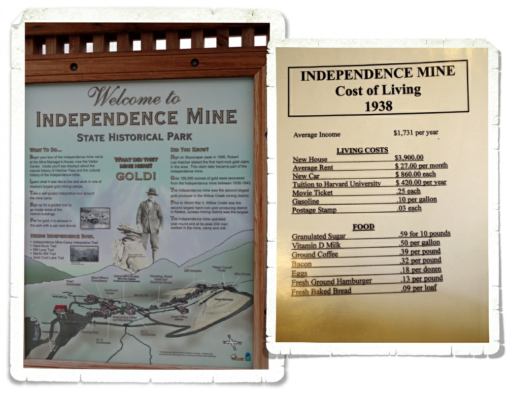
There are several trails and plenty of buildings to explore. We only had two hours before the gates closed so we kind of rushed through the Independence Mine area. I always find it interesting to compare the cost of living then to the cost of living now.
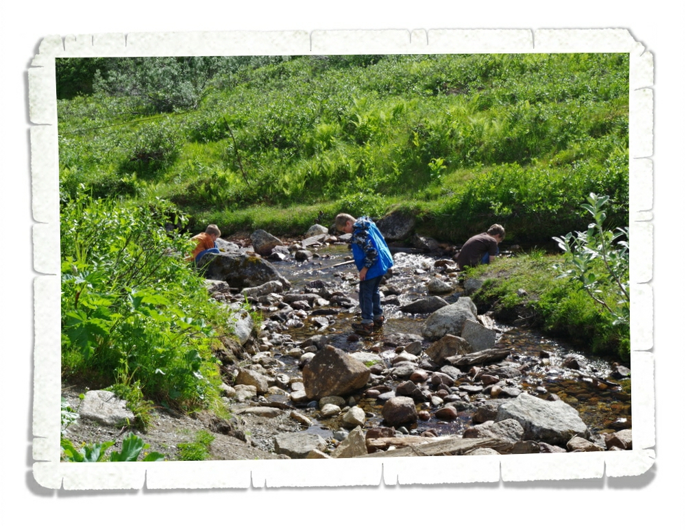
The Visitor Center closed forty five minutes after we got there so we quickly borrowed a few gold pans and tried our hand at panning for gold in the stream that ran through the Independence Mine area. We didn’t find any this time, but we aren’t giving up! The boys all tried their hand at it and had a good time trying not to fall into the stream!
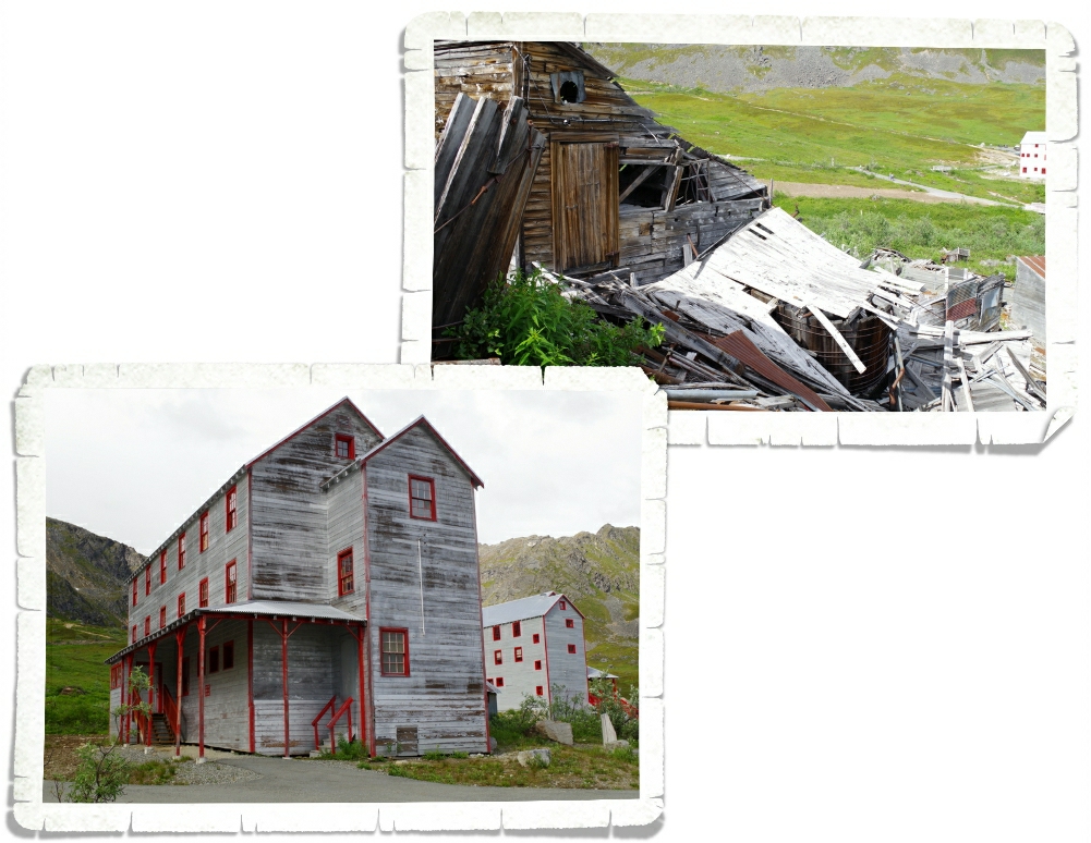
Some of the buildings have been preserved so nicely, while many other buildings have fallen into ruins. I think it added to the landscape. To see buildings standing that looked like they could (with a little work) be used again today while not far away from them were collapsed buildings…it really gave it a ghost town feel.
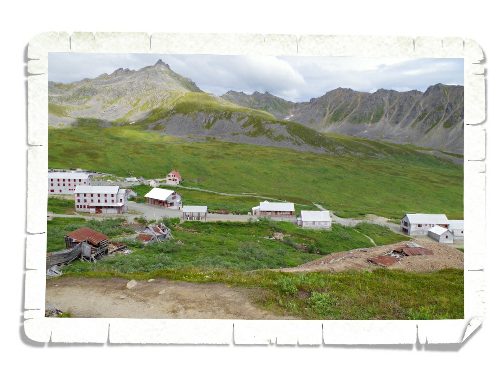
The photo above gives you a good idea of the landscape and how the Mine was dotted about the natural land formations.
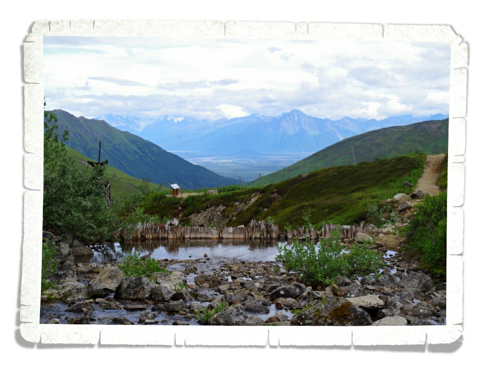
There were views in every direction. We could make a whole postcard book from the shots we got here!
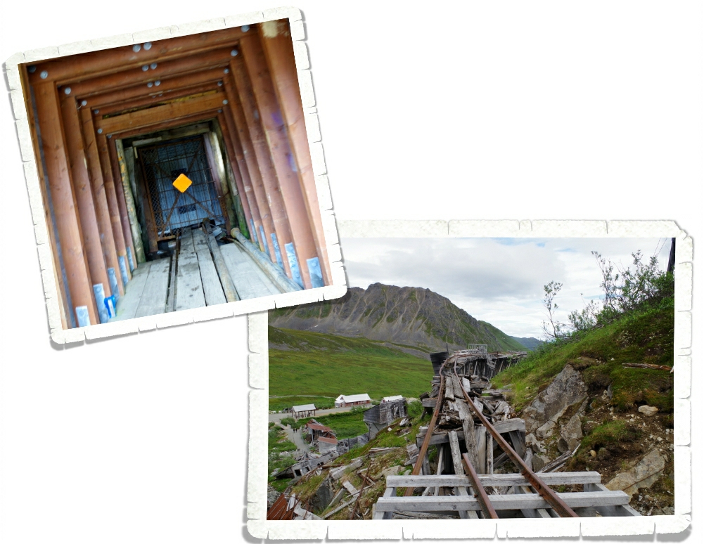
In the left photo above you’ll see the only tunnel left. You can walk to the back of it and feel the temperature drop several degrees. I believe it was called a water tunnel. I’m not entirely sure of all of the details about it, but it was neat to see. The train tracks in the right photo had long ago fallen. We thought they looked cool and wondered what happened to make them twist and become misshapen.
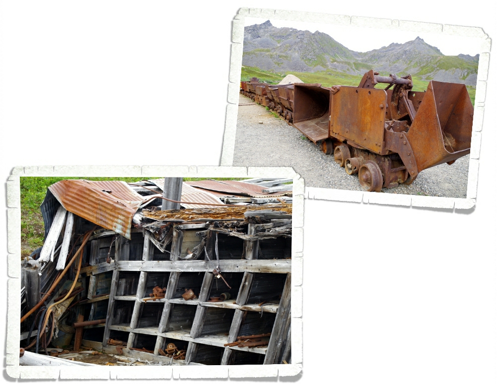
It looks like when the Mine was closed down, the residents got their belongings and left without any thought to the supplies left in the shops. In the right photo you can see part of an old train. The carts could dump things to the front or to the side. We must be nerds because we love learning all about these kinds of things!
We had to hurry through the gates before they closed for the night. They won’t wait for you if you’re late and if you’re unlucky enough to get stuck there the park impounds your car and it’s a very long walk back to the RV Park.
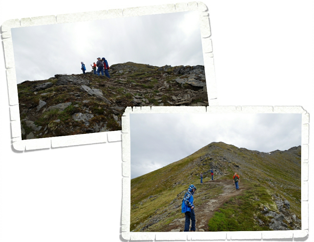
A few days later we came back to Hatcher Pass to explore the Summit Lake State Recreation Area where you can drive to nearly 4,000 feet above sea level on a winding dirt road to be rewarded with an alpine tundra meadow to explore. There were several hiking options. We chose the April Bowl Trail. The April Bowl Trail climbs up to a height of 4,811 feet. It was a steep, rocky climb! I wasn’t prepared for how I would react to it. I had a little melt down after slipping and almost falling for the umpteenth time…I was done with it. I was stressed and worried about breaking my camera. The boys were up the trail some so they didn’t see me melt down… Jerl talked me down from it. We definitely balance each other. Once I gathered myself we headed on up the trail.
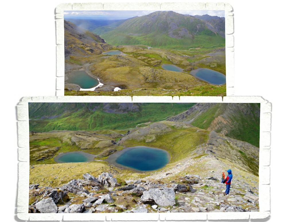
The path takes you right by a lovely turquoise tarn called April Bowl which is where the hike gets it’s name. You can see it in the bottom photo above. Once we got a little higher, we saw more of April Bowl and noticed there’s still snow and ice around one of the little ponds. Excuse the water drops on the lens…it started sprinkling on us.
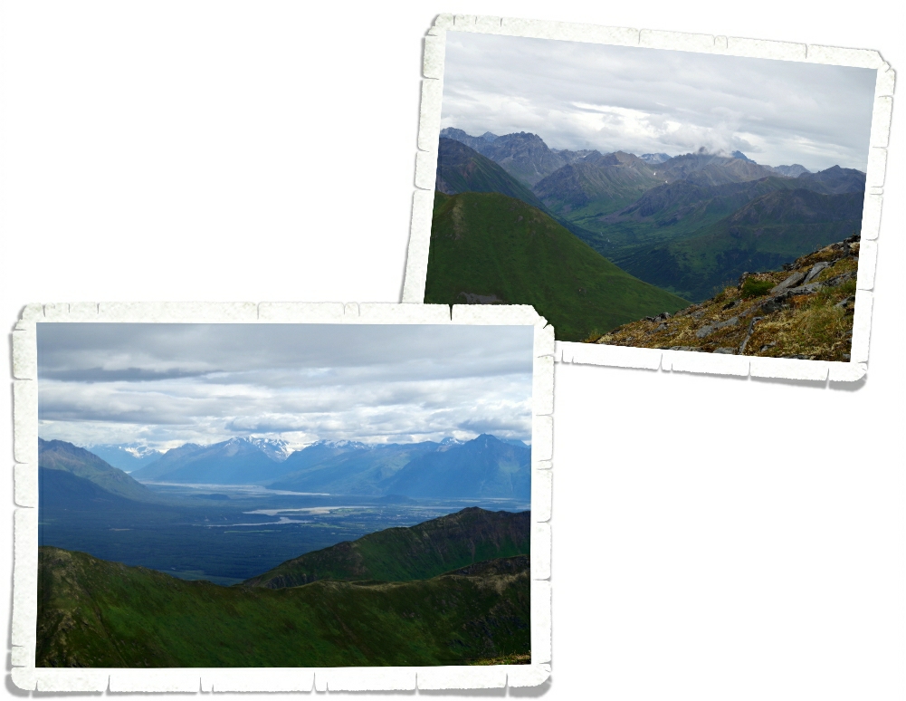
The views from the top were stellar! We were rewarded with 360° views. I was so thankful that Jerl was able to talk me into continuing! I would have missed some absolutely stunning views.
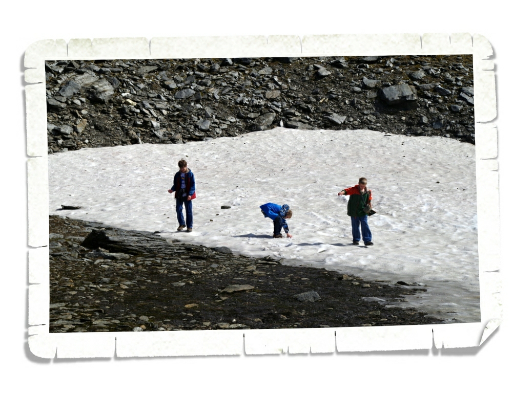
On the way back down, we stopped to play in the snow. Since we moved to Texas, the boys haven’t had the opportunity to really play in the snow. They had a great time throwing snowballs and just being boys.
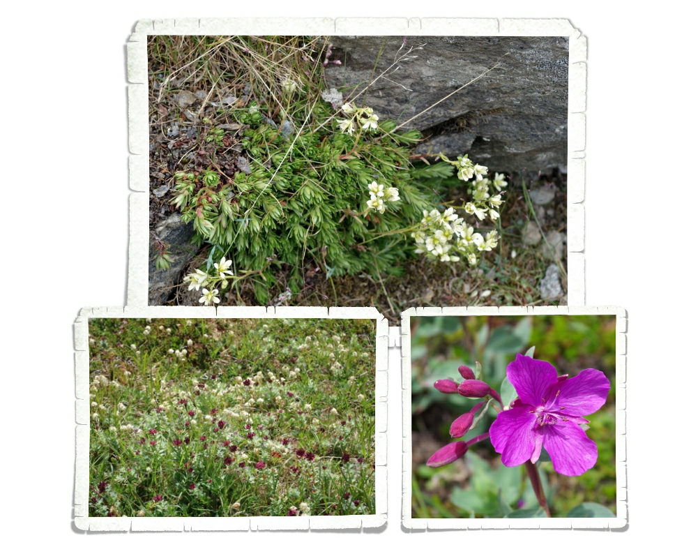
And, of course, there were the flowers! There were flowers everywhere. Flowers and moss, but no grass. It was really…spongy walking around the alpine meadow.
This is the final post about the Palmer/Wasilla area. We had the best time in this area and we’ve all decided we’ll have to go back to this area if we ever get to come to Alaska again.
See y’all down the road!
#alaskabound
2 Replies to “Hatcher Pass”
You are taking some seriously awesome pictures! One of these days I’d love to print some off. What an adventure you guys are having!!!
It’s been pretty amazing!