Category: Uncategorized

Glacier National Park And A Ranch

Glacier National Park And A Ranch

Hey Guys!! We spent two weeks in West Glacier so we could explore Glacier National Park!

Confession: We didn’t want to like Glacier National Park.

It’s true. For years, we’ve heard so many people say how awesome Glacier NP is. We heard the same things about a couple of other parks that are wildly popular and…well…we’re not too fond of those particular parks. So, when we headed to Glacier, we’d already made up our minds (but tried to stay hopeful) that Glacier was going to be another dud for us. I should tell you here…the entire east side of the park (according to most, the east side is the best side) was closed so that also factored into our feelings that this park was going to be a miss for us.

And honestly, after the first day…we thought maybe we’d been right…that Glacier was a dud for us. Our first day was filled with super grumpy Rangers, so many people we felt like canned sardines, and some pretty spectacular views.

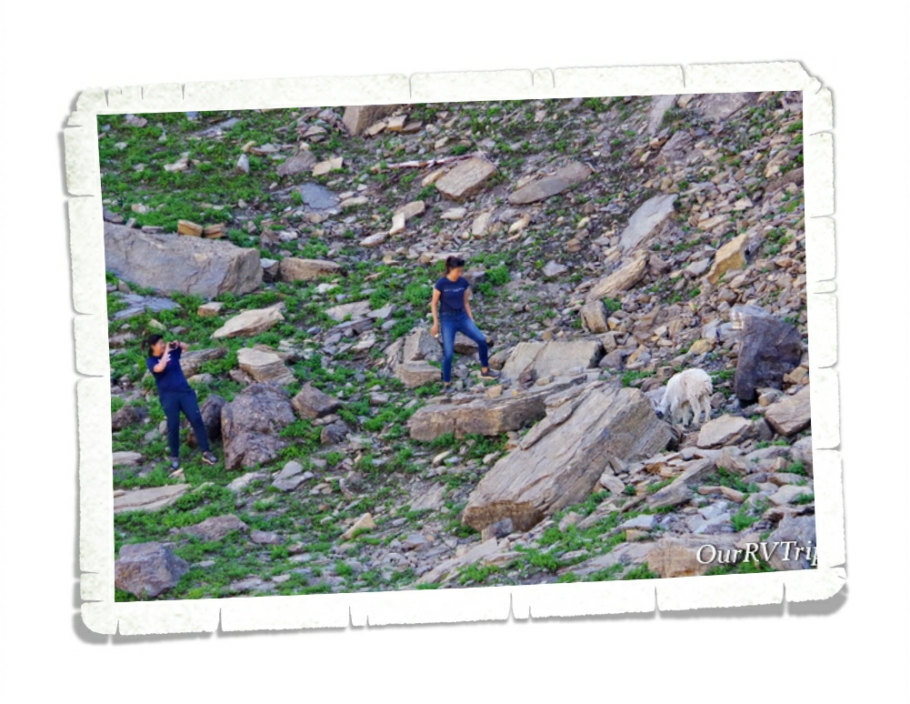
We also saw an alarming number of tourons (tourist+moron) trying to get selfies with wildlife. Guys, don’t be a touron. Just don’t. It’s not cool…wild animals don’t like it…and Ranger’s will have to step in and try to save your life while putting their lives in danger. Please remember to stay 100 yards from bears and wolves and 25 yards from all other wild animals.

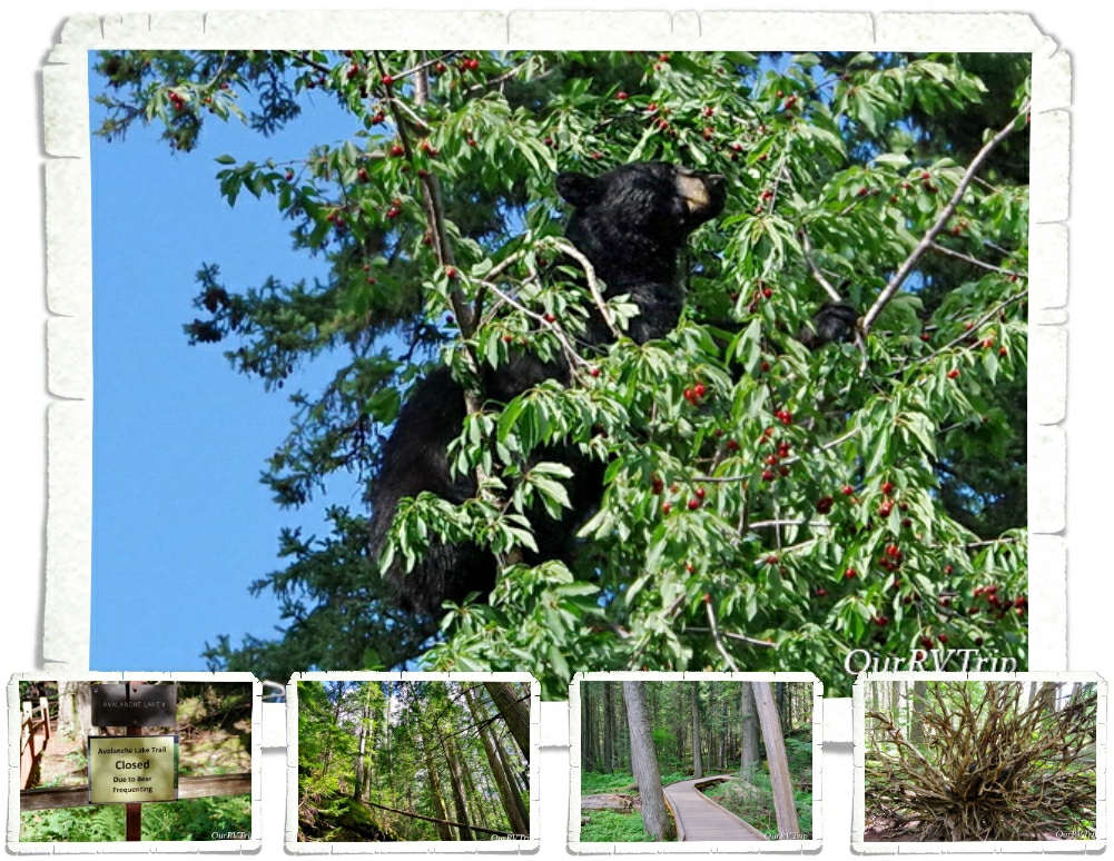
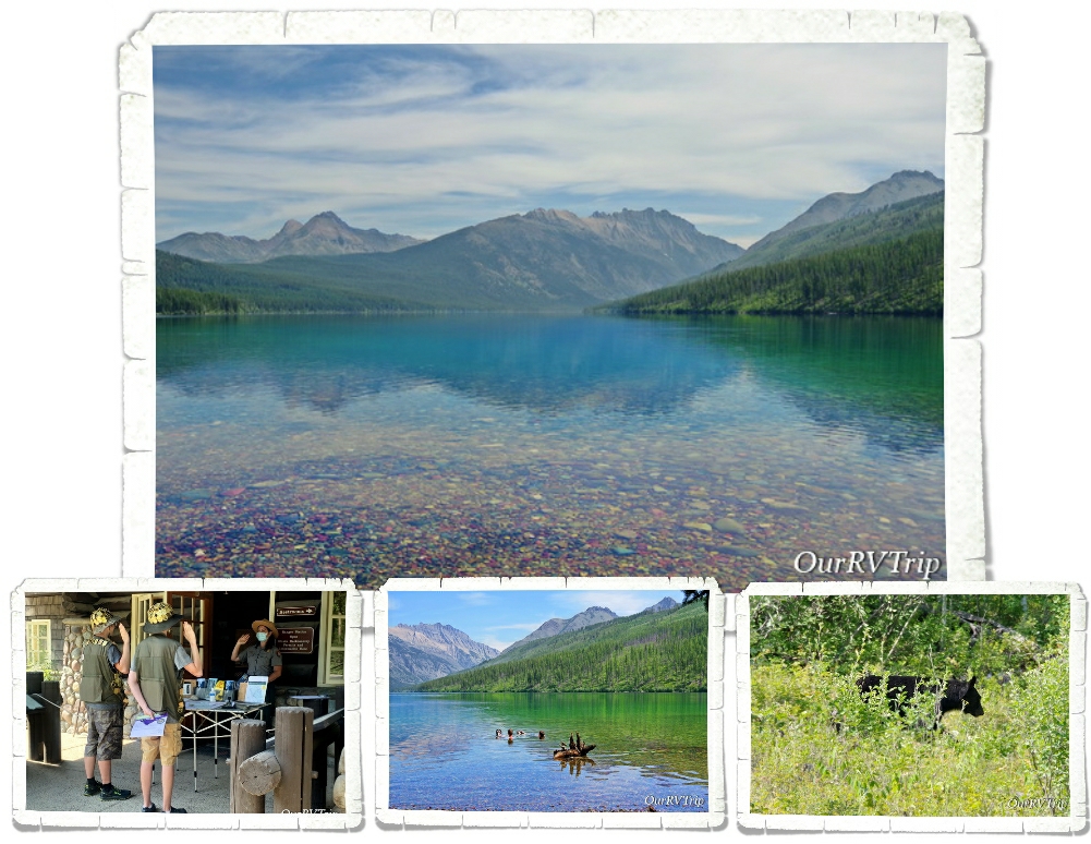
The next time we went into the park we decided to head out to Kintla Lake to hopefully get away from the crush of people. We had a relaxing day at the lake with about twenty other people. We just about had the place to ourselves. The boys spent about an hour or so floating around in the glacier fed lake before we headed to Bowman Lake to check it out. Bowman was super crowded so we walked to the edge, got a look, then left. On the way out to the main road we got our first glimpse of a black bear in Glacier NP. It was off the side of the road, up the hill, gorging on berries. He knew we were there (there was a group of us), but couldn’t have cared less. He was more interested in the fresh berry bushes.

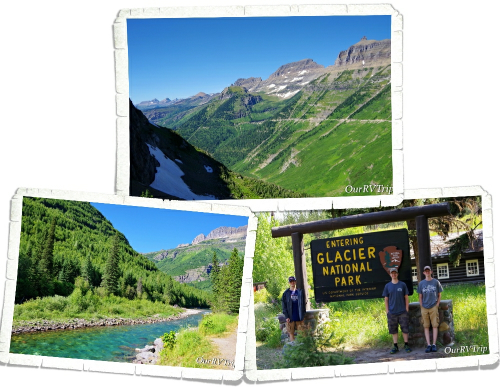
The next day, we drove Going To The Sun Road and stopped at all of the stops we could find a parking space. It was ridiculously busy but, we found a spot at a few key pull-offs.

When Glacier National Park was established in 1910 there were over 100 glaciers within the park boundaries. Today, there are 25 active glaciers. So, what makes a glacier a glacier? A glacier forms when an area of snow doesn’t melt over the summer then accumulates layers of snow over the years. Eventually, the bottom layers will compress under the weight of snow and turn to ice. The weight of the snow mass along with some of the yearly melt will cause the bottom layers of ice to become flexible and slick and the snow mass will start to move downhill…becoming a glacier. A glacier has to have enough mass to “flow” downhill under gravity due to it’s own weight.

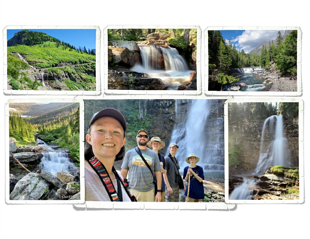
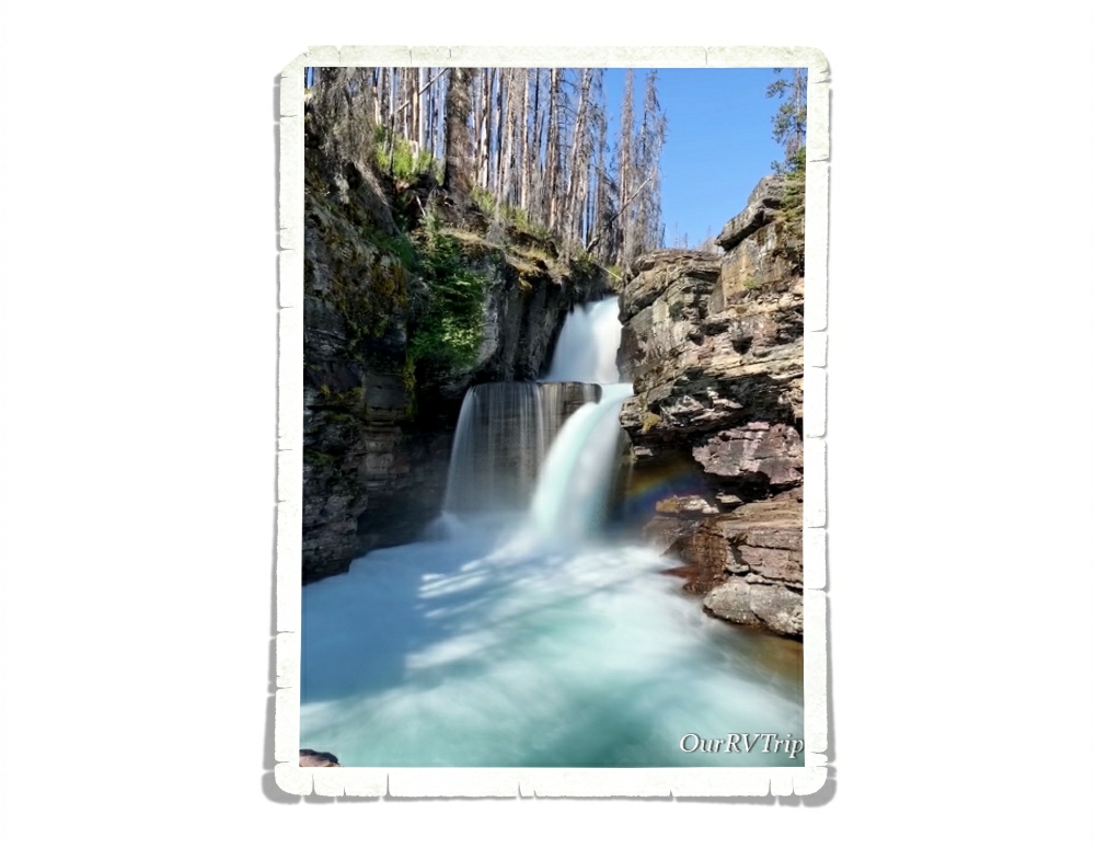
Most of the trail-heads we wanted to stop at were full by 9am so we found ourselves pulling into any pull-off that had an available spot. That’s how we ended up at the St. Mary Falls trail. We hadn’t planned on doing this hike, but we were there and y’all know I love a good waterfall. We were checking out the trail-head sign when we met a couple of ladies just finishing up so we talked to them about the trail and if it was worth the mileage with the 90­°+ temps. You can see in the picture above that there had been a fire and all of the trees for most of the trail were burned which means…no shade. The ladies who were finishing up insured us that it was worth it so…we headed down our first trail in Glacier NP.

We made it to St. Mary Falls (in the pic above) without any trouble and decided to head on to Virginia Falls. We saw so many small waterfalls along the trail! It was kind of amazing… Now, having said that, y’all know I like to keep it real for you…a couple of us really struggled on the way back to the car. It was right in the heat of the day, it was 93°, there was zero shade or cloud cover and there was a pretty good incline we had to make it up to get back to the car. We had taken our water and we were all wearing hats, but the heat just zapped us. If we were to do this hike again, we would be on the trail by 7am if not earlier to escape the heat of the day. It was a great trail, and I would highly recommend it…just be prepared for the heat and the lack of shade. But Guys, look at the color of that water!! We decided after this hike that maybe…just maybe…Glacier NP was going to be ok.

Speaking of waterfalls… Oh. My. Goodness!! There were so many waterfalls!!

So. Many!

Glacier National Park has a whopping 200 waterfalls scattered throughout the park. You’ll see everything from a trickle making its way down the side of a cliff to a full out gushing beauty. I think I might have taken more pictures of waterfalls than anything else in this park.

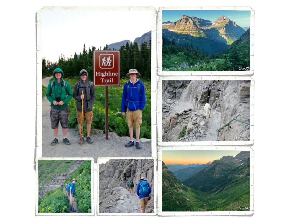
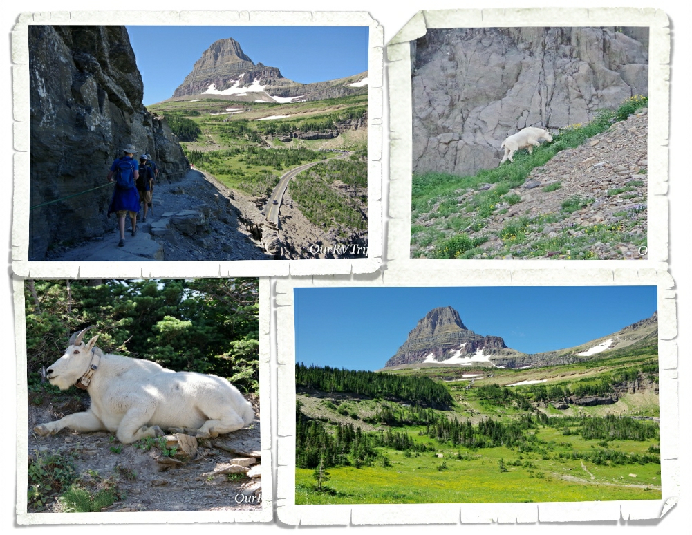
The big trail I wanted to get in while we were there was the Highline Trail. The Highline Trail is said to be the one trail in Glacier that you have to do. You start at the Logan Pass Visitor Center. We learned from our friends at the St. Mary Falls trailhead that if we wanted to get a parking spot at Logan Pass, we would need to be there by 7am at the latest. So, we got there at 6am and scored a spot. I wanted to start this trial early because the temps were still brutal and the only shade on this trail is provided by the shadow of the mountain. Starting mid-day, there’s zero shade and I’d made that mistake once…I wasn’t going to do that again.

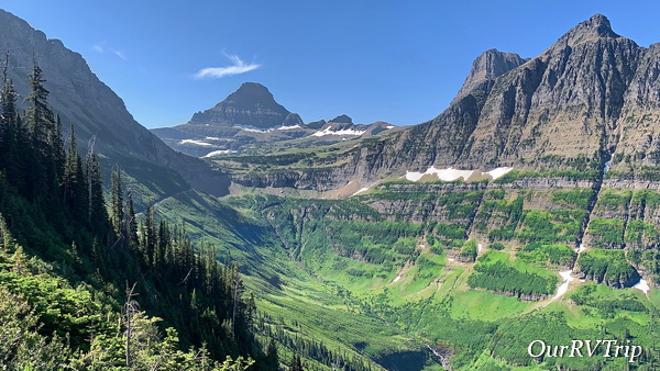
The Highline Trail begins on the Continental Divide where you follow it for a while. This section of the trail is known as the “Garden Wall” and is roughly 100 feet or more above the Going to the Sun Road which means you get some amazing views right from the beginning of the trail. We started our trek as the sky was starting to lighten up with temps in the high 30s. We froze, but none of us complained. We prefer to hike in the cold rather in the sweltering heat.

About a quarter mile or so from the trail-head you get to the part of the trail that gives anyone with a height issue some problems. In some places along this portion of the trail, the trail is only about four to six feet wide with steep drop-offs on one side. The park has installed a cable for people to use. I noticed a couple of us holding pretty tightly to that cable…this part of the trail seemed pretty tame to me after hiking Angel’s Landing in Zion last year. Until, we met up with a mountain goat. He was coming at us down the narrow trail, but seemed totally unfazed by our presence. He politely got off the trail when he got to us and perched precariously on some rocks along the steep drop-off while we scurried by him.

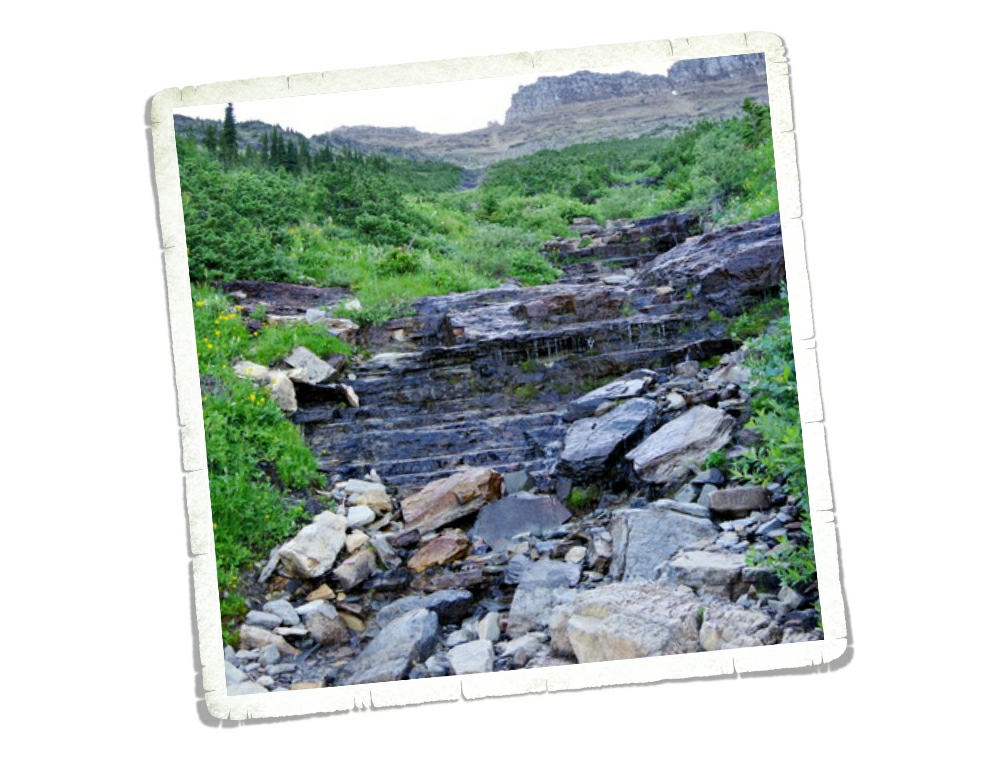
Remember all of those waterfalls I told you about? Well, you get to hike through the tops of several of them while on the Highline Trail. Between the morning dew and the slick wet rocks and the mud…well, I had a few little moments of panic while going through the waterfalls. None of them were deep. We were all wearing regular hiking shoes and none of us got wet feet or anything, but every time we would walk through one of the waterfalls, I would look down, down, down, and down to how far we would slide if we happened to slip right then. There wasn’t a ledge to catch yourself. This aspect of the trail is the only part that would give me pause about doing it again. But let’s be honest, I’d still do it again…some moments of panic are worth it.

I’ll also confess to you that I did slip and fall on some mud. It wasn’t on a waterfall crossing (thank goodness) but it was in front of several people and on some slippery rocks. It happened so fast I didn’t even know it was happening until I was on the ground with a sharp rock trying to wedge itself somewhere I’d prefer it not be. I had a humongo bruise that lasted three weeks and I messed up my forearm from landing on it (that only lasted a couple of days). Honestly, I think my ego was hurt worse than my body, but it did make me slow down when walking over those slick rock areas and hesitate even more before walking over a waterfall crossing.

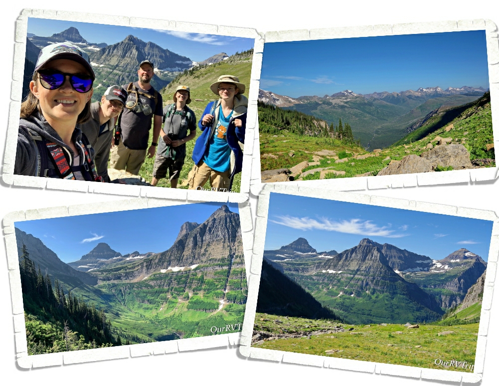
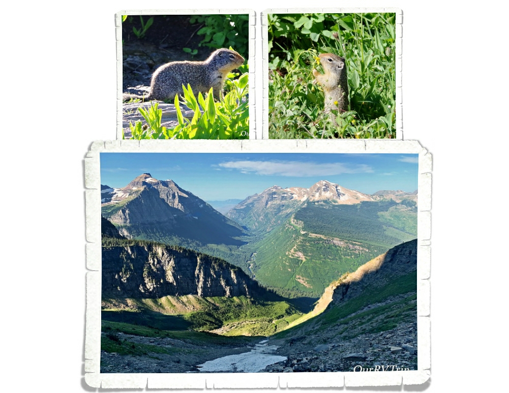
We had planned on only going about two or three miles into the hike then turning around. The entire hike is anywhere between 13 and 30 miles depending on how far you go and any trails you take off on that meet up with the Highline Trail. When we got to the two mile point none of us were ready to turn back. When we made it to three miles we could see the switch backs up to the pass and decided to push on to get to the view so, we ended up hiking up to the Haystack Pass. Haystack Pass sits at an elevation of 7,024 feet and has plenty of great rocks to sit on and have a snack.

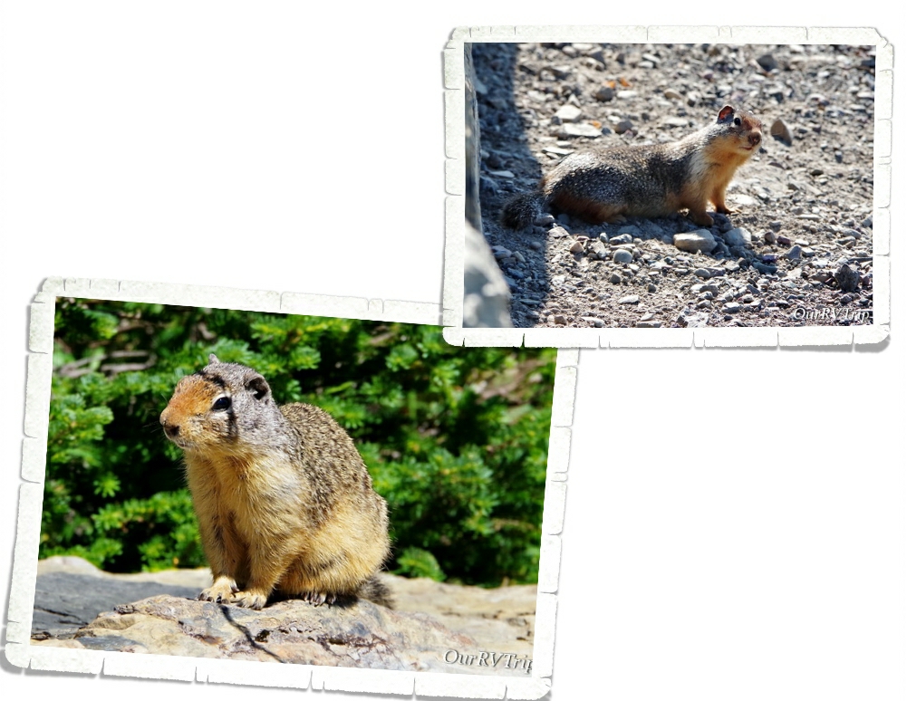
While three of us decided to hangout at Haystack Pass and watch all of the Colombian Ground Squirrels scurry around (there were so many), two of us headed on down the trail for another half mile or so just to see what they could see. Alex took this picture when he and Jerl explored a bit farther down the trail. We spent about an hour hanging out at the pass before making our way back to Logan Pass.

On our trek back to the trail-head, the crowds started to show up and we had to stop several times to let people pass on the narrow trail. We ended up seeing four different mountain goats and met back up with our mountain goat friend from the morning. He had taken up a spot right by the trail and was posing for all of the paparazzi snapping photos of him.

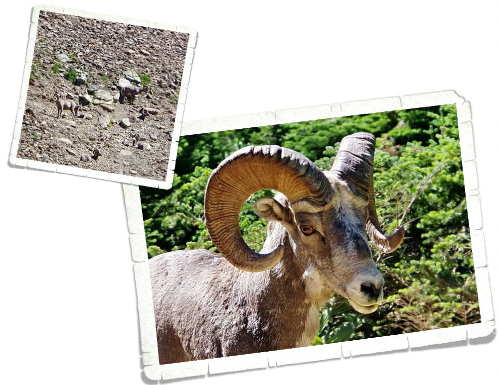
We also spotted some longhorn sheep. We saw a group of them way up on the hillside chilling out, avoiding the people…but one was romping around right by the trail and seemed a little panicky. He busted out of the trees onto the trail right as I was walking up and we sized each other up for a minute before I started yelling for Jerl and the sheep took off. Ha! I’m not sure which of us (me or the sheep) was more startled to see the other.

We had a great morning on the Highline Trail! We’ve decided it’s on our list of top five hikes and we all agree we would do it again. Between the views and the wildlife, I can see why this trail is so popular.

A couple of the trails we wanted to do were closed due to bear activity. We heard a couple of stories about bears and mauling and stealing backpacks… If you visit Glacier NP make sure you are prepared for bears. Educate yourselves and be bear aware.

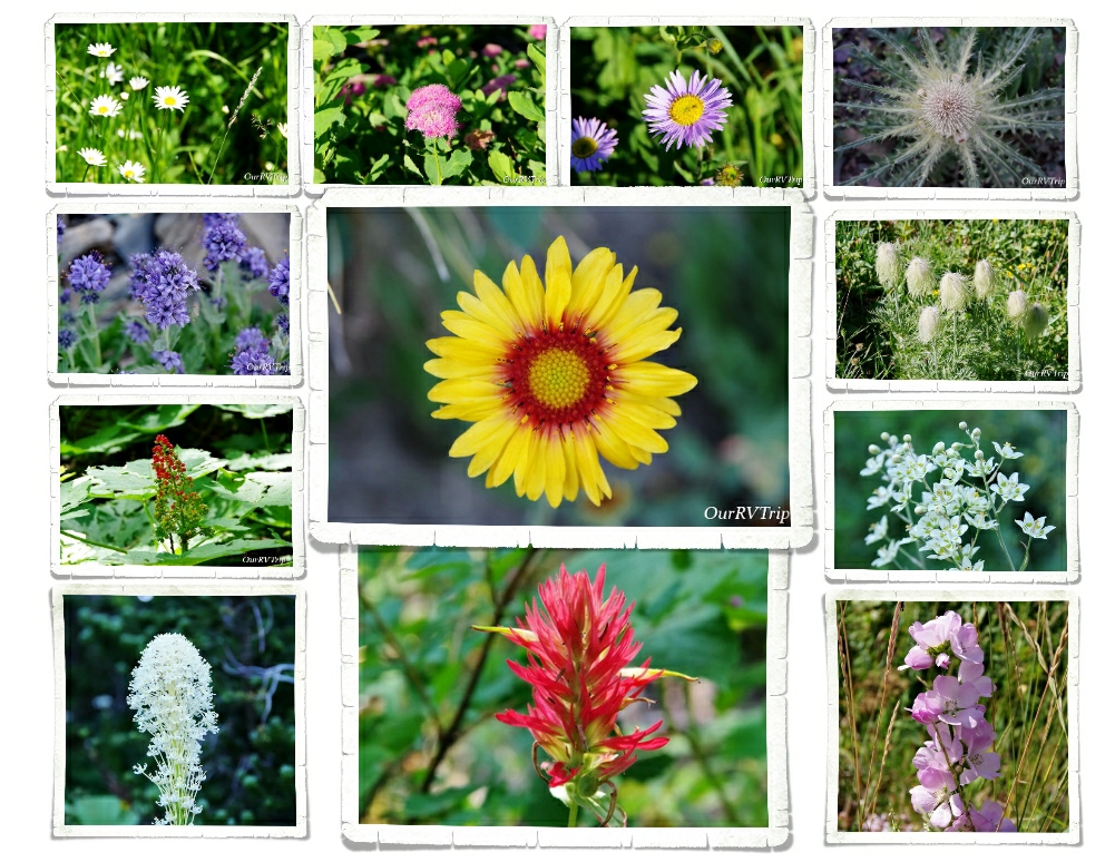
OK…let’s talk pretties. I know y’all are here for the pictures of flowers and Glacier National Park did not disappoint. Most of these pictures are from the Highline Trail. I was in flower heaven the entire hike!

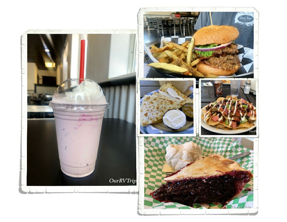
And…the foodies! We had our first huckleberry pie and it was pretty darn good! You can find huckleberry flavored everything in the Glacier area and yes, we totally had to try as much as we could. Our faves were the pie, ice cream, and preserves. We also found a great burger place called Mudman and a really tasty Mexican food truck called The Wandering Gringo that we ate at twice!

I guess Glacier National Park is called “Crown of the Continent” for a reason. We had our doubts, but in the end…the park won us over and easily earned a spot on our top ten list. We will definitely go back to explore the east side.

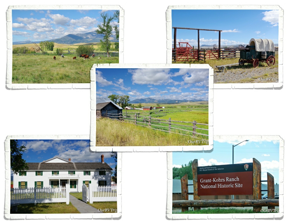
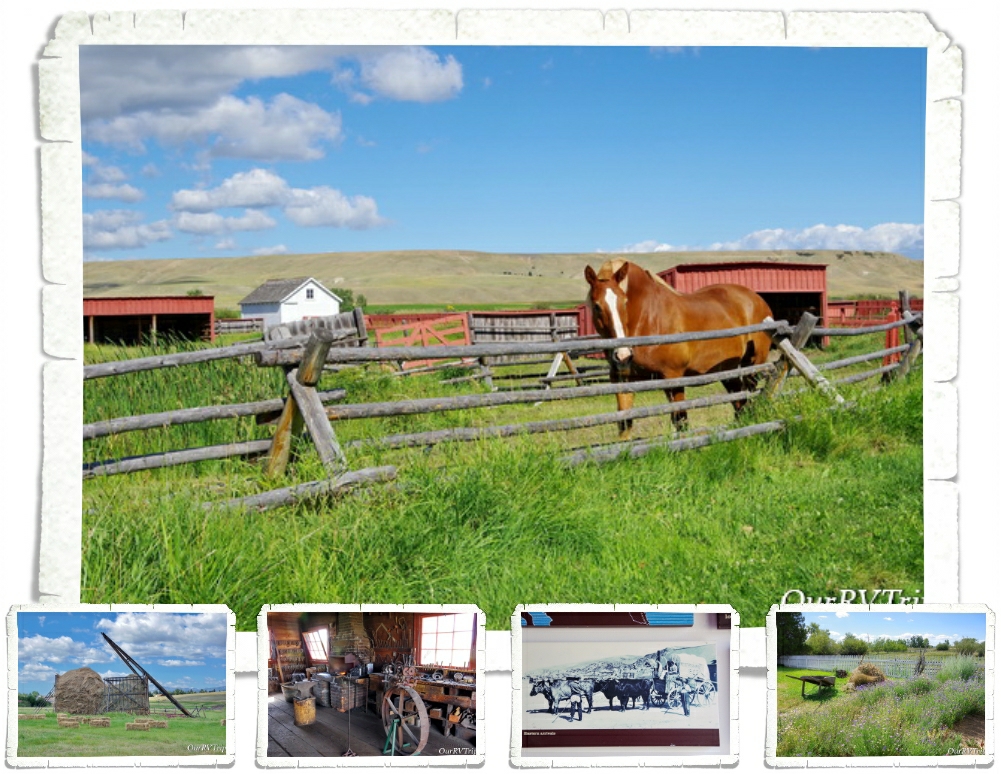
Bonus Park! We had two days to kill in between our Glacier reservations and our Yellowstone reservations so we stayed in Deer Lodge, MT for two nights just to see the Grant-Kohrs Ranch National Historic Site.

Grant-Kohrs Ranch was once the headquarters of a 10 million acre cattle empire. Today, this National Historic Site preserves the history and memory of two of the biggest symbols of the American West…the cowboy with his vast herds of cattle out on the open range. Grant-Kohrs Ranch was founded in 1862 by John Grant, a Canadian fur trader, and then expanded by a cattle baron named Conrad Kohrs. Dwindling bison herds and the growth of eastern cities led to a demand for beef.

Returning Civil War soldiers came back to Texas to find millions of unbranded cattle roaming around. There was too many cows in Texas which made the price of cattle go down to $2 a piece but the quickly growing cities in the north would buy a cow for $30. Nelson Story and his group of twenty-five cowboys made the first cattle drive from the open lands in Texas up to the rich grazing ranges of Montana in 1866.

By 1885, cattle was the most lucrative industry on the High Plains but, it only lasted for three decades. Between a couple of extremely harsh winters and the Homesteaders Act that split up the open range into 160 acre barb-wired plots, the big cattle barons had to find a different way. Grant-Kohrs Ranch NHS helps preserve and tell the story of the Open Range Era. Today, it’s still a working ranch and you can see some cows, horses, chickens, and learn about a chapter of America’s history.

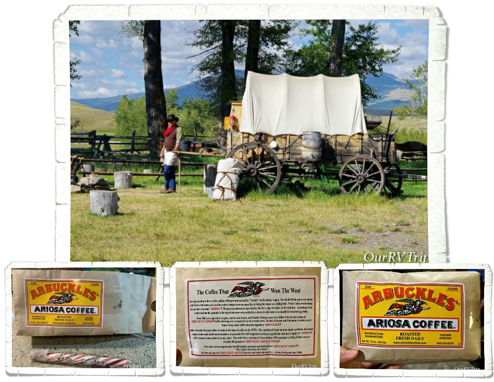
We learned a lot about cowboys and their life on the range. Most cowboys were teenagers who were willing to work long hard days and nights for very little pay. Chuck-wagons like the one above was home for cowboys out on the range. One of these wagons could carry enough food and supplies for ten to fifteen cowboys to live on the range for one month. The chuck wagon was where the cowboys would gather for food, sleep, and companionship.

One of the most memorable things we were able to do while exploring Grant-Kohrs Ranch was try Cowboy Coffee. The volunteer at the Chuck Wagon made up a pot of it the same way the cooks would have made it out on the range. The cooks would get the coffee in the same packages you can see above. Since the coffee came in whole beans, the cook would always ask for a volunteer to grind it all and he never had to ask twice. The cowboy who volunteered to grind up the coffee beans got to keep the sweet surprise hidden in the coffee package…a stick of peppermint. They sell packages of the coffee in the visitor center at the park. It’s from the same company that sold it to the Chuck Wagon cooks way back then for life on the range.

“Cowboys are smaller and less muscular than wielders of ax or pick, but they are as hardy and self-reliant as any man who ever breathed — with bronze, set faces, and keen eyes that look all the world straight in the face without flinching as they flash out from under their broad-brimmed hats. Peril and hardship and years of long toil, broken by weeks of dissipation, draw haggard lines across their eager faces, but never dim their reckless eyes, nor break their bearing of defiant self-confidence…” ~Theordore Roosevelt, 1888

See y’all down the road!

#NationalParkTour
Page, AZ: Take Two

Page, AZ: Take Two

Hey Guys! After two months of sitting still in Camp Verde, AZ…we’re on the move again! I have to admit, it feels very uncertain this time. We’re in the thick of the whole Corona Virus thing and at this point it’s making us second guess and doubt everything we’re doing/not doing.

We’d already called ahead to our next RV Park to make sure it was open and that we would be allowed in. We keep hearing about other fulltime RV families who are struggling to find a place that they can stay. State parks, federal campgrounds, BLM land, and county parks are all closing down and kicking people out. Private parks are starting to either close down or refuse any new arrivals. It’s a stressful time for everyone, but being a nomad has a bit of extra stress to it now. We don’t have a sticks-n-bricks home we can go to and hunker down in until this all blows over. So, for now, we’re moving forward and trying to make due…and not stress too much.

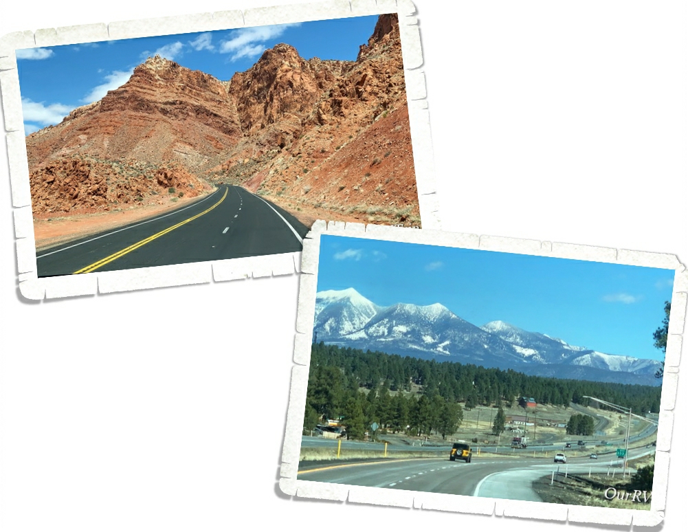
On our way to Page, we passed through the snowy town of Flagstaff and made our way back to the high desert region. It was neat to watch all of the geographical changes that came with that.

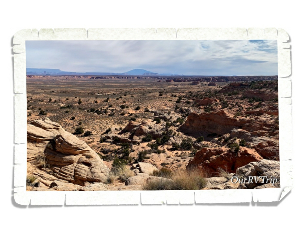
This wasn’t our first visit to Page. In fact, we’d been there just a few months before. There are so many things to see and do in Page…some great views and some awesome hikes. I had an entire list of things to see and do while we were back in Page, but due to the virus…pretty much everything was closed.

We usually move spots on Saturdays and then go adventuring on Sundays. Jerl went to the grocery store early Sunday morning to see what we were going to be dealing with on the food/necessities problem that the country had been dealing with. The little grocery store in Camp Verde had been struggling to keep up with it all. We wanted to assess the situation in our new spot to see if we needed to go back to Camp Verde and stay longer. Jerl was surprised to see that pretty much all of the isles were decently full…except the paper isles. He also had the chance to talk to a couple of policemen who were there to protect the delivery truck (I never thought I would be typing that kind of sentence…I mean…police protection for a regular ol’ delivery truck?) Anyway, Jerl asked the police officers if hiking was allowed in Page at that time and they both encouraged us to go have a great hike and get some fresh air…while staying away form anyone that looks sick.

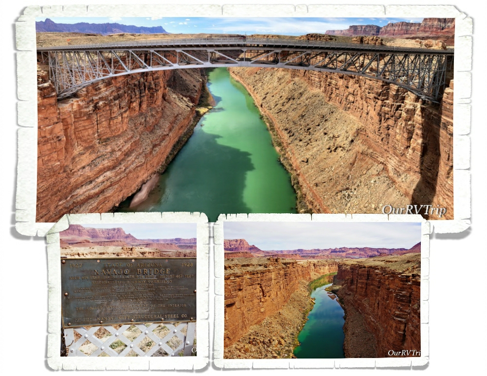
With the police officer’s approval, we headed out to do a little social distancing on a hiking trail. I had a few things on my list that we could hit all in one day and luck would have it…they were all still open. The first spot we hit was the Navajo Bridge. Did you know that there are only seven land bridges across the Colorado River for around 800 miles? Before the Navajo Bridge was built, travelers had to go several hundred miles out of the way to get across the Arizona/Utah border. Can you imagine having to do that with a horse and buggy? That would add weeks to a trip.

Guys, look at the color of that water! We stood on that bridge way longer than we’d planned.

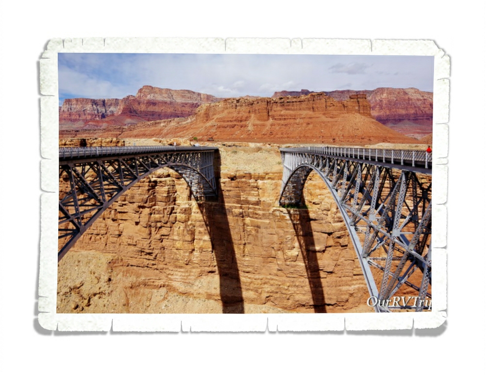
The original bridge opened in 1929 and was called the Grand Canyon Bridge, but in 1990…there was a need for a newer and wider bridge. So now, the old bridge (on the right) is open to pedestrian use only while the new bridge (on the left) is open for everything else. These two bridges are tied in ninth spot for highest bridges in the US.

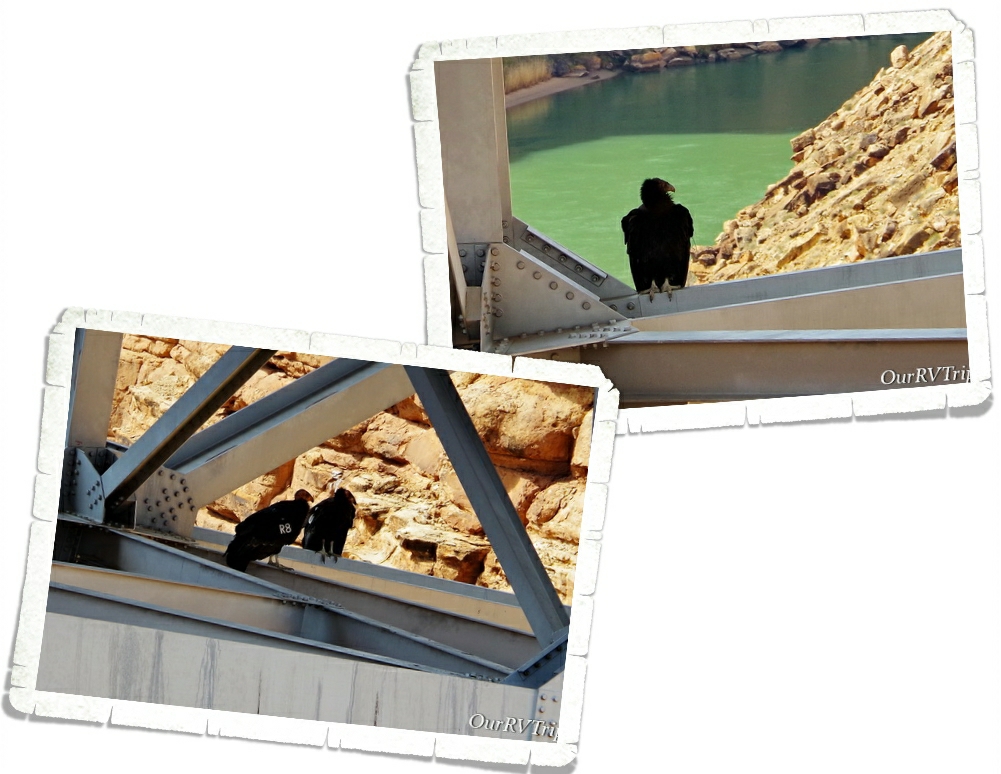
I knew from my research that California Condors call the area around Page home, but we didn’t expect to actually see any. We found four of them hanging around the Navajo Bridge! Did you know that you can look up the California Condor numbers and find out where they were born and what their family lines are?!

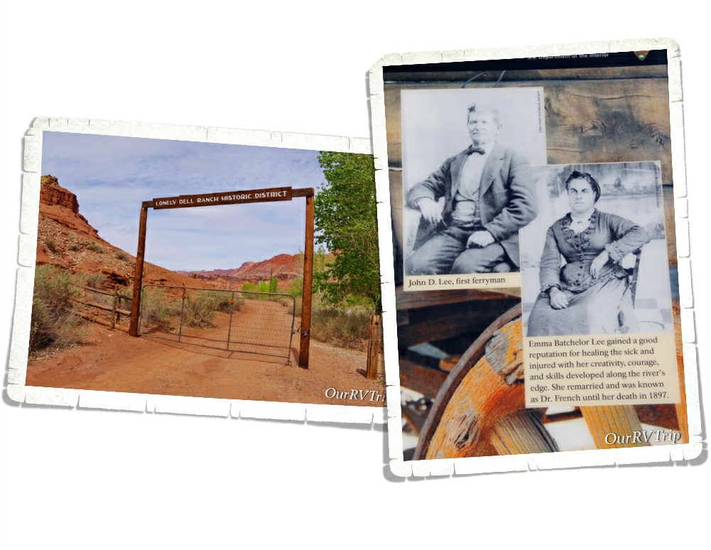
Lonely Dell Ranch and Lees Ferry are both part of the Glenn Canyon National Recreation Area. We had planned on visiting the area the last time we were in Page, but simply ran out of time. I’m so glad we got to visit during our second visit to the area!

For a long time, the Colorado River was a major obstacle while traveling between Utah and Arizona. At one spot, where the Paria River runs into the Colorado River, there’s an area where the cliffs aren’t quite as impassible and the Colorado River isn’t rushing with rapids. It’s here, at this spot where the Utah Territorial Governor, Brigham Young, sent John Lee to set up and operate a ferry.

So, in 1872 John Lee loaded up two of his families and headed out to make a life as a ferryman. Some people say he was sent there to hide from the authorities due to his part in the Mountain Meadow massacre and the slaughter of over one hundred pioneers from Arkansas who were passing through the Utah territory in 1857.

Lee spent the first few years building homes for his family and a ferry to cross the river. Since the area was so remote, the family had to be completely self-reliant. They needed to grow their own food and set up irrigation for not only household use, but to water their crops. There’s still an orchard there that you can walk though and pick some ripe fruit as you’re exploring the ranch. In 1874, the law caught up with Lee and executed him. His wife, Emma, ran the ferry until 1879 when the LDS church bought it from her and sent a new family to run it.

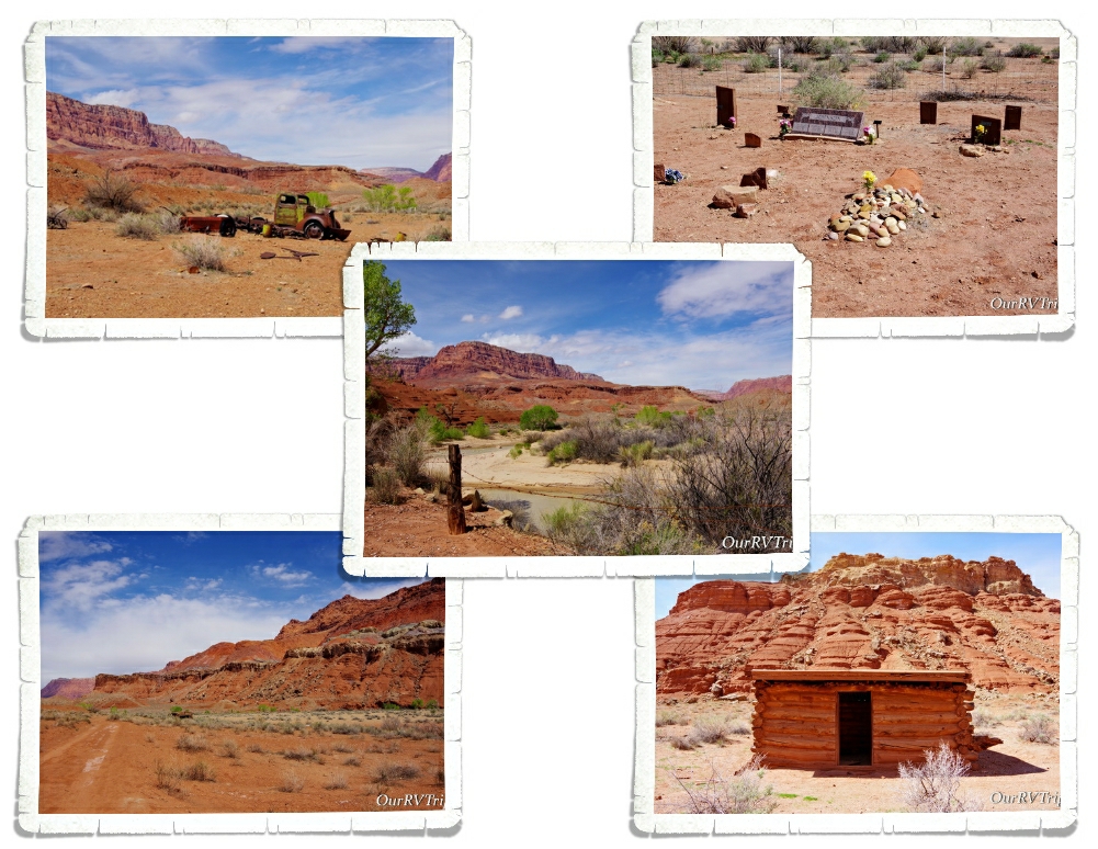
If you go on past the ranch, you can see remnants of the people who once made Lonely Dell Ranch their home. Over the years, LDS members continued to run the ferry and the ranch was expanded to include different families and community members.

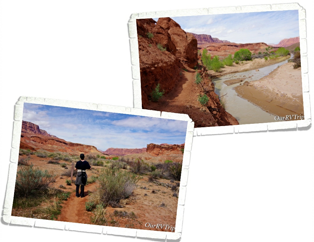
The trail goes for quite a ways…but, this wasn’t the trail we’d come for so we headed back after a mile and a half or so. I wish we’d had a few more days to explore here. We would have loved to continue on this trail. The area was gorgeous!

In the early 1900s the gold rush hit southern Utah/northern Arizona and miners ascended on Lees Ferry. One of them was Charles Spencer who led the American Pacer Company. Spencer was more of a salesman than a miner. He hauled tons of equipment up to Lees Ferry. Spencer left the area broke in 1912. He abandoned everything there when left. All that remains of his time there are a couple of stone buildings, part of a steamship and an old boiler.

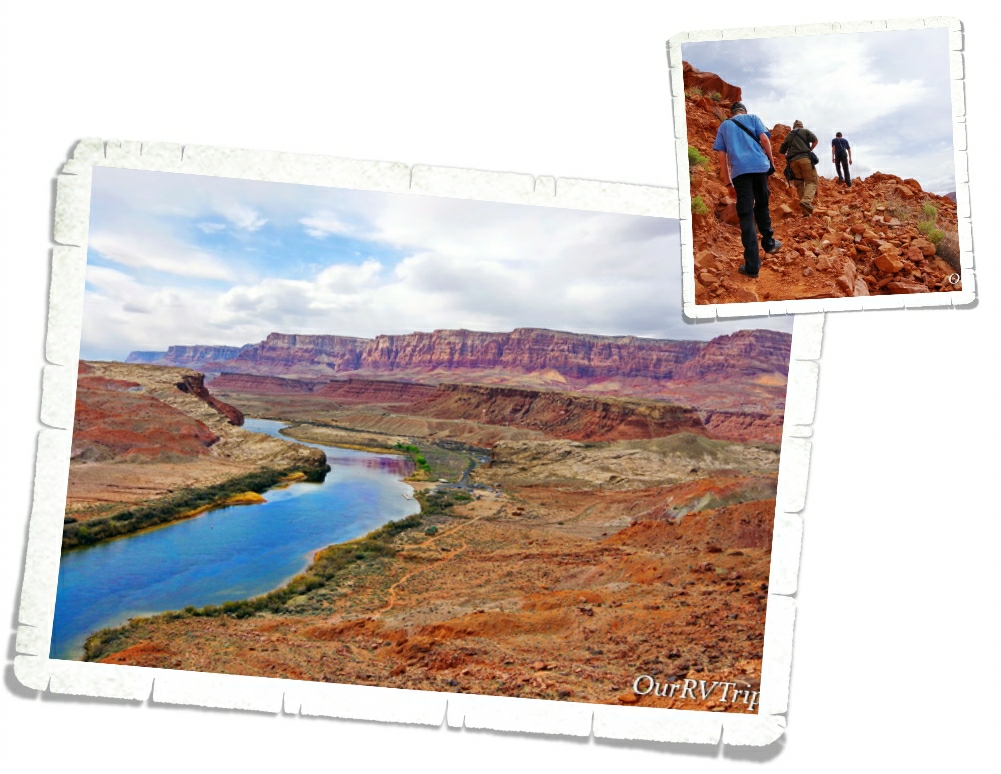
Today, you can hike up the 4.4 mile Spencer Trail. The trail eventually leads to an old coal mine. This trail climbs over 1,500 feet in less than a mile. It’s steep!

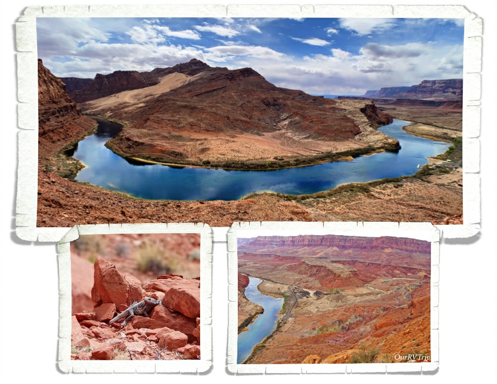
The higher we went on the trail…the better the views got. This was a rough trial…three of us only made it half way up then called it quits. The other two almost made it to the top but the trail got too dicey for them so they turned back. In the group of pictures above, you can see a shot that was taken near the top. If you look closely, you can see the Lonely Dell Ranch.

The last ferry crossing was in 1928 and it ended up sinking…killing three people. Seven months later, the Navajo Bridge opened. Now, the Lees Ferry area is mile zero for launching boat trips down the Colorado into the Grand Canyon. In the summer the beach there is lined with rafting boats and adventurous boaters prepping for trips down the mighty Colorado.

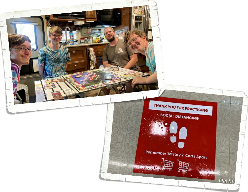
Other than our excursion to Lees Ferry and the Lonely Dell Ranch…we hung out at home. Alex got the National Park version of Monopoly for his birthday and we’ve enjoyed adding it to our collection. When we had to get out to get groceries, we found signs to tell us where to stand for social distancing while standing in line. This time in our world is truly bizarre.

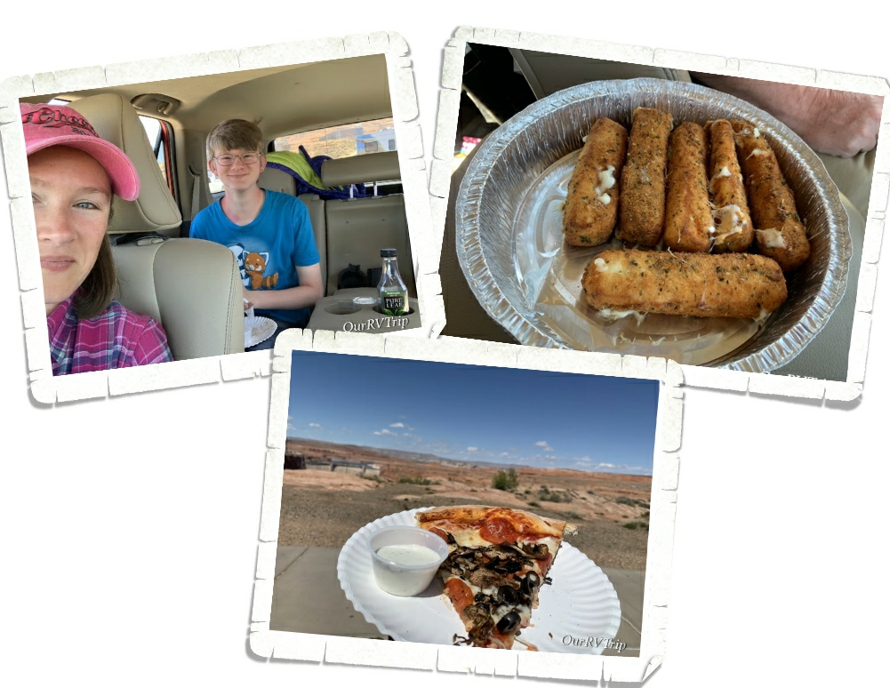
We still made our weekly lunch with one of the boys happen. We got take out then found a scenic view to enjoy some one-on-one time with Nicholas. He, of course, chose pizza. Actually, we found this pizza place the last time we were in Page. It’s a great little place called Stromboli’s…if you’re ever in the area, do yourself a favor and go grab some cheese sticks and pizza! They have the best cheese sticks at this place!!

We saw signs of Spring everywhere during our one week stay in Page. We will definitely spend more time in this area! We’ve spent three weeks there now and haven’t even scratched the surface on available activities!

That’s it for now, Guys!

See y’all down the road!

#NationalParkTour
Arches and Canyons

Arches and Canyons

Hey Guys!! We made it to Utah!! We loved Colorado quite a bit and we’re totally going to miss it, but we were ready to adventure into a different state…at least for a little while.

Y’all know we’re on a National Park Tour so it shouldn’t be a surprise that our first stop in Moab was Arches National Park. We stayed pretty close to Arches, so we were in and out of the park on a fairly consistent basis during our two weeks in the area. We would head there in the late afternoons to get some hiking in and it worked out pretty well because most other explorers were headed out about that same time which meant…fewer people in the park.

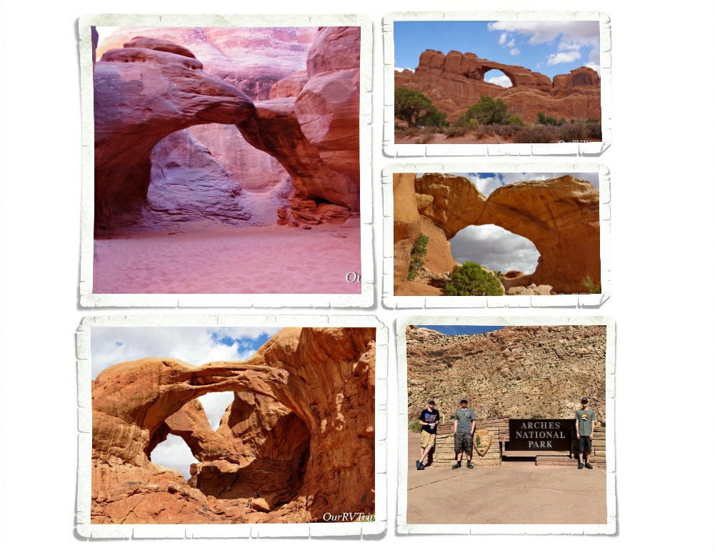
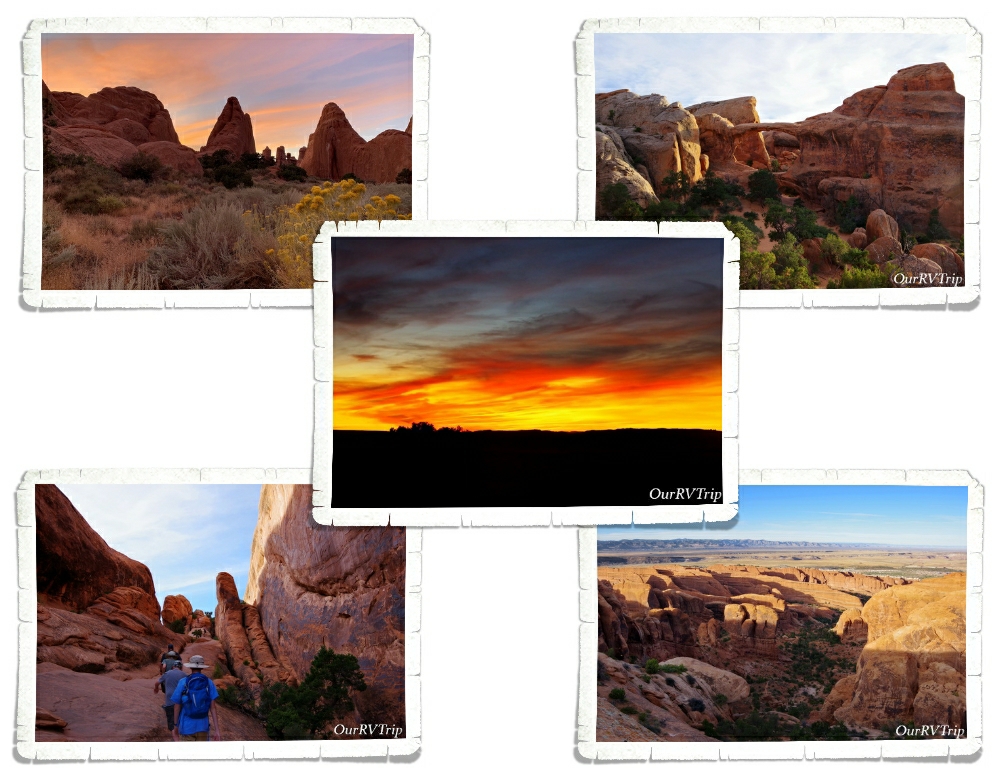
Arches National Park is home to over two thousand natural arches made out of sandstone. There are several arches you can see right from the paved road that winds its way through the park. But, if you want to really experience an arch…you’ll need to get out of your car and get some sand under your feet. To photograph an arch, you’ll want a little distance so you can get the whole arch in the shot, but to get a good feel for how big some of these arches are, you’ll need to get up close to one. This can be easier said than done on most days in the park. Arches NP is super crowded with tons of other people trying to get “the view” of that same arch you’re trying so hard to get “that shot” of. It can be frustrating. We try to avoid going into a busy NP during the weekend or over a holiday. We had better luck with crowds by going during odd times…usually later in the afternoon/evening throughout the week when most people were leaving.

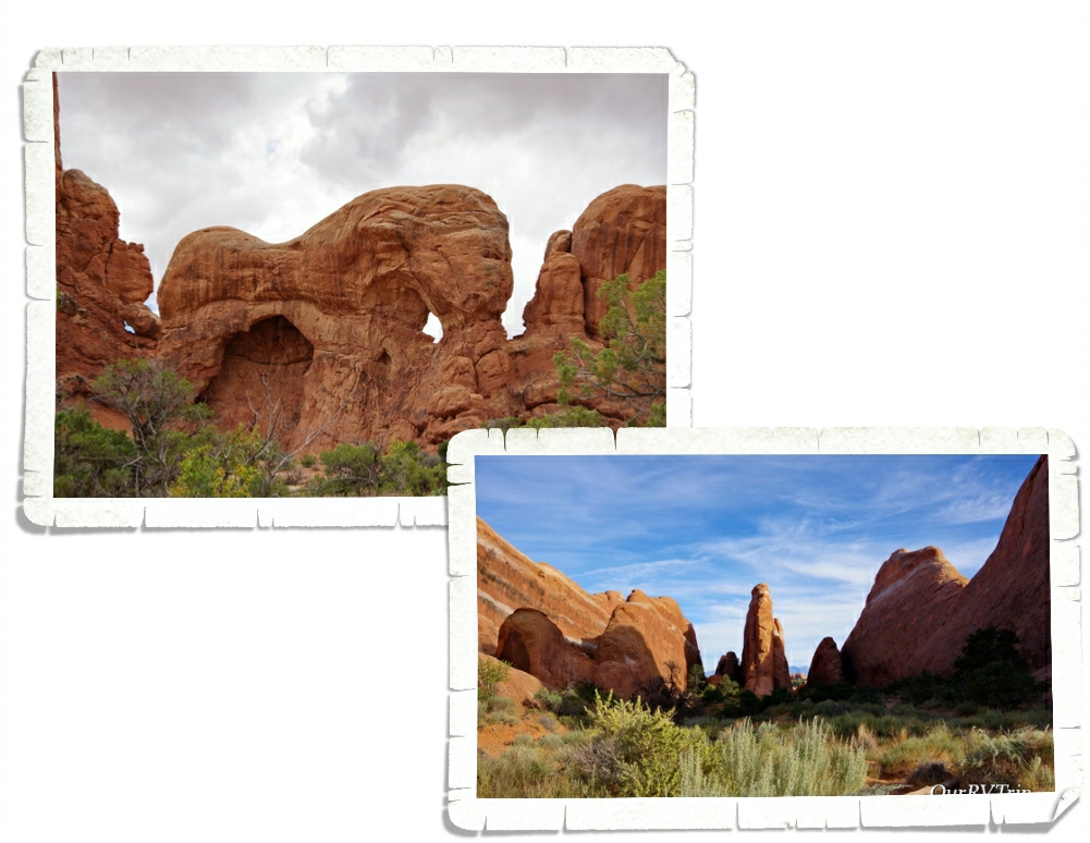
Arches are the main attraction at this National Park, but they aren’t the only attraction. There are also towering sandstone spires, pinnacles, fins, and balanced rocks. Some formations look like elephants! To get to Sandstone Arch, you have to hike between two sandstone fins! It was a really short and neat hike.

It takes a lot to make an arch. You have to have the right kind of rock and it has to be exposed to just the right combination of environmental factors…and time…lots and lots of time. In order to be considered an “official arch”… there has to be at least three feet of space within the opening of the arch. Becoming an arch is no easy task.

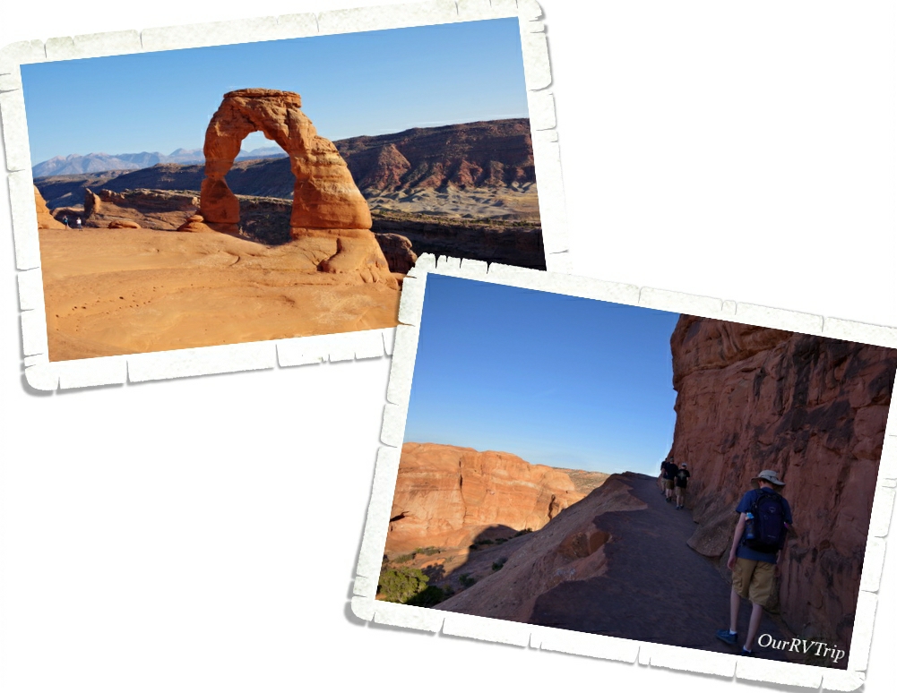
If you’ve ever seen a postcard or a sticker or sign for Arches National Park, chances are…you’ve seen Delicate Arch. Delicate Arch is the poster arch for all arches at Arches National Park. It’s the arch that all of the other arches want to be. It’s a stand-alone, complete arch with an awesome view. There are two ways to see Delicate Arch. You can go to one of two viewpoints or you can go to the trail-head and hike the mile and half up, up and up to get to the actual arch. We did both. We stopped by the viewpoints first, but when we saw how far away we still were…we went back on a different day to hike up to Delicate Arch. I’m so glad we hiked it…the view from the top is spectacular and while there was quite a lot of up to this hike, it wasn’t too horrible.

Our favorite hikes at Arches National Park was the Devils Garden. There are several different trails and arches you can get to within the Devils Garden. We did the four mile Double O Arch Trail and it was awesome! When you first start this trail the crowd can be a bit thick, but once you get to the good stuff…the part where you climb up the back of one of the fins…the crowd starts to thin. And then when you walk across the back of a different fin…Guys…the views. I caught the boys with their mouths hanging open and their cameras out trying to capture the amazingness of this hike. I know, I know, some of you don’t think amazingness is a real word…and if it’s not…well, it should be. It. Should. Be.

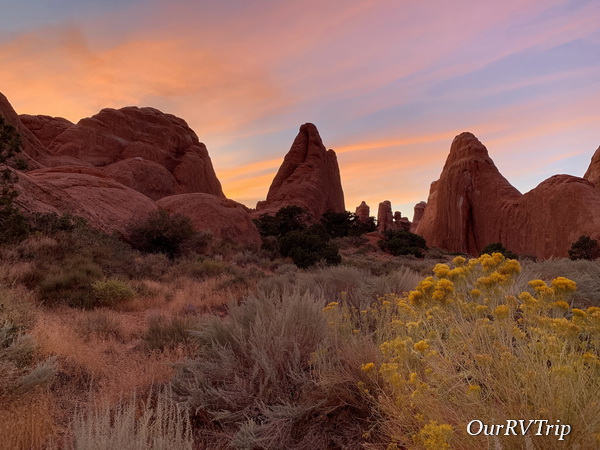
We timed our Double O Arch hike just right. We got there ogled all of the views, shimmied down the back of the fin and made it to the trail-head right as the light show started during that evening’s sunset. We stopped the car several times so we could all sit and watch the sunset. Mother Nature was not playing around that night…no…she was showing us some of her best stuff. She always wins. Always.

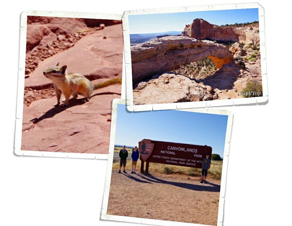
We only spent a day at Canyonlands National Park. We were a little farther away from it and there was so much to see and do in the area that we didn’t want to take the time to drive all the way back. We only had time to visit one of the three sections of Canyonlands NP. We spent time in the Island in the Sky section. We’ve already discussed the need to go back and see more of this park. It is, after all, the biggest national park in Utah and that is saying something.

We did the scenic drive, stopped at all the stops, and got in a couple of short hikes, but we were really wanting to drive down into the canyon and then find our way over to Potash road where we could drive back to Moab…on a dirt road…following the Colorado River for most of it. Y’all know how we are about dirt roads. Ha! Canyonlands National Park has a canyon within a canyon within a canyon. I’m not even joking. There are three layers of canyons at work in the picture above!

We seem to always find ourselves on a dirt road. What is it about dirt roads that we love so much? Well, they usually take us to some pretty dang awesome places and…not many people are equipped to drive them so the crowds tend to thin out a bit. We drove down out of Canyonlands on Shafer Trail then made our way over to Potash Road and back to Moab. Potash Road is one of our absolute favorite dirt roads in the Moab area. The views along this drive are breathtaking as it follows the Colorado River for several miles.

Well, Guys…I think I’m going to pause here for now and pick up with some more of our Moab adventures next time!! We crammed so much into these two weeks…So, stay tuned!!

See y’all down the road!

#NationalParkTour
Alpine Lakes and Mountain Passes

Alpine Lakes and Mountain Passes

Hey Guys! Welcome to part two of our time in the Montrose, CO area! We did sooo much in the two weeks we had in the area that I felt like it made the post too long. So, I split the post up. And…I’m not going to lie…I’ve left the best for last.

The last National Park Unit we did in the area was Curecanti National Recreation Area. Curecanti NRA is made up of three reservoirs along the Gunnison River. Blue Mesa, Morrow Point, and Crystal Reservoir are all popular for boating and fishing, but there are some hiking opportunities as well. We did a short hike along Crystal Reservoir where the trail literally sparkled! I’m not sure what kind of rock it was, but there were tons of this flakey, sparkly rock all over the trail. Engine 278 had a new display after seven years of restoration. This engine used to pull trains up and down the Black Canyon for the Denver and the Rio Grande railroads.

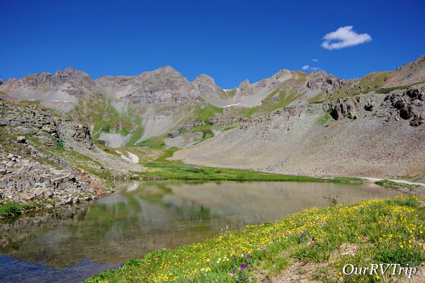
Y’all know we love our National Parks. I mean, we’re on a National Park Tour! But, my favorite memories from our time in the Montrose area were the old mining roads we drove up to see the wild areas and the mountains. The Million Dollar Highway was built in the late 1880s. Technically, it’s only twenty five miles long, but this road is packed with some seriously winding mountain roads that are littered with the skeletons of Colorado’s mining days. We found this little alpine lake down one of the old mining roads that snaked off the highway and Guys…I think we found the best place in Colorado. This little alpine lake was amazingly gorgeous. We had the whole place to ourselves…

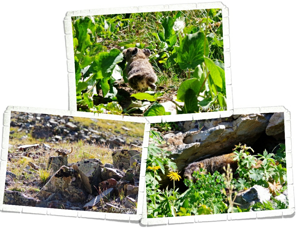
except for the chipmunks, marmots, and picas that call the area home. They were all too busy preparing for winter to bother with us though.

The main reason (besides the views) we headed down the Million Dollar Highway was to get to the Alpine Loop, a seventy five mile loop that follows routes first traveled by Native Americans. Later, these routes became roads as Colorado moved into it’s mining boom.

Last winter Colorado had a record number of avalanches. We saw the destruction they left behind and even drove through the remnants of one.

Y’all know we love driving down those dirt roads…but we’re not into technical 4×4 trails. The section of the Alpine Loop we drove is about as technical as we like it…in fact, it was pushing the limit of what we’re comfortable with. We started in Silverton and made our way up to Engineer Pass. On the last curve to the pass, Jerl got out of the car just to make sure we could actually make the turn. The road was…tight…and the drop off on one side was…steep. We were so relieved to reach the pass! And y’all, when we got to the pass, there was a mini-van!!! We were like…what-the-what?!?! Who in their right mind would drive a mini-van on those roads? Turns out it was a rental. They headed down the pass before us and we never saw them on the way back down. We still wonder how they did. Can we take a minute to admire that view though?

We didn’t do the whole loop. We made it to Engineer Pass (12,800 feet) then headed toward our home-on-wheels by taking a different route. We stayed on the dirt roads and ended up going over two more passes. California Pass (12,960 feet) and Hurricane Pass (12,730 feet). The views were stunning but we were all ready for that paved road by the time we found it again.

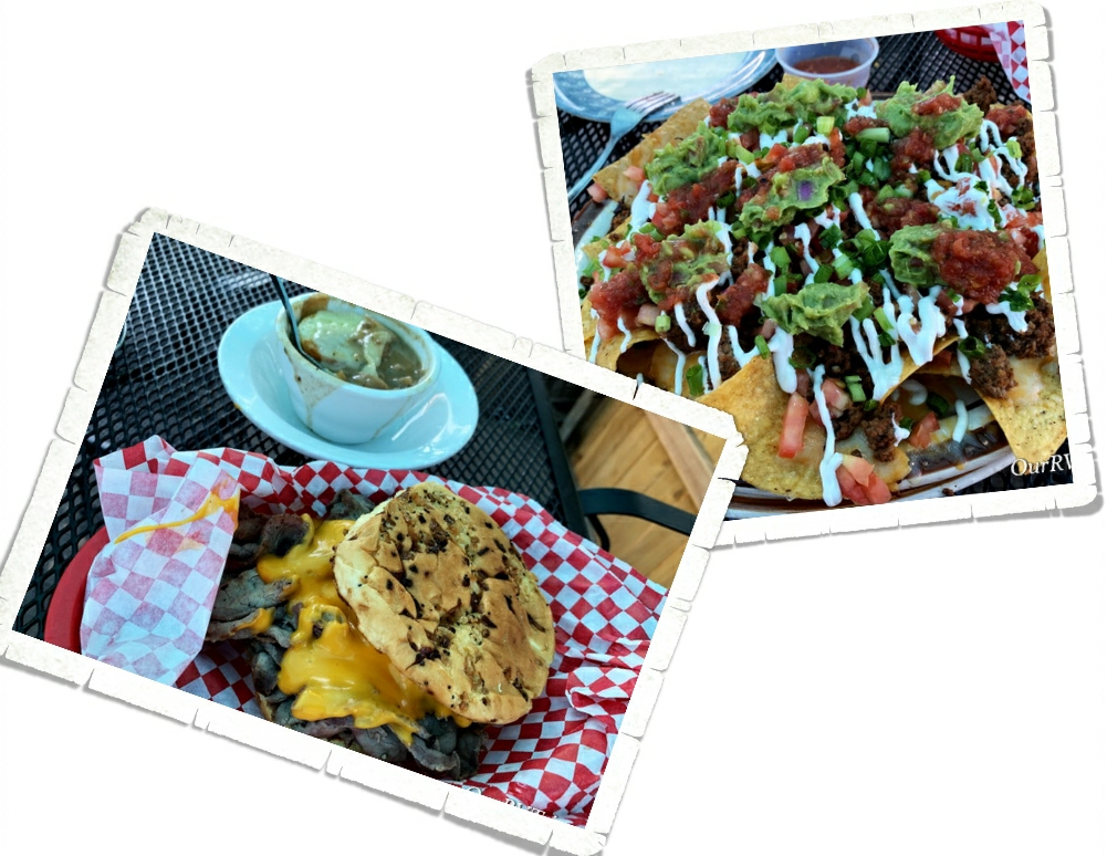
Horsefly Brewing Company in Montrose, CO was one of our go to spots while we were in the area. They had the best nachos I’ve ever found at a restaurant. Seriously. They also had awesome burgers! If y’all ever find yourself in Montrose, head over to Horsefly Brewing for a meal. You won’t be disappointed.

That winds up our time in Montrose. We had an excellent adventure and will most definitely be back.

See y’all down the road!

#NationalParkTour

Canyons and Cliff Dwellings in Colorado

Canyons and Cliff Dwellings in Colorado

Hey Guys! After two weeks fighting yellow jackets in Colorado Springs we were ready to move on. While we loved Cheyenne Mountain State Park…we got really tired of fighting for our food and running from the yellow jackets. It took us two days to drive to Montrose. The plan was to hit a state park during our overnight to get in a hike to a waterfall, but we got there later than we’d anticipated so we missed the hike. We weren’t too upset…it would have been another hour drive and we were all pretty done driving/riding for the day.

Our spot in Montrose was fantastic! We had shade pretty much throughout the entire day…which was welcomed with the 90° plus temps we were getting. I’ve started making notes on each of our spots. We stay at so many places they can get jumbled up in our memories. Did that place have good cell service? What were the sites like? Did we have a spot we wanted to get next time?

The main reason we stayed in Montrose was to visit Black Canyon of the Gunnison National Park. It’s called the Black Canyon because the walls are usually in shadows (there are parts of the canyon walls that only get about thirty minutes of sunlight a day) making the canyon look black. This canyon started forming millions of years ago as the Gunnison River cut it’s way through rock eventually making one of the steepest cliffs in North America. Even with the dizzying height of the canyon, you can still hear the Gunnison River at the bottom as it continues to carve away the Black Canyon. At somewhere around 2,000 feet high and only about 1,000 feet wide the Black Canyon may not be the deepest or biggest canyon in the US, but it definitely has a beauty all it’s own. Plus, it’s one of the least visited NPS units which means fewer people. We had most viewpoints to ourselves. We did a few hikes, made our way down the dirt road to see the Gunnison River at the bottom of the canyon and went to an astronomy program one evening. The park never felt crowded.

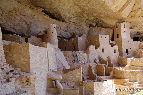
We hadn’t planned on going to Mesa Verde National Park from Montrose, but we realized if we waited until we were closer later on in our loop, all of the tours would be closed. We’ve always enjoyed the National Park Units that protect and tell the history of the Ancestral Pueblo people so we had high hopes for this park. Mesa Verde National Park protects around 5,000 different archaeological sites which include almost 600 cliff dwellings. The Ancestral Pueblo people made this area their home for 700 years. We saw so many cliff dwellings all along the walls of the cliffs that make up this park. Now, the most important thing you need to know about visiting Mesa Verde NP is that you have to take a Ranger guided tour to actually get down into one of the dwellings. We did the Cliff Palace tour and we definitely weren’t the only ones there. The tour was packed. Our Ranger talked so much that we didn’t get to do much looking. When we tried to lag behind to snag some pictures or look he would hurry us along. The tour was pretty disappointing. The NPS needs to either give more time between tours or make the tour groups smaller.

One of the cooler things we learned was that the Ancestral Pueblo people would use corn-on-the-cobs to chink in the spaces in the walls. We saw a 700 year old corn cob. We think we know quite a bit about the Anasazi people. We know they use to farm on the tops of the mesa’s that their cliff homes were built on. We know they made baskets and later on pottery. We know they lived in communities. We know they hunted. We even know how they collected water. What we don’t know is why they suddenly abandoned the Mesa Verde region.

Going on a tour of one of the cliff dwellings is a workout. You go down stairs, up ladders, and on some tours you crawl through tunnels. The Ancestral Pueblo people didn’t have the luxury of stairs and ladders. They used hand and foot holds to make their way down or up the cliff faces. We were told by a visiting archaeologist that each trail had a story that went with it so they could remember what hand or foot hold to use next. It was also a type of security…if you didn’t know the story, you’d have a harder time finding your way. I’m not sure how they could know that…but, I’m not an archaeologist.

Let’s talk foodies. We found a few places we liked. One was a Mexican place called Mi Mexico. Guys, we were really surprised by this place. We went into it not expecting anything spectacular, but we liked it so much we ate there three times in the two weeks we were in the area. Another of our favorites was a little place called Crash Burger where we got some very tasty burgers and fries.

There were flowers everywhere! They were so gorgeous!! I might have taken a few dozen pictures of various flowers/weeds that I found. Y’all know how I like my pretties.

Well, Guys, I’m going to save the rest of our Montrose area meanderings for the next post. Stay tuned for an epic mountain drive, ghost towns, and another National Park Service unit!

See y’all down the road!

#NationalParkTour

Sand For Days

Sand For Days

Guys!! We’re officially back on the road and it feels good to get some miles under our tires! Now that we’re done with our State Tour where we visited all of the states we could drive to, we have officially started our National Park Tour.

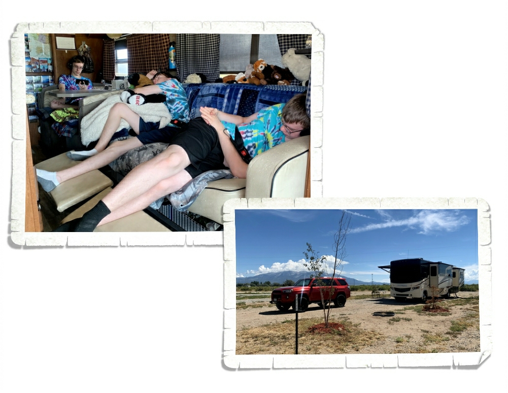
It took us two long days to get to Alamosa, CO and when we did…there wasn’t too much there. It was sandy and hot…but the views of the mountains from our “yard” were welcome.

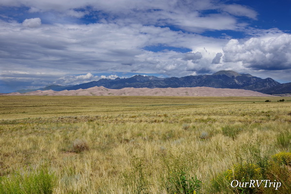
I’ve always been curious about Great Sand Dunes National Park. It sounds odd to say that the highest sand dunes in North America are in Colorado…but, they are. Driving to the park, all you see is the Sangre de Cristo Mountains. You’d never know you were driving toward sand dunes until you turn a corner and then there they are stretching out under the mountains. Looking deceptively small.

The highest dune is close to 750 feet tall and called Star Dune. To get to the dunes you have to cross the Medano Creek first. The creek wasn’t very deep when we went, but it can have waves up to a foot deep depending on the time of year. We rented some sand sleds from a nearby store and the boys had a good time sledding down the dunes a few times. The sand at Sand Dunes is very different than the sand at White Sand National Monument. The sand at Dunes sticks to everything…including the boards whereas the sand at White Sands seems to slide right off of everything.

It’s hard walking in sand. You take a step forward and slide back almost as far as you stepped. It makes walking up sand dunes more taxing than you’d think. Add that to the fact that we’d just spent nine months at near sea level…and well, we definitely got a workout. I made it up to this point and decided my view was pretty darn good. Jerl, Charles, and Alex decided to try and go farther up.

Nicholas and I walked at a more leisurely pace until we got to a very steep section. We decided we’d just sit in the sand and have a snack…and people watch. The view from our snack spot was pretty amazing. It wasn’t the worst place to have a snack.

I sent my camera with Jerl up to the top. He got some great shots! When you visit the dunes, you’re really only seeing a small portion of the thirty square miles of sand dunes. In fact, the park itself encompasses woodlands, grasslands, 13,000 foot mountains, and alpine tundras.

It’s hard to convey the size of the dunes. Here’s a picture that will help give you and idea of the scale. Those little dots are people on the dunes. We’d been warned to get there early in the morning not only because the dunes get busy but because the sand gets hot fast. Sand temps can reach 150° when the air temp is only 80° to 90°.

On the way to Great Sand Dunes NP we kept passing this little gravel road that went up the side of a mountain…so…we had to see where it went. It was one of the bumpiest roads we’ve been on in our car! We never made it to the lake that was said to be at the end of the road, but we made it a good distance up the mountain before we turned around. The view was hazy, but decent.

It wouldn’t be a proper post without some foodies. Guys, this burger…yes, there’s a burger under there somewhere…is firmly on our list of top five burgers. When I got this burger, I didn’t know it was an open-faced burger. Ha! I thought they’d given me the wrong thing, but it looked so good I was going to ask if I could just have it instead of what I’d ordered. It’s a smothered green chili burger with pepper jack cheese. We liked it so much we ate there twice in one week instead of trying someplace new.

Our first week back to being nomads went by quickly. We fell back into the usual rhythm of our traveling lives pretty easily.

See y’all down the road!

#NationalParkTour
A Slow Year So Far…

A Slow Year So Far…

Hey Guys!! It’s been awhile!! The last time we chatted, we had just moved from the Houston area to the Kyle area. That was way back in April. In June, we moved up to Missouri for two months. I thought I could squish the four months we were in Texas and Missouri into one post…so here we go!
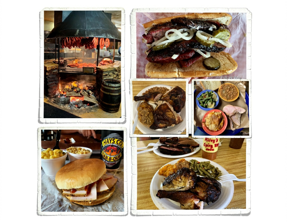
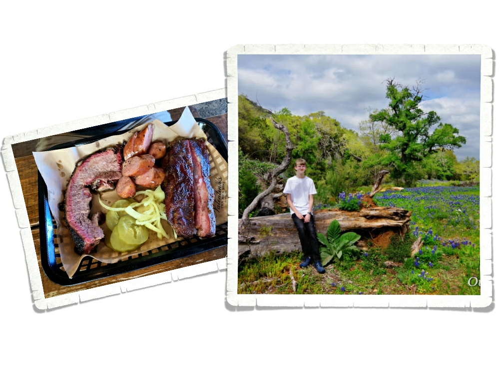
Let’s start with the BBQ…because y’all know we had some. We ended up eating at nineteen different BBQ places in the two months we were in Kyle. Yup, you read that right. Nineteen. And some of those places we ate at several times. Ha! It was hard to leave all of that amazing BBQ!! Jerl is still grumbling about having to leave all of those BBQ joints behind.

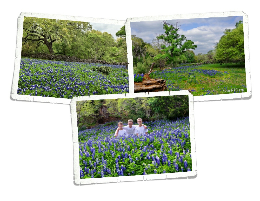
When we got to Kyle, the entire area was covered in carpets of bluebonnets. It was gorgeous! When I planned this part of our year, I’d hoped we would be able to see some bluebonnets. It’d been four years since we had been in Texas during the bloom and I was desperately wanting to get pics of the boys with the bluebonnets once again. During our two months in the area we saw the bluebonnets in all of their glory fade away to be replaced with the bright yellows and oranges and reds of the other wildflowers known in the area. It was beautiful.
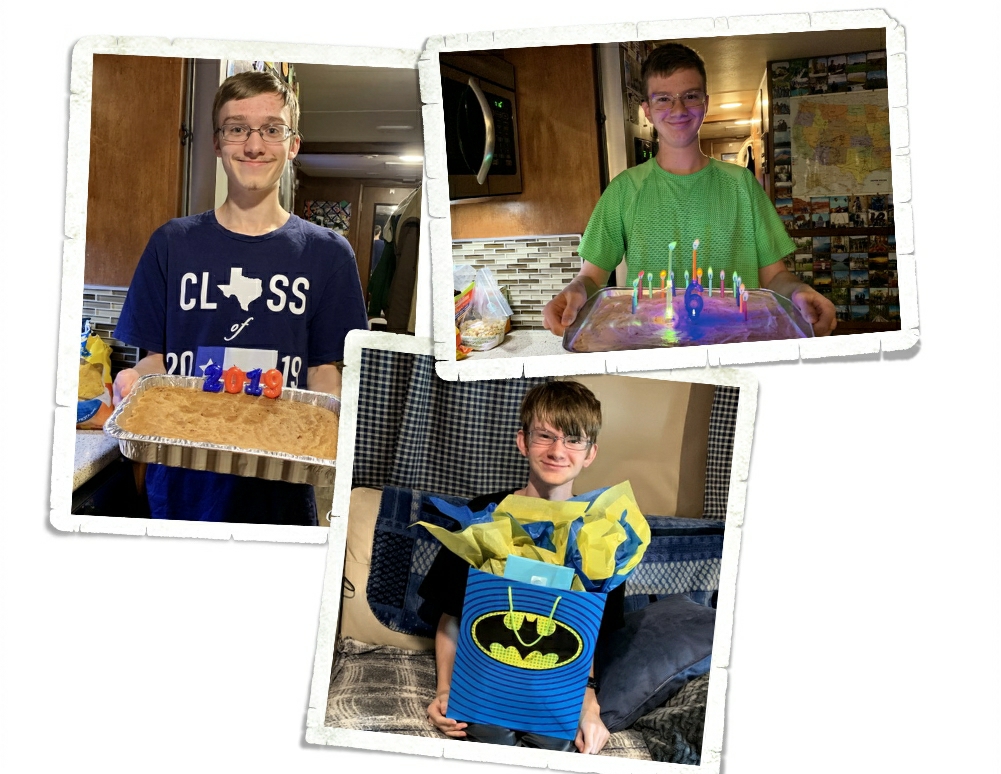
We were fortunate enough to celebrate two Birthdays and a High School Graduation while we were in Kyle!

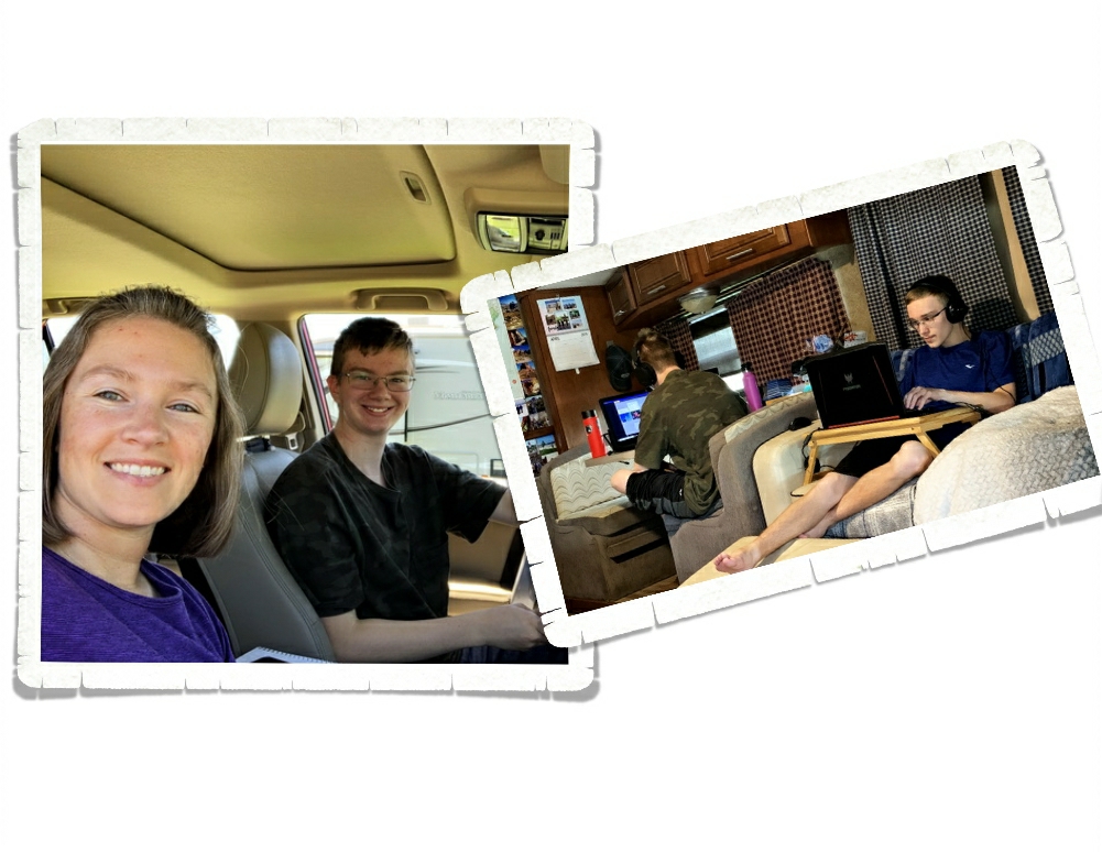
When we weren’t stuffing ourselves with BBQ or celebrating something, our days looked pretty…normal. Normal for us anyway. Work, school, and chores. The boys were all working on learning to drive. I left those lessons up to Jerl. I’m a reluctant and a bit nervous driver at the best of times. The last thing the boys need is a Nervous Nellie trying to teach them to drive.
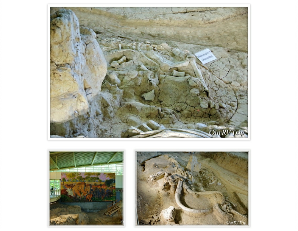
We’d had grand plans of hiking every weekend, but the weather seemed to have other plans for us. It stormed so much that the hiking trails were either under water or a muddy mess. We weren’t able to hike at all, but we did take a day trip to Waco and visit Waco Mammoth National Monument to learn about when Colombian mammoths once roamed Texas.

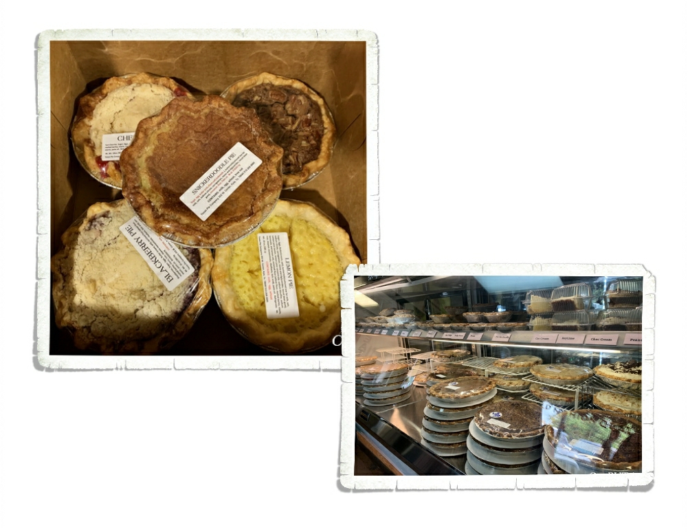
Right next to one of our favorite BBQ places to frequent was a pie shop. Pie and BBQ…a match made in heaven. We actually found out about the Texas Pie Company while we were eating at a different BBQ place. These pies were sooo good! And there were tons of flavors! I think I ate my weight in BBQ and pie and then washed it all down with sweet tea. Gotta love the South!!

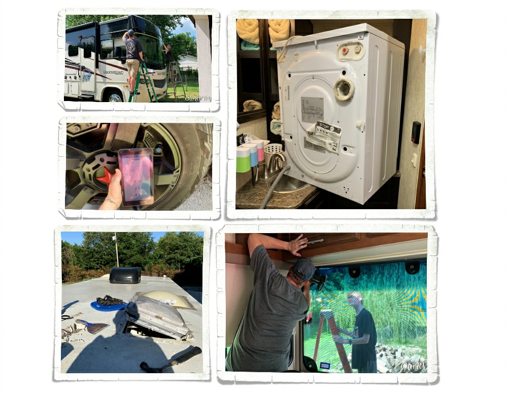
We headed for Missouri in June to spend some time with family and work on some projects on our home-on-wheels. Besides the many projects we had in mind…we also had some medical stuff to deal with. Eye surgeries were done (Jerl), wisdom teeth were extracted (Charles), and the many projects were…almost all done.

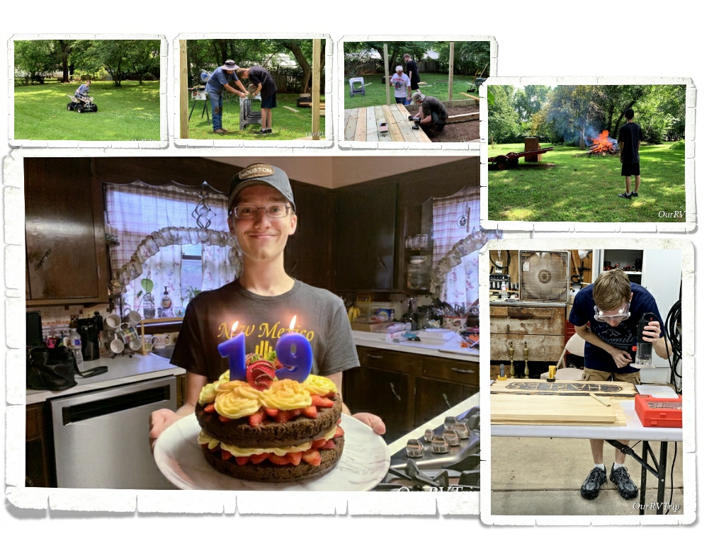
In between medical stuff and projects, we had some fun. The boys learned some new skills by helping their grandpa build a deck, we celebrated a birthday, and we took advantage of all of the space. Living in an RV gives us limited space and while we have a new “yard” every couple weeks or so…it’s different than having a real backyard where you can let loose and be free. The boys really enjoyed their summer.

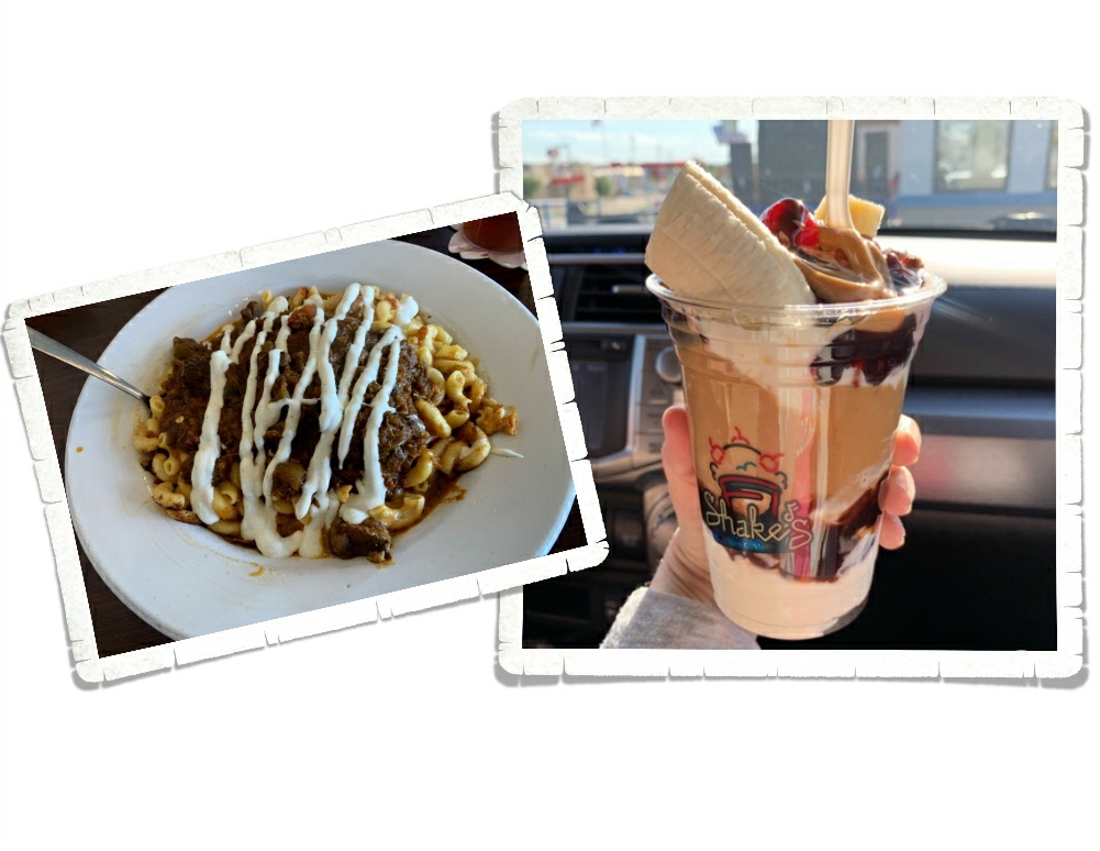
We’ve been to forty-nine states and have favorite foodie spots in quite a few, but there are some foodie spots in the Joplin area that we always look forward to visiting!

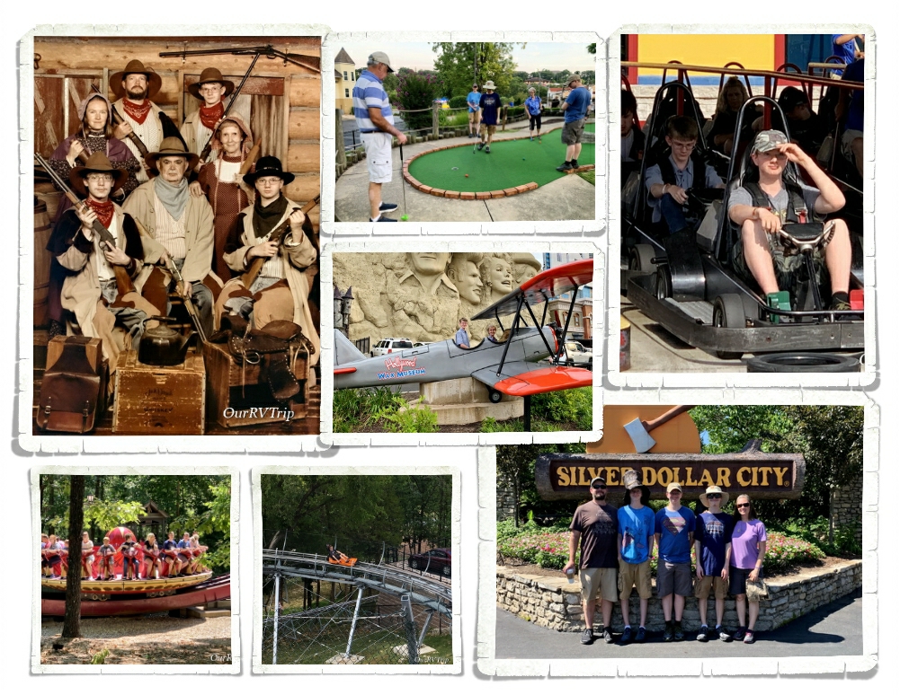
Right at the end of our visit in Missouri we were able to squeeze in a trip to Branson. Some of my favorite childhood memories are of family vacations to Branson. When I was a kid, we would go every summer. We love sharing new places with the boys, but we also love to give our boys a chance to experience some of our favorite childhood places too. It was so fun watching the boys make some great memories with my parents this summer.

We were basically stationary for four months this year. It was both the longest and shortest four months ever! Ha! After four years of frequent moves, I start getting the itch to move along about three weeks into a stay. The first week of August we headed out on our next loop of adventures. We love our time with family and leaving Missouri is always hard, but (as the quote goes) “the mountains are calling…”

See y’all down the road!!

#nationalparktour

Four Year Nomadiversary!

Four Year Nomadiversary!

Guys! Today is our four year nomadiversary!!

I can’t believe we’ve been doing this crazy nomad life for four years. I thought it would be fun to look at the stats for our journey overall so far before getting into the nitty gritty of year number four.

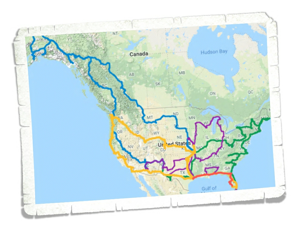
This map shows where we’ve been so far. Each color is a different calendar year. Our journey so far in numbers: 51,808.85 miles, 49 US states, 4 Canadian Provinces, 1,460 days, 119 National Park Units, 137 Junior Ranger badges, and countless memories.

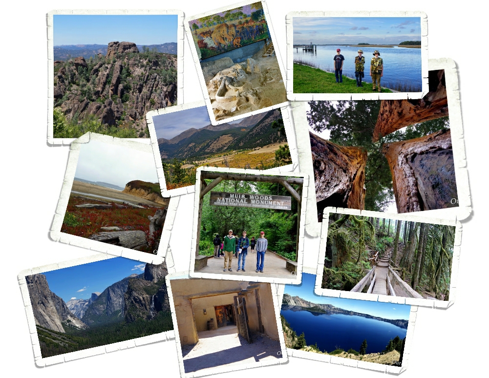
We spent most of our fourth year as nomads exploring the west coast and it did not disappoint! It took me three years to talk Jerl into going to California and I knew it would probably be years before I could get him back to California so I packed as much as I possibly could into our time there. It was one of the best states we’ve explored…but it was also really crowded and super expensive. I’m already trying to talk Jerl into going back for a shorter visit to some of our favorite places.

Oregon was on fire when we went through, but we managed to see some of its beauty. We only spent a few weeks in Oregon…I have tons of places on our to see list, so we’ll definitely be back in Oregon exploring!

Washington was gorgeous. It was also dealing with some wildfires so it was really smokey some days, but we saw enough to know we would totally spend an entire season up there. We’ve made plans to spend a couple of months in Washington in 2020 and we’re so excited to get back up to the PNW!

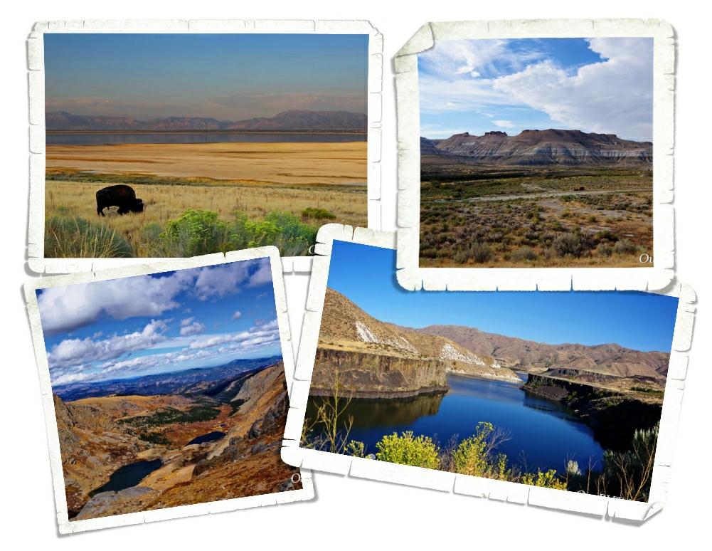
We spent so much time on the west coast that we had to rush through Idaho, Utah, Wyoming and Colorado. We didn’t get to see much of them, but we were able to see the State Capitols of each state and make plans to visit again. We’ll be back in Colorado and Utah this year (2019) and we’re super excited to get back and explore more! We’ve already made reservations for Idaho and Wyoming for 2020…yup…2020. I’m a bit of a planner.

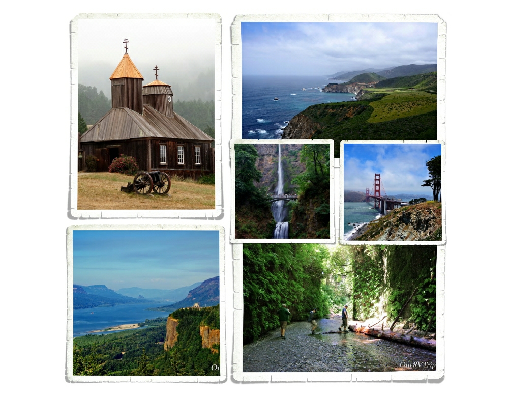
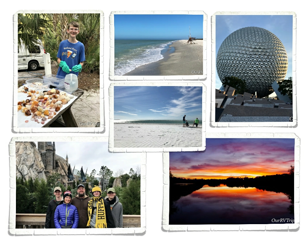
We spent the winter hiding from the cold in Florida. Florida was mainly sand and shells and amazing sunsets. We mostly succeeded in avoiding winter weather, but we did hit some colder weather once we moved up into the Orlando area. We didn’t mind the cooler weather while we were at Disney and Universal. The cold weather thins the crowds a little bit…not much…but some…and if you’ve been to Disney or Universal, you’ll know any help with shorter lines is welcome!

In our fourth year as nomads, we made it to fourteen new-to-us National Park Units and we revisited three NPS Units! National Parks really are America’s best idea. We have plans to see around twenty new-to-us NPS Units for 2019 and we are sooo ready to get going! Our favorite NP from year four of our explorations is Sequoia National Park. Something about those tall trees spoke to us and for the first time since we went nomad, we were genuinely sad to leave an area.

We finished our fourth year as nomads back in our home state of Texas so our boys could go through driver’s ed. Our timing was just right to see some of the best bluebonnets we’ve ever seen so I took the opportunity to snag some pics with the boys. We’ve also been eating as much bbq as we can…I mean, we are in one of the best bbq areas in the country…it would be wrong to waste the opportunity to try as many different bbq joints as we can…right?

And that is our fourth year as nomads in a nut shell! Thanks for coming along on the ride!

See y’all down the road!

#nomadiversary

Stop Off In Louisiana

Stop Off In Louisiana

Hey Guys! We spent a week in Louisiana…eating. I’m not even kidding. When I scheduled us to stop in Louisiana for an entire week it was purely to chow down on some Cajun food. We’re foodies…it’s part of the journey for us.

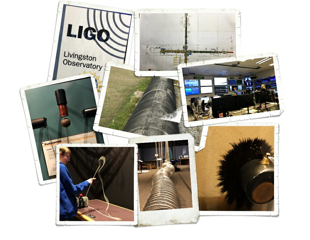
Lets start with the one thing we did that wasn’t food related. We took a field trip to LIGO in Livingston, LA. What the heck is LIGO? LIGO stands for Laser Interferometer Gravitational Wave Observatory. Man, that’s a mouth full! Try saying that five times real fast! ;-P So, what the heck do they do at LIGO? To put it in simple terms…they detect gravitational waves…with lasers. The facility works in conjunction with the facility in Hanford, WA to measure and detect gravitational waves. I’ll be honest…most of it was way over my head. We absolutely loved the hands on science exhibits!! Our little nomadic nerd hearts were in heaven!

We were lucky to even get into LIGO for a tour. They only do schools through the week and then they’re open the third Saturday of the month to the public. And, if we’d been a week later, we’d have been out of luck because they were all booked. It’s a great tour and an awesome field trip…if any of you are ever in Louisiana, it’s worth it to stick around the Livingston area so you can do a tour at LIGO.

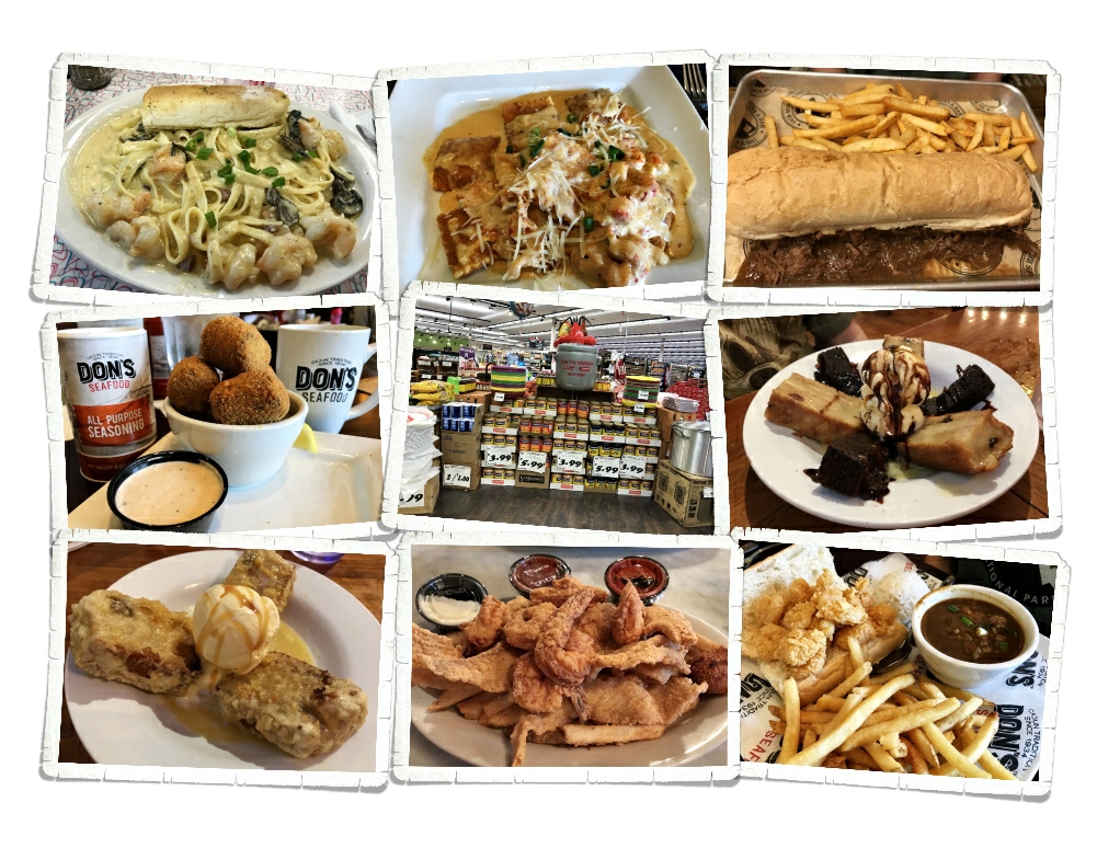
Now to the foodies. I’m not going to break down every place we ate…but every single place we tried was amazing. Guys, that doesn’t happen often You know…you go try a place and it’s just meh and turn around and try a place right down the street and it’s ah-maze-ing. There are some states that we struggle just to find a decent burger and then there are states (like Louisiana) where we struggle not to eat out every single day because it’s all just so dang good!

One of our top picks for this visit is a place called Cate Street Seafood Station. We ate there twice…in a week. Cate Street has it all…seafood, boudin balls, pasta, po’boys, and sushi! All with a Cajun flare to it. And Guys…the desserts…I have three words for you… Fried. Bread. Pudding. It’s a good thing we don’t spend more time in Louisiana. I’d weigh two-hundred pounds easily.

See y’all down the road!

Pizza Roundup V Pizza

Pizza Roundup V Pizza

To my fellow pizza lovers! I bring to you a post from Jacksonville, FL.

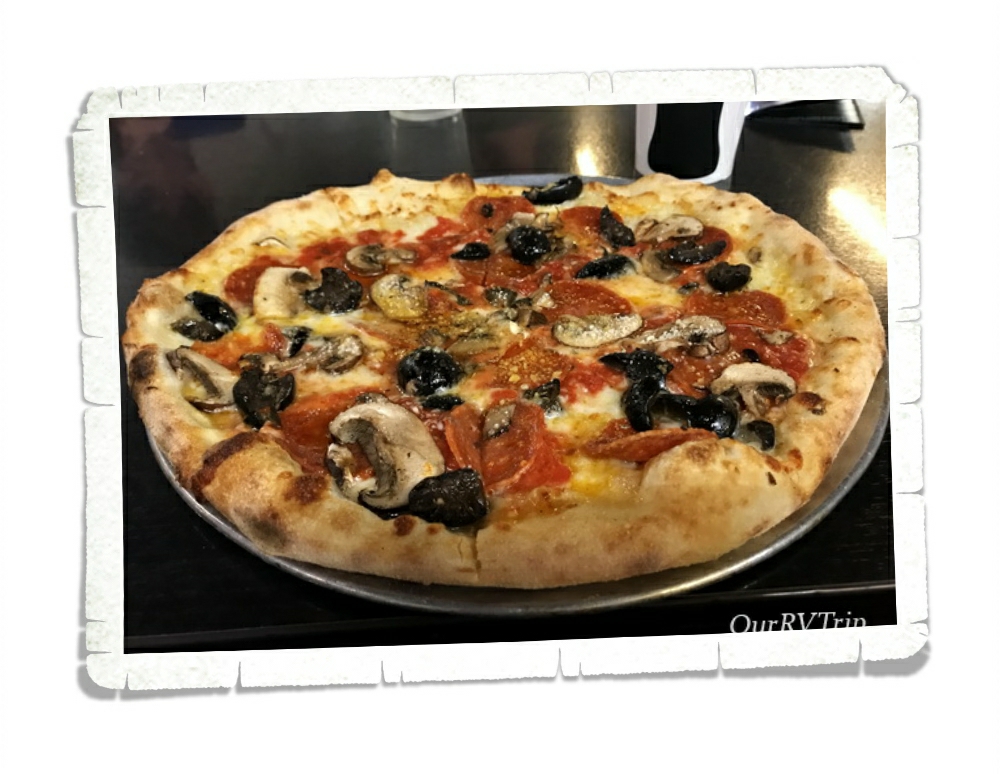
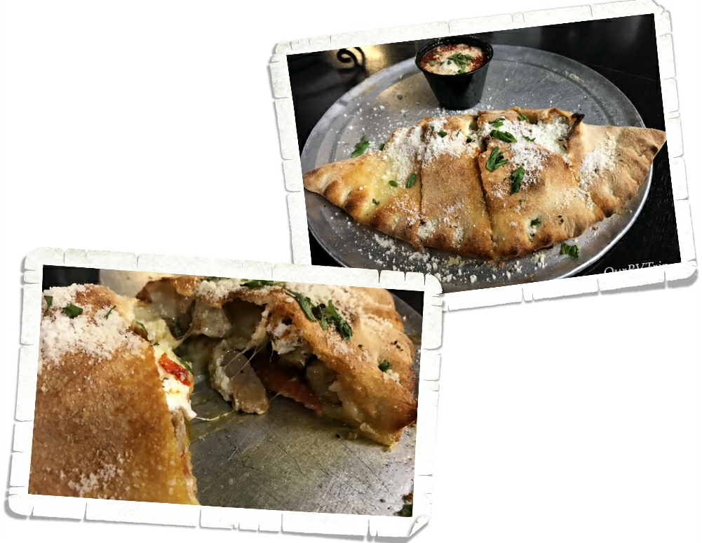
V pizza is a really good pizza place. You can really tell they only use the best ingredients in their food. For example, they get one of their mozzarellas imported straight from Italy!

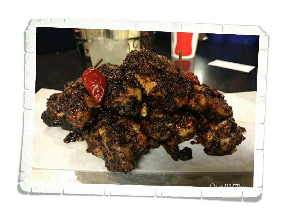
They have some really good wings too. You order up front then go pick your table. It wasn’t busy when we were there so we got in really quickly.

They have a nice crunchy crust, it holds up when you pick it up! No soggy crust here!

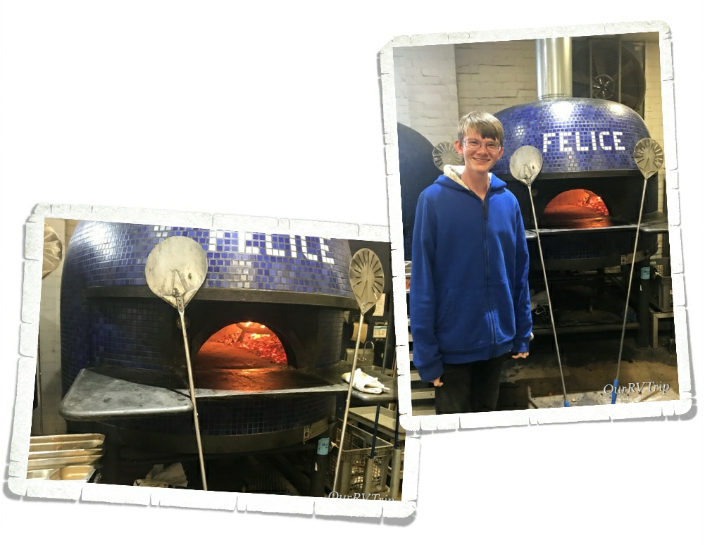
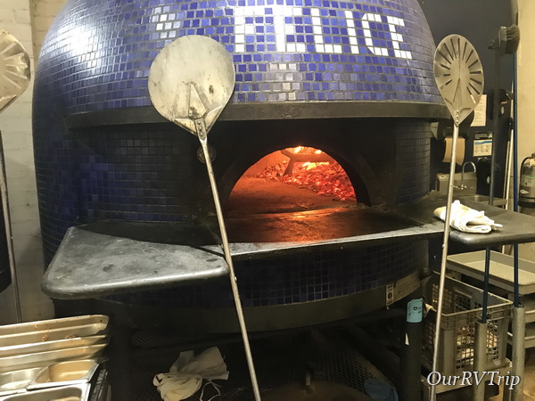
You can even watch them make the pizzas! The staff was super nice and they let me take a picture with the ovens. How cool are these ovens?!

I think V pizza gets a 4.5 star review! I would definitely recommend V pizza if you are in the area.

See y’all next time on…

Pizza Street!!

Written by Nicholas