Category: National Park

Hiding From The Cold

Hiding From The Cold

Howdy!! It’s been a while since I last wrote a post. In fact, it’s been a few months. I took some time off from writing posts to be present in life. I feel like sometimes I get so caught up in trying to get a blog post written and out each week I forget to be in the moment…present in life. So, I worked ahead and was able to get posts scheduled from October 2018 to January 2019. Last week’s post was the last post I had pre-written so I could take a break.

SO! We’re back to the normal writing and posting schedule where I’m just a few weeks ahead! It’s been a few months…and we’ve done quite a bit! Let me get y’all caught up!

We left Colorado and spent some time in Missouri to visit family and friends. Then, we headed down to Texas to do some doctoring and visit with more friends. After Texas…we hightailed it down to Miami, FL where…we hid from the cold for six weeks.

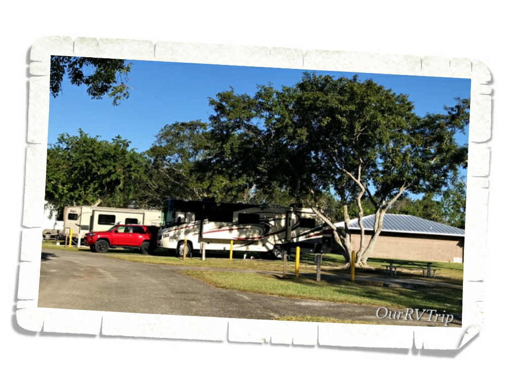
We stayed at Larry and Penny Thompson Park the last time we were in the Miami area. It’s a great park with full hookups and is wonderful for getting some walking in. I can get right around two miles with one loop.

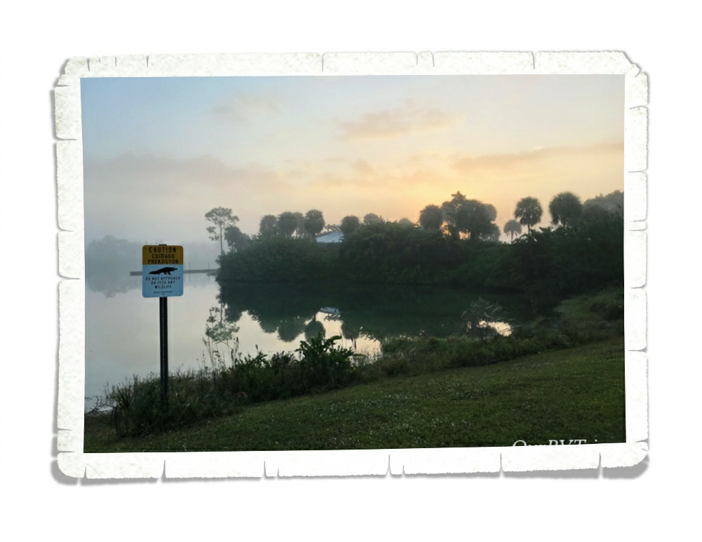
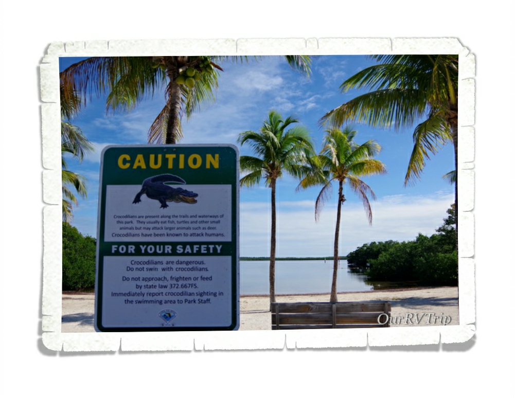
And…when I got tired of walking the loop in the park, I could venture out to this little pond just outside the campground boundary. The signs say watch for gators, but in the six weeks we were there…we never once saw a gator. Not. A single. Time.

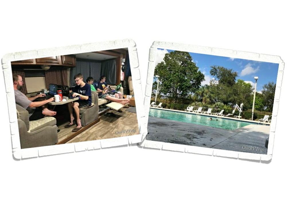
Most of our six weeks we did regular life stuff. School, chores, work… Nothing exciting or remotely adventurous. I guess you could say we took a staycation. ;-p

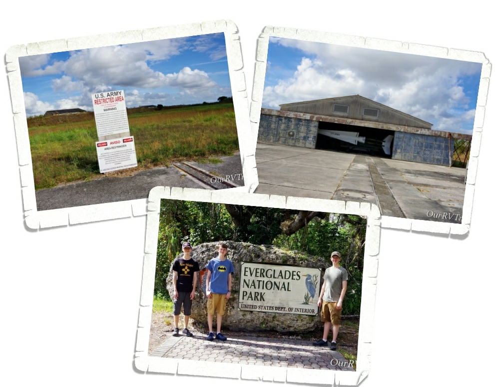
We did eventually decide we should probably venture out and do something. We’d visited both National Parks in the area during our last stay in Miami, but we’d missed seeing the Nike Hercules Missile Base over at the Everglades National Park so we hit the Ranger Walk one Saturday. If you’re interested in seeing the Nike Missile Base here, you should know it’s only available through the Ranger Walk so make sure you check the times for that. We’ve been to other Nike Missile sites, but this was the first time where the missiles were kept in topside buildings instead of underground silos! This missile site was the last one to go dark in 1979 due to the Cuban Missile Crisis of the time.

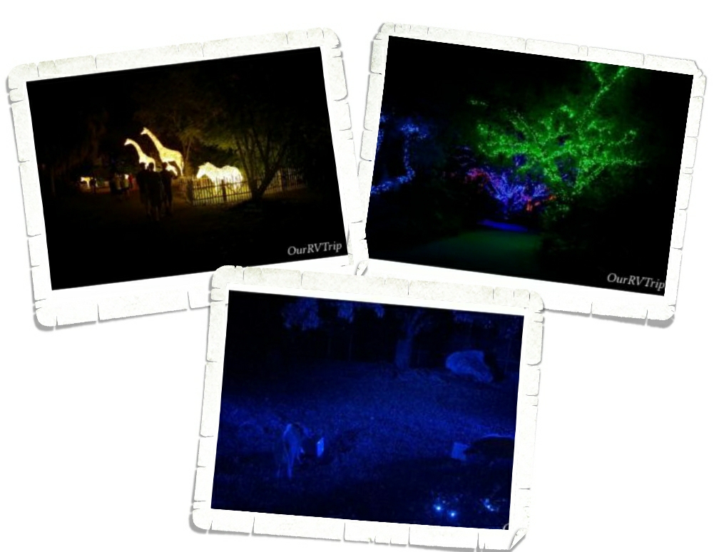
We also made it to the Miami Zoo Lights during the Christmas season. We’d never been to the Miami Zoo…we wish we’d gone during the day instead of during the Zoo Lights. Don’t get me wrong…the lights were super cool! But, we only saw three animals. And, their habitats were lit with weird blue lighting. So, I guess we’ll have to hit that up the next time we’re back in Miami because the zoo itself looked like it would be a really neat zoo to visit!

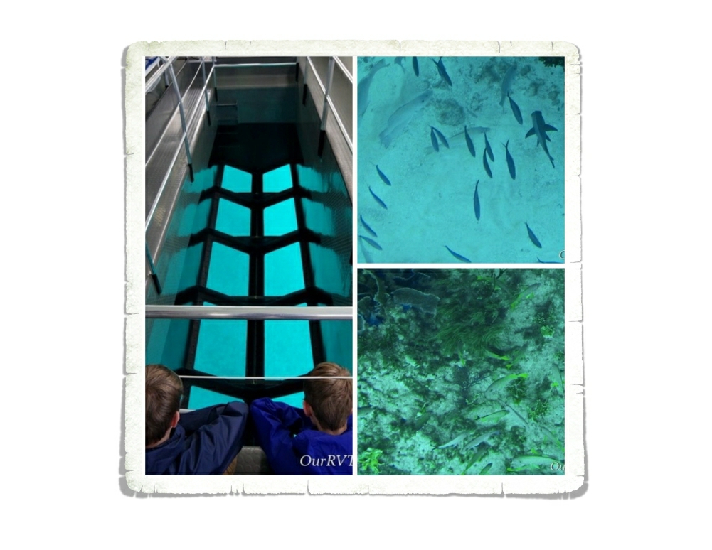
One of the cooler things we did during our six weeks in Miami was to go to John Pennekamp Coral Reef State Park and take a glass bottom boat ride! It was really neat to go check out some of the sea life hanging out by the coral reef! The whole tour was about two hours and there were a couple of very knowledgeable guides to tell us what we were looking at. They did a great job!

After the boat ride, we hung out at the state park long enough to check out the beaches and fight off the thousands of no-seeums that swarmed us. They were bad. We all went home with tons of little itchy bites! And yes…for those of you wondering…we did use spray. They might have thinned a bit after the spray, but they were still pretty darn thick.

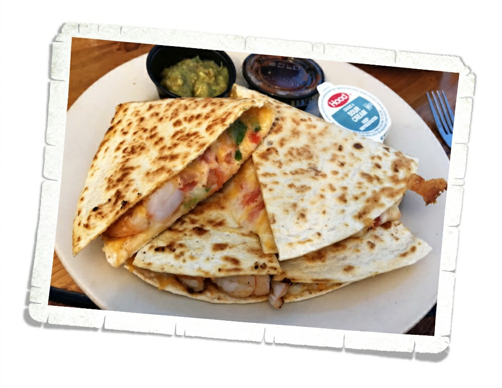
John Pennekamp Coral Reef Sate Park is on Key Largo and…since we were so close…we decided to go hit up Robbie’s down in Islamorada for some lunch after the boat tour! Check out that shrimp quesadilla! It was huge! And it was loaded with shrimp. I wasn’t expecting to get that much shrimp in a quesadilla.

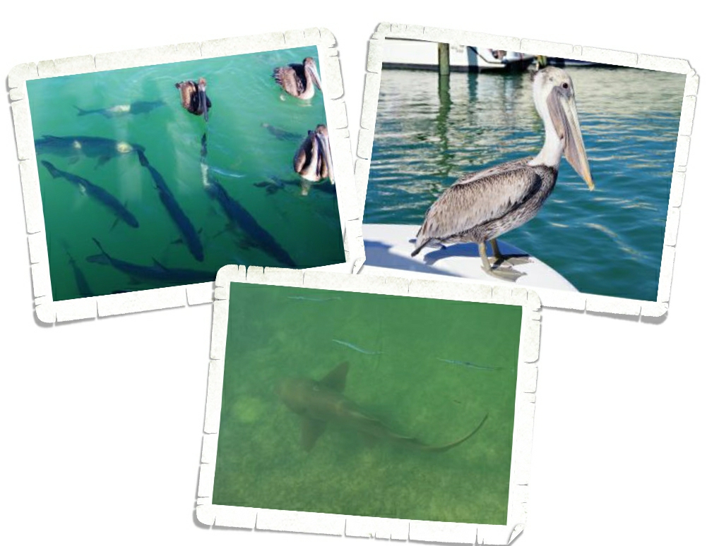
After we ate at Robbie’s we walked over to the docks right next to the restaurant where you can feed the ginormous tarpons!! Guys!! These fish were soooo big! We saw a few sharks lurking nearby too. And the pelicans were begging for food. Begging…stealing… The pelicans were kind of pushy about the food.

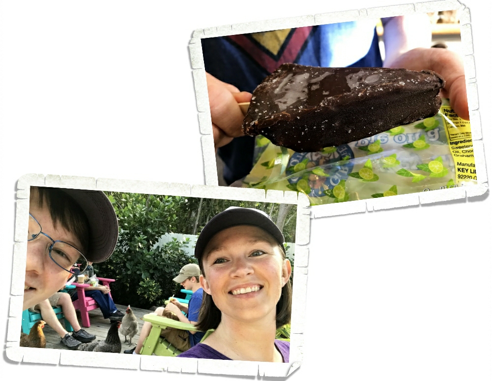
The last stop on our day trip to The Keys was to The Blond Giraffe Key Lime Pie Factory where you can get anything key lime flavored. We all got something then headed out to the chicken yard to eat. The chickens were awesome. They were so friendly they were willing to share your key lime treat…they might have been a little too friendly because they didn’t really care if you were done with your treat or not. Ha! I loved it! And yes, that is a frozen chocolate covered piece of key lime pie. Alex let me know that it was delicious!

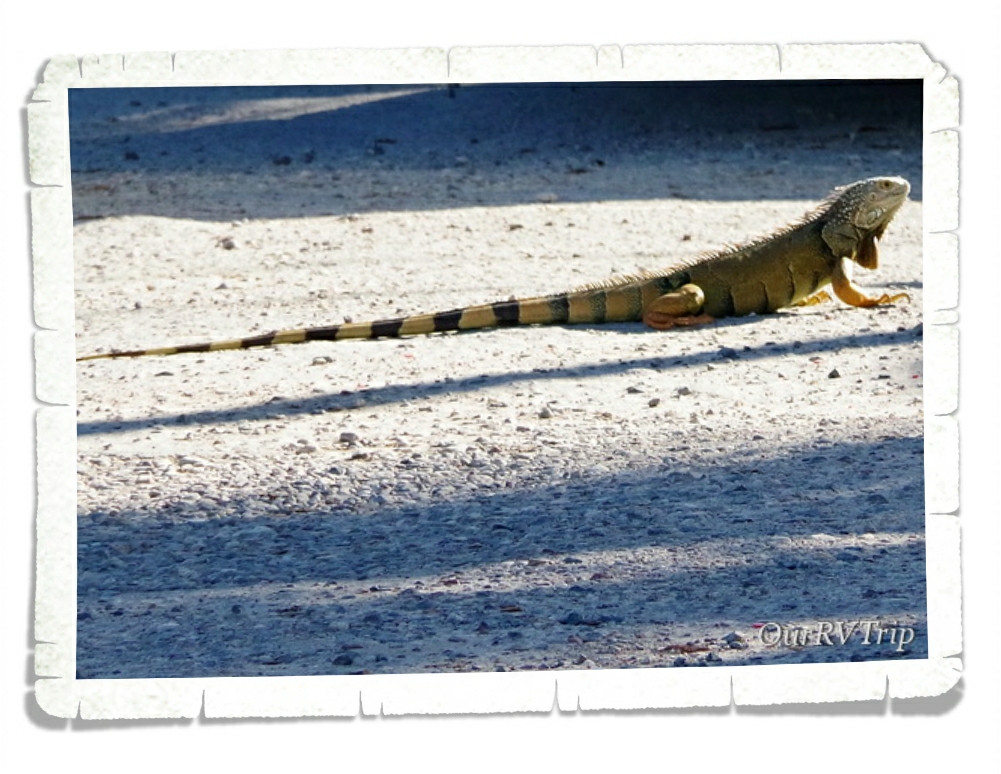
We spotted tons of these huge iguanas. They would just kind of lumber around everywhere. The biggest ones we saw were all lounging around along the side of the big borrow pits along the sides of the roads. What’s a borrow pit? It’s where the state had to dig a big ditch in order to use that material to build up the road. All of the borrow pits we saw were filled with water…and quite a few had some gators that were keeping the iguanas company.

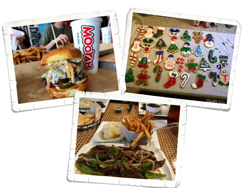
We made Christmas cookies over Christmas. It’s one of our traditions. The decorating gets more and more creative each year. We also ate ourselves silly on Cuban food and Mooyah burgers.

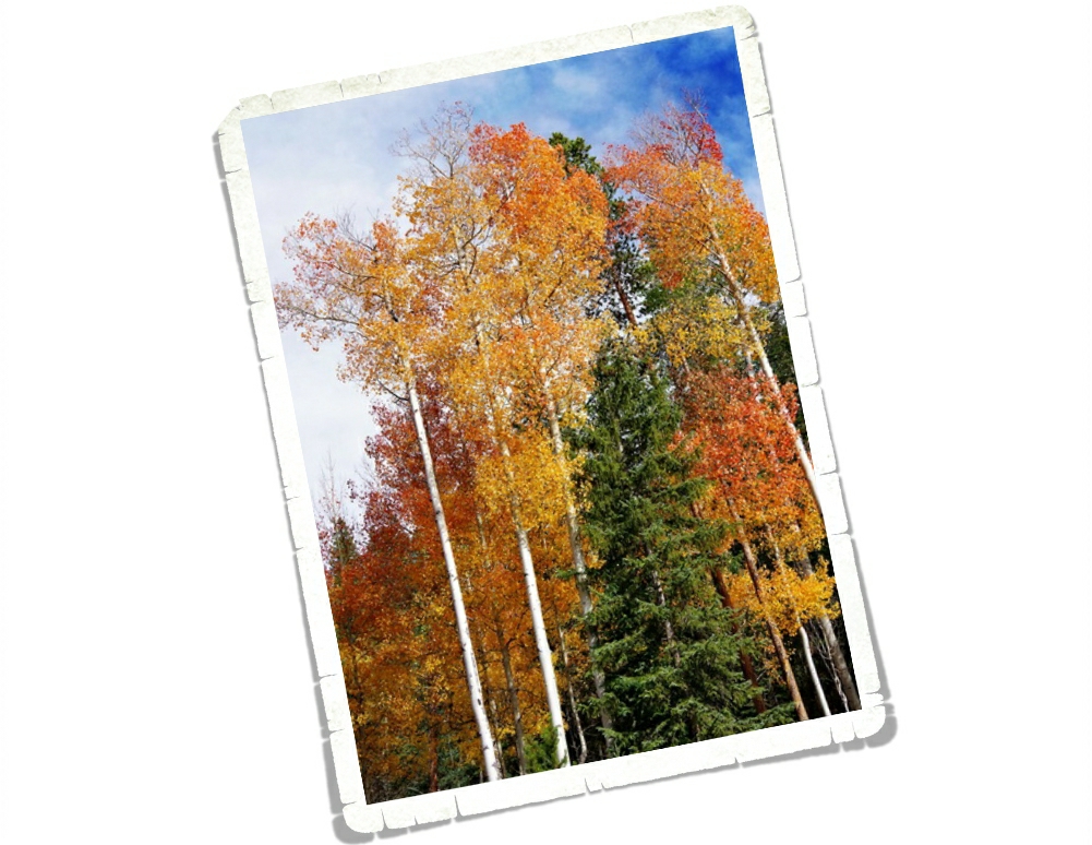
There were pretties everywhere, but these purple ones were my favorite.

We had a great six weeks being semi-normal and slowing down a little. It was such a switch from the fast paced moving we’d been doing all year. We learned we’d like to take it a little slower…we also learned that six weeks in one stop is way too long for us. We were all getting a little stir crazy by the end.

See y’all down the road!!

#hidingfromthecold
Mountains, Mountains, and More Mountains

Mountains, Mountains, and More Mountains

Hey Guys! Here’s part two of our Denver area explorations. If you missed part one, you can find it here. We were only in the Denver area for one measly week, but we crammed every bit of adventure we could into that one week.

It was so cold and windy the day we went to Loveland Pass. Alex forgot his jacket and wasn’t up for doing much exploring so we walked around a little, snapped a few pictures, and got back into the warmth of the car.

Even on a cloudy day the view was breathtaking…and not just because it was cold.

We got there right as the clouds started brushing the tops of the mountains. We thought briefly about walking up the trail…but with one of us without a jacket and the bitter cold…we passed.

This picture was taken the same day as the ones on Loveland Pass. We took a drive up the Mount Evans Scenic Byway. We barely squeaked in on the last day the road was open for the 2018 season.

We made it all the way to Summit Lake before we had to stop. The road to the summit was already closed. Alex was still without a jacket so our hiking was pretty limited. It was a balmy 30° with a wind-chill much lower at Summit Lake that October day. Those of us who braved the cold and wind to see the views really wished we had actual coats and not just jackets. But Guys…look at that view!

We saw some female longhorn sheep. There was a whole herd of them just hanging out right by the road. Checking out the cars as they drove by. Meandering into the road whenever they felt like it. We thought they were goats until we talked to a Ranger. The Ranger told us all of the goats had been staying higher up on the mountain. Wildlife is one of our favorite things to see while we’re out exploring.

Here’s another shot of the view. This one was on the way back down. We were super bummed we couldn’t go all the way to the summit. We’ve made plans to go back to Colorado next year and have this on our list of places to revisit. Hopefully, on a warmer day.

Mount Evans, with a height of 14,264 feet, is the twelfth highest mountain in Colorado. The Mount Evans Scenic Byway is the highest paved road in North America and takes you through several biomes before getting to the top. We stopped at the Mount Goliath Natural Area to see the Krummholz Forest.

Krummholz comes from a German word meaning crooked wood. The stunted, twisted trees mark the transition between forest and tundra.

We love National Parks. We basically make all of our plans based on National and State Parks along with the State Capitol Buildings. Jerl had been looking forward to this particular National Park since we started this crazy nomad life. We were staying in Golden, CO so it took us a good two hours to get to the Rocky Mountain National Park. We only had one day to explore RMNP so we got up super early and spent the entire day seeing as much of the park as we could.

It was rut season for the Roosevelt Elk in Rocky Mountain National Park. We were hoping to see and hear them. We hadn’t been in the park an hour yet, and we both saw and heard them. You can’t see them in the picture above, but this is where we were standing when we first herd them. Bugling to one another. Calling out challenges. Staking claims.

The mammas and the babies were grazing by the road.

The day we were at RMNP was the last day the Old Fall River Road was open for the season. We couldn’t have timed it better if we’d tried. And trust me, I try…but this was just a happy coincidence. Old Fall River Road was built between 1913 and 1920 as the first motor route to cross the Rocky Mountain National Park. It’s only a nine mile road, but it took us a couple of hours to traverse it. Every turn was cool enough to stop at and take pictures of and ogle, there were waterfalls to hike to, and all four life zones to learn about. The road ends about half way up the main park road at the Alpine Visitor Center.

 Welcome to the high mountain country! It was super windy up on the mountain at the Alpine Visitor Center. Soooo windy and not even close to warm. But I like the views…so we hiked the Alpine Ridge Trail. The trailhead is right off the Trail Ridge Road which is the highest road in any of the National Parks. The trail itself isn’t long…it’s just over half a mile, but it is a steep climb up 220 or so stairs. The trail ends at 12,000 feet. It was so windy the day we went that we kept expecting to get blown off the trail. It was a pain going up…but it totally made the trip down faster.

The view at the top was spectacular! There were mountains in every direction.

On a different day, we would have stuck around and really taken in the view…maybe even picnicked up there, but the warmth of our car was beckoning to us. So, we looked as long as we could withstand the cold and wind then raced back down the trail to get warmed up.
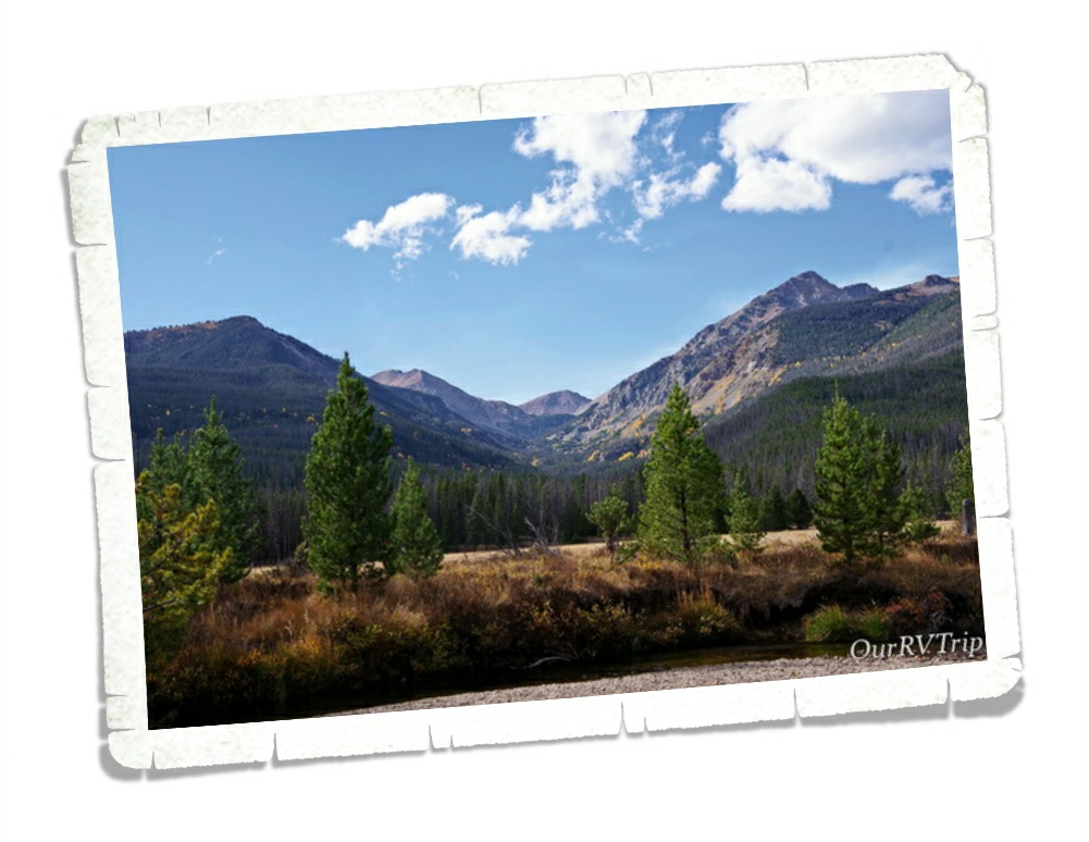
The aspens were showing off their colors. We found this gorgeous grove along the Trail Ridge Road. Fall colors are some of my favorite colors. I spent a good portion of our time here trying to find some fall foliage.

We were in Colorado three whole weeks. We’ve changed our plans for our next loop so we can spend more time in Colorado. For the first time…in 49 states…we’ve found a state that gives our love of Texas (our home state) a run for its money.

Colorado, we will be back.

See y’all down the road!

#westernloop2018

Our 2018 Year In Review

Our 2018 Year In Review

Hey Guys! Happy New Year’s Eve!!

I thought we’d end the year with a quick post to share some of our favorite memories from this year.

Our year started off…well…not the best. We spent last New Year’s Eve driving through an ice storm to get back to Missouri so Jerl could have eye surgery and our home-on-wheels could get a new engine. It was a stressful start to the year, but it got loads better!

We made it to twenty-one different National Park Units this year! Twenty-one! Two of those were revisits, but nineteen were new for us…so it shouldn’t come as a surprise that seven of our top ten memories for this year are about National Parks.

Let’s start with our honorable mention…Sparky’s Burgers in Hatch, New Mexico just missed our top ten, but we all like it so much we decided it really should at least get an honorable mention! We’d been eyeing Sparky’s for a couple of years now. We found out about it in 2015 while we were in Alamogordo, but didn’t want to drive that far in the time we had in the area. This year, however, we made it! And Guys…it’s so good! We got there right as they were opening and it’s a good thing because when we left, the line was already starting to curve around the block. Alex had to try one of Sparky’s famous green chili shakes. He chose chocolate and raved about it the whole time. I think next time I may have to get one too!

Our number ten spot isn’t a foodie or city or state…it’s not a National or State Park…it’s a view. The Columbia River Gorge from the Portland Women’s Form State Scenic Viewpoint in Corbett, OR was spectacular even though the smoke from some nearby fires was wafting through. We had this entire viewing area to ourselves…well…there was one other person there and he was busy having a conversation with himself…so…yeah. But, that view!

Sequoia Park Zoo comes next. We found this little zoo in Eureka, CA and made time to visit right at the end of a day of exploration. We got there just in time for the red panda feeding and zoo talk. We’ve been to some of the top rated zoos in the country and this little zoo is one of our favorites. Happy animals, clean and big exhibits…what more does a zoo need? What it lacks in size, it more than makes up for in heart.

One of the things we love is a good view and what better place to get a view than atop one of Colorado’s tallest mountains. Pikes Peak is the most expensive mountain we’ve explored…but Guys…that view. When we were there, the summit was torn up for construction of the new Summit House. It’ll be fantastic when it’s done! We just might have to go back and see it completed!

One of the states that Jerl has been looking forward to the most is Colorado. The mountains have called his name for many years so it shouldn’t be a surprise that Rocky Mountain National Park is on our top ten list. We were only able to spend one day exploring this giant park and hope to go back one day to see more of it.

Yosemite National Park is in the number six spot on our top ten list for 2018! We were there right before the busy season, but there were still so many people. The few days we ventured into Yosemite Valley the crowds were insane! It wasn’t our thing…all of the crowds. But, when we drove Glacier Road and Tioga Road…the crowds weren’t nearly as bad and the views were ah-mazing!

One of the places I’d been looking forward to visiting is Redwood National and State Park! These two parks work together to preserve one of the largest tracks of old growth coastal redwoods left in the US. And! There’s Fern Canyon! This canyon has fifty feet walls covered in several types of ferns. It was so fun to wade down the small creek! If traveling isn’t your thing…you can take a look at Fern Canyon without leaving your home…it was used to film parts of Jurassic Park II.

We made it to Oregon right as the burn season was revving up. We could see the smoke from one of the fires at the park we were staying in. We were worried we wouldn’t make it up to Crater Lake National Park due to the fires. I’m so glad we did! Crater Lake is gorgeous! The blue of that water!! There’s a bit of lore that says the blue bird used to be black before it dipped into the waters of Crater Lake.

Olympic National Park rests in the number three spot on our top ten list for this year! This place…Guys, I could totally spend a season or two in this area of Washington. There is so much to love about Olympic National Park! You get beaches, mountain vistas, and forests of moss covered trees to hike through!

This next park is not only in our number two spot, but was the biggest surprise for us. We weren’t entirely sure of what to expect from Kings Canyon National Park, but we loved it! You get the gorgeous tall trees and you get to explore a huge canyon! We somehow ended up taking an old forest service road to get into the park and in doing so drove right through one of the largest groves of redwood old growth left. We had it to ourselves and it was fantastic! The canyon was a total surprise. There are views for days, hikes and waterfalls to explore!

Our number one memory of 2018 is Sequoia National Park! We heart tall trees in a serious way. We can’t get enough of them. We stayed in the Sequoia National Park area for two weeks and we spent every spare minute we could up the mountain, in the park walking amongst the tall trees. I’m already trying to plan our next trip to Sequoia.

We’ve wrapped up our State Tour. Y’all haven’t seen the last few posts about those explorations yet, but they’re coming! We hope that each of you have a wonderful New Year’s Day and a blessed 2019! Thank you for being a part of our crazy nomad journey!

See y’all down the road!

Forts, Fossils, and Rock Formations

Forts, Fossils, and Rock Formations

We made it to Colorado!

Guys! Colorado is state number forty-nine for us!!

We spent two weeks in the Colorado Springs area and tried to squish as much as we could in.

Y’all know forts are kind of our jam…so it won’t be a surprise when I tell you that one of our first stops in Colorado was Bent’s Old Fort National Historic Site. Fur trader brothers Charles and William Bent along with their partner Ceran St. Vrain established a place for trading opportunities.

Bent’s Old Fort opened in 1833 and was one of the main centers of fur trade along the Santa Fe Trail. The fort prospered for 16 years until the region’s beavers and buffalo herds started to disappear. Bent’s Old Fort was the only place between Missouri and Santa Fe for travelers to replenish their supplies and make repairs. It was a safe haven for travelers making the long trip.

Some seasons, the population of the fort could swell upward of 200 people. Most of the rooms at the fort were used for necessary crafts like blacksmiths, carpenters, doctors, warehouses, and kitchens. The few rooms dedicated to living quarters were available to company employees and sometimes important guests.

Around 1846 the fort was no longer used just for trading. Because the Bents were known peacemakers with the region’s tribes, Bent’s Old Fort turned into the headquarters for the Upper Platte and Upper Arkansas Indian Agency.

 At Bent’s Old Fort, we learned several things. One of the coolest things we learned is that they used scraps of fur to line the windows to help weather proof. In hind-sight, this is a ridiculously obvious and simple solution, but one I hadn’t thought of. We also learned that forts employed cats. It makes perfect sense, doesn’t it? Forts are full of supplies like food and furs that need to be protected from not only raiders and thieves but also from mice. When they were excavating the original Bent’s Old Fort they found graves for the working cats. We’ve been to…well…quite a few forts and at every single fort we learn something new. Some new small detail about life during that time period.

In the middle of a prairie, not far from Colorado Springs you’ll find Paint Mines Interpretive Park. It’s only about half an hour from Colorado Springs, but it feels like you’re on a completely different planet! Native Americans have used the colorful clay in this area for their pots for over 4,000 years. The kaleidoscope of colors is due to the different amounts of iron oxide in the clay. We found colors ranging from bright yellows and oranges to pinks and purples to a whole range of grays. There were a few different hiking trails to get to the paint pots. We parked at the closest one and only hiked about half a mile to get to the park. It was a fun way to spend a couple of hours!

We love visiting National Park Units. Love it! So when we found Florissant Fossil Beds National Monument we added it to our list of must-sees while we were in the Colorado Springs area. The boys earned another Junior Ranger badge while we were there. The Rangers got a kick out of seeing all of the badges. It’s fun to watch the Rangers with the boys. The boys still don’t really get it…the attention. They love the learning and exploring that comes with each badge and each park. They’re not collecting the badges for attention.

The thousands of detailed fossils that have been found at Florissant Fossil Beds National Monument tell the story of a prehistoric Colorado. This area used to be under a large shallow lake millions of years ago. There was also a very active volcano about fifteen miles away. The combination of all of these elements made the perfect area for making fossils.

We spent weeks exploring the giant sequoias and redwoods along the Northern California coast. We saw them in the form of pine cones and saplings all the way to huge 3000 year old trees. At Florissant Fossil Beds NM we saw huge sequoia petrified stumps. The largest stump is forty-one feet in circumference. It was really something seeing these magnificent trees from the beginning of their lives to end.

Lets talk foodies! Colorado Springs isn’t lacking in foodie spots. Check out this burger! And Guys…Jamaican food… So…good! We actually have plans to go back to the Colorado Springs area next year and this Jamaican place will definitely be a place we will revisit!

There weren’t very many pretties around the Colorado Springs area while we were there. It was late summer/early fall when we were there so the flowers were mainly gone, but I did find these purple pretties!

Stay tuned for the rest of our Colorado Springs adventures!

See y’all down the road!

#westernloop2018

More OP Adventures

More OP Adventures

Hey Guys!! We spent two weeks exploring as much of the Olympic National Park as we could. We didn’t get to see nearly as much as we wanted to due to the amount of smoke from all of the nearby fires, but we saw enough to fall in love with the area.

National Parks are usually big. There are smaller monuments or historic sites…but the parks are…well, they’re huge. Usually, they’re more wilderness than not and unless you’re up for doing really long or overnight hikes, you’re not going to get to see most of the park. Olympic National Park is so accessible. You can explore coasts, tall trees, and mountains. The NPS has done a fantastic job with this park and it’s trails.

 On our first full day in the Olympic Peninsula (OP) we headed out to the coastal part of Olympic NP. When we started out it was an absolutely gorgeous day! No smoke in the are…the sun was shining…it was amazing. We stopped by Tongue Point on our way over to our first hike of the day. We got there really early in the morning and spent a few minutes exploring the tide pools. The tide wasn’t very low, so we didn’t see much. The view wasn’t bad though.

Our first hike that day was Cape Flattery. I’d done my research and knew ahead of time that the Cape Flattery hike is super popular and parking can be difficult to find. So, we headed there super early and had our choice of spots to park. There were already quite a few groups there…we weren’t the first that morning. I really love this trail. It’s mostly up on this boardwalk which is cool, but did make it kind of hard to pass people.

It was so sunny that morning when we started out! But Guys…look at all of that fog! I’d be lying if I didn’t say I was a little disappointed. I really wanted the unobstructed view here. But, look how gorgeous the view is even with the fog. I mean, when you’re surrounded by beauty it’s hard to be anything but in a good mood.

We were impressed with this tree. It looks like a candelabra to me. You can also kind of see how people were having to hang off and scoot around each other on that boardwalk trail. It was a little narrow, but workable.

It was lunch time when we made it to Rialto Beach and the place was packed! We circled around a couple of times then headed back down the road to find a parking spot. We had lunch in our car and then headed back to the beach to do some exploring. I’d seen online that there was a neat rock formation a little ways down the beach. There were some conflicting distances though, so I wasn’t sure just how far down the beach it was.

Check out the driftwood. It’s huge! And there was a ton of it lining the beach. The farther down the beach we got the fewer people we saw. If you squint at the upper right picture, you can see a couple of the boys next to that big rock. The look like ants. The bottom right pic is another look at how big those rocks were. The boys are standing down below them. It ended up being about a mile down the beach, but it was an enjoyable walk with only a few other people venturing that far. We did find a few little shallow tide pools on our walk. I was hoping to find some sea stars, but…we didn’t see any. Something to look forward to next time we’re in the area.

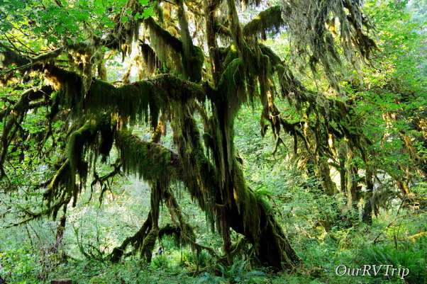
One of our favorite areas in the Olympic NP is the Hoh Rain Forest. We got to the visitor center right before they were closing, but the park was still open for a few more hours so we did the Hall of Mosses trail. Check out that moss! All of the trees on the trail were dripping with green moss. The entire area was green. Green fuzzy moss, green ferns, green grass in the water…it was a lot of green.

Before we made it to the Olympic National Park, I checked the website to do some last minute research on a trail I wanted to do. It’s always a good idea to check the alert section of the NP website you’ll be visiting. This time I learned about a wasp problem. And they weren’t lying. We had a whole group of wasps decide to take up residence under our car. We drove to a gas station and saw a few of them coming out from under the car, but didn’t think much of it. When we got to our next stop by Lake Crescent we’d lost several of them, but almost didn’t make it back in the car. The wasps that were left were not happy with us. We drove to the Sol Duc trail head and lost the rest of the wasps. We didn’t see any when we got out or came back after the hike. Thank goodness! We did see a whole nest of the same wasps on the Hall of Mosses trail.

We found another tall tree that’s now on our list of favorites. The Sitka spruce averages 220 feet tall and looks very cool dripping with moss.

We walked right by this fawn and its mom while we were on the Hall of Mosses trail. They weren’t terribly worried about us.

We found some decent foodies in the Port Angeles area. We had to stop by a local chain called Frugals. It’s a drive through only so we took it back to our home-on-wheels to eat it. It was pretty good considering it was pure fast-food.

There weren’t very many pretties around, but I found a few. I know this is a mushroom…technically a fungus. But I love the colors in it.

And then there was this pretty. It was all alone on one of the trails we hiked. I love how pristine white it is.

We absolutely loved the OP! More than we thought we would.

See y’all down the road!

#westernloop2018

Olympic Peninsula

Olympic Peninsula

Hey Guys! We made it all the way up to the Olympic Peninsula of Washington! This is the farthest north we will go on this loop before we turn south and head for Florida for the winter.

We’d spent the last month in smoky and hot Oregon. We started keeping track of where all of the wildfires were the first week we were in Oregon. It felt like the entire western US was on fire. We managed to keep ahead of it, but it got close a few times. Close enough for ash to fall on us. We’d seen a report that there was a wildfire in the eastern side of the Olympic National Park. So, as you can imagine, we were kind of thrilled to see the rain as we were driving into Washington.

We stayed at a great little RV park right near the old Elwha Dam in Port Angeles. We were there for two weeks, but due to the smoke, we spent quite a bit of that time inside. On days when the smoke receded enough, we headed out to explore. We walked down to the old Elwha Dam one afternoon. We could walk there from our RV park which was great. We meant to go back and follow a trail we found but it ended up not happening.

The Olympic Peninsula (OP) of Washington has quite a large population of Native Americans. I loved seeing the dual language signs everywhere!

Our first drive up to Hurricane Ridge (one of the Olympic NP areas) was a little…foggy. If you’ve been following along on our adventures for awhile, you might remember our Sequoia NP fog experience. If you need a refresher, you can find that here. We got a little worried as we drove up the mountain to get to Hurricane Ridge and it kept getting foggier and foggier. I thought, well…here we go again.

Thankfully, we drove up above the fog/clouds and this was our view. Not bad, right? Some of that is fog or clouds and some of it is smoke. It’s still an impressive vista even with the smoke.

We ended up going back up to Hurricane Ridge on a clear-ish day. You can see in the top picture above how the smoke hung around. The smoke was a constant, but the view was still beautiful. One of the cool things about Hurricane Ridge is that during the winter months, you can snow shoe and ski from there. The NP Service has a little snow cabin for the Ranger’s that’s manned during the winter months.

On one of our full days to explore, we headed out to hike and on the way there we drove by Lake Crescent. It was choked with smoke. We’d heard that the smoke would be coming in that day and we were hoping to get in a hike before we had to retreat back inside.

We made it to the Sol Duc Falls that day and it was gorgeous! You couldn’t even tell the smoke was hanging around while we were hiking. We did start to smell it as we were on our way back to our car though. But the hike was awesome.

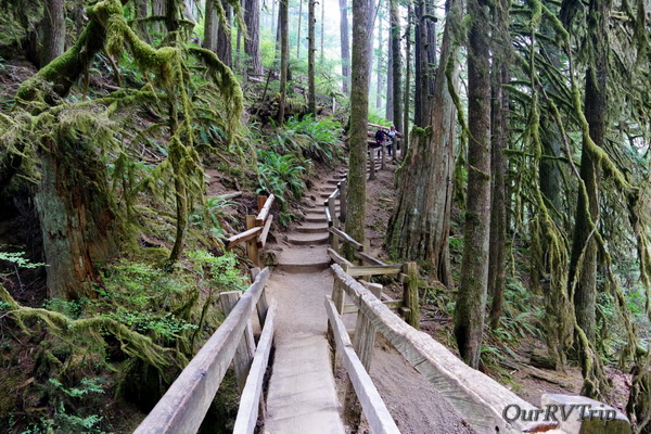
On a different day, we made it to Marymere Falls. The trailhead for this hike was right on the Lake Crescent shore. I loved the trail for this hike! Check out this bridge we walked over. (top right picture) It was an old log that the NPS had fashioned into a sturdy bridge across a stream. And check out all of the moss. This is what I’d always thought this area would look like. I had a specific vision in my mind of what hiking in the OP would be like…and this picture is it. This is what I thought it would be like…what I had hoped it would be like. You know how sometimes you get it in your head that something is going to be a certain way, but then when you get there it’s so different than what you’d thought that it’s a let down? This place totally held up to what I was hoping it would be. Actually, that’s not true…it was better. In the right picture you can see a little stream the bridge took us over. There was a path down to it. You can get a sense of how big the trees are in this area with this picture. Can you find the person in the lower right corner of this pic?

Here’s another picture of Lake Crescent for you. You can see more of it here and you can kind of see just a hint of the beautiful water color.

We saw so many deer! So, so many! And they weren’t real shy. Guys, don’t try to pet or feed the wildlife. We saw a few people actually trying to take selfies and feed/pet the wildlife. Don’t do that. If you frighten the animal and it harms you…the animal is the one who will suffer. Some parks are required to put down any animal who’s harmed a human. So, just don’t do it. Admire them from afar…take pics from afar, but let them stay wild. Oh! And Guys…check out the blue of this bird! It reminds me so much of the blue water in Crater Lake! There were a couple of these birds playing around while we did the Marymere Falls hike.

I’m realizing that there are tons more pics I want to add on to this post…so I’m going to break it up into two posts. I’m going to show you some foodies we found…and pick up with some more explorations on the next post!

Lets talk foodies for a minute! We hit a BBQ place our first night in the area. It was pretty good! Check out the sandwich one of the boys got. Huge! They ate it all. There wasn’t anything left. We found this little burger place in Forks while we were out exploring one day. You can’t tell, but that burger is huge! Huge! It’s sitting on a regular sized dinner plate. It was and 8″ or 9″ plate. Alex laid waste to this burger. Teenagers…whattaya gonna do? You’ve got to feed them. It’s a good thing we have a residential sized refrigerator in our home-on-wheels!

I found this pretty up on Hurricane Ridge during one of our excursions. Love the purple pretties!

Well, I’m going to leave off here this time. I’ll pick back up with some more OP adventures next time so stay tuned!

See y’all down the road!

#westernloop2018

Portland Area Part Two

Portland Area Part Two

Hey Guys!! We stayed in the Portland area for two weeks and we tried to squish as much as we could into those two weeks. We didn’t see everything on our list…but we came close.

Most of the time we spent in this area was smoky but we were lucky enough to have a couple of sun filled days to take in the views. We found a great overlook that gave us a nice view of Mount Hood. You can see the haze of smoke in the picture above.

Fort Vancouver was a British fur trading post built in 1824. The National Park Service has done an excellent job recreating Fort Vancouver. When I was looking it up online, I wasn’t sure if it was going to be much more than a partial fence and a building or two…it was really hard to tell online.

There was a volunteer manning the blacksmith building. If you ever really want to get a feel for what life was like while you’re at one of these forts…talk to the volunteers. The volunteers that choose to spend their time teaching the public about what life was like during certain areas or times are some of the most knowledgeable and passionate people we’ve met. We got to see what it took to make just one nail while we were in the blacksmith shop. He talked to us about how anytime the people in the fort needed anything they had to make it themselves. Want a house…better start making nails. Some of the blacksmiths back then could make 100s of nails an hour. The best ones could make 1000s of nails per hour. It took our volunteer a few minutes to make one. The blacksmith was one of the most important people in any settlement and usually made the most money.

The other building that had volunteers present the day we went was the carpenter’s building.  They were making some chairs while we were there.

Due to the lack of funding right now, there was only one Ranger on site and just a handful of volunteers so several of the buildings were locked up. One of the volunteers offered to show us the fur trading building where the area’s settlers would bring in their furs to get money or trade for other items. The biggest money maker was the beaver fur that the top hats were made of. Any respecting gentleman had a top hat made of beaver fur. They would bring the furs in all bundled up in 50 pound packs like the ones in the above left picture. The furs were inspected and weighed before a price was agreed upon.

There was a separate trading building for the Native Americans of the area. One family at a time was let into the fort to trade. When one family left another was let in.

I loved the garden at the fort! Look at all of those pretties! Y’all know my love affair with pretties. I can’t tell you how many pics of different flowers I took…probably more than what was necessary. Ha! The garden was full of life. Bees buzzing around…birds flitting about…I do love a good garden.

Pearson Air Museum is in the same area as Fort Vancouver. I believe the two parks are run jointly. The museum is dedicated to preserving the aviation history of the area. There are some very cool planes and exhibits in an old hangar.

The museum also keeps the history of the old mill that used to be in the area. I love this mural of the lumber mill that helped supply the WWI construction of biplanes. This was a great little museum that had a surprising amount of history and information crammed in it. We could have spent several hours here, but we’d spent all morning at Fort Vancouver and some of us were starting to get a little…hangry and needed food.

I knew there was a lot to do in the Portland area, but I really didn’t know just how much there would be to do! Maybe one day we’ll find ourselves back in the area.

See y’all down the road!

#westernloop2018

Hello Oregon!

Hello Oregon!

Hey Guys! We spent two hot and smoky weeks in Central Point, OR.

I was a little worried about this drive day. I’d heard that highway 199 between Central City, CA and Grant’s Pass, OR could be a bit of a white knuckler. Lots of narrow winding roads combined with steep grades. The thought of it kept me up the night before. It turned out to be…not so bad. There were spots of narrow winding roads…there were definitely some steep grades up and down…but, we’d been on worse roads and Jerl handled it like a pro.

I’d been preparing myself for a stressful drive day…I was prepared for it. What I wasn’t prepared for was how stinkin’ pretty the drive was! We followed this river for quite some time and the coloring of it was just…wow! I tried several times to get a good shot of it as we were navigating the road. It’s not the greatest shot, but you can get an idea of how pretty the area was.

The RV park we stayed in was in a great location and at an even better price. After three months of steep California prices we were ready to get back to some more reasonable rates.

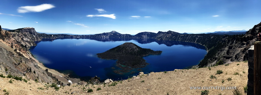
The main thing we wanted to do while in Central Point was visit Crater Lake National Park. The day we went was a gorgeous day with an amazing blue sky and temps in the 80s. Check out the blue of that water! There’s an old Native American legend that says the blue bird was actually black until it took a dip into the water of Crater Lake. With a depth of 1,943 feet, Crater Lake is the deepest lake in the US and the seventh deepest lake in the world. It’s a combination of that depth and it’s source of water that gives the lake that incredible inky blue color.

The boys have vests and hats that they put all of their Junior Ranger badges on. They usually just wear them into the Visitor Center at each park to do the Rangering and then they take them off to do any exploring. It would totally stink to lose a badge somewhere. So, usually not too many people see them in their Rangering gear, but at Crater Lake we had to park farther away from the Visitor Center and the boys ended up wearing their gear down to one of the overlooks…and people kind of went nuts over it. I lost count of how many people wanted pictures of/with them or they wanted to just talk to them. The boys didn’t really know what to think of it all. They don’t do it for the attention or to grab more bling. They genuinely enjoy the learning.

Once we finished up with the Rangering we took off on Rim Drive. Rim Drive is around 38 miles and takes you all the way around Crater Lake.

Pumice Castle is 200 feet high and is the result of an eruption that took place 70,000 years ago.

The day we went to Crater Lake NP it was crazy busy. We figured we would end up eating in our car surrounded by other cars, but we ended up having an entire pull-off all to ourselves. We got out and sat on the wall and enjoyed a few minutes of quite solitude as we ate our picnic lunch. It was nice to get away from the crowds for awhile…and the view wasn’t bad either. ;-P

Phantom Ship is what remains of one of the mountain’s original cones…back around 400,000 years ago. From the view point on Rim Drive, Phantom Ship looks small, but it stands at an impressive 160 feet high. Can you see that teeny tiny why dot in between Phantom Ship and the edge of the caldera? That’s a real boat. If you look closely you can also see it in the big panorama picture earlier in the post. You can buy boat tickets to tour around the lake. We opted not to do the boat tour this time, but look forward to doing it next time.

If you’re looking for a nice day hike, you can walk all the way around the rim on the Rim Trail. We decided not to do this hike. We did walk a tiny bit of it while we were checking out some of the overlooks, but that’s it. We saw a few people who looked like they were going to try to do the whole hike, but it wasn’t our kind of hike. The trail was close to the road a lot and really…its pretty much the same view for the entire hike. A beautiful view…but the same view. If I’m going to go on a hike like that…it’s got to have a big payoff at the end in the form of a stellar vista or something.

Crater Lake was formed when the caldera of Mount Mazama filled in with rain and snow water. We’ll never know for sure what the 12,000 foot high volcano really looked like, but there are clues as to what features it held. When Mount Mazama exploded around 7,700 years ago it was forty-two times greater than the explosion of Mount St. Helen’s in 1980.

During our second week in Central Point there was a thunder storm and the lightening from that storm started a fire. (Top picture) We could see the smoke from our RV park. We watched it all week. Some days it seemed to be about out and other days it would roar back to life. It was far enough away that we weren’t too worried about it. And then we heard that a homeless person was trying to cook something with fire and it got away from them. (bottom left picture) It was close enough that we were worried about being able to escape if we needed to. The park was put on level two alert, but luckily this fire was put out by that evening. Between these two fires and a fire up north near the Grant’s Pass area…our park was filling with smoke and ash from all the fires started falling like snow on our RV park.

Before the valley filled with smoke, we were treated to some spectacular sunsets!

It was a busy two weeks. Along with exploring, we celebrated Charles’ birthday,

the boys started back to school,

and we celebrated our 21st anniversary!

We found some pretty tasty foodies during this stop! There was a cashew chicken noodle thing (left picture). Yup, that’s the actual name. Cashew Chicken Noodle Thing. Not really, but I can’t remember what it was called. It’s my new favorite Asian dish. It was so good everyone else “helped” me eat it. Wasn’t that nice of them?! Ha! I didn’t mind. The portions at this place were huge! We also found a really great little burger/brewery place. There’s a burger under that pile of jalapeno slaw…I promise. So far, we’ve been super impressed with the foodie finds in Oregon!

There weren’t very many pretties. It was full on summer and super hot and dry, but I did find this one pink pretty.

We didn’t do much exploring during these two weeks for various reasons…school, work, celebrations, smoke, heat… but we enjoyed the slower pace after four weeks of non-stop going.

See y’all down the road!

#westernloop2018

Redwoods and Fern Canyons

Redwoods and Fern Canyons

Hey Guys!! We spent one week in Myers Flat so we could spend some more time amongst the tall trees we’ve come to love so much.

When we got to our RV park we realized that the Verizon service they’d promised on the phone wasn’t there. I couldn’t even pull up Facebook on my phone and Jerl had a real bugger of a time trying to work. If we’d been planning on staying for more than a week we would have had to find a place with better connectivity and move.

Redwood National and State Parks are home to the world’s tallest trees. The two parks protect almost half of the remaining old growth redwoods left in the world. We spent some time in the midst of the giant sequoia trees earlier this year while we were in Sequoia National Park and completely fell in love with tall trees. The first full day we had in the area we went to Redwood National and State Parks. We started in the National Park with the Lady Bird Johnson Grove trail where we spent some time tripping on things in the trail because our necks were craned back looking up at the tall trees.

The coastal redwood is the tallest living thing on earth. It’s hard to believe that something so big can grow from something the size of a tomato seed.

There’s a good sized herd of Roosevelt Elk in the area. We’ve seen a lot of warning signs in our travels, but this was the first time we’ve seen a sign like this. Don’t mess with the mamas. They will hoof you.

Fern Canyon. You might recognize it from Jurassic Park II. I can’t remember where I first heard about Fern Canyon, but I knew right away it was a spot I really wanted to see. In all of the pics I saw of the one mile gorge, there were little bridges over all of the water crossings…but when we got there…there weren’t any bridges. None. Plenty of water in the little creek that runs through the gorge though! At first we tried to keep our shoes dry by walking on strategically placed rocks and logs.

It wasn’t long before we realized we were going to get wet so we rolled up our pant legs and waded through the water. We had the best time! Fern Canyon has fifty foot walls that are draped with seven different kinds of ferns. When you’re walking through it, it’s easy to imagine huge dinosaurs rambling through the canyon munching on all of the ferns.

When we know that we’re going to be out all day exploring in remote areas we like to pack a picnic lunch. Most times we end up eating in our car somewhere, but check out the view we had at this picnic! Not bad, right? It was a gorgeous day for a picnic by the ocean.

On the way home we stopped at Patrick’s Point State Park. We walked the trail out to Wedding Rock. The view was pretty amazing. And check out that black rock! We’d seen some black sand beaches around…I guess we know where the black sand comes from.

We also walked out to Agate Beach. We were told you can find agates there. We picked up some rocks, but I really don’t know if they’re actually agates. It doesn’t matter though…we love them. It’s hard to tell in this picture, but the sand was a black-ish sand.

So, I’ve only told you about one day of the week that we spent in Myers Flat. Instead of making one really long post, I’m going to break this week up into two posts. We found the pink flower in the Lady Bird Johnson Grove. There were several trees with the blooms on them throughout the trail. Bright pops of pink in a sea of green. It was pretty magical.

See y’all down the road!

#westernloop2018

Bodega Bay

Bodega Bay

Hey Guys! Remember when we had to change all of our plans because of engine trouble and eye surgery? Bodega Bay wasn’t originally in our plans, but when I was reworking our schedule I added it in on a whim. It’s just north of San Francisco and I don’t usually have such small travel jumps, but something about the area called to me…so I answered.

Bodega Bay is, as you might guess…right on the water. It’s kind of a white knuckley drive down highway one to get there, but Guys, we loved the area! The RV park we stayed in was near enough to the coast that we could hear the boats and water, but far enough that we were somewhat protected from the wind that seems to be a constant on the west coast.

We only had one week in Bodega Bay. That means we really only had one full day of exploration. We started out early in the morning and headed down to Point Reyes National Seashore. When we took off that morning it was a gorgeously sunny day with just a few specs of clouds but as we drove south to Point Reyes NS the clouds and fog started creeping in.

By the time we made it to Point Reyes it was sooo foggy and windy!! We tried to go out to the Point Reyes Lighthouse, but Guys…it was so incredibly windy and foggy we could barely see the road that you have to walk up to get to the lighthouse. We talked to the Ranger sitting in his car up at the lighthouse gate (it was bad enough that even he didn’t want to get out of his car) and he let us know that the lighthouse was open, but it was about a half mile walk to get to it. We opted out. As much as we love lighthouses…it was just too windy, wet, and cold. We did stop at Drake’s Beach! Love those cliffs!

I always try to give you a size comparison. Here’s a shot of the boys standing next to those cliffs on Drake’s Beach. With the weather being kind of…miserable…we didn’t have to share the beach with too many people. I mean, really, what kind of a nutter goes to the beach when it’s in the 40s and is super windy with fog? Well, the nomad nutters do. Yup. When you have a set time at a location, you go explore no matter what the weather (within reason) does or you miss out.

We found several sand dollars, a few shells, and some tide pools! They weren’t big tide pools, but we did enjoy the little sea anemones in them.

While I prefer to have beautiful sunny days to explore, I have to admit…I’m kind of digging the moodiness that the fog gave my pictures of Drake’s Beach. I guess it’s ok to have mood…sometimes.

The weather was so miserable that day we almost gave up on adventuring and went home. I’m so glad we stuck it out and headed up to Fort Ross State Historic Park which was about an hours drive north of where we were staying. We got there later in the day and only had about an hour to explore it. We do love our forts. It’s not unusual for us to get lost in a fort for half a day or more. So, we really had to rush through this one.

Fort Ross was established in 1812 for the primary purpose of finding food and hunting sea otters for their furs to support the Russian outposts in Alaska. Some of the buildings have been reconstructed and decorated to look close to what they would have looked like during the time the fort was up and running. There’s so much history that can be learned at forts like this. Most of what we’ve learned by visiting all of these forts isn’t taught in the general history books, but history is an important lesson.

On our way home from our foggy day of exploration we stopped at this pull-off to take in the view of the spot where the Russian River dumps into the pacific ocean. We noticed a crowd of people down on the beach all ogling a particular spot on the beach in between us. Guys! Seals! There was a ton of them! We found out later that the beach is called Goat Rock Beach and apparently, the seals are there often.

This is another shot of Goat Rock Beach on a different day. We tried to get out each afternoon during our week in the Bodega Bay area to get some more exploring done.

There are tons of pull-offs to take in the amazing views all along this section of highway one. We spent most of the afternoons at one of the pull-offs or beaches in the Sonoma Coast State Park. We loved our week along this rugged coast. I don’t think any of us were really ready to move on.

Let’s talk foodies. Right in front of where we stayed was this great little Mexican restaurant. We stopped in our first night and kind of wished we hadn’t. It was really good and way too close…we walked there. We also found a place right on the wharf where we got some great fish-n-chips! We’re getting our fill of all of the coastal fish-n-chips while we can.

I started seeing these in the supermarkets when we were in San Diego, but I kept resisting. We found them for sale singely at a little market in Bodega Bay though…so we tried them. Guys…do you see the two oatmeal cookies? These were so wrong that they were so right. I thought I’d be safe enough…we only had one more week in California at this point. I was really hoping I wouldn’t be able to find them once we got out of California…but, we’re in Oregon right now and…I saw them in the grocery store here! I may have to grab a box before we leave…I’m trying to be strong…but y’all know I’m a sugarholic… The struggle is real.

I love love love these pink and purple pretties! We found these at Fort Ross.

We had a great week exploring the coast here!

See y’all down the road!

#westernloop2018