Category: Foodie Find

Troutdale, OR

Troutdale, OR

Hey Guys! We spent two weeks in Troutdale, OR so we could check out Portland and see the Columbia River Gorge area.

We really enjoyed staying in Troutdale. It was a cute little town and was close to pretty much everything we wanted to check out in the area.

The RV park we stayed in was right by the river. On weekends it was crazy busy, but through the week it wasn’t too bad. There were tons of marionberry bushes all loaded with ripe berries down by the river and the boys would walk down with me to help pick some. They would eat a few then wander off to the river. Honestly, I think I ended up with more berries in the bowl without their help, but I appreciated the company. We enjoyed fresh marionberries daily while we stayed at this park! Yum!!

At a local food chain called Burgerville we found an amazing marionberry shake! It was so good!

My favorite thing about the location of this RV park was it’s proximity to the river and all of the available walking paths we had. We like to get out and walk around everyday. Some parks make this easier than others. At this one we could walk down by the river, then make our way over to the main street of Troutdale. We could easily spend more time in this area. Troutdale is the cutest little town with art dotted here and there down the main street. We made ourselves a walking loop we liked to do in the evenings. Down by the river then up to the main street and back. We’d get right around 2 miles in when it was all said and done.

Location, location, location. Our home-base for the area was right next to the Columbia River Gorge. The Columbia River Gorge is where the Columbia River makes its way through the area by cutting a path right into the Cascade mountains. If you drive the Historic Columbia River Highway, you’ll come across some amazing waterfalls! This one is a popular one called Multnomah Falls and it’s right off the highway. You don’t have to put in a long arduous hike to get to this one which makes it nice and quick to visit but also is probably why this place was absolutely packed when we got there one morning. We were lucky to find a parking spot! To get to the falls you have to walk in a tunnel that goes under the highway and then under a railroad track. A train went by while we were there…I have to admit that the crowd and the location of the highway/train kind of detracts from the beauty of the falls.

If you stay on the Historic Columbia River Highway you’ll come to the Portland Women’s Forum State Scenic Viewpoint. From the road, it doesn’t look like much. When we pulled in, there was one other car…and I think the guy was living out of his car and staying there over night. But, we pretty much had the place to ourselves to ogle the view. And what a view it was! In the picture above you can see the Vista House sitting up on the cliff over to the right of the picture. That’s where most people go and that’s where we were headed when we saw this little gem of a pull-off.

When we eventually got back in the car and headed to the Vista House, it was packed. There were so many people even though the Vista House was closed. We got there just before they officially closed. I barley had enough time to grab a couple of souvenirs. We hoped that everyone would leave after closing, but we definitely weren’t the only ones hanging around for the view. It is a great view, but I’ll be honest…I think I prefer the view from the Portland Women’s Forum State Scenic Viewpoint.

Now, y’all know we love our foodies. And y’all have probably heard how Portland, OR is a huge foodie town. One of the things we wanted to experience is the famed Portland food truck scene. There are several areas of Portland that have a big gathering of food trucks…they call them Food Cart Pods. We did a little research on what was where and landed at this pod. I don’t remember what it was called, but it had food options for everyone. Charles got some Asian, a couple of us got Polish food, Nicholas had Mexican, and then one of us had Salvadorian food! I expected it to be a fast food setup with everything disposable, but some places had actual plates that you return to them when you’re done. There were tables to sit at while we ate. We were very pleasantly surprised by our food pod experience. We tried to go to a different one while we were in the area, but it didn’t work out. We went on a Sunday and tons of the carts were closed and there wasn’t a place to sit down to eat…so we passed.

But Guys…Portland did not disappoint with the foodies. Not even a little. It’s probably a good thing we were only there for two weeks…there are so many foodie spots to try!

We squished quite a few adventures into the two short weeks we had in the Troutdale area so I’m going to break this area up into two posts. I’ll leave you with these two pretties that we saw on one of our evening walks.

Stay tuned for part two!

See y’all down the road!

#westernloop2018

Salem, OR

Salem, OR

Hey Guys! We spent one week in Salem, OR exploring the area.

When we left Central Point we were surrounded by wildfires. The RV park was filling with smoke, it was extremely hot and dry, and Guys…we were just so ready to head north to try and get away from it all. When we started out to our next spot, we headed up I-5 and the smoke started getting worse. We got a little worried it would get too thick to drive through, but as we got up out of the valley, the smoke cleared and it turned into a beautiful day.

One of the things we always love to see is what each state looks like…topography, agriculture, different architectural styles…sometimes it surprises us. Like Oregon. We saw so many huge hay fields. Hay as far as the eye could see! It was all mowed down and ready for harvesting, but it still looked really neat. And dry. It’s no wonder why Oregon is a fire hazard every summer.

The main reason we spent time in Salem was to visit the State Capitol Building. Right from the start, I liked this one. Most of the SCBs look something like the National one in DC so it’s nice when we find one that’s different. I wasn’t expecting a dome, but check this one out! I love the patriotic theme of it. The Oregon SCB wasn’t flashy and it wasn’t huge. It didn’t have every square inch covered in decoration but, there were some very nice murals and they used marble from all over the country. It was very tasteful and simplistic. What decorations there were all had meaning.

We added our Oregon sticker! The map is looking kind of full! It’ll be a month before we get to add the Idaho sticker as we start making our way south for the winter.

We heard about a Silver Falls State Park a few weeks before we got to the Salem area. It wasn’t too far from where we were staying so we went to check it out. The most popular trail there is the Trail of Ten Falls. It’s a ten mile trail that takes you by ten falls.

The day we went it was over 100 degrees. It was so so hot. With no breeze. We decided we’d check out two of the falls, but it was just too uncomfortable to try to do all ten miles. We did see some of the local wildlife. This guy wasn’t interested in us at all, he was trying to find place to cool off.

This area of Oregon was shaped by lava flows. Some geologists think there were around eight different lava flows layered up one on top of another in the Silver Falls SP area. Some layered up to as much as 600 feet thick. One of the coolest things about this SP is that the trail actually goes behind some of the waterfalls! Not only was it neat to walk behind a waterfall and look through it…the cooling mist coming off of the waterfall was very welcome. We might have lingered longer than necessary. Ha!

Foodies! Some friends of ours (waves at the McConnels) told us about a BBQ place in the area so we went to check it out. It was so good! Check out that tray full of food! Yum!

It’s getting harder to find pretties…this summer season has been so hot and dry the flowers are either all dried up or too far away to get a decent picture of.

We enjoyed the Salem area more than we thought we would! We would totally visit the area again…during cooler weather.

See y’all down the road!

#westernloop2018

Hello Oregon!

Hello Oregon!

Hey Guys! We spent two hot and smoky weeks in Central Point, OR.

I was a little worried about this drive day. I’d heard that highway 199 between Central City, CA and Grant’s Pass, OR could be a bit of a white knuckler. Lots of narrow winding roads combined with steep grades. The thought of it kept me up the night before. It turned out to be…not so bad. There were spots of narrow winding roads…there were definitely some steep grades up and down…but, we’d been on worse roads and Jerl handled it like a pro.

I’d been preparing myself for a stressful drive day…I was prepared for it. What I wasn’t prepared for was how stinkin’ pretty the drive was! We followed this river for quite some time and the coloring of it was just…wow! I tried several times to get a good shot of it as we were navigating the road. It’s not the greatest shot, but you can get an idea of how pretty the area was.

The RV park we stayed in was in a great location and at an even better price. After three months of steep California prices we were ready to get back to some more reasonable rates.

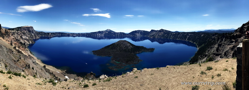
The main thing we wanted to do while in Central Point was visit Crater Lake National Park. The day we went was a gorgeous day with an amazing blue sky and temps in the 80s. Check out the blue of that water! There’s an old Native American legend that says the blue bird was actually black until it took a dip into the water of Crater Lake. With a depth of 1,943 feet, Crater Lake is the deepest lake in the US and the seventh deepest lake in the world. It’s a combination of that depth and it’s source of water that gives the lake that incredible inky blue color.

The boys have vests and hats that they put all of their Junior Ranger badges on. They usually just wear them into the Visitor Center at each park to do the Rangering and then they take them off to do any exploring. It would totally stink to lose a badge somewhere. So, usually not too many people see them in their Rangering gear, but at Crater Lake we had to park farther away from the Visitor Center and the boys ended up wearing their gear down to one of the overlooks…and people kind of went nuts over it. I lost count of how many people wanted pictures of/with them or they wanted to just talk to them. The boys didn’t really know what to think of it all. They don’t do it for the attention or to grab more bling. They genuinely enjoy the learning.

Once we finished up with the Rangering we took off on Rim Drive. Rim Drive is around 38 miles and takes you all the way around Crater Lake.

Pumice Castle is 200 feet high and is the result of an eruption that took place 70,000 years ago.

The day we went to Crater Lake NP it was crazy busy. We figured we would end up eating in our car surrounded by other cars, but we ended up having an entire pull-off all to ourselves. We got out and sat on the wall and enjoyed a few minutes of quite solitude as we ate our picnic lunch. It was nice to get away from the crowds for awhile…and the view wasn’t bad either. ;-P

Phantom Ship is what remains of one of the mountain’s original cones…back around 400,000 years ago. From the view point on Rim Drive, Phantom Ship looks small, but it stands at an impressive 160 feet high. Can you see that teeny tiny why dot in between Phantom Ship and the edge of the caldera? That’s a real boat. If you look closely you can also see it in the big panorama picture earlier in the post. You can buy boat tickets to tour around the lake. We opted not to do the boat tour this time, but look forward to doing it next time.

If you’re looking for a nice day hike, you can walk all the way around the rim on the Rim Trail. We decided not to do this hike. We did walk a tiny bit of it while we were checking out some of the overlooks, but that’s it. We saw a few people who looked like they were going to try to do the whole hike, but it wasn’t our kind of hike. The trail was close to the road a lot and really…its pretty much the same view for the entire hike. A beautiful view…but the same view. If I’m going to go on a hike like that…it’s got to have a big payoff at the end in the form of a stellar vista or something.

Crater Lake was formed when the caldera of Mount Mazama filled in with rain and snow water. We’ll never know for sure what the 12,000 foot high volcano really looked like, but there are clues as to what features it held. When Mount Mazama exploded around 7,700 years ago it was forty-two times greater than the explosion of Mount St. Helen’s in 1980.

During our second week in Central Point there was a thunder storm and the lightening from that storm started a fire. (Top picture) We could see the smoke from our RV park. We watched it all week. Some days it seemed to be about out and other days it would roar back to life. It was far enough away that we weren’t too worried about it. And then we heard that a homeless person was trying to cook something with fire and it got away from them. (bottom left picture) It was close enough that we were worried about being able to escape if we needed to. The park was put on level two alert, but luckily this fire was put out by that evening. Between these two fires and a fire up north near the Grant’s Pass area…our park was filling with smoke and ash from all the fires started falling like snow on our RV park.

Before the valley filled with smoke, we were treated to some spectacular sunsets!

It was a busy two weeks. Along with exploring, we celebrated Charles’ birthday,

the boys started back to school,

and we celebrated our 21st anniversary!

We found some pretty tasty foodies during this stop! There was a cashew chicken noodle thing (left picture). Yup, that’s the actual name. Cashew Chicken Noodle Thing. Not really, but I can’t remember what it was called. It’s my new favorite Asian dish. It was so good everyone else “helped” me eat it. Wasn’t that nice of them?! Ha! I didn’t mind. The portions at this place were huge! We also found a really great little burger/brewery place. There’s a burger under that pile of jalapeno slaw…I promise. So far, we’ve been super impressed with the foodie finds in Oregon!

There weren’t very many pretties. It was full on summer and super hot and dry, but I did find this one pink pretty.

We didn’t do much exploring during these two weeks for various reasons…school, work, celebrations, smoke, heat… but we enjoyed the slower pace after four weeks of non-stop going.

See y’all down the road!

#westernloop2018

Bodega Bay

Bodega Bay

Hey Guys! Remember when we had to change all of our plans because of engine trouble and eye surgery? Bodega Bay wasn’t originally in our plans, but when I was reworking our schedule I added it in on a whim. It’s just north of San Francisco and I don’t usually have such small travel jumps, but something about the area called to me…so I answered.

Bodega Bay is, as you might guess…right on the water. It’s kind of a white knuckley drive down highway one to get there, but Guys, we loved the area! The RV park we stayed in was near enough to the coast that we could hear the boats and water, but far enough that we were somewhat protected from the wind that seems to be a constant on the west coast.

We only had one week in Bodega Bay. That means we really only had one full day of exploration. We started out early in the morning and headed down to Point Reyes National Seashore. When we took off that morning it was a gorgeously sunny day with just a few specs of clouds but as we drove south to Point Reyes NS the clouds and fog started creeping in.

By the time we made it to Point Reyes it was sooo foggy and windy!! We tried to go out to the Point Reyes Lighthouse, but Guys…it was so incredibly windy and foggy we could barely see the road that you have to walk up to get to the lighthouse. We talked to the Ranger sitting in his car up at the lighthouse gate (it was bad enough that even he didn’t want to get out of his car) and he let us know that the lighthouse was open, but it was about a half mile walk to get to it. We opted out. As much as we love lighthouses…it was just too windy, wet, and cold. We did stop at Drake’s Beach! Love those cliffs!

I always try to give you a size comparison. Here’s a shot of the boys standing next to those cliffs on Drake’s Beach. With the weather being kind of…miserable…we didn’t have to share the beach with too many people. I mean, really, what kind of a nutter goes to the beach when it’s in the 40s and is super windy with fog? Well, the nomad nutters do. Yup. When you have a set time at a location, you go explore no matter what the weather (within reason) does or you miss out.

We found several sand dollars, a few shells, and some tide pools! They weren’t big tide pools, but we did enjoy the little sea anemones in them.

While I prefer to have beautiful sunny days to explore, I have to admit…I’m kind of digging the moodiness that the fog gave my pictures of Drake’s Beach. I guess it’s ok to have mood…sometimes.

The weather was so miserable that day we almost gave up on adventuring and went home. I’m so glad we stuck it out and headed up to Fort Ross State Historic Park which was about an hours drive north of where we were staying. We got there later in the day and only had about an hour to explore it. We do love our forts. It’s not unusual for us to get lost in a fort for half a day or more. So, we really had to rush through this one.

Fort Ross was established in 1812 for the primary purpose of finding food and hunting sea otters for their furs to support the Russian outposts in Alaska. Some of the buildings have been reconstructed and decorated to look close to what they would have looked like during the time the fort was up and running. There’s so much history that can be learned at forts like this. Most of what we’ve learned by visiting all of these forts isn’t taught in the general history books, but history is an important lesson.

On our way home from our foggy day of exploration we stopped at this pull-off to take in the view of the spot where the Russian River dumps into the pacific ocean. We noticed a crowd of people down on the beach all ogling a particular spot on the beach in between us. Guys! Seals! There was a ton of them! We found out later that the beach is called Goat Rock Beach and apparently, the seals are there often.

This is another shot of Goat Rock Beach on a different day. We tried to get out each afternoon during our week in the Bodega Bay area to get some more exploring done.

There are tons of pull-offs to take in the amazing views all along this section of highway one. We spent most of the afternoons at one of the pull-offs or beaches in the Sonoma Coast State Park. We loved our week along this rugged coast. I don’t think any of us were really ready to move on.

Let’s talk foodies. Right in front of where we stayed was this great little Mexican restaurant. We stopped in our first night and kind of wished we hadn’t. It was really good and way too close…we walked there. We also found a place right on the wharf where we got some great fish-n-chips! We’re getting our fill of all of the coastal fish-n-chips while we can.

I started seeing these in the supermarkets when we were in San Diego, but I kept resisting. We found them for sale singely at a little market in Bodega Bay though…so we tried them. Guys…do you see the two oatmeal cookies? These were so wrong that they were so right. I thought I’d be safe enough…we only had one more week in California at this point. I was really hoping I wouldn’t be able to find them once we got out of California…but, we’re in Oregon right now and…I saw them in the grocery store here! I may have to grab a box before we leave…I’m trying to be strong…but y’all know I’m a sugarholic… The struggle is real.

I love love love these pink and purple pretties! We found these at Fort Ross.

We had a great week exploring the coast here!

See y’all down the road!

#westernloop2018

San Francisco Part Two

San Francisco Part Two

Hey Guys!! We stayed in the Vacaville area for two weeks while we explored the San Francisco area.

Vacaville was about forty-five minutes away from San Francisco so it really suited us well. Far enough away to avoid the crush of so many people on a daily basis, but close enough that we were able to spend two days explore San Francisco.

We passed by this field every time we went toward the Bay area. Do you see the little outhouse? It’s quite the outhouse! Complete with modern plumbing…but no door…and facing a highway. Oh the things we see…

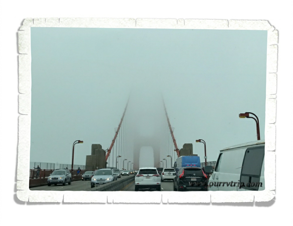
Y’all know that big cities aren’t really our thing. In fact, we usually skip them, but I wanted to see the big red bridge. Our first day in San Francisco was on a weekend and boy let me tell you…the crowds were insane! It took us quite a bit of time to find a parking space anywhere near the bridge, but we eventually did. It was cold and super windy. Apparently, that’s a typical summer day for San Francisco. By the time we walked to the bridge that famous San Francisco Bay fog had started rolling in.

We waded through the crowds to snap some pictures of the view then hightailed it back to the warmth of our car. This was as close as we got to Alcatraz. Timing and tickets weren’t on our side this trip. I’m hoping to revisit the area someday, but like I said before…big cities aren’t really our thing…so, we’ll see. We made our way down to Fisherman’s Wharf to do some more sight seeing, but the crowds were just too thick for us so we decided to leave.

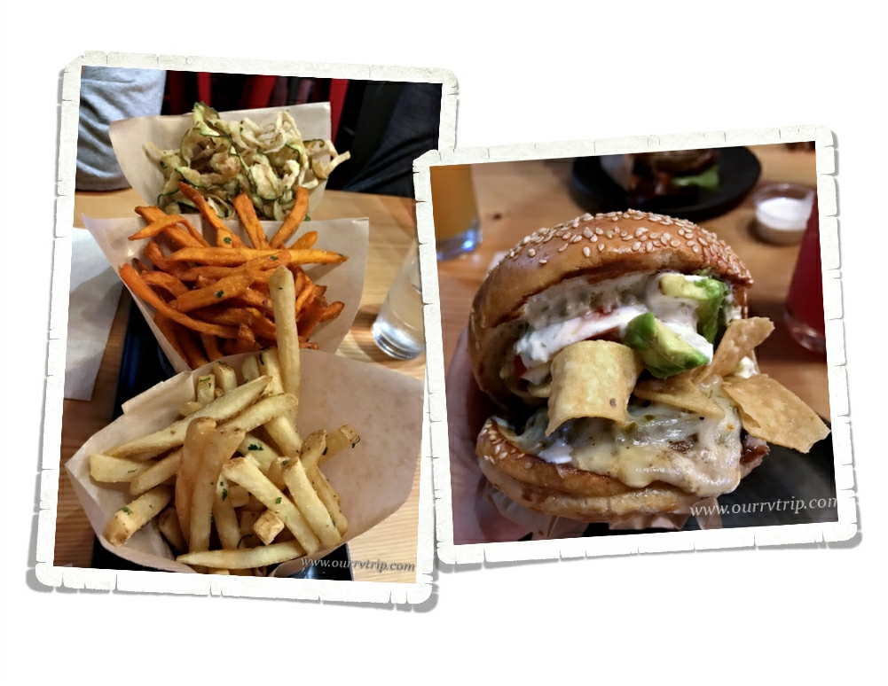
We headed out in search of food and found ourselves at a place called Roam. Do you see that burger in the picture? I somehow got my mouth around it (no comments please) and promptly realized that this burger was definitely on my list of top five burgers…near the top. We got the Fry-Fecta to go along with our burgers. My favorite of the three choices was the fried zucchini/onion spirals. We left reminiscing about all of the other burgers we’ve had while trying to decide which burger is on the top of our list of favorites. We all agreed it was a green chili cheeseburger, but we’re divided as to exactly which one.

By the time we were crossing back over the bridge to head home the fog had rolled fully in. It was a little eerie crossing over the water without being able to see it.

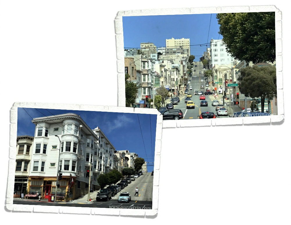
Our second excursion into the city was during the week. We made the trip first thing in the morning to avoid as much of the crowd as we could. We found Fisherman’s Wharf much less crowded. And Guys, check out the famous San Francisco hills. It’s hard to really see how steep it is in pictures…you can see the slope of it better in the bottom picture. Driving up one of the steeper hills felt kind of like the beginning of a roller-coaster. You know…the very beginning when you’re click, click, clicking slowly to the top of the hill so you can plummet down the other side. I feel like it would definitely be more terrifying to go plummeting down one of these steep San Francisco hills.

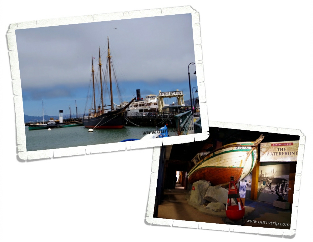
Our first stop was the San Francisco Maritime National Historical Park where we learned about the city’s seafaring past. There’s a nice little museum at the Visitor’s Center where the boys got their Junior Ranger booklets, but the best part is right across the street, over at the Hyde St. Pier where you can walk around and explore some older ships.

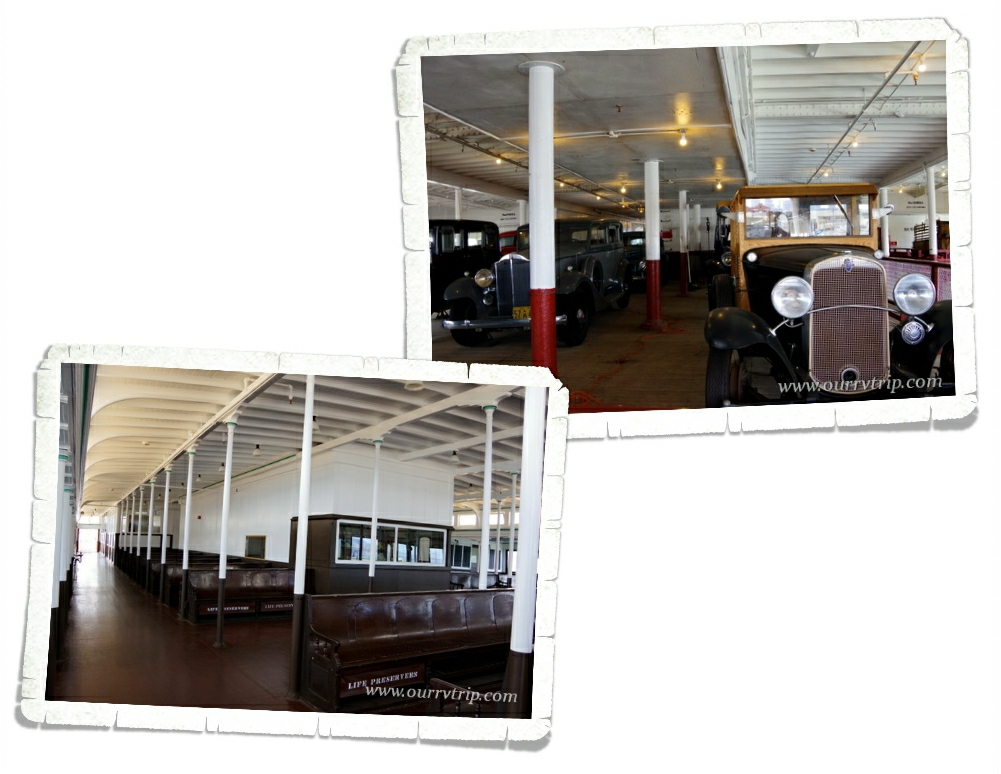
We walked around an old passenger ferry named Eureka. Eureka started out as a ship named Ukiah that used to transport munition filled railroad cars. We loved walking through all of the old cars and the upper level where the passengers would ride.

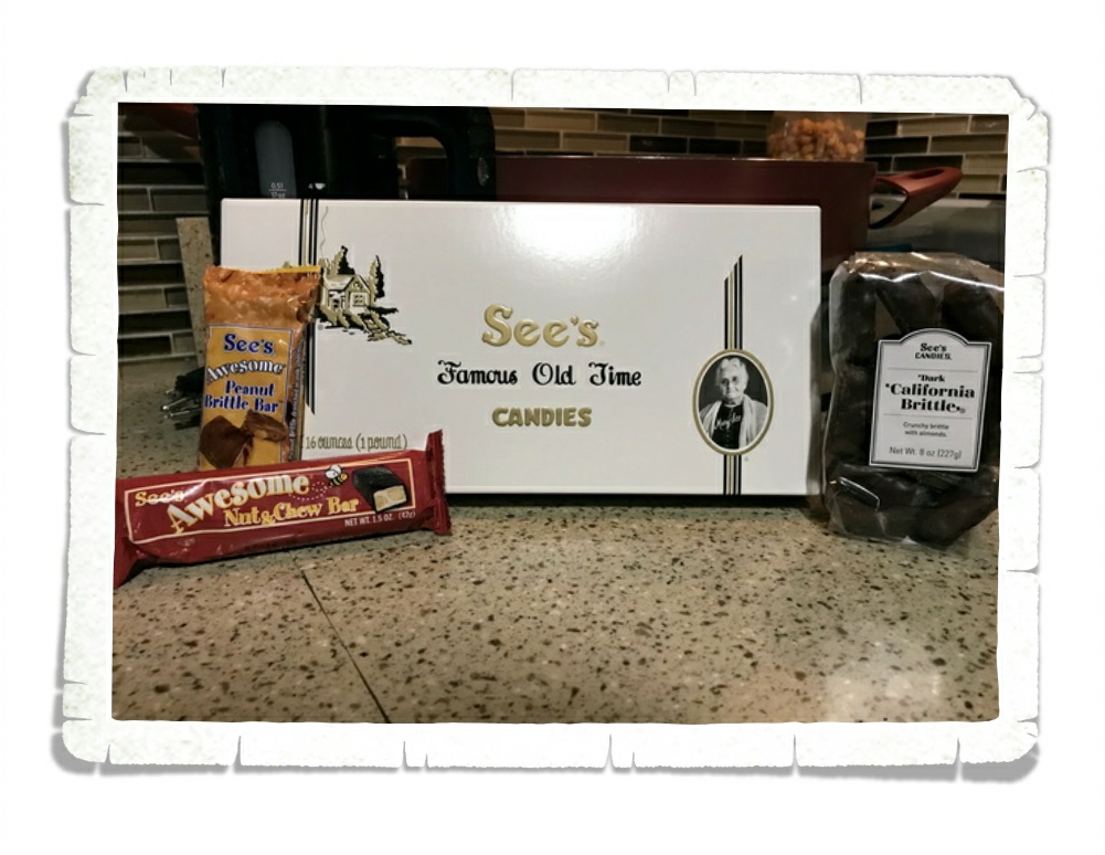
Years ago…I don’t remember where I first got some…I had my first taste of See’s Candies. It’s been my favorite boxed chocolate since then. So, when we saw a See’s Candies store on Fisherman’s Wharf…I had to go in. And…come out with a few…souvenirs.

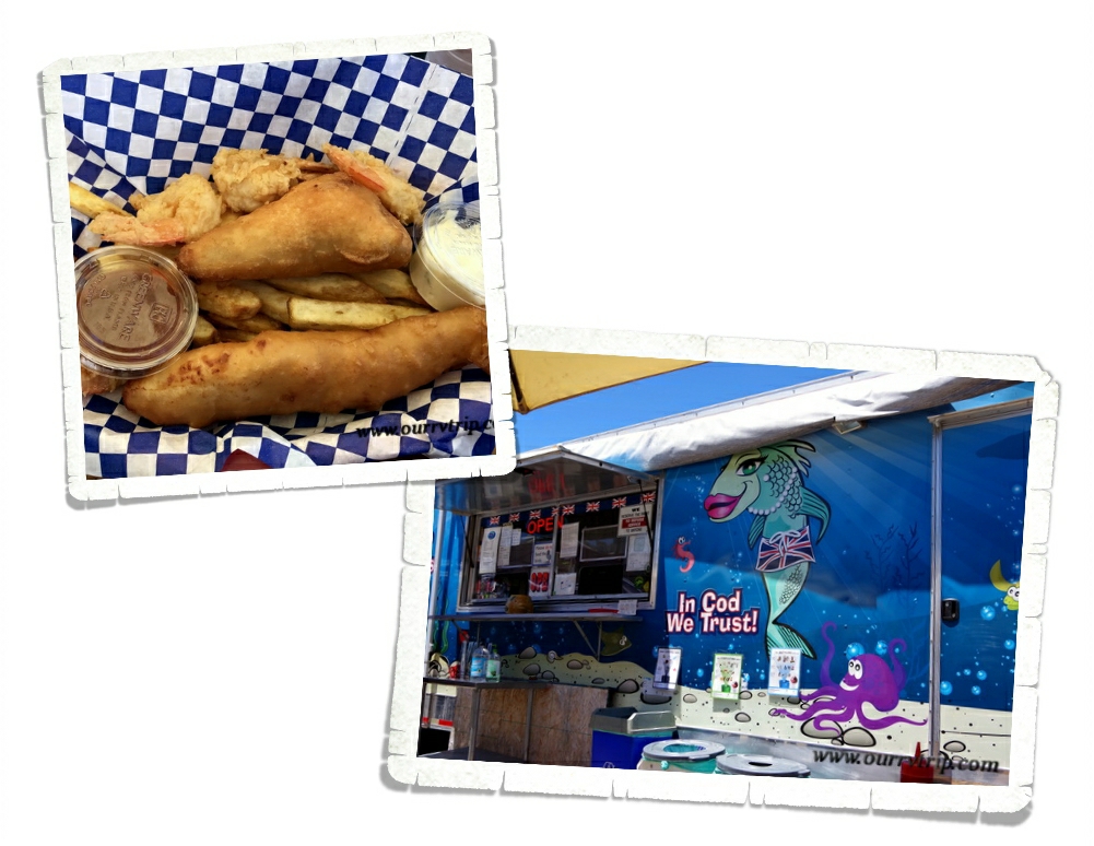
We ended up at a fish-n-chips place called The Codmother Fish & Chips. There’s something about having fish just feet from the water it was caught in…so good!

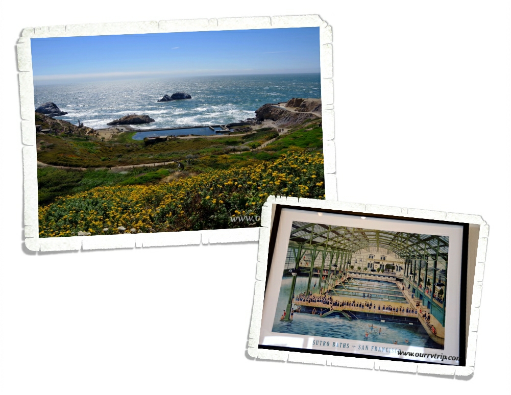
Our last stop in San Francisco was the Sutro Baths. At one time, the Sutro Baths were once the world’s largest indoor swimming complex. The building itself is all but gone, but there are still remnants of what once was. This picture of what the Sutro Baths used to look like was in the Visitor Center. Adolph Sutro, a German immigrant, used the money he made as an engineer of a ventilation tunnel for the silver mines of Nevada’s Comstock Lode to purchase the real estate called Lands End and build the Sutro Baths. The swimming and bathing complex was covered in three acres of stained glass and steel and seemed to be built right into the seaside cliffs.

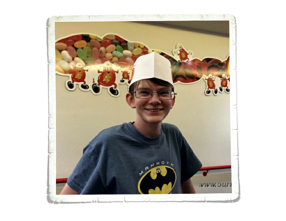
Confession…I’m a little bit of a sugarholic. Just a little. Well, if I’m being completely honest, I might as well tell you…I’m a huge sugarholic. Huge! Some of my friends and family have told me that sugar runs through my veins instead of blood. While I’ve made an effort to cut back on the amount of sugar I have a day…er…I mean a week. We couldn’t pass up touring through the factory of one of my favorite sugary treats. Jelly Belly!

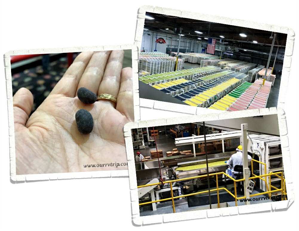
The Goelitz family has been in the candy business since 1869. That’s a lot of candy making! At the Fairfield factory, you can take a free self-guided tour of their candy making process and see the factory in action. In the picture above you can see what Jelly Belly bean centers look like. When the centers get their shells, they’ll be 40% bigger! The center bean of a Jelly Belly is made from a slurry made of sugar, water, corn syrup, and corn starch. Every Jelly Belly bean starts with the same basic slurry and then the flavor and color is added. The Fairfield Jelly Belly factory can make around 800 Jelly Belly bean centers per second. Once the bean centers have been made they have to cure, rest and dry.

Have you ever wondered how they mix the Jelly Belly beans for the bags of mixed flavors? They pour boxes of each bean in the mix on this long conveyor belt. The belt moves and the beans work their way up to a big barrel where the beans are all mixed up together. The beans are then moved by another conveyor belt to those big white containers in the picture (top left a bit) above where they wait to go to the packaging area.

There’s a bean artist who gets to spend all of their time making these Jelly Belly bean works of art. How fun would that be?! Some fun facts:  each work of art is typically 4’x5′, each picture weighs about 100 pounds with the frame, it takes around 100 hours from start to finish, and it takes somewhere around 12,000 beans to make one masterpiece.  

One of the best things about the Jelly Belly factory…they’ve got all of the flavors! And I do mean all of them. We, of course, had to take home some samples. Just a few. **wink, wink**

We really enjoyed exploring the San Francisco area! There was so much to see and do that we didn’t even scratch the surface with two very full weeks of adventuring. Maybe someday we’ll travel through the area again so we can hit some of the things we missed…when we’re ready to face the huge crowds again.

See y’all down the road!

#westernloop2018

San Francisco Area Part One

San Francisco Area Part One

Hey Guys! We spent two weeks in the San Francisco area. We crammed so much into those two weeks that I’ve decided to break up this area into two separate posts. I could easily do four posts…we saw that much…but I’ll cram it all into two to save some time. The RV park we were staying in was in the town of Vacaville and it was in a great location for exploring the area without being right in middle of the San Francisco crowds all the time.

We went to five National Park Units while we were in the San Francisco area. Five! We missed a few…they either weren’t open or we didn’t plan far enough ahead and we missed out on tickets. Y’all know how far out we plan our travels so the fact that we missed out on tickets…sigh…should tell you how fast tickets are snatched up at popular parks.

 John Muir is known as the “Father of the National Parks” and the “Patron Saint of the American Wilderness”. He devoted most of his life to preserving the wild places that he loved so much. We’re big fans of John Muir and what his perseverance to save the wild spaces did for future generations. All over our Country, in the many National Park Units we’ve visited we’ve heard his name spoken with a kind of reverence. It is because of him, that we have National Parks. We visited Muir National Historic Site in Martinz, CA one afternoon. It was just as thrilling to us to walk in John Muir’s home as it was for us to walk through the home of Abraham Lincoln or Lyndon B. Johnson or well, any of the other great homes we’ve visited during our travels across the US.

Muir spent quite a bit of his time in solitude as he explored and studied nature. Around the time John was turning forty, some of his friends started to urge him to return to society. Upon his return, a friend of his introduced him to his future wife, Louisa Strentzel. Louisa was the daughter of Dr. Strenzel who owned a 2,600 acre fruit orchard. Muir and Dr. Strentzel went into business together and within five years, Muir had earned enough money to keep his family living well for the rest of their lives. Muir spent the next ten years working on the orchard. He was a devoted husband and father to his two daughters, but his heart was still yearning for the wild places. Louisa encouraged him to go back to the mountains for some respite. He went. Sometimes he would go alone and other times he would take his daughters.

Muir called it his “scribble den”. This is the room where John Muir wrote most of his books and published articles. He would worry about the wording of his books and articles in his determination to make others see how important the preservation of wilderness is. Many of his journals helped in the preservation of National Parks even after his death in 1914.

Muir Woods National Monument was established in 1908. When John Muir found out that they’d named this park after him he said, “This is the best tree lover’s monument that could possibly be found in all the forests of the world.”

Muir Woods National Monument was our first glimpse of the coastal redwoods. The coastal redwoods are in the same family as the giant sequoia trees we fell in love with while we were exploring Sequoia National Park. Coastal redwoods are known as the tallest living things on Earth. In Muir Woods, there’s a tree that reaches up to 258 feet above the forest floor. To give you some perspective…that is about the height of a 23 story building. These giant trees need the moderate temperatures and fog that the northern California coast provides them with in order to survive.

Muir Woods National Monument is a little tricky to get to. You have to make prior arrangements to either claim one of the few parking spots at the park or to get a ticket with a shuttle bus. We chose to take the first shuttle bus of the day in hopes of avoiding the mass of people. This park gets over a million visitors a year. Our plan worked. We were leaving when the park started to feel crowded. We had a great morning walking through the giants…listening to their stories…and marveling at their height. And freezing. We weren’t prepared for how cold it was!

In December of 1941 everything changed for America. Men were sent to fight in the war which left a gaping hole in the American workforce. To fill that hole, the government turned to the women left behind. Around six million women joined the workforce during the war. Rosie the Riveter/ World War II Home Front National Historic Park tells the story of the American workforce during World War II. Women and other minority groups answered the call to help their Country by joining the workforce. It wasn’t easy for them. Many of these women had never worked outside of their home before. They weren’t accepted or welcomed by the men left in the factories.

I didn’t really know what to expect at this NPS Unit. We arrived late in the day and was rushed to get through it all. I could have easily spent hours here reading all of the memories. I hope to revisit this one again someday.

We finally made it to the California State Capitol Building in Sacramento! I’m going to be totally honest with you. I’m behind on writing posts…it’s been almost two months since we were at the California SCB and while I do love this dome…it’s really all I remember about the building itself…other than an awful lot of pink. Don’t get me wrong…it’s a lovely building. We took a guided tour and our docent was very enthusiastic about how big and powerful California has always been. This was pointed out numerous times. It was also admitted that the reason this SCB looks so much like the National Capital Building is because the plans for the NCB somehow fell into the hands of the California SCB planners…so yeah, there’s that too. It was for sure, the oddest docent led tour we’ve ever had of a SCB.

The day we went there was a parade and several protests. We didn’t’ stick around for any of it. Crowds aren’t really our thing. At all.

There was a really nice rose garden! So many different colors of roses! There were also some other really pretty flowers on the SCB’s grounds. It really was a very pretty campus.

We found a really good old fashioned diner in Martinez, CA while we were visiting the John Muir National Historic Site. Great burgers and milk shakes!

Stay tuned for part two of our San Francisco area adventures!

See y’all down the road!

#westernloop2018

Pizza Roundup Round Table Pizza

Pizza Roundup Round Table Pizza

To my fellow pizza lovers, I bring to you a post on Round Table Pizza.

Now walking in I expected a fast food Cicis like pizza but once we got the pizza, I thought differently. Round Table is a chain pizza place that is really good.

We had to go back it was so good!

The Round Table Pizza we went into was pretty clean and had good service…

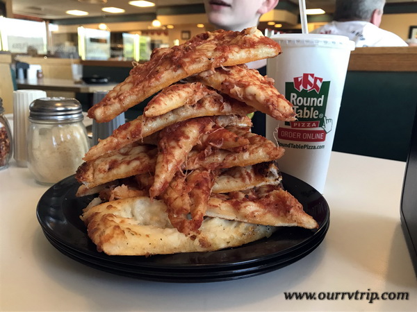
oh don’t mind the stack of pizza crust, dad just wanted more room for the toppings. You have to admit, it’s an impressive stack of pizza crust!

Round Table really surprised me with how good it is, so it deserves a 5 star review!

See y’all next time on…

Pizza Street!!

Written by Nicholas

Gilroy, CA

Gilroy, CA

We spent two weeks in the Gilroy area of California. We wanted to explore some of the coast and hit a National Park there. When I pick places to stay, one of the things I look at is cell service strength. We have to have decent Verizon service so work can be done. In three years, we’ve only had to move once due to lack of cell single. We almost had to move from this area. We weren’t that far from a big city, but there were so many people the bandwidth was completely bogged down. It was bad. The area it’s self was pretty good! We enjoyed it!

Welcome to the Garlic Capital of the World! Gilroy is all about the garlic. You can get garlic flavored…everything. And I do mean…everything. We tried the garlic ice cream. The garlic flavor was so light that we couldn’t really taste the garlic much.

This entire part of California is a heavy agricultural area. If a house or business isn’t sitting on some land…it’s being used to grow something. One of our favorite things to do was try and guess what was growing in the different fields. Have you ever seen artichoke plants? They look pretty crazy!

All those fields of veggies and fruits meant tons of little farm stands…and some not so little stands. Casa de Fruta is one of those touristy places we usually try to avoid, but a friend of ours told us we had to see it. She was right! We stopped on our way out of the area and it was pretty cool! So many different local fruits, veggies, nuts, and candies! I’d never seen so many different flavors and styles of garlic. There were honey, jams, jellies, dates and nuts…I could have spent several hours looking at everything.

We had to stock up on a few things. We could have easily spent way too much on all of the yummy looking treats here!

We found a fish-n-chips truck called Ketch It outside one of those fruit and veggie places. Guys…it was the best fried fish we’ve ever had. Ever. And the garlic fries…top notch! We went back twice…we would have gone one more time, but the timing was off. We will forever compare all other fish-n-chips to these. We also found a burger place. The Habit. It’s fast food, but better. We like them better than In & Out and Five Guys and so far in California we’ve seen Habit stores in most areas we’re staying in. We try not to eat out too often, but it does happen.

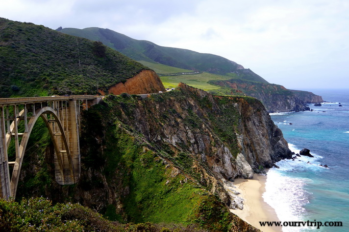
We spent a day driving highway one. The road is as snaky as you’ve heard and the views…are even better than you think they’re going to be. Luckily, there were tons of pull-offs so we could safely gawk. And we did. We gawked and ogled and said wow more times than we thought we would.

To be honest, it was better than I thought it would be. I’d seen pictures, but you know we compare everything to Alaska and Maine. I thought…how could it be anywhere near as great as Alaska or Maine…but Guys, it is. It’s gorgeous! And the color of the water even on a cloudy day was so pretty. We started near the Monterrey Bay area and made it down to the Julia Pfeiffer Burns State Park to see the little waterfall. We had to stand in line to get a glimpse of it. The crowd was not the best but it was pretty though! It was worth wading through the crowd and standing in line to get a glimpse.

Garrapata State Park was probably my favorite stop of the day. I love love love all of the flowers right next to the beach! I mean…look at those colors!! When we started out that morning we were pretty much on our own. Not that many people out and about. But, by mid-morning the people found us and we decided to call it quits on the exploring.

Pinnacles National Park was a surprise. I actually found it after I’d made our reservations. It was a happy coincidence that we were close enough to go check out Pinnacles NP. We only got to visit once, but there’s enough to do for several visits. Pinnacles NP is part of an old volcanic field that sits near the San Andreas Fault Zone. There’s not a lot of parking at this NP. You have to park at the visitor center then ride a shuttle bus back to the hiking. So be prepared for that.

We were about a mile into a five mile hike when Nicholas started not feeling well. He pushed on a little more, but just wasn’t feeling it. Nicholas, Alex, and I ended up turning around while Jerl and Charles finished out the hike. We were so bummed to miss the hike, but it was a really hot day and the heat was making Nicholas feel even worse. Luckily, we’d packed a lunch so the three of us made our way back down to the visitor center where we sat in the shade and had our lunch while we waited. The food and the cooler temps in the shade helped.

The main reason we wanted to visit Pinnacles was to see the California condors. Pinnacles National Park is a nesting area for them and is one of very few release sites in the US for the big birds. Weighing in at around twenty pounds with a wingspan of nine and a half feet, the California condor is one of the largest birds in North America. They’re certainly not the prettiest bird…but they are awe inspiring.

While the little boys and I were relaxing in the shade, Jerl and Charles were working hard on the trail. Check out those foot holds in the pic above! I’m a little jealous I didn’t get to finish this trail. It looks totally awesome! Jerl and Charles came back with tales of how difficult it was all while raving about the views!

It’s a thistle…but it’s pink. I’d never seen a pink thistle before. They’re usually purple…but the ones at Pinnacles were all this vibrant pink color. Love! The other beauties pictured above were also at Pinnacles!

These pretties were all down highway one. I love them so much! I mean…Guys…it’s purple with a pink glow!!!

While this area presented a challenge with cell service, we really enjoyed our time in Gilroy, CA. So much so that we would consider going back one day even though it was extremely congested with people.

See y’all down the road!

#westernloop2018

Three Rivers, Two Parks, Snakes and Spotty Cell Service

Three Rivers, Two Parks, Snakes and Spotty Cell Service

Hey Guys! We spent two weeks in the Three Rivers area of California so we could explore Sequoia and Kings Canyon National Parks. Y’all know that this blog is really my digital scrapbook…my journal of our nomadic life. I like to put my favorite pics up here and after going through the pics for the last two weeks…Guys, I tried to cut pics out, but we really loved this area and these parks. So, I think I’m going to have to do this area in three posts. I’ll start with the shortest one because I’m pressed for time today…we’re heading out to explore soon. :-}

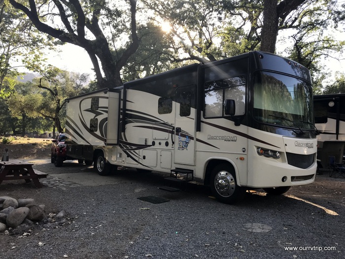
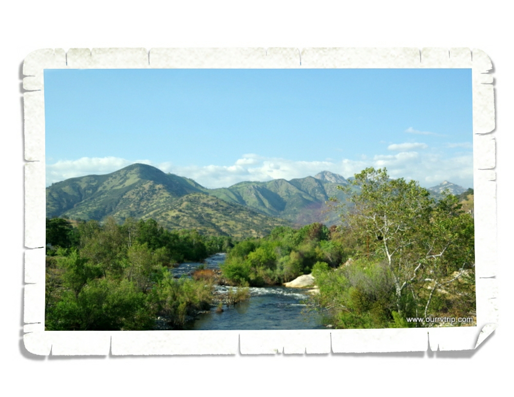
We stayed at the Sequoia RV Ranch in Three Rivers, CA. This was a hopping park! Lots of turnover throughout the week. All of our neighbors were super nice. We knew our first day here that we were going to love this area. It felt like Canada and Alaska to us. The forest…the smells. After coming from the stifling heat of the Desert Hot Springs area, it felt a little like taking that first deep breath after swimming all the way across the swimming pool underwater. Yes, the park was crowded. Yes, we were packed in like sardines. But, it didn’t matter. We loved it. There was a nice river that ran through the back of the RV park. We walked the shore several times. It was cooler by the water, and it was usually less crowded there.

I believe the bright orange and yellow patches in the picture above are California Poppies. They were gorgeous! We saw tons of them up on hills in the distance as we drove around, but the closest I got to them was at the RV park. There were three or four little sparse patches of them…kind of pathetic looking after seeing such huge fields of them, but at least I finally got to see them up close!

Check out this tiny post office. Established in 1890, this Kaweah Post Office has been handling mail for 128 years. I’m pretty sure this is the smallest post office we’ve ever seen.

We’ve been amazed at all of the agriculture around California. In the Three Rivers area we saw grove after grove of oranges and olives! Tons of them! The best part though…all of the fruit and veggie stands! We found the best oranges at the little stand in the pic above. Big, juicy, sweet…and a great price! At the little market down the road from the RV park, there was an orange juice press where you could get freshly squeezed orange juice made from oranges taken from the tree just down the road. The boys have declared it to be the best orange juice they’ve ever had. I’m pretty sure they each tried to drink their weight in the stuff while we were there. Ha! We also found some good olives at one of the stands. The olive grove was about twenty minutes down the road. Charles has been hooked on green olives ever since we brought home a jar of them.

Another reason this area felt like Alaska, was the remoteness of it. We had to drive a good forty-five minutes to get to an actual grocery store. There was one little market close to us (the one with the orange juice) that had a surprising amount of options…just like the little general markets we would find throughout Alaska. And check out that statue. It kind of screams Alaska…ok, so maybe it doesn’t…buy we did see quite a few similar ones while we were in Canada and Alaska.

Jerl had an eye checkup. Everything is looking good. He’s still in the healing process from his two surgeries, but the doc we saw said everything seemed to be healing the way it should. It was a relief to hear it.

We, of course, found some foodies! This was a chili relleno burger from one of the local-ish breweries. This burger (the one on the right)…I don’t know what this burger was called, but it was huge and delicious! You’re looking at three patties with three different cheeses, pastrami, and bacon. Pastrami on burgers must be a California thing. We’ve seen them on menus since we crossed into CA. Every little town has their own version of it.

Both of these pretties were in our RV park!

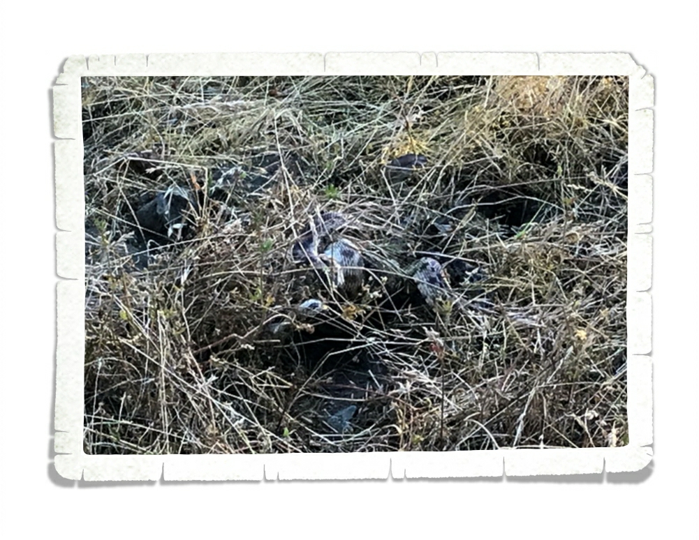
You know what else was in our RV park? These guys. It’s hard to see…I’ll give you a minute to really look.

See them yet?

There are three rattlesnakes in that picture. Three! I about lost my ever lovin’ mind when we walked up on them! They were pretty occupied with each other, but we warned all of the campers who were just feet from them. It must be a bad year for snakes. We’ve been running into them since we were in New Mexico back in March! We’ve also heard about several snake bites this year. Y’all be careful while you’re out exploring.

The only thing that wasn’t that great about our RV park in the Three Rivers Area was the super spotty cell service. It was workable while we were in the RV, but for some reason as soon as we stepped out…it was gone. No service. I guess we’re lucky we got the spot we did.

It’s funny how some places you travel to really resonate with you. This was one of those places for us. For the first time in…well, since we started this trip, we were sad to leave an area.

You know one thing Alaska doesn’t have that Three Rivers does? Snakes. We didn’t see a single snake while we were in Alaska. I think it’s time for another Alaskan summer. ;-P

See y’all down the road!

#westernloop2018

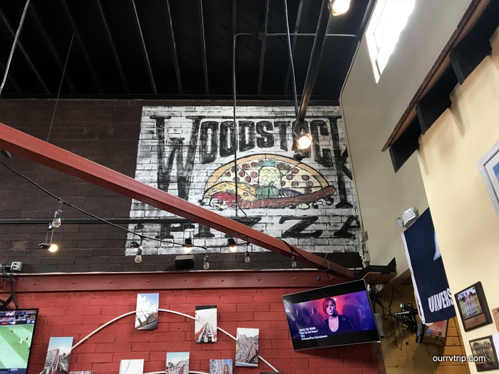
Pizza Roundup Woodstock Pizza

Pizza Roundup Woodstock Pizza

To my fellow pizza lovers! I bring you a post after long break! This time from San Diego, CA.

Woodstock has some really tasty pizza, and a good deal on all you can eat by the slice!

But if you decide to go with a full pie then there are some arcade games you can play while you wait! (I had to play some pinball.)

As you can see they weren’t super busy. Works for us, we got our food faster! The restaurant is nice and clean and service is great! Now I didn’t have any wings but…

They look REALLY good! My brother said they had a really good flavor.

They have a variety of pizza to choose from for by the slice, and the options look good!

The one time I decided not to get pepperoni was at a pizza place that has all you can eat pepperoni pizza, but I couldn’t pass up on a carnitas pizza! They rolled the crust at the outside and it really added, they had sauce under that rolled part! Now I don’t know about y’all, but this place needs 5 stars.

See y’all next time on…

Pizza Street!!

#pizzastreet

And don’t forget to check out my new Instagram account! Come find me @ https://www.instagram.com/rvkid04

Written by Nicholas