Month: June 2018

Gilroy, CA

Gilroy, CA

We spent two weeks in the Gilroy area of California. We wanted to explore some of the coast and hit a National Park there. When I pick places to stay, one of the things I look at is cell service strength. We have to have decent Verizon service so work can be done. In three years, we’ve only had to move once due to lack of cell single. We almost had to move from this area. We weren’t that far from a big city, but there were so many people the bandwidth was completely bogged down. It was bad. The area it’s self was pretty good! We enjoyed it!

Welcome to the Garlic Capital of the World! Gilroy is all about the garlic. You can get garlic flavored…everything. And I do mean…everything. We tried the garlic ice cream. The garlic flavor was so light that we couldn’t really taste the garlic much.

This entire part of California is a heavy agricultural area. If a house or business isn’t sitting on some land…it’s being used to grow something. One of our favorite things to do was try and guess what was growing in the different fields. Have you ever seen artichoke plants? They look pretty crazy!

All those fields of veggies and fruits meant tons of little farm stands…and some not so little stands. Casa de Fruta is one of those touristy places we usually try to avoid, but a friend of ours told us we had to see it. She was right! We stopped on our way out of the area and it was pretty cool! So many different local fruits, veggies, nuts, and candies! I’d never seen so many different flavors and styles of garlic. There were honey, jams, jellies, dates and nuts…I could have spent several hours looking at everything.

We had to stock up on a few things. We could have easily spent way too much on all of the yummy looking treats here!

We found a fish-n-chips truck called Ketch It outside one of those fruit and veggie places. Guys…it was the best fried fish we’ve ever had. Ever. And the garlic fries…top notch! We went back twice…we would have gone one more time, but the timing was off. We will forever compare all other fish-n-chips to these. We also found a burger place. The Habit. It’s fast food, but better. We like them better than In & Out and Five Guys and so far in California we’ve seen Habit stores in most areas we’re staying in. We try not to eat out too often, but it does happen.

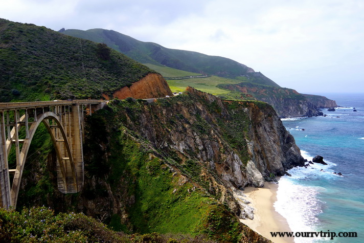
We spent a day driving highway one. The road is as snaky as you’ve heard and the views…are even better than you think they’re going to be. Luckily, there were tons of pull-offs so we could safely gawk. And we did. We gawked and ogled and said wow more times than we thought we would.

To be honest, it was better than I thought it would be. I’d seen pictures, but you know we compare everything to Alaska and Maine. I thought…how could it be anywhere near as great as Alaska or Maine…but Guys, it is. It’s gorgeous! And the color of the water even on a cloudy day was so pretty. We started near the Monterrey Bay area and made it down to the Julia Pfeiffer Burns State Park to see the little waterfall. We had to stand in line to get a glimpse of it. The crowd was not the best but it was pretty though! It was worth wading through the crowd and standing in line to get a glimpse.

Garrapata State Park was probably my favorite stop of the day. I love love love all of the flowers right next to the beach! I mean…look at those colors!! When we started out that morning we were pretty much on our own. Not that many people out and about. But, by mid-morning the people found us and we decided to call it quits on the exploring.

Pinnacles National Park was a surprise. I actually found it after I’d made our reservations. It was a happy coincidence that we were close enough to go check out Pinnacles NP. We only got to visit once, but there’s enough to do for several visits. Pinnacles NP is part of an old volcanic field that sits near the San Andreas Fault Zone. There’s not a lot of parking at this NP. You have to park at the visitor center then ride a shuttle bus back to the hiking. So be prepared for that.

We were about a mile into a five mile hike when Nicholas started not feeling well. He pushed on a little more, but just wasn’t feeling it. Nicholas, Alex, and I ended up turning around while Jerl and Charles finished out the hike. We were so bummed to miss the hike, but it was a really hot day and the heat was making Nicholas feel even worse. Luckily, we’d packed a lunch so the three of us made our way back down to the visitor center where we sat in the shade and had our lunch while we waited. The food and the cooler temps in the shade helped.

The main reason we wanted to visit Pinnacles was to see the California condors. Pinnacles National Park is a nesting area for them and is one of very few release sites in the US for the big birds. Weighing in at around twenty pounds with a wingspan of nine and a half feet, the California condor is one of the largest birds in North America. They’re certainly not the prettiest bird…but they are awe inspiring.

While the little boys and I were relaxing in the shade, Jerl and Charles were working hard on the trail. Check out those foot holds in the pic above! I’m a little jealous I didn’t get to finish this trail. It looks totally awesome! Jerl and Charles came back with tales of how difficult it was all while raving about the views!

It’s a thistle…but it’s pink. I’d never seen a pink thistle before. They’re usually purple…but the ones at Pinnacles were all this vibrant pink color. Love! The other beauties pictured above were also at Pinnacles!

These pretties were all down highway one. I love them so much! I mean…Guys…it’s purple with a pink glow!!!

While this area presented a challenge with cell service, we really enjoyed our time in Gilroy, CA. So much so that we would consider going back one day even though it was extremely congested with people.

See y’all down the road!

#westernloop2018

Sequoia National Park

Sequoia National Park

Hey Guys!! We spent two weeks in Three Rivers, CA so we could explore Sequoia National Park and Kings Canyon National Park. We only made it to Kings Canyon NP once, but we were in Sequoia as much as we could be. It took us over an hour to actually get up into Sequoia National Park.

The road to get into Sequoia NP winds it’s way up a mountain with hairpin turns. Our first time into the park we were waiting in line to cross the construction area when some fog started to waft in. Well, it wasn’t so much wafting in as it was pouring in. It came in really fast and really thick. We thought it might just go on through so we headed on into the park anyway.

We made it to the Giant Forest Museum and went in to kill some time hoping the fog would roll out while we were in there. You can see the fog in the windows of the pic above. Did you know it takes 91,000 sequoia seeds to make one pound? Each seed is the size of an oat flake.

The fog was still rolling in, but we decided to try and push forward…until we couldn’t see the road in front of our car. It was slightly terrifying. We were stuck on a two lane, very narrow, mountain road going up the mountain into thicker fog. We finally found a place to turn around and start our slow, nerve wracking decent down the mountain. It was crazy how fast other people were driving…without their fog lights on. We made it down the mountain and went to get pizza. After all of that we were ready for some comfort food!

If you’re heading into Sequoia National Park this summer, be prepared for construction and lane closures. Depending on when we went up the mountain we would have anywhere between a 15 min to an hour delay.

Established in 1890, Sequoia National Park is the second oldest National Park. We had to hunt for this park sign. The one at the Three River’s entrance with the Indian Head that you’ve probably seen…it was taken down for restoration. We were super bummed, but at least we found this other sign.

Every year the General Sherman tree grows enough new wood to make a brand new sixty foot regular sized tree. You are looking at the largest living (by volume) tree on earth. The estimated volume is more than 52,000 cubic feet…which is about the same volume as sixteen blue whales.

This little marmot was out enjoying the sun at one of the less popular pull-offs. We try to check out a variety of pull-offs…sometimes the views are just as spectacular as the more popular super crowded pull-offs. And, sometimes you come face to face with some of the park residents. ;-}

One of the hardest things to portray in pictures (for me) is size. I snapped this picture of the Giant Tree Museum in the middle of some sequoias to try and show you how massive these trees are. The museum is a decent sized building and look how much taller those amazing trees are!

These giant sequoias only grow on the western slope of the Sierra Nevada range and can grow to almost 275 feet tall with a trunk circumference of around 100 feet. It’s hard to believe the little seedling in the pic above might one day reach 275 feet high.

We went to Sequoia NP before the official start of the summer season, so not all of the roads were open. One of the places we really wanted to visit was Moro Rock. You could park down by the Giant Forest Museum and walk up. It made the hike a few miles longer…one way. And we were totally going to do that…if we had to. We kept checking to see if the Moro Rock road was open every time we went into the park. On our last day in the park it was…open!! Sweet Chickens! When you can park in the parking lot by the trail head…Moro Rock is a short quarter mile hike up 400 steps along with several ramps. The trail was built by the CCC back in 1931 and takes you up to 6,725 feet. Before this nice trail was built, early visitors had to use ropes to scale Moro Rock. I’m not sure we would have attempted that particular hike. I like to think we’re adventurous and daring…but there’s a limit to what I’ll do with kids in tow.

When you reach the top and after you catch your breath… you can walk out to the end of the trail and enjoy unobstructed views of the Great Western Divide. We stood up there for awhile. The views were…well, they were pretty darn amazing in every direction! We finally moved on when other people started nudging us out of the way. I get it. We all want to take in the view and get pictures with that vista. We moved out of the way and started back to the car excited that we could check Moro Rock off of our list.

Buttress Tree fell without warning on June 3, 1959. Most sequoia trees die from toppling over. The roots are shallow and they don’t have a taproot to help anchor them. We found Buttress Tree after we left Moro Rock and found a wide spot in the road so we could pull over to get a closer look. I had to snap a picture of the boys with the root system to show how big the roots get.

Hale Tharp was the first settler of European descent to move into the Sequoia NP area. He built a cabin out of an old hollowed-out sequoia. Tharp’s Log has been pretty much left alone. You can step inside the door and see how Hale Tharp had it set up. Did you know that Sequoia bark is up to 2 feet thick and is a poor conductor of heat? Sequoia bark also has some natural immunity to bugs and fungi which means a fallen sequoia can stick around for a very very long time under natural circumstances. How cool would it be to have a house built from fallen Sequoia logs?!

Sequoias rarely die of old age. Many of the oldest sequoias are close to 3,000 years old. Sequoias live so long that we’re only just now seeing the second generation of these gigantic trees. Think about that… We still don’t really know how these amazing trees will evolve over time. They’re really just getting started.

Sequoia NP is in bear country so all of that stuff you carry around when you hike that has any kind of smell at all… lotions, lip balms, repellents, snacks, cans and bottles (even unopened)…bears can smell them up to a mile away. The park has provided tons of these bear boxes to store all of your stuff in. Oh, and bears have been known to claw their way into cars…in the middle of a crowded parking lot…so, do yourself a favor and use the bear boxes.

Did you know that sequoia trees actually need fire to regenerate? A sequoia pine cone needs fire in order to release all of those tiny, oat flake sized seeds. The NPS now conducts prescribed burns in order to keep the forest healthy. They’ve sectioned off the park and rotate burn sections.

We weren’t sure we were going to get to drive through Tunnel Log. This is up the same road as Moro Rock. We actually got to drive through it twice. Everyone we saw driving though it stopped for a picture or two or three. We even saw some tourists having a full on photo shoot in front of it. Seriously, how many pics do you need of yourself in front of the same tree? Ha!  But really…move it along. Tunnel Log fell naturally and instead of reworking the roads, the NPS tunneled through the tree so cars could get through. Oh! We also made it to an old fallen tree that you used to be able to actually pull your car up on and then get a pic of it…while it was on the log! So cool! It’s blocked off now. You can’t get your car up on it anymore, but you can walk and climb all over it. So fun!

Springtime in the mountains means pretties everywhere! I loved all of the flowers in bloom! These yuccas were amazingly huge and dotted all over the foothills of the park. We also spotted quite a few dogwood trees! I love dogwoods with their delicate white and pink blooms!

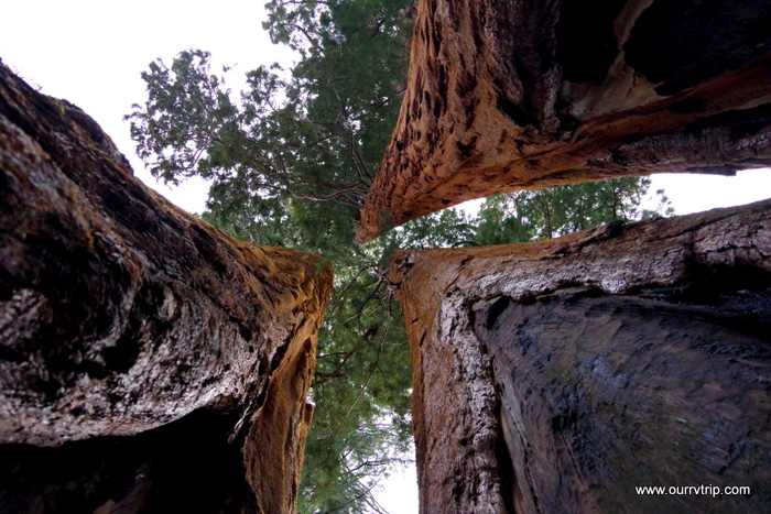
We loved Sequoia National Park so much more than we could have imagined. There was something very humbling about standing next to a living thing that’s been around for thousands of years. There’s a sense of being so small in the grand scheme of things.

It’s hard to grasp the sheer size and feel of a giant sequoia until you’re standing next to one.

See y’all down the road!

#westernloop2018

Kings Canyon National Park

Kings Canyon National Park

Hey Guys!!  Kings Canyon National Park is usually lumped together with Sequoia National Park but, Kings Canyon is so amazing…it really deserves a post all of it’s own.

 We found all of those California happy cows we hear so much about on television. Seriously though, we love this topography! The big rolling hills with little groves of trees here and there…This area of California is gorgeous!

It took us two hours to get to Kings Canyon from where we were staying. The road started out fine…narrow and windy, but paved. And then, the GPS Lady in all of her infinite wisdom decided we needed to be more adventurous and took us down an old forest service road to get into Kings Canyon NP. Truthfully… we loved it! We ended up driving though a section of the park not very many people get to see. Redwood Canyon is home to one of the largest sequoia groves and is one of the largest areas of old growth sequoias.

We had this area all to ourselves as we bumped and bounced our way up the old dirt forest service road filled with deep ruts. We feel like we should have seen a bear. Or mountain lion. Or any wildlife…but, we didn’t.  We loved that we didn’t see another car until we were almost into the park. Sometimes the GPS Lady totally messes up and sometimes…she’s spot on. We loved driving through the largest remaining grove of sequoia trees (over 15,000)!

Kings Canyon National Park was originally established in 1890 as General Grant National Park. It was expanded and renamed Kings Canyon National Park in 1940.

General Grant Grove is home to the General Grant Tree (in the picture above). At a whopping twenty-seven stories in height, the General Grant Tree is the world’s second largest living tree. Not tallest…but second largest…based on trunk volume. Want the numbers? The General Grant Tree stands at 267.4 feet in height and has a circumference of 107.6 feet. The General Grant Tree is a memorial to US soldiers killed in war and is also known as “the Nation’s Christmas Tree”.

It takes hundreds of years for one of these fallen giants to completely deteriorate. If you get to visit Grant’s Grove take your time and explore some. We found this fallen tree near the trail. As impressive as these giant trees are from the outside…they’re just as impressive on the inside. That’s Jerl’s silhouette at the end of the sequoia.

There’s a little general store and a pretty descent restaurant in Grants Grove. We ate at the restaurant, but I would suggest grabbing something to go at the general store and heading down into the canyon for a picnic lunch. Alex was so hungry he had a big burger and a potpie. Teenagers…

Kings Canyon Scenic Byway takes you to the bottom of the canyon via a road with hairpin turns, steep drop offs, and sheer granite cliff faces. This road isn’t for the faint of heart, but the payoff is huge. At the bottom of the canyon you can stand and look up at the canyon walls that rise thousands of feet up.

We only did a couple of hikes in Kings Canyon. One of them took us on a bridge over the Kings River. The water was amazingly clear and pretty darn cold.

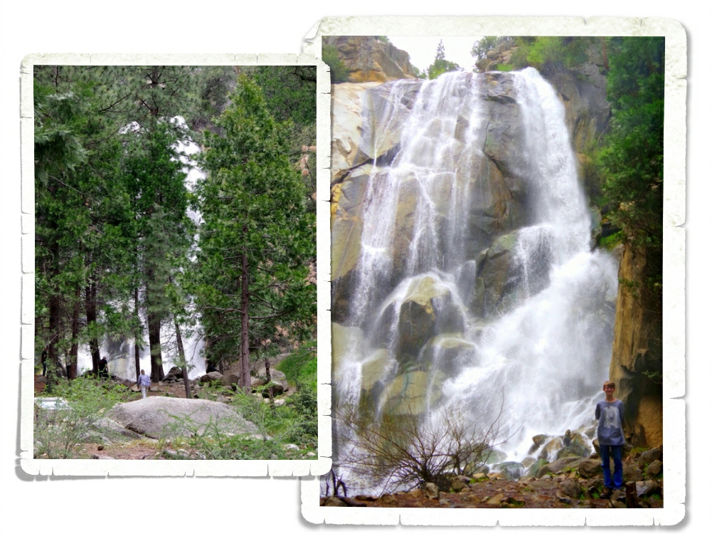
Grizzly Falls is a must stop while you’re exploring Kings Canyon. It’s just feet away from the parking area and it’s a great spot for a picnic! I was standing at our car when I snapped the left shot of Grizzly Falls. If you’re not into hiking, this stop is good place to see one of the many waterfalls in the canyon.

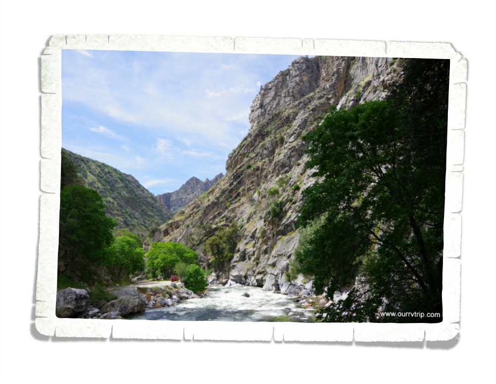
The Kings River flows through the canyon. The road follows it most of the time so you have ample opportunity to gawk at the swiftly moving river. There are some pull-offs where you can get out and take a closer look. Just don’t fall in. Can you spot our red 4Runner in the picture above? It gives you a size comparison as to just how massive this canyon is.

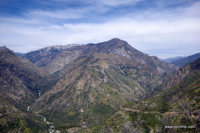
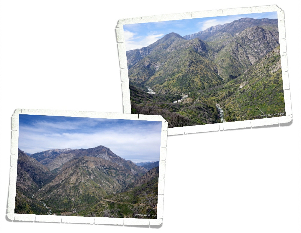
On the way back up and out of the canyon we stopped at several of the vista pull-offs…and there are several! You can see the Kings River snaking it’s way through the canyon in the pics above. See how all of the mountain tops are rounded? That’s evidence that Kings Canyon is a glacier carved valley. With extreme elevation ranging between 1,500 feet to 14,500 feet, Kings Canyon National Park has a wide variety of habitats. Keep your eyes open and you never know what you might find…and always hike bear aware.

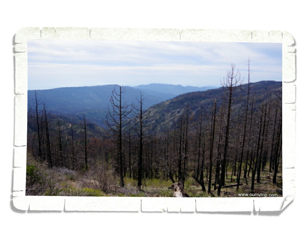
We saw some evidence of fires. This one happened back in 1955 when over 17,000 acres was burned. Now, Rangers know more about preserving these wild forests and do a prescribed burn to help prevent wildfires that rage out of control.

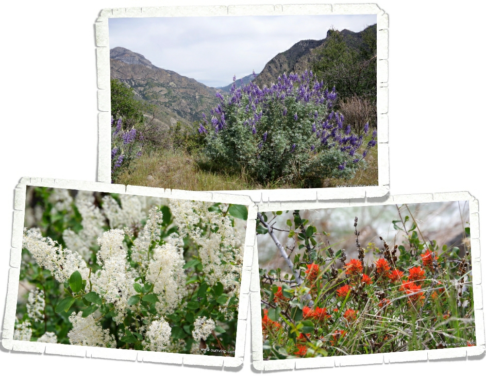
It was spring time while we were in Kings Canyon NP so all of the flowers were waking up from their winter nap. I love these bright orange pretties! They remind me of a wildflower called Indian Paintbrush. I don’t know if that’s what these are, but they’re very similar. The purple pretties are gorgeous!  It’s hard to tell, but these bushes were huge…and everywhere!

John Muir once said that Kings Canyon National Park is “a rival to Yosemite”. He was right. With it’s multiple 14,000 foot peaks and some of the worlds largest strands of giant sequoia trees…the Kings River and the canyon that is more than a mile deep…Kings Canyon National Park is definitely a rival to Yosemite.

See y’all down the road!

#westernloop2018

Three Rivers, Two Parks, Snakes and Spotty Cell Service

Three Rivers, Two Parks, Snakes and Spotty Cell Service

Hey Guys! We spent two weeks in the Three Rivers area of California so we could explore Sequoia and Kings Canyon National Parks. Y’all know that this blog is really my digital scrapbook…my journal of our nomadic life. I like to put my favorite pics up here and after going through the pics for the last two weeks…Guys, I tried to cut pics out, but we really loved this area and these parks. So, I think I’m going to have to do this area in three posts. I’ll start with the shortest one because I’m pressed for time today…we’re heading out to explore soon. :-}

We stayed at the Sequoia RV Ranch in Three Rivers, CA. This was a hopping park! Lots of turnover throughout the week. All of our neighbors were super nice. We knew our first day here that we were going to love this area. It felt like Canada and Alaska to us. The forest…the smells. After coming from the stifling heat of the Desert Hot Springs area, it felt a little like taking that first deep breath after swimming all the way across the swimming pool underwater. Yes, the park was crowded. Yes, we were packed in like sardines. But, it didn’t matter. We loved it. There was a nice river that ran through the back of the RV park. We walked the shore several times. It was cooler by the water, and it was usually less crowded there.

I believe the bright orange and yellow patches in the picture above are California Poppies. They were gorgeous! We saw tons of them up on hills in the distance as we drove around, but the closest I got to them was at the RV park. There were three or four little sparse patches of them…kind of pathetic looking after seeing such huge fields of them, but at least I finally got to see them up close!

Check out this tiny post office. Established in 1890, this Kaweah Post Office has been handling mail for 128 years. I’m pretty sure this is the smallest post office we’ve ever seen.

We’ve been amazed at all of the agriculture around California. In the Three Rivers area we saw grove after grove of oranges and olives! Tons of them! The best part though…all of the fruit and veggie stands! We found the best oranges at the little stand in the pic above. Big, juicy, sweet…and a great price! At the little market down the road from the RV park, there was an orange juice press where you could get freshly squeezed orange juice made from oranges taken from the tree just down the road. The boys have declared it to be the best orange juice they’ve ever had. I’m pretty sure they each tried to drink their weight in the stuff while we were there. Ha! We also found some good olives at one of the stands. The olive grove was about twenty minutes down the road. Charles has been hooked on green olives ever since we brought home a jar of them.

Another reason this area felt like Alaska, was the remoteness of it. We had to drive a good forty-five minutes to get to an actual grocery store. There was one little market close to us (the one with the orange juice) that had a surprising amount of options…just like the little general markets we would find throughout Alaska. And check out that statue. It kind of screams Alaska…ok, so maybe it doesn’t…buy we did see quite a few similar ones while we were in Canada and Alaska.

Jerl had an eye checkup. Everything is looking good. He’s still in the healing process from his two surgeries, but the doc we saw said everything seemed to be healing the way it should. It was a relief to hear it.

We, of course, found some foodies! This was a chili relleno burger from one of the local-ish breweries. This burger (the one on the right)…I don’t know what this burger was called, but it was huge and delicious! You’re looking at three patties with three different cheeses, pastrami, and bacon. Pastrami on burgers must be a California thing. We’ve seen them on menus since we crossed into CA. Every little town has their own version of it.

Both of these pretties were in our RV park!

You know what else was in our RV park? These guys. It’s hard to see…I’ll give you a minute to really look.

See them yet?

There are three rattlesnakes in that picture. Three! I about lost my ever lovin’ mind when we walked up on them! They were pretty occupied with each other, but we warned all of the campers who were just feet from them. It must be a bad year for snakes. We’ve been running into them since we were in New Mexico back in March! We’ve also heard about several snake bites this year. Y’all be careful while you’re out exploring.

The only thing that wasn’t that great about our RV park in the Three Rivers Area was the super spotty cell service. It was workable while we were in the RV, but for some reason as soon as we stepped out…it was gone. No service. I guess we’re lucky we got the spot we did.

It’s funny how some places you travel to really resonate with you. This was one of those places for us. For the first time in…well, since we started this trip, we were sad to leave an area.

You know one thing Alaska doesn’t have that Three Rivers does? Snakes. We didn’t see a single snake while we were in Alaska. I think it’s time for another Alaskan summer. ;-P

See y’all down the road!

#westernloop2018

Desert Hot Springs

Desert Hot Springs

Hey Guys! We spent one very hot, very windy week in the Desert Hot Springs area of California. We were there at the end of April and the daily temps reached a scorching 90* by 10 every morning.

We spent a day exploring Joshua Tree National Park. If you’re going to visit this National Park come in the winter. Winter daytime temps are in the 60s vs. summer when the day time temps exceed 100*. Everyone says the best time to visit is March and April. We were there at the end of April and it was already too hot.

We didn’t do very much hiking here. It was just too dang hot and windy. We wanted to see all of the gigantic boulders so we hiked the Hidden Valley loop. This area is very popular with rock climbers so it can be a bit crowded.

We made it out to Keys View. Guys…check out that view! If you look hard enough you can see the Salton Sea and the San Andreas Fault in the pic above. Keys View is a quarter mile loop…so it’s pretty short, but we found some of the best views in the park here.

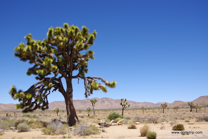
Did you know…a Joshua Tree isn’t actually a tree? Its actually the largest species of yucca! What?!? Crazy, right? For the first ten years, the Joshua tree grows about three inches a year. They can live for hundreds of years but unlike the saguaro I told y’all about…Joshua trees only grow to about forty feet tall. Driving through this National Park felt a little like driving through a Dr. Seuss book. Ha!

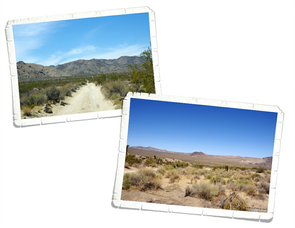
Yup, we found a dirt road to explore while we were in Joshua Tree NP. Are you surprised? ;-p We drove the 18 mile Geology Tour Road. It was a pretty narrow dirt road, but it wasn’t bad at all. We never had to kick it up into four-wheel drive and the views were all pretty stellar!

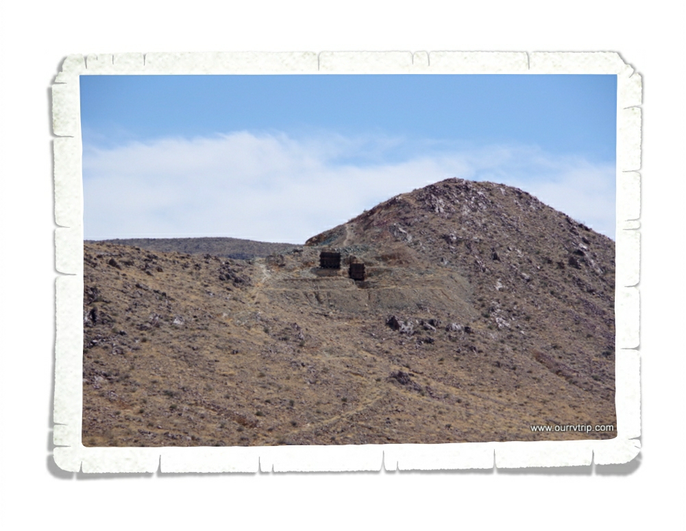
Scattered throughout Joshua Tree NP are the remnants of old mines. The one above is what’s left of the Silver Bell Mine. Gold in the 30s, lead in the 40s, and copper in the 50s. There are several old mines you can hike to, but most of them are unsafe. So, this is as close as we got.

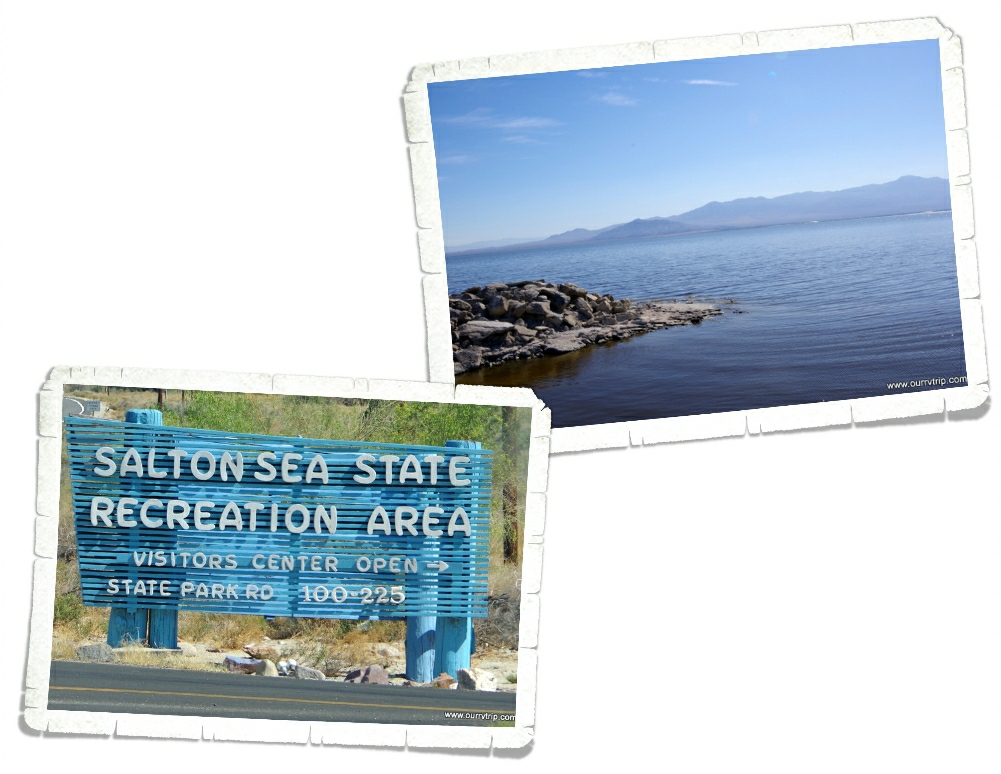
It’s not technically a sea any more, but a long, long time ago it was part of what is now the Gulf of California. The Salton Sea is California’s largest lake at around 35 miles long and 15 miles wide. It sits 235 feet below sea level. Most lakes have a natural outlet flowing to the ocean, but the Salton Sea doesn’t. The only water it gets is through rain and agricultural runoff.

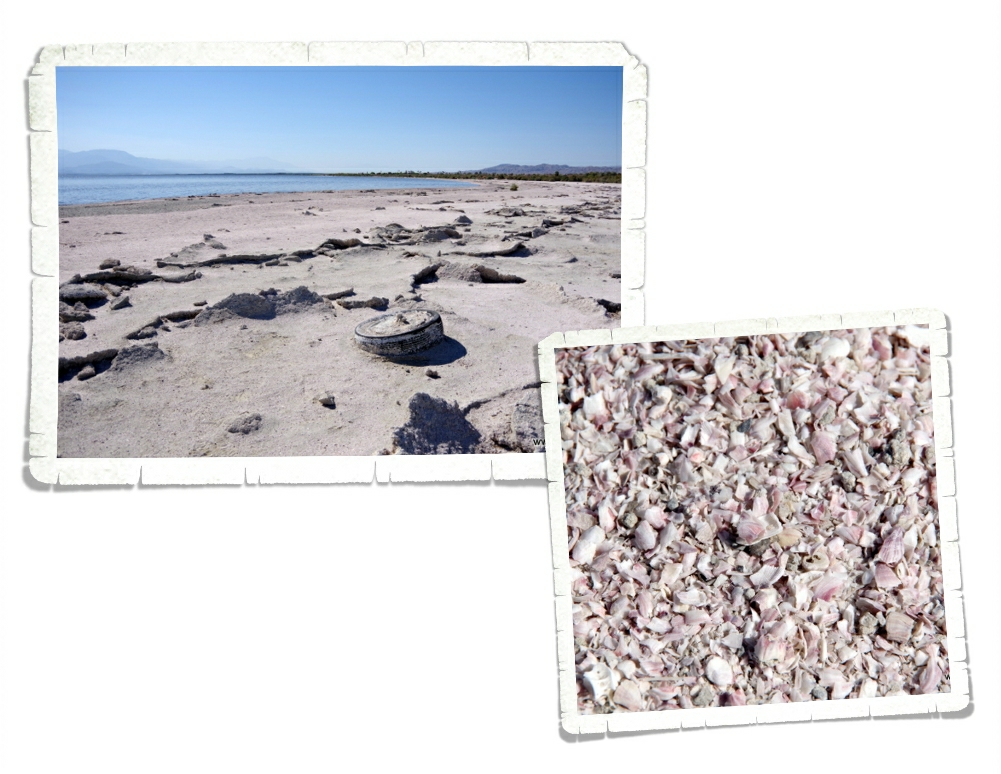
The lake you see today is only the current form of the many different lakes that have filled this area over millions of years. Because of all of the agricultural runoff there is a peanut butter type sludge that sits at the bottom of the lake. Fishing for tilapia is a popular recreation at Salton Sea, but I don’t think I would eat anything that came out of this lake. You think it’s sand until you get closer. It’s the skeletons of thousands and thousands of barnacles and fish. Neat but gross at the same time. There are old motels and and boarded up yacht clubs all over the shores. If you go exploring here, do it in a safe spot. We’ve read horror stories of people sinking to their ankles and then having to throw their shoes away due to some residue on them that eats the shoe. We didn’t encounter that at all, but we didn’t stray from the state park head quarters.

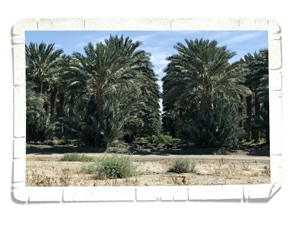
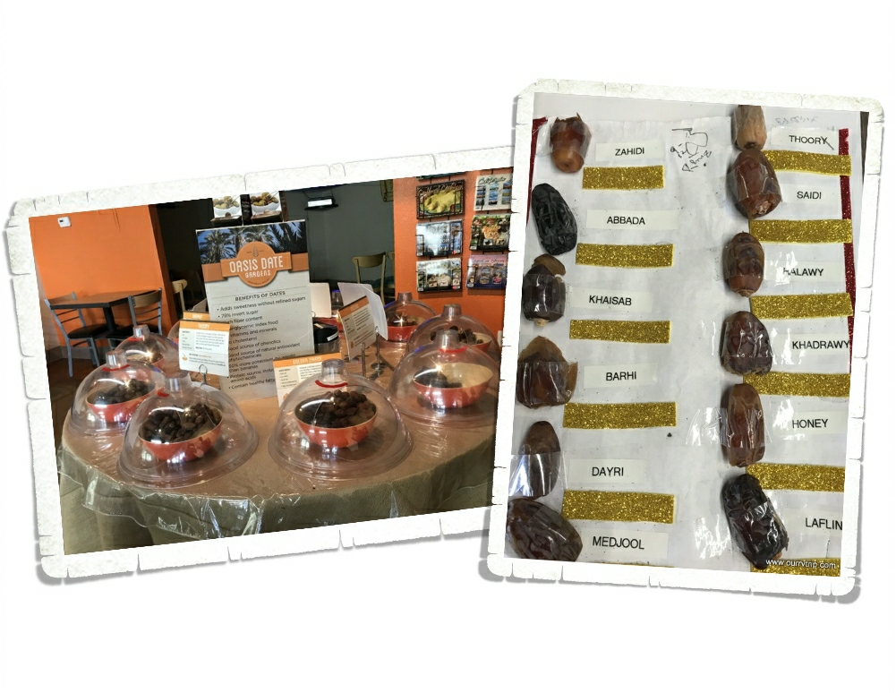
Those…are date palms. The first date palms in the US were planted by missionaries in California in 1769. There are a few different date farms in the Desert Hot Springs area. We went to Oasis Date Gardens.

Oasis Date Gardens was established in 1912 and is a whopping 175 acres full of date producing palm trees. YUM! The Oasis Date Gardens doesn’t give tours but they have a video you can watch and there are dates set out for sampling! We had no idea there were so many different kinds of dates. And that they tasted so differently!

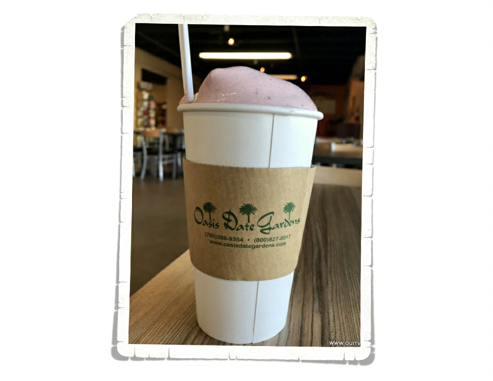
I had to try the prickly pear date shake. Had to. There just wasn’t any way around it. It was soooo good. If we’d found this place our first day in the Desert Hot Springs area…I would have gone back to Oasis Date Gardens at least four…maybe five times just for this shake.

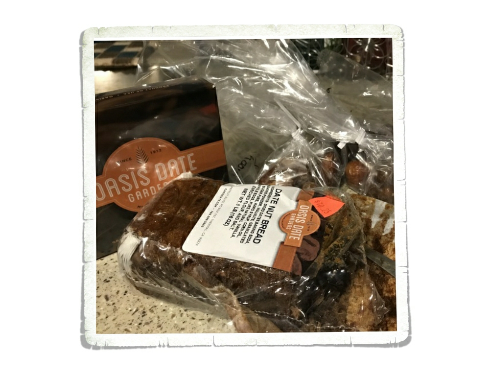
We walked out with some goodies. The boys didn’t waste any time getting into the date bread. It didn’t last long.

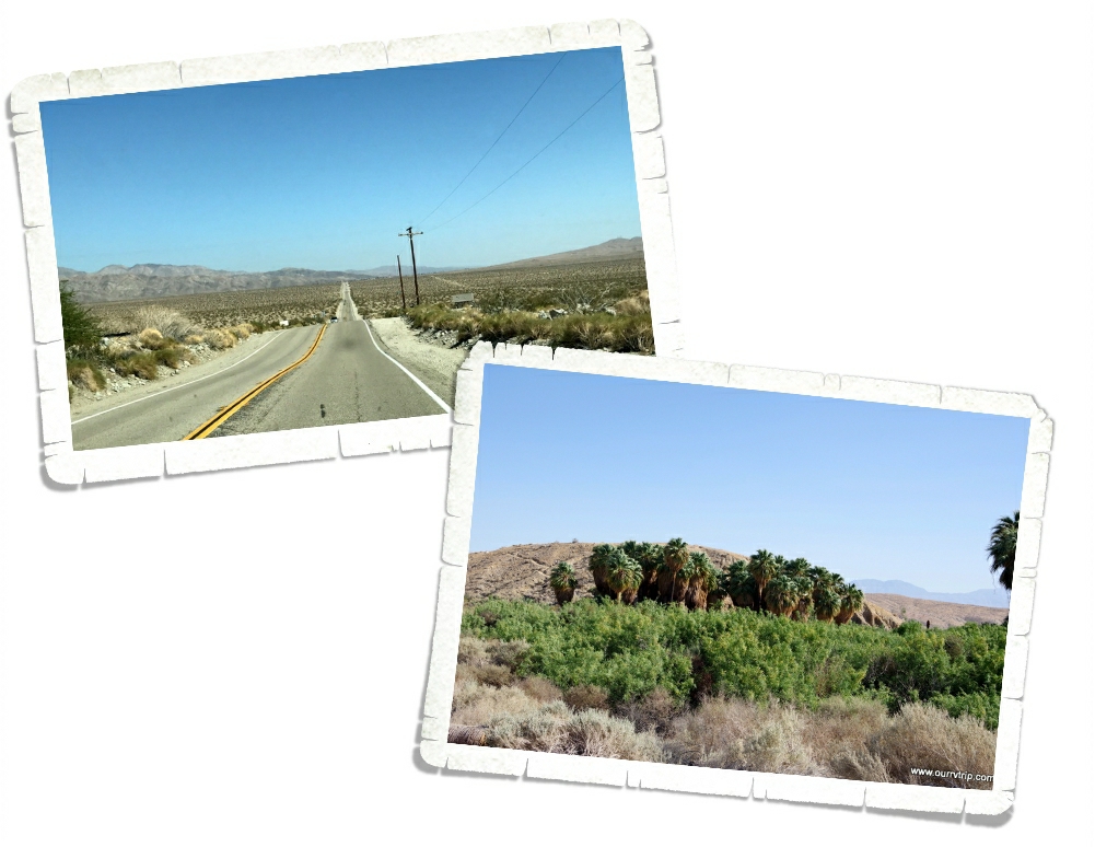
Over in Palm Springs there’s plenty of green. Big palm trees…lots of lush bushes…but the rest of this area looks…well, brown. Along with some very nice shades of tan. We drove about 15 miles down this road and found a natural oasis. A spot of green in the middle of the desert.

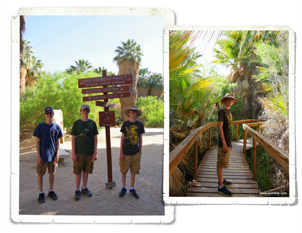
There were several hiking trails here. We stuck to a short boardwalk hike because we were warned that the rattlesnakes were waking up and were very active. And…they like to hide in the trees. Um…nope. Nope. Nope. That’s a great big nope from me. It was bad enough to worry about danger noodles in bushes and near big rocks…but to have to worry about them falling out of the trees onto us…I’m gonna pass on that every time. We saw everything we wanted to see. It was really cool to walk among the huge fan palms. This particular oasis sits on top of the San Andreas Fault. The boys are standing on it in the pic above. You really can’t tell. If the sign didn’t tell you, you’d never know.

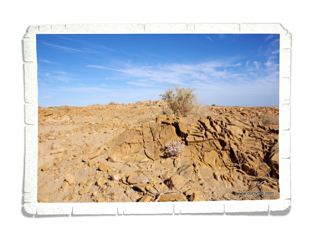
We were told of a different place to see the San Andreas Fault in it’s more natural state. It was out in the middle of nowhere and the whole area was in upheaval. It was something else to see it.

We stayed at the KOA. There was zero shade and temps of over 100* every day. It was a very very hot week. They KOA had its own hot springs spa. We didn’t use it because…we were hot enough as it was. The thought of getting into hot water was not at all appealing. We did, however, utilize the pool! Most of the time we were the only ones there.

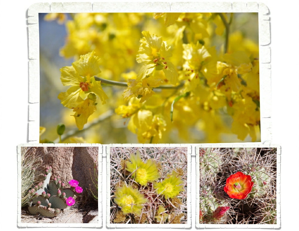
I can’t leave out the pretties. Even in the desert there is color. Spring in the desert is so full of color and life. Not all of it from cacti! This palo verde tree (top picture) is lovely with it’s green bark and yellow blooms!

There was a surprising amount of things to see and do in the Desert Hot Springs area and if we ever go back… it’ll be in the winter. It was just too hot and too windy for us. While we thought what we saw was neat, it was kind of a looong miserable week.

See y’all down the road!

#westernloop2018